On the eastern foothills of Mt. Ebal are remains of an Iron Age ritual place, suggested as an altar built by Joshua.
Home > Sites > Samaria > Joshua’s altar, Mount Ebal
Contents:
Background
Location
History
Structure
Photos
* Shechem
* Access
* RitualComplex
* Altar
* WalledAreas
* Views
* Nature
Etymology
Links
Overview:
On the eastern foothills of Mt. Ebal are remains of an Iron Age 1 ritual place. The archaeological team, headed by the late Adam Zertal, suggested it was an altar built by Joshua.
The construction of the altar by Joshua is described in the Bible (Joshua 8:30):
“Then Joshua built an altar unto the lord God of Israel in mount Ebal”
Location and Map:
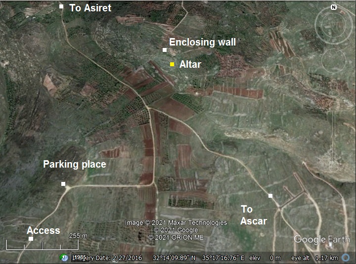
The site is located on the east side of Mt. Ebal, at a remote area. Access to the site is from the south west, by a road that is opened occasionally by the Army. A point is indicated on the map, where the tour parked the cars, then a steep descent to the ridge leading to the altar area.
History:
-
Biblical periods
A Biblical map is shown here, with Mt Ebal and Mt Gerizim on both sides of Shechem. Many major routes passed here – the north-east to Beit Shean (Skythopolis), the east to Adam crossing over the Jordan river, South to Jerusalem, west to the coast, and north through Shomron/Samaria to Jezreel and the Galilee.
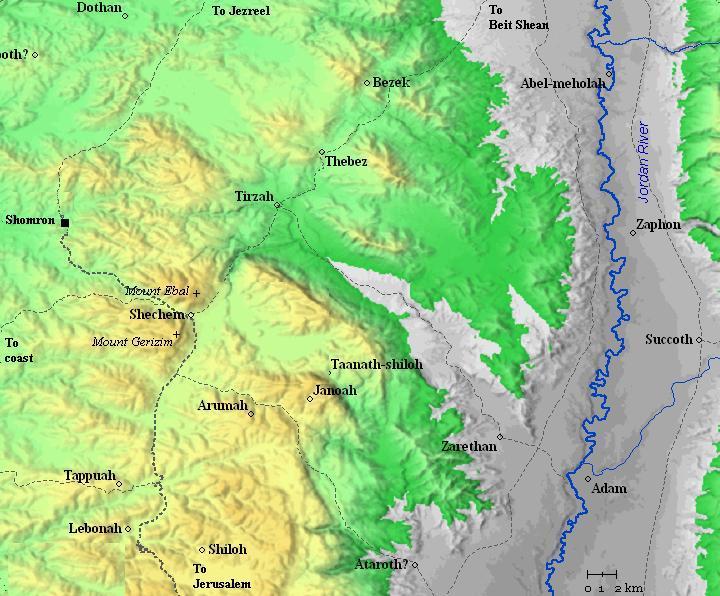
Roads and cities during the Israelite period, 12th to 7th century BC (based on Bible Mapper 3.0)
- Joshua (Mid 13th century)
Shechem – today’s Arabic city of Nablus – is located between two mountains: Mount Ebal on the north, and Mount Gerizim on the south. Both of these hills witnessed the mass ceremony held by Joshua after his entry to Canaan, following the return of the Israelites from the Exodus in Egypt. The ceremony took place according to the commands Moses received earlier from God – to gather the people between the two facing mountains – Gerizim and Ebal – and bless the former while cursing the latter.
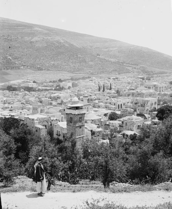
Mt Ebal and Nablus – view from Shechem
[ Dated: 1900-1920; Matson collection; Library of Congress]
Mt. Ebal was cursed by the Bible (Deuteronomy 11:29):
“And it shall come to pass, when the lord thy God hath brought thee in unto the land whither thou goest to possess it, that thou shalt put the blessing upon mount Gerizim, and the curse upon mount Ebal”.
The gathering and sacrifice is described in the Bible, prior to the return to the promised Land (Deuteronomy 27, 11-13):
“And Moses charged the people the same day, saying, These shall stand upon mount Gerizim to bless the people, when ye are come over Jordan; Simeon, and Levi, and Judah, and Issachar, and Joseph, and Benjamin: And these shall stand upon mount Ebal to curse; Reuben, Gad, and Asher, and Zebulun, Dan, and Naphtali”.
Joshua performed the ceremony after the conquest, constructing an altar on Mount Ebal (Joshua 8: 30-34):
“Then Joshua built an altar unto the lord God of Israel in mount Ebal, As Moses the servant of the LORD commanded the children of Israel, as it is written in the book of the law of Moses, an altar of whole stones, over which no man hath lift up any iron: and they offered thereon burnt offerings unto the LORD, and sacrificed peace offerings. And he wrote there upon the stones a copy of the law of Moses, which he wrote in the presence of the children of Israel. And all Israel, and their elders, and officers, and their judges, stood on this side the ark and on that side before the priests the Levites, which bare the ark of the covenant of the LORD, as well the stranger, as he that was born among them; half of them over against mount Gerizim, and half of them over against mount Ebal; as Moses the servant of the LORD had commanded before, that they should bless the people of Israel. And afterward he read all the words of the law, the blessings and cursings, according to all that is written in the book of the law”.
Both mountains are about the same height (881m for Gerizim, 940m for Ebal). Between them, in the valley, is the city of Shechem (Nablus). The Canaanite/Israelite city was located to its east (“Tel Balata”).
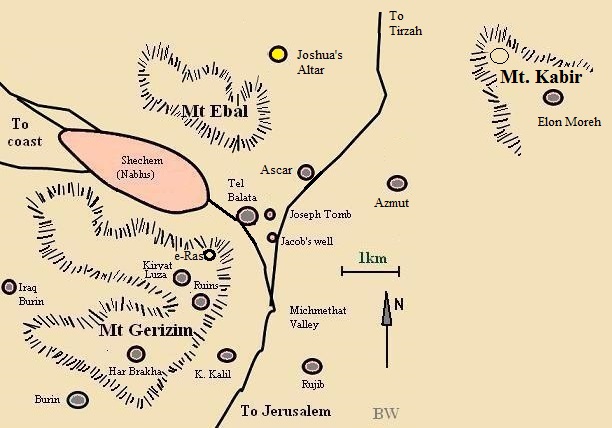
Map of Mt Ebal and Gerizim area, with the altar indicated by a yellow marker
The location of the newly found altar is indicated on the map, north east of the summit of Mt. Ebal.
Surprisingly, it does not face both mountains, but rather faces Mt. Kabir (“The Great”) on the east, another mountain that rises to 765m, about the same height of the altar (785m). This was one of the arguments against the identification of the discovered altar. There were therefore suggestions that the Biblical Mt. Gerizim was actually Mt. Kabir.
- Ottoman period:
In the PEF map (1878) Mt. Ebal is listed as Jebel Eslamiyeh, with an altitude 3077 ft. The location of the altar is adjacent north of el Kulah – ruins of a Persian period farm that grew wine – and east of Sheikh Beit ez Zaky (a Shiekh’s tomb, located at a higher altitude).
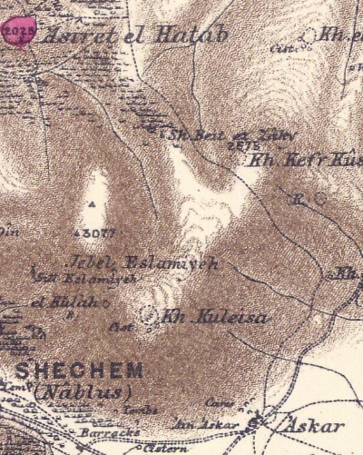
Part of map Sheet 11 of Survey of Western Palestine,
by Conder and Kitchener, 1872-1877.
(Published 1880, reprinted by LifeintheHolyLand.com)
The authors Conder and Kitchener wrote about Mt Ebal in the Survey of Western Palestine – SWP (Vol 2 p.186-187). They did not identify the altar. They focused on ruins to the south of the site – Kh. El Kulah and Kuleisa.
“Mount Ebal.—El Kulah on the top of the mountain is a large building of stones of moderate size, built up without mortar ; the stones have the appearance of being rudely squared, but as the limestone here splits naturally into cubes, and as they show no tool-marks, they are more probably not artificially dressed at all.
Similar masonry exists on the south slope of Gerizim. It measures 92 feet square externally, with walls 20 feet thick. Several chambers 10 feet square exist in the thickness of the wall, and a projection 4 feet broad is built at the ends, as if for defense. The walls are packed inside with small stones, and are entirely without mortar. They resemble in construction the walls now made to support terraces and enclose gardens on the lower slopes of Mount Ebal. The whole of the plateau on the summit of the mountain is covered with similar masonry, walls, terraces, and enclosures. All these remains have a very rude appearance. The scattered ruins about a quarter-mile east of el Kulah are called Khurbet Kuleisa, or Kuneisa. This name has been confused with the term Keliseh (‘church’), but is spelt quite differently in Arabic, and no remains resembling a church—no apses, pillars, or capitals—exist here. There are two long walls radiating south-west and south-east from the summit of Ebal, like the enclosure walls lower down. El Kulah was thought by Mr. Tyrwhitt Drake to be an ancient cattle-fold, but the ruins are more probably connected with old orchards now decayed. The Samaritans say it is an ancient village.
Visited July, 1872, and May, 1881”.‘ The summit of Ebal is a comparatively level plateau of some extent. There is no actual peak, but the ground rises towards the west, and attains its greatest elevation near a small pile of stones. The view from this point is a perfect panorama, and one of the finest and most extensive in the country, embracing Safed, Jebel Jermuk, and Hermon on the north ; Jaffa, Ramleh, and the maritime plain on the west ; the heights above Beitin (Bethel) on the south ; and the Hauran plateau on the east. The upper strata of the nummulitic limestone, of which the mountain is composed, are so cracked and broken, apparently by the action of weather, that the surface of the plateau, at first sight, looks as if it were covered by a rude pavement ; and it was some time before we realised that it was quite natural.
Wilson also reported on Kh. Kuneisa (or Kneeseh), while searching for Joshua’s altar.
“Towards the east end of the plateau is the remarkable ruin called by the Arabs “Khurbet Kneeseh.” It consists of an enclosure 92 feet square, with walls 20 feet thick, built of selected unhewn stones, without mortar. In the thickness of the wall are the remains of several chambers, each about 10 feet square, and at two opposite ends there is a projection of 4 feet, as if for defensive purposes. There is a cistern within the building, and round it are several heaps of stones and ruins. Excavations were made, but without result. It is not easy to form an opinion on the object of this building ; it is too small for a fortified camp, and though the chambers are somewhat similar to those in the fortified churches, the interior space, 50 feet square, is too restricted to have held a church. There was no trace of any plaster, and nothing that would enable us to connect it with the altar said to have been erected by Joshua on Mount Ebal”.
Wilson also compares the two mountains:
‘ The contrast between the rich vegetation on Gerizim and the barrenness of Ebal has frequently been commented upon by travellers. This arises from the structure of the rock, the strata dipping towards the north across the valley, and thus preventing the existence of springs on the southern slope of Ebal. The mountain, however, is by no means so sterile as has been supposed ; for a considerable height it is clothed with luxuriant cacti gardens carefully cultivated in terraces, and above these, to the very summit, rise a succession of terraces well supplied with cisterns, that speak of a careful system of cultivation and irrigation at a former period. Many of these terraces are well preserved, and planted in spring-time with corn, which is as fine and healthy-looking as any on Gerizim. The northern slope of Ebal is rich in springs, and almost as well supplied with water as the northern slope of Gerizim. ‘At the foot of Ebal there is a modern Moslem cemetery, and scattered amongst the cactigardens, and over the southern slope, are numerous rock-hewn tombs.’
— Colonel Sir Charles Wilson, ‘Quarterly Statement,’ 1873, p. 66.
- The Search for the origins of Israel
The late Professor Adam Zertal (Univ. of Haifa) was a distinguished archeologist who focused on the early periods of the Israelite period. He discovered the site of an altar on Mt Ebal, an Iron age site he attributes to Joshua.
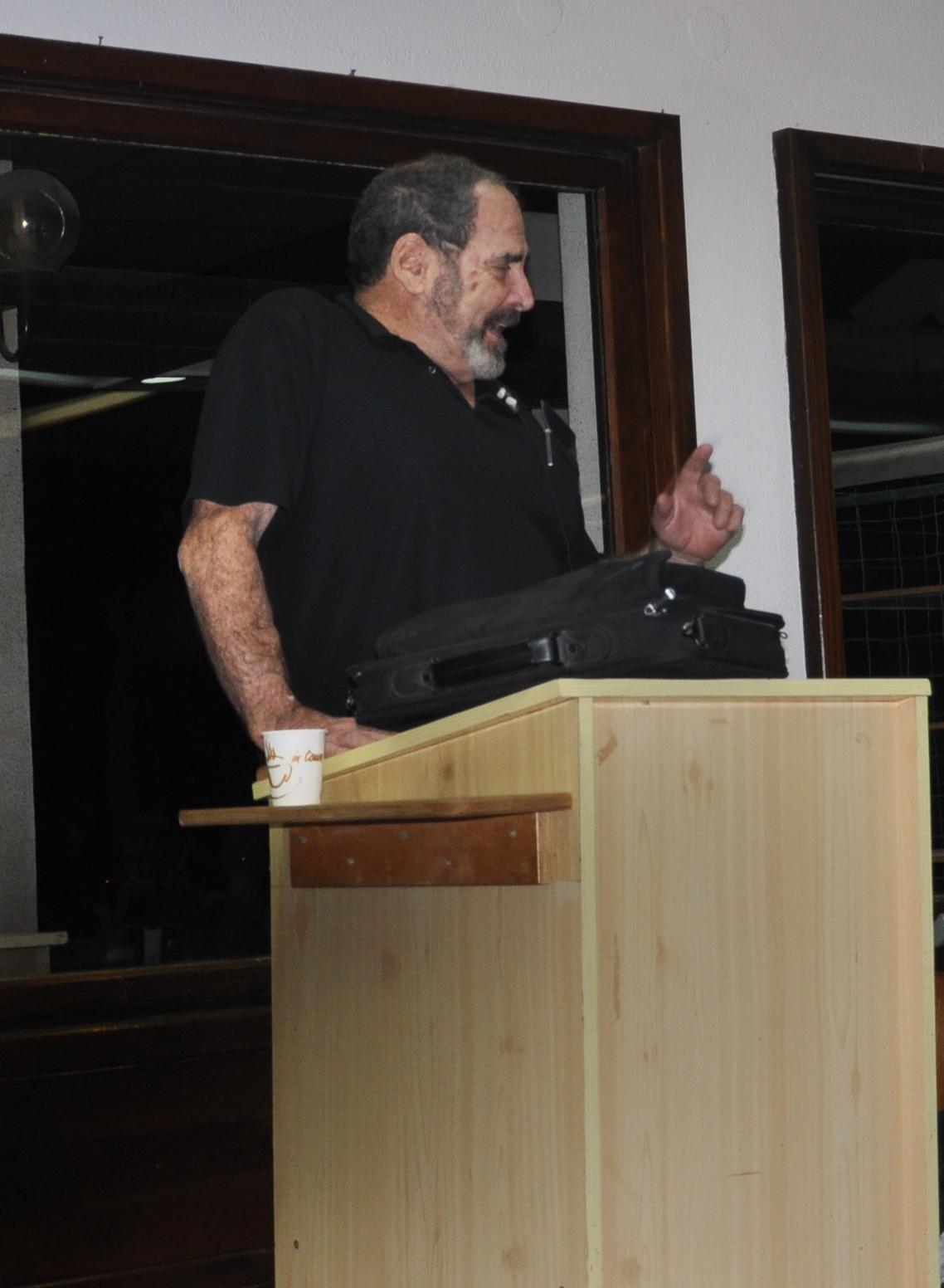 Prof Zertal lecture in Kibbutz Geva – Jan 6, 2010
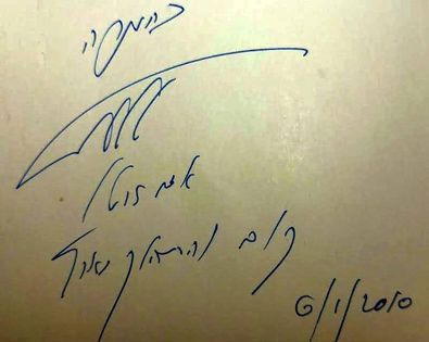
Adam Zertal’s amazing discoveries in the site and excavation surveys in Samaria were published in his book “A nation born- The Altar on Mt Ebal and the origins of Israel” (2000). On its cover is an illustration of the altar he discovered on Mt. Ebal.
He signed on our copy of his book – “with appreciation – Adam Zertal”. He added a line from Genesis 13:17: “Get up and walk around the land”.
Adam and his team also published 5 volumes of the Samaria region archaeological sites (“”The Manasseh Hill country survey””) with hundreds of surveyed historical places. The site of Joshua’s altar appears in the survey’s first volume – The Shechem Syncline, and its site number is 276. It is named “El Burnat” based on a place near the site.
Adam Zertal passed away on October 2015.
-
Modern times
Access to the site is limited, as the area is within area ‘A’, which requires coordination with the Army. Occasionally there are permits to travel from the community of Shavey Shomron, such as in Passover 2021 when we visited the site. The road from Shavey Shomron follows the track of the dismantled Ottoman period railway to Shechem, then ascends to Mt. Ebal along the southern foothills. It then passes Sh. Amad ed Din overlooking Nablus, continues east near the peak of Mt. Ebal, then turns north along a road thru Khirbet el Kulah.
Photos:
(a) Views of Nablus – Shechem
The access road to Mt. Ebal passes along the northern side of Nablus – the modern Arab city that grew around the old city, sandwiched between Mt. Gerizim and Mt. Ebal. In the middle of this view was the center of the Roman city.
Click on the photos to view in higher resolution…
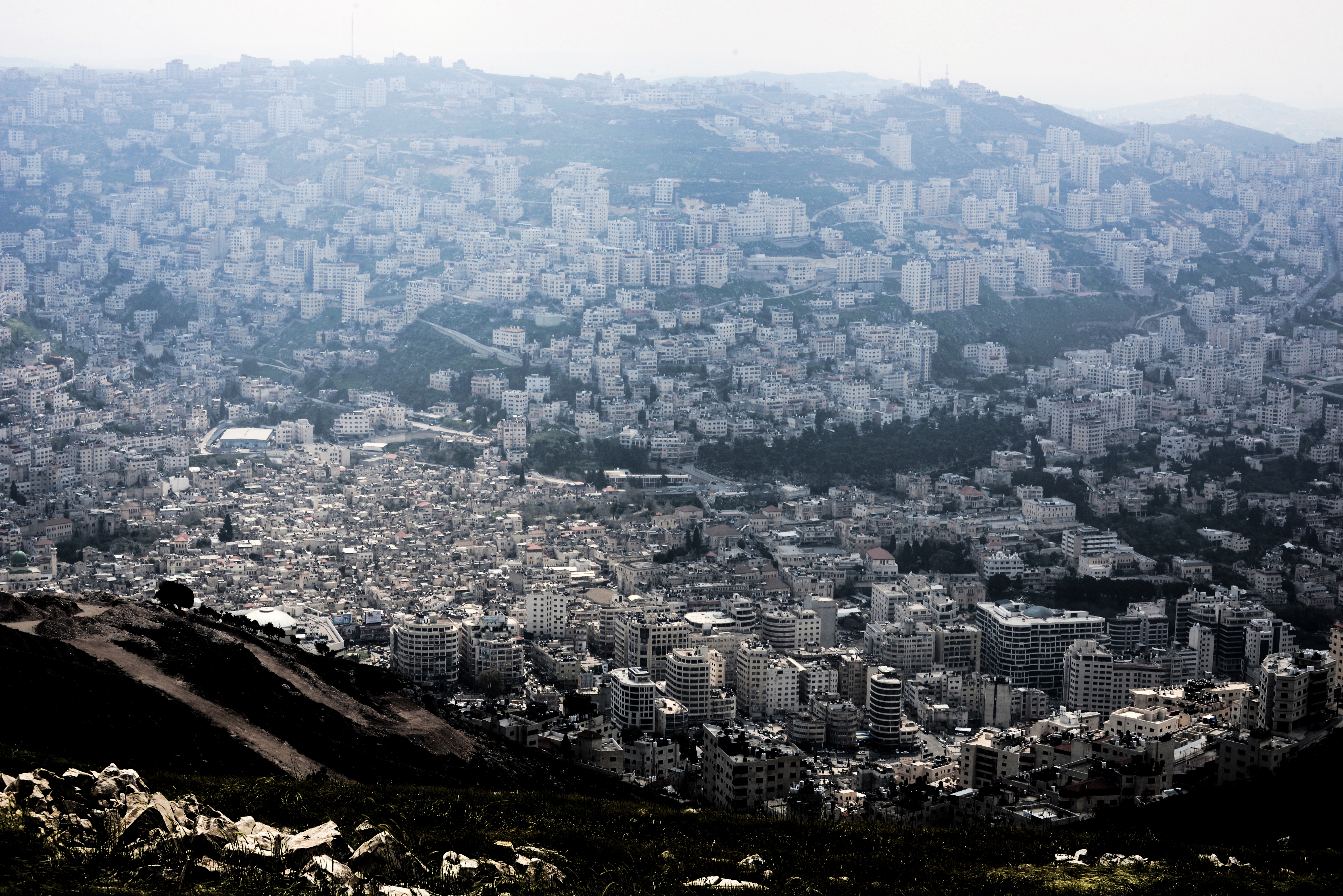
Behind the city stands Mt. Gerizim. In the photo below the ruins of the Samaritan temple and the Byzantine church are located on the peak.Check our review of the site.
Below the summit, on the round hill on the left, is Tell er-Ras (“the mound of the hilltop”). On it are remains of the Roman period sanctuary of Zeus, built by Hadrian in the 2nd century AD. An ancient staircase that led to it from Shechem.
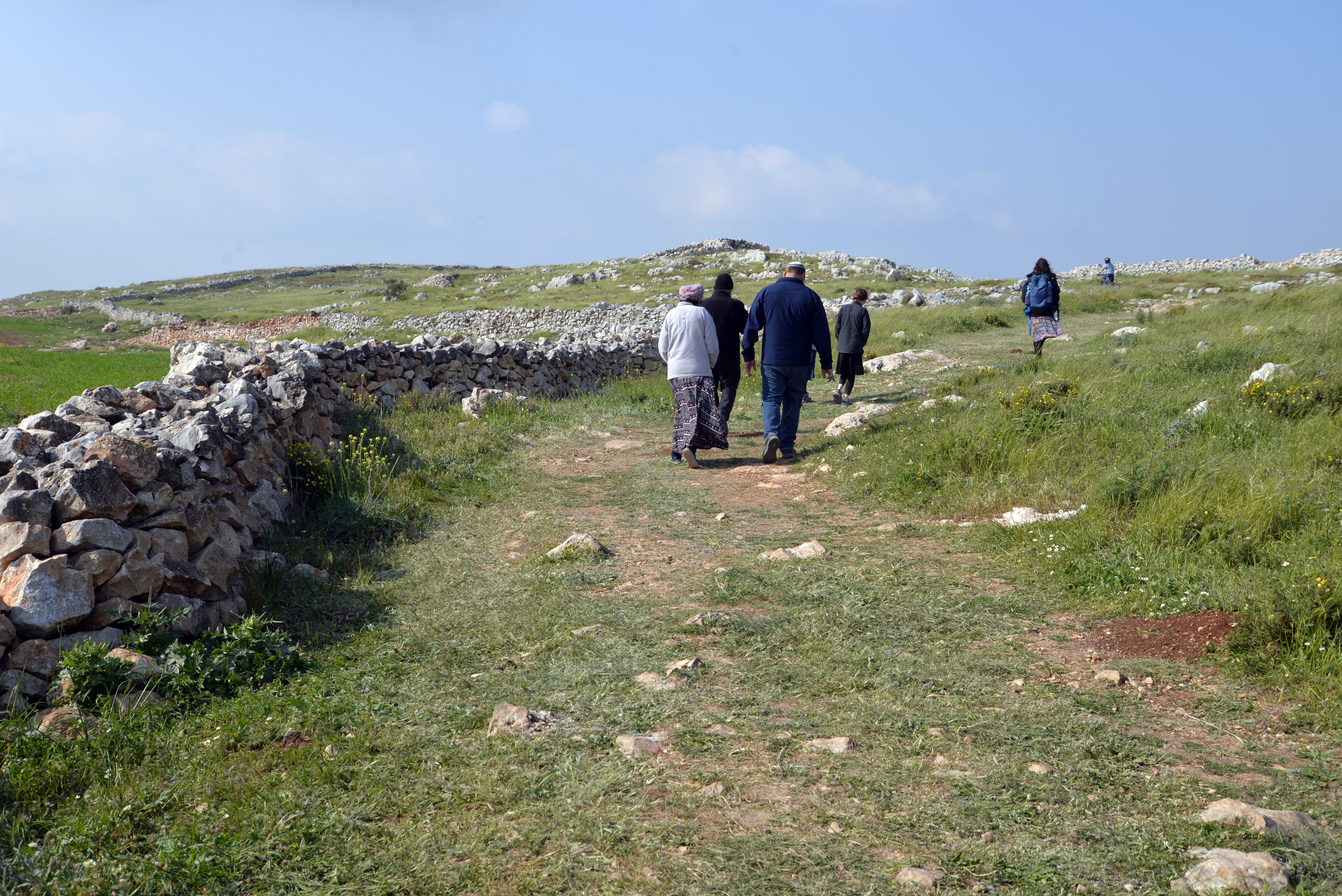
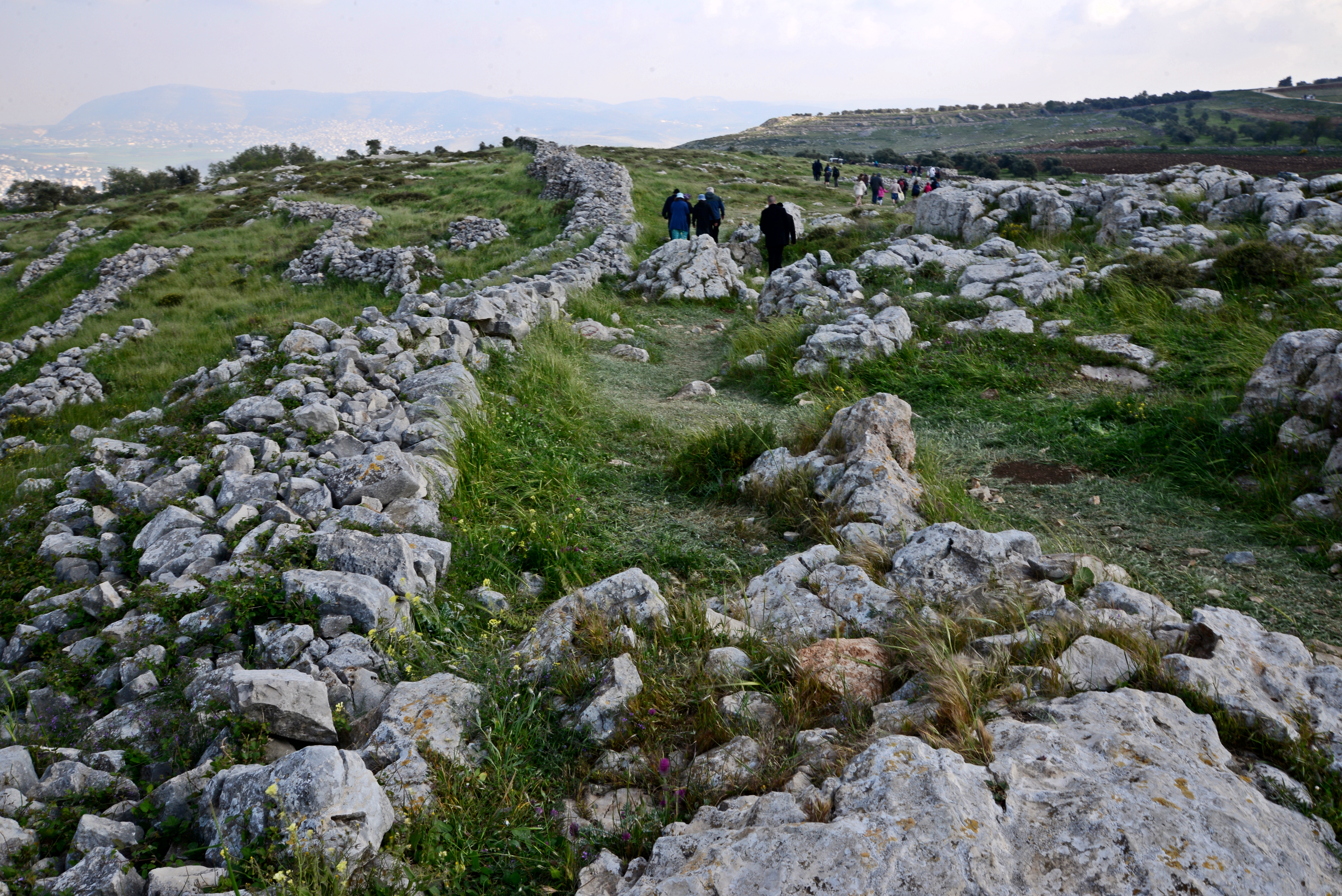
(b) Access to the site
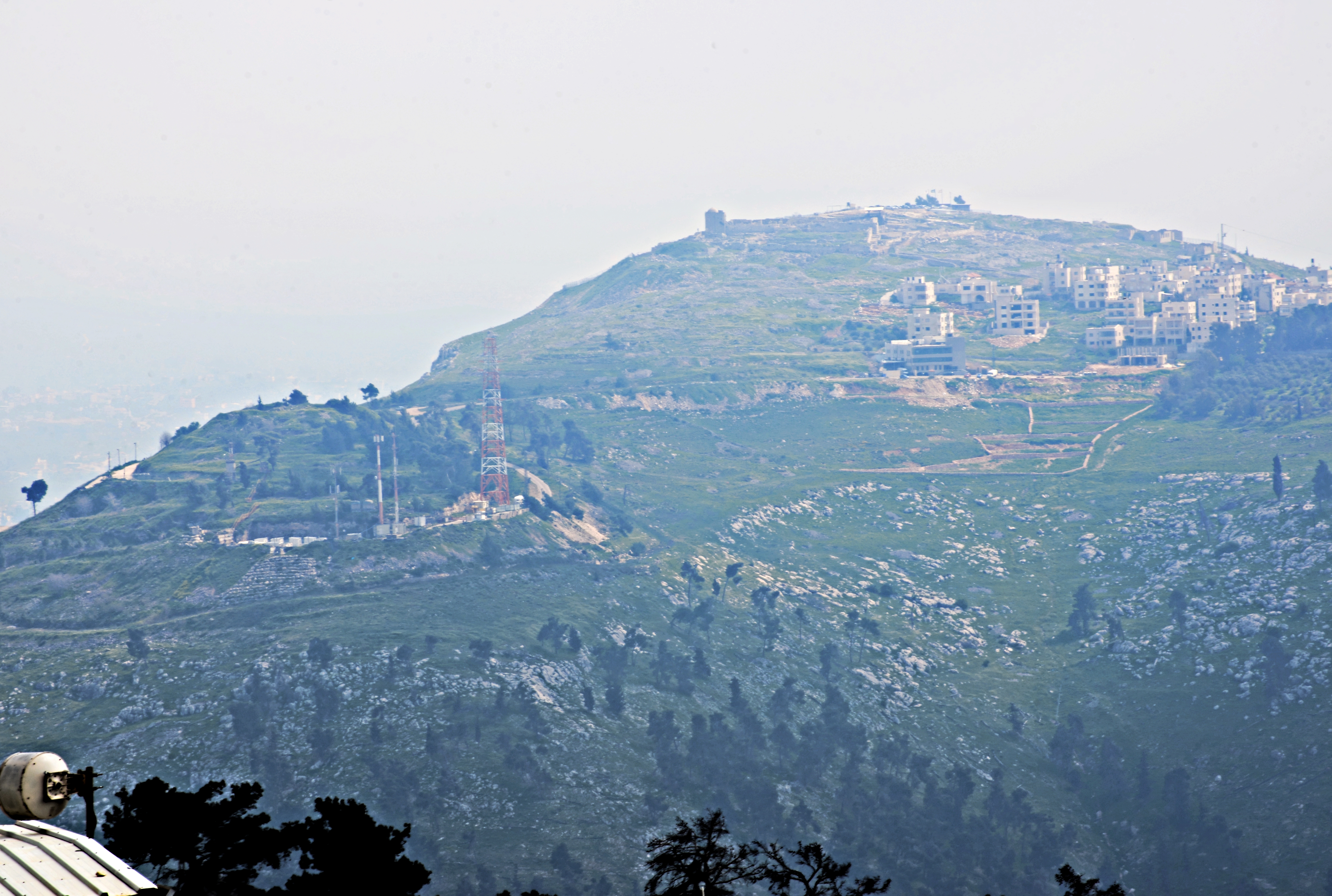
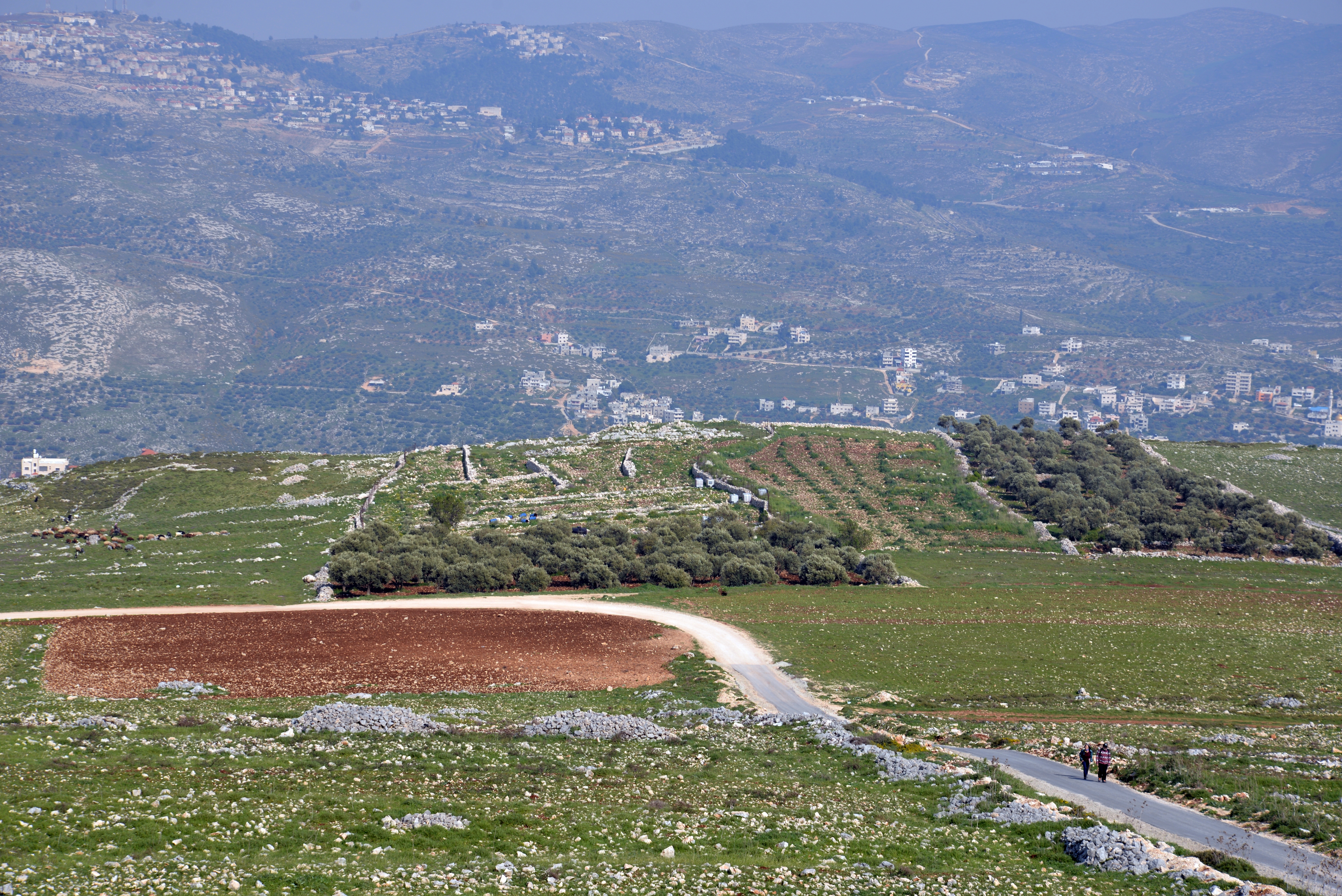
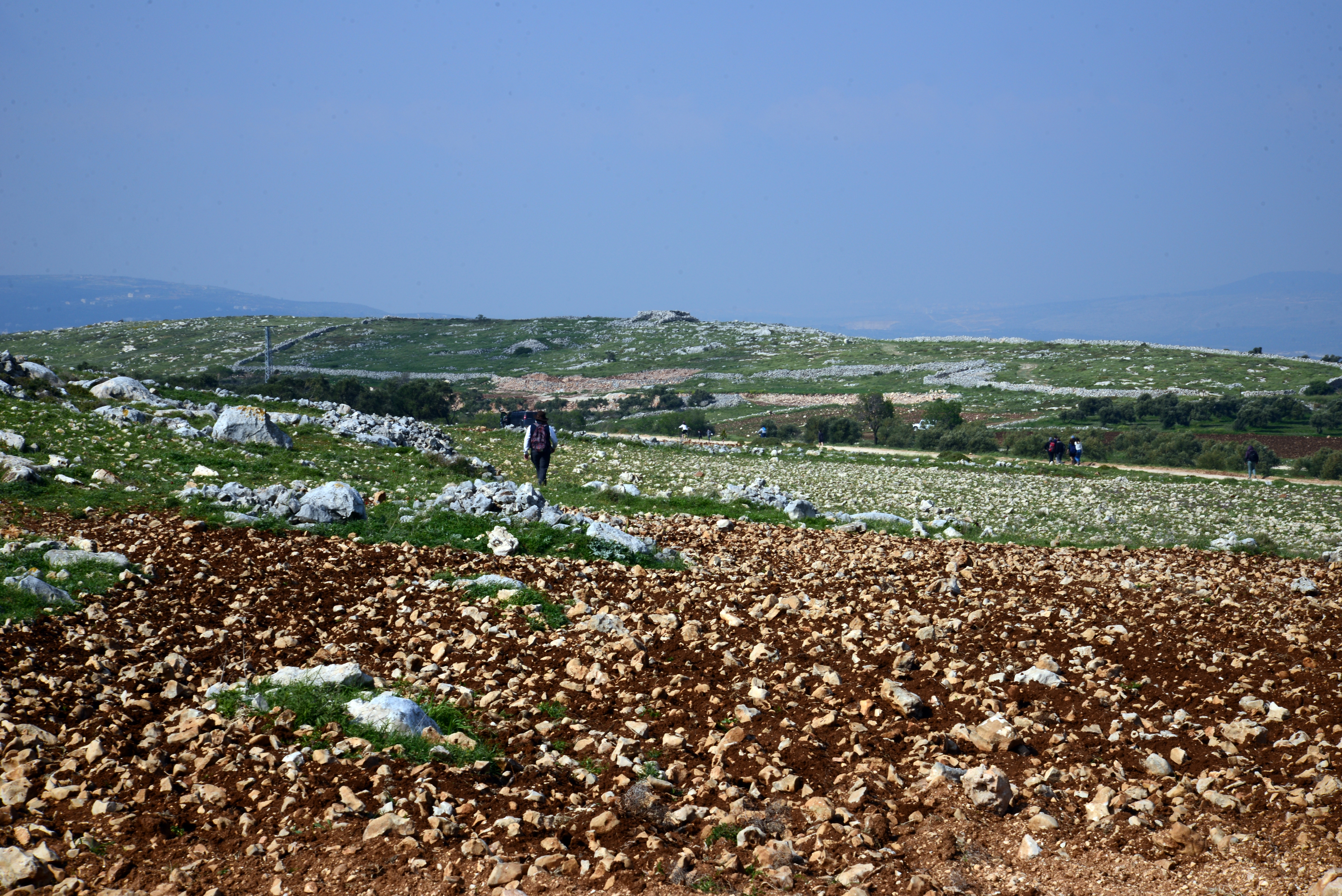
The site of the altar does not face Shechem. Rather, it is located at the eastern foothills of Mt. Ebal, 2km north east of the location where we viewed the city. After driving closer to the place, we parked our cars in a parking area designated for visits, then walked down a steep descent.
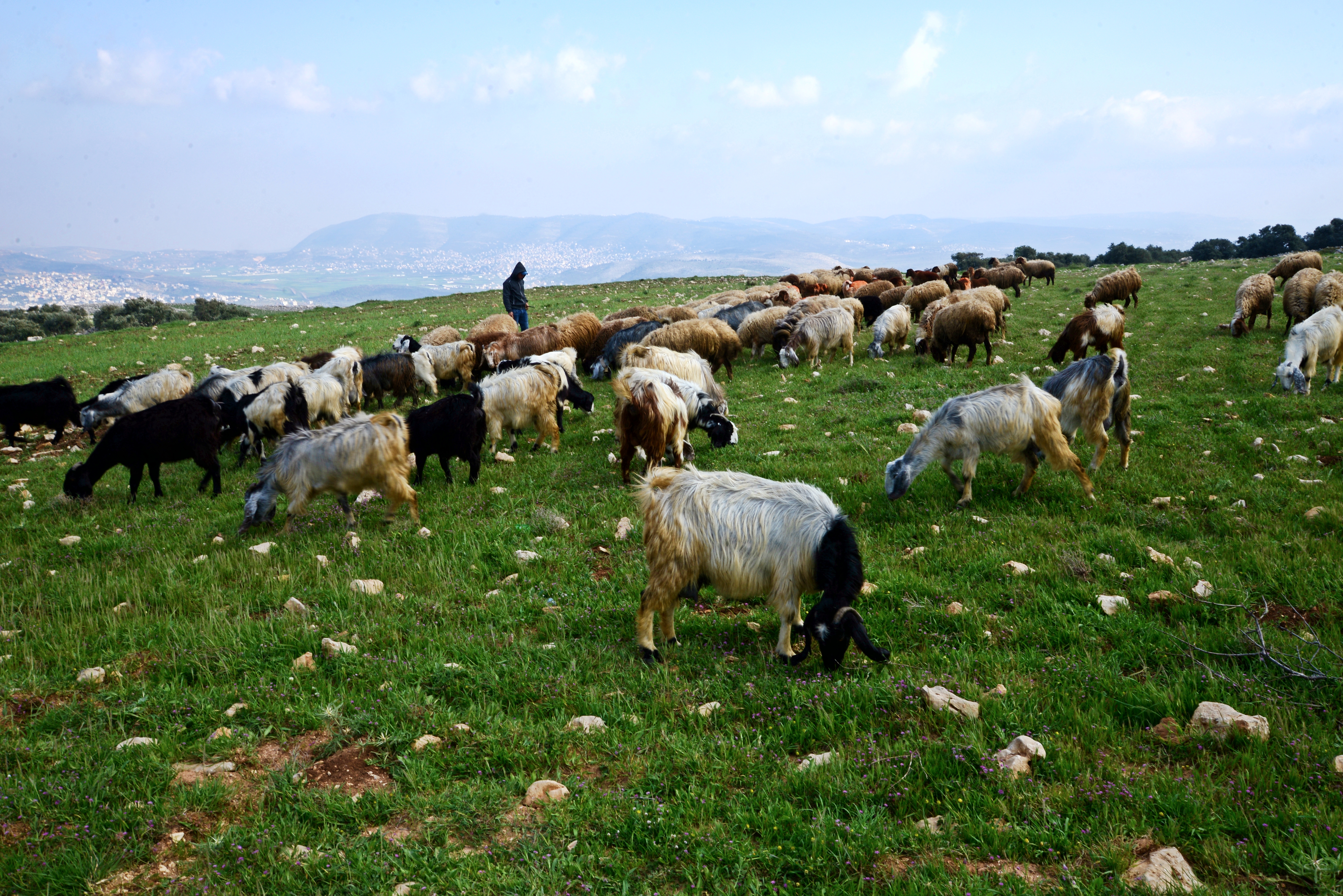
Along the way to the site was a herd of goats and their shepherd.
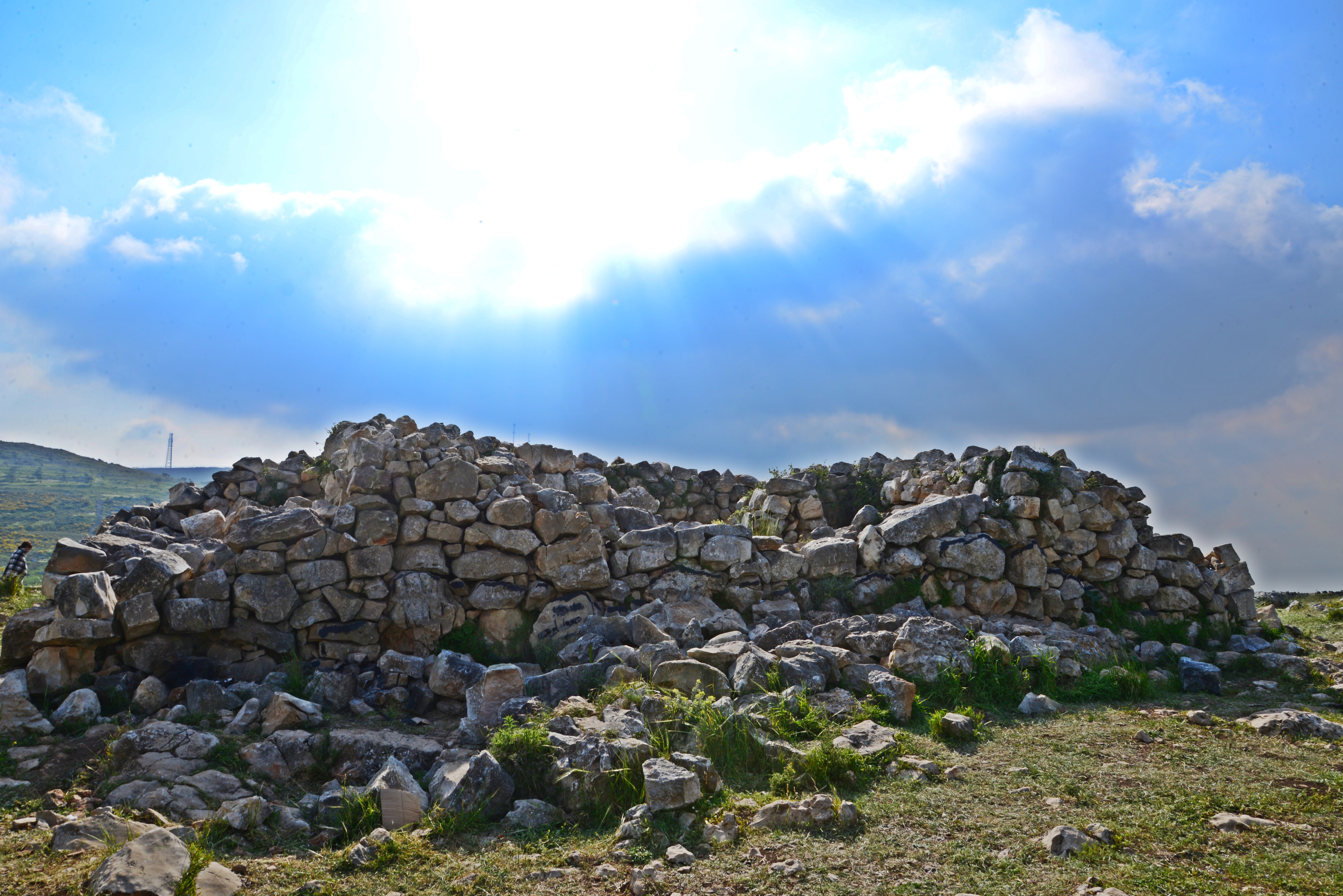
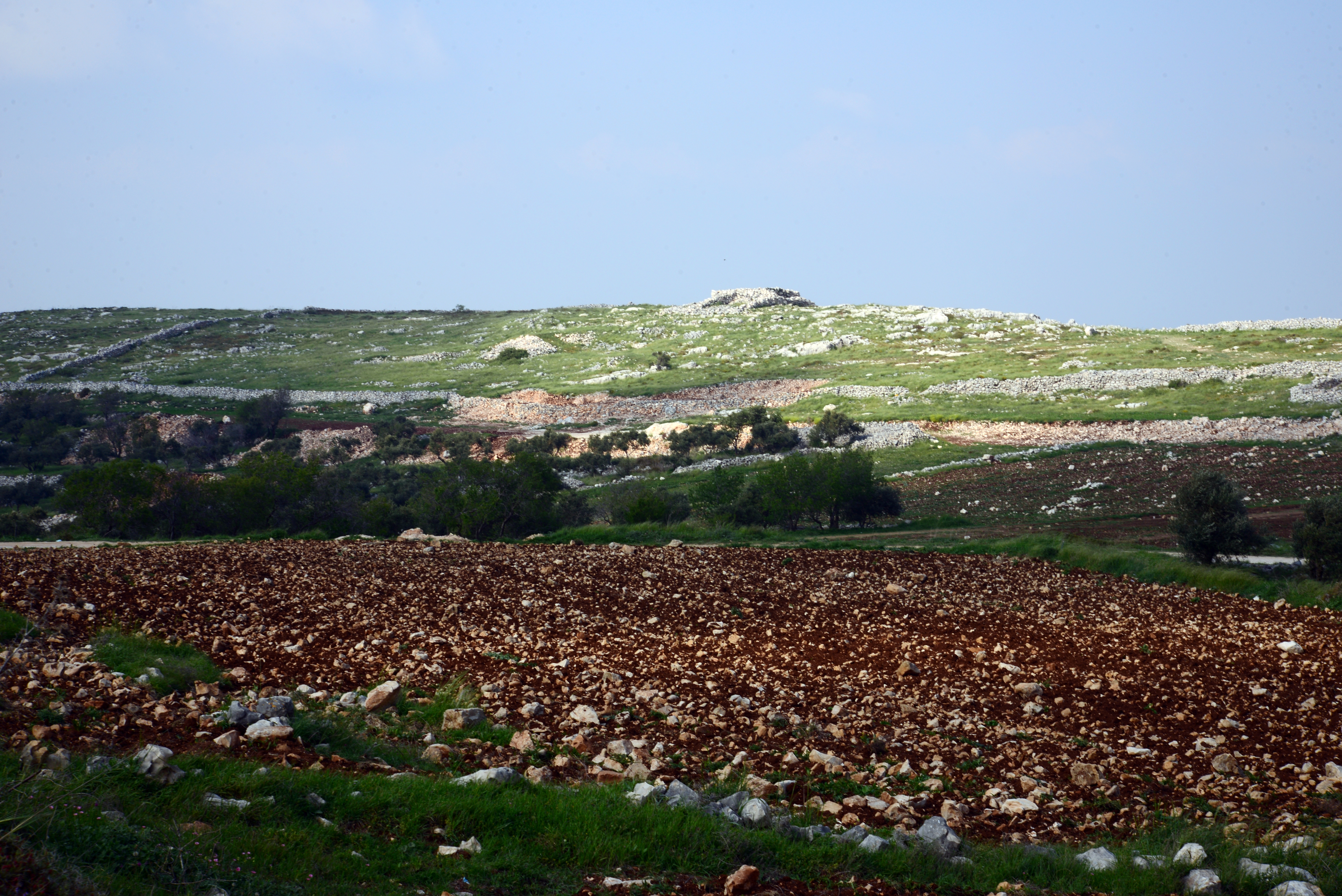
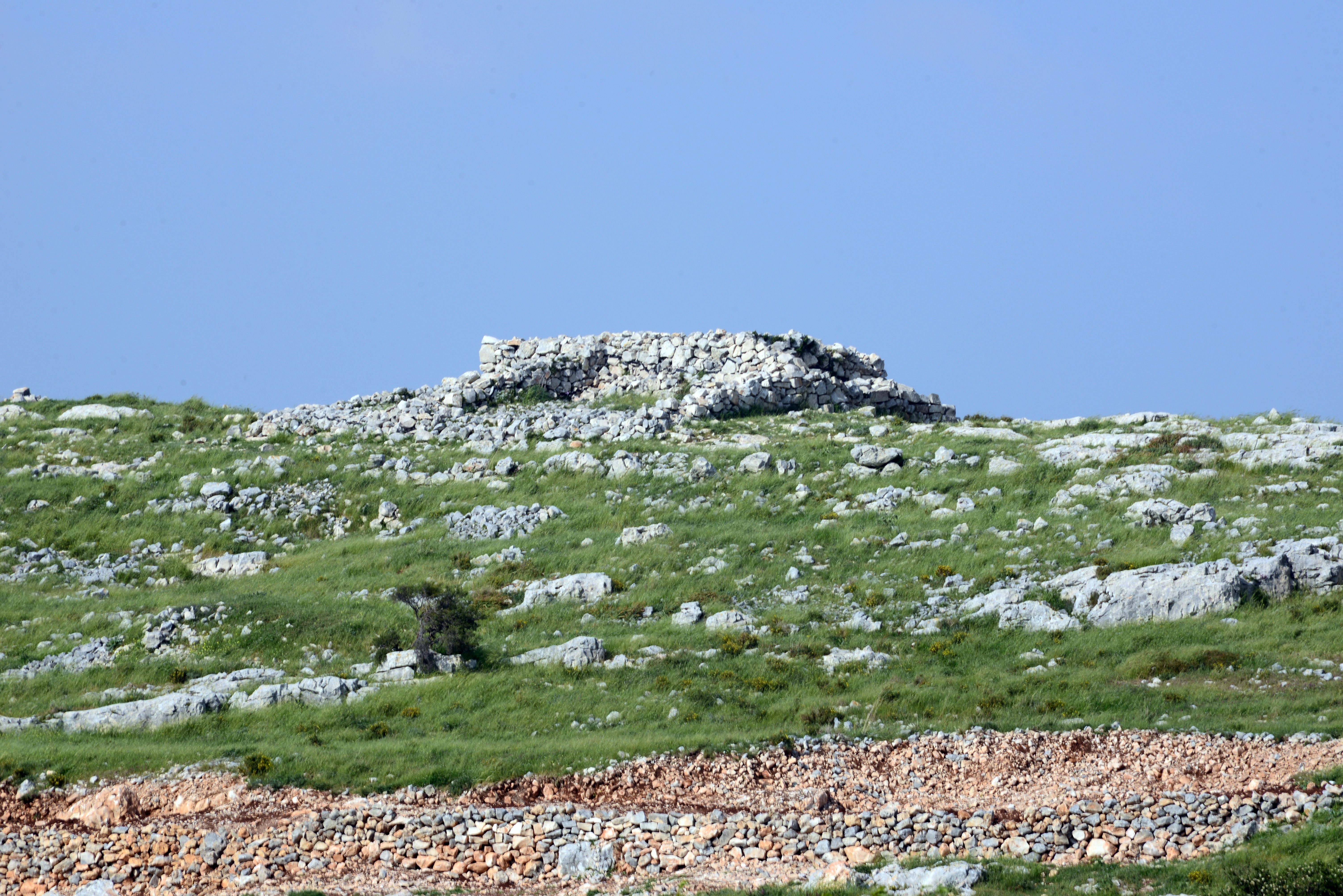
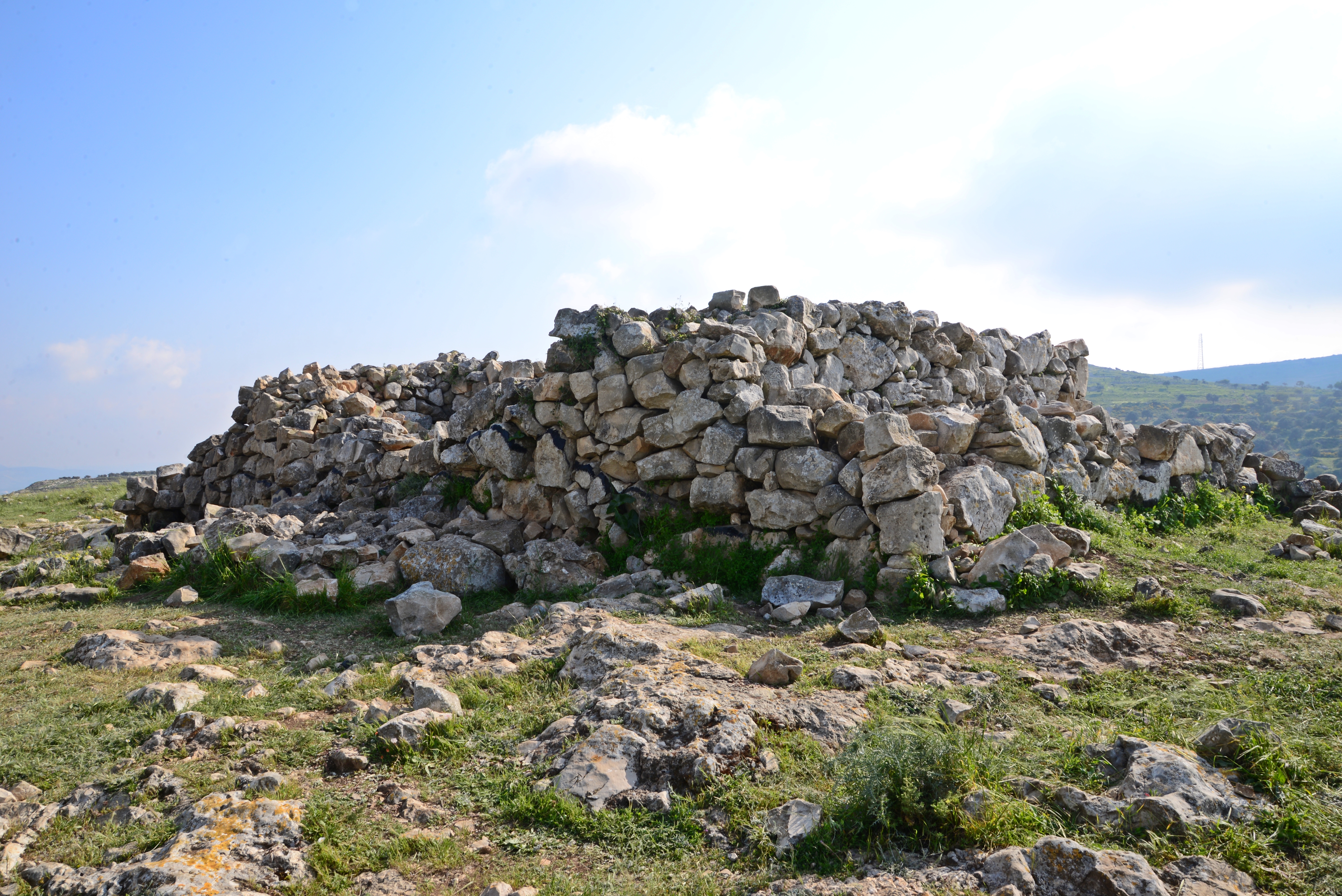
From afar we could see the surrounding wall of the altar, here on the left side.
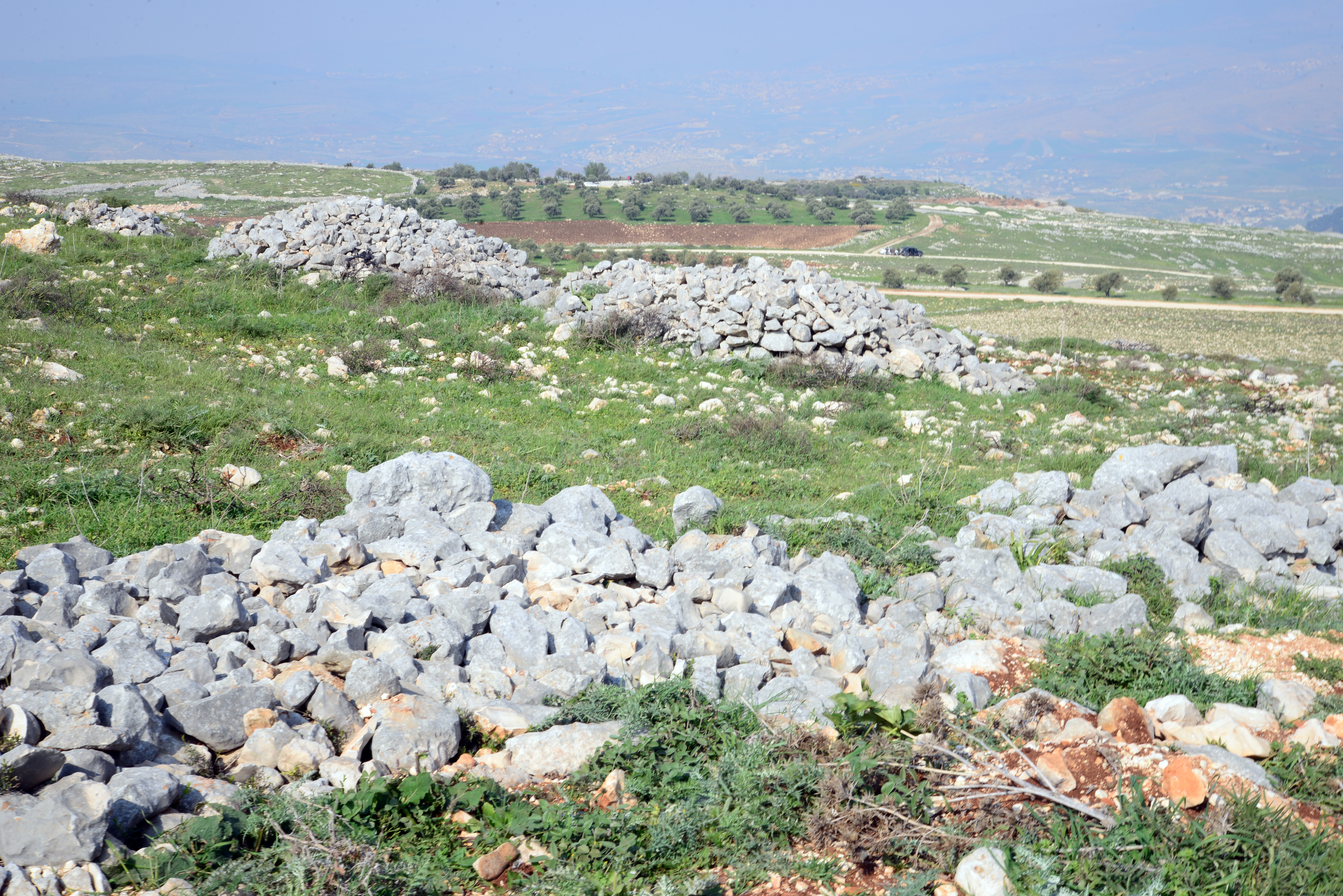
The altar is seen here rising above the ridge.
(c) The ritual complex
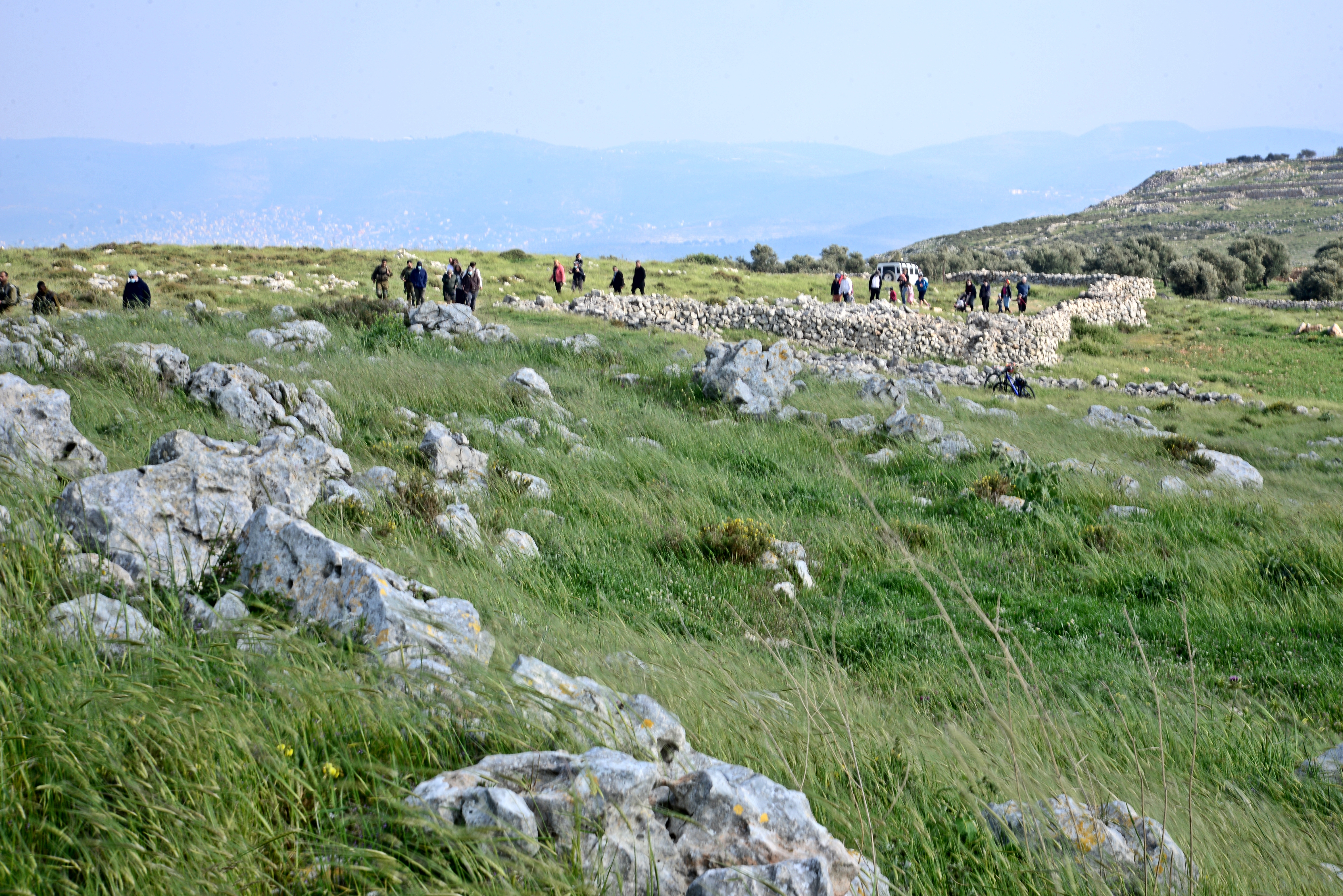
The next view is a closer view of the altar and the wall that surrounds it. There are 3 regions on and around the hill – a valley to the west of the walled complex, a large open walled area lower than the area of the altar, and a smaller walled area around the altar.
The Israelites (“all Israel“) must have assembled in thousands in the vast open valley on the west side of the complex. The valley, seen here in the area of the green trees, has a great acoustic plan so the multitudes would have heard the sounds and voices coming from the walled complex. The large walled area would have been allocated to the distingished elder and leaders (“and their elders, and officers, and their judges“), while the priests would have been servicing the ceremony close to the altar (“stood before the priests the Levites“). This is described in the Bible (Joshua 8, 33):
“And all Israel, and their elders, and officers, and their judges, stood on this side the ark and on that side before the priests the Levites, which bare the ark of the covenant of the LORD, as well the stranger, as he that was born among them; half of them over against mount Gerizim, and half of them over against mount Ebal; as Moses the servant of the LORD had commanded before, that they should bless the people of Israel”.
We entered thru an opening on the south east side of the enclosed area.
The path leads along the western wall up to the altar.
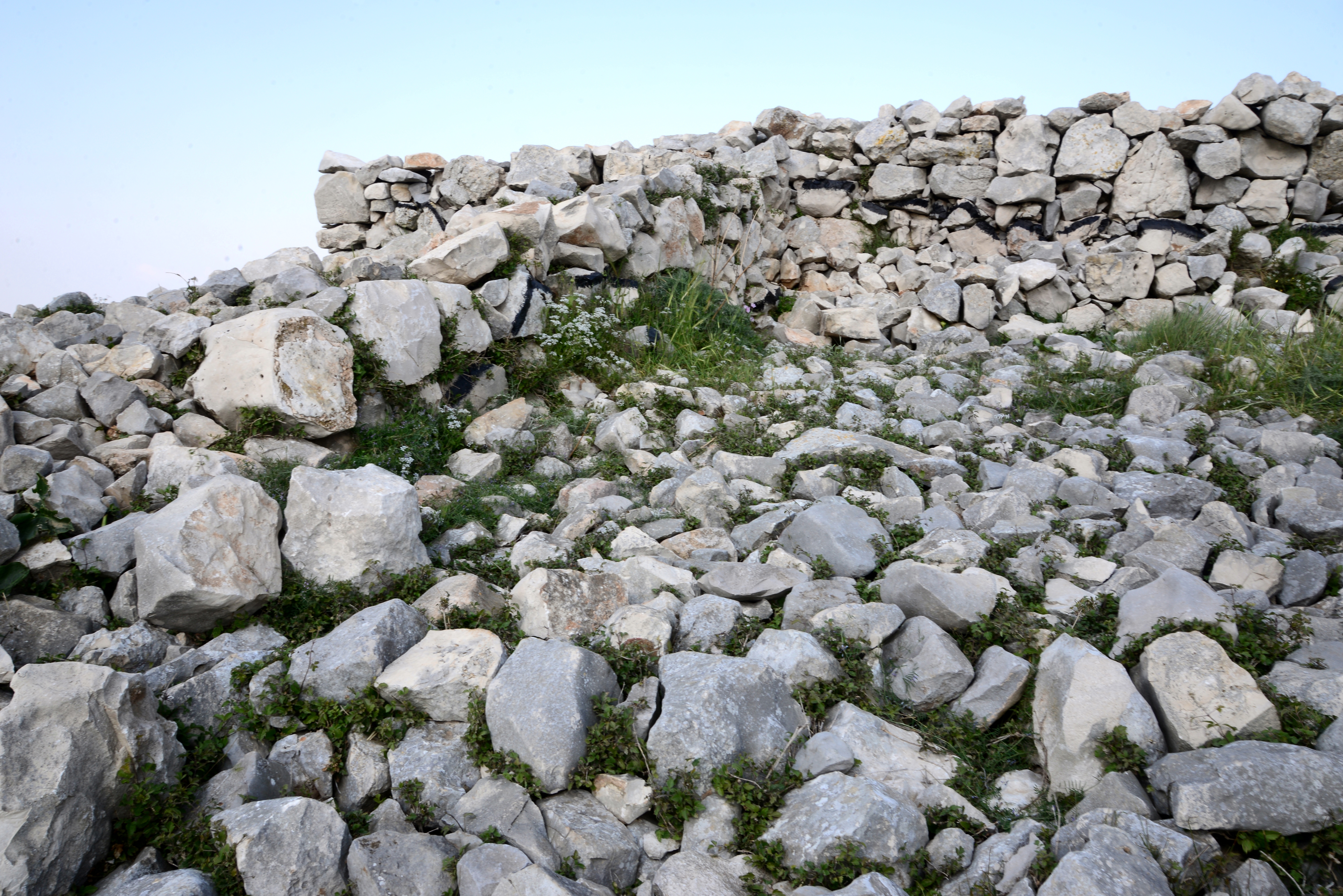
(d) The altar
The altar stands in the highest point of the ridge – altitude of 790m – rising 25m above the area around it.
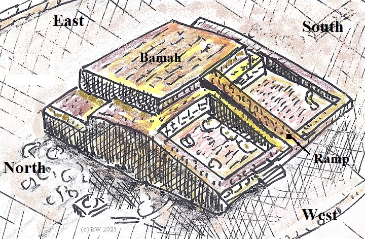
The altar covers an area of, roughly, 13m by 13m. The basic structure is a Bamah (the top platform) and a ramp that leads up to it.
An illustration of the altar is shown here.
The following photos view the altar from all its sides, and provide additional details.
- Southern side
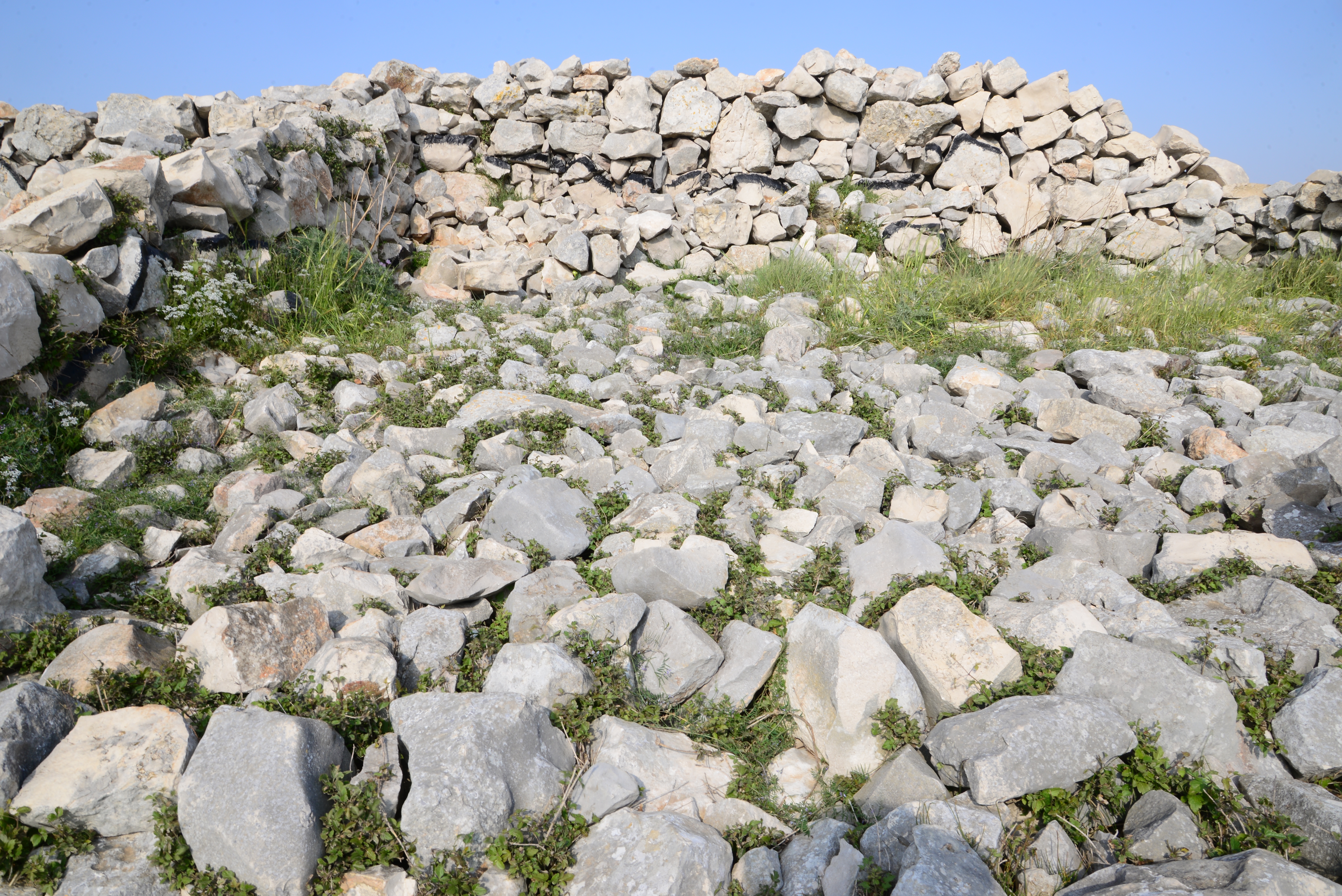
The southern side of the altar is seen below.
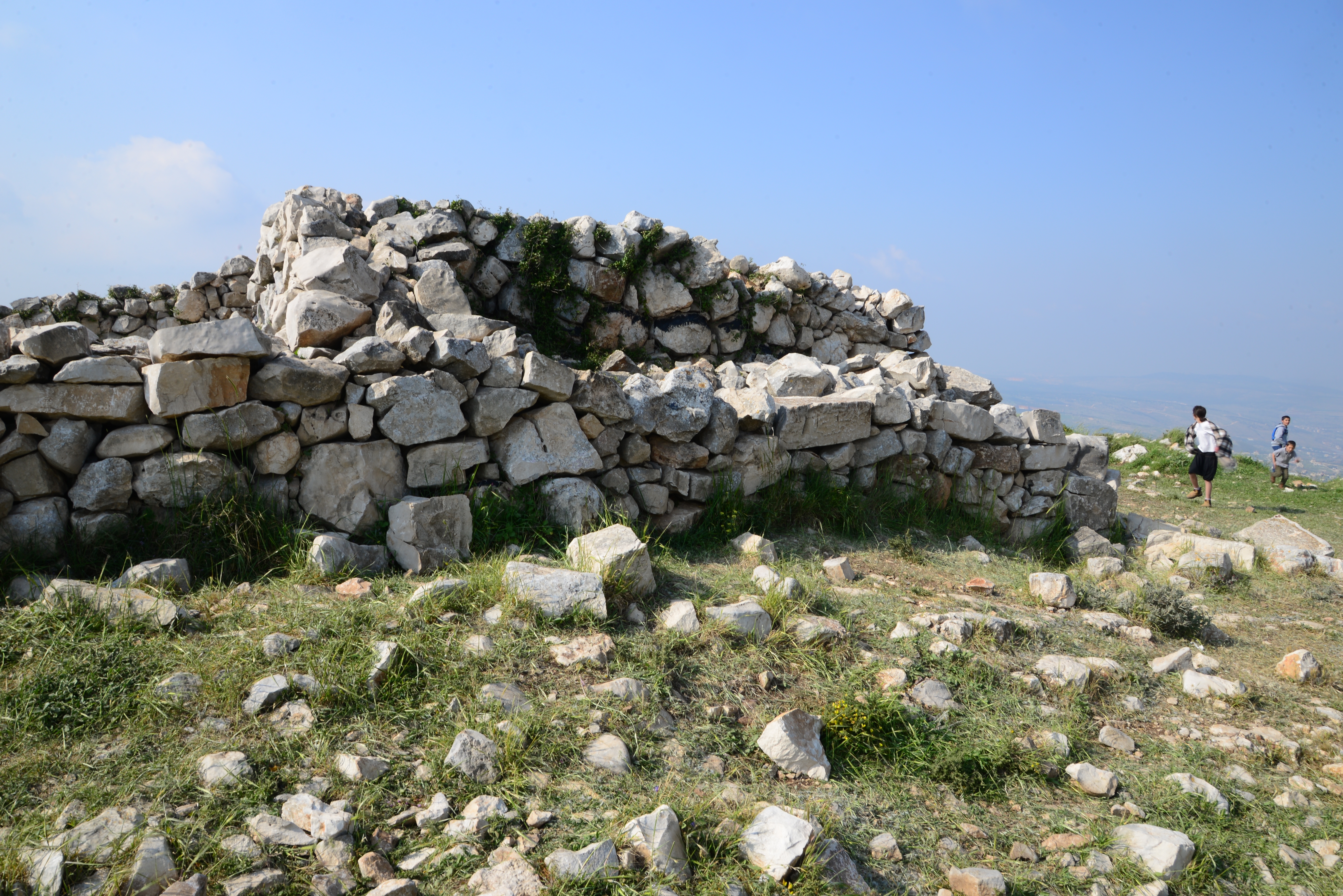
A thick black line was painted by the archaeologists all around the altar, indicating the height of the structure as it was found. The stones above the line were added to reconstruct the original structure.
Another view of the southern side:
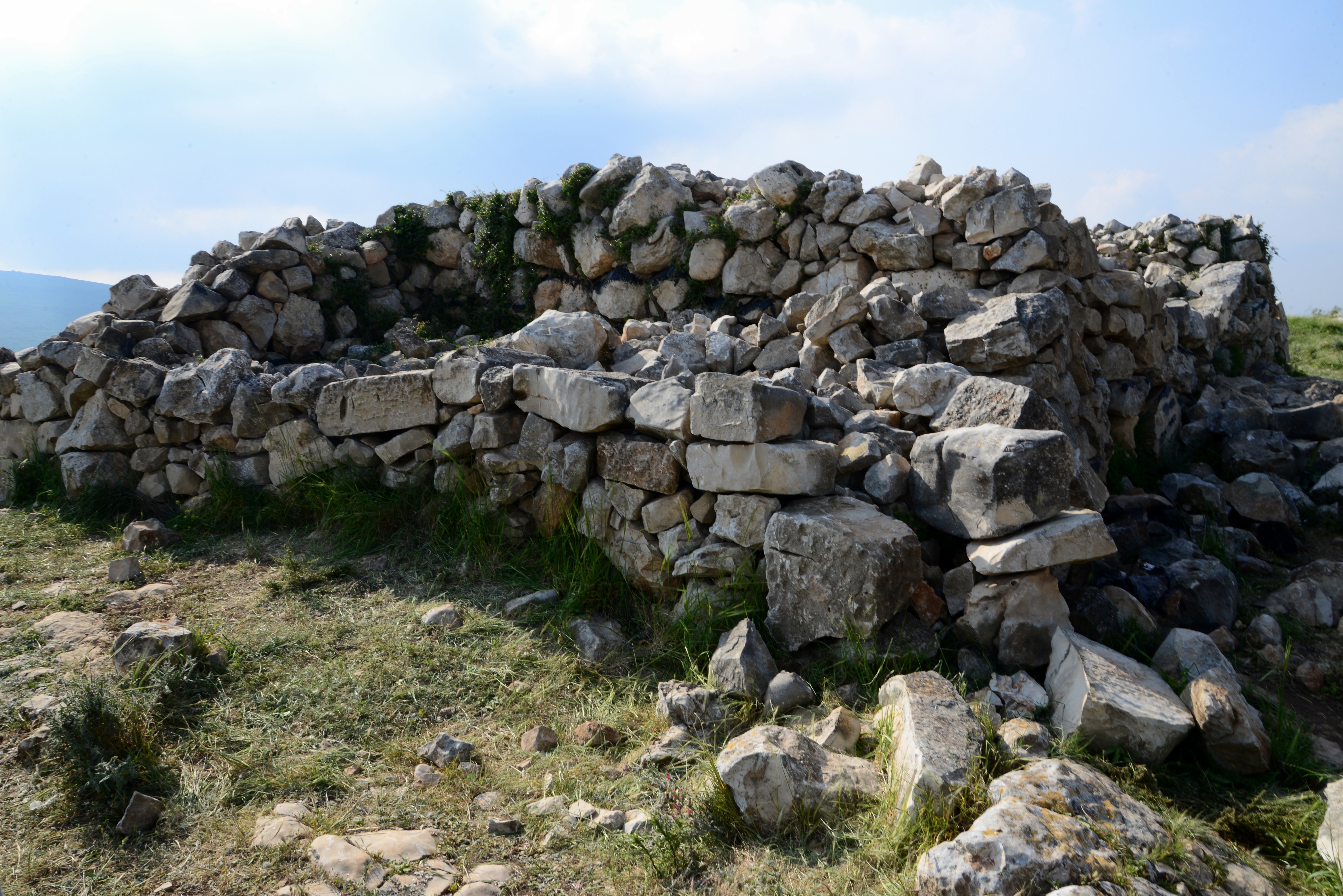
On the ground level, adjacent to the wall, the survey identified 5 offering installations.
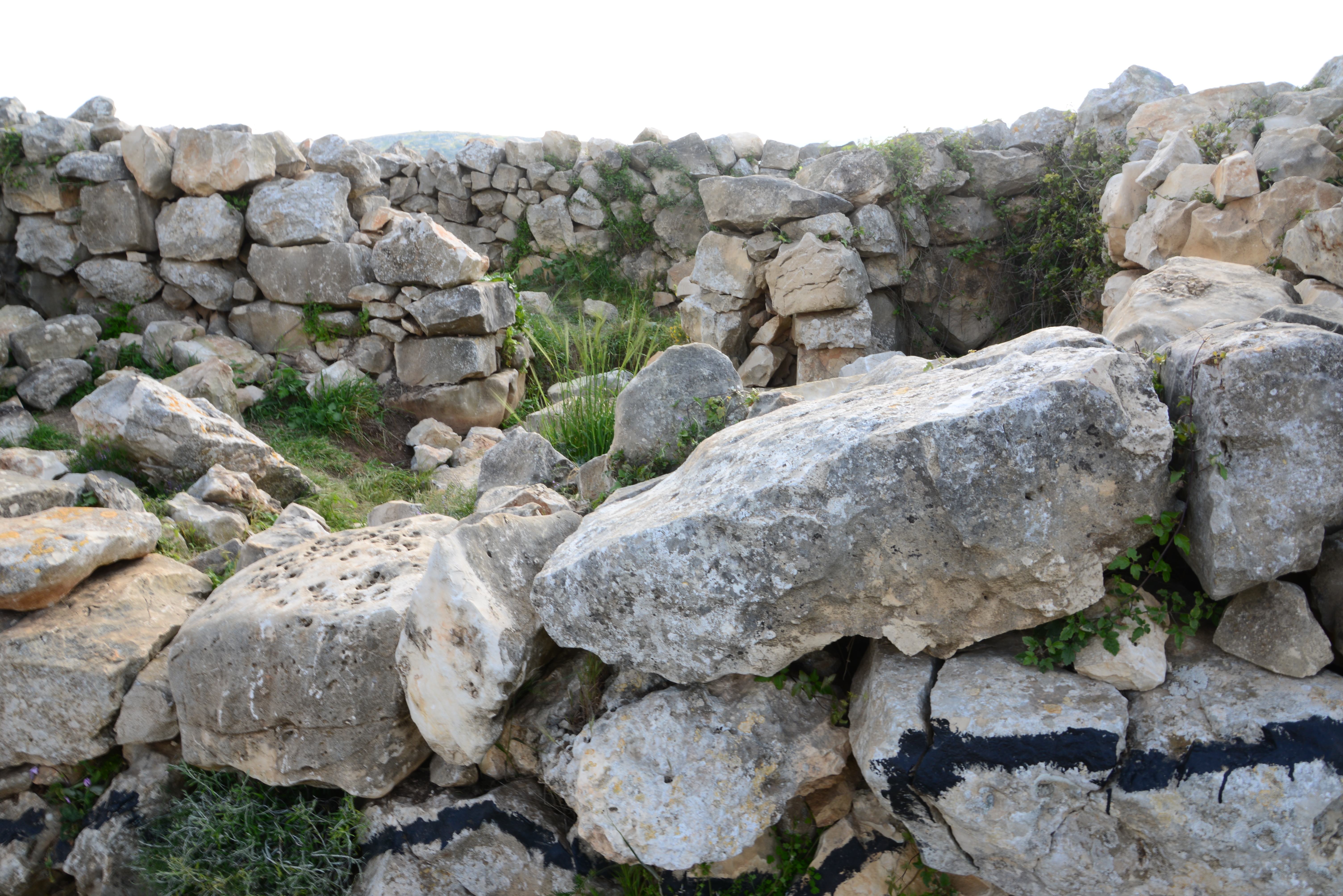
Eastern side:
The eastern side of the altar is seen below, highlighted by the sun rays.
Another view:
A view from the north east edge:
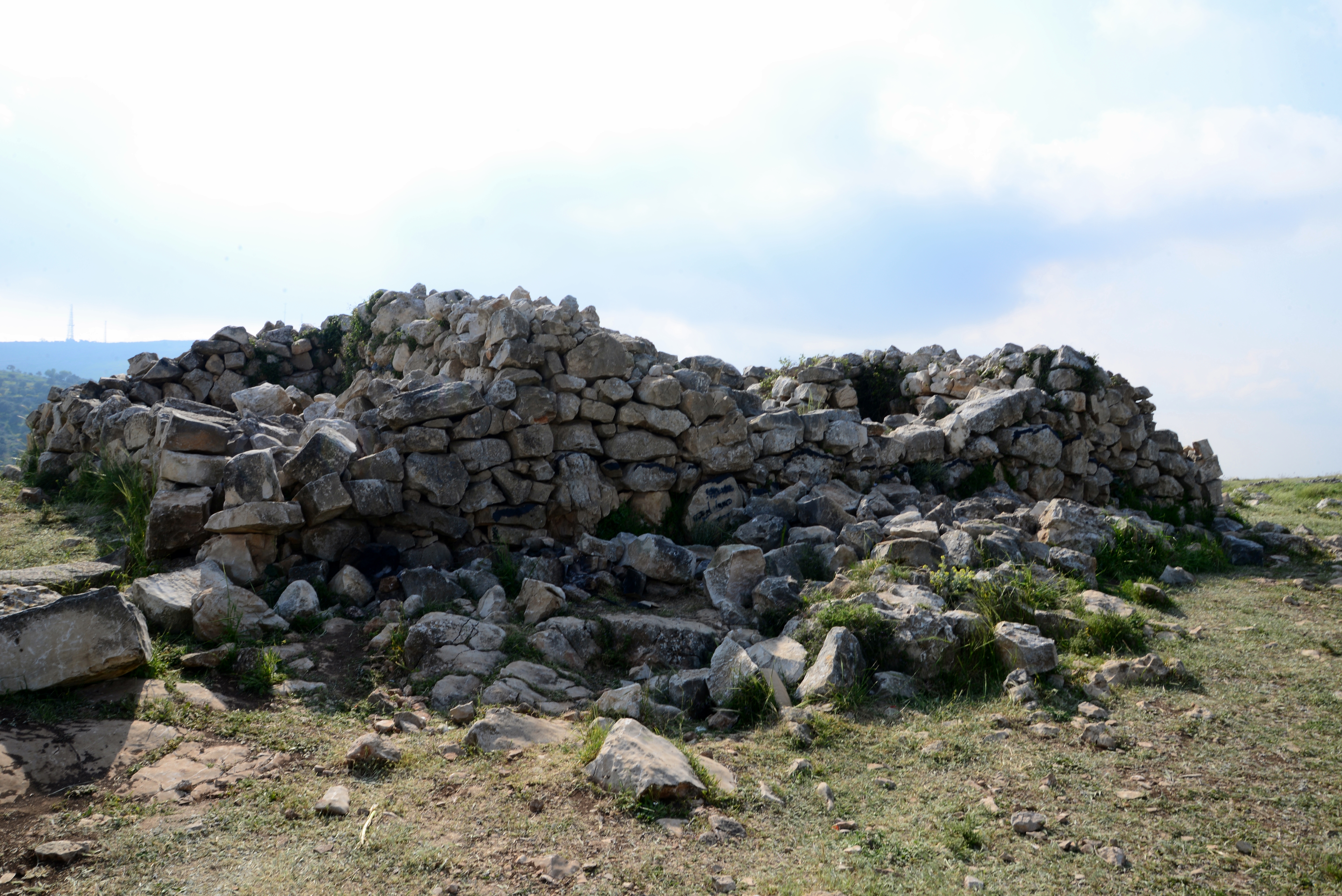
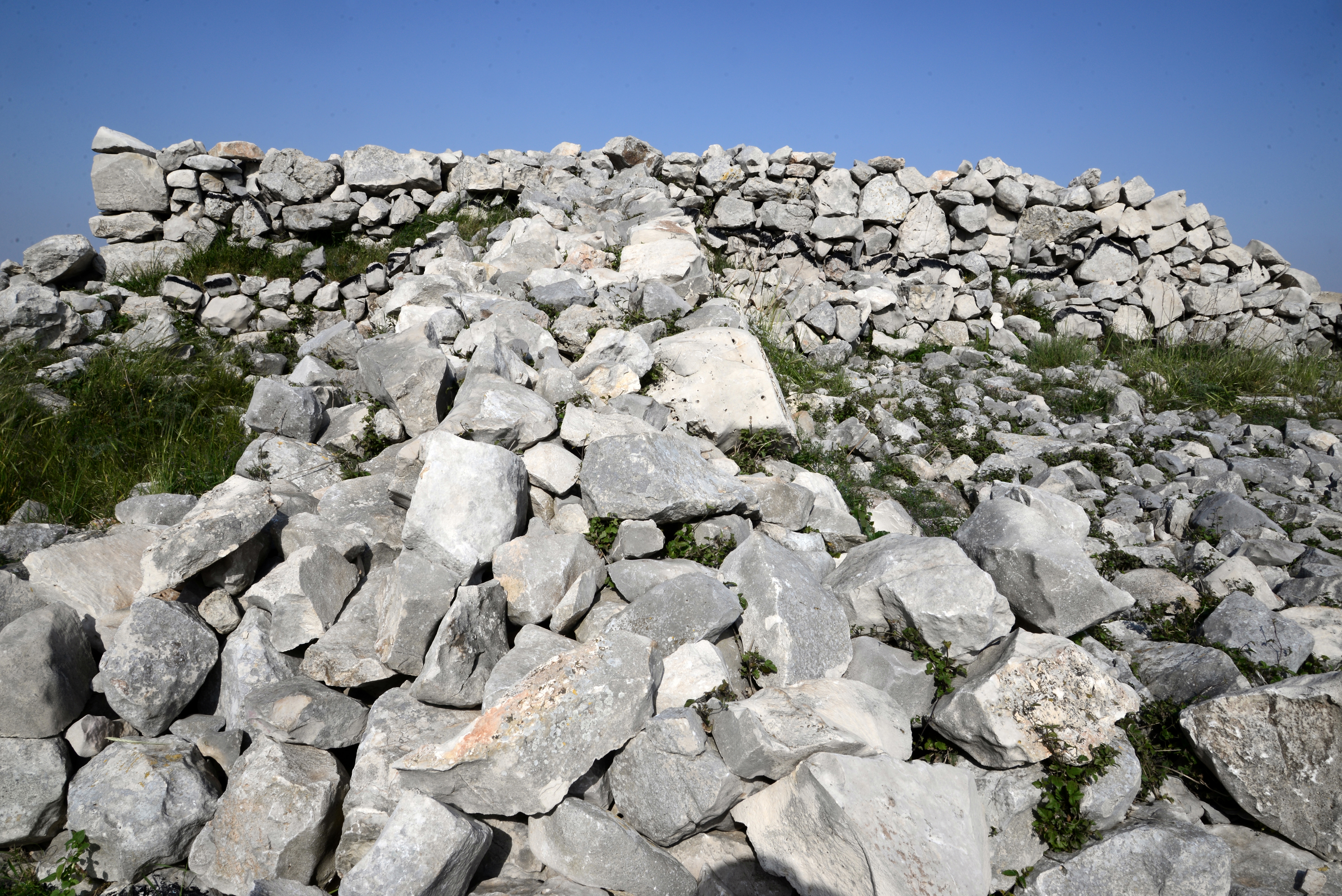
- Northern side:
The northern side of the altar is seen below.
A shelf, 1m wide and 1m lower than the top, surrounds the altar from 3 sides.
On the ground level, adjacent to the altar, the survey identified a dozen offering installations.
- Western side:
The west side consists of 2 paved courtyards, and a ramp that ascends to the top.
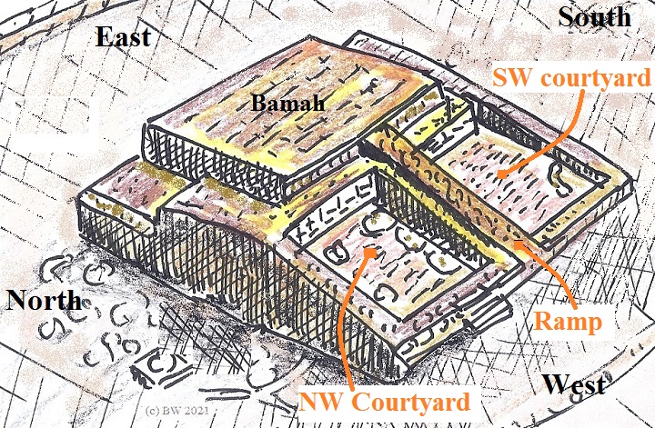
Each of these sections are further detailed, as they are important to the ritual processes.
a. North west courtyard
This view is the north west paved courtyard. Its size is 5m by 3m. The pavement on its north side was based on larger stones than on the side closer to the ramp, resulting in two sections with unequal depths.
Embedded in the lower southern section of the paved courtyard, along the side of the ramp, were several ritual installations and vessels. They were used for offerings (Minhah), and contained animal bones and ash. On the upper section northern section were 3-4 stone circles, 1m in diameter, with 0.5m wide flat stones in their centers. Adam Zertal suggested that these ritual elements were constructed during the Israelite settlement phase.
A small staircase (3 stones) lead from the ground level to the courtyard – a 1m difference in height.
b. South west courtyard
The next view is the south west paved courtyard. Its trapezoid area is flat, measuring 7.5m by 6m.
Three installations were found in this area – two adjacent to the ramp and one on the south corner.
c. Ramp
A ramp separates both paved courtyards, leading up to the top of the altar. It is 7.5m long and 1.2m wide.
A side view of the ramp:
A secondary narrow ramp (60cm wide), lower and parallel to the main ramp, leads up to a 1m wide shelf that surrounds the top of the altar from 3 sides, but is lower than 1m from the top.
- Top side:
The top of the altar covers an area of 8m by 6.8m. This is the bamah – a cultic platform on the top of the altar, where the high priest would stand and perform the ritual service.
Two phases of construction were identified in the center of the altar. The later stage was a flat square paved platform. However, the archaeologists then pealed the top covering stones and found that at an earlier stage, under the pavement, there were two chambers, seen here from the east side after the top stones was removed.
Inside these chambers they found a round basin rock with animal bones and ash.
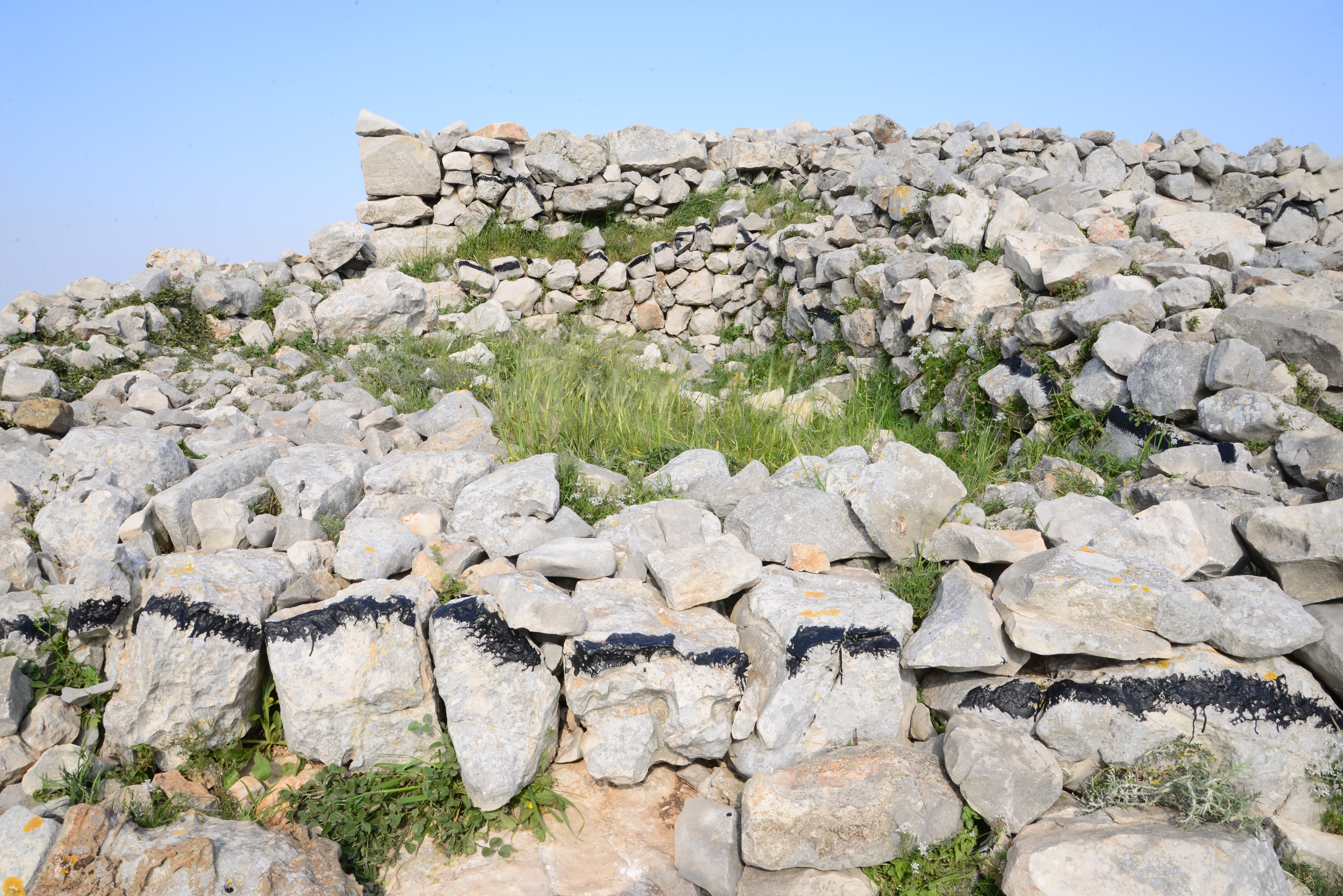
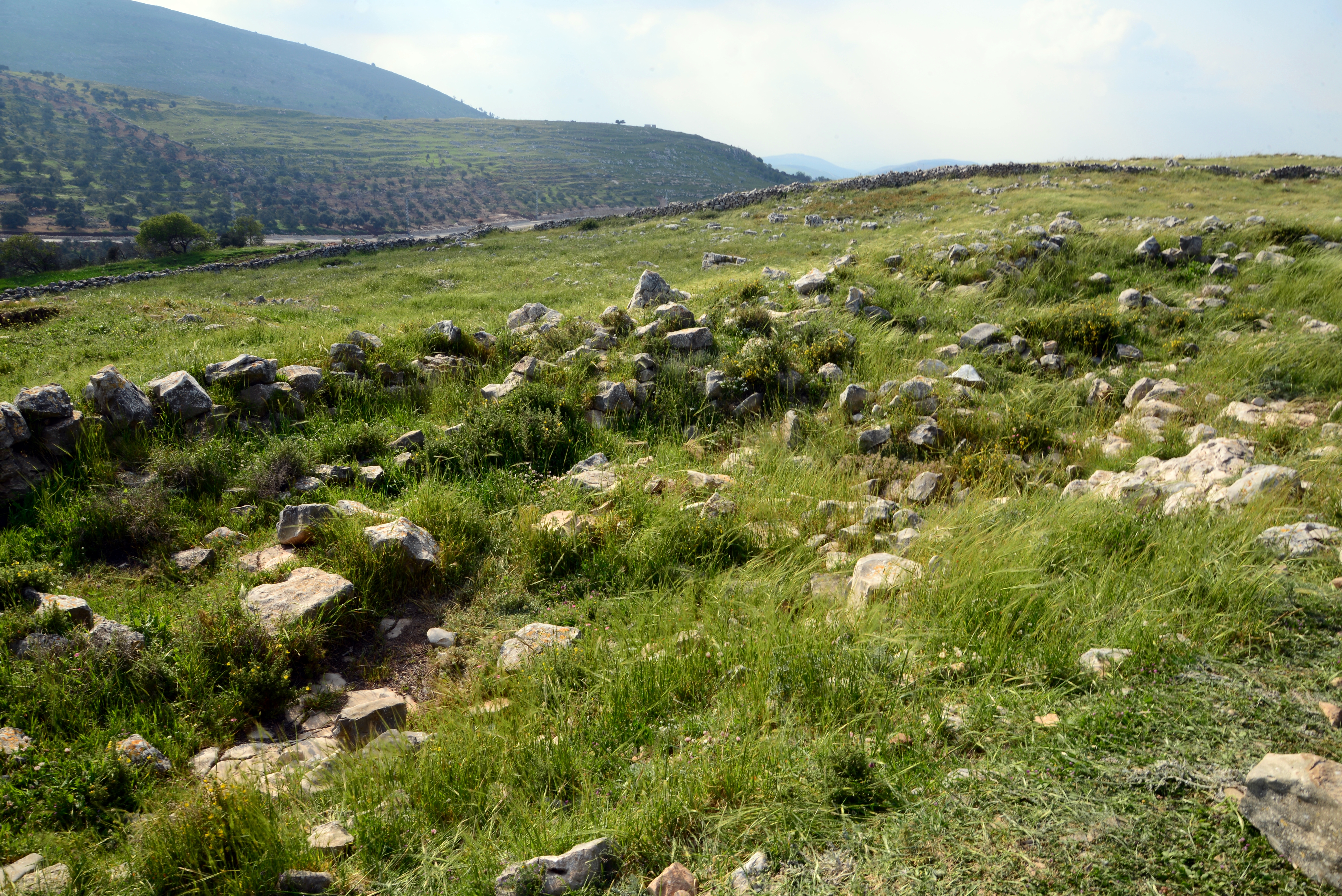
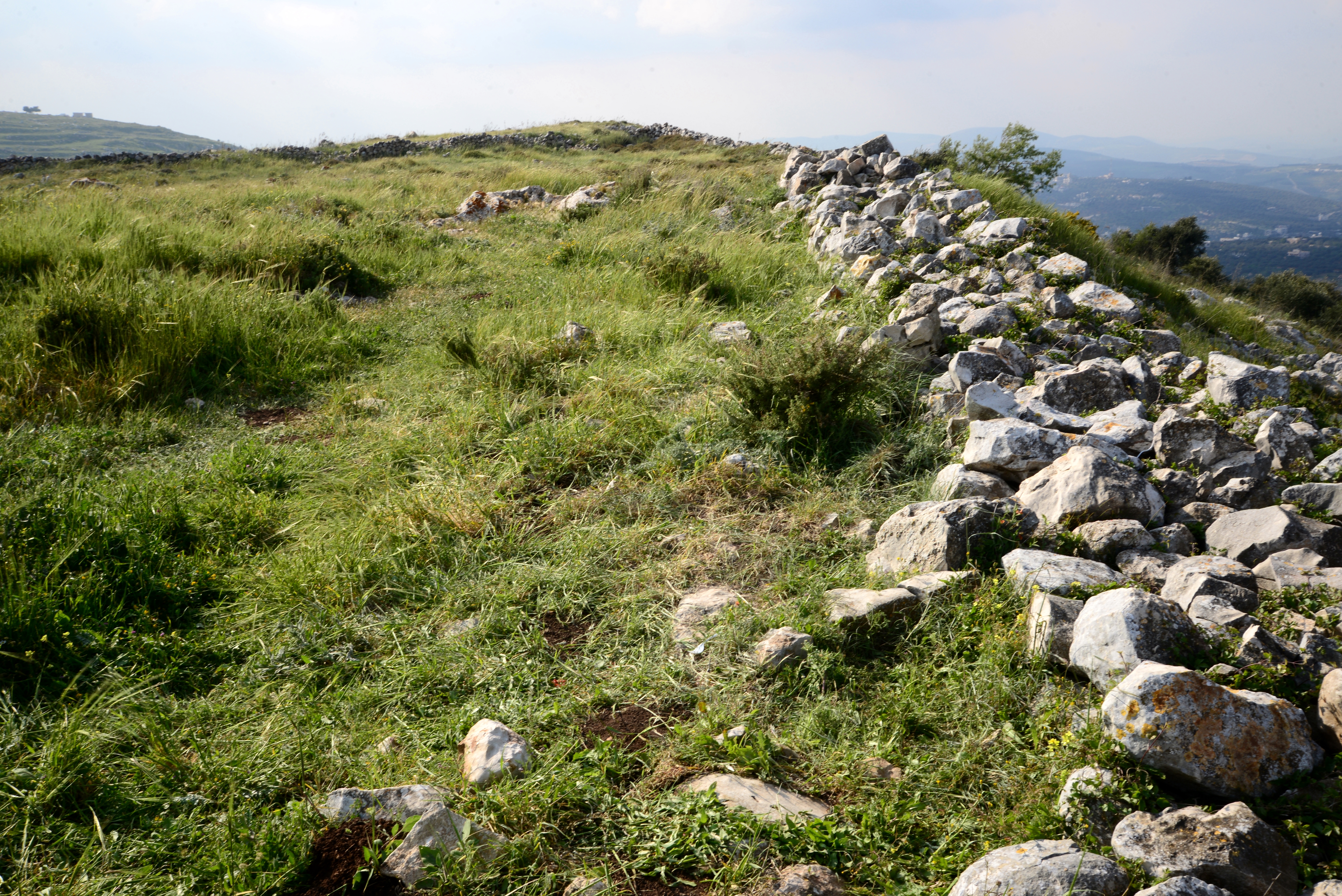
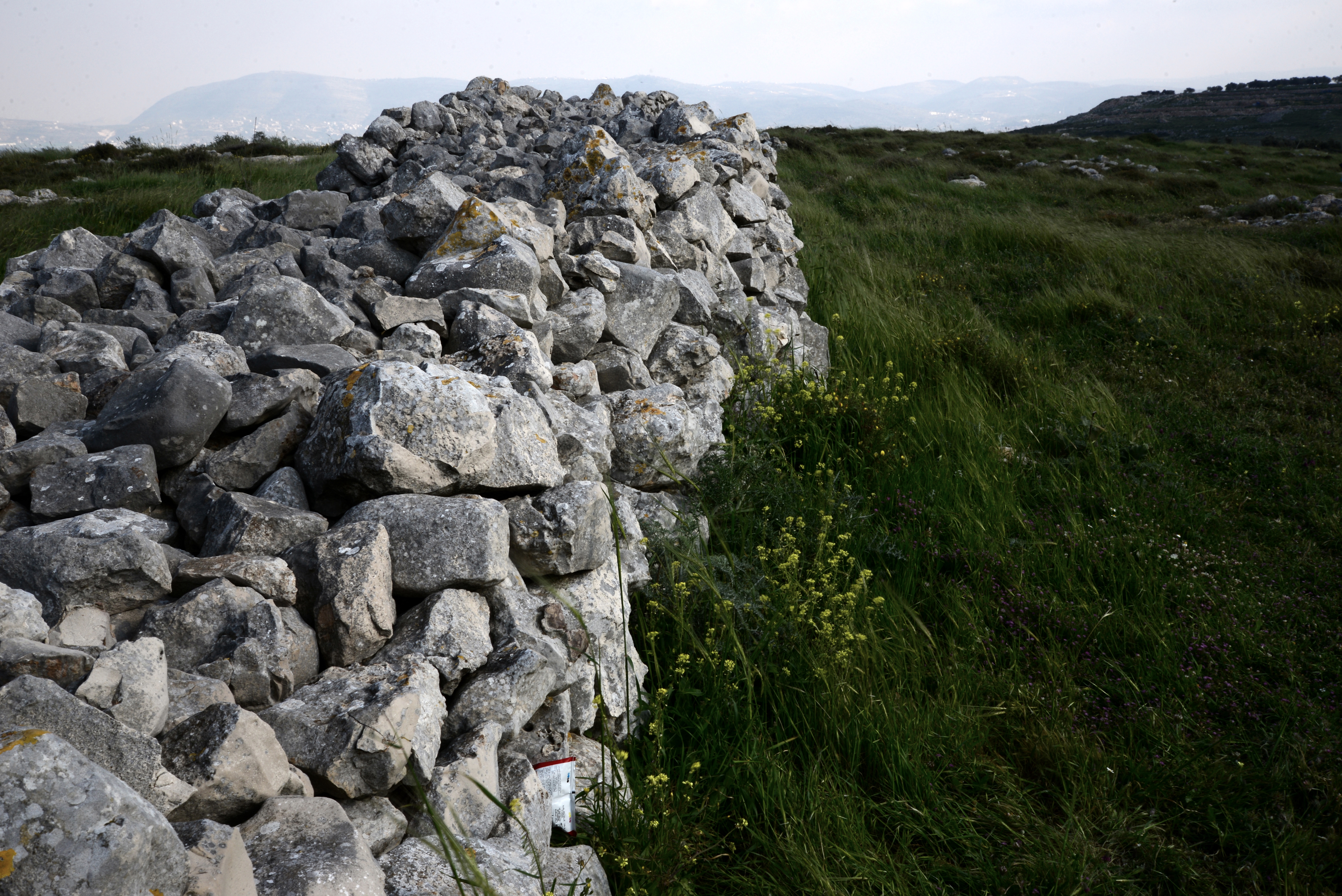
(e) Walled areas
The ritual area is oriented south-east to north-west, covers 14 dunam (3.5 acres). It is 250m long and 80m wide on the north side. An inner area, where the altar stands, is located on the north west side and covers an area of 4 dunam (1 acre).
This photo, taken north of the altar, shows the wall of the inner area. Farther – is the peripheral wall.
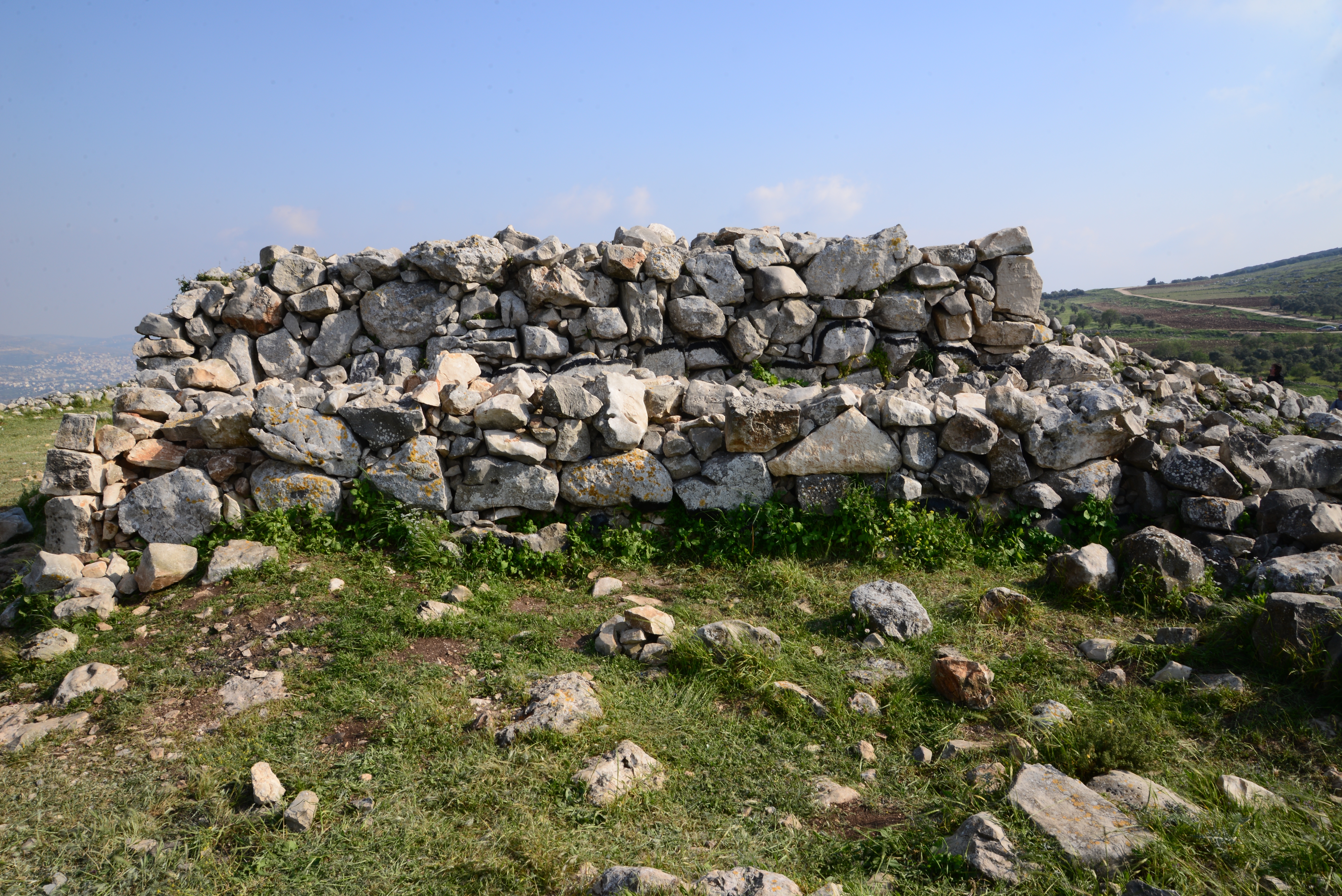
A section of the peripheral wall on the north side of the altar:
A section of the wall to the south of the altar:
The peripheral wall is 1.5-2.0m wide, made of unhewn field stones.
(f) Views
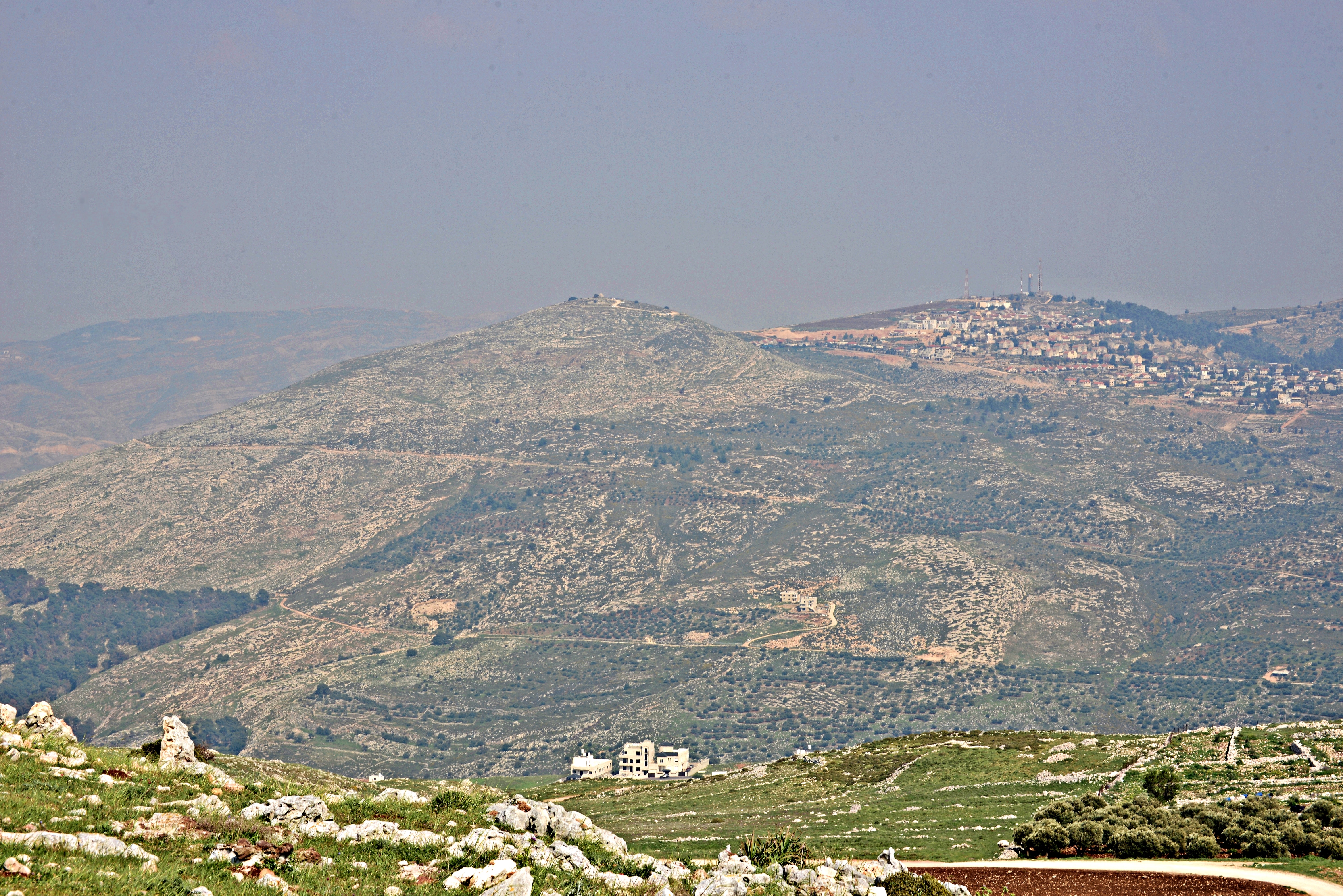
From the ritual place are great views of Mt. Kabir (“The Great”), seen here on the east with a Makam (shrine) on its peak.
The deep gorge of Nahal Beidan, that merges into Nahal Tirzah and continues to the Jordan valley, separates mountains Ebal and Kabir. It is 500m lower than the peak of Mt. Kabir and the location of the altar.
On the ridge east of Mt. Kabir is the community of Elon Moreh.
(g) Nature
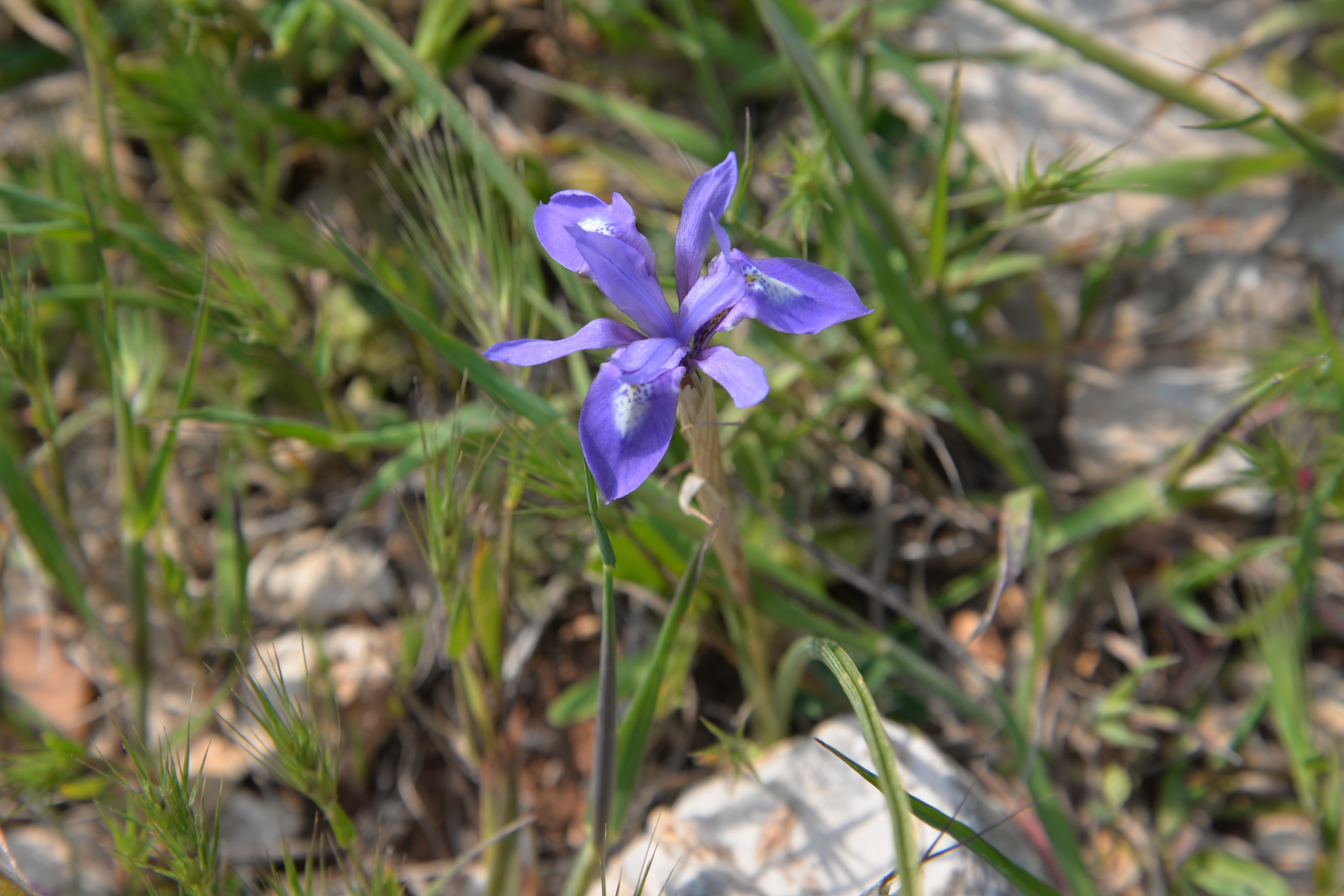
- Wild flowers:
While walking to historic sites, it is always heart opening to see the nature blooming with wild flowers.
These Iris flowers are of type Barbary Nut (Iris sisyrinchium), or Hebrew Tsaharon.
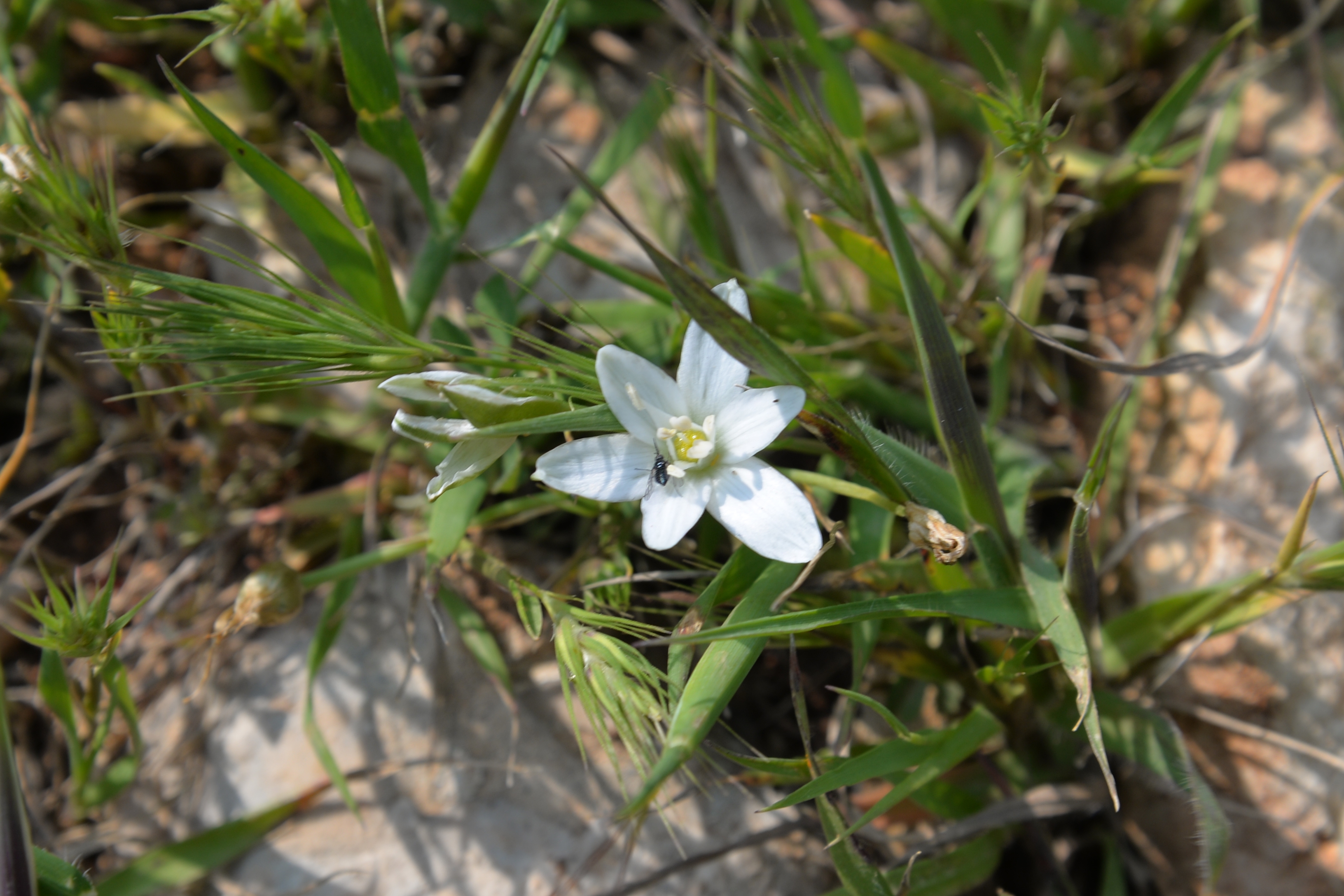
Another flower is the Mountain Star-of-Bethlehem (Ornithogalum montanum, Hebrew: Netz Khalav Harari). This star-like flower links to story of Bethlehem star, that revealed the birth of Jesus to the wise men.
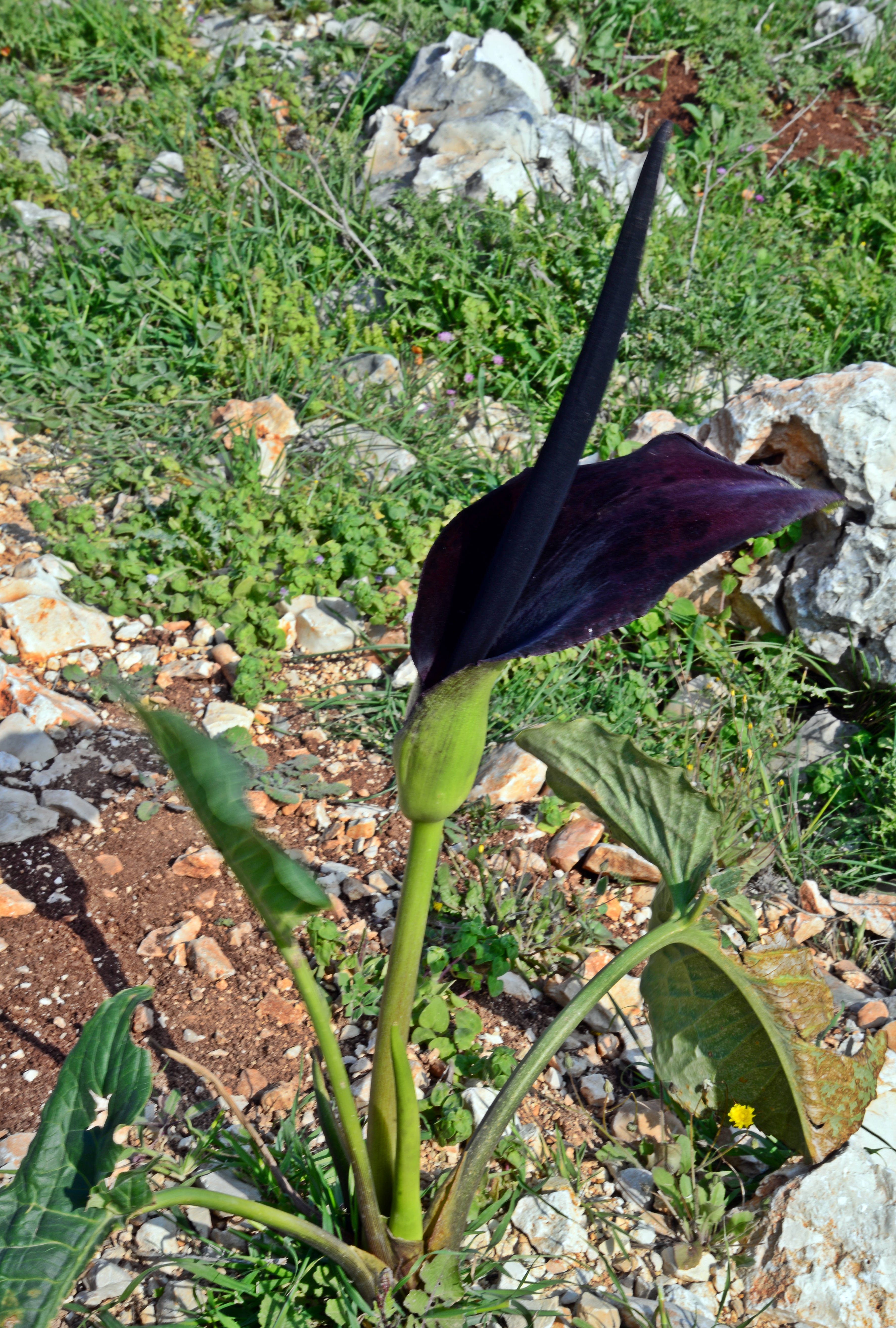
Below is the “Israeli Luf” (Arum Palaestinum, of the Araceaes), which flowers during months Feb-April. It is toxic (poisonous Aroin), although during the second temple period the farmers knew how to cook it safe (as written in the Mishna – a collection of Jewish oral traditions, written in the 3rd century).
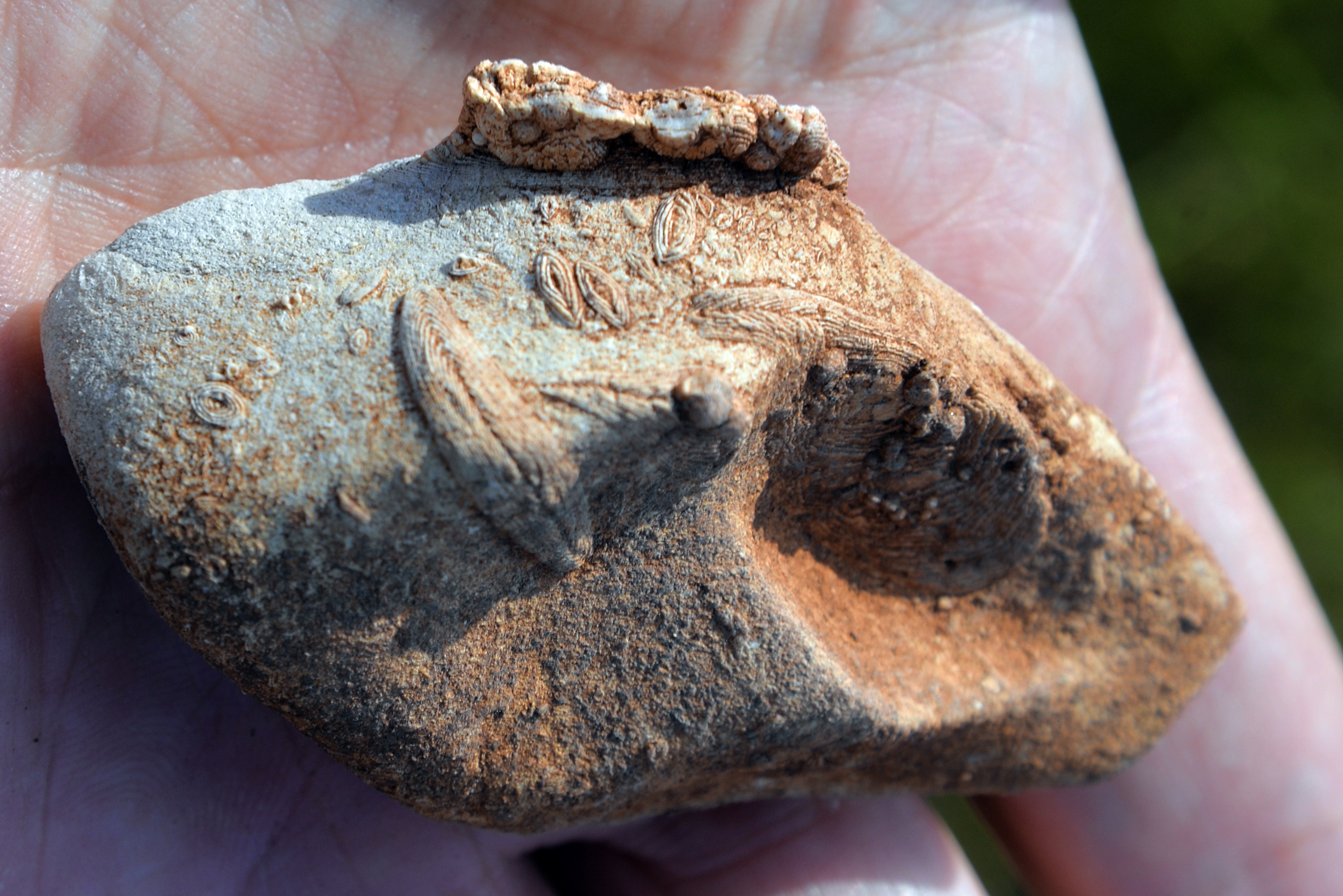
- Fossils:
A small stone was found near the parking place. Embedded in the limestone piece are, what looks like, fossilized leaves. It is covered from all sides with patterns that look like leaves. They are the actually the shells of the fossil marine single-celled Nummulites. These simple organisms, that also exist today, feed on organic matter.
The PEF report by Wilson defined the geology of Mt Ebal as (Colonel Sir Charles Wilson, ‘Quarterly Statement,’ 1873, p. 66.) : “…the nummulitic limestone, of which the mountain is composed”. The geological age of Mt. Ebal is of the Eocene geological epoch, from 56 to 33.9 million years ago.
Etymology (behind the name):
* Names of the site: Mt. Ebal
- Mt Ebal – Biblical name. It was cursed by the Bible (Deuteronomy 11:29): And it shall come to pass, when the lord thy God hath brought thee in unto the land whither thou goest to possess it, that thou shalt put the blessing upon mount Gerizim, and the curse upon mount Ebal”.
- Jebel Eslamiyeh – Arabic name of Mt. Ebal, named after a Holy woman’s tomb
- Jebel et Tur – Arabic name: The “mountain of the mountain” par excellence. Mt. Ebal, Gerizim, Olives, and Tabor are all so named. (from PEF dictionary)
* Other:
- Joshua – Leader after Moses; led the Israelite conquest. Hebrew meaning: “God is savior”.
Links and References:
* Internal:
- Elon Moreh – community on Mt Kabir, east of Ebal
- Wild flowers of the Holy Land
- Shiloh – an altar was found in the excavations
- Shiloh altars – other altars around Shiloh
- Tel Dothan – an altar stone found on the mound
* External:
- 13th century BC “Curse” text on ancient amulet found on Mt Ebal – a significant find for Biblical study – Times of Israel Mar 24 2022
- “Nation has born” – A great book by Adam Zertal, with the story of discovery of the altar (ISBN 965-448-805-1; Hebrew; 2000)
- “The Manasseh Hill country survey” – Volume 1 – The Shechem Syncline – Adam Zertal (ISBN 965-311-012-8; Hebrew; 1992)
* Other:
- Biblical pictures by Gustave Doré (1832-1883) – public domain
BibleWalks.com – Get up and walk around the land
Luza <<<—previous site—<<<All Sites>>>—next Samaria site—>>> Joseph Lookout
This page was last updated on Mar 25, 2022 (amulet found)
Sponsored links: