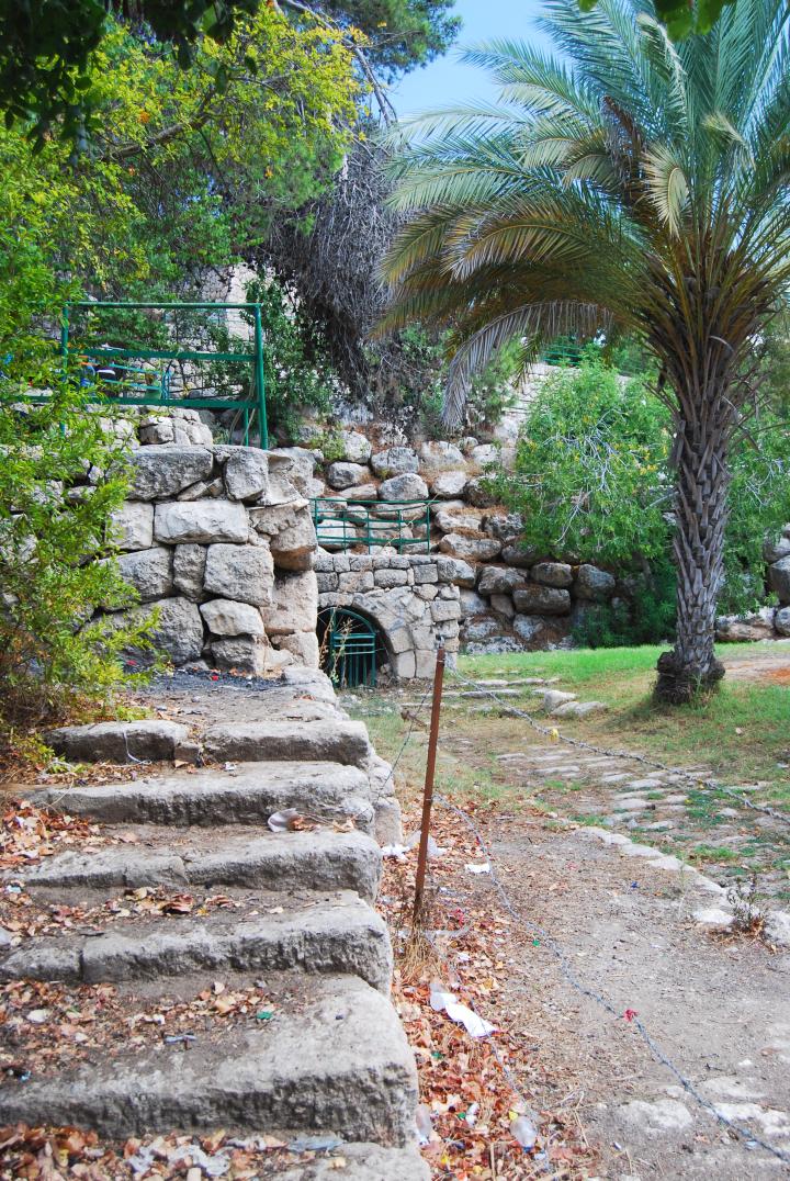
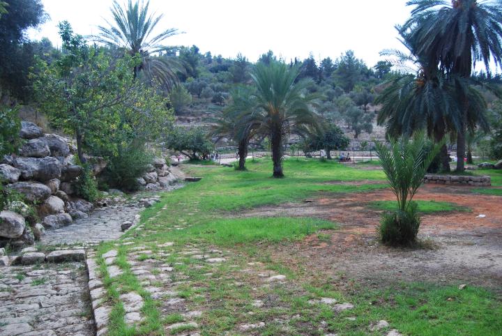
This Late Roman water system supplied the water to the city of Emmaus-Nicopolis.
Home > Sites > Judea > Emmaus (Nikopolis) > Valley of Springs
Contents:
Overview
Map
History
Photos
* Spring house
* Upper aqueduct
* Merging pool
* Lower section
* Lake
* Palm spring
* Aerial Views
Etymology
Links
Overview:
On the east side of Emmaus, now part of Ayalon (Canada) park, is a valley with a number of springs, several sets of aqueducts, cisterns and other installations. It is known as “the valley of springs” and is the park’s main tourist attraction. The water supply system, dated to the late Roman period, was used for as the source of water supply for the ancient city. The aqueducts were also used to supply water for the agriculture fields around the valley. These water systems made Emmaus/Nicopolis a famous city, well known for her abundant waters.
Another water system from the Early Arab period is located near the aqueducts.
Map / Aerial view:
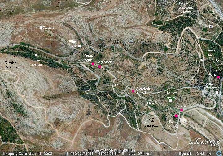
The water system flows inside the valley, from a point close to the Hasmonean-period fortress, until a point along the valley where the aqueducts were diverted to a underground tunnel that was cut into the hill and moved the water towards the city of Emmaus/Nicopolis.
You can walk along the center of the valley downhill (from east to west) or up hill (starting from the lake and walking up the path). We recommend the former path since it is easier to walk down the steep descent of the valley.
An aerial photo of the area is seen below, indicating the major points of interest.
History:
The water systems were discovered during an archaeological survey which was conducted as part of the park design by KKL. The archaeologists determined that the twin Roman aqueducts, which are composed of modular stone units, were constructed during the 3rd or 4th century AD. Their construction was required in order to supply the growing water needs of the Roman city of Emmaus Nicopolis.
Near the Roman aqueducts is another underground water system which was constructed during the early Arab period.
Photos:
The photos are shown in the order following the flow of the waters along the valley, from the upper east side, towards the lake on the bottom west side.
(a) Spring house – beginning of the aqueduct:
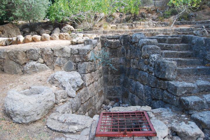
The spring house is located on the upper side of the valley, at the foothills of the Hasmonean fortress. It collected underground water and stored them in a small underground pool, 3M deep under the ground level. The “lower aqueduct” emerged from the pool and flowed downhill in the center of the valley.
Click on the photos to view in higher resolution…
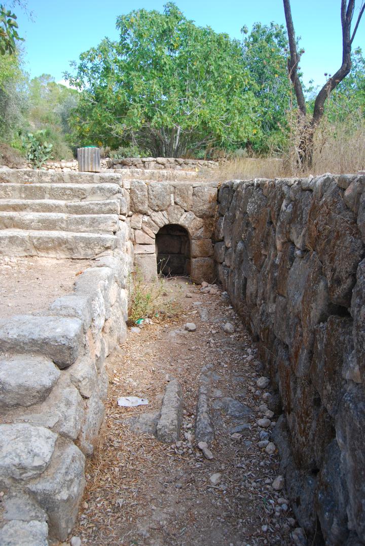
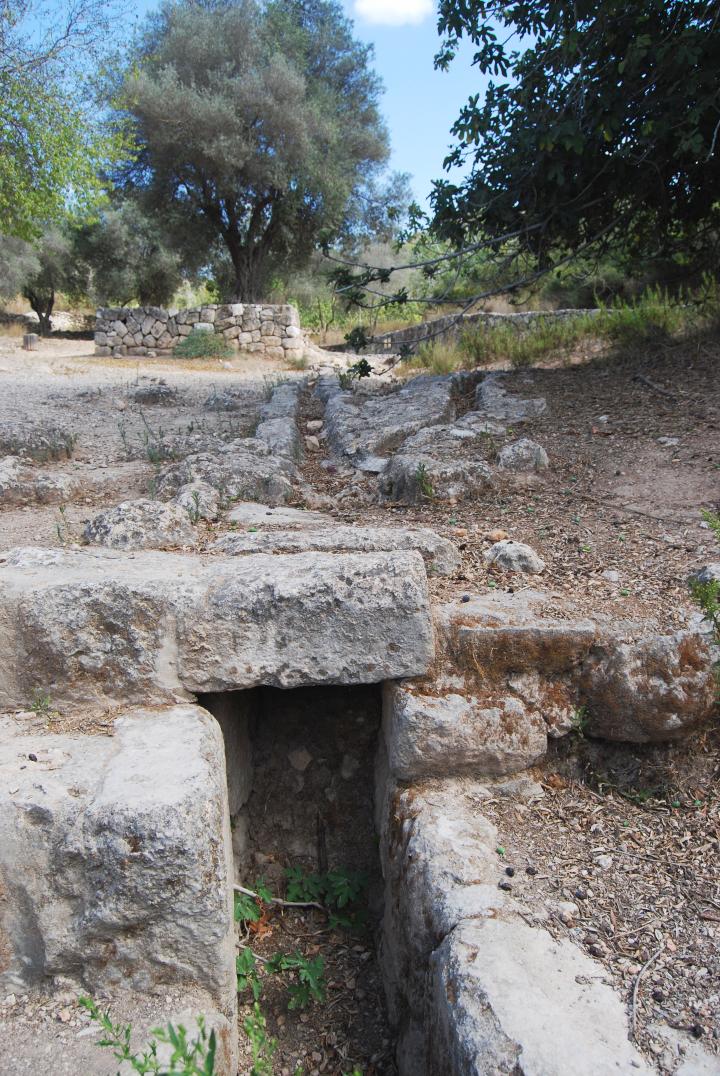
After about 100M the lower aqueduct emerged from the ground, as seen below. The aqueduct was built with modular stones, which one of them is seen in the center of the canal.
(b) Upper Aqueduct:
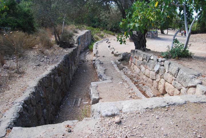
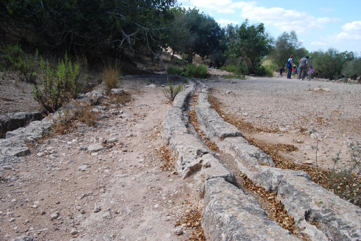
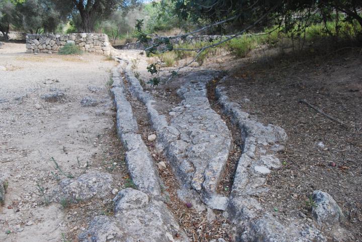
The photo below shows the same section of the aqueduct, and the lower aqueduct is seen on the left side.
A second twin aqueduct, called the “upper” aqueduct, is seen on the right side, and flows in a parallel line. It is also composed of modular stone segments, but is located on a higher level.
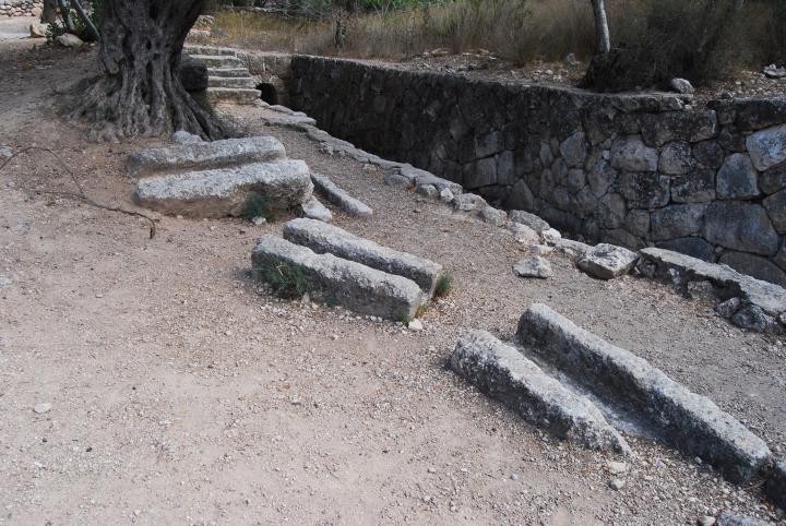
The upper aqueduct is broken at several segments, and its stones are scattered along the original path.
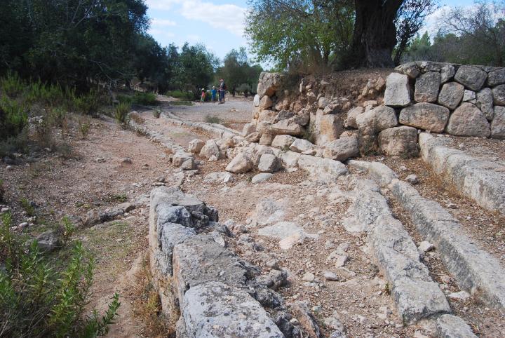
The twin aqueducts, dated to the late Roman period (3/4th century AD), flow down the valley.
Another view of the twin aqueducts.
(c) Merging Aqueducts:
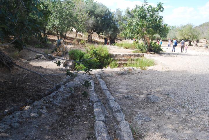
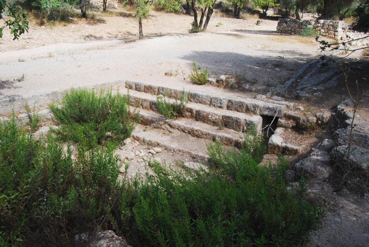
The two aqueducts merge finally to the same height and fill an open collecting pool which was used for regulating the flow of the waters. A third aqueduct merges from the left (south side) into the regulating basin.
The photo below shows the two aqueducts merging into the regulating basin.
Another view of the two aqueducts, merging together at the regulating basin.
The regulating basin is seen below. The pool collected the waters from the three aqueducts, and another aqueduct continued from the pool down the valley (on the left side).
(d) Lower section:
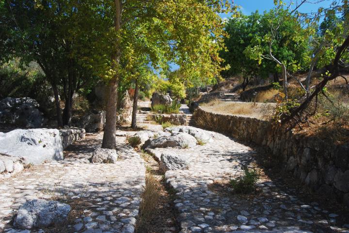
The total length of the visible aqueducts stretches about 1500M along the valley.
The aqueducts finally entered the hill about 100M past the “Roman tomb”. A rock cut tunnel diverted the waters from the aqueducts under the hill and south west towards the city of Emmaus.
(e) Lake and Palm spring:
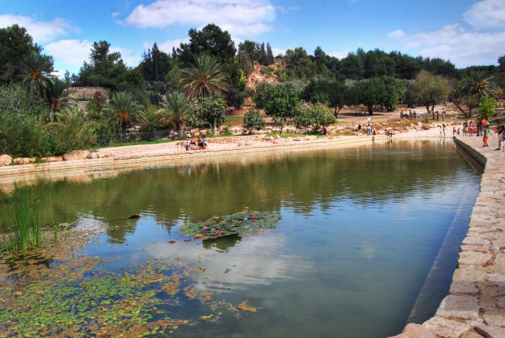
The valley of Springs ends in a modern artificial lake. Behind the lake is “Palm spring”, and an area with picnic tables and an “active recreation area” (meaning, many kids running around and their moms chasing them).
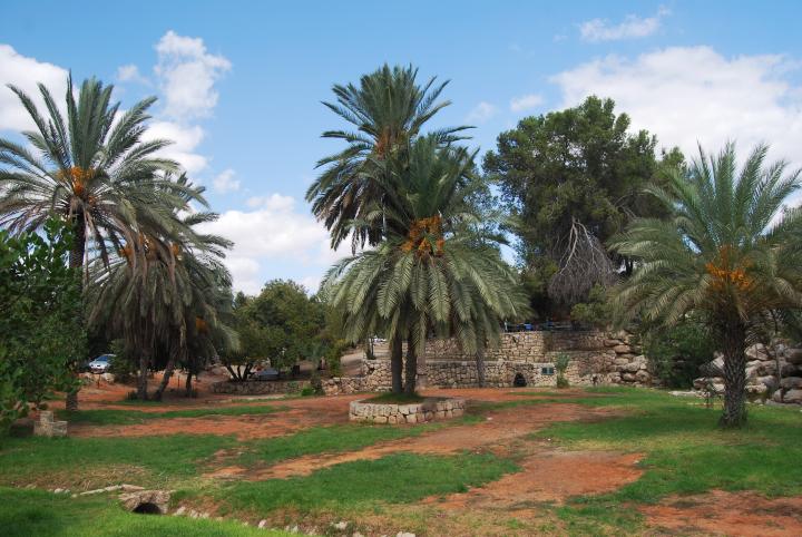
The “Palm” spring, named after the palm trees around it, is located inside the structure seen in the center of the photo. The spring provides water all year round.
A closer look on the spring. An aqueduct leads the water from the spring to a square pool over a 30M aqueduct, which is based on modular stone units. The pool was constructed during the Byzantine period.
The photo below shows the view from the spring towards the valley.
(f) Aerial views
A drone captured (on July 2017) the western side of the valley of springs. The lake and palm spring are seen in the foreground, while the valley extends farther towards the east. In the far background is a round hill, where the Hasmonean period fortress is located.
![]() The drone also captured this video over the site, starting and ending from the west side:
The drone also captured this video over the site, starting and ending from the west side:
Etymology (behind the name):
- Ham – warm in Hebrew.
- Hammat/Hammath – the Hebrew name of the city, based on its hot springs.
- Emmaus – the name of the city in Greek, based on the Hebrew name, and means hot springs. Another spa city, called “Emmaus of Galilee” , is located near Tiberias.
Links:
* External links:
- Park Canada (Ayalon) (in Hebrew)
* Other BibleWalks web pages of Emmaus:
* Other internal links:
- Quadcopter Aerial views – collection of Biblical sites from the air
BibleWalks.com – exploring the sites of the Holy Land
Emmaus Roman Bath<<<—previous site—<<< All Sites >>> — next Judea site—>>> Hasmonean fortress
This page was last updated on July 14, 2017 (Added aerial views)
Sponsored links:
