This page describes the ancient streets in the old city of Jerusalem, following the Madaba street map.
Home > Sites > Jerusalem > Roman Streets
Contents:
Overview
History
Madaba Map
Streets
* Station 3
* Christian.
* David Tower
* South-West
* CardoMax
Biblical refs
Etymology
Links
Overview:
Jerusalem’s Roman/Byzantine streets are recently rediscovered in various sections of the old city. These discoveries sheds light on the ancient history of Jerusalem and provides valuable insights into the city’s urban planning and architecture during the Roman period. It also underscores the importance of ongoing archaeological work in preserving and interpreting the rich history of this ancient city.
This web page summarizes these places, mapping them to the Madaba street map.
History:
The Romans conquered the Holy Land in 63BC and ruled for over 700 years. Among their major effect on the land and its history was the quality of the urban design and its streets. The Romans perfected the art of civil engineering: they redesigned the cities and structures, added new water supply and sewerage lines, repaved existing streets, and laid out new streets. Additionally, the Romans connected the cities with better roads.
Madaba Map:
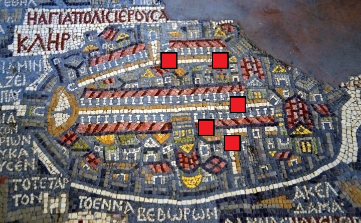
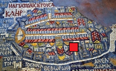
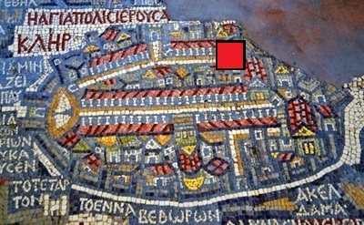
An ancient map of the Holy Land from the 6th century AD was discovered in 1884 in a Byzantine church in Madaba, Jordan. The map shows the the Holy Land, with dozens of illustrated sites. Jerusalem is illustrated in a 54 x 93 cm section of the map.
Jerusalem is seen in a perspective aerial view from the west, and reveals several of the highlights of the city, including the Cardo Maximus, which is shown as a straight line crossing the city North to South – from left (Nablus-Shchem Gate) to right (Holy Zion Church in Mount Zion). Another smaller eastern street (“secondary Cardo” or “Valley Cardo”) connected the north gate to the south, passing between the temple mount and the upper city, and reaching the dung gate. It is indicated by a single line of columns crossing the top side of Jerusalem.
These are the detailed sections in this page (indicated as red squares on the map):
-
- Station 3 (El Wad/ Hagai, along the Via Dolorosa path)
- Christian Quarter street (between Holy Sepulcher and St John the Baptist)
- David Street/Tower (western gate, near Jaffa Gate)
- South-West (along the temple mount walls)
- Cardo Maximus (in the Jewish quarter)
The Streets:
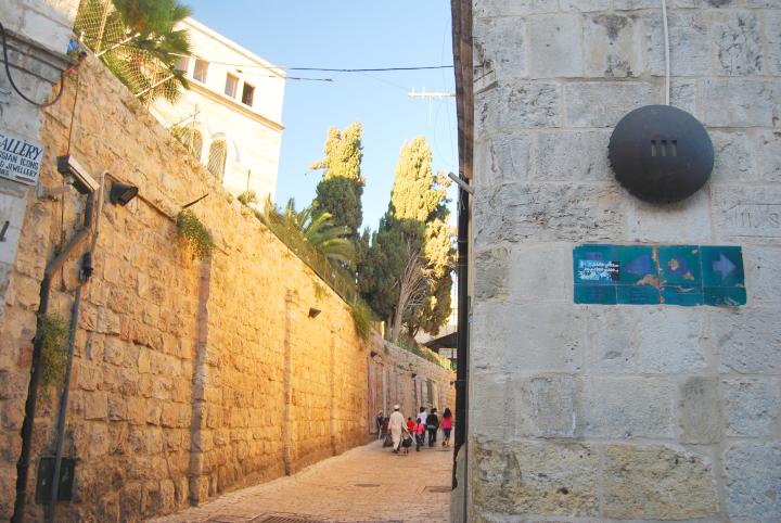
(a) Station 3, El Wad (Hagai):
A short section of the Byzantine street is located near Station 3 of Via Dolorosa, near the junction of Via Dolorosa street and El Wad (Hagai). This pavement was probably part of the “secondary” (Eastern) Cardo, which once connected the Damascus (Shkhem) gate to the Dung (Ha-Ashpot) gate in the south, as seen in the Madaba map. A red square indicates the location of this pavement.
The stones may have been also part of the Early Roman street(1), during the times of Jesus who conceivably could have walked on them.
(1) Correction by S. Browns
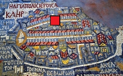
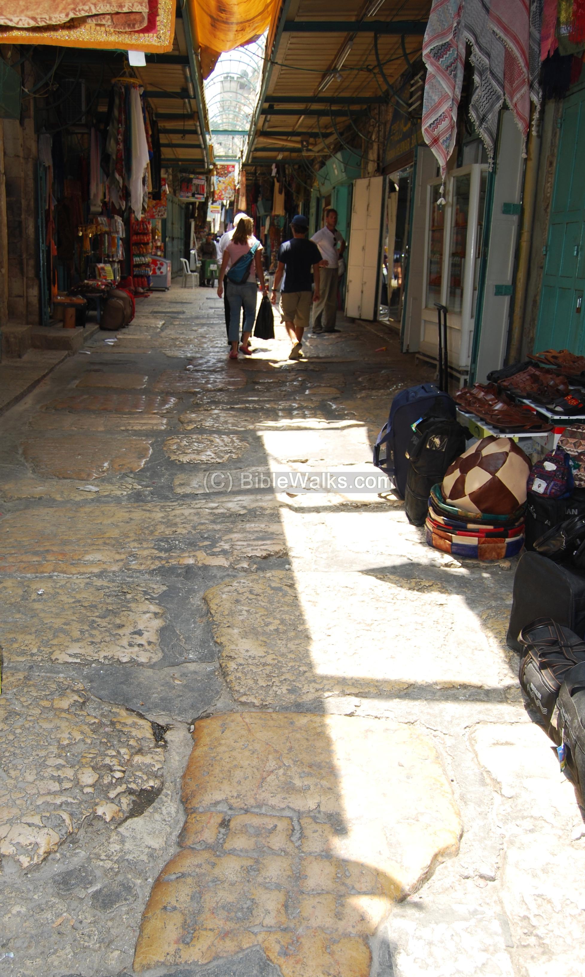
(b) Christian Quarter street:
A section of a paved Roman road is located on the Christian Quarter street between St. John and the Holy Sepulcher. Its approximate location is indicated on the map as a red square, to the right of the Holy Sepulcher.
This section was discovered during the restorations conducted at this area in 1977, under the modern level. This street dates to the end of the Roman period – 3rd/4th century AD, and connected the city gate near David’s tower to the north.
In the photo below is a section of the paved Roman road, flanked by modern shops.
Click on the photo to view it in higher resolution…
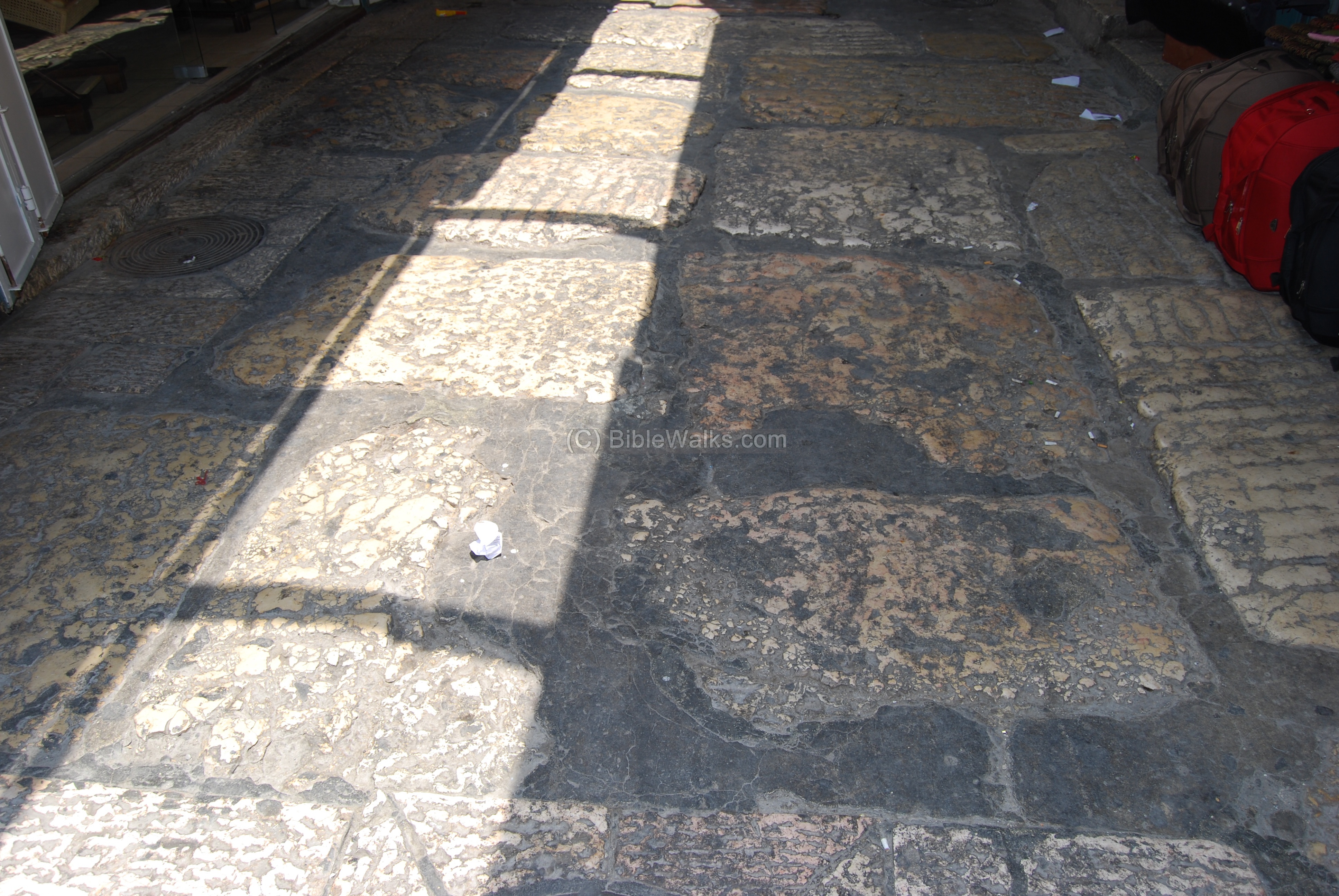
Another section of the Roman road is seen below:
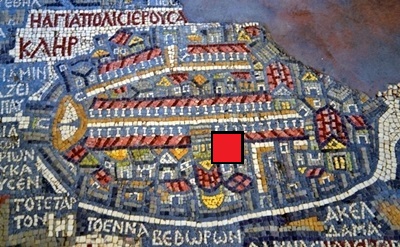
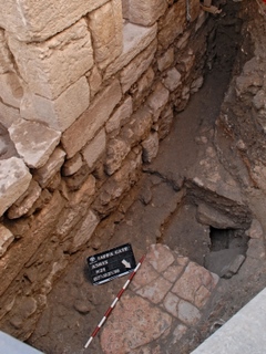
(c) Western Gate Road (David Tower):
An emergency excavation was conducted at the end of 2009 near the top entrance to David Street, close to David tower. At a depth of 4.5m under the current street level, a section of a Roman paved road was discovered, as reported by Dr. Ofer Sion on behalf of the IAA.
The large flagstones, more than 1M in length, were found cracked. This section is dated to the 5th C AD, and was the main road connecting the western entrance near Jaffa gate to the Byzantine city. This road is indicated on the map as a red square.
The photo, courtesy of IAA, shows the section of the paved road.
(d) South-West walls:
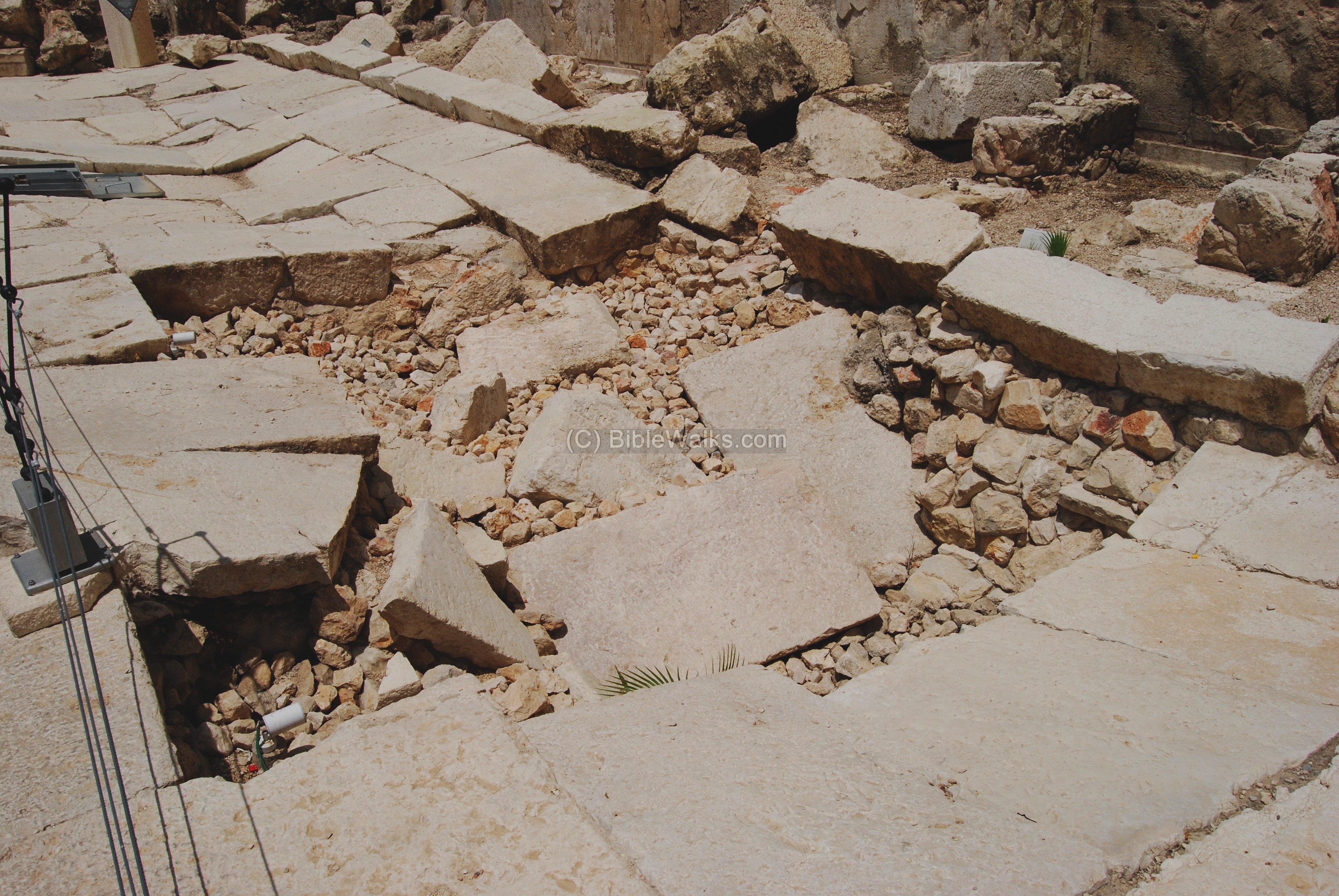
Along the southern wall of the temple, near the Robinson arch, the excavations discovered a paved Herodian street, one of the most important findings in the Jerusalem excavations, which serve as a time machine – bringing us back to the days of the second temple and the destruction of Jerusalem by the Romans (70AD). A magnificent paved road came back to life after almost 2,000 years.
The excavators cleared out several meters high rubble and the large stones. A magnificent paved road came back to life after almost 2,000 years. On top of this street the excavators found a number of large stones which were thrown from the temple above into the street by the Roman soldiers, during the leveling of Jerusalem, after it was captured and burnt. The photo below shows an amazing record of the history – the street was damaged by the stones that were toppled from the temple mount down into the street.
![]() More info on this street may be found in the Southern-Wall site.
More info on this street may be found in the Southern-Wall site.
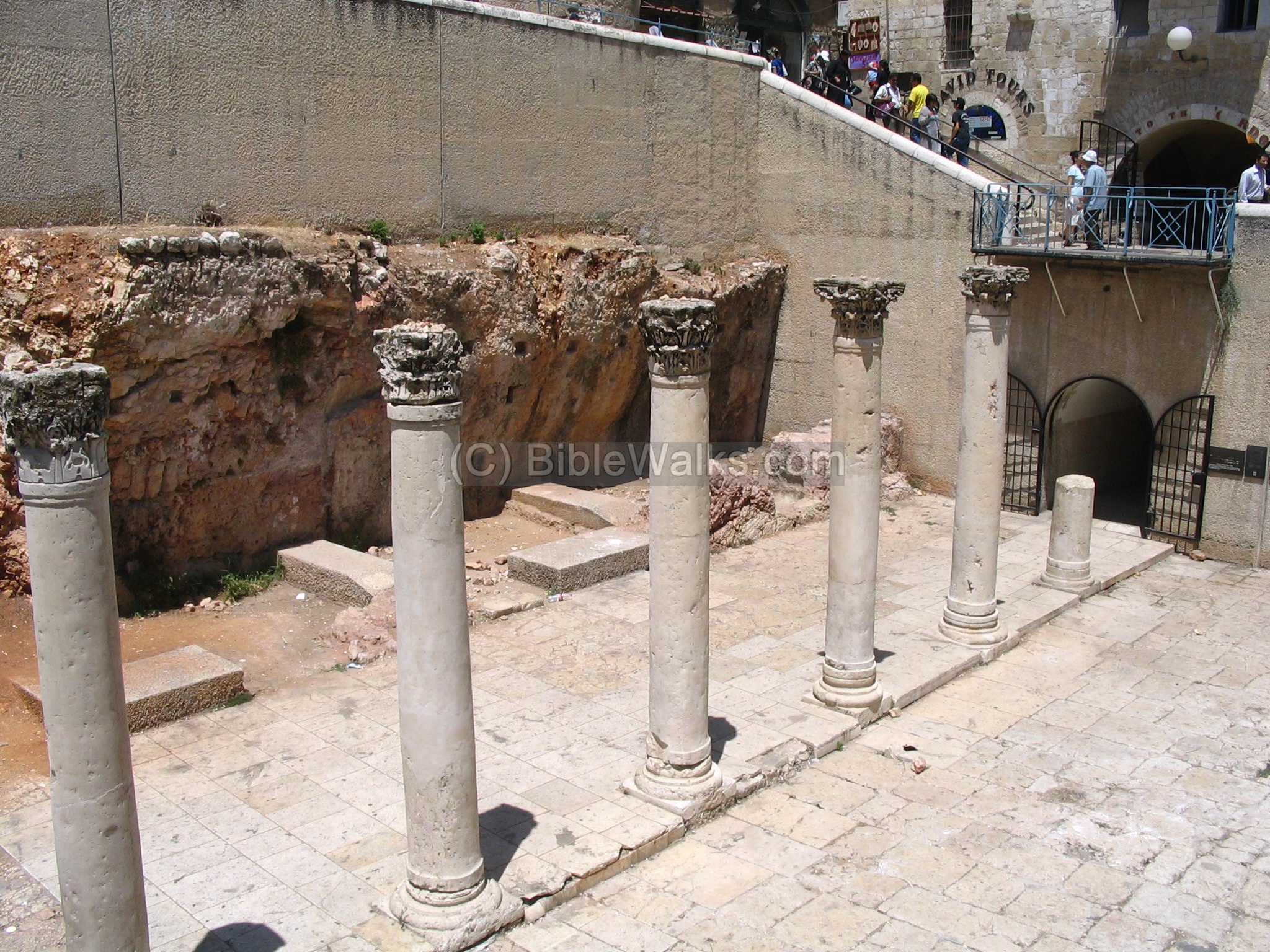
(e) Cardo Maximus (Jewish Quarter):
The excavated Cardo Maximus, a 150M stretch, can be seen in an open air section in the heart of the Jewish quarter, between the Jews street and Chabad street. The Madaba map on the right shows that this street crossed the city from side to side (North to South). A red square indicates the location of the excavated section.
This section is 2.5M under the modern street level. Its width is 22.5M, and is flanked by a row of 5M high pillars on both sides of the road.
The Byzantine street was open to the sky in the center, but was covered on both sides with terra cotta tiles supported by wood planks, that connected the pillars to the houses on the sides of the road and provided a protection from rain and sun. Near the Stylobates (pillar base level) were drainage tunnels to collect the rain and keep the road dry. These findings closely match the map’s illustrated description.
![]() More info on this street may be found in the Cardo Maximus site.
More info on this street may be found in the Cardo Maximus site.
Etymology:
- Derech – Hebrew: road, way.
Links:
* External:
- Main road of Jerusalem found near Jaffa Gate (IAA11-2-2010)
- Eastern Cardo
* Internal:
- Cardo Maximus
- Roman roads in BibleWalks.com
BibleWalks.com – walk with us through the sites of the Holy Land
Jerusalem Roads<<<—previous site–<<< All Sites >>>—>next Jerusalem site—>>> King David’s harp
![]()
This page was last updated on Mar 1, 2023 (new overview)
Sponsored links: