Ruins of a small Byzantine monastery, located on a hill in the center of Karmi’el.
Home > Sites > Beit-Kerem > Karmi’el > Khirbet Zagag (Kazaz, Qazaz)
Contents:
Background
Location
History
Photos
* Aerial view
* Winepress
* Top of hill
* Oil Press
* Church
* Nature photos
Links
Etymology
Background:
Ruins of a small Byzantine monastery on top of a high hill in the center of Karmi’el. Initial excavations revealed rooms, oil press and chapel on top of the small hill.
Location:
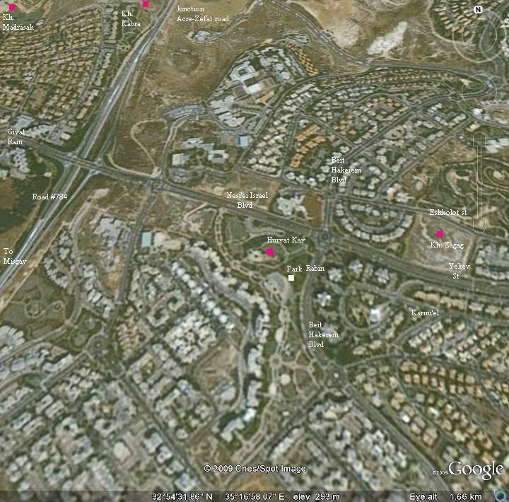
The site is located at altitude of 325M in the center of Karmi’el. It is seen on the right of the map below. Other nearby Byzantine sites are indicated on the map.
History:
Byzantine:
During the Byzantine period (5th-7th century) the area of western Galilee was mostly populated by Christians. The area within the municipal area of the city of Karmiel was the densest in this region – a total of nine (!) Byzantine monasteries were excavated here or identified as such.
Khirbet Zagag was one of these monasteries. The ruins of a chapel and structures are located on top of a high hill overlooking the area. Adjacent to the church was an oil press, used as the source of income. A number of cisterns on top of the hill provided water during the dry seasons.
Arab/Mamlukes period:
Most of the Byzantine sites were destroyed in the 7th century during the Persian or Arabic conquests. The site remained in ruins until recent years.
Modern times:
Karmiel was established in 1964, and has grew since then to a large and beautiful city with over 50,000 residents (2008).
A monument was constructed, honoring a soldier. The site was named “Shay’s observation point”.
In 2005 M . Aviam conducted an archaeological excavation on this site. His team, which included High school pupils from mixed Arab/Jewish schools (Araba and Karmi’el), reconstructed several rooms on the south side, an oil press on the north side, and an adjacent chapel.
Photos:
(a) Aerial view
An aerial view of the site, as captured by the quadcopter from the west side, is shown here. The entrance to the site is from the left side. On top of the hill, near the flag, is an observation point and a monument.
Click on the photos to view in higher resolution…
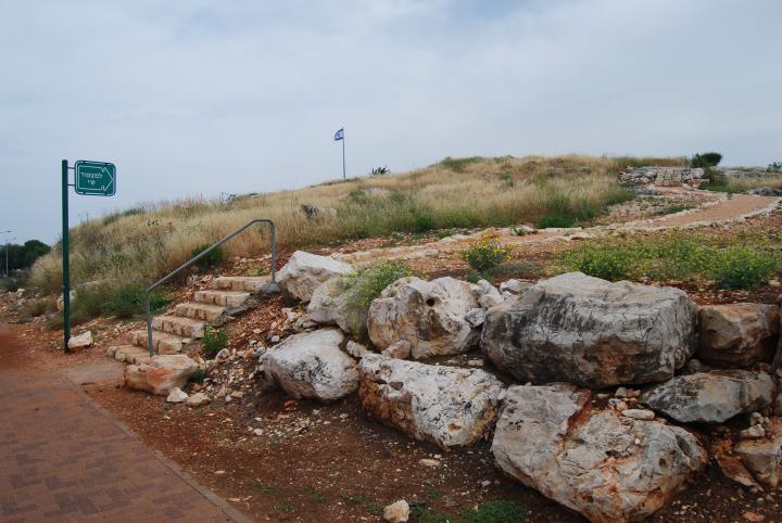
A sign shows the path from the north side to “Shay’s observation point”. Walk up the hill along the path.
(b) Wine press
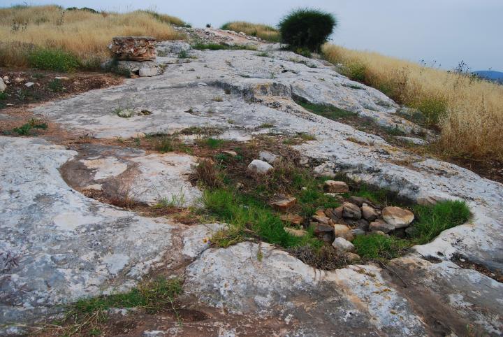
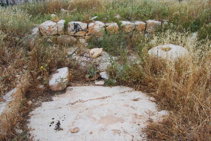
On the west side of the hill, along the path up the hill, are several bases of wine presses, such as the one seen below. A square treading floor, cut into the rock, leads to a collecting pit which is now covered by stones and weed.
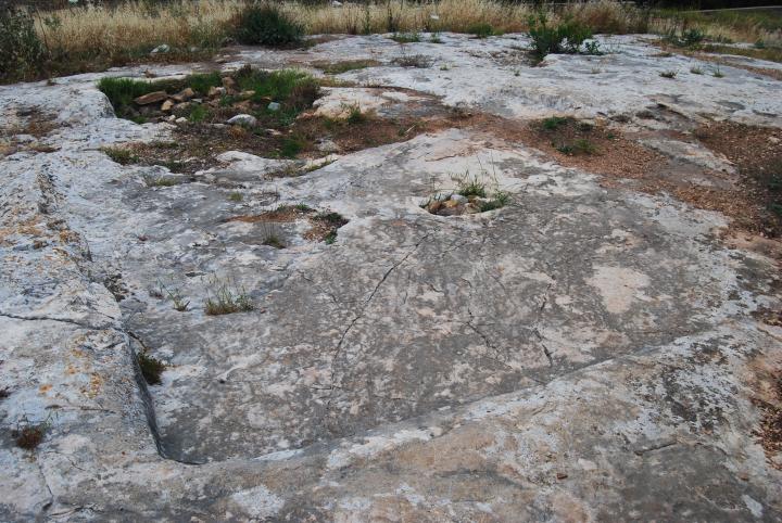
Another view of the winepress, from the top side of the treading floor, is seen below.
(c) Top of hill
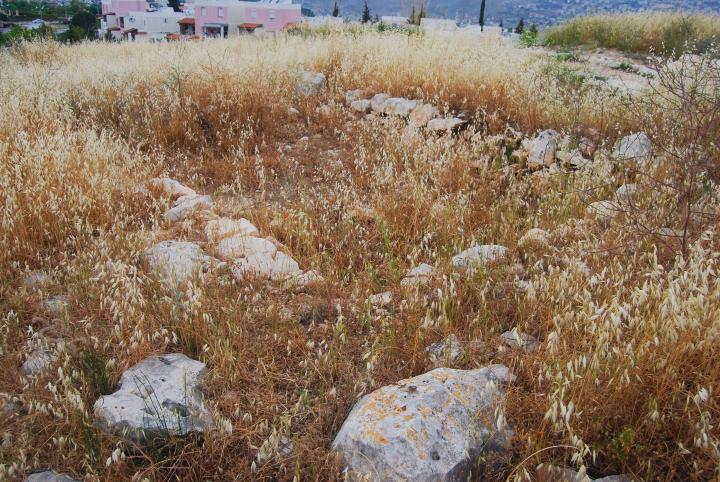
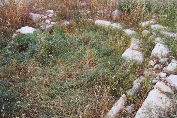
On top of the hill are traces of ruins of Byzantine structures, probably rooms of the monastery. These were excavated and reconstructed, as seen on the south side.
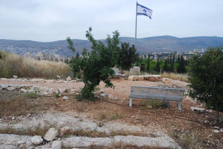
A monument and flag was erected here, honoring the fallen soldier Shay. This observation point is high above the neighborhoods of Karmi’el and is a good spot for viewing the vast city.
(d) Oil press
An oil press was found on the north side of the hill. The photo below shows the room of the oil press. Behind the back wall is the small church.
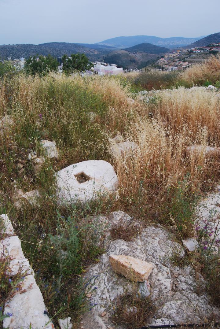
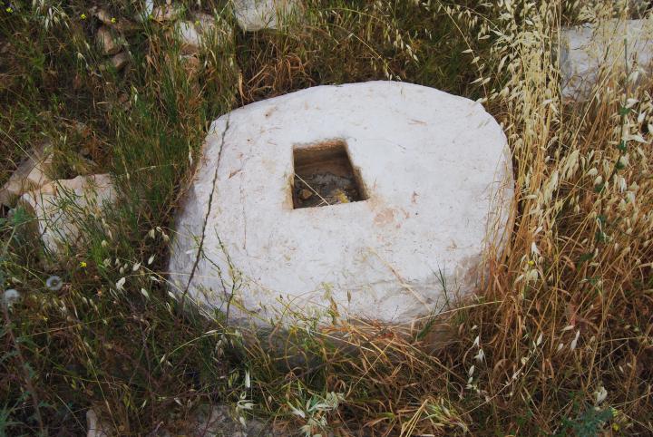
A weight of an oil press of the type “beam and screw” was found inside the room. The photo below shows the heavy stone, with the neighborhoods of Karmiel on the south side of the hill and Hilazon (snail) creek in the distant background.
The stone was the base of the oil press. With its weight the stone held down the bottom of a screw, which was turned around to press down a beam. The beam then pushed down over the olives, thus extracting their oil. This was one of the methods used in ancient times for oil production on a small scale.
(e) Chapel
The base of the apse of the chapel is located near the oil press room. The photo below shows the semicircular design of the apse, with an eastwards orientation. The floor was covered by colorful mosaics, but they were left covered in order to protect the floor until future seasons. A hole, which was found in the center of the floor of the apse, was probably where the table of the altar once stood. The church was dated to the end of the Byzantine period (6th-7th century).
(f) Nature photos
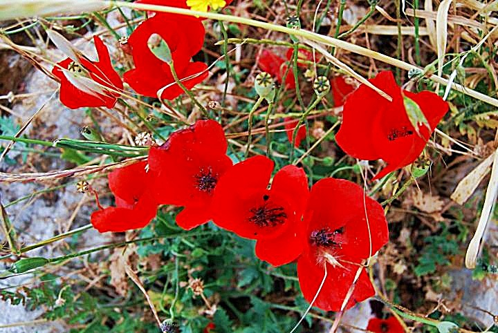
There are wild flowers on the hill during the short spring time. The photo below is of a poppy flower, which radiates its vivid red color.
After a few weeks of spring time the hill is completely dry, and covered by thorns and dry weeds. Isaiah wrote about this (40 6-8): “All flesh is grass, and all its beauty is like the flower of the field. The grass withers, the flower fades when the breath of the Lord blows on it; surely the people are grass. The grass withers, the flower fades, but the word of our God will stand forever”.
Links and references:
* Archaeological links:
- Archaeological sites around Karmiel – Power point (Hebrew)
- Conservation in Urban areas – Karmiel as a test case (Hebrew)
- Conservation in Urban areas – Karmiel as a test case (English)
- Aviam M. 2004: Jews, Pagans and Christians in the Galilee (Land of Galilee 1). Rochester. Pp. 181-204.
- Hurvat Zagag (Hebrew) – Aviam M.
- Zinman institute of Archaeology (Univ Haifa) – Zagag excavation 2005
* Structures:
- Oil presses – ‘Atiqot XXXIV p55 Haim Ben David [ISSN 0792-8424]
- Winepresses – BibleWalks.com
* Others:
Etymology (behind the name):
- Hurvah, Harvat – Hebrew: ruins (Arabic: Khirbet). Based on the root word “Harev” – ruined.
- Zagag – Hebrew: glazier. Translated from Arabic – Khirbet El-Kazaz – the glazier. Based on the large number of glass fragments, indicating a possible glass factory.
- Beit Kerem (Beth Cerem) – Hebrew: House of the vineyard (or olive grove). In Jeremiah 6:1 there is reference to another site near Jerusalem with the same name”… and set up a sign of fire in Beth Haccerem: for evil appeareth out of the north, and great destruction”.
- Karmi’el (Carmiel) – Hebrew: Olive grove (Kerem) of God (-EL). Kerem means also vineyard, so the name also can mean “Vineyards of God”. The city’s name was based on the name of the valley – Beit Hakerem.
BibleWalks.com – Experience the Bible by foot
Kh. Kav<<<–previous site—<<<All Sites>>>—next Beit-Kerem site—>>> Khirbet Bata
This page was last updated on May 10, 2014 (Added aerial view)
Sponsored links:
