Ruins of a small Upper Galilee village, dated to the Roman/Byzantine period, with impressive group of sarcophagi.
* Site of the Month Feb 2020 *
Home > Sites > Upper Galilee > Center > Horvat Dur
Contents:
Overview
Location
History
Photos
* On the trail
* Sarcophagi
* Pool
* Other
* Oak tree
Etymology
Links
Overview:
Ruins of a small Upper Galilee village, dated to the Roman/Byzantine period. The ancient village is mostly hidden, covered by the bush and trees, but in a clearing on its western side is a group of Sarcophagi and a pool.
Location and map:
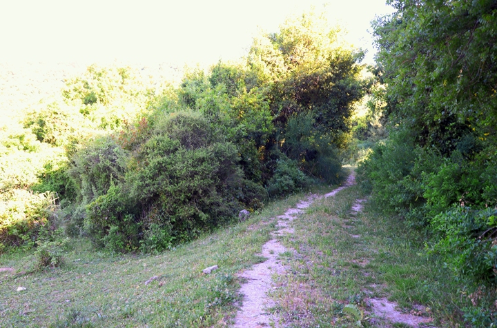
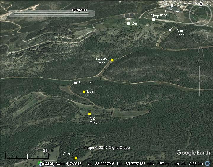
This aerial map indicates the major points of interest around the site. Drive along a dirt road off highway #899, marked as “access road”, to a parking place near the site. A gate blocks the last 100m to reach to the foothills of the site. Walk from the gate along the dirt road until you find a narrow trail, barely marked, that ascends to the ruins.
History:
-
Roman/Byzantine period
The site was inhabited during the Roman and Byzantine period.
A Byzantine monastery was probably located in the village, and named by the Arabs as Deir Basta (also Deir Busta).
-
Crusaders period
The village was also inhabited during the Crusaders period. According to a suggested identification by R. Frankel it was known as Dere (or Deleha), part of the Lands of Godfrey le Tor (as per document RRH 624 of 1183 AD and RRH 934 of 1220 AD). Perhaps the Crusaders name was based on the Arabic name of a monastery (Deir) and was named Dere.
-
British mandate
A British Mandate map of 1942 (Map 17/27 – Tarshiha – 1:20,000) shows the area around the site, south of Iqrit (at that time it was an Arab village). The map shows that the site’s name is “Kh. ed Duweir” or “Deweir”, meaning in Arabic: the ruin of the little convent or circle. This name was translated in later maps to Hebrew as “Horvat Dur”, meaning the ruin of the circle (Dur in Hebrew is circle, round). The map shows a pool (pond) in this ruin.
- Modern Period
The site is in a public area, settled in an untouched nature area. We recommend to combine the visit to Horvat Dur with the nearby site of another “hidden city” – Horvat Zunam (kh. es Suwwana on the map above).
Photos
(a) On the trail:
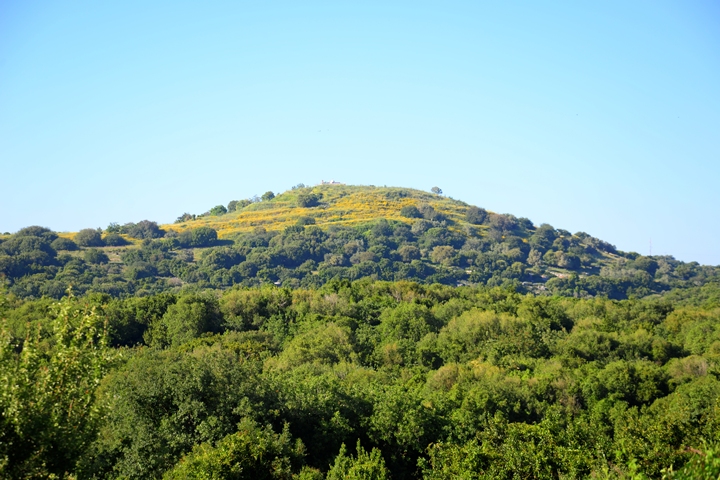
The road to Horvat Dur passes on the south side of Ikrit – a multi-period ancient city with a Church on the summit.
Click on the photos to view in higher resolution…
After driving south along a dirt road, the road ends with a gate near the hill where the ruins are scattered.
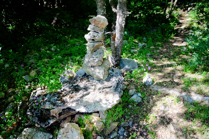
The ruins are hidden among a thick bush area. We barely noticed the entrance trail into the ruins, which is now marked by a pile of stones.
(b) Sarcophagi:
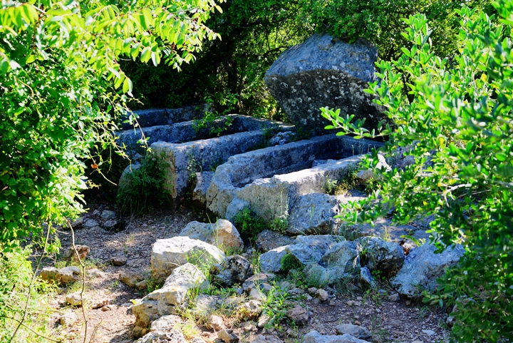
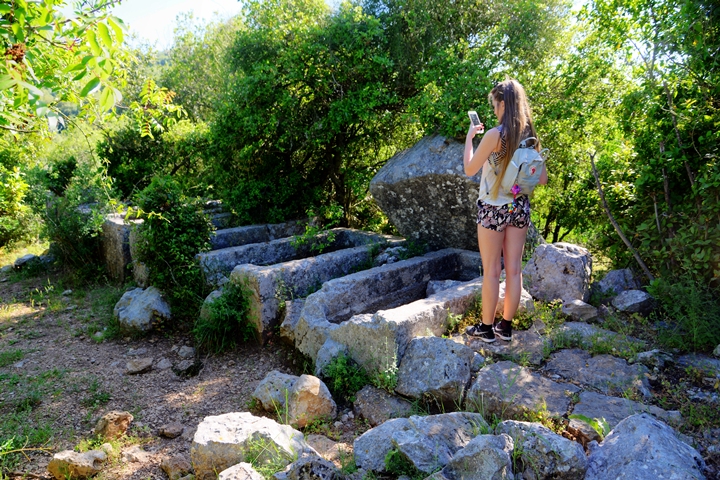
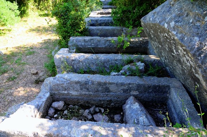
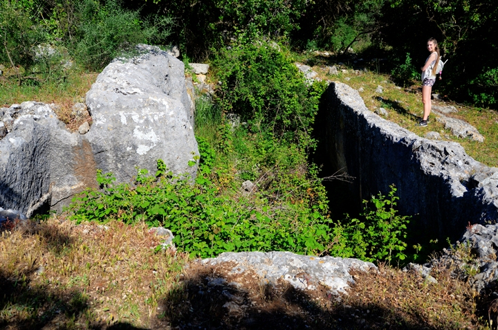
The highlight of the site is the row of sarcophagi (tomb coffins). This area, on the western foothills of the ancient village, was probably the cemetery of the village. The coffins, dated to the Roman/Byzantine period, may have been part of a mausoleum of a rich family.
The group includes 8 large stone coffins, with 6 covers.
A sarcophagus (sarcophagi in plural) – in Greek – means “flesh eater”. It is a stone coffin, intended to be a multiple use box that contained the body of the deceased for the first phase. After the flesh decomposed the bones were removed to a smaller container or pit, allowing the next member in the family to be placed in the coffin.
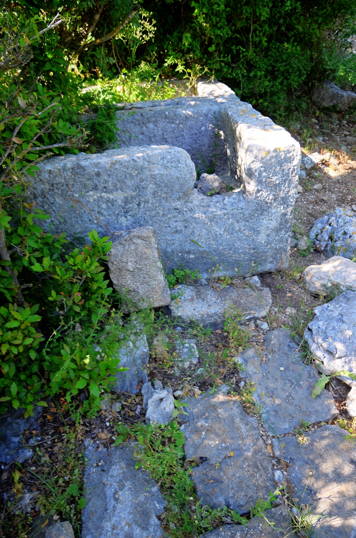
In the photo below – one of the heavy stone covers is seen at the back of the coffin. It was probably removed in ancient times in search for valuables.
The coffins are standing over a paved surface.
In some of the coffins, such as this one below, there are holes that were smashed in the past by grave robbers.
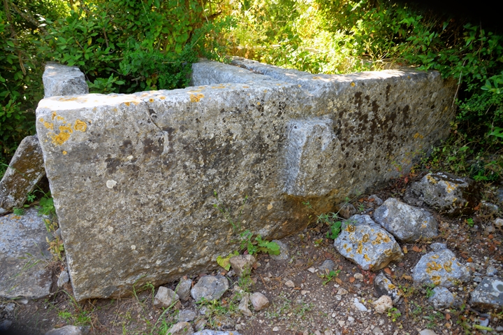
A side view of these 2 stone coffins is in the next photo.
In the area around Horvat Dur are two dozen sarcopagi, such as a pair in the northern foothills of Ikrit.
(c) Pool:
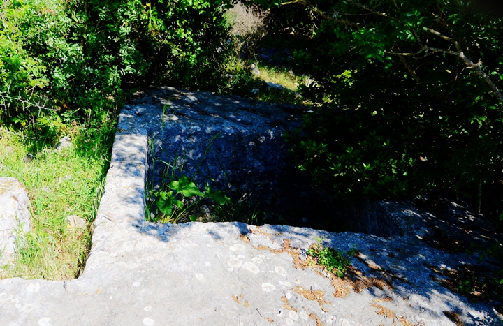
A large water reservoir is located near the stone coffins. This pool may have been the quarry where the sarcophagi were excavated.
A staircase leads down to the bottom of the pool.
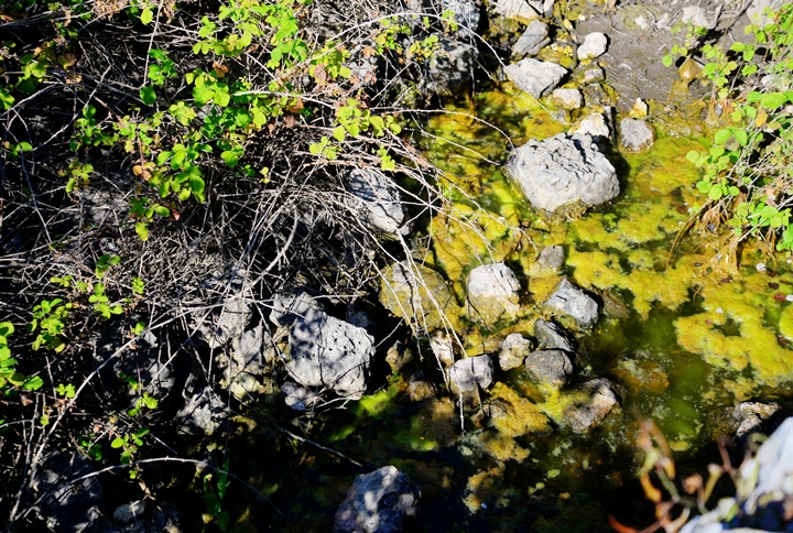
The water still fills up the bottom of the pool, after the unusually wet winter of 2018/9.
(d) Other findings:
Near the sarcophagi is an agriculture installation – a winepress.
(e) Oak Tree:
A path leads from the ruin towards the south east, on the way to Kh. Zunam – another “hidden city” worth visiting.
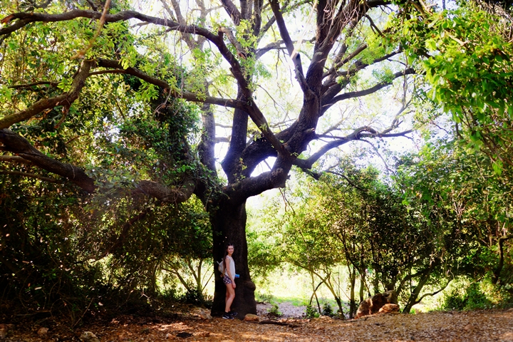
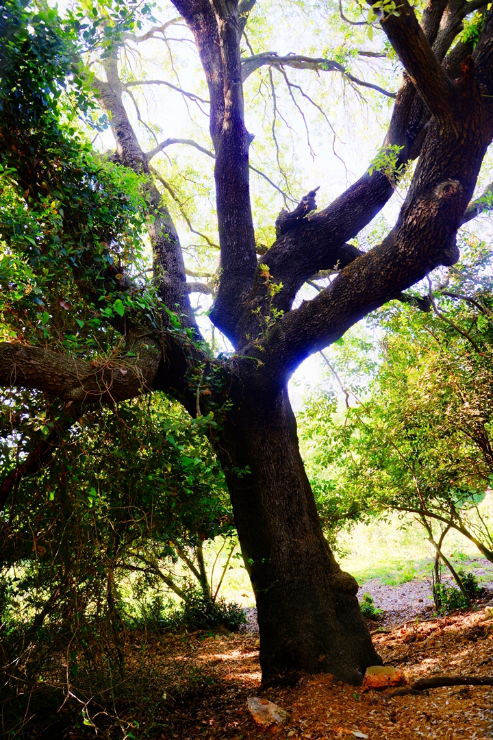
A giant ancient oak tree stands on the side of the path. The tree is of type Quercus calliprinos (common name: Palestine oak, Hebrew: Alon Matsui).
The trunk of this old tree is roughly 85 cm wide, and the height is about 20m.
A great place to rest and drink a cup of coffee…
Etymology (behind the name):
* Names of the place:
-
Kh. ed Duweir or Kh. ed Deweir, – Arabic name of the ruin, meaning in Arabic: the ruin of the little convent or circle.
-
Dur – Hebrew: circle, round. Based on the Arabic name.
-
Horvat Dur – the ruin of the circle
-
Dere (or Deleha) – perhaps the name of the village during the Crusaders, based on Deir (monastery)
Links:
* External sites:
- Hike to Horvat Dur
- Mysteries in the Galilean bush (A suggested hike; Hebrew, 2014)
-
Settlement and History in Hellenistic, Roman, and Byzantine Galilee: Uzi Liebner, pp.106-116
-
Topographical Notes on the Territory of Acre in the Crusader Period – R. Frankal (IEJ 38, N. 4 (1988), pp. 249-272
* Nearby sites:
* BibleWalks sites:
BibleWalks.com – Views of the Holy Land
Zonem<<<–previous site—<<<All Sites>>>—next Upper Galilee site—>>> Ein Tamir
This page was last updated on June 5, 2019
Sponsored links:
