Tel Aphek (Afek, Antipatris) was a gateway on the main trade route from north to south. More than 6,000 years of successive cities have been built on the mound overlooking the springs of the Yarkon river.
Home > Sites > Sharon > Tel Aphek (Afek, Antipatris, Tel Rosh Ha’Ayin)
Contents:
Background
Aerial Map
Biblical Map
History
Photos
* General view
* Fortress
* Bronze Age
* Roman Road
* Roman city
* British waters
Biblical
Links
Background:
Tel Aphek (Afek, Antipatris) was a gateway on the main trade route from north to south. More than 6,000 years of successive cities have been built on the mound overlooking the springs of the Yarkon river.
Joshua 12: 7, 18: “And these are the kings of the country which Joshua and the children of Israel smote …the king of Aphek, one…”
The present fortress is from the Ottoman period. Inside the courtyard are reconstructed houses from the Bronze age. Outside of the fortress are ruins of the Roman city and its main road.
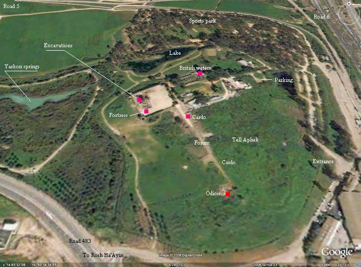
Aerial Map:
The following aerial view shows the points of interest around the site. Tel Aphek is in the center of the aerial map, and is roughly 400M by 300M, oriented north-north-west.
Biblical Map:
Tel Aphek (Afek) is strategically located on a pass along the north-south Via Maris, the ancient road that connected the regions north of Israel (Mesopotamia, Asia minor and Syria) to the south (Egypt). This narrow pass of 2KM was an ideal location for the ancient city, since the trade caravans had to pass at this site. The passage was blocked on both sides of the city: eastwards to the sea was the Yarkon river and its marsh lands, and westwards are the hills of Samaria. Through the city also passed the main road from Caesarea, the large Roman city, to Jerusalem, and from Aphek to Jaffa and the coastal parallel road to Egypt.
The cities and roads during the Canaanite, Israelite and Hellenistic/Roman periods are indicated on the Biblical Map below, with Afek/Antipatris in the center.

Map of the area around Afek/Antipatris – 15C BC through 1C AD (based on Bible Mapper 3.0)
History:
-
Chalcolithic period
The city was first settled during the end of the Chalcolithic period (4,500-3,150 BC). The first walled city was established in the early Canaanite period (3,300-3,000BC).
-
Canaanite (Bronze Age)
The city expanded during the beginning of the early Bronze age (3150-2700 BC) and was built over a high mound which defended the city, in addition to the water and muddy swamps that provided a natural protection to the city. It was abandoned from 2,700 until 2,000.
In the 20th – 18th Century BC the city was rebuilt, with massive earthen ramparts that increased its defensibility, becoming a major fortified Canaanite city in the middle Bronze (2200-1550BC) and late Bronze periods (1550-1200BC). It was located on the strategic main highway – the way of the Sea or King’s highway (Numbers 21, 22: “Let me pass through thy land… we will go along by the king’s high way, until we be past thy borders”).
The city is referenced in several Egyptian sources, starting in the 19th C Egyptian (12th Dynasty) enemy-curse clay tablets as “Aphkm”. The city is one of the cities that were conquered by Egyptian Pharaoh Thutmose III , just before the famous battle near Megiddo (1468 BC), which resulted in the Egyptian conquest of Canaan for 350 years. The Egyptians had to subdue some mutinies, such as in 1431 and 1429 by Amenhotep II, who listed Aphek among the cities he passed through.
Excavations in the Egyptian Governor’s house, on top of the Tel, are from the Late Bronze Age (1,550-1,200 BC). Additionally, 5 superimposed palaces from the Bronze age were excavated. They revealed many findings, including seals and rare scrolls.
-
Israelites (Iron Age)
The excavations inside the fortress reconstructed an Iron age I (1200-1000BC) layer above the Bronze age layer. Aphek was one of the Canaanite cities that yielded to the Israelites led by Joshua (as per Joshua 12).
During the 12th Century and 11th Century BC, Aphek was part of the Philistine territory. The city was also the site of the great battlefield of Eben Ezer with the Philistines at the times of the judges (about 1050 BC), with tragic results for the Israelites, including the loss of the sacred ark of covenant.
During the times of King Saul there were several attempts to kick the Philistines out of Israel. King Saul’s fatal battle in Mt. Gilboa against them resulted in his death, and according to the Biblical description the Philistines assembled their forces in Aphek (1 Samuel 29:1: “Now the Philistines gathered together all their armies to Aphek…”).
Only during King David’s Kingdom, the Philistine’s former ally, the attempts to push them back finally prevailed, and Aphek returned to Israel (about 1000 BC) . In 928BC the Kingdoms of Judea/Judah and Israel separated, and Aphek was part of the Israel Northern Kingdom.
-
Assyrian conquest
In the 8th Century the Assyrians conquered the Israel Kingdom. The intrusions of Tiglath-Pileser III (Kings II 15: 29, 734-732BC) and the intrusion of Shalmaneser V and Sargon II (Kings II 17: 3; 724-712) ended the Kingdom of the 10 tribes. Aphek is listed as one of the cities conquered and destroyed during the Assyrian intrusions, and their residents were exiled and replaced.
Aphek is also listed in Assyrian sources in a description of their campaign against Egypt (Eserchadan; 669 BC). This was their peak in conquests, which lasted until 610 BC when the Assyrian empire finally ended.
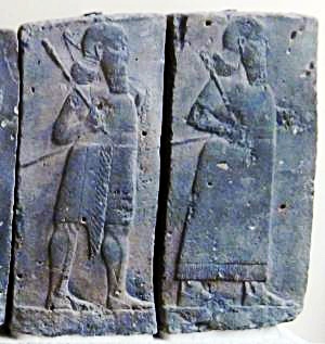
Orthostat relief – depicting soldiers from different orders of the Assyrian Army, in procession; basalt; Hadatu Tiglath-Pileser III period (744-727BC) [Istanbul Archaeological museum]
-
Babylonian and Persian
The Babylonian empire rose after the fall of the Assyrians (610BC), defeated the Egyptians (609BC) and conquered the land until the Nile (2 Kings 24 7): “… for the king of Babylon had taken from the river of Egypt unto the river Euphrates all that pertained to the king of Egypt”.
After 10 years under Babylonian control, Jehoiakim King of Judah mutinied, and so the Babylonians reached the gates of Jerusalem (598) and placed it under siege (2 Kings 24 10): “At that time the servants of Nebuchadnezzar king of Babylon came up against Jerusalem, and the city was besieged”.
Jehoiakim was murdered (Jeremiah 22 18-19): “Therefore thus saith the LORD concerning Jehoiakim the son of Josiah king of Judah; They shall not lament for him, saying, Ah my brother! or, Ah sister! they shall not lament for him, saying, Ah lord! or, Ah his glory! He shall be buried with the burial of an ass, drawn and cast forth beyond the gates of Jerusalem”.
Most of the nobles were exiled, including the son Jehoiachin (2 Kings 24 14-15): “And he carried away all Jerusalem, and all the princes, and all the mighty men of valor, even ten thousand captives, and all the craftsmen and smiths: none remained, save the poorest sort of the people of the land. And he carried away Jehoiachin to Babylon, and the king’s mother, and the king’s wives, and his officers, and the mighty of the land, those carried he into captivity from Jerusalem to Babylon”.
Nebuchadnezzar appointed Zedekiah (2 Kings 24 17): “And the king of Babylon made Mattaniah his father’s brother king in his stead, and changed his name to Zedekiah”.
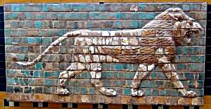
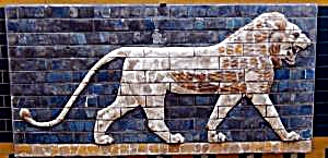
“Lions in Relief” – from the procession street in Babylon. Nebuchadnezzar II period (604-562BC); glazed brick [Istanbul Archaeological Museum]
However, after some time (589) Zedekiah mutinied, which brought Nebuchadnezzar to destroy the Judah kingdom completely. The Babylonians passed through the city of Aphek (587) on their way to Judah. In this intrusion most of the cities were leveled. Close to the end, only Jerusalem, Lachish and Azekah were left fighting (Jeremiah 34 7): “When the king of Babylon’s army fought against Jerusalem, and against all the cities of Judah that were left, against Lachish, and against Azekah: for these defenced cities remained of the cities of Judah”. Azekah fell after some time, and Jerusalem followed in the summer of 587, and many of the people in the land were exiled to Babylon – thus bringing an end to the Kingdom of Judah.
The Babylonian empire lasted another 50 years later, and the new power – the Persian empire – allowed the exiled Judea residents to return to Jerusalem and rebuilt the area around it. Aphek was still outside of the Jewish region.
-
Hellenistic and Hasmonean – Pegae
During the Hellenistic period (4th-1st Century BC) the city was reestablished and called Pegae (“springs” in Greek). It was a border city with Judea, and collected taxes from the traffic across the pass.
In 133 BC the Judea Hasmonean Kingdom, under Hyrcanus I (134-104BC), finally conquered the city of Pegae. The Greek Seleucids, however, tried to reclaim their lost territories. In 94-84 BC the great Hasmonean King Alexander Yanai (Jannaeus, 103-76BC) fortified the line stretching from the hills east to Pegae/Aphek, along the Yarkon river, and all the way to the sea. (Wars 1 4 7):
“Yet did that Antiochus, who was also called Dionysius, become an origin of troubles again. This man was the brother of Demetrius, and the last of the race of the Seleucids. Alexander was afraid of him, when he was marching against the Arabians; so he cut a deep trench between Antipatris, which was near the mountains, and the shores of Joppa; he also erected a high wall before the trench, and built wooden towers, in order to hinder any sudden approaches. But still he was not able to exclude Antiochus, for he burnt the towers, and filled up the trenches, and marched on with his army”.
Some of these fortifications were excavated in Tel Aviv. This “Yanai” line failed to hold against the Seleucids, but a truce was reached to end the battles in 84BC.
-
Early Roman period – Arethusa and Antipatris
In 63BC the Roman Pompey the Great conquered Judea, and renamed the city to Arethusa (which is, in Greek Mythology, a Nereid nymph who became a fountain). Thus started 400 years of Roman rule in Aphek.
Herod the Great (37-4BC) expanded the Judah kingdom, under the Roman rule. He sided Octavian (Augustus) against Anthony and Cleopatra. Cleopatra controlled the city of Arethusa, after receiving it from her lover. The victorious Augustus gave him the city and the area as a bonus (30 BC). Herod expanded the city in 9BC, naming it after his father – Antipatris – which was his Greek name. See text.
Antipatris is not listed in Jesus travels, since Jesus traveled through the center and eastern side of the country.
However, the city is mentioned in connection with Paul’s journey to Rome: in 63 AD the Romans led St. Paul through the city on the way to Caesarea, as written in Acts.
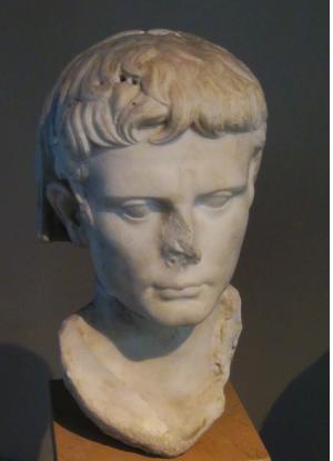
Bust of Octavian – Augustus Caesar (reign 27BC -14 AD)
-
The revolts against the Romans – Migdal Aphek
The nearby Jewish city, named Migdal Aphek, was damaged during the great revolt against the Romans (68AD). The Roman general Vespasian pitched his camp on the hill and stayed there for 3 days. (Wars 4, 9:1):
“…at the beginning of the spring he took the greatest part of his army, and led it from Caesarea to Antipatris, where he spent two days in settling the affairs of that city, and then, on the third day, he marched on, laying waste and burning all the neighboring villages”.
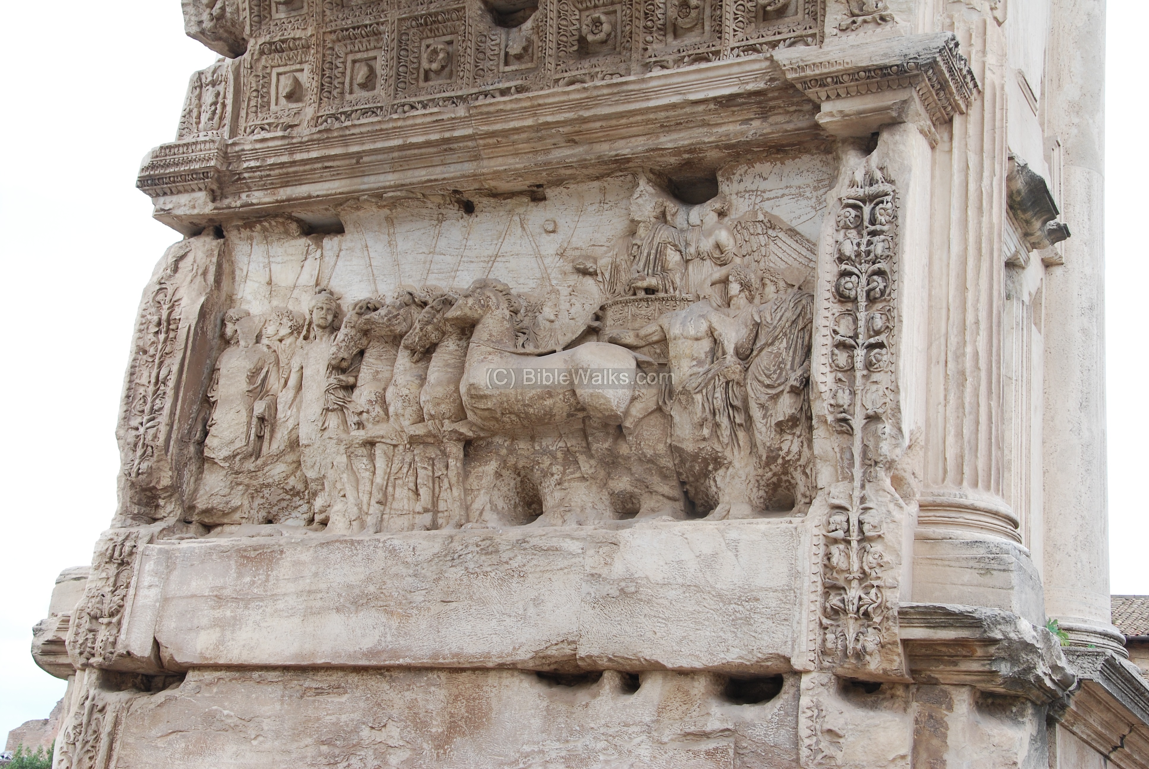
Titus Arch, Rome – the victory procession of Titus, son of Vespasian (right, on chariot)
-
Late Roman period – Antipatris at its peak
The city reached its peak during the late Roman period (132-324 AD). The excavated ruins along the Cardo, including the shops and public houses, belong to this period.
-
Byzantine
The city was damaged by a massive earthquake in 363 AD, when most of the cities in the Galilee and Israel sustained severe damages. The city did not recover – during the Byzantine period (324-638AD) it was a small military station.
-
Crusaders
The Crusaders (1099-1291 AD) protected their pilgrimage route from Acre to Jerusalem with a series of forts and police stations. The nearby fortress of Migdal Aphek (“Mirabel”) was one of these fortresses.
-
Ottoman – Binar Bashi
A fortified Khan (hostel) was commissioned by Ottoman Sultan Selim II (1566-1574), the son of Suleiman the Magnificent – the great builder of Jerusalem and other cities in the empire.
The castle was built during 1571-1574, on top of the earlier layers, and protected this important gateway. It was called “Binar Basahi” – the head of the springs. This castle is the structure that stands today on the top of the hill.
Old photos of the fortress are seen below. Notice the vast sources of the Yarkon river in the aerial view.
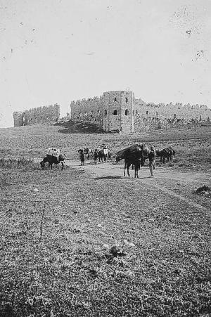
Photo dated 1900 – American Colony Collection – Library of Congress archive
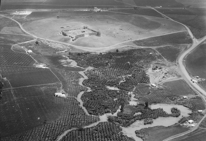
Aerial view from the west side – dated 1925 – Matson collection , Library of Congress
-
British Mandate
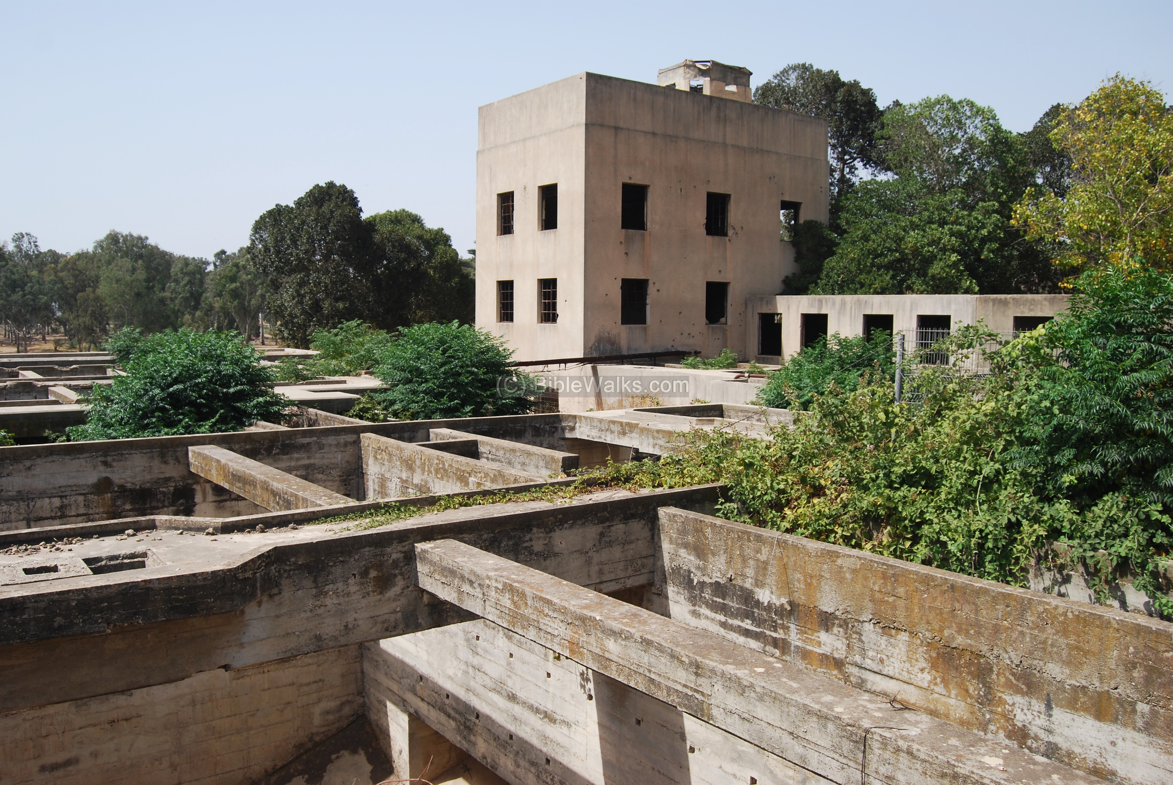
During the British Mandate (1920-1948) a large pumping station was built here on top of the hill. The station stored the waters pumped from the springs, performed filtration and chlorination. The water was stored underground, then pumped up to Jerusalem. The water supply operated from 1936 through 1939.
In 1948 the Iraqi forces held the building and attacked the neighboring villages, but surrendered to Palmach forces. You can see the results of these attacks as bullet hole scars on the walls of British building.
-
Modern times – Tel Aphek
Today the ancient site is a large National park, a recommended archaeological, picnic and sports site.
Photos:
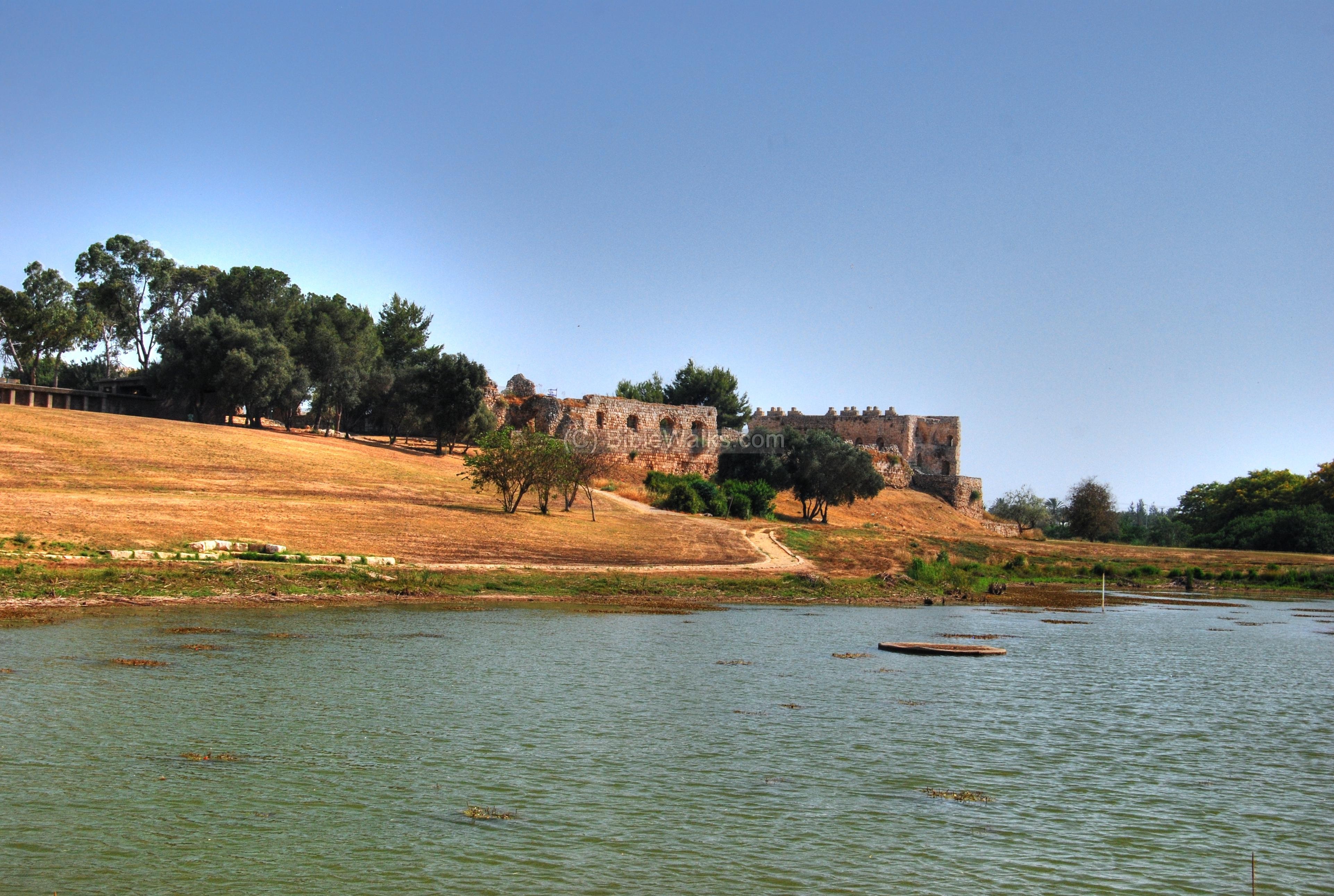
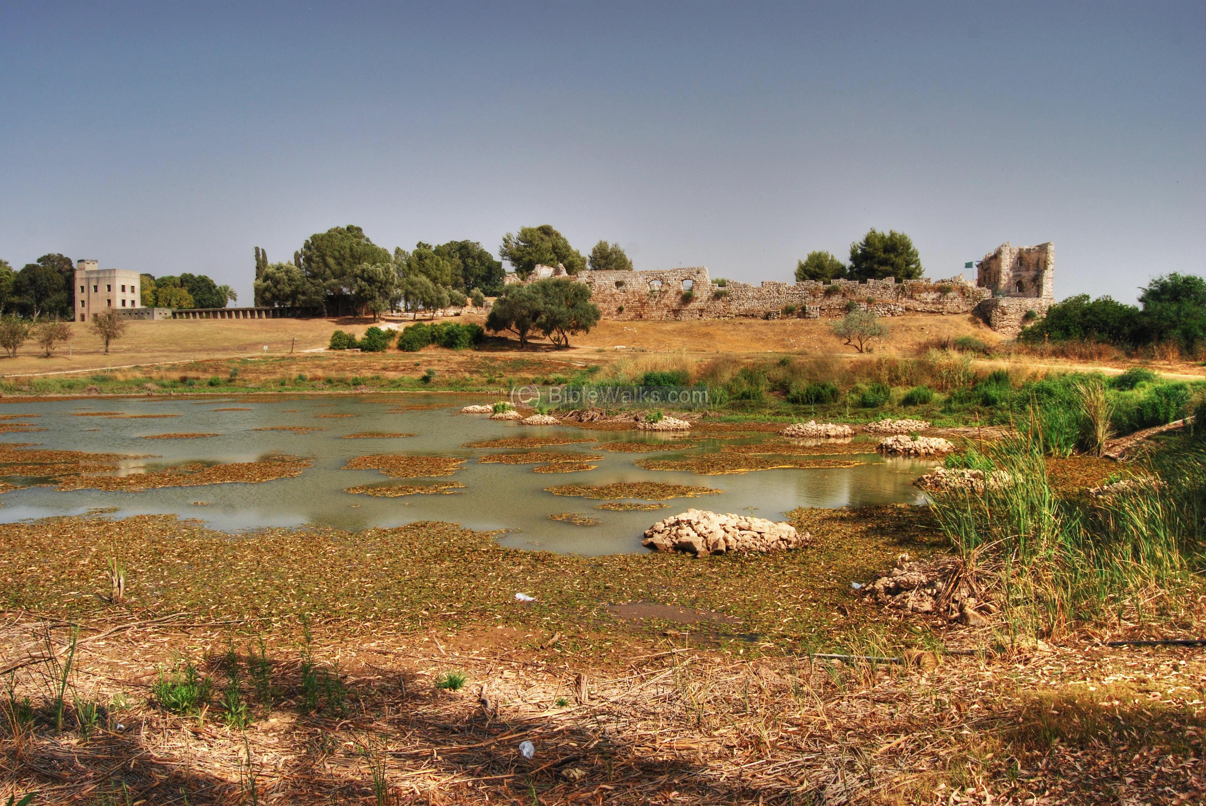
(a) General View:
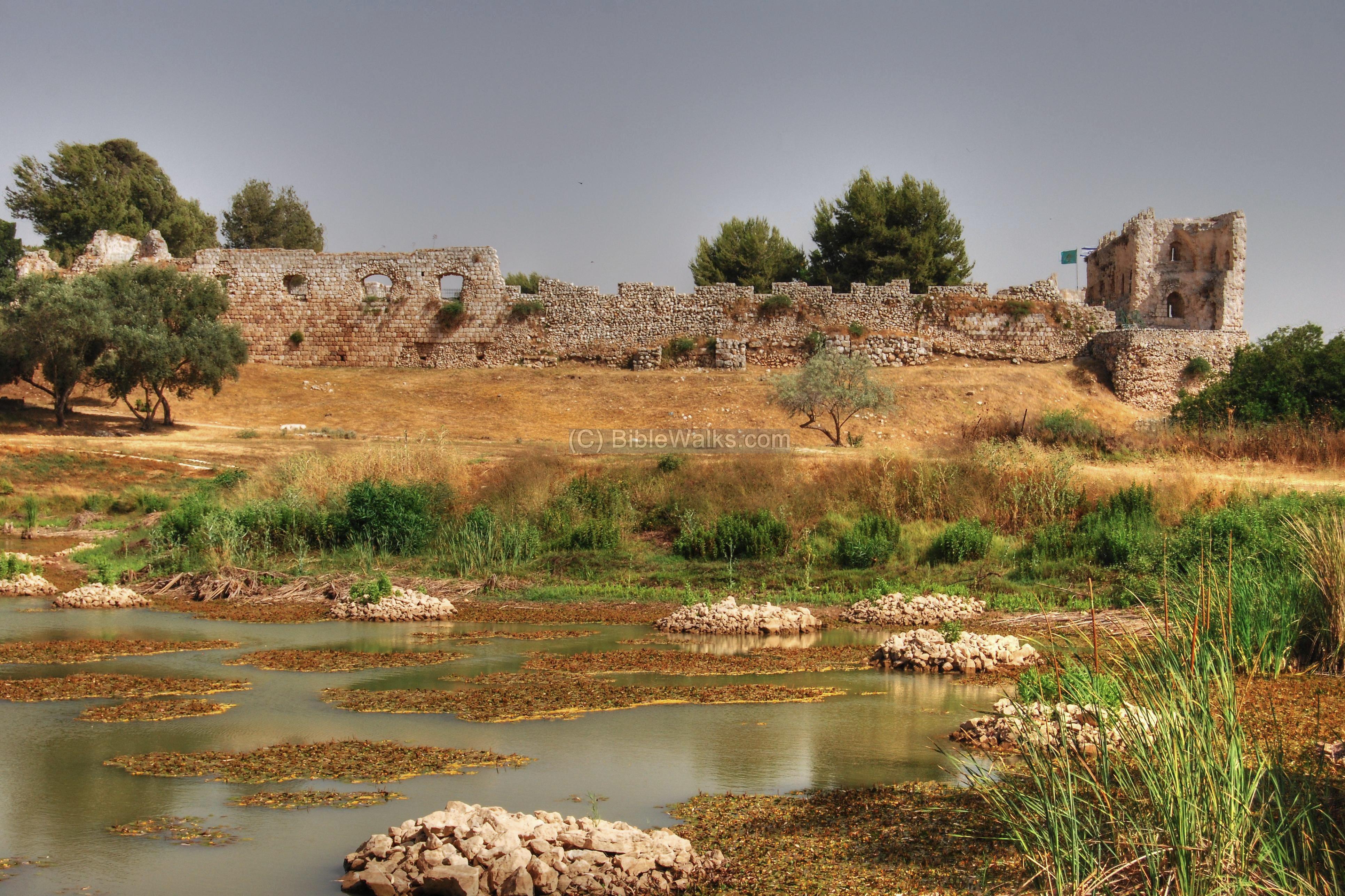
A view from the north side of the fortress is seen below. This artificial lake fills up from the Yarkon springs, which are located on the west side of the site.
Click on the photos to view in higher resolution…
Another north view of the Ottoman castle. The Bronze age fortifications extended along the Ottoman castle walls, from left to right, and were based on earthen ramparts. Perhaps the ancient site was also surrounded by water as part of the defense systems.
(b) The Ottoman Fortress:
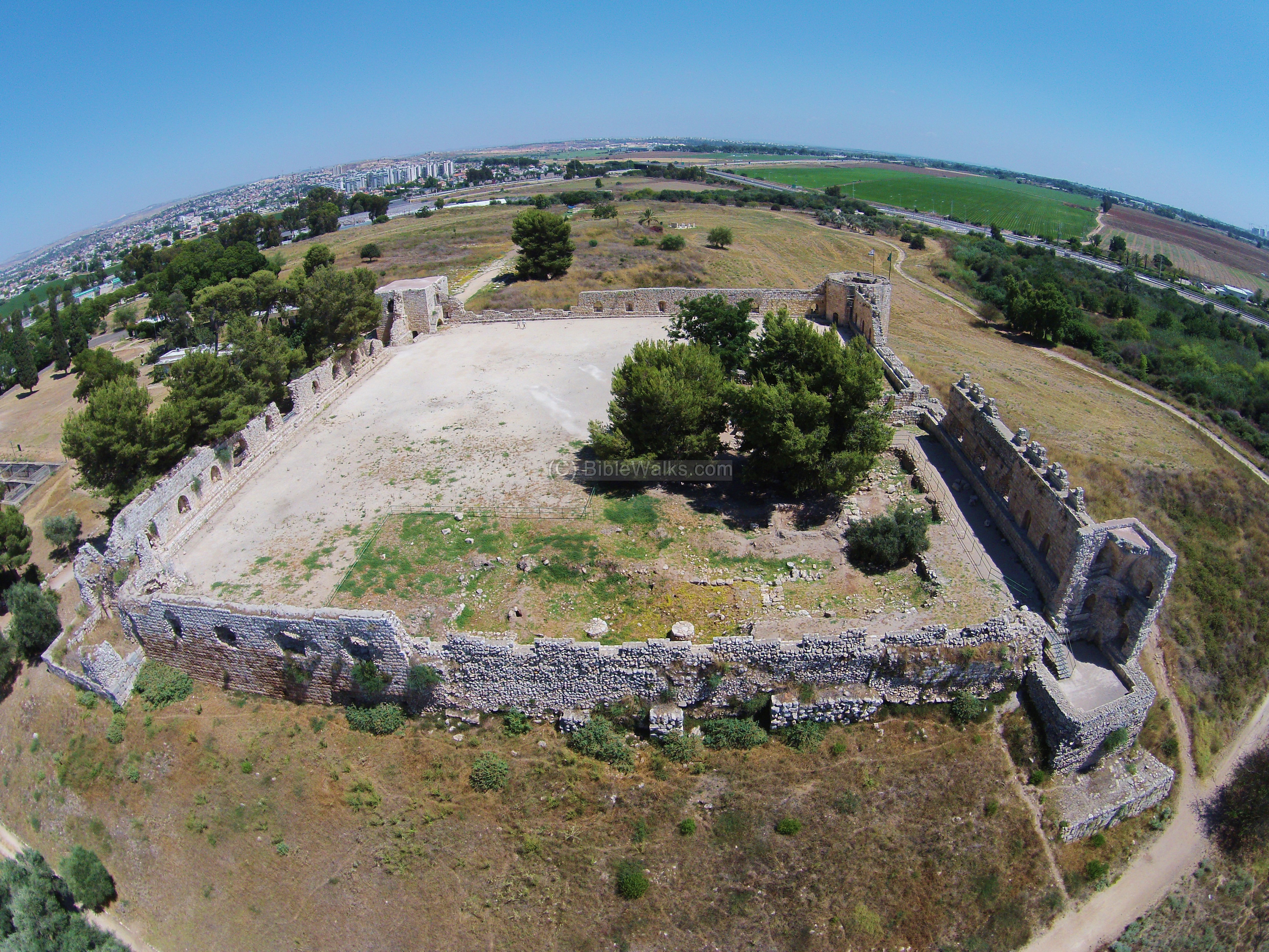
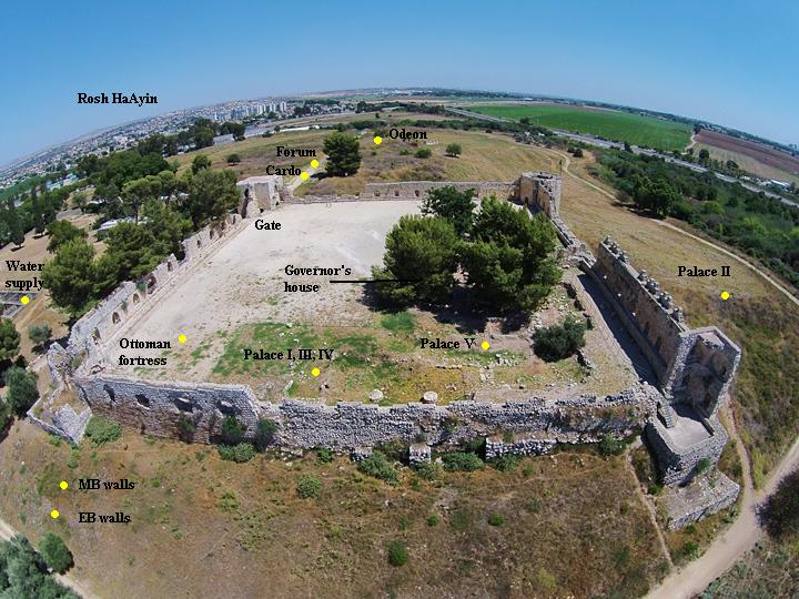
The Ottomans built a large fortified Khan in the 16th century, which protected the pass, and also served as a hostel for the caravans that passed through the Holy Land. An aerial view, as captured from a drone from the west side, is seen here. Under the large trees and near the closest walls are traces of the excavations under the fortress, with Bronze Age remains.
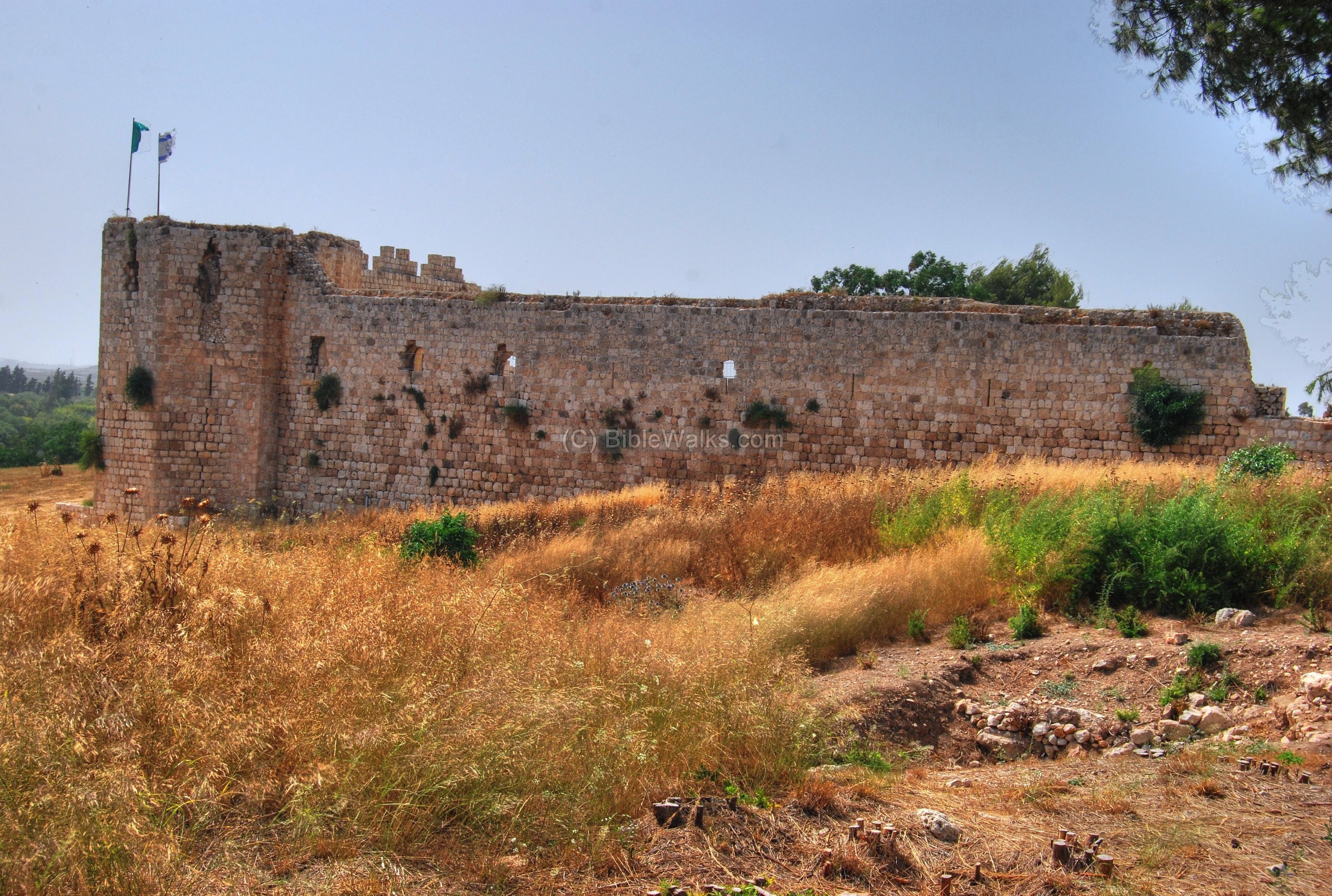
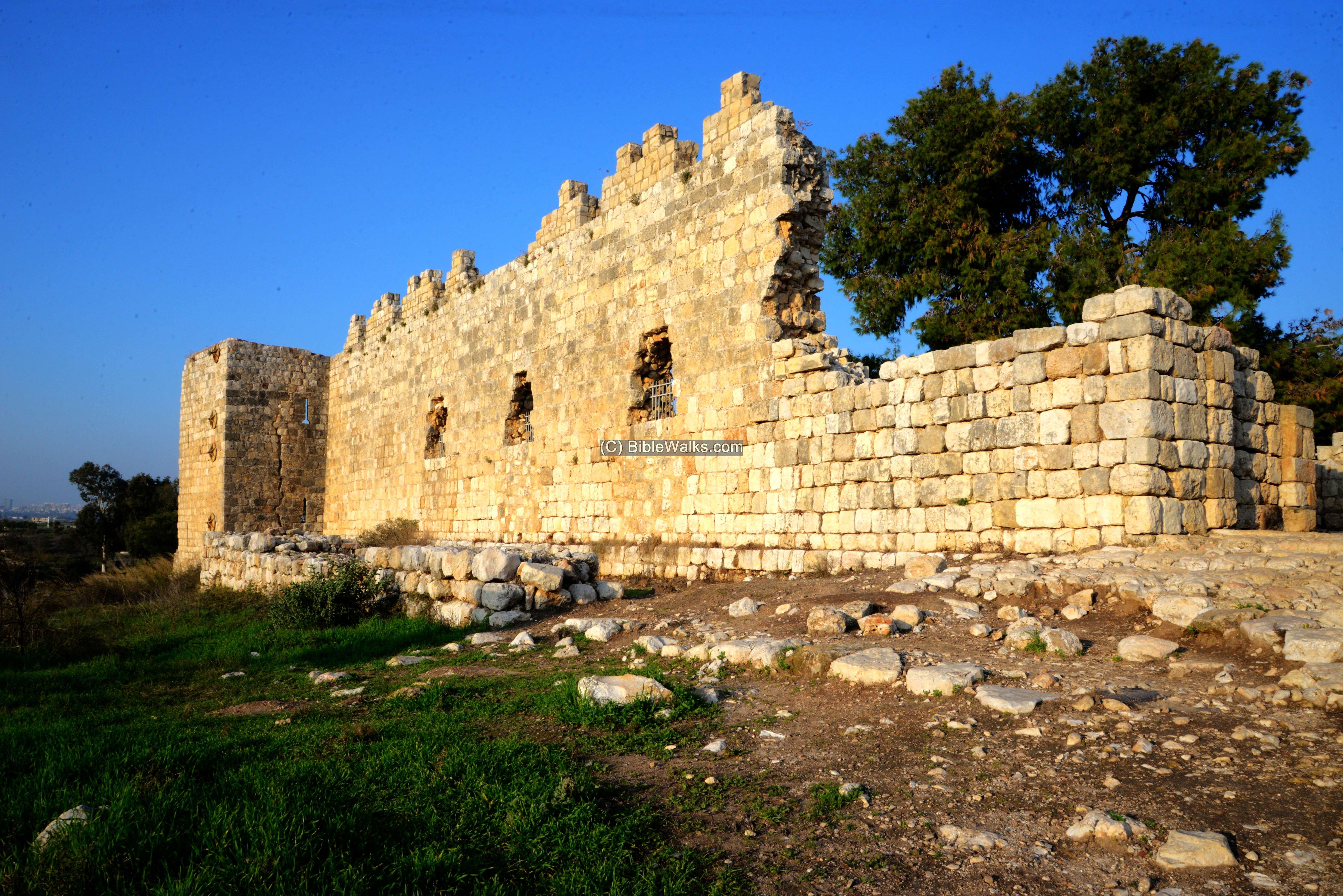
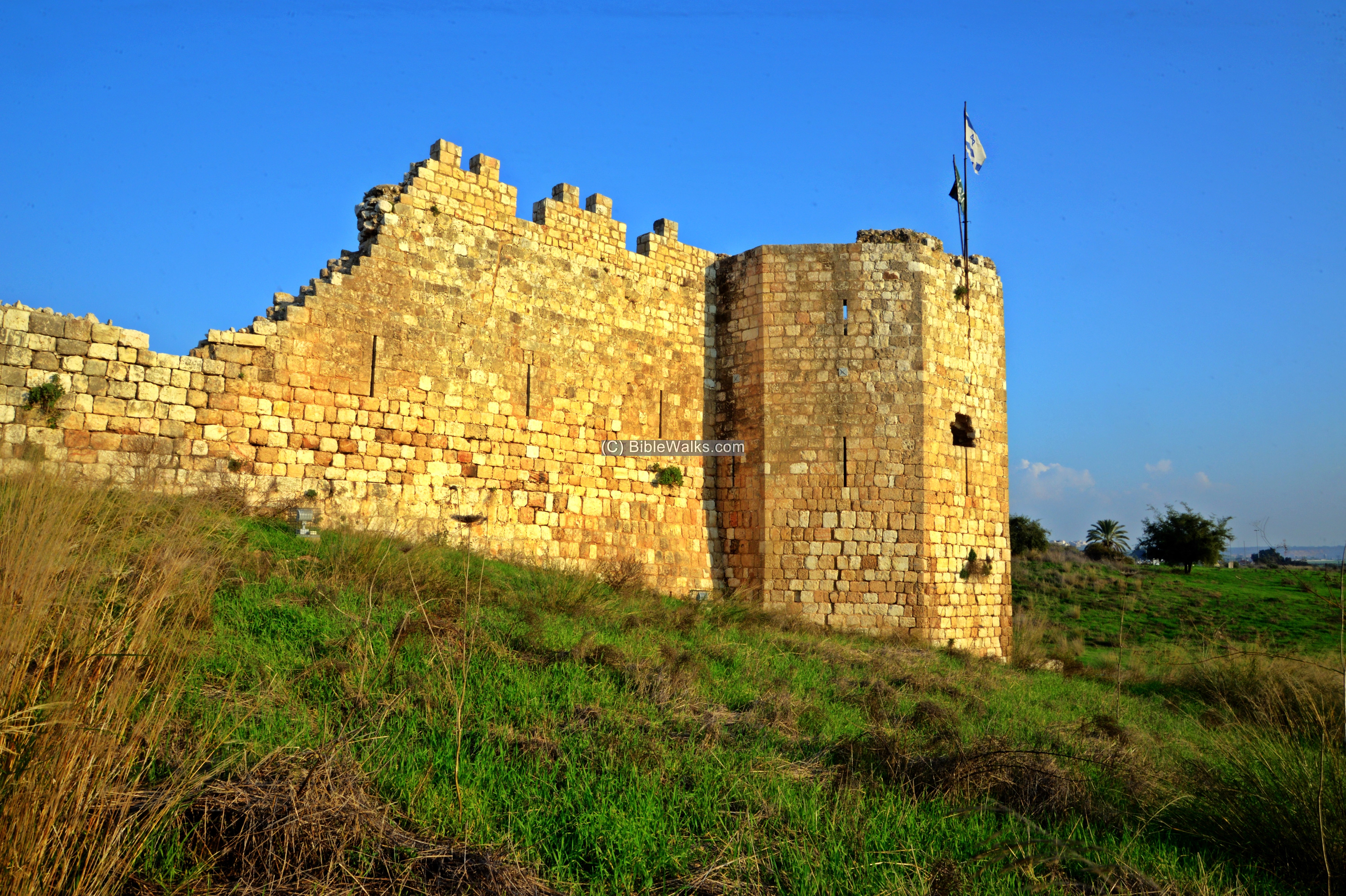
The south-east walls are seen in the photo below.
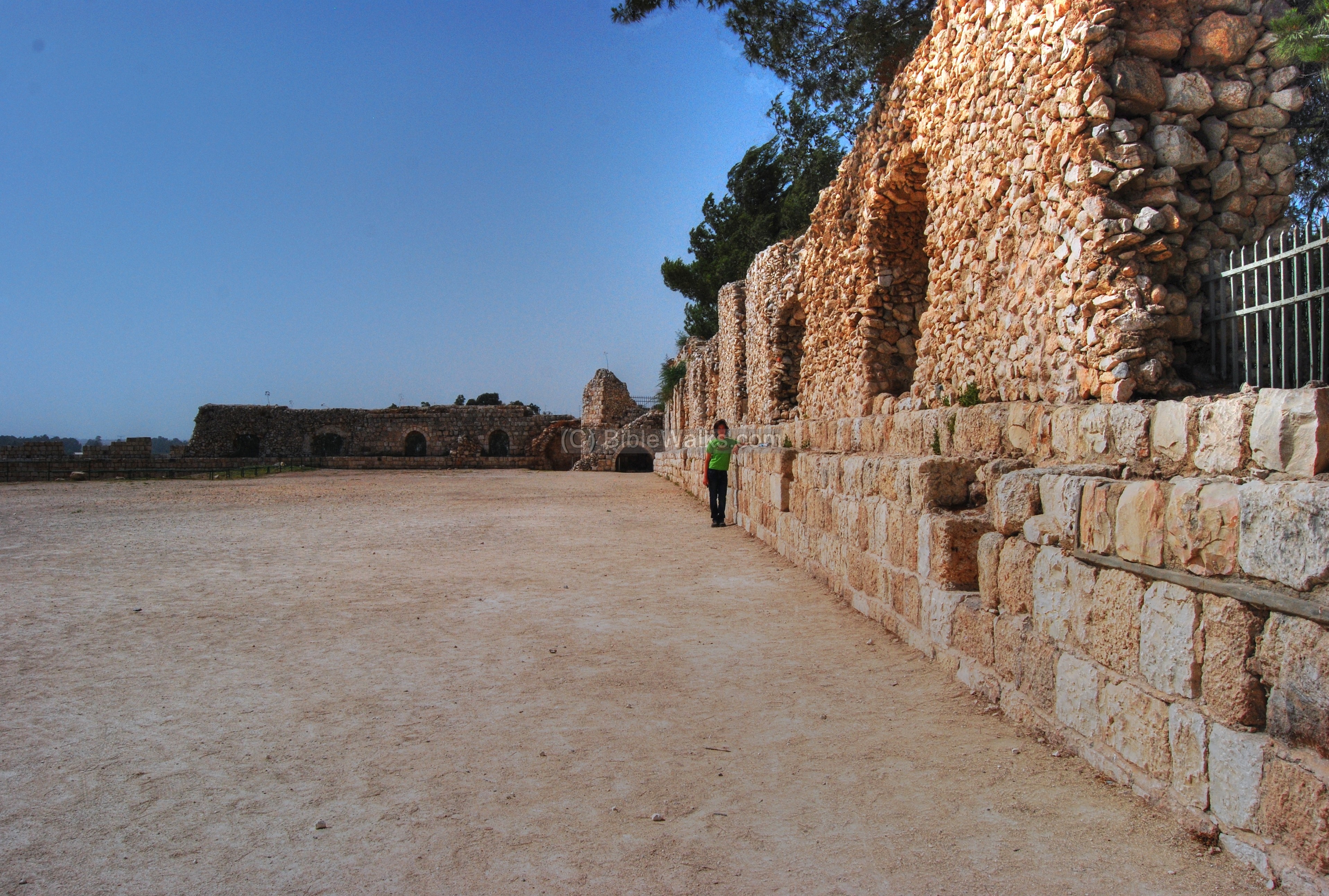
The fortress is entered through the gate seen below, near the north-east side tower. The tower and the fortress were built over the earlier layers: on a lower layer, behind and below the green fence, is the north most section of the Roman road, which is seen extending behind the tower on the left side. The Ottomans reused the ancient stones to build the castle.
This is a view of the Ottoman fortified Khan, looking towards north.
A view towards the south west side of the fortified Khan:
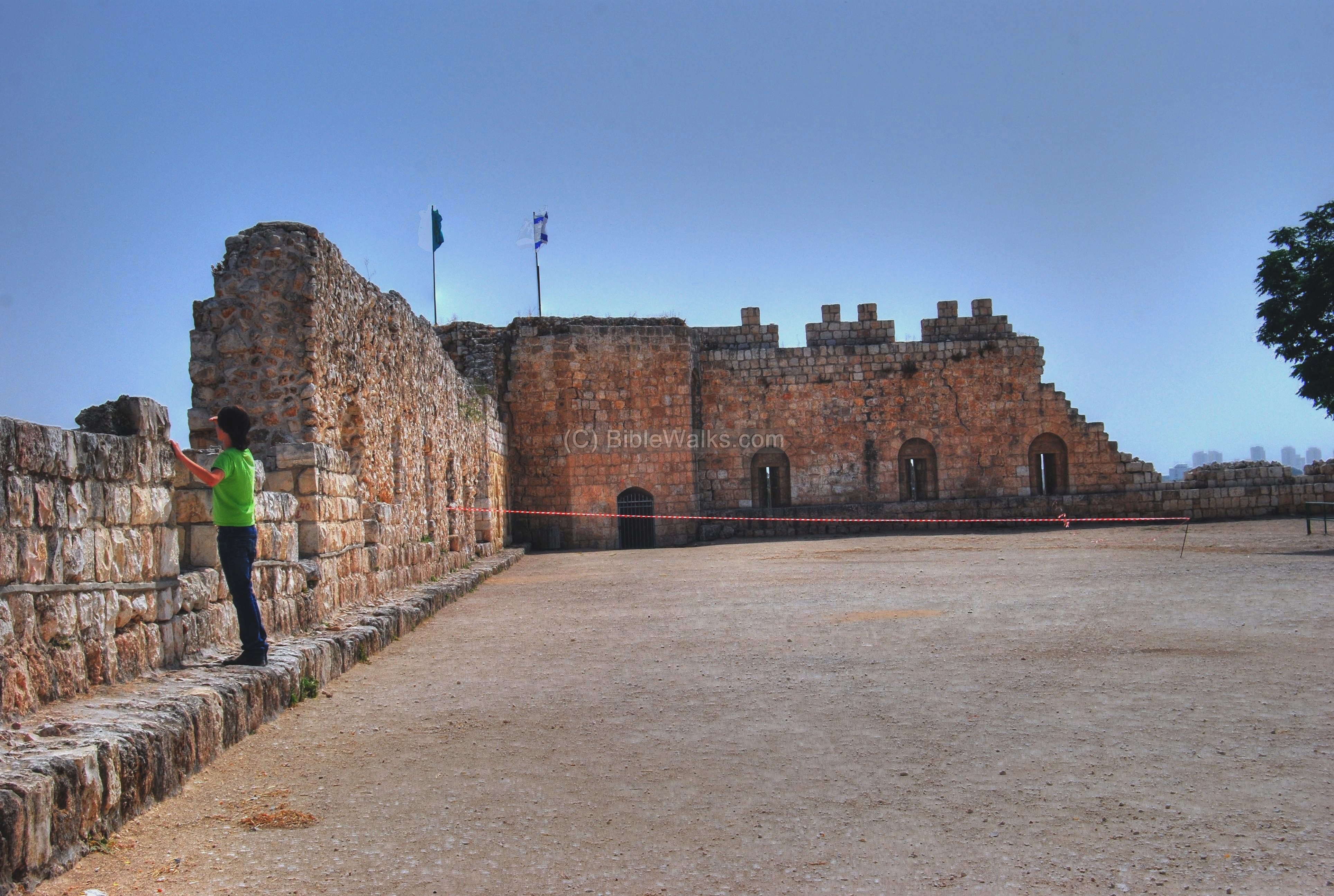
There is a gate that opens to the west side of the castle, where the view of the walls and the north-west tower are seen.
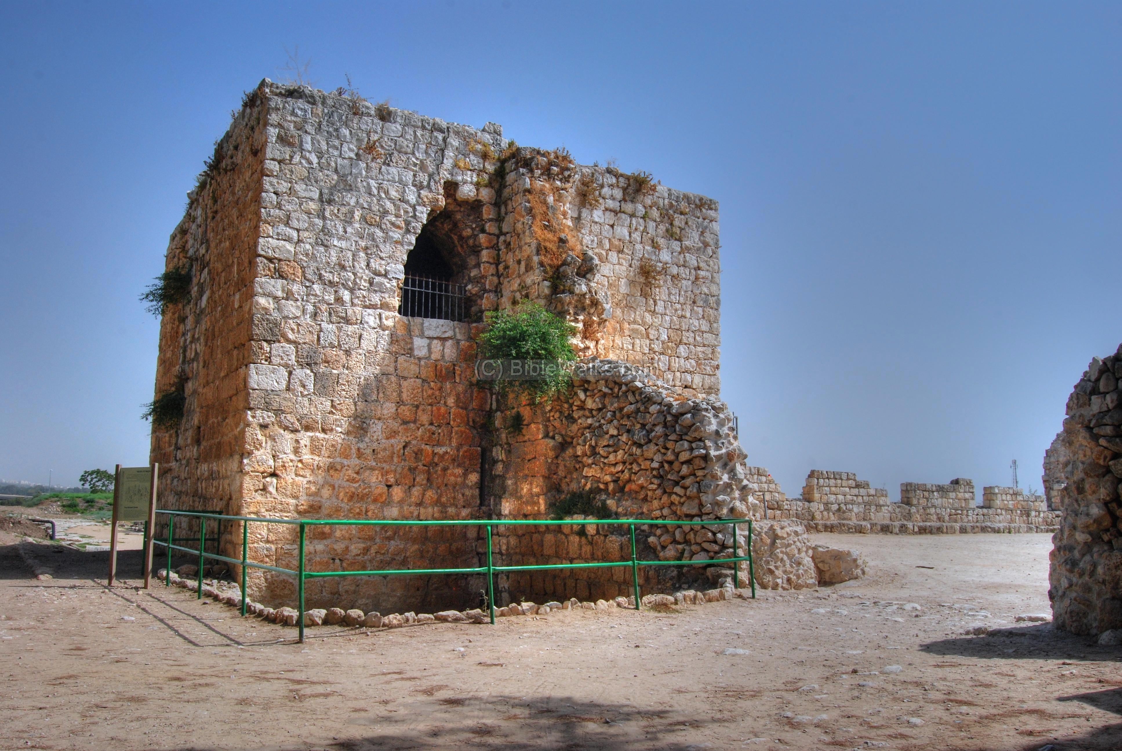
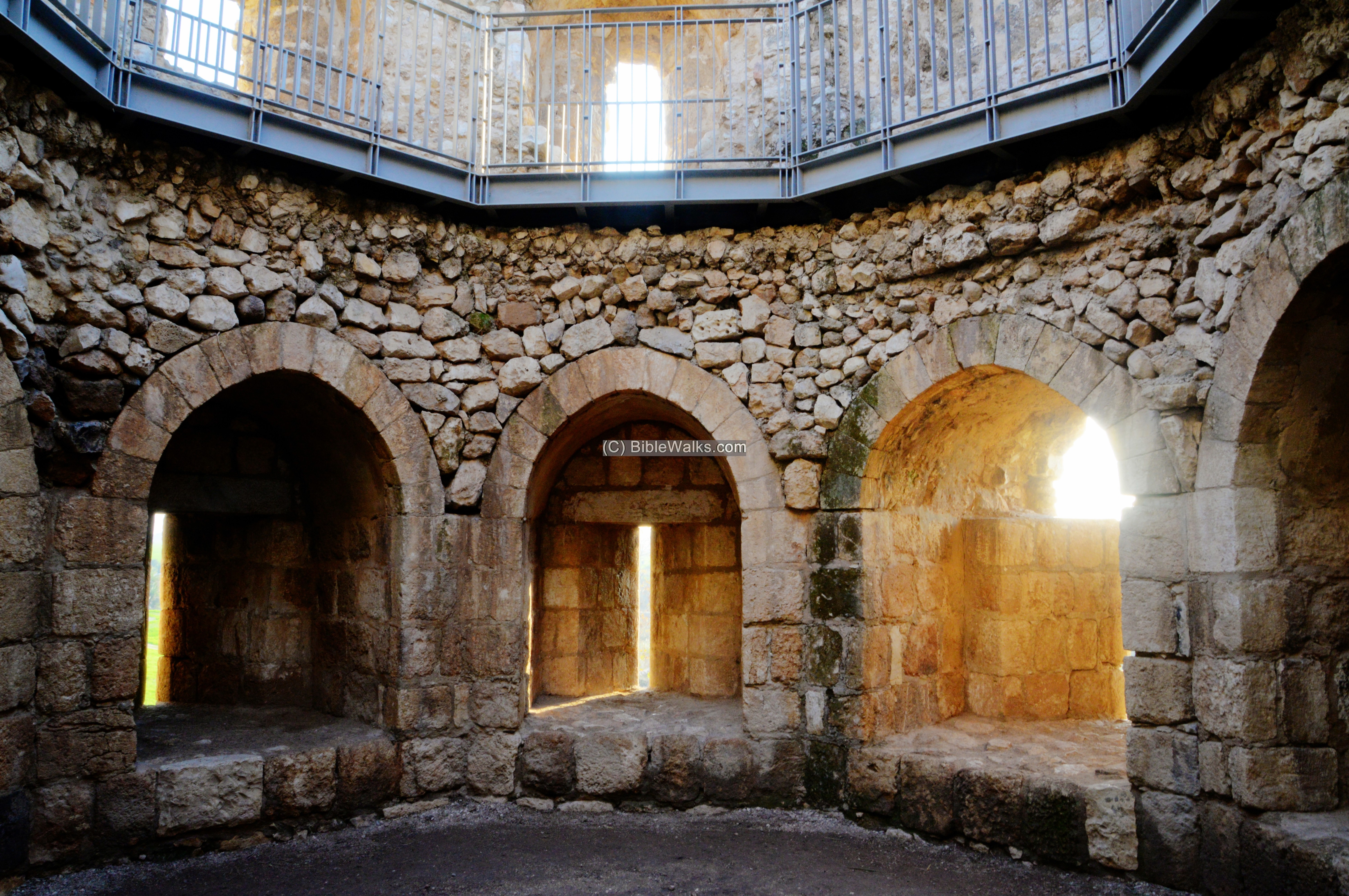
- South-East Tower
The photo below shows the western facing wall and the south-east corner tower.
Next is a view of the tower from the courtyard.
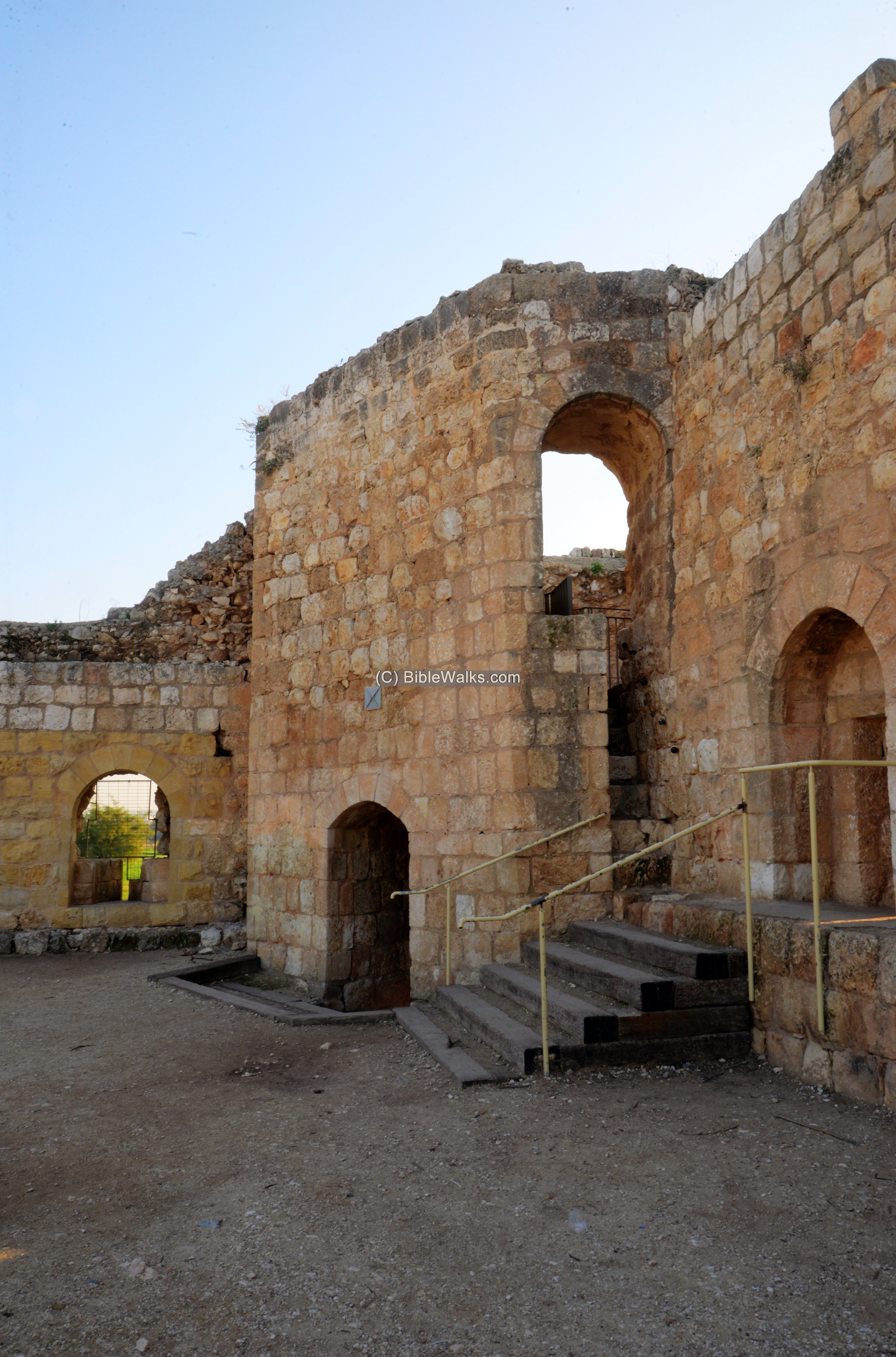
Renovations made this tower accessible for visitors. You can walk up into the structure and view its structure.
(c) Bronze Age excavations:
- Administrative house
On the north-west corner of the castle are reconstructed walls in the area which was excavated. Excavations in the Egyptian “Governor’s residence”, seen below in an aerial view from the north side, are from the Late Bronze Age (1,550-1,200 BC).
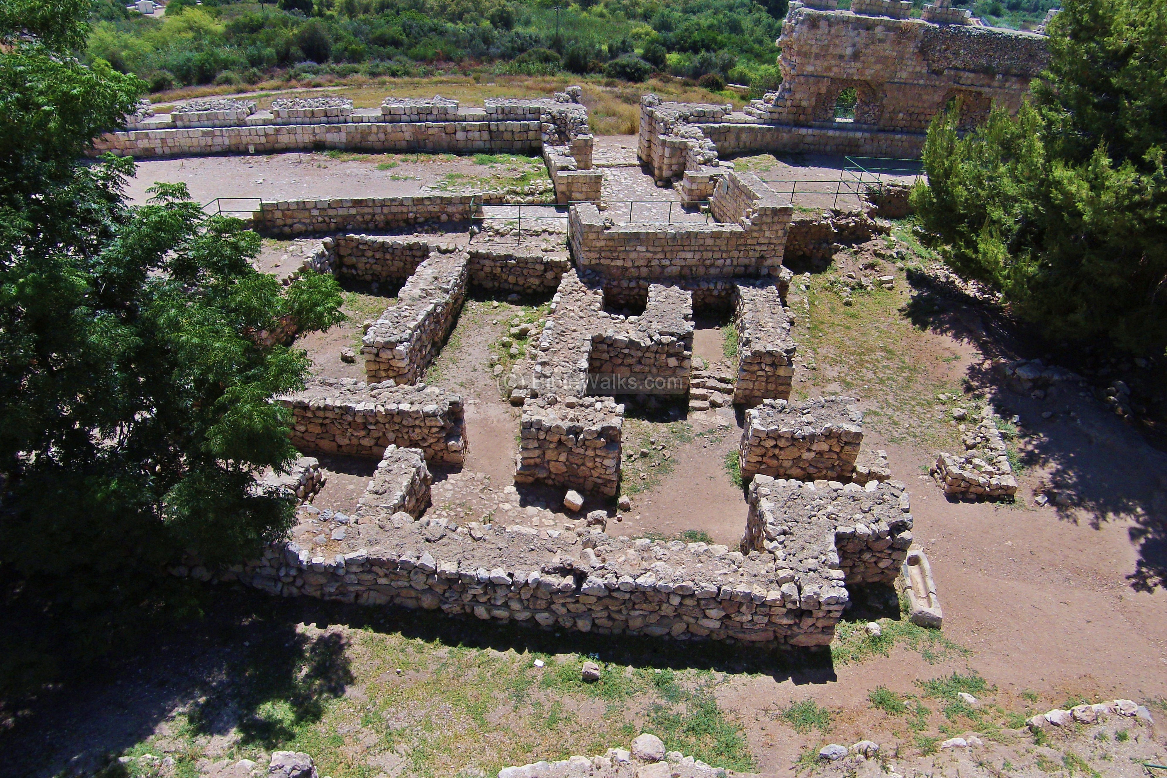
The excavations revealed many findings, including seals and rare scrolls. Two winepresses were excavated here, one of the earliest in the Levant. They were located near the Egyptian governor’s residency.
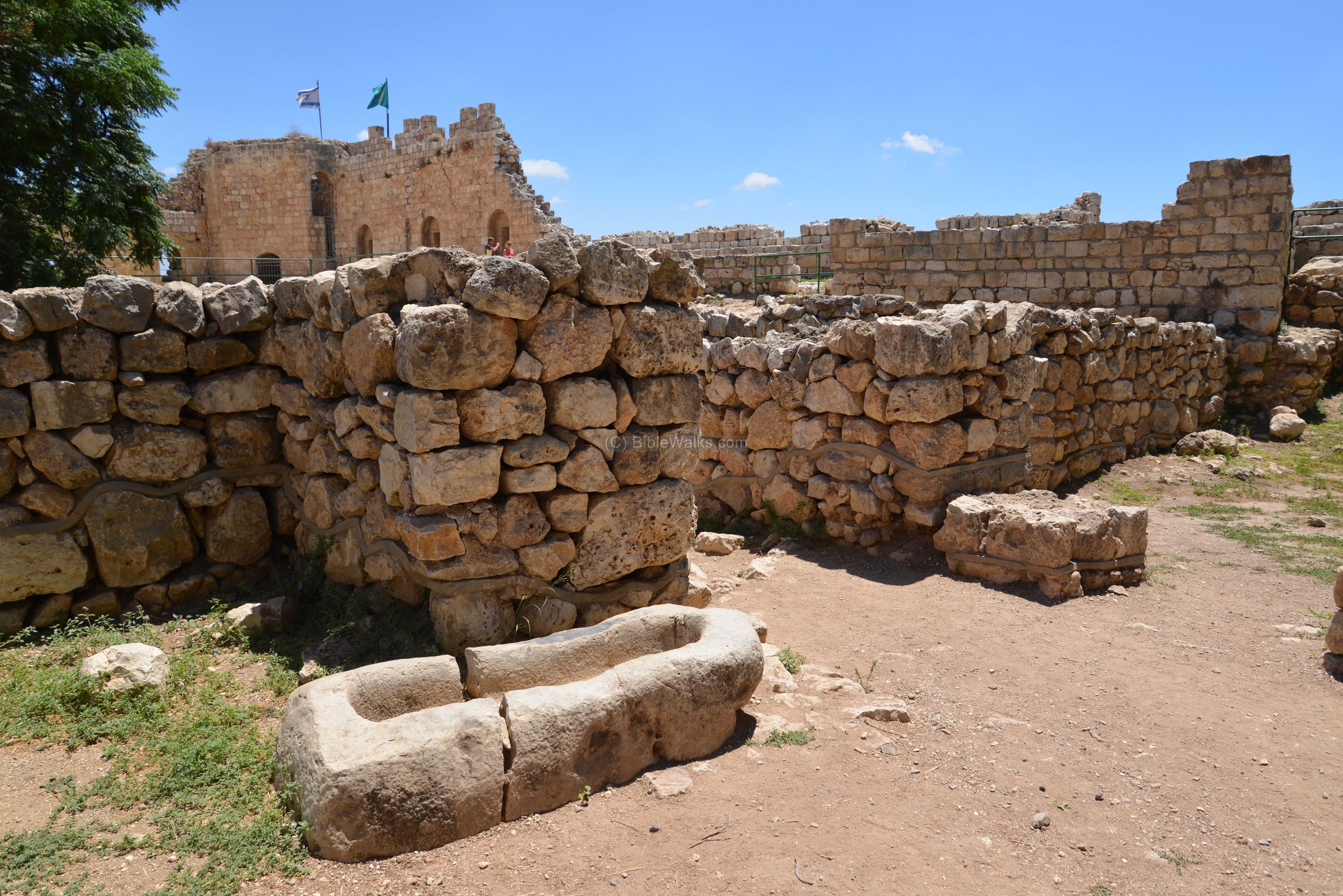
The “Governor’s house”, so called since the findings imply an administrative function of the structure, was destroyed by the end of the Late Bronze period. It had two floors, with a section of the flight of stairs found in the excavations.
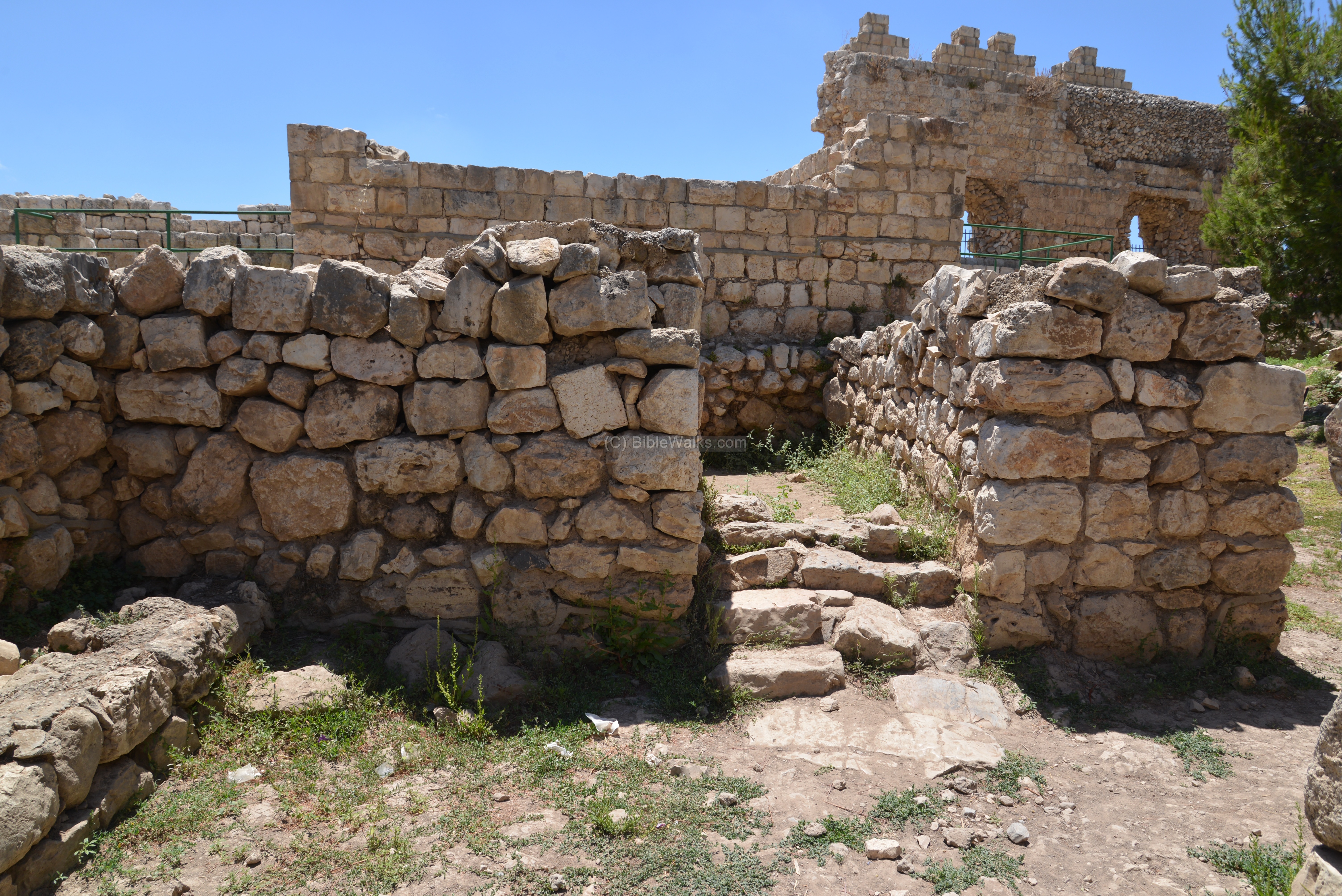
- Canaanite Palaces
The archaeologists also traced 5 superimposed palaces. Above the Bronze age layer was an Iron Age I layer (1200BC-1000BC). The palaces are marked I to V, shown in the aerial view among other highlights of the site. Palace II was located outside of the fortress, on the west side. Palace V was located near the Governor’s house.
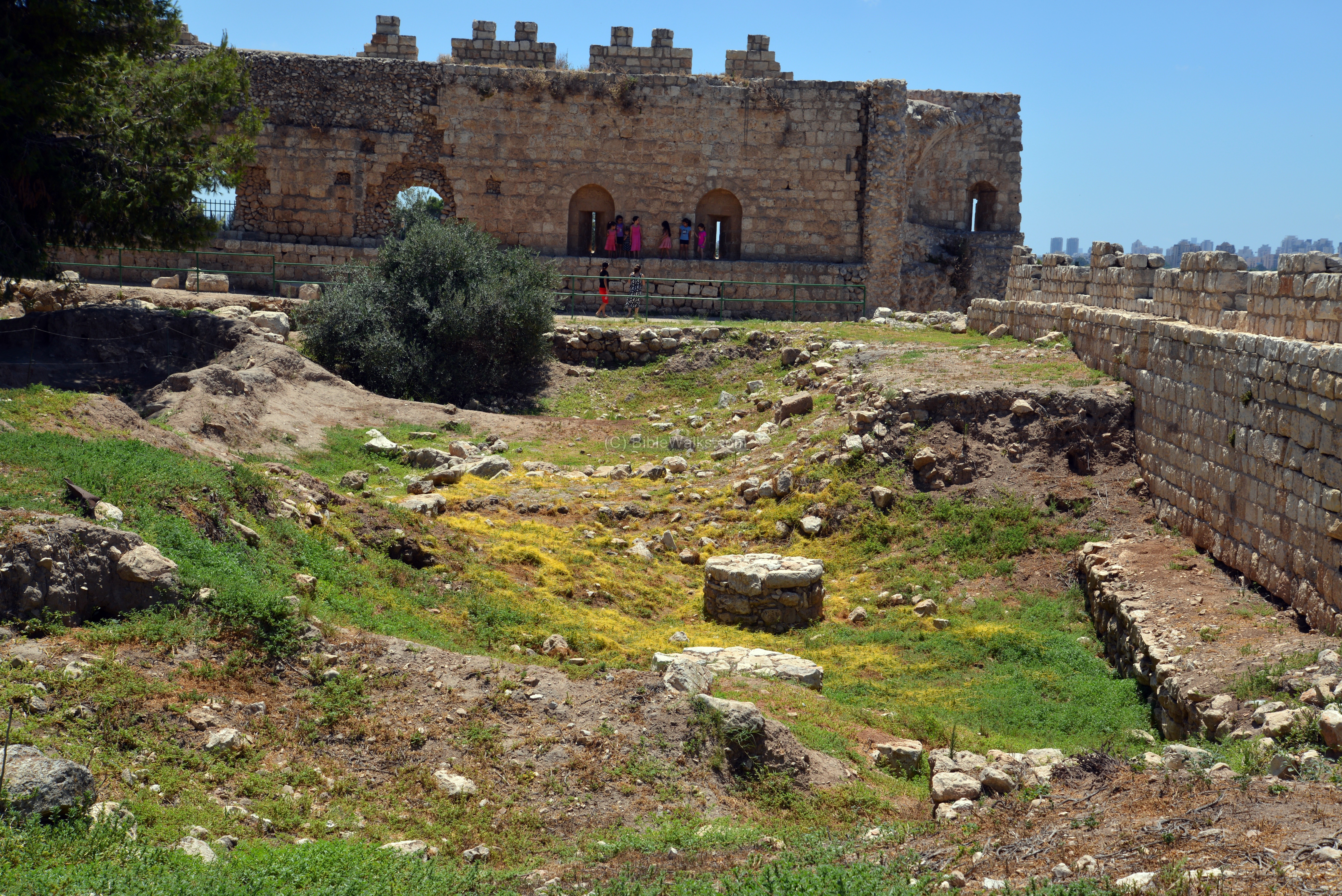
Along the Ottoman northern walls (on the bottom of this photo) are traces of the Early Bronze and Middle Bronze period fortifications, which line with the slopes of the hill.
In the following photo, taken from the northwest corner, are remains of the excavations of the Middle Bronze/Late Bronze period palaces (numbered I, II and IV) under the southwest corner of the fortress.
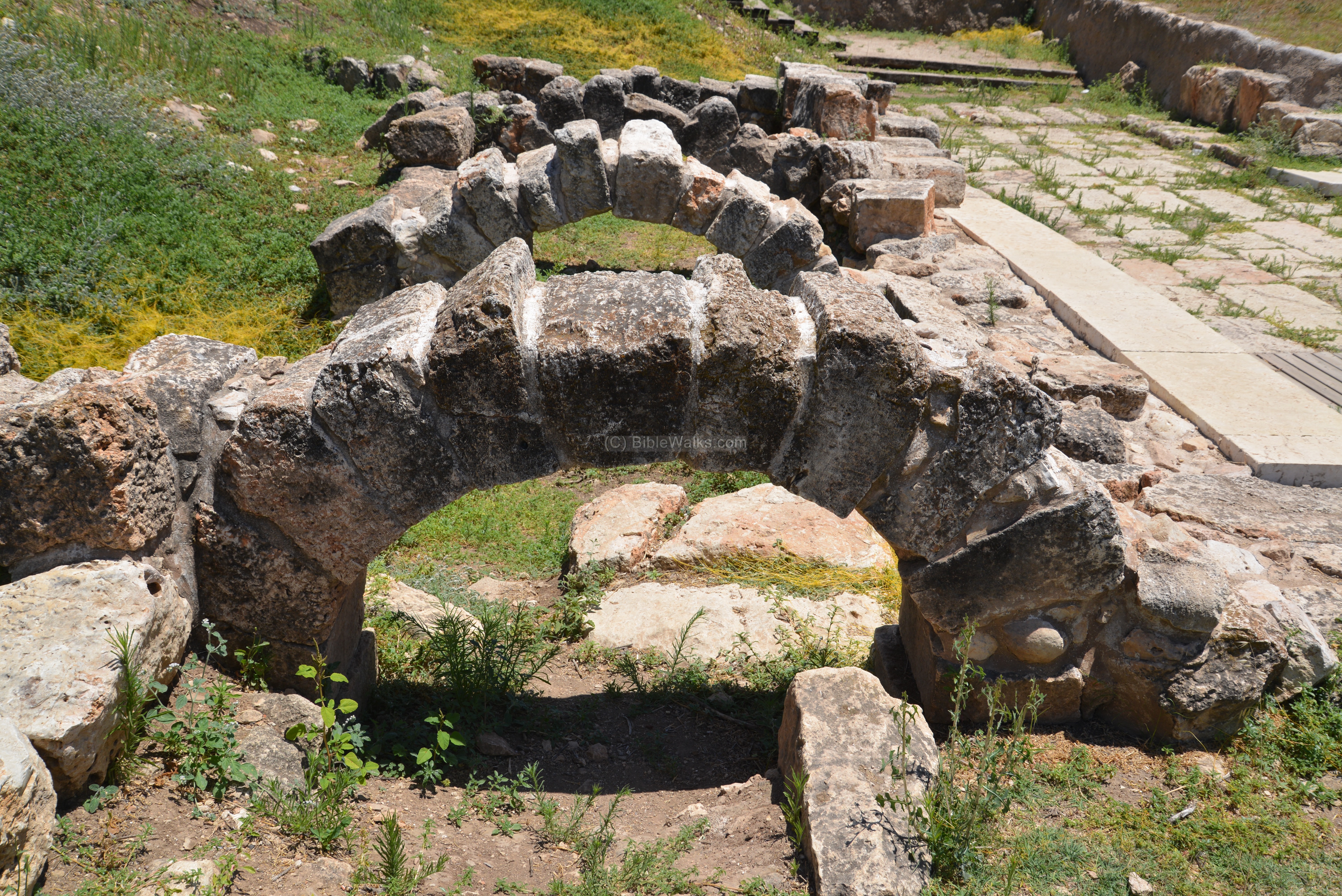
(d) Cardo – Roman Road:
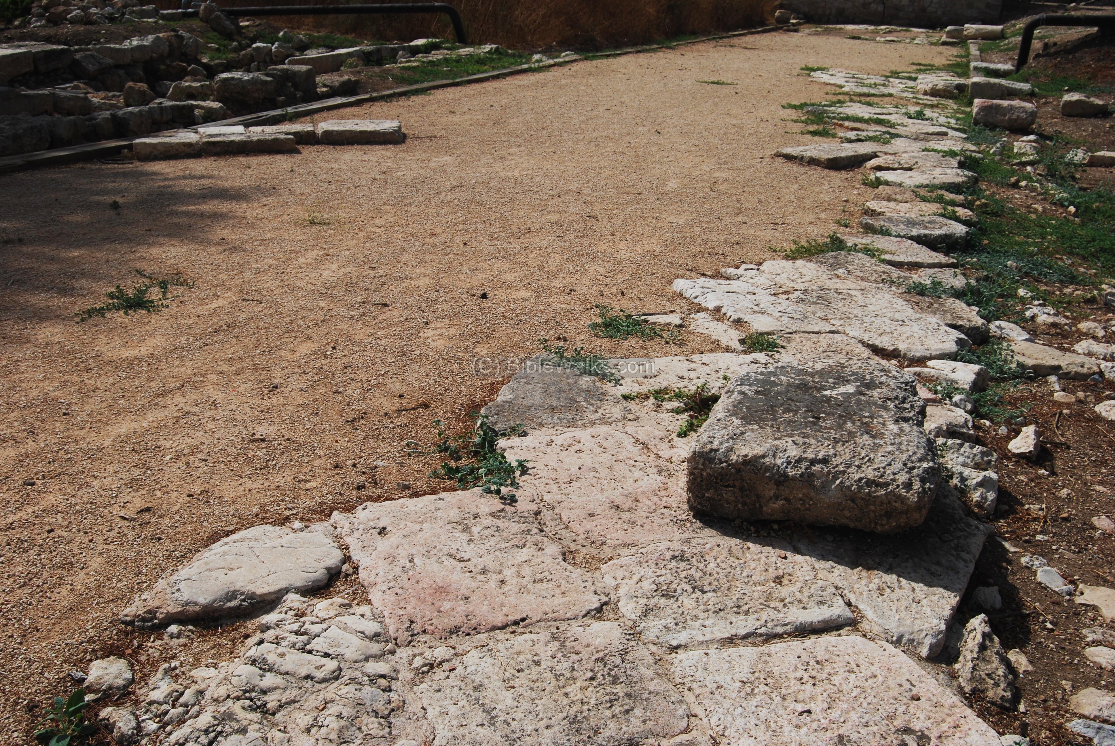
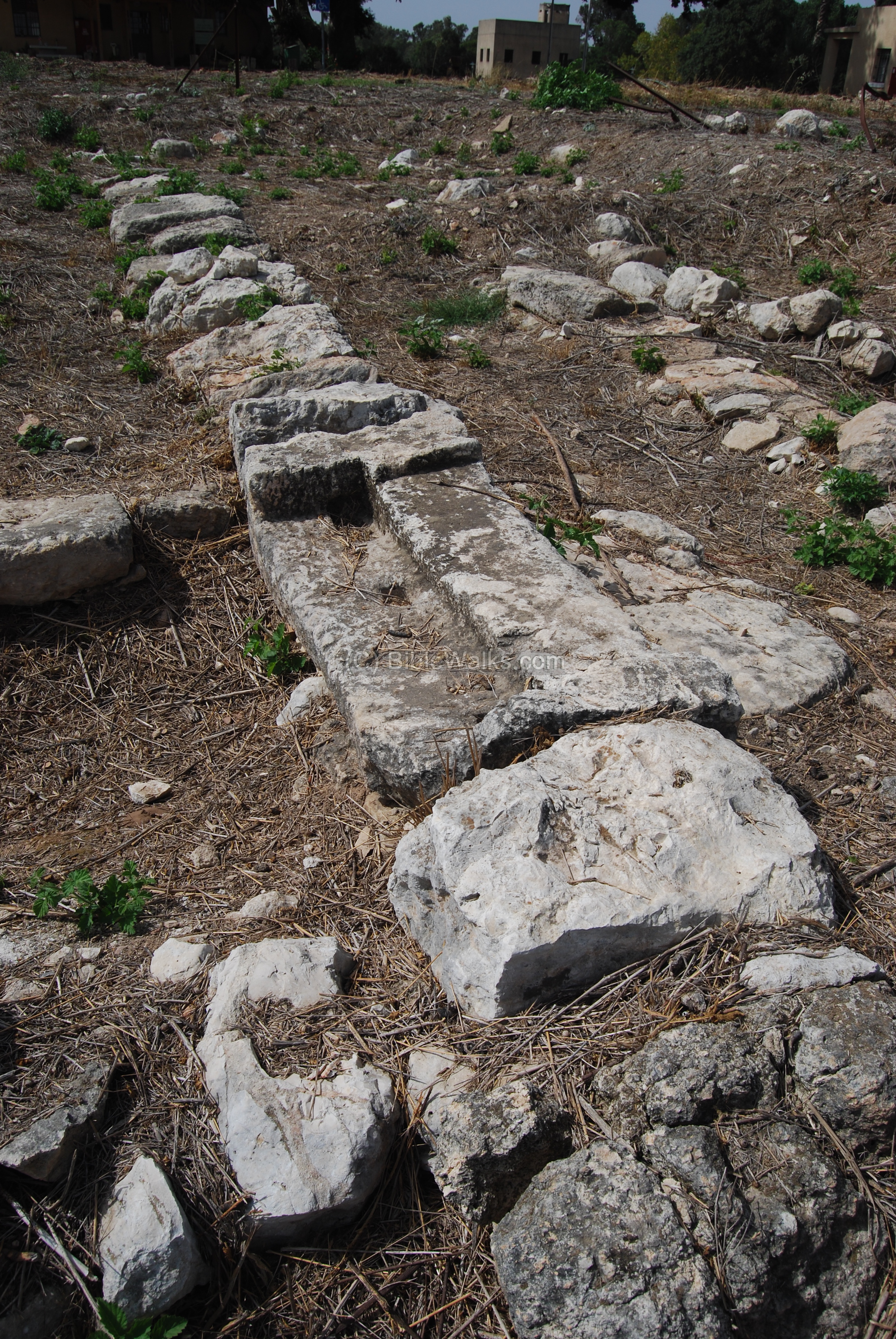
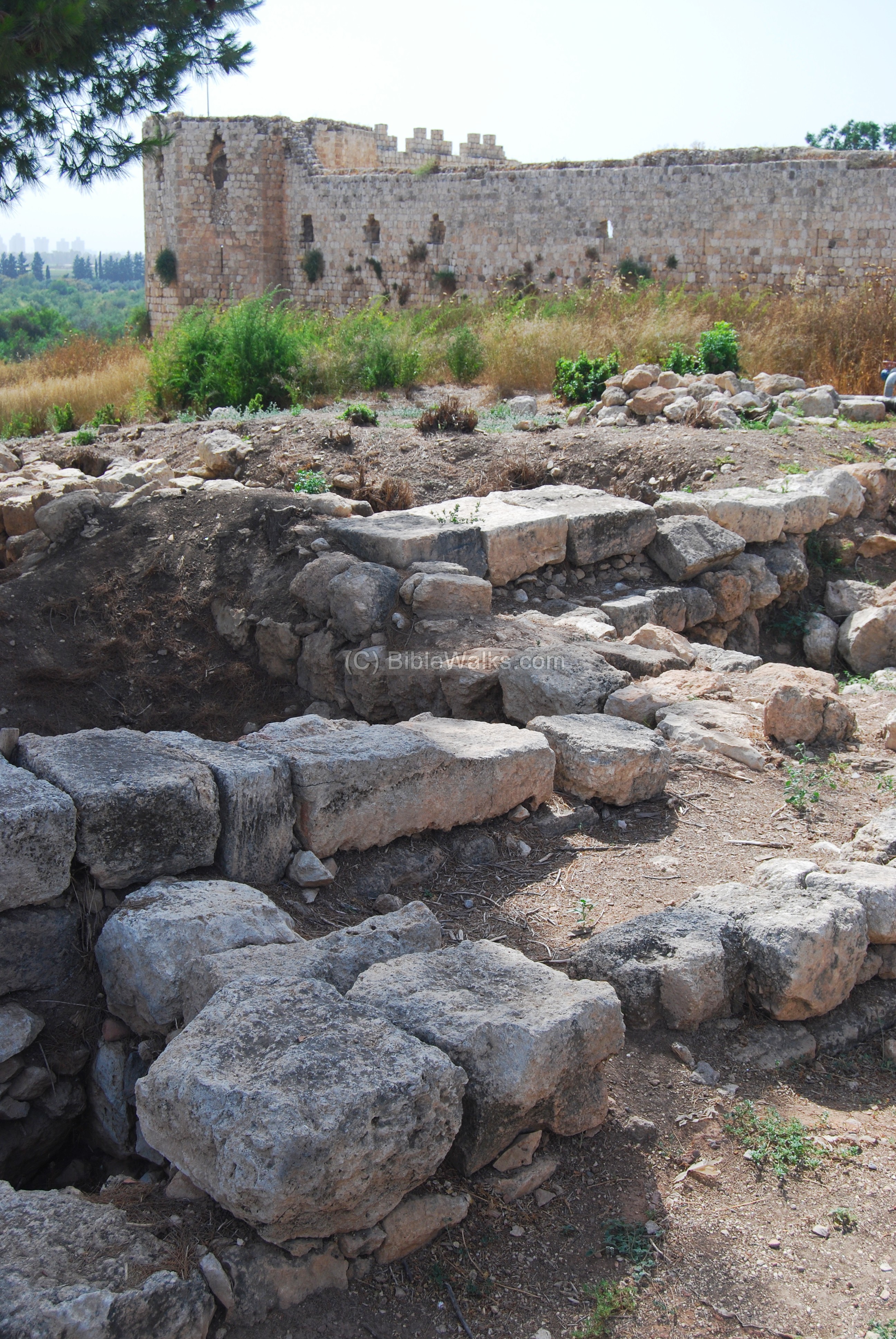
The main Road in the Roman city was the “Cardo”. Here in Antipatris, the Roman city established by Herod, the Cardo is oriented in a south-east to north-west orientation, on top of the Tel. The excavated road can be first seen under the south-east tower of the fortress, as in the photo below. The Roman layer is under the fortress, since it predated it by about 1300 years.
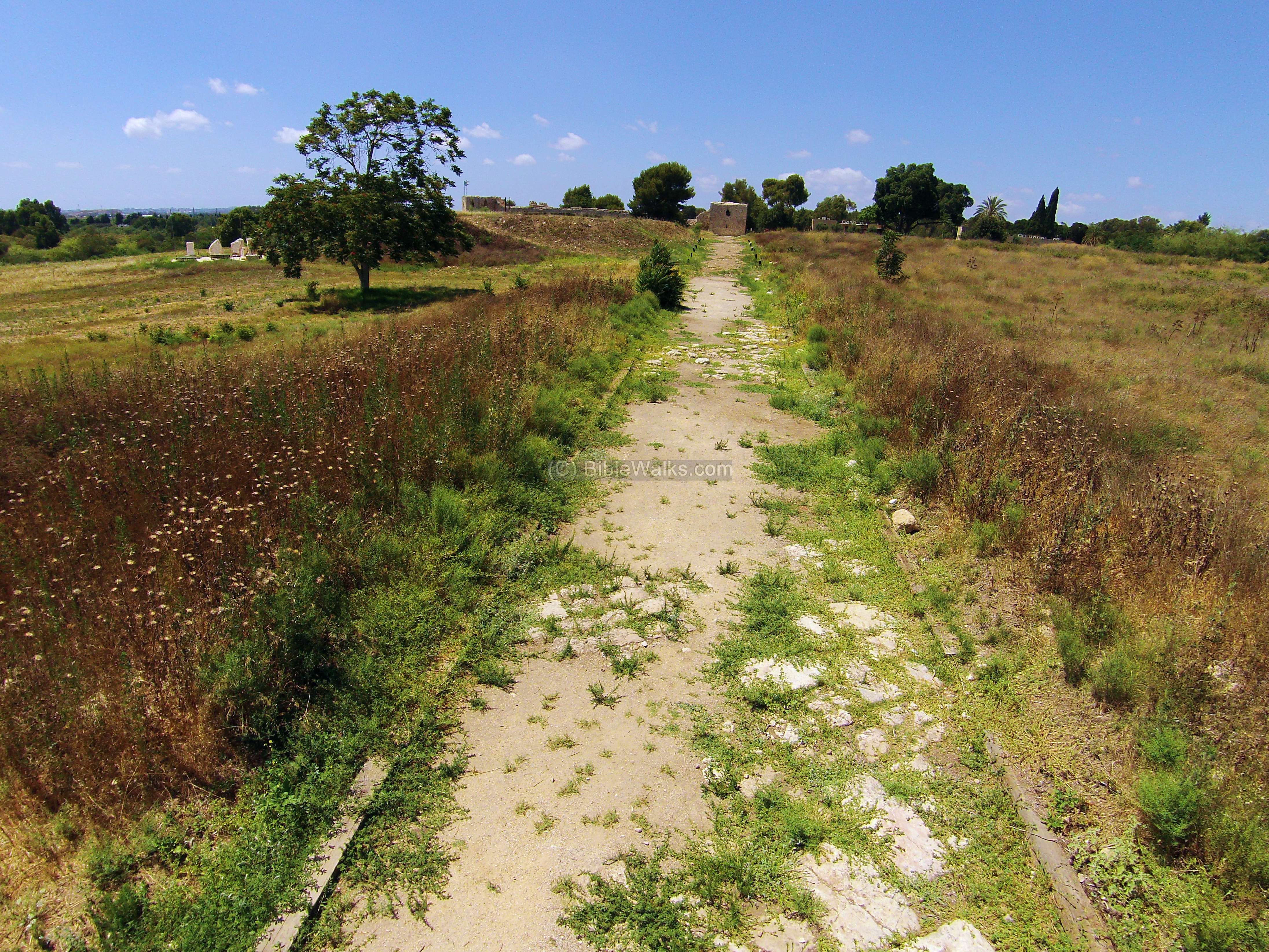
The road then extends from the tower, seen in the center background below. A 40 m section of the Cardo, including curbstones and drainage channels, were excavated here. Some of its sections are in a good shape, and you can even see the grooves of the cart wheels that once moved over the road.
The excavated Cardo extends for 300 M from the fortress. This section is on the east side, with a view towards the east. On both sides are traces of the ruins of the Roman/Byzantine city.
Shops and public houses were built along the road. On the left side are ruins of a Roman villa, and in the center is the Forum – the city center.
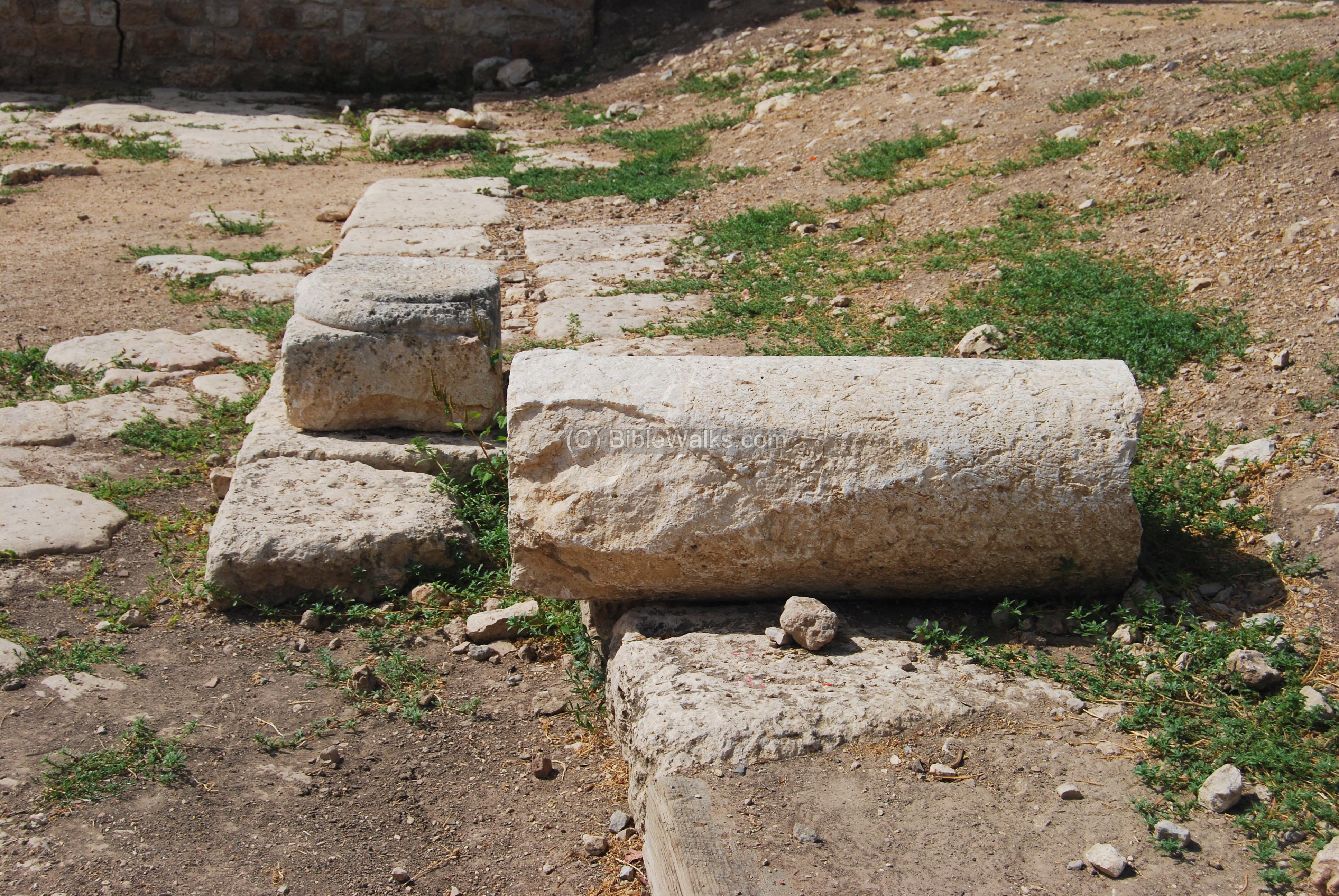
Along the sides of the Cardo were columns, which stood above their bases. This is a similar design of Cardo, as seen in Jerusalem or Sepphoris.
The photo below shows one of the columns and its base.
Below – an aerial view of the Cardo road from the east side.
(e) Roman city:
Along the sides of the Cardo are excavated ruins of the shops and public houses that once serviced the residents of the early Roman city of Antipatris. The photo below shows an excavated Roman villa.
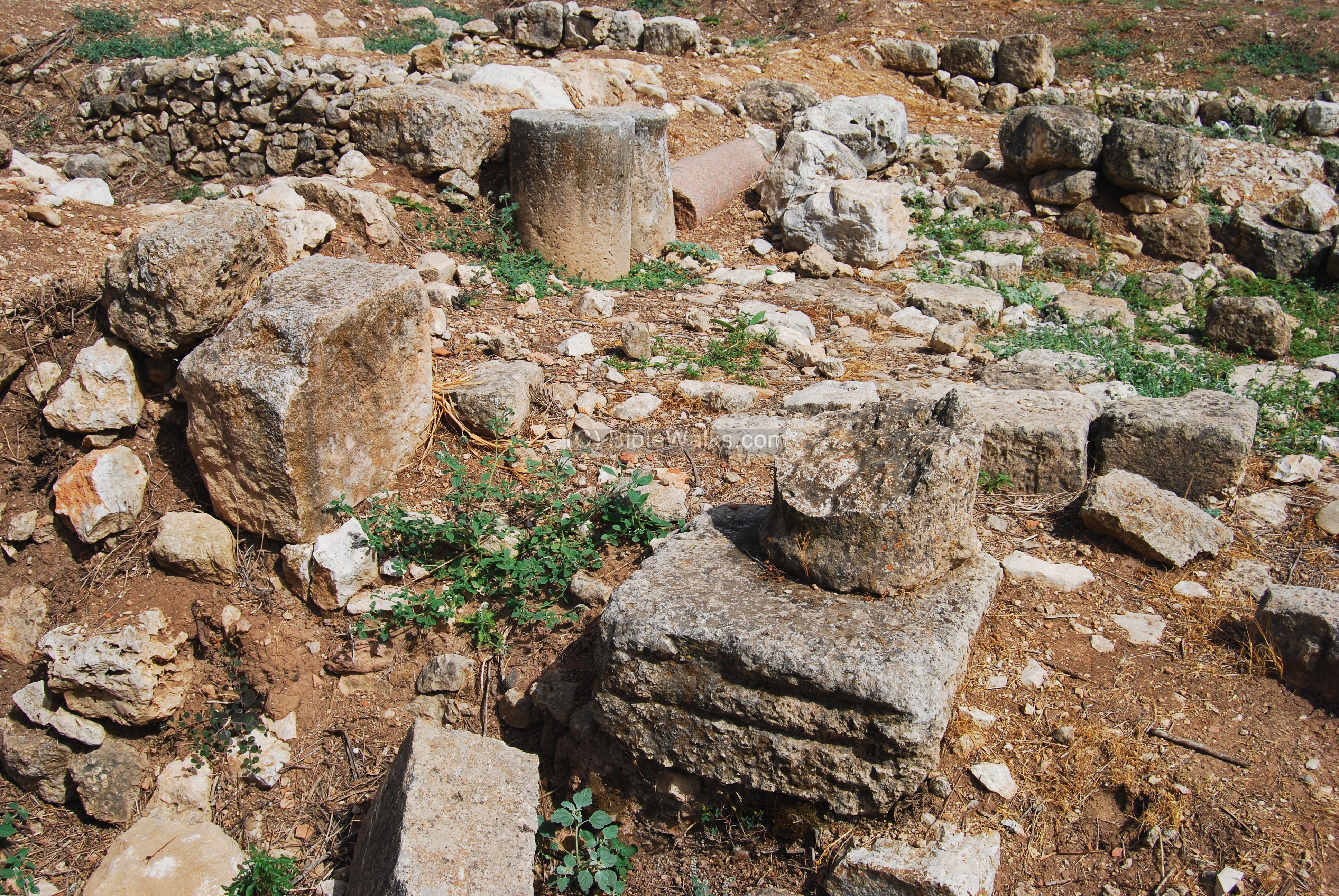
Other views of the ruins are seen below, including the base of the door to the house below.
On the other side of the Cardo are more excavations, with the walls of the fortress seen in the background.
-
Odeon:
On the side of the Cardo street is a Roman period Odeon – a roofed mini-theater which was used for musical shows, poetry reading, poetry competitions and singing exercises.
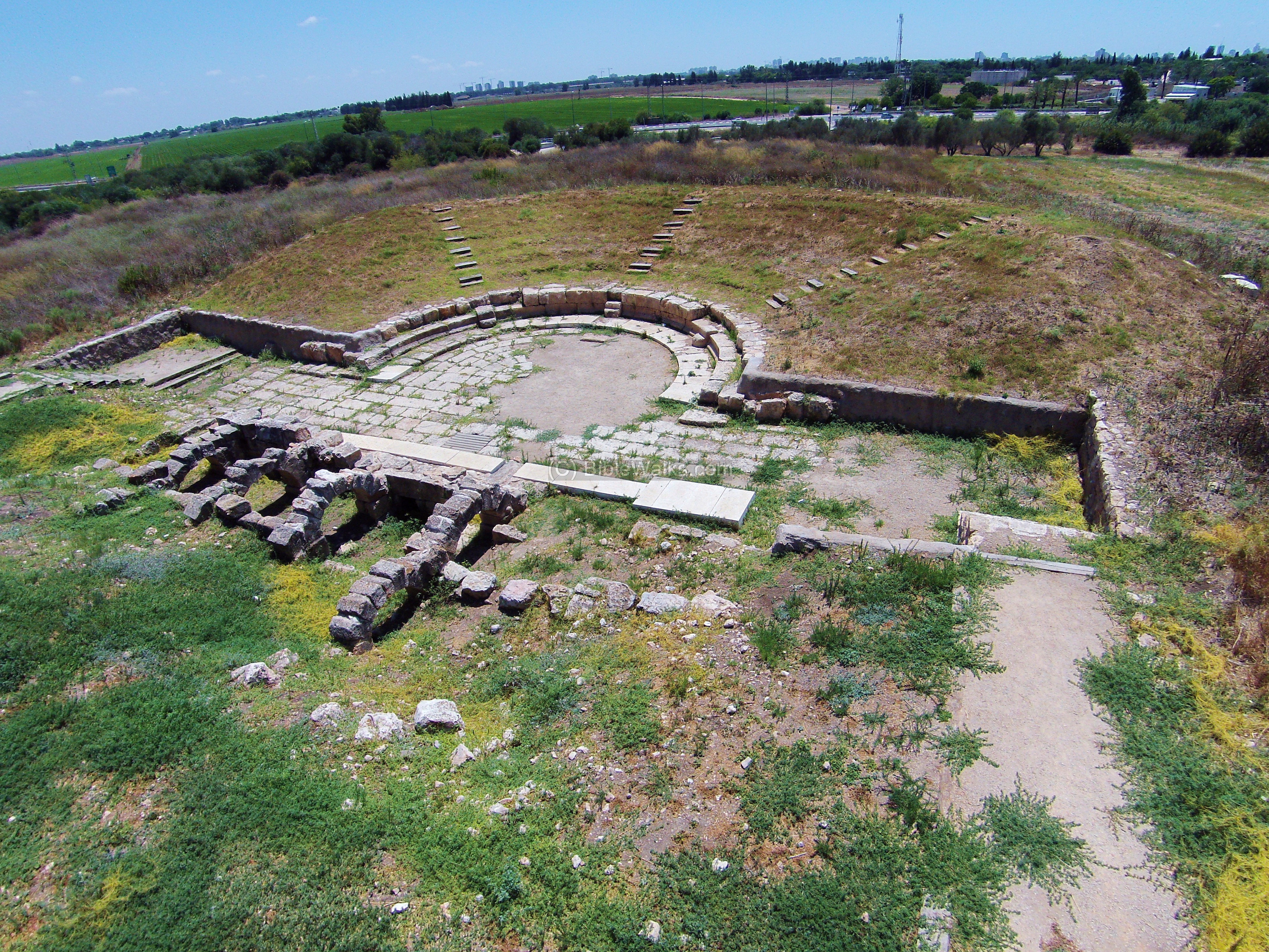
The word “Odeon” is based on the Greek word “to sing”. These structures were generally small in size compared to a full-size theater, since they were used by a quality and selected audience.
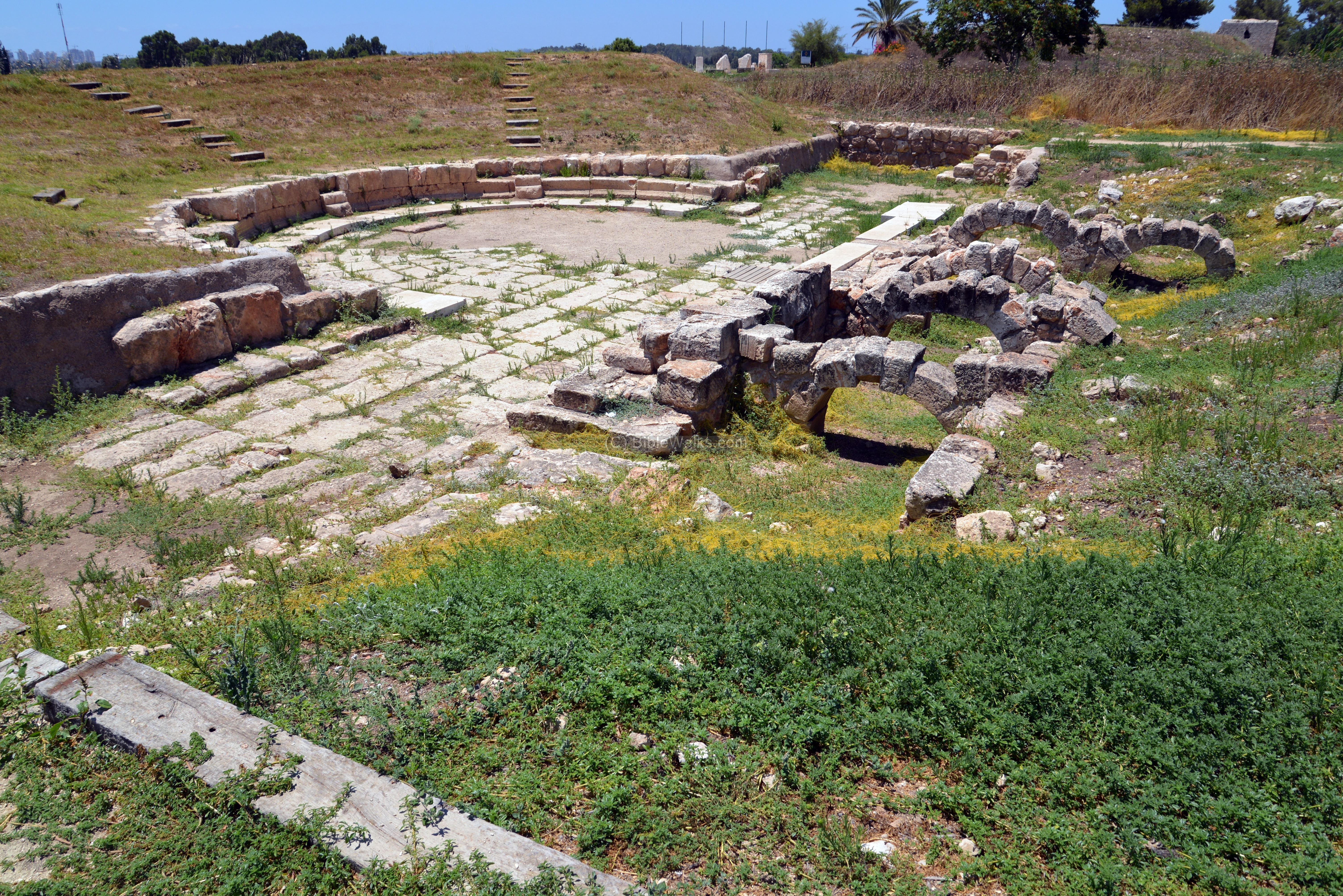
Odeon structures were common in the Greek and Roman cities, but few were found in Israel. Another Odeon was found in Hippos in the Golan.
(f) British water supply:
During the British Mandate (1920-1948) a large water supply project was built here on top of the hill. The photo below shows the view of the British concrete building and pools, located on the left (east) side of the ancient fortress. The waters were pumped up from the springs into the water pools.
The pools seen in the photo below were used to store the waters pumped from the springs, perform filtration and chlorination. The cleaned water was stored underground, then pumped up to Jerusalem. The water supply operated from 1936 through 1939.
Biblical References:
Joshua 12:7, 18
“And these are the kings of the country which Joshua and the children of Israel smote on this side Jordan on the west…The king of Aphek, one”
1 Samuel 4:1-11
A great battle between the Israelites and the Philistines was conducted here during the times of the judges. The Israelites camped at Ebenezer (site near Aphek), while the Philistines camped at the city. The Israelites lost the first battle and 4,000 men. To reclaim their victory they brought in the ark of the covenant from Shiloh, but lost another battle, 30,000 men and the ark.
“And the word of Samuel came to all Israel. Now Israel went out against the Philistines to battle, and pitched beside Ebenezer: and the Philistines pitched in Aphek. And the Philistines put themselves in array against Israel: and when they joined battle, Israel was smitten before the Philistines: and they slew of the army in the field about four thousand men”.
And when the people were come into the camp, the elders of Israel said, Wherefore hath the LORD smitten us to day before the Philistines? Let us fetch the ark of the covenant of the LORD out of Shiloh unto us, that, when it cometh among us, it may save us out of the hand of our enemies.
So the people sent to Shiloh, that they might bring from thence the ark of the covenant of the LORD of hosts, which dwelleth between the cherubim: and the two sons of Eli, Hophni and Phinehas, were there with the ark of the covenant of God. And when the ark of the covenant of the LORD came into the camp, all Israel shouted with a great shout, so that the earth rang again. And when the Philistines heard the noise of the shout, they said, What meaneth the noise of this great shout in the camp of the Hebrews? And they understood that the ark of the LORD was come into the camp. And the Philistines were afraid, for they said, God is come into the camp. And they said, Woe unto us! for there hath not been such a thing heretofore. Woe unto us! who shall deliver us out of the hand of these mighty Gods? these are the Gods that smote the Egyptians with all the plagues in the wilderness. Be strong and quit yourselves like men, O ye Philistines, that ye be not servants unto the Hebrews, as they have been to you: quit yourselves like men, and fight. And the Philistines fought, and Israel was smitten, and they fled every man into his tent: and there was a very great slaughter; for there fell of Israel thirty thousand footmen.And the ark of God was taken; and the two sons of Eli, Hophni and Phinehas, were slain”.
(c) Acts 23: 31
St Paul was led by the Roman soldiers on his way to Caesarea, and stayed over night in the city.
“…Then the soldiers, as it was commanded them, took Paul, and brought him by night to Antipatris. On the morrow they left the horsemen to go with him, and returned to the castle: Who, when they came to Caesarea and delivered the epistle to the governor, presented Paul also before him”.
Historical References:
(a) Josephus Flavius, Wars 4, 8:1:
This text, written by the Jewish general turned Historian Josephus Flavius, tells about the march of the Romans through Aphek towards Jerusalem during the great revolt. The Jewish city in Antipatris was wiped out by Vespasian’s armies, who camped at the site and “settled the affairs of the city”.
“…at the beginning of the spring he took the greatest part of his army, and led it from Cesarea to Antipatris, where he spent two days in settling the affairs of that city, and then, on the third day, he marched on, laying waste and burning all the neighboring villages”.
(b) Josephus Flavius, Wars 1, 21:9:
The city was named after Herod’s father, Antipatris.
“Herod was also a lover of his father, if any other person ever was so; for he made a monument for his father, even that city which he built in the finest plain that was in his kingdom, and which had rivers and trees in abundance, and named it Antipatris”.
Etymology (behind the name):
- Aphek (Afek)- also Afik (Aphik) as in Judges. Afik in Hebrew means the source of water (of the Yarkon river). There were other cities with the same name – such as Afek in the Galilee and Afek in the Golan (Ein Gev).
- Antipatris – the city was established by Herod in20BC and was named after his father (his Greek name)
- Pegae The name of the city during the Hellenistic period (means “springs” in Greek)
- Abu Butrus – the Arabic name of the city, which preserved the name of Antipatris (Patris sounds as Batris in Arabic)
- Tell (Tel) – a layered mound (read about the story of the Tels, including our animation)
- Tel Rosh Ha’Ayin – the name is based on Arabic (Tel Ras El-A’yin)
- Rosh Ha’Ayin – in Hebrew: head, Ha: the, A’yin: springs.
- Binar Bashi – in Turkish – the “top of the springs”. This was the name of the Ottoman Khan (hostel), based on the Hebrew name of Rosh Ha’ayin.
- River Yarkon (Jarkon) – Flows for 30KM from the springs in Aphek to the outlet in Tel-Aviv. Based on the Hebrew word “Yarok” – green or “yerek” – plants, which is a reference to the green bushes along the river. Biblical reference (Mejarkon – waters of Yarkon): Joshua 19 46: “And Mejarkon, and Rakkon, with the border before Japho”.
Links:
-
IAA Tel Aphek – 2006 excavation of the Cardo
-
Tel-Aviv University: Tel Aphek Upper city excavations (M. Kochavi 1976-1985)
-
Governor’s house (IAA article)
-
Tel Afeq (Hadashot Arkheologiyot, V120, 2008)
-
Old photos of Antipatris (Library of Congress)
* Nearby sites:
- Ebenezer (Izbet Zartta)
- Migdal Afek (Migdal Tsedek)
* Other internal links:
BibleWalks.com – tour the Land with a Bible in the hand
Jaffa Station<<–previous site—<<< All Sites>>>—next Sharon site—>>> Qaqun
This page was last updated on Jan 15, 2022 (added new photos)
Sponsored links: