The sites of park Adullam-France in the area of the low hills (Shephelah) of Judea.
Home > Sites > Judea > Park Adullam-France (overview)
Contents:
Overview
Location
History
The sites
Etymology
Links
Overview:
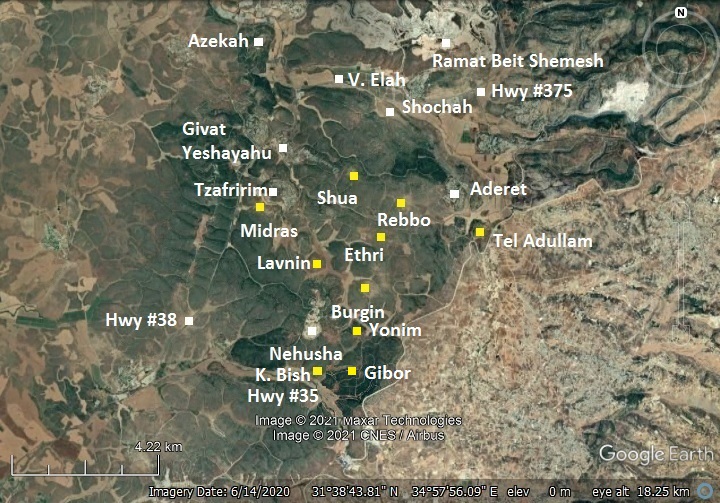
The Adullam-France National Park is located in the area of the low hills (Shephelah) of Judea, south of Beit Shemesh and the valley of Elah. The park, established in 2008, covers an area of 50 square Kilometers. It features many archaeological sites from the Second Temple period. Hiking and Biking trails crisscross the park.
This is an overview page, pointing to the sites reviewed in BibleWalks.com.
Location:
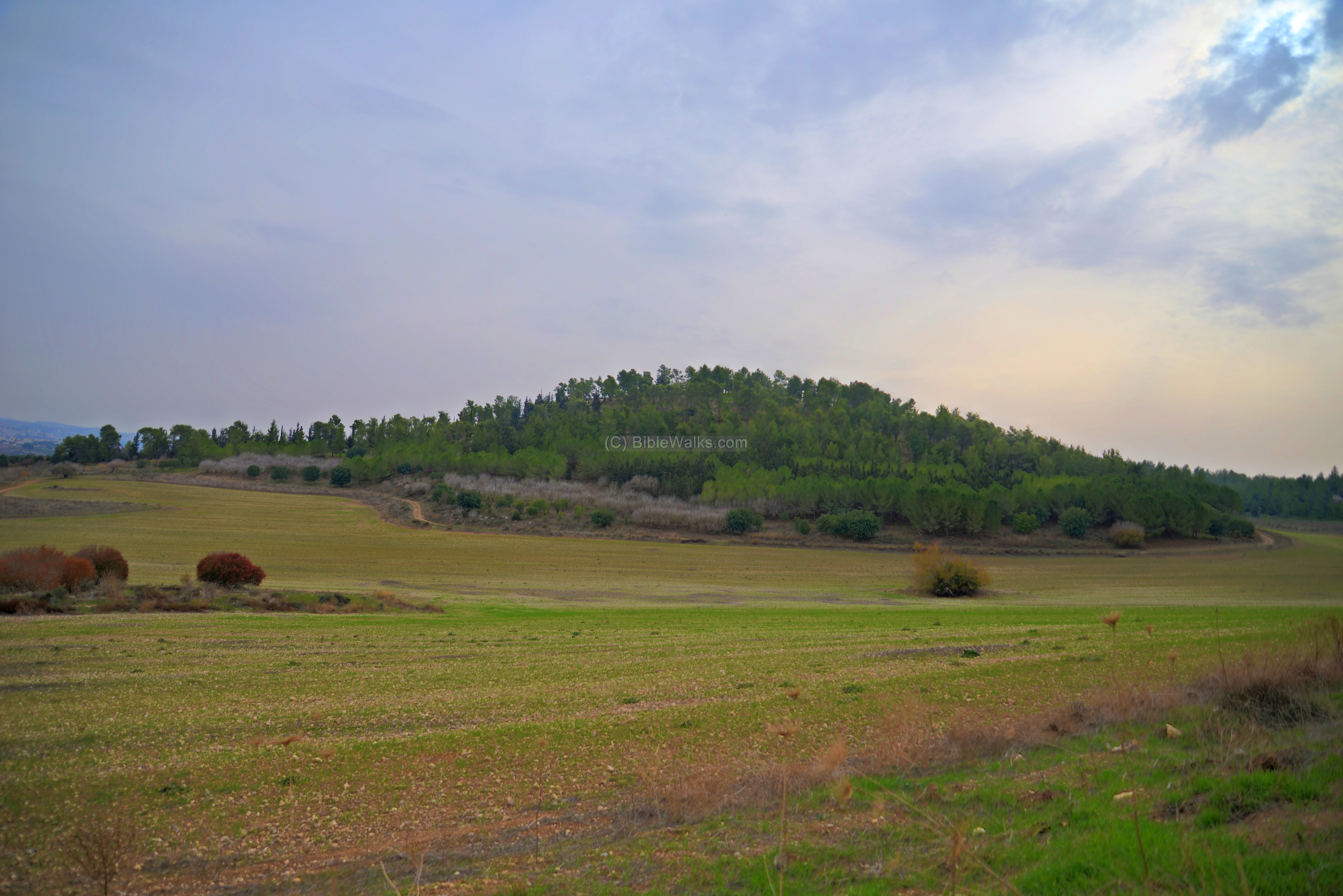
The following map shows the area of the park. Its declared area is bounded by the valley of Elah in the north, highway #38 in the west, highway #35 in the south, and the security fence on the east. It consists of low limestone hills, at an altitude of 300-400m. The landscape is covered by natural bush and trees, with some areas of planted pine tree forests.
The major archaeological sites inside the park are marked with yellow squares.
History:
- Second temple period
A map of the cities and roads of the Iron Age period is here, with Aczib marked as a red point in the center, south west of Adullam and south of the valley of Elah. The site Aczib (Achzib) which is identified as Tel Lavnin – one of the Second Temple ruins within the park.
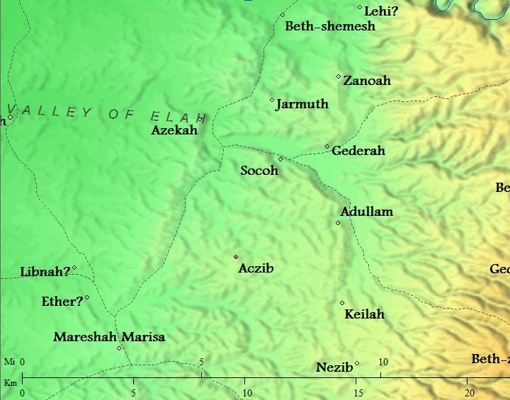
Cities and roads around the sites of Park Adullam – during the Canaanite, Israelite, Hellenistic period – Bible Mapper 3.0
- Roman period
During the great revolt against the Romans the Jewish villages were burnt and destroyed. A record of such destruction may have been implied in Josephus accords, when one of the villages in this area (Ethri = Caphethhra) was destroyed by the 5th Legion in 69 AD (War IV:9:9):
“…but Cerealis, one of his commanders, took a body of horsemen and footmen, and laid waste that part of Idumea which was called the Upper Idumea, and attacked Caphethra, which pretended to be a small city, and took it at the first onset, and burnt it down”.
- Bar Kokhba hiding complexes
Hiding complexes of the Bar-Kochbah revolt were found on most of the sites.
During the second (Bar Kokhba) revolt in the 2nd century AD, Jewish residents across most of the villages in Judea tried to save themselves by constructing underground hiding places. Most of these rock cut tunnels and chambers were constructed under or near the residential buildings. The Roman historian Cassius Dius wrote about this (Historia Romania, 69, 12, 3):
“To be sure, they did not dare try conclusions with the Romans in the open field, but they occupied the advantageous positions in the country and strengthened them with mines and walls, in order that they might have places of refuge whenever they should be hard pressed, and might meet together unobserved under ground; and they pierced these subterranean passages from above at intervals to let in air and light”.
- Devastation of Judea
These hiding places may have saved some of the souls. However, the carnage that followed the onslaught left the villages in ruins.
After its destruction, the Jewish population ceased, as all other Jewish villages in Judea. Cassius Dio, the historian of Rome, wrote about the devastation of Judea by Hadrian (Roman History, 69 13):
“Fifty of their most important outposts and nine hundred and eighty-five of their most famous villages were razed to the ground. Five hundred and eighty thousand men were slain in the various raids and battles, and the number of those that perished by famine, disease and fire was past finding out. Thus nearly the whole of Judaea was made desolate, a result of which the people had had forewarning before the war”.
Jews were forbidden to return to all settlements in the vicinity of Jerusalem. Eusebius Pamphili of Caesarea, a 4th century Greek historian of the Church, wrote about this ban in the 4th century (Church History, Book IV, Ch. 6, 3):
“…the whole nation was prohibited from this time on by a decree, and by the commands of Hadrian, from ever going up to the country about Jerusalem. For the emperor gave orders that they should not even see from a distance the land of their fathers..”.
- Byzantine period
According to the PEF report, some of the ruined villages were inhabited during the Byzantine period.
- Modern period
The park was established in 2008 for public recreation. It is run jointly by the KKL (Keren Kayemeth Leisrael), the Nature & Parks Authority (INPA) and the Israel Antiquities Authority (IAA).
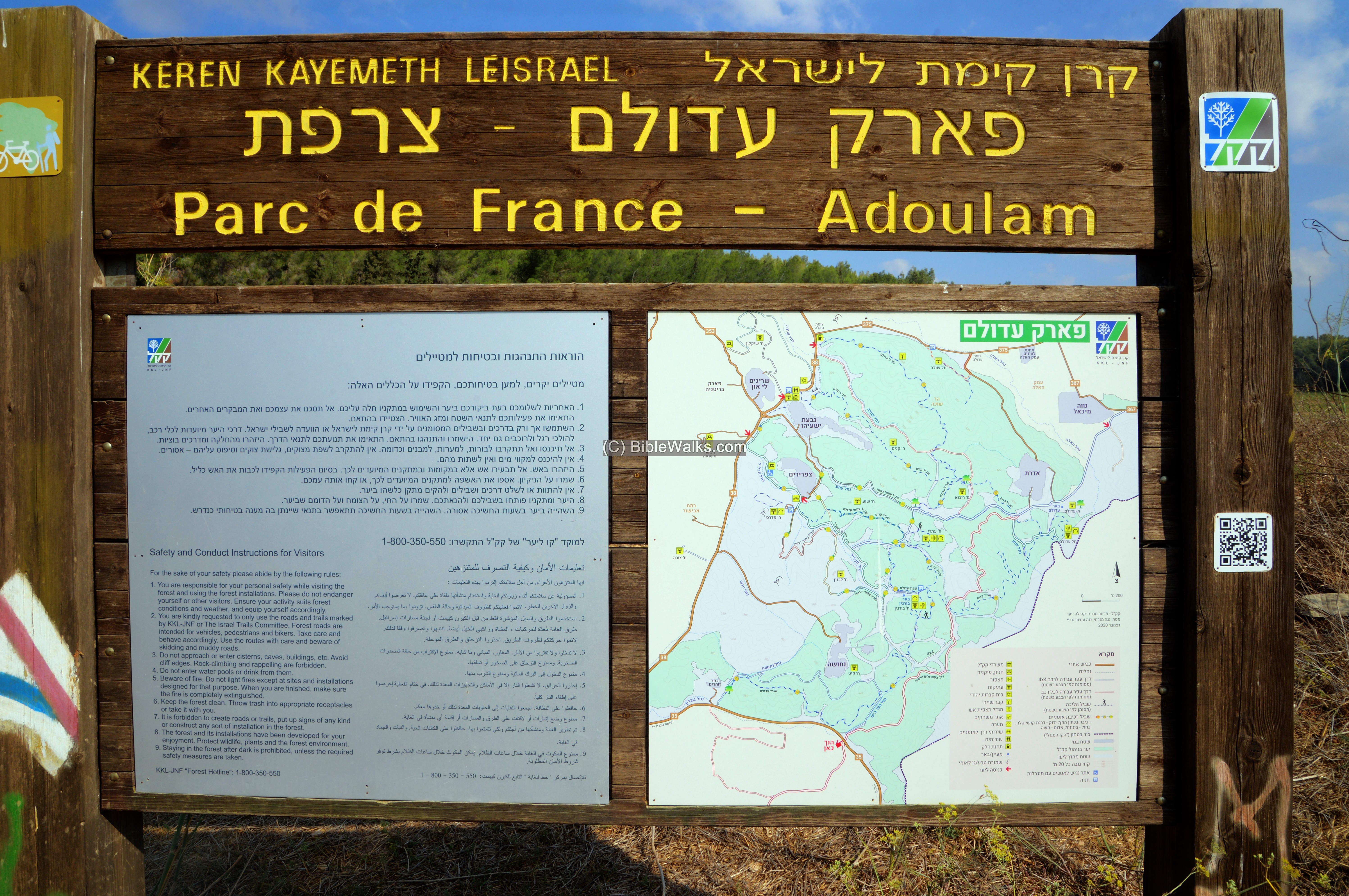
A park sign, with a map and use instructions
Adullam-France National park is open to the public. The landscape and ancient ruins cast a special Biblical-like atmosphere. A network of roads, some of them dirt roads, are laid across the park. During weekends many come to enjoy the forests, hike or bike thru the park, and explore the ruins. The main attractions are the ruins of Midras, Burgin and Etri.
The sites:
The sites inside the park area are listed below. Under each site is a link to the BibleWalks website or Youtube video.
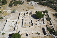
(a) Horvat Rebbo
Horvat Rebbo is an archaeological site, situated on a hill between the valleys of Nahal Shua and Nahal Shochah. The site is located 1km west of Moshav Aderet. Its Arabic name is Kh. Rubba (also Raba, Ribbo), possibly based on the Hebrew word Rabbath (meaning ‘large’).
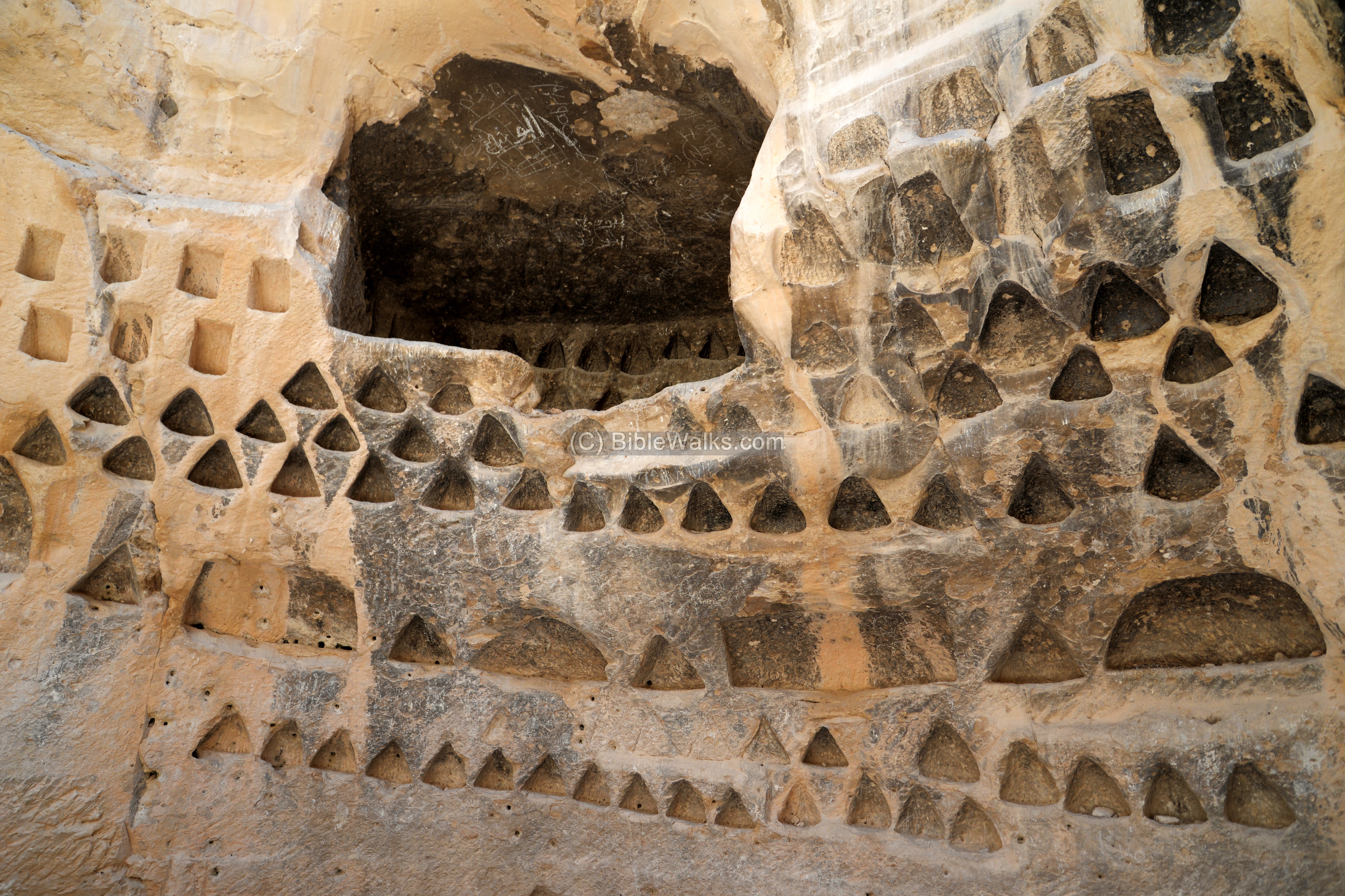
On the summit of the hill are ruins of residential complexes with hewn caves, cisterns, installations, and columbariums. The site was settled during the second Temple period. Hiding complexes of the Bar-Kochbah revolt and a ritual bath (Miqveh) indicate that it was a Jewish village. It continued to be settled in the Byzantine period.
An aerial view was taken above the site, with a view towards the west. The mountains of Judea are seen in the far background, and Moshav Aderet is on a hill on the left side.
Click on the photos to view in higher resolution…
![]() Explore the site: Horvat Rebbo
Explore the site: Horvat Rebbo
(2) Horvat Shua
Horvat Shu’a is an archaeological site, situated on a hill on the southern bank of Nahal Shu’a. This site is located 1km east of Moshav Tzafririm, within the Adullam-France National Park, in the area of the low hills (Shephelah) of Judea. Its Arabic name is Kh. Umm el Loz – “the ruin with the Almonds”.
On the summit of the hill are residential complexes with hewn caves, cisterns, installations, columbariums, and a well. The site, covering an area of 5 dunam, was settled from the Hellenistic period, Roman and Byzantine periods. Hiding complexes of the Bar-Kochbah revolt indicate that it was a Jewish village.
![]() Explore the site: Horvat Shua
Explore the site: Horvat Shua
(3) Horvat Lavnin
Horvat Lavnin (Khirbet Tell el-Beida) – “The ruin of the white mound”) is located in the Adullam -France National park, situated on a hill above the western bank of Nahal Hakhlil. This area, south of the valley of Elah, has fertile lands with broad valleys, and was in ancient times a highly populated farming area.
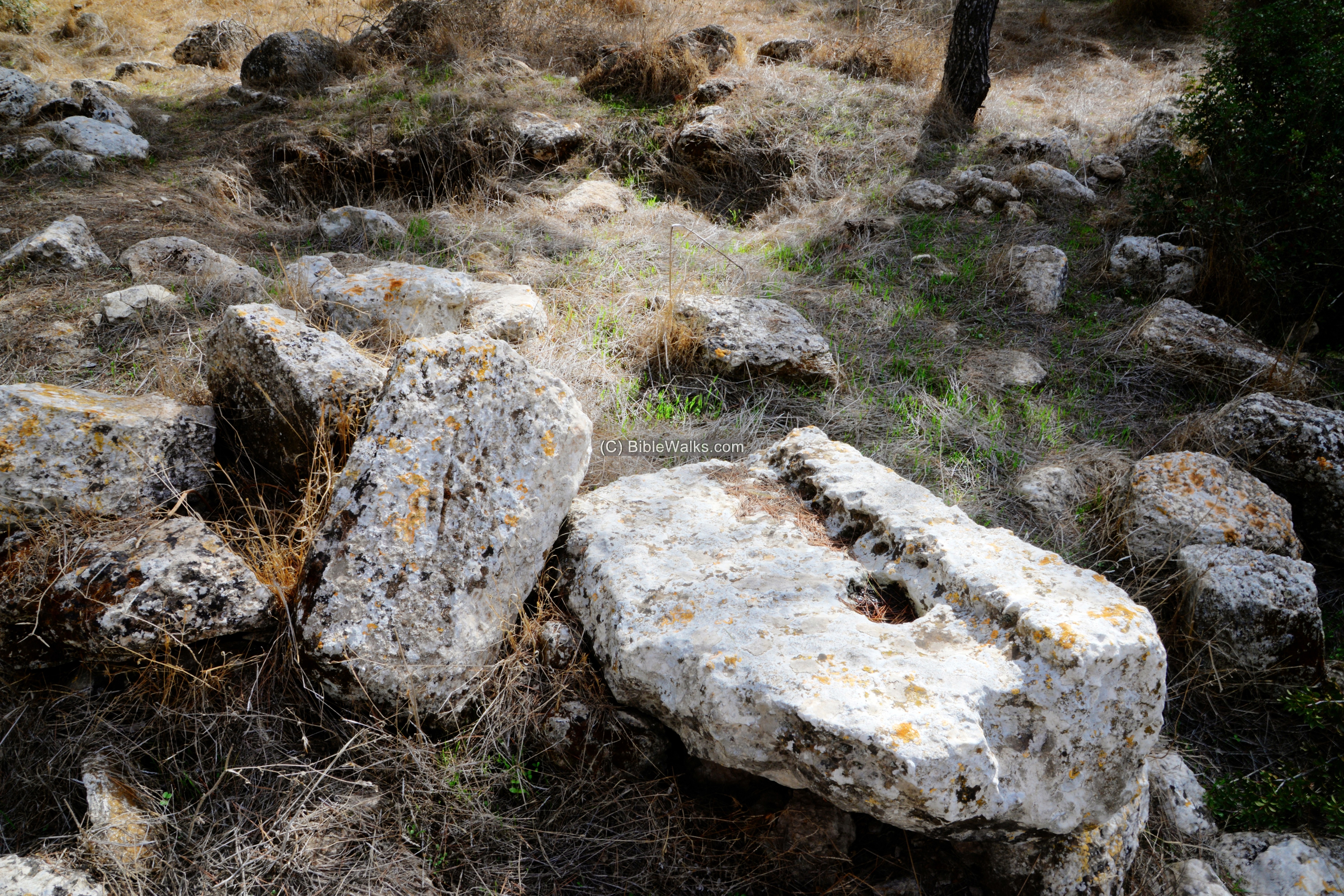
On the mound are traces of fortifications, building walls, installations, columbarium, burial caves, cisterns and a carved lintel.
![]() Explore the site: Horvat Lavnin
Explore the site: Horvat Lavnin
(4) Horvat Ethri
Horvat Ethtri (Kh. Umm Suweid) is an Early-Roman Jewish rural settlement. It is located in the Judean foothills region, 4km south of the valley of Elah, now a part of the Adullam park. The remains, spread over 20 dunams, include residential houses, cisterns, several ritual baths (Miqveh), ancient synagogue, wine presses and other farming installations.
The name of the site is based on an ostracon that was unearthed here bearing the name “‘Ethri”. It provides a probable identification to the village name: Caphetra, or: Kefar Ethra, which was described by Josephus Flavius as one of the Jewish villages destroyed by the 5th Legion in 69 AD. After then the Jewish settlement was rebuilt, but finally destroyed after the Bar Kokhba revolt.
![]() Explore the site: Horvat Ethri
Explore the site: Horvat Ethri
(5) Horvat Midras
Horvat Midras (Khirbat Durusiya) is a large archaeological site in the Judean Shephelah region, now part of the Adullam park. Founded in the early Hellenistic period, it grew to a large and rich Jewish rural settlement in the 1st century BC to the 2nd century AD when it was destroyed in the Bar Kokhba revolt. A small Christian community erected a church in the 5th-6th century.
![]() Explore the site: Horvat Midras
Explore the site: Horvat Midras
(6) Tel Adullam
Remains of a Biblical city, located south of the valley of Elah. This was the home village of the wives of Judah, the hiding place of future king David, and a city fortified by King Rehobam.
1 Samuel 22:1: “David therefore departed thence, and escaped to the cave Adullam“.
![]() Explore the site: Tel Adullam
Explore the site: Tel Adullam
(7) Kefar Bish
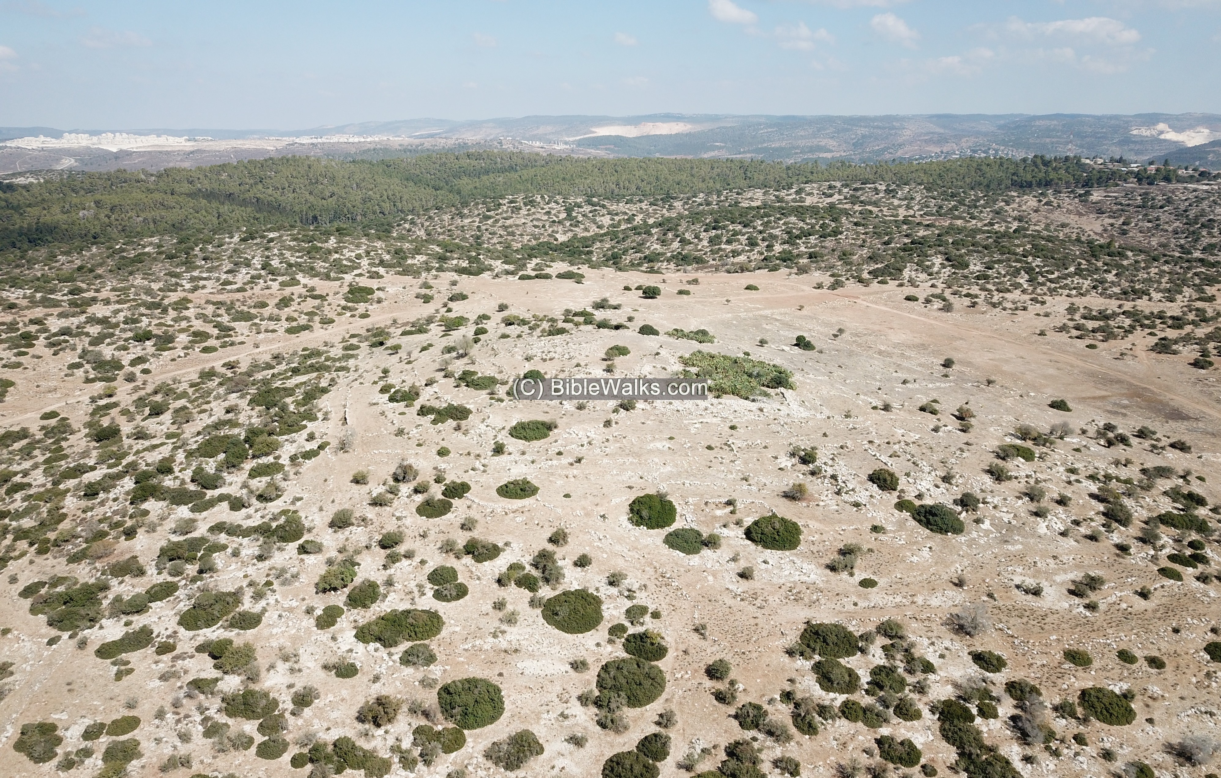
The ruin named Kefar Bish (kh. el Bis) is located on a hilltop, on the southern side of the Adullam-France nature reserve park, 2km south of Moshav Nehusha. It overlooked the ancient route to Hebron, now a modern highway (35), close to the Tarqumiyah crossing. The valley on its east side (Nahal Bish) was another trade route, connecting to the valley of Elah.
On the hill (alt. 360m) are foundations of structures, caves, cisterns, installations, columbariums and terraces. The ruin covers a maximum area of 15 dunam, with ceramics dated to the Roman, Byzantine and Early Arab periods. A possible hiding complex may have suggested the village was destroyed following the Bar-Kokhbah revolt.
This village was identified as Kefar Bish (also: Caphatabira), which surrendered to the fifth Legion in the Upper Idumea campaign, during the great Jewish Revolt against the Romans (summer of year 69). (Josephus War 4 9): “He [Cerealis] also attacked Caphatabira, and laid siege to it, for it had a very strong wall; and when he expected to spend a long time in that siege, those that were within opened their gates on the sudden, and came to beg pardon, and surrendered themselves up to him”.
Kefar Bish is also mentioned in the Jerusalem and the Babylonian Talmud.
The Arabic name of the ruin (el Bis) preserved the ancient name. The common identification of the site was Kefar Bish of the above references, based on the Arabic name and the surveys of the ruin. However, some scholars (such as Boaz Zissu) changed the identification of Kefar Bish to a larger ruin named Horvat Burgin, 3 km north east.
![]() View the aerial view of Kefar Bish.
View the aerial view of Kefar Bish.
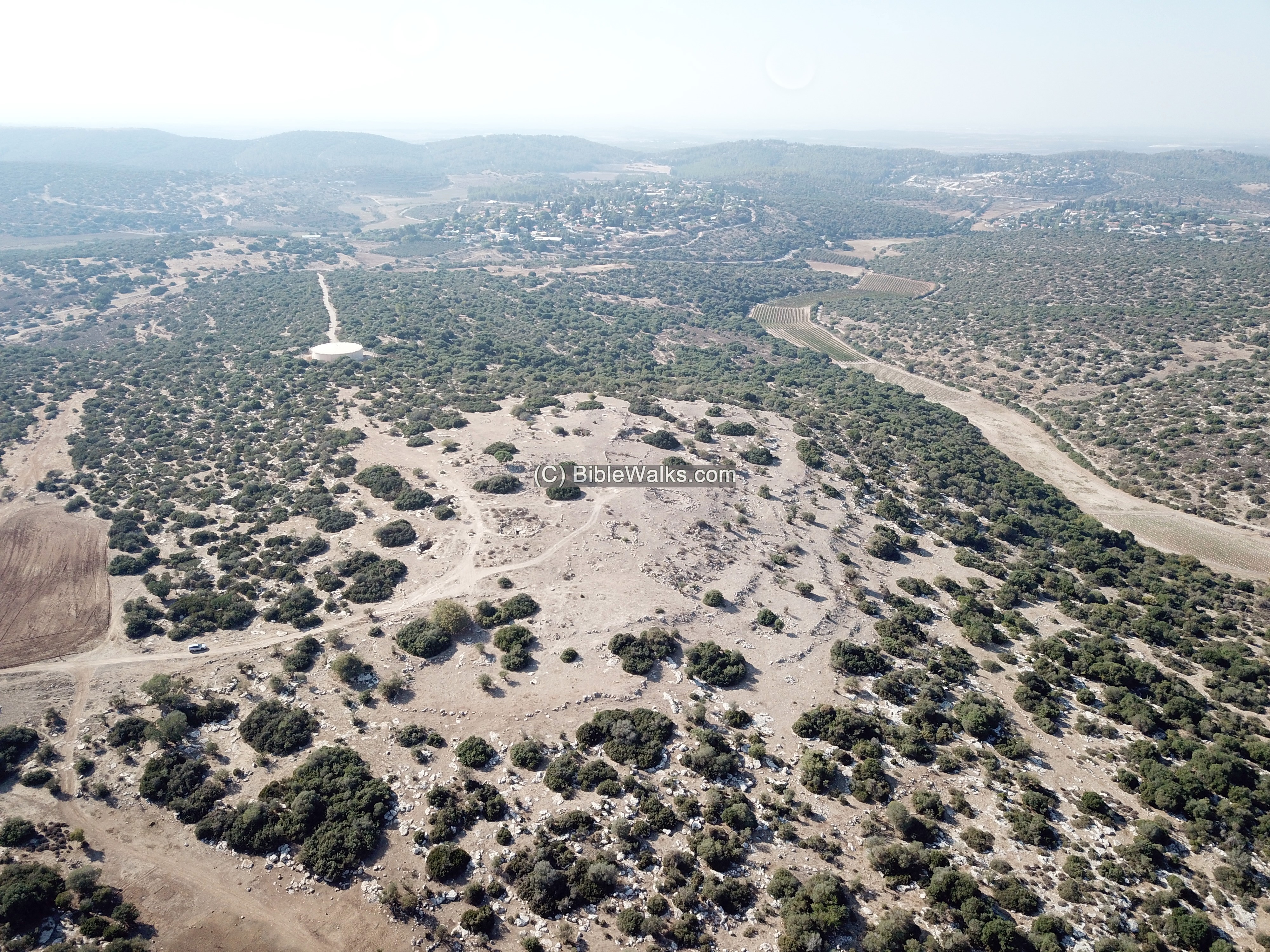
(8) Horvat Kanim
Horvat Kanim (also Qanim) is an archaeological site, situated on a hill rising above the south bank of Nahal Shochah. The site is located 500m east of the eastern neighborhood of Moshav Givat Yeshayahu, within the Adullam-France National Park, in the area of the low hills (Shephelah) of Judea.
On the summit of the hill (alt. 415m) are foundations of structures, hewn caves, cisterns, installations, and columbariums. The site was settled during the second Temple period. Hiding complexes of the Bar-Kochbah revolt indicate that it was a Jewish village, which was destroyed following the revolt.
Its Hebrew name means “ruin of the canes”, based on a phonetic rendition of the Arabic name. Its Arabic name is Kh. Kanya – meaning “ruin of the store”. The 19th century PEF survey wrote about the site (SWP Vol 3, p.355): “Caves, cisterns, foundations, ruined walls and heaps of stones.”
The caves and the well (in the valley below the hill) are named after Hirah of Adullam – a friend of Judah son of Jacob from the story of Tamar (Genesis 38: 12): “Judah was comforted, and went up unto his sheepshearers to Timnath, he and his friend Hirah the Adullamite”.
![]() View the aerial view of Horvat Kanim.
View the aerial view of Horvat Kanim.
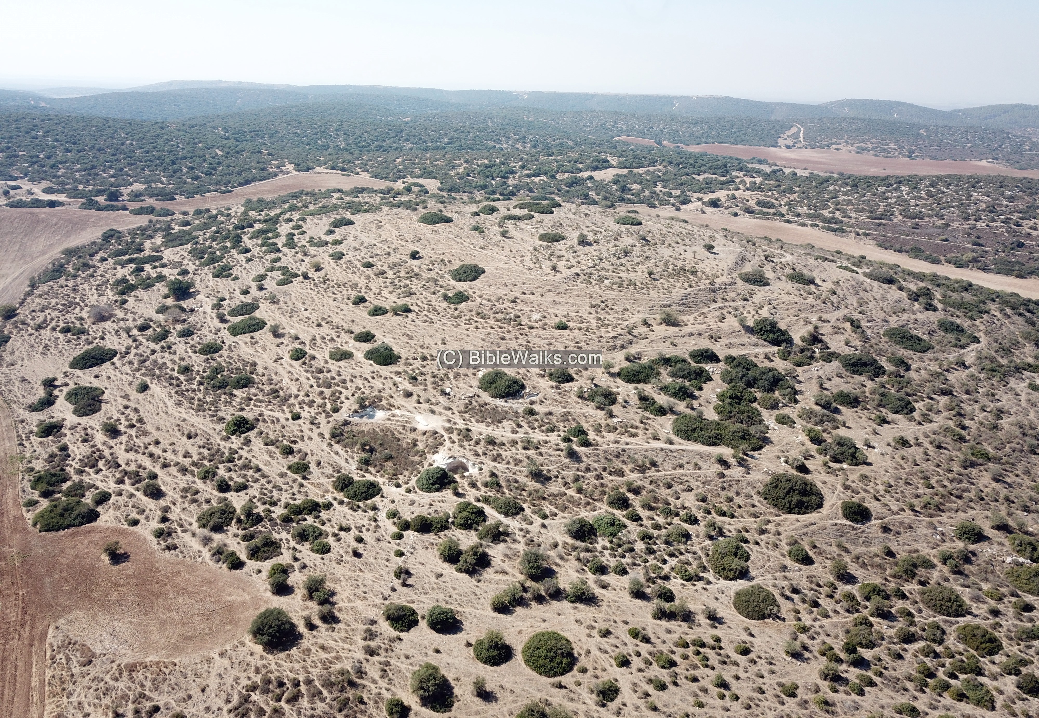
(9) Horvat Qerumit
Horvat Qerumit is an archaeological site, situated on a hill between Nahal Shelah and Nahal Shua. This site is located within the Adullam-France National Park, in the area of the low hills (Shephelah) of Judea. Its ruins cover an area of 20 dunams (2 hectares) which are concentrated on the summit (altitude 434m, ~30m above the valleys).
The Hebrew name means “crust”. It is based on the Arabic name – Khirbet Kerma or Kermeh (meaning: “ruin of the tree-stumps”).
On the summit of the hill are ruins of residential complexes with hewn caves, rock cut tombs and burial caves, cisterns, and agriculture installations. The site was settled during the second Temple period. Hiding complexes of the Bar-Kochbah revolt and ritual baths (Miqveh) indicate that it was a Jewish village. It continued to be settled in later periods.
A major ancient road, connecting the valley of Elah to the south, passed in the valley between the site and the adjacent village of Ethri.
Survey report:
https://www.hadashot-esi.org.il/Report_Detail_Eng.aspx?id=40&mag_id=108
![]() View the aerial view of Horvat Qerumit.
View the aerial view of Horvat Qerumit.
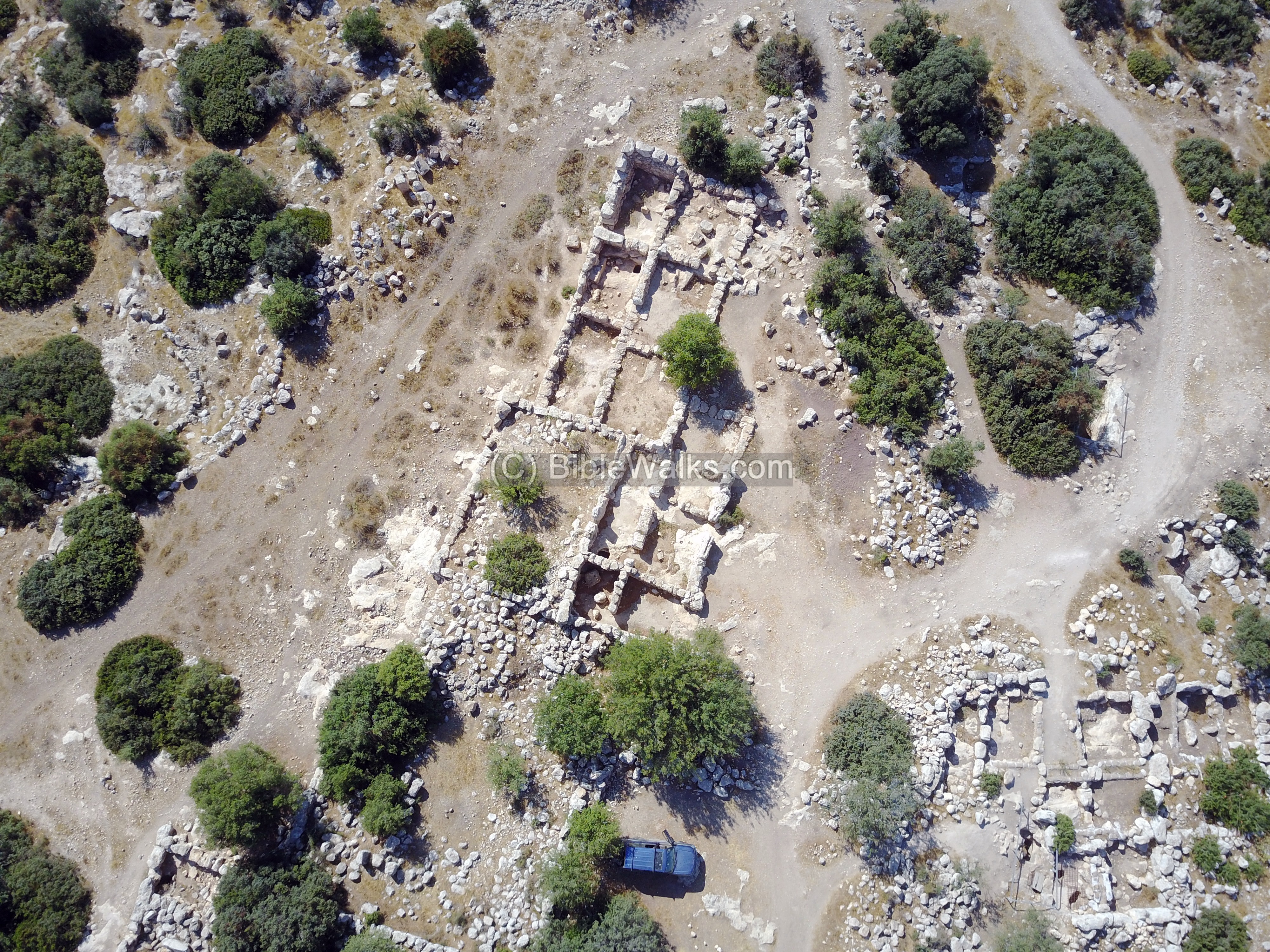
(10) Horvat Burgin
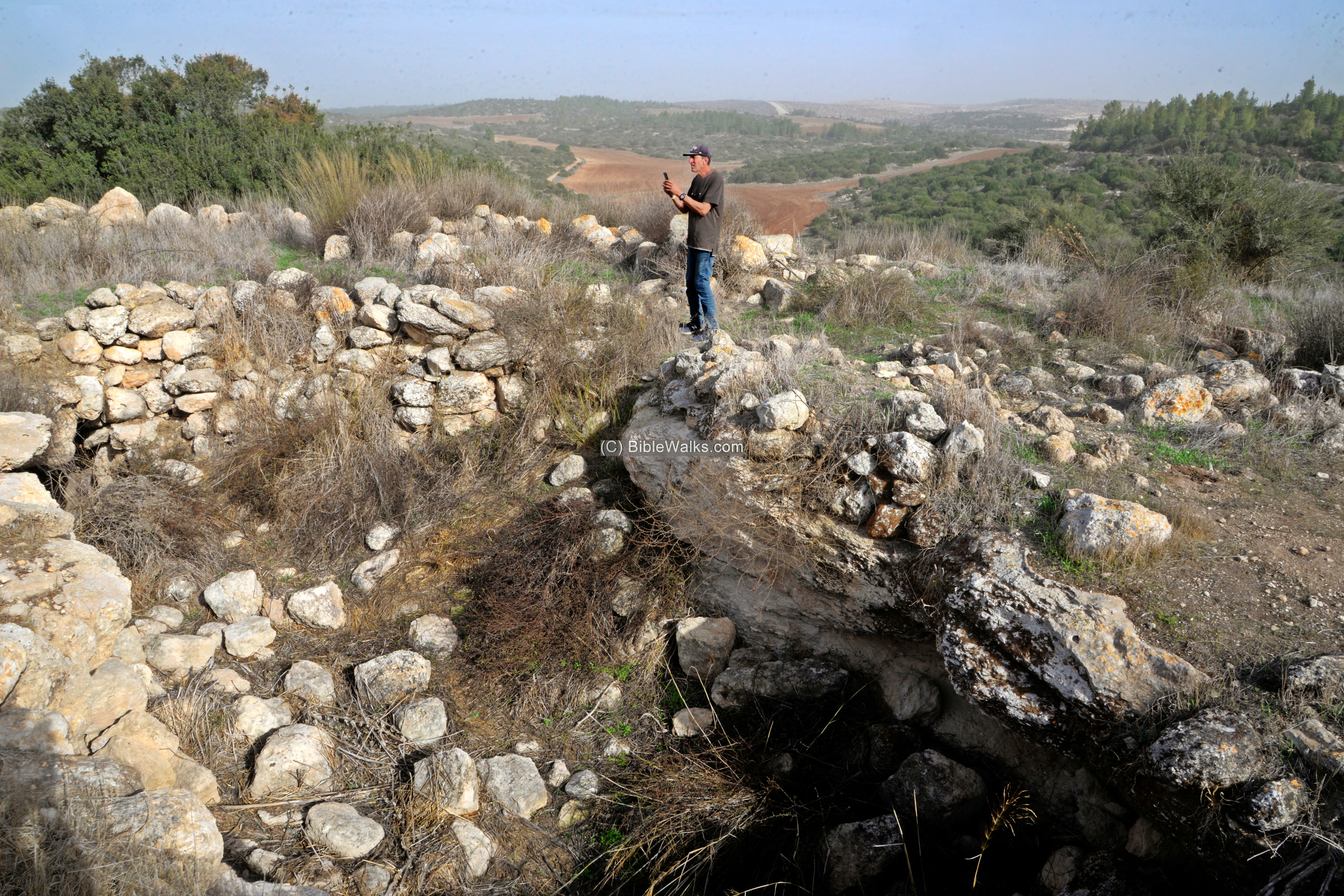
Ruins of Hurvat Burgin are located on a hill (alt. 430m) overlooking the area, in the south central region of Judea, Israel. Archaeological excavations revealed a large, second Temple period fortified village. It was also occupied during the Byzantine period and later by the Arab village of Umm Burj. The ruins include a central public house (synagogue or church), a vast necropolis with rock-hewn tomb complexes around the city, underground hiding complexes of the Bar Kokhbah revolt, cisterns, columbarium, wine-press, and more.
This large village was identified bu Boaz Zissu as Kefar Bish (also: Caphatabira), which surrendered to the fifth Legion in the Upper Idumea campaign, during the great Jewish Revolt against the Romans (summer of year 69). (Josephus War 4 9): “He [Cerealis] also attacked Caphatabira, and laid siege to it, for it had a very strong wall; and when he expected to spend a long time in that siege, those that were within opened their gates on the sudden, and came to beg pardon, and surrendered themselves up to him”. Other scholars identify it in a ruin named el-Bis, south of Burgin.
The site, part of the Adullam Grove Nature reserve, became a popular hiking place with an easy access road and a circular discovery walking trail.
![]() View the aerial view of Horvat Burgin.
View the aerial view of Horvat Burgin.
(11) Horvat Gibor
Horvat Gibor (Khirbet Jabir) is located on a hill (alt. 406m) covered by trees and bush, on the south side of the park. The ruins include scattered remains of buildings, cisterns, underground hiding complexes, burial caves and installations.
(12) Horvat Yonim
Horvat Yonim (Khirbet el Hammam) is an archaeological site located on a hill (alt. 431m) on the south side of Park Adullam. Its ruins include cisterns, underground hiding complexes, burial caves and installations.
![]()
There are a dozen or so more smaller sites inside the park. More of these sites will be added.
Etymology:
Names of the site:
- Adullam – unknown meaning and source; mentioned several times in the Bible. For example (1 Samuel 22:1): “David therefore departed thence, and escaped to the cave Adullam…”.
- Adullam-France park (French: Parc de France-Adoulam) – the name of the park, named after Biblical Adullam
-
Adullam Grove Nature Reserve – a section of the park is a nature reserve
Links:
* Archaeology:
- Rock-Cut Hiding Complexes from the Roman Period in Israel Boaz Zissu and Amos Kloner (2009)
- Cassius Dio, Roman History
* Nature:
- eYarok – information on the park, with suggested hikes (Hebrew)
* Internal – sites nearby:
* Other:
- Drone Aerial views – collection of Biblical sites from the air
- BibleWalks Youtube channel – join!
BibleWalks.com – exploring the Biblical landscape
Tel Yarmut<<<—previous site–<<< All Sites >>>—>>> —Next Judea site—>>>Horvat Ethri
This page was last updated on Jan 14, 2022 (Add 2 sites)