Beit Shean was a major Biblical city, located on the ancient trade route. This web page focuses on the history and scenes of the ancient Tel (mound).
Home > Sites > Yizreel Valley > Beit She’an > Tel Beit She’an
Contents:
Background
Location
History
Photos
* General view
* West side
* Egyptian
* Canaanite
* Israelite
* Roman
* East side
* South-east
* South
* Nature photos
Biblical
Links
Etymology
Background:
Tel Beit She’an (Beth Shean) was a major Biblical city, located in the center of crossroads between the Jordan valley and the Jezreel (Yizreel) valley. The ancient city thrived from the third millennium BC until the Hellenistic period in the 3rd century BC.
1 Samuel 31 6-13: “So Saul died, and his three sons,…and they fastened his body to the wall of Bethshan”.
Location:
The Tel is located along the southern bank of the Harod creek which flows from the foothills of the Gilboa mountain.
It is 106M under sea level, since the area is located in the Jordan valley depression. The steep hill is 80M above the Nahal (creek) Harod which flows on its north side.
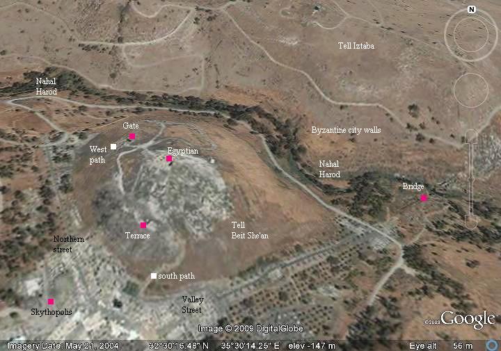
An aerial map of the ruins of Tel Beit She’an is shown below, with the north side on the top of the photo, indicating the major points of interest.
History:
-
Prehistory
Excavations dated the earlier findings in the area to the Calcolithic period (about 45 century BC). The early man dwelt in the caves around the site, and cultivated the fertile area with an abundance of water.
According to the excavations, the city was established in the Early Bronze age (early 3rd Millennium). It extended to the hill east of the Tel, and became a large walled town. It is located on a prime location – in the center of major ancient crossroads (North-South connected Asia Minor to Egypt, and West-East connected the sea to Jordan and Arabia). The city is referenced in several Egyptian sources, starting in the 19th century Egyptian (12th Dynasty) enemy-curse clay tablets as “Aphkm”.
After it was destroyed by fire, it declined into a small Middle Bronze age town (19th-15th century BC) .
-
Canaanite/Egyptian city
The city is listed as one of the cities that were conquered by Egyptian Pharaoh Thutmose III , just after the famous battle near Megiddo (1468 BC), which resulted in the Egyptian conquest of Canaan for 350 years. The excavations in the city unearthed findings from the period of Thutmose III.
During the late Bronze period and the beginning of the Iron age (15th century to 12th century ) the city became as a center of the Egyptian imperial administration in northern Canaan, as did Megiddo.
A basalt tablet from Seti I (~1294-1279 BC) was found in the city with the name of Beit-Shean. The name of the Holy Land in this tablet is “Retenu”, which was the Egyptian name of the land of Israel before the Israelite conquest.
The city is also mentioned in the Amarna letters, a 14th century BC Egyptian archive of clay tablets.
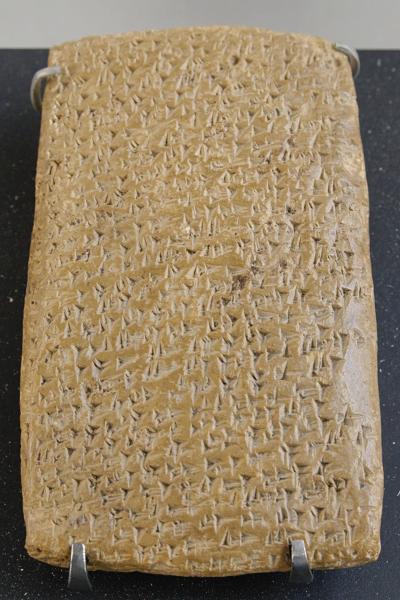
One of the Tell Amarna letters (Louvre Museum, Public domain CC 2.5)
Cuneiform writing on a clay tablet.
-
Biblical times – Beit She’an – Judges until King Saul
The mighty Canaanite city was not conquered by the Israelites (Judges 1: 27: “Neither did Manasseh drive out the inhabitants of Bethshean and her towns”).
King Saul also failed to conquer the city, and during his times (11 century BC) it was controlled by the Canaanites and the Philistines. After his defeat by the Philistines on Mt Gilboa, the body of Saul and the bodies of his sons were displayed on the city’s walls. (1 Samuel 31 6,10: “So Saul died, and his three sons, and his armourbearer, and all his men, that same day together….and they fastened his body to the wall of Bethshan”.
Later, the citizens of Jabesh Gilead removed the bones and gave the king an honorable burial (1 Samuel 31 11-13): “And when the inhabitants of Jabeshgilead heard of that which the Philistines had done to Saul; All the valiant men arose, and went all night, and took the body of Saul and the bodies of his sons from the wall of Bethshan, and came to Jabesh, and burnt them there. And they took their bones, and buried them under a tree at Jabesh, and fasted seven days”.
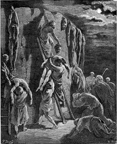
Saul and sons bodies removed from the walls of Bethshean –
Drawing by Gustav Dore (French artist, 1832-1883)
-
Biblical times – David & Solomon
The Canaanite/Philistine city was burnt in the 10th century by King David. His son, King Solomon, rebuilt it and made it an important administration city (1 Kings 4 7-12: “And Solomon had twelve officers over all Israel… Baana the son of Ahilud; to him pertained Taanach and Megiddo, and all Bethshean, which is by Zartanah beneath Jezreel“.
After Solomon’s death, Egypt’s Shishak invaded Israel in 924 BC (1 Kings 14: 25: “in the fifth year of King Rehoboam, Shishak king of Egypt attacked Jerusalem”).
According to the Pharaoh’s hieroglyphic inscriptions, Beit Shean is listed as one of the cities that he captured and Beit Shean’s governor is illustrated as led to captivity in Egypt.
Karnak: Commemoration of Shishak’s victory over Rehoboam
Photo of the Library of congress (American Colony, taken 1900-1920)
The major cities during the Canaanite and Israelite periods are indicated on the Biblical Map below.
Map of the area around Tel Beit She’an – during the Canaanite and Israelite periods (based on Bible Mapper 3.0)
The Assyrians captured the Galilee (732 BC), and destroyed Beit She’an to its foundations.
-
Hellenistic, Roman and Byzantine periods
The population of the Tel moved during the Hellenistic period to the newly founded Polis (city) on its south side. This was an urbanization pattern that occurred in the whole ancient world, and most of the Tels “died” (see more).
The new city was named Nisan-Scythopolis. Check the overview page for the history of these periods.
Photos:
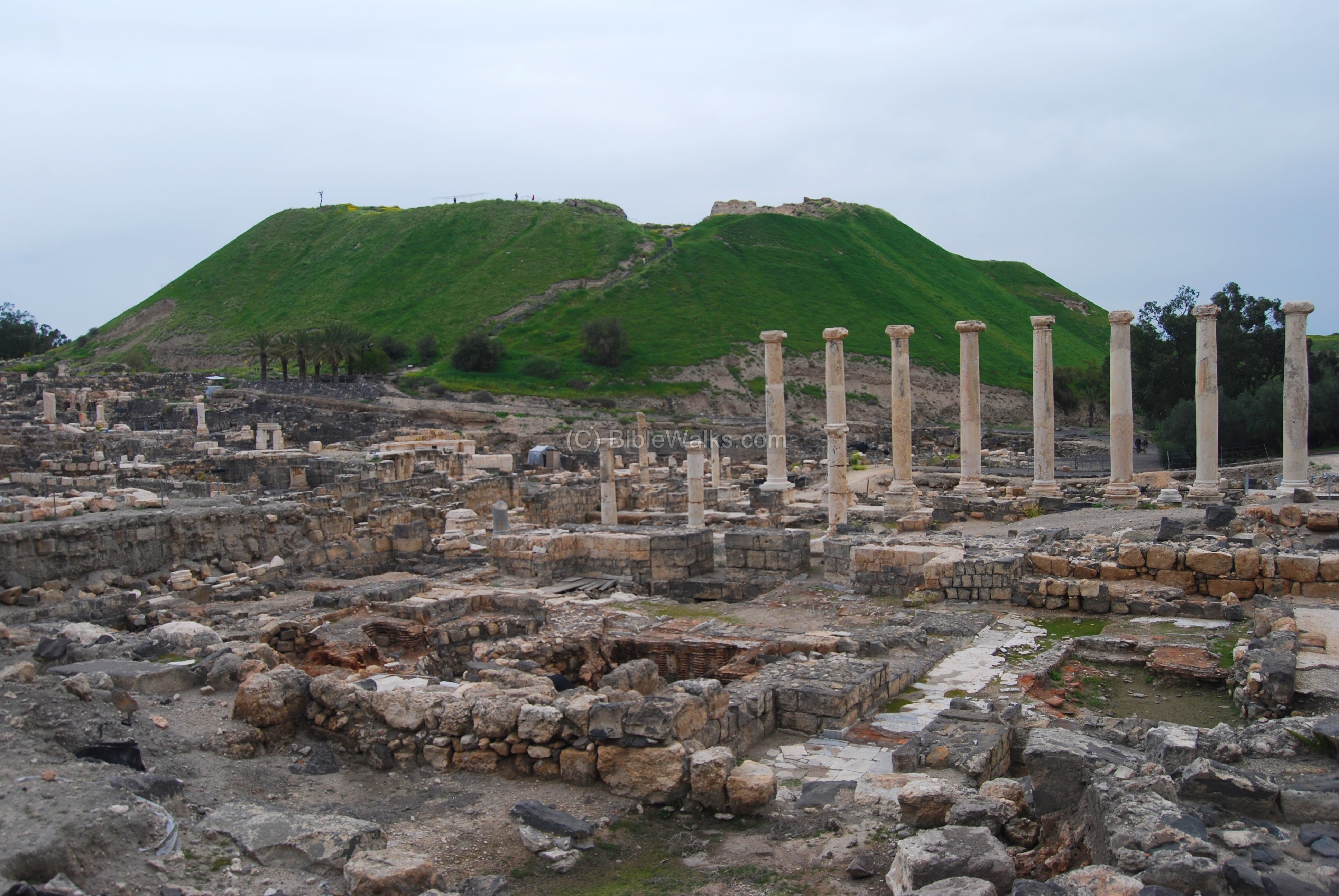
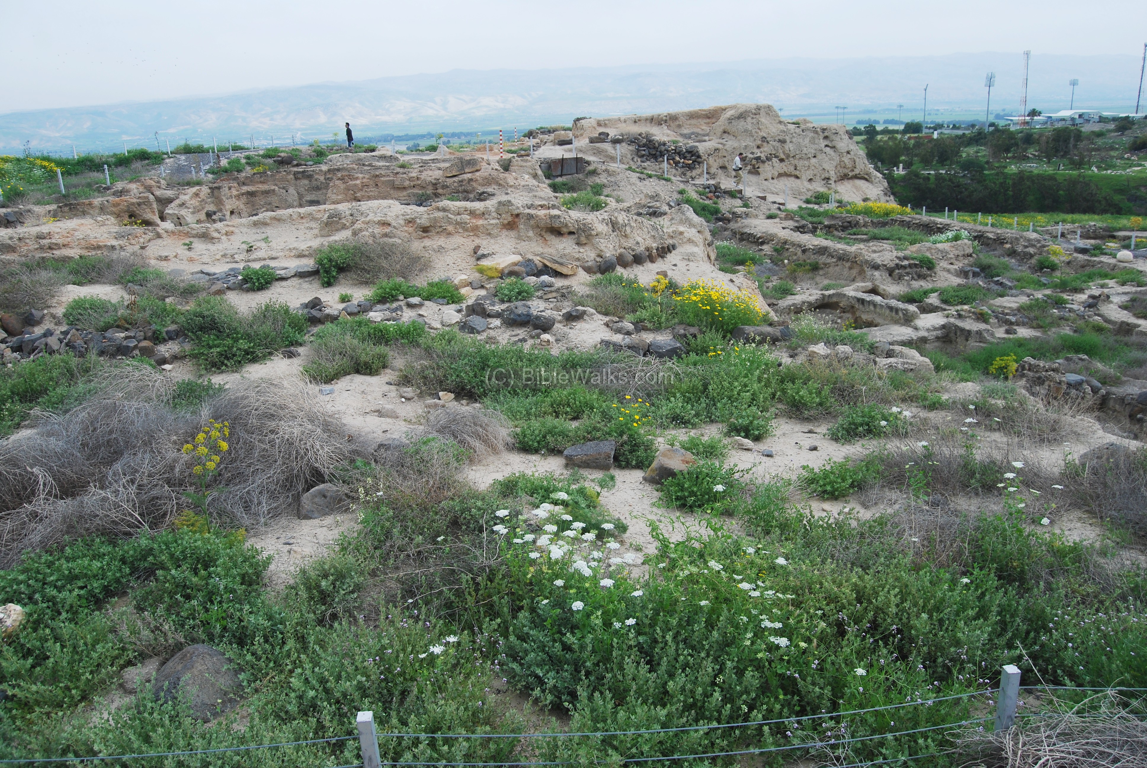
(a) General View
This photo of Tel Beit She’an was captured from the north by an airplane in 1937, following the large scale excavations of 1921-1933 headed by the University of Pennsylvania,
Photo of the Library of congress (American Colony, taken 1937)
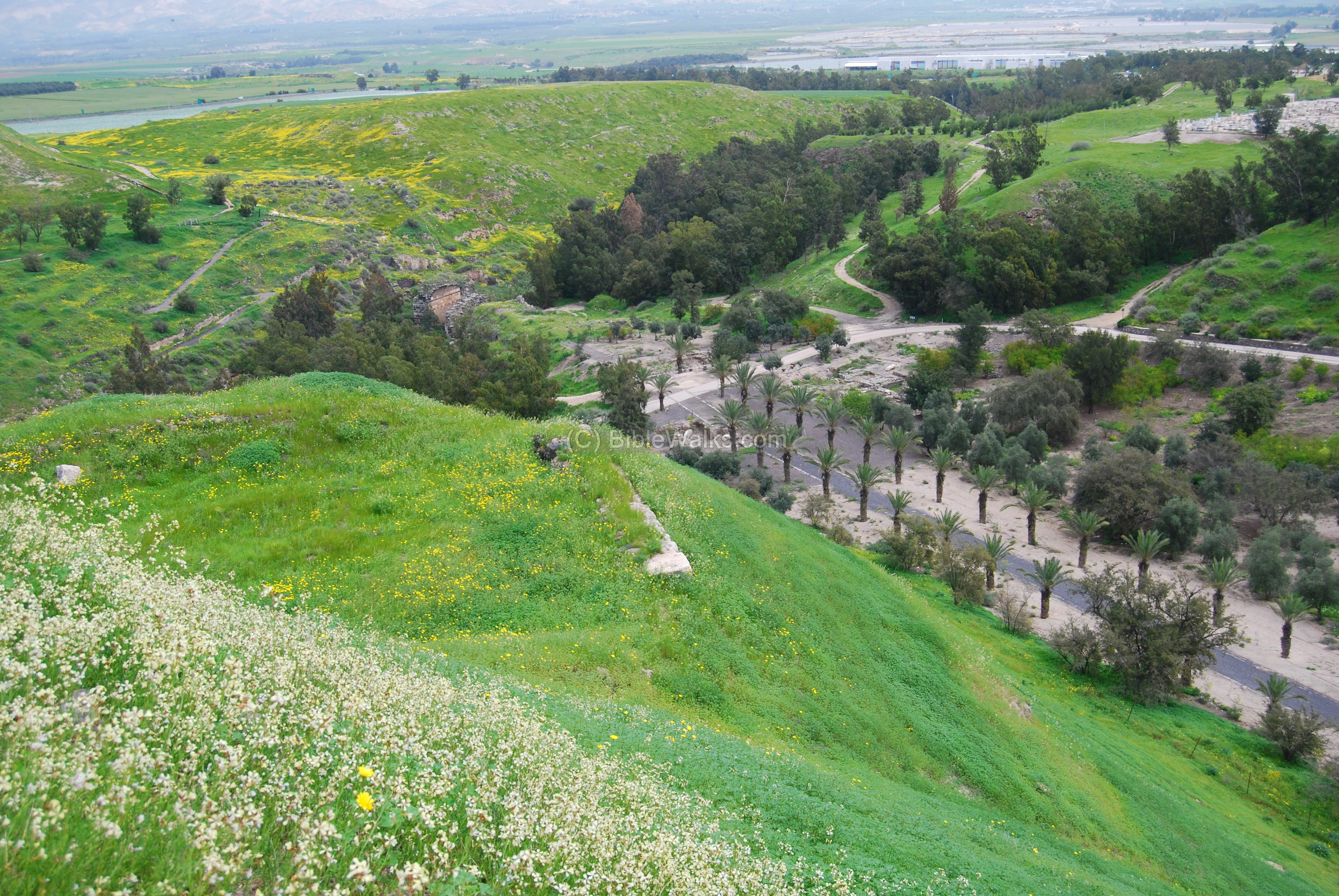
A modern view of the mound is seen here from the north, taken from Tel Iztabba. The deep valley of Nahal Harod river is seen here at the foothills of the mound.
Tel Beit She’an started on a natural hill during the Chalcolithic period, but was later fortified and raised layer above layer, accumulating height and storing the treasures and remains of the past.
Click on the photos to view in higher resolution…
Another view of the Tel is seen in the photo below, as seen from the south. The ancient Biblical Tel is seen in the background of the lower Roman city.

(b) West side
There are two access paths to reach the summit – from the west and the south.
The photo below shows the path on the west side. It ascends the steep hill and reaches the ruins of a gate.
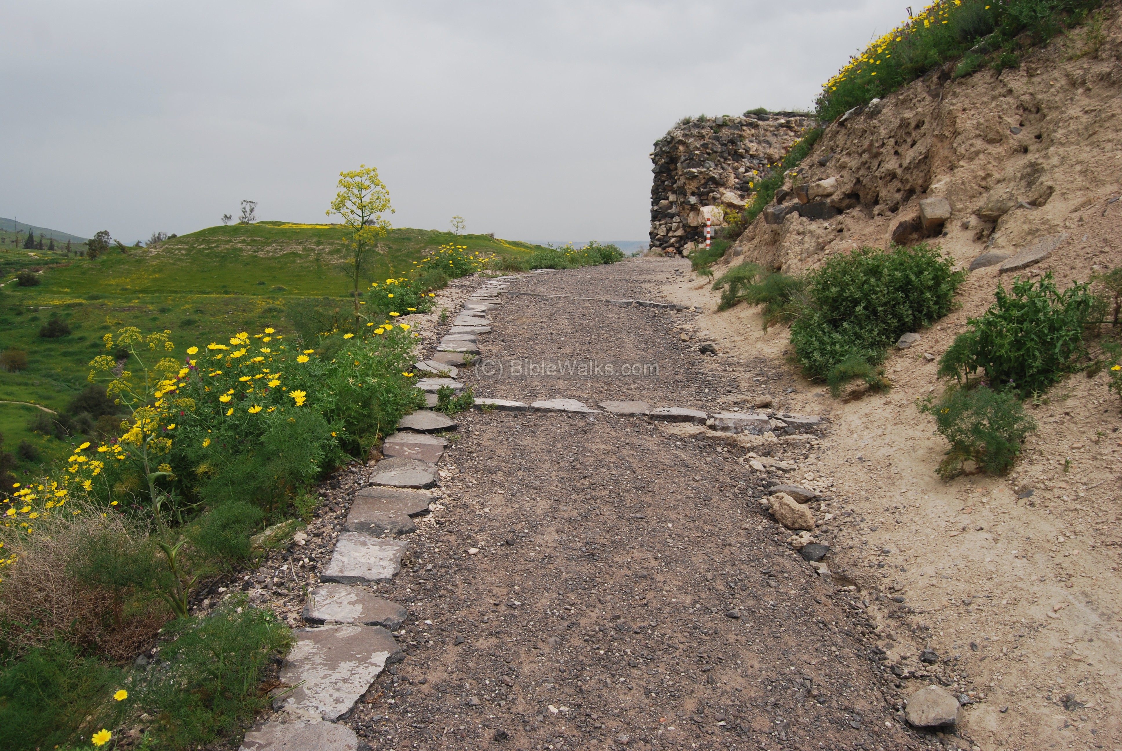
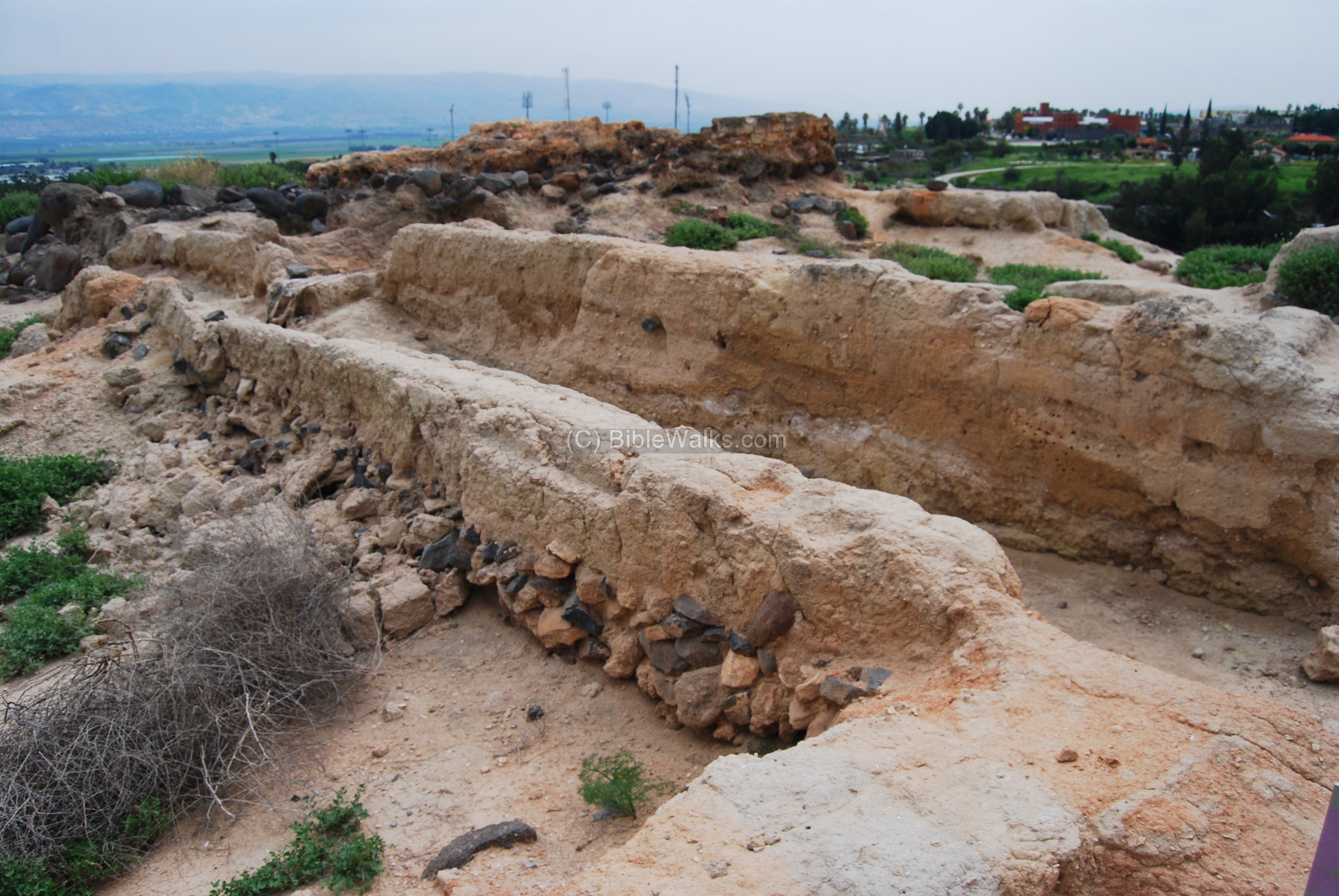
The gate is dated to the middle ages, when the Tel was a fortified farm or estate. This is the latest level of the city, and under it are the remains of about 20 levels of cities spanning the time from the first settlement (5th Millennium BC).
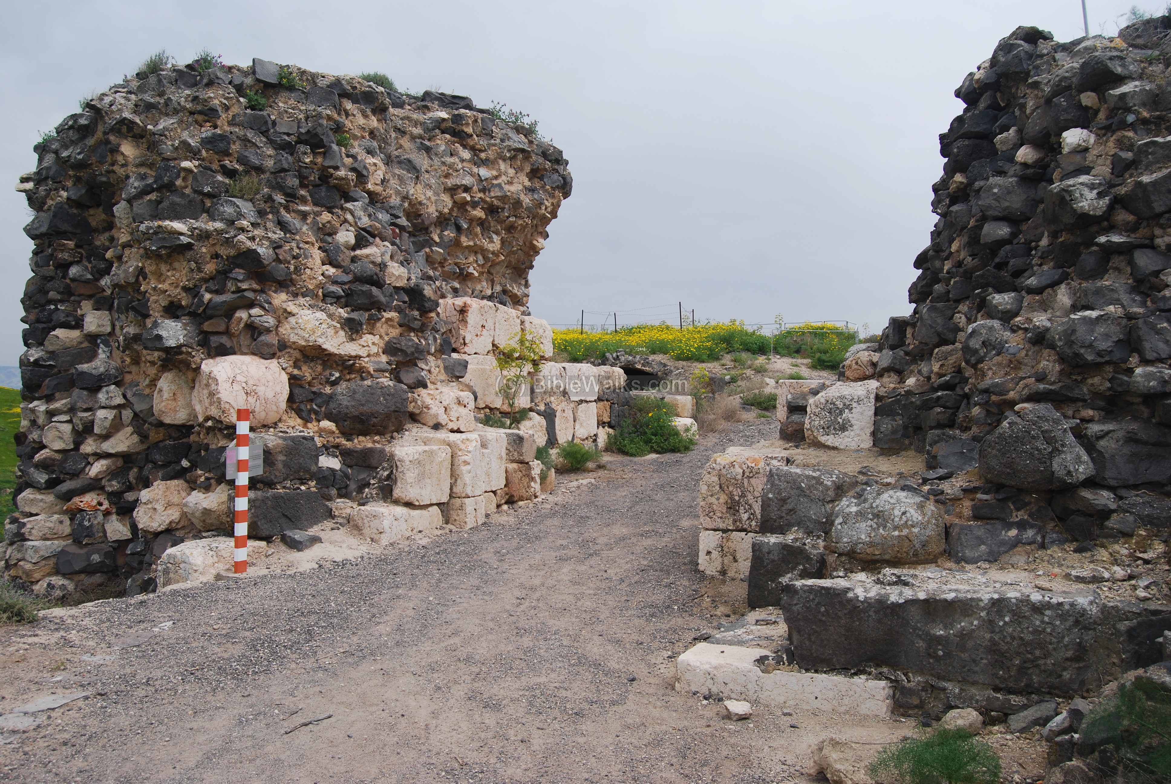
The photo below shows traces of ruins behind the gate. In the background is Tel Iztabba.
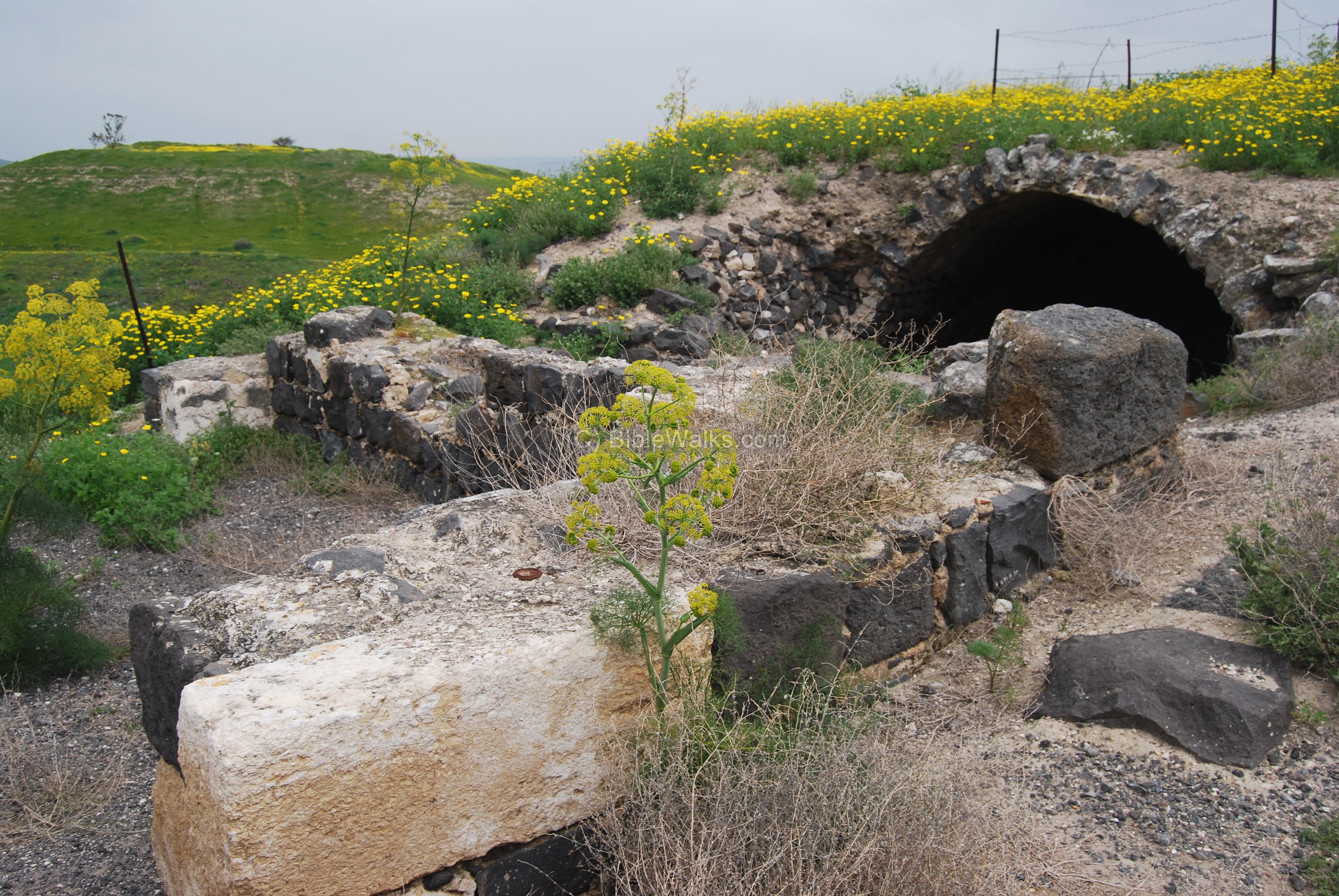
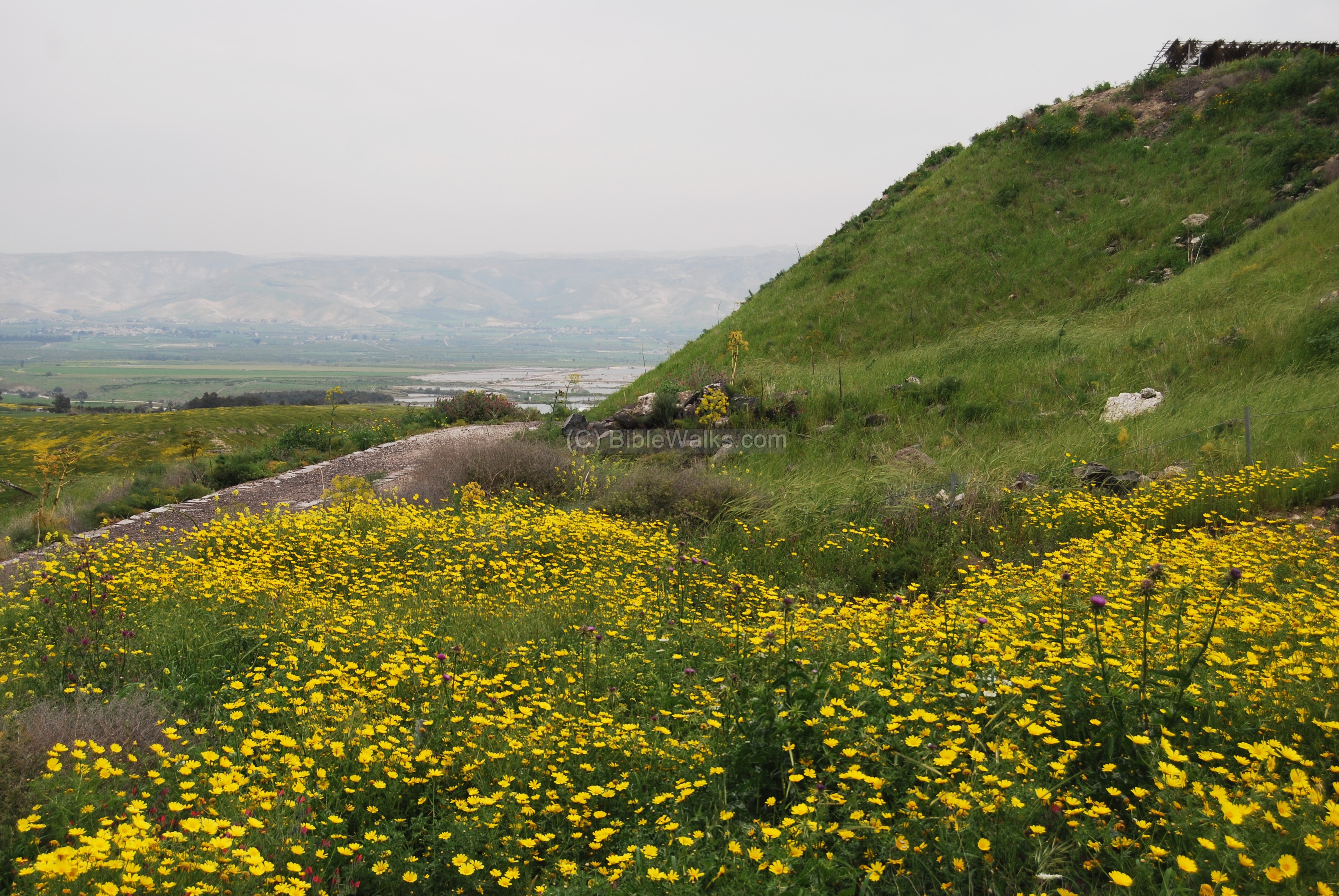
The path takes the visitor along the northern edge of the Tel, then turns around and up to the top of the hill. You can see how steep the hill is. In the background, towards east, are the hills of Jordan.
(c) Egyptian period
During the late Bronze period and the beginning of the Iron age (15th century to 12th century ) the city became as a center of the Egyptian imperial administration in northern Canaan.
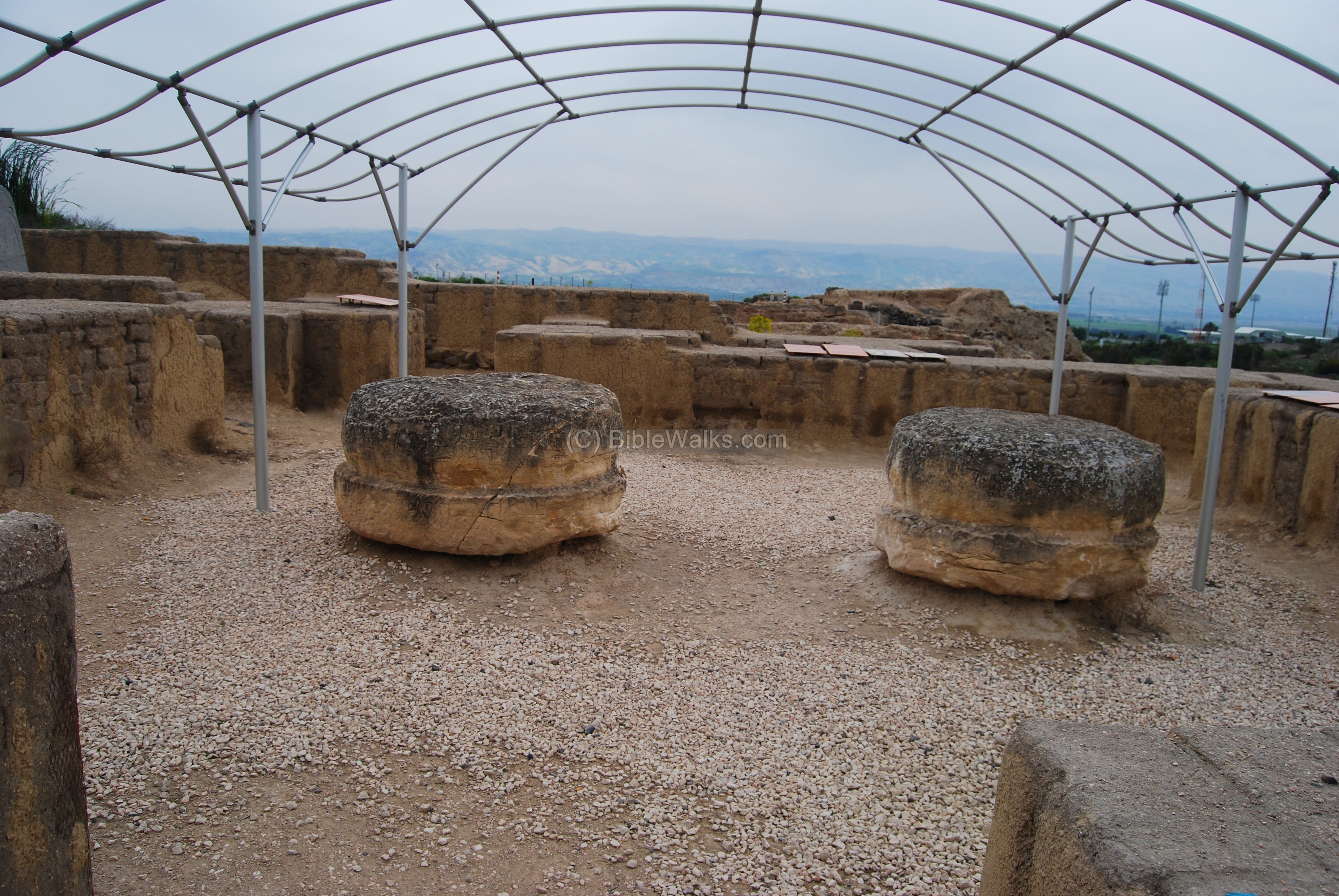
On the top of the hill are the ruins of an 12 century BC Egyptian structure – known as the governor’s house. It served as the headquarters of the Egyptian rule in this region.
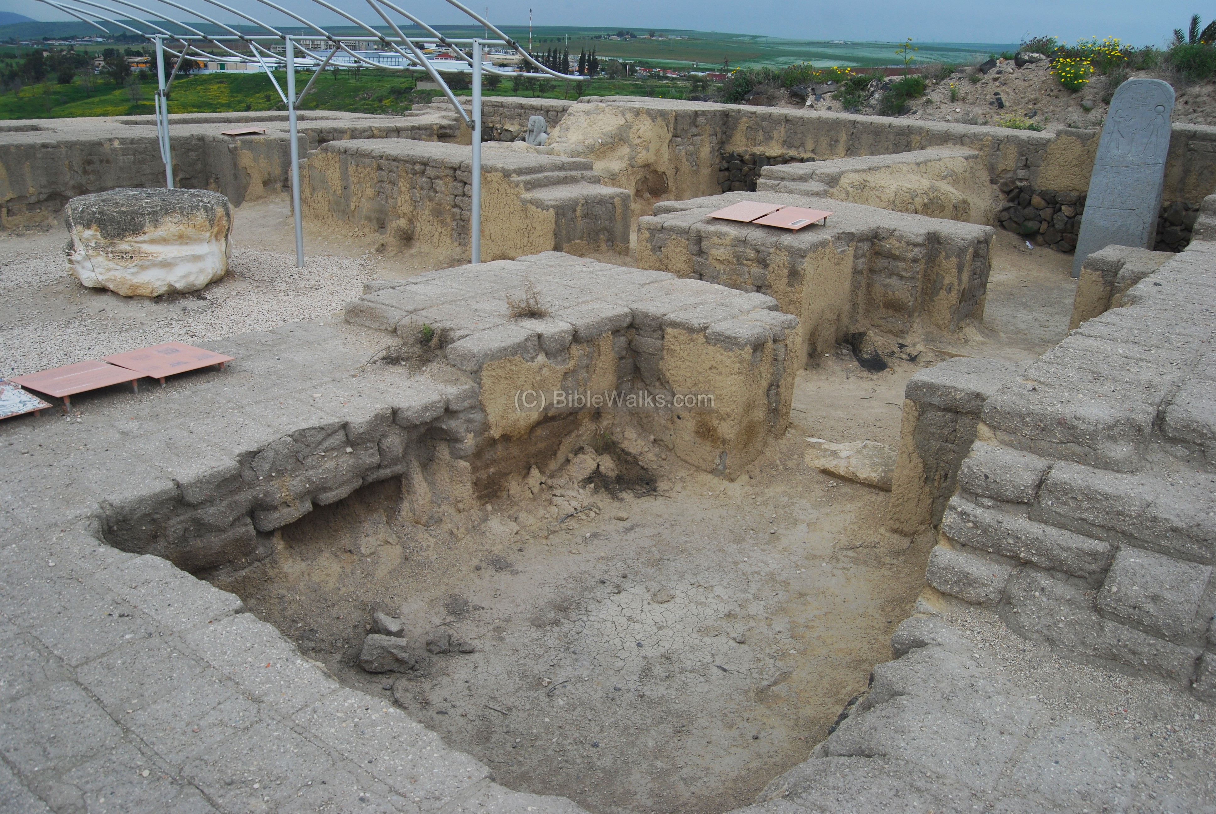
This is the center of the structure. The roof of the governor’s house stood over two columns, whose bases are seen below.
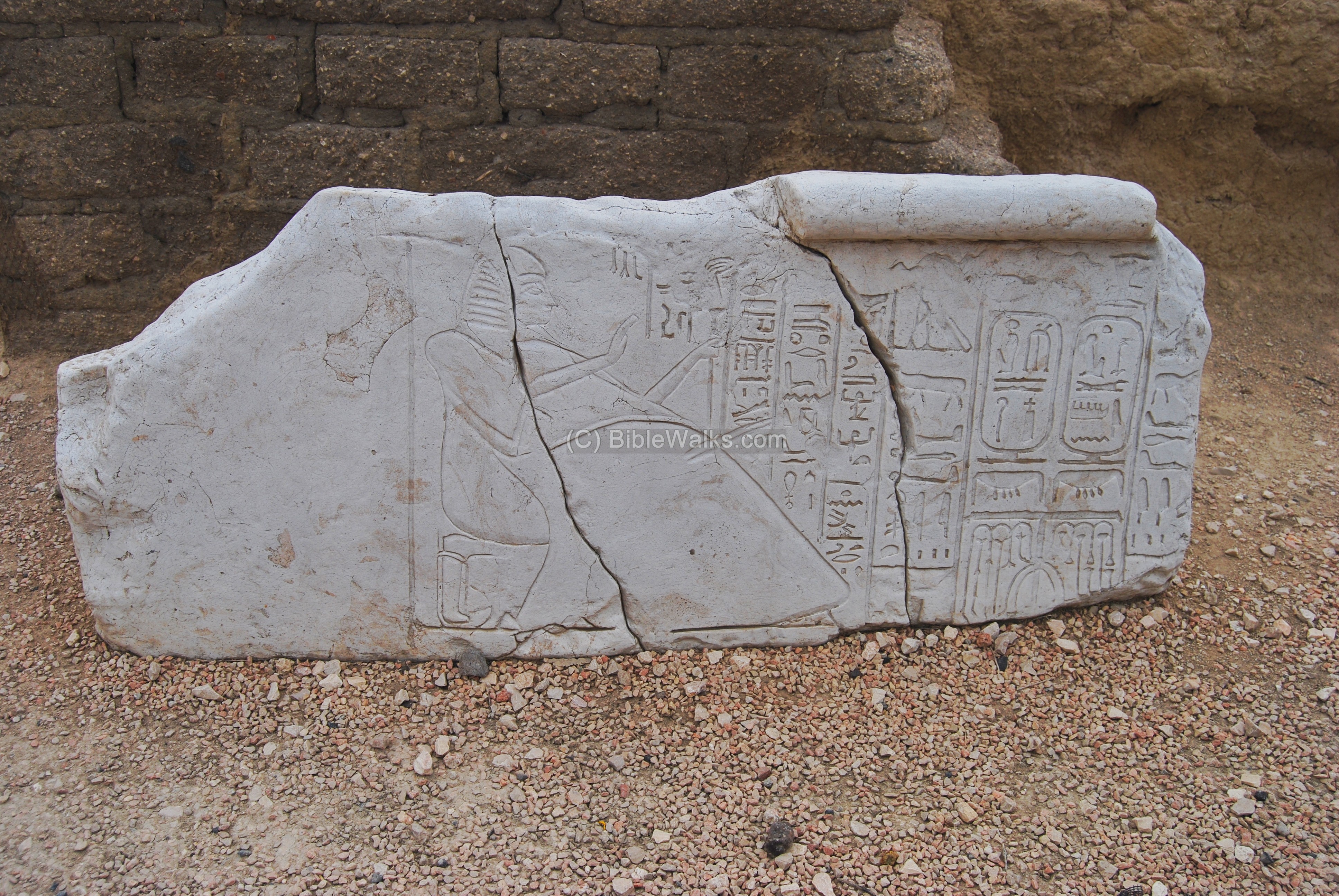
Above the doorpost (lintel) of the house was a stone tablet bearing the name and title of the governor: Ramses-Weser-Khepesh. The inscription attests to his high rank: “The King’s scribe. Appointed chief of the house”. The image depicts the governor kneeling before the name and attributes of Pharaoh Ramses III (1st half of 12th century BC). Note that this King has left several marks in Israel, including the rock engraving in Solomon’s Pillars.
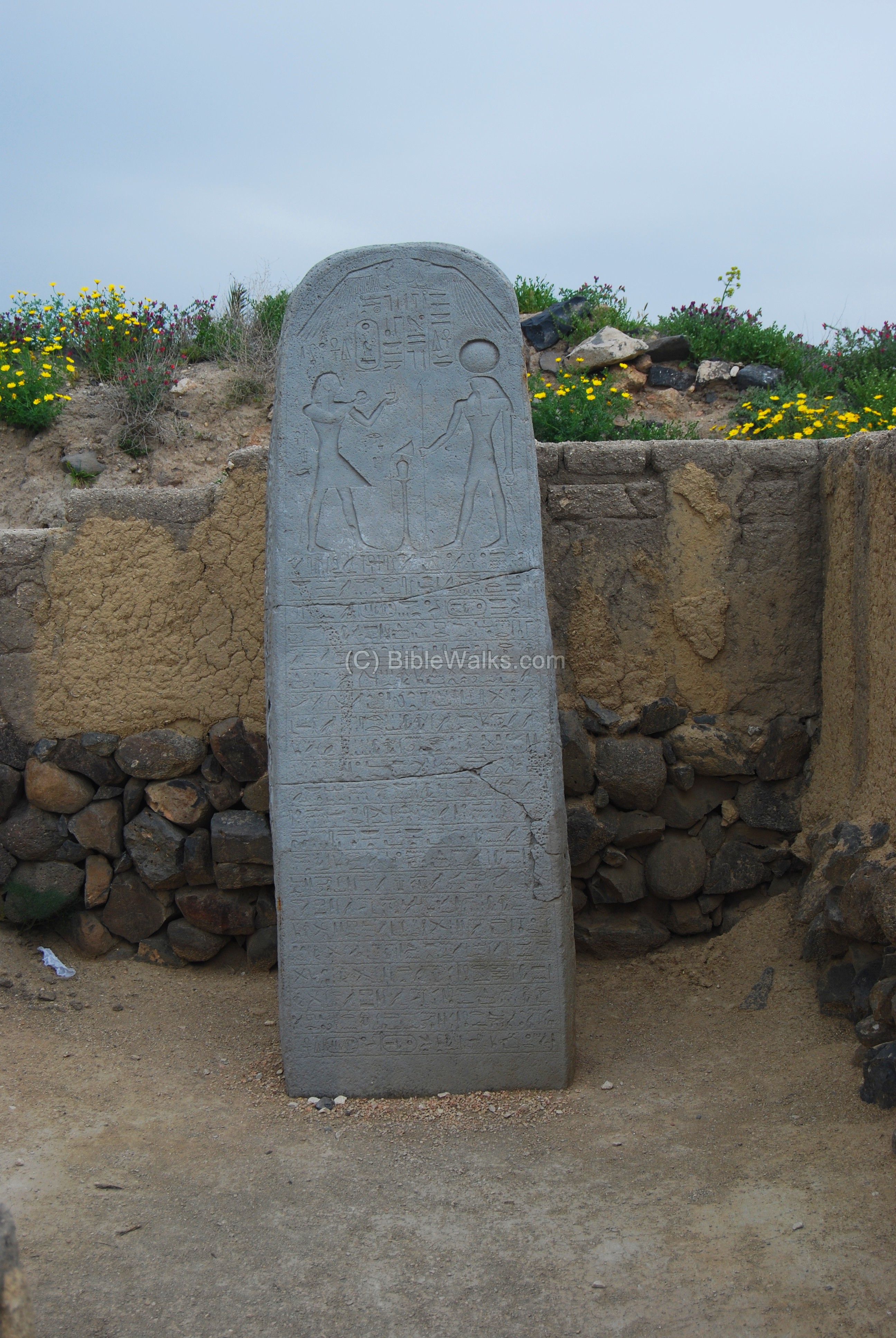
An Egyptian basalt stele was found in 1928 on Tel Beit She’an, bearing the name of the city. It commemorates one of the Egyptian military victories: during the reign of Pharaoh Seti I (~1294-1279 BC) a coalition of several rebelling cities attempted to seize the headquarters in Beit She’an, and were crushed by the Egyptians. The name of the Holy Land in this tablet is “Retenu”, which was the Egyptian name of the land of Israel before the Israelite conquest.
(d) Canaanite
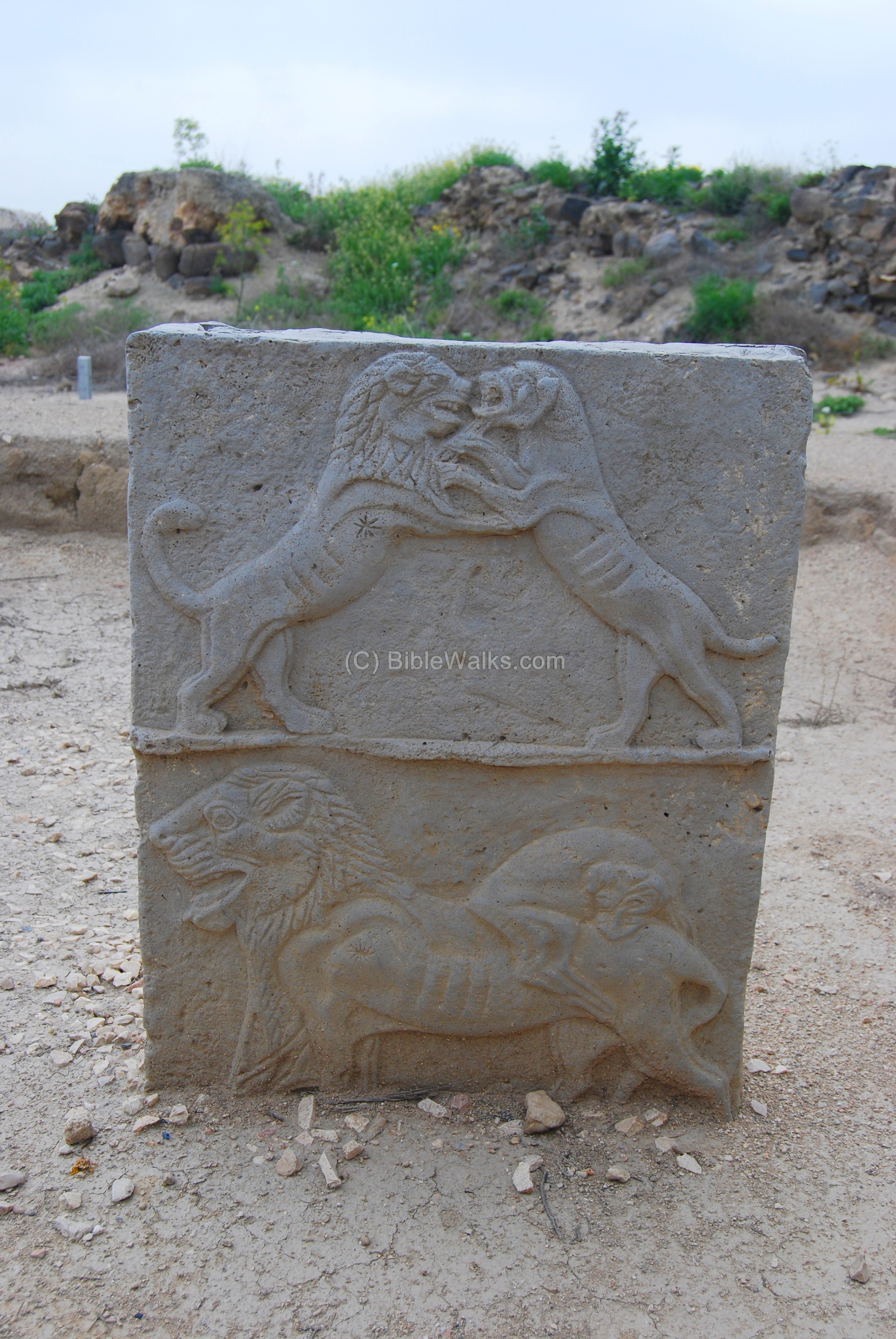
The archaeologists reconstructed five Canaanite temples, one constructed on top of the other. The Canaanite temples were decorated with basalt reliefs, such as the example seen below dated to the 14th century BC. The relief is 92 cm high, and is a copy of the original excavated in this site.
This is one of the most important examples of Canaanite art found in the Holy Land. It depicts a fight between a dog (the keeper of the city) and a lion (symbols death and the deadly plague). The dog manages to bite the lion, thus keeping the city safe from the plague.
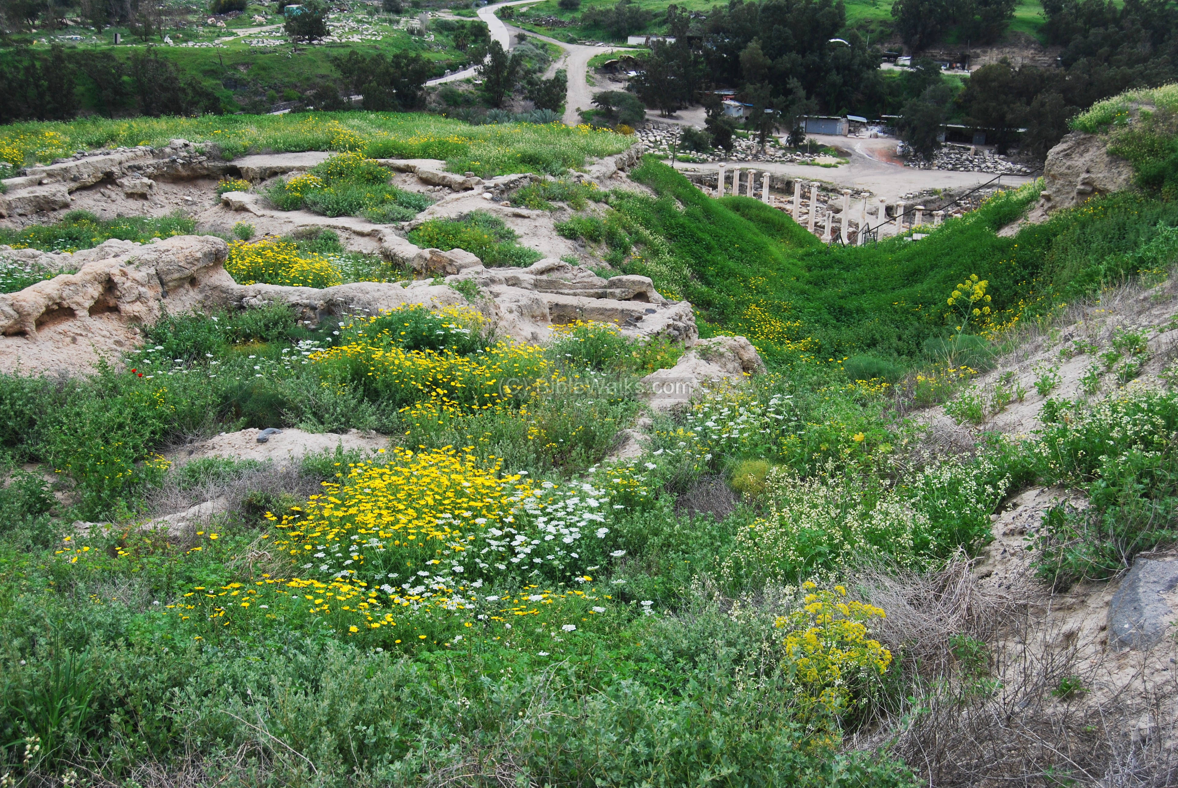
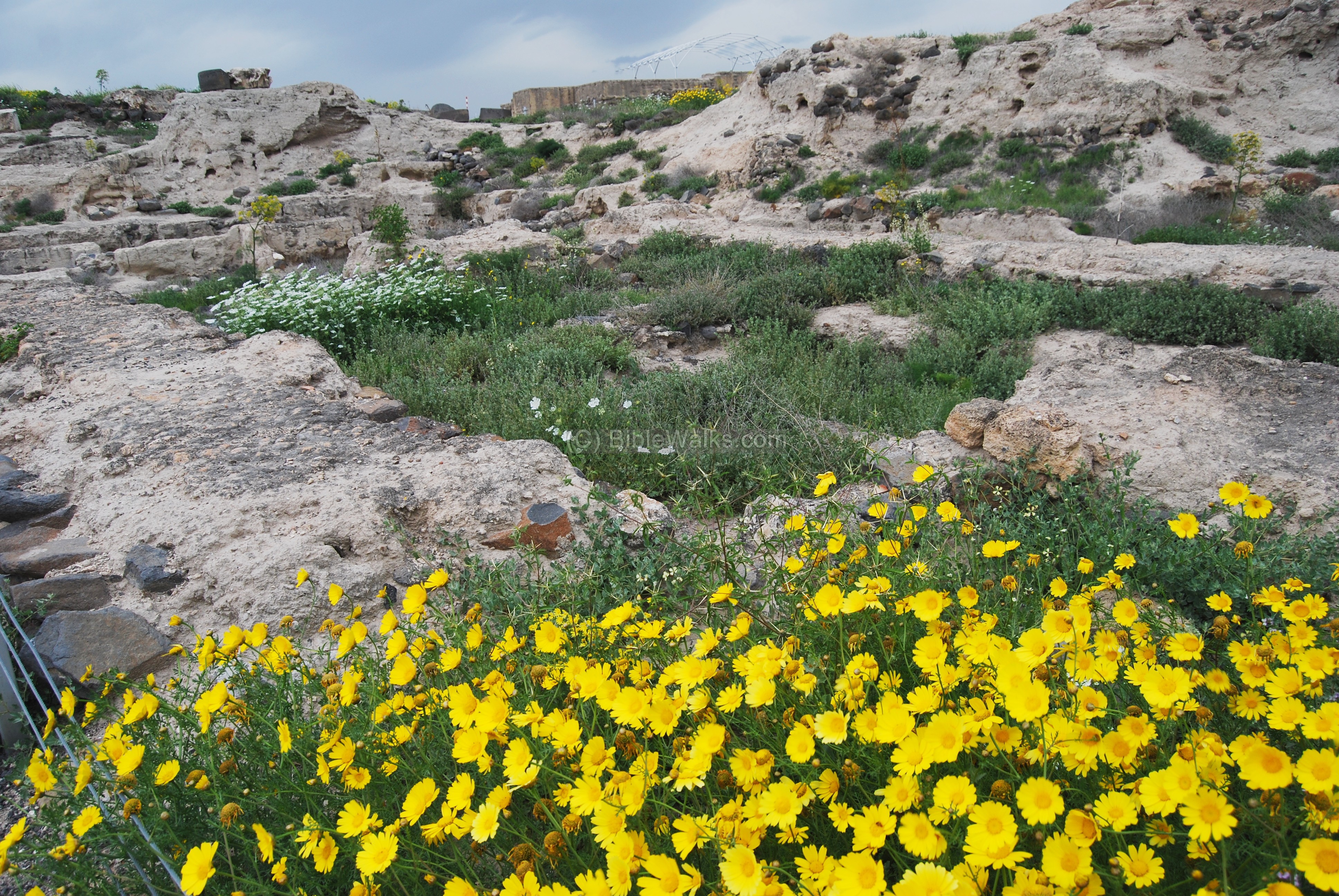
Standing on the south-east site you can see a window of the past: layers upon layers of cities, from the earliest dwellings in the 5th Millennium, through the Early bronze age (early 3rd Millennium) to the latest Roman period layers. The archaeologists cut a deep hole inside the hill, carving through the 20 layers of civilization, until they reached the bedrock.
The ruins of a public house, seen in the foreground, are dated to the early 3rd Millennium.
The city remained under Canaanite control, and was settled by Philistines, as documented by the Bible and proven by the Archaeological excavations. Their rule ended during the times of King David or Solomon, at about 1000BC.
(e) Israelite period
Ruins of an Israelite fortress are located near the Egyptian house. The citadel included residential and administrative buildings, and was erected by the kings of Israel. It was destroyed during the Assyrian conquest (8th century BC).
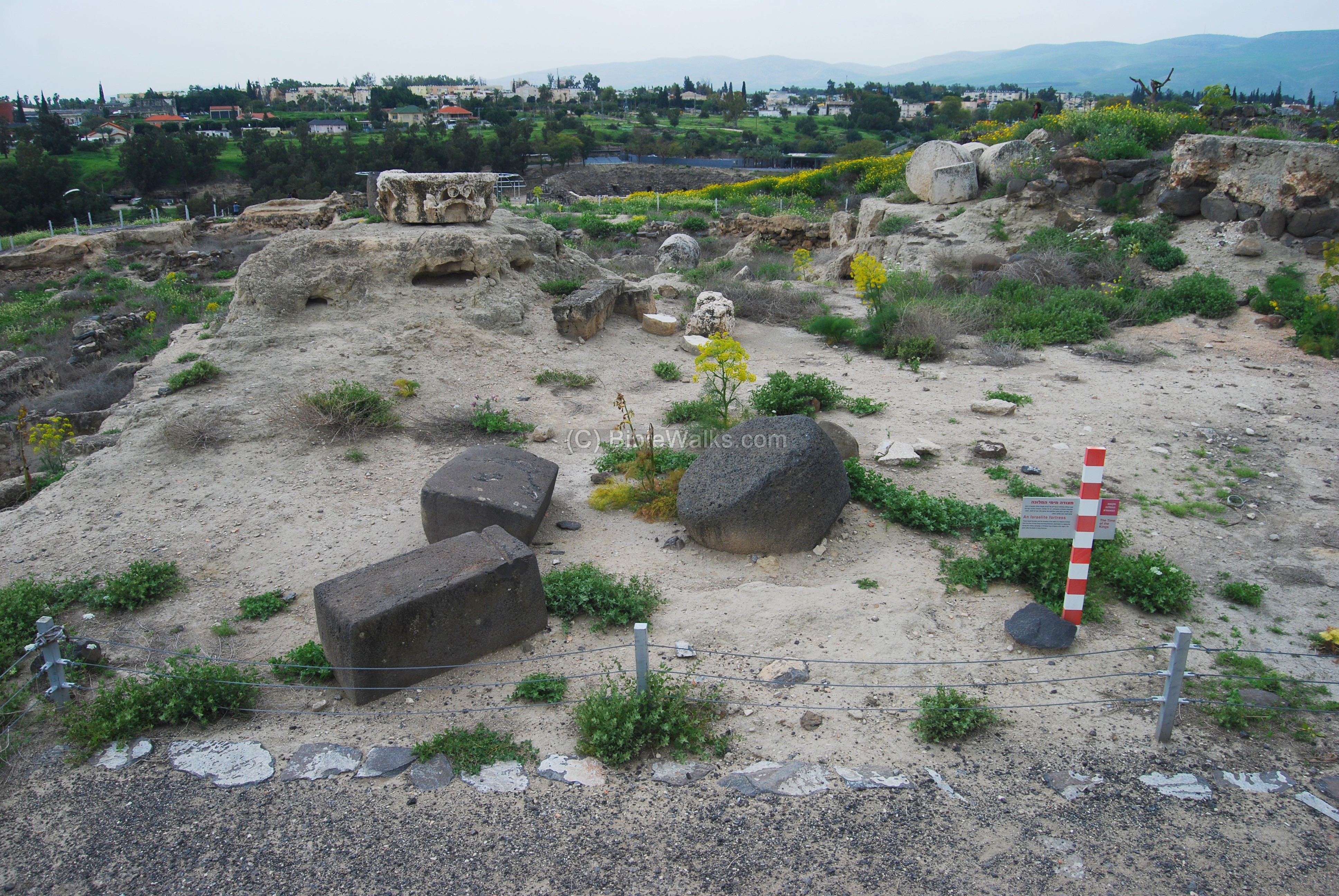
On the eastern side of the hill are ruins of a massive Israelite fortress from the times of Kings David and Solomon. It was destroyed in 924BC by fire during the conquest of the Egyptian King Shishak , several years after Solomon’s death. As per the Bible (Kings I 14: 25): “And it came to pass in the fifth year of king Rehoboam, that Shishak king of Egypt came up against Jerusalem”.
(f) Hellenistic and Roman period
After the Assyrian destruction the Tel was resettled during the Hellenistic period, as a secondary section of the newly founded Polis south of the Tel. A temple was erected by the Seleucid rulers, who worshipped Zeus.
A view of the Roman period ruins, as seen from the east side.
(g) East side
The east side of the Tel faces Nahal Harod (which flows from left to right) into the Jordan river (not seen, but in the far background). The scene below shows the Roman period street passing on the foothills of the Tel, crossing Nahal Harod over a Roman bridge.
On the east side is a view of the Jordanian mountains beyond the Jordan river.
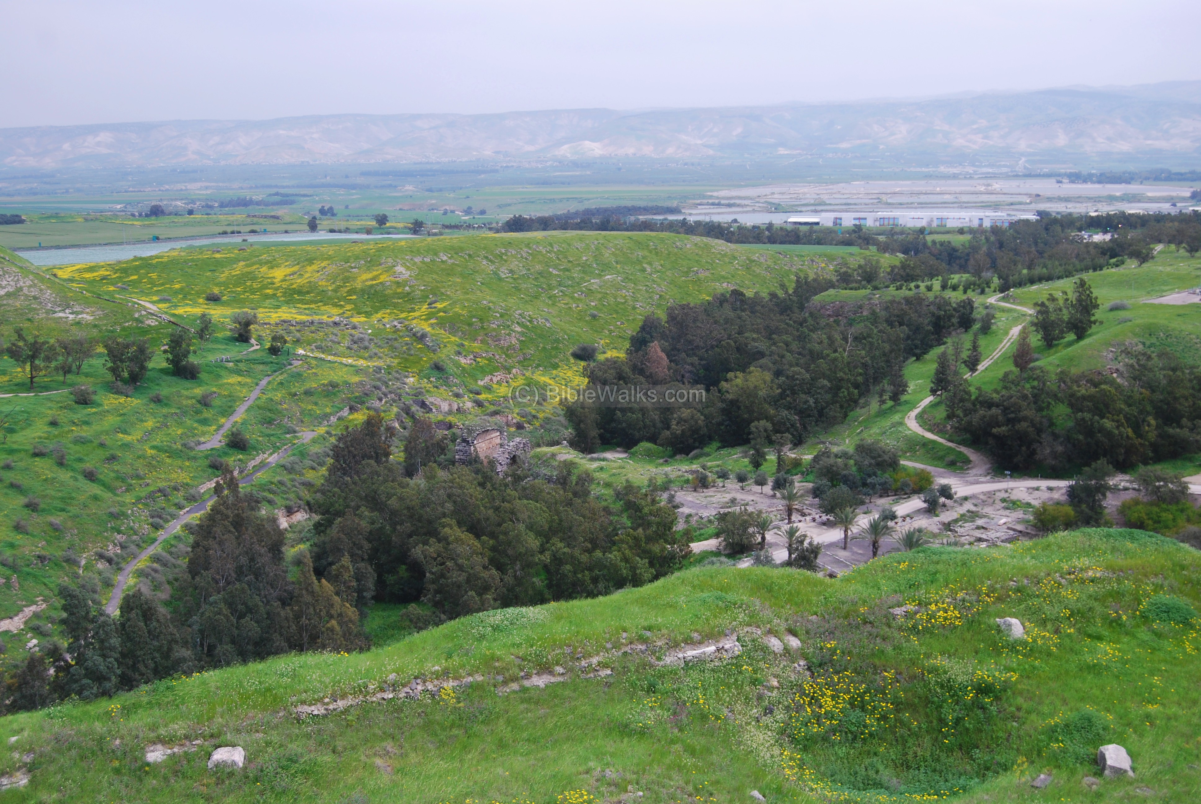
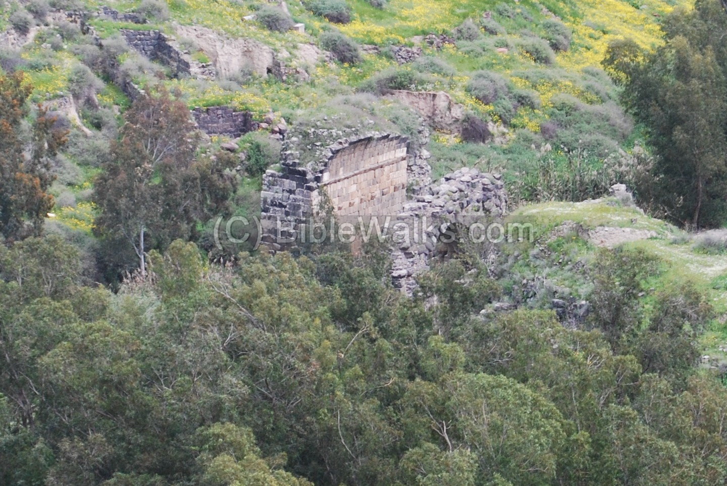
The photo below shows a closer detail of the ruins of the Roman bridge. The triple arch bridge was incorporated in the Byzantine period walls that passed at this point and protected the city.
(h) South East
The photo below shows a view from the south-east side of the hill. The ruins of the Roman city lay below the hillside of the ancient Tel. On the left background are the houses of the modern city of Beth Shean, while on the right background are the Gilboa hills.
One of the tragic stories in the Bible relate to this scene. On these walls the Philistines hanged the body of the first Israelite King, Saul, and his sons (1 Samuel 31 10: “…and they fastened his body to the wall of Bethshan”). They were killed on the Gilboa battle, as the Biblical text tells us: “And it came to pass on the morrow, when the Philistines came to strip the slain, that they found Saul and his three sons fallen in mount Gilboa. And they cut off his head…”.
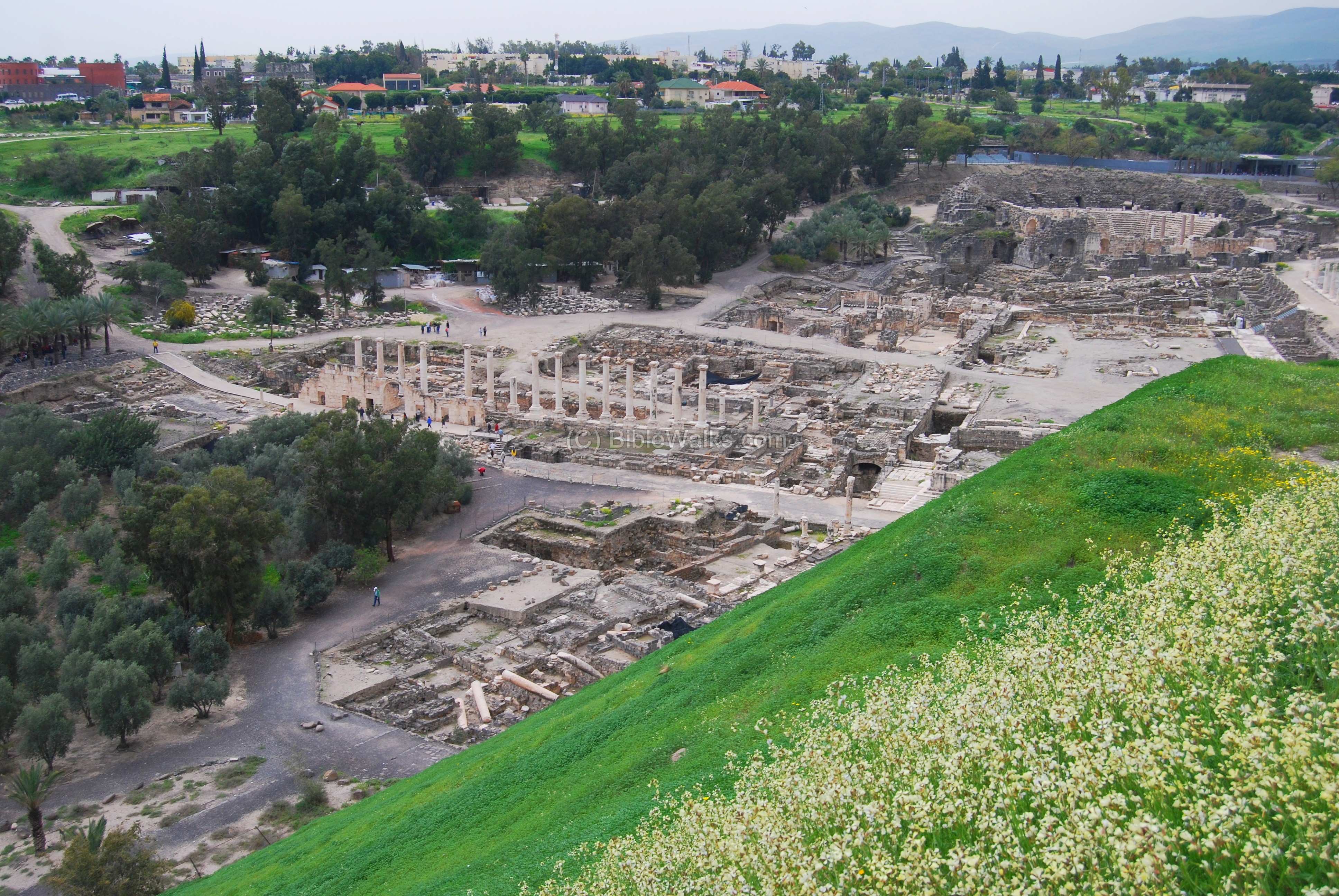
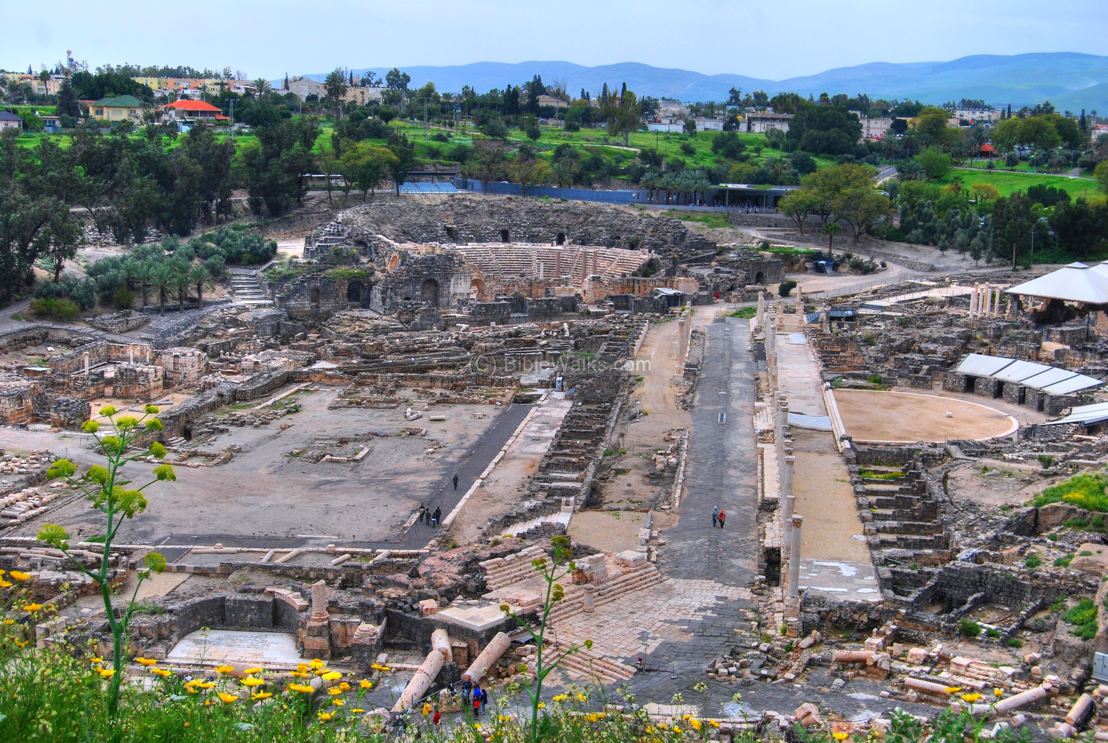
(i) South
The best view of the Roman city is seen from the top of the Biblical Tel. The photo below shows the Palladius street on the right, stretching towards the south, and the Western bathhouse to its right. The Theater is seen on the far left. In the background is the modern city of Beit Shean, and behind it are the Gilboa Mountains.
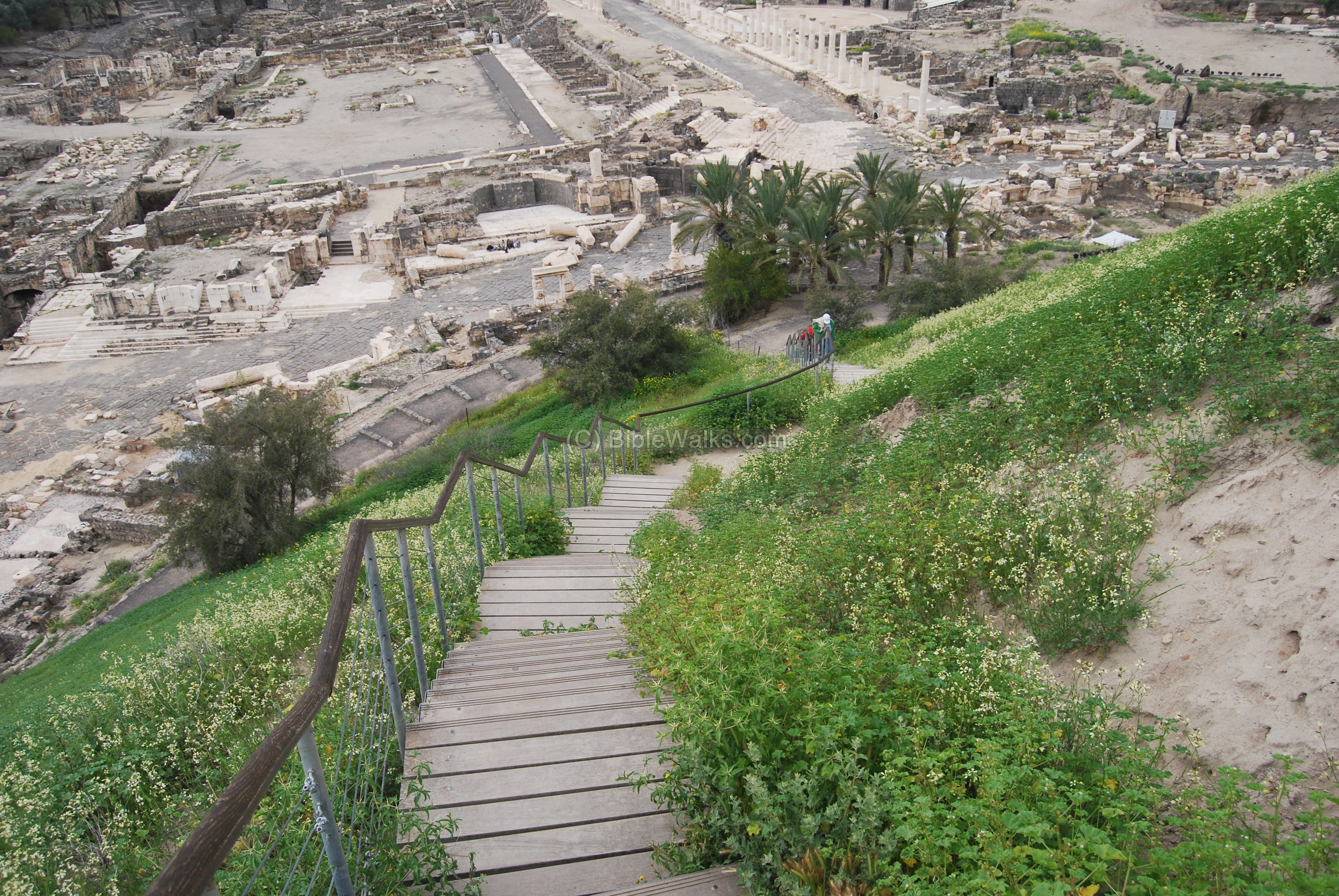
A path on the south side of the hill connects the upper ancient site to the lower Roman/Byzantine site.
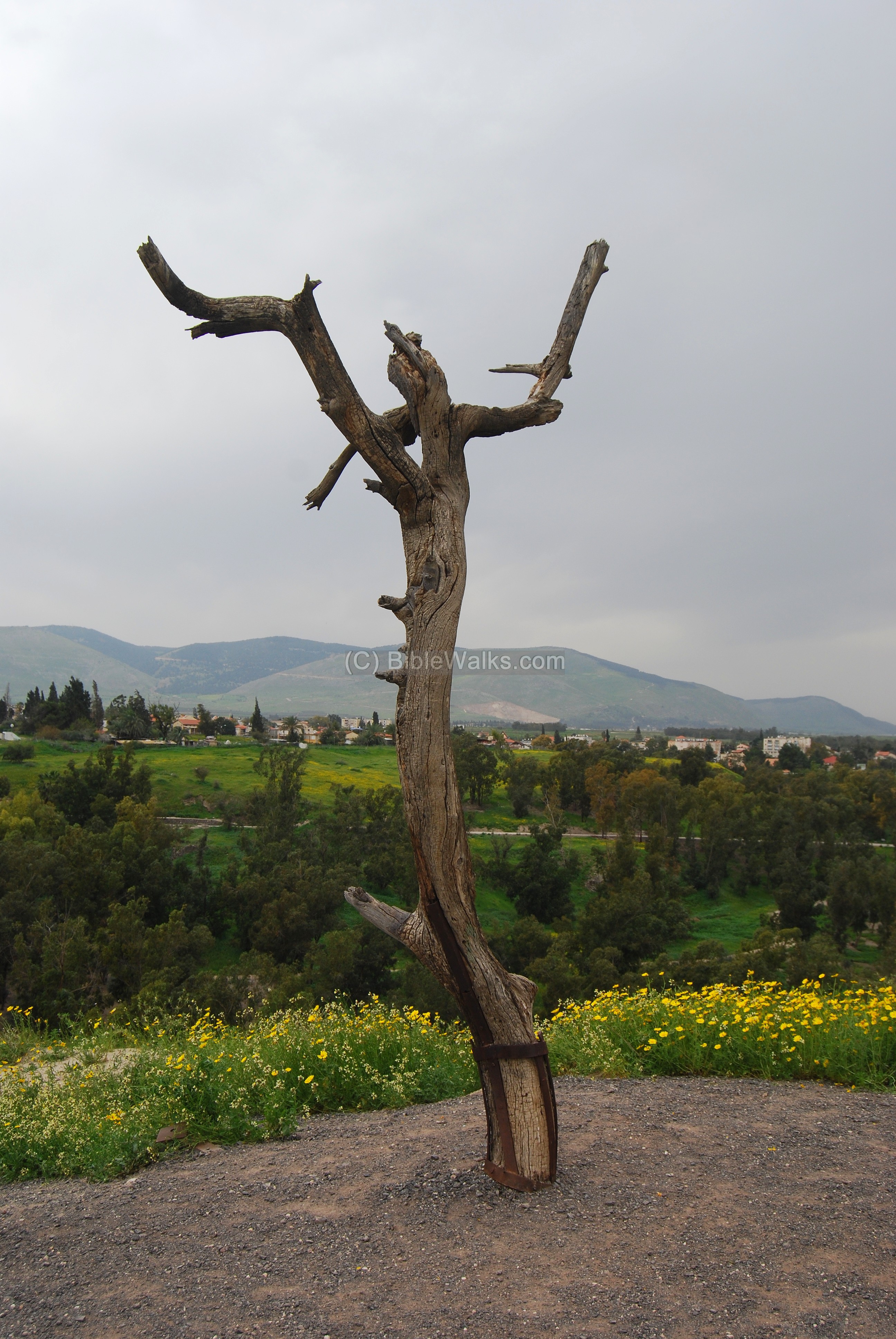
On top of the hill, facing south, stands a lone tree bark in the form of a cross. This was actually a movie prop left over from the 1973 movie “Jesus Christ Superstar”. The Oscar-nominated rock-opera film was shot in Israel in various locations including in Tel Beit Shean, where several scenes were filmed here.
(j) Nature photos
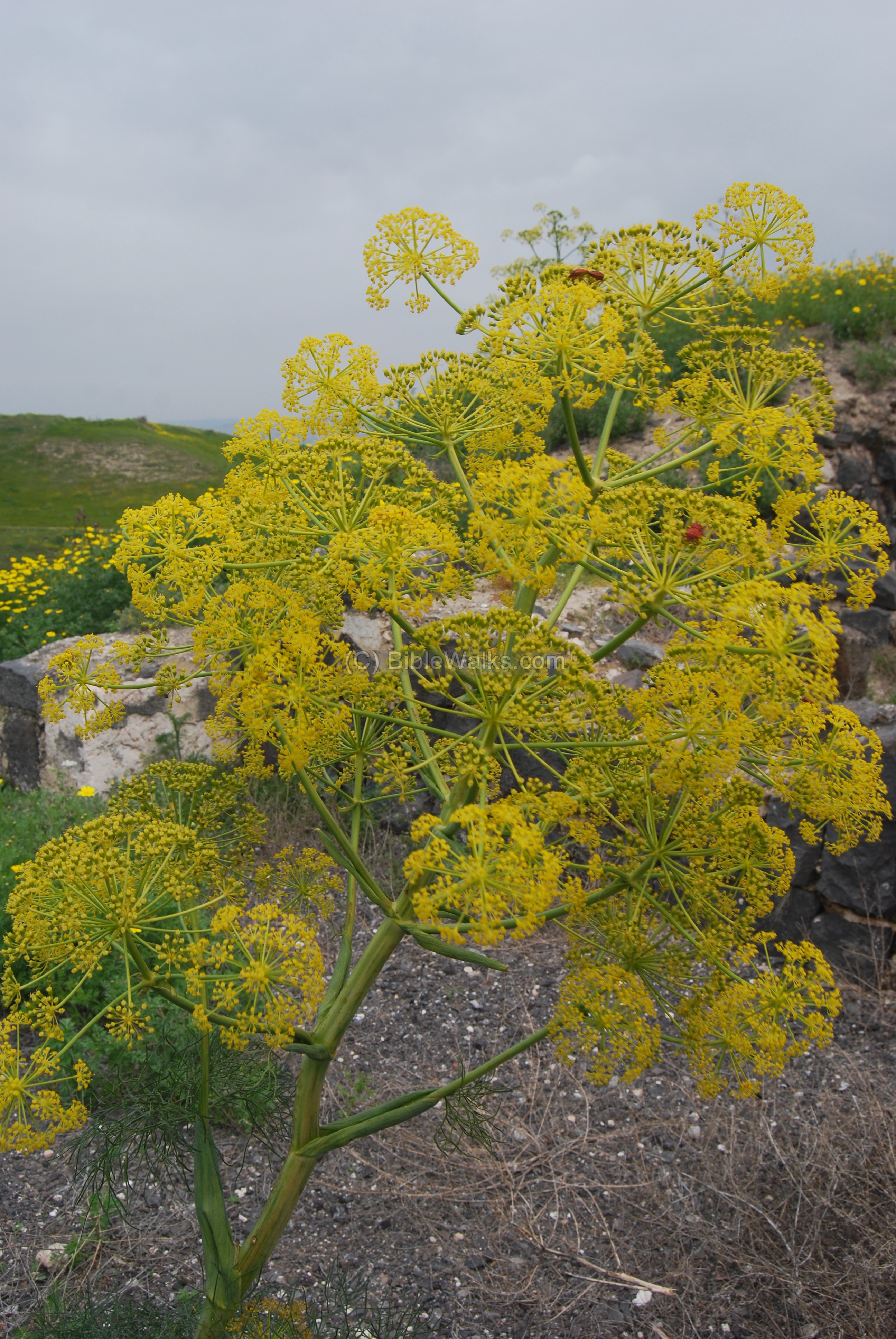
- Common Giant Fennel – Kelech Matsui
The Common Giant Fennel (Ferula communis, Hebrew: Kelech Matsui) is a cluster of yellow flowers that grows 2M high during the spring time. It may have been referred in the Bible (Job 30 2): “Yea, whereto might the strength of their hands profit me, in whom old age was perished?”. The phrase “Avad Kalach” in the Hebrew Bible version means that a person became “perished” or “useless”. It is perhaps based on the fact the cattle avoids eating this plant since it is toxic, and the plant became analogous to being useless.
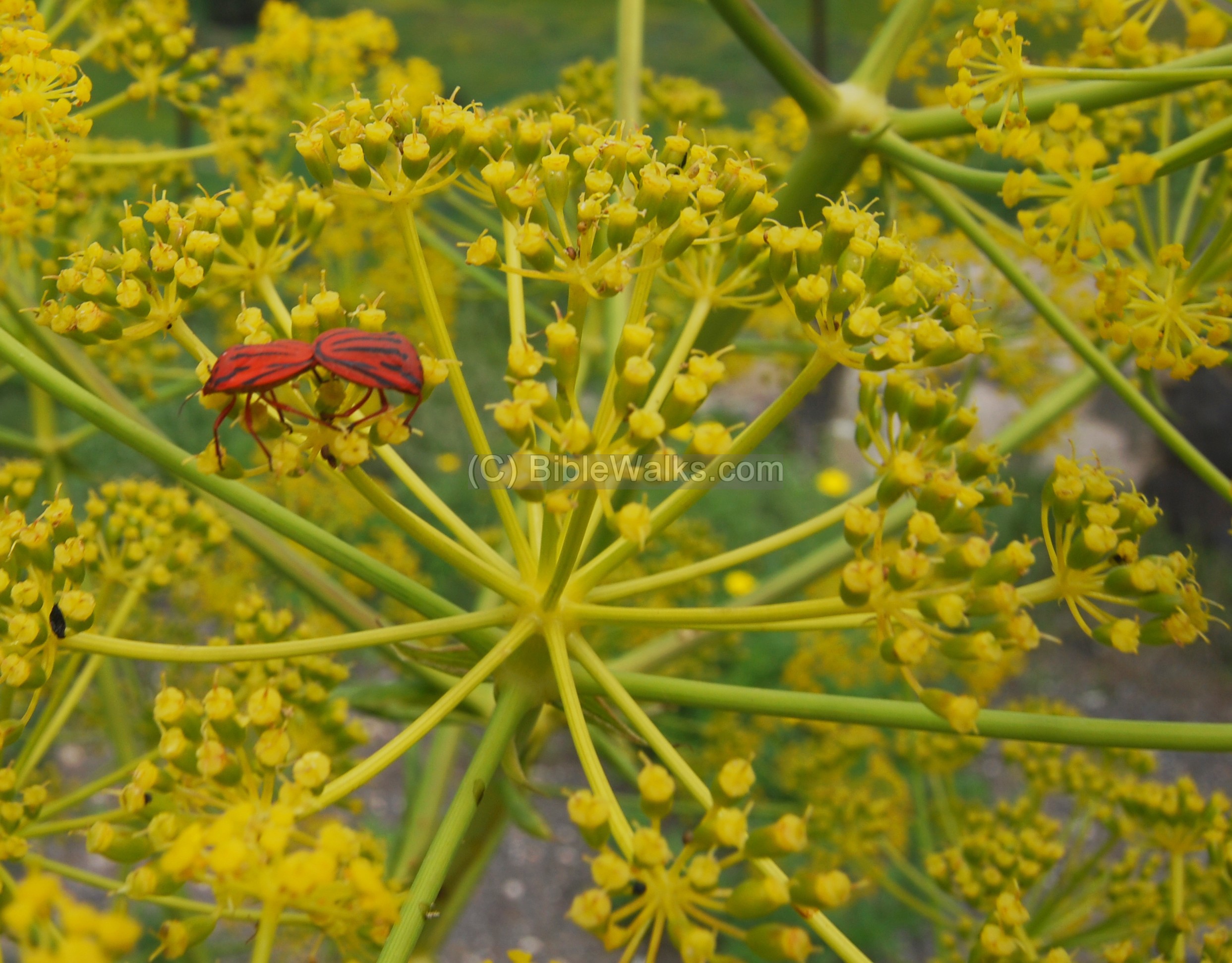
A closer view of a pair of red insects mating or sharing the same flower. These shield bugs are of the type “Graphosoma lineatum” of the family Hemipetra of the super family Pentatomidae (meaning, bugs with 5-segment antennae). Their Hebrew name is “Trisit Hapasim”. (Thanks for the identification by Oz Rittner from the Israel insect world web site).
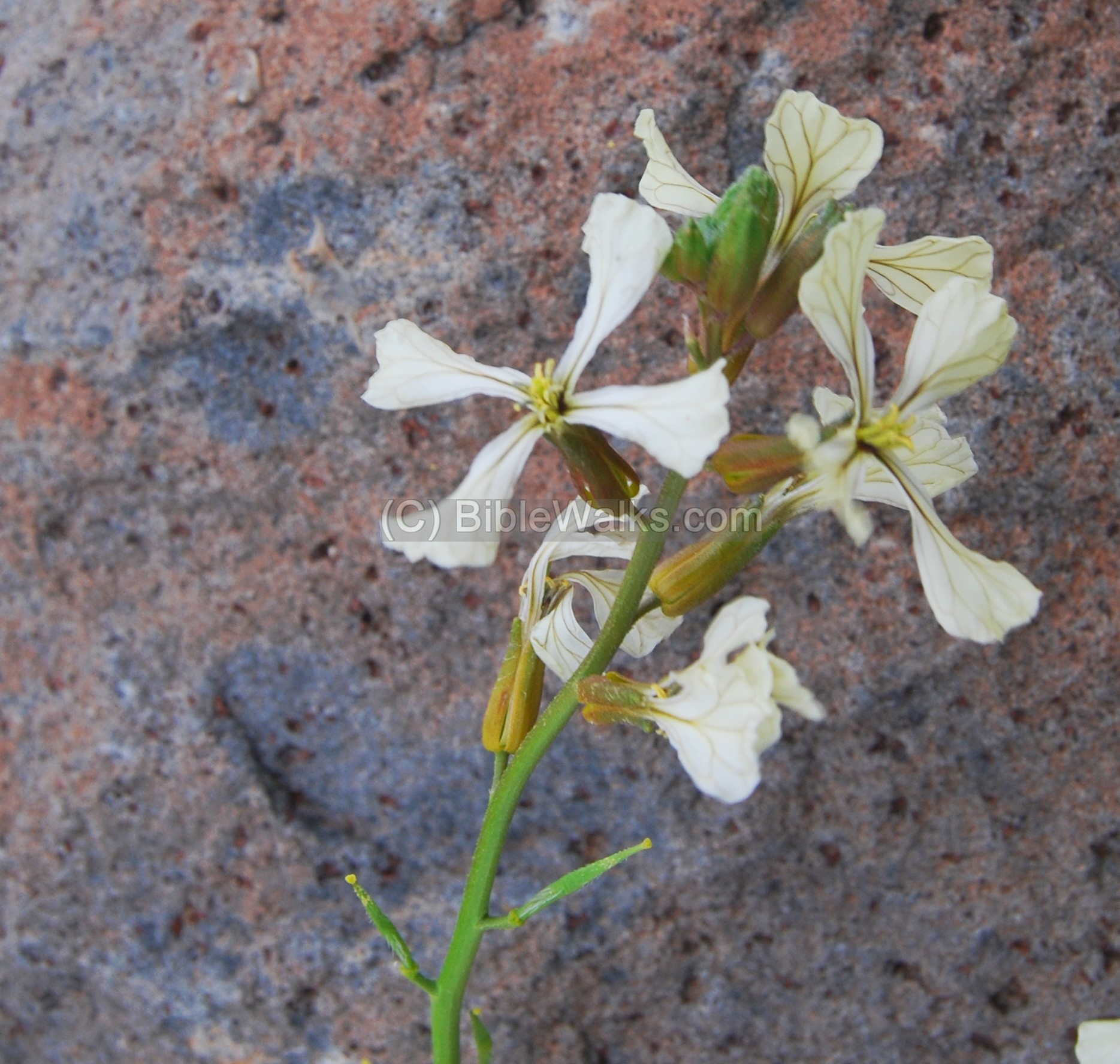
- Eruca sativa – Ben-Hardal Matsui
This wild flower (called in Hebrew: Ben-Hardal Matsui) covers the slopes of the eastern hillside like a white carpet (see the photo above). In Hebrew the family is called “Matsliv” or crosswise, named after the form of a cross. The name “Ben-Hardal” means “son of mustard” since its fruits taste like mustard.
Biblical References:
(a) Joshua 17: 11-12
The Israelites did not conquer Beit Shean:
“And Manasseh had in Issachar and in Asher Bethshean and her towns, and Ibleam and her towns, and the inhabitants of Dor and her towns, and the inhabitants of Endor and her towns, and the inhabitants of Taanach and her towns, and the inhabitants of Megiddo and her towns, even three countries. Yet the children of Manasseh could not drive out the inhabitants of those cities; but the Canaanites would dwell in that land”.
(b) Judges 1 27-28:
Neither did Manasseh drive out the inhabitants of Bethshean and her towns, nor Taanach and her towns, nor the inhabitants of Dor and her towns, nor the inhabitants of Ibleam and her towns, nor the inhabitants of Megiddo and her towns: but the Canaanites would dwell in that land. And it came to pass, when Israel was strong, that they put the Canaanites to tribute, and did not utterly drive them out”.
(c) 1 Samuel 31 6-13:
King Saul’s body was displayed on the walls of Beit Shean (here it is spelled BethShan) after his defeat to the Philistines:
“So Saul died, and his three sons, and his armourbearer, and all his men, that same day together. And when the men of Israel that were on the other side of the valley, and they that were on the other side Jordan, saw that the men of Israel fled, and that Saul and his sons were dead, they forsook the cities, and fled; and the Philistines came and dwelt in them.
And it came to pass on the morrow, when the Philistines came to strip the slain, that they found Saul and his three sons fallen in mount Gilboa. And they cut off his head, and stripped off his armor, and sent into the land of the Philistines round about, to publish it in the house of their idols, and among the people. And they put his armor in the house of Ashtaroth: and they fastened his body to the wall of Bethshan. And when the inhabitants of Jabeshgilead heard of that which the Philistines had done to Saul; All the valiant men arose, and went all night, and took the body of Saul and the bodies of his sons from the wall of Bethshan, and came to Jabesh, and burnt them there. And they took their bones, and buried them under a tree at Jabesh, and fasted seven days”.
(d) 1 Kings 4 7, 12:
King Solomon made Beit Shean a major administrative city:
“And Solomon had twelve officers over all Israel, which provided victuals for the king and his household: each man his month in a year made provision…
Baana the son of Ahilud; to him pertained Taanach and Megiddo, and all Bethshean, which is by Zartanah beneath Jezreel, from Bethshean to Abelmeholah, even unto the place that is beyond Jokneam:”.
(e) 2 Kings 15:29
The Assyrians captured the Galilee (732 BC), and destroyed Beit Shean.
” In the days of Pekah king of Israel came Tiglathpileser king of Assyria, and took Ijon, and Abelbethmaachah, and Janoah, and Kedesh, and Hazor, and Gilead, and Galilee, all the land of Naphtali, and carried them captive to Assyria”.
Links:
In BibleWalks:
-
Beit Shean overview – overview of the site
-
Beit Shean night show – amazing sound & light show
- Tel Iztabba – north of Harod river
-
The Tels – story of the life and death of the Tels
-
Tel Rehov – the nearby Canaanite/Israelite site
External links:
-
Beit She-an including map
Flowers:
Insects:
* Other:
- Biblical pictures by Gustave Doré (1832-1883) – public domain
Etymology (behind the name):
- Beit Shean (Beth Shean): Hebrew: Beit (Beth) is “House”; She’an may have been a name of an ancient God. Thus, the meaning of the name is “the house of Shean”.
- Tel (Arabic: Tell) – mound (See more on the story of a Tel).
- Harod – the name of the creek that passes north of the site. It is mentioned in the Bible (Judges 7,1: “Then Jerubbaal, who is Gideon, and all the people that were with him, rose up early, and pitched beside the well of Harod: so that the host of the Midianites were on the north side of them, by the hill of Moreh, in the valley”).
BibleWalks.com = Bible + Map + Travel
Beth She’an at night <<<—previous site—<<< All Sites>>>—next site—>>> Tel Iztabba
This page was last updated on Aug 23, 2024 (add LOC photo)
Sponsored links: