Ruins of the ancient port city of Haifa, located on the west shore side of Mount Carmel.
* Site of the Month – May 2012 *
Home > Sites > Carmel > Tel Shikmona
Contents:
Background
Location/Map
History
Photos
* Aerial View
* Entrance
* Coast
* Tel
* South
* Monastery
* Necropolis
* Chapel
* Flight Over
Etymology
Links
Background:
Shikmona is an archaeological site that represents the ruins of the ancient port city of Haifa, situated on the western shore of Mount Carmel in present-day Israel. The site has a rich history spanning several millennia, and its remnants provide valuable insights into the various civilizations that inhabited the area.
The origins of Shikmona date back to the late Bronze Age, around the 18th century BC. During this period, the city thrived as a bustling port, serving as a hub for maritime trade and cultural exchange. Its strategic location along the coast made it an attractive settlement for different civilizations throughout history.
The city continued to be inhabited during the Israelite period, which encompasses the time of the ancient Israelites. It witnessed the rise and fall of empires, including the Persian period when the Achaemenid Empire exerted control over the region. Shikmona likely played a crucial role in maritime trade during this period, connecting the inland territories with other Mediterranean civilizations.
As the centuries passed, Shikmona transformed into a prominent Phoenician port. The Phoenicians, known for their seafaring prowess, established a strong presence in the region and utilized the city as a hub for their maritime activities. Shikmona’s importance as a port continued during the Hellenistic period, under the influence of Alexander the Great’s successors and subsequent Greek rulers.
With the arrival of the Roman Empire, Shikmona experienced another phase of development. The Romans recognized the strategic value of the port and expanded its infrastructure to accommodate their growing maritime trade network. The city flourished during the Roman and Byzantine periods, witnessing economic prosperity and cultural influence. It expanded to the “lower city” on the east and south side of the mound.
Over the centuries, Shikmona fell under the rule of different powers, including Arab, Crusader, and Mameluke periods. Each era left its mark on the city’s architecture and cultural landscape. The diverse influences can be seen in the architectural styles, religious structures, and other archaeological remains discovered at the site.
Today, the archaeological site of Shikmona is a testament to the complex layers of history that have shaped the region. Excavations have revealed a wealth of artifacts, including pottery, coins, jewelry, and architectural elements, shedding light on the daily lives, trade networks, and cultural interactions of the past civilizations.
The exploration and study of Shikmona have contributed significantly to our understanding of the ancient Mediterranean world and the role of port cities in facilitating commerce, cultural exchange, and political dynamics. The site continues to be an important focus of ongoing research, allowing us to delve deeper into the history of Haifa and its connections to the wider ancient world.
Location and Map:
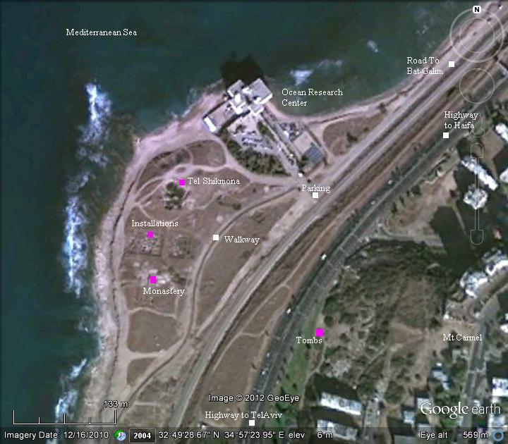
Tel Shikmona is located on the shores of Mt Carmel, on the side of the highway entering into Haifa.
The map shows the major points of interest.
History:
-
Early times – Late Bronze period
The city was established at 14th century BC during the Canaanite period, when the land was ruled by the Egypt. It was abandoned or destroyed during the mid 12th century.
-
Israelite period – Iron Age II
The city was resettled during the 11th century BC (Iron Age IIb) by the Israelite kings.
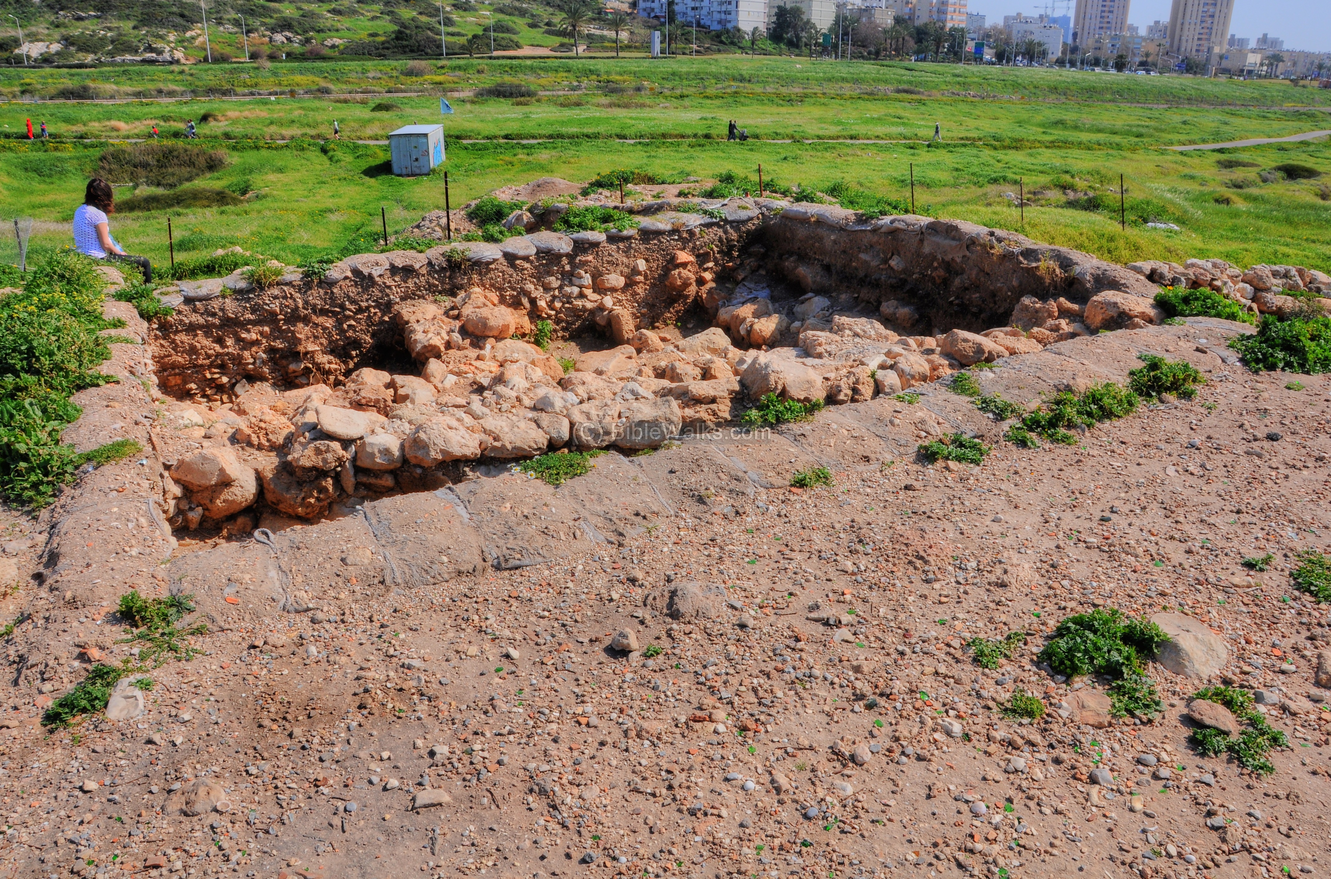
During the 9th century the city was fortified. A section of the city wall with a casemate design was excavated in the mound. The walls continued to defend the city until the 8th century. The scholars attribute these fortifications to the importance of the purple dye industry that was established south of the city. Pottery sherds stained with purple dye were found in the excavations during the Iron II period.
The excavations also unearthed streets and houses, including a “four-room” house which is typical of this period – a structure of four rooms, three rooms positioned lengthwise and one broad-roomed.
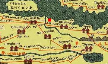
A Biblical map of the area around the site is shown here. Notice the coast road – a western branch of Via Maris -which passes through the city.
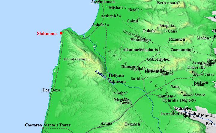
Map of the area around Shikmona – during the Canaanite to the Roman periods (based on Bible Mapper 3.0)
-
Assyrian Conquest
The north cities of Israel were subjected to a series of intrusions and conquests from the north. Shalmaneser III was the Assyrian king who invaded to Israel in the first Assyrian intrusion (841 BC). His forces reached the Carmel, and may have caused damages to the city.
Another arch enemy of the Northern Israelite Kingdom was Aram-Damascus. These forces, headed by Hazael, invaded in 815-810, as per Biblical accounts (2 Kings 8:12, 12:18-19, 13:3+7; Amos 1:3) and (2 Kings 10 32): “In those days the LORD began to cut Israel short: and Hazael smote them in all the coasts of Israel;”. In one of these intrusions the city was probably destroyed.
In 732BC was an intrusion to the North of Israel by the Assyrian King Tiglath-Pileser III, who annexed the area (as per 2 Kings 15: 29): “In the days of Pekah king of Israel came Tiglathpileser king of Assyria, and took … Galilee…and carried them captive to Assyria”. During this period the city may have been destroyed, and later rebuilt, by the Assyrians.
The Assyrians occupied the city until the Babylonians conquered the land (about 604BC).
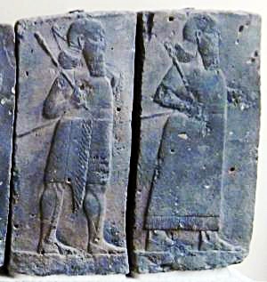
Orthostat relief – depicting soldiers from different orders of the Assyrian Army,
in procession; basalt; Hadatu Tiglath-Pileser III period (744-727BC)
[Istanbul Archaeological museum]
-
Persian period
The Persians replaced the Babylonians as the ruling empire in the region, and controlled Israel from 538 to 332 BC. Their maritime partners, the Phoenicians, expanded and administrated the city. The Phoenicians were the great marine merchants of those times, mastered the seas of the Mediterranean, and established cities all along the coast of Israel. A layer of the Persian city was found on the mound under the Byzantine period layer. Industrial installations were exposed on the south side of the hill.
-
Hellenistic and Hasmonean period
Alexander the Great conquered Shikmona in 332 BC. After his death, the city became part of the Greek Seleucid kingdom (306-150BC).
The Jewish Hasmonean Kingdom managed to free from the Seleucid control in the area of Judah (starting at 167BC). More than 60 years passed until the Hasmonean King Alexander Jannaeus attempted to recapture the northern coastal area. In 104BC his forces attacked the port city of Acre, north of Shikmona. The city of Acre called for help from the king of Cypress, who sent troops to Shikmona. This was the first reference to Shikmona, named Sycamine or Sycaminos. (Josephus Antiquities of the Jews III, 13: 12):
“When Alexander Janneus had settled the government in the manner that he judged best, he made an expedition against Ptolemais… So the people of Ptolemais sent to this Ptolemy Lathyrus… Now Ptolemy, although he had heard of the change that was made in the people of Ptolemais, yet did he still go on with his voyage, and came to the country called Sycamine, and there set his army on shore”.
The Hasmonean king retreated, but after negotiations he received the city as well as other coastal cities of Dor and Straton’s Tower.
Shikmona remained under Hasmonean control for 40 years.
-
Roman/Byzantine
The Roman legions under Pompey conquered Israel in 63BC. Sycamine/Shikmona was later given to Acre/Ptolemais as part of his rearrangements (63-48 BC).
During the Byzantine period, Shikmona reached its climax and became the main city of Haifa and the area.
The coastal Roman road from Caesarea Maritama (“Cesaria”), Dor (Thora) to Ptolamais (“Ptolma”) and Tyre (“Tyro”) passed through the city. The city is marked as a red square on this section of the Peutinger map (Peutingeriana tabula) of the 4th century Imperial Roman roads. The ancient map is not accurate, as it shows the mouth of the Kishon river south of Dor/Thora and flowing from Lebanon rather than the Jezreel valley.
The total area of the Byzantine city was 120 Dunam (12 Hectares), which was then a medium size city. The city’s principal residential area was located to the south of the mound and along the shore. The commercial area was located on the north side of the mound, near its port. The necropolis (cemetery) was located on the hillside to the east of the city.
The archaeologists unearthed a Byzantine villa on the eastern foothill of the mound. It was destroyed during the Arab conquest of 638 AD, and a building was built over it during the Early Arab period.
The Byzantine city of Sycamine/Shikmona was abandoned in the 7th century AD.
-
Ottoman period – PEF survey
The area was examined in the Palestine Exploration Foundation (PEF) survey (1866-1877) by Wilson, Conder and Kitchener. They reported (in Vol 1, Sheet V, pp352-353) on the site, known in its Arab name as “Tell es Semak” (“mound of the fish”), with the following report:
“A low hillock by the sea. It is covered, as well as the shore near it, with ruins of dressed masonry, and there appears to have been a place of some importance at this site. Pottery, glass, and marble were found, and there are tombs east of it, in the sides of Carmel. Quantities of the ashlars blocks have been taken away, the holes remaining whence they were dug out. A fragment of a capital and coins (Byzantine) were here found by the Germans. Shafts and capitals of Byzantine appearance were also dug up. Fine building stones were transported to Haifa to build houses with. Large quantities of copper coins of Constantine were found, and a Crusading coin, with the date 127. The tombs are rude caves, with loculi”.
They also correctly identified the site as “Sycaminos”.
The map shows the site at that time. Notice that the entire area around the ruins is barren.
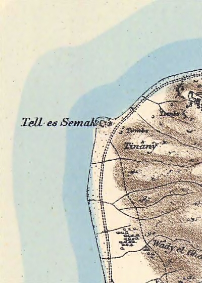
Tell es Semak – Shikmona – Part of Map Sheet 5 of Survey of Western Palestine,
by Conder and Kitchener, 1872-1877.
(Published 1881, reprinted by LifeintheHolyLand.com)
-
Modern times
Excavations in Shikmona were conducted in 1939, 1963-1979 (Yosef Algavish), and 1994. Renewed excavations started in 2010 as part of the renovations along the coast of Haifa, within the scope of the continued construction of the Hecht park. The excavation team is directed by Dr. Michael Eisenberg of the Zinman Institute of Archaeology at the University of Haifa.
Photos:
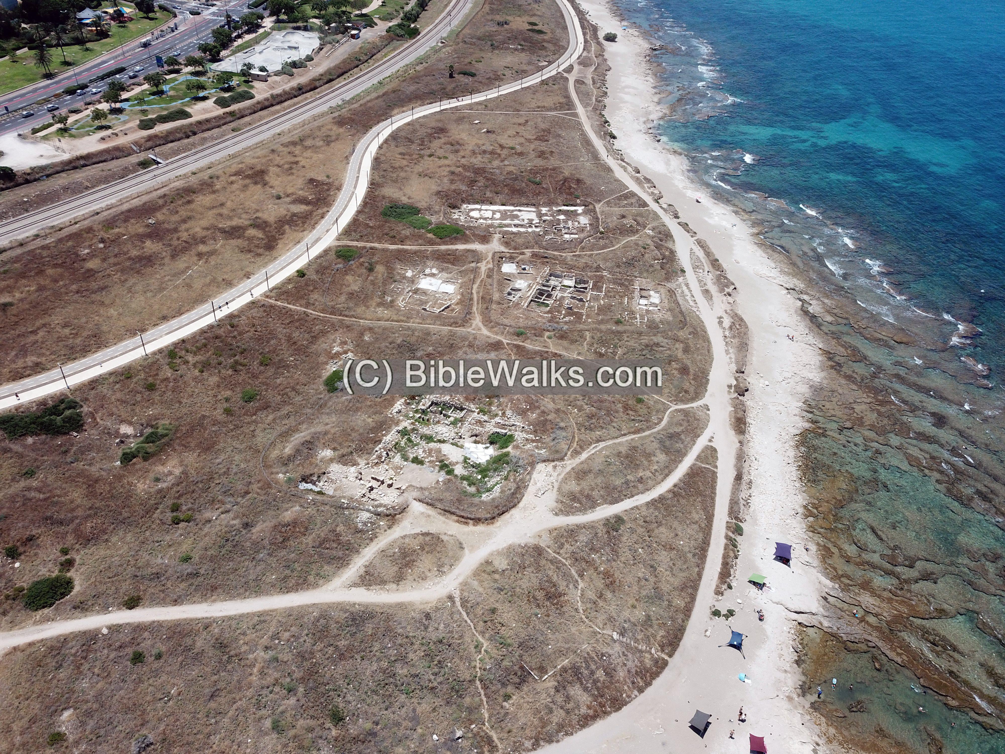
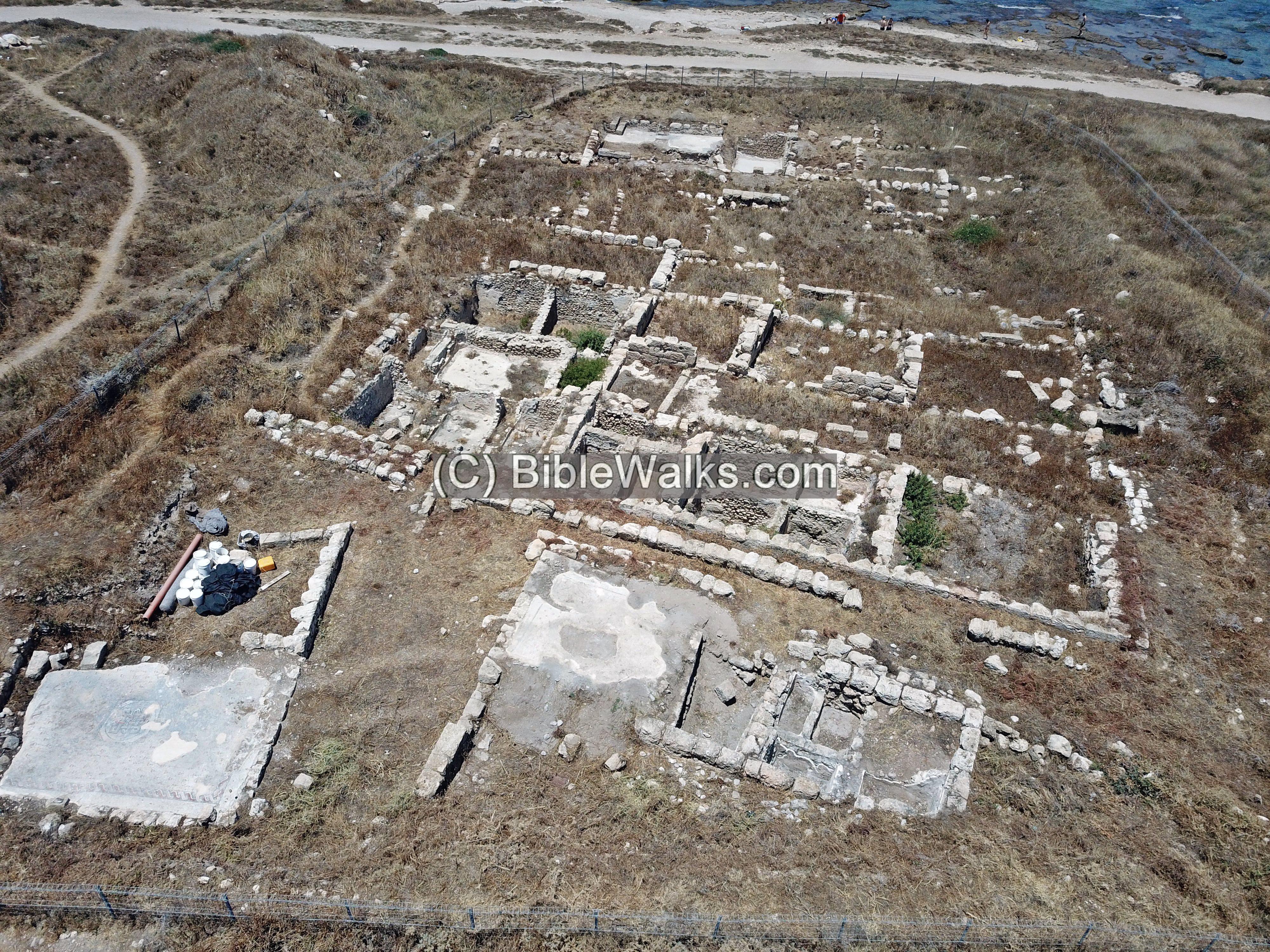
(a) Aerial view
An aerial view of the area around Tel Shikmona was captured in June 2023, with a view towards the south. The coast line is seen on the right (west) side, while the entrance highway to Haifa and the railroad are on the left (east) side.
In the lower side of the photo is the ancient mound of Tel Shikmona. South of the mound is a complex of storehouses and installations dated to the Persian period. Farther south are remains of a Byzantine monastery.
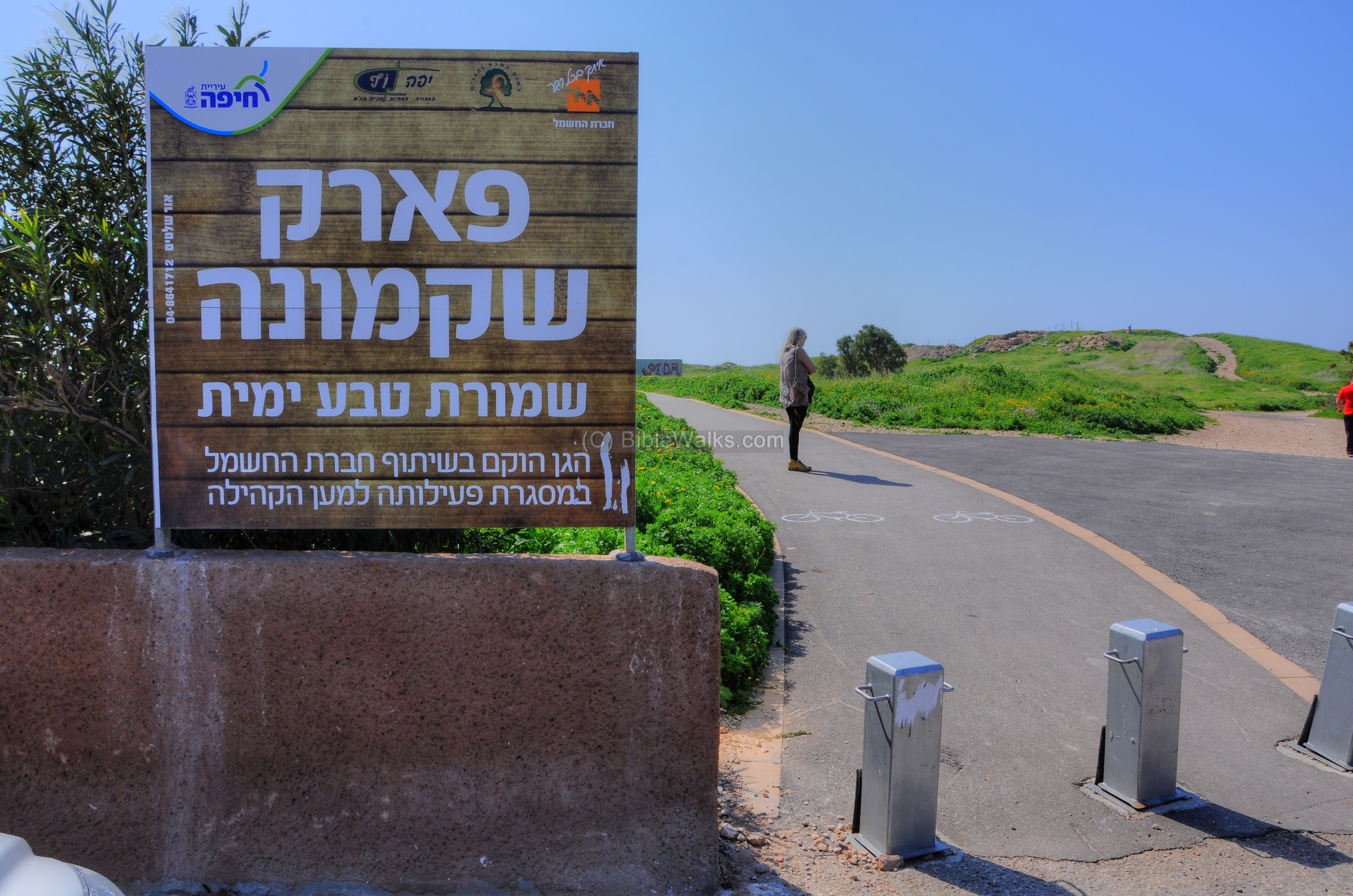
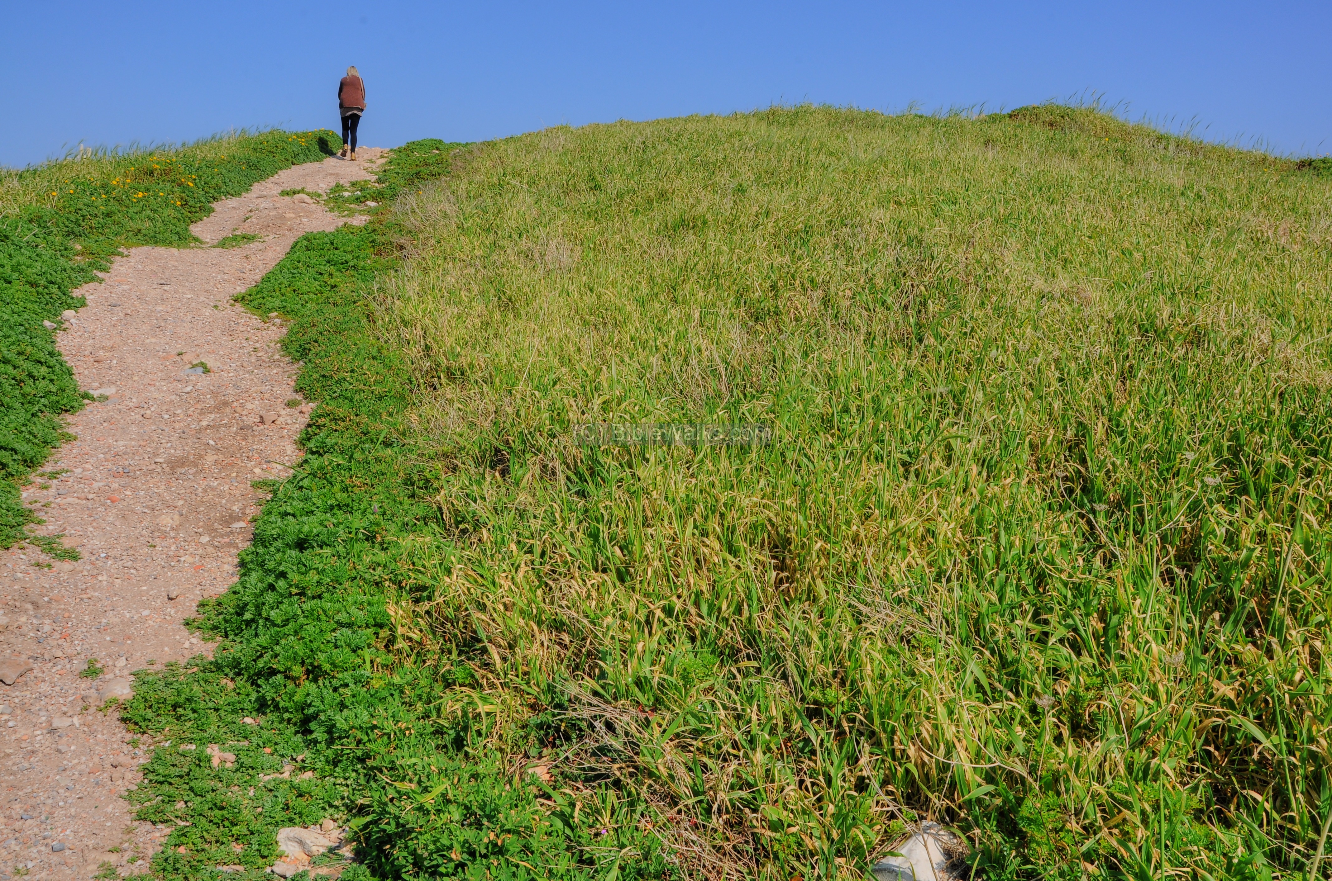
(b) Entrance to Park Shikmona
The entrance to the marine nature reserve of Shikmona is located near the Ocean research center, adjacent to the ancient mound. This is where you park your car, and walk towards the hill of Tel Shikmona which can be seen here on the right side of the walkway. The area was declared a nature reserve, occupying a large area (1677 dunams), including an area of a National Park (73 dunams). The length of the park, which includes the historic site, is 1.5km.
Click on the photos to view in higher resolution…
Along the path are various species of wild flowers, which bloom during the spring time. This type is called Allium Trifoliatum (Hebrew: Shum Sa’ir).
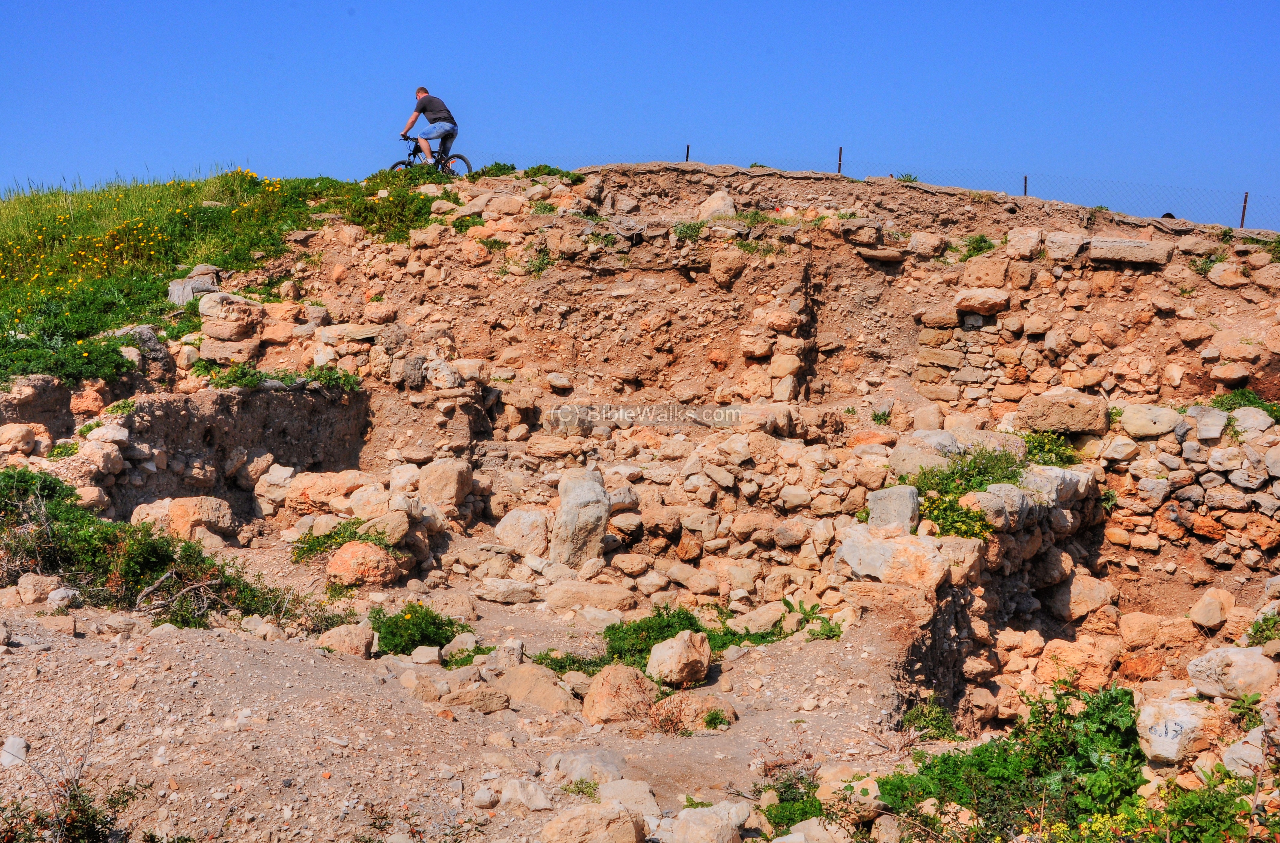
A closer view of the mound from the east side is seen below. It is partially excavated, with several of its southern and eastern parts removed.
(b) Coast
The site is located on the shores of the Mediterranean sea. Shikmona was an ancient port city, and its small harbor was one of its main sources of income and the reason of its location. The city also was a gateway on the western section of the coastal road (“Via Maris”), connecting the north to the south. This important link passed on the eastern side of the city and was another source of income for the city.
Along the coast is a shallow bedrock made of sandstone (Kurkar) rock and some sand. The shore attracts families, beachcombers, the waves, fishermen and birds.
Along the beach front are bases of walls and sections of the east side of the ancient city. In the photo below, behind the mound, is the round tower of the ocean research center.
Along this path, along the western edge of the mound, we noticed a corner of a carved stone, with two connected grooves. This was probably used to tie a rope to the secure boats in the bay.
A circular pool, 2m in diameter and 1m deep, was cut into the reef west of the mound. This ancient industrial installation was used for storing live fish or live murex snails. It serves today as a popular natural jacuzzi.
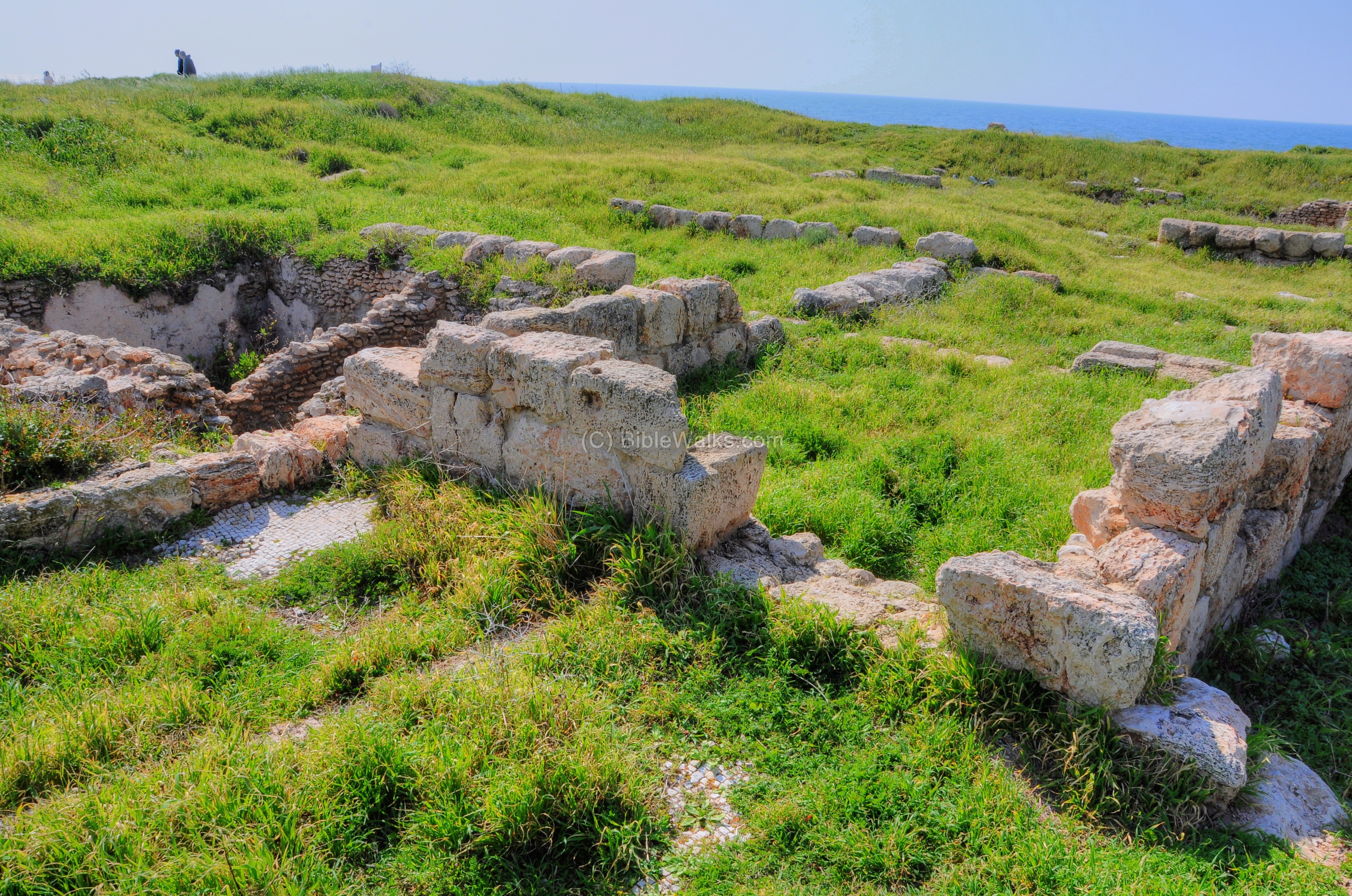
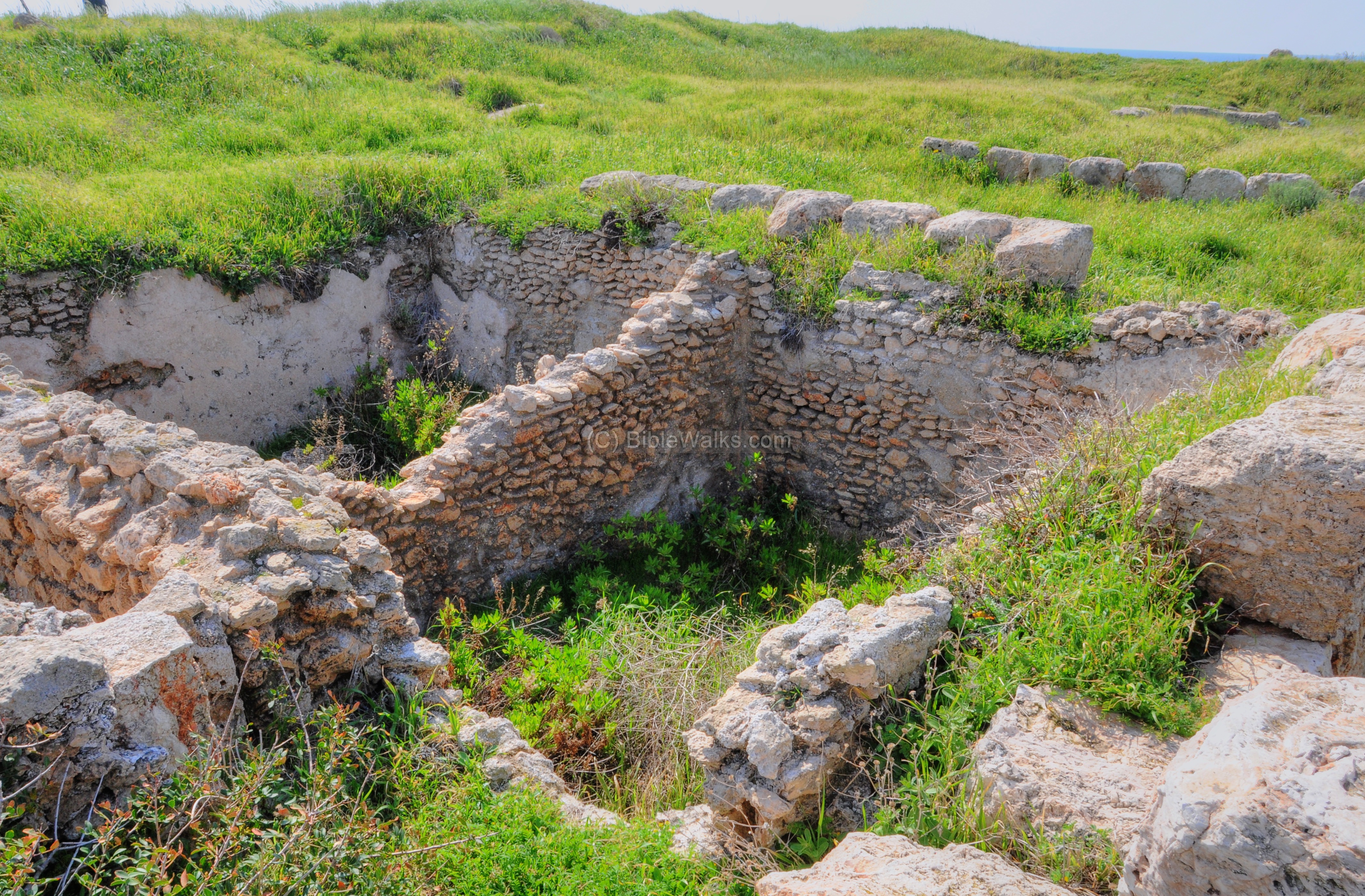
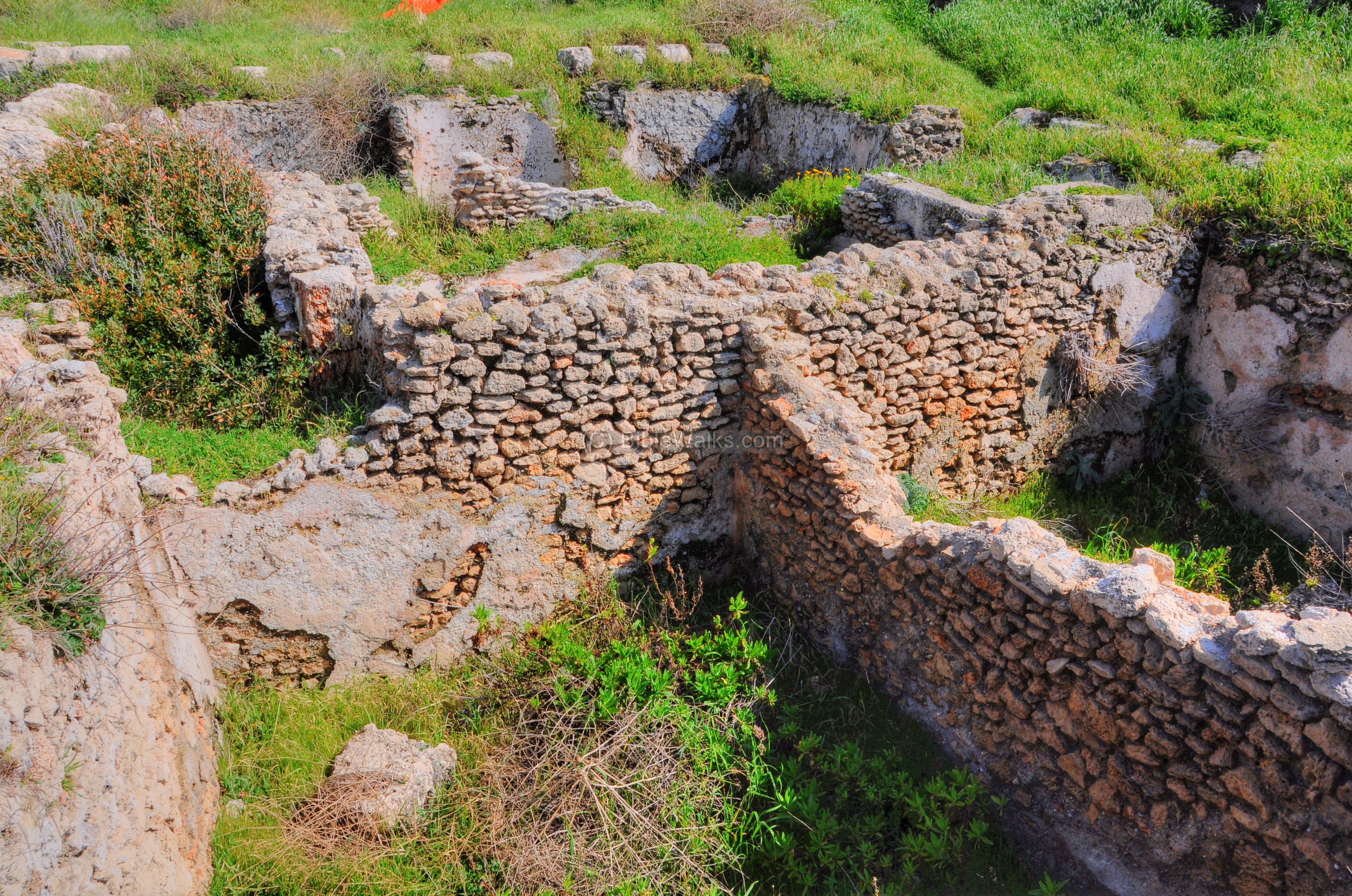
(c) Tel Shikmona
The aerial view, captured from the east by a drone, shows the top of Tel Shikmona and its current (June 2023) visible ruins.
This is an aerial view of the top of the mound, as seen from above:
From the ground side:
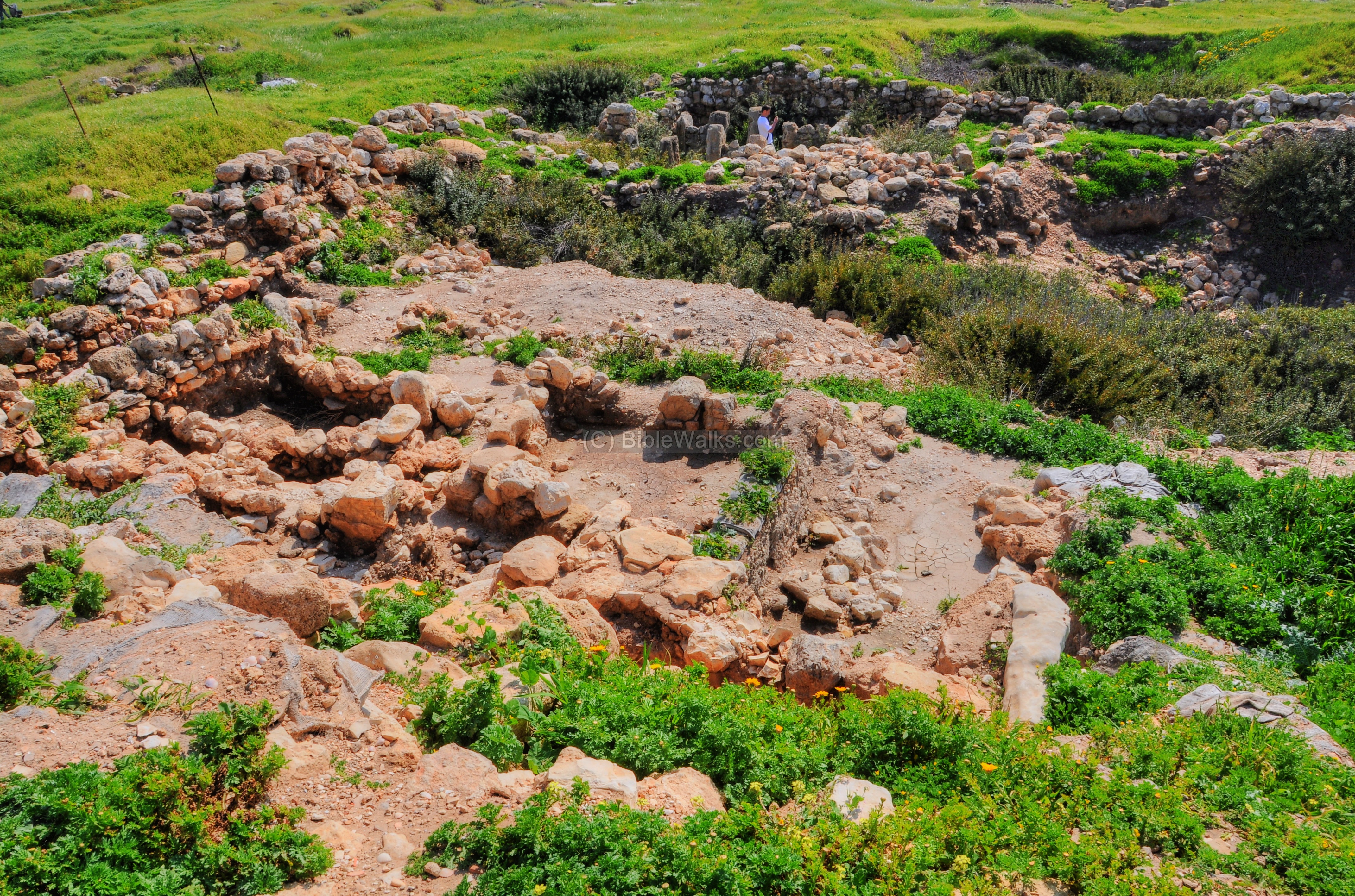
A path leads up from the shore to the top of the mound. This hill is actually a pile of many layers spanning about 35 centuries of history.
The eastern and southern sections of the hills were excavated. According the the University press release (July 3, 2011):
“Earlier in the season, a long section of the eastern side of the tell was exposed, revealing remains of terraced Byzantine structures (4th-7th centuries CE) that were built on the slope. Inside the houses, a number of destroyed mosaic floors and storage rooms were uncovered, while dozens of vessels there survived the ruins and were found whole. Many coins, ornaments, pendants, weapons and glass vessels were also found there, providing evidence of the wealth of the inhabitants. Beneath these Byzantine remains, the archaeologists exposed a structure from the Persian era (4th century BCE) in which an oven, clay loom weights and storage pitchers were found, indicating Persian settlement of the area. At another section of the excavations on the tell, the remains of three stages of settlement from the 11th-8th centuries BCE were found. It seems that at the beginning of that era, settlement in the region was relatively sparse but increased over time, becoming a prosperous, fortified city by the first century BCE”.
The following photo shows the south-southern side of the mound.
Another view of the southern section:
A northern views of another cross section:
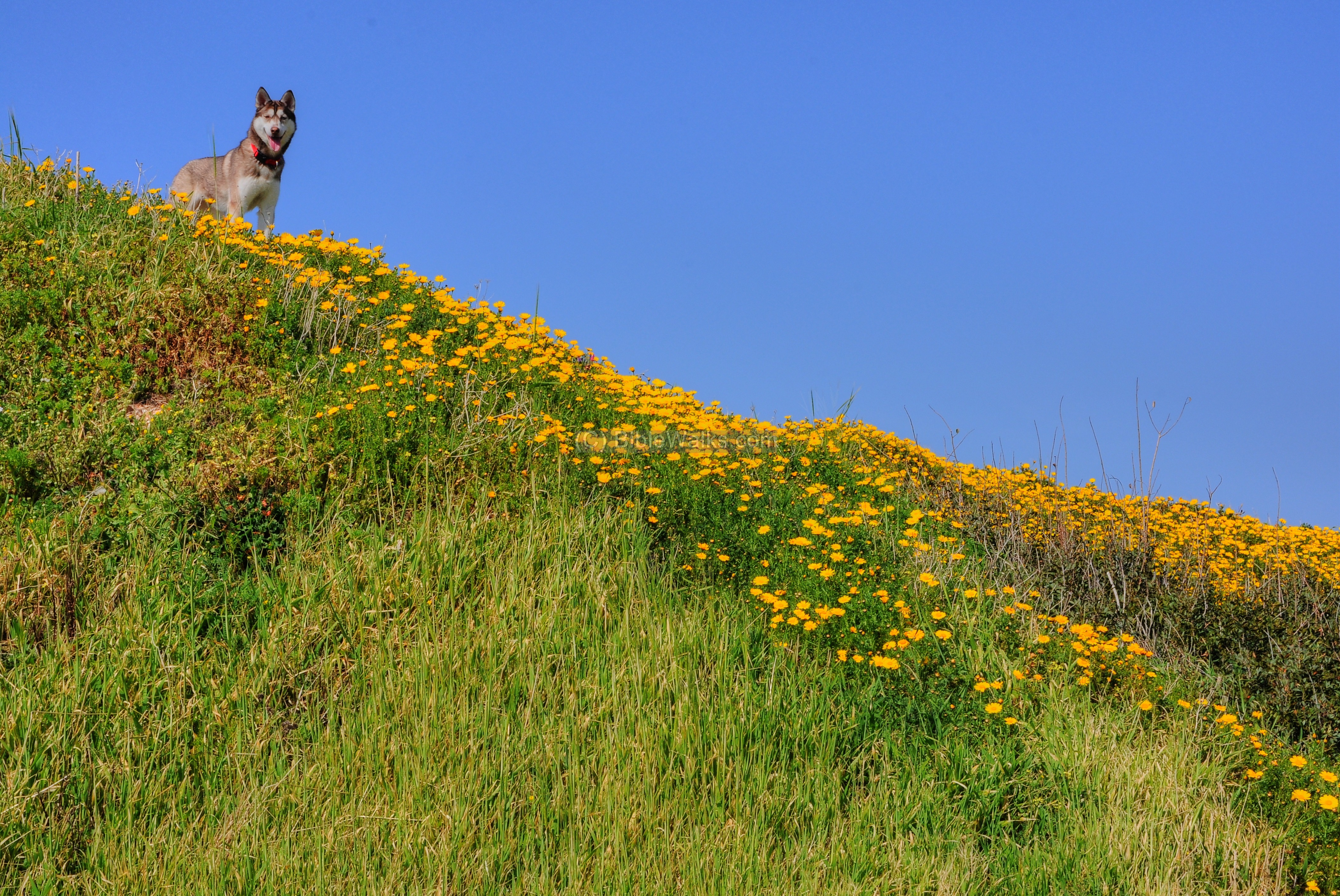
The dog, who accompanied the biker from the previous picture, seem to be interested in these excavations:
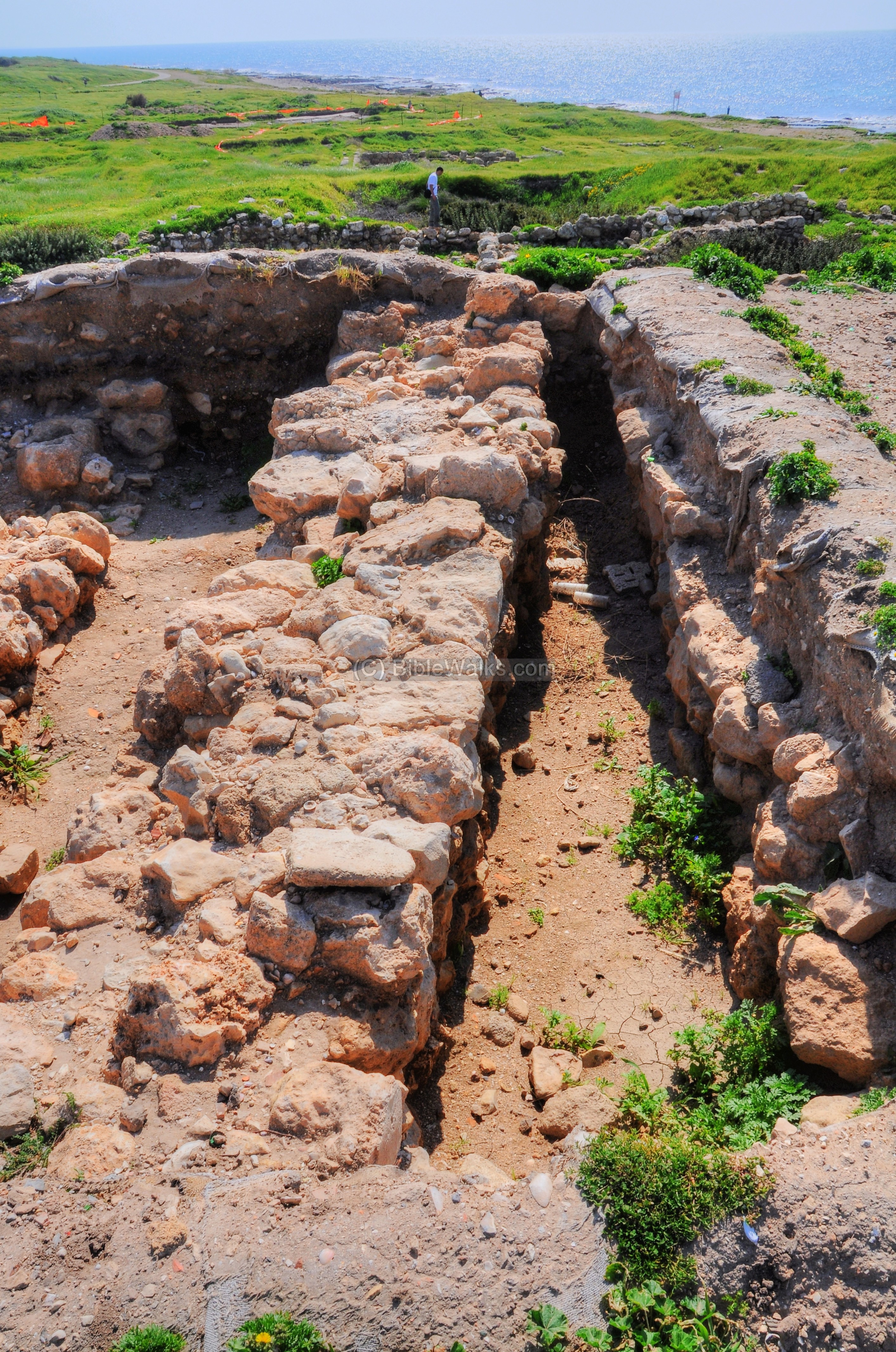
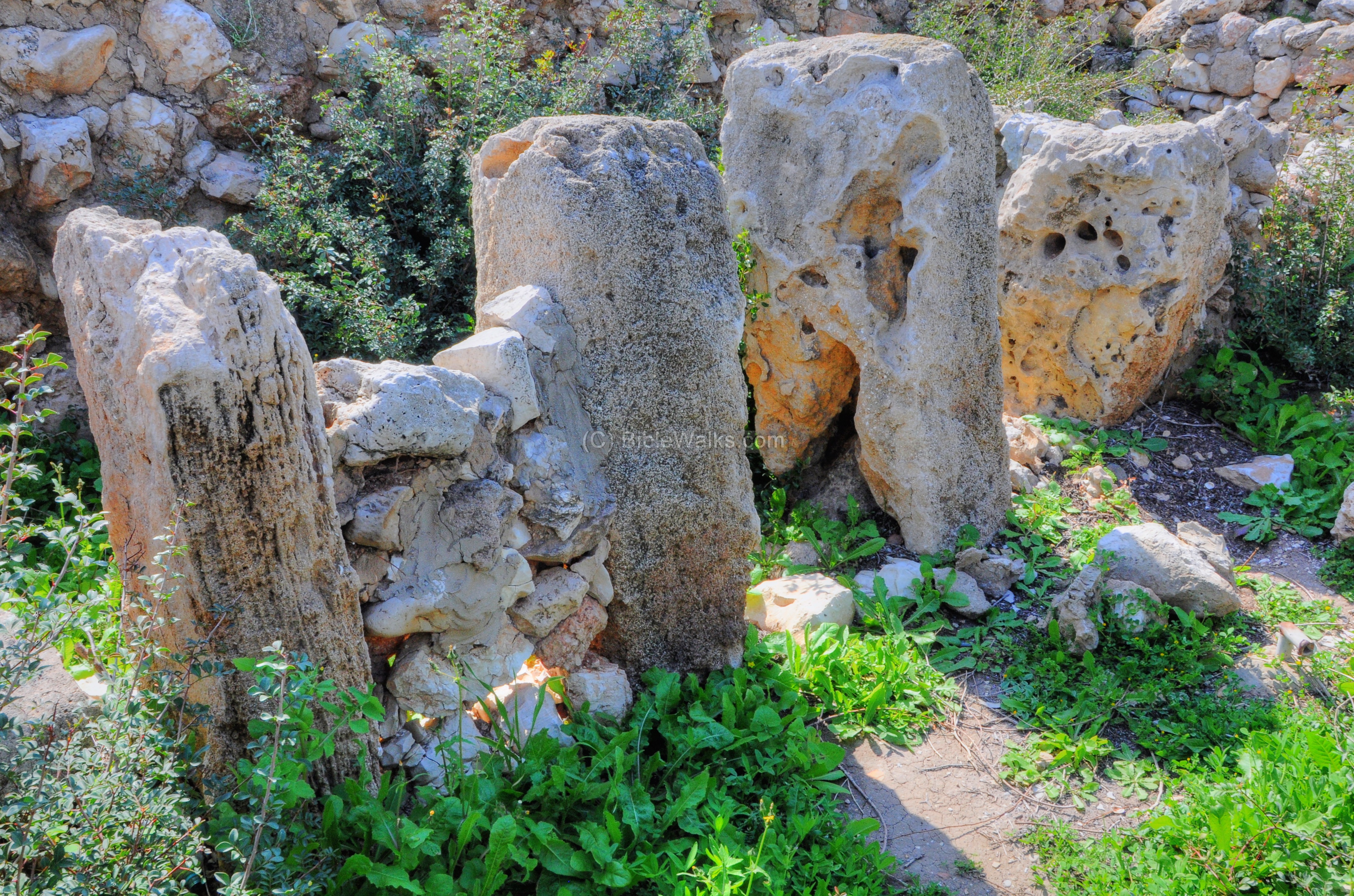
- Four-room house
Recent excavations have exposed a well preserved 9th century BC structure. This design is called a “Four-room house”.
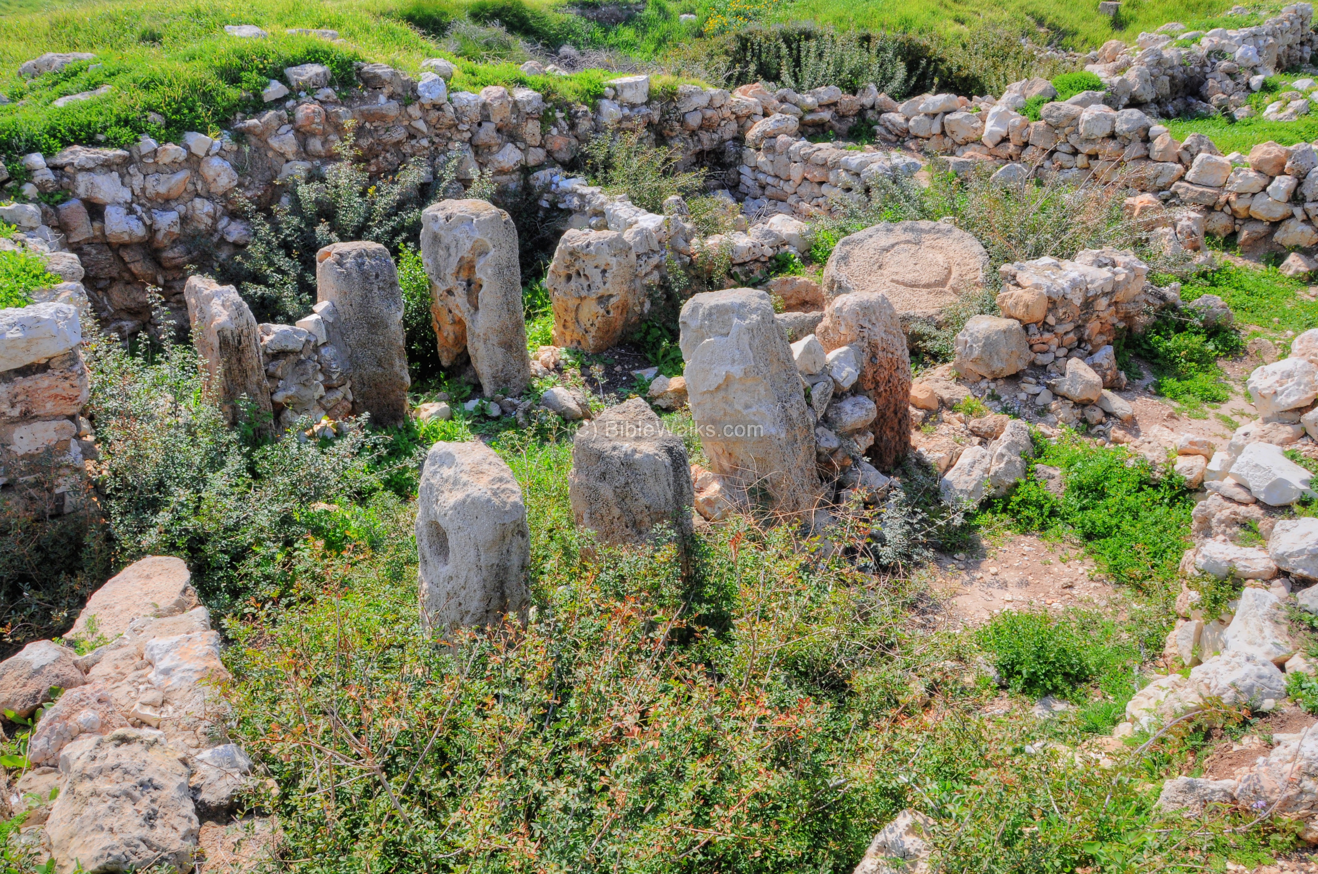
This “four-room” house was popular in the Iron age, from the 11th to the 6th century BC. The design was based on a long house with four main spaces – a broad room in the back and three long spaces extending forward from it. The rooms were divided by stone pillars and walls.
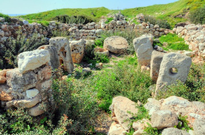
The entrance to the house was usually located on the central room.
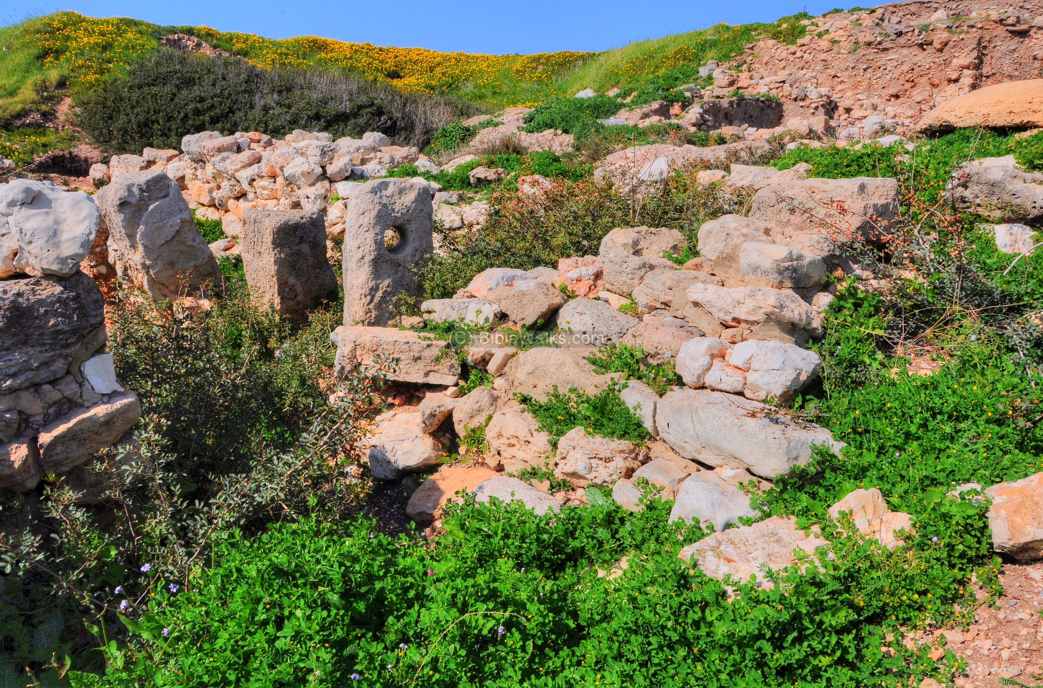
The “four-room” house is usually attributed to the Israelites.
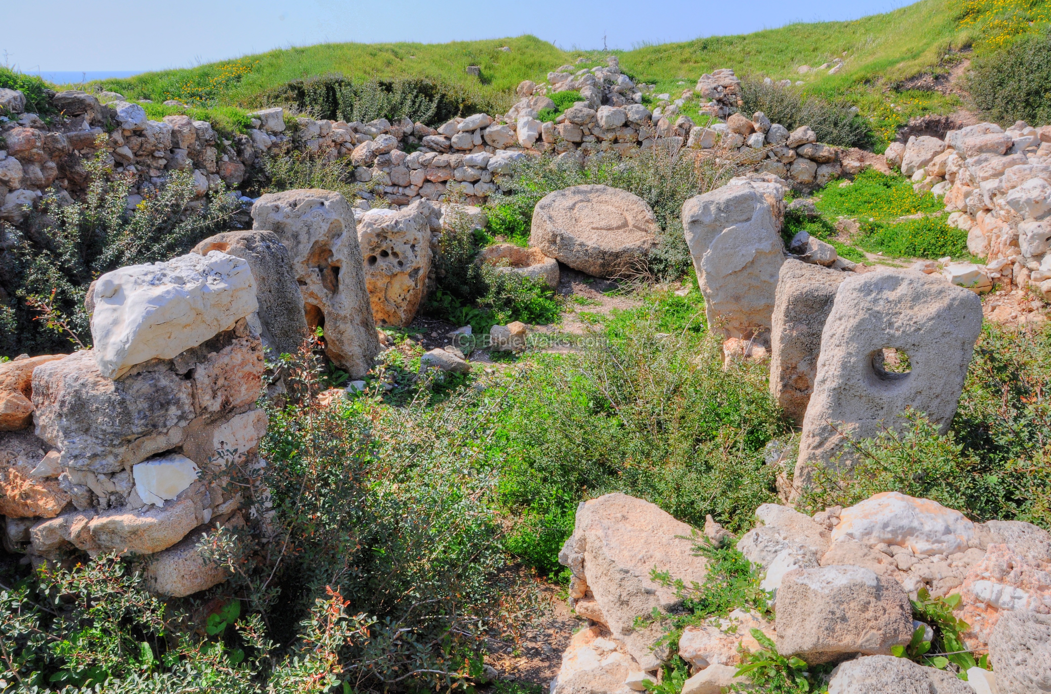
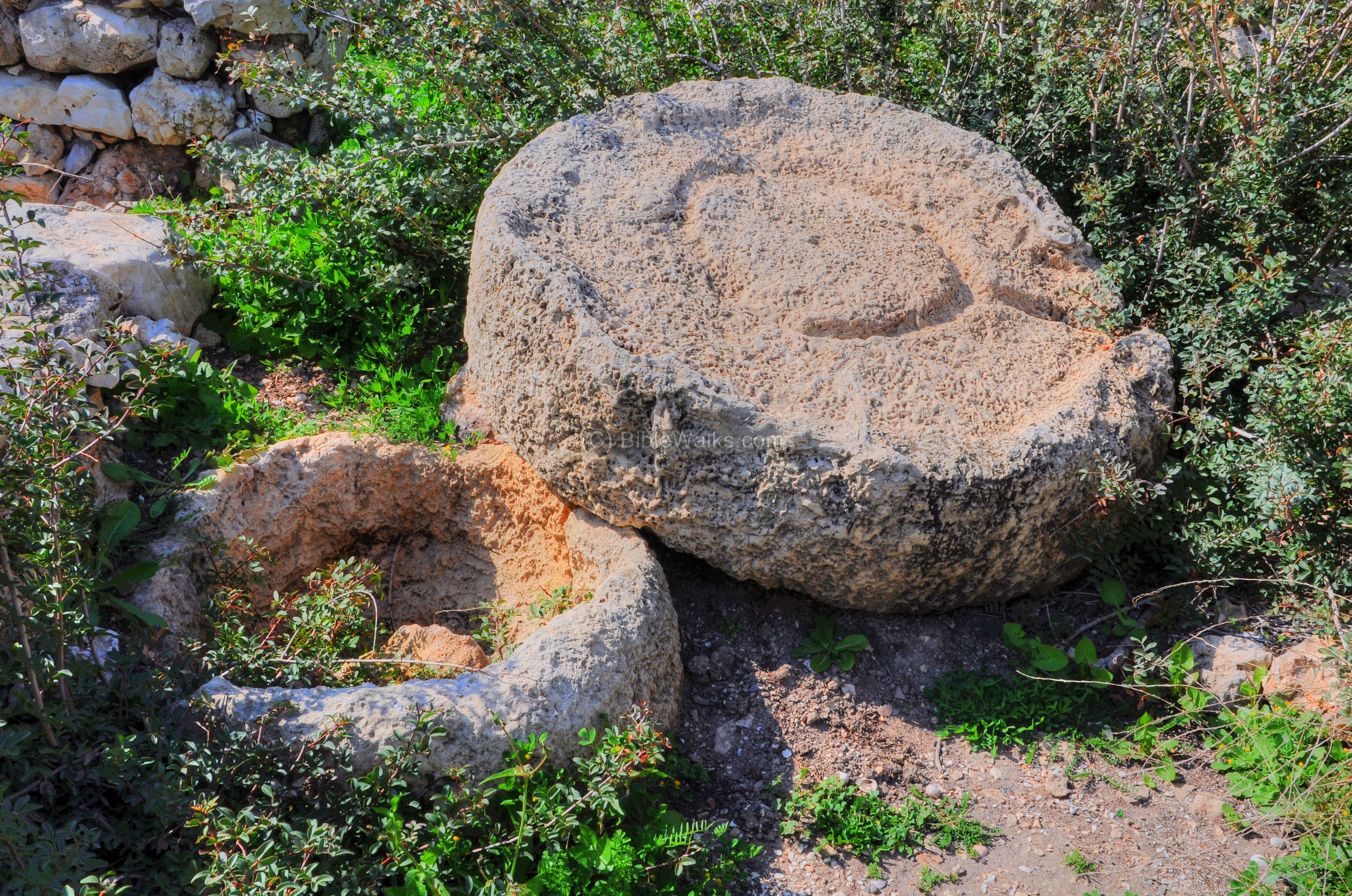
A basin stone of an oil press is located on the edge of the room:
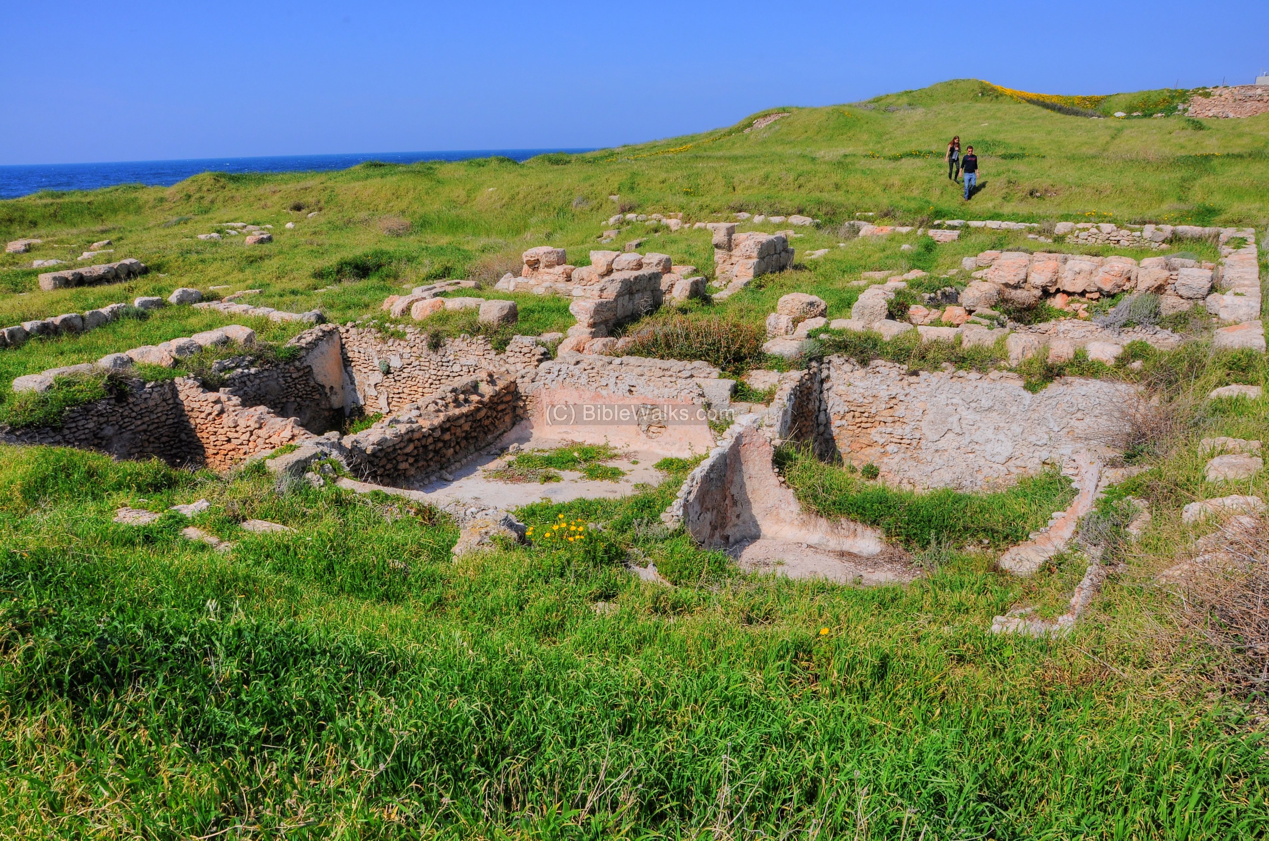
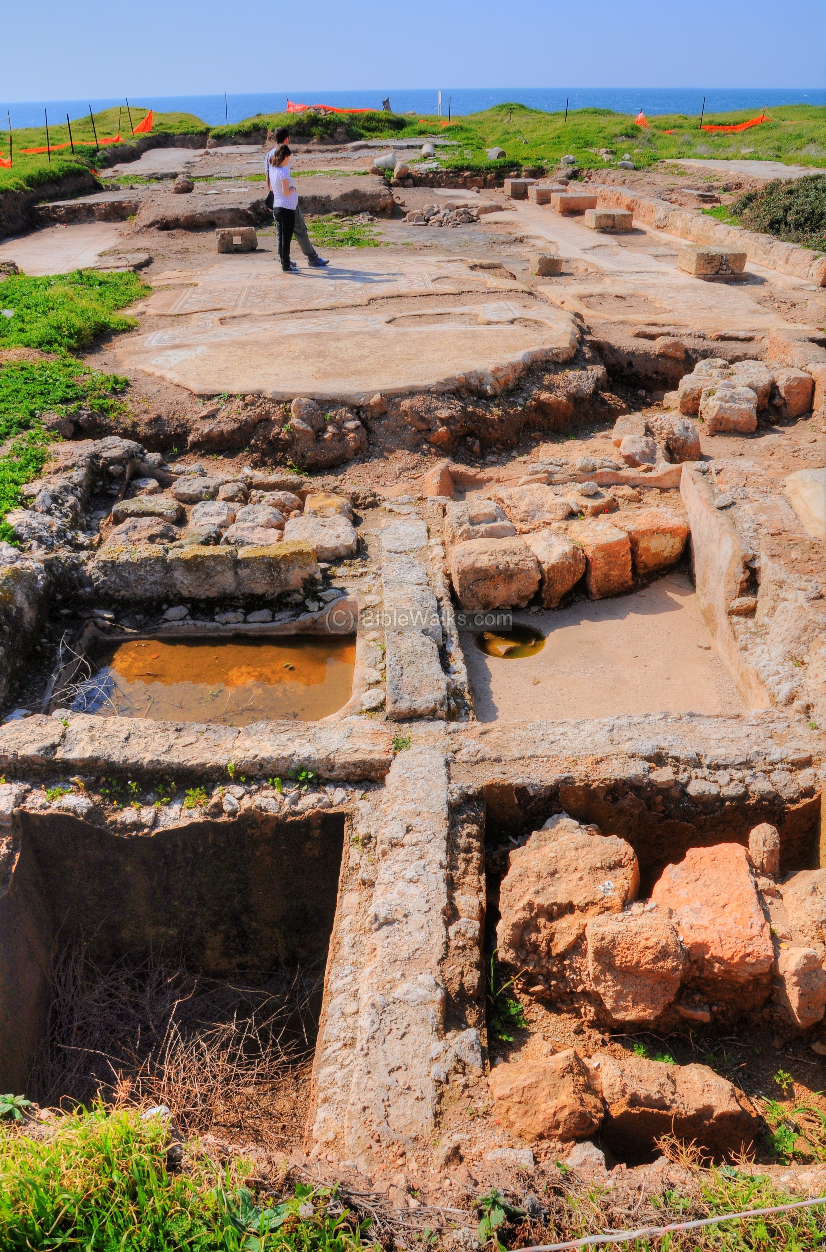
(d) South of the Tel
On the south side of the mound is an excavated area with storehouses and installations. This drone view from the north side shows the plan of the excavated areas. In the upper side of this view are the ruins of a Byzantine period monastery, which is detailed in the next section.
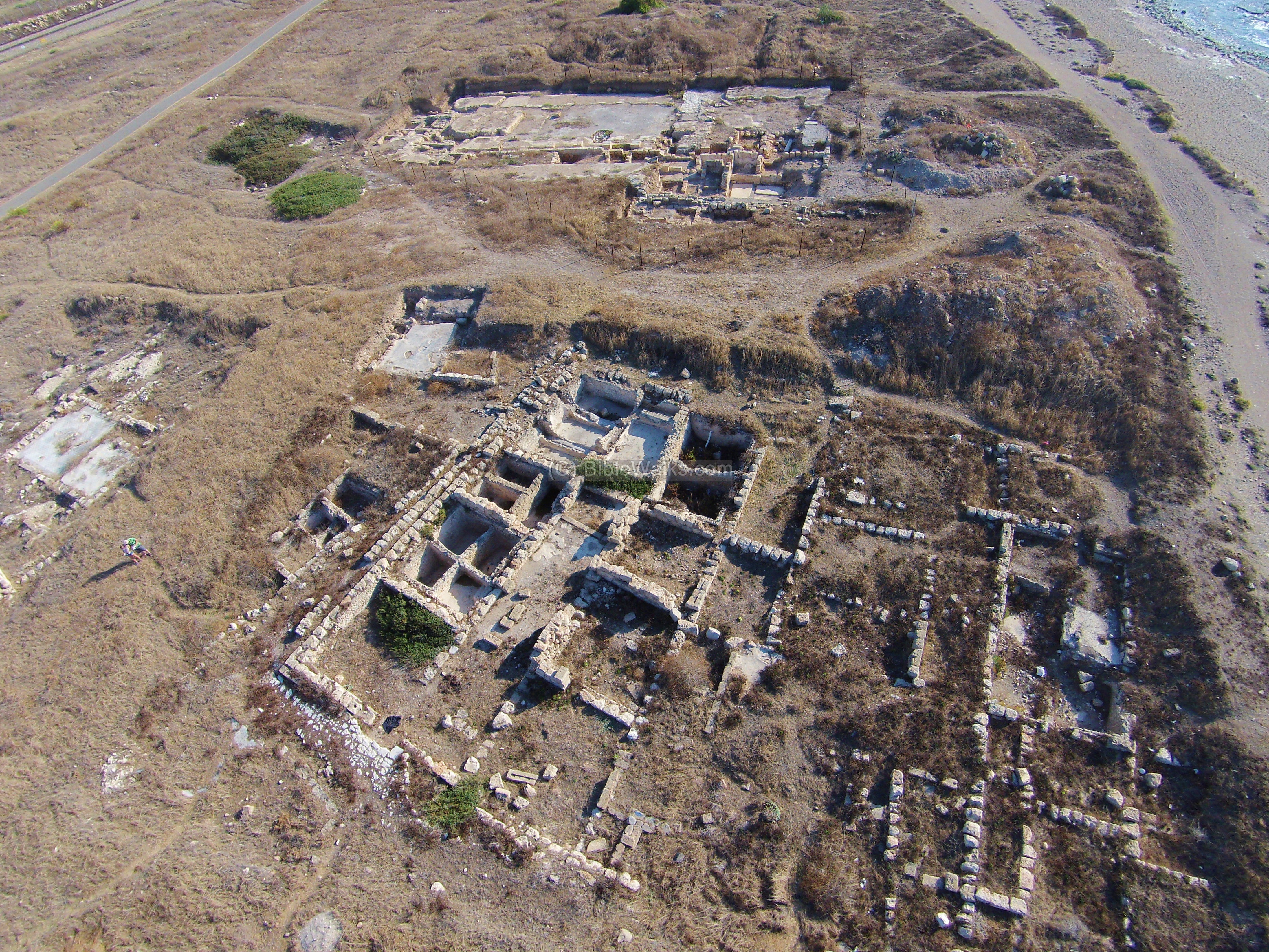
A closer look on these structures is shown in the following photos.
-
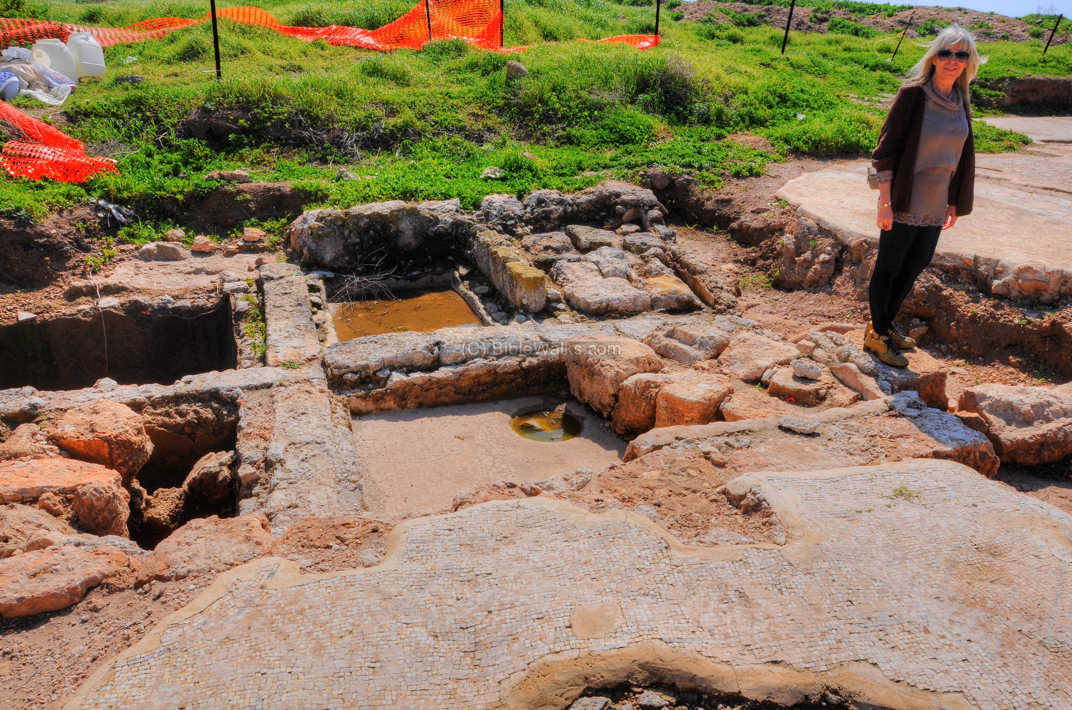
Storehouses
An industrial complex dated to the Phoenician period was found to the south of the hill. The following aerial view, captured on June 2023 from the east side, shows the vast industrial area which includes storehouses and installations.
It was probably used to produce and store oil and wine. Shikmona in the 9th-8th century BC was a center for olive oil production, and its port exported the merchandise. The complex included three oil presses, storerooms for the oil and for the olives.
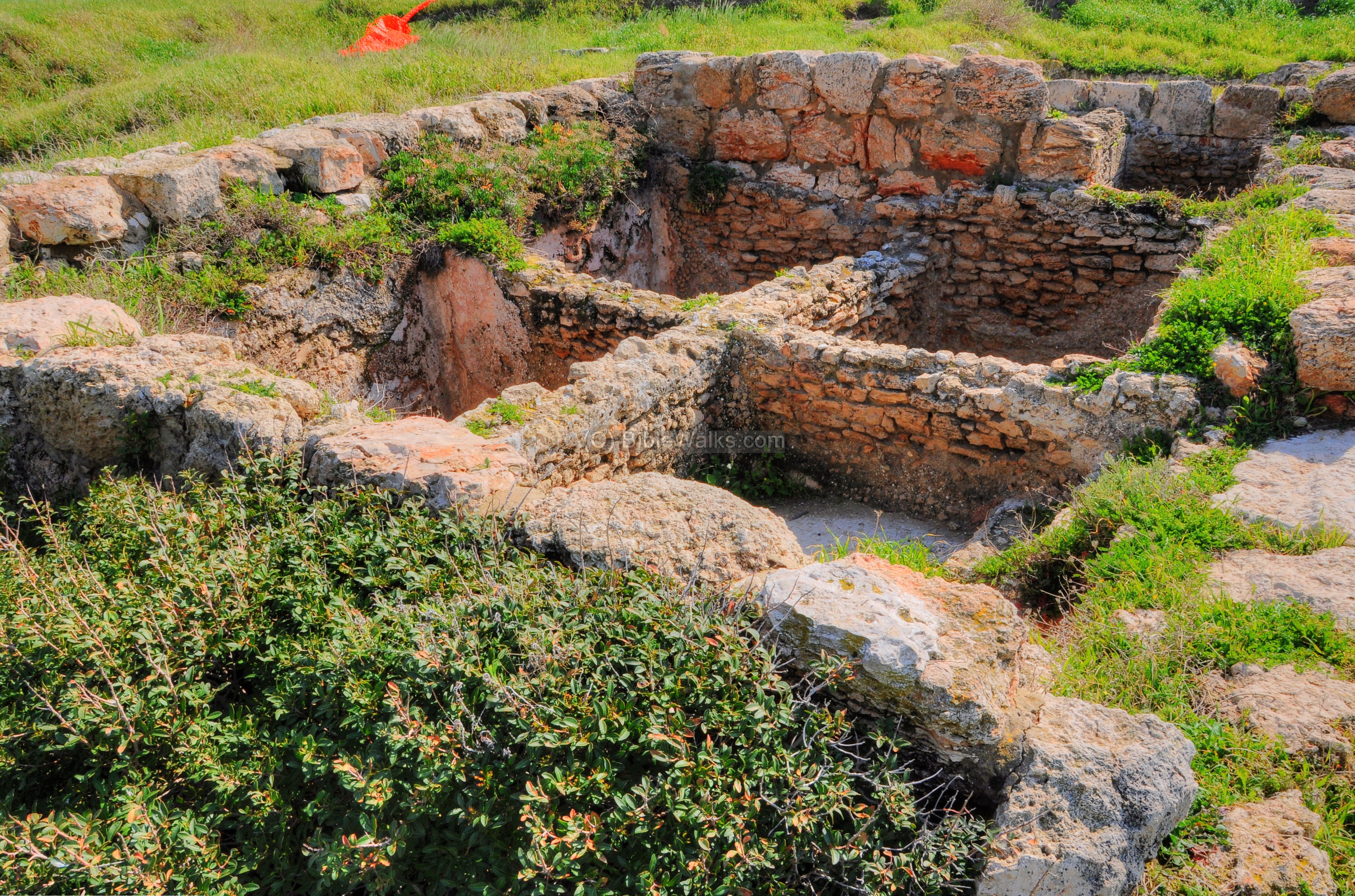
In the following picture is one of the pits where the olive juice was collected. It has a mosaic floor.
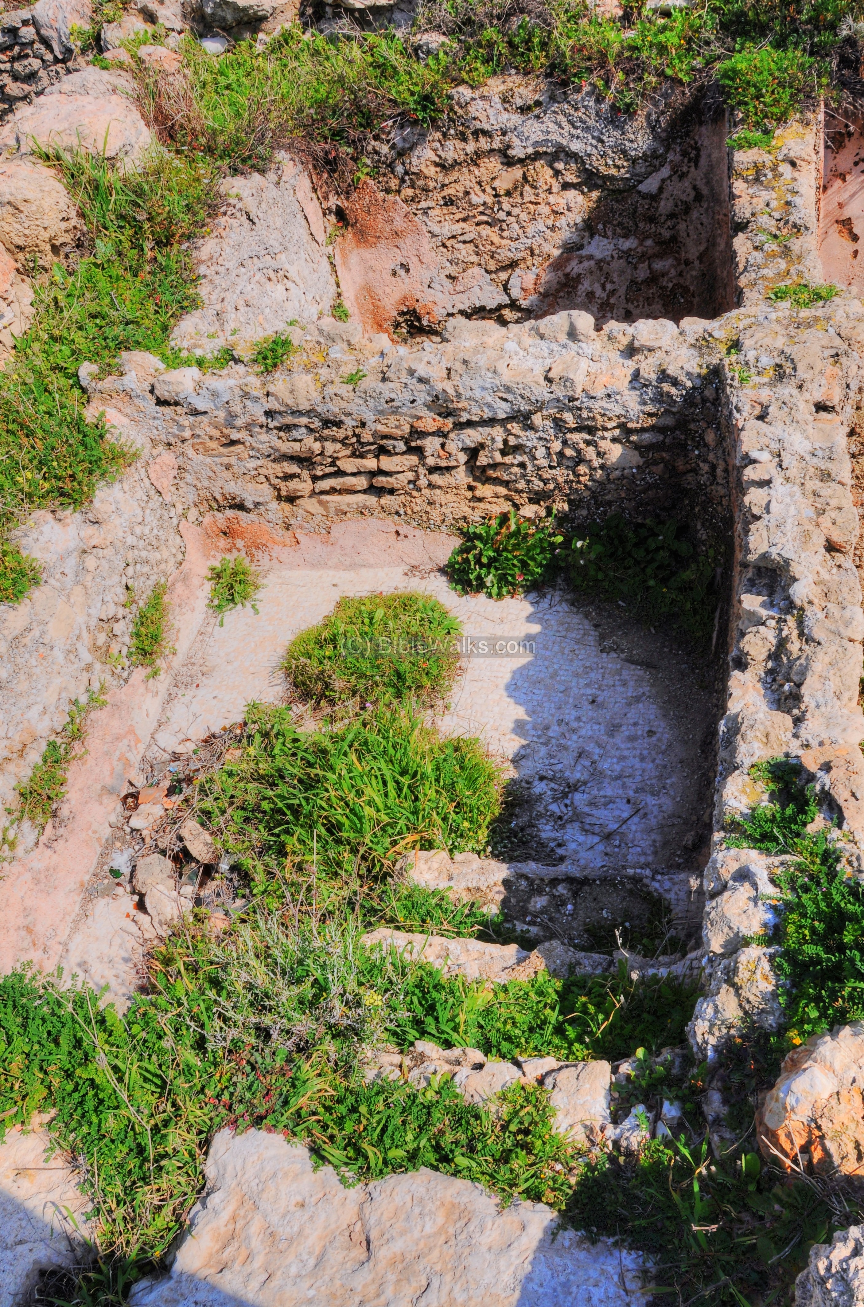
- Purple dye
Another industrial installation complex was found here that produced the purple dye. Dozens of pools were found on the south western side of the mound. This might have been a textile production or dyeing complex, associated with the deep-purple color extraction based on marine snails. This is one of the theories of these installations, although the archaeologists in the recent seasons are re-examining the structures.
The Canaanites, Hebrews of the Zebulun tribe, and especially the Phoenicians produced the deep-purple indigo dye which was used for the textile industry. Purple became a symbol of status, sovereignty and power. The Phoenicians of Tyre and around the Mediterranean coast skilled in purple dyeing, based on the marine snail (Hilazon in Hebrew, Murex trunculus as scientific name) which was one of the important sources of dye colors in antiquity. The Greek name of “Phoenician” actually means red-purple, based on their production and trade of the purple cloths.
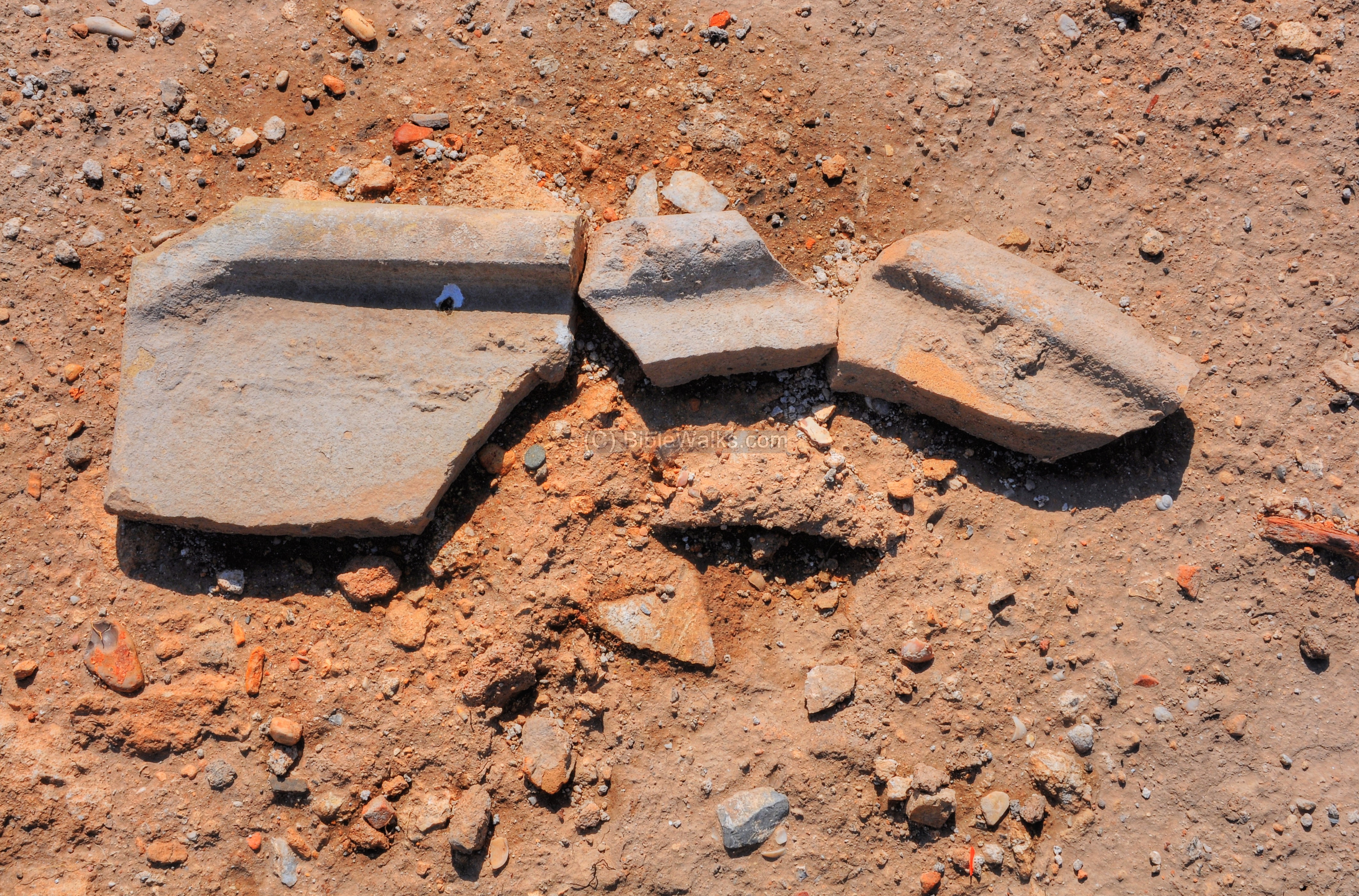
Remains of a vat stained with the purple Murex dye, which was found in Shikmona and dated to 1200 BC, indicates that this industry started here in the Canaanite period. More Phoenician shreds with the purple dye were found here, dated to Iron Age II (9th-8th century BC).
Hundreds of murex shells were also found here. Since 60,000 murex were needed to produce one pound of dye, the dye was highly prized in ancient times. Their shells are found in most of the Phoenician sites along the coast in Israel and Lebanon.
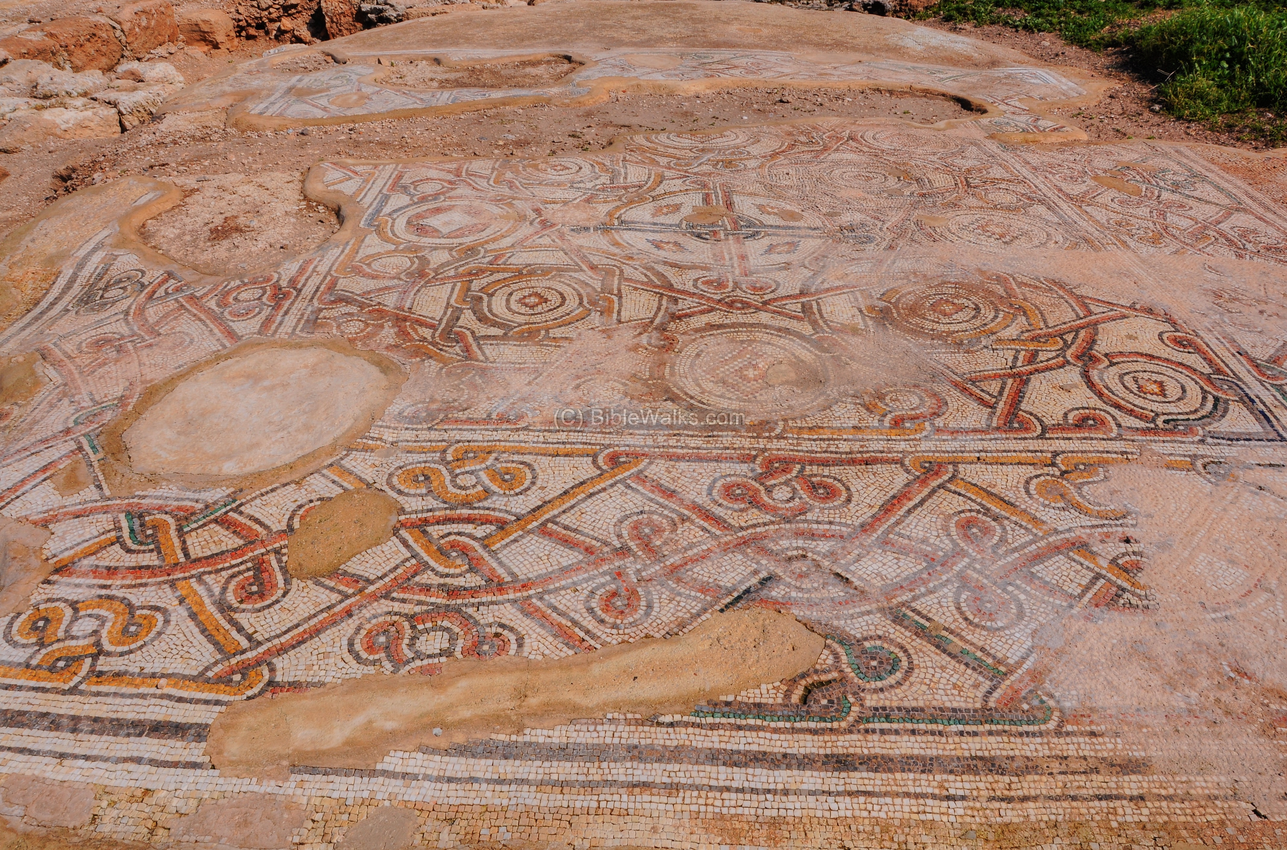
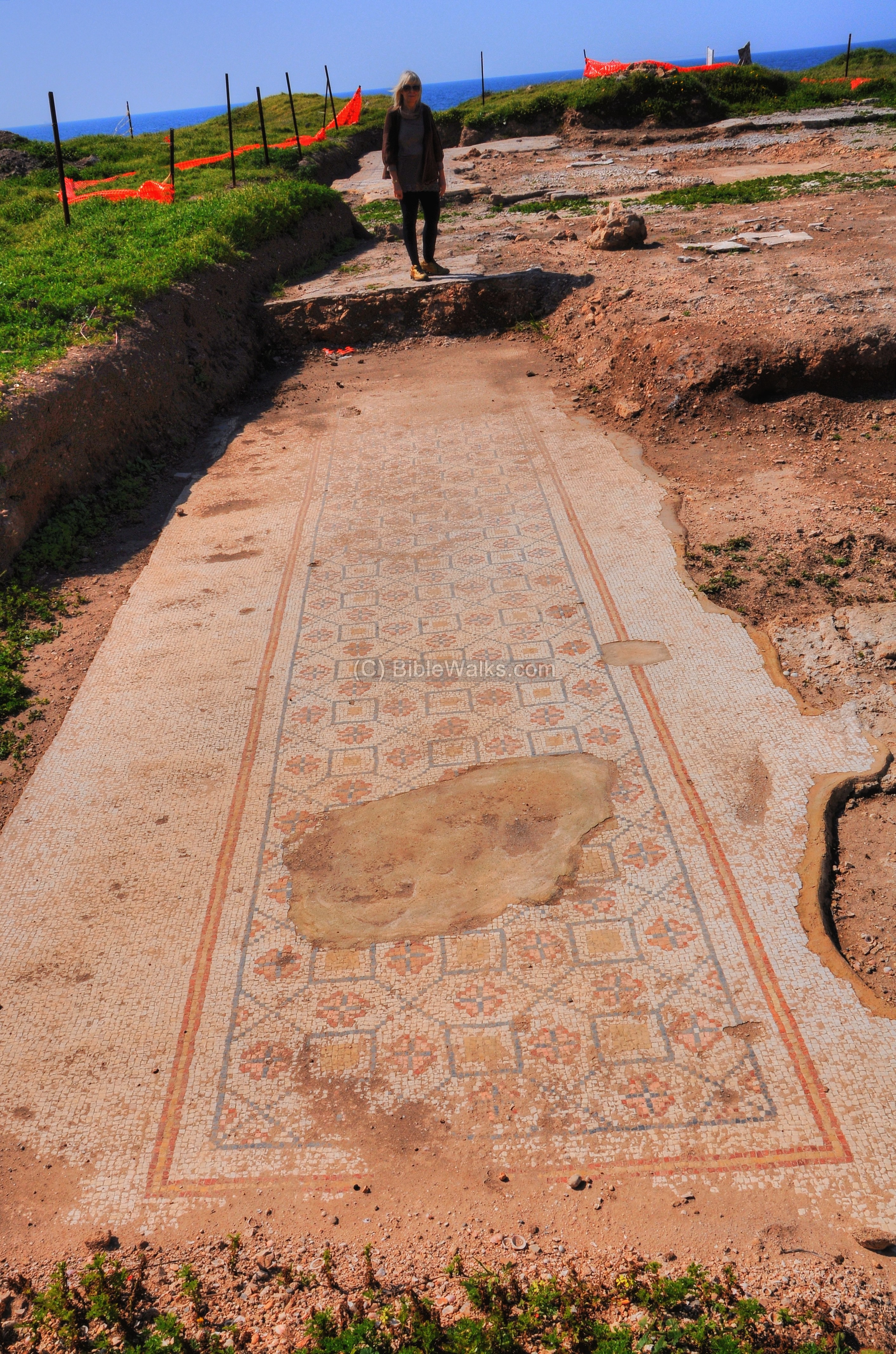
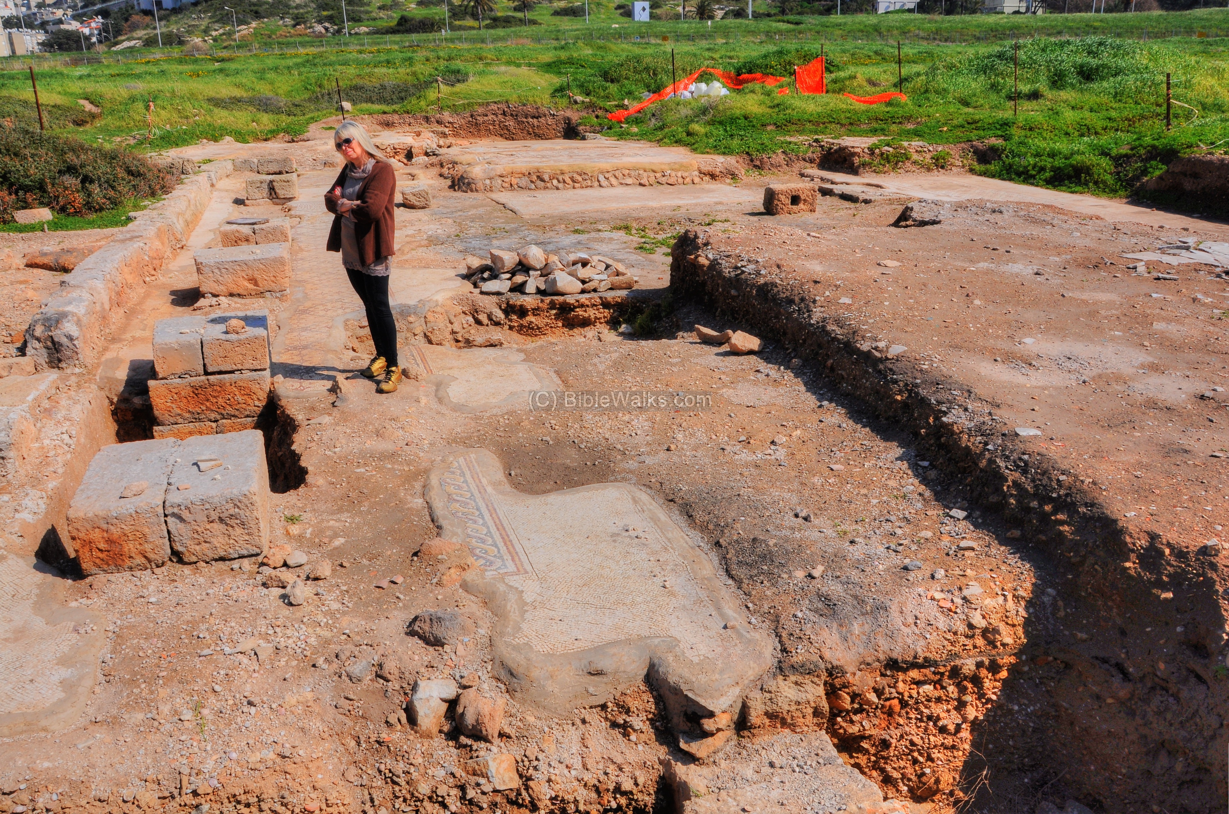
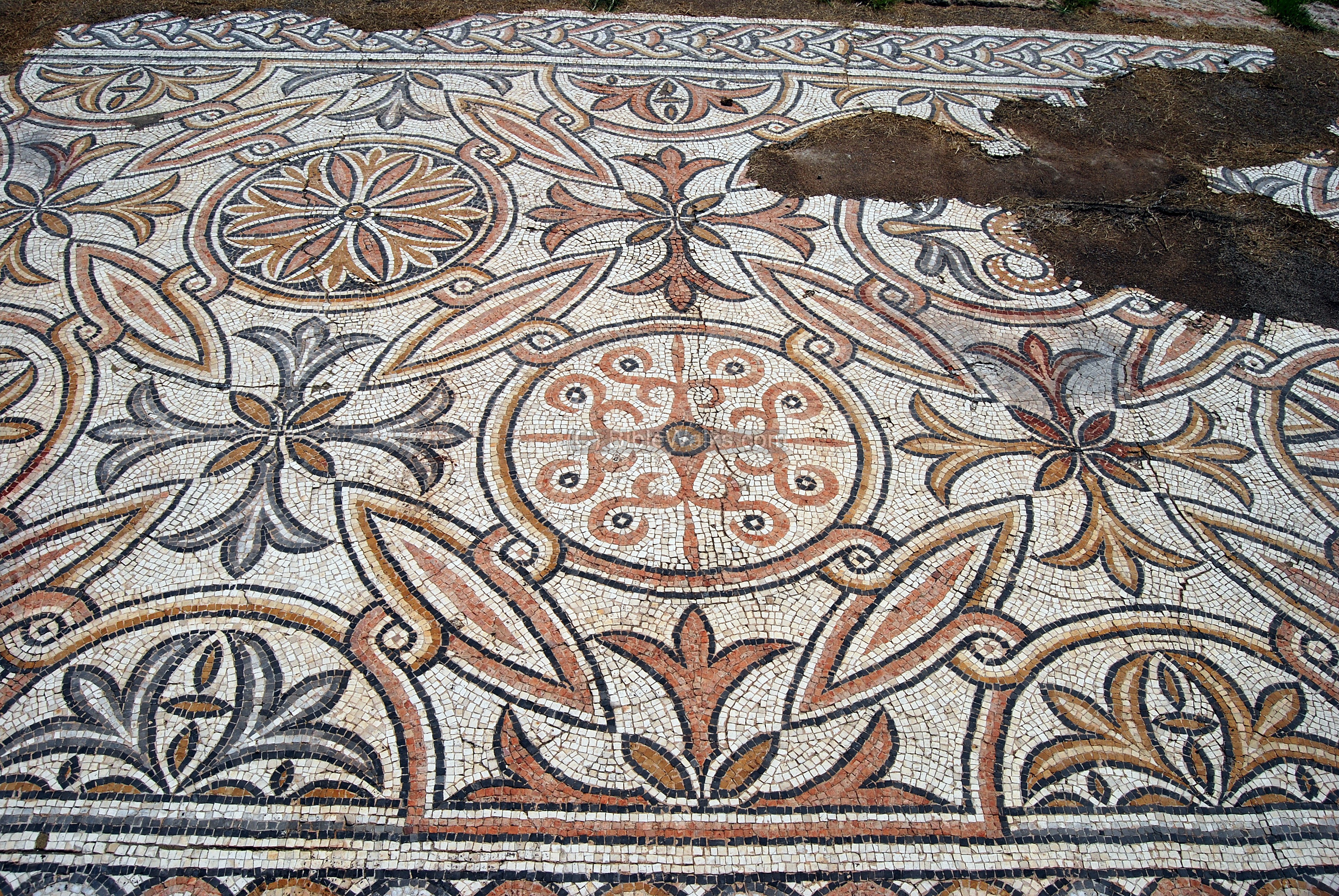
(e) Monastery
A section of a Byzantine monastery was excavated in the season of 2011, and is now under preservation. It is located to the south of the hill. This aerial view, captured on June 2023 from its east side, shows the plan of the monastery.
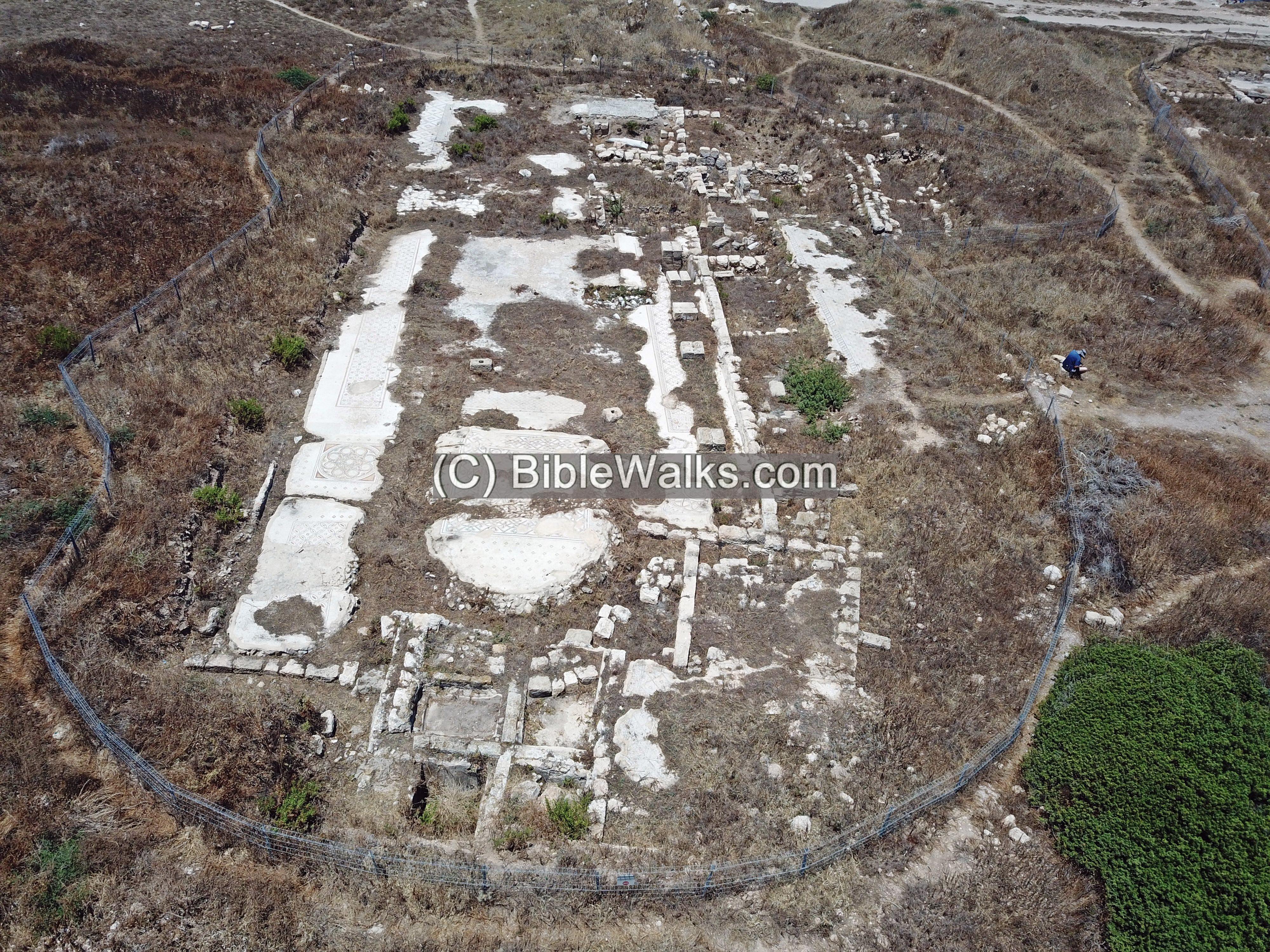
The monastery is now (2023) closed to the public. However, we visited the site shortly after the excavations of 2011 and got a closer view of the monastery.
Here is the view on the ground level:
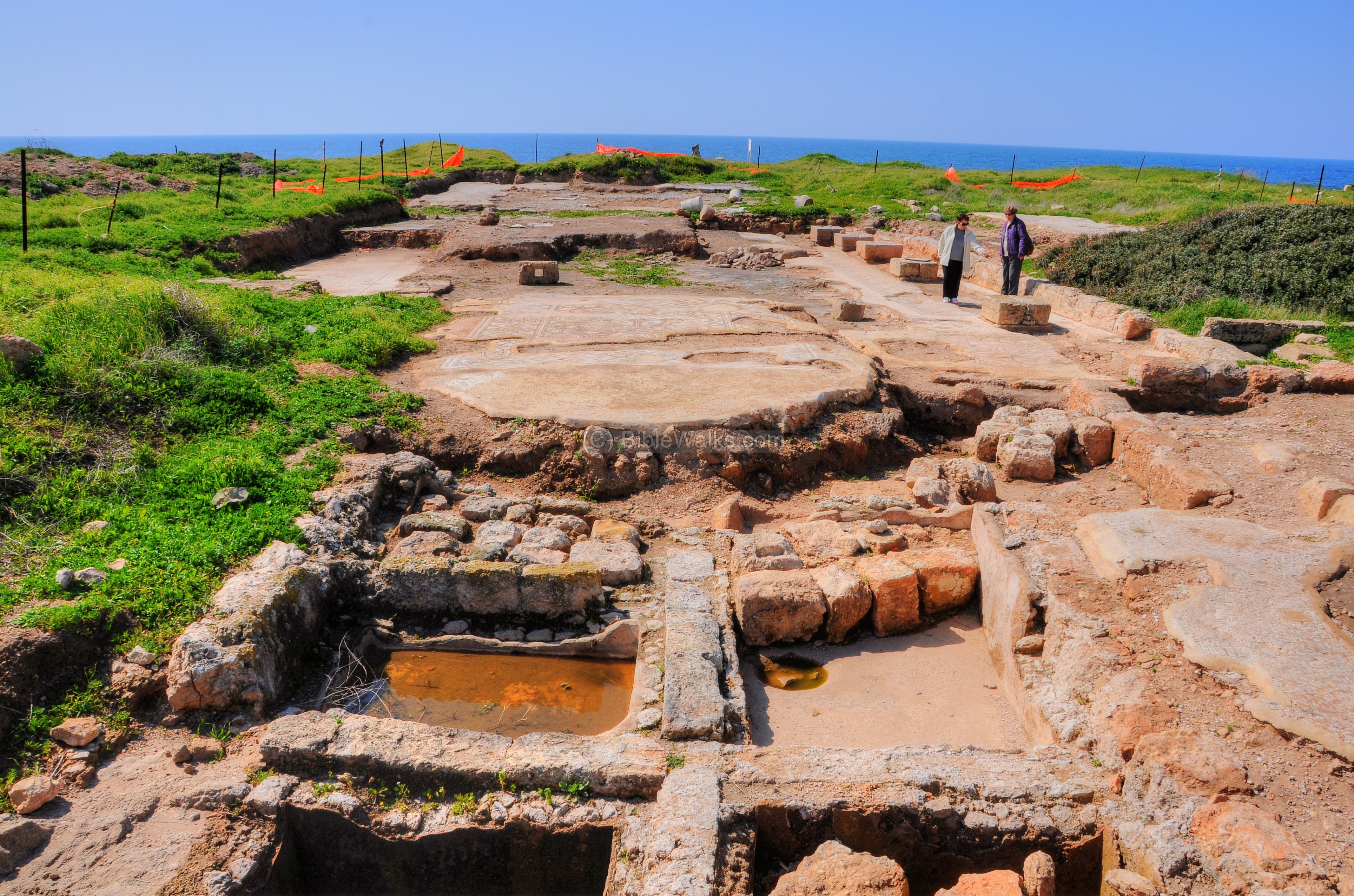
The Church was built in the end of the 4th century AD to the early 5th century.
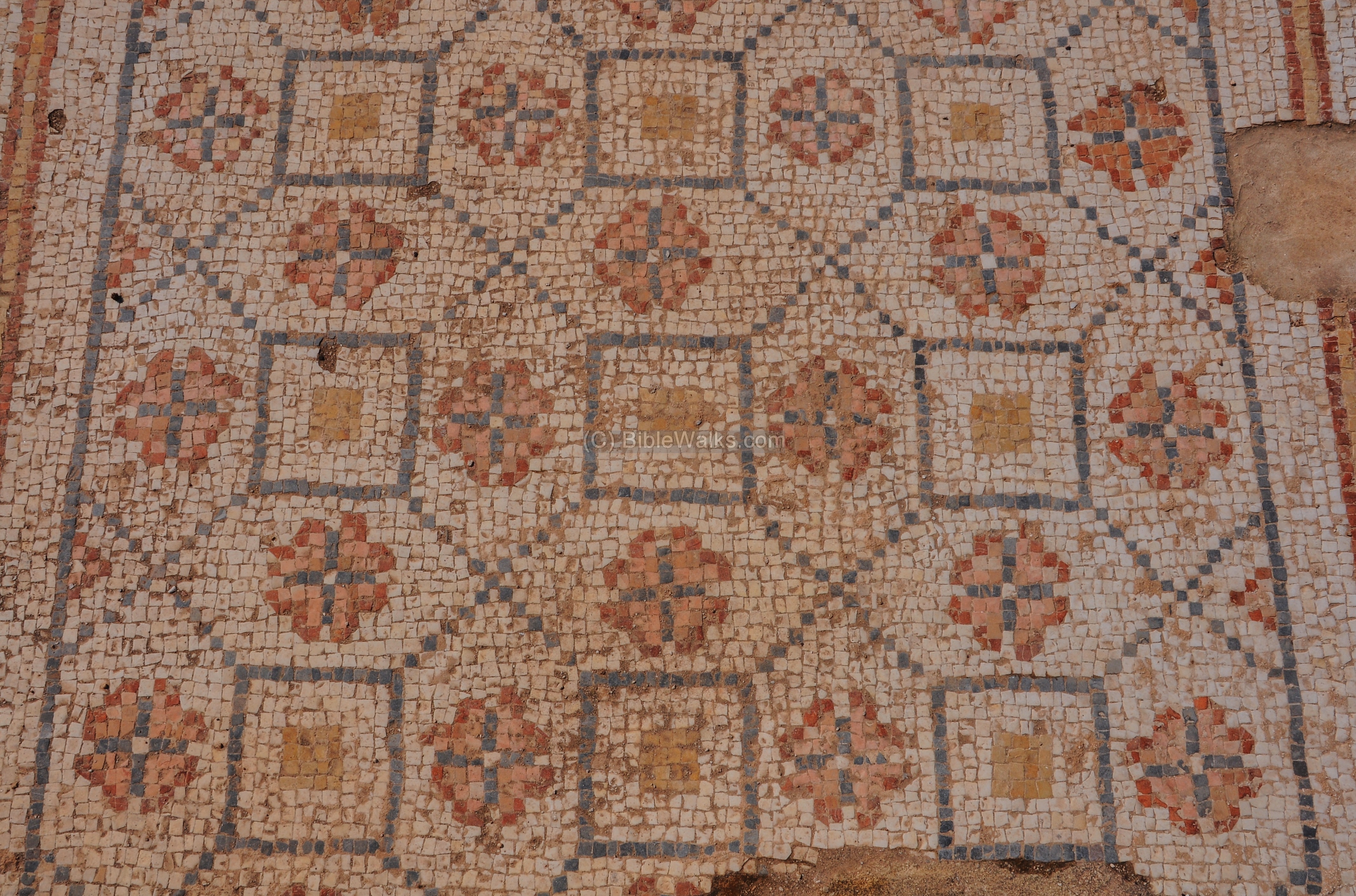
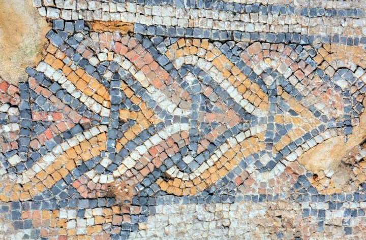
The unique feature of this area are the beautiful mosaics floors.
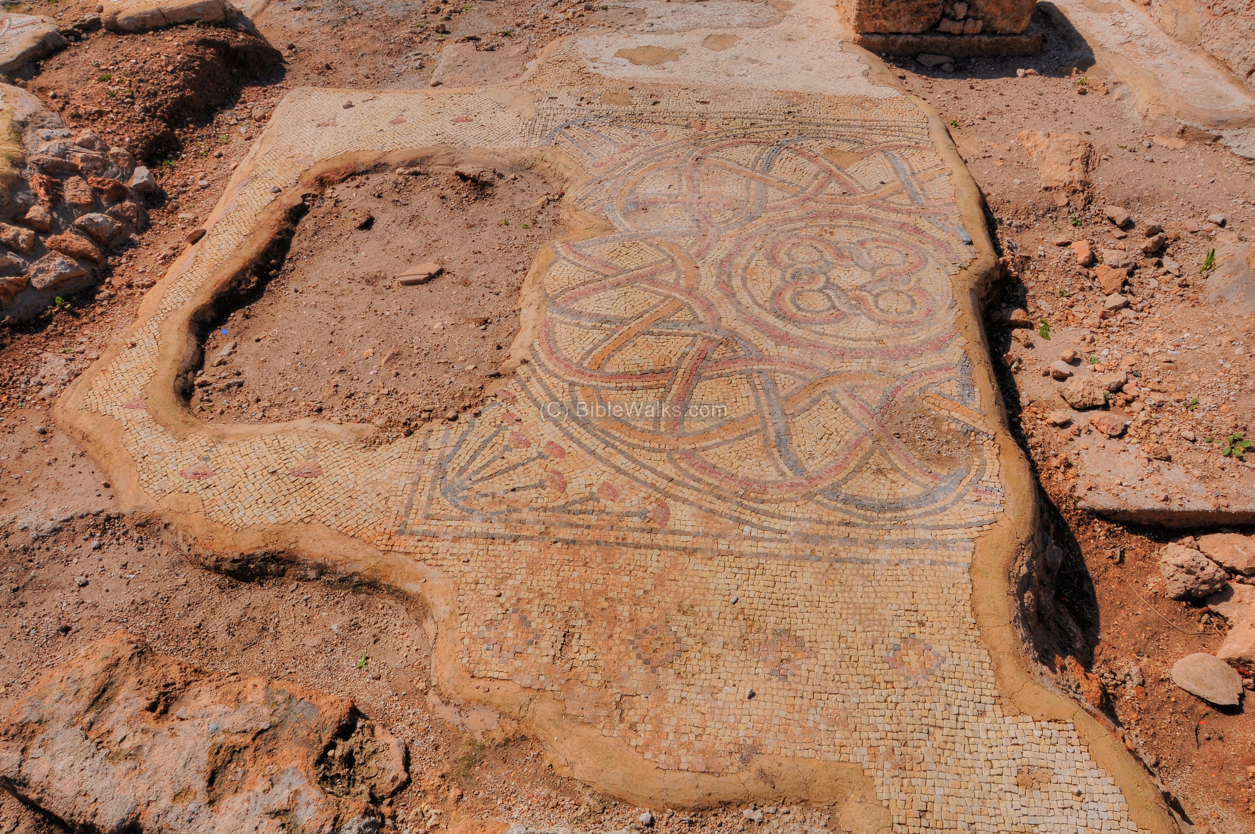
More examples are shown in the following pictures:
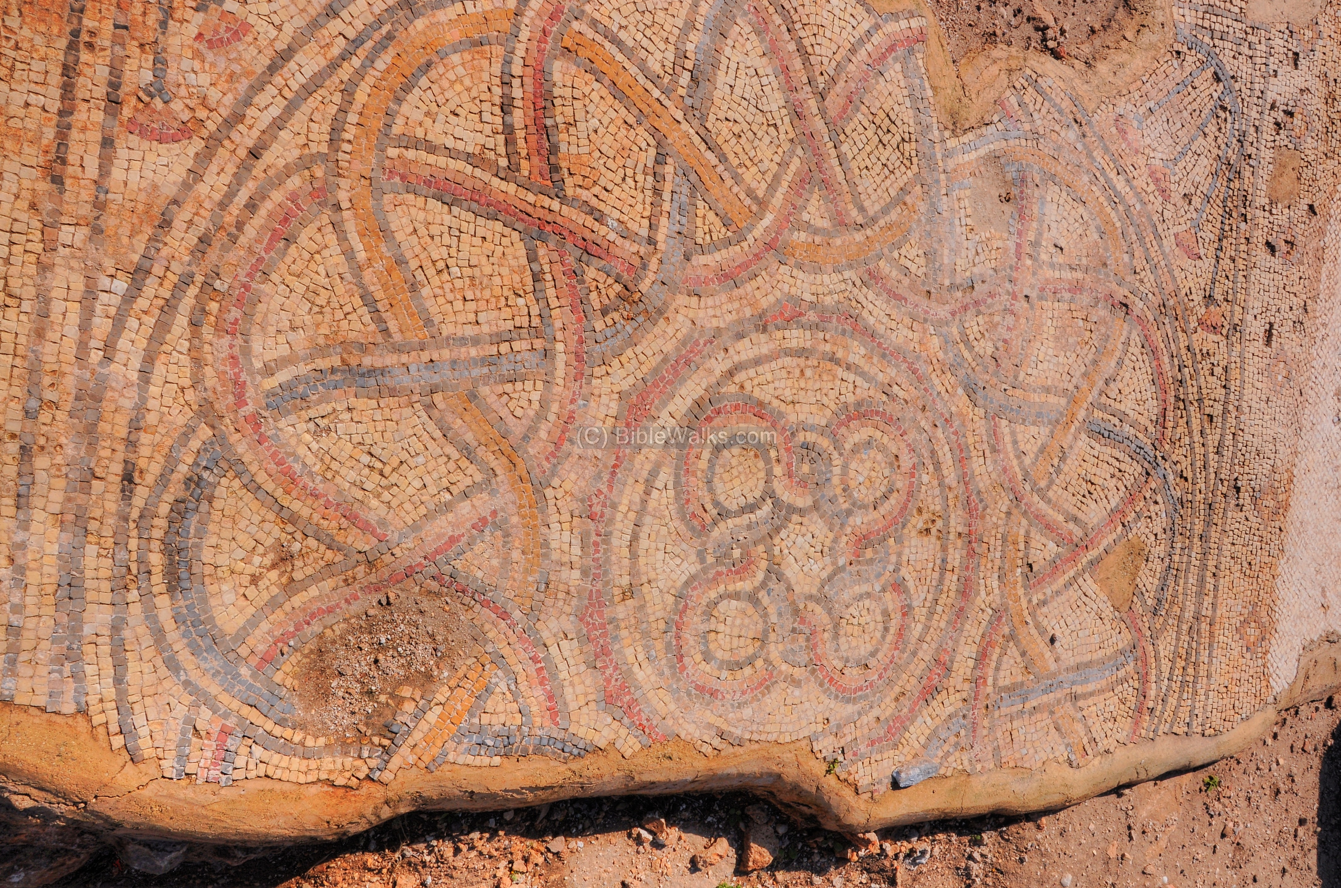
Another section with geometric patterns, with a cross in the center, as seen in the apse on the east side:
A section on the south side:
A detail in this floor:
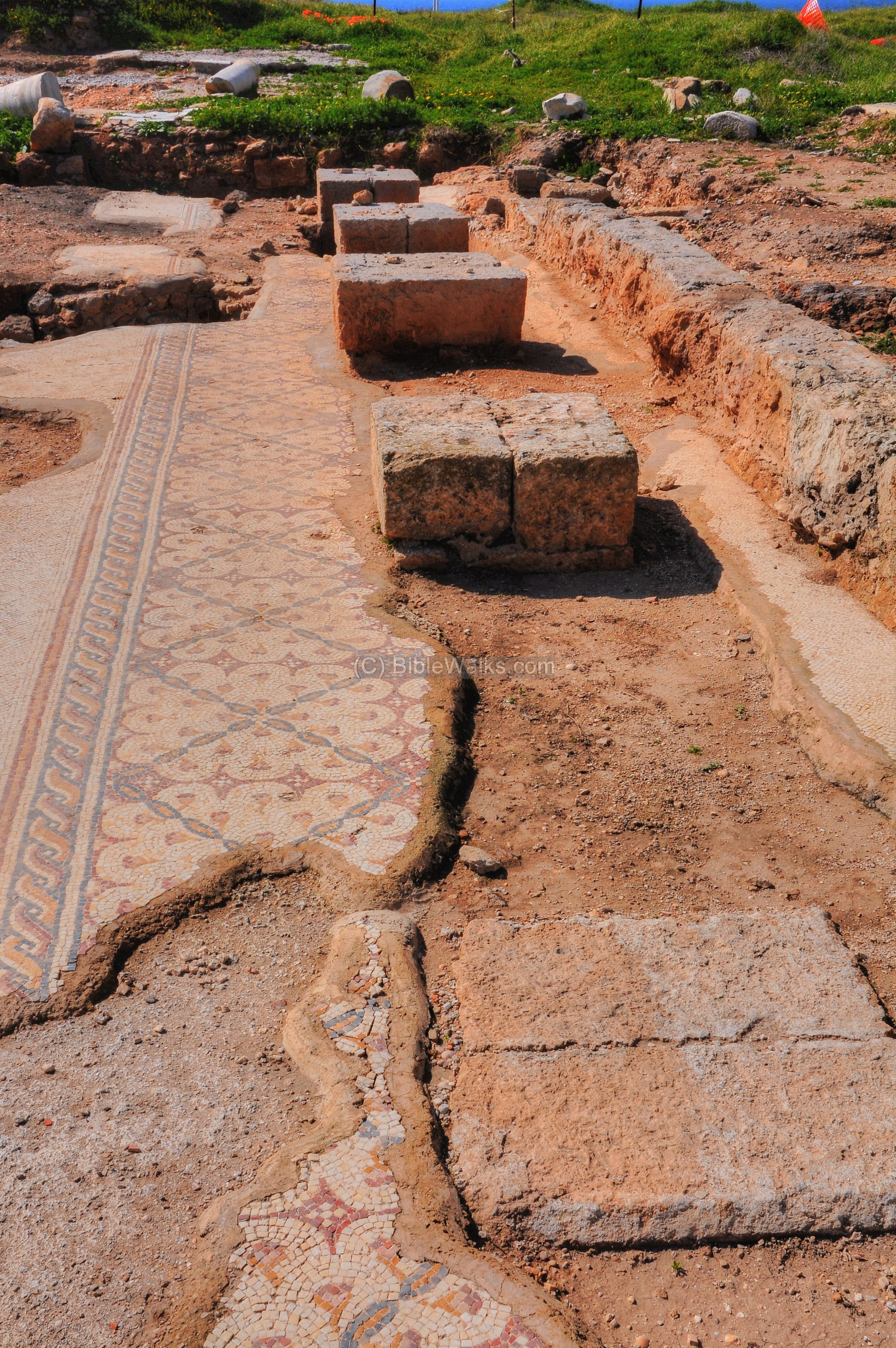
- Colonnaded hall or courtyard:
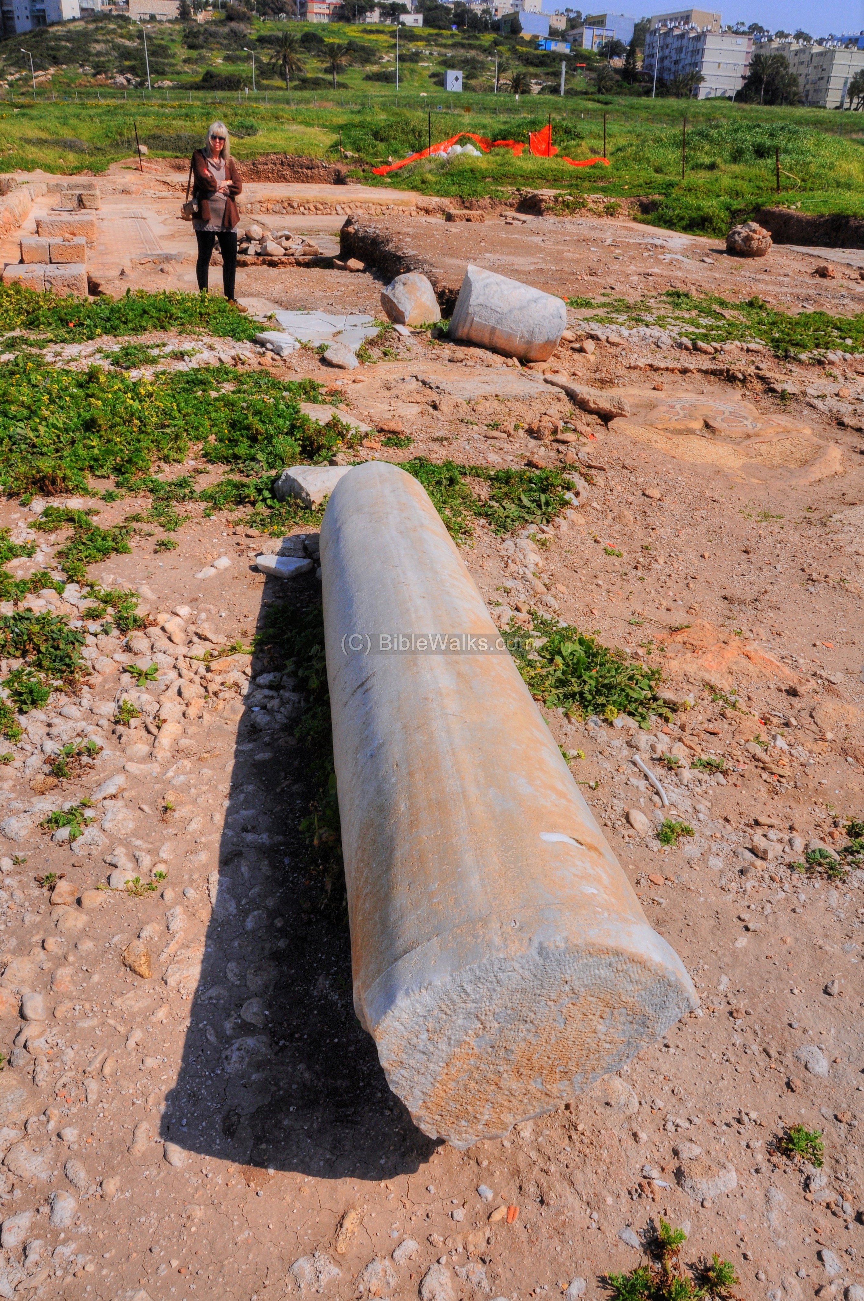
Along the length of the floor is a number of bases of columns.
A closer view from the east side:
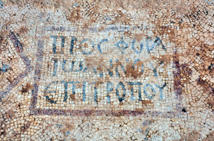
A 3-line mosaic inscription, dated to the first phase of construction in the 4th-5th century, is located on the floor of the atrium. It is 47 x 30 cm in area, with 8cm high letters. The Greek words read: “ΠΡΟΣΦΟΡΑ ΙΩΑΝΝΟΥ ΕΠΙΤΡΟΠΟΥ”, translation: “Donation of John the Administrator.”
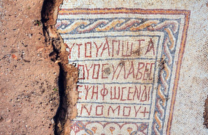
Another 4-line inscription, dated to the 4th-5th century, was found in the middle of the northern aisle of the church. It measures 70 x 72 cm with 12cm high letters. The inscription informs who was responsible for the mosaics in the church.
“… the holy one
“… the reverent
“… laid this with mosaic by
“… the steward
One of the marble columns is seen in the picture below:
A clay fragment belonged to the roof of the structure.
The eastern edge of the structure, with pools, is seen below.
A western view of the structure:
(f) Necropolis
Shikmona’s Necropolis (=large cemetery) is located on the hillside east of the highway. One of the burial caves is seen under one the the famous monuments of Haifa – an anchor greeting the drivers arriving to the port city of Haifa.
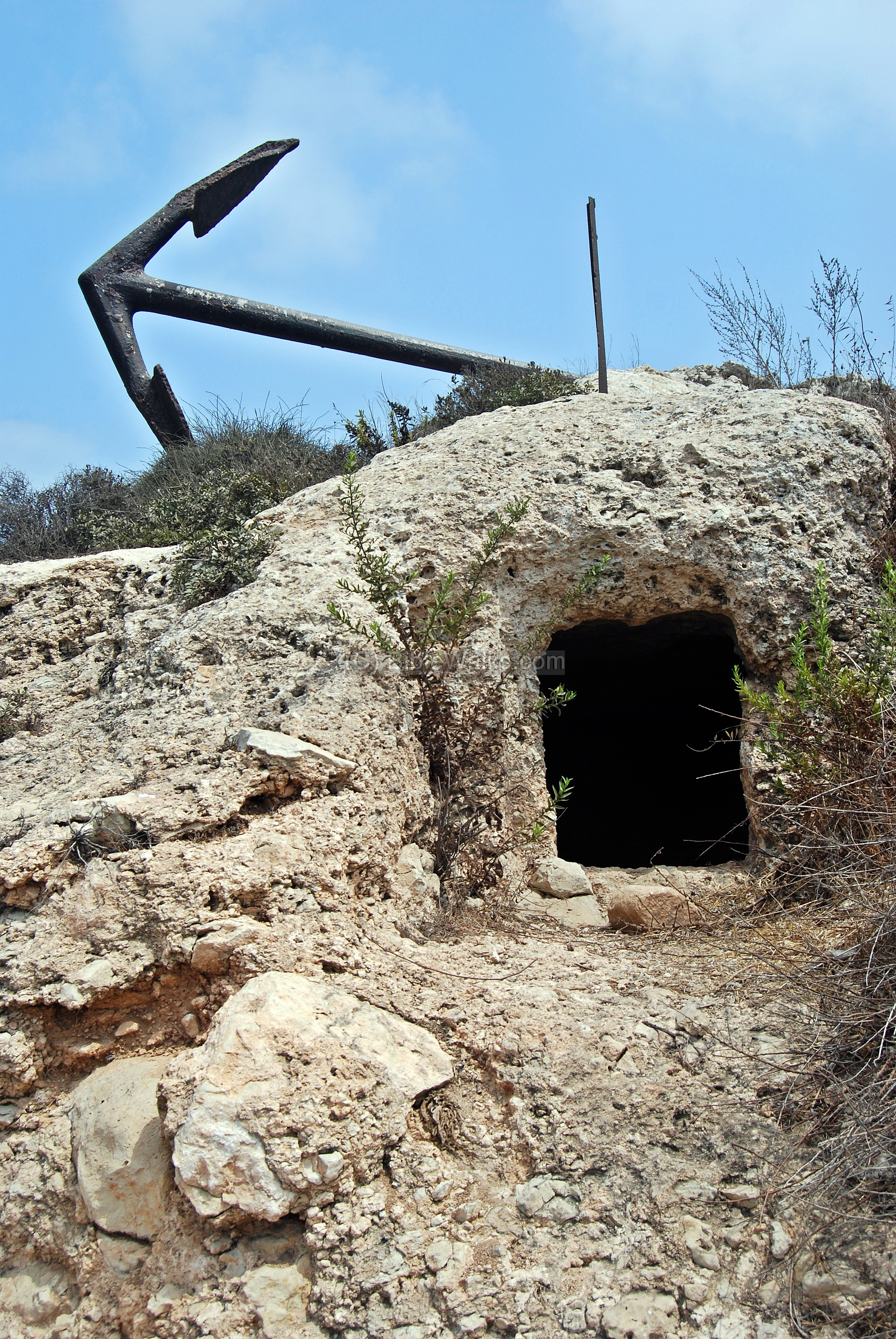
In the garden along the foothills of Mt Carmel are 22 burial caves. The caves, hewn into the rock, have different designs. Some of the burial caves have staircases that lead down into one or two chambers, while one of the caves has nine chambers. A groove around the opening protected the chambers from flooding. Some of them have metal studs which once secured a modern metal cage that protected its entrance.
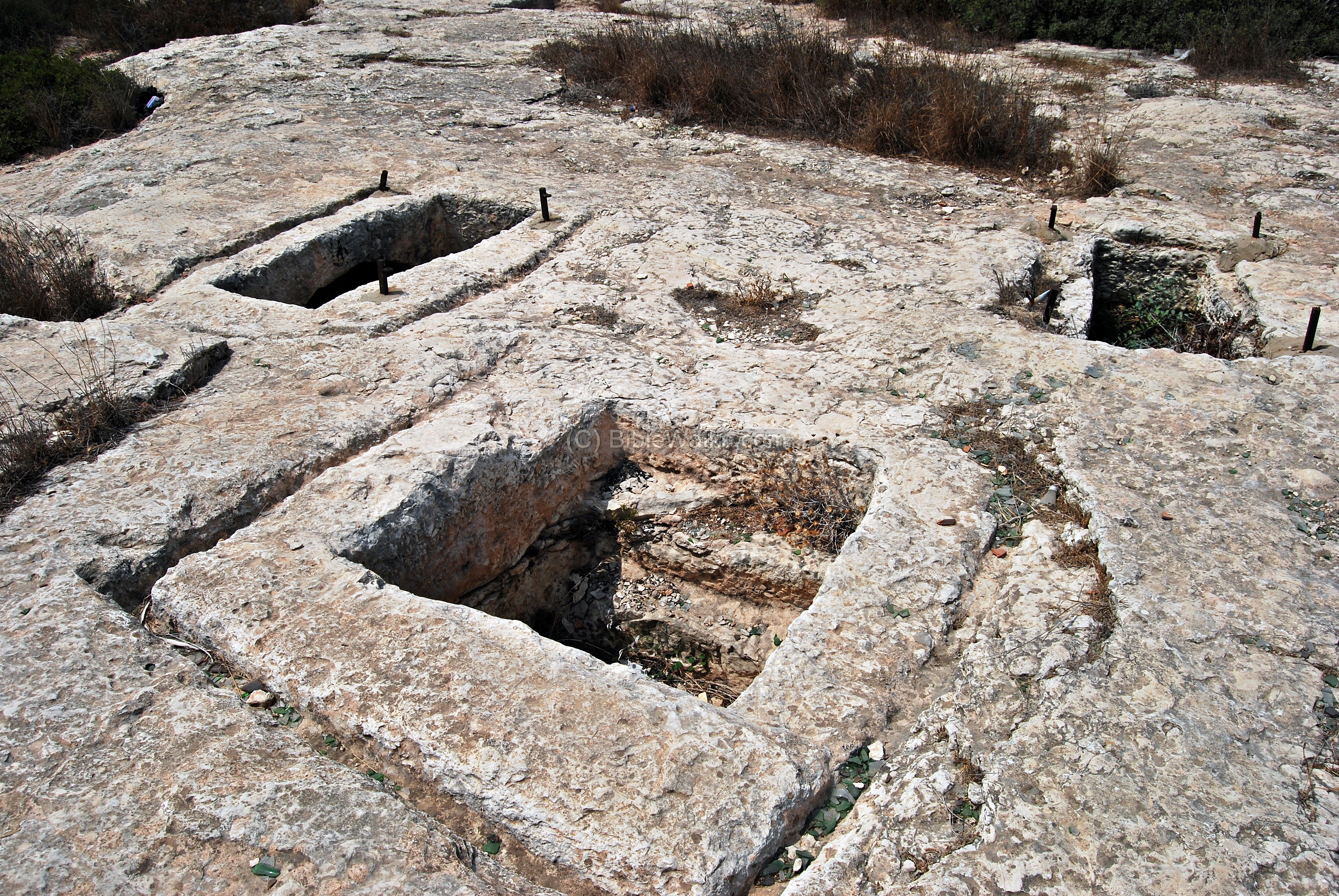
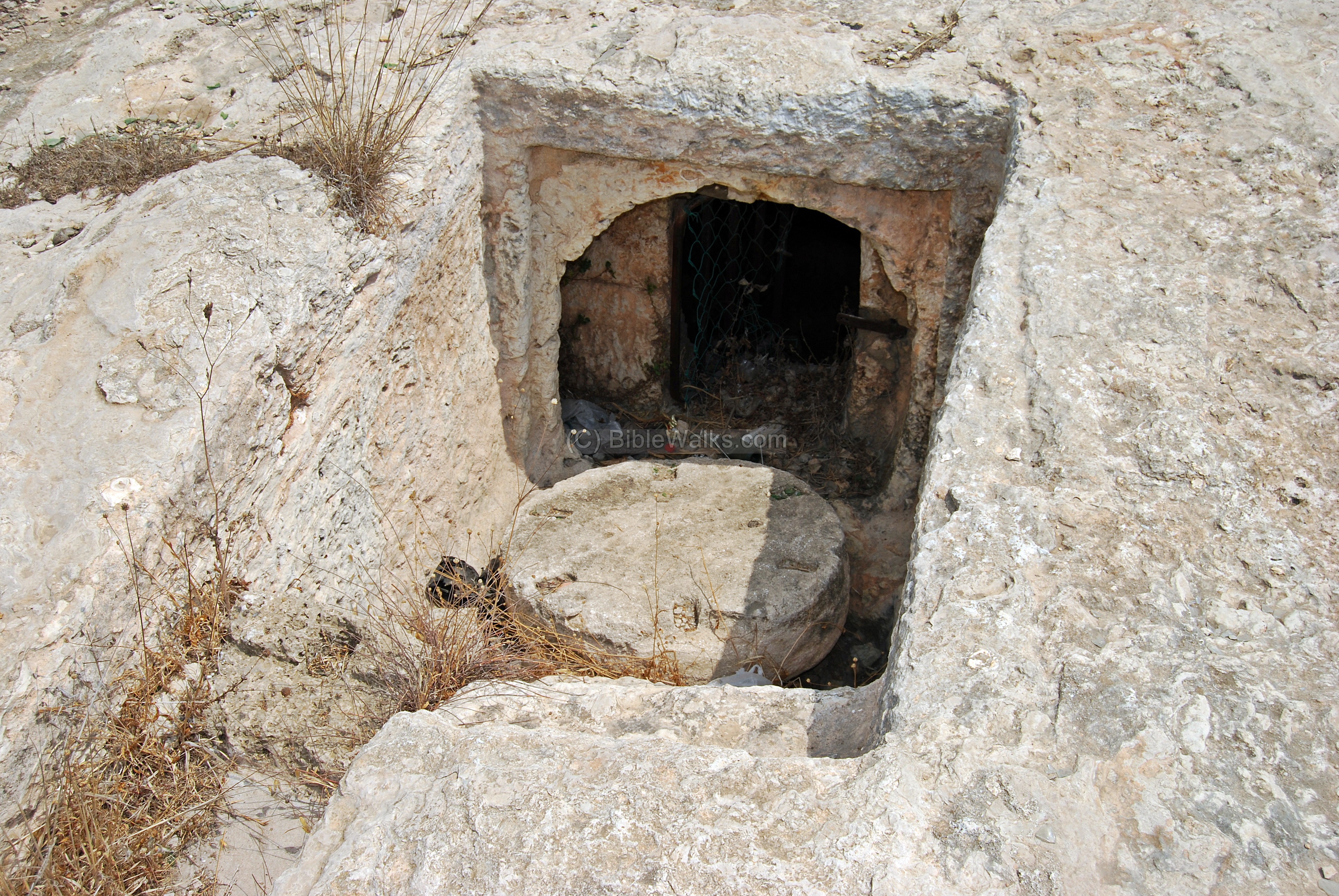
Another sample of a burial cave, with the sealing door in front of the entrance, is seen below. All but one of the 22 caves are dated to the Roman/Byzantine period.
(g) Byzantine Chapel
A mosaic floor of a Byzantine chapel was unearthed and reconstructed in 2000 during the construction of a bus lane. The chapel, first found in the excavations of 1939, was part of a monastery and is dated to the 5th-6th century AD. The mosaic floor was relocated, and is on public display on the side of the highway.
(h) Flight Video
![]() Fly above and around the site with this YouTube video.
Fly above and around the site with this YouTube video.
Captured on June 2023
Etymology (behind the name):
- Shikmona, Shiqmona – Hebrew; named after the Shikma (sycamore) trees. Mentioned in the Talmud.
- Sycaminum, Sicaminos, Sycamina, Cycaminon, Sycaminon – Greek/Roman names of the city
- Tell el-Semak (es-Samak) – Arabic name of Shikmona, means “mound of the fish”. Preserves the ancient name.
- Porphyreon – Crusader’s name of the site, named after Haifa (which was wrongly identified by them)
Links and references:
* External:
- Israel Oceanographic and Limnological reserach
- Listen to report on Shikmona (Hebrew, May 2011)
- Video report on excavations (Hebrew, YouTube – Oct, 2011)
- Video Report on excavations (Hebrew, YouTube – Sep 2011)
- “Tell es-Samak (Shikmona/Porphyreon) on the Haifa Coast” – Eisenberg, M.; Bar, S., eds. (September 2021)
- New evidence of the purple-dye industry at Tel Shiqmona – Sukenik, D. Iluz, Z. Amar, A. Varvak and S. Bar
* Internal:
- Quadcopter Aerial views – collection of Biblical sites from the air
BibleWalks.com – walk with us through the sites of the Holy Land
Migdal Malcha<<<—previous site —-<<<All Sites>>>— next Carmel site —>>> Kebara Cave
This page was last updated on Dec 15, 2024 (add article)
Sponsored links: