A monastery on the southern side of the Jordan valley, founded in the 5th Century by Abbot Gerassimos.
Home > Sites > Jordan Valley> South > St. Gerassimos (Deir Hijla)
Contents:
Overview
Aerial Map
History
Photos
* General view
* Entrance
* External
* Internal
* Church
* Crypt
* First Floor
* Back Yard
* Laura
Links
Etymology
Background:
A Greek Orthodox monastery located close to the north side of the Dead Sea.
Founded by the 5th Century Abbot Gerassimos of the Jordan, it is one of the earliest monasteries. Its Arabic name – Deir Hijla (“monastery of Hijla”) – preserved the name of the nearby Biblical city of Beth-Hogla.
Joshua 15 6:”And the border went up to Bethhogla, and passed along by the north of Betharabah”
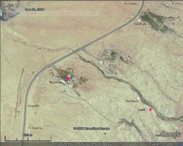
Map / Aerial View:
The site is located on the east side of road #90, 5.5KM north of the Dead Sea and KM west of the Jordan river, north of the Beth-Arabah junction. The area around St Gerassimos is shown in the aerial map below, with the Monastery close to the road, and the caves of the Laura on its east side.
History:
-
Biblical period
Near the monastery (about 1 KM north-east) are the ruins of the Biblical city of Beth Hogla. This city, which was recently excavated and seen near the highway, was located on the border between the tribes of Judah and Benjamin. Joshua 15 1, 6:“This then was the lot of the tribe of the children of Judah by their families…And the border went up to Bethhogla, and passed along by the north of Betharabah”. And Joshua 18 19-20: “And the border passed along to the side of Bethhoglah northward: and the outgoings of the border were at the north bay of the salt sea at the south end of Jordan: this was the south coast. And Jordan was the border of it on the east side. This was the inheritance of the children of Benjamin, by the coasts thereof round about, according to their families”.
-
Byzantine period
The monastery was founded in 455 AD by Gerassimos (also spelled Gerasimos or Gerasimus), a monk from Lycia (Anatolia, Turkey). He was an Abbot (head of monastery) of a community of 70 monks in the area east of Jericho who maintained a strict rule of asceticism. He is regarded as one of the second generation leaders of the Judean desert hermits (desert dwellers), who followed the founders (Euthymius and Chariton).
The monastery (Deir Hijla) was built in the form of a Laura – a cluster of caves or cells for hermits with a common center. The monks met in the center on Saturdays and Sundays, while in the rest of the days they lived in seclusion. The monks’ caves are located 1KM to the east (Ein Nukeil) and in the mountains around the site. This Laura (Lavra) form was also established in the Judean desert monastery of Mar Saba as well as other places in the Judean desert.
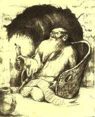
Hermit in a cave – drawing by Rina
Gerassimos attended the Fourth Ecumenical Synod at Chalcedon in 451. This gathering of the council in Asia Minor was a key turning point in the Christian religious debates and caused a major split in the Eastern Orthodox world. Gerassimos was initially against the decisions of the council, but later supported them.
The monk, also known as St. Gerasimus of the Jordan, died in 475. His burial place is unknown since the Byzantine structure was totally destroyed. The Saint’s honor is celebrated on March 4.
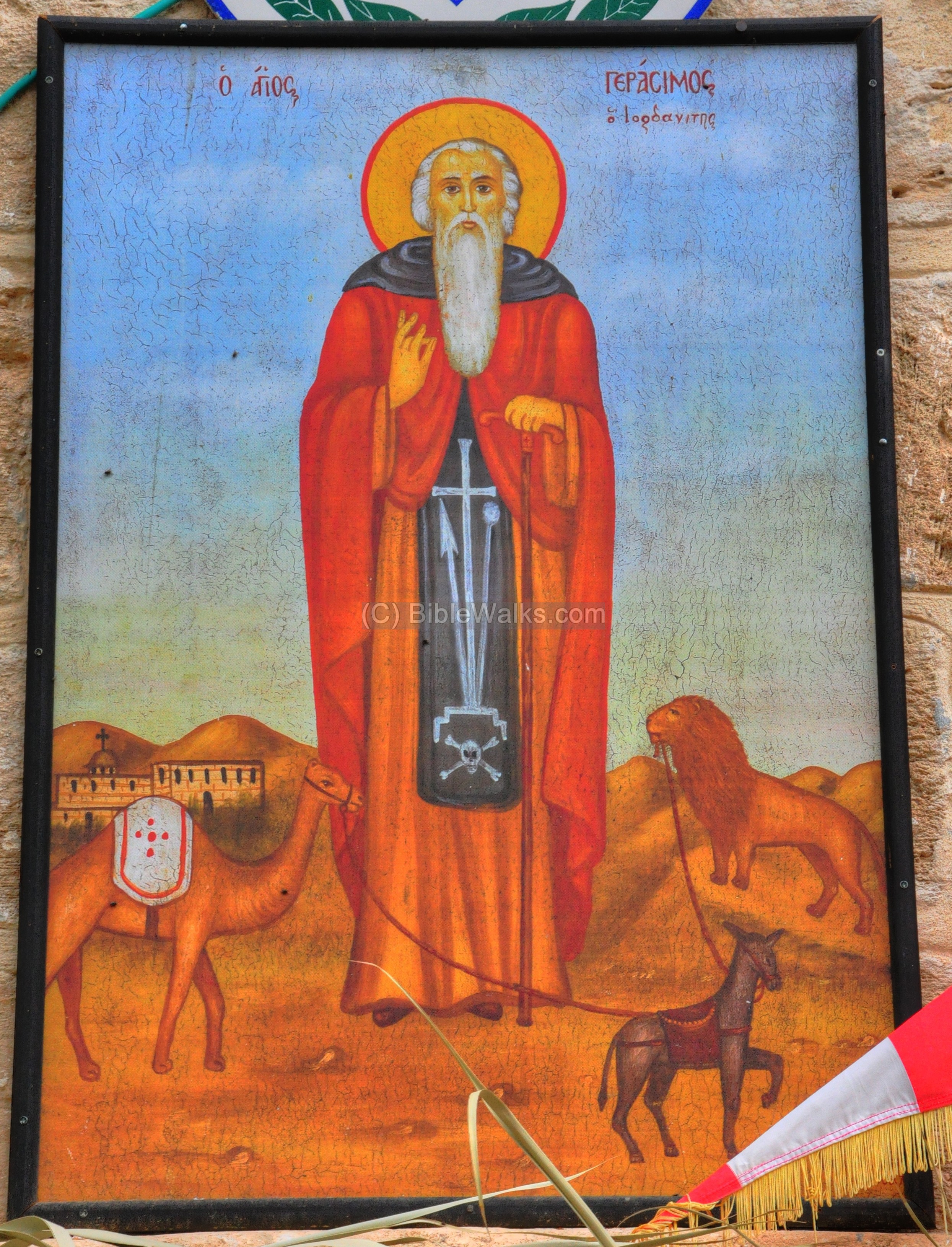
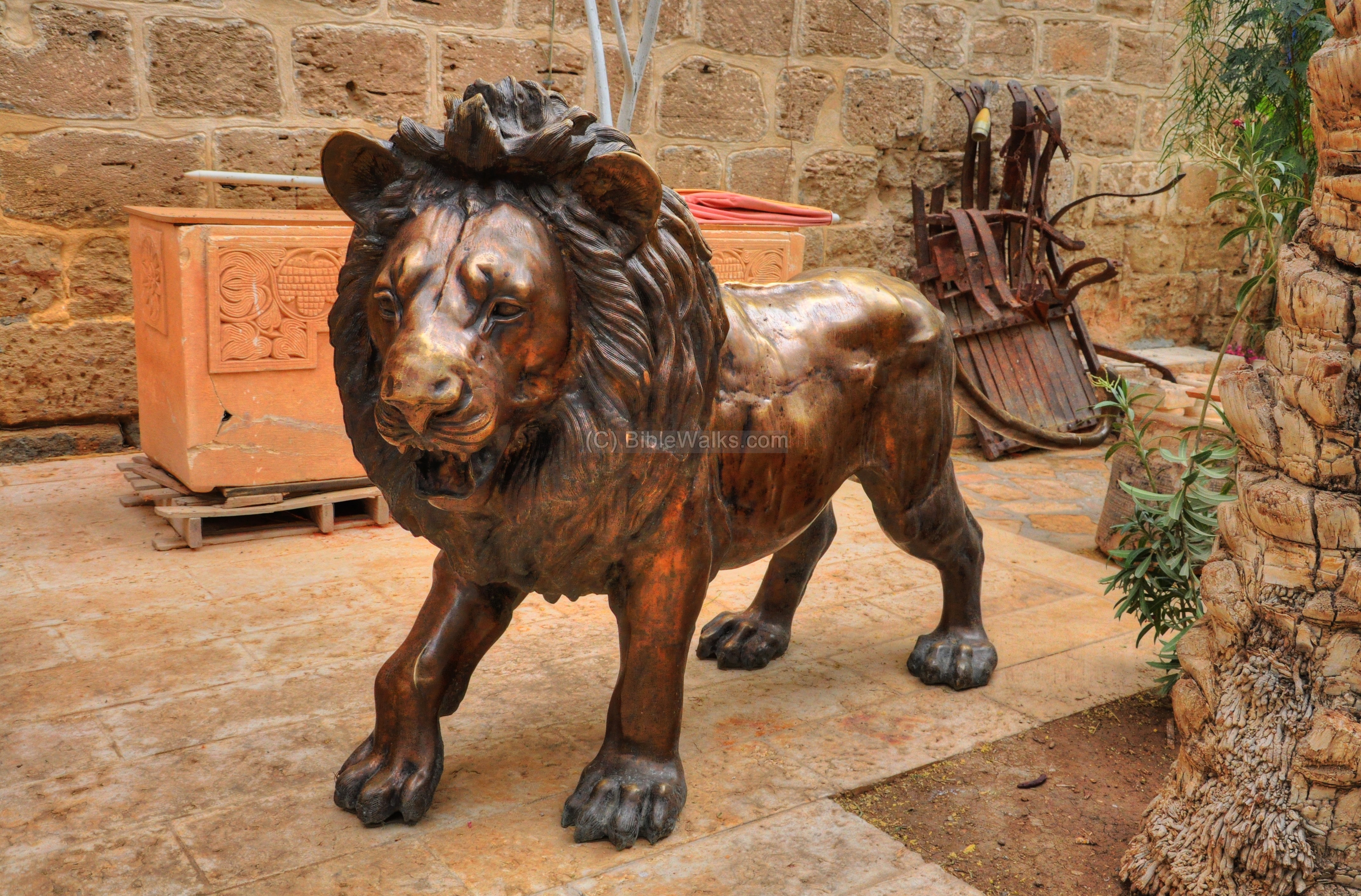
The encounter of Gerassimos with the lion is a central theme in the paintings and sculptures in the monastery. According to the tradition, the Abbot met the lion near the Jordan river, roaring in pain because of a thorn was stuck in its pawn. After removing the thorn the lion became tamed and joined the community. The lion is often illustrated with a donkey and camel, its friends from the Monastery.
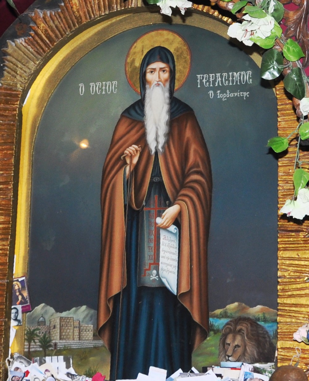 Gerassimos; painting in St. Gerassimos
The original structure was built in 460, but was destroyed during the Persian conquest (614), and the monks were butchered. Their remains are on display in the crypt on the lower floor. It was repaired several times during the Arab period (7th-12th century). There are only few remains from the Byzantine structure.
-
Crusader period
The Crusaders rebuilt the monastery. Most of the existing structure dates to the 13th century, although the periodic earthquakes, including the severe earthquake of 1837, required frequent rebuilding.
-
Ottoman Period
The site of the Monastery was examined in the PEF survey (1866-1877) by Wilson, Conder and Kitchener. It appears as “Kusr Hajlah” in the center of the section of this map of 1878.
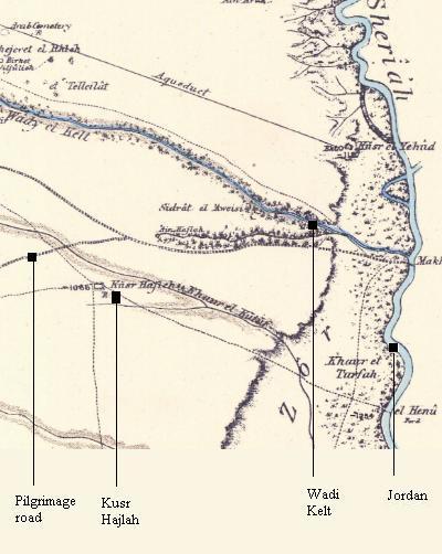
Part of Map sheet 18 of Survey of Western Palestine,
by Conder and Kitchener, 1872-1877.
(Published 1880, reprinted by LifeintheHolyLand.com)
It is situated near the Pilgrimage Road (as indicated on the map), south of the spring of Ain Hajlah, south of Wadi Kelt, and west of the Jordan river .
The report describes the site (pp 213-217):
“An important ruin of a mediaeval monastery. The ruin included a large chapel, a second smaller to the south, and a third in the vaults below. The whole is surrounded by a wall, which remains almost perfect on three sides, but is destroyed on the north.” The report describes the plan of the monastery, adding: “This monastery is sometimes known as Mar Yohanna Hajlah ’St. John of Hajlah.’ In the sixteenth century it was inhabited by monks of the Order of St. Basil, and was known to the Latins as the monastery of St. Jerome as early as the fiftcenth. In the fourteenth century the place is called Bet Agla by Marino Sanuto. Its earlier history is not known. It may perhaps be the monastery of Calamon, which existed in this neighborhood in the twelfth century”.
-
Modern times
Recently (2009) the area around the monastery is undergoing restorations and hosting a pilgrimage center. It is open to the public and is easily accessed from the adjacent #90 highway just before arriving to the Beit-Ha’aravah junction.
Photos:
(a) General view:
A view of the monastery is shown below, as viewed from the east side.
Click on the photos to view in higher resolution…
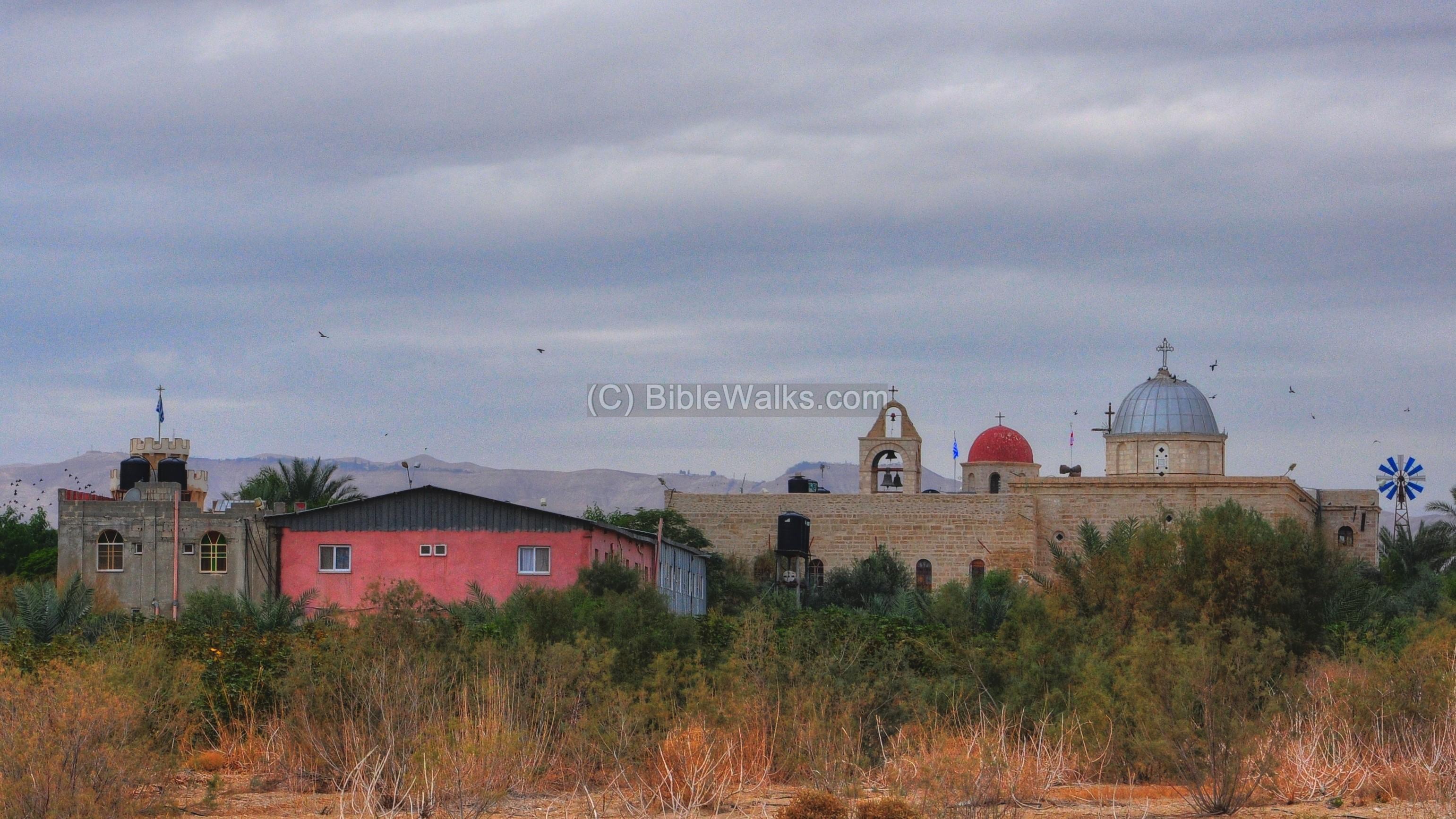
The photo below is a closer view of the north-east side. The dome of the church, covered by metal, is seen in the center of the structure.
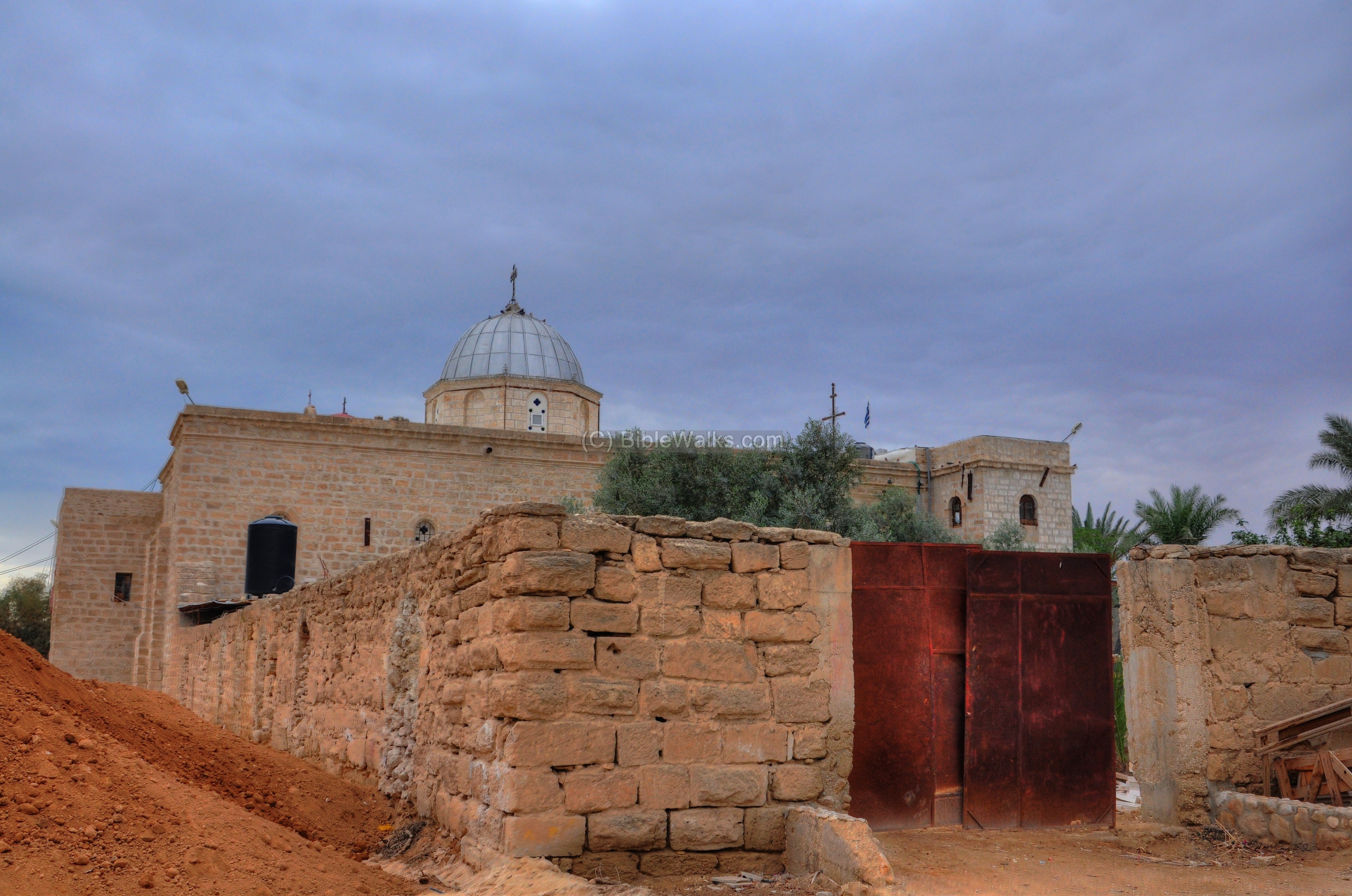
A view of the north-western side is seen below. The entrance to the monastery is on the right side.
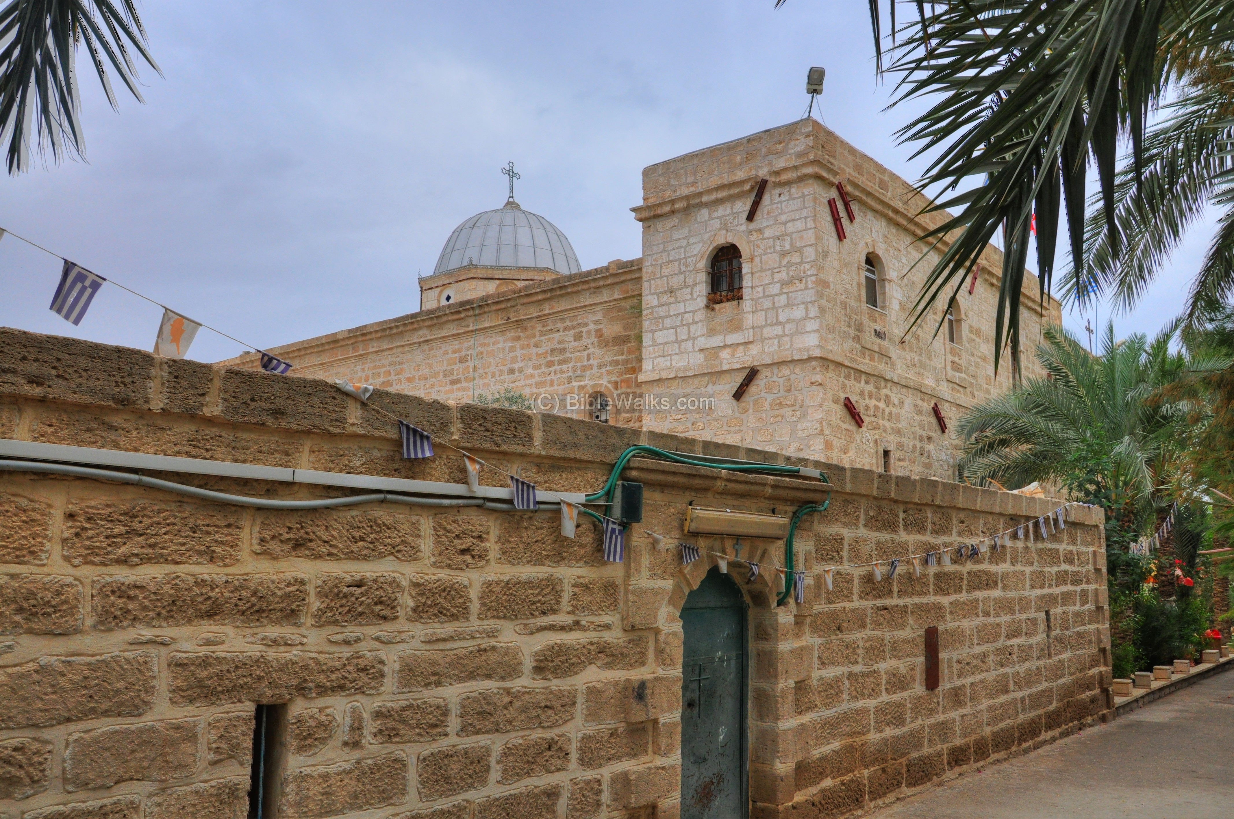
(b) Entrance:
The entrance to the monastery is shown below. Most of the churches are entered from the west side, since the altar is always facing east.
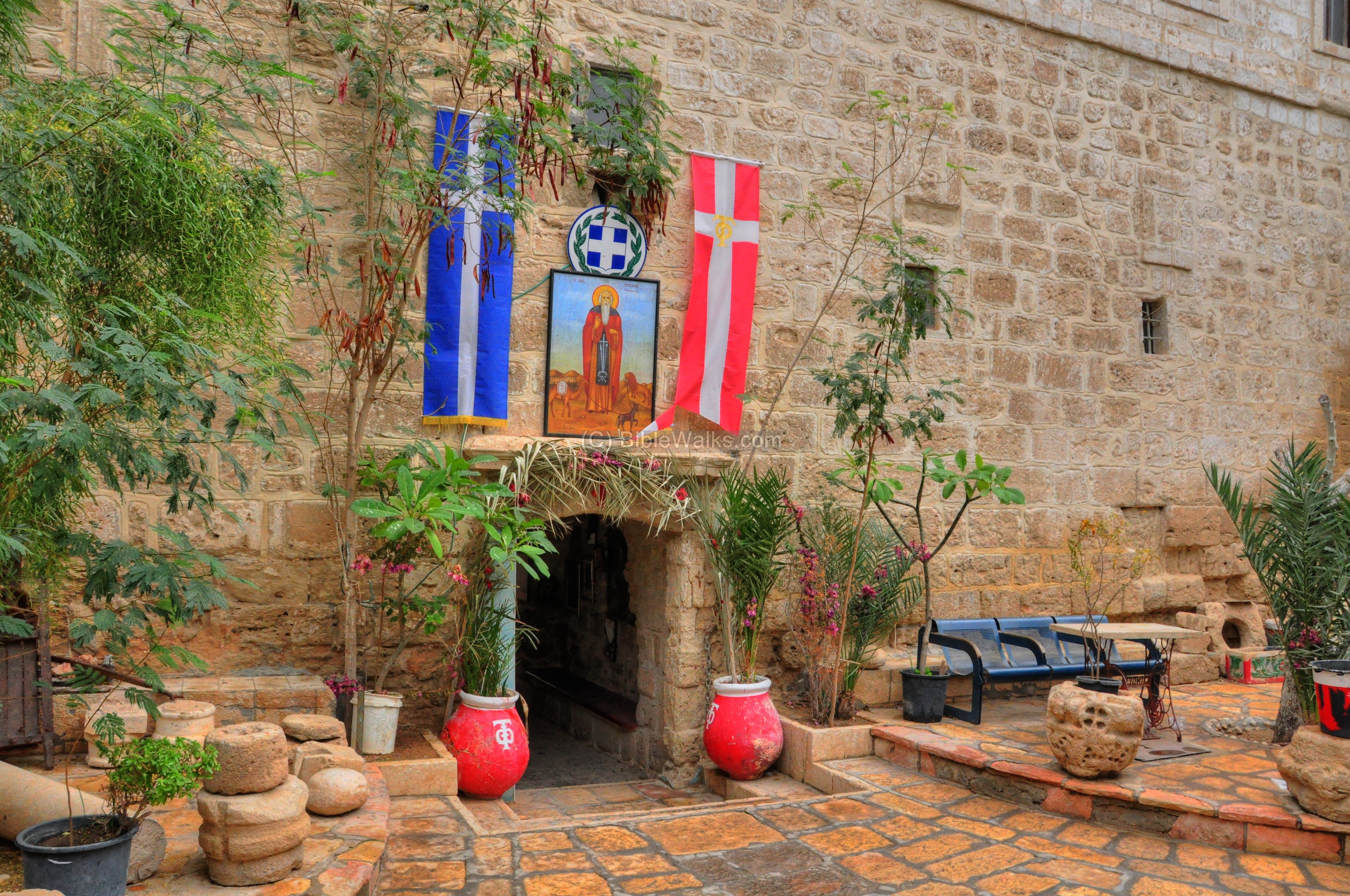
Flags above the door are of Greece (blue and white) and the Orthodox church (red and white).
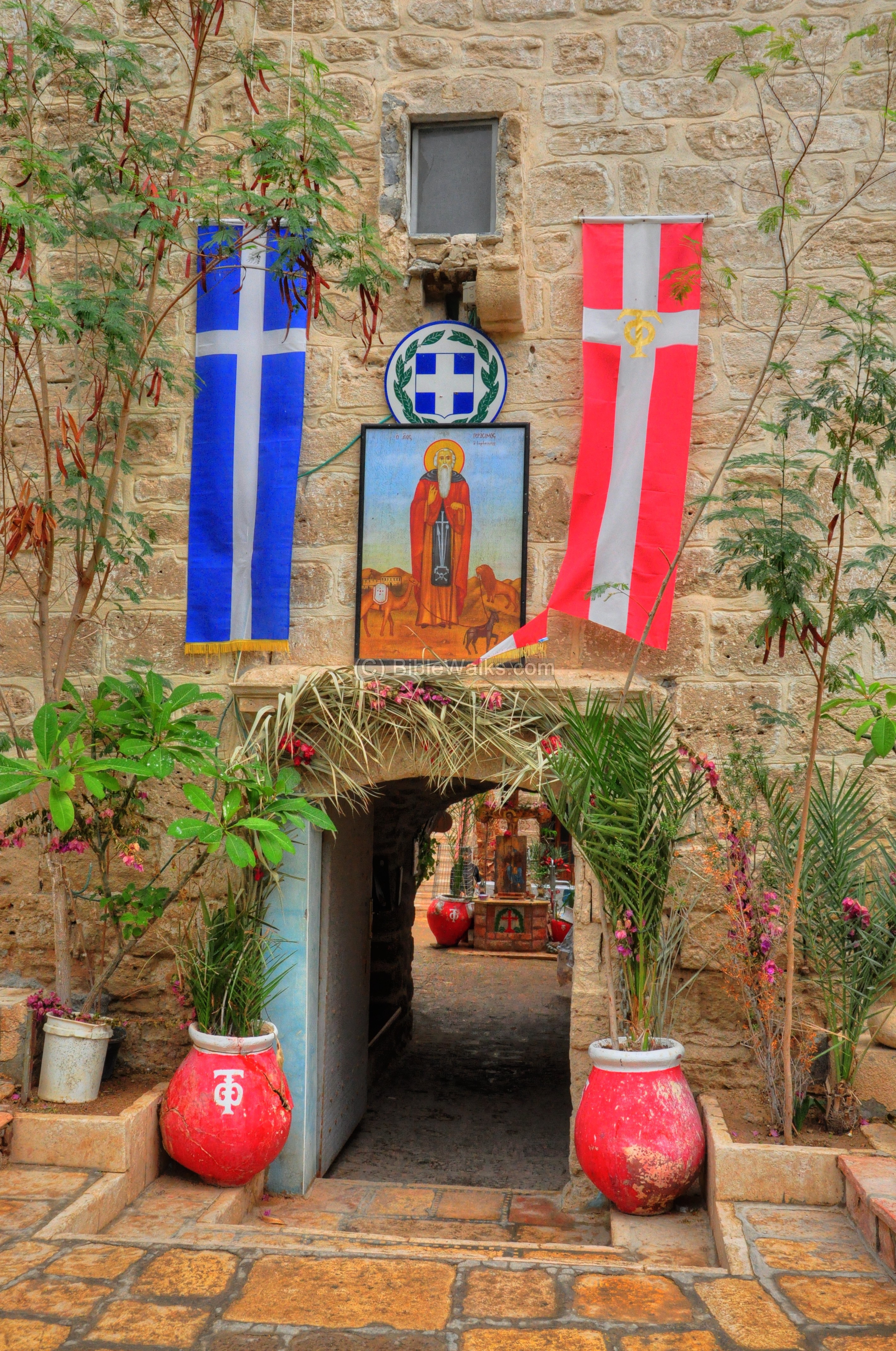
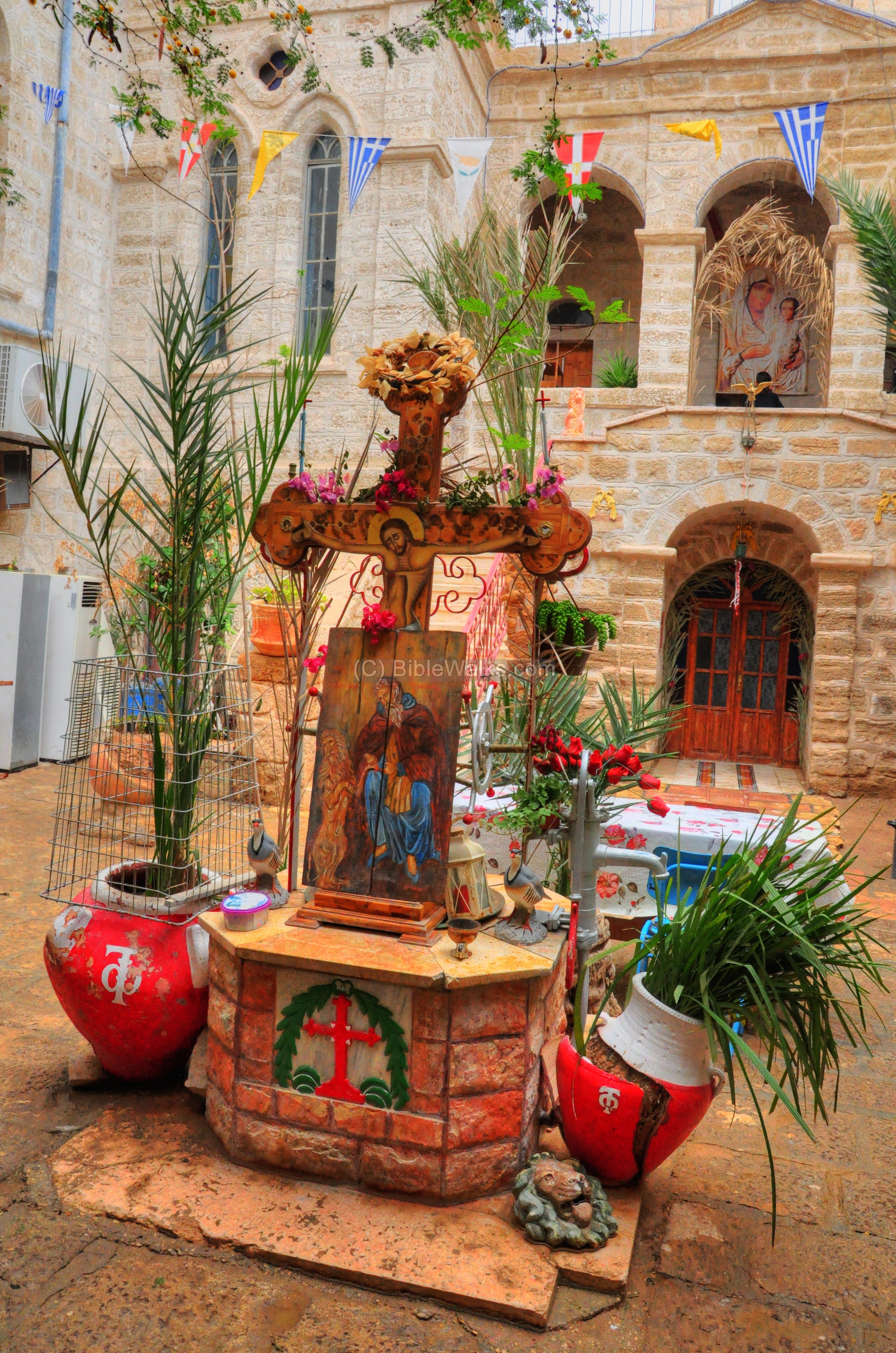
Between the flags is a picture of St. Gerassimos, with animals – donkey, camel and lion – and the Judean desert mountains in the background. The triple animals are associated with Gerassimos (see history).

A closer view of the painting is seen below, with the monastery on the lower left background. On the right the Greek letters stand for “Gerasimos”. The skull and crossbones, drawn on the lower center garment, symbolize Golgotha – place of the skull – the location of the crucifixion.
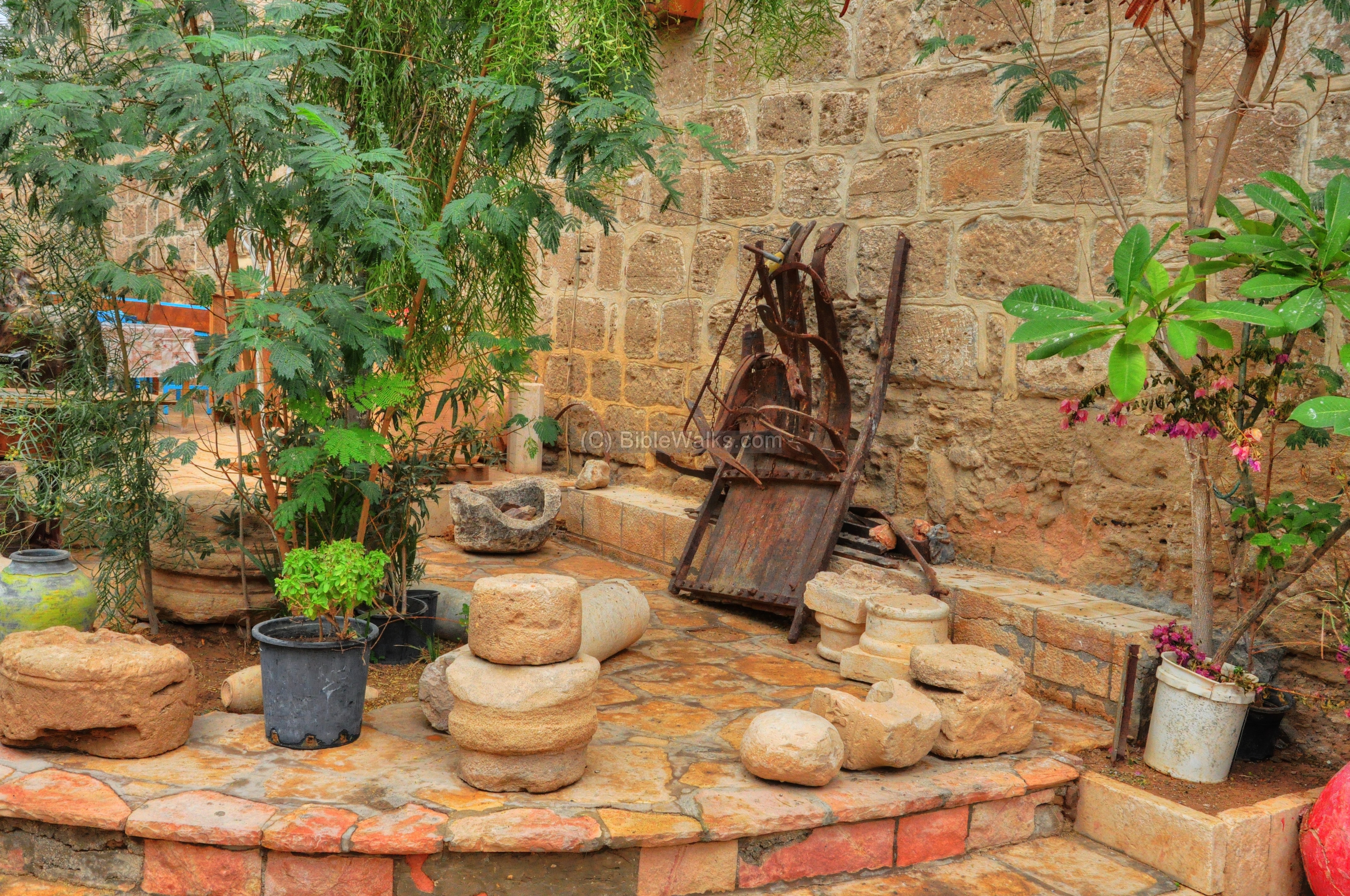
(c) External Yard
A display of ancient tools and stones is located in the external yard near the entrance. This is a common theme in Greek Orthodox churches.
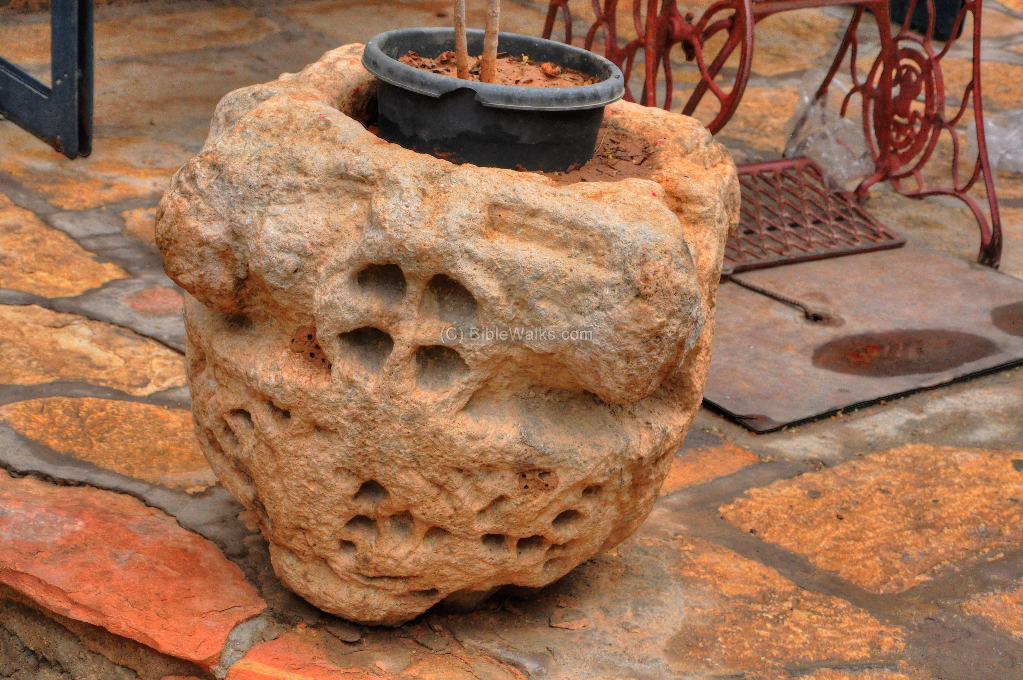
Another interesting stone is used as a pot holder:
A statue of a lion stands near the entrance. The lion is associated with the traditional story of St. Gerassimos encountering with the lion.
(d) Internal Yard
Through the small entrance gate is a short corridor that opens up to the yard. The picture below shows a view towards the exterior.
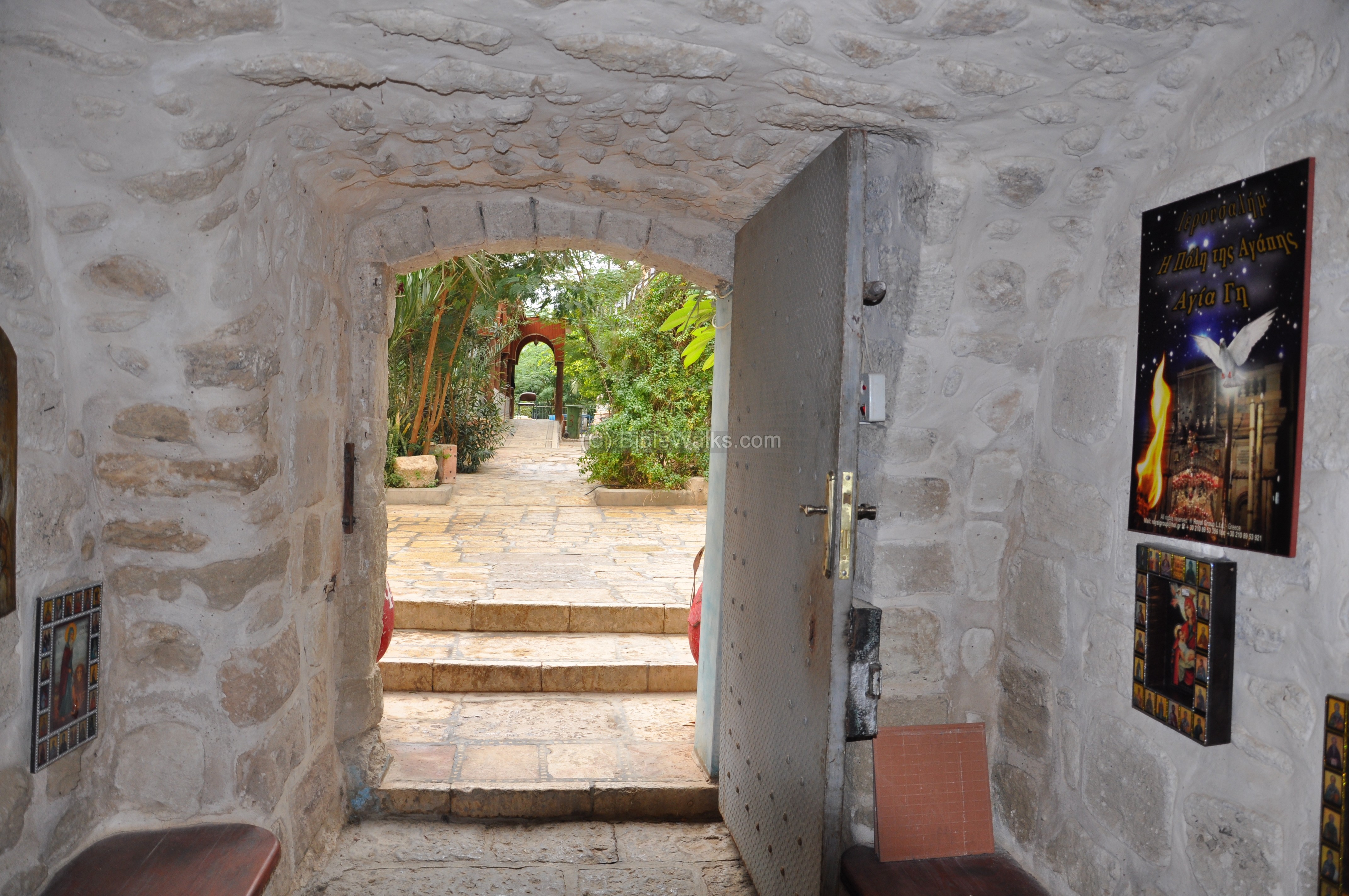
The entrance corridor leads to the inner yard.
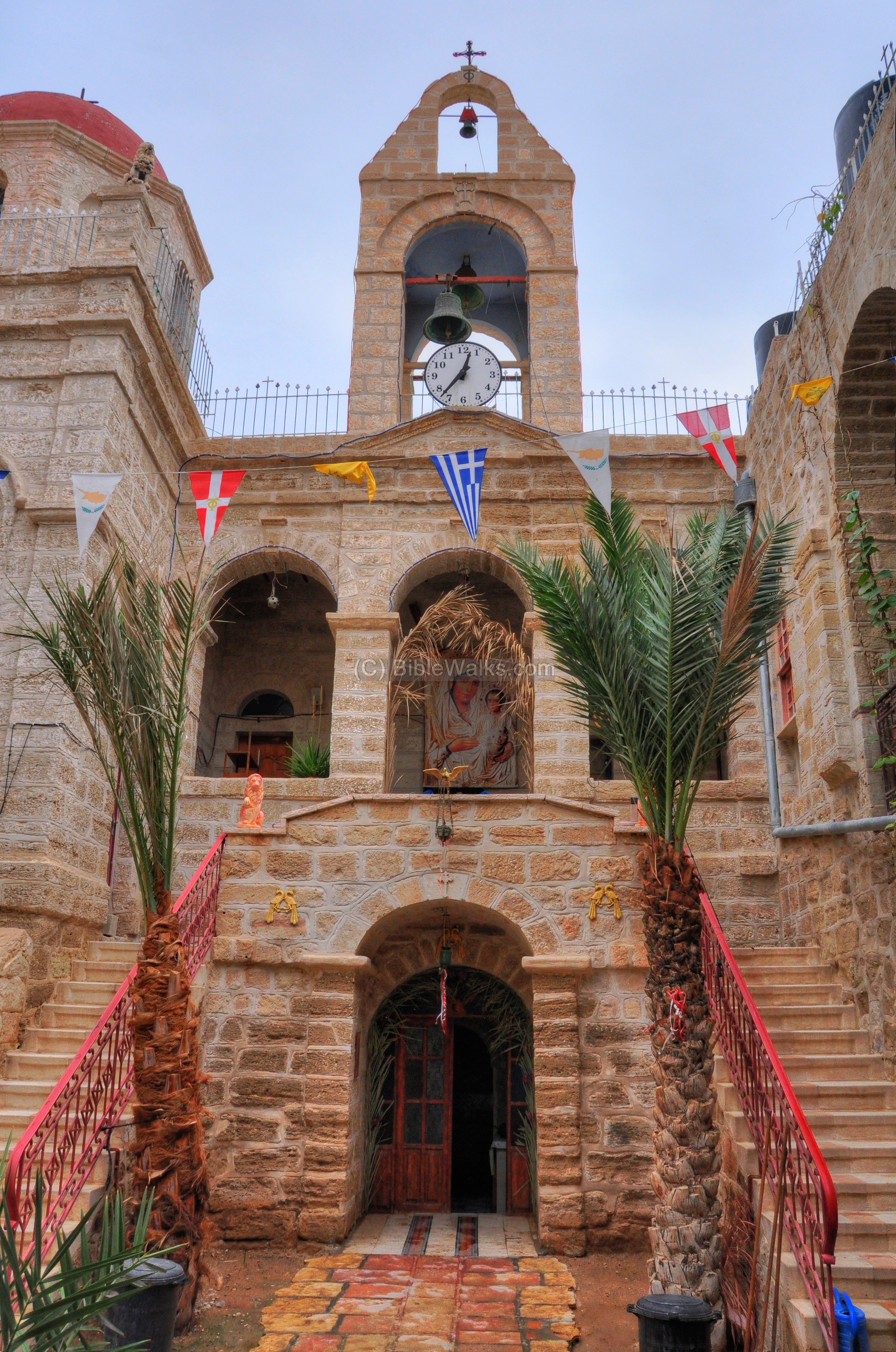
The monastery is designed as a two level structure which is built around a small inner court yard. The bell tower is located on the east side of the yard.
A well is located in the center of the paved yard. The water is fetched from the underground cistern. The painting in the front of the cross shows Gerassimos with his friend the lion.
(e) Second floor – church:
The second floor hosts the large church and the rooms of the residents. This is a typical design of a Crusader monastery – a cloister (claustrum) which is a covered walk with an open colonnade on one side, running along the walls of the building.
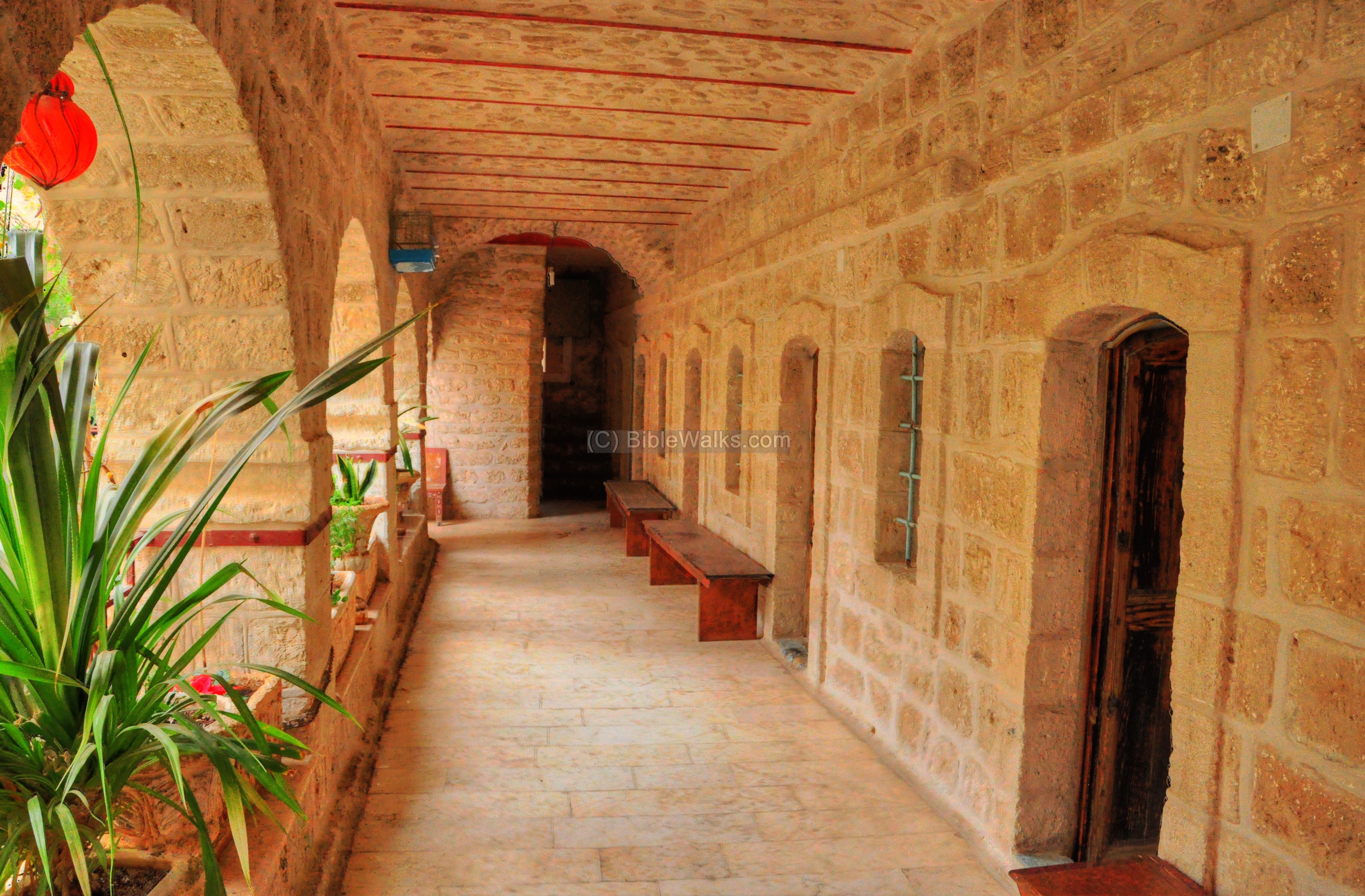
Beyond the door on the north side of the staircase is the external narthex of the church, where self-made candles are sold to the visitors.
A painting of St. Gerassimos – with his faithful lion – stands in the narthex.
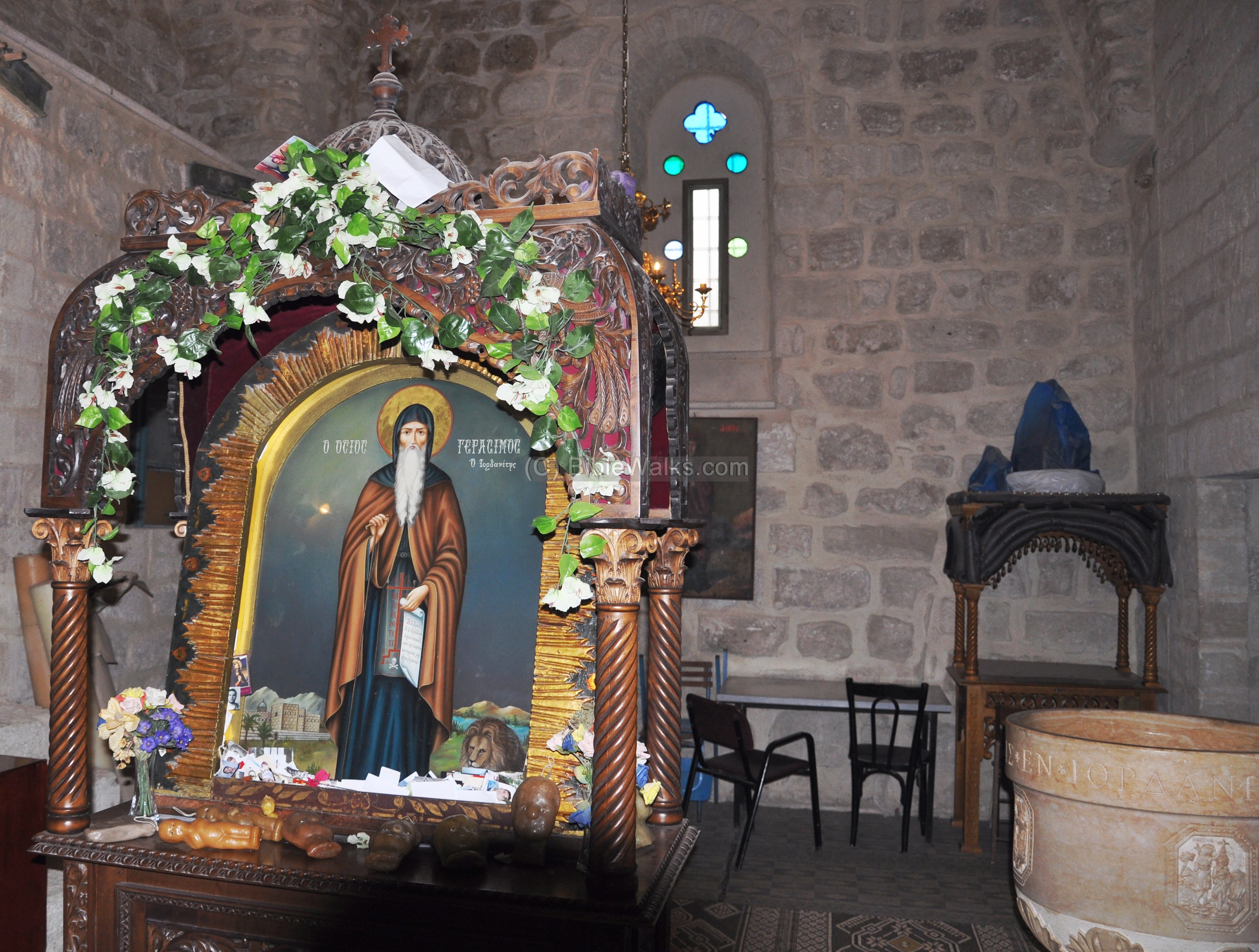
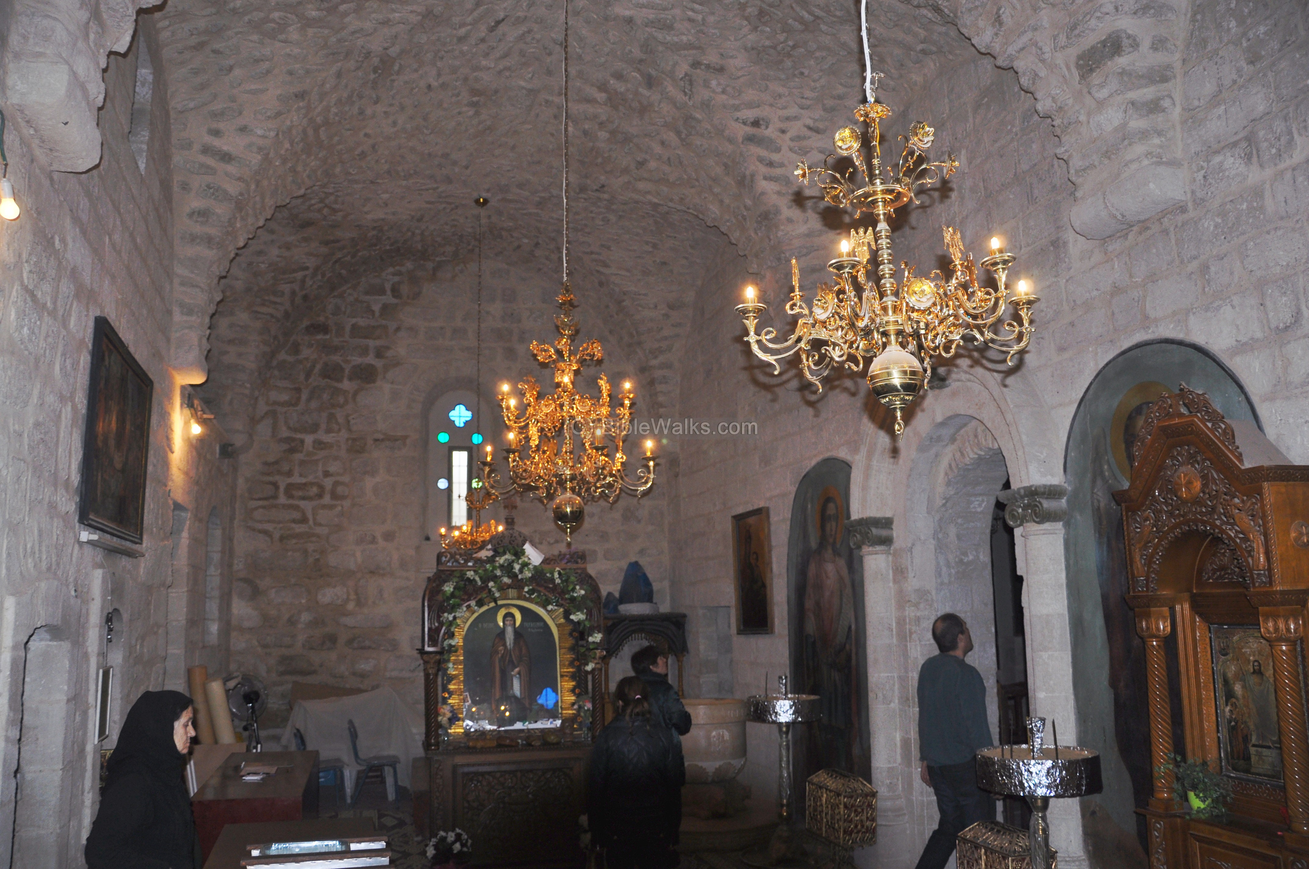
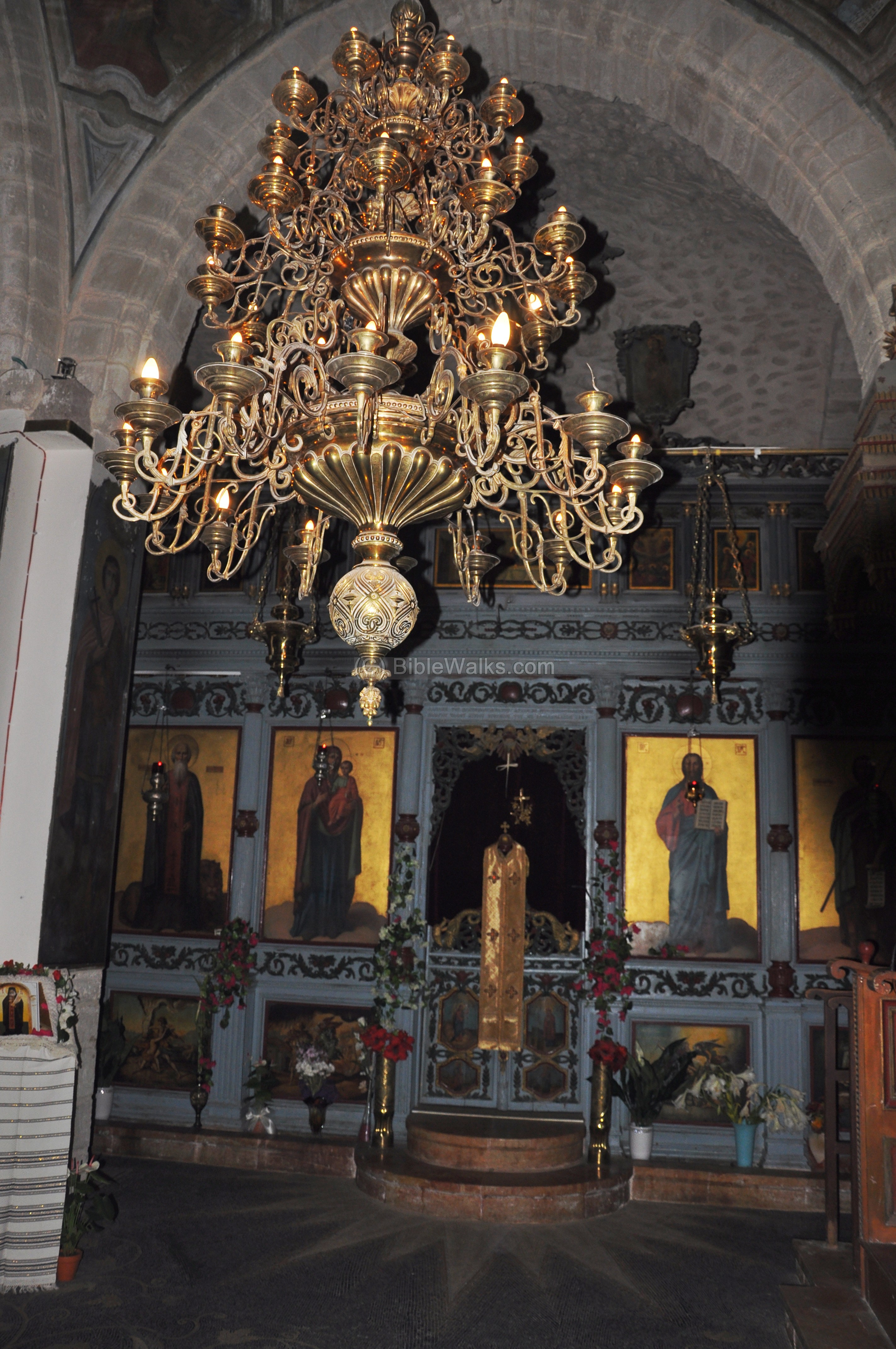
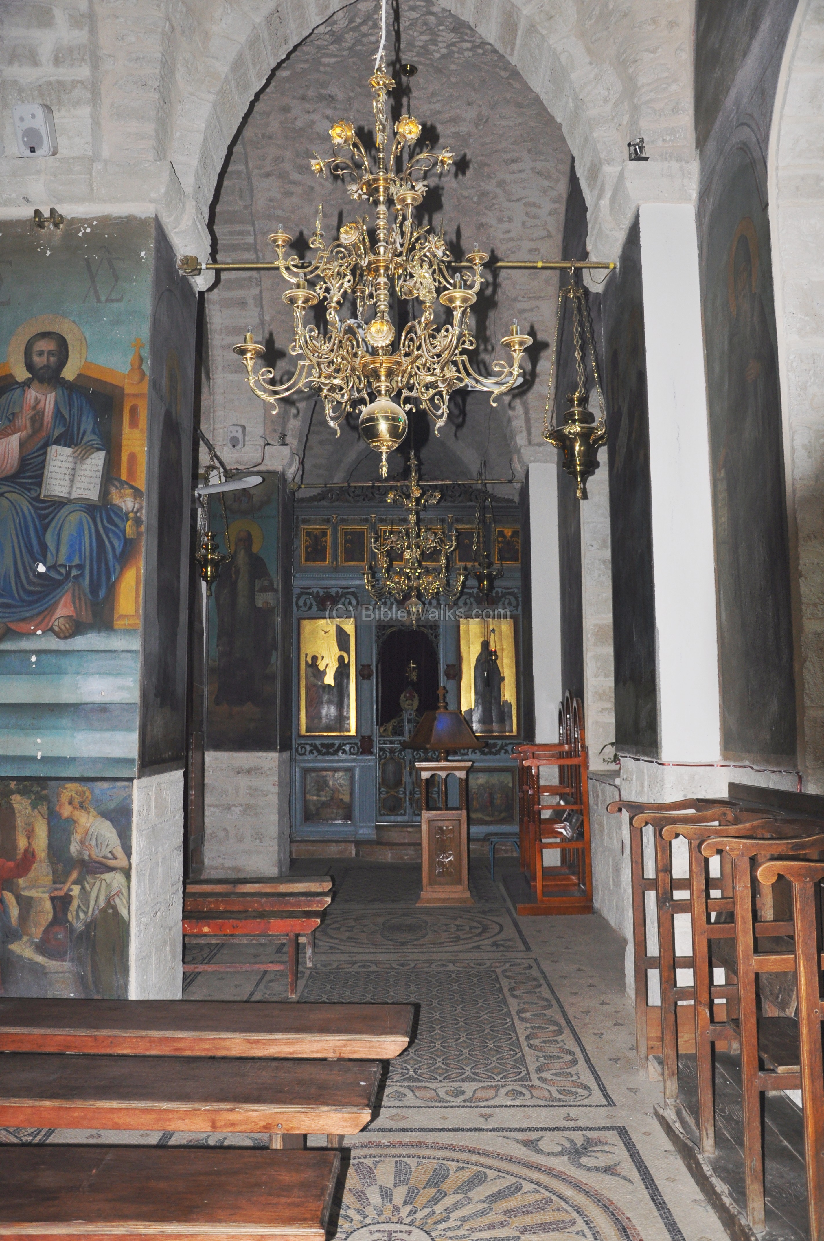
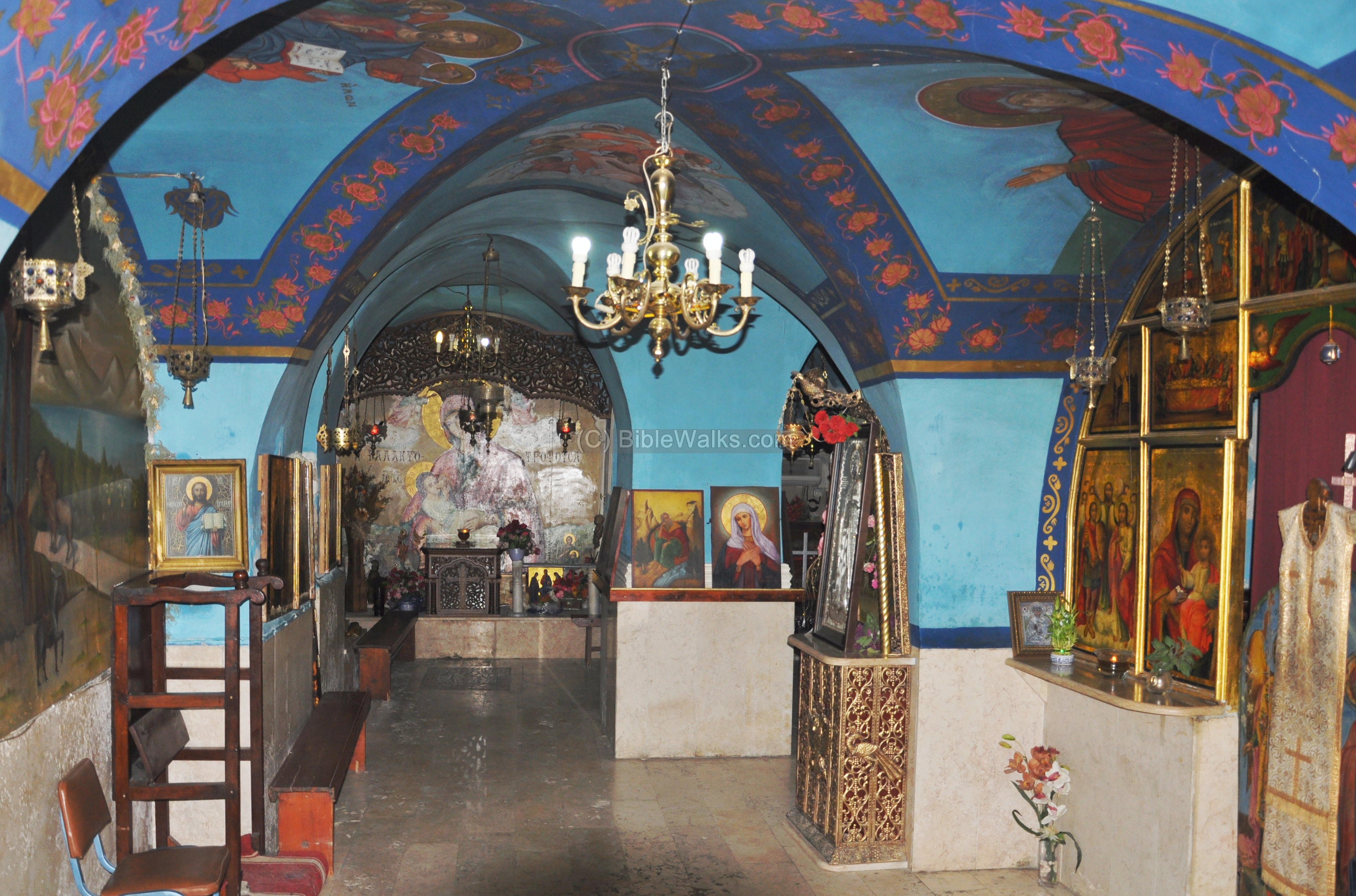
In the center of the church is a high dome. On the eastern side of the nave (hall) is the altar, hidden behind the decorated partition between the church hall and the main altar.
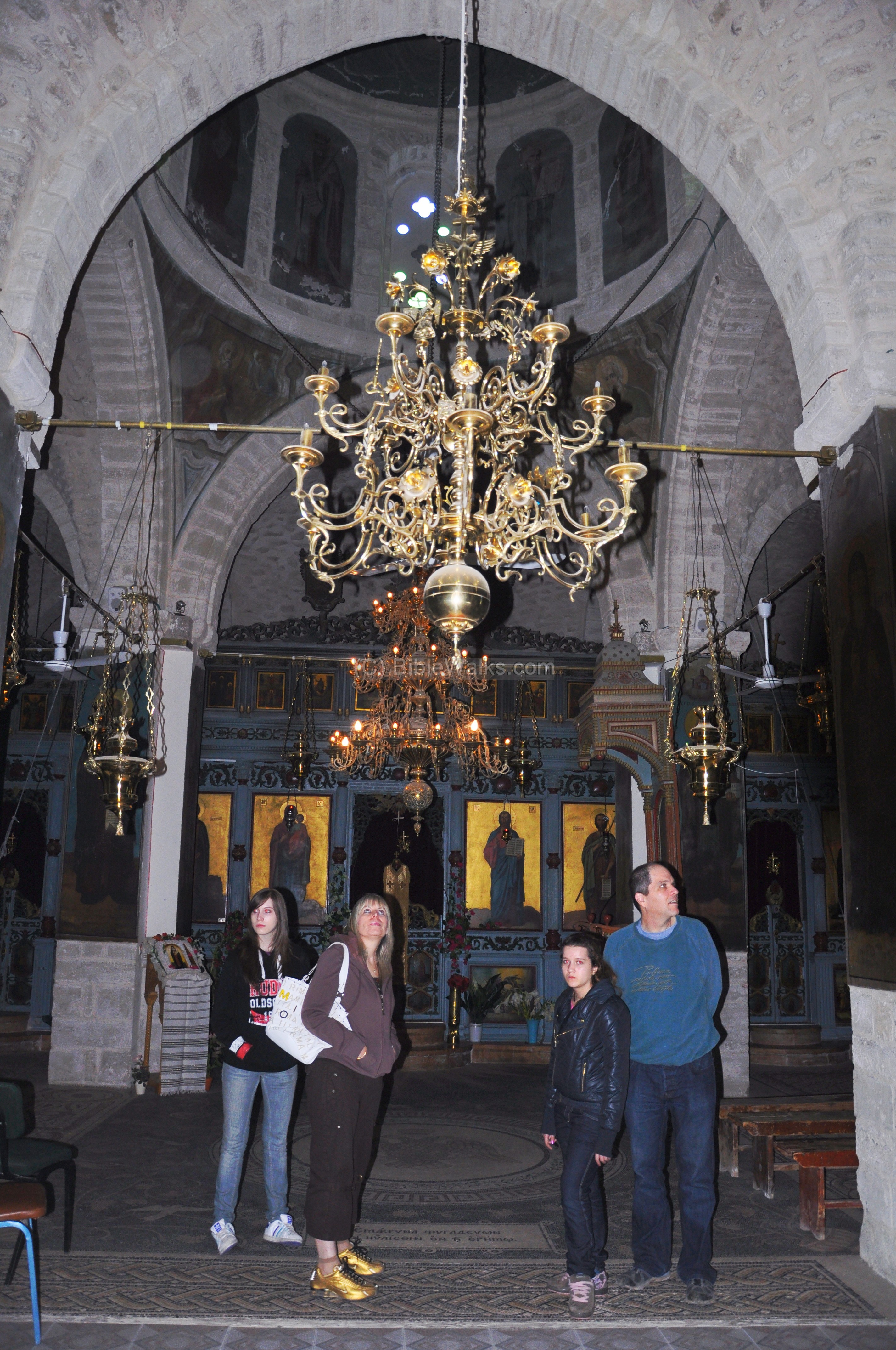
A closer view of the altar is seen below, which is a typical design of Greek-Orthodox and Byzantine churches. The “Templon”, the decorated covered screen with icons and paintings (also called iconostasis), separates the hall and the hidden altar. The upper icons on the iconostasis illustrate 12 saints, with Mary and Jesus closest to the center. The lower icons illustrate Biblical scenes from the area of the Dead Sea and the Jordan. In addition to the center door leading to the altar (called the “beautiful gate”, seen below), there are two side doors that lead to the back.
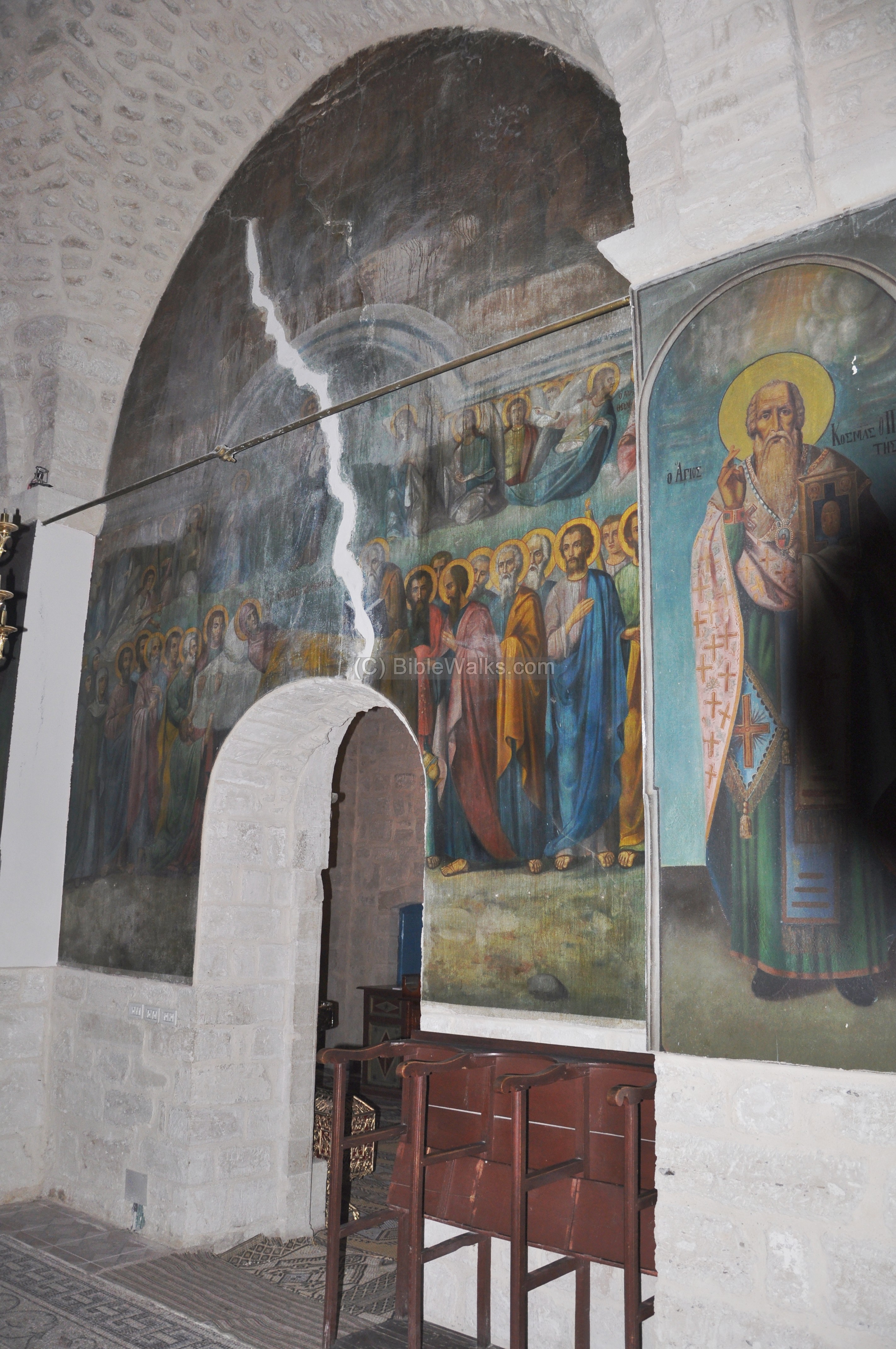
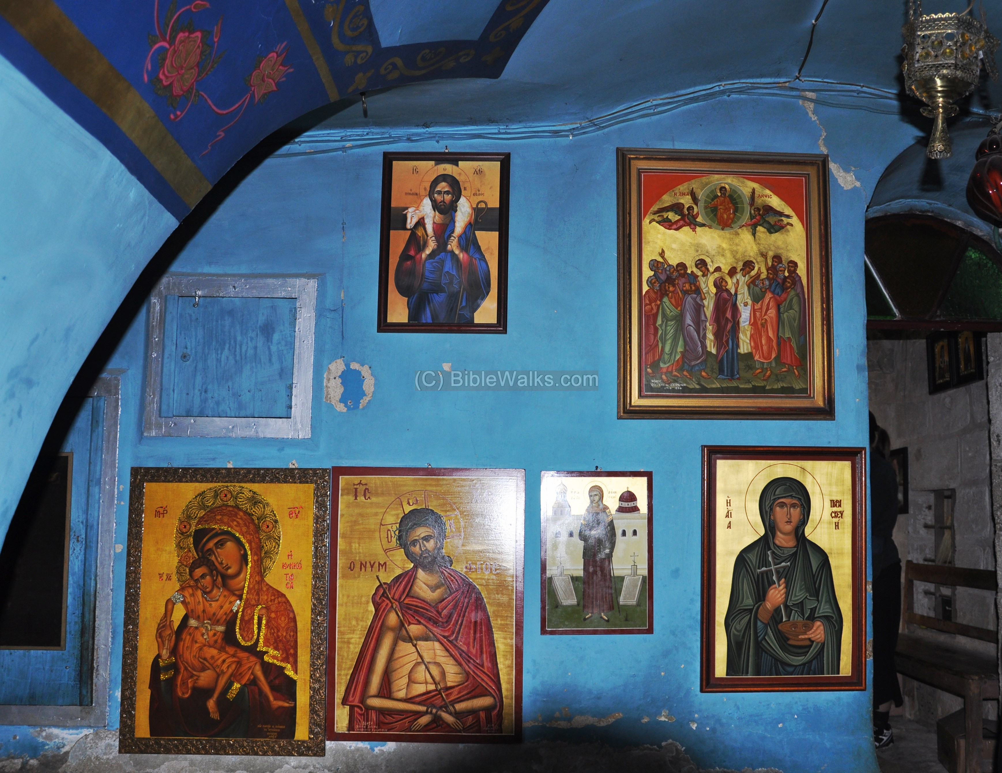
The southern side of the nave is shown below, with one of the two side doors. The frescoes (wall paintings) and oil paintings include both ancient originals (from the Crusader period) and restored art of distinguished clergymen from the Jordan and Judean desert. The floor is decorated by mosaics with geometric patterns.
Some of the frescoes (wall paintings) are seen below. A huge crack on the wall is probably a result of the earthquakes that shocked the structure. The last major restoration (1890) repaired the major earthquake that shocked the area in 1837.
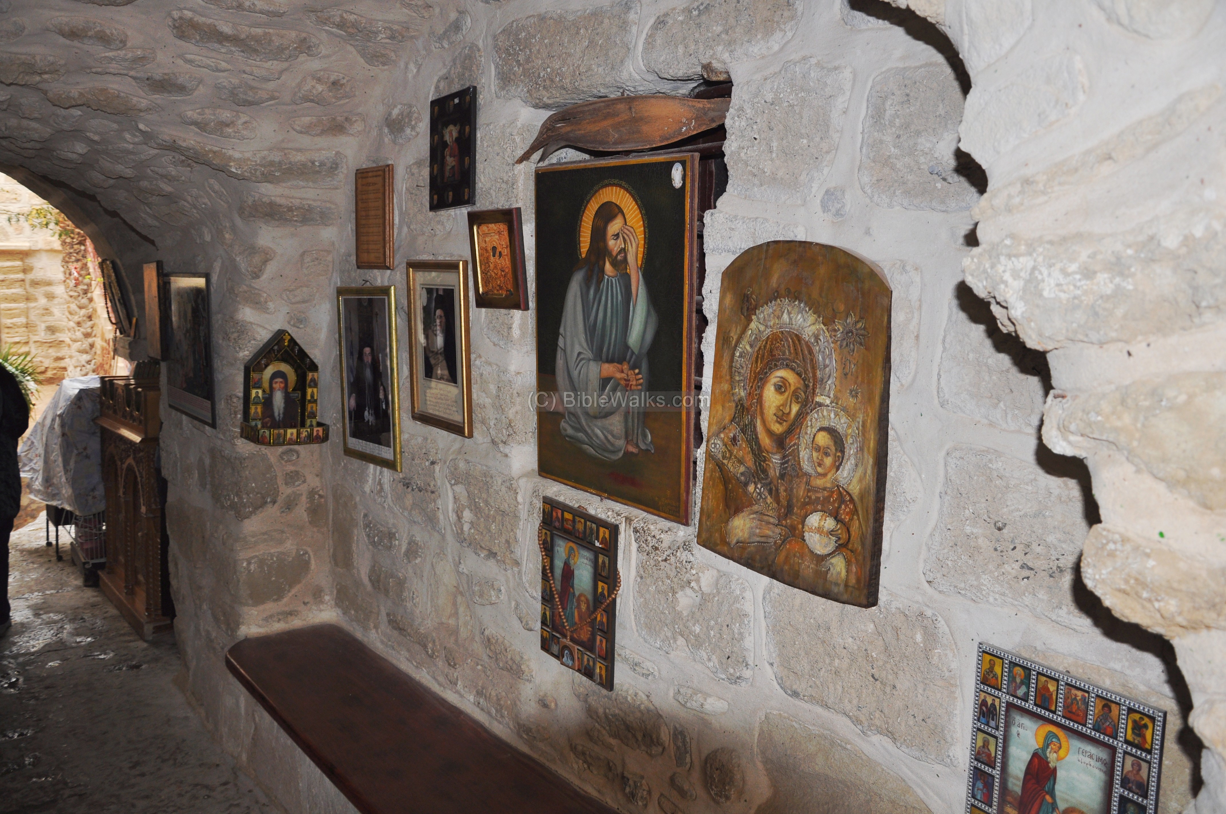
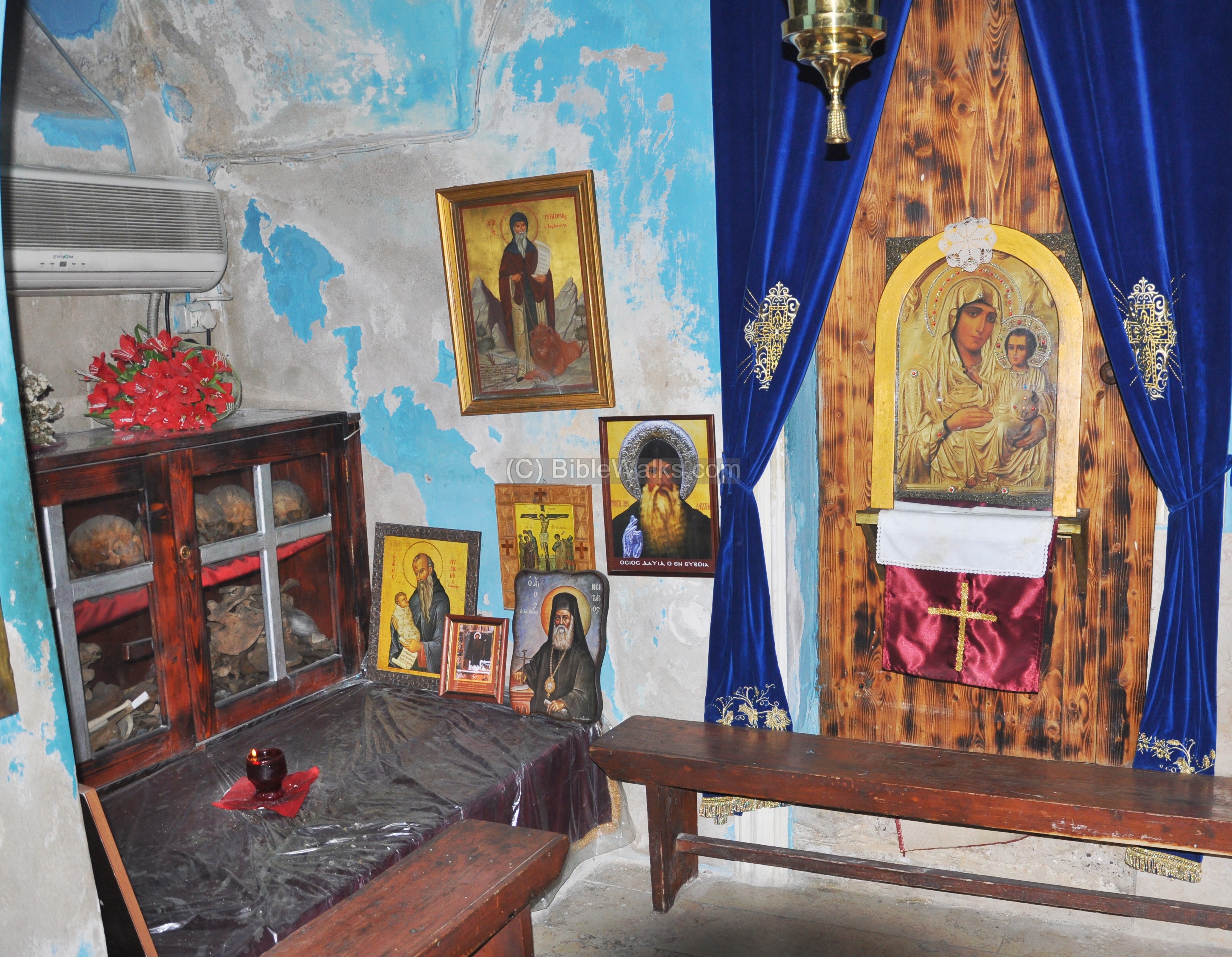
(f) First floor – the Crypt:
On the first floor, under the church, are rooms of the crypt. It is accessed on the left side of the entrance. The rooms in this section store some of the cherished antiquities and remains from clergymen who lived and served in the monastery. The entrance hall is seen below.
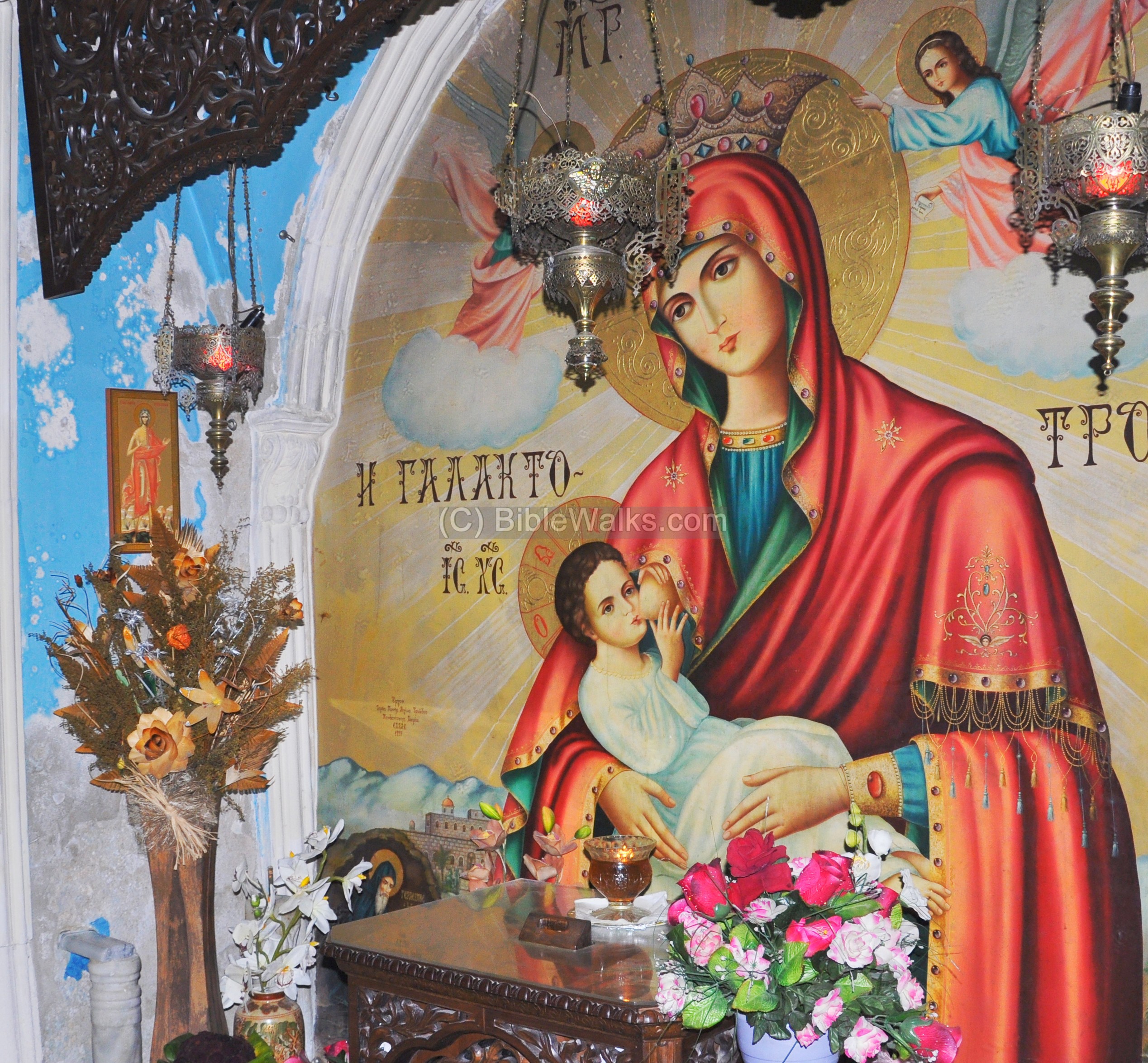
At the end of the entrance hall is a remarkable painting of Mary nursing Jesus. According to tradition, Mary and Joseph fled to Egypt and stayed overnight in a cave at this place, and the painting commemorates this visit.
Another section of the hall is seen below.
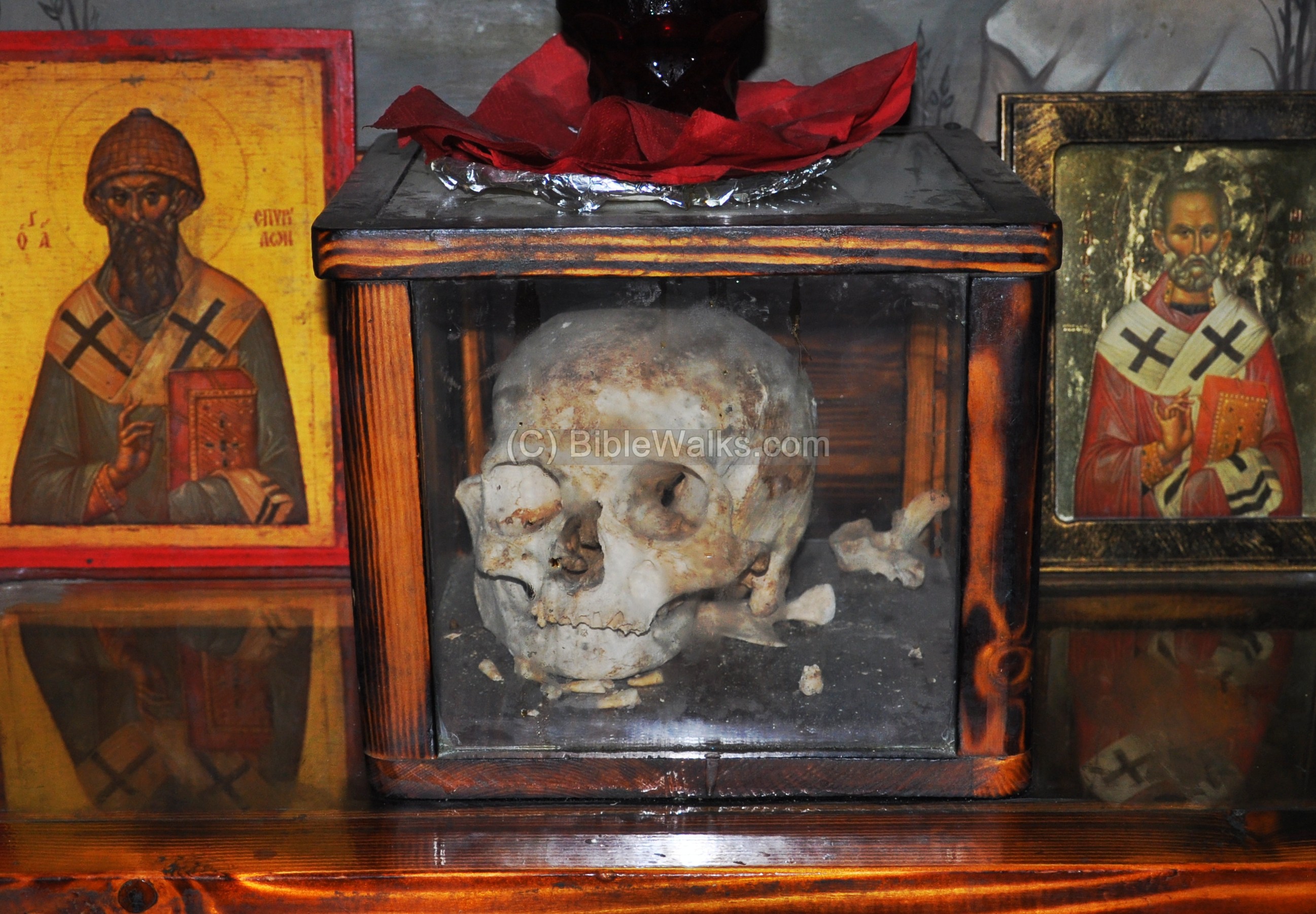
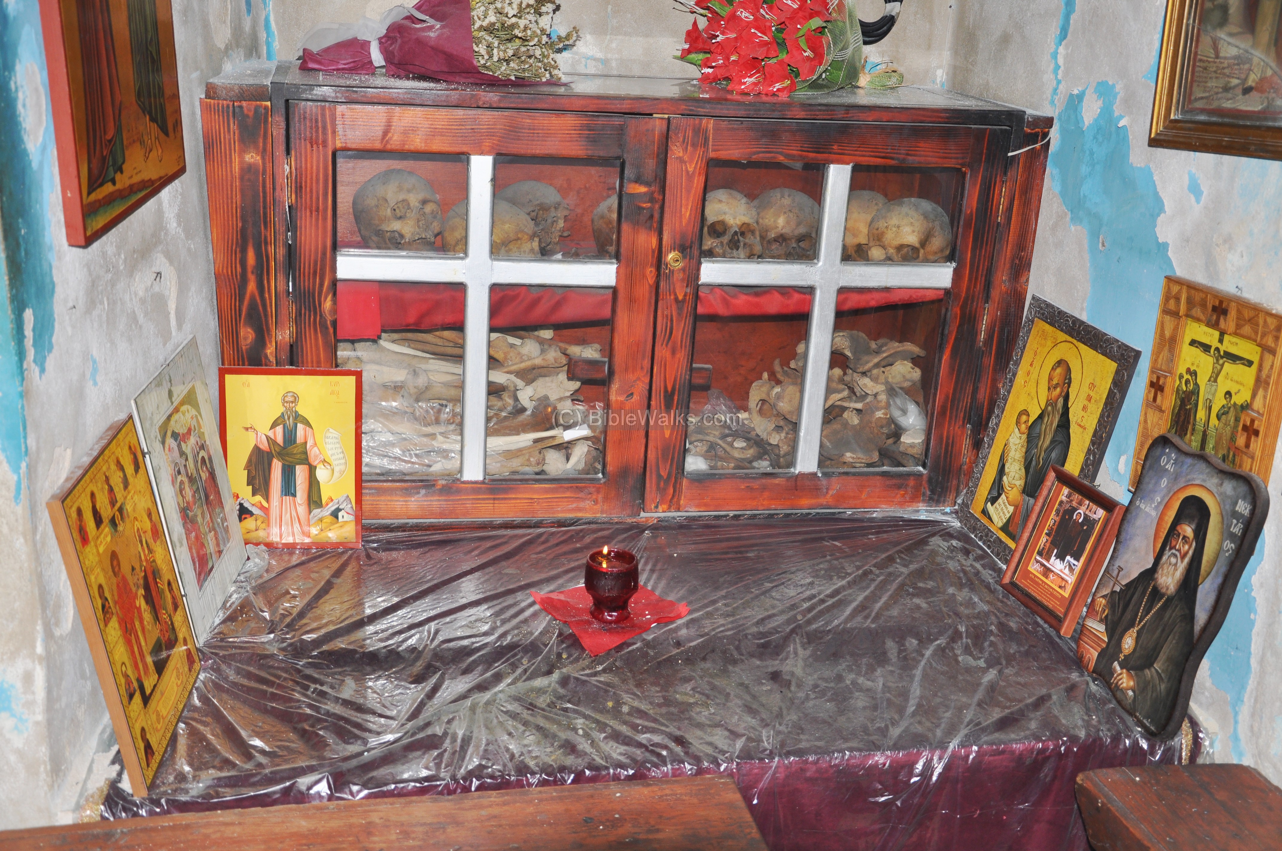
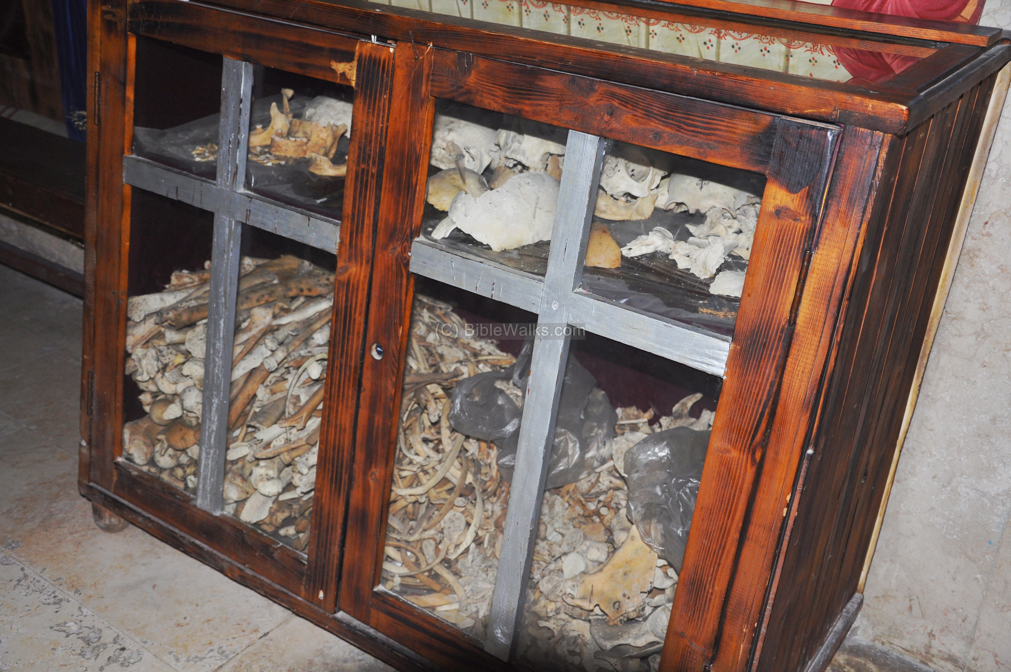
The crypt stores the remains of the victims of the Persian massacre (614) and the great earthquake (1837), which are stored and displayed in the cabinets.
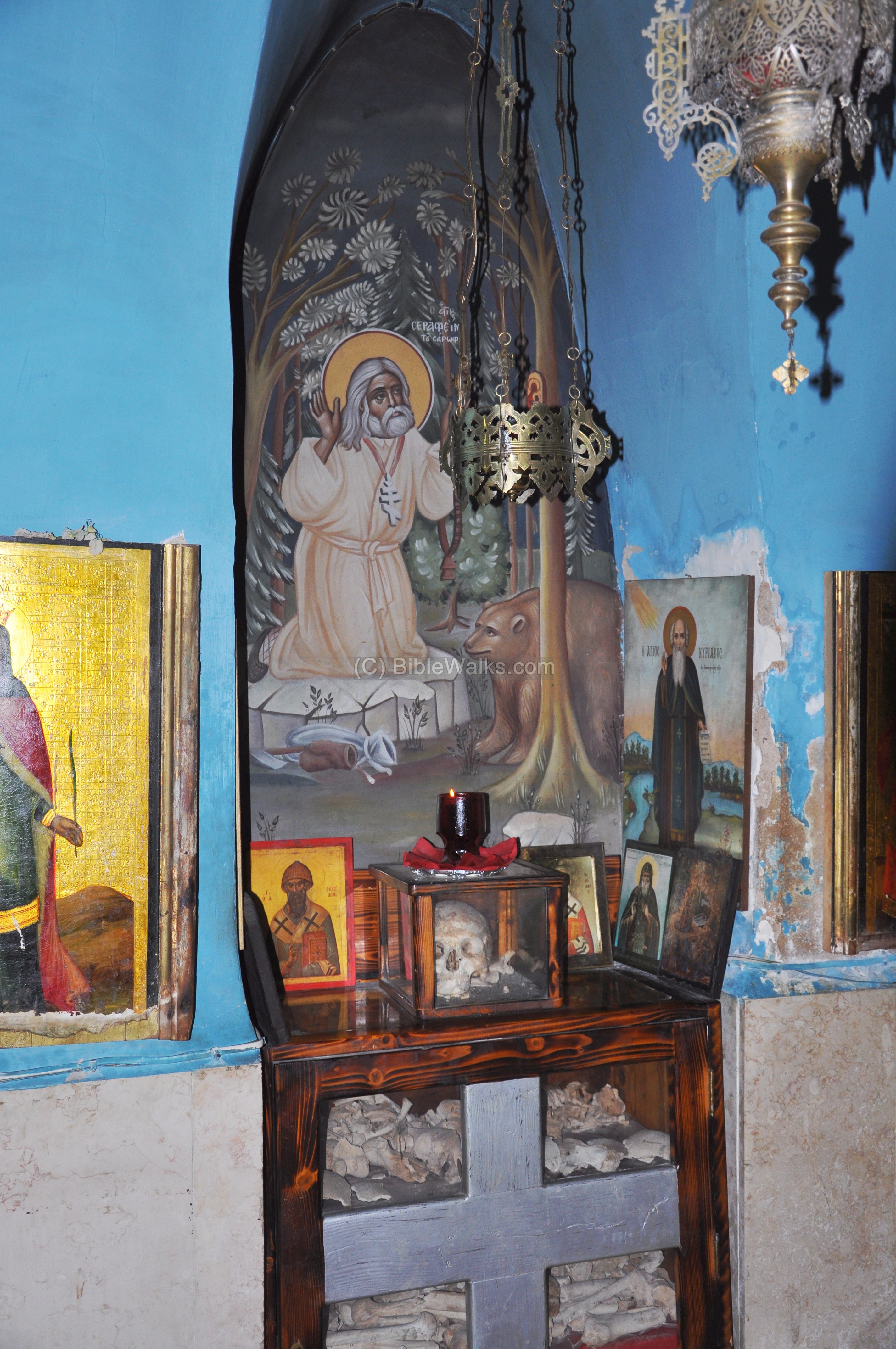
A closer view of this cabinet is shown below.
Another set of remains are displayed in the cabinet below.
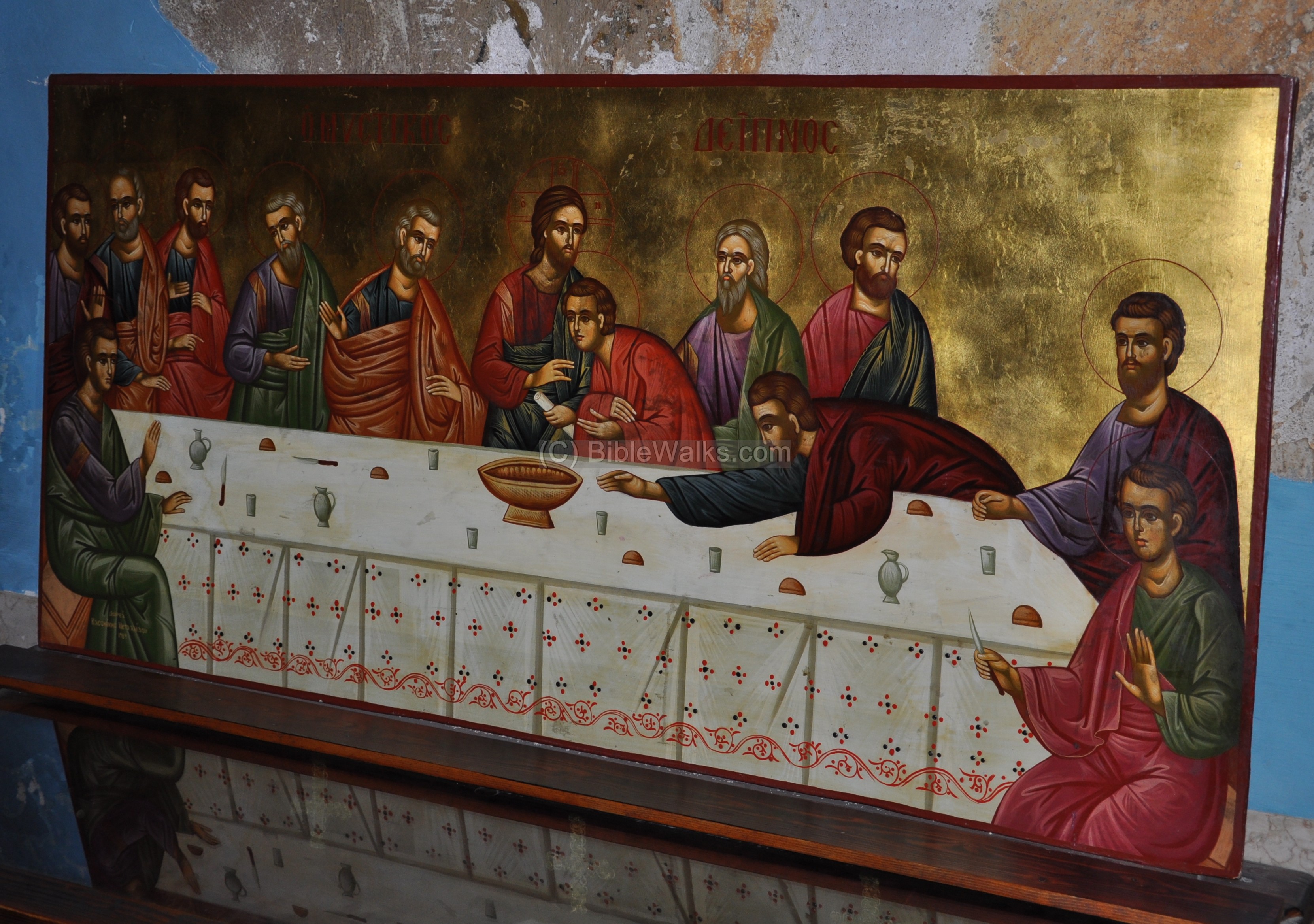
A painting of the last supper is shown below.
Under that painting is another set of remains.
Another section of the crypt is shown below. Behind the door is a small chamber where a cache of ammunition was found during the restorations of the structure.
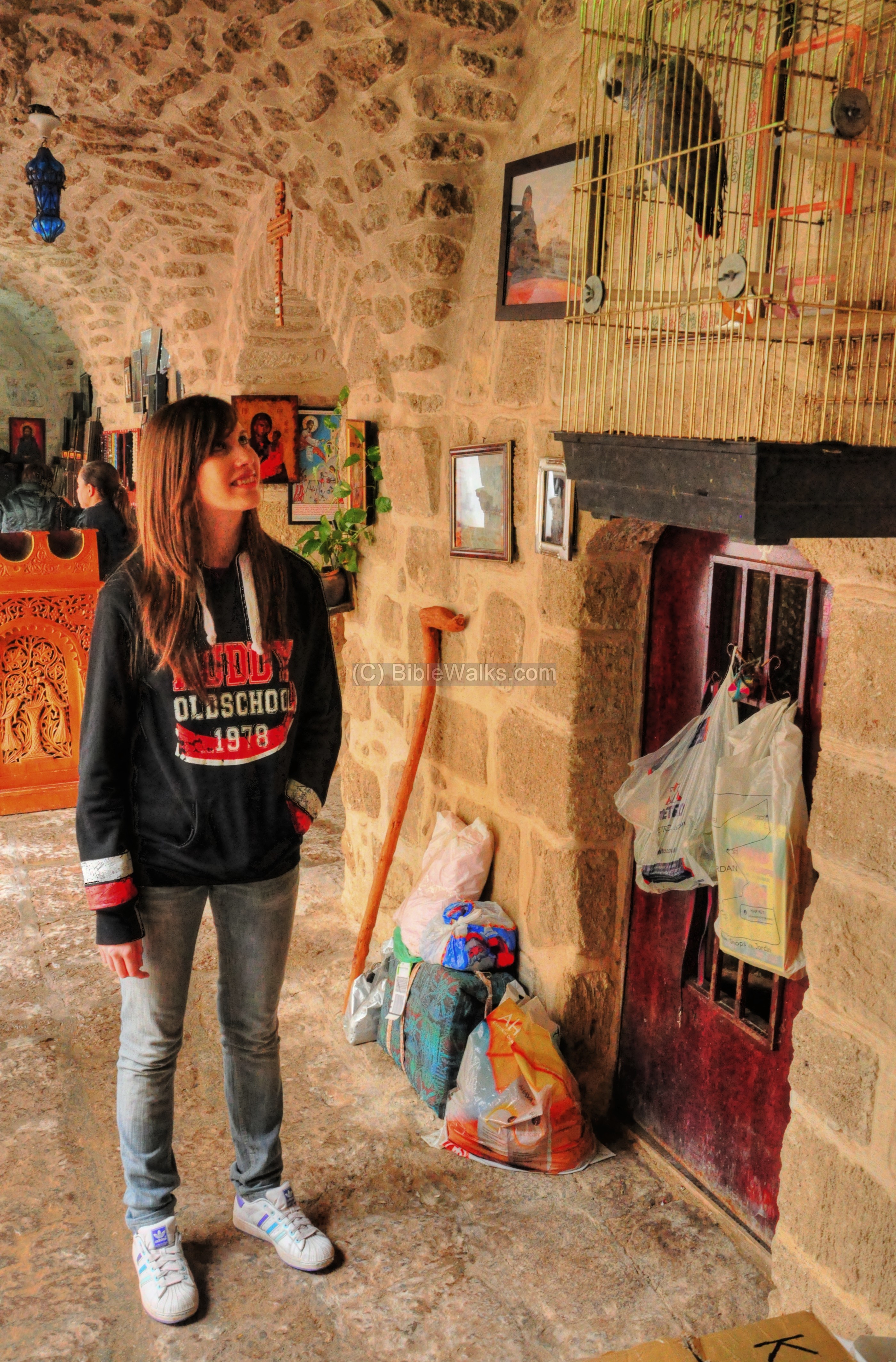
(g) First floor – shop:
Outside of the crypt, near the entrance, is a small shop where you can buy souvenirs, such as scarves and necklaces. Also, a talking parrot with a surprising large lexicon, conducts interesting conversations.
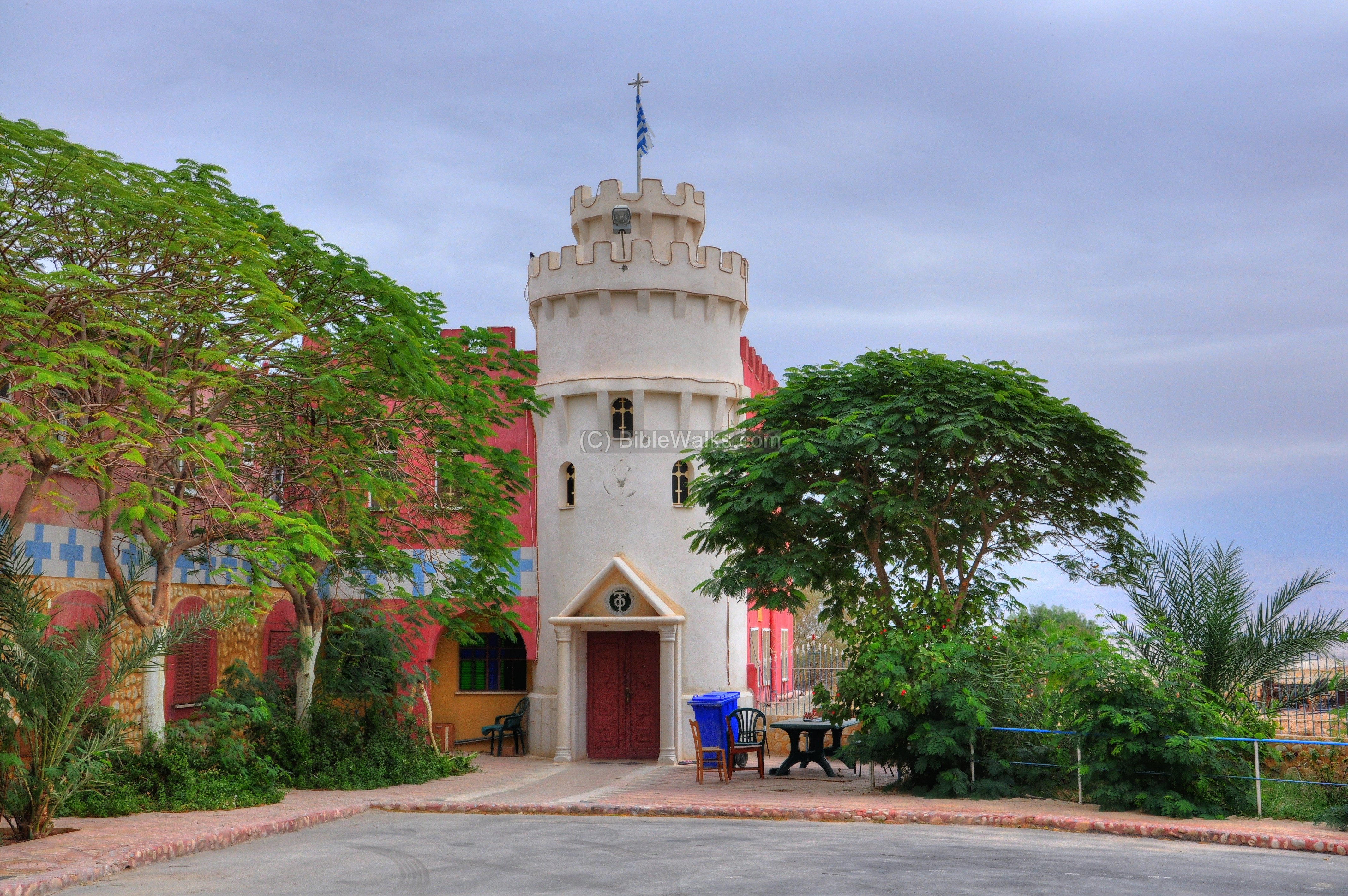
(h) Pilgrimage center:
In the rear of the complex is a Greek-Orthodox pilgrimage center.
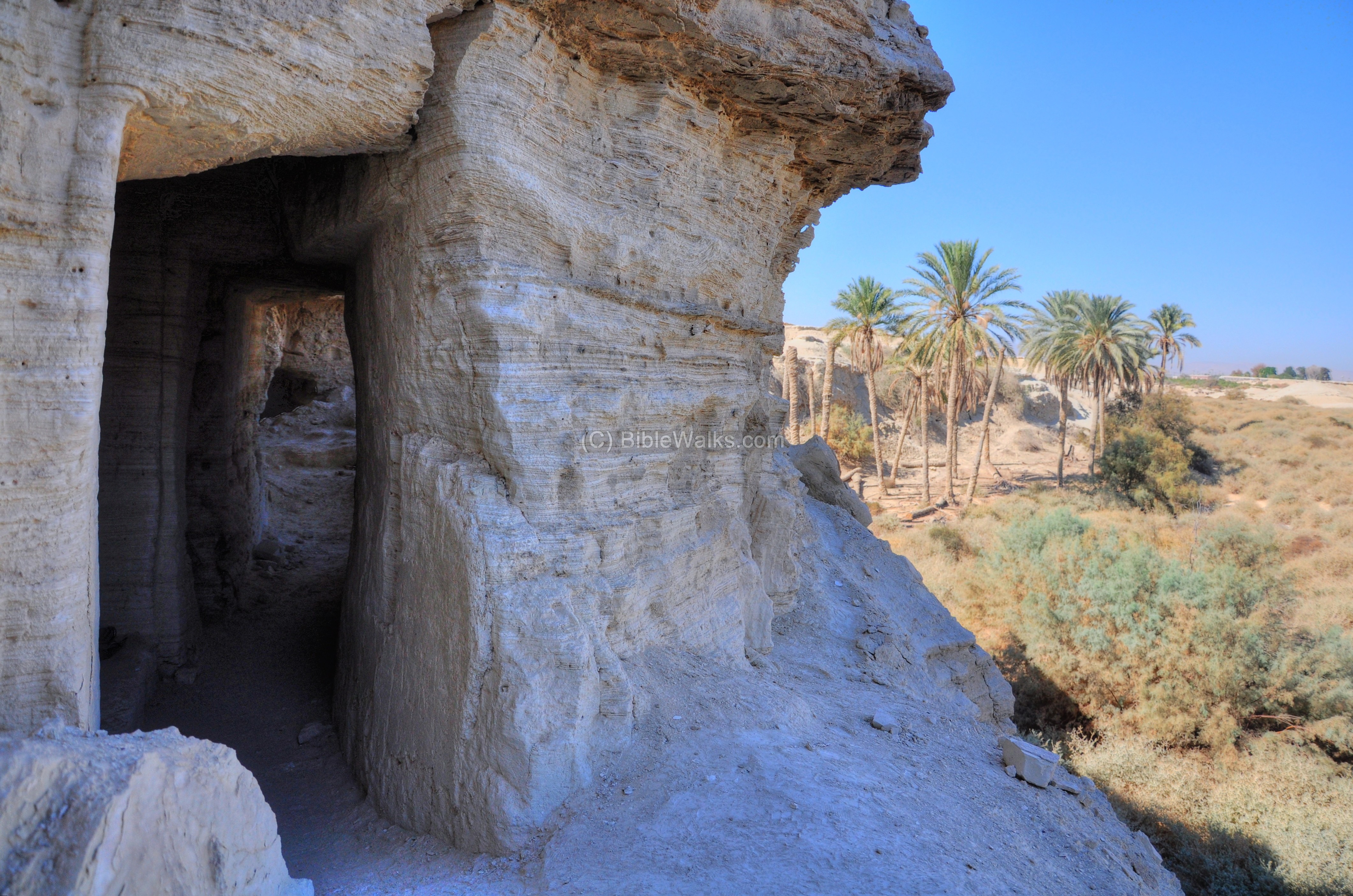
(i) Laura of Hijla:
The original Byzantine monastery was built in the form of a Laura – a cluster of caves or cells for hermits with a common center. Their caves are located 1KM to the east of the monastery, on the northern face of a cliff.
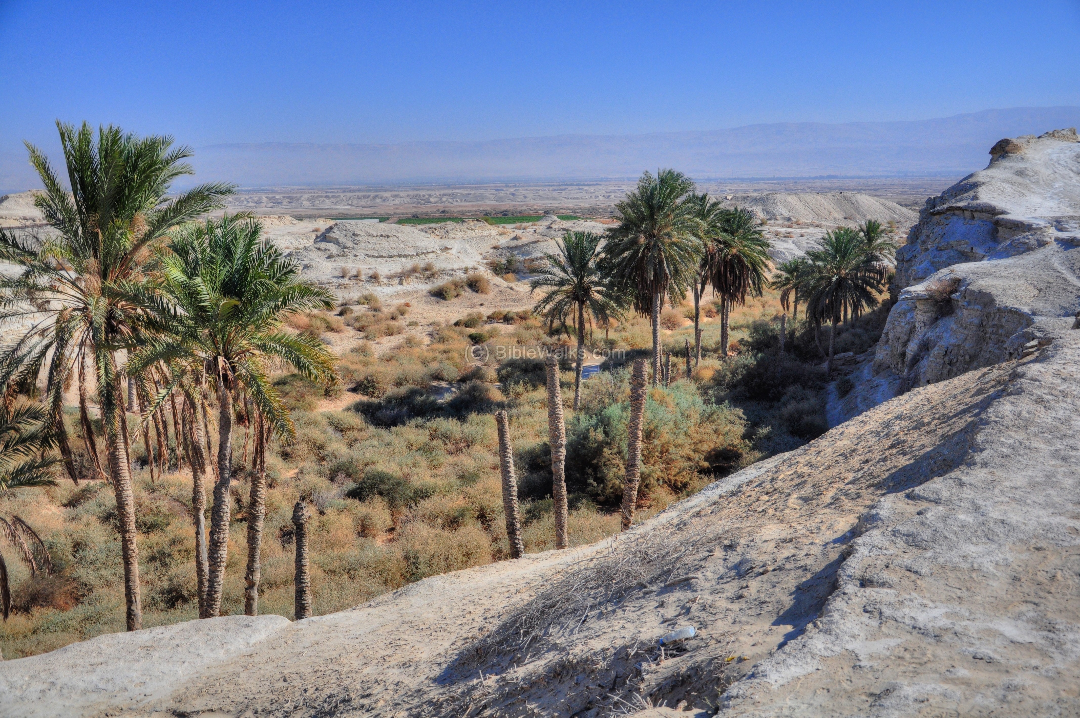
The following picture shows the cliff with the holes of the hermit caves.
Below the cliff was a spring which provided water, and dozens of palm trees supplied the basic needs of the hermits (dates and bread).
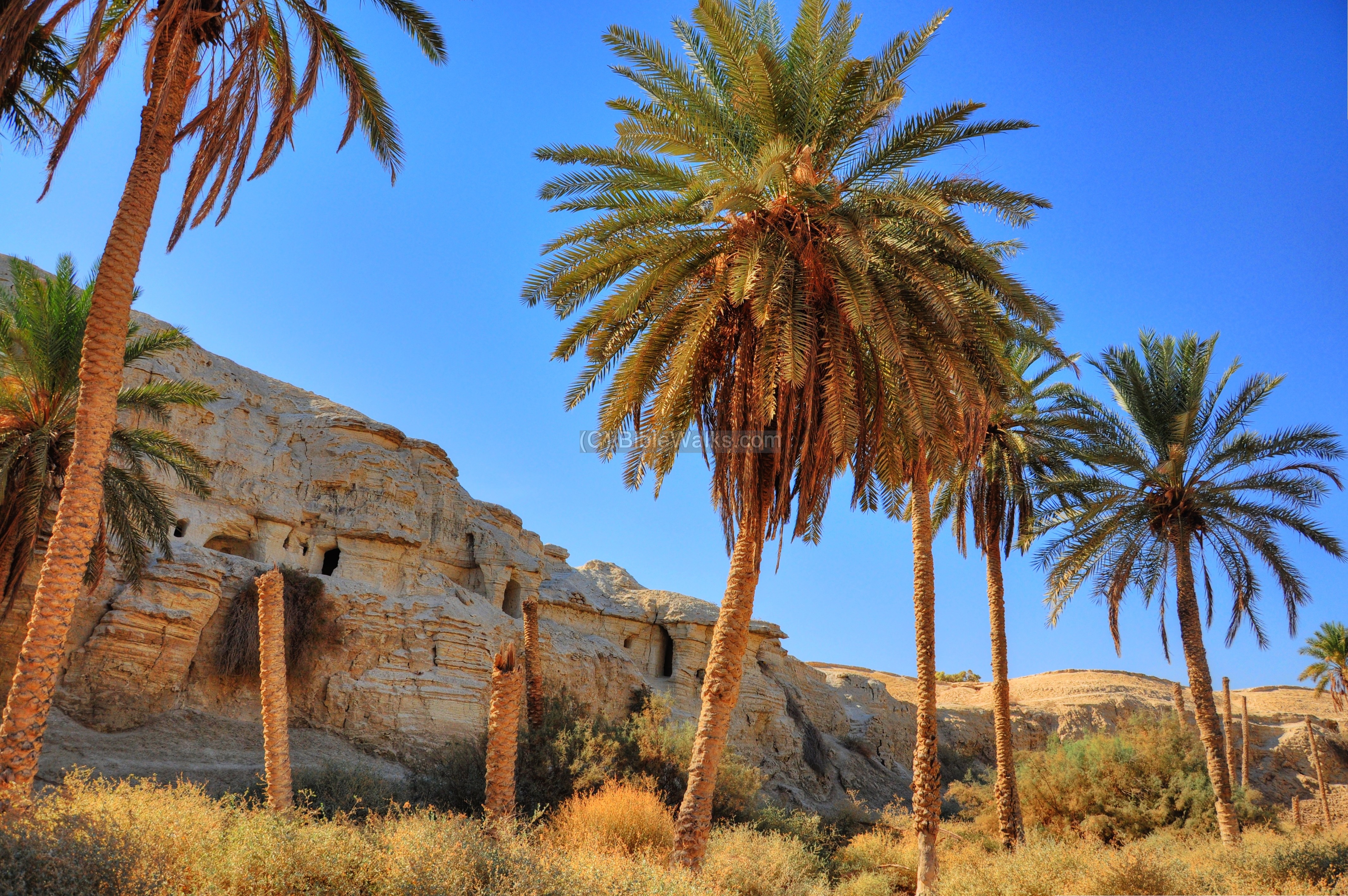
Gerassimos and other hermits resided in these man-made caves, most of the time in total seclusion.
They carved the small cells, cisterns and halls in the soft rock. Some of the external walls have collapsed in the past 1,500 years.
Links:
* Internal links:
- Byzantine monks – info page on desert Monasticism
- Beth Hogla – nearby excavations (BibleWalks YouTube)
* External links:
Etymology – behind the name:
- Deir – Arabic: Monastery.
- Hogla (Hoglah) – The Hebrew name of the partridge bird, which is a common bird found in this region.
- Beit Hoglah, BethHoglah – Hebrew: The house of the partridge. This was a Biblical period city, as per Joshua 18 19-20: “And the border passed along to the side of Bethhoglah northward”.
- Hajlah, Hijlah – Arabic name, based on Hoglah.
BibleWalks.com – walks along the Jordan river
Tell Sheikh edh Dhiab <<<—previous site—<<<All Sites>>>—next Jordan Valley site—> >> Tel Rechov
This page was last updated on Jan 15, 2011
Sponsored Links: