A Roman/Byzantine village which was resettled in the 19th century by the Templars and later became a Moshav.
Home > Sites > Yizreel Valley > BethLehem (Galilee)
Contents:
Background
Location
History
Photos
* Western side
*Inside the village
*Oil press
* North cemetery
*Nature photos
*Templars
Biblical
References
Etymology
Background:
The site was one of the Biblical cities included in the area of the tribe of Zebulun. It reached its peak in the Roman/Byzantine period. In modern times the site was a German Templars settlement, who were later replaced by farmers (1948) and converted to a Moshav.
Joshua 19: 14: “And the border turned about … and Beth-lehem; twelve cities with their villages. This is the inheritance of the children of Zebulun…”.
Location:
BethLehem of the Galilee is located north-east of Tivon, on the north-west side of the Jezreel valley. The ancient site is located on the western side of the modern village of BethLehem-Haglilit.
The area is covered by a thick cover of low gall oaks (in Hebrew: “Alon Tabor”). Between the trees there are many rock cuttings, which include installations, cisterns and ancient cemeteries. There are two clusters of rock-cut tombs – on the north side (where the photos were taken) and south side of the entrance to the Moshav.
History:
-
Biblical times
The site existed in the biblical periods and was part of Zebulun region, as described in Joshua:19. It may have been the home of Israelite Judge Ibzan as per Judges:12. It was probably one of the villages of city of Shimron which is 4KM to the south-east. The archaeological survey did not locate that period, but it may have been covered by the later periods.
The northern cemetery of BethLehem had characteristics of Phoenician tombs, and this may indicate pre-Roman periods.
-
Roman/Byzantine peak
The ancient village reached its peak in the late Roman and Byzantine periods (2nd-7thC AD). The ruins of the village covered a large area of the modern Moshav with an abundant remains of foundations of ashlars (cut blocks), bases, structures and columns, installations such as oil presses. There was also an ancient synagogue (as described by Gurin in 1860) and/or a church (as per SWP survey, 1882-1888).
In later Roman periods (2nd century AD) the site was Jewish and one of the 24 Mishmerot Cohanim villages and cities (Malchija, as per 1 Chronicles) settled here after the Bar-Kochva revolt, and served in the synagogue until the destruction of the village.
A magnificent mosaic floor was discovered in a Byzantine structure (5th-6th century AD) and is on display in the entrance to the passport control in the Ben-Gurion Airport, as seen on the right side. It features animals, birds, trees, grapes, and geometric patterns.
-
Persian/Arab destruction
The site was destroyed in the Persian or Arab conquests in the 7th century AD, but according to the survey, some parts of the site continued in the early Arab period, and later in the Mamluk (13-16th century) and Ottoman (17-20th century) periods.
-
German Templars
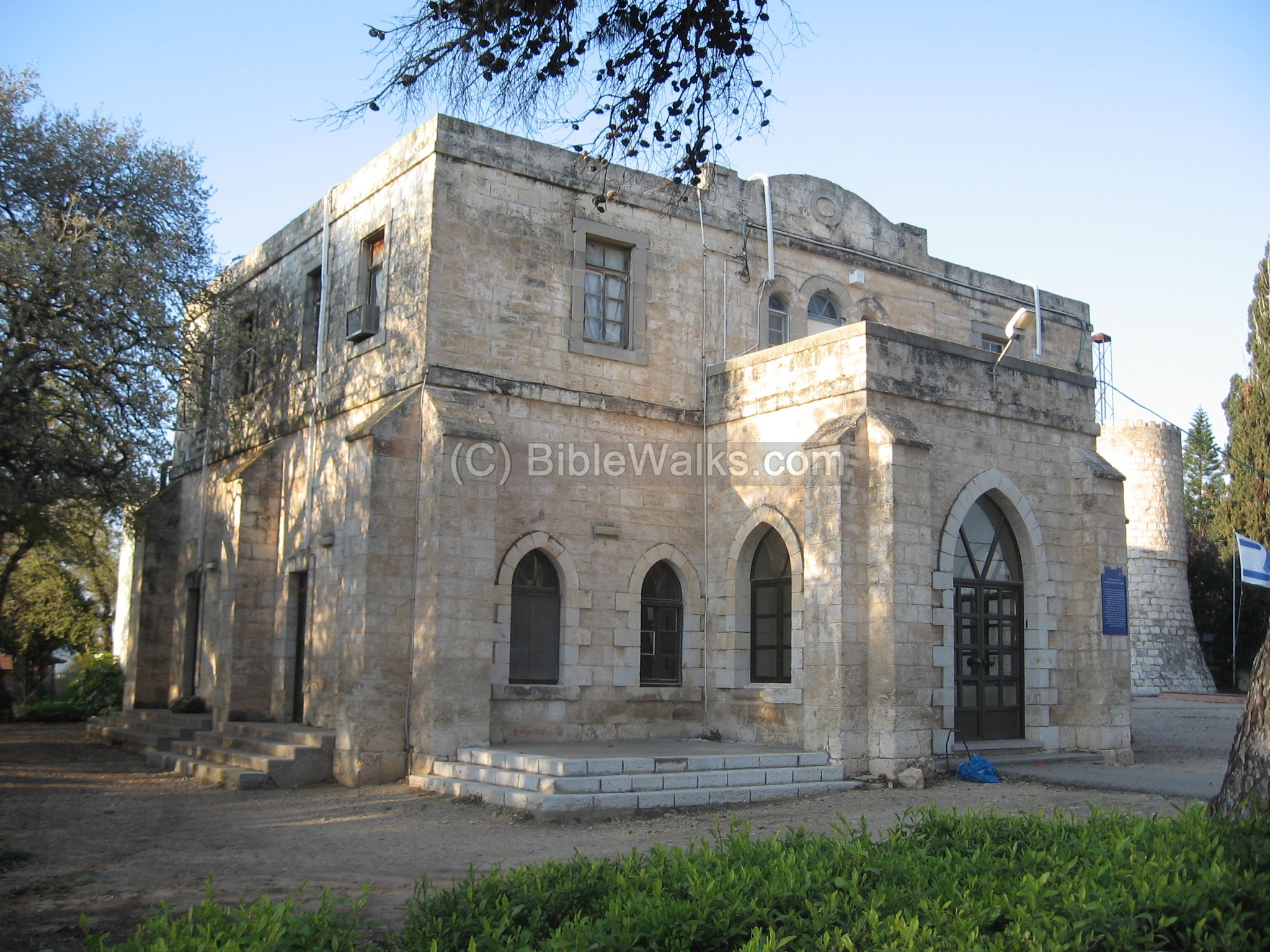
In the 1890s century the German Templars, a Christian sect and offshoot of the Protestants, purchased the lands. They built fine stone houses that exist to date, farmed the land, and preserved the ancient name. An adjacent site, Alonei- Abba, was another Templar site. They were expelled by the British to Australia in WWII since some of them were active supporters of the Nazi party. The deserted village was resettled and converted to a Moshav, an agriculture private-style village, in 1948.
-
Modern times
Today, the Moshav of Bethlehem is a popular tourist attraction, and is open to the public with restaurants, gift shops and other attractions located in and around the Templar houses. It is a recommended place to visit on a sunny weekend, especially in February/March timeframe when the wild flowers splash the hillsides with charm and colors.
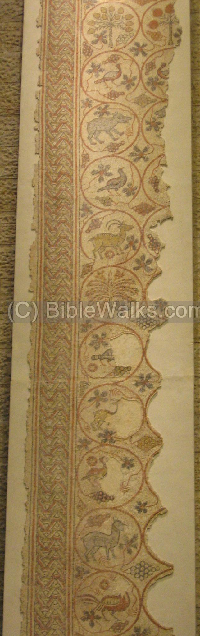
Mosaic floor from Bethlehem of the Galilee – on display in Ben-Gurion airport
Photos:
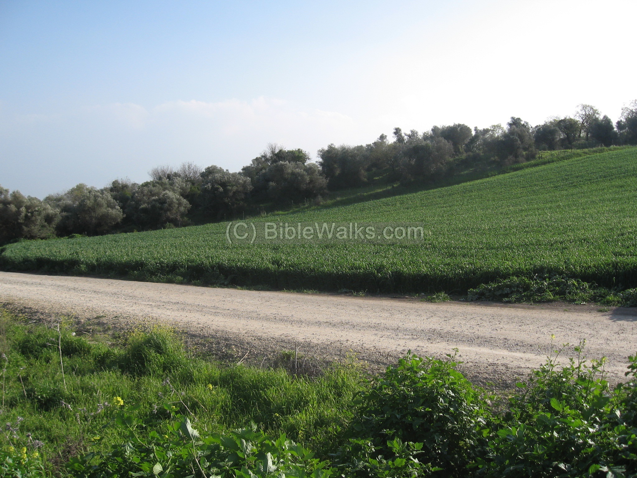
(a) The western side
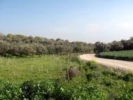
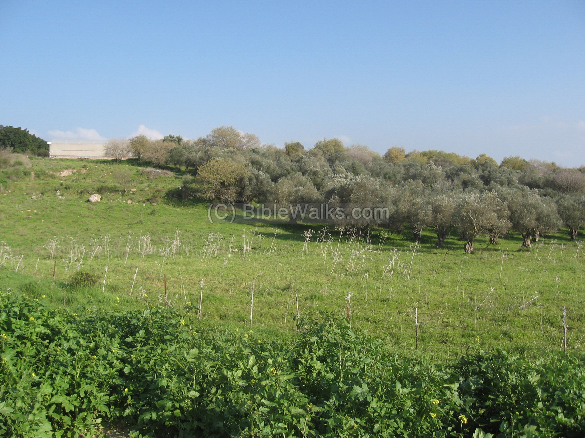
The site is spread over the western side of the Moshav. The following photo shows the southern side of the gate, where there are thick rows of olive trees. Although these trees are young, but in the Biblical period the olives were the main income in the Galilee – producing the olive oil.
Click on the photos to view in higher resolution…
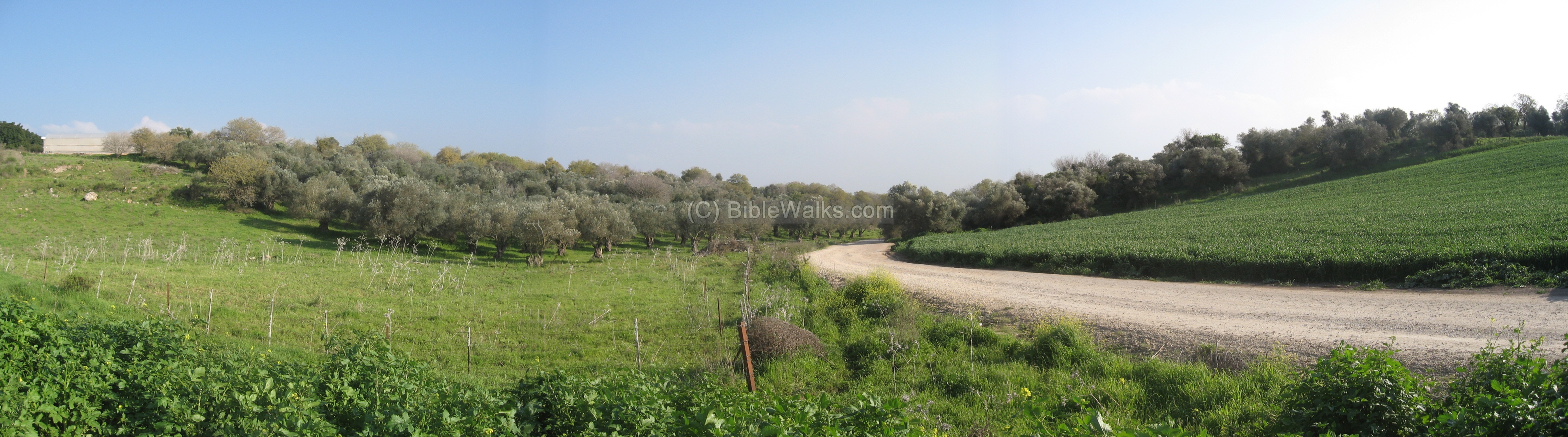
The following photo is captured at the same spot, where a unpaved road leads eastwards. It is used today by the farmers and the visitors to the popular herbs farm/store (“Derech Hatavlinim”) which is a recommended place to stop. This path is based on the ancient road that once connected BethLehem to the main ancient north-south highway in the Yizrael (Jezreel) Valley. That road connected the north (Netufa Valley and Sepphoris) to the south (Megiddo and central Israel).
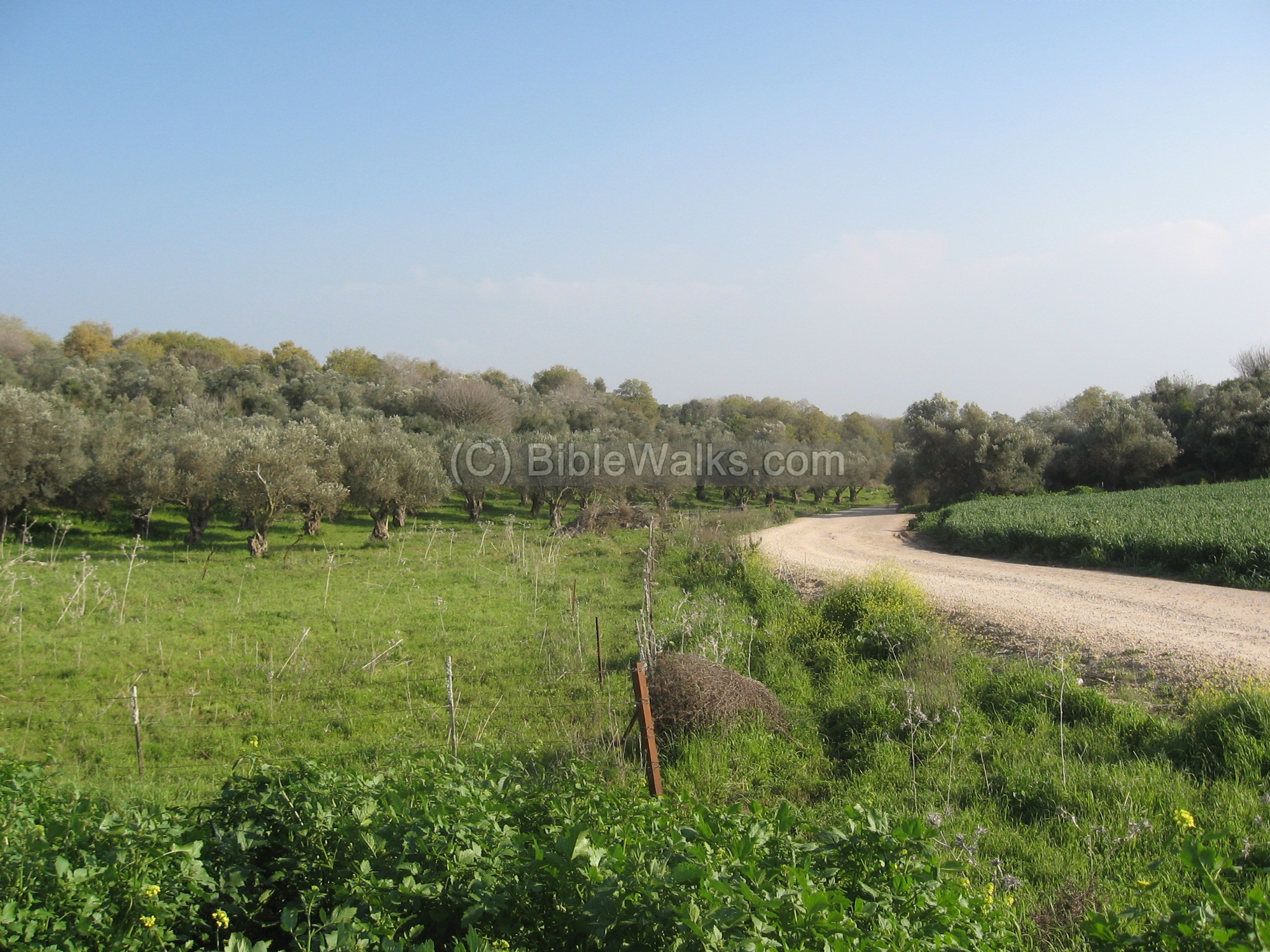
Yet another view of the area. Left to this hillside, after the curve of the road, is the southern ancient cemetery which is located between the trees.
The merged photo is seen below, a classic “biblical” Galilean scene.
(b) Inside the village
Inside the modern village, between the houses and near the gate, is a small area with several layers of ruins, with ashlars, columns and bases. The whole public area on both sides of the entrance road, and beyond the fork of the roads, is covered with ruins – most of them leveled to the ground.
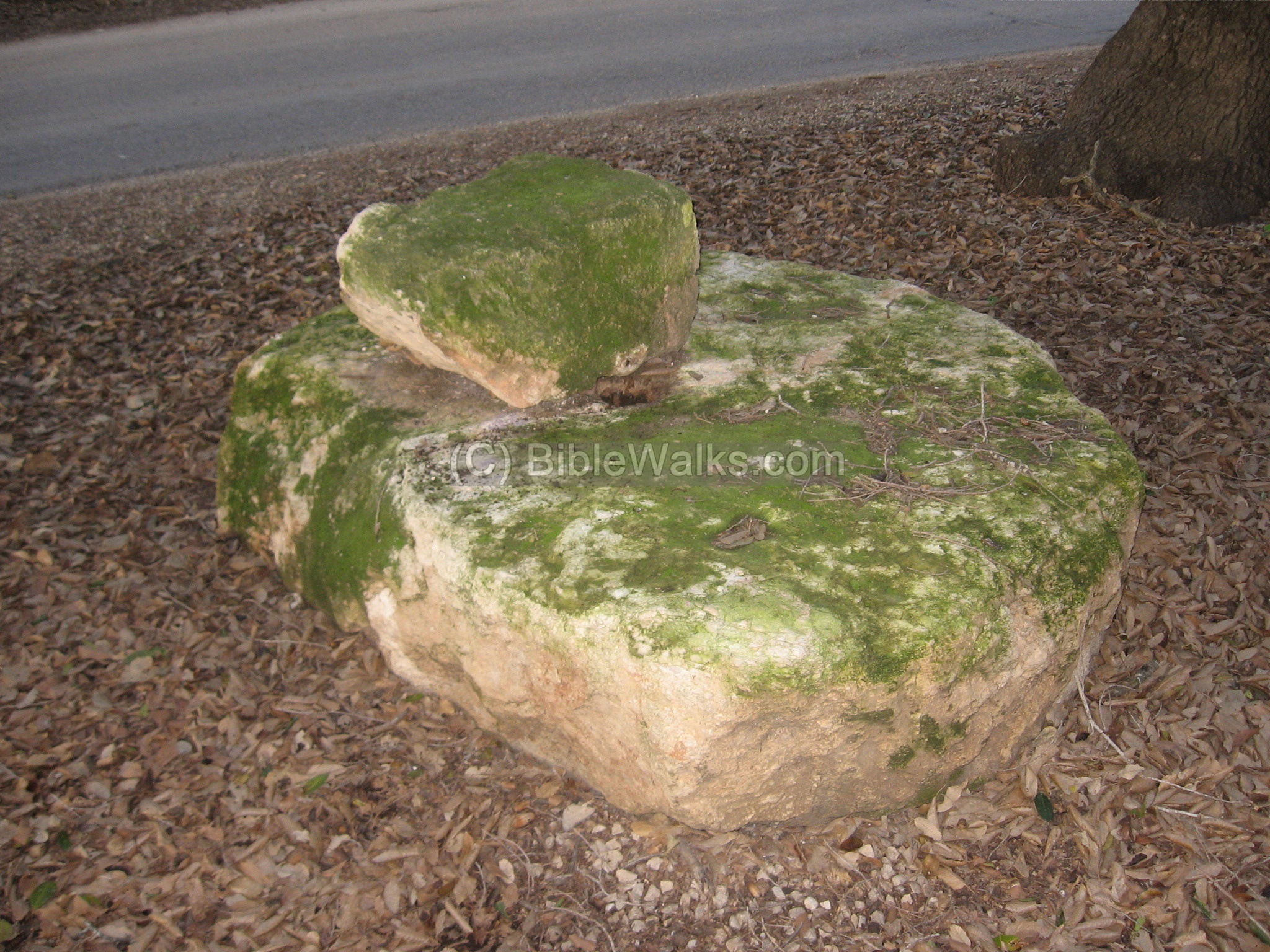
(c) Oil press
After entering the Moshav, you can see on the right side a base of an oil press – a mash olive press type. The olives were placed inside the basin, and a mashing stone (seen on the next photo) was turned around the cavity to press the olives.
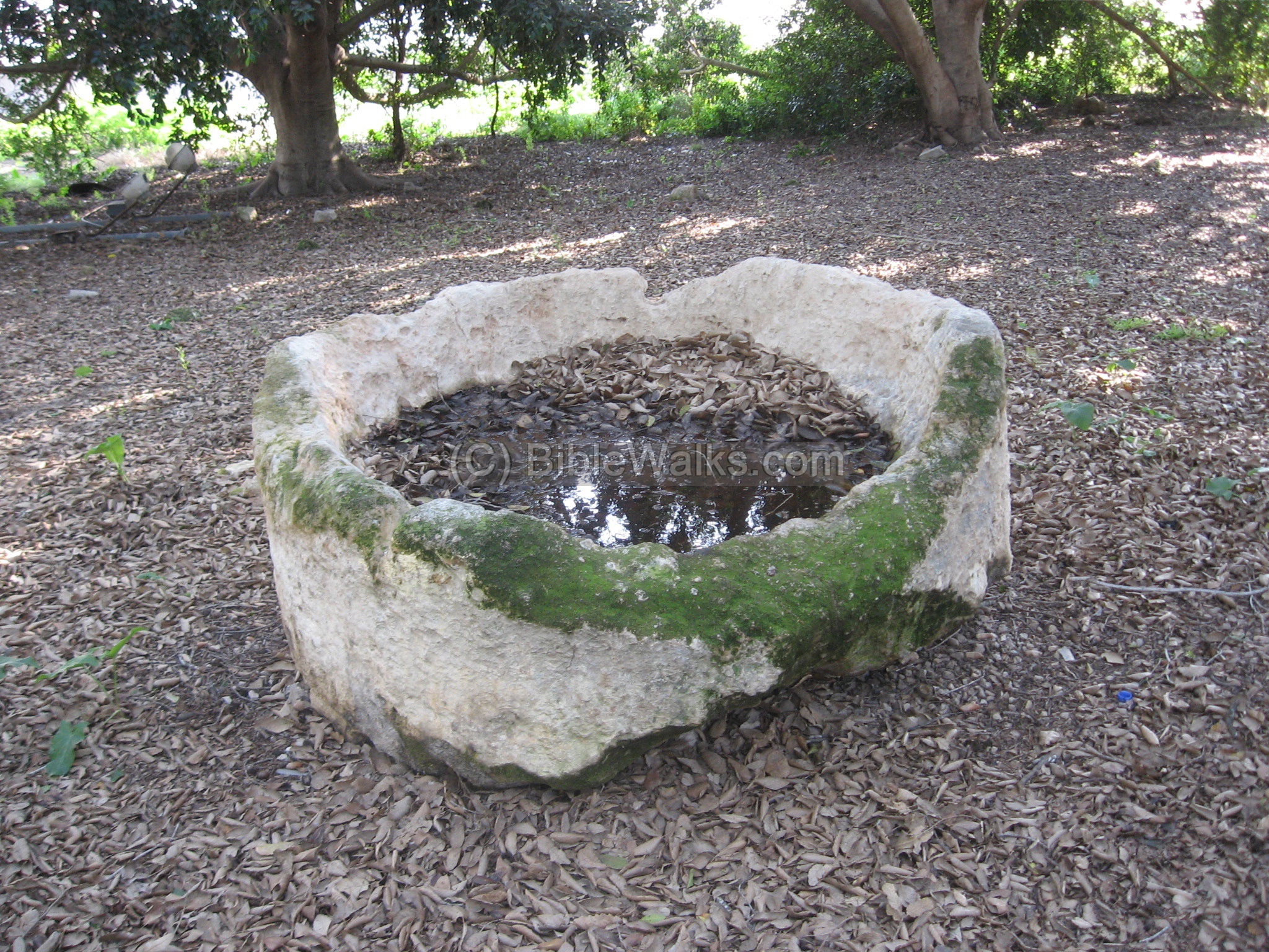
Another part of the oil press – a large round crushing stone with a hole in the center; it rolled around the basin and mashed the olives, extracting the golden oil.
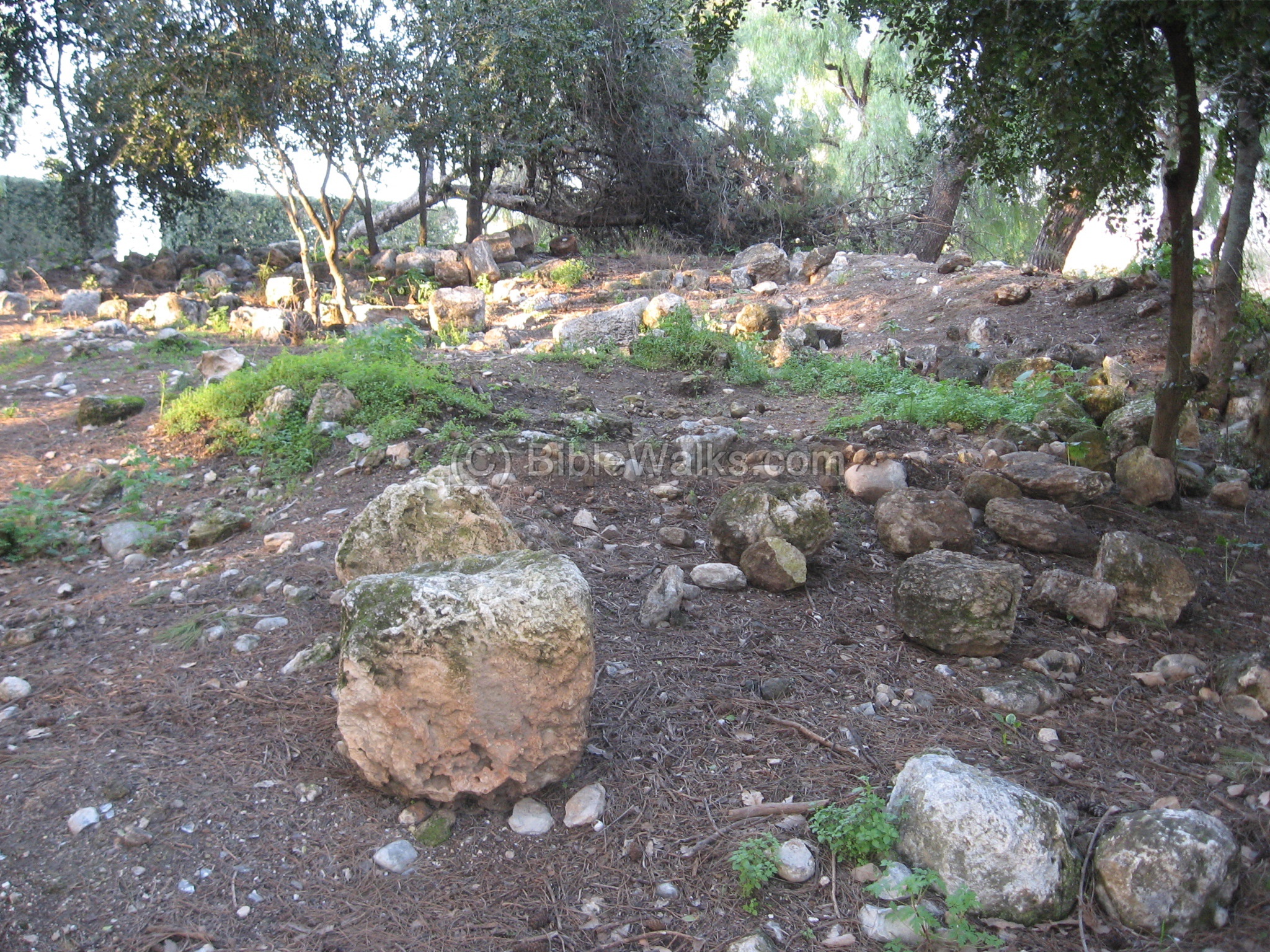
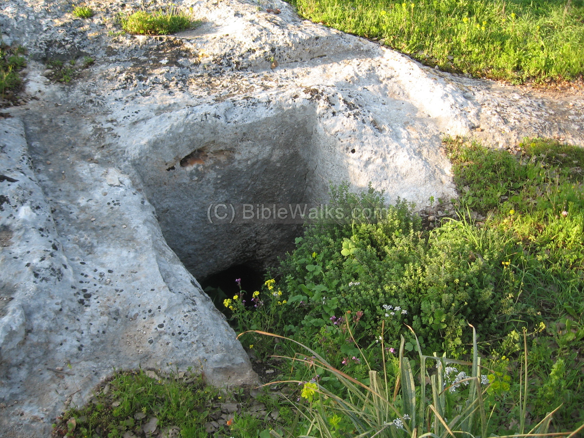
(d) Northern Cemetery
About 100 M north to the entrance of the Moshav is an ancient cemetery. The following photo shows one of the dozens of rock-hewn tombs and burial clusters. There are many shaft and cist tombs on the hillside among the trees.
The site was also used as a stone quarry in a later stage, when some of the burial sites were cut out for extracting the building blocks.
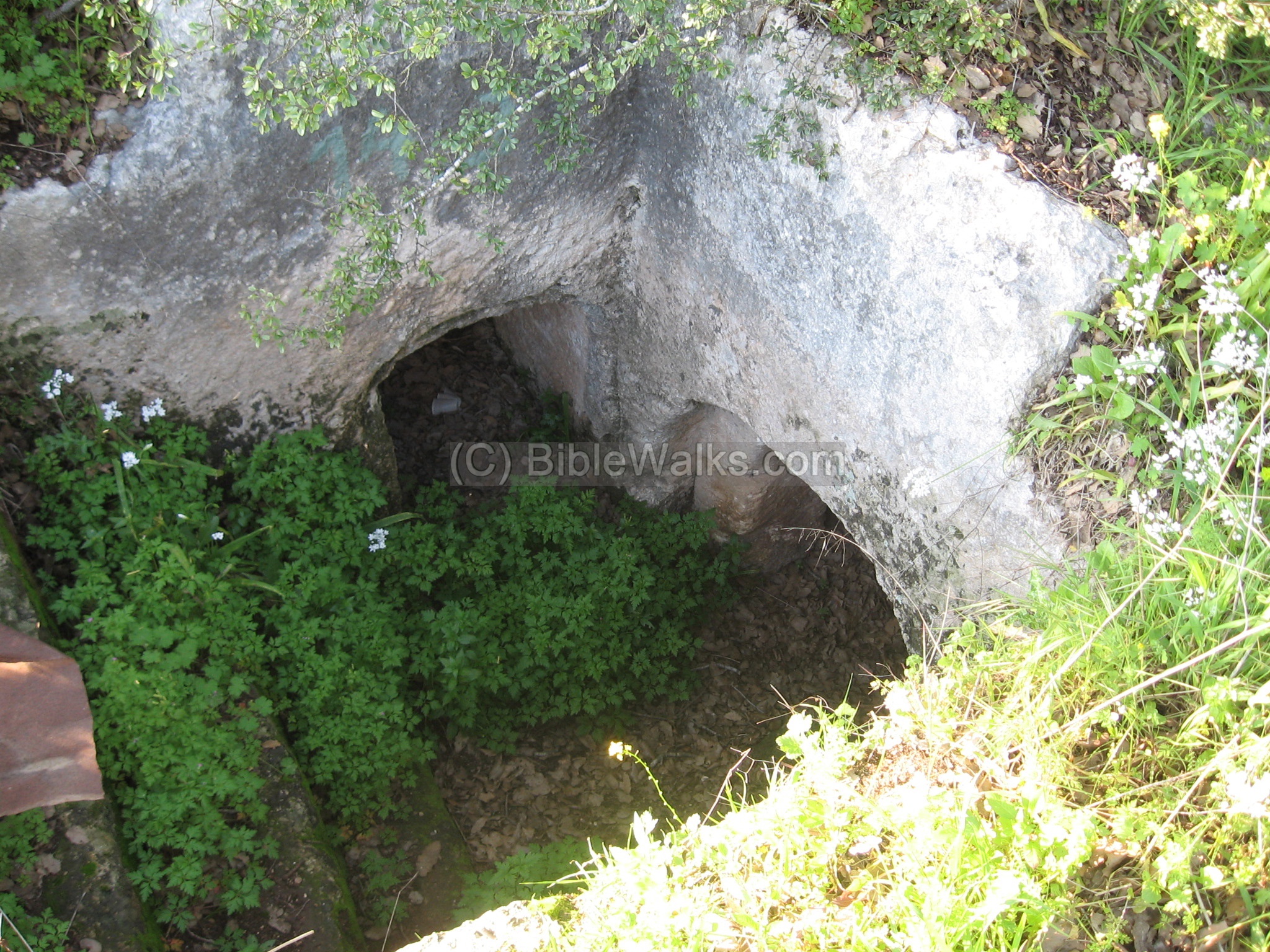
To get here, drive 100M to the north of the junction of dirt roads which cross the entrance road to the Moshav. The cemetery is easily accessed through an opening in the gate on the left side of the dirt road.
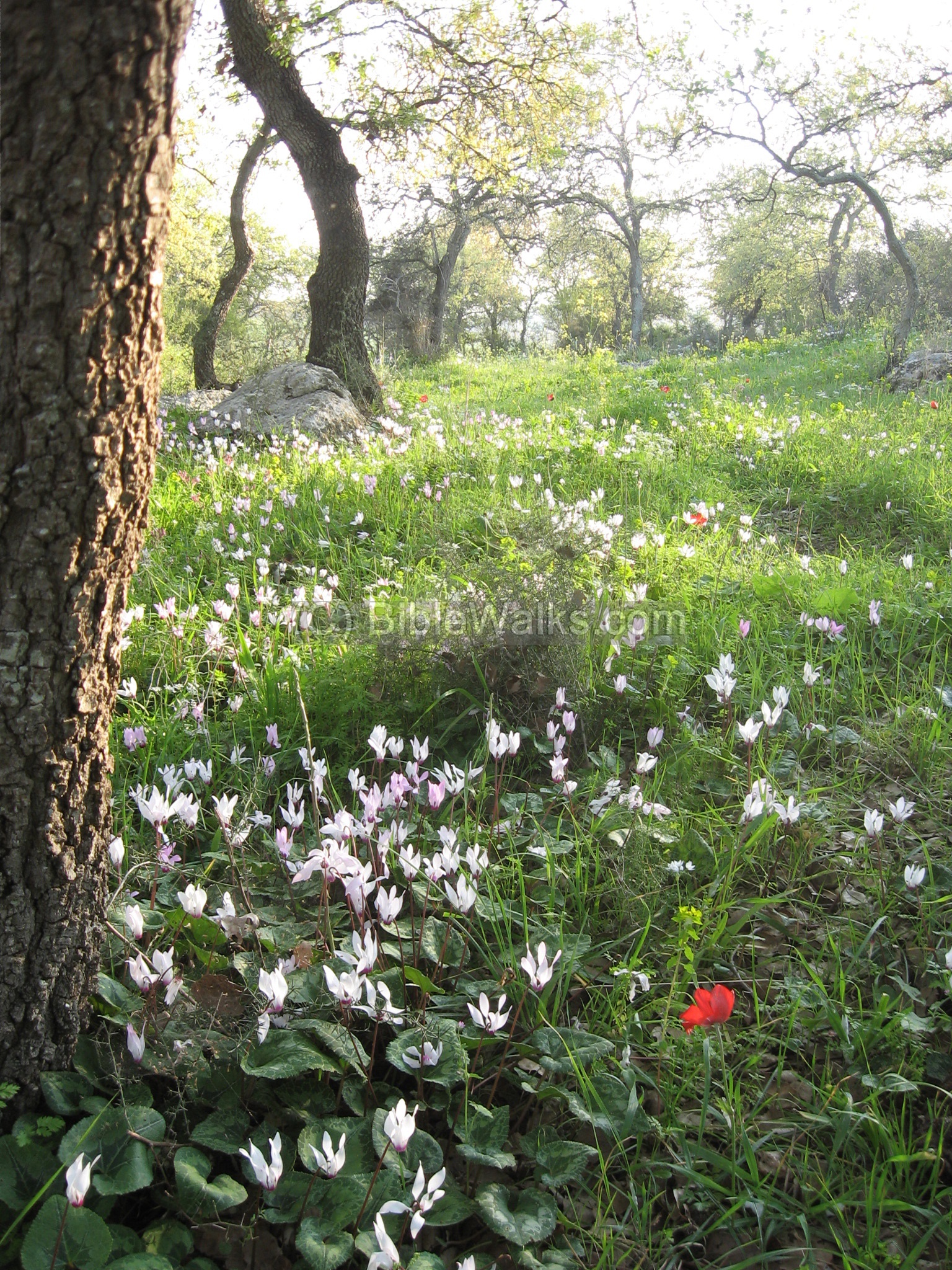
(e) Nature photos
Around the cemetery, and covering most of the hills around the site and in the area, are forests of gall oaks (“Alon Tabor”). During the end of the winter season there is an amazing cover of wild flowers – such as cyclamen (Hebrew: Rakefet, as seen below).
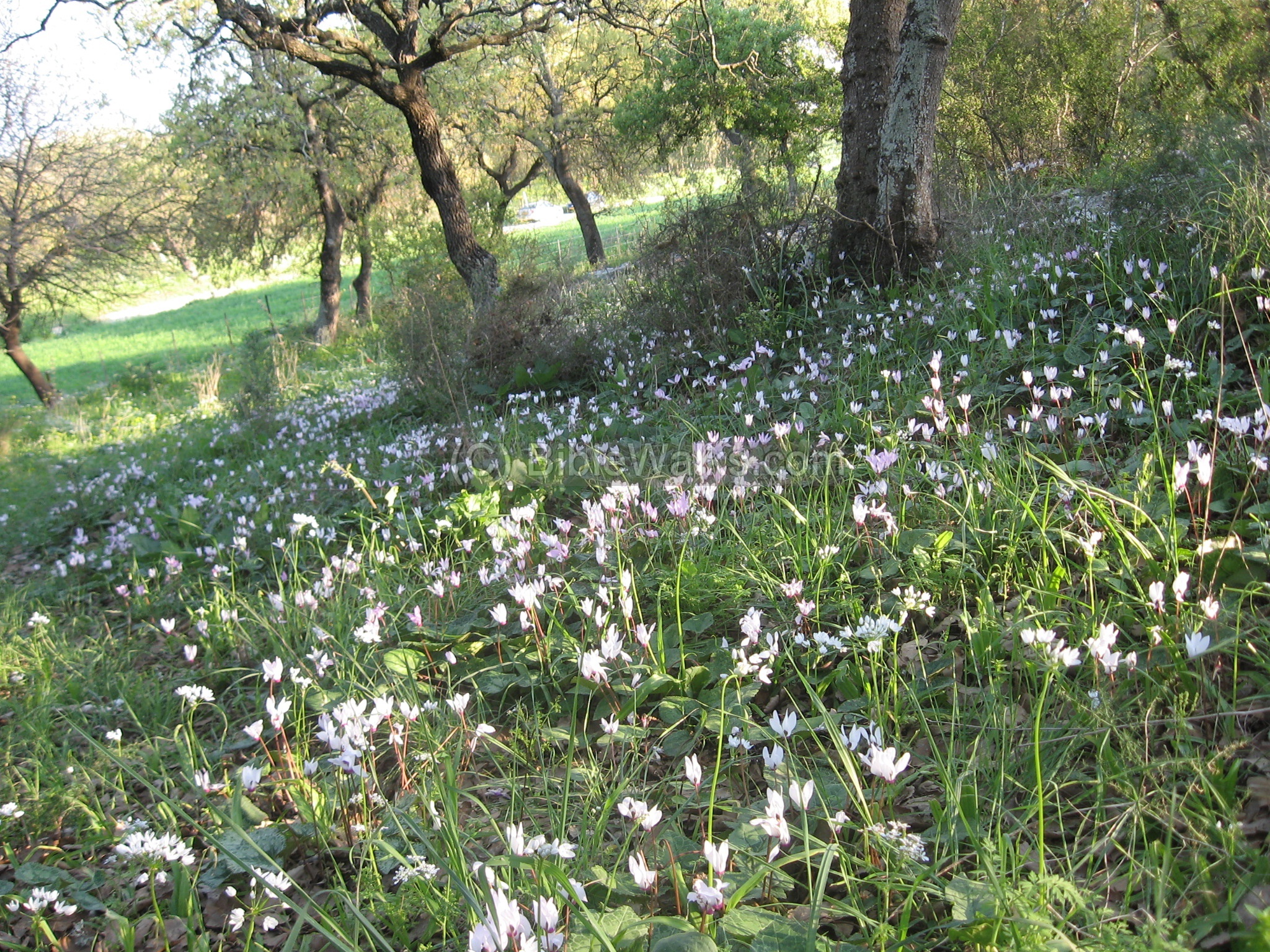
Another view of the forest, with a single red anemone (Kalanit – Anemone coronaria). In other sections there are carpets of these red flowers. How can you miss this view? It charges your batteries!
(f) The Templar Colony houses
There are about 50 Templar houses, most of them built during the 1890s. The building style of this Christian sect was an unprecedented in the landscape of Israel in those times, and the quality of theses stone houses is admirable. (See Haifa web page for details on the Templars). The following photo shows the central folk house.
Biblical References:
(a) Joshua 19: 14-16
This text describes the region of the Tribe of Zebulun:
“And the border turned about it on the north to Hannathon; and the goings out thereof were at the valley of Iphtahel;
and Kattath, and Nahalal, and Shimron, and Idalah, and Beth-lehem; twelve cities with their villages. This is the inheritance of the children of Zebulun according to their families, these cities with their villages”.
(b) Judges 12: 8-10
Ibzan was an Israelite judge in 11-12 century BC, and may have been from Bethlehem in the Galilee (as per Z. Vilnai; some scholars, including Y. Aharoni, identify his home place to Bethlehem in Judea).
“And after him Ibzan of Bethlehem judged Israel. And he had thirty sons, and thirty daughters, whom he sent abroad, and took in thirty daughters from abroad for his sons. And he judged Israel seven years. Then died Ibzan, and was buried at Bethlehem”.
(c) 1 Chronicles 24: 5-6, 9
This text lists the 24 families of Cohens, who served the temple. The family of Malchijah settled in BethLehem.
“Thus were they divided by lot, one sort with another; for the governors of the sanctuary, and governors of the house of God, were of the sons of Eleazar, and of the sons of Ithamar. And Shemaiah the son of Nethaneel the scribe, one of the Levites, wrote them before the king, and the princes, and Zadok the priest, and Ahimelech the son of Abiathar, and before the chief of the fathers of the priests and Levites: one principal household being taken for Eleazar, and one taken for Ithamar”. … “The fifth to Malchijah, the sixth to Mijamin…”
Other References:
-
Arch. Survey of Israel – Nahalal Map (28) – A. Rabin [1982] , sites #54 (Bethlehem), #52 (Northeren cemetery), #53 (southern cemetery)
-
Carta’s Atlas of the Bible [Y. Aharoni, 1964, 1974] – maps #72, #113
-
Carta’s Atlas period of the 2nd Temple – M. Avi-Yonah [1966, 1974]. maps #131, 161
-
SWP (Survey of Western Palestine, 1882-1888) I, p. 270
-
V. Guerin, Description … de la Palestine [ 1860], Galilee I p. 362
-
Arch News 14: 1965 p7-8
-
Oil presses: Antiquities XXXIV (ISSN 0792-8424) – survey of oil presses in the Golan (Chaim Ben david, pp1-62)
-
Wine & Oil Production in Antiquity in Israel & other Med. Countries [ISBN 1850755191 1998] Frankel, Rafael.
-
History & Technology of Olive Oil in the Holy Land [ISBN 09177526066 1994] Frankel, Avitson, Ayalon.
-
Is this the real Birthplace of Jesus? – IAA article in Hebrew [Aviram Oshri]. The excavator of the site thinks it is….
Laurence Oliphant “Haifa, or Life in Modern Palestine” May 1, 1883:
His article was published with the title “”Holy places” in the Galilee”, where he tells his readers about his horseback visit to Canna, Sepphoris and Bethlehem. The visit in Bethlehem was before the Templars settling. Laurence claimed to find an underground aqueduct, a stone coffin, part of a column and other parts. He talked about the ancient oak forest that sadly was thinned down by the coal makers. He told about the use of a compass to navigate through the valleys, since at these years the Galilee landscape was virtually deserted.
Laurence signed the article with one of the strongest lines in his books that I always cherish: “… to me this was one of the most joyous journeys that my luck has brought to me in this land”.
|
As a reporter, his articles ignited the imagination and curiosity of the World… Indeed, a pioneer of Bible Walks!
“Haifa” by Laurence Oliphant is a recommended book for the period of rediscovering the Holy Land. |
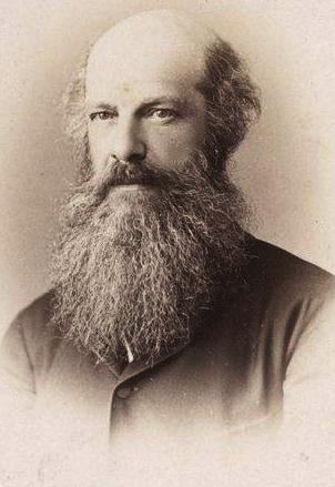
Laurence_Oliphant (1829-1888) Public domain photo |
Links:
Etymology (behind the name):
- BethLehem – In Hebrew; the house of Bread (Beth/Beit=house, Lehem/Lechem=bread). This name is the same as the birth place of Jesus, but that place is located south to Jerusalem.
- Haglilit – In Hebrew: “of the Galilee”; Ha=”The”, Glilit=Galilean. This suffix is added to the name of the site to distinguish it from the site in the south.
- Malchijah – In Hebrew: “My King is God”. Malchi = my King. Jah = God. One of the 24 Cohen families.
BibleWalks.com – The Bible – from the ground up
Beit Shearim Catacombs<<<—previous site—<<< All Sites>>> —next Yizreel Valley site—>>> Yizreel
This page was last updated on July 29, 2024 (fix links)
Sponsored links: