Ruins of a Persian/Hellenistic period settlement, where an important Hellenistic stele were found .
Home > Sites > Yizreel Valley > Horvat Shamot (Tell el-Firr)
Contents:
Background
Location
History
Photos
* Horvat Shamot
* Revisiting the discovery
* Excavation Preparations
* Excavation
References
Etymology
Background:
Ruins of a Persian/Hellenistic period settlement, known as Horvat Shamot (Tell el-Firr), are buried in the field between Hefzibah and Beit HaShitta, 2km north-north-east of the ancient synagogue. The site was totally leveled in 1960, but fragments of an important Hellenistic stele were found and assembled after it was razed by the local farmers.
Location:
The site is located in a farming field, adjacent to the railway. The bright area seen in the field is probably the center of the ruined village.
History:
- Biblical Periods (Bronze/Iron age)
According to pottery remains, the early settlement on this site was during the Iron Age II.
Ancient roads passed along the north bank of Harod river, along the north side of the village (marked by a red circle), connecting the north and west to Beit-Shean/Scythopolis and Jordan on the east.

Map of the area – Horvat Shamot is a red circle -Biblical periods (based on Bible Mapper 3.0)
D. Dorsey (“The roads and highways of ancient Israel”, p. 113) added more Biblical roads that passed thru the village (spelled Shammot and marked in the book as #261). These are the roads:
- ‘T8’: Acre, via Afula, thru Shamot to Beit Shean and Jordan valley
- ‘T10’ and ‘T8’: Jezreel via Shunem thru Shamot to Beit Shean (as appear on the map above)
- ‘T8a’: Linking Tel Rehob thru Nir David to Shamot
- ‘T8b’: Linking T8 from Shamot to T7 (Megiddo-Jezreel-BeitShean) via Tel Yosef
- Persian/Hellenistic period
Ruins of a Persian/Hellenistic period settlement, known as Horvat Shamot (Tell el-Firr), are buried in the field between Hefzibah and Beit HaShitta, 2km north-north-east of the ancient synagogue.
The site was totally leveled in 1960, but fragments of an important stele were found and assembled after it was razed by a local farmer. The limestone stele measures 77 x 47 cm and 16cm deep.
The inscription features a transcript of correspondence between Antiochus III (223–187 BCE) and Ptolemy son of Thraseas. It is a significant artifact that sheds light on the diplomatic and political interactions during the Hellenistic period. This inscription, written in Greek, provides valuable insights into the communication and relations between the Seleucid Empire and other Hellenistic states.
Antiochus III, also known as Antiochus the Great, was a ruler of the Seleucid Empire and is known for his attempts to consolidate and expand his territory. Ptolemy son of Thraseas was a notable figure under the Ptolemaic dynasty, possibly holding a significant administrative or military position. The documents belong to various stages of the 5th Syrian war.

Hefziba Stela, courtesy Israel Museum, Jerusalem
The inscription is essentially a series of 5 letters exchanged between Antiochus III and Ptolemy. The purpose of the letters was to address complaints about soldiers’ behavior and to establish the king’s authority and regulations for the region. Specifically, Ptolemy was seeking to prevent his soldiers from forcibly taking quarter in local homes and pressing the population into service. The king’s response aimed to restrain and punish any offenders.
The inscription serves as a public record of this exchange, highlighting the diplomatic and administrative efforts to maintain order and control within the Seleucid Empire. It demonstrates the king’s concern for the well-being of the population and his efforts to enforce his authority through written decrees.
The letters on the Stele:
Here’s a concise summary of the five letters preserved in the Hefzibah Stele:
Letter A From Antiochus III to Ptolemaios
Instruction: Have your memoranda about the villages and related letters inscribed on stone steles and put up in the villages under your jurisdiction. He notified Kleon and Heliodoros (the dioiketai, i.e., financial administrators) to comply. Approximate date: Hyperberetaios (perhaps September) 200 BCE
Letter B From Antiochus III to Kleon
Clarifies that villages registered as grants to Ptolemaios should continue to be taxed at the same rate as before. Grants Ptolemaios the same rights enjoyed by many followers during the first year of Antiochus’s reign. A parallel message was also sent to Heliodoros
Letter C From Antiochus III to Kleon
Adopted a formal statement: The copy of Ptolemaios’s memorandum (submitted to the king) is included and his requests are to be implemented. Approximate date: 111th year, which corresponds to 202/1 BCE
Letter D Memorandum from Ptolemaios to Antiochus III
Outlines procedures for dispute resolution within his villages: Minor disputes among his villages: handled by his own agents. Disputes involving other villages: decided by the local oikonomos and village head. Serious cases (e.g. murder): referred to the strategos of Syria–Phoenicia (Ptolemaios himself). He also stated that garrison commanders or district officials must not dismiss the majority of complaints. A copy was also sent to Heliodoros
Letter E From Antiochus III to Kleon
Similar to Letter C: introduces another memorandum from Ptolemaios, stating “it shall be done as he requests.” Approximate date: Year 112, 4th of Audnaios (likely December 201 BCE)
A Figurative illustration of the stele posted in the Hellenistic village – AI generated by ChatGPT
Who was Ptolemaios son of Thraseas?
- Not an Egyptian king: Despite sharing the dynastic name Ptolemaios, he was not a member of the royal Ptolemaic dynasty in Egypt. Likely a Greek or Macedonian settler: His father’s name Thraseas is Thracian/Greek in character, not Egyptian. This suggests he was part of the Hellenistic ruling/military elite installed in Coele-Syria and Phoenicia under Ptolemaic control.
- Position: He was strategos (military governor) and high priest of Coele-Syria and Phoenicia (around 220–200 BCE). That made him the supreme civil and military official of the southern Levant on behalf of the Ptolemaic king in Alexandria.
Seat of power: His administrative base is thought to have been in Phoenicia (possibly Tyre or Sidon), though his authority extended inland into Palestine. - Relationship to the village? According to Dr. Roi Sabar he was the owner of the village, as implied by the text of the letters.
Historical Roles:
- Before the war (200+ BC) – Ptolemaic Governor, under the Ptolemies, Coele-Syria was governed by a single strategos who was responsible for both defense and taxation. Ptolemaios son of Thraseas held this powerful position — he commanded troops, managed taxation, and had judicial authority.
- During the Fifth Syrian War (202–195 BCE) -Antiochus III of the Seleucids defeated the Ptolemaic forces at Panion (200 BCE). After this victory, Antiochus incorporated the region into his empire. The Hephzibah Stele letters show Ptolemaios cooperating with Antiochus — instead of resisting, he seems to have defected or at least accepted Seleucid supremacy. This ensured a smoother transfer of authority, with Antiochus confirming his privileges and position (a pragmatic move).
- After the War – Ptolemaios disappears from our records soon after. It seems Antiochus eventually replaced him with Seleucid loyalists (like Heliodoros).
His cooperation may have been temporary — a way to safeguard his status and properties during the shift from Ptolemaic to Seleucid rule. - Was he Egyptian or Syrian?
He was not Egyptian ethnically, though he worked for the Egyptian (Ptolemaic) regime.
He was a Greek/Macedonian official stationed in Syria-Phoenicia, representing Egyptian (Ptolemaic) interests there.
In short: A Greek governor in Syria-Phoenicia under the Ptolemies, later briefly serving under Antiochus III. -
Roman/Byzantine period
During the Roman/Byzantine period the village moved to Beit-Alpha, a small Roman/Byzantine agriculture village, situated at the northern foothills of Mt. Giboa. It was located near the Roman road from Scythopolis (Beit She’an) to Megiddo/Legion and Caesarea.
The village is marked (with a yellow circle) on a section of the Peutinger map (Peutingeriana tabula), which is based on a Roman map of the 4th century Imperial Roman roads. Note that the map is inverted with the west on top. On the east end is “Scytopoli”, and on the west side is Caperconti (Legion near Megiddo) and then Caesarea Maritama (“Cesaria”).
The village was established during the 1st century AD or so. The synagogue itself was built at the end of the 5th century, while its mosaic floor was commissioned during the beginning of the 6th century, at the times of Byzantine emperor Justine I (reigned 518-527 AD).
-
British Mandate
A 1940s map shows the settlements and roads during the end of the British mandate period. The site appears here as “Tell el-Firr”. Note that this name was possibly a mistake on this map, as it may have actually meant to be the name of another site – Tell Shlavim (2km west of Shamot).
Notice that the Harod river (W. el Jalud) passed to the north of its current location (at the Qanat el Jalud location). Horvat Shamot (Tell el Firr) was situated at that time on its northern bank.
Beit Alfa and HeftsiBah (spelled as they appear on this map) are not seen here, as they are located south of the site.

British survey map 1942-1948 – https://palopenmaps.org topo maps
License: public domain under the UK Copyright, Designs and Patent Act 1998
- Modern period
The stele was discovered in 1960 by Uri Telem, an 18-year-old member of Kibbutz Hefzibah. At the time, he was working in the fields with a group of youths from Naura, preparing the land for furrow irrigation—a task that required clearing stones and leveling the ground. While removing stones, Uri noticed a large stone fragment bearing an inscription. Realizing its significance, he concealed the pieces in a sack near the railway. Later that night, he moved the sack to his room and hid it under his bed. After consulting with a friend, he presented the find to Rafael Salus, the kibbutz’s local archaeologist, who subsequently published the discovery.
The site, whatever remained of it, is now buried under the farming field.
Photos:
(a) Horvat Shamot (Tell el-Firr)
Ruins of a Persian/Hellenistic period settlement, known as Horvat Shamot (Tell el-Firr), are buried in the field near the Beit HaShitta interchange. The site was totally leveled in 1960, but fragments of an important limestone stele (“Hefzibah Stela”) were found and assembled after it was razed by a local farmer.
Click on the photos to view in higher resolution…
Four segments of the Hellenistic plaque were found, and we tried to find more missing parts, but could not. Hopefully a future excavation would fill in the missing pieces…
Ceramic dating:
We also searched the ground for pottery remains, in order to date this settlement. Pottery fragments were dated by previous surveys (and confirmed by our findings) to the Iron Age II, Persian, Hellenistic (majority) and Byzantine periods.
(b) Revisiting the Stele discovery
In 1960 Uri Telem of Kibbutz Hefzibah, then 18 years old, worked in the fields north of the Kibbutz. During the earthworks he found fragments of a Hellenistic period stele bearing inscriptions of important historic letters.
In 2025, 65 years later, Uri made a visit to the site. He pointed out to the place where the pieces of the stele were found. Dr. Roi Sabar, whose Ph.D. dissertation topic was: “The Galilee during the Hellenistic Period (4th – 1st c. BCE)“, intends to continue researching the site and plans on a limited excavation.
![]() This 5+minutes video recaps the visit. Uri described the events leading to the discovery of the stele, and Dr. Roi Sabar provided historic background and provided insights on the ancient village that once stood here in Horvat Shamot (Tell el-Fir) and the purpose of the stele.
This 5+minutes video recaps the visit. Uri described the events leading to the discovery of the stele, and Dr. Roi Sabar provided historic background and provided insights on the ancient village that once stood here in Horvat Shamot (Tell el-Fir) and the purpose of the stele.
(c) Excavation preparations
Roi plans to unearth remains of the village that belonged to Ptolemy son of Thraseas, and perhaps find more fragments of the Stele.
On September 14, 2025, Dr. Roi Sabar conducted a thorough analysis of the site, in preparation of an excavation. The survey included ground radar penetration (GPR) equipment which was used to sweep the area.
Roi was assisted by a geologist (Yaniv, of Yaniv Engineering), a metal detection and ancient technology expert (Yeshu Drey, of the Restoration of Ancient Technology) and pottery surveyor (Ron, BibleWalks staff).
The photo below shows Yaniv pushing the GPR cart along the field. In the background are the northern foothills of Mt. Gilboa.
The ground-penetrating survey revealed several anomalies consistent with buried stones. These results suggest the potential discovery of remains from the ancient village, as well as a chance that there are additional fragments of the stele.
(4) Excavation
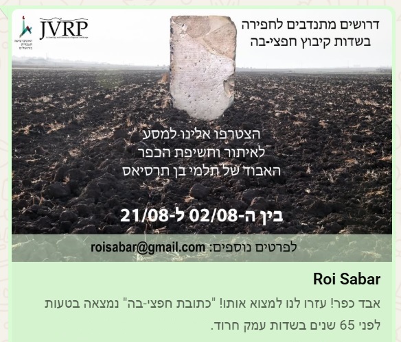
An excavation was conducted on October 2025. The first step was to open 3 squares, then several long trenches were cut to find the remains of the village. Additionally, coins were detected and found in the entire area of the ruins. The results of the excavation will be published.
A new excavation is scheduled for August 2026 in the field of Hefzibah. The translation from the Hebrew call: “A village was lost! Help to find it!..”.
Links and References:
* Beit Alpha:
- Archaeological Survey of Israel –
- Horvat Shamot (Tell el-Firr) – Map 63, site 15
- Beit Alpha and Hefzibah – ancient synagogue and Zodiac mosaic
* Other:
- A Greek inscription found near Hefzibah – Y. H. Landua; Israel exploration Journal, Vol 16, No 1 1966
-
“100 years of settlement – 100 years of coins” – coins found around the site – Ayelet Keidar Goldberg, 2020 (Hebrew)
- Dr. Roi Sabar publications – Academia
Etymology (behind the name):
* Horvat Shamot:
- Shamot (Shammot) – Hebrew name, meaning: deserted, destruction, empty, lifeless. Based on the root word שממ – deserted.
- Tell el-Firr – Arabic, possible meaning: Mound of Escape. This name may be an error, as it may have actually pointed to a nearby site Tel Shlavim (located 2km west of Horvat Shamot).
- Horvat Shamot – Hebrew – ruin of lifeless area
- Stele (or stela) – an ancient world tall stone, erected as a monument. Pronounced Stee-Lee.
* The area:
- Beit Alpha – Hebrew: Beit is “house”. Alpha is the first Greek letter, and was a private name used in the Greek and Roman times (Alpha is common name in the Talmud). Therefore, the name means “the House of Alpha”.
- Khirbet Beit Ilfa – the ruins of the Roman/Byzantine town (appears in the 1881-3 map of the PEF survey). The Arabic name of the ruins preserved the ancient Roman name.
- Kibbutz Beit Alpha – The Kibbutz was established in 1922. It is named after the ancient site.
- Hefzi-ba (Hephzi-bah) – The Kibbutz on the west side of the ancient synagogue was established in 1922. It is a female Hebrew name and means: “I desire her”, which refers to the love of Jerusalem (and is one of the city’s names). Biblical reference: Isaiah 62 4: “Thou shalt no more be termed Forsaken; neither shall thy land any more be termed Desolate: but thou shalt be called Hephzibah, and thy land Beulah: for the LORD delighteth in thee, and thy land shall be married.”
Note that are other places in Israel that are named Hefzi-ba, such as near Hadera.
BibleWalks.com – armchair tours of the Bible places
Beit Alpha <<<—previous site—<<< All Sites>>>—next site—->>> Beit Shean
This page was last updated on June 20, 2026 (call for volunteers)
Sponsored links: