Yodfat is the famous site of the Roman siege on Josephus Flavius and his Galileen army in 67AD.

Home > Sites > Lower Galilee> Yodfat (Jotapata)
Contents:
Background
Location
History
Photos
* General view
* Siege Ramp
* Defense walls
* Water works
* Eastern side
* Southern ridge
* Western Wall
* Byzantine
* Other
* Flight over the site
Biblical References
Historical Refs
Links
Background:
Tel Yodfat is an archaeological site located in northern Israel, about 13 kilometers northwest of the city of Nazareth. It is also known as Jotapata in ancient times, and it is famous for being the site of a significant battle during the First Jewish-Roman War in 67 AD.
The city of Yodfat was fortified during the Hellenistic period and later became an important Jewish center during the Roman period. In 67 AD, during the First Jewish-Roman War, the Roman general Vespasian marched on Yodfat with a large army. The city was defended by Jewish rebels led by the famous military leader Josephus, who had fortified the city and prepared it for a long siege.
The siege of Yodfat lasted for several weeks, and the Roman army eventually breached the city walls and captured it. Josephus managed to escape by hiding in a cave with a group of his followers, but the rest of the defenders were either killed or taken captive. After days of siege all the defenders committed suicide, but Josephus surrendered himself to Vespasian and later became a writer of the Roman and Jewish history, and provided the details of the tragic story. War of the Jews 3, 6 36: “…Vespasian gave order that the city should be entirely demolished, and all the fortifications burnt down. ” The fall of Yodfat was a significant blow to the Jewish rebellion and marked the beginning of the end of the war.
Today, the Tel Yodfat archaeological site is open to the public, and visitors can explore the remains of the ancient city and learn about its history.
Location:
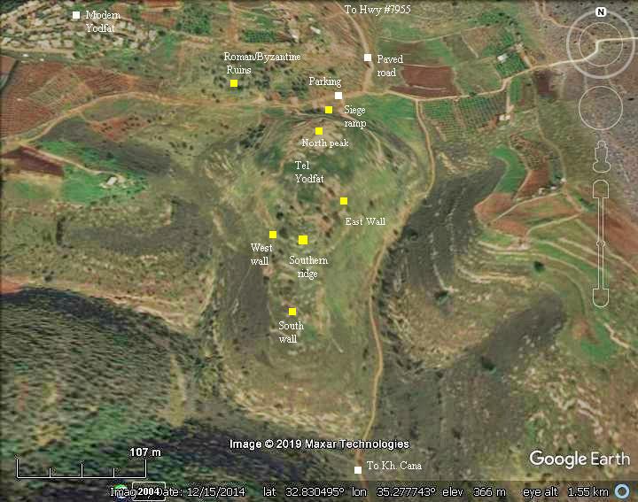
The ruins of Tel Yodfat are located on a hill at the edge of the Yodfat valley, south east of the modern community of Yodfat. It can be approached from a new good paved road that starts from the junction of the entrance road to the modern community.
The center of the early Roman city lies on the top of a steep hill, at 419M altitude. The peak is 50-100M above the valleys around it. It is dotted by caves, ancient cisterns and the remains of ancient buildings which are mostly scattered on the southern ridge. To the north of Tel Yodfat are remains of a later period Roman/Byzantine village.
An aerial map below shows the hill of Yodfat in the center, indicating the major points of interest.
History of the place:
The site was settled during the Iron/Israelite period (1200-732BC), although few remains were left from that period.
-
Assyrian destruction
Yodfat was probably destroyed in 732BC by the Assyrian King Tiglath-Pileser III, who annexed the area (as per 2 Kings 15: 29: “In the days of Pekah king of Israel came Tiglathpileser king of Assyria, and took … Galilee…and carried them captive to Assyria”).
The list of exiles of the King includes a city called “[Ya]tvat”, which may have been this site.
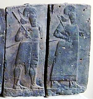
Orthostat relief – depicting soldiers from different orders of the Assyrian Army, in procession; basalt; Hadatu;
Tiglath-Pileser III period (744-727BC)
[Istanbul Archaeological museum]
-
Hellenistic and Hasmonean period
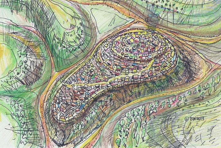
The village was repopulated at the Persian or Hellenistic periods (4th- 3rd century BC). The Hasmoneans then conquered the area in the 2nd century BC and populated the village by Jews. It grew from the northern peak, expanded down the southern elongated hillside, and covering a total area of 47 dunams (4.7 Hectares). At its peak the estimated population of the Hasmonean town was 1,500 residents.
An illustration of the town is shown here, with a view from the east.
-
Early Roman period
Yodfat was one of the 19 Galilee towns fortified by Josephus Flavius at the time of the great revolt against the Romans (see references). Sections of the fortifications were unearthed in the archaeological excavations, revealing wide casemate style peripheral walls.
The fame of Yodfat came from the siege laid by Vespasian at 67 AD, in the beginning of the Roman campaign to crush the Jewish revolt. The Roman legions managed to enter the fortified city after 47 days, and captured the last remaining person – the commander Josephus himself, while the rest of the defenders died or committed suicide. These accords resemble the tragic events of Gamla and Masada, and therefore Yodfat is often referred as the “Masada of the Galilee”.
-
Late Roman/Byzantine period
After it was totally destroyed by the Romans, the site was allowed to be rebuilt, but only on the facing unprotected hillside, since the Romans did not want this stronghold to be used again as a rebel fort. It was repopulated by Jewish refugees from Jerusalem, and flourished for another 300 years, and destroyed again. It was then left in ruins for yet another 1600 years, until it became a national park. In recent years the site was excavated, and its fortifications, ramp and some of the buildings were dug out of the rubble. Dozens of arrows and ballista stones were found, proving at least some of Josephus’s accounts of the siege and fall of the city.
-
Modern period
A modern community settlement was established in 1960 west of the ancient site, and called Yodfat.
Excavations were conducted here from 1992 thru 2000, headed by Dr. Mordechai Aviram.
Photos:
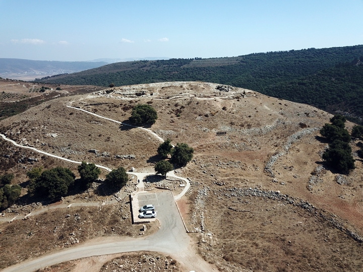
(a) General Views:
The photo below shows an aerial view of the site from the north west, as captured by a quad copter. On the top of the hill a set of caves can be seen, and just beneath it the walls of the fortress. On the right side is where the Romans built the ramp in order to crush the walls.
Click on the photos to view in higher resolution…
A ground-level view from the west side is seen below. The hill is steep around all sides. It presented a challenge to the thousands of Roman soldiers who surrounded the fortress, facing a group of hundreds of Jewish zealots who assembled in this last fortress, willing to die in order to defend their newly independent country.
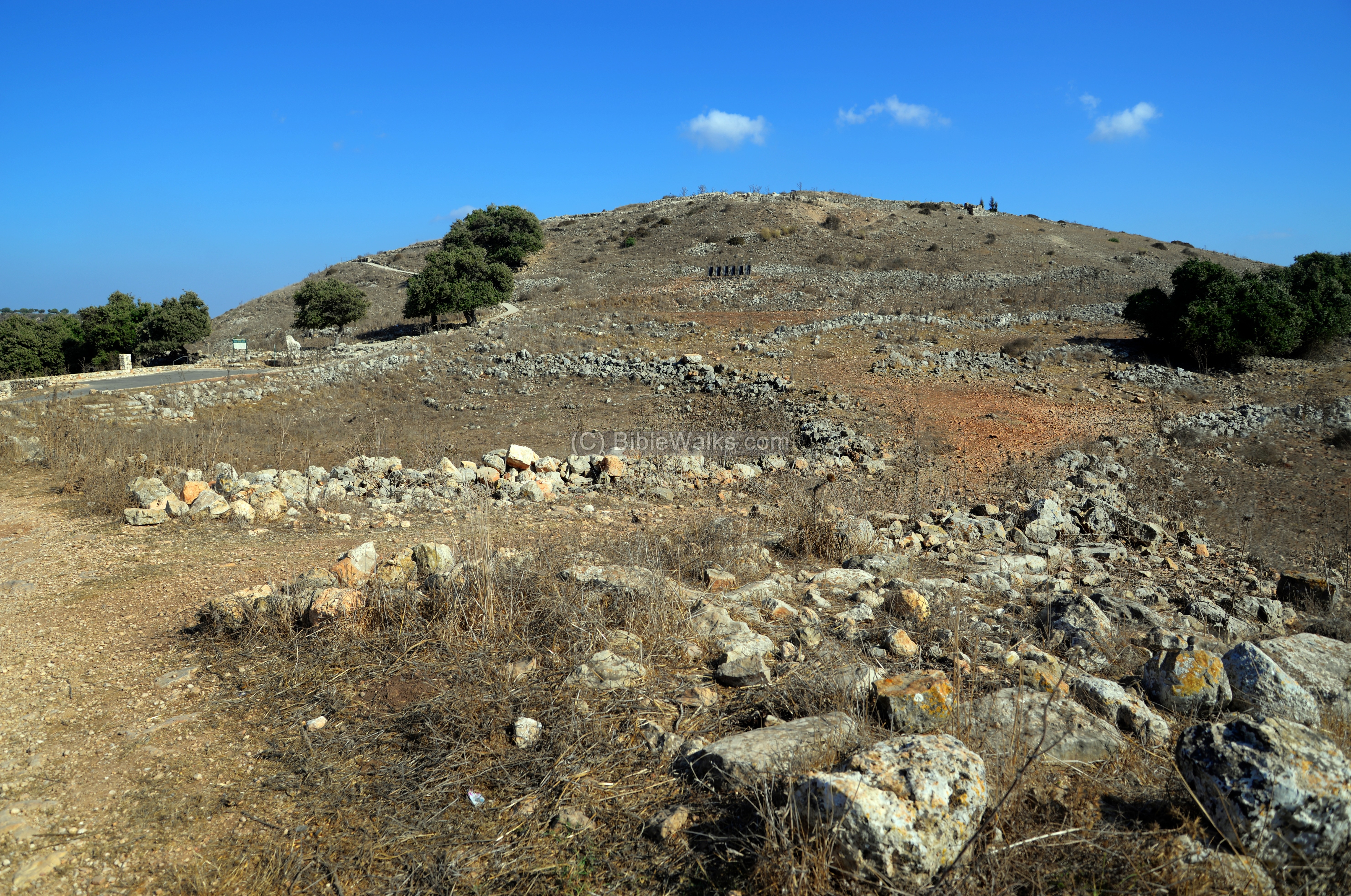
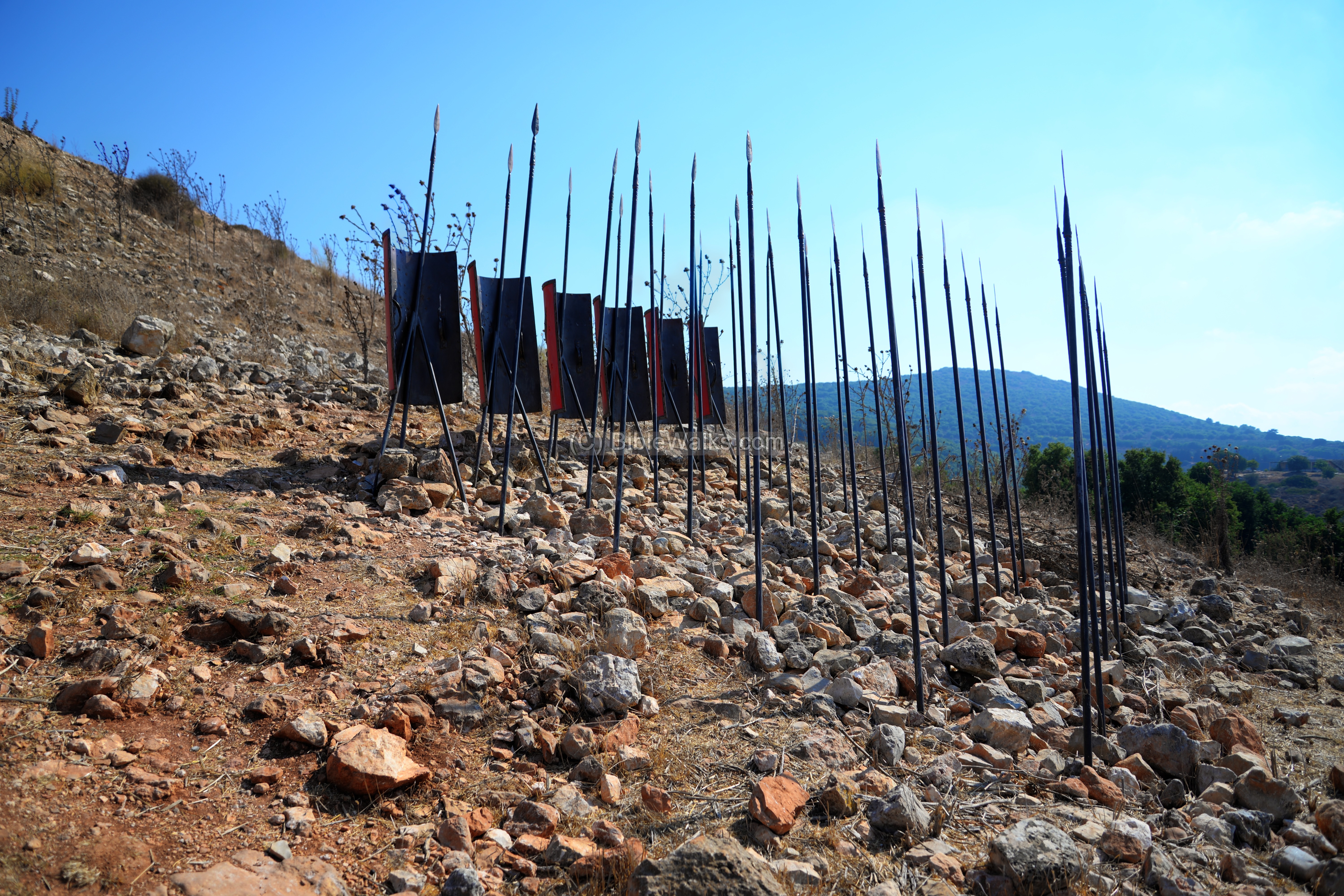
(b) Siege ramp:
The Romans built a siege ramp on the western side, as seen in the photo below. They reached the fortifications on the top of the hill only after 47 days, overcame the resistance, and killed all men – except for the commander, Josephus Flavius, who survived and wrote about the famed war against the Romans.
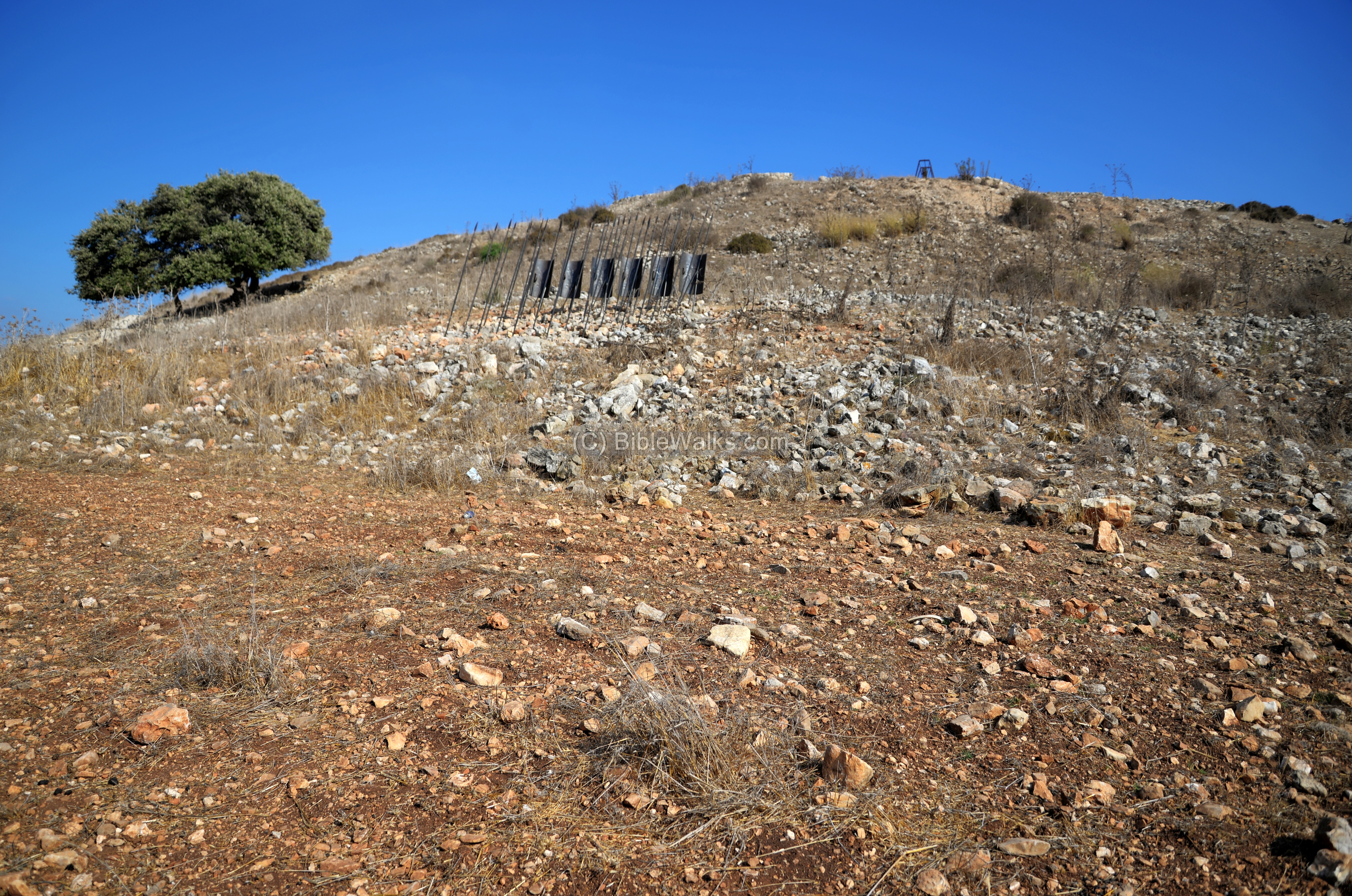
A reconstructed array of Roman spears and shields mark the point where the Romans ascended the slopes in order to reach the wall at the top of the hill.
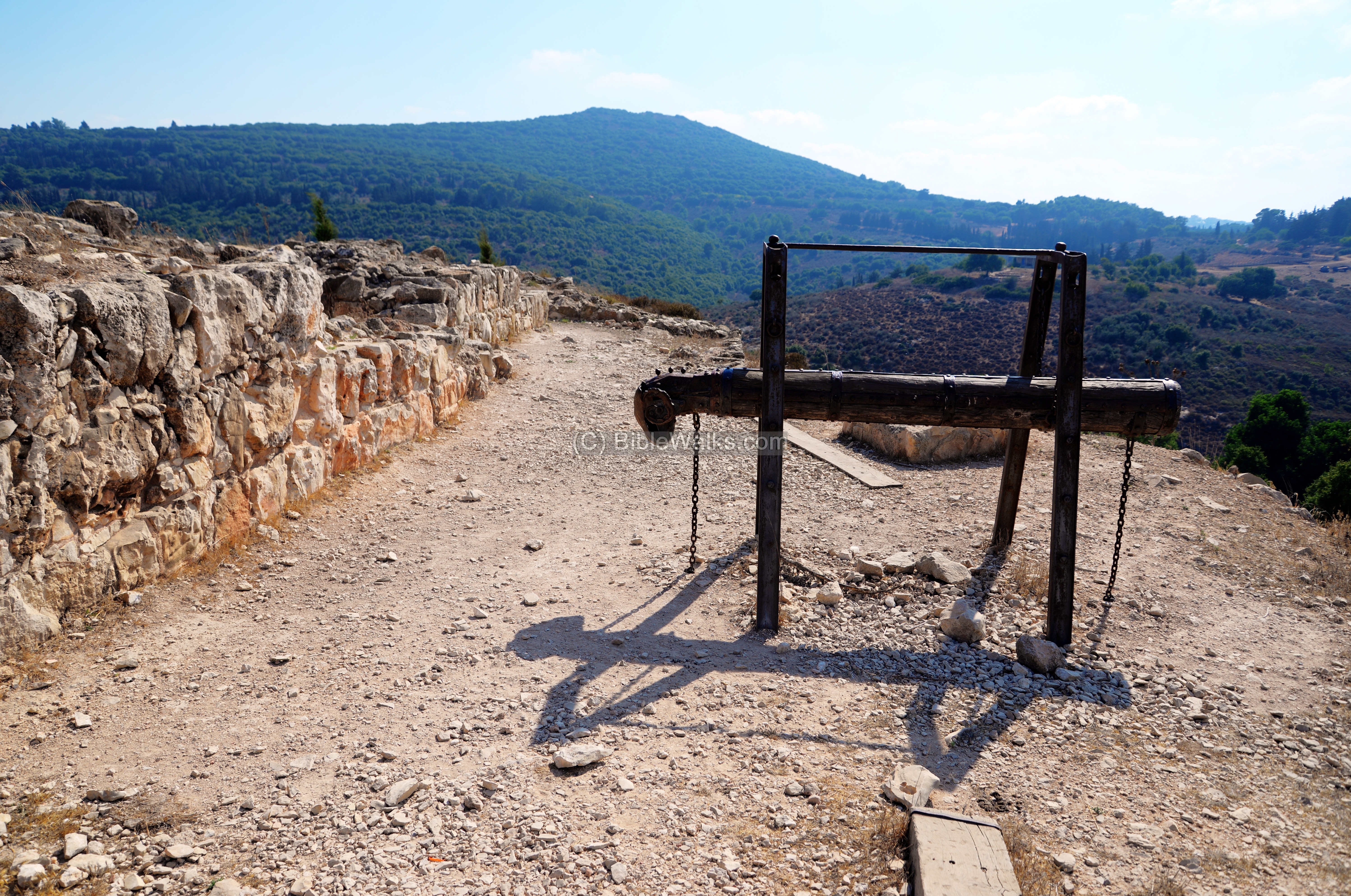
The battering ram, yet another reconstructed instrument that demonstrates the Roman siege methods, shows where the wall was breached.
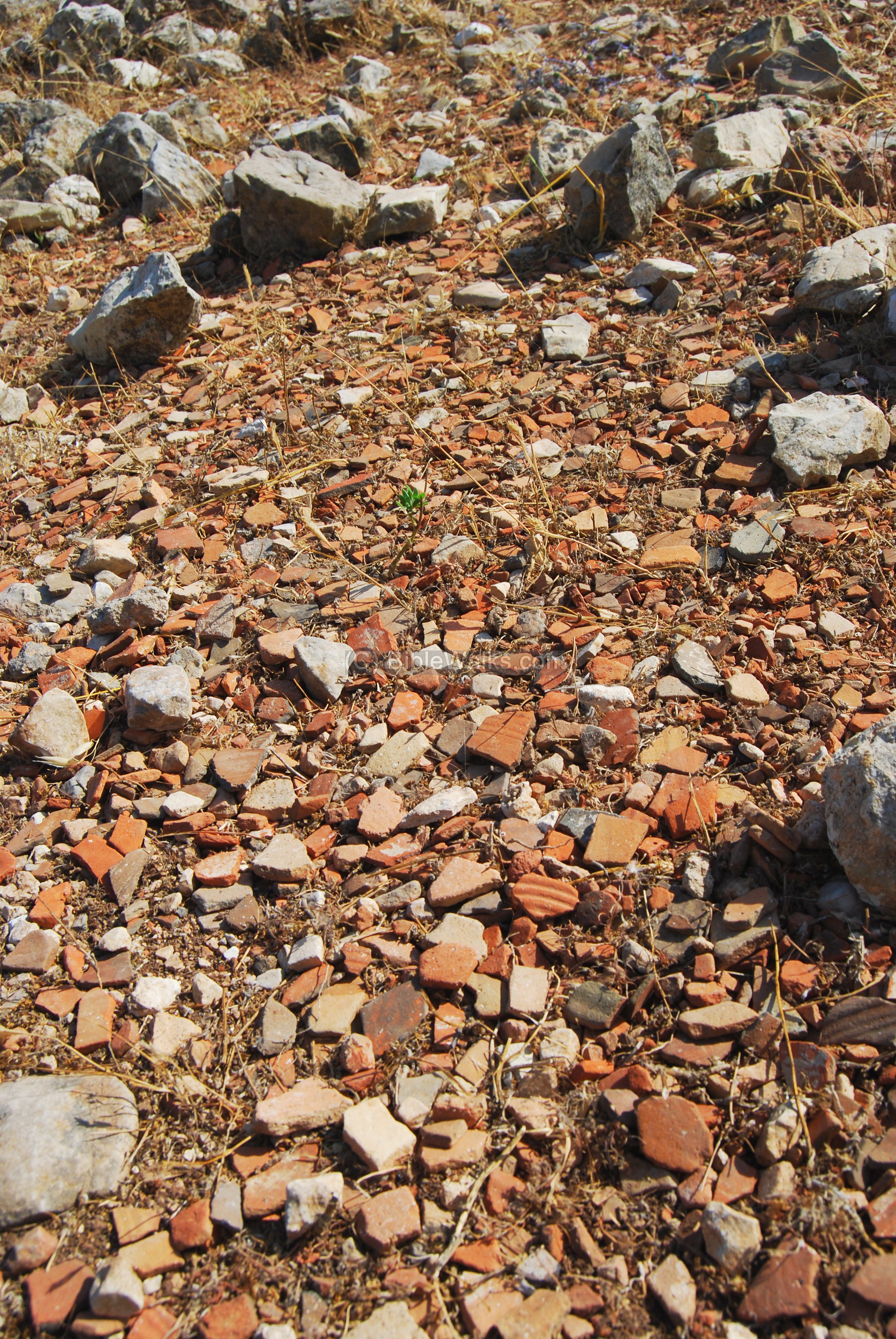
The slope at the middle of the steep ramp is covered by thousands of pieces of Hellenistic and Roman ceramics. This extraordinary concentration of fragments may have been a result of the excavations on top of the hill.
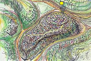
(c) North peak:
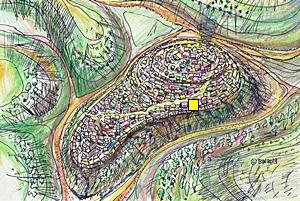
The peak of Tel Yodfat is on the north side, as illustrated here, marked with a yellow square.
There are several trails that you can walk up the slopes, surround the Tel and its eastern foothills, and come back to the north side where the parking place is located.
A view of the northern side of the top of the hill is seen in the aerial view below. Notice the reconstructed battering ram facing the wall on the right side.
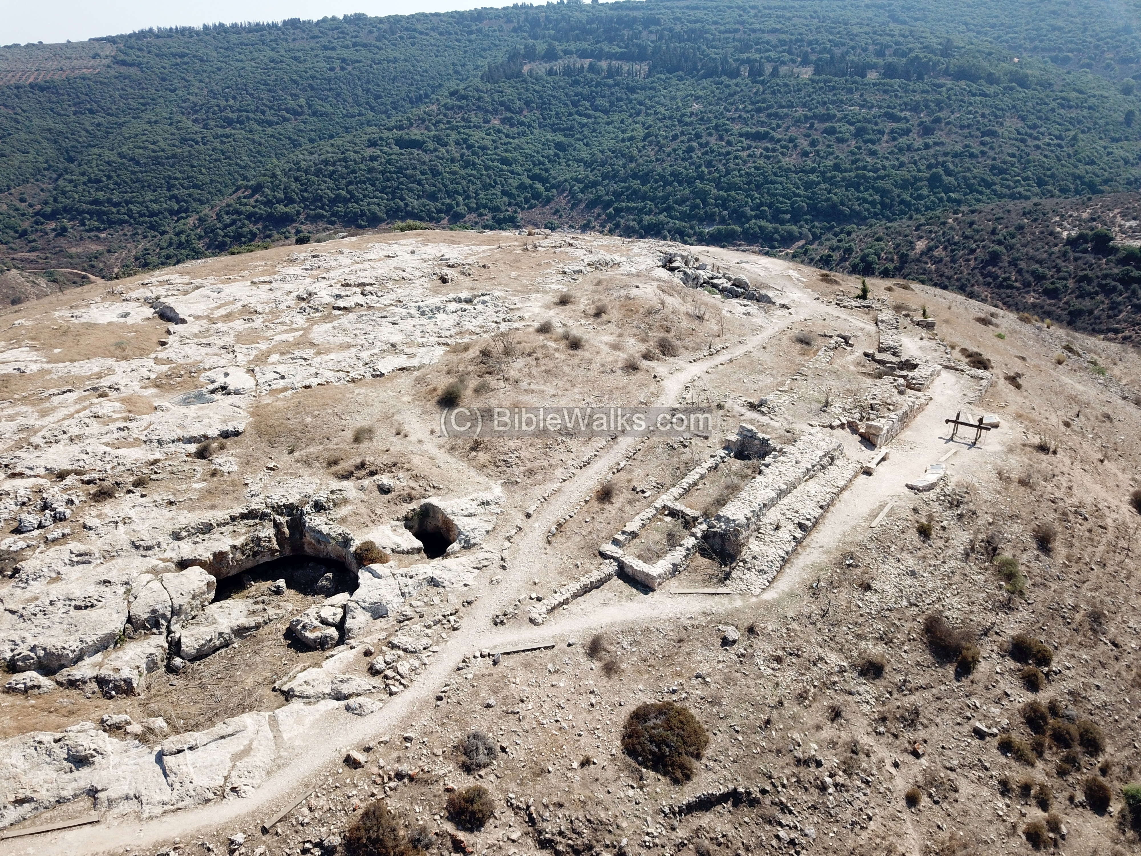
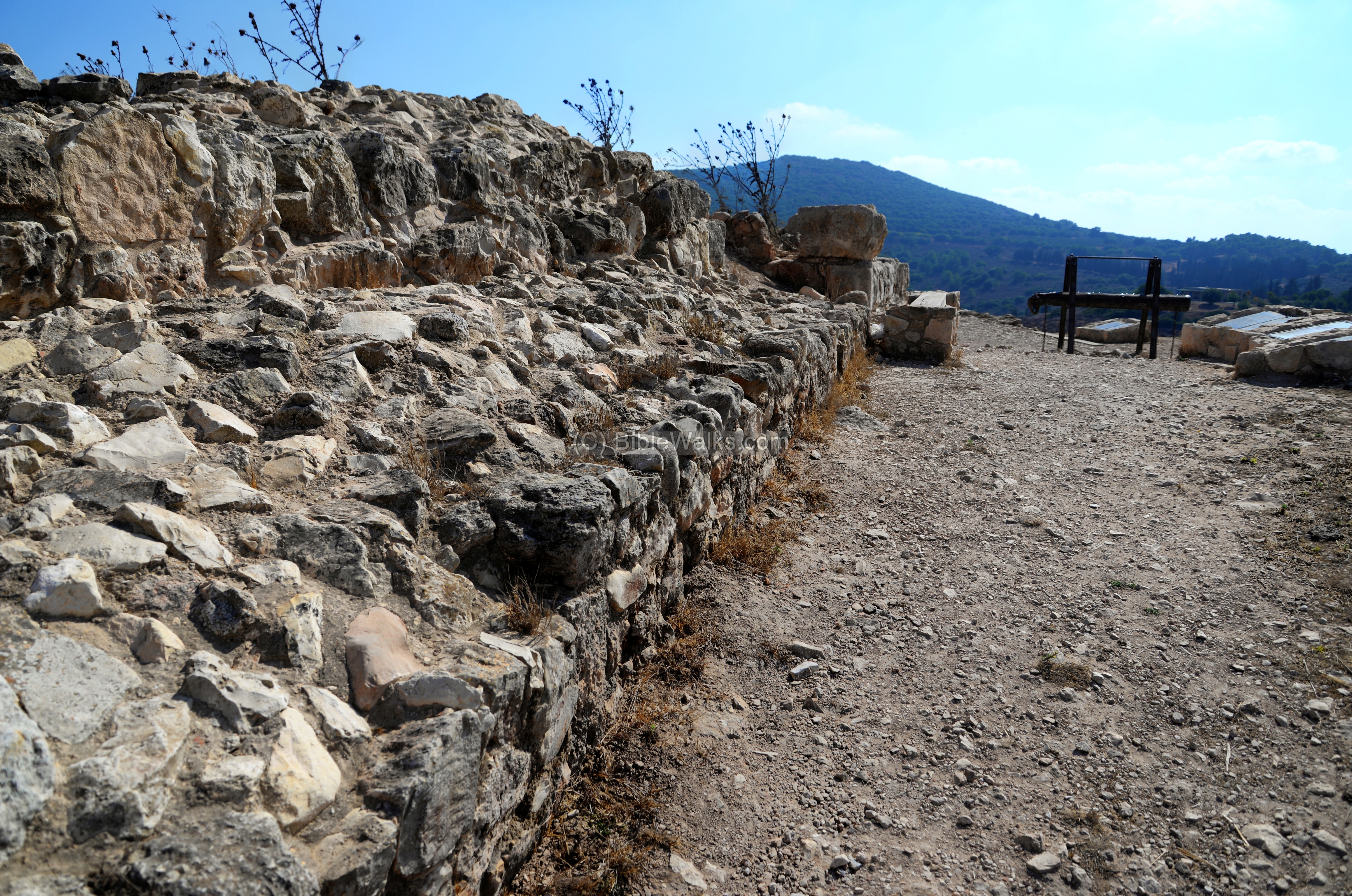
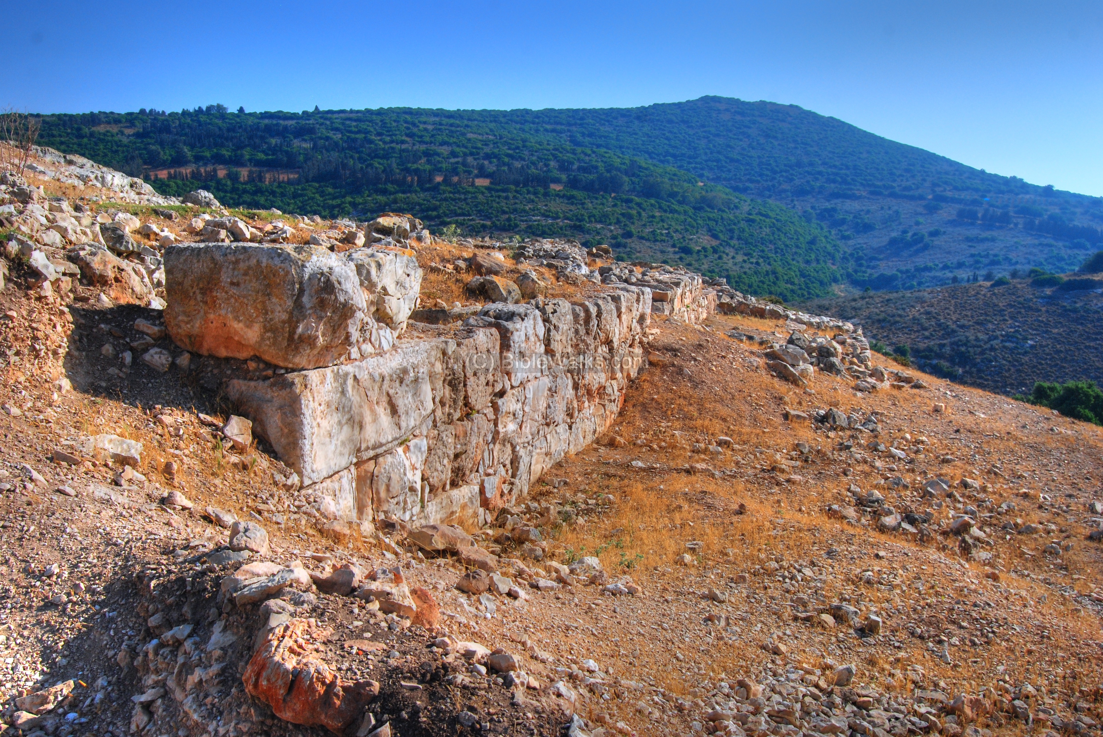
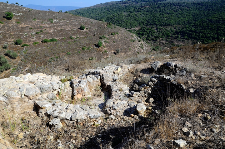
At the top of the hill are the foundations of the walls, built by the Army of the rebels in anticipation of the Roman invasion. These walls are located on the north side, where the trail reaches the top.

Along the ridge are more sections of the wall. It is a double wall “casemate” type, which extends from north-west side to the middle of the western side of the Tell.
The rebels were hiding behind this wall in July 67, watching the Roman soldiers who were stationed on the hillsides, tossing spears, stones and arrows with their mighty war machines.
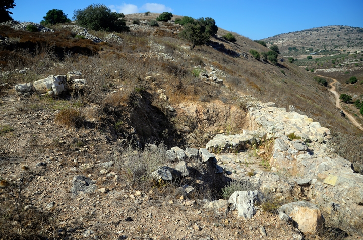
Other sections of the wall are seen below. This section was the side where the siege ramp was built by the Romans, and the defenders fought over the wall under a rain of arrows and stones by the Roman troops below.
In the far background of the next photo, captured with a view toward the south, is a hill called Atzmon (alt. 548M), where thousands of Jews fled away from the Roman troops but were eventually butchered.
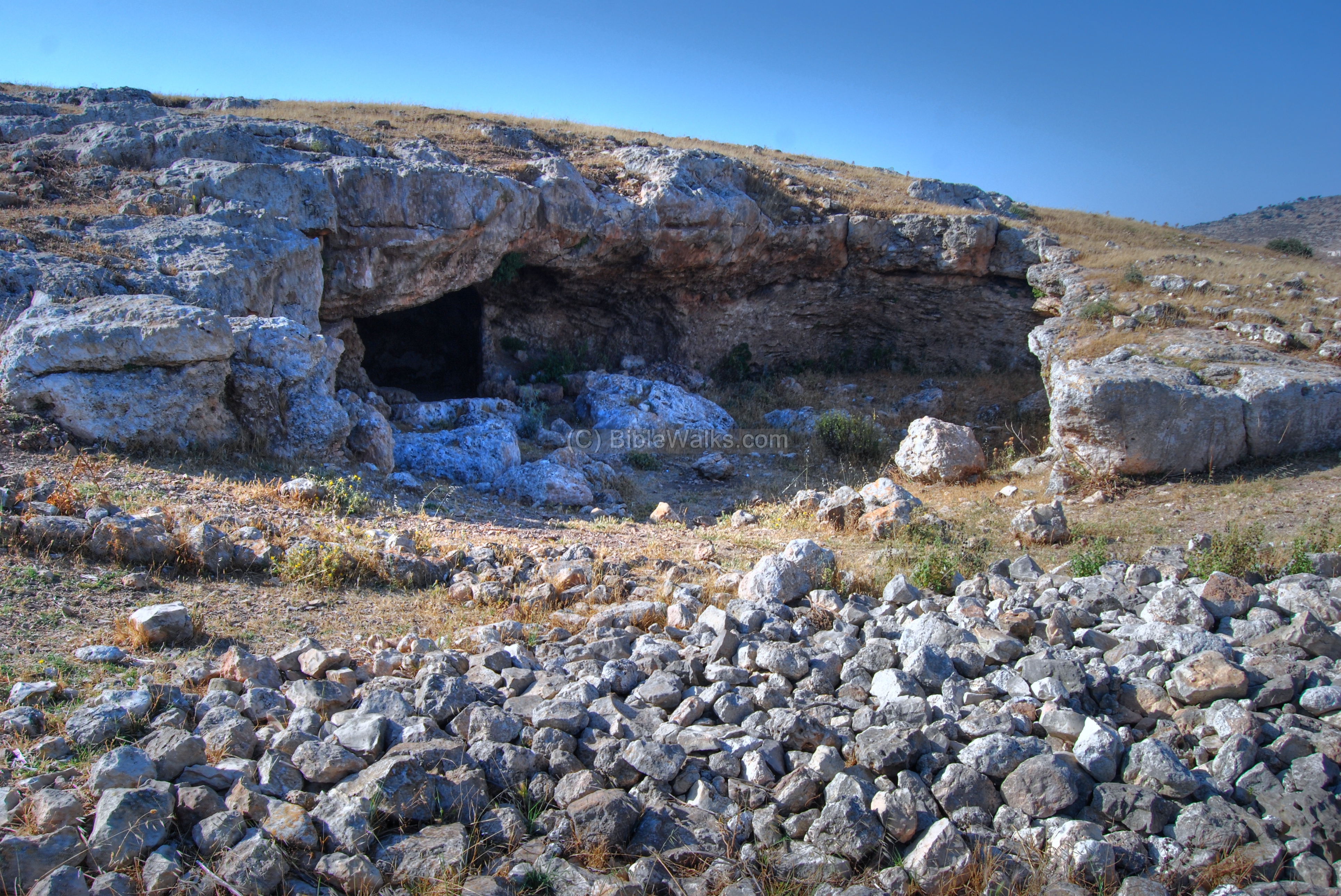
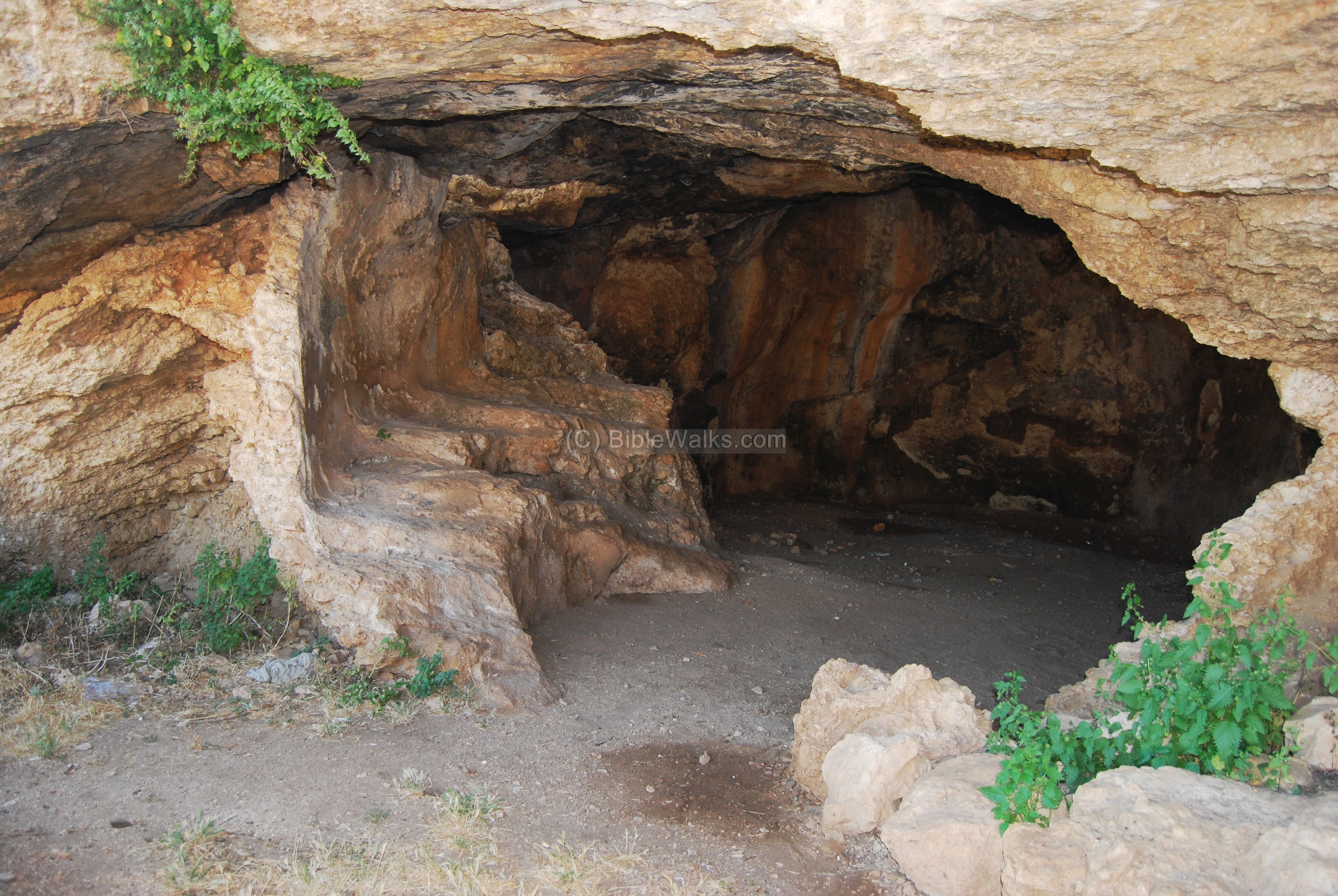
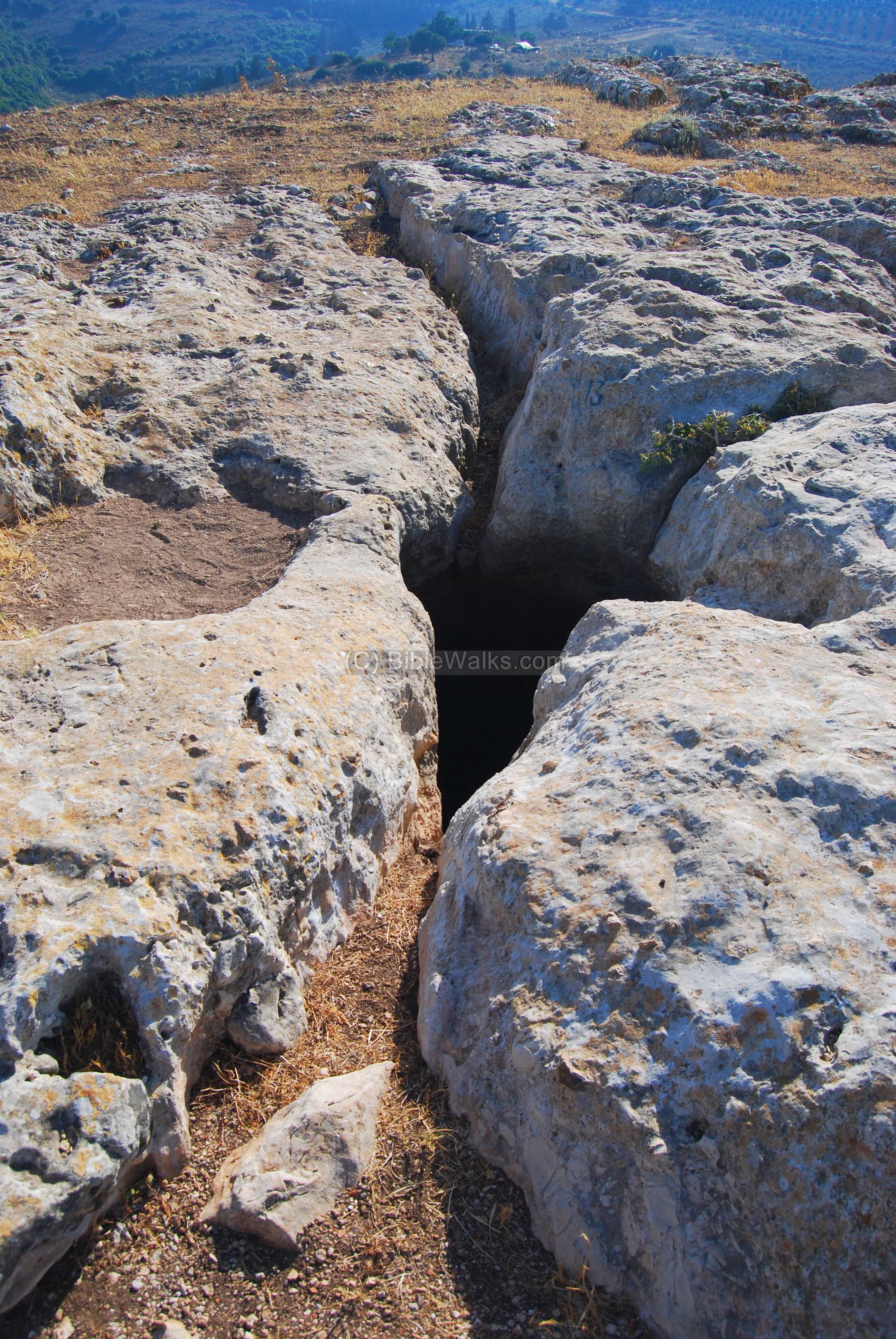
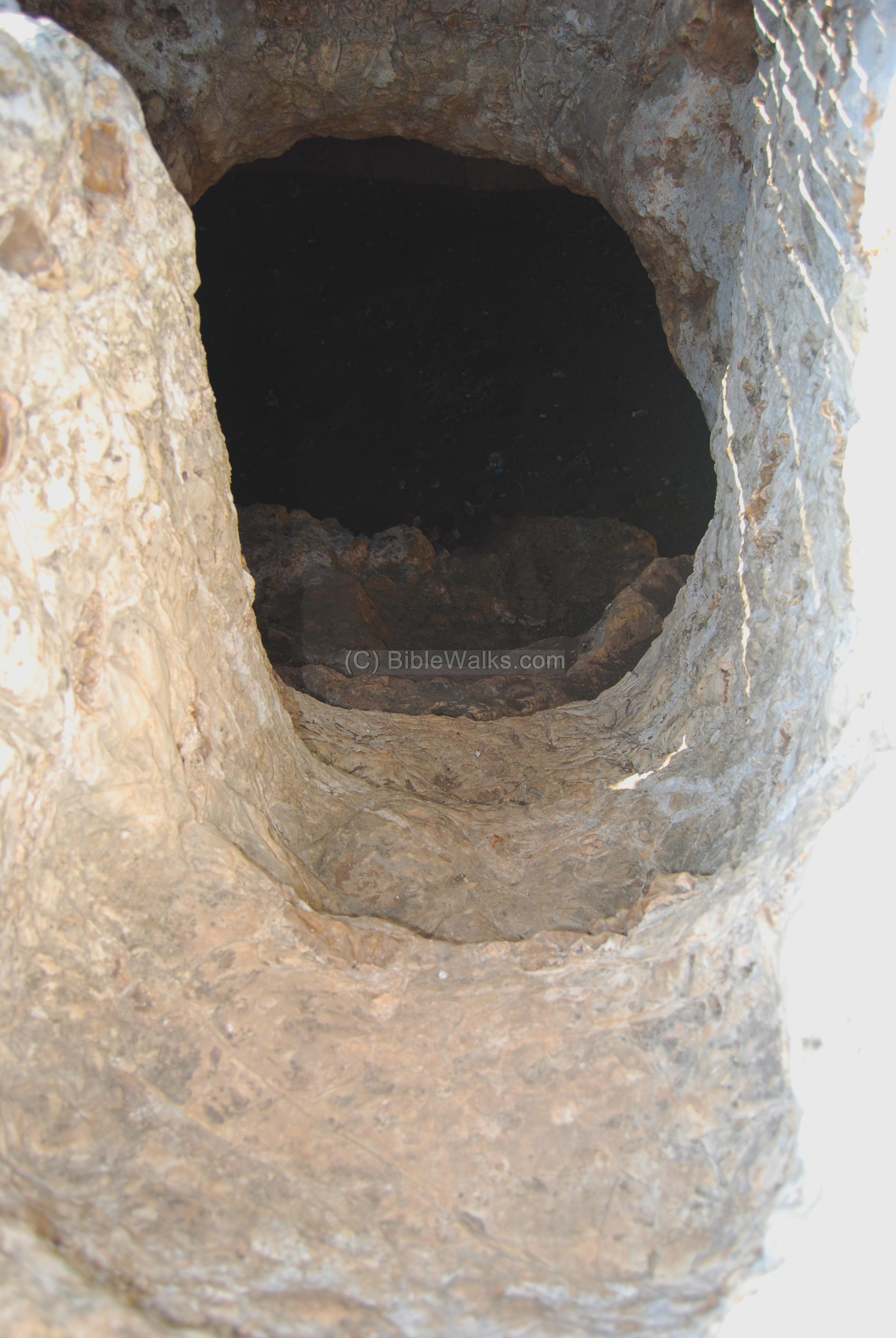
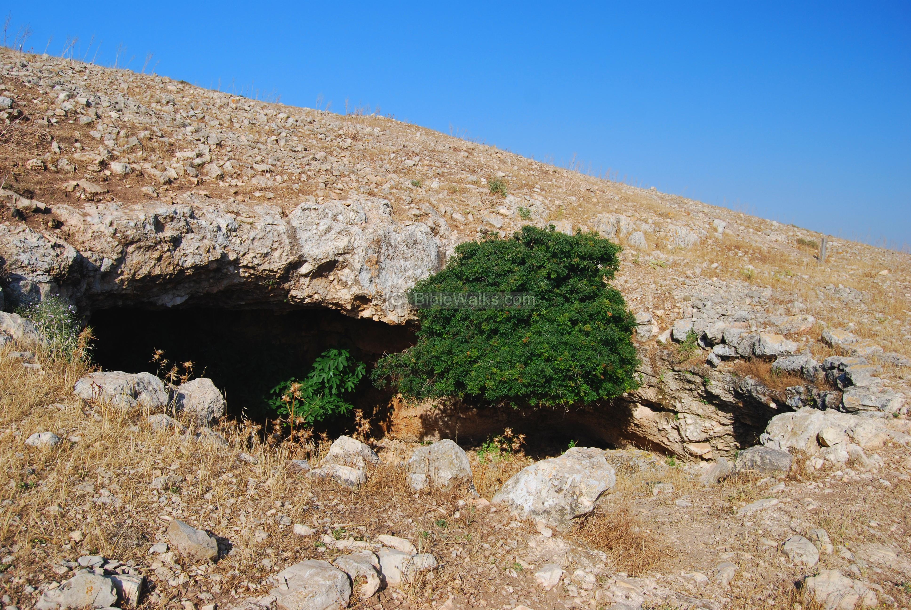
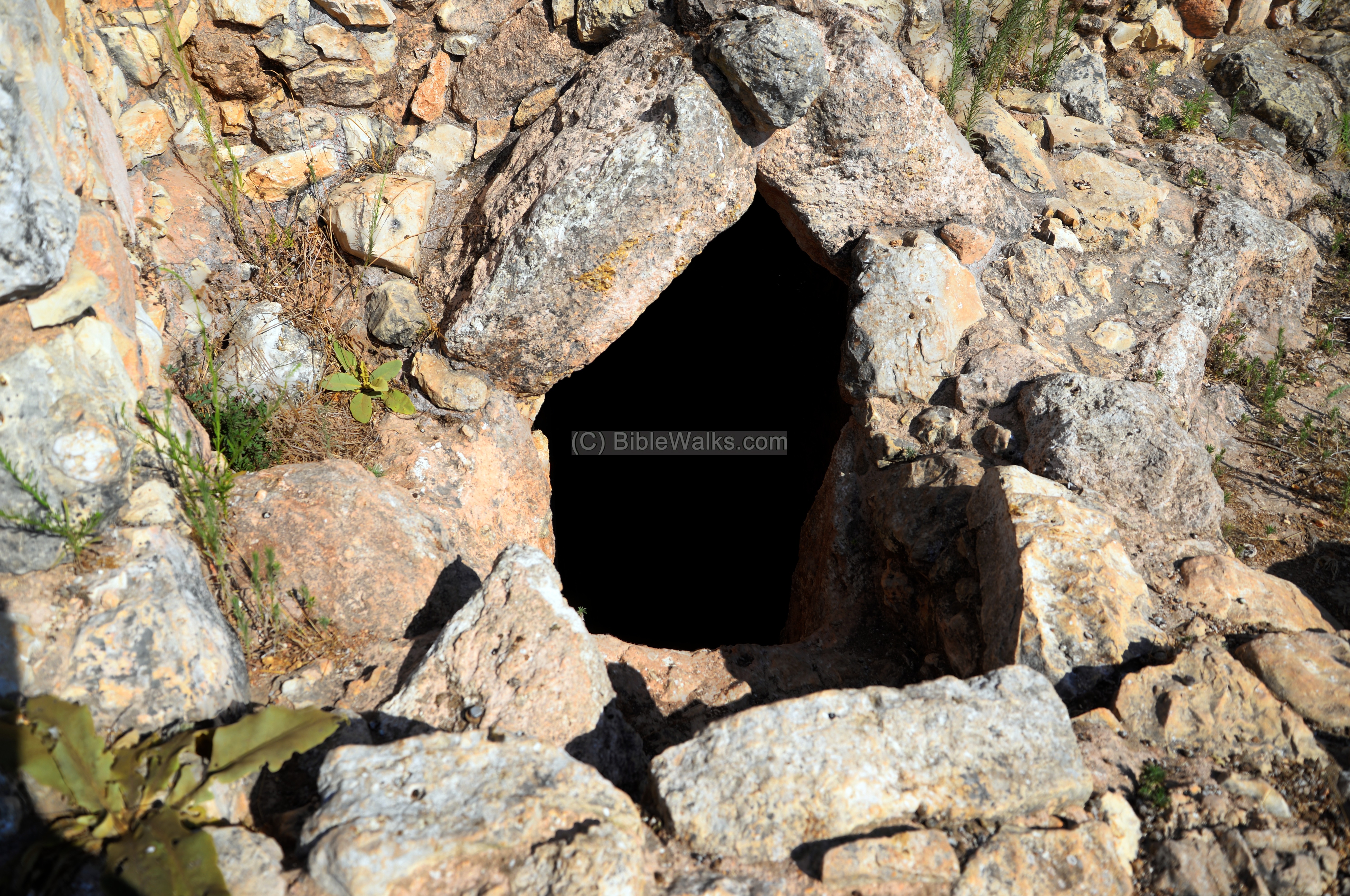
(d) Caves and water installations:
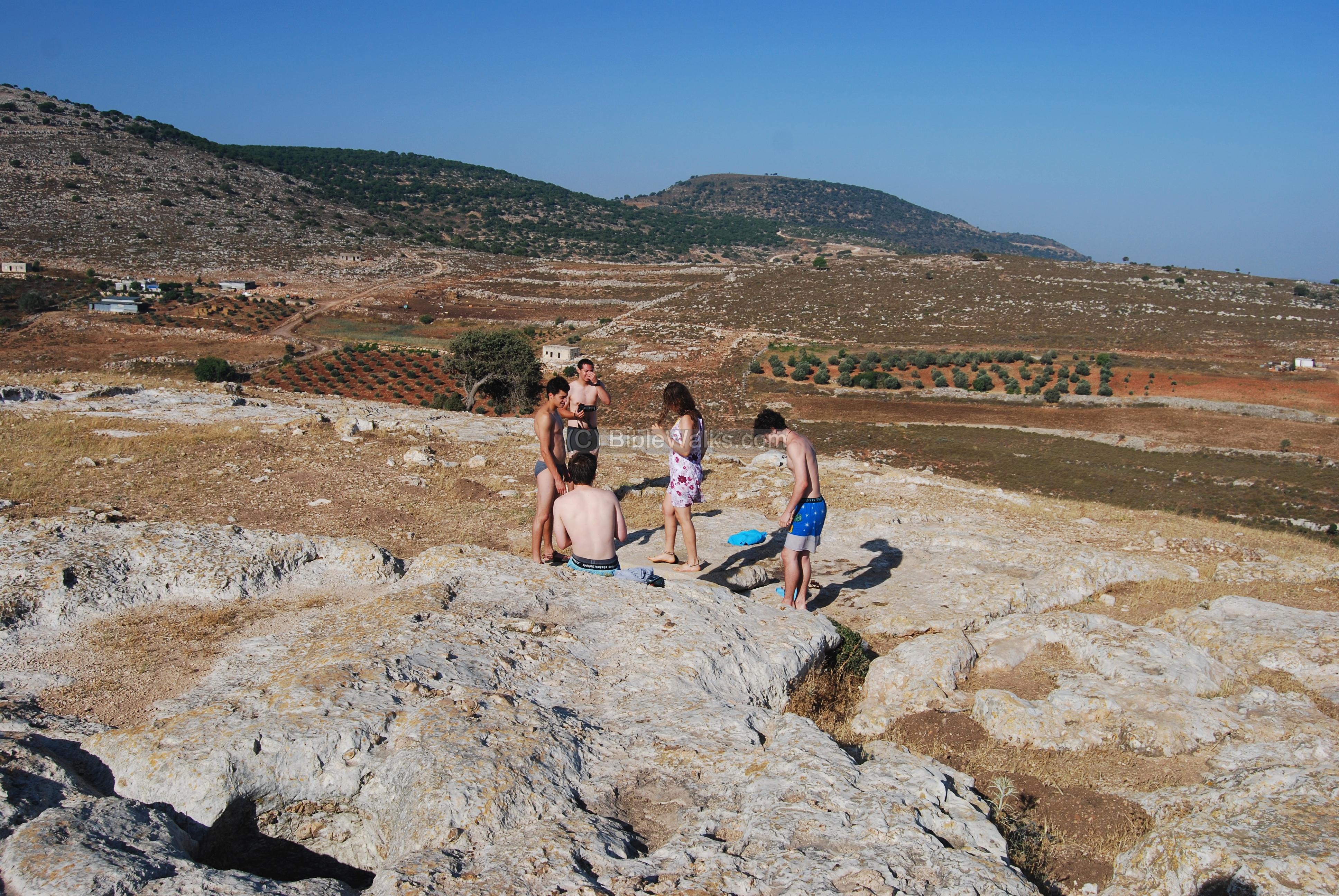
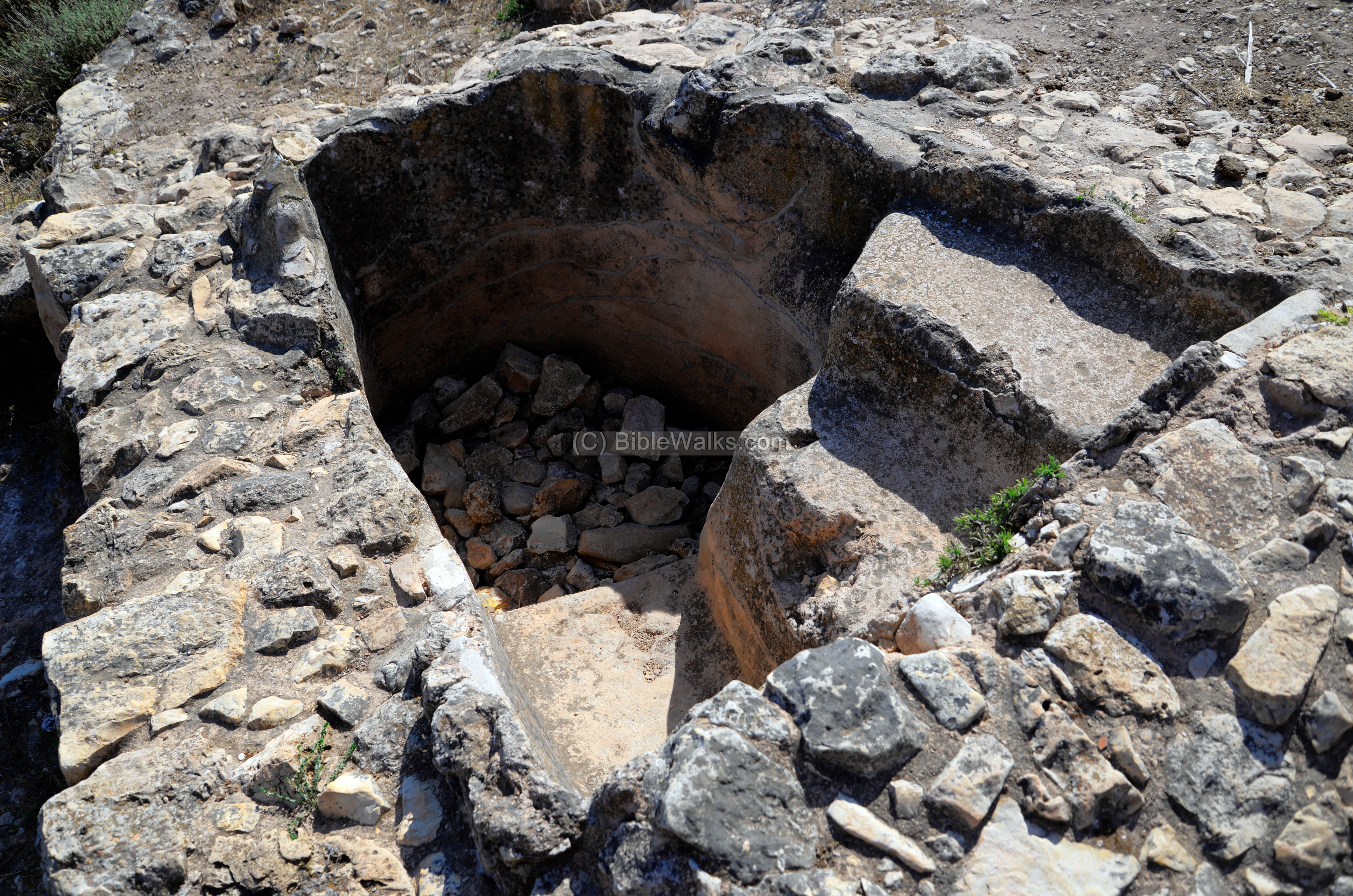
The war was conducted in the dry summer. Where did the hundreds of defenders get their water from? Where was their shelter? Walking around the top of the hill you can see the answer to these questions: the hill is pocketed with dozens of small and large caves, some of them interconnected, and many cisterns full of water.
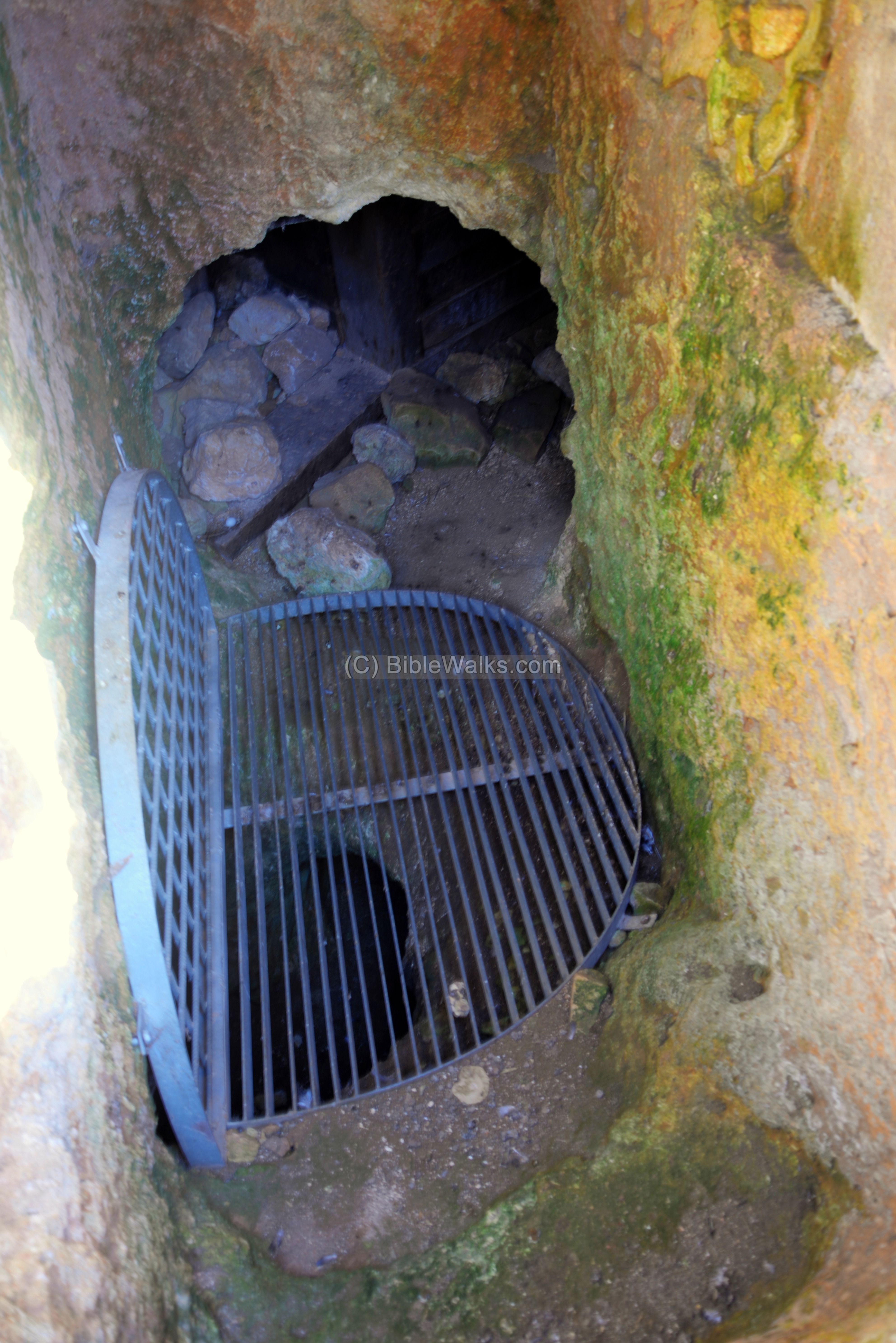
The photo below shows one of the entrances to the water reservoirs and ritual baptismal (miqveh). A staircase cut into the rock leads to the water reservoir below.

The exterior wall of the water reservoir, seen below, has collapsed. This allows us to see how the flight of stairs descended down into the bottom of the cistern. The stairs allowed easy access for bathing and filling up the water jugs.
Where did the water come from? The photo below shows grooves that were cut into the rock bed from different sides, directing the winter rain to fill up the cistern. These waters were stored in the reservoirs, and used during the dry spring and summer season.
In June we found the water cisterns completely full of water. The young group seen below came with bathing suits to enjoy a cool swim in one of these water reservoirs. They later toured the site and listened to the stories about the courage of the defenders and the tale of their bitter end.
Another flight of steps is seen below.
The water is directed into the cistern to fill it up during the winter season.

On other parts of the hill, such as in the south side seen below, there are many other cisterns with rock hewn water buckets that are filled up to water the cattle and sheep.

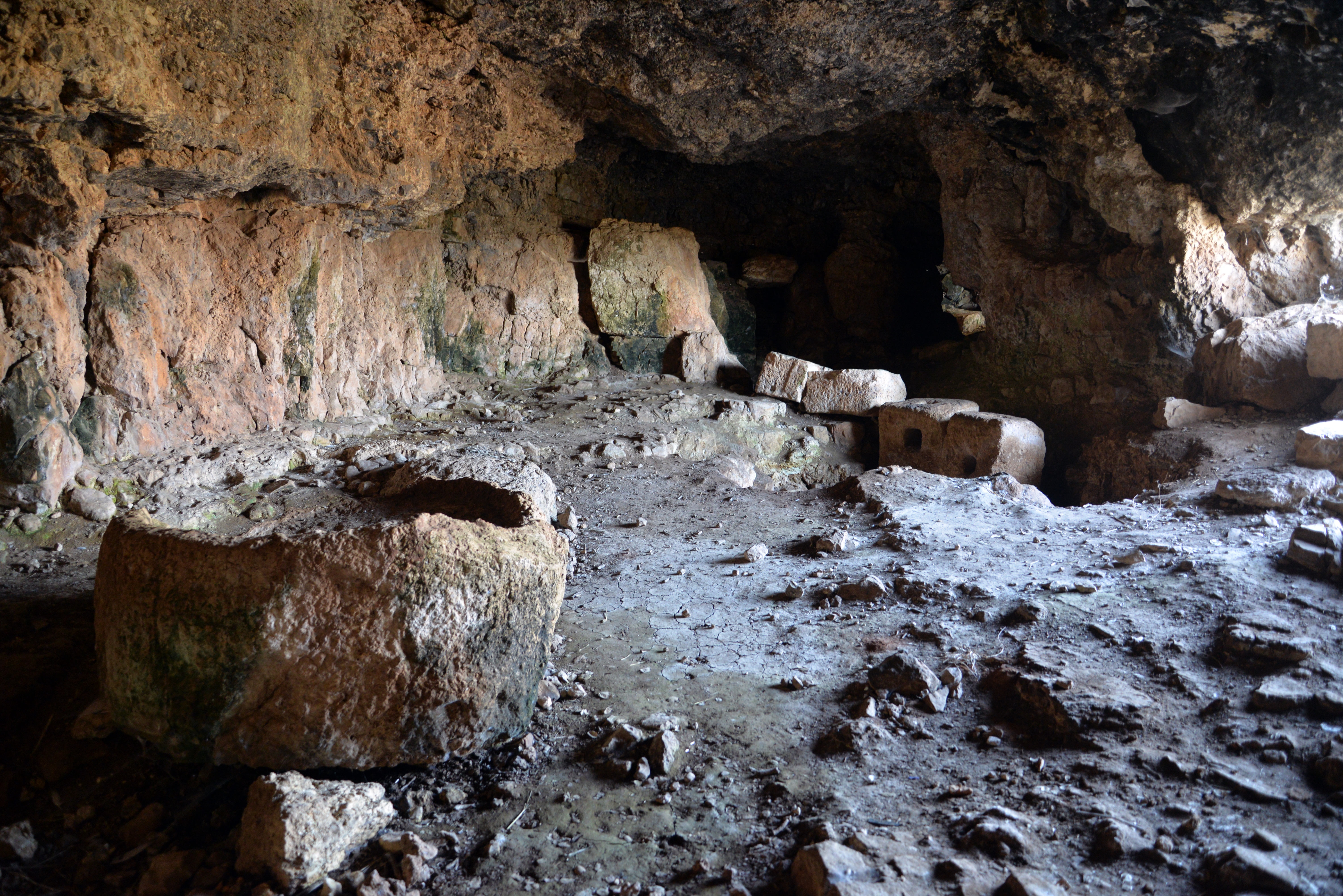
Yet another one of the caves, located on the south side. In one of these caves the 40 last men hid together with the rebel commander, Josephus. They remained there hiding for 3 days, but were the Romans found about it. All his men committed suicide, but Josephus alone was taken prison and is spared by Vespasian. This is fortunately, since he became the famous writer of the War against the Romans and allowed us to get acquainted with the tragic events in the site and the rest of the country.
(e) Eastern wall:
The location of the eastern wall is illustrated here, marked with a yellow square.
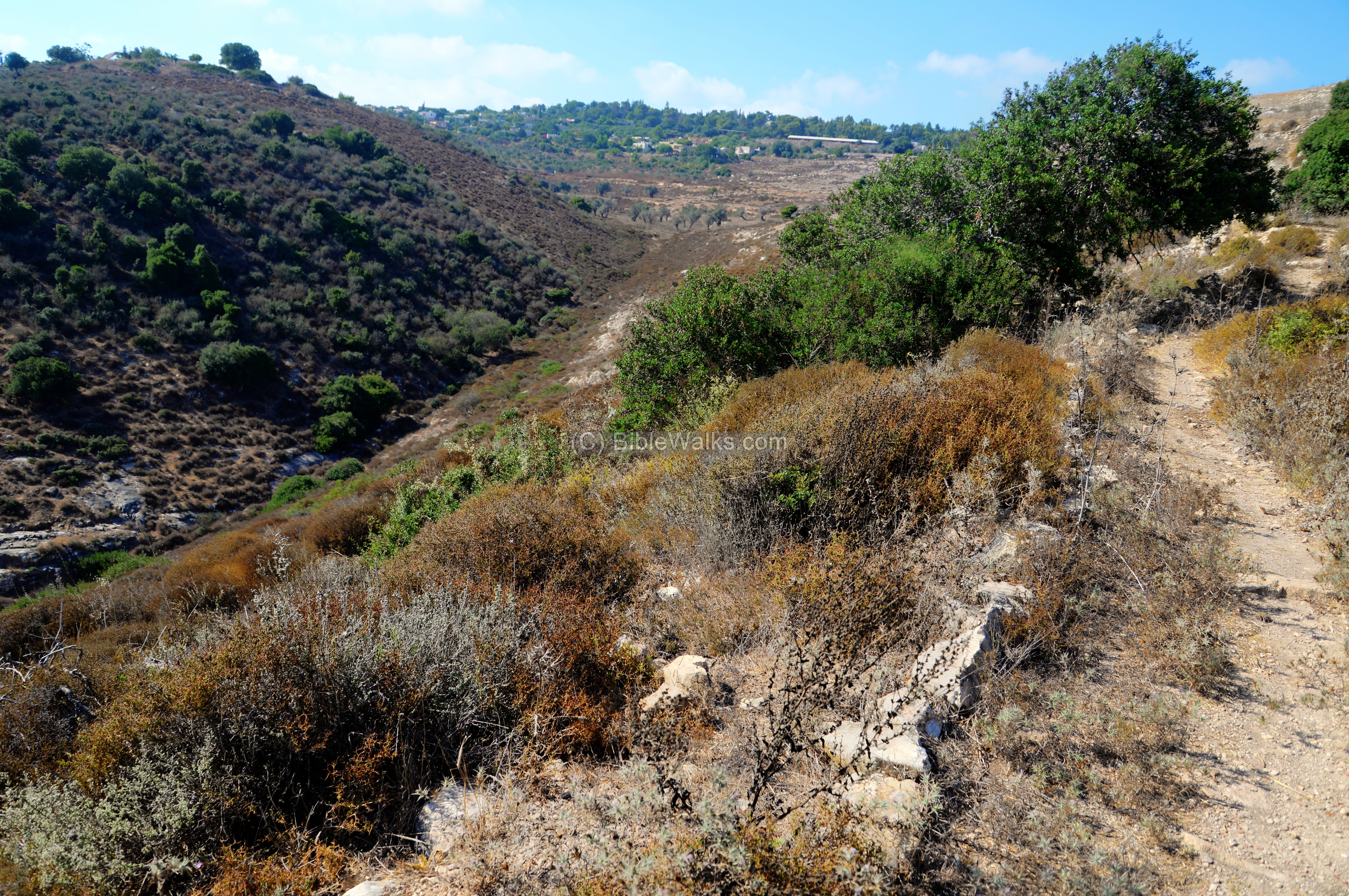
The eastern side of the hill has a long ridge that extends beyond the hill, but is also surrounded by the deep canyons on both sides. A trail leads from the park’s entrance along the eastern foothills.
On the left background of this photo is a dirt road. It passes from the canyon, down to Khirbet Cana (the site of Jesus first miracle) and to the Netufa valley. Through this road the Roman army ascended to Yodfat and surround it with a tight siege.
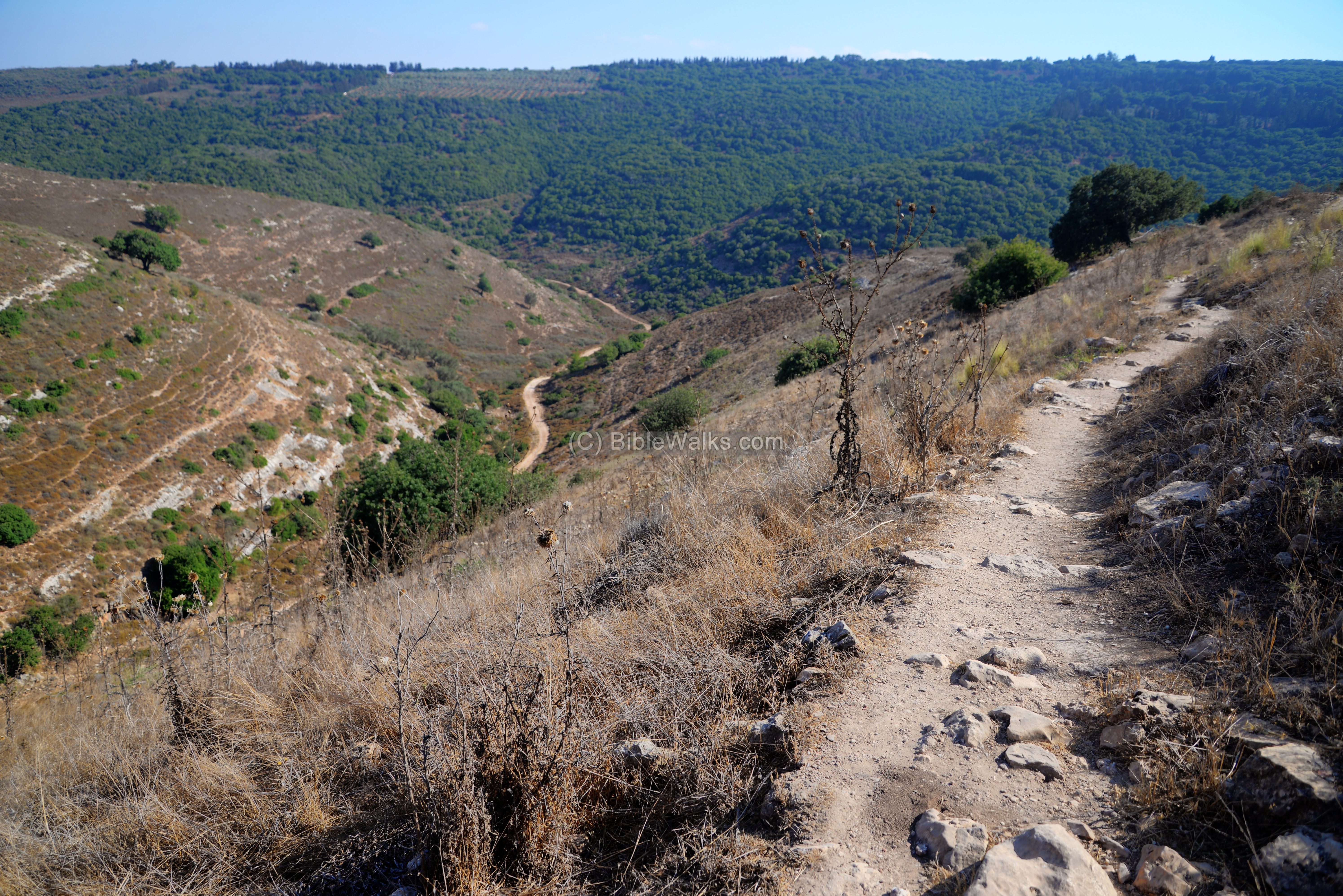
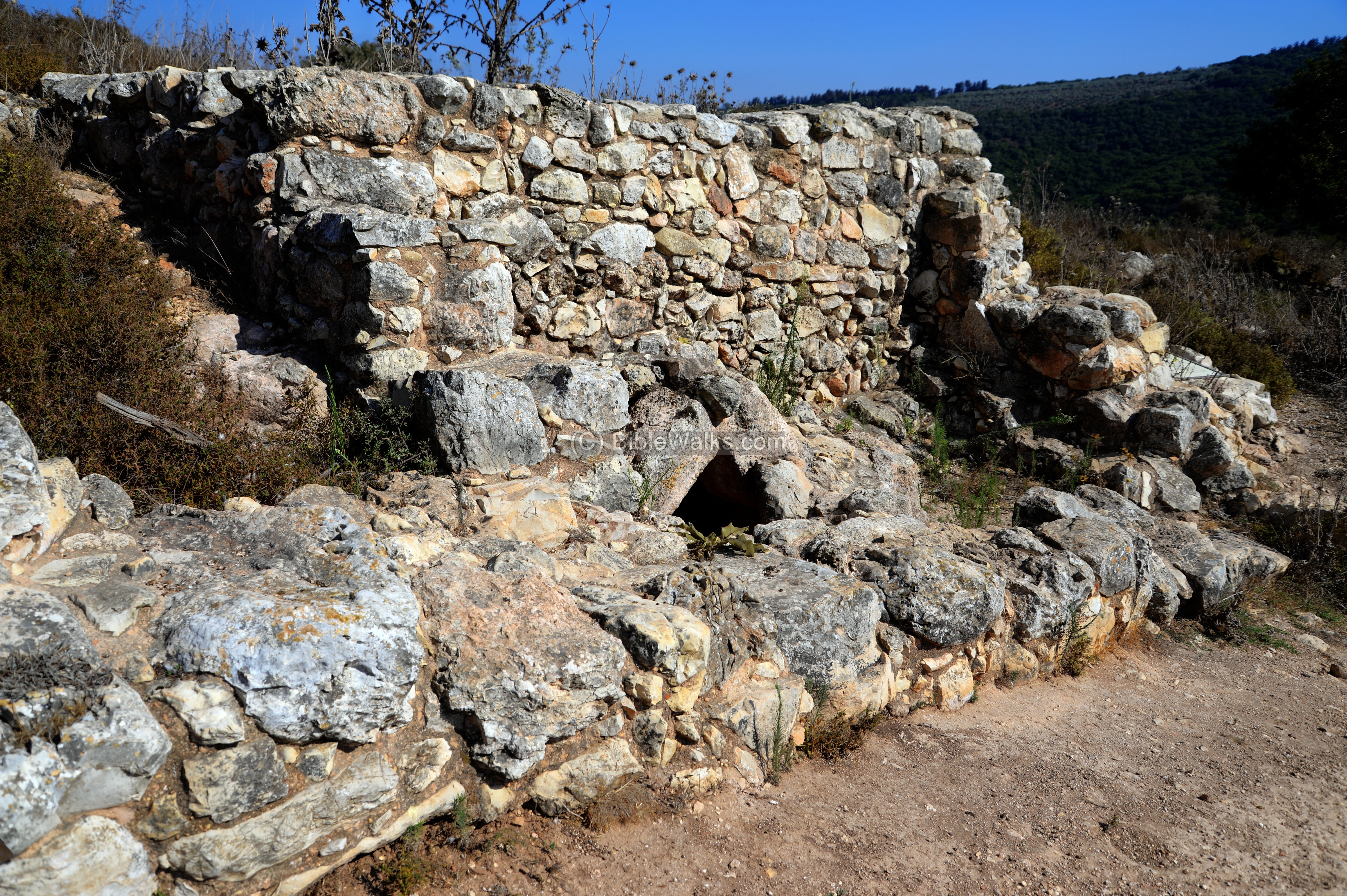
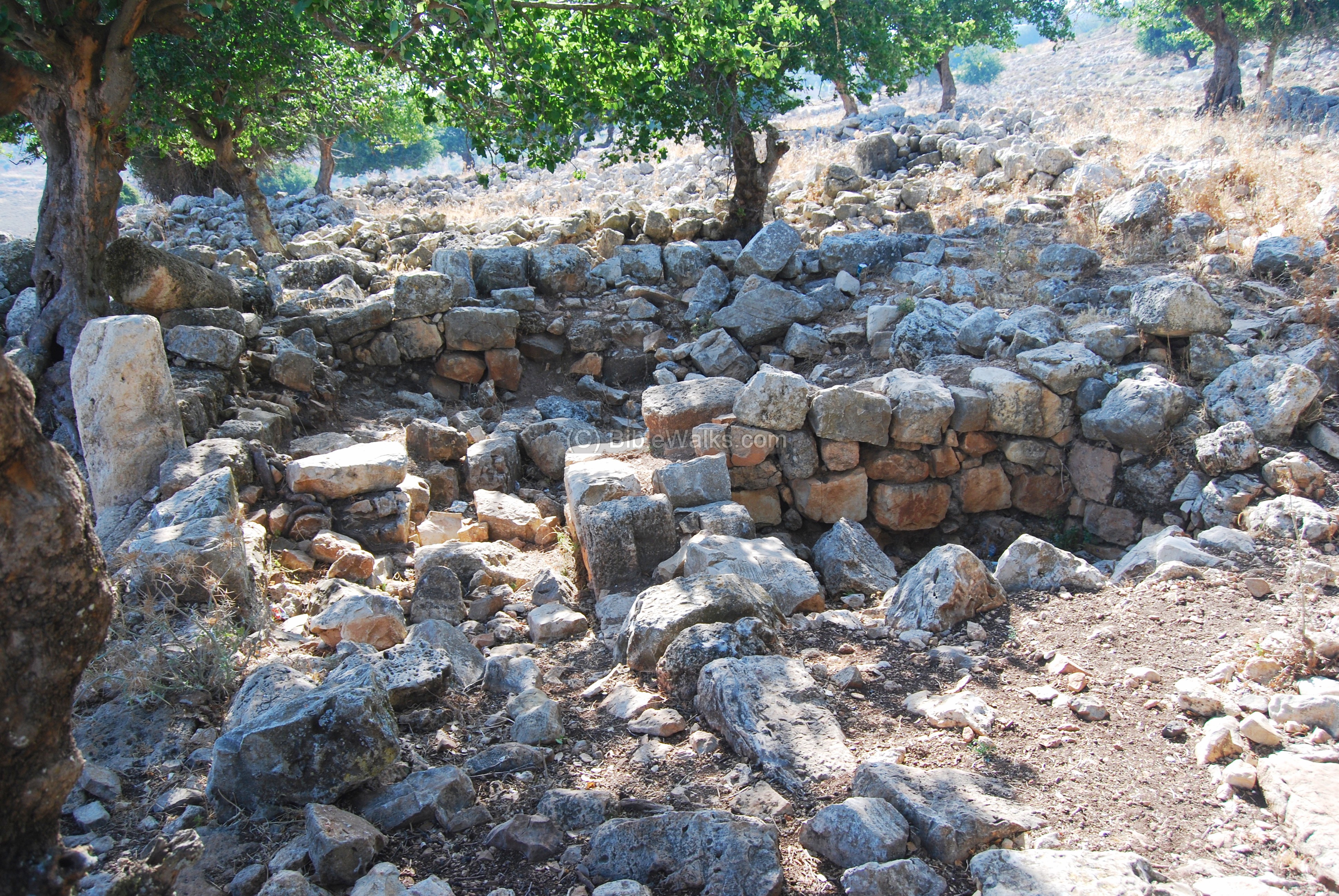
The eastern ridge was also defended by a wall that surrounded it by all sides. A section of the peripheral wall is seen along the trail, near a new excavation section.
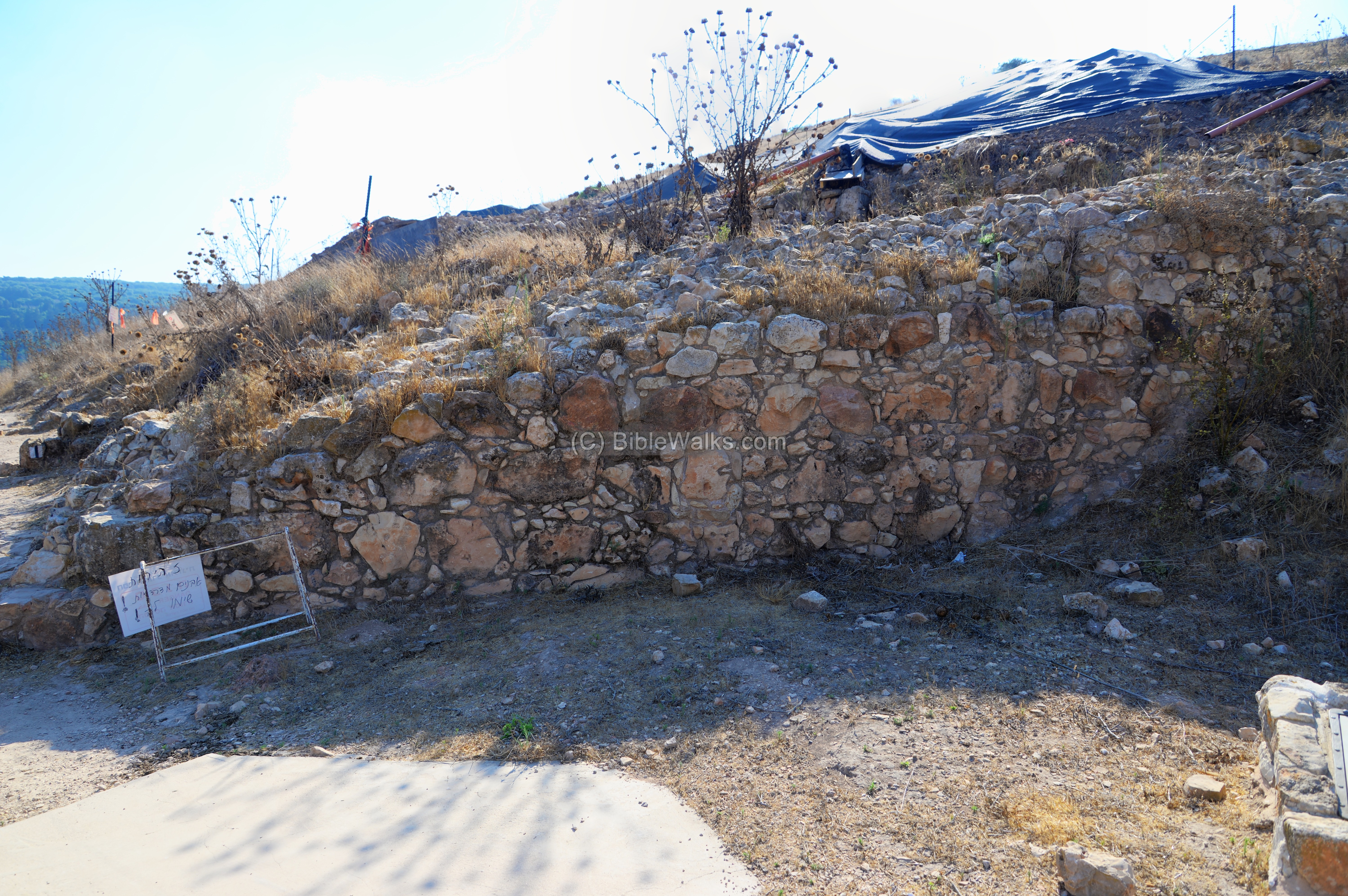
A residential structure was excavated near the eastern wall. The archaeologists revealed a house with walls and floor decorated with colorful frescos. On the floor they found a skeleton of a man, with arrowheads beside him, evidence of the Roman assault.

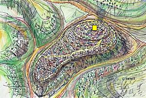
(f) Southern ridge:
The majority of ancient Yodfat, destroyed by the Roman army, are spread along the southern ridge. It is illustrated here on the illustration, marked with a yellow square.

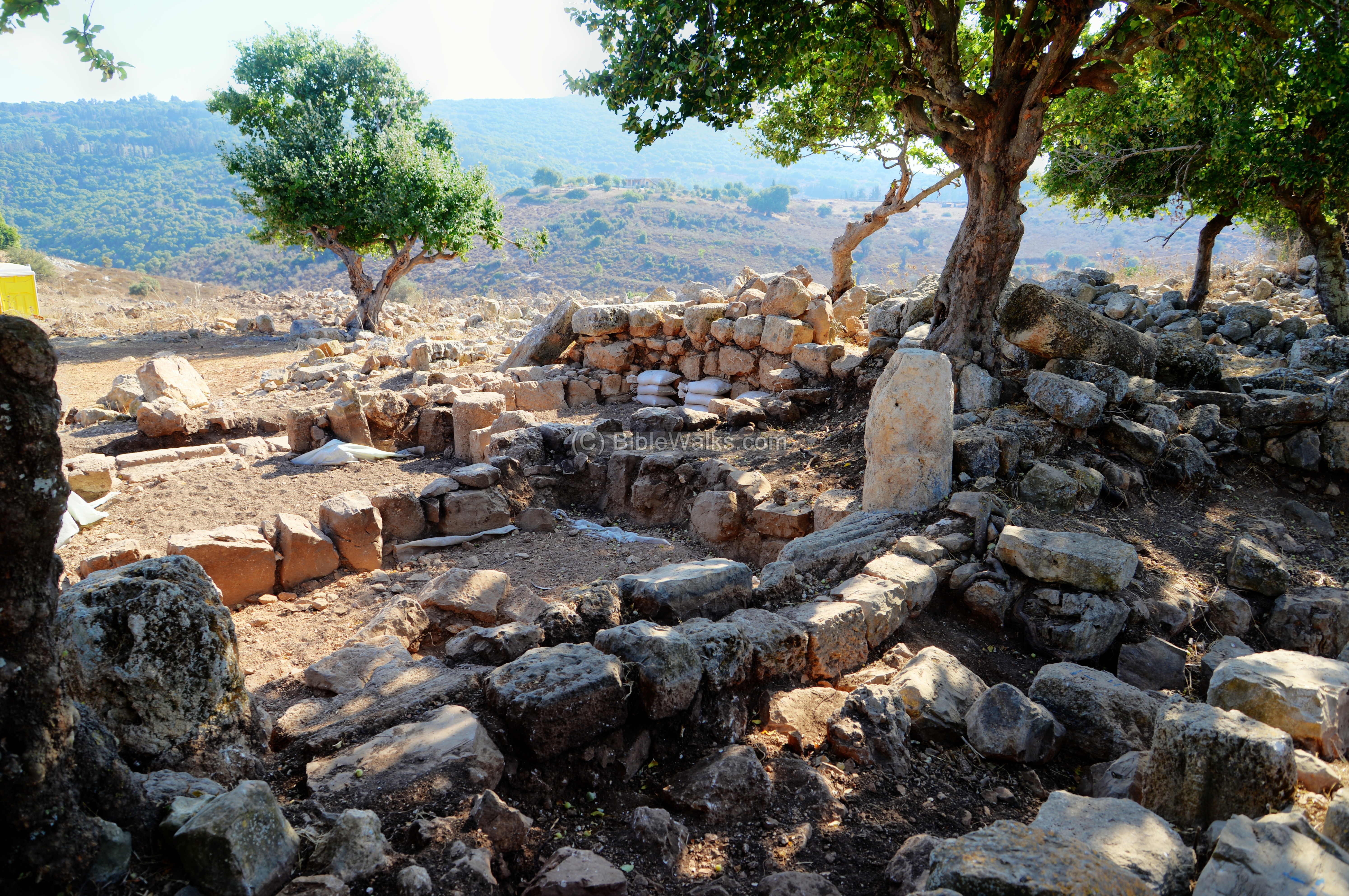
The photo below shows the southern side of the village, looking towards the peak on the north. The southern side is considerably lower than the peak, and is covered by the ruins of the of the village. Only few sections have been excavated so far.
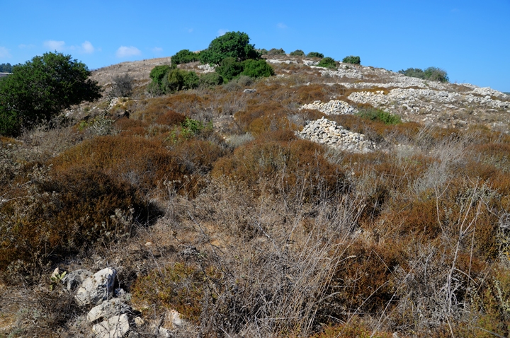
Recent excavations unearthed interesting findings that provide evidence to the accords of Josephus Flavius of the Roman siege, the assault and the demise of the fortified village. The points of interest in this area are detailed below.
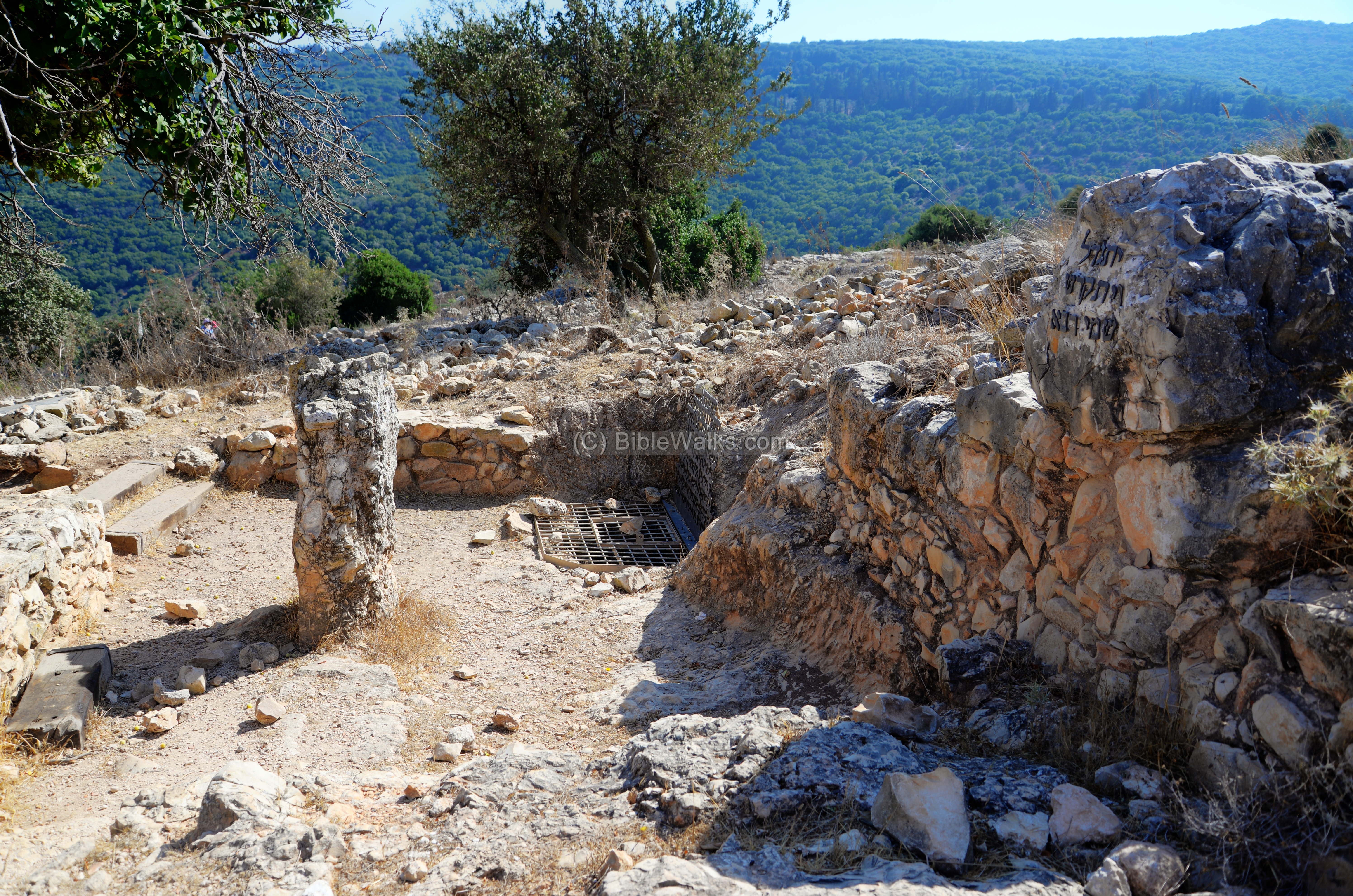
1. Mass grave: Inside this pit the archaeologists found a large pile of skeletons of men, women and children. Some of them had sword injuries. It is assumed that their bodies were left after the assault without burial in the streets and fallen houses, then later their bones were collected and reburied by Jews in this mass grave.
Above the entrance to the pit is a memorial, including metal letters with quotes from Josephus’s description of the slaughter, and to its side is a Jewish mourner’s Kaddish.
2. An etched stone was found in the adjacent room, bearing a sketch of a mausoleum on one side and a drawing of a crab on its other side. The interpretation was that the stone was drawn by one of the besieged resident that predicted the death of the village (hence the mausoleum) in the month of Tamuz (symbolized by the crab).
3. Residential houses: Several of the residential houses were excavated on the southern ridge. At this location, two adjacent houses were unearthed. They were burnt and destroyed by the Romans, leaving in the debris arrowheads and catapult stones.
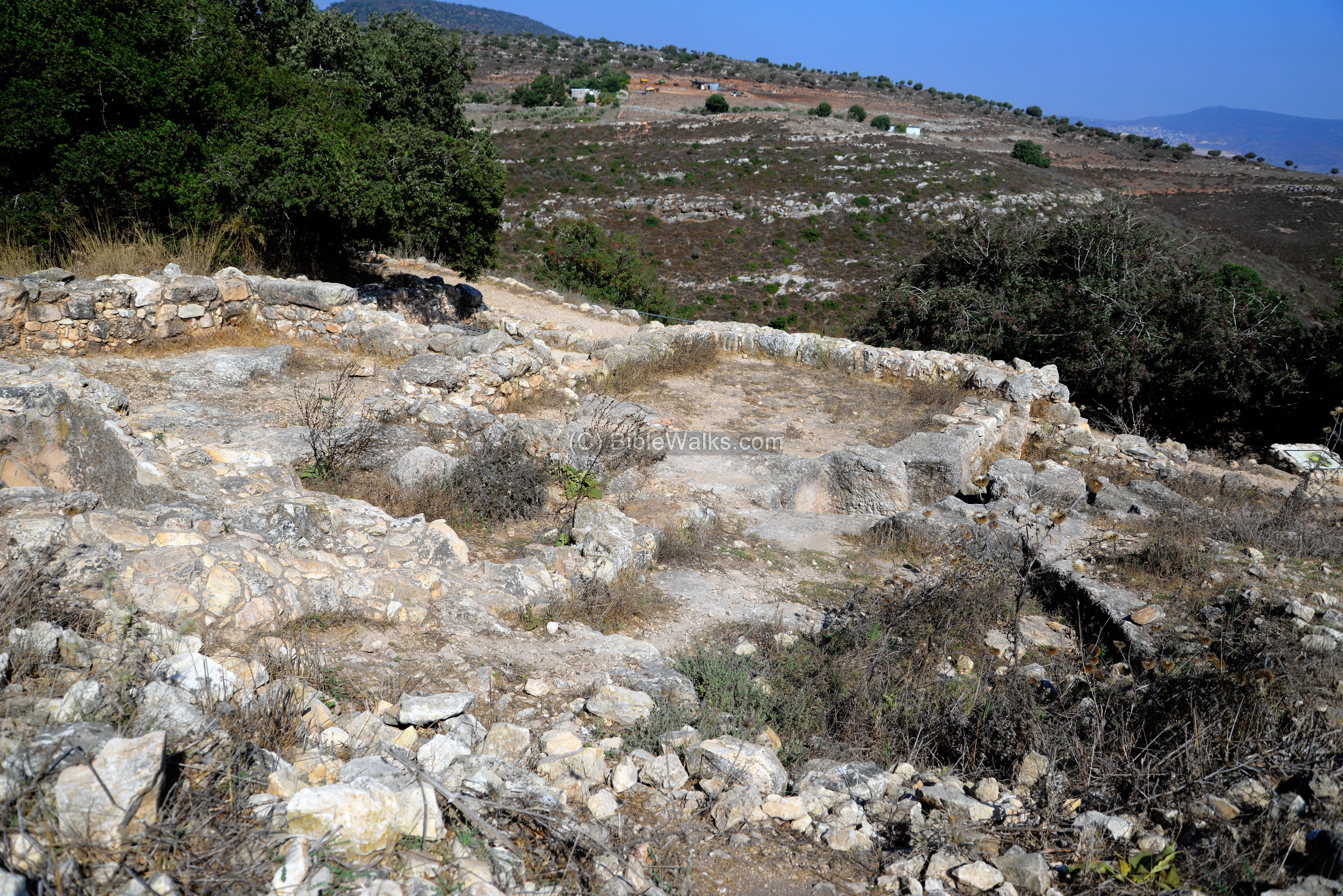
The houses included a cistern for water supply, ritual bath, oil press, kilns, pottery and stone vessels.
4. Oil press in a cave: An oil press was found inside a cave near the residential houses. Olive oil production was one of the major incomes of the farmers in these villages.

The oil press includes a crushing basin (used to crush the olives), and weights (part of a lever-and-weight type oil press).
5. Pottery kiln – a pottery kiln was unearthed on the inner side of the eastern wall. The potters produced here cooking pots, jars, and bowls for the local residents and sales to traders.
The kiln was demolished when the defenders hastened to build the wall, and so the potters built a smaller kiln on the right side.
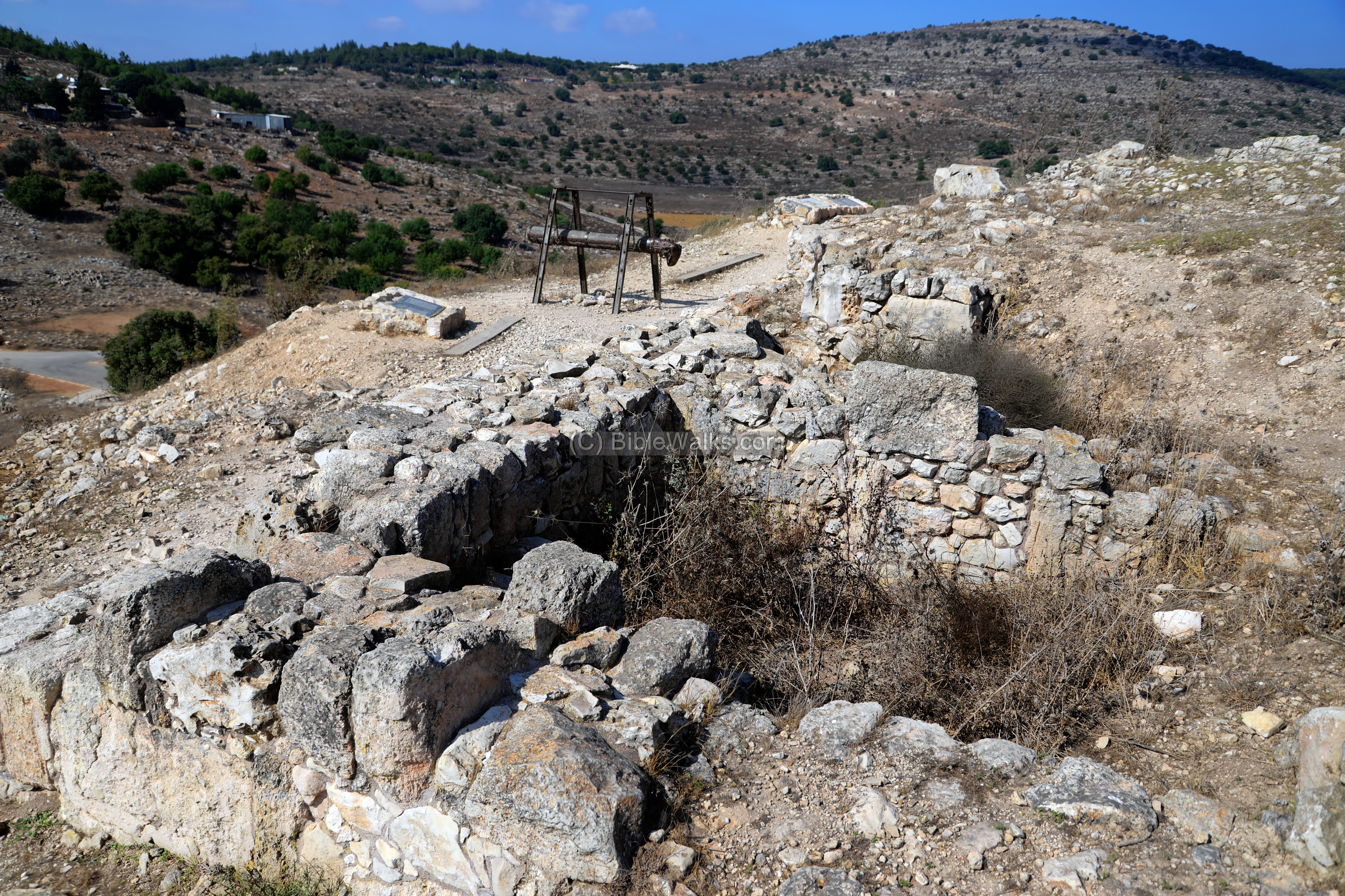
(g) Western side of the hill:
The peripheral wall was also built along the western side of the hill. The location is illustrated here, marked with a yellow square.

Along the wall are several interesting points of interest. The western trail passes along these points. In the photo below is the view of the valley to the west of Tel Yodfat.
A section of the western wall is seen in the next photo. This residential house was built along the wall.
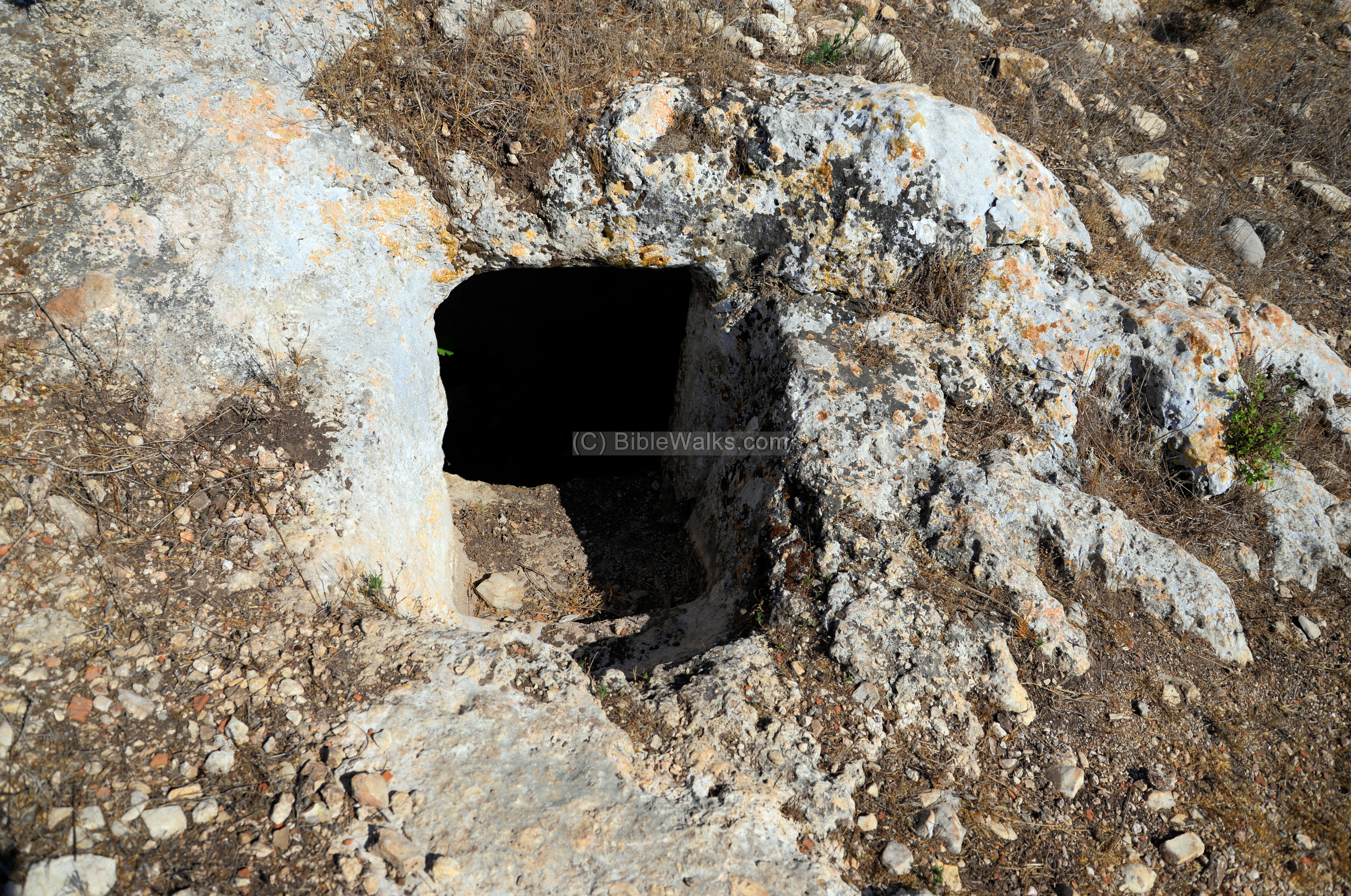
On the side of the wall is an entrance to a cistern.
Inside the cistern is secret hiding complex, made of tunnels and chambers. Among the remains, the excavators found a hoard of bronze and silver coins, minted in 65 AD – two years before destruction.
- Cistern and ritual bath
Along the western trail are additional traces of houses and walls, wells (such as the reconstructed one below), and a ritual bath.
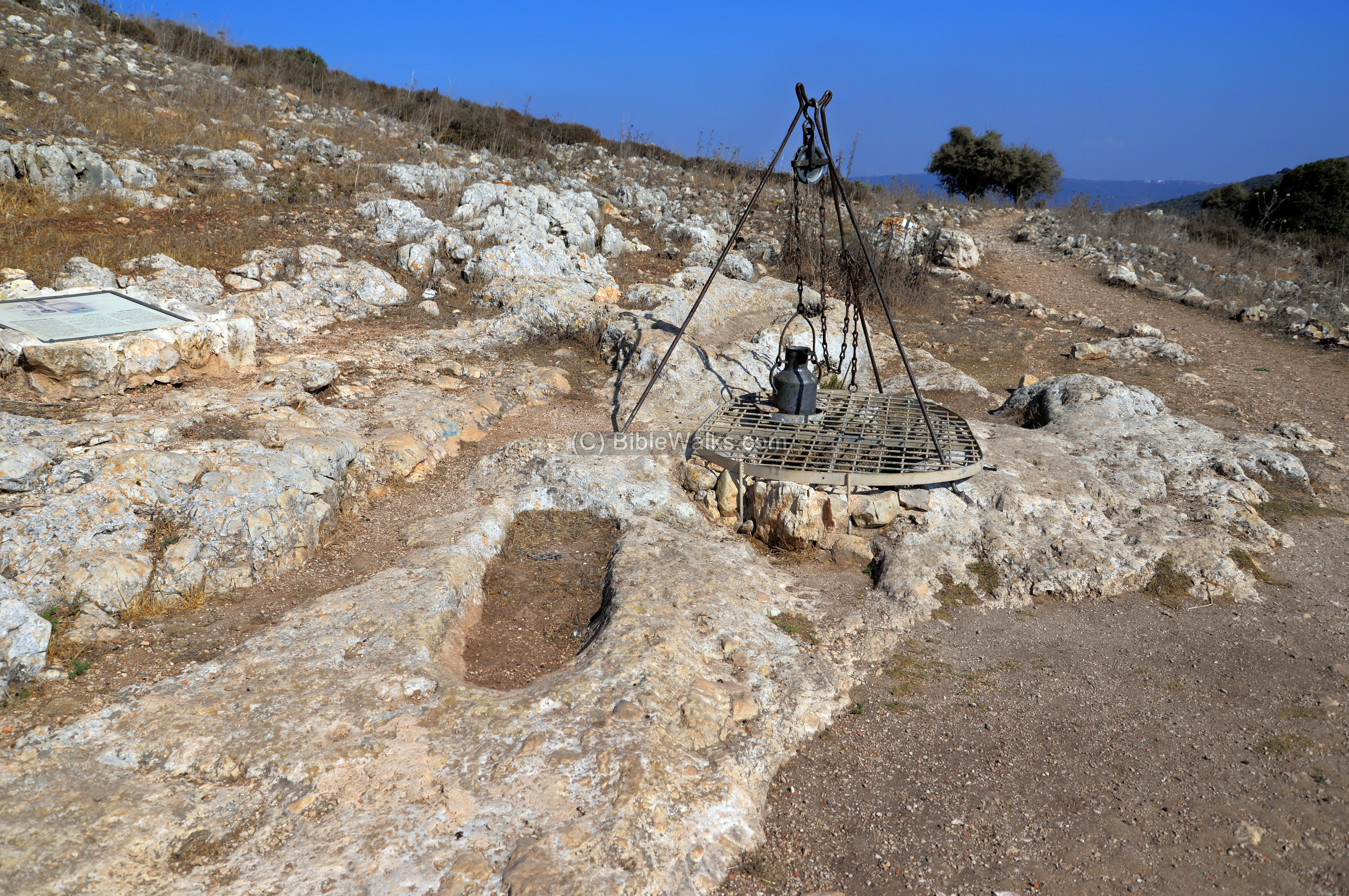
The ritual bath (Miqveh) was an important element in Jewish tradition. Steps lead down to a reservoir which was filled by rain water, or filled from the larger nearby cistern.
(h) Roman and Byzantine site:
On the north western slopes of the hill, and especially on the hillside facing the hill, are large traces of ruins from a period after the fall of Yodfat/Jotapata. The location is illustrated here, marked with a yellow square.
The photo below shows a shepherd with his goats in the center of the photo, moving through these ruins.

A closer view of the ruins:
Some of the walls of the houses were partially restored, as in the photo below.
An excavation of a public structure (synagogue?) is under progress (2019) in the eastern side of the ruins.
(i) Other photos:
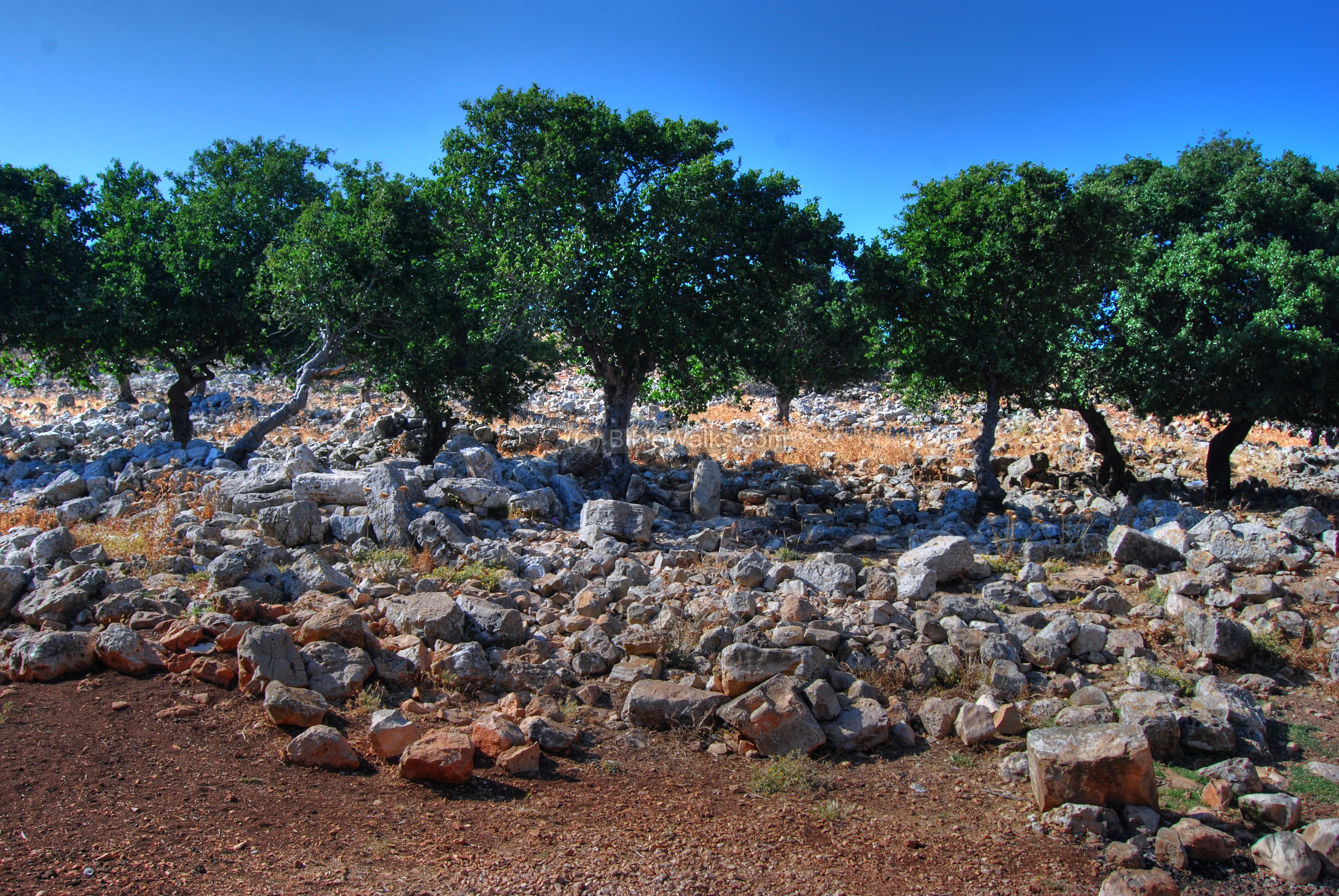
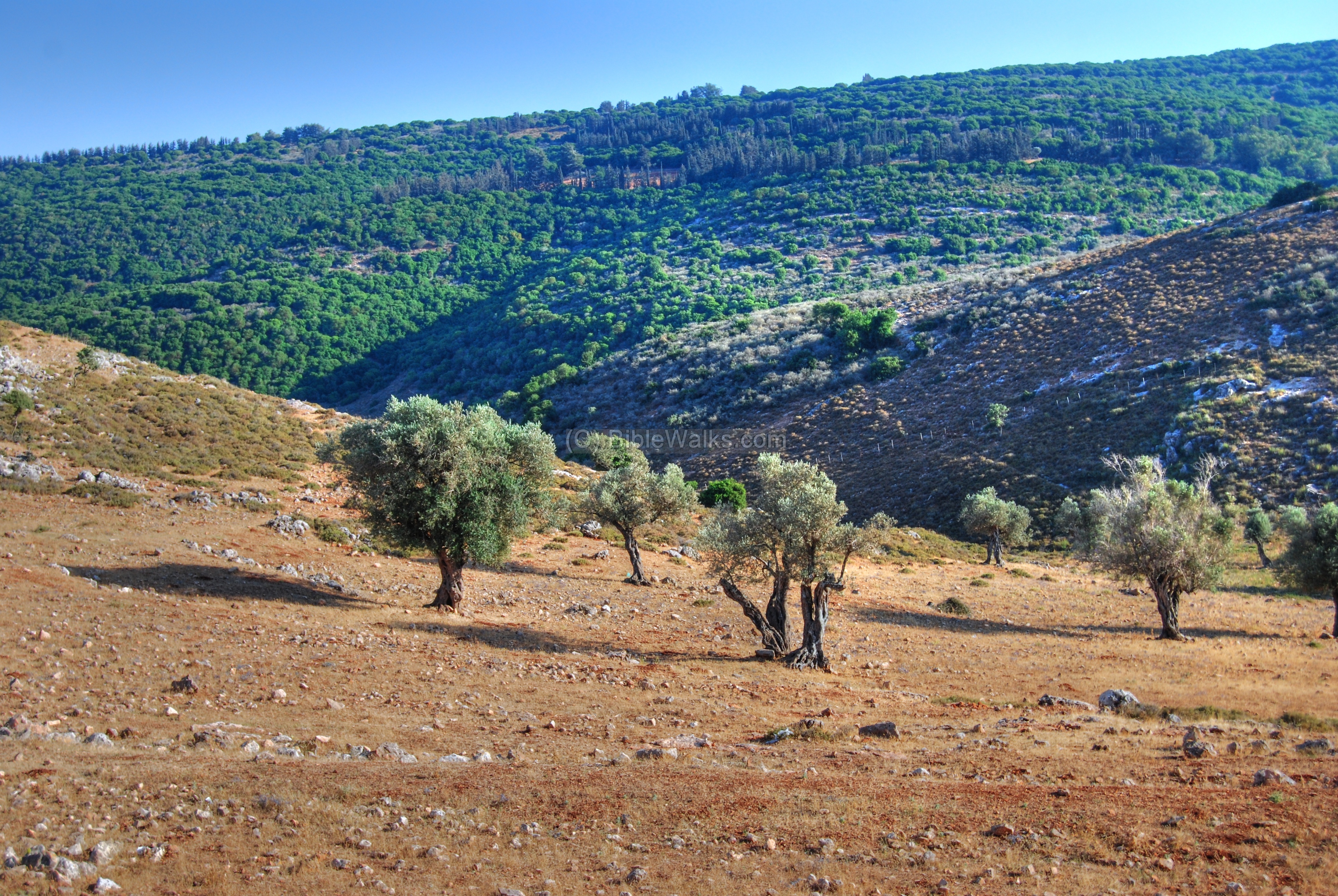
Around the site are beautiful Galilean views, such as the slopes on the south side of the hill. In the background is the hill of Atzmon.
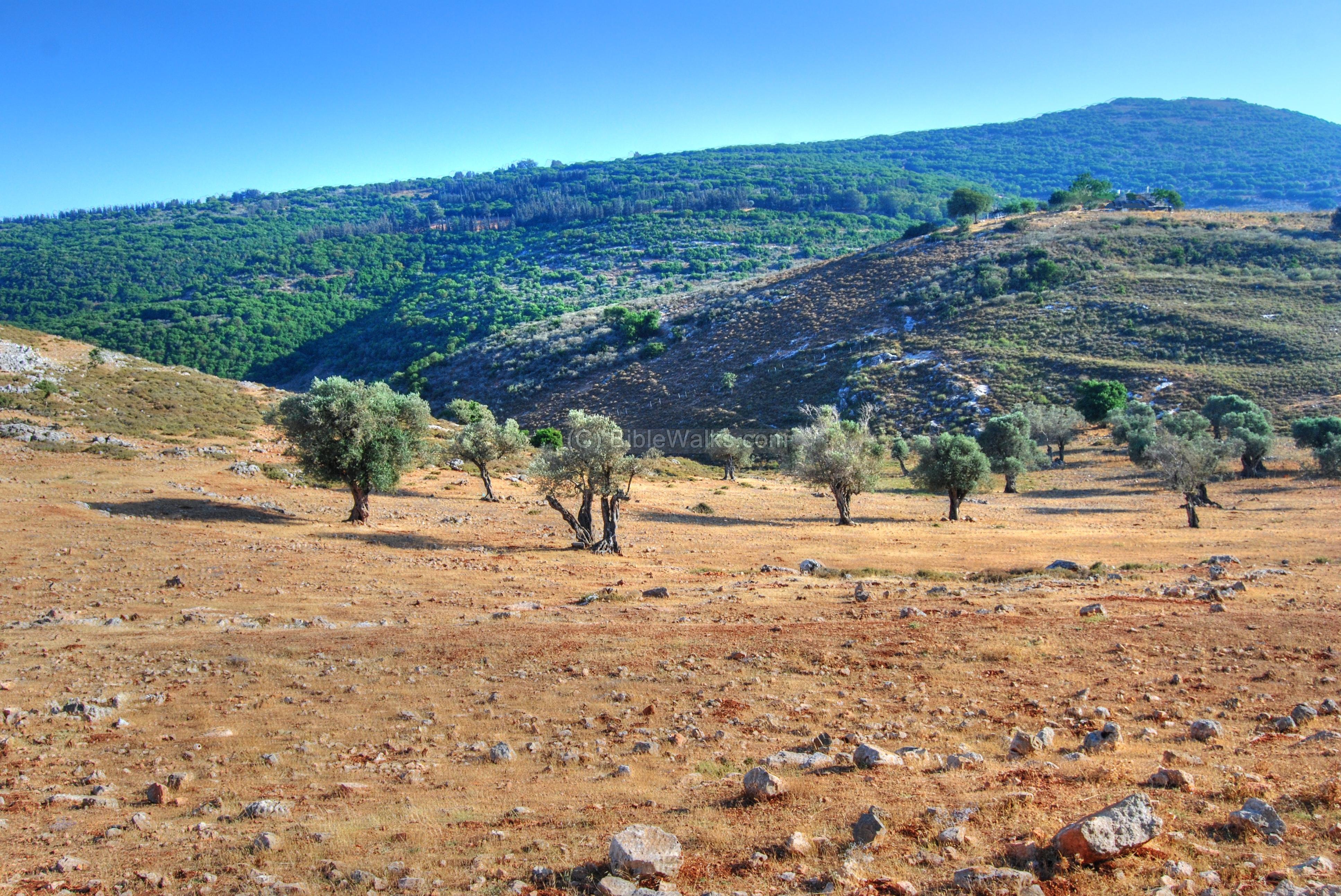
A closer view of the olive trees in that hillside.
(j) Flight over the site:
![]() An aerial view of Tel Yodfat, captured on August 2019, can be seen in the following YouTube video:
An aerial view of Tel Yodfat, captured on August 2019, can be seen in the following YouTube video:
Biblical References:
The site may be referred in the Bible as “Yotvah”/”Jotbah” (Kings 2, Chapter 21, 19):
“Amon was twenty and two years old when he began to reign; and he reigned two years in Jerusalem; and his mother’s name was Meshullemeth the daughter of Haruz of Jotbah“.
Historical References:
(a) Josephus Flavius
The historian Josephus Flavius was the commander of the revolt, and fortified the site. He later wrote about it in his book, “War of the Jews“.
- Fortification of Yodfat -Jotapata ( Book 2, Chapter 20, 6):
” Josephus also, when he had settled these rules for determining causes by the law, with regard to the people’s dealings one with another, betook himself to make provisions for their safety against external violence; and as he knew the Romans would fall upon Galilee, he built walls in proper places about Jotapata, and Bersabee, and Selamis”
- Description of the site (Book 3, Chapter 7, 7):
“Now Jotapata is almost all of it built on a precipice, having on all the other sides of it every way valleys immensely deep and steep, insomuch that those who would look down would have their sight fail them before it reaches to the bottom. It is only to be come at on the north side, where the utmost part of the city is built on the mountain, as it ends obliquely at a plain. This mountain Josephus had encompassed with a wall when he fortified the city, that its top might not be capable of being seized upon by the enemies. The city is covered all round with other mountains, and can no way be seen till a man comes just upon it. And this was the strong situation of Jotapata”.
- The initial failed attempt to seize the fortress by a commander of Vespasian’s army (Book 3, Chapter 6, 1):
“But when Placidus, who had overrun Galilee, … he marched furiously against Jotapata, which was of them all the strongest, as supposing he should easily take it by a sudden surprise…”
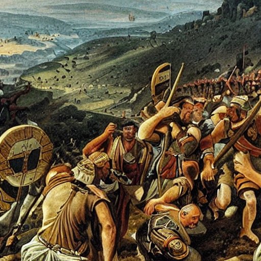
Jewish defenders fight against the Romans – AI generated by Stable Diffusion
- The Siege starts (Book 3, Chapter 6, 8):
“Vespasian, therefore, in order to try how he might overcome the natural strength of the place, as well as the bold defense of the Jews, made a resolution to prosecute the siege with vigor….”
“…Vespasian then set the engines for throwing stones and darts round about the city….”
- The defenders build the walls higher (Book 3, Chapter 6, 10):
“…And when the bank was now raised, and brought nearer than ever to the battlements that belonged to the walls, Josephus thought it would be entirely wrong in him if he could make no contrivances in opposition to theirs, and that might be for the city’s preservation; so he got together his workmen, and ordered them to build the wall higher…”
- The fortress lacks water (Book 3, Chapter 6, 12):
“Now the besieged had plenty of corn within the city, and indeed of all necessaries, but they wanted water, because there was no fountain in the city, the people being there usually satisfied with rain water; yet is it a rare thing in that country to have rain in summer, and at this season, during the siege, they were in great distress for some contrivance to satisfy their thirst; and they were very sad at this time particularly, as if they were already in want of water entirely, for Josephus seeing that the city abounded with other necessaries, and that the men were of good courage, and being desirous to protract the siege to the Romans longer than they expected, ordered their drink to be given them by measure; but this scanty distribution of water by measure was deemed by them as a thing more hard upon them than the want of it; and their not being able to drink as much as they would made them more desirous of drinking than they otherwise had been; nay, they were as much disheartened hereby as if they were come to the last degree of thirst.”
- Knocking down the walls with the battering Ram (Book 3, Chapter 6, 19):
“When, therefore, Vespasian looked upon himself as in a manner besieged by these sallies of the Jews, and when his banks were now not far from the walls, he determined to make use of his battering ram. This battering ram is a vast beam of wood like the mast of a ship, its forepart is armed with a thick piece of iron at the head of it, which is so carved as to be like the head of a ram, whence its name is taken. This ram is slung in the air by ropes passing over its middle, and is hung like the balance in a pair of scales from another beam, and braced by strong beams that pass on both sides of it, in the nature of a cross. When this ram is pulled backward by a great number of men with united force, and then thrust forward by the same men, with a mighty noise, it batters the walls with that iron part which is prominent. Nor is there any tower so strong, or walls so broad, that can resist any more than its first batteries, but all are forced to yield to it at last.
This was the experiment which the Roman general betook himself to, when he was eagerly bent upon taking the city; but found lying in the field so long to be to his disadvantage, because the Jews would never let him be quiet. So these Romans brought the several engines for galling an enemy nearer to the walls, that they might reach such as were upon the wall, and endeavored to frustrate their attempts; these threw stones and javelins at them; in the like manner did the archers and slingers come both together closer to the wall. This brought matters to such a pass that none of the Jews durst mount the walls, and then it was that the other Romans brought the battering ram that was cased with hurdles all over, and in the tipper part was secured by skins that covered it, and this both for the security of themselves and of the engine. Now, at the very first stroke of this engine, the wall was shaken, and a terrible clamor was raised by the people within the city, as if they were already taken”.
- The City is taken after 47 days of siege (Book 3, Chapter 6, 33):
“…But as the people of Jotapata still held out manfully, and bore up tinder their miseries beyond all that could be hoped for, on the forty-seventh day [of the siege] the banks cast up by the Romans were become higher than the wall; on which day a certain deserter went to Vespasian, and told him how few were left in the city, and how weak they were…”
“…and it was Titus himself that first got upon it, with one of his tribunes, Domitius Sabinus, and had a few of the fifteenth legion along with him. So they cut the throats of the watch, and entered the city very quietly. After these came Cerealis the tribune, and Placidus, and led on those that were tinder them. Now when the citadel was taken, and the enemy were in the very midst of the city, and when it was already day, yet was not the taking of the city known by those that held it; for a great many of them were fast asleep, and a great mist, which then by chance fell upon the city, hindered those that got up from distinctly seeing the case they were in, till the whole Roman army was gotten in, and they were raised up only to find the miseries they were under; and as they were slaying, they perceived the city was taken”.
- The fate of the defenders and the city (Book 3, Chapter 6, 36):
“And on this day it was that the Romans slew all the multitude that appeared openly; but on the following days they searched the hiding-places, and fell upon those that were under ground, and in the caverns, and went thus through every age, excepting the infants and the women, and of these there were gathered together as captives twelve hundred; and as for those that were slain at the taking of the city, and in the former fights, they were numbered to be forty thousand. So Vespasian gave order that the city should be entirely demolished, and all the fortifications burnt down. And thus was Jotapata taken, in the thirteenth year of the reign of Nero, on the first day of the month Panemus [Tamuz]”.
- The Sequel (Chapter 8)
Josephus and 40 of his men hide in one of the caves for 3 days, but a woman reveals this to the Romans. All his men commit suicide, but Josephus alone is taken prison and is spared by Vespasian. He later accompanies the Roman army in its conquest of Israel, and writes about it in his books.
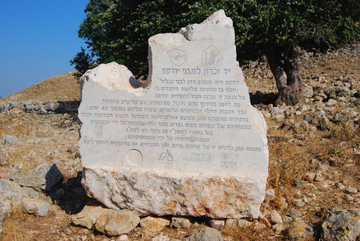
A monument memorizing the defenders of the site in July 20, 67AD
Links:
* External links:
- Modern Yodfat (Hebrew)
- The life and death of a Jewish Galilean town – Lecture by Modechai Aviam (2018)
* Nearby sites: Khirbet Cana
* Internal links:
- Quadcopter photos – collection of aerial views
BibleWalks.com – This Land is carved by History
K. Cana <<<—previous site —<<< All Sites>>> —next lower Galilee site—>>> Ammudim
This page was last updated on Mar 18, 2023 (new overview, add AI illustration)
Sponsored links: