Haifa is the 3rd largest city in Israel. Its main facilities are the port of Haifa and the bay of Haifa with a refinery. Parts of the city are located on Mount Carmel.
Contents:
Background
Location
History
Photos
– Haifa Bay
–Bahai Gardens
–German Colony
–Tell Shikmona
–Mount Carmel
Biblical
Other refs
Links
Etymology
Background:
Haifa is the 3rd largest city in Israel, after Jerusalem and TelAviv. Its main facilities are the port of Haifa and the bay of Haifa with a refinery. Parts of the city are located on Mount Carmel.
Location:
Haifa is located in the north of Israel, on the shores of the Mediterranean Sea, at the south-west corner of the Galilee. The mountain ridge of Carmel, on which the center of Haifa is located, separates the Carmel shore (and the south of Israel) with the bay of Haifa (and the north of the country).

History:
The following summarizes the history of the area of Haifa, including the Carmel and the coast of the Carmel.
(a) Prehistory:
Mount Carmel was a center of early man settlements, spanning over 150,000 years. There are over 200 sites around Haifa, some of them are famous prehistoric sites – like Carmel caves and Oren caves. During the early Bronze (Canaanite) period (31C-22 century BC) there were some small settlements. They declined in the middle Bronze (Cannanite) period (22nd century – 15th century BC) and the late Bronze (Canaanite) period (15 century -12 century BC).
A port city along the bank of Kison river was Tell Abu Hawam. It was founded in the Late Bronze period (~1600 BC). During the Crusaders period this port city was known as “Old Haifa”. It then moved west to a new location (Haifa el-Atika), south of Bat Galim.
(b) Israelite (Iron) period (12 century – 586 BC)
During the Israelite period, there are still few sites in the area. In the old testament there are many references to Mount Carmel, including the acts of Elijah the prophet in the 9th century BC. In Kings I 18, Elijah slaughters 450 Baal false prophets: “… and Elijah brought them down to the brook Kishon, and slew them there”. According to the tradition, his cave is located on the north west side of the Carmel.
King Solomon gave Hiram the cities on the west shore of the Galilee (Kings 1 9:11). This area probably included the whole area north of the Kishon river ( flows into the sea north of the Carmel), in the Western Galilee (“Kavul” area). Haifa was therefore the border of the Israelite Kingdom at that time. It was lost to the Assyrians in 733/2 BC, and the whole area south of Acre was under the rule of the port city of Dor, a port city south of Haifa.
A Biblical Map is shown here, indicating the major routes and cities.

Map of the area – during the Canaanite and Israelite periods (based on Bible Mapper 3.0)
There were 2 major routes that were part of Via Maris (Way of the Sea), that bypassed Mt. Carmel:
* From the west side along the sea.
* Along the east side, with crossings thru the Jokneam pass (route not marked) or farther south.
(c) Babylonian and Persian period (586-332 BC)
The coastal area saw a great development of sites at the Persian period (number of sites grew from 8 to 23 on mount Carmel and from 8 to 39 on the coast). Most of the coastal cities were controlled by the Phoenicians, who were great maritime merchants and worked in cooperation with the Persians.
(d) Hellenistic period (332 BC – 37 BC)
The sites continued to prosper under the Greek rule, which was controlled by the Seleucid kingdoms. Although the number of sites remained the same on the Carmel, the sites on the coast of the Carmel reduced to half (39 to 17), maybe due to the effect of the invading armies along the coastal road (“Via Maris”). Most sites changed to Greek names. The area, excluding Acre, was later transferred to the Hasmonean Kingdom (Alexander Yanai).
(d) Roman period (Early: 37 BC-70 AD, Late: 70 AD-324 AD, Byzantine: 324 AD-640 AD)
This period saw a jump in the number of sites on the Carmel and the coast (total of 150, 3 times more), mainly small agriculture villages on the Carmel (100). This increase was due to the relative calm and secure period under the Romans. The important cities were the large port cities : Herod’s new city of Caesarea (the capital of Province of Judea after the destruction of the 2nd temple), Dor and Acre. There were some larger urban centers, like Shikmona (the ancient port city of Haifa) and Oren. Christianity started to influence only in the 6th century AD.
(e) Arab (636 AD+) and Crusader period (1099-1187 AD)
The Arab Conquest ruined most of the Carmel and Coastal sites, but Haifa saw a migration from the old site at Shikmona. The small fishing village of Haifa, located on the northeastern slopes of the Carmel, emerged as the 2nd most important port after Acre in the northern region. It was fortified with walls, and had a shipyard .
The Crusaders took the city in 1100 AD, after a month of heavy resistance from the Jewish population. The city was important for them in order to protect the pilgrimage road from Acre to Jerusalem, and as a secondary port. They also founded several Monasteries in the Carmel, most dedicated to prophet Elijah.
Their rule collapsed on 1187 AD; Haifa and Shefaram became the front bases against the remaining Crusaders presence in Acre. After then, the sites around Haifa declined.
(f) Mameluke Period (1250-1517 AD)
In this period most of the sites around Haifa were in ruins, as part of the systematic destruction of the coast villages. In 1291 Haifa was completely abandoned.
(g) Turkish Ottoman Period (1517 AD – )
The city gradually was resettled, but the real change was when an Arab- Bedouin called Daher El-Omar , made Acre his capital and Haifa his port.
Daher el-Omar mutinied against the Ottoman empire, capturing the area of the Galilee and establishing a self governed province in the years 1730-1775. Daher and his family fundamentally reshaped the Galilee landscape by building fortresses, warehouses, khans and administrative buildings.

A Bedouin warrior – Library of Congress, American Colony
Daher leveled the old city (Haifa El-Atika, in the area where Rambam hospital is standing today), and moved the city 3KM to the east (near Zim offices today). He built a wall around the new city, constructed a fort and governor palace. It was the nucleus of the new city, which started to grow steadily. After 1831, general Mohammad Pasha made the city his HQ at the time of his siege on Acre, which was severely hit during that war, and for the first time lost its supremacy to Haifa. Still, it was still a small and insignificant city of 4,000 in 1868.
An illustration of the ruins of Daher’s castle, dated 1882, was published in a book by CH. W. Wilson , one of the PEF explorers. The title: “The bay of ‘Akka from the slopes of Carmel”. The subtitle is: “With the ruined castle of Haifa in the foreground and a glimpse of the town of Haifa at the foot of the castle-hill ; in the distance the city of ‘Akka is clearly shown”. Today the castle is gone. The place, named el-Burj (the fort), is located in Gan Hazikaron (memorial garden) in Ramat Hadar, near the municipality of Haifa.
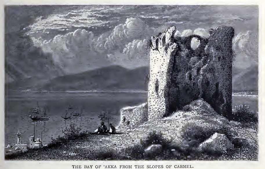
Ch. W. Wilson, Picturesque Palestine, 1882, Vol III P. 83
(i) The German Templers (1868-)
The German Templers were a German Christian sect, an offshoot of the Protestants, who were sort of Christian “Zionists”. They came in 1868-9, and established 7 villages in Israel within 40 years, starting from Haifa. The Haifa Colony was built west of the walled city. They planned a neat neighborhood of several dozen 2-story houses along a wide boulevard (Carmel-Strasse, now Ben-Gurion Avenue). Later they build the first residential houses on the Carmel. Their fields were planted west of the colony (wheat fields and other crops) and grapes on the slope of the Carmel (where the Golden shrine is today; Hagefen street was named after their grapevines). The Colony survived until WW2, when they were expelled by the British to Australia after sympathizing with the Nazis.
Their contribution was also building factories, and a commercial port to export the goods (at the north end of the Colony). The German Kaiser Wilhelm II embarked in the port in 1898, starting his visit to the Holy Land. After this success of the port the Ottomans built the Hejaz railway from Haifa to Damascus in Syria (1905). This railway linked Haifa to Turkey and Arabia, and was another important contribution to the growth of Haifa. In 1911 there were already 20,000 inhabitants in Haifa, a growth of x5 within 40 years.
Haifa was examined in the PEF survey (1866-1877) by Wilson, Conder and Kitchener. It appears in the center of the section of this map of 1878.

Part of Map Sheet 5 of Survey of Western Palestine,
by Conder and Kitchener, 1872-1877.
(Published 1880, reprinted by LifeintheHolyLand.com)
At this time, 10 years after the German colony was established, the colony appears (in pink) on the west side of the center of Ottoman Haifa. These two sections were the only inhabited neighborhoods at that time, with only 4,000 residents.
The ruins prior to the 16th century (prior to its destruction by Daher el-Omar) are indicated on this map as “Haifa el Atikah” (“old Haifa”), located on the shore north-west of the German Colony.
An illustration of the bay of Haifa, dated 1882, was published in a book by CH. W. Wilson , one of the PEF explorers. The title: “Mount Carmel”.
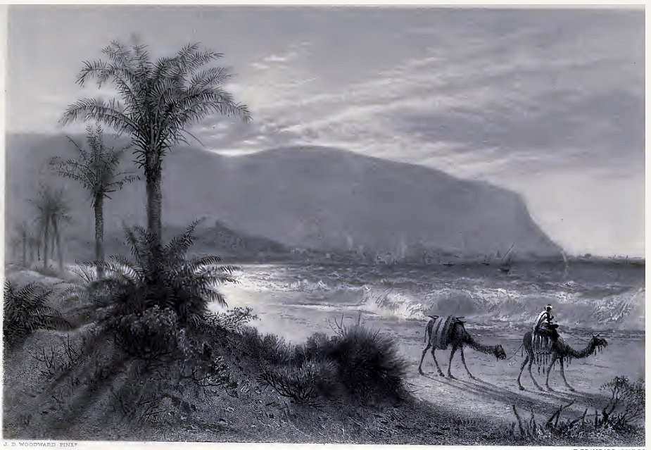
Ch. W. Wilson, Picturesque Palestine, 1882, Vol III P. 94
(j) British Mandate (1920-1947)
The drilling of Oil in the Middle East marked a turning point for Haifa. The British built a large port and refinery for their Iraqi Petrol Company (IPC) and laid a pipeline from Iraq to Haifa. This gave a tremendous boost to the city. In 1933 the new deep water port was opened, after drying up the area where Independence Avenue is located, north of the old city. Many workers came to the city for work: Arabs settled in the west and east of the old city of Daher El-Omar, and Jews built their houses in Hadar (above the old city). The population surged to 50,000 (1931) then to 128,000 (1944). There were also new neighborhoods on the Carmel and in the bay of Haifa, close to the refineries and port.
(k) State of Israel (1948+)
After the British left the Country, the city was taken after a heavy battle by the Israeli forces within 48 hours (21, 22.4.1948). It took another 3 months to capture the rest of the Arab villages around Haifa.
The city today is the 3rd largest city in Israel, with over 270,000 residents in the city and above 1 Million in its metropolitan area.
Photos:
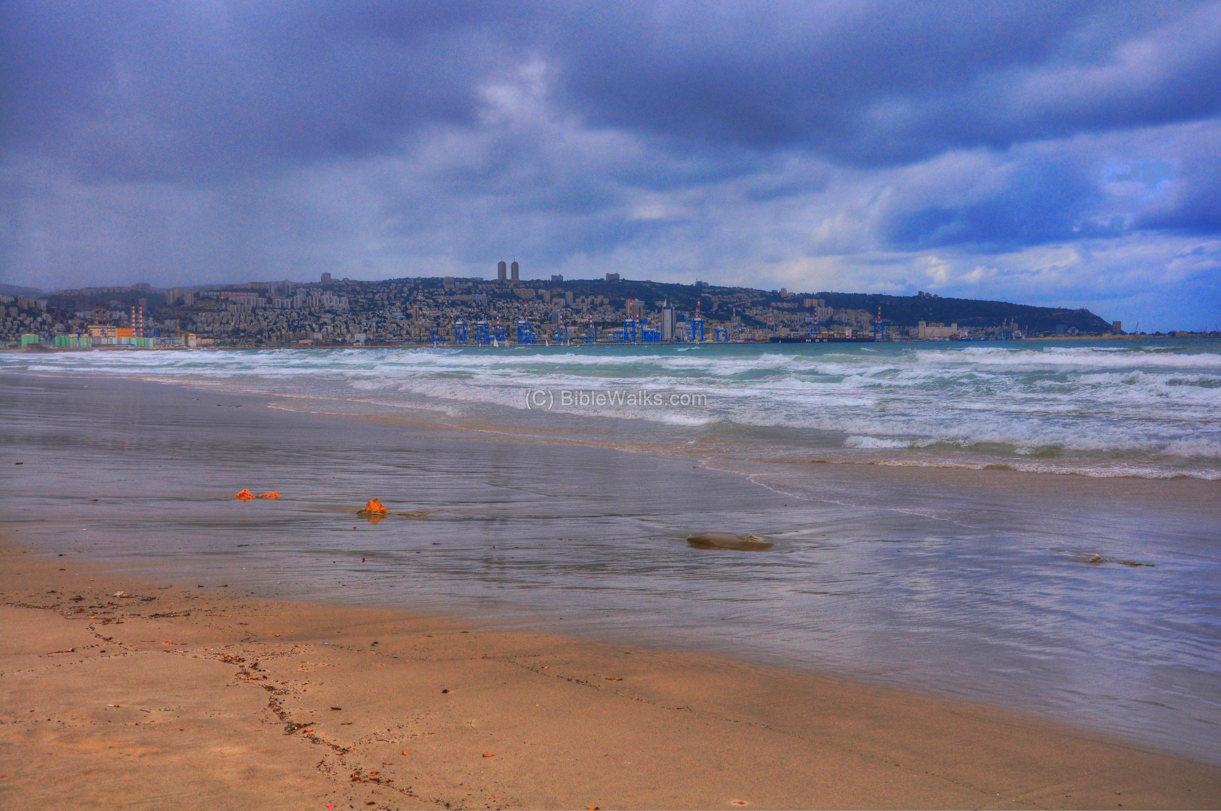
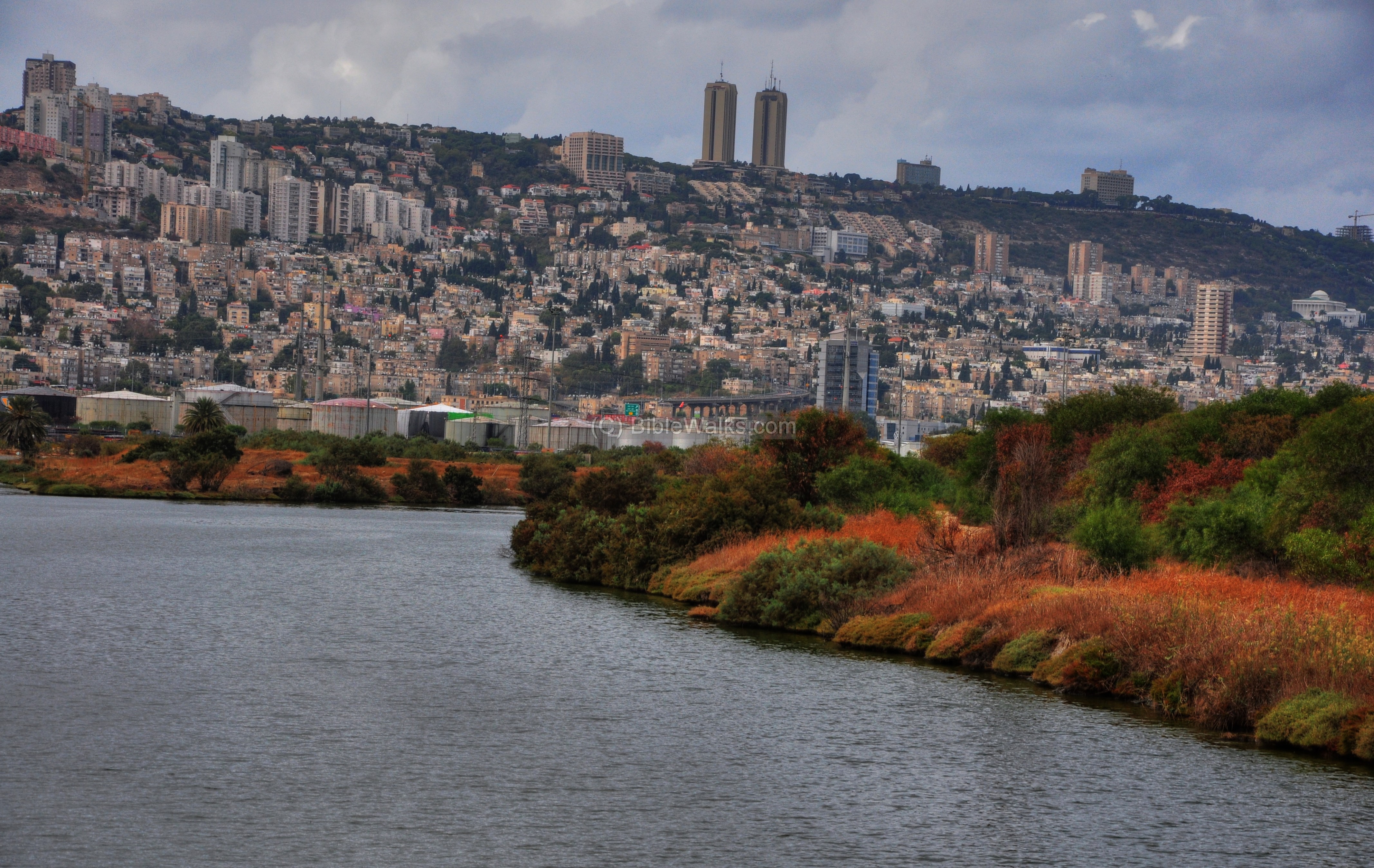
(a) Haifa Bay:
The city of Haifa is located on the south side of the bay of Haifa, and stretches along the ridge and foothills of mount Carmel. The photo below captured a view during one of the mild winter days.
Click on the photos to view in higher resolution…
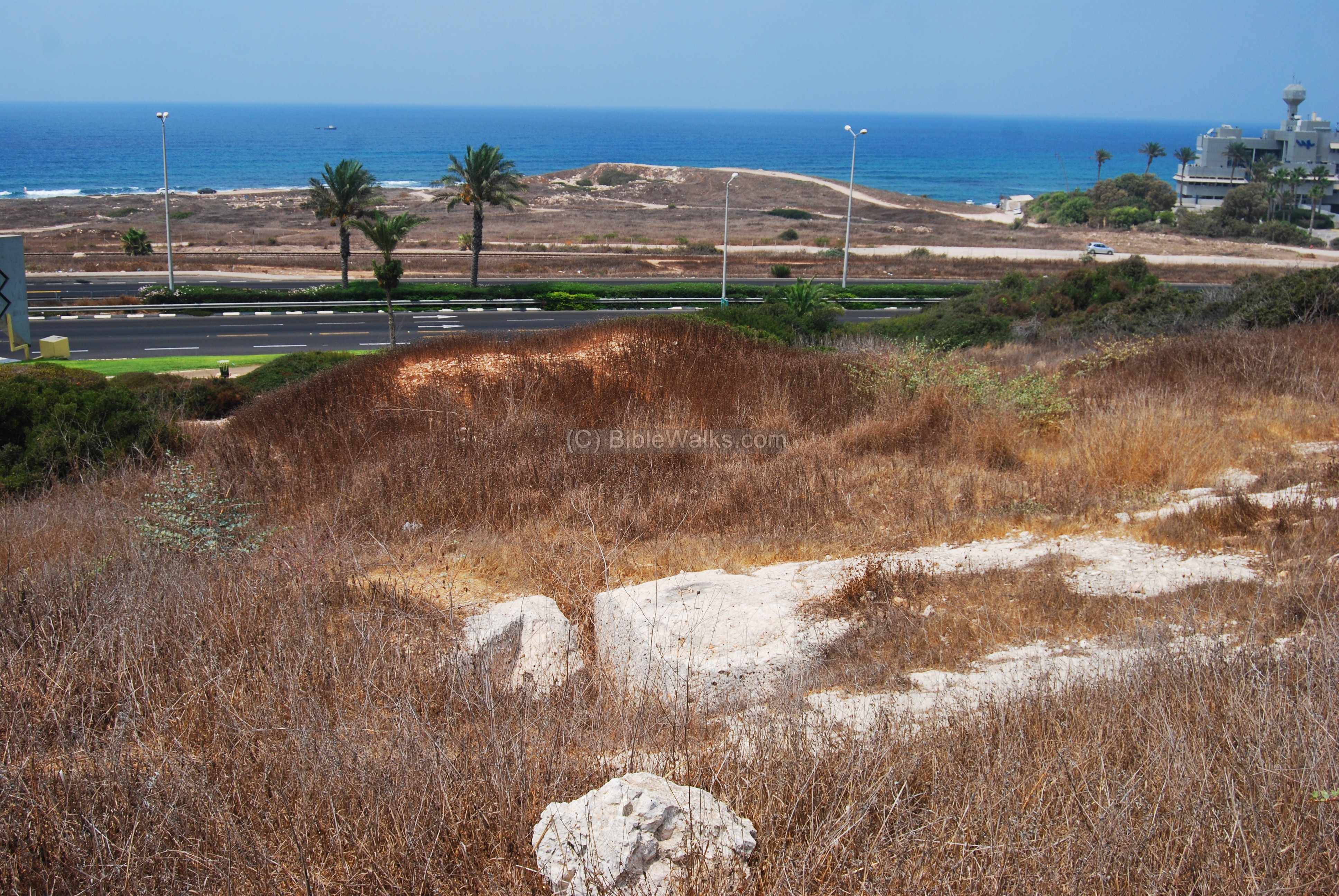
Haifa is located on the south and west side of the outlet of the Kishon river, which is the largest in Israel. Many Biblical events and sites are located along its banks (Judges 5 21: “The river of Kishon swept them away, that ancient river, the river Kishon”). During ancient times the mouth of the river served as the port, which was a safe haven for the vessels during the storms. A major Canaanite city (Tell Abu-Huam) was located at this location (at the place where the storage tanks are located on the bottom left side).
This was also the location of the ancient marine port. Today, the port of Haifa is one of the two large Israeli ports, continuing to serve Israel for its imports and exports.
The next photo was captured by a drone, showing the same section from a height of 110m. The port of Haifa, and the bay of Haifa, are seen on the far right background.
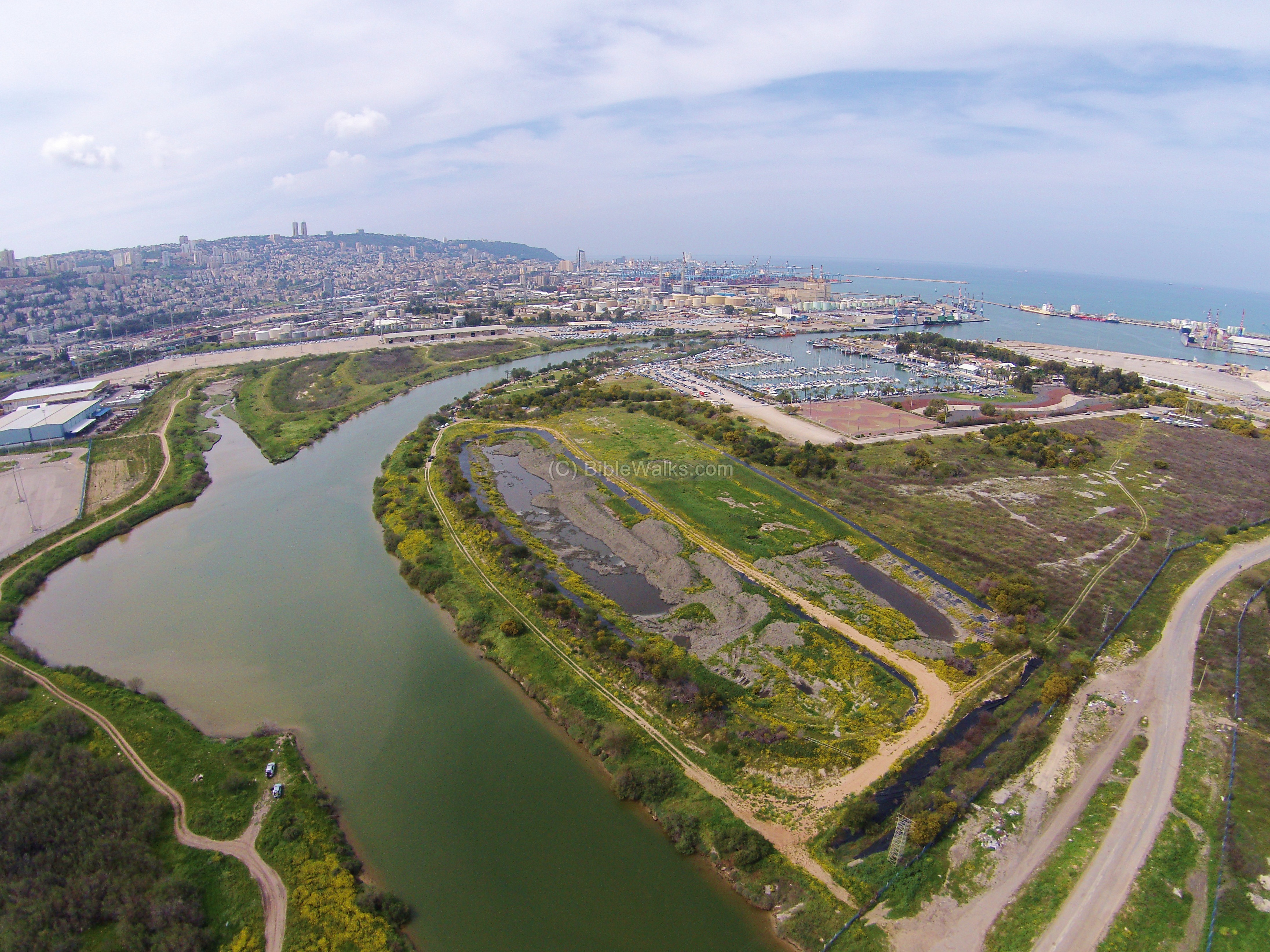
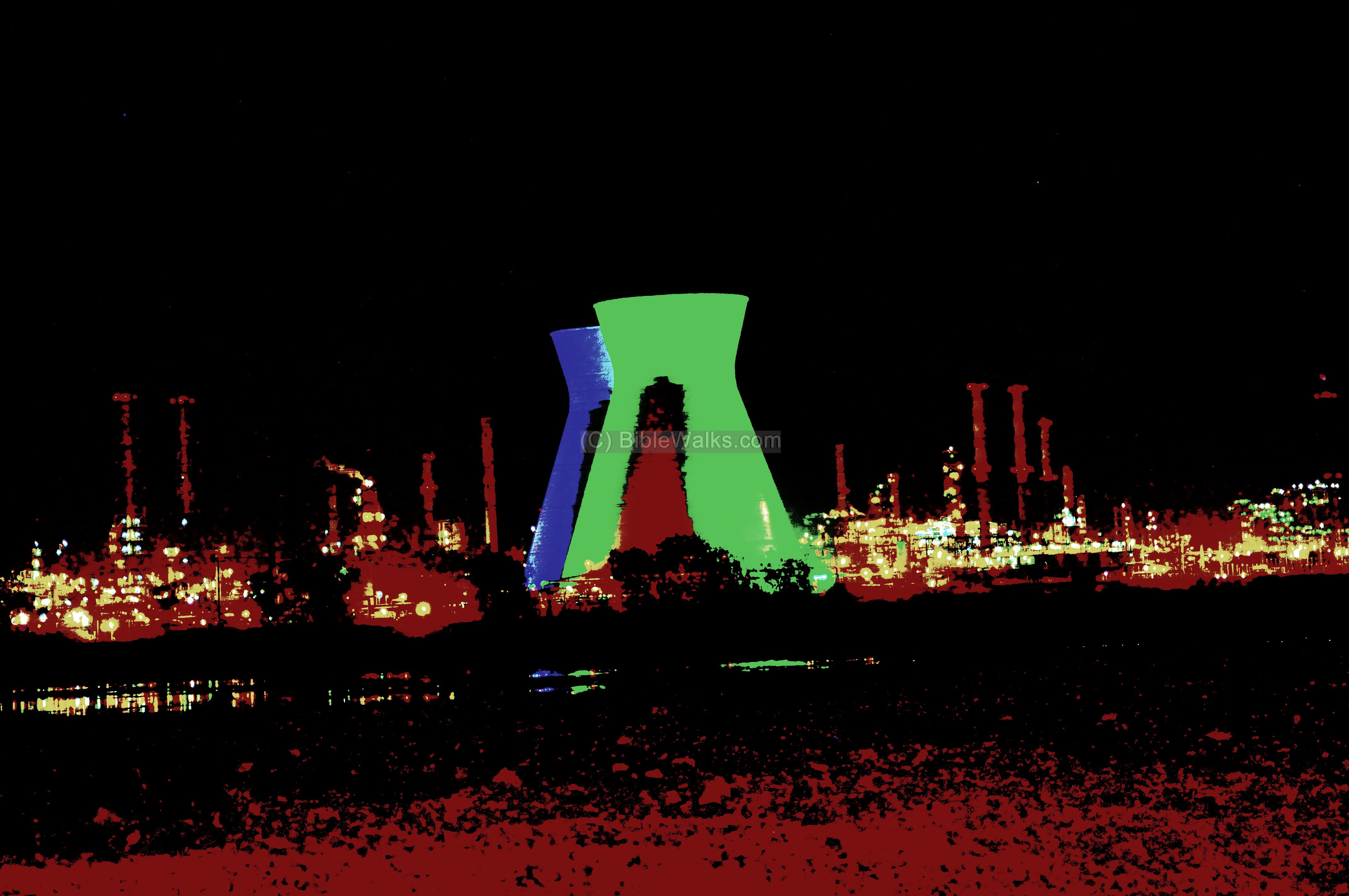
Haifa’s oil refinery, which was established in 1938, used to process crude oil from Iraq (IPC pipeline). The combination of a marine port, the river (source of its cooling water), access to the Mediterranean sea, and the pipeline from the oil wells – were the reasons why the British developed this port. The refinery continues to process oil from crude oil imported through the port, and other petrochemical industries around the plant produce additional products based on the petrol.
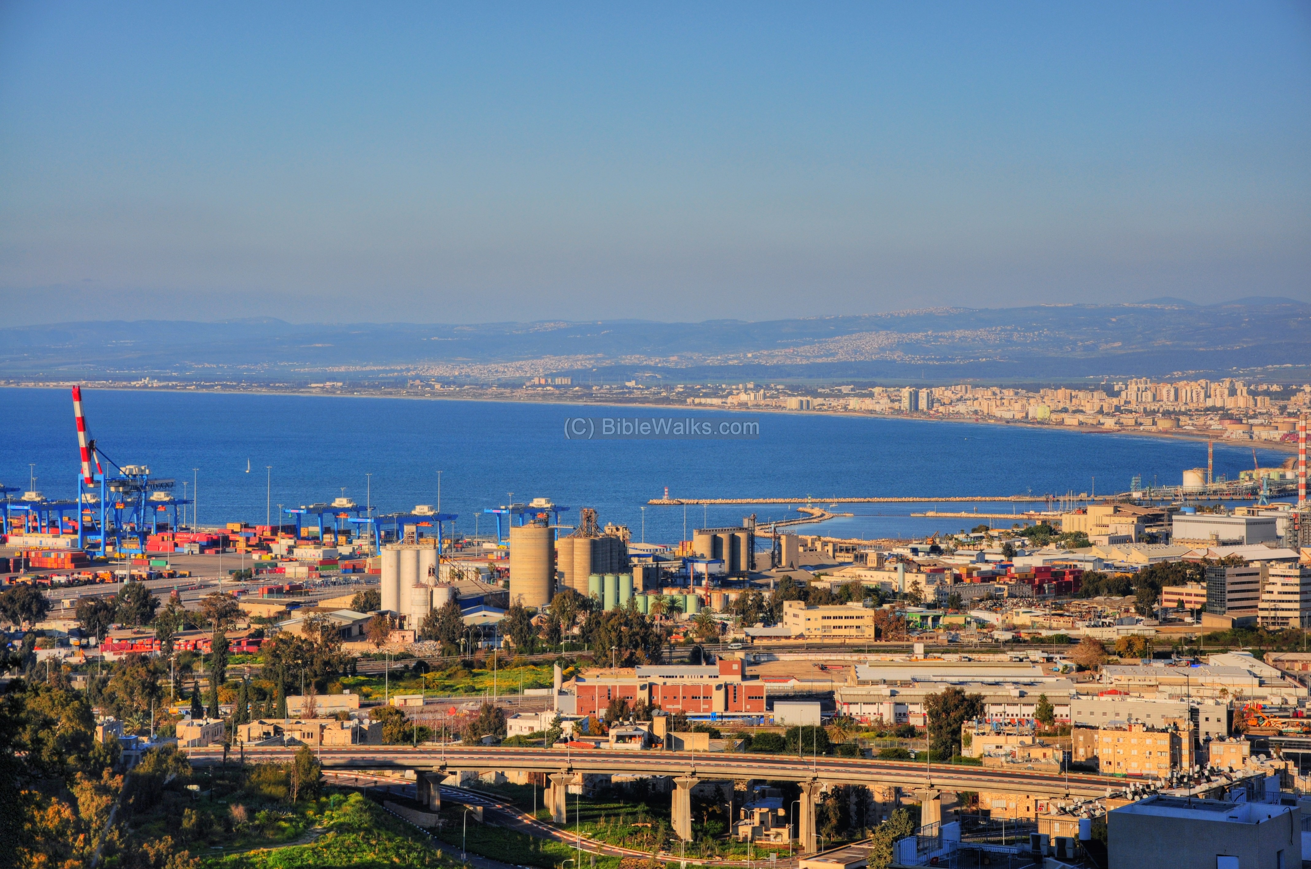
A view of the port of Haifa and the bay is shown below, as seen from Ramat-Hadar.
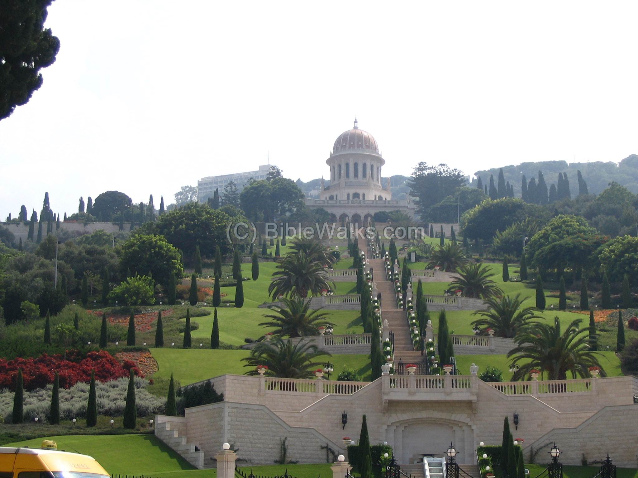
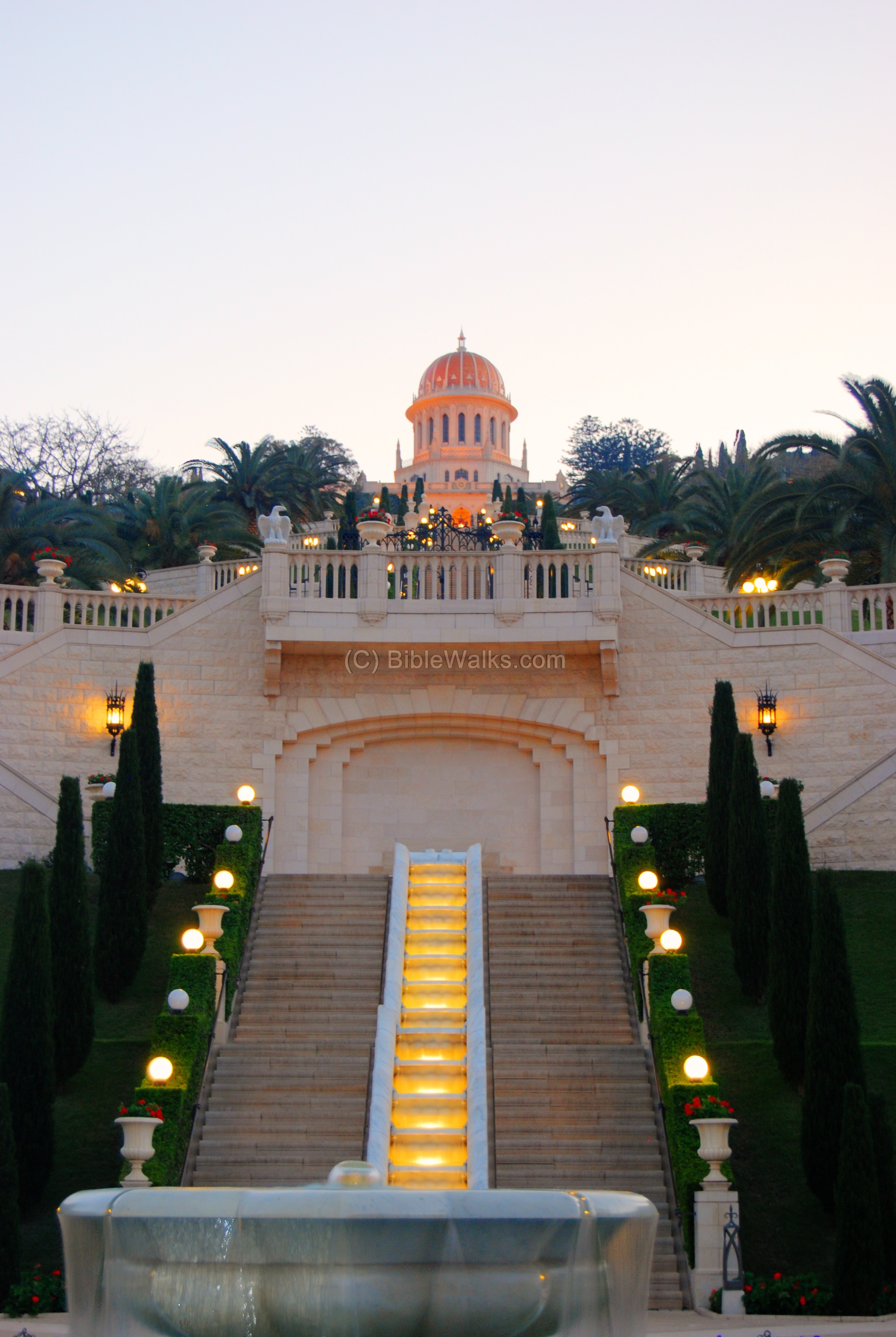
(b) Bahai Gardens, Mount Carmel:
The following photo shows a view of the Bahai Golden Shrine and Gardens on the slopes of Mount Carmel. The tomb of the Bab, the forerunner of the Baith faith, is located here, after his remains were brought from Persia in 1899. The gardens have been redesigned in recent years, and the site is a charming place to visit. In 2008 the site was named UNESCO worldwide heritage site, together with the gardens in Acre.
In the background, on the left of the shrine, is Dan Carmel hotel, one of the hotels on the top of the Mountain.
At the evening the gardens light up and continue to cast a beautiful view, as seen below from the lower gates at the edge of the German Colony.
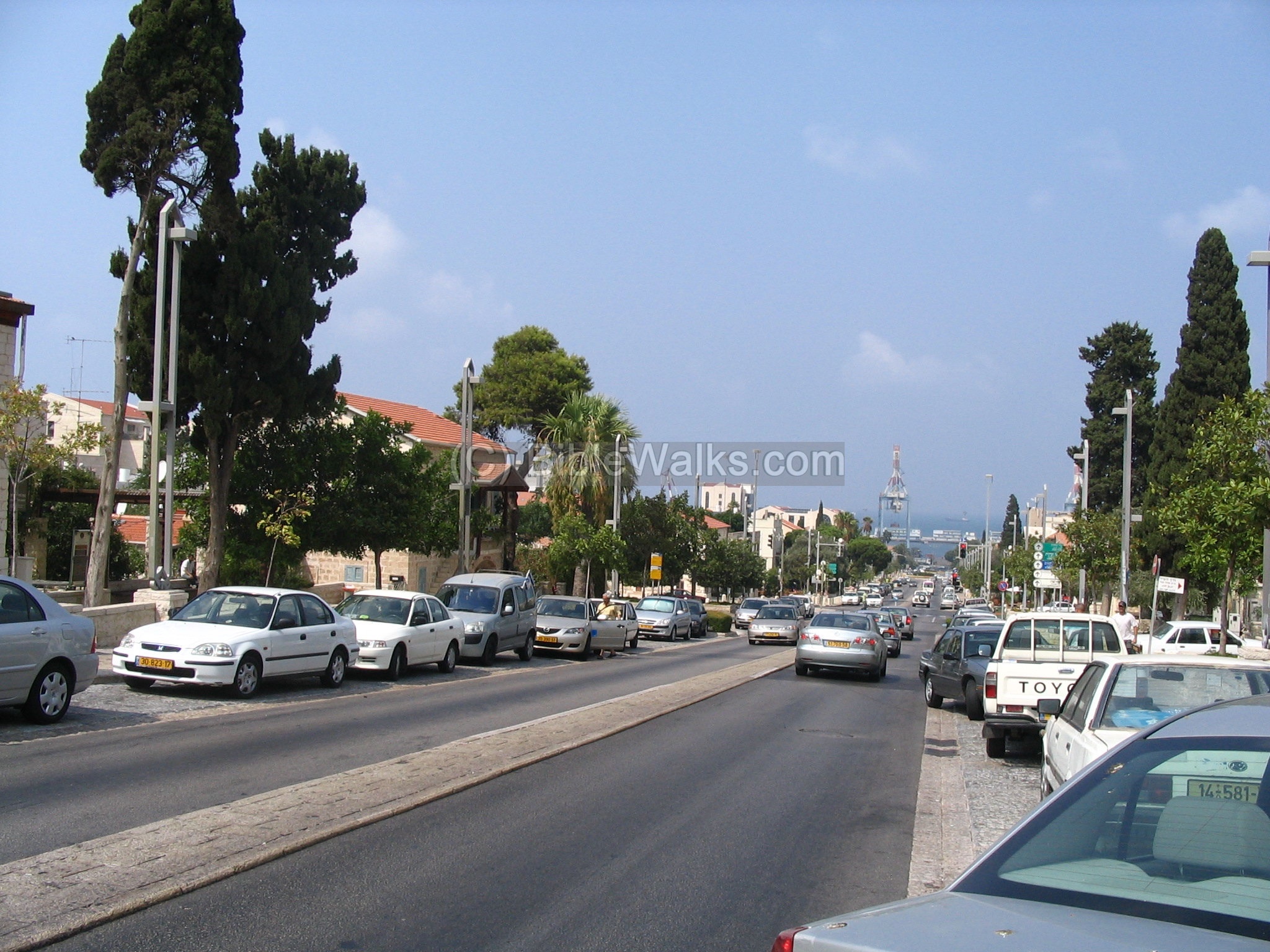
(c) German Colony, Mount Carmel:
Just below the Shrine is the old section of the German Templar Colony. The 150 year-old buildings were one of the first to be built by westerners in the 19th century. The following photo shows the avenue between these houses, and the port of Haifa in the background. In fact, the German settlers built the first port at that area, which was one of the major factors why Haifa started to expand. After the initial success of the port the Ottomans built the Haifa railway to Damascus in Syria (1905). This railway linked Haifa to Syria, Turkey and Arabia, and was another important contribution to the growth of Haifa.
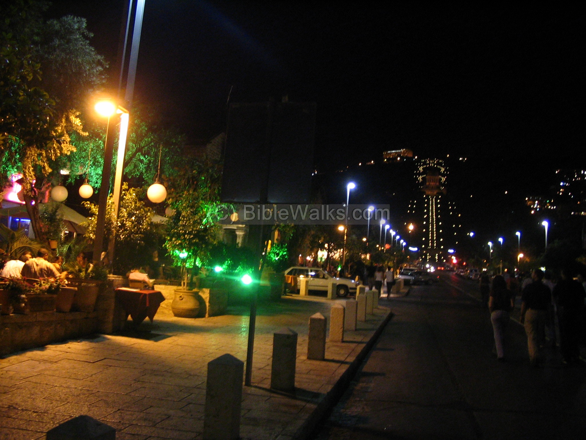
At nights, especially on weekends, the bars and restaurants are a center of nightlife activities in the City. The Bahai gardens are seen in the center background.
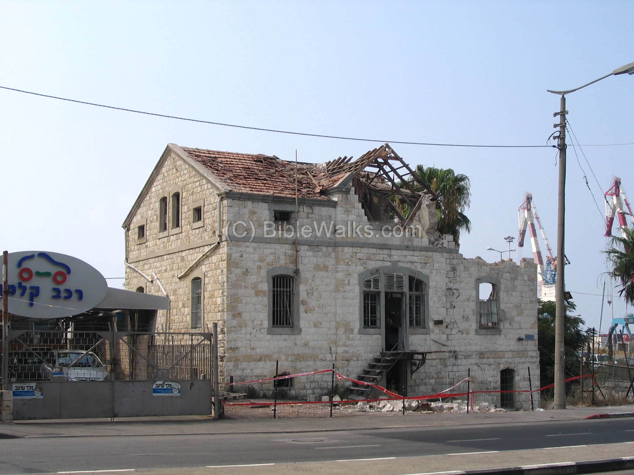
The closest house to the port in the German colony was located on the waterfront, before the area was dried out to build the new port. This house, seen below, was hit by a missile in the latest shelling from Lebanon (Aug 2006). The city was hit in several locations, including the port and the railway. The old house, and the other damaged sites, will hopefully be restored soon.
(d) Tel Shikmona:
There are many ancient sites around Haifa, spanning from Prehistoric sites (like Carmel caves and Oren caves) up to recent years .
One of the ancient sites is Tel Shikmona, another ancient port and city in Haifa, located on the west shore side of Mount Carmel. This site was inhabited starting in the late Bronze age, about 18 century BC. It continued in the Israelite period, the Persian period, a Phoenician port before and during the Hellenistic period, Roman/Byzantine, Arabic, Crusader and Mameluke periods. Shikmona remained in ruins after then, until it was excavated in recent years.
![]() For more information and photos of Shikmona, see a separate page.
For more information and photos of Shikmona, see a separate page.
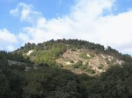
(e) Carmel sites
To see other sites on Mount Carmel, around the city of Haifa, check our gallery of sites on Mount Carmel.
Biblical References:
Luke 3, 1-2
A possible option for the source of the name of Haifa – the name of the High priest at the times of Jesus:
3:1 Now in the fifteenth year of the reign of Tiberius Caesar, Pontius Pilate being governor of Judaea, and Herod being tetrarch of Galilee, and his brother Philip tetrarch of Ituraea and of the region of Trachonitis, and Lysanias the tetrarch of Abilene,
3:2 Annas and Caiaphas being the high priests, the word of God came unto John the son of Zacharias in the wilderness.
Other References:
- Atlas of Haifa and Mount Carmel (1980, ISBN 965-222-003-5) – Prehistory pp 32-49 [A. Ronen & J. Olami). This Atlas is highly recommended as a reference for the history and geography of the city.
Links:
- Bahai Faith web page
- Visit the gardens in Acre & Haifa
- Drone Aerial views – collection of Biblical sites from the air
Etymology (behind the name):
- Haifa – source of the name is not known. It appears first in the 3rd century AD in the Jewish Talmud (Khaifa or Kheifa, as in Arabic). It could be explained by either options:a. In Hebrew: Hof (beach) Yaffe (pretty)b. Chippa (‘covered’ in Hebrew – the Carmel covers the area).
- Haifa – Called by Christians from 13th century AD as: Caiaphas, Chaifa, Caifa and Cayphas. According to the tradition the city was named after the high priest at the times of Jesus (Luke 3, 2).
![]()
BibleWalks.com – walk with us through the sites of the Holy Land
Dor Shore <<<—previous Carmel site—<<<All Sites>>>–-next site –>>> Keren-Carmel
This page was last updated on Apr 1, 2026 (add Abu Hawam)