A small biblical site which is located in the valley of a brook that flows into the Zippori brook. The site was one of Zebulun tribe cities, and located at ancient and modern junction of crossroads.
Home > Sites > Lower Galilee > Yiftach-El (Iphtahel)
Contents:
Background
Location
History
Photos
* The brook
* The site
* Newer site
* Dig 2007
* Flint stone
* Flight over
Biblical
Archaeological
Etymology
Nearby sites
Background:
Khirbet Yitach-El (Iftahel) is the ruins of a small biblical fortified site in the lower Galilee. It is mentioned as one of the cities in the Zebulun tribe region.
Joshua 19: 10,14: “And the third lot came up for the children of Zebulun … and the goings out thereof were at the valley of Iphtahel;”
Location:
The Tel is located near the new “Hasolelim” junction, which is a crossroad of the Acre-Nazareth road (highway #79), road to Jezreel Valley and the road to Tiberias (highway #77). This modern junction is located almost at the same position of the ancient junction of the same roads.
The site is located on the Yitach-El brook, which flows south and into the Zippori (Sepphoris) Brook. The Yitach-El brook drains the Netufa and the Turan vallies. In ancient times the year-round flow of water gave the site a strategic location, in addition to its important location near the crossroads. A spring and several wells are located nearby.
Most of the remains are covered under the field, while a small section is visible in an area covered by the bush and trees adjacent to the brook.
An aerial map of Yiftach-El is shown below, taken in a North-South orientation, and indicating the major points of interest.

History of the place:
-
Prehistory
Along the brook there are many sites, starting from prehistoric times. In almost the whole stretch of the valley you can walk the banks of the brook and pick up early man’s flint stones. They are scattered in many sites, showing that the area was inhabited in the prehistoric periods. According to the Archaeological survey (on the western side of the Zippori brook) most of the prehistoric findings in this area were from the Neolithic period (8,300 -4,500 BC) and Chalcolithic (Copper) period (4,500-3150BC).
-
Biblical
It continued in the bronze age (3150-1200BC), and in the end of this period it may have been Yiftach-El which is referred by Joshua. If you look at the present Tel, it is tiny. However, recent excavations 100-200M away from the center shows that the city was tens times larger at these times and had thousands of residents. The large number of wells in this site, and the fertile fields around it, supported the city. Since it is located on a ancient trade route, connecting Yokneam (and the south of Israel) to Hannathon and beyond, the city was important at the Biblical times.
-
Assyrian destruction
The site continued until the late Israelite period (1000-586BC), and was destroyed (734-732BC) in the intrusion Tiglath-Pileser III (Kings II 15: 29). This intrusion wiped out most of the Galilean sites, as written in the Bible.
Kings II 15: 29: “In the days of Pekah king of Israel came Tiglath-pileser king of Assyria, and took Ijon, and Abel-beth-maacah, and Janoah, and Kedesh, and Hazor, and Gilead, and Galilee, all the land of Naphtali; and he carried them captive to Assyria.”.
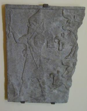
Fragmentary relief slab from Tiglath-Pilesar III palace in Nimrud (744-727BC)
[Istanbul Archaeological museum]
-
Persian – return to Zion
The area of Yiftach-El was repopulated after about 200 years in the 6th century BC (Persian period), in a smaller site which is 200M north of the old site. This was a period when the exiles started to return back to Zion (538-445BC).
-
Roman and Byzantine
After the Hellenistic period, the site was relocated to new sites nearby (such as Mitzpe Zevulun and Shimshit, each about 1KM to the east and south). They survived until the Arab conquest in the 7th century AD. Since then the area fell into total decay, until the establishment of modern Israel.
-
Modern Times
Today the site is covered by tall trees, and is a nice place for a picnic. There are two modern agriculture villages which flank the site on the hills above: Moshav Alon Hagalil (on the western hill) and Kibbutz Hasolelim (on the eastern hill).
Photos:
(a) The brook:
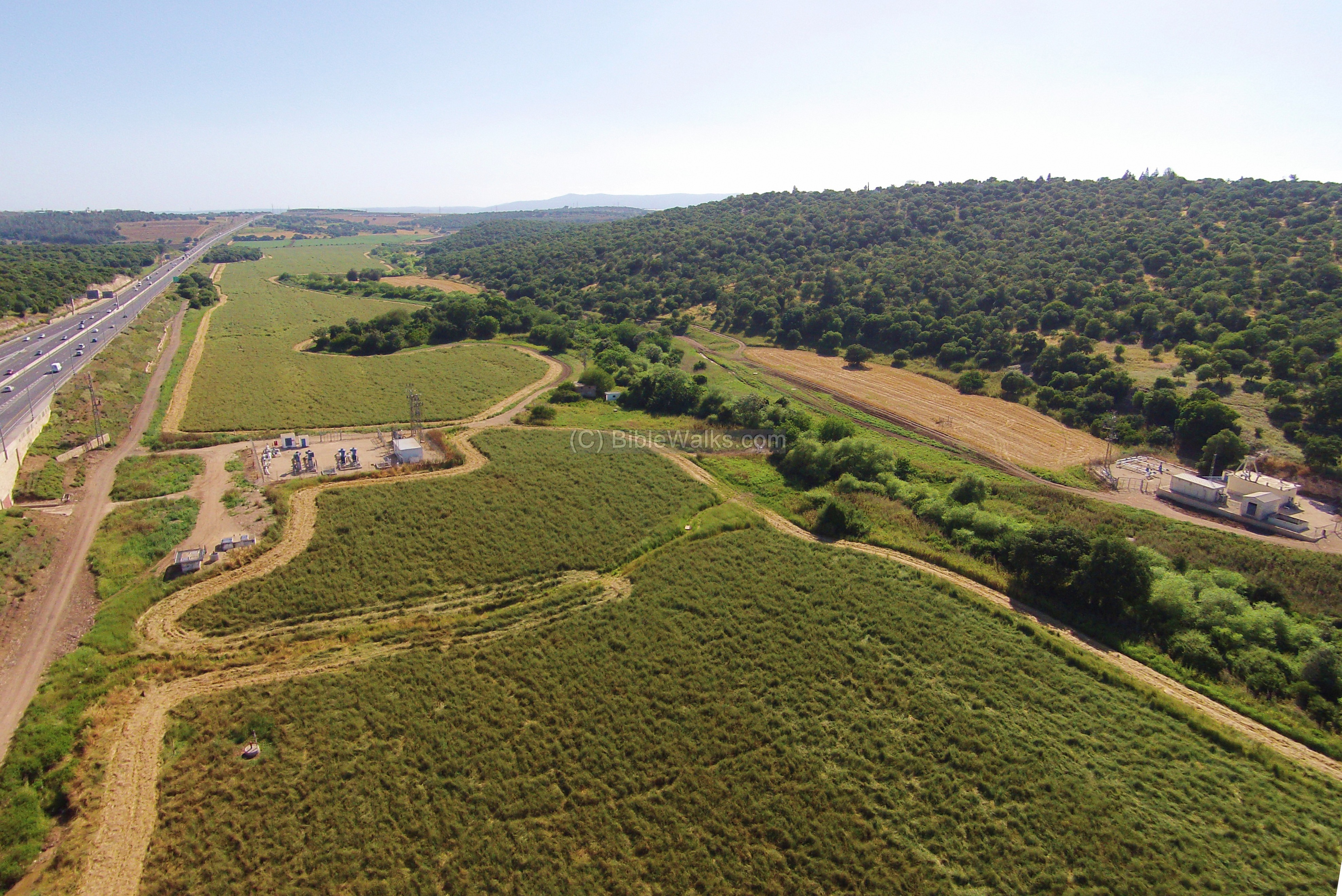
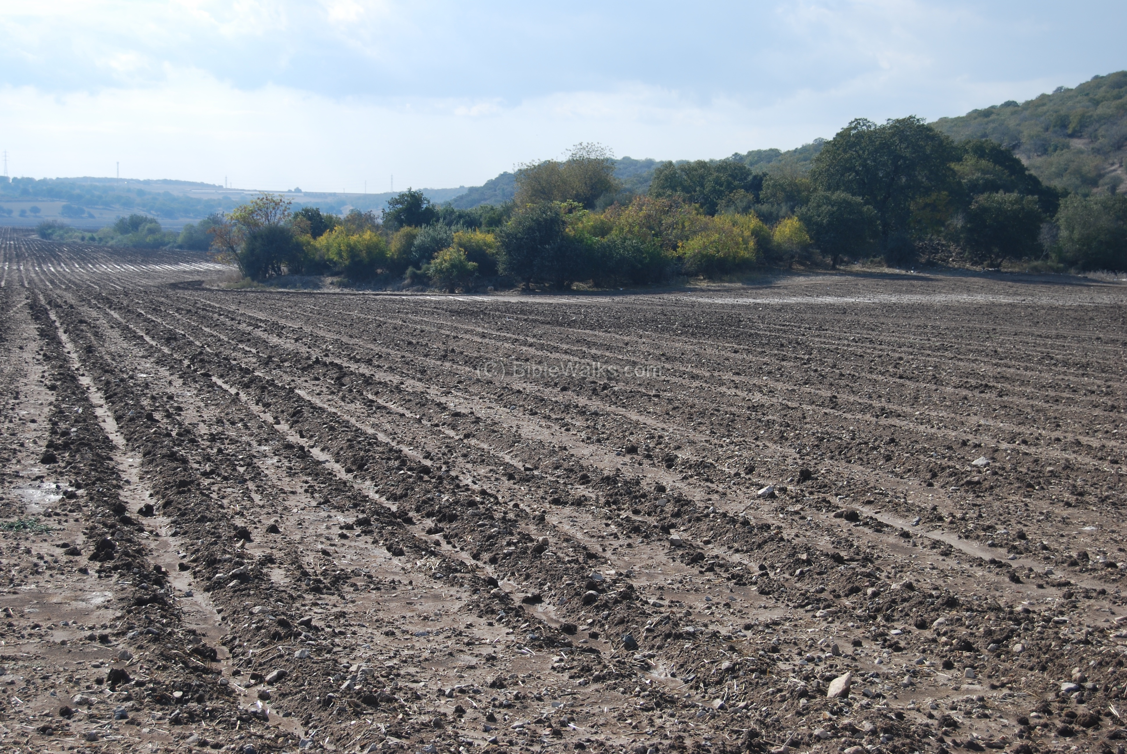
An aerial view of the site was captured from the north side by a quad copter drone. Highway #77 is on the left side, while the Yiftach-El brook is on the right side, flowing to the south into the Zippori brook towards the far background.
The ancient city is actually covered by this large green field. During the Bronze Age its structures were spread out to the east of the brook. A small section of its “upper city”, which is the only visible ruins today, is located in the group of trees behind the modern water pump.
Click on the photo to view it in higher resolution…
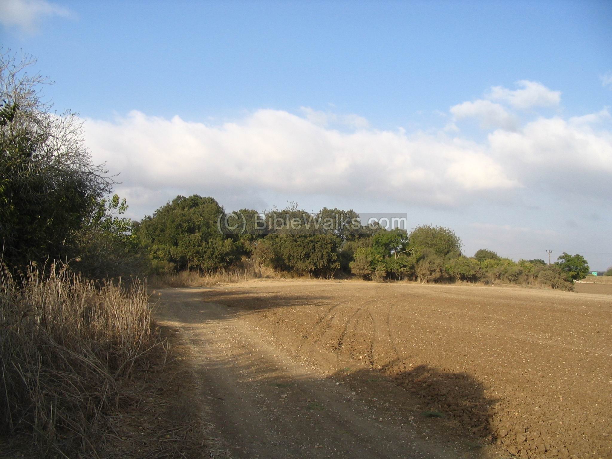
The next photo is a ground view from the south on the visual ruins of the site, which is in the center (covered by tall trees). The brook is located on the left, and flows north to south.
This is the Yiftach-El brook, which is heavily covered by bushes and trees.
A short distance after the site is an opening in the brook, and you can easily cross it.
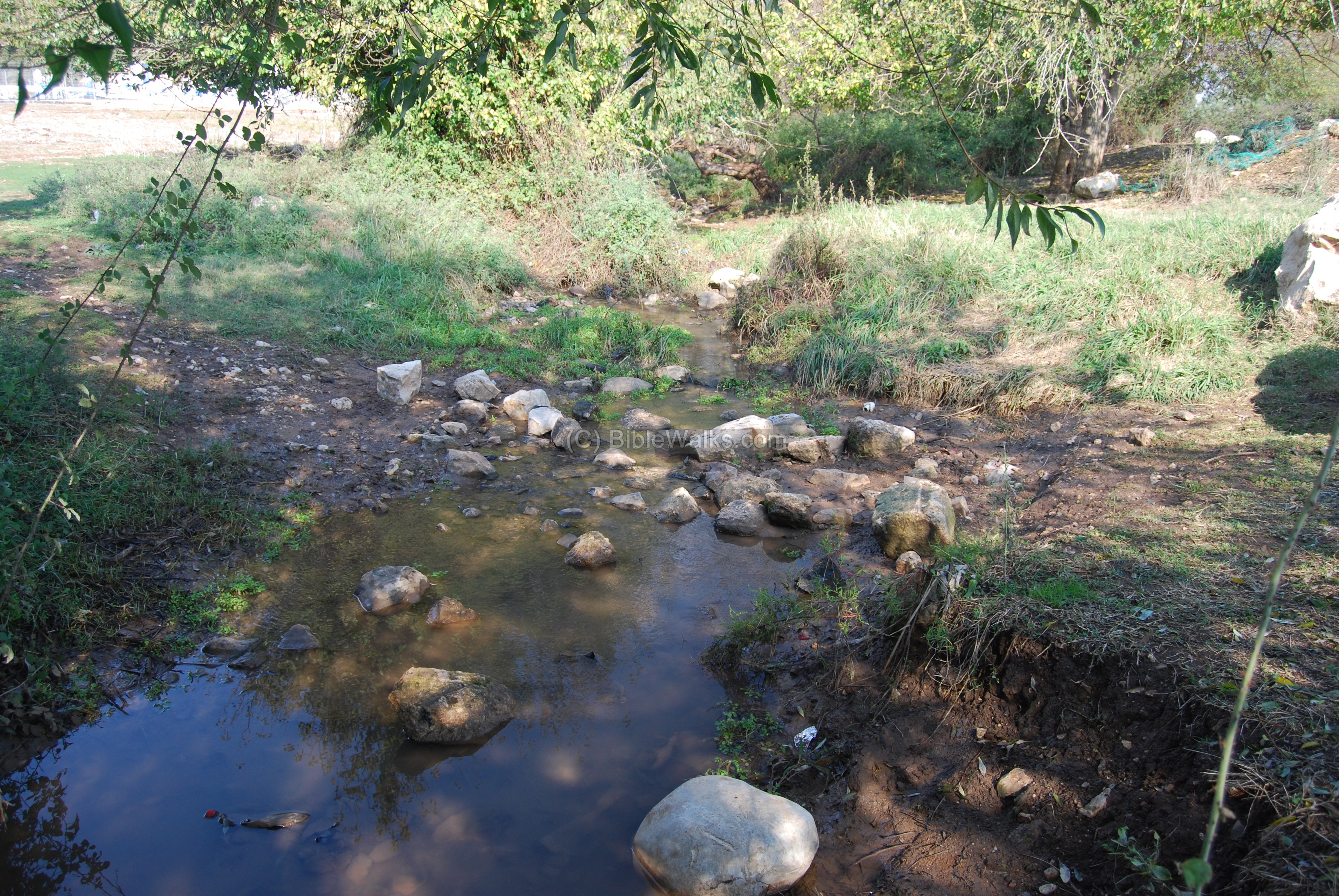
Closer to the bridge of highway #79 is another section of the brook.

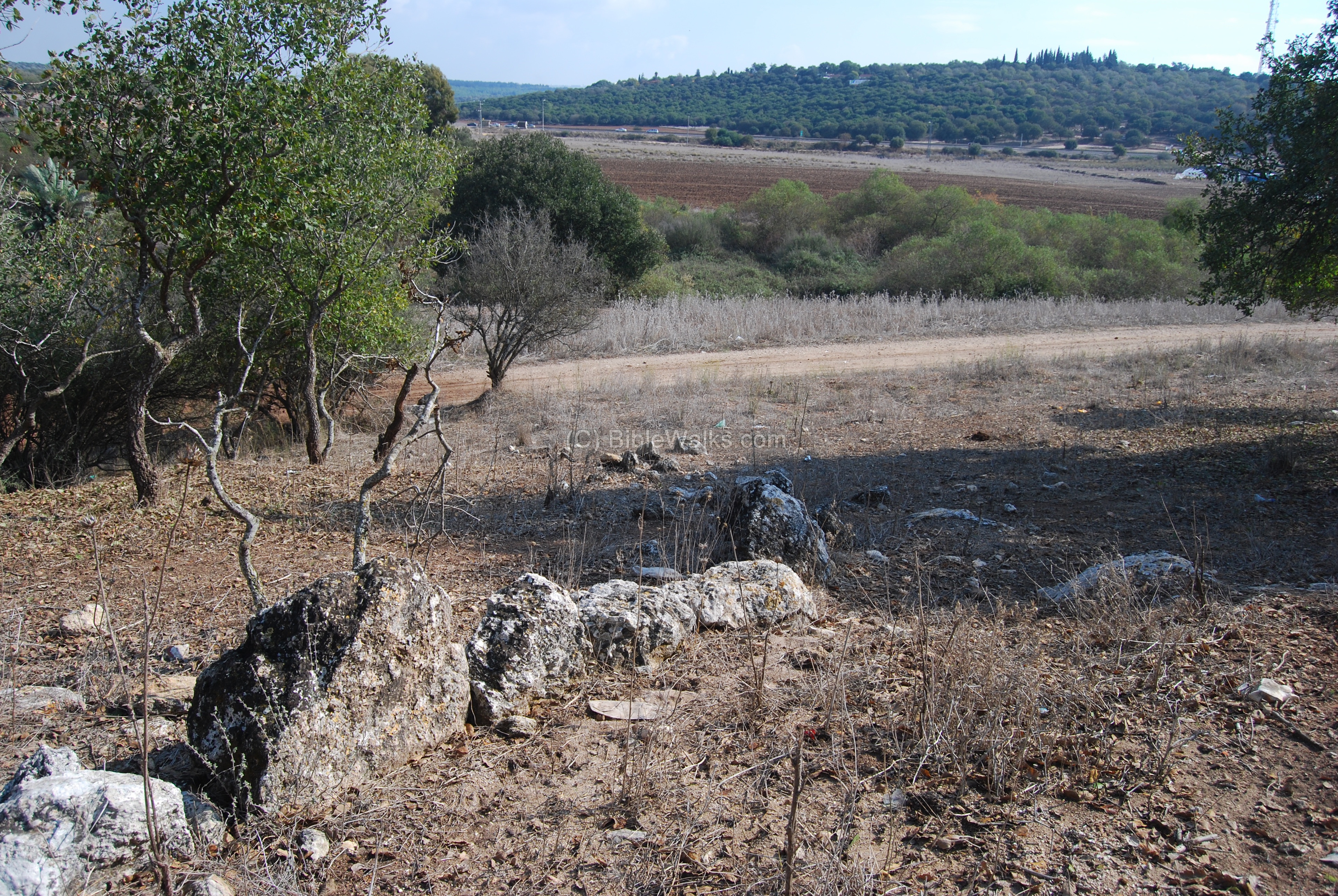
(b) The site – Bronze and Iron (Israelite) periods:
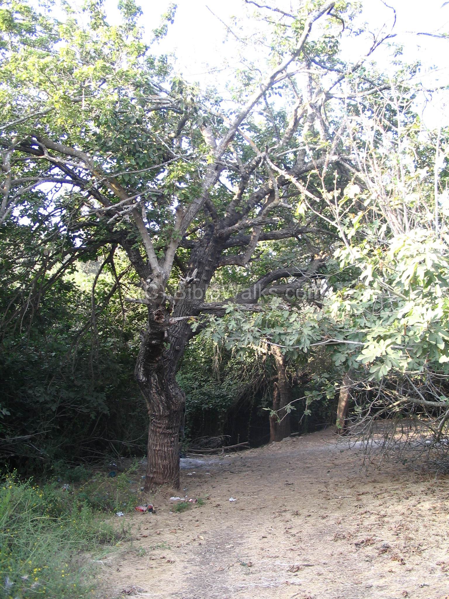
A view of the site from the north side. In the background is the valley of Sepphoris (Zippori).
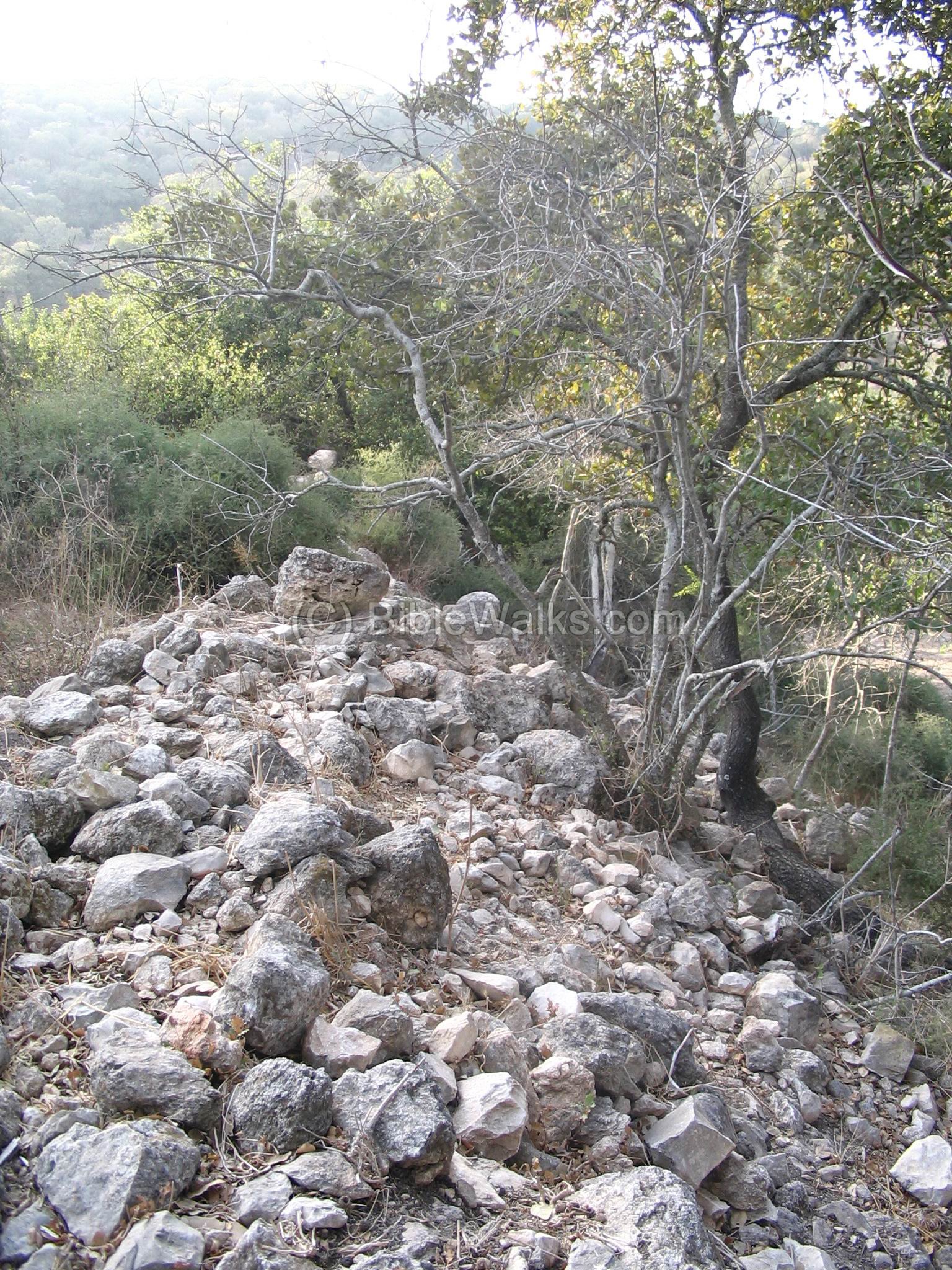
On top and sides of the the site are ruins of the ancient city walls. This may have been the “upper city” where the King resided, and the area around this small hill (now several meters under the fields around it) was populated by dozens of lower buildings.
Another view of the Bronze age (Canaanite) and the Iron age (Israelite) walls. You can tell according to the roughly cut stones that they are before the later Roman and Hellenistic periods, when the quality of stone cutting produced rectangular building blocks.
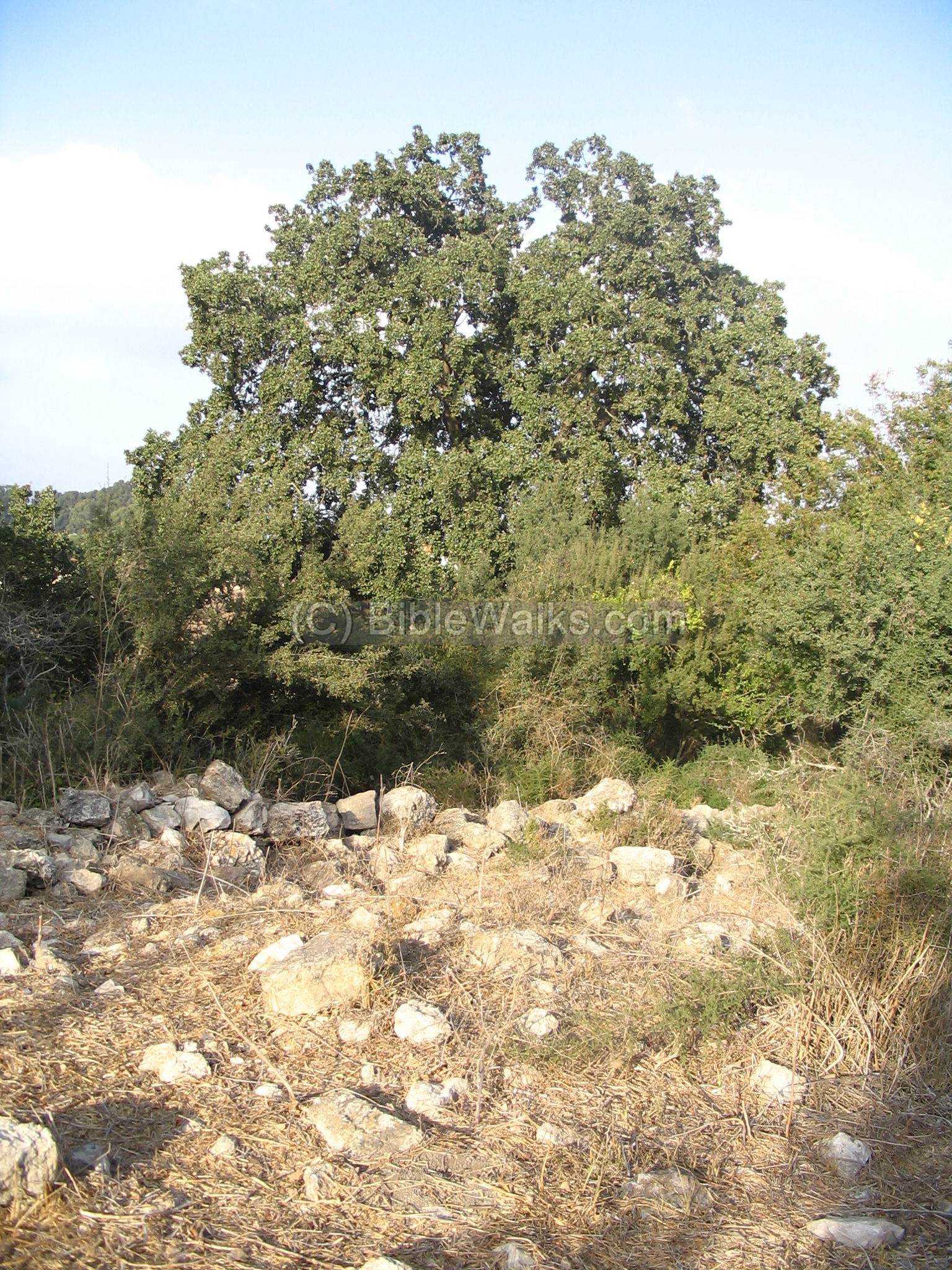
(c) The newer site – Persian period:
About 200M to the north of the site, a newer site (6th century BC) was built on the slopes of the hill. On the right side you can see a modern well. On the top left side (hidden) is the modern agriculture village of Alon Hagalil, which is located above (west) to Khirbet Yiftach-El.

A view from the foothills, towards east. In the foreground are some of the remains of the Persian period site.
(d) Digs 2007/2008:
Due to a new major intersection (Hamovil) that is built north-east to the Tel, the Israeli Antiquities Authority (IAA) held emergency excavations in the area close to Highway #77. The photo below shows one area which is on the west side of the existing road.
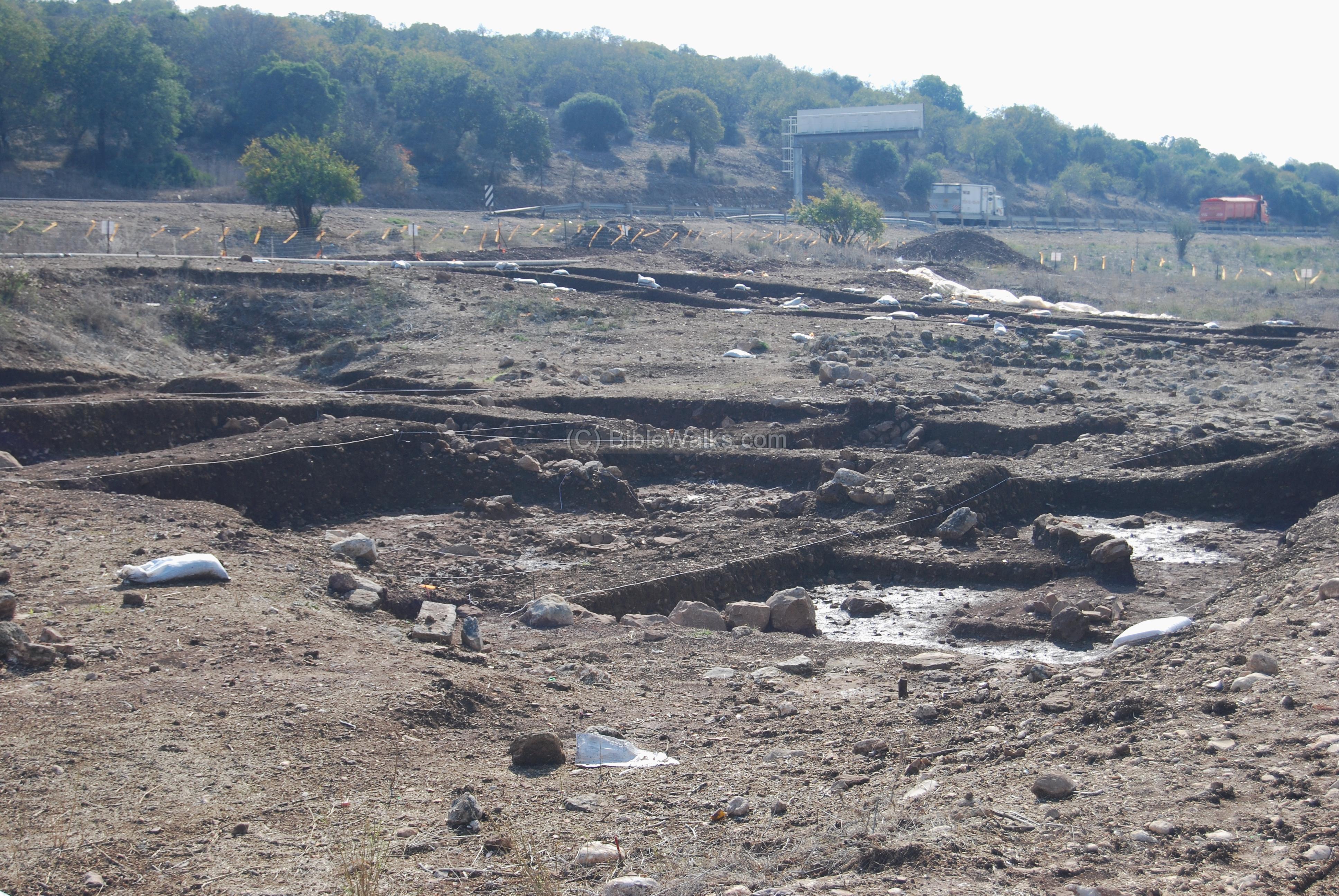
A large number of square pits were dug (60), revealing findings from the Neolithic and early Bronze periods. Therefore, the small Tel that is located near the brook (seen on the left background) was only a part of a larger city.
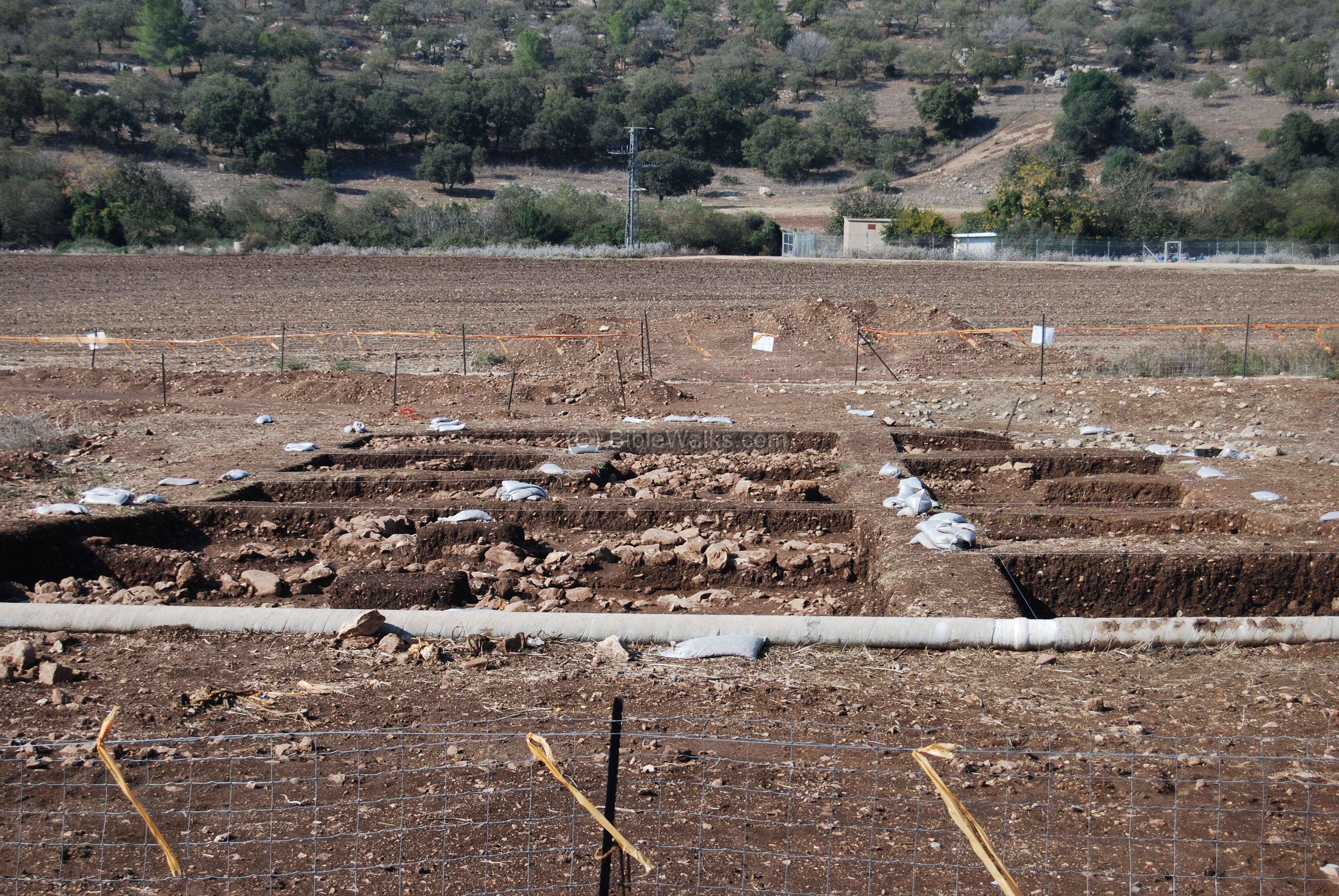
For more info, see IAA dig permit. We hope to publish information on this after obtaining a permit.
(e) Flint Stones:
The valley around the site of Yiftach-El was inhabited for thousands of years. Along the brook you can see many flint stone fragments, and prehistoric tools. They are dated to Neolithic period to the Bronze period (8,300 BC –1200BC). For example, a flint scraper that we saw near the west side of the brook – is seen “in situ” in the center of the following photo, with other flint chips around it.

(f) Flight over the site:
![]() An drone flight over the site can be seen in the following Youtube video.
An drone flight over the site can be seen in the following Youtube video.
Biblical References:
Joshua 19: 10,14
This text described the borders of the Tribe of Zebulun (Zevulun), which included the valley of Yiftach-El (Iphtahel).
“And the third lot came up for the children of Zebulun according to their families; and the border of their inheritance was unto Sarid…And the border turned about it on the north to Hannathon; and the goings out thereof were at the valley of Iphtahel;”
Kings II 15: 29
This text describes one of the most tragic intrusions in the history of the Galilee. In 734-732BC the Assyrian King invaded Israel and caused major damages, which (according to the article below) caused the area to be deserted for almost 200 years.
“In the days of Pekah king of Israel came Tiglathpileser king of Assyria, and took Ijon, and Abelbethmaachah, and Janoah, and Kedesh, and Hazor, and Gilead, and Galilee, all the land of Naphtali, and carried them captive to Assyria.”
Etymology (behind the name):
-
Iftach – in modern Hebrew means ” will open”. In the old testament it actually referred to opening the earth, as in plowing.
In Ishaiah 28: 24 the word “Yiftach” is in the Hebrew text, “open” in the KJV text: “Doth the plowman plow all day to sow? doth he open and break the clods of his ground?”.
-
El – God.
-
Therefore, “Yitach-El” means “God will plow”.
Archaeological References:
-
Lower Galilee in 8th to 6th C BC Israel Antiquities (article in Hebrew); includes a history of lower Galilee and recent surveys of the area
-
Israeli Antiquities Authority Digs archives (in Hebrew) – emergency excavations in 2004/2005, on the western side of the site and the brook’s bank, revealed levels from the early Bronze period I and pits from the late Iron age III.
-
IAA dig permit Season 2007/2008
-
IAA 2008: “A 9,000 Year Old Hoard of Flint Blades was Exposed at the Movil Junction”
-
Extraordinary Skulls found in digs (8/2008)
-
Yiftah’El Preliminary report (2007/2008)
-
Yiftah’el Preliminary report (2009) HadashotArkheologiyot 128 2016
-
Gai Yiftachel – border between Asher and Zebulun (Hebrew; pdf)
Nearby Sites:
-
Hannathon – a site from the same period, and probably was the mother city of Yiftach-El
You can also learn about the story of a Tel in our info page.
* Other links:
Drone Aerial views – collection of Biblical sites from the air
BibleWalks.com – walk with us through the sites of the Holy Land
Hannathon <<<—previous site—<<<All Sites>>>—next lower Galilee site—>>> Sepphoris
This page was last updated on Mar 17, 2017 (Added excavation report)
Sponsored links: