Impressive ruins of a Nabatean, Roman and Byzantine city in the Negev desert. A UNESCO world heritage site.
Home > Sites > Negev > Shivta (Shivtta, Subeitta, Sobeita, Sobota)
Contents:
Background
Location
History
Plan
Photos
* Western Gate
* Western street
* South qrtr
* Pools
* South Church
* Mosque
* Governor
* Central Church
* Panorama
* Eastern Street
* North Plaza
* North Church
* Video
* North side
* Colt expedition
Etymology
Links
Overview:
The impressive ruins of Shivta in the Negev desert date to the Nabatean, Roman and Byzantine periods. Shivta (Sobota) is one of the largest Nabatean settlements in the Negev, and recognized as a UNESCO world heritage place. Here, in the middle of a dry desert, the ancient builders of the city transformed the desert into an oasis. Although it is located at a remote location – far from the famous Holy Land tourist attractions – it is a unique, well preserved and remarkable city. This desert jewel indeed deserves a special detour, and is highly recommended to witness the amazing accomplishments of its settlers.
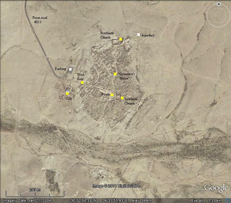
Location and aerial map:
The ruins of Shivta (Shivtta) are located 43 km southwest of the city of Beer Sheba, in the middle section of the Negev desert, at a height of 340m above sea level. The area around it is crossed by many dry riverbeds (wadis) that flow into Nahal Lavan, which flows westwards into Wadi el Arish.
The aerial map shows the extent of the ruins, covering an area of roughly 300m by 500m.
History:
- Early Roman period (1st century BC – 1st century AD)
The city was first settled by the Nabateans during the early Roman period (1st century BC to 1st century AD). It was established on the side of the trade route called the Incense & Spice route.
This route connected the east (Yemen and Oman), through Arabia, via the Nabatean capital city Petra, to the port cities on the shore of the Mediterranean Sea – Gaza, Raphia, Rhinocorura (al Arish). The road was used by the Nabateans to export the incense and spices from southern Arabia and the Far east to the Classic world of Greece and Rome. In order to support & protect the Incense route, the Nabateans established stations and fortresses along the road.

Caravans crossing the desert – AI Illustration by DALL-E 2
The Incense route declined at the end of the 1st century AD, since it was replaced by other routes through the Roman empire.
The Biblical map below shows the path of the Incense route, with the Nabatean cities marked with a red star. Shivta is located between Avdat (Obobda) and Nessana (Nitzana). The other large Nabatean cities in the Negev desert were Haluza (Elusa), Rehovot and Mamshit.

Map of the ancient cities along the Incense/Spice route – during the Nabatean and Roman/Byzantine periods (based on Bible Mapper 3.0)
- Roman Annexation (106AD)
In 106AD the Romans annexed the Nabatean Kingdom, and Shivta and other Nabatean cities became part of the Roman empire. This was a turning point in the history of the Nabateans.
The Nabateans gradually switched to the development of desert agriculture and providing support to the Roman army and travelers along the desert roads.
At Shivta there were no significant Roman presence. The town was not fortified, nor was there any garrison stationed in the city.
- Byzantine period (4th – 7th century AD)
The Nabateans converted to Christianity starting at the 4th century AD. Three churches were built in the city, as well as other public structures, water systems and hundreds of houses. It became a center of Christian pilgrimage and scholarship.
The city continued to develop and grow on the basis of the desert farming. The residents of the city, with a population of 2,000, offered services to the great number of pilgrims who passed through the city, or came to worship at saints’ relics in the churches of the city.
The Byzantine empire encouraged the development of the border cities such as Shivta by financing public projects and roads, reducing taxes and relocating population from the north.
- Decline during the Muslim period ( 7th century AD)
An evidence of the Muslim conquest is found in the form of a mosque, located on the side of the southern church. According to a prominent excavator and expert on Nabatean culture and cities, Prof A. Negev, the construction of the mosque was carried out with care not to damage the church’s baptistery, and so it seems that both communities of Christians majority and the Muslim minority lived peacefully together.
After the Muslim conquest the city gradually declined. The sources of income (farming and pilgrimage services) started to dry out. The residents gradually deserted their homes, and the city was totally abandoned in the 9th C. The city remained in ruins until the 20th century.
- Rediscovery (20th century)
Most of the stones were left intact in the ruins of the city. This is an archaeologist’s dream – finding an ancient city in a state as it was during the ancient times. The site was first reported in 1805 by the German traveler Ulrich J. Seetzen. In 1870 it was described and sketched by Edward H. Palmer, a British-born Arabic linguist as part of the Palestine Exploration Fund (PEF) survey. In 1901 the Czech explorer Alois Musil made another visit to the site and reported his findings. In 1904 Dominican monks studied the cemetery and the south church. The ruins were first scientifically researched in 1914 for the PEF survey by T. E. Lawrence (Lawrence of Arabia) and C. L. Woolley (archaeologist).
An extensive excavation was led by the archaeologist Dunscombe Colt (1933-1938). The team’s headquarter serves today as a desert inn on the western side of the city.
Further excavations and studies were conducted or published by teams headed by M. Avi-Yonah(1958-9), R. Rosenthal (1970s), and S. Margalit, A. Segal, A. Negev (1981), T. Tsuk and Y. Hirschfeld(2000).
- National Park and UNESCO heritage site
The site became a UNESCO World heritage site in 2005, and was listed together the Nabatean towns of Haluza, Mamshit and Avdat, along with Incense route, its associated fortresses and agricultural landscapes in the Negev Desert. Today it is a well preserved national park, and although it is located in a remote site, we highly recommend to visit there and admire how the ancient people turned the desert into an oasis.
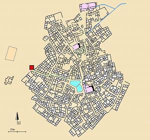
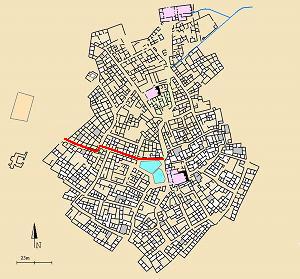
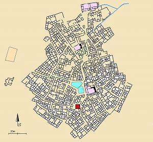
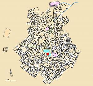
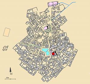
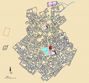
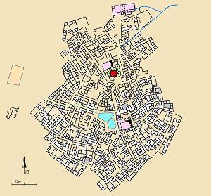
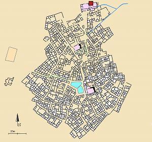
City Plan:
A reconstructed plan of the ancient city is seen in the diagram below, based on the excavations’ maps. A number of points of interest are indicated on the map. The three churches are colored in pink, and the double pools in light blue.
The visitors’ parking are is located on the west side of the ruins.
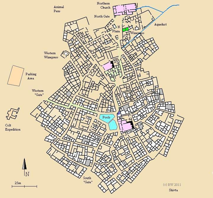
Each of the points of interest, which are detailed in the photos section, will have a small scale version of this map with a red location mark.
Photos:
The photos section is ordered according to the recommended walking route.
(a) Western “Gate”
Shivta was not protected by a wall or fortifications, which is unique among the desert cities. However, the houses along the external side of the city were built in a continuous wall-like line. The example below of the western side of the city shows that the external side of the houses are aligned along a straight line.
Click on the photos to view in higher resolution…
One of the the western entrances to the city is located closer to the parking place. Its location is indicated on the plan of the city as a red square.
The entrance to the western street is seen in the picture below. As seen here, there is actually no gate, and the street opens up directly from the outer line of the external walls. This is one of the 12 openings in the external circumference of the city.
One of the well preserved houses on the entrance to the street serves as an office for the park, and is shown below.
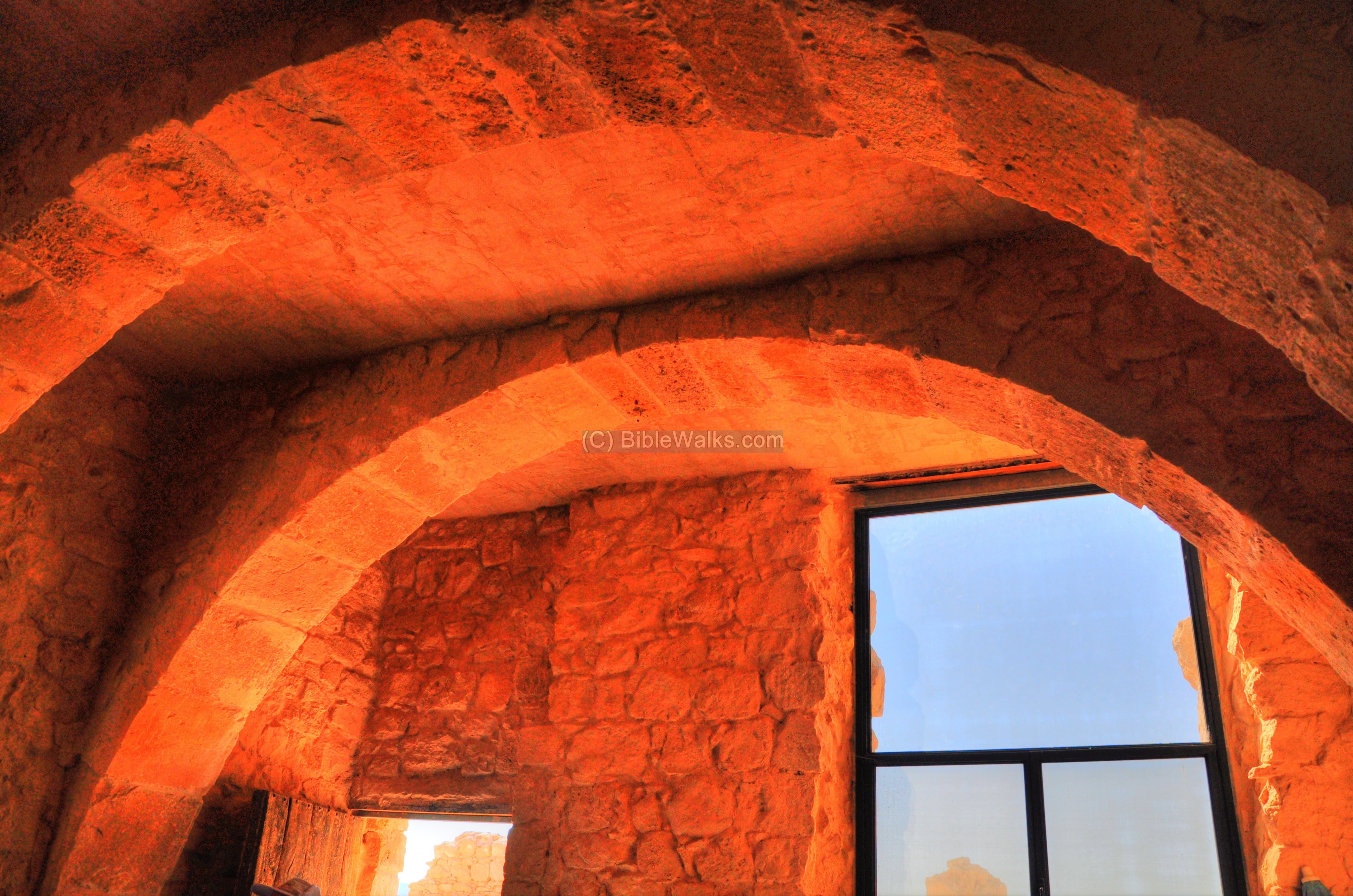
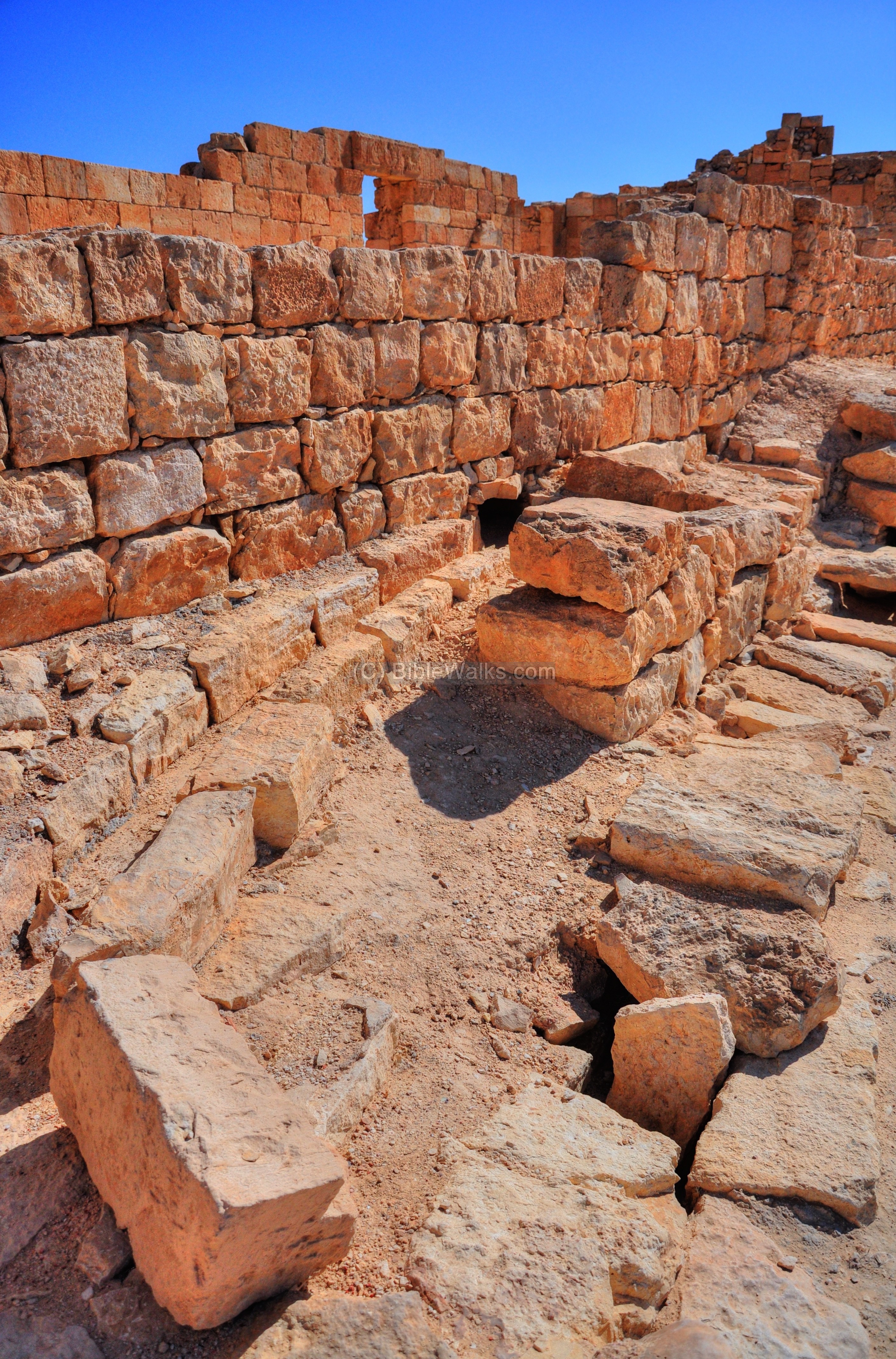
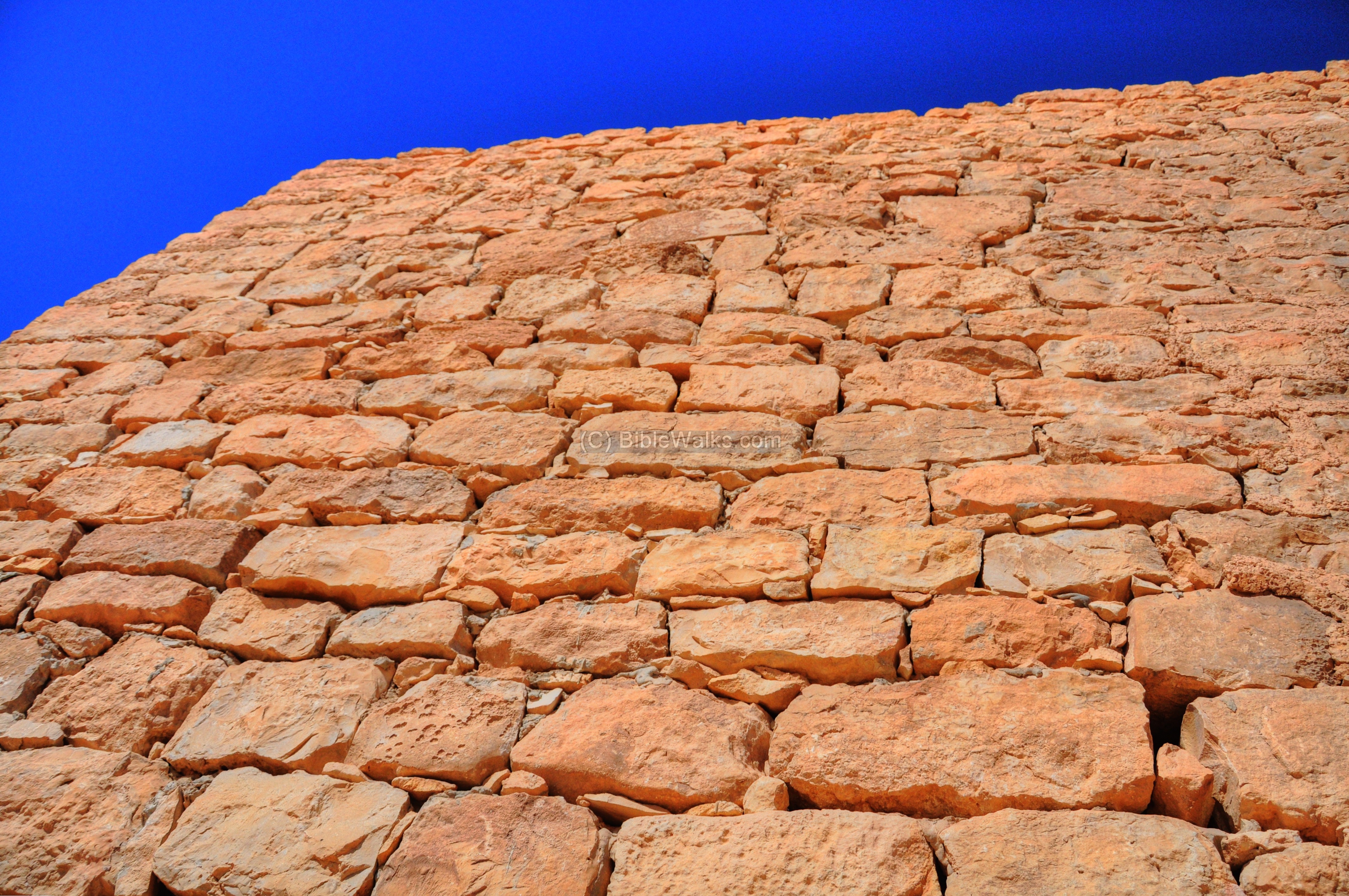
The Shivta houses were 2 or 3 level buildings, made of stone without cement. The walls were composed of three types of stones: The lower level of the exterior side of the wall is based on larger, roughly square hewn undressed hard limestone blocks; The middle level of the wall had smaller smoothed and dressed medium-hard stones; The upper level and roof was usually a soft, lighter chalk. No wooden beams were used in these private structures, except for the churches.
The cracks between the stones were filled by sand with gravel.
The interior side of the walls was made of two additional layers – a thin layer of stone and a thin layer of plaster (see illustration ).
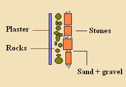
The advantage of such stone walls is that it keeps the house cold during the heat of the day, and warm during the cold desert nights.
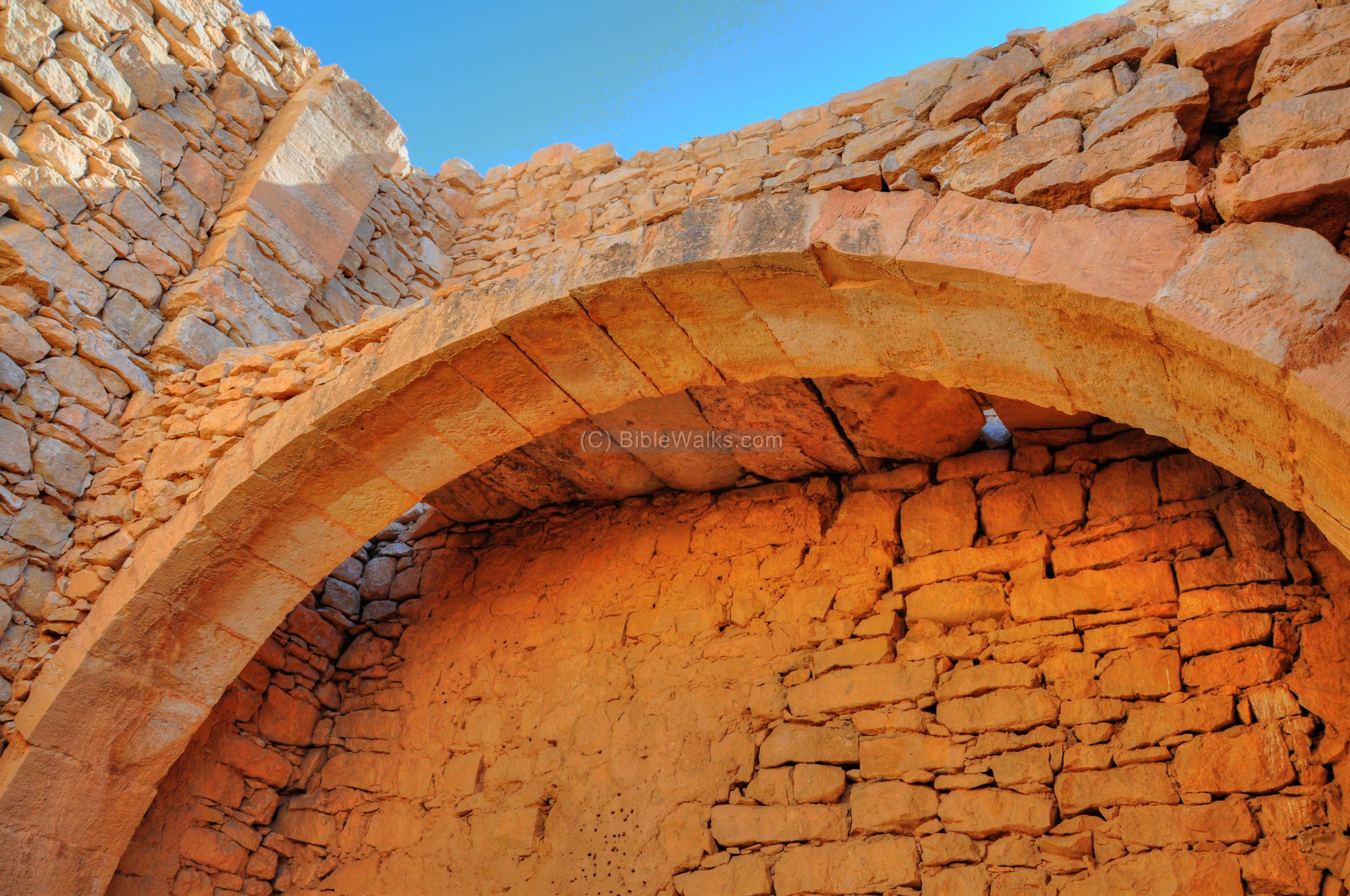
The interior of the house is shown below. It is a two level structure, with the second level supported by arches. Each arch is about 60cm wide, with a 1m separation between each arch. The roof was laid over the arches using long thick beams of cover-stones.
The original windows were not based on glass, but were with narrow slots that entered light but shielded against the heat and dust. On the door was a vertical blind to keep the flies away.
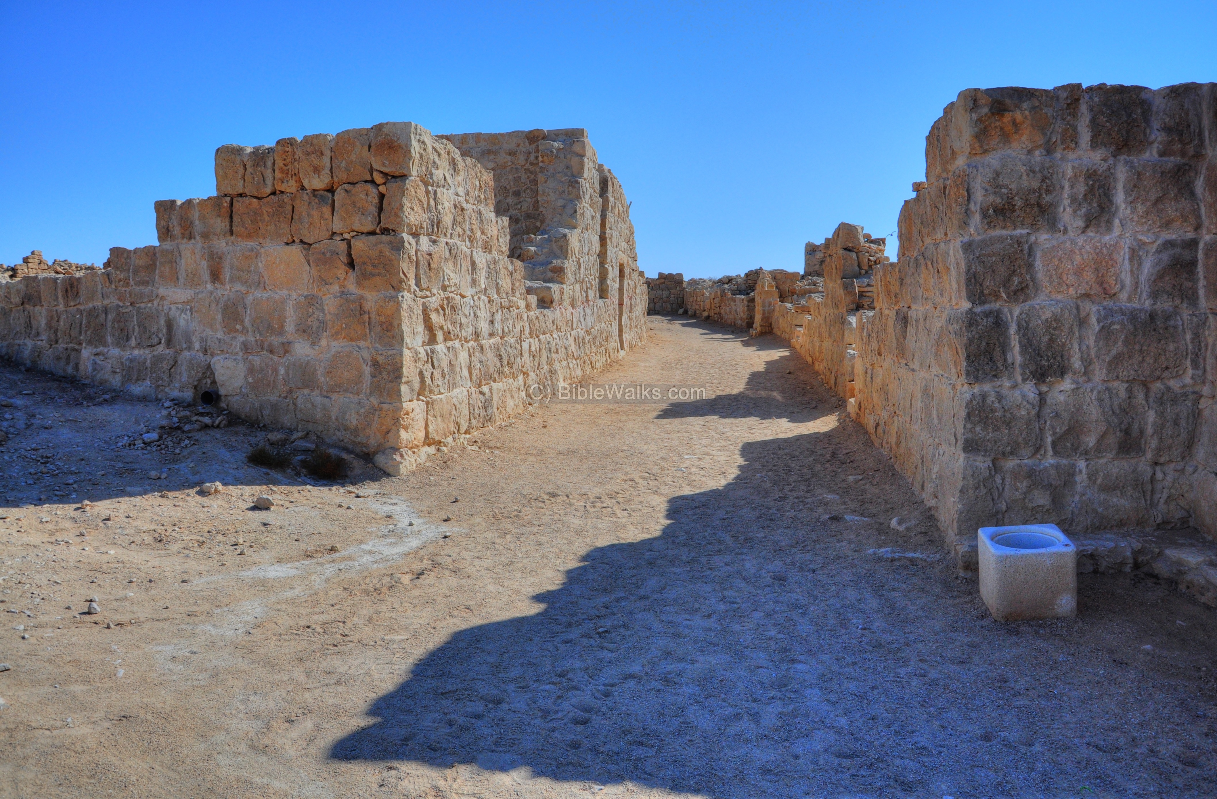
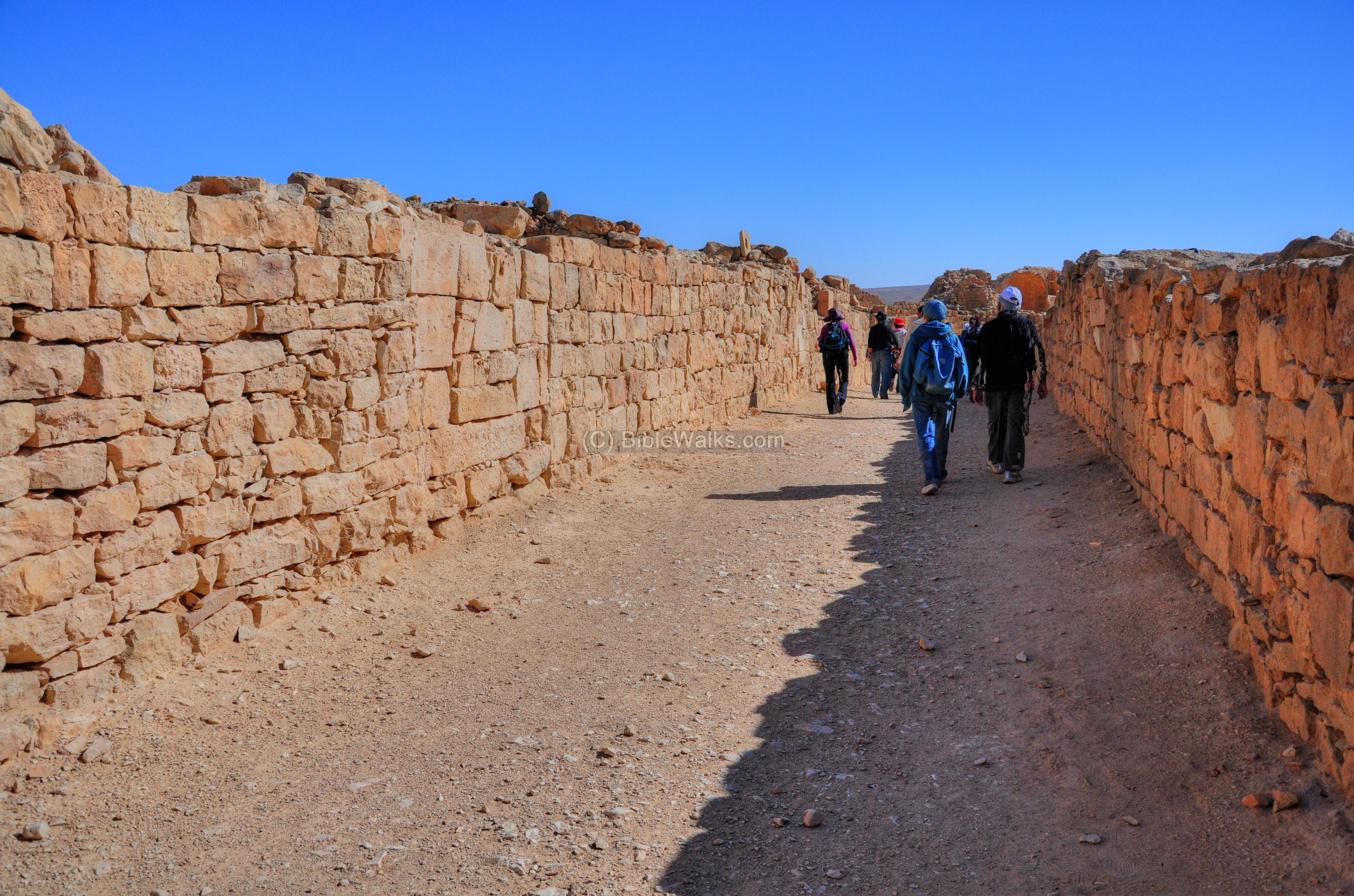
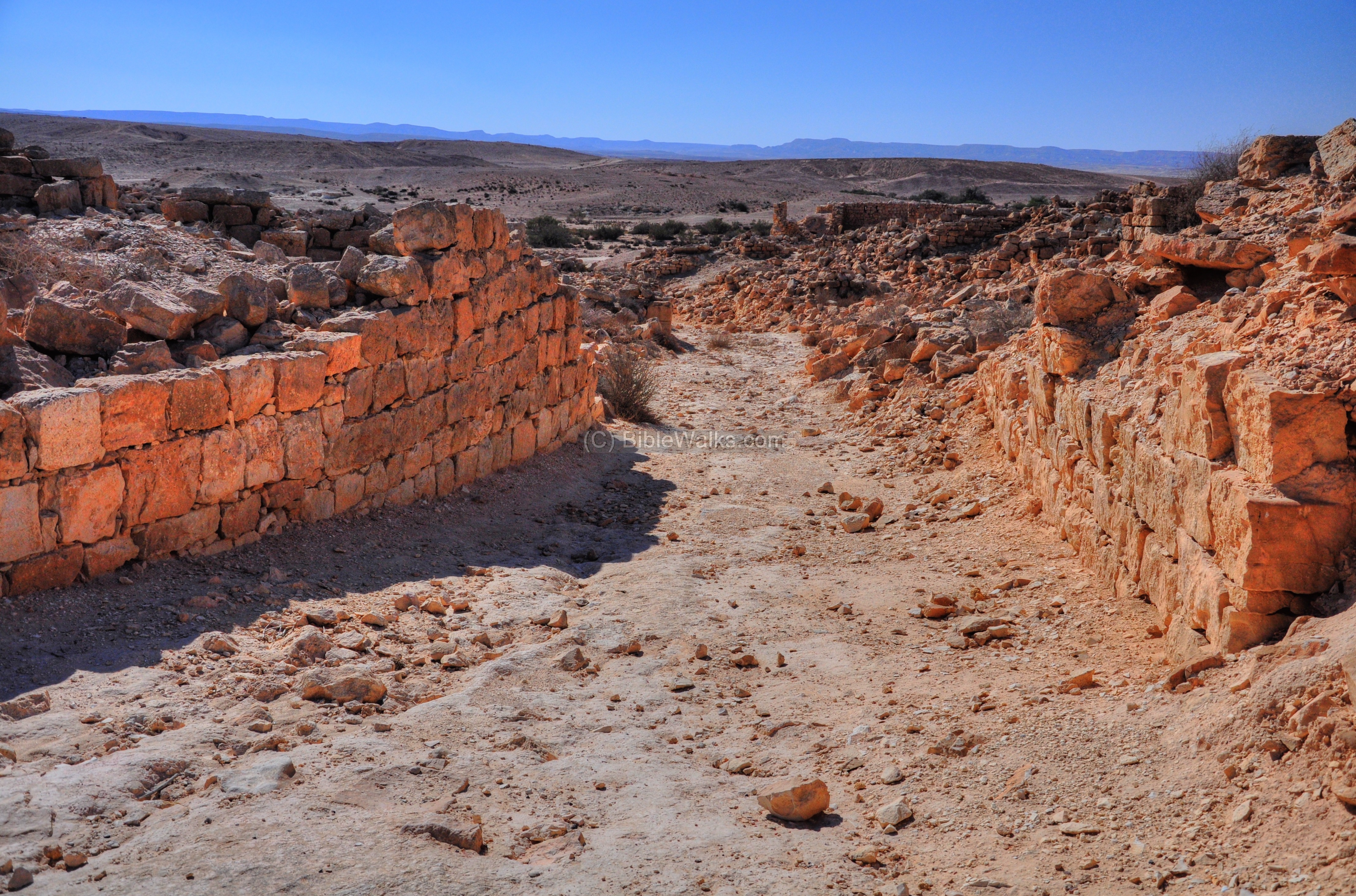
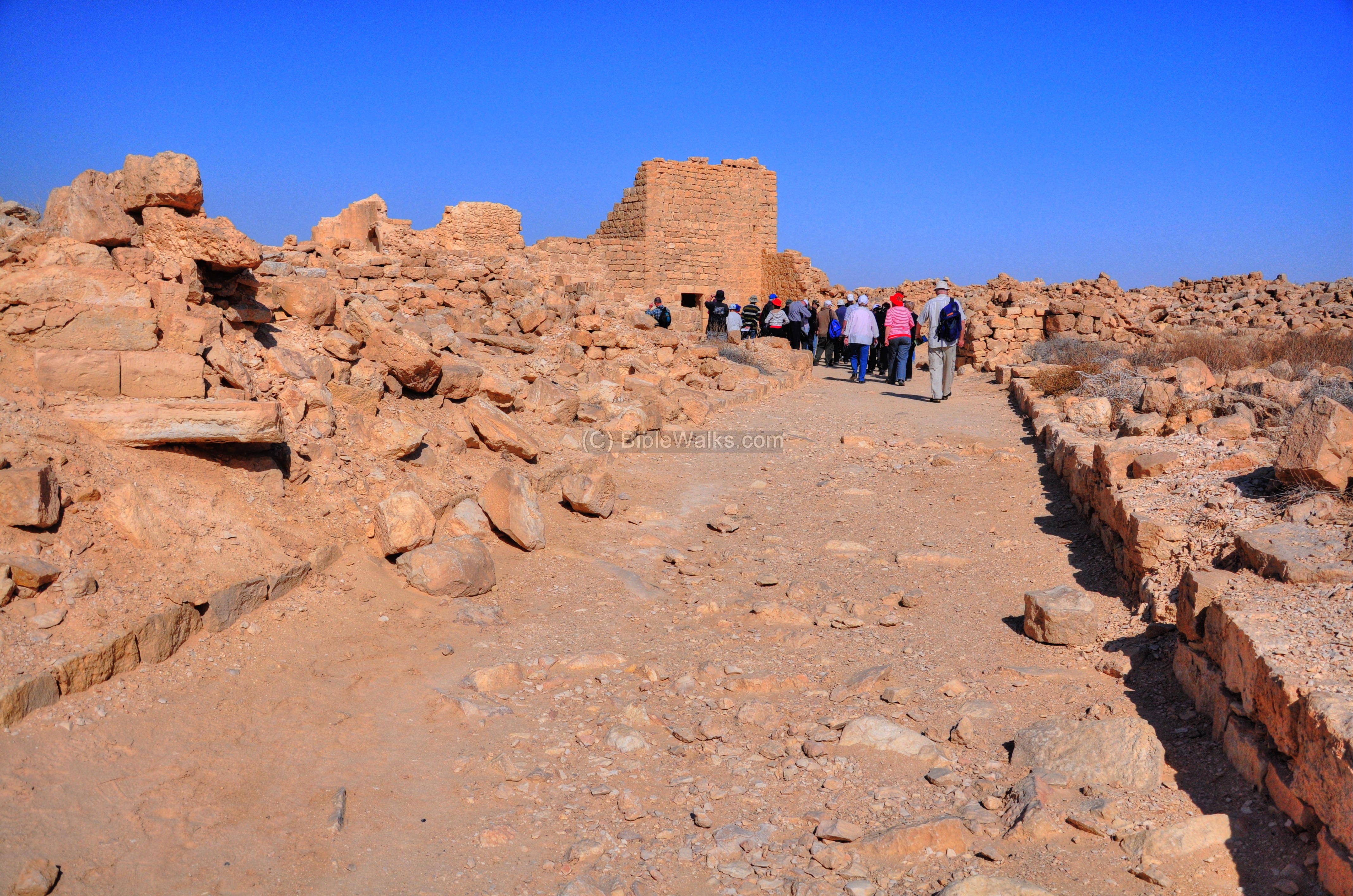
(b) Along the western street
The recommended walking path is from the western “gate”, along the western street, towards the pools and the southern church. Then, walk up through the “Governor’s house” to the Northern Church.
The western street starts from the western “gate” and continues all the way to the Southern church .
Its location is indicated on the plan of the city as a red line.
In the picture below, the tour guide explains to the group about the history and plan of the city.

The following picture is a view towards the western entrance. This is where the tour starts.
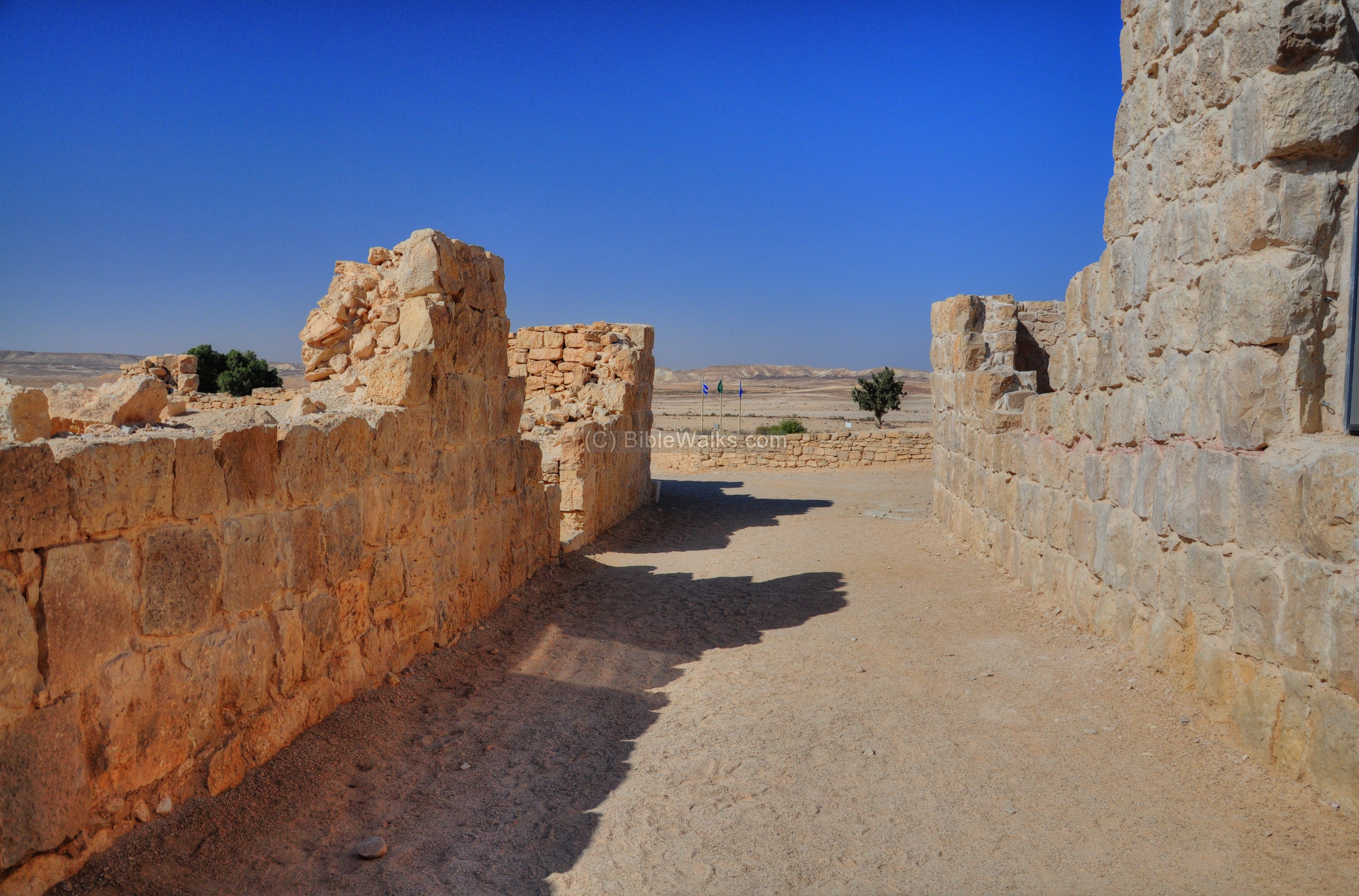
The street is well preserved, with most of the walls and entrances to the houses on both sides standing as they were about 1,200 years ago. Indeed, this visit is like a time machine.
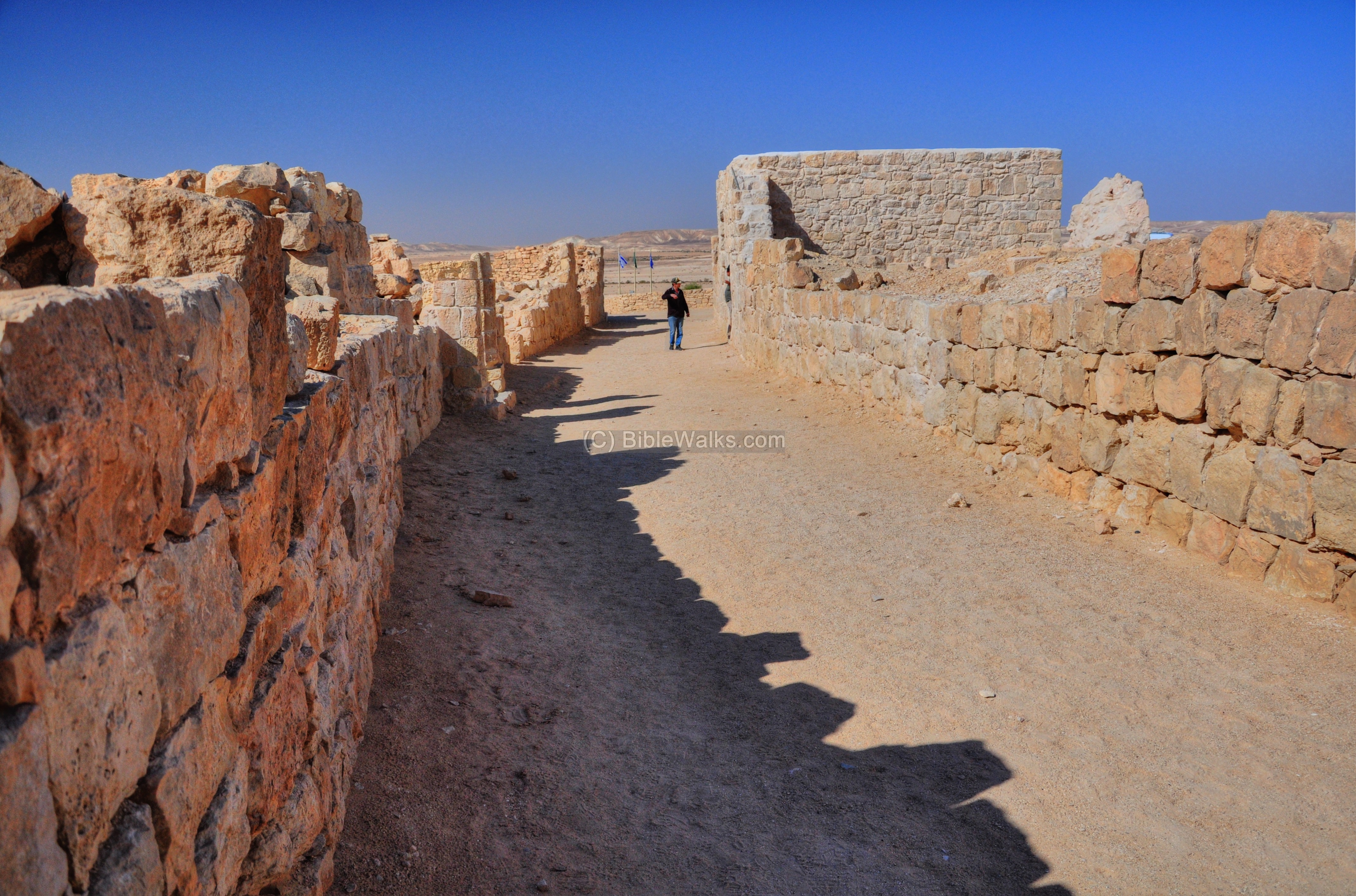
A view towards the east side of the street is in the next photograph:
One of the entrances to a residential house is seen below:
Windows are embedded in the wall:
Another scene of a junction of two streets:

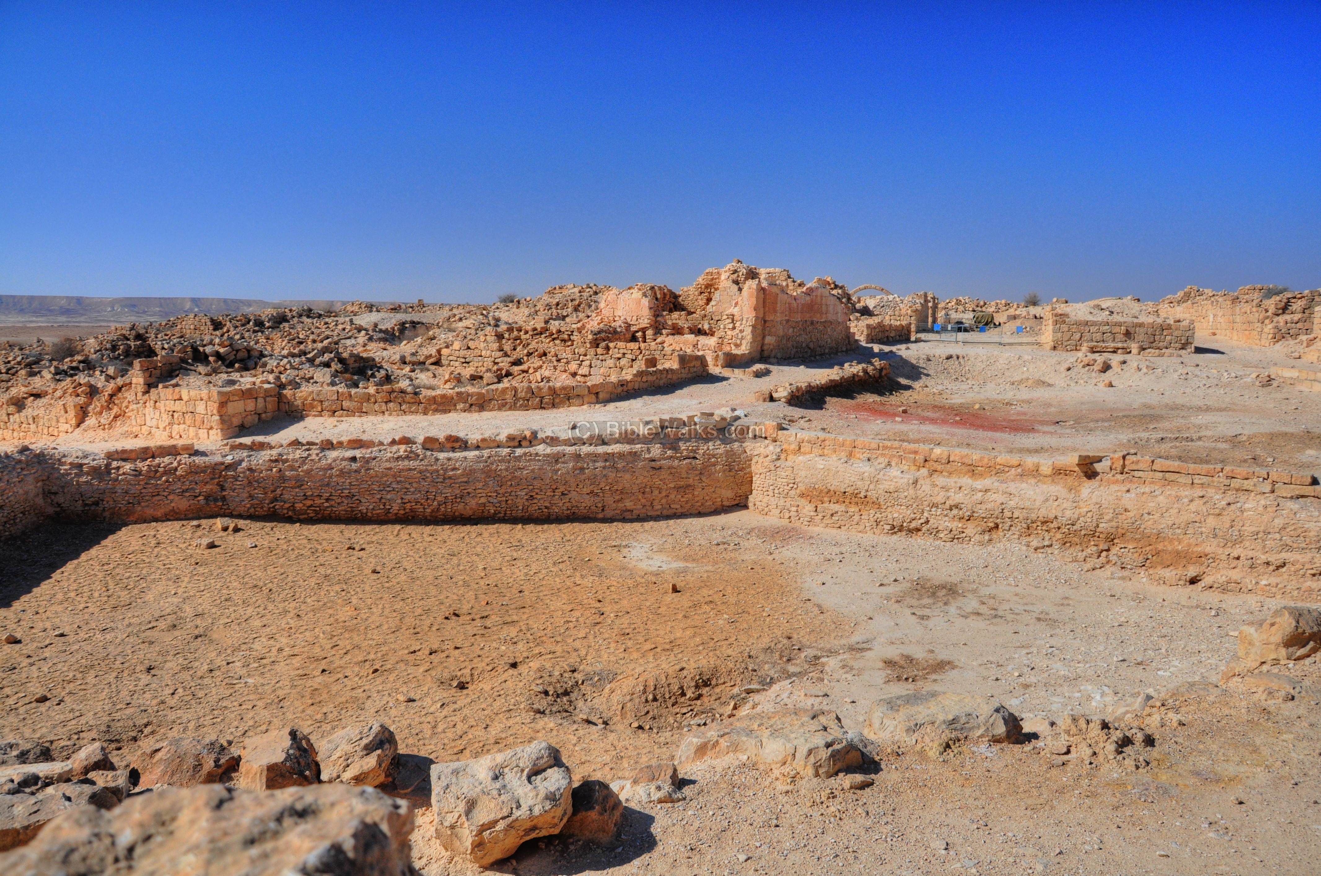
(c) Southern Quarter
This area, located around the double central pools and the southern church, was the oldest section of the town. It later developed into a large city by developing to the north.
Its location is indicated on the plan of the city as a red square.
The southern quarter is seen in this view from the pools area towards the south.
A corner house near the central pool stands almost two stories high:
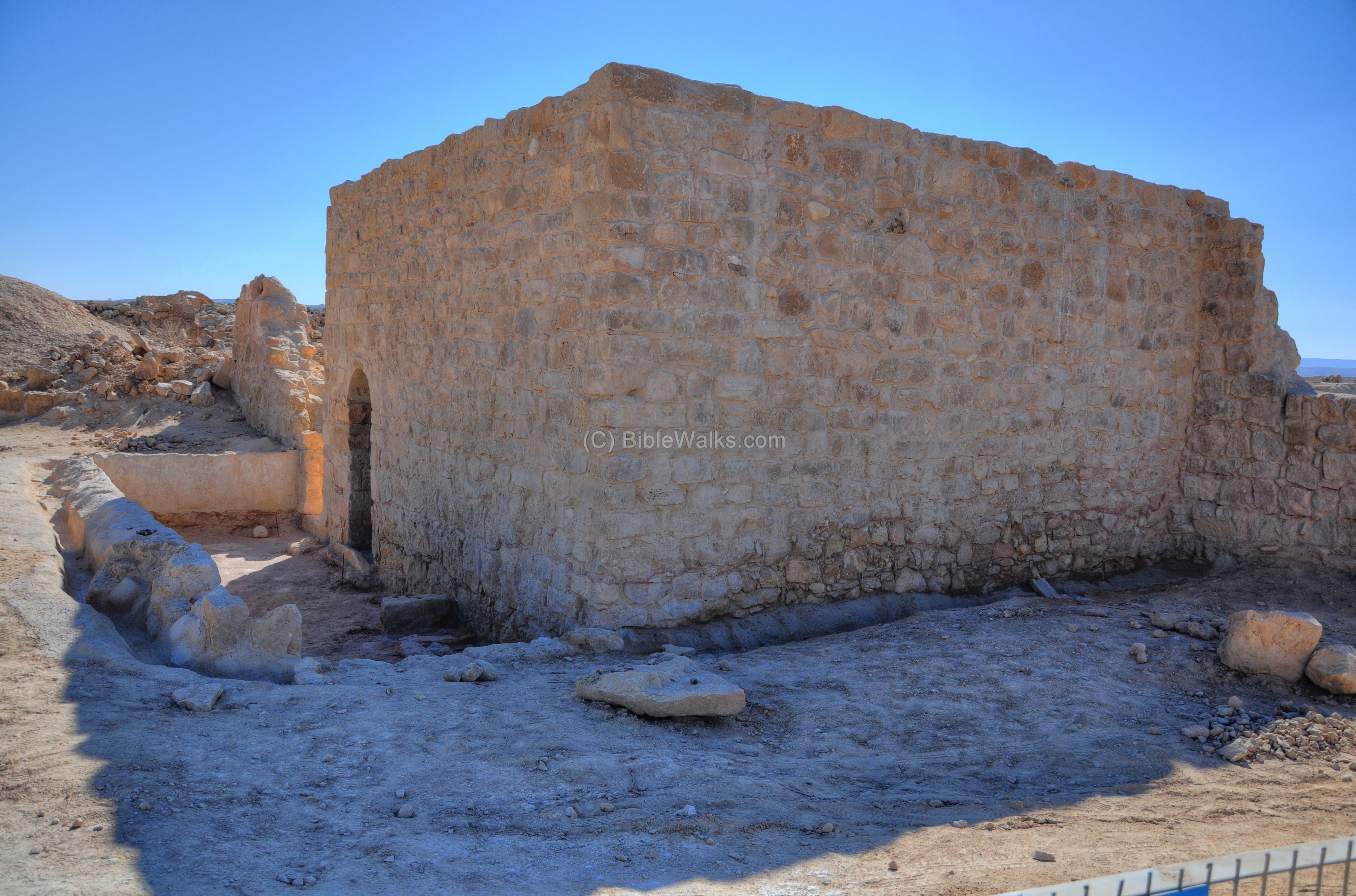
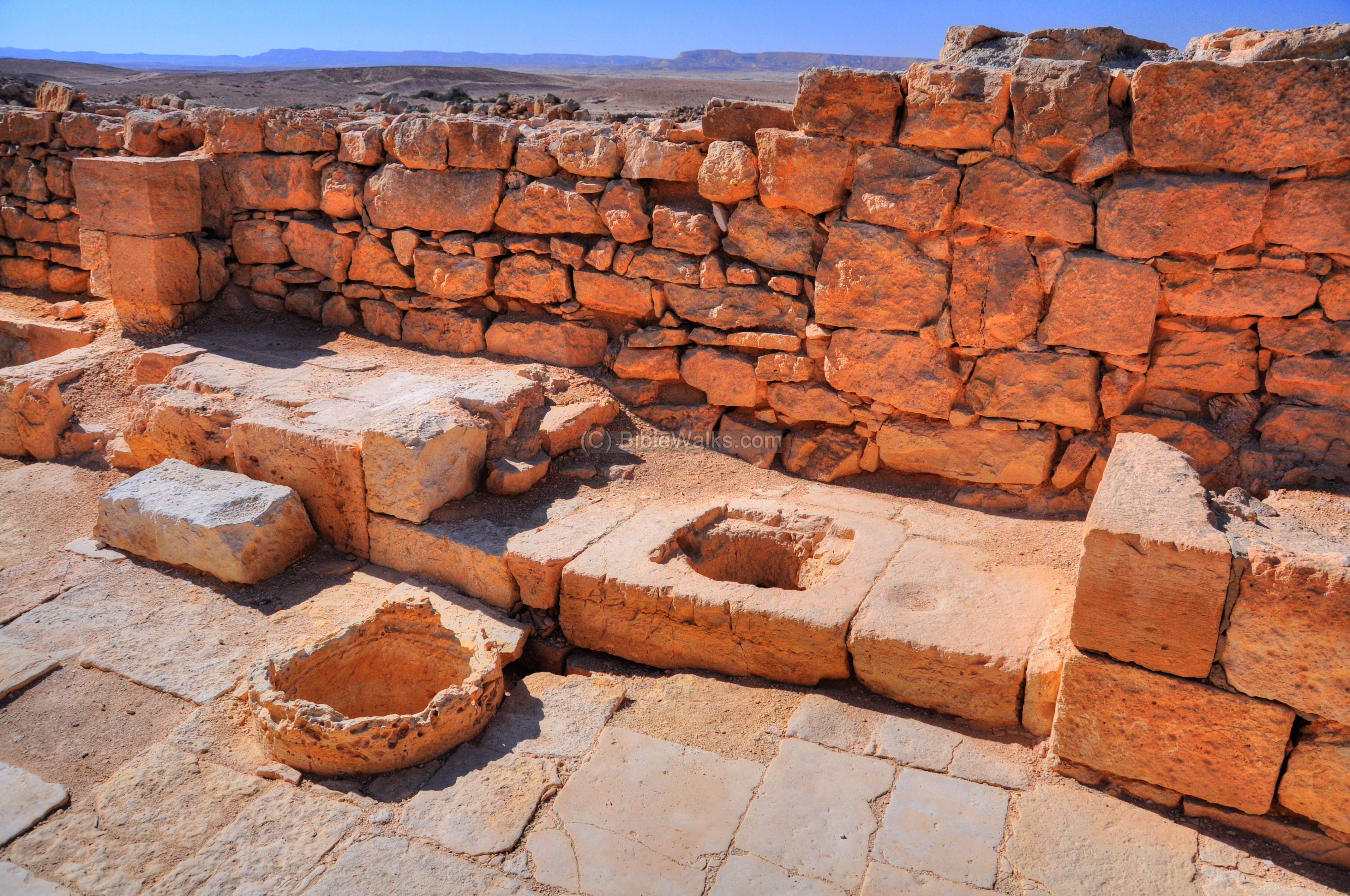
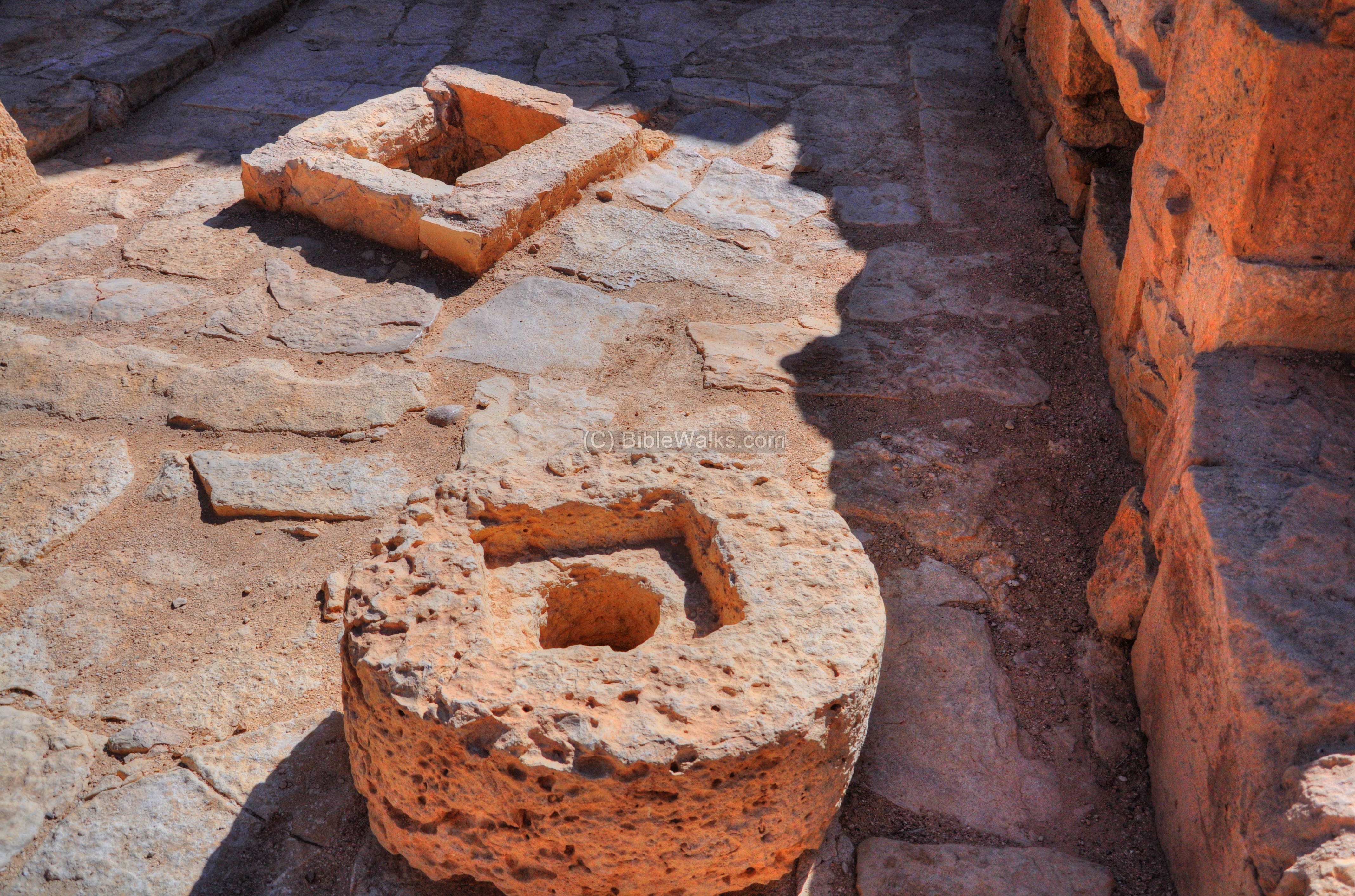
(d) Pools
In the center of the city are two large pools, with a capacity over 2,000 cubic meters. They served as public water reservoirs. This desert area is very dry, with an average annual rainfall of 200mm, and the reservoirs were vital for the water supply.
Their location is indicated on the plan of the city as a red square.
The pools are located in a huge square near the southern church, which is seen behind the southern pool in the following picture.

Another view of the southern pool, which was excavated. The maintenance of cleaning the public pools was carried out by turn. An inscription of a Clay ostraca (piece of pottery) indicates that the task was cleaning was assigned every month to one or more families.
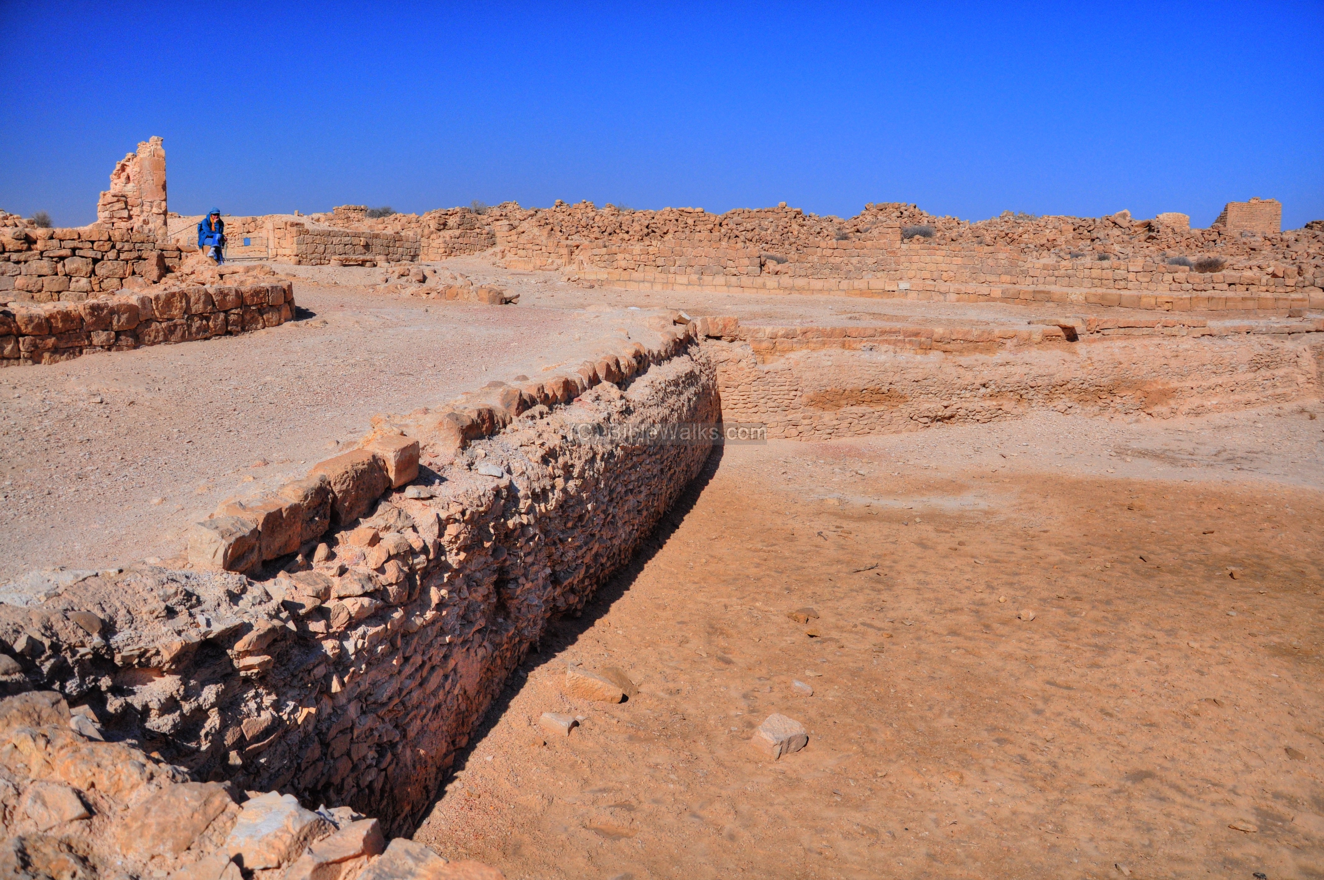
A western view of the southern pool is shown next. The northern pool is seen on the far right side.
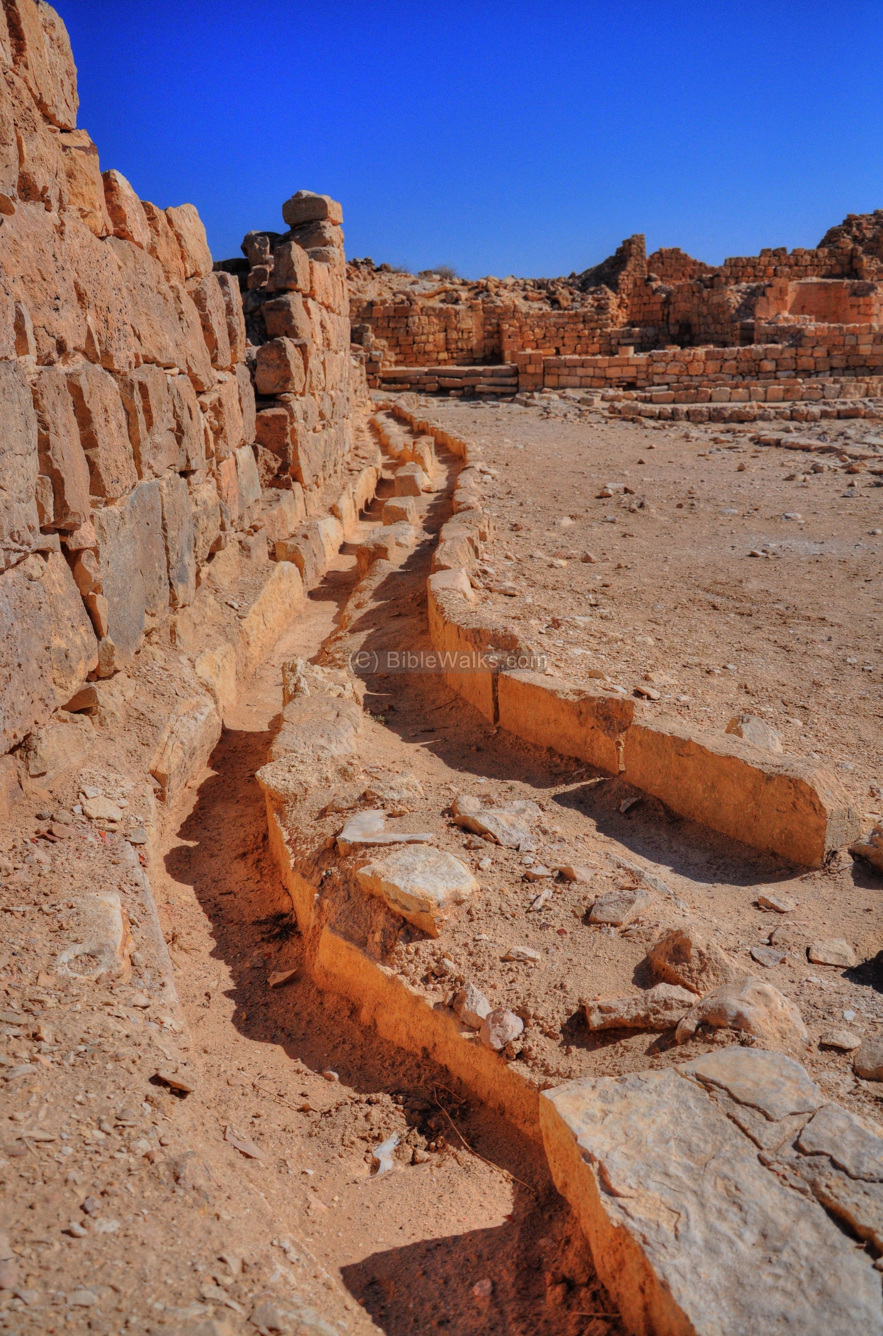
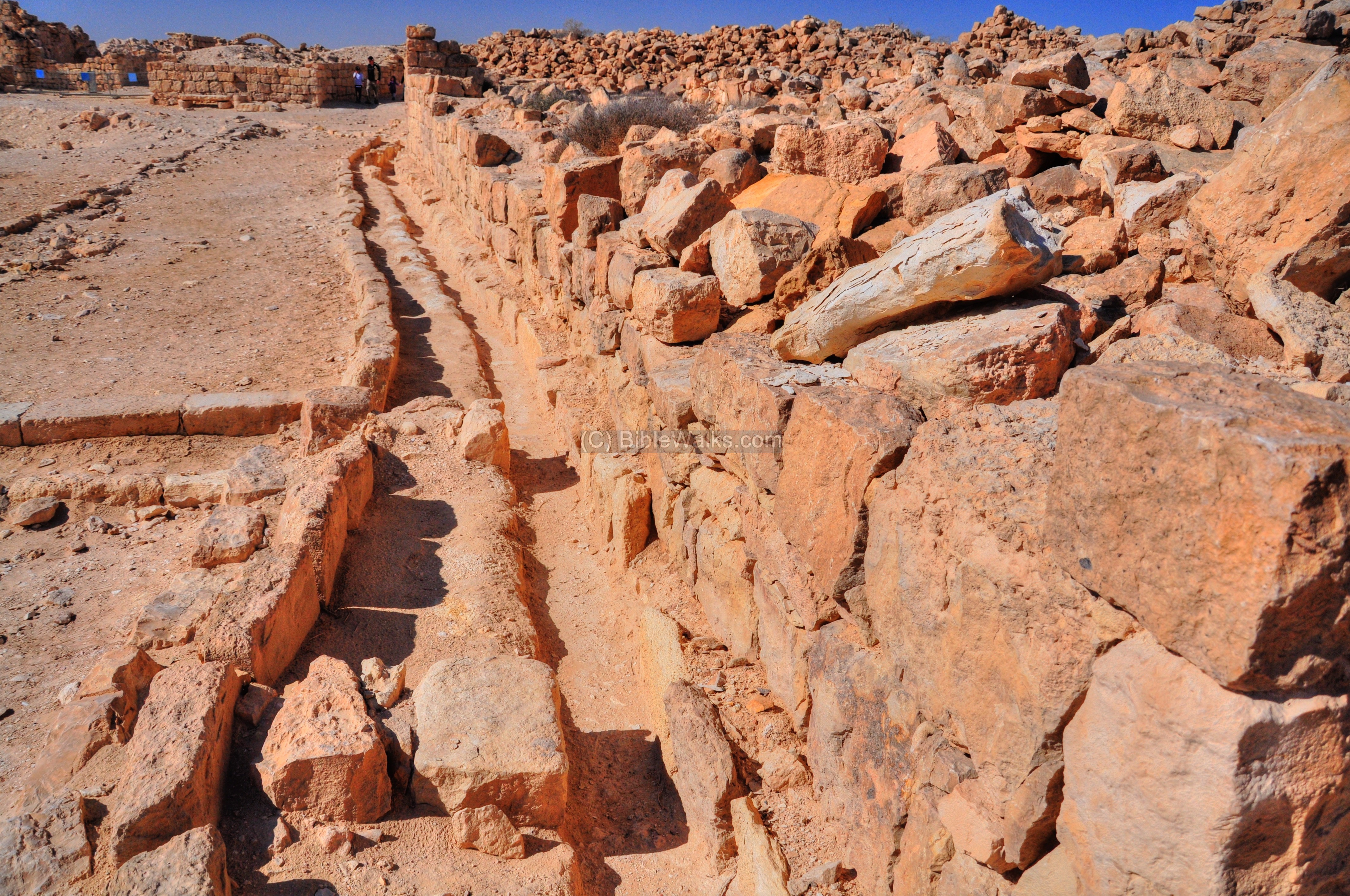
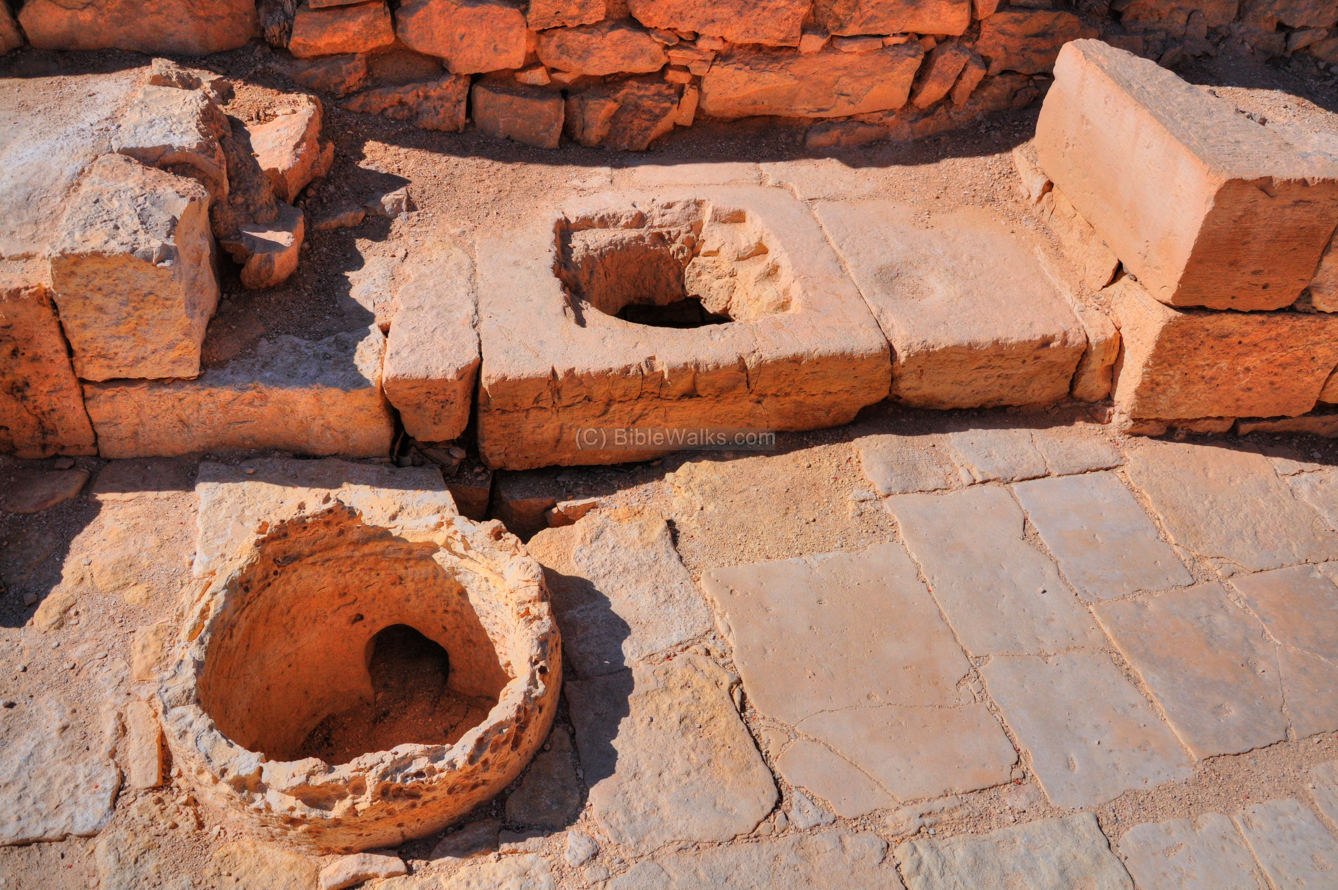
The pools were fed by channels bringing the rainfall from the roofs of the buildings. An additional external source was from an aqueduct which brought water into Shivta from a higher point (420m) located 2.5km in the northeast.
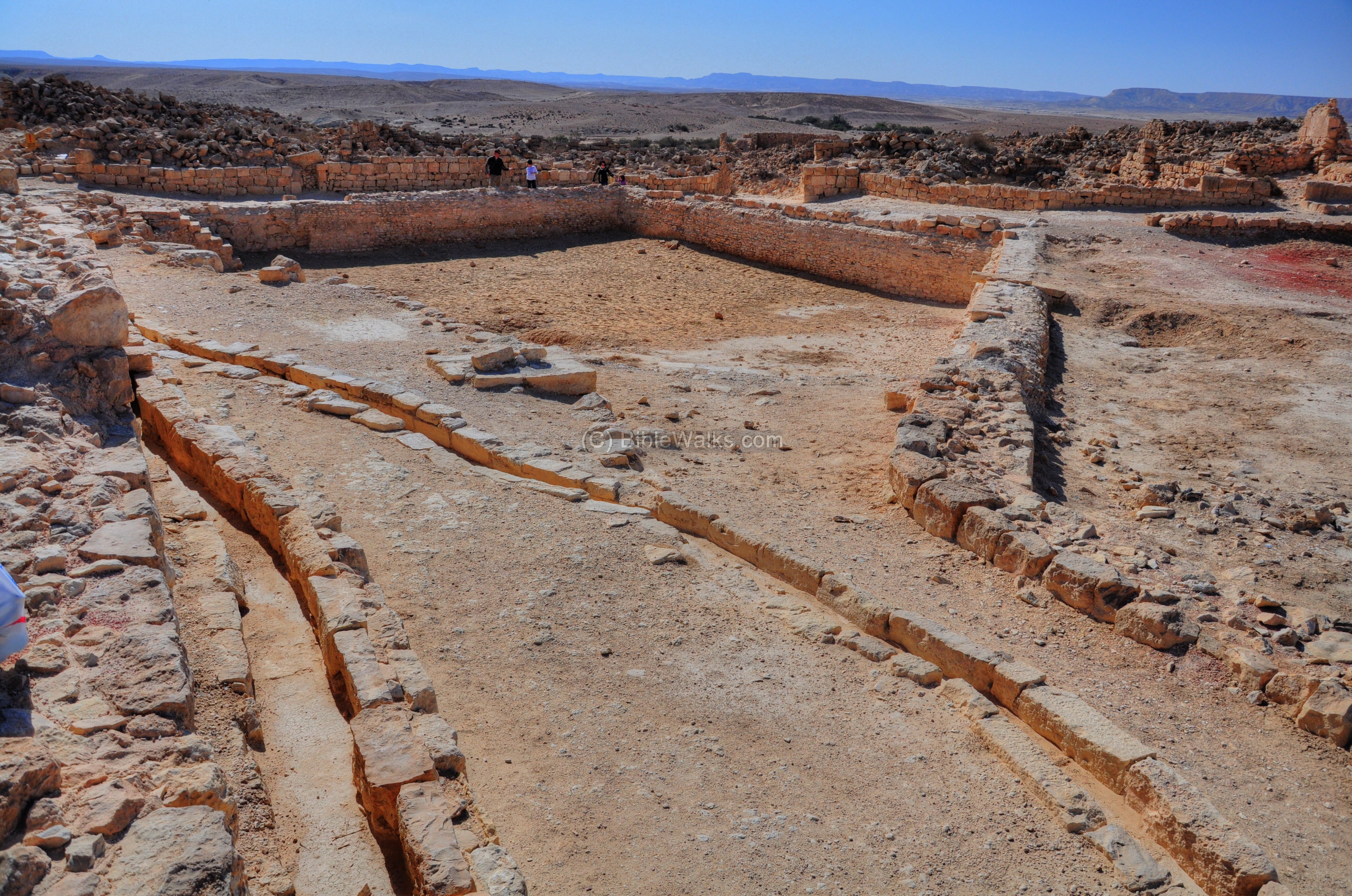
A view of the water channels on the west side of the southern church is seen next. One of the channels supplies the cisterns under the church, while the other is the afferent line to the central pool:

Another side of the channels:
- Northern Pool
The northern pool, which is seen on the following picture, is not yet excavated.
The northern water channels are seen below:
A view from the east of these water channels:
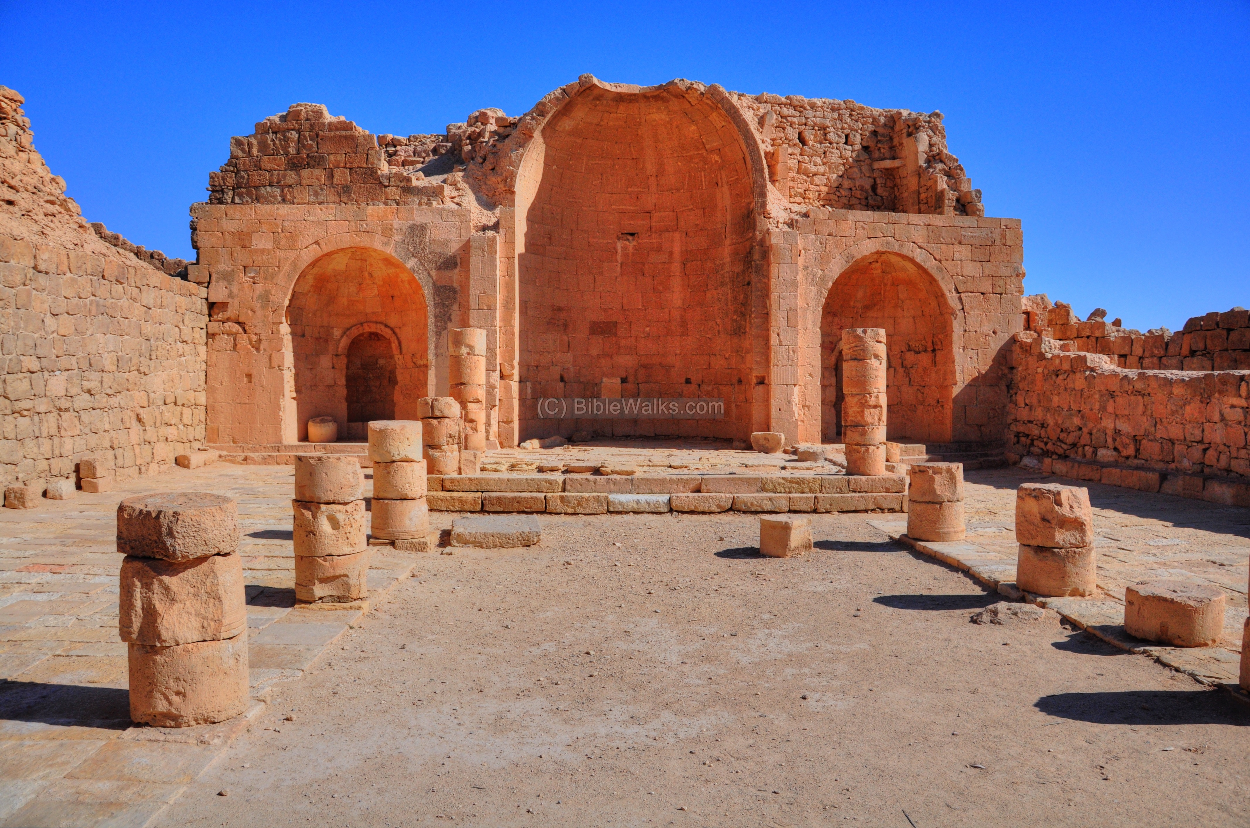
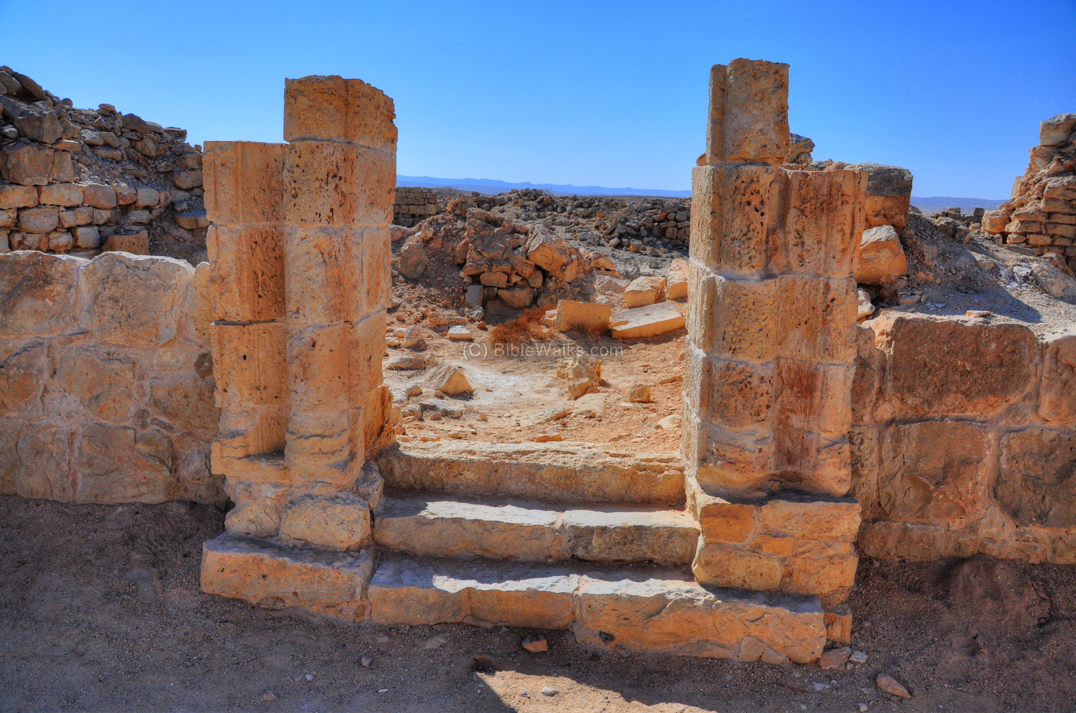
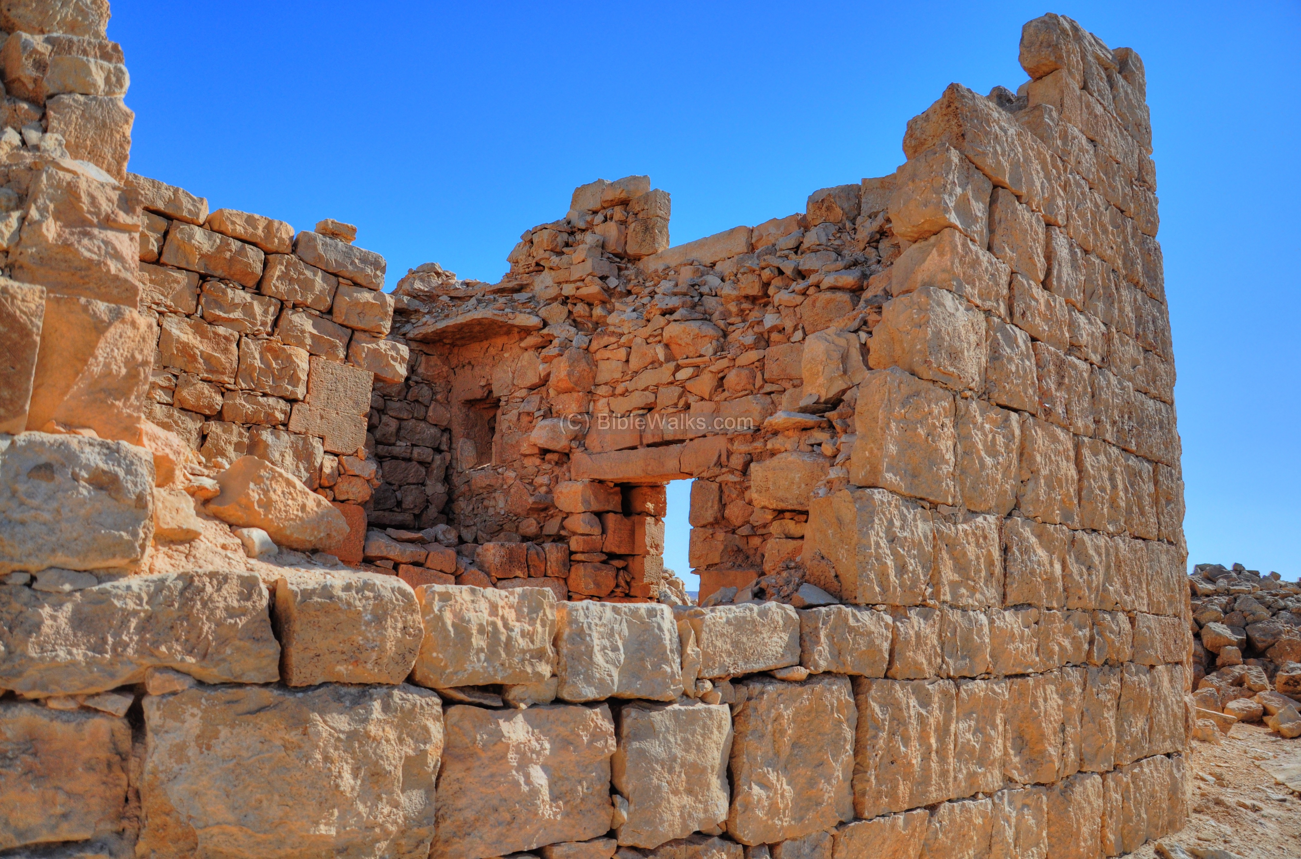
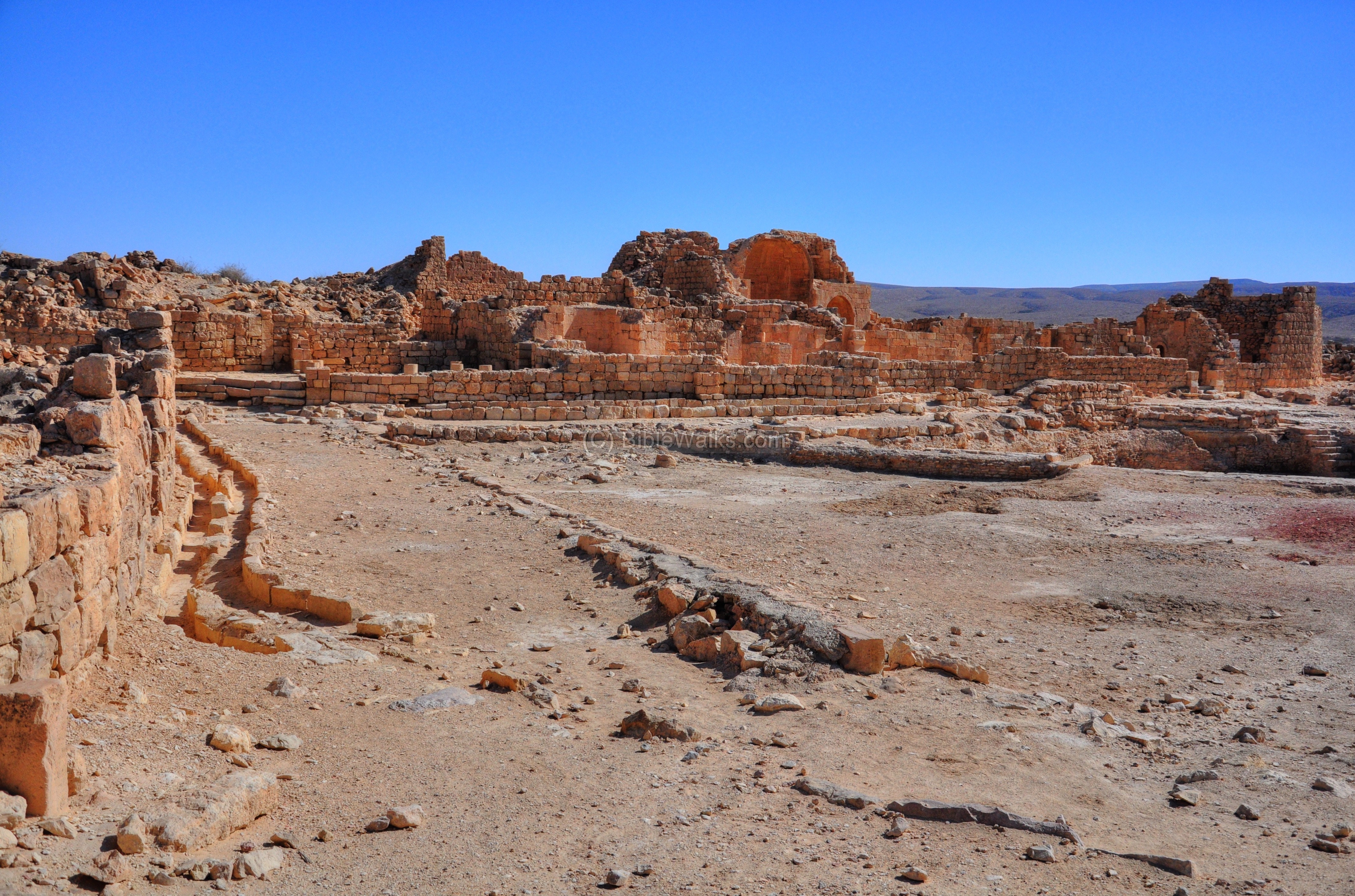
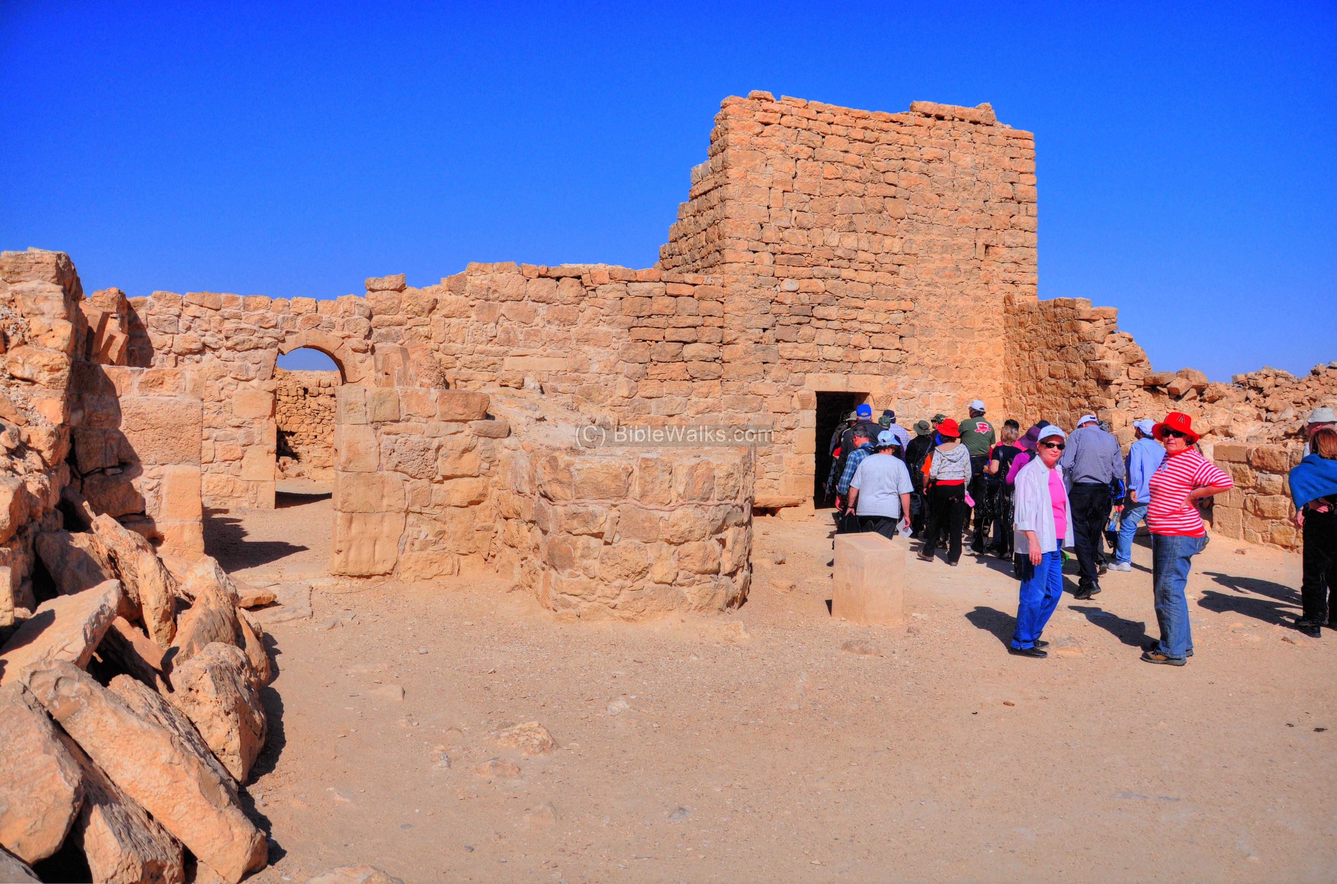
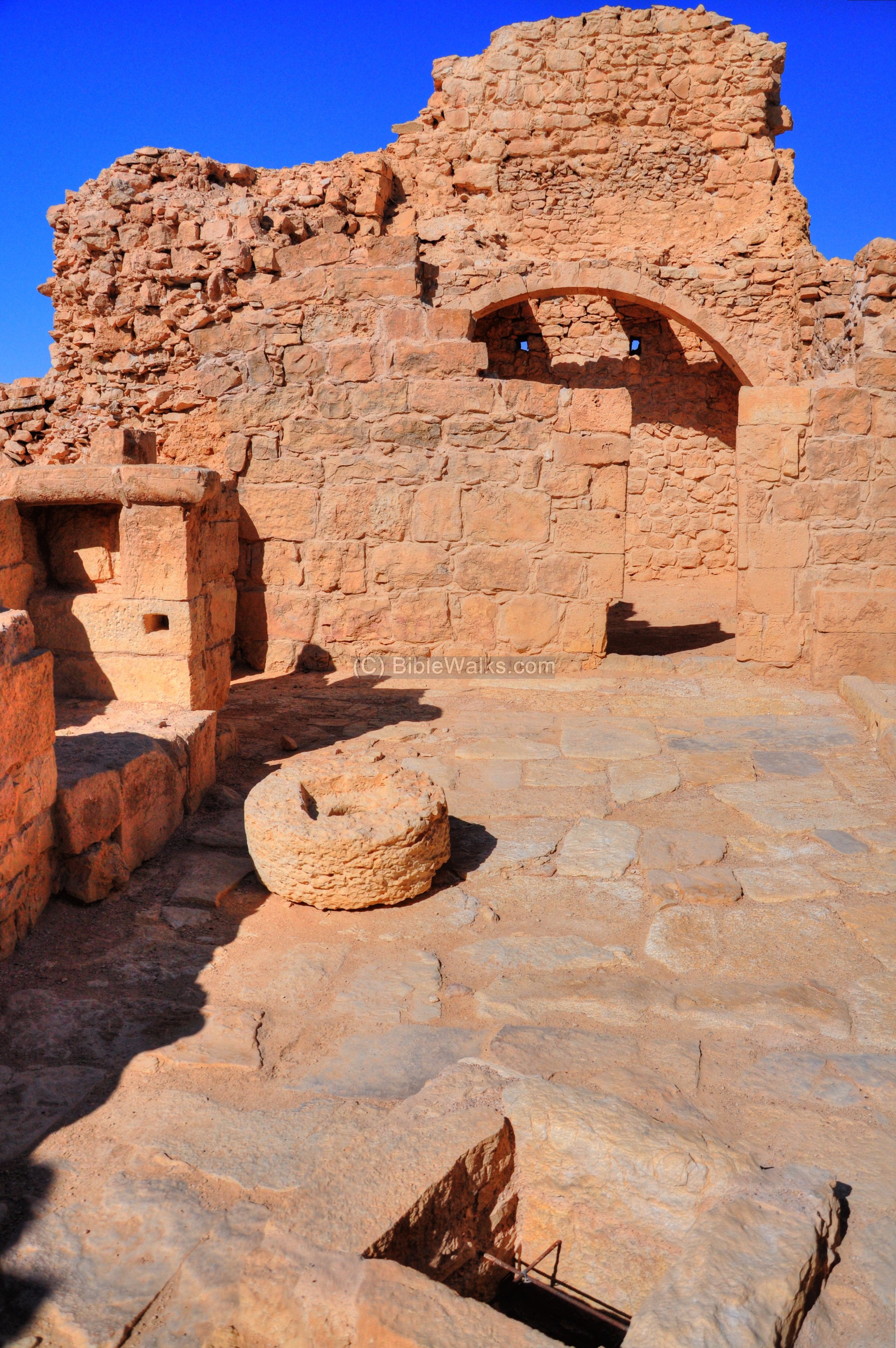
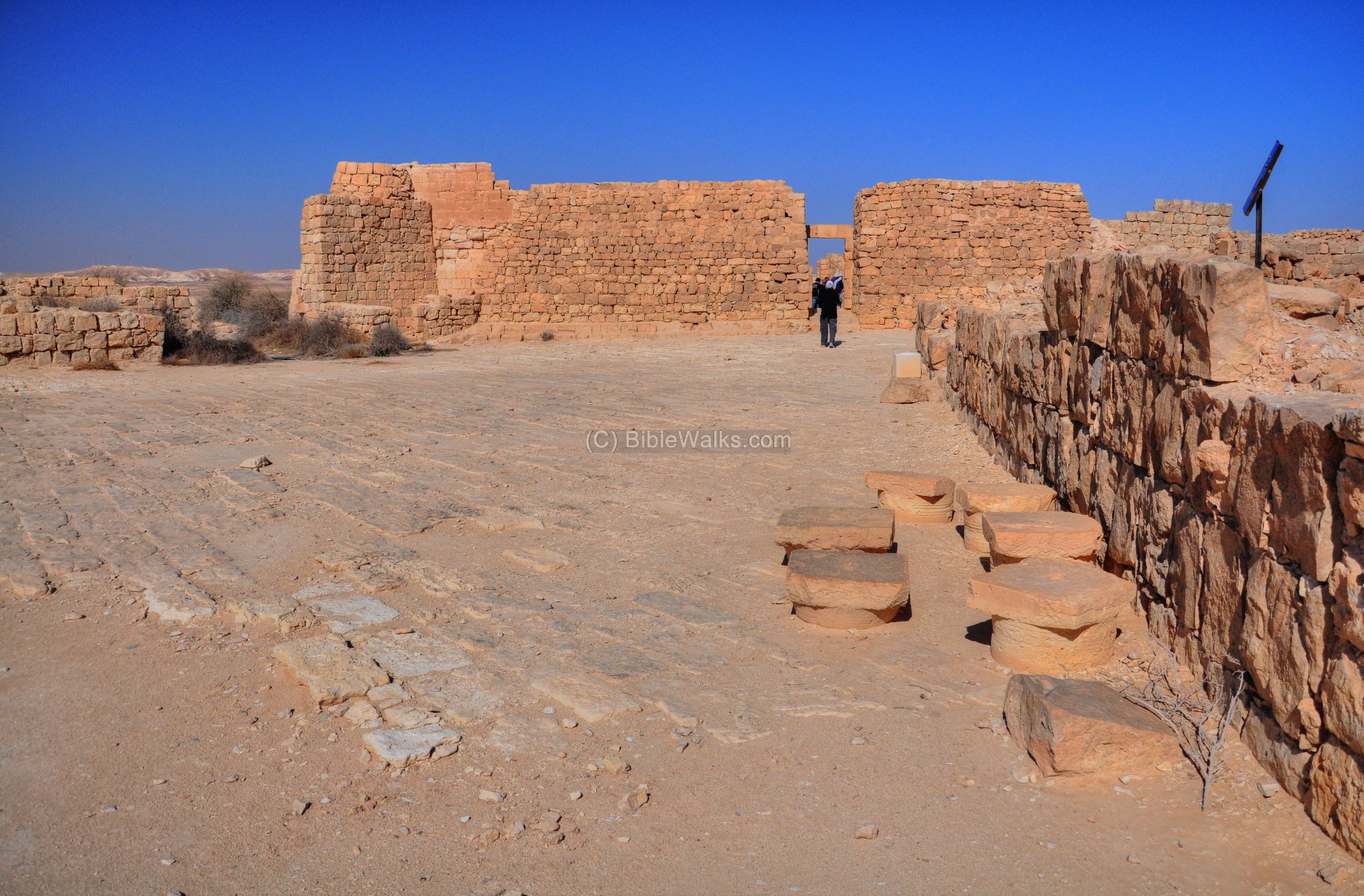
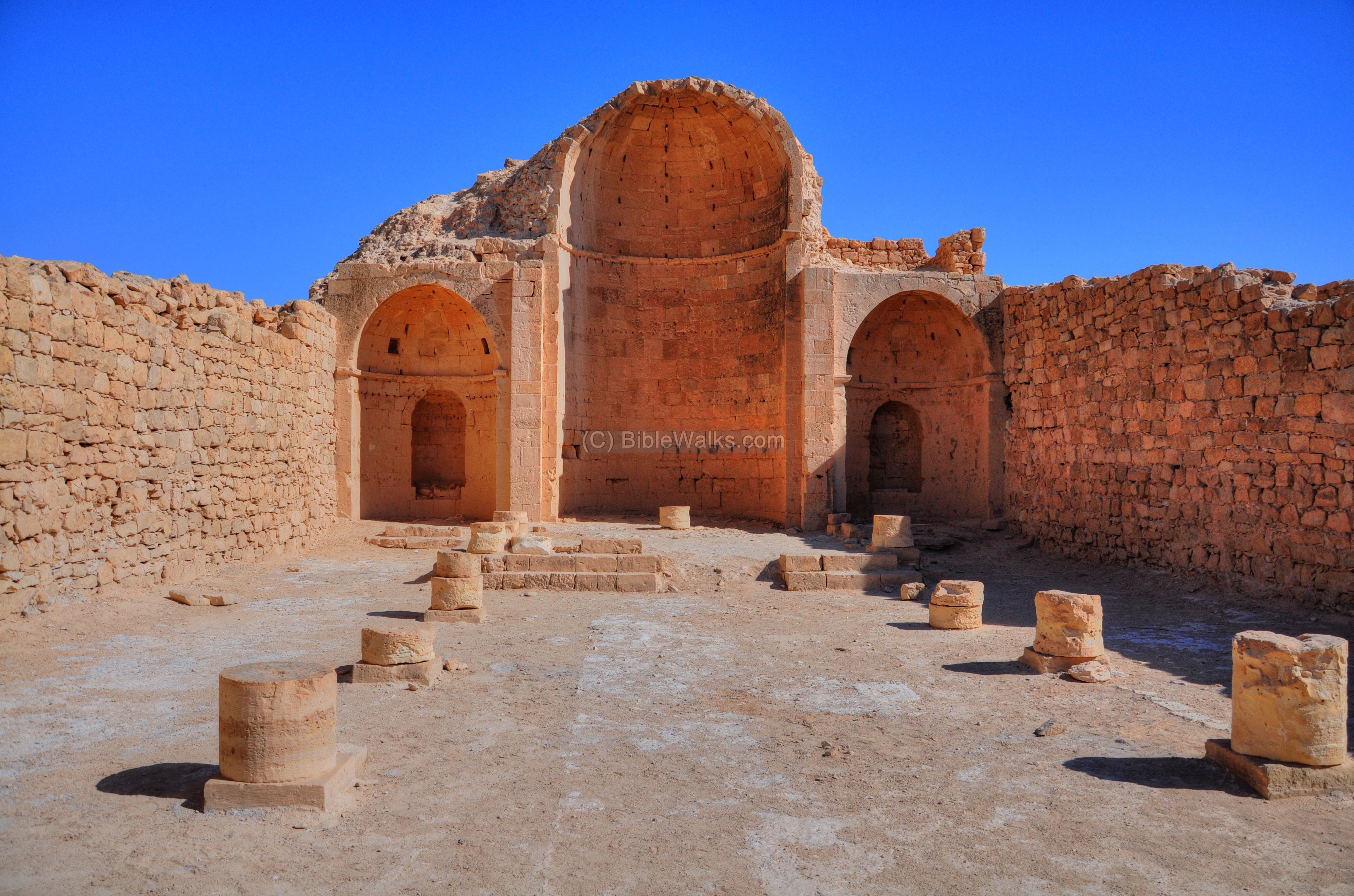
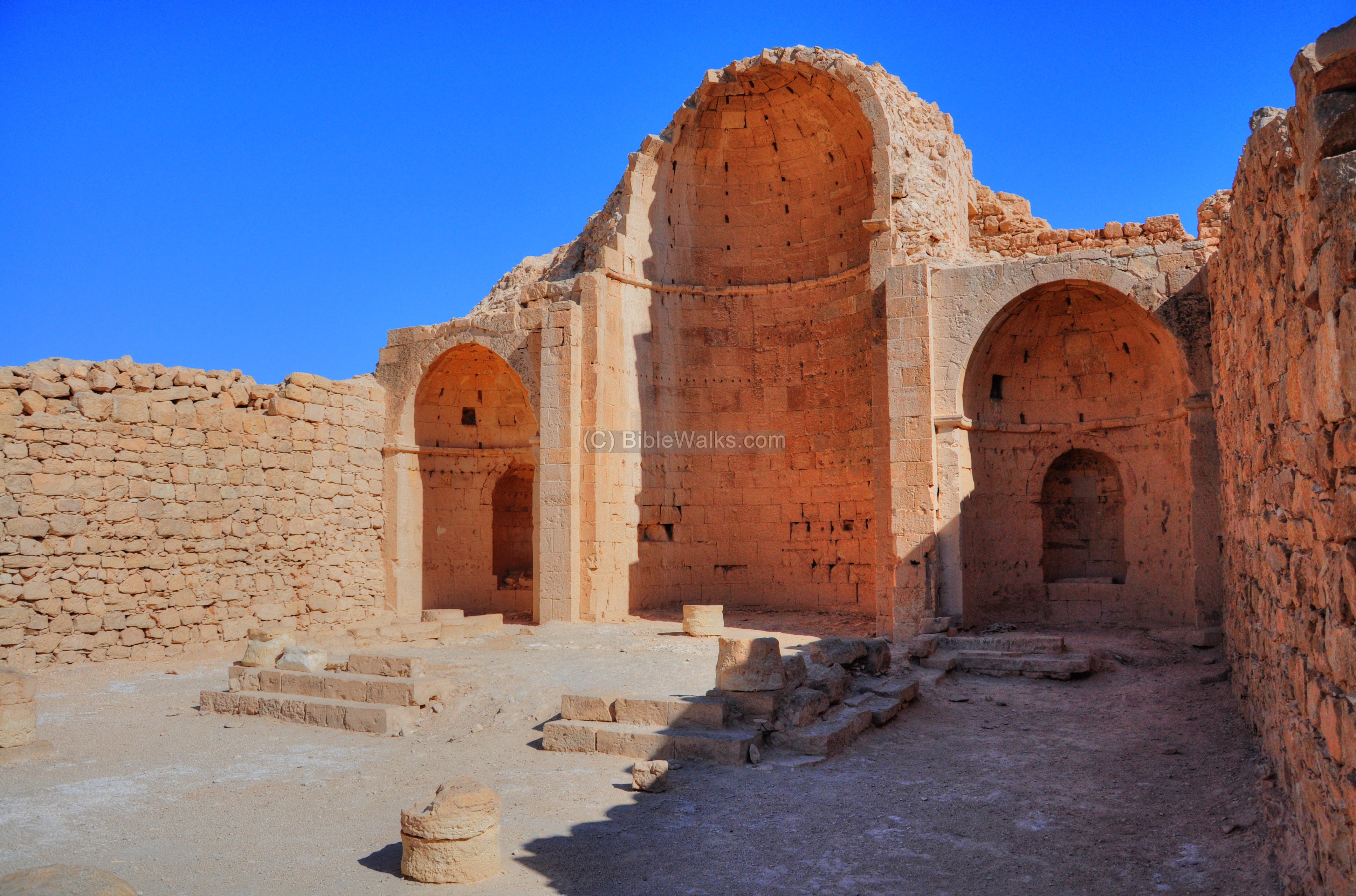
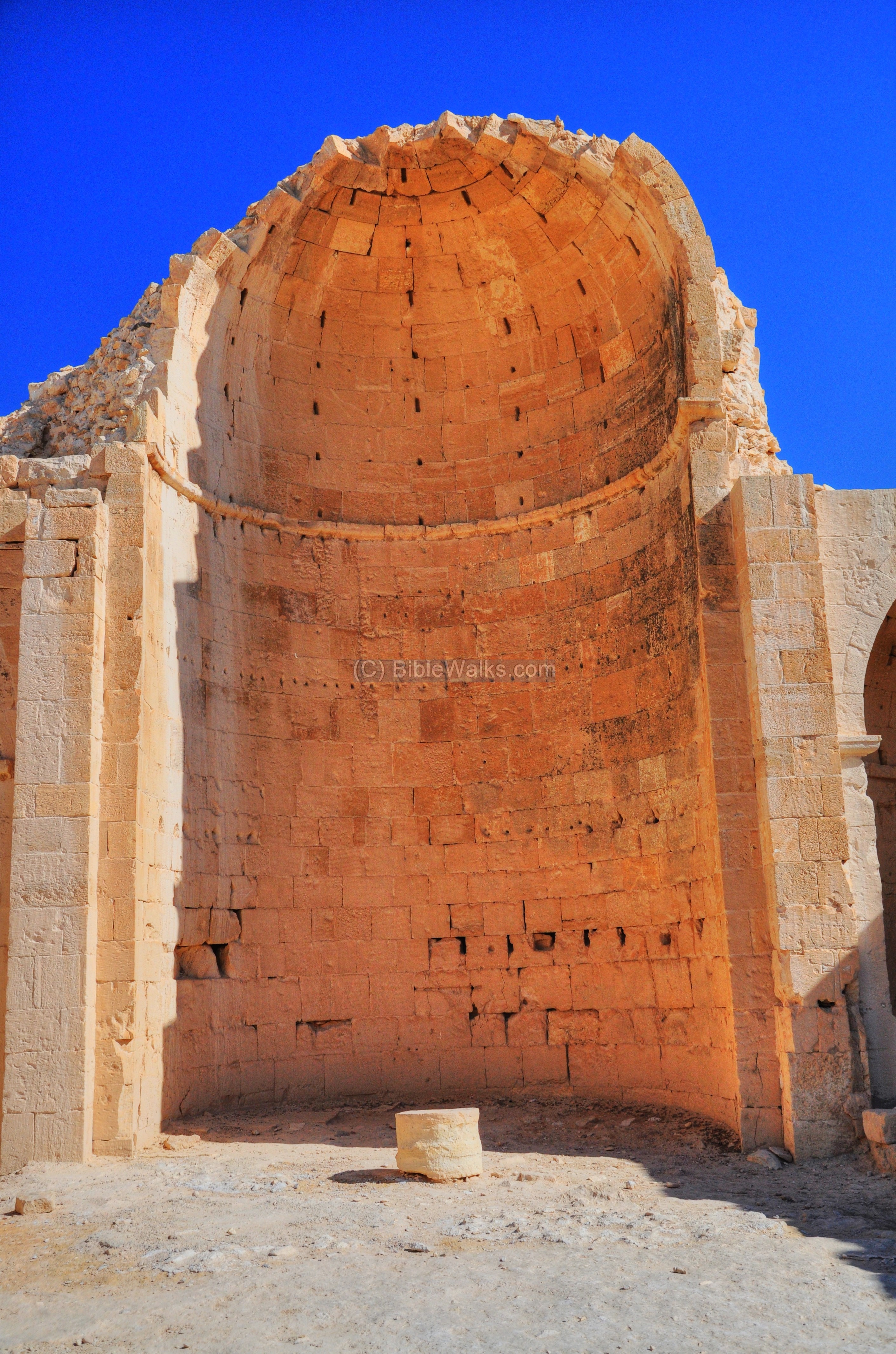
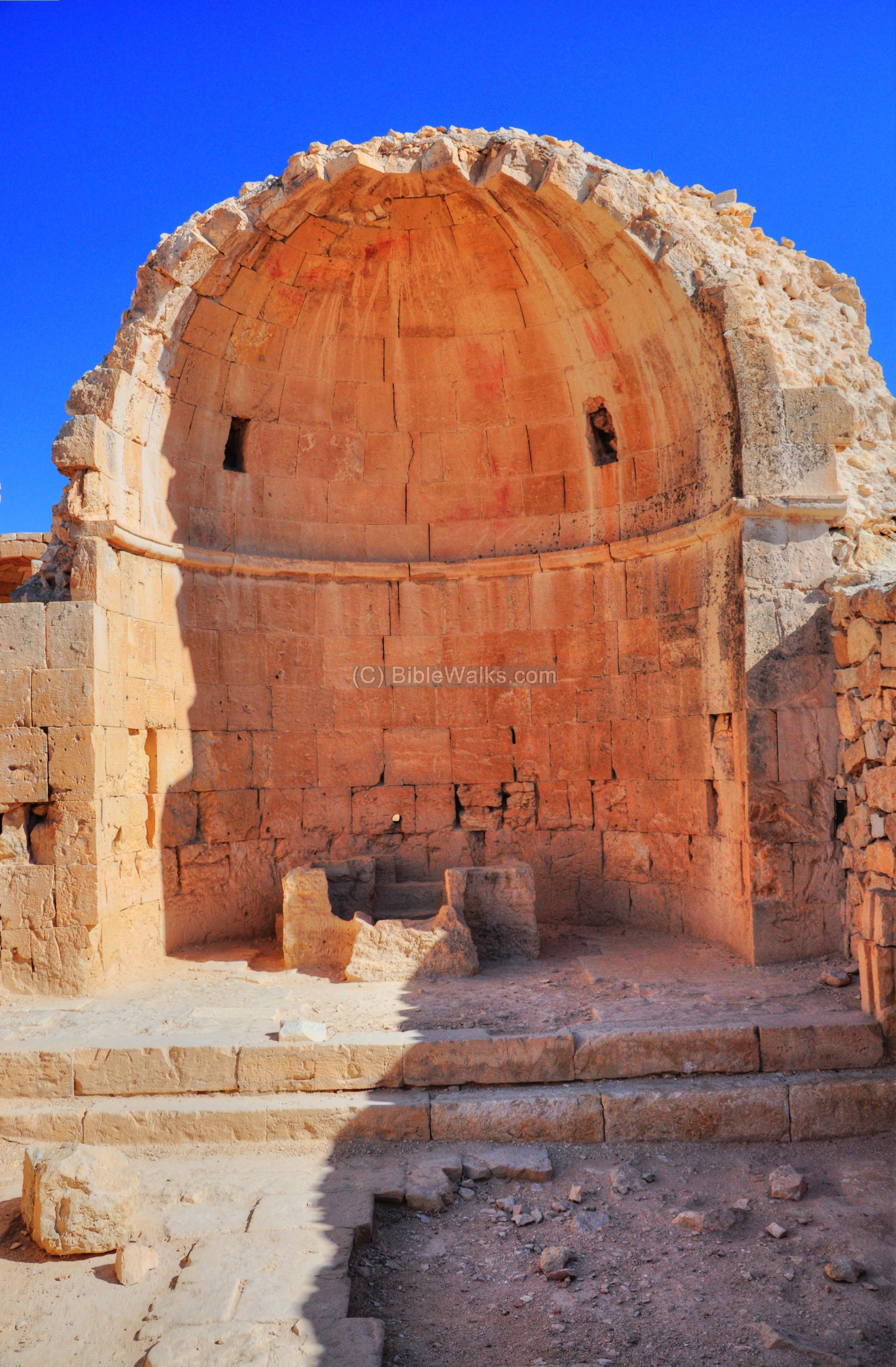
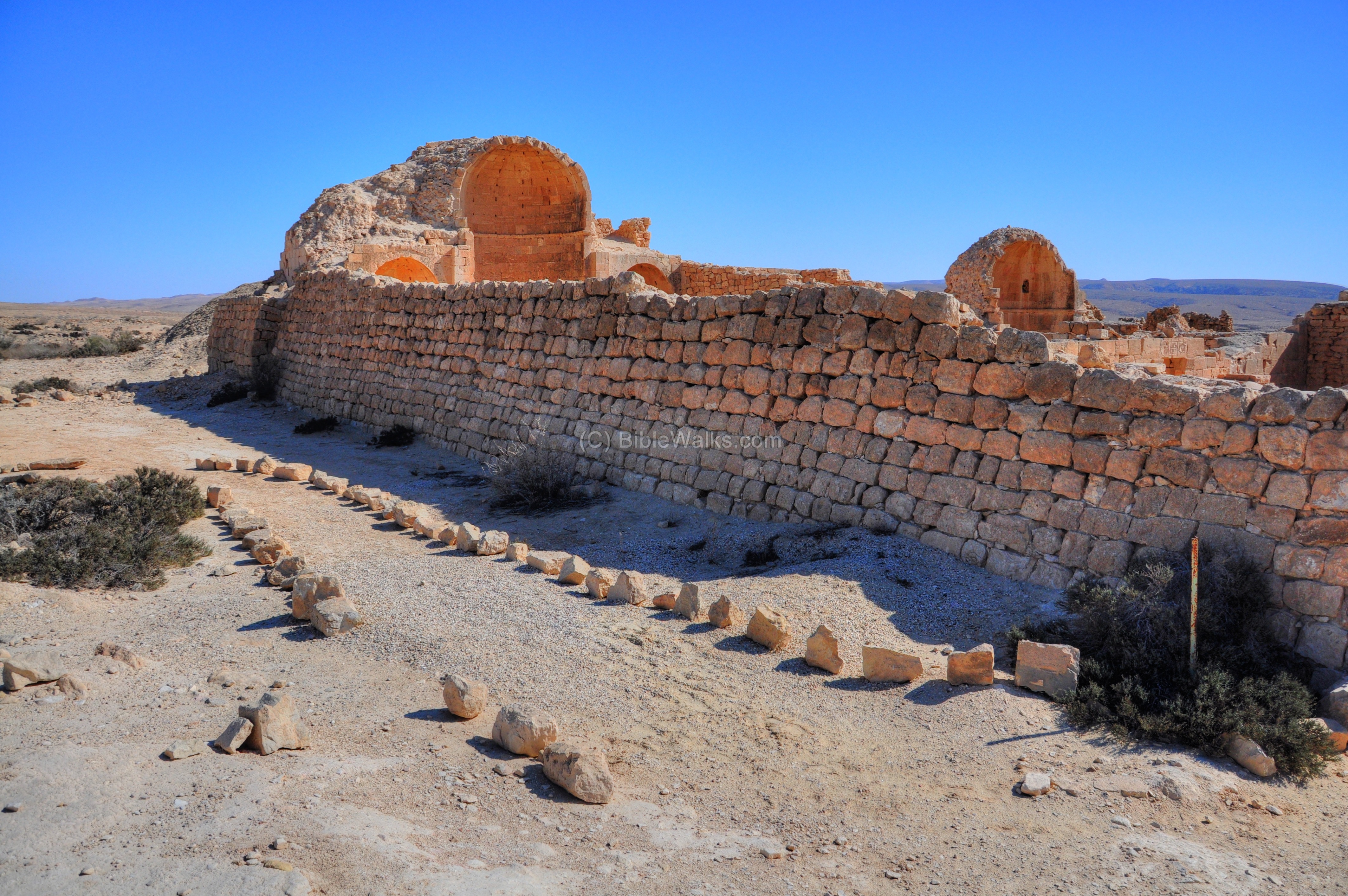
(e) Southern Church
The southern Church is the oldest in Shivta, dated to the middle of the 4th century AD. Its location, east of the double pools, is indicated on the plan of the city as a red square.
The church’s design is a triple apse basilica, with a long nave separated by two rows of columns. Its size is 23.35m by 17.30m, and oriented to the east (as almost all ancient churches – facing Jerusalem).
Its original design (in the middle of the 4th century AD) was a single hall, with two square rooms (pastophoria) on both sides alongside a single altar. In the first half of the 6th century the side apses replaced these rooms, and the design changed from a mono-apsidal to a tri-apsidal design as it is found today. This design change was found in other churches in the Holy Land (Avdat, Rehovot, Kh. Heshek, and Kh. Eirav), according to a research by S. Margalit.
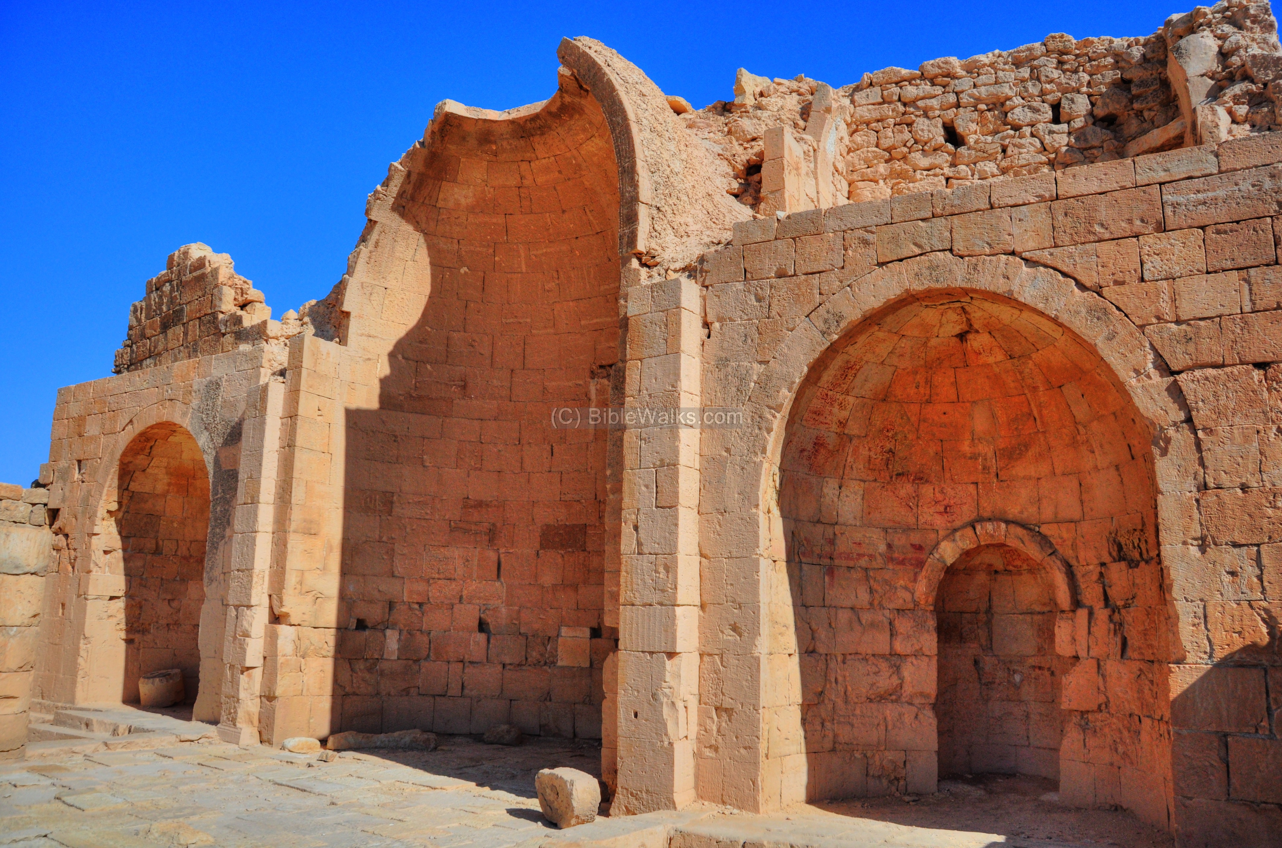
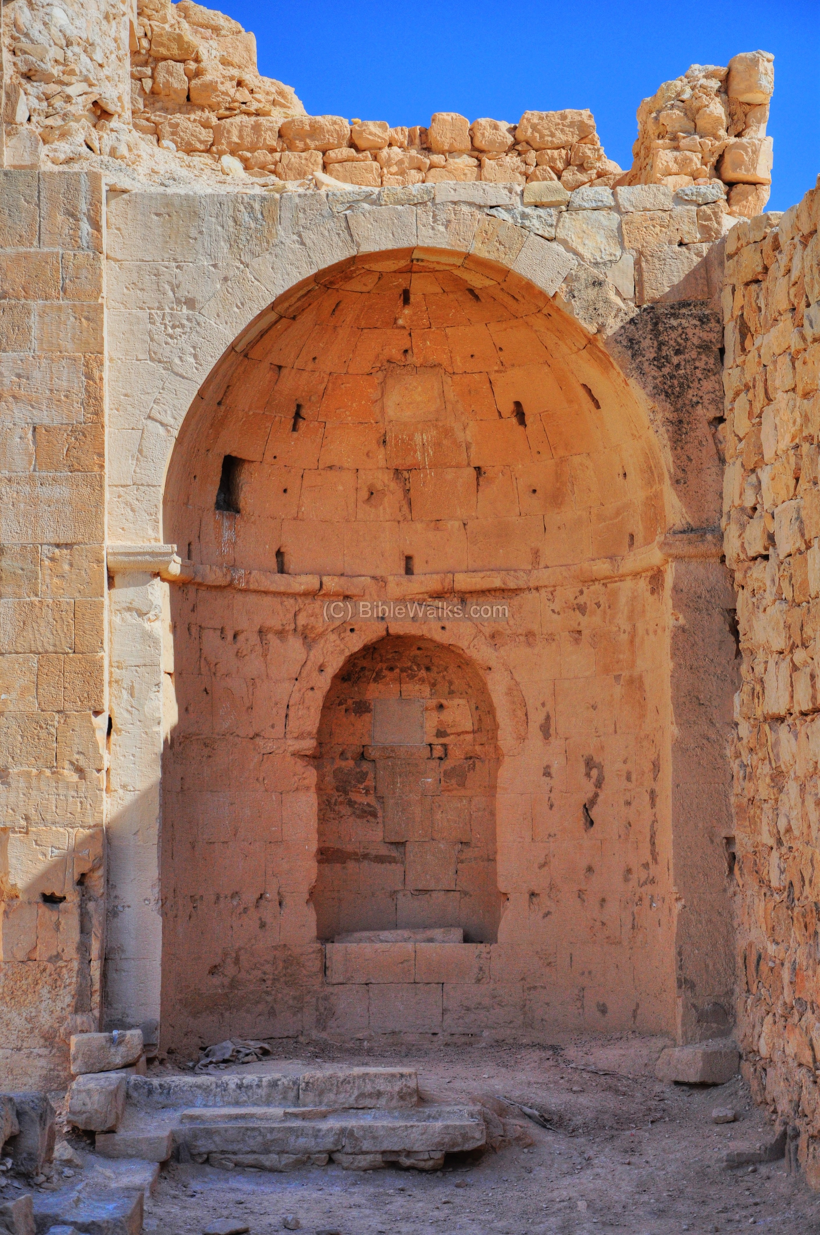
The central apse, where the main altar stands, is seen in the middle of the following picture.
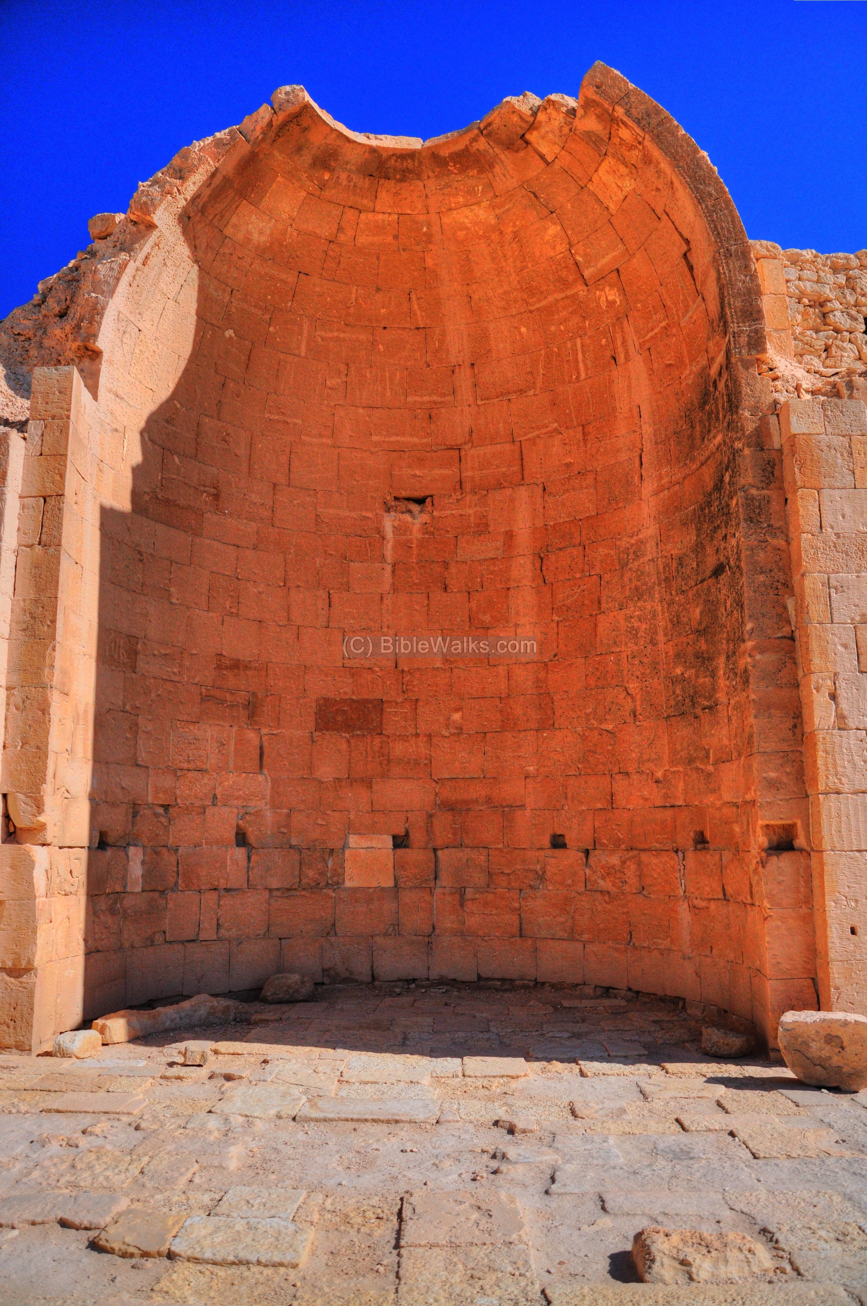
Another view of the central apse:

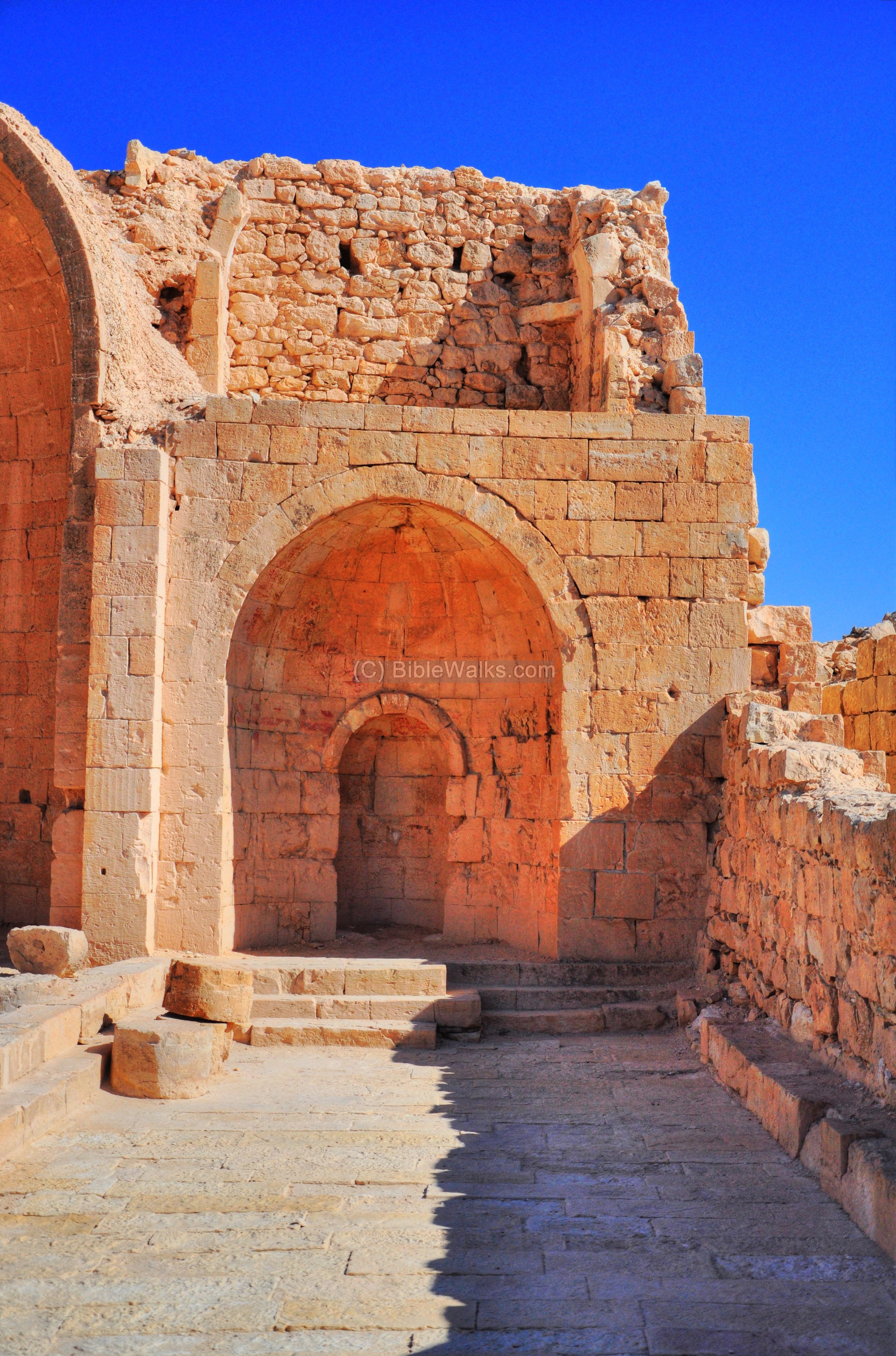
The southern apse is shown in detail in the following picture. The three apses were not created on the same axis, so the wall on the right is slightly tilted to the south.
An inscription on the floor of the south aisle is of the year 640 AD. This date is after the Muslim conquest, indicating a religious tolerance.
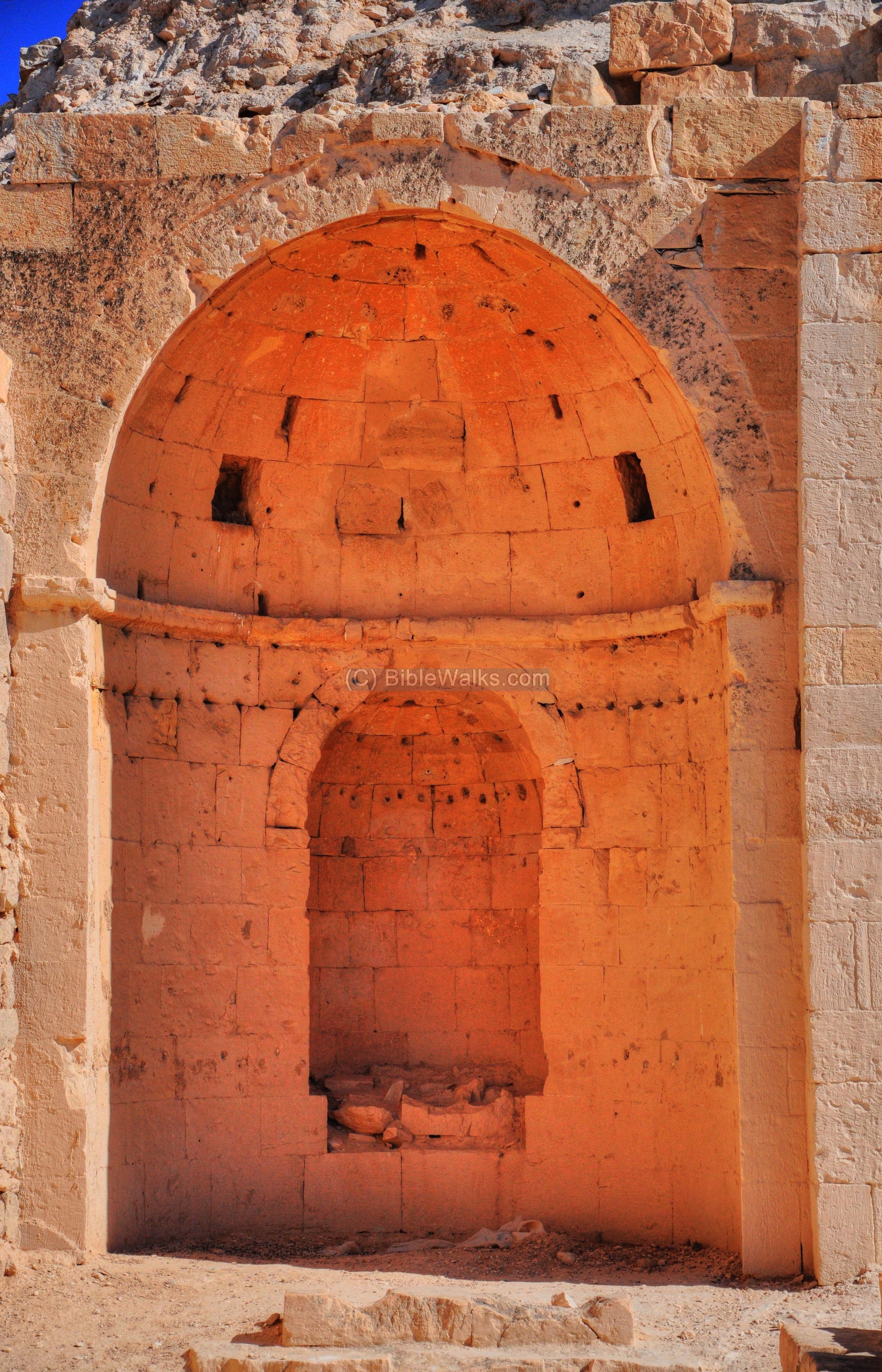
The northern aisle and apse is shown below:
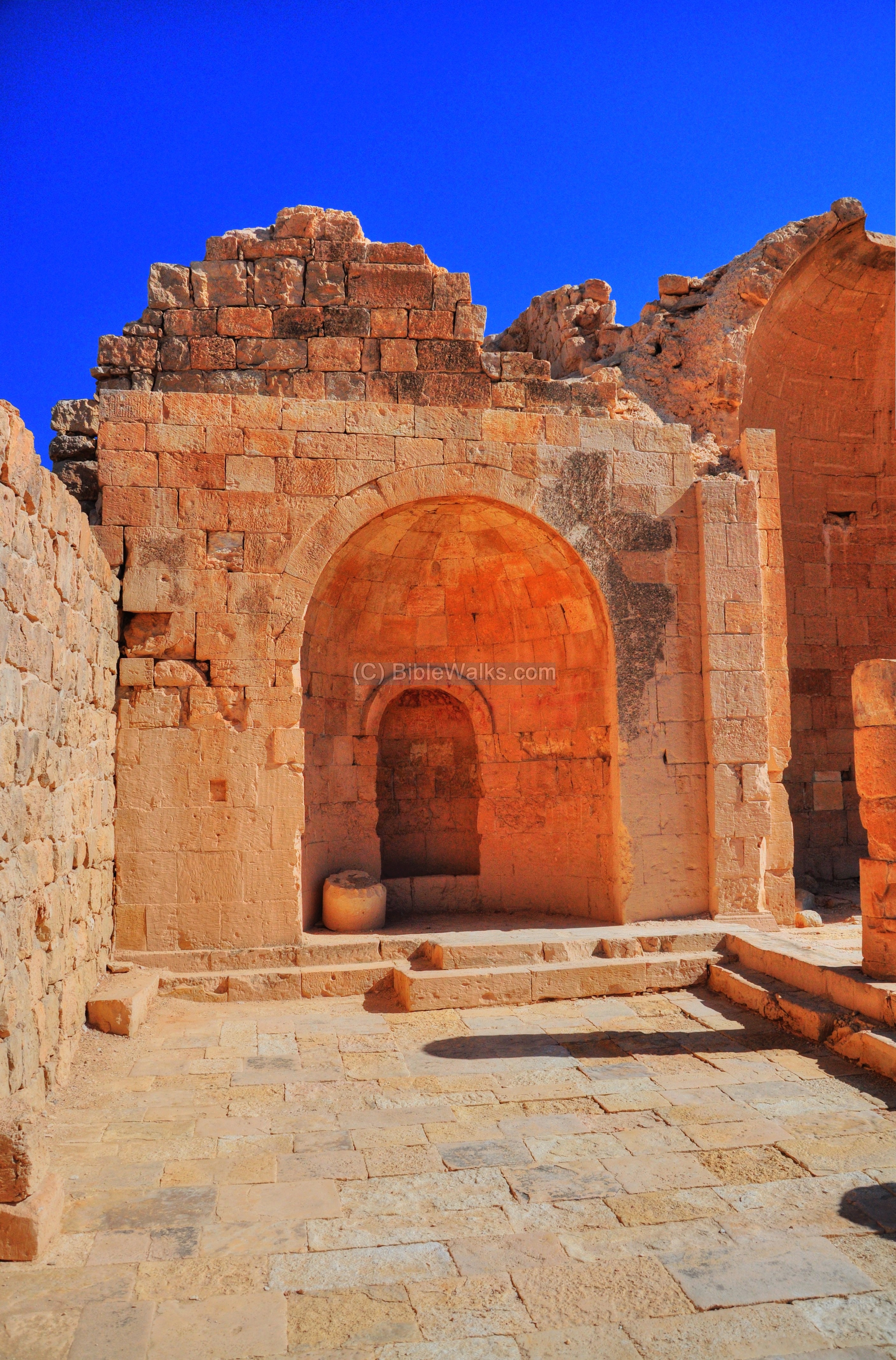
The next photo shows a closer view of the niche in the northern apse. The original red paint on the apse is what remained from the paintings which once decorated the apses. The archaeologists who visited the site at the beginning of the 20th century reported that the painting was a depiction of the transfiguration of Jesus, with John and Peter kneeling at the feet of Jesus.

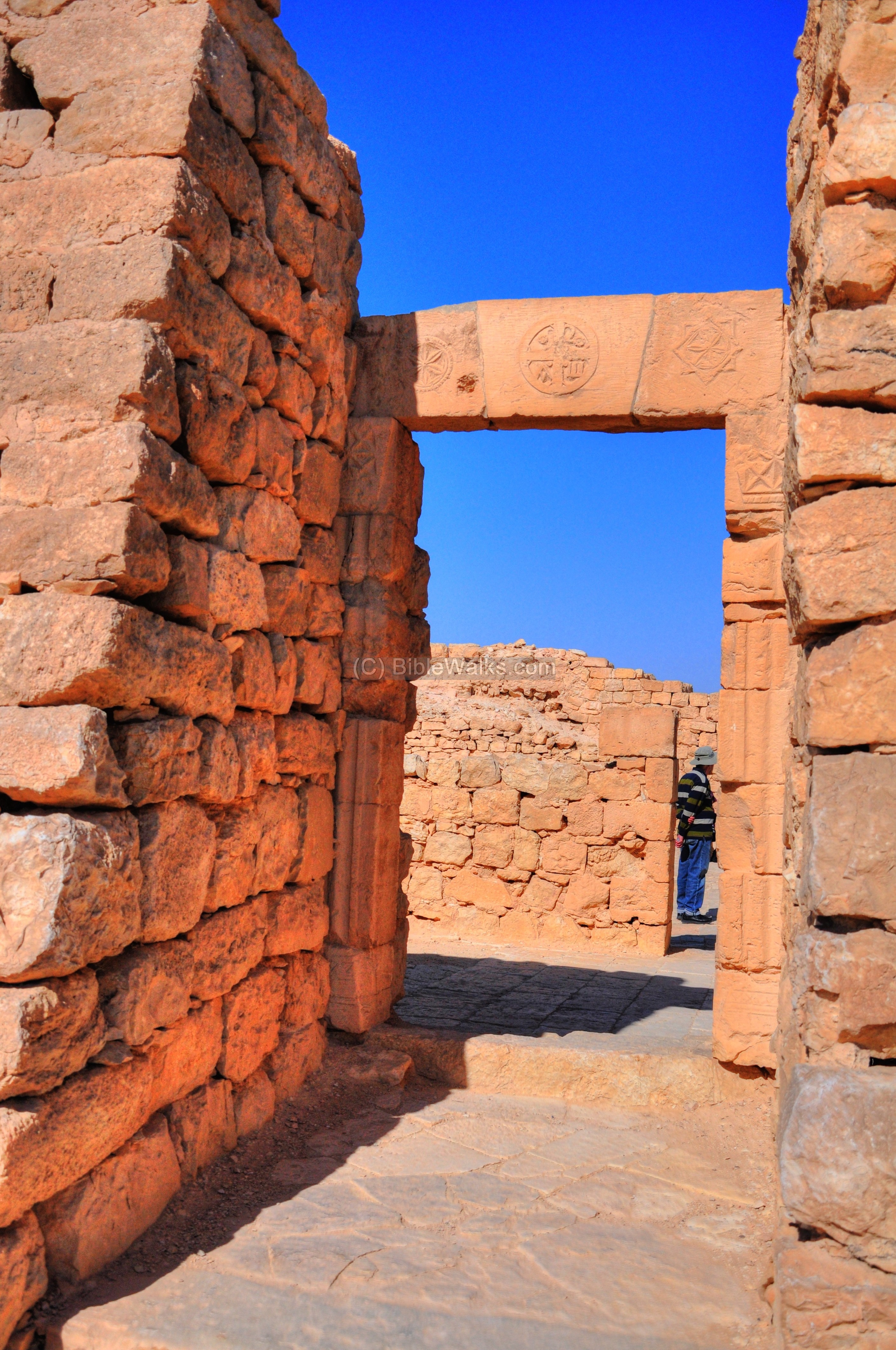
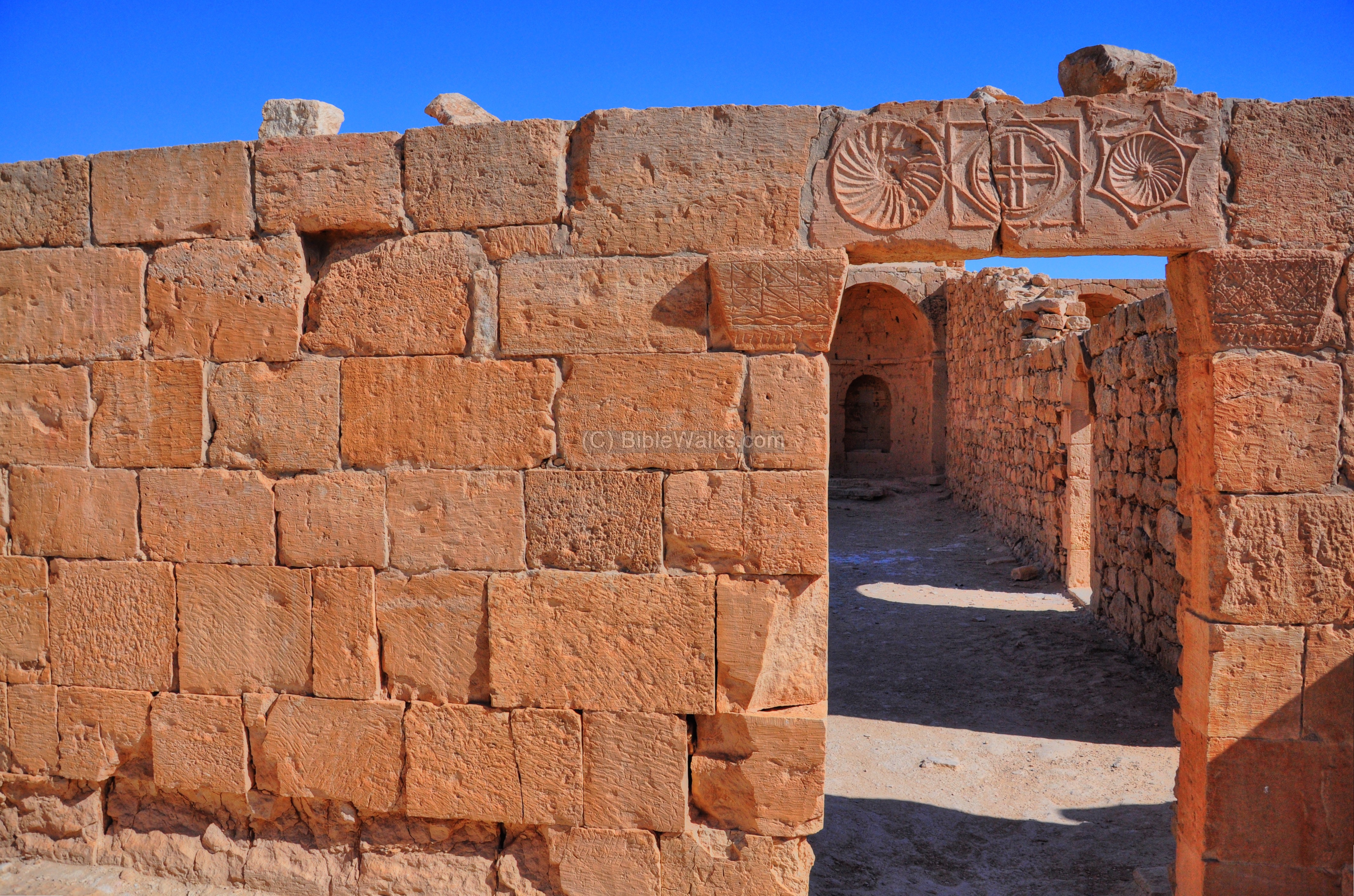
- Entrances
The southern church has a small square in front of the entrances. It leads to the entrance to the hall of the church.
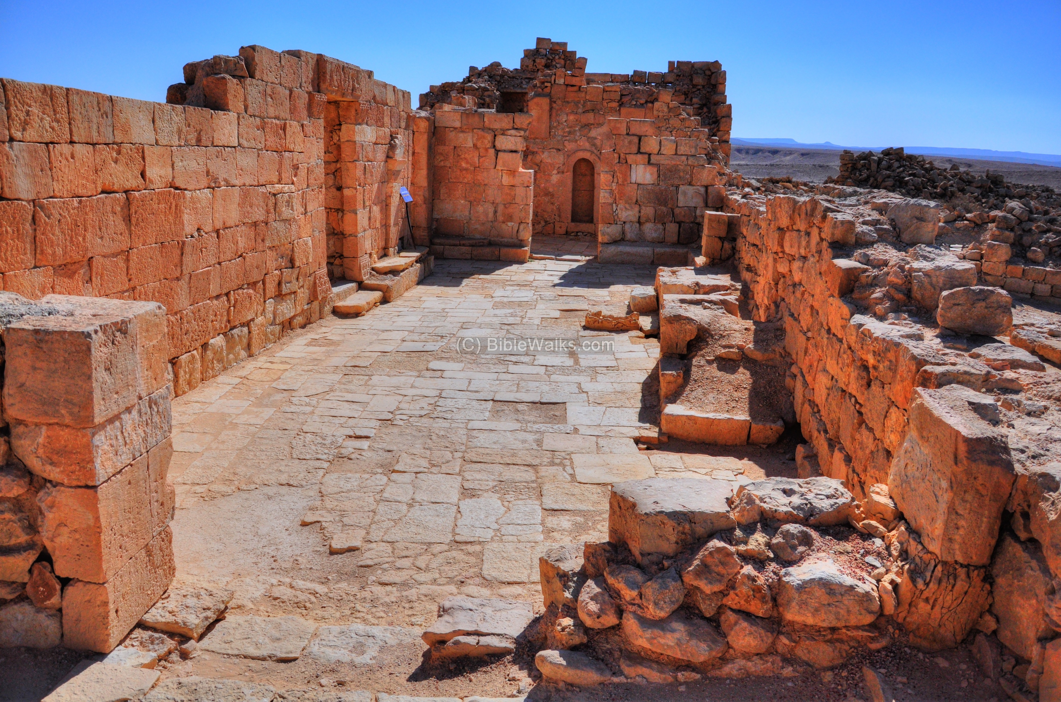
A view of the entrances:

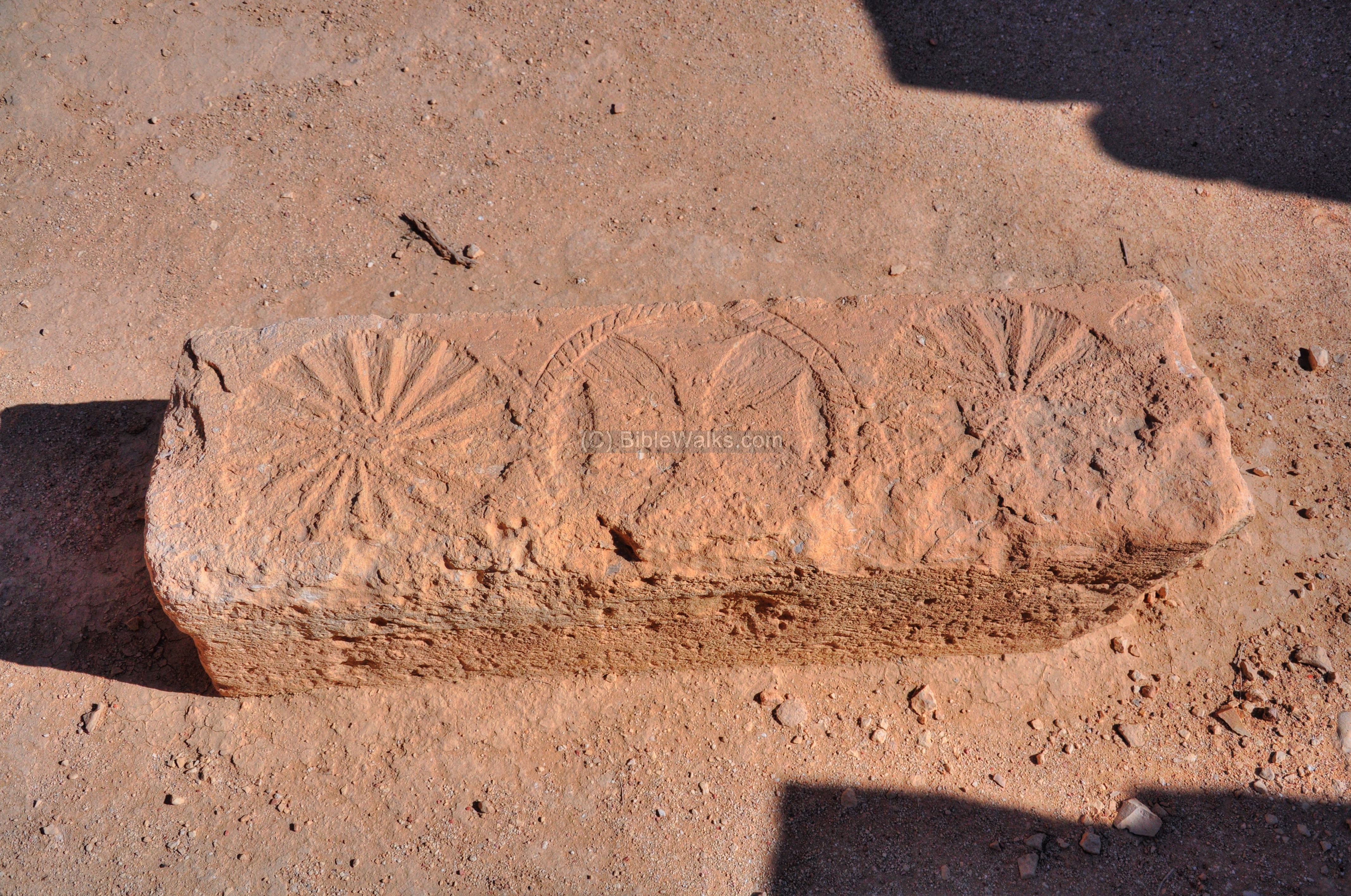
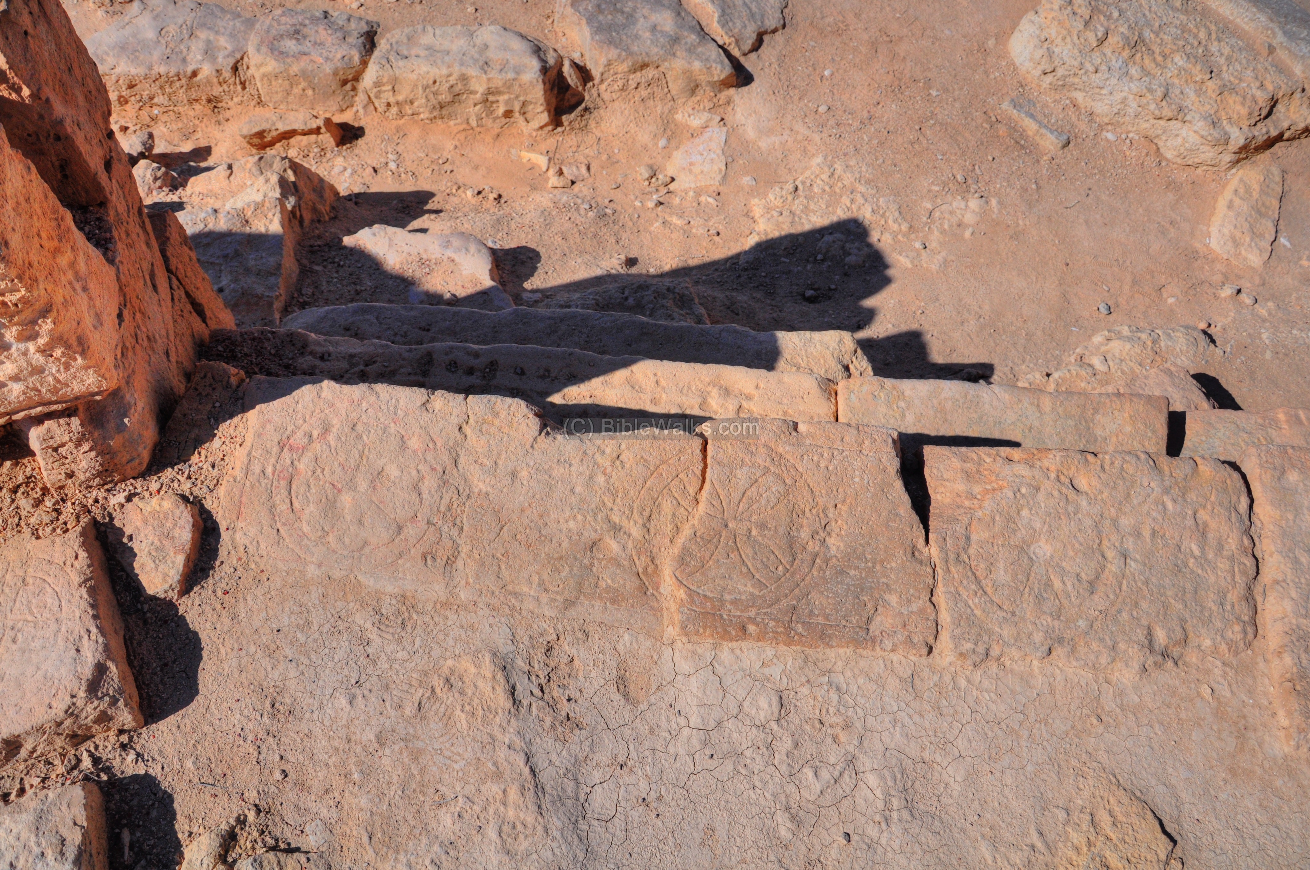
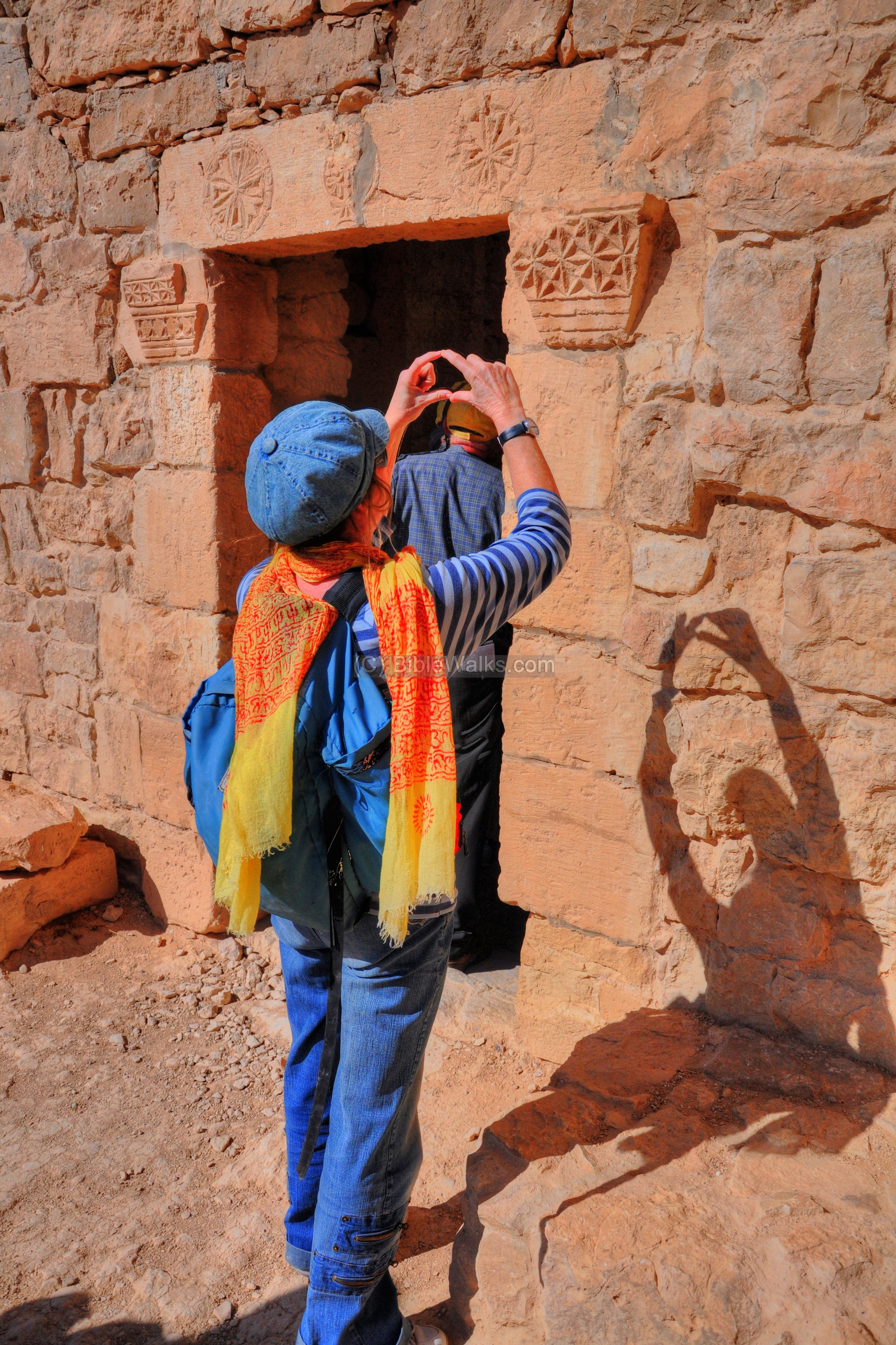
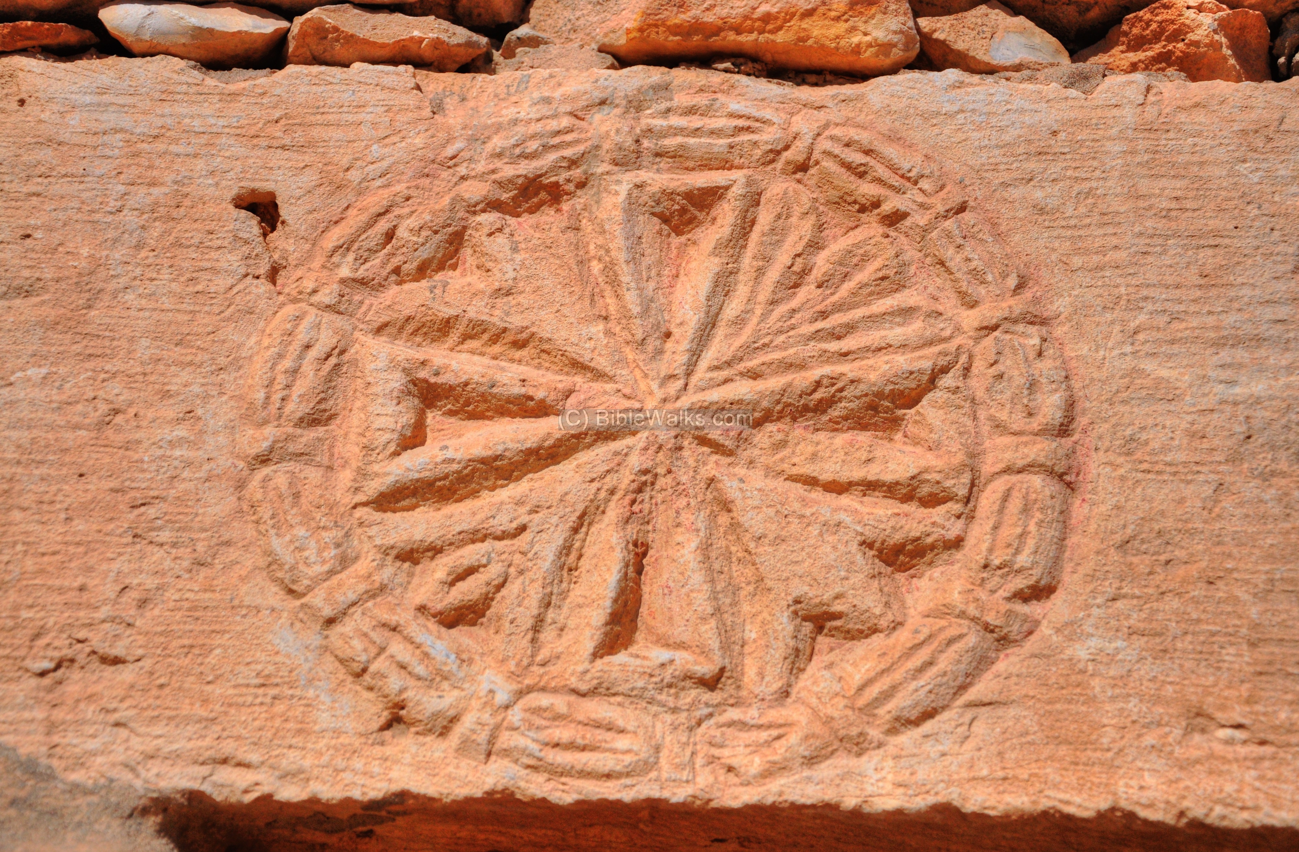
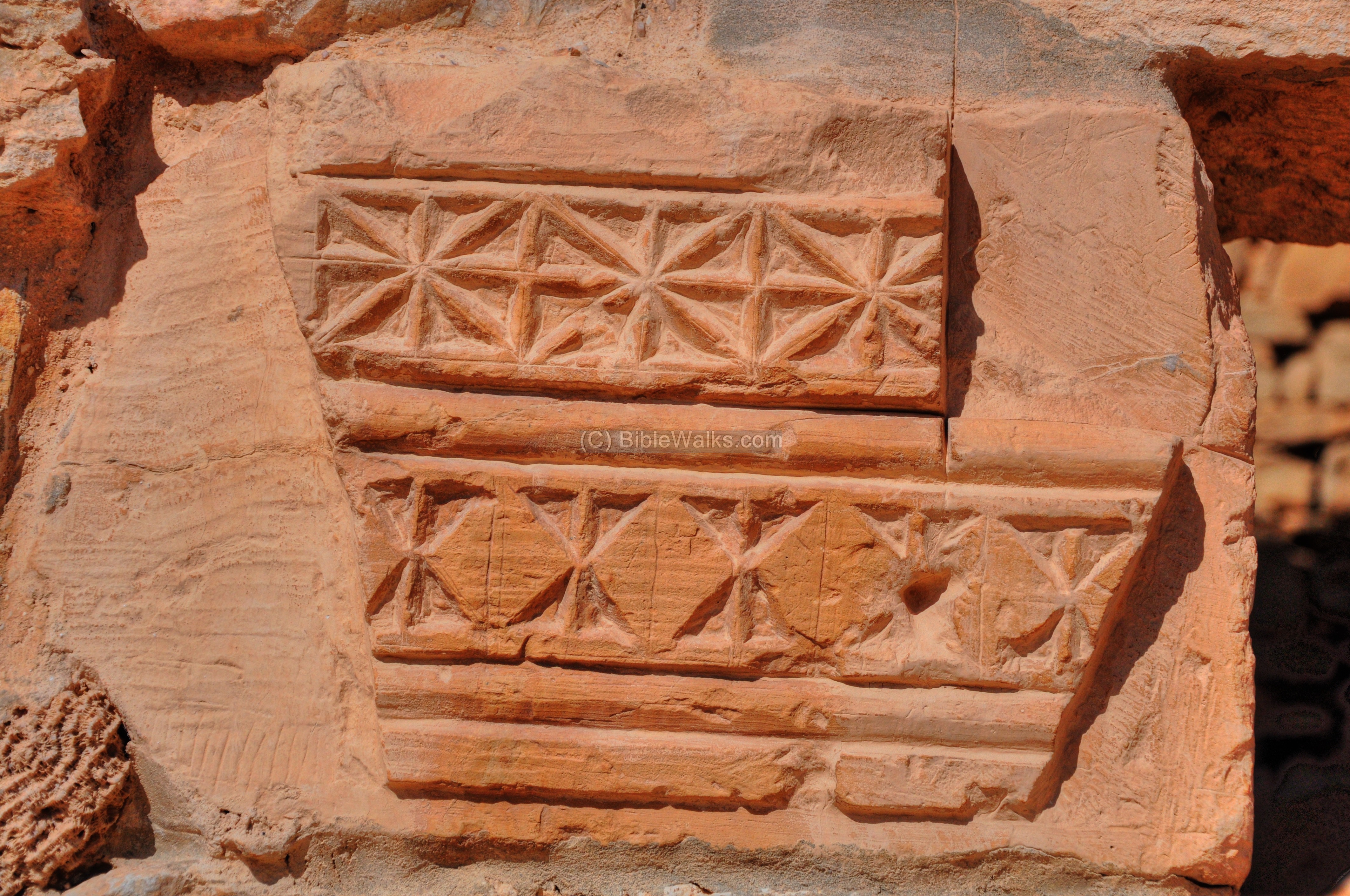
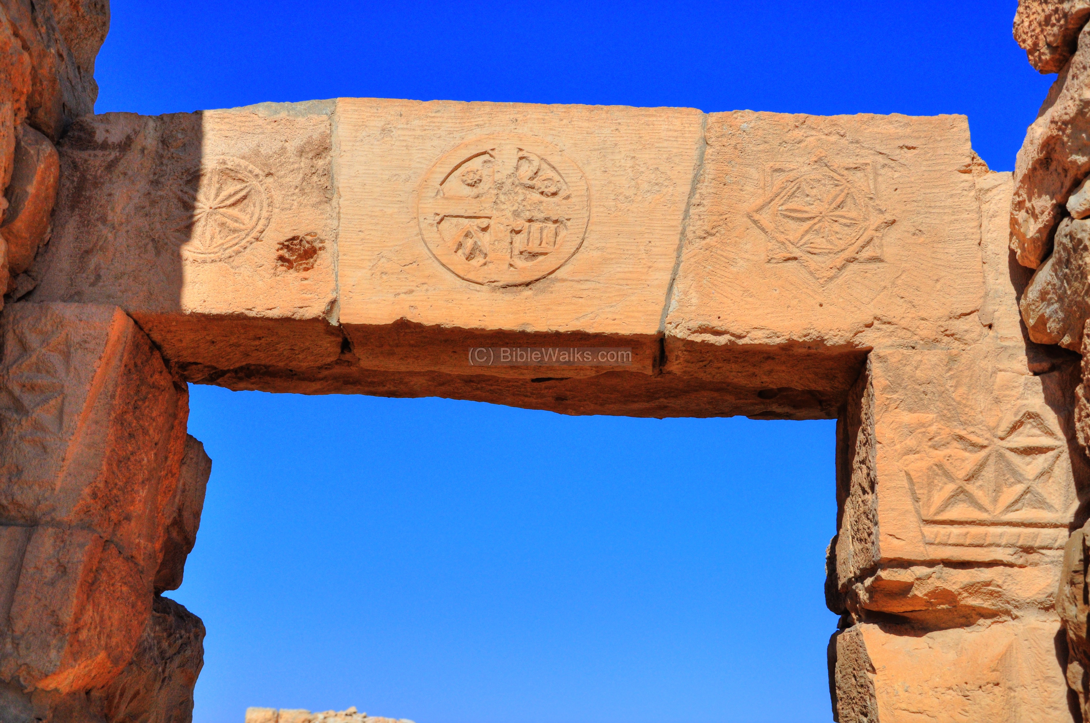
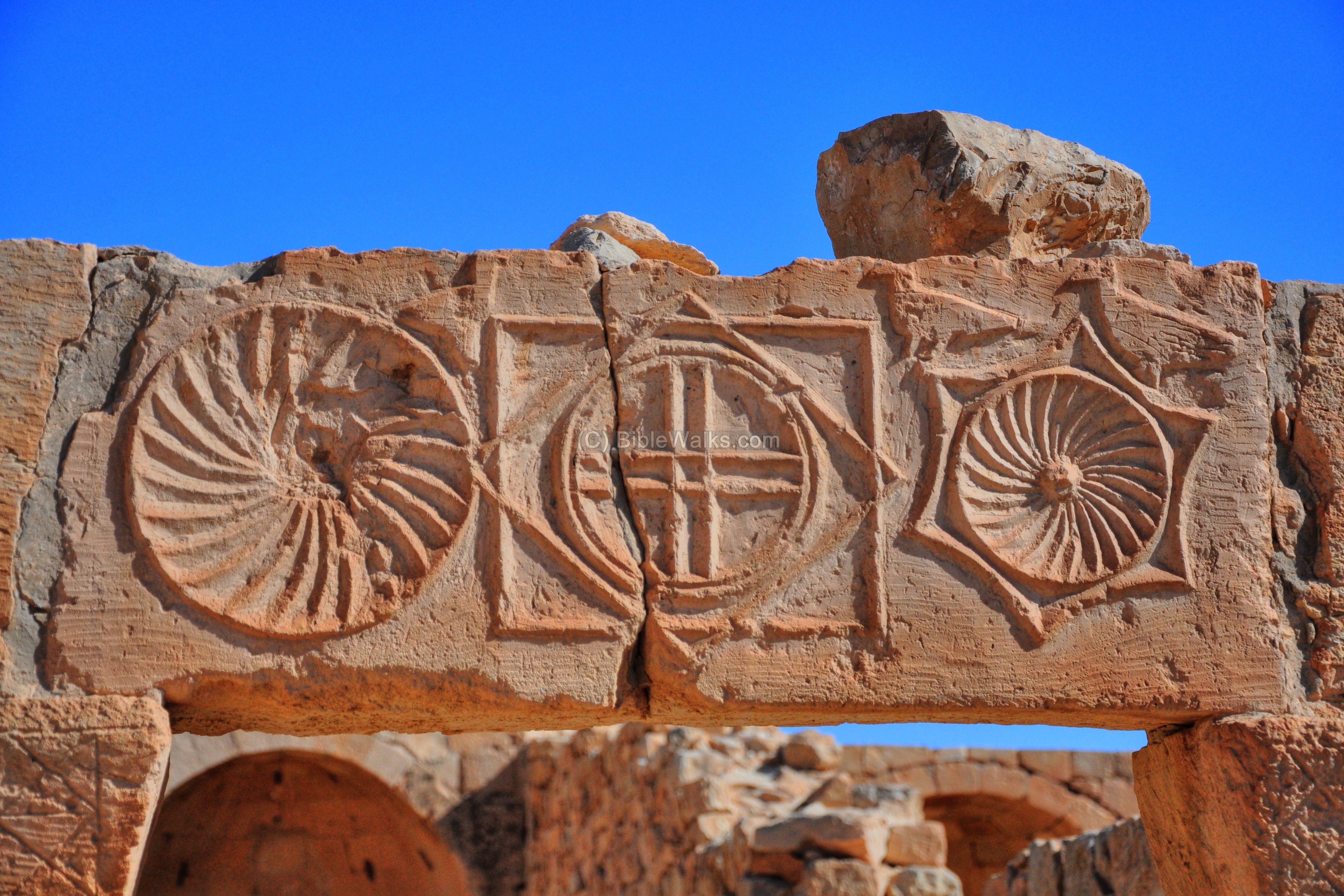
The decorated lintel above the entrance. Most of the decorations engraved into the stone are geometric patterns, but some of them include crosses, letters and fish. The deep carvings are typical of the decorated lintels – their purpose is to enhance the shadows in the bright desert sunlight.
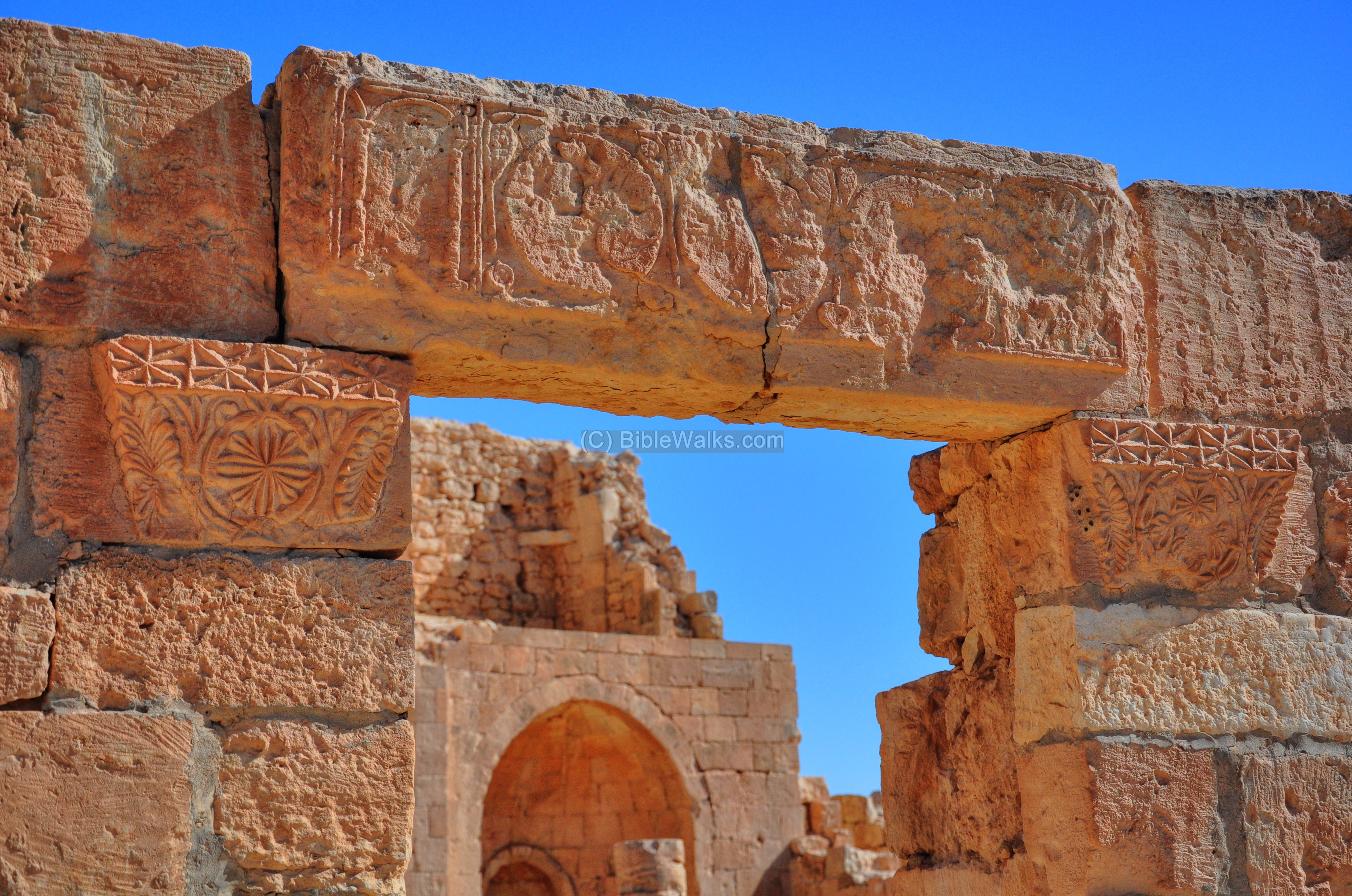
The lintel is a closer view:
A detail of the decorated entrance:

Another detail of the entrance:
- Small Square instead of an Atrium
The small square in front of the southern Church serves as a substitute for an atrium (courtyard in front of a church). Typical churches in the Nabatean cities have quite large atriums, but in this case there was no room for a considerable atrium. The area of the church was limited in size due to the constraints of the double pools.
A closer view of the wall along the atrium is seen in the next picture.
Notice the opening of the cistern which is located under the pavement.
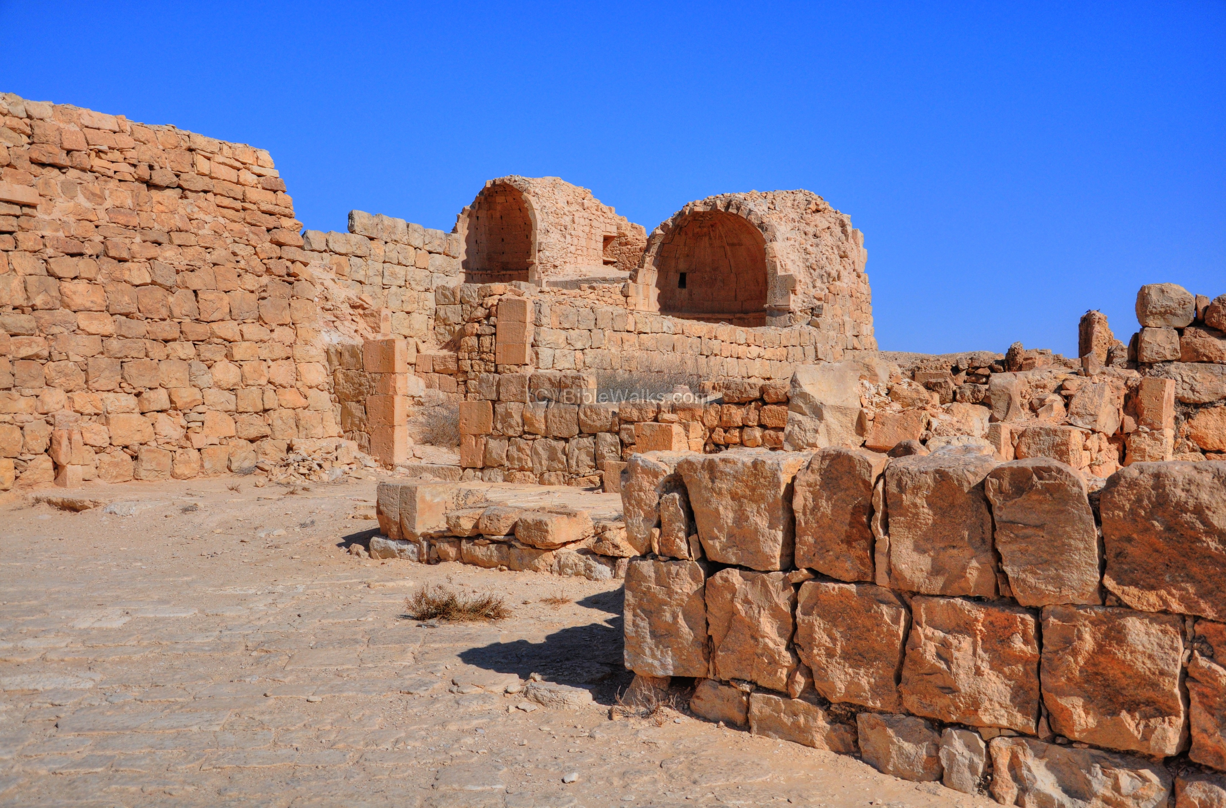
- Rooms around the church
There are several rooms and chapels around the church that may have served as part of a monastery. They were added at a later phase after the basilica was constructed (first addition was in the 5th century, and later in the 7th century).
Another chapel:
The room on the south side of the church has a pile of fragments of stones, still waiting to be assembled.
Another room around the church:
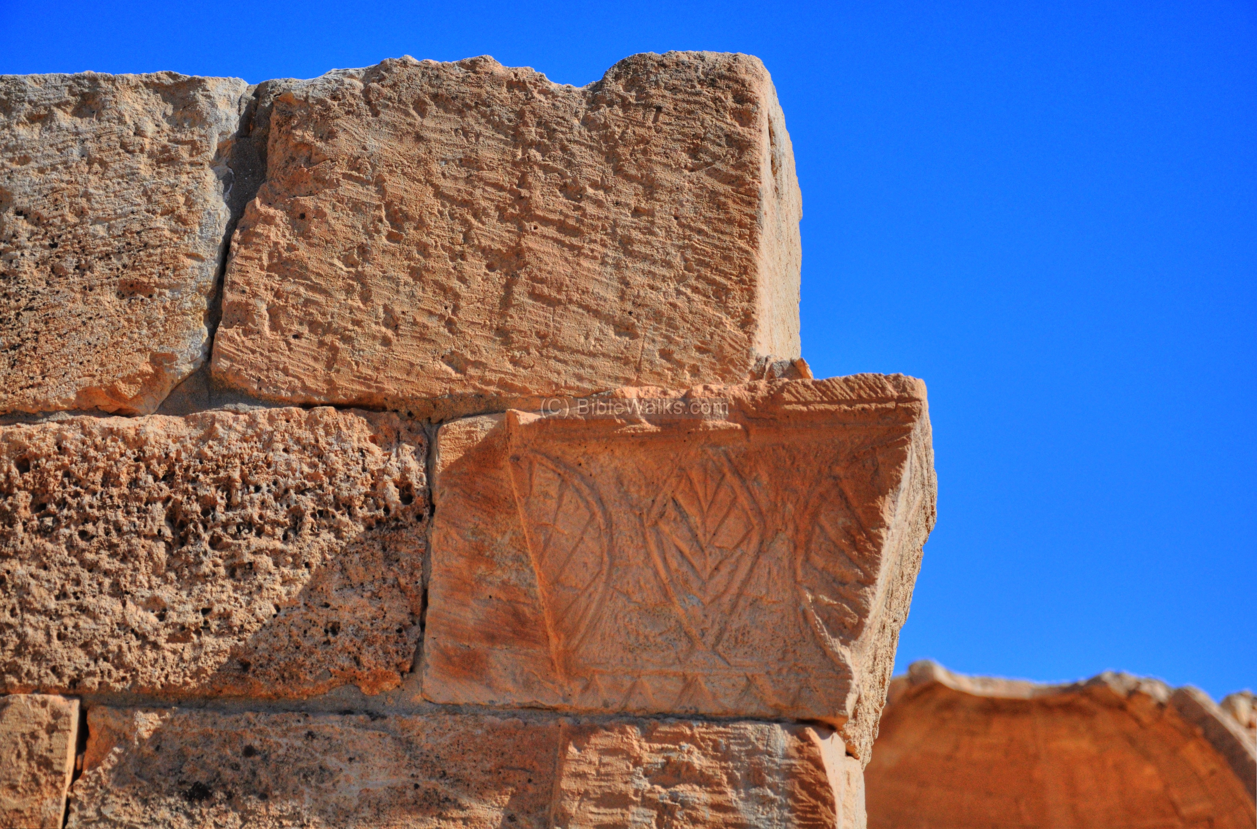
A decorated stone with a cross in the center and two geometric forms on each side:
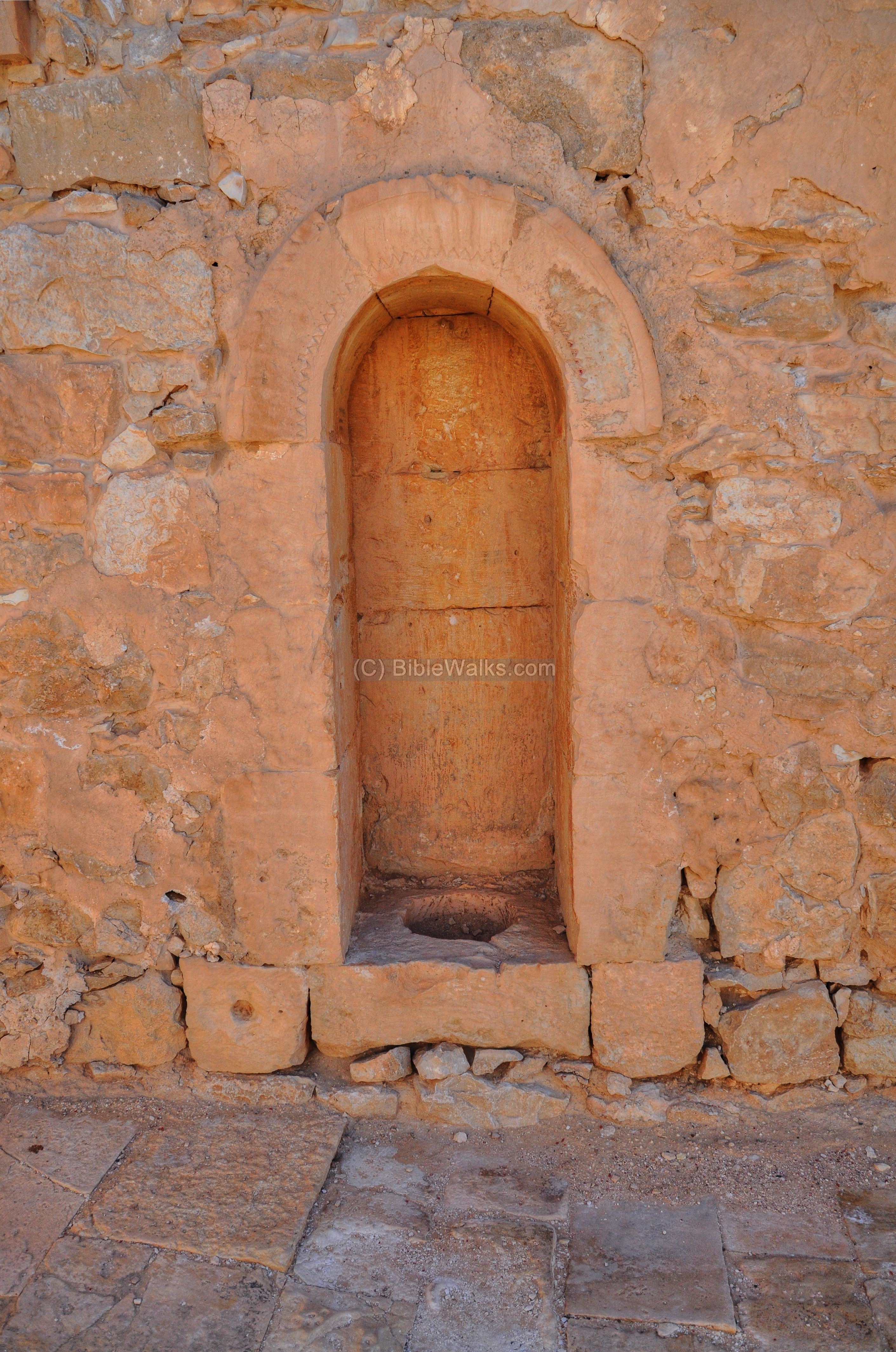
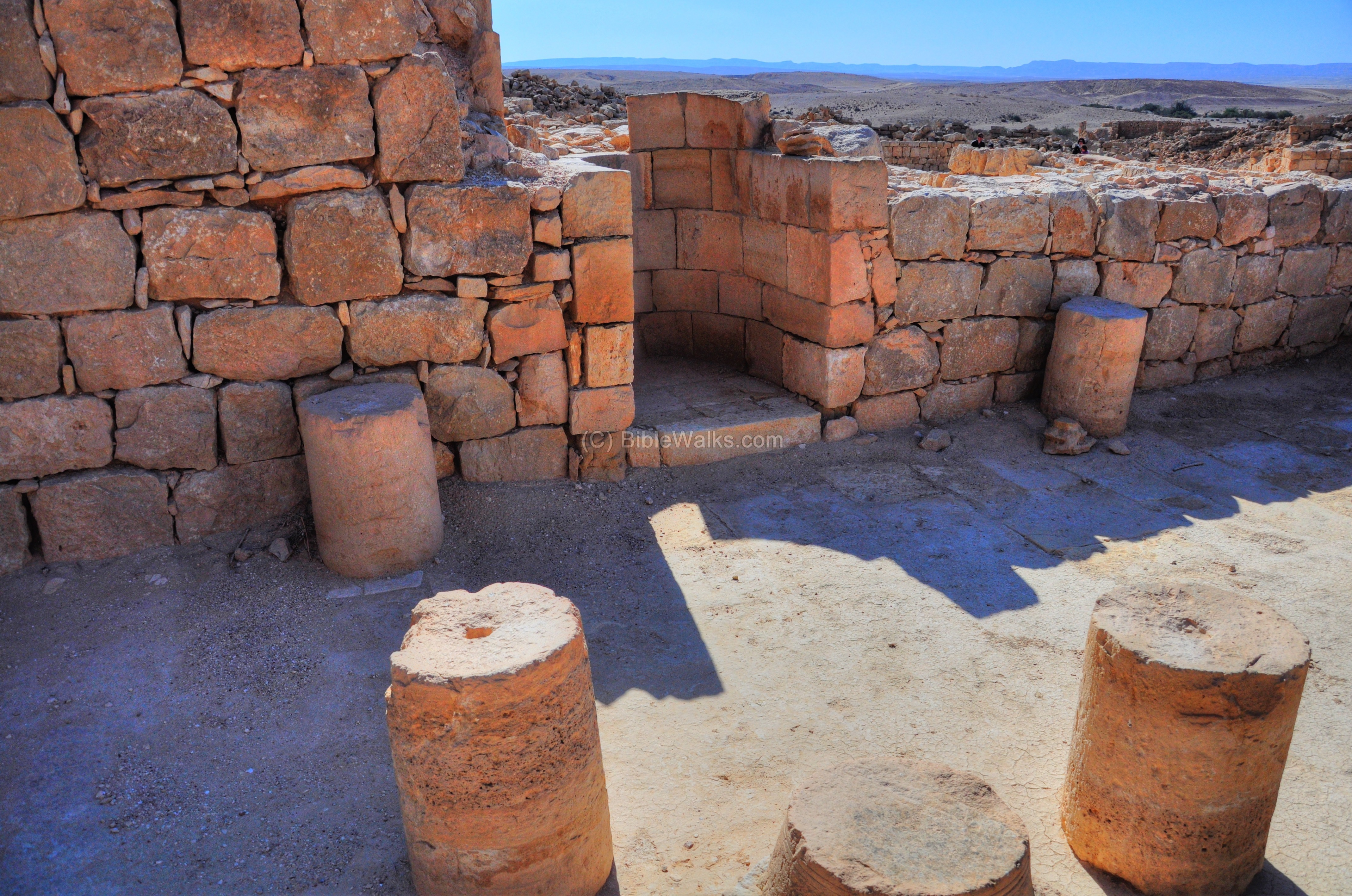
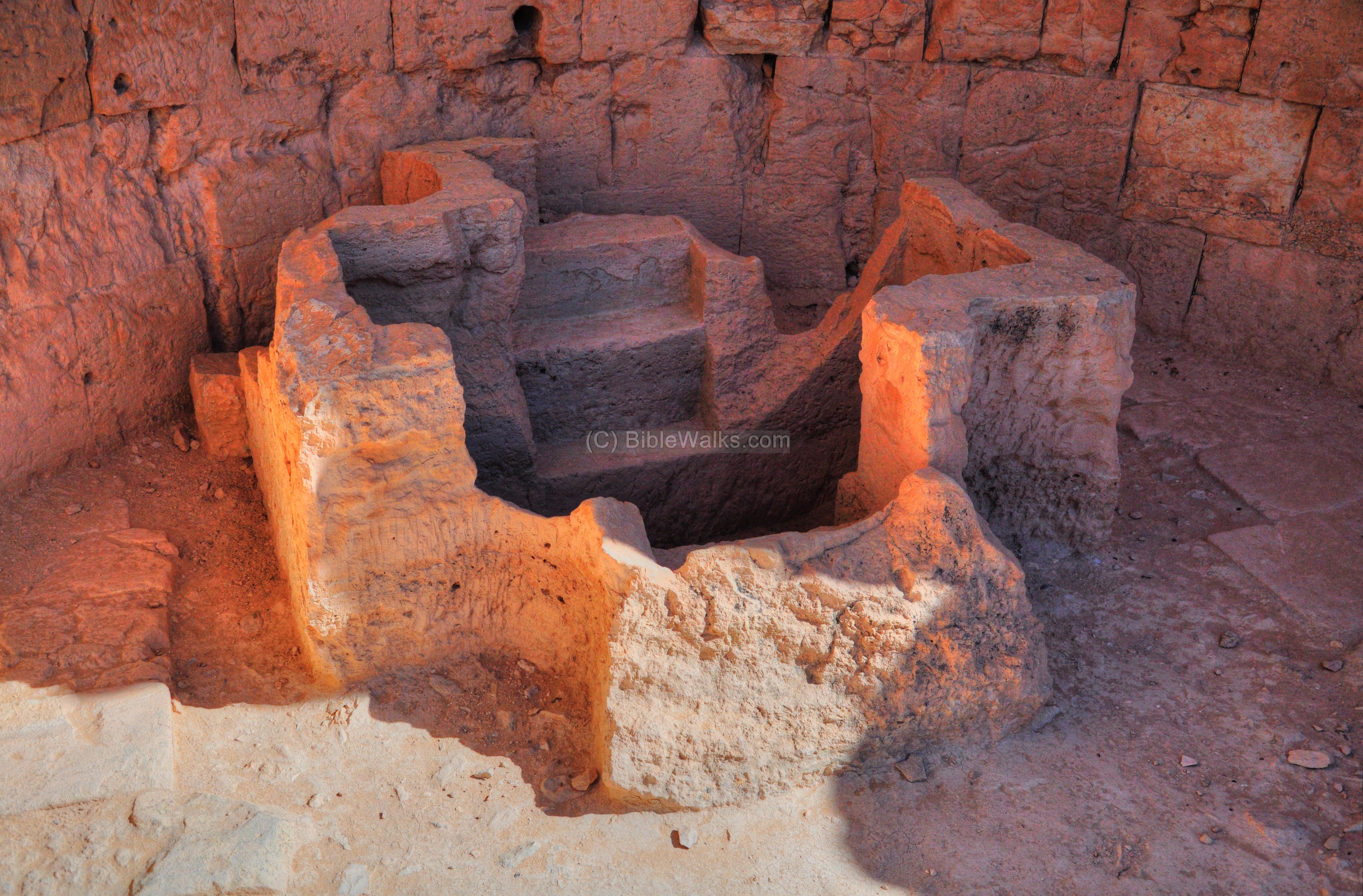
- Baptistery
A baptistery is built on the north-west side of the church. Its design is similar to the baptistery near the northern church of Avdat and the Eastern church of Mamshit. In the larger pool, which is in the shape of a cross (see photo below), adults were immersed in the water during the process of conversion to Christianity. On its left side is a smaller round pool for babies.

(f) Mosque
Evidence of the Muslim presence during the 7th to the 9th century is seen in this small hall situated on the north side of the Southern Church. Its location is indicated on the plan of the city as a red square.
The small hall is based on two rows of three columns on each side.
A prayer niche – Mihrab – is directed according towards the Islam Holy cities of Mecca and Medina. The niche is is embedded on the south wall, adjacent to the baptistery.
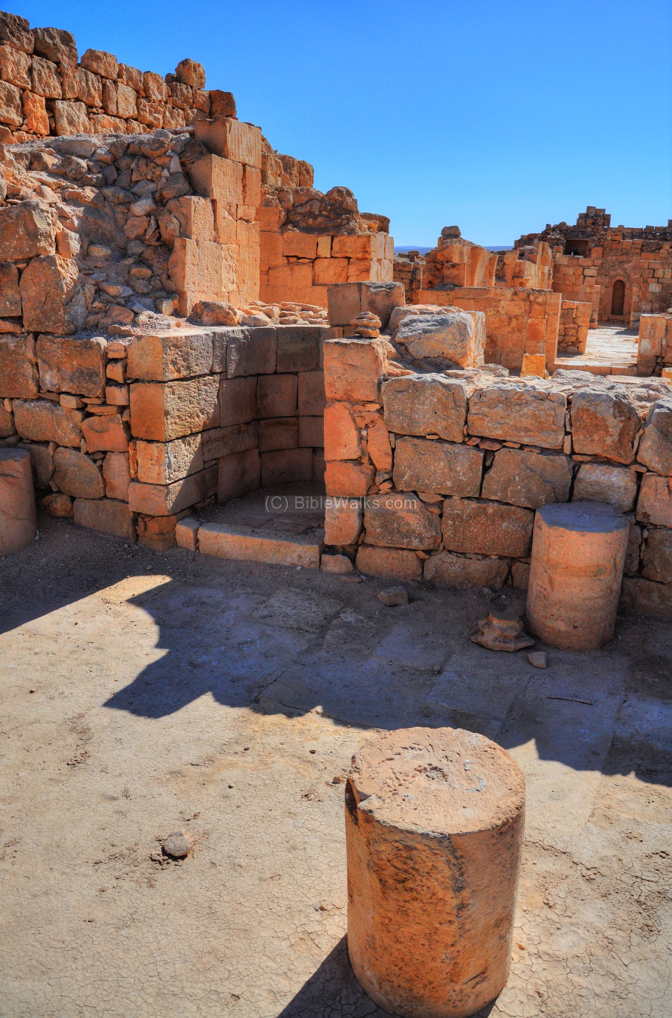
Steps with decorated carvings lead from the floor of the mosque down to the level of the water channels above the pool. They seem to belong to the earlier church rather than to the mosque.
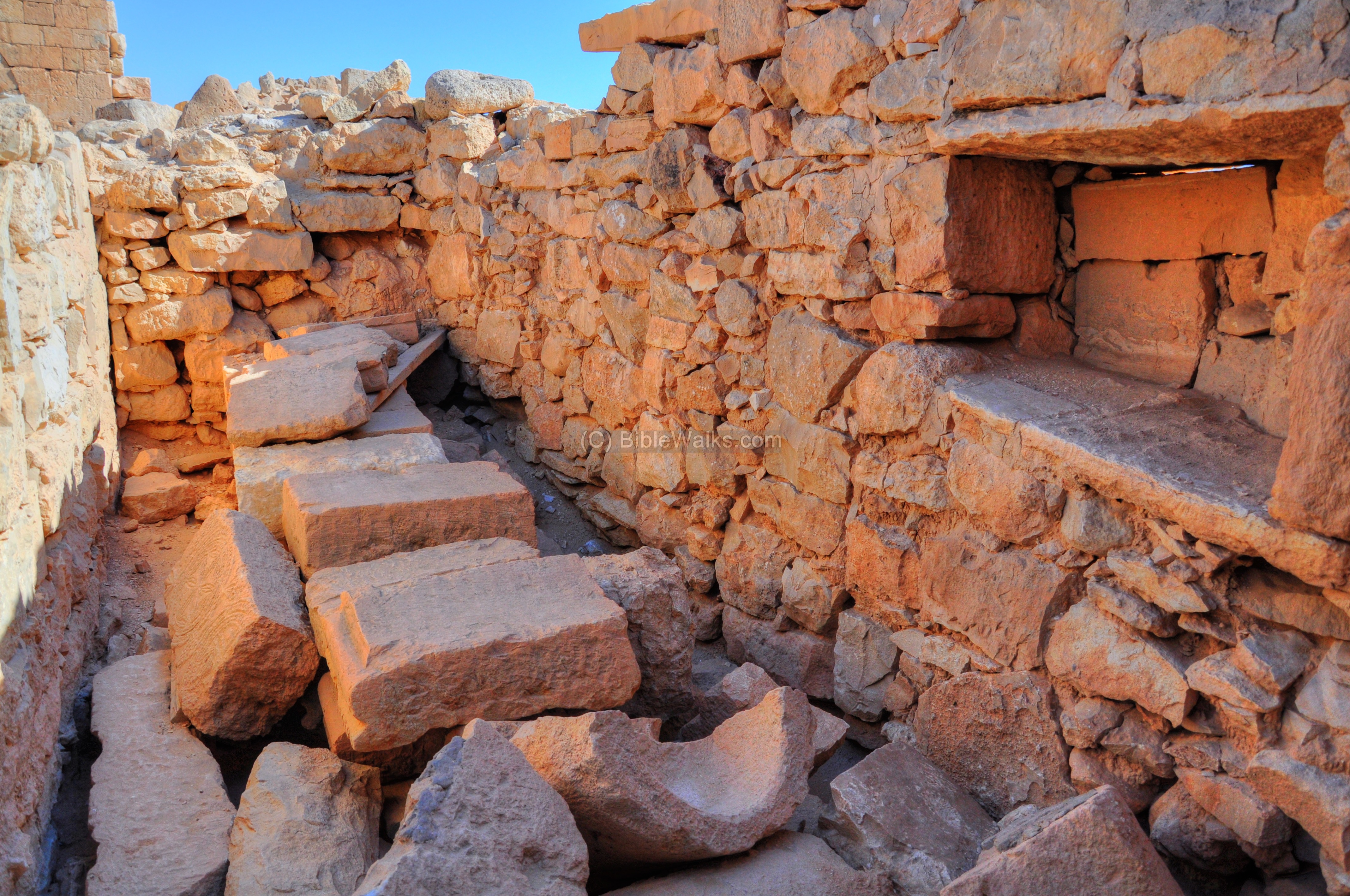
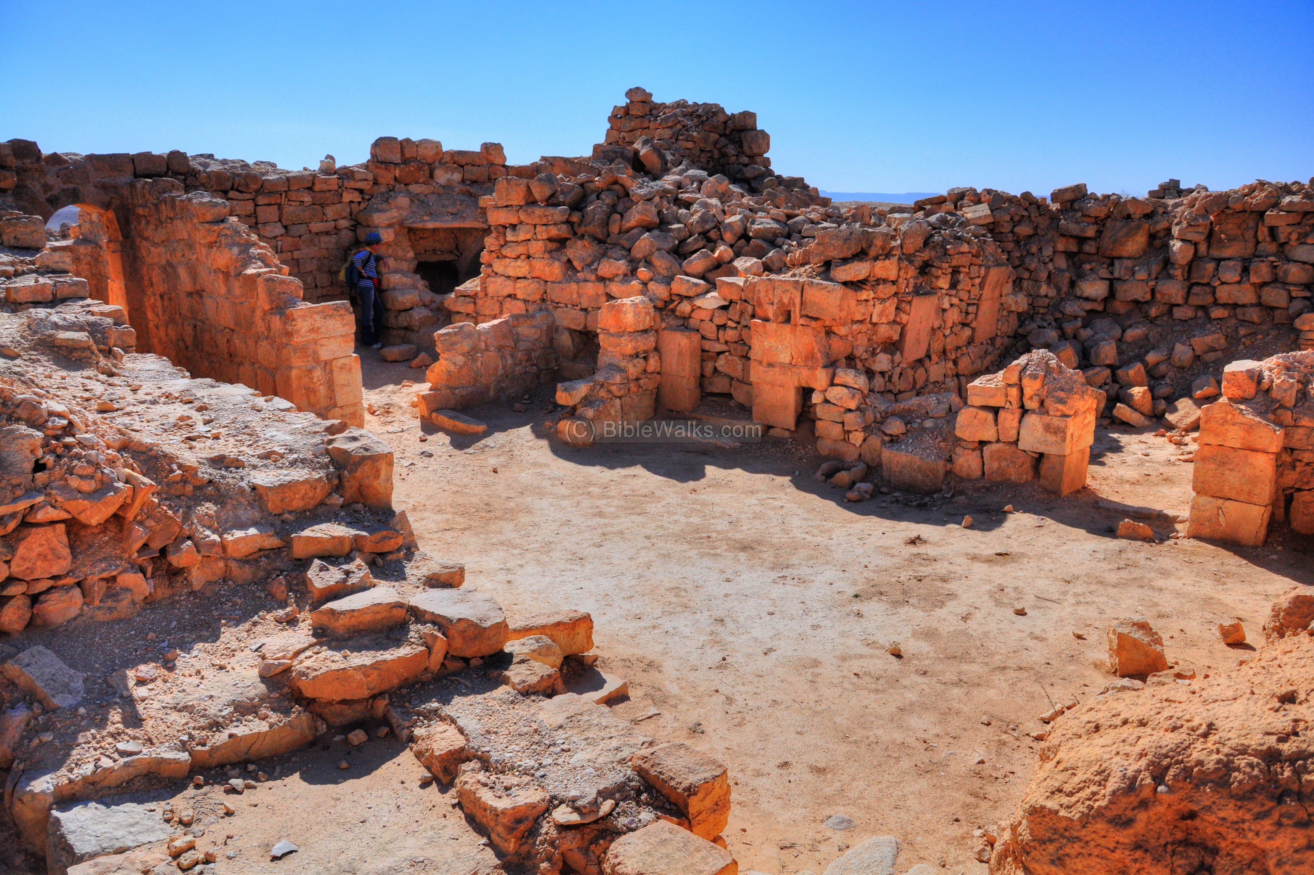
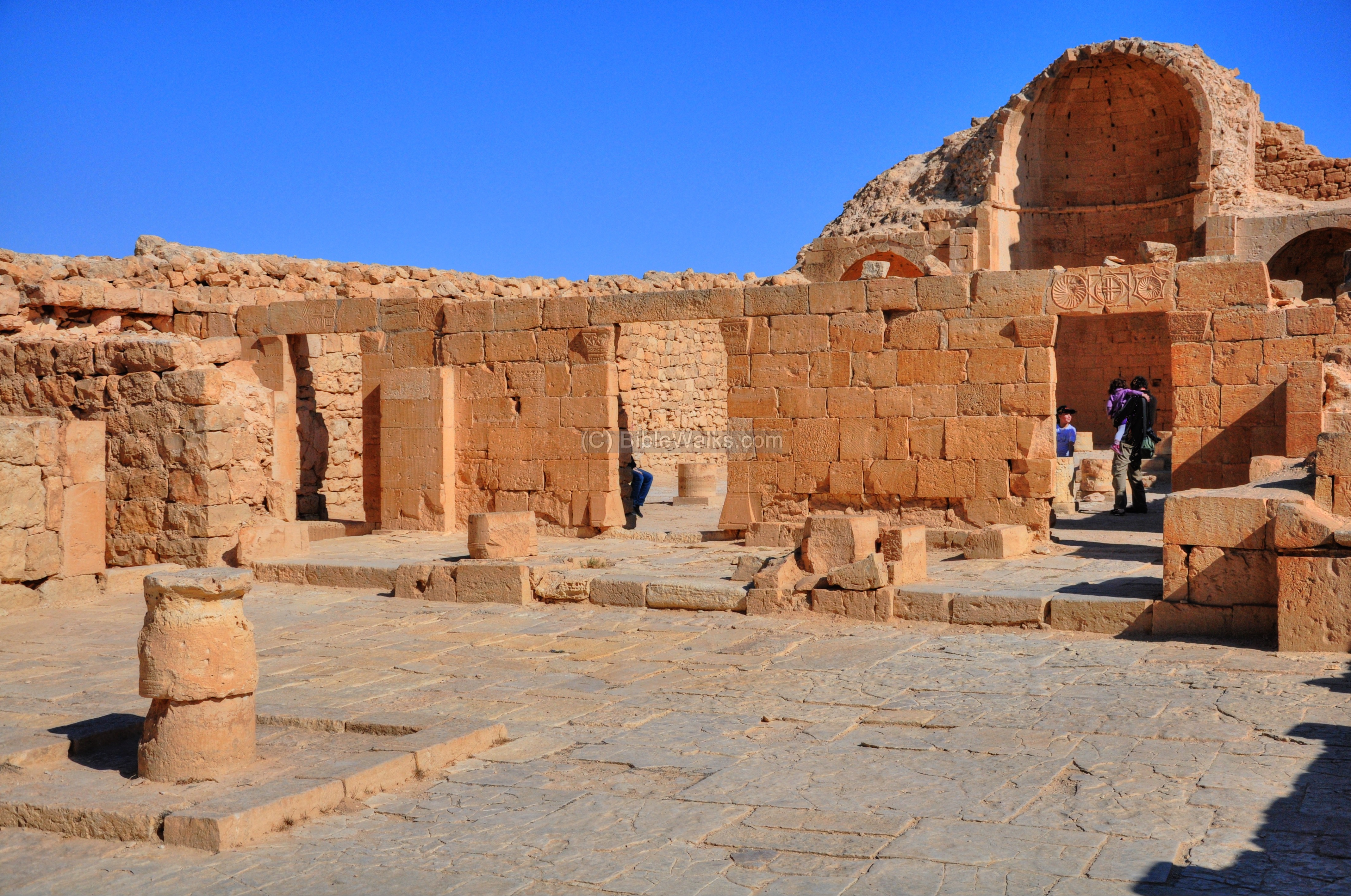
(g) Governor’s house
The main eastern street continues from the Southern Church up north along the center of the city. It starts with a staircase, then the street continues on straight. Ruins of residential buildings are located on both its sides. Along the street are water channels that collected the rainwater down to the pools.
After 70m, a plaza is reached, and on its north end is a remarkable structure. This structure is a private dwelling complex with a tall tower, and was nicknamed by the Colt expedition as the “Governor’s house”. The total area of the complex is 659m2, and is composed of three residential units.
The “Governor’s House” location is indicated on the plan of the city as a red square.
The structure may have been a private house, or part of a monastery connected with the adjoining Central Church.
According to A. Segal, it was first constructed in the 4th-5th century as a four residential units building with a total of 30 rooms. Then, in the 5th-6th-7th century one of the residential units was demolished and rebuilt as a church, while the other units became an administrative center. Since the Church played an important role in the management of the Byzantine towns, the administration may have been controlled by the Church. Later, during the Muslim period, the Governor’s house may have separated from the control of the church which has lost its prominent position.
The tower above the south side of the house is preserved to a height of 8m, out of the original height of 21m with three stories high.

Indeed, an impressive tower. It initially looked like the bell tower of the church but it is only the main entrance to the complex.
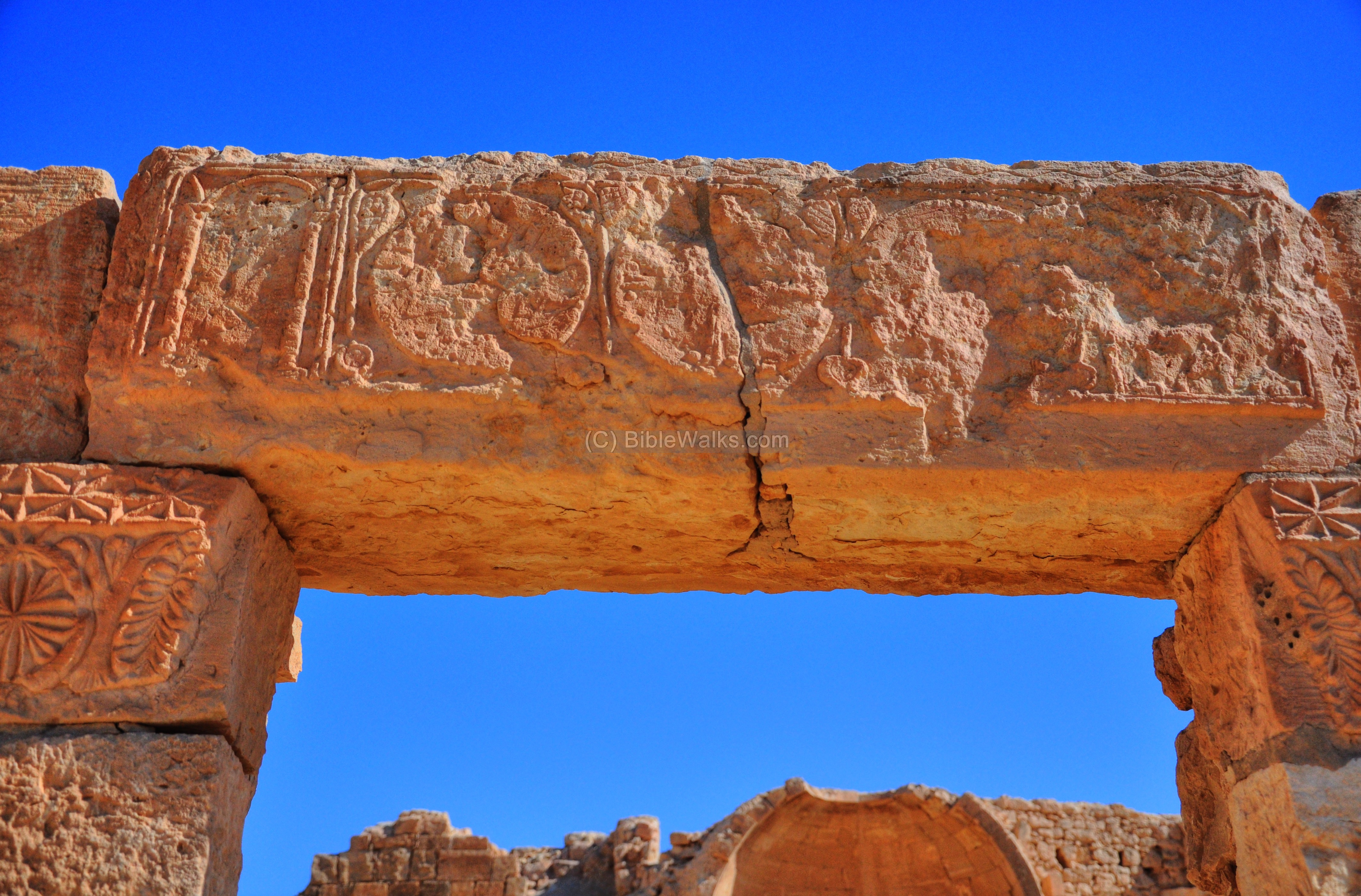
The lintel above the entrance is decorated with Christian symbols:
The decorations on the reconstructed entrance are indeed admirable:
A closer view on one of the decorations:
Another segment of the lintel:
Inside, the arch supports the tower. This entrance room is 4.4m x 3.7m, and it opens up to the open courtyard.
Another view of the tower, from the courtyard inside the house, is seen in the next picture.

- Southeastern unit
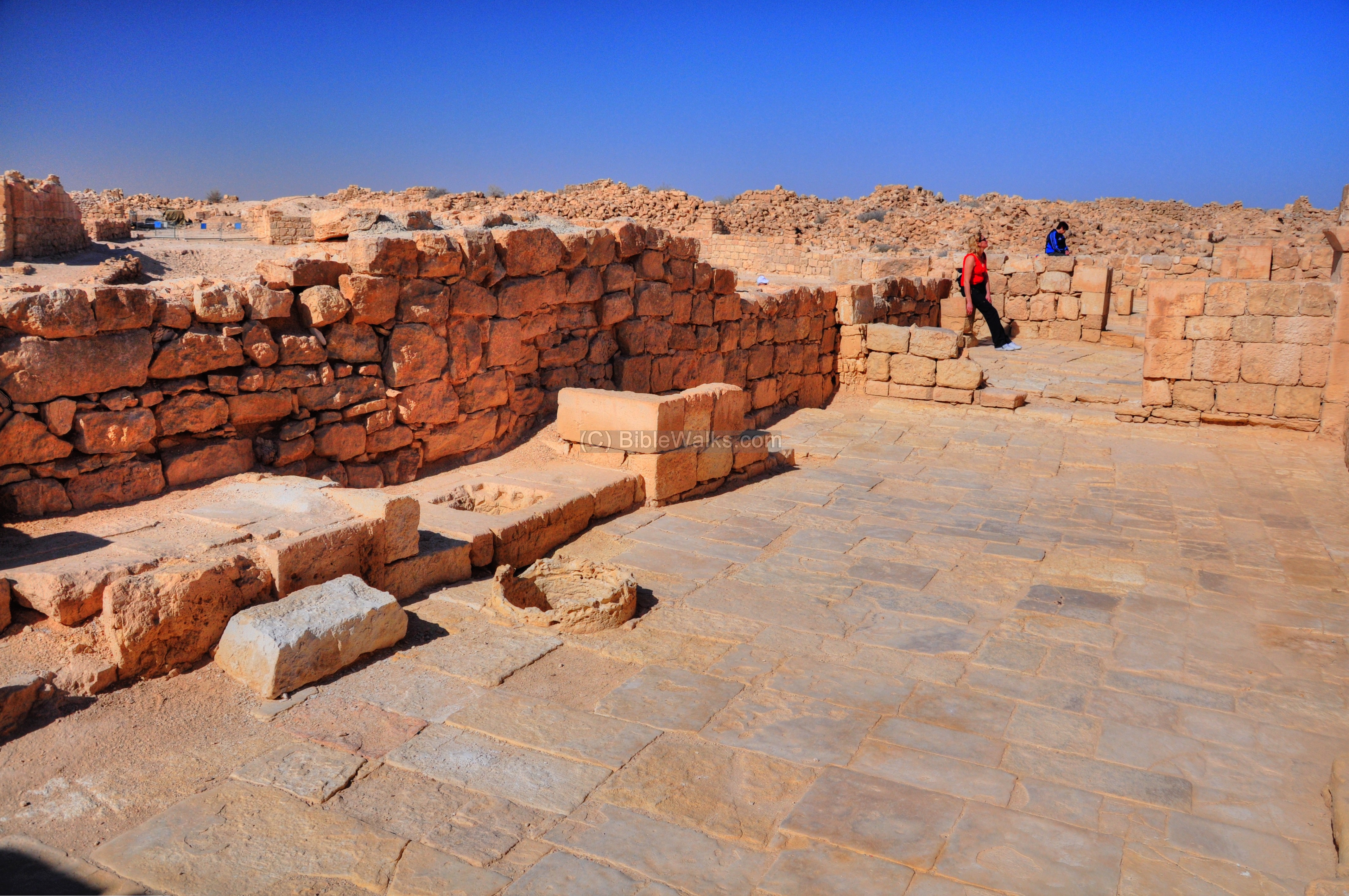
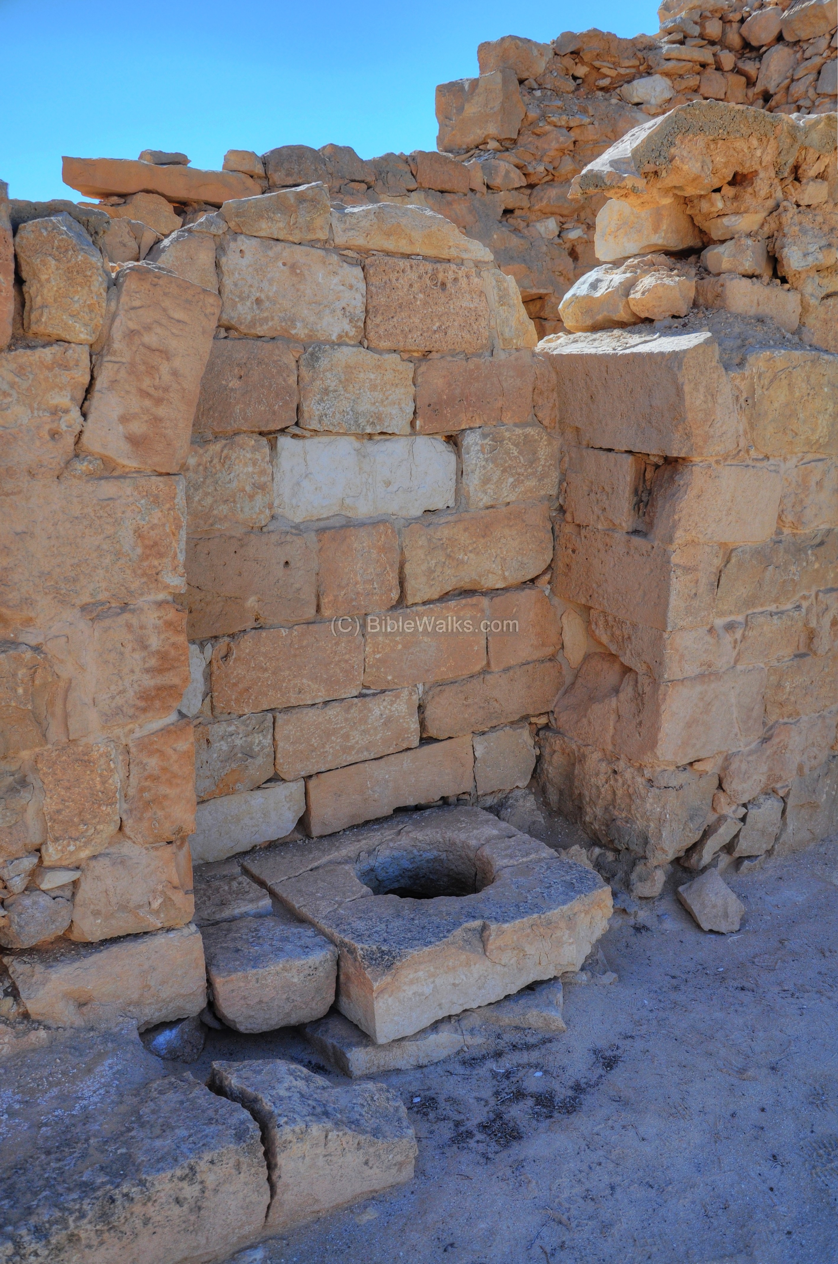
After entering into the complex, you step into a large (6.2m x 10.3m) courtyard. The floor is paved with uneven sized stones. In the center is an opening to a cistern, which receives water by channels from the roofs of the building. The courtyard was 2/3 open, while only its eastern side was covered.
View of the courtyard from the east is shown below. On the western wall are 7 steps, which once led to the second floor.

Another view:
- Southwestern unit
The courtyard inside the western unit of the “Governor’s house” is seen in the next picture. This section was not yet excavated or restored. The courtyard was entered from an arched entrance which is located on the south wall west of the main entrance.
Peeking into the cellar on the south-western corner:

A modern coffee cup was left in one of the niches:

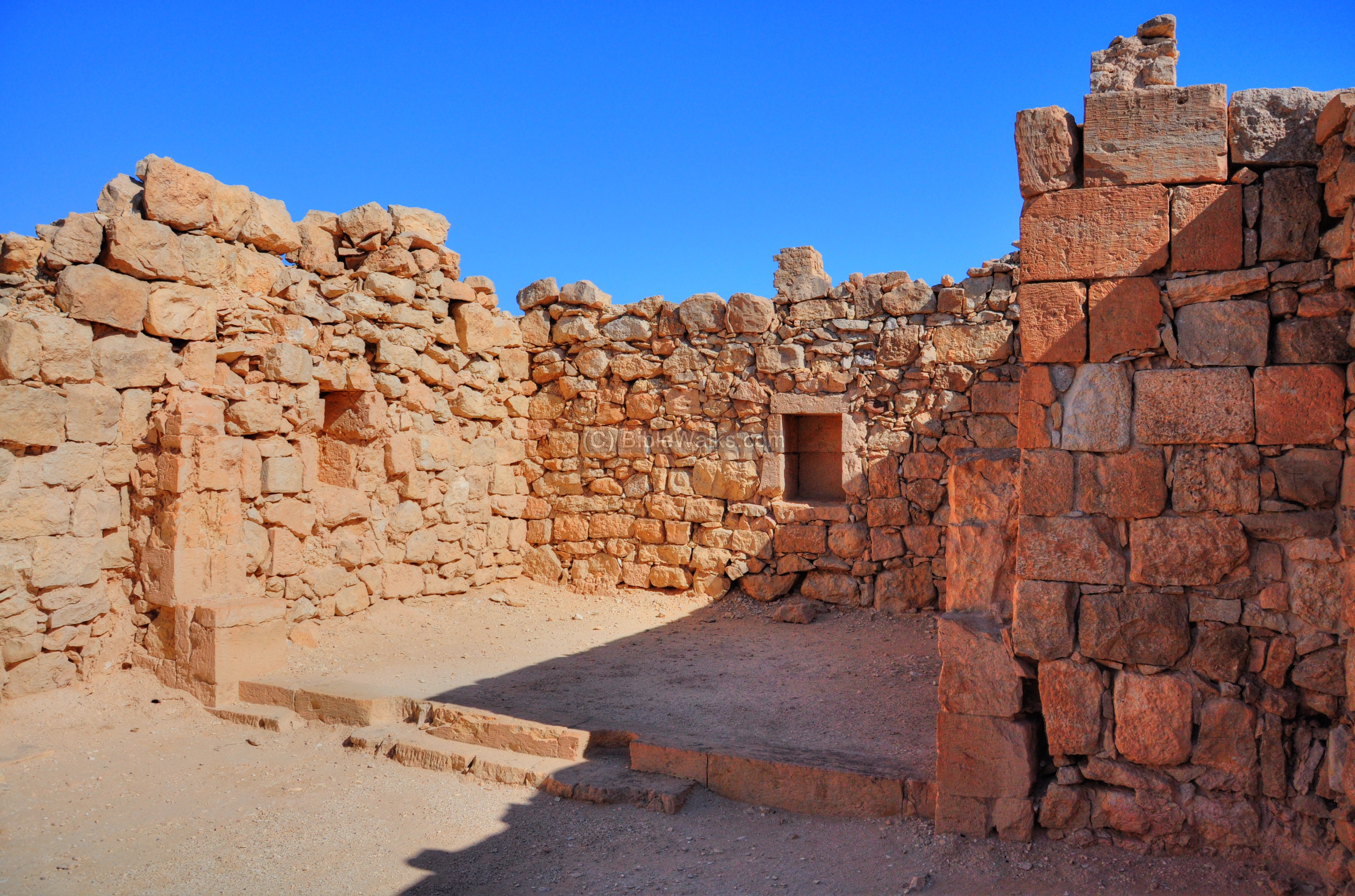
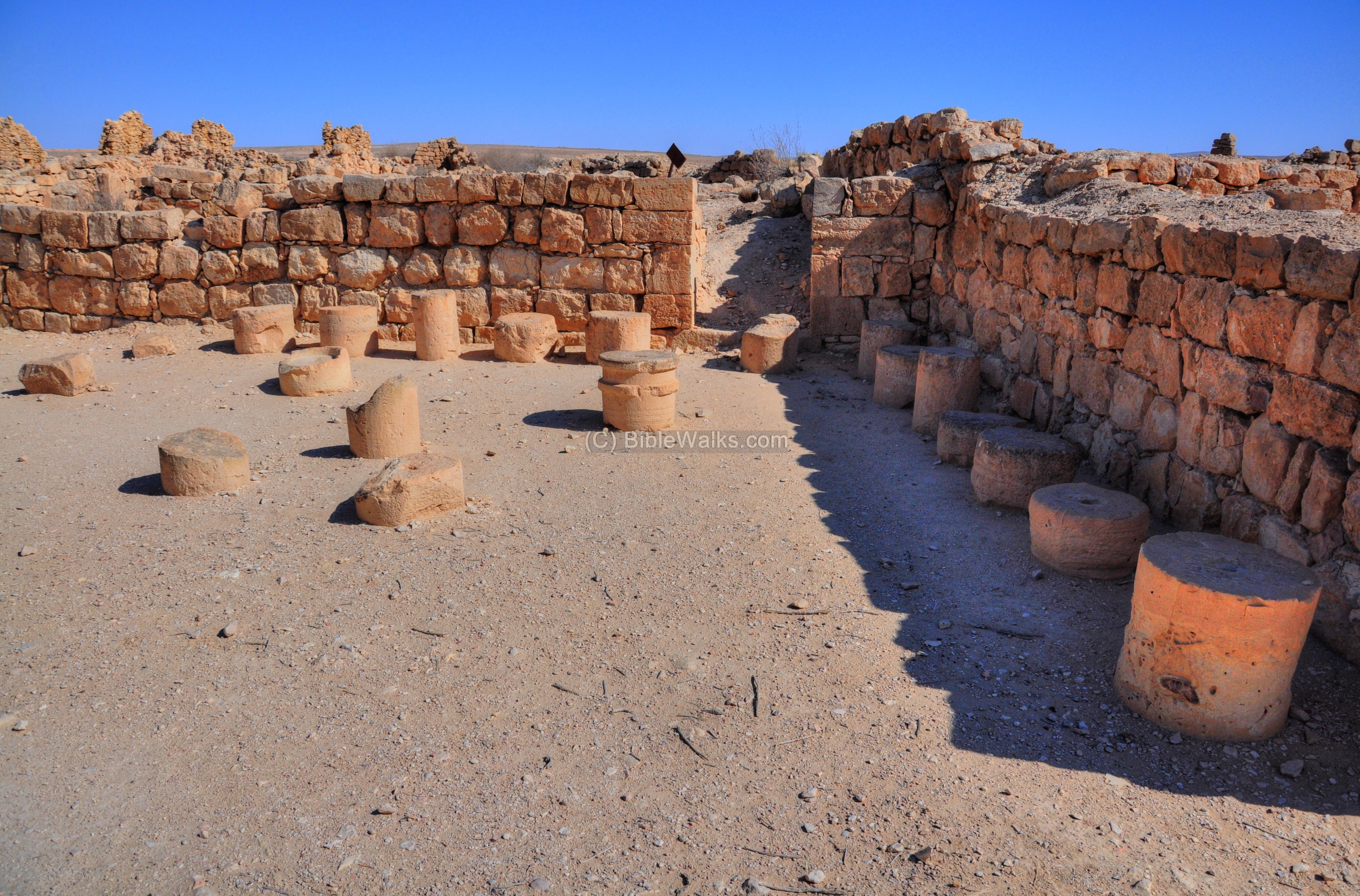
(h) Central Church
The Central Church is located near the “Governor’s house”. It is relatively small (22.37m x 15.60m), and hidden between the residential houses. It was built in the 5th-6th century – the latest church constructed in the city, following the expansion of the city. It served as a local prayer place that provided local religious services to the local community.
The location of the Central church is indicated on the plan of the city as a red square.

The following picture shows the tall structure of the church behind the Northeastern unit of the Governor’s house.

The entrance doors are located on its west side. Its triple apses are oriented to the east. The plan of the church is based on two rows of four columns.
Another view of the walls of the church is seen in the next picture, which is taken from the south.
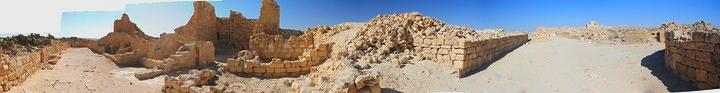
A panoramic view, as seen from the eastern street at this location, in shown in the following picture. If you press on it, a panoramic viewer will pop up. Using this flash-based panoramic viewer, you can move around and zoom in and out, and view the site in full screen mode. Note that it may take several minutes to upload, but this is faster than riding over there…
To open the viewer, simply click on the photo below. It will open a new window.
(i) Along the Eastern street
The eastern street connected the south side of the city to its north side. Its route started in the south “gate”, passes near the twin pools and the southern Church, passes the “Governor’s house” and the Central church, crosses the northern plaza and reaches the Northern gate near the Church.

The houses are aligned on the side of the eastern street.

(j) Northern Plaza
There are no large public areas inside the city, and most of the large public activities such as the market were conducted outside of the city walls. This paved square, in front of the northern church, is the only public square inside the city. It may have been a center of the city’s social and economic life.
The location of the Northern Plaza is indicated on the plan of the city as a red square.

An isolated building was found on the south side of the plaza, containing two rooms. The northern room had a stone bench. According to the late Prof. Y. Hirschfeld, a leading Israeli researcher of Greco-Roman and Byzantine archaeology and desert monasticism, speculated that this building might have served as a kiosk that served the people who assembled in the plaza.

A winepress is located on the east side of the northern plaza. This winepress, as well as others found in Shivta, indicate that grapes was one of the main crops.

To the north of the winepress is a structure with a large courtyard and stone benches around its walls. The stones were found in another room in the building. The structure may have served as the council house of Shivta.
The Shivta aqueduct entered to the city at the east side of the northern plaza. From here it was distributed to the houses and the central pools in the southern section of the city.
Some of the rooms may have been workshops belonging to the nearby monastery and church. This probably also included the winepress.
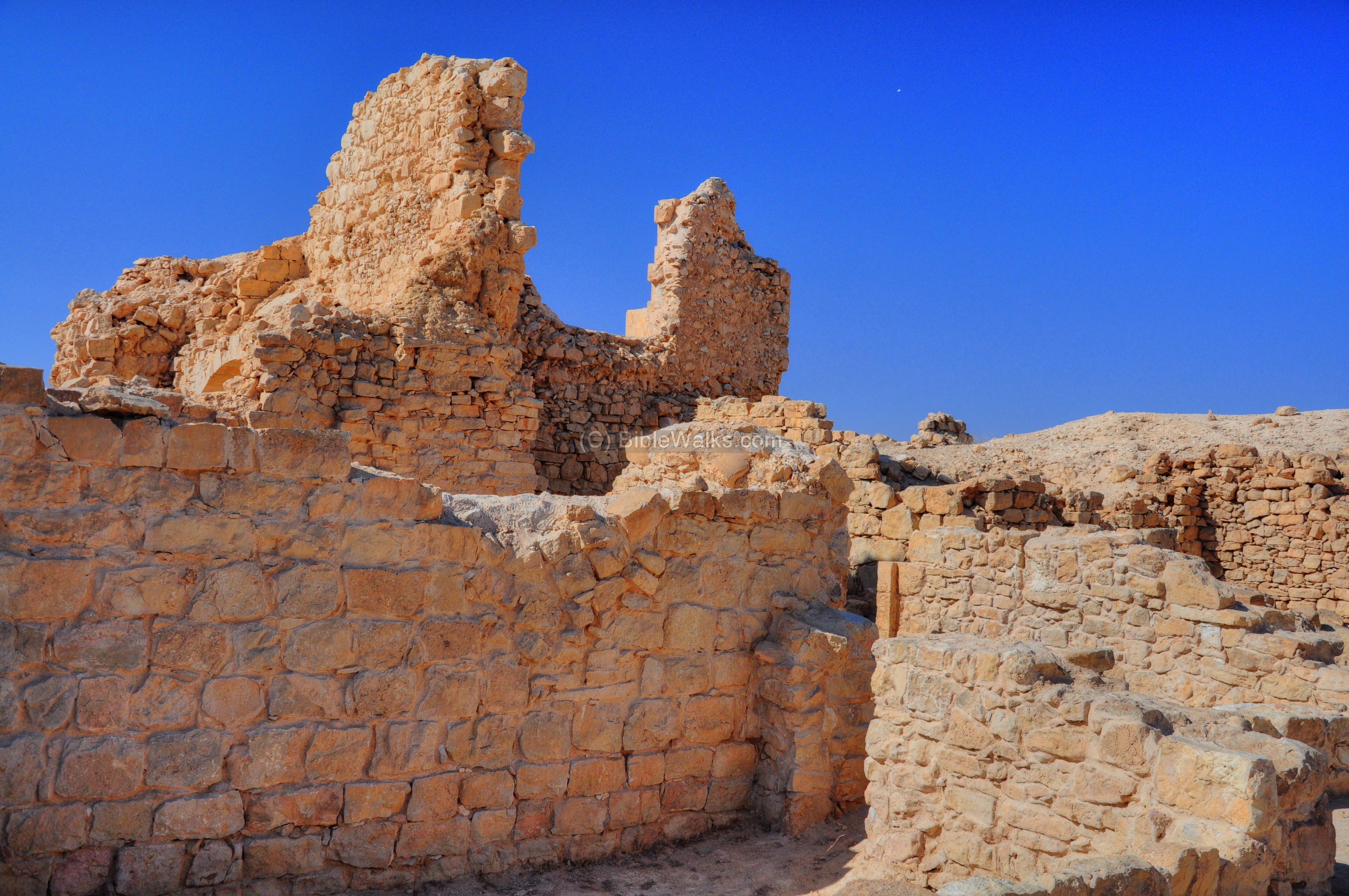
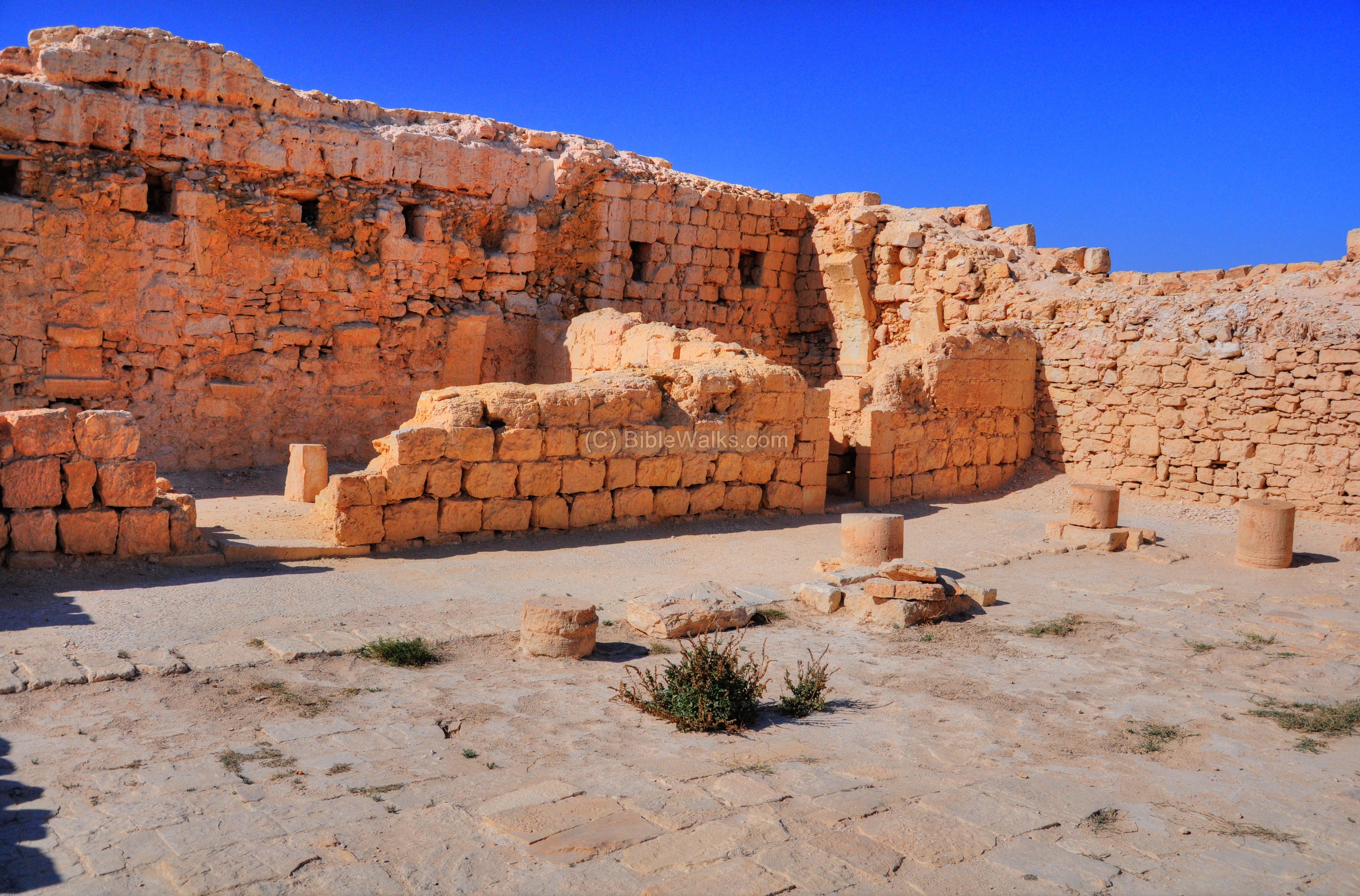
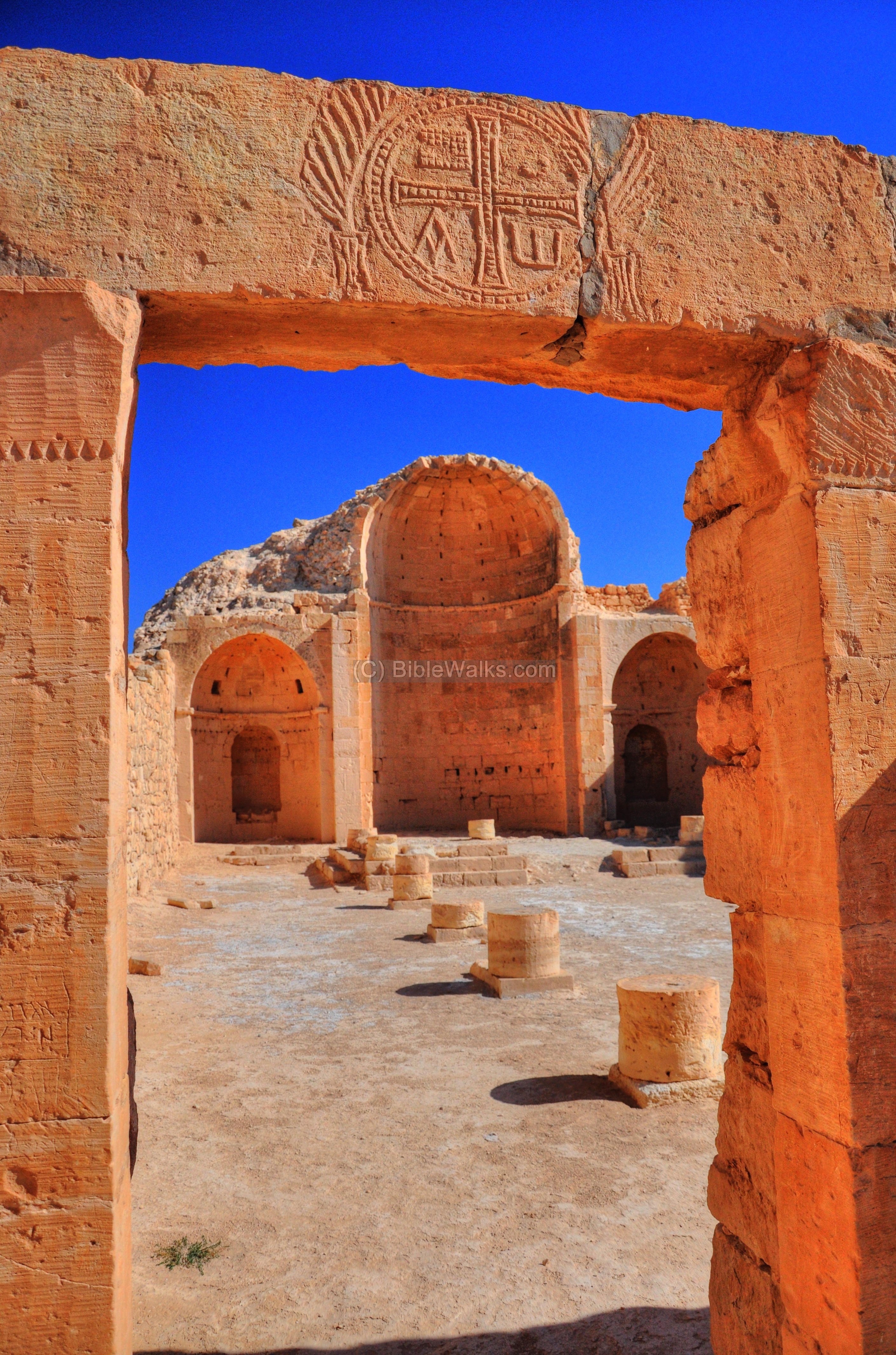
(k) Northern Church
This is the 3rd Church in Shivta, located on the north most side of the city. This complex, with forty rooms, may have been part of a monastery. The present tri-apsidal design has been converted from a mono-design like in the case of the southern Church. It was constructed in the middle of the 4th century.
The location of the Northern Church is indicated on the plan of the city as a red square.
The triple apses face east, as the other churches. The church dimensions are 20m x 13m, and its walls were once covered with white marble. The plan of the church is based on two rows of six columns.
The picture below shows the north apse. Notice the holes in the wall, which once held the white marble stones which decorated the walls. The two larger holes in the upper side used to enter natural light into the apse at the time it was a separate room.
Niches were found in which boxes were kept containing sacred relics.
The next photo is of the south apse. Here, too, niches were found in which boxes were kept containing sacred objects.
The walls are preserved to a height of 10m, and are supported on the exterior by slanting stone walls.
- Entrance to the Atrium
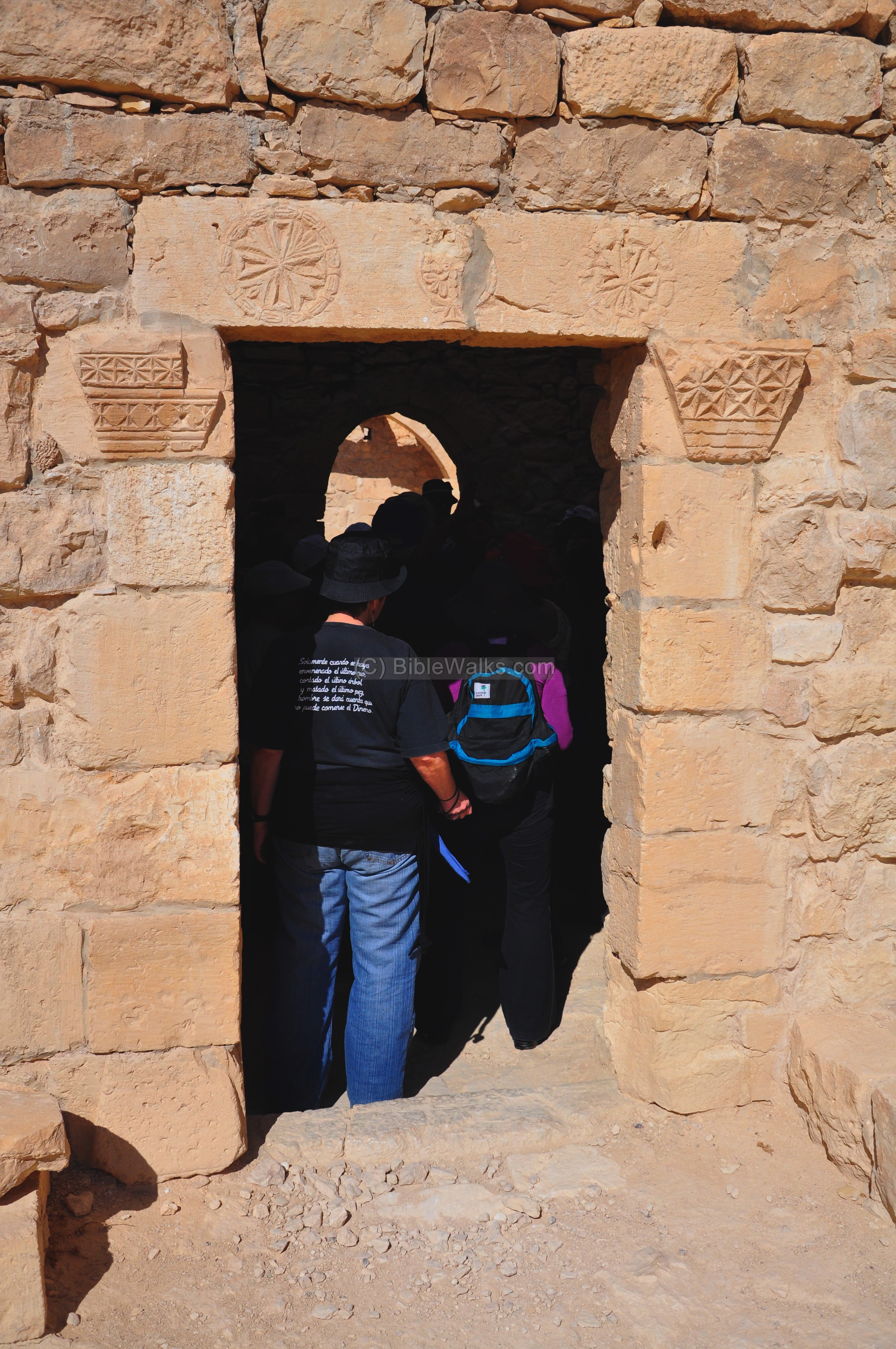
The church was entered through an open paved area south of the atrium.
The decorated lintel of the gate on the south side is shown in the following picture.
Inside the center symbol, on both sides of a cross, are the letters Alpha (Α) and Gamma (Ω). These are the first and last letters of the Greek alphabet, and represent that God is eternal – spanning the beginning and the end. At both sides are rosettes within geometric forms.
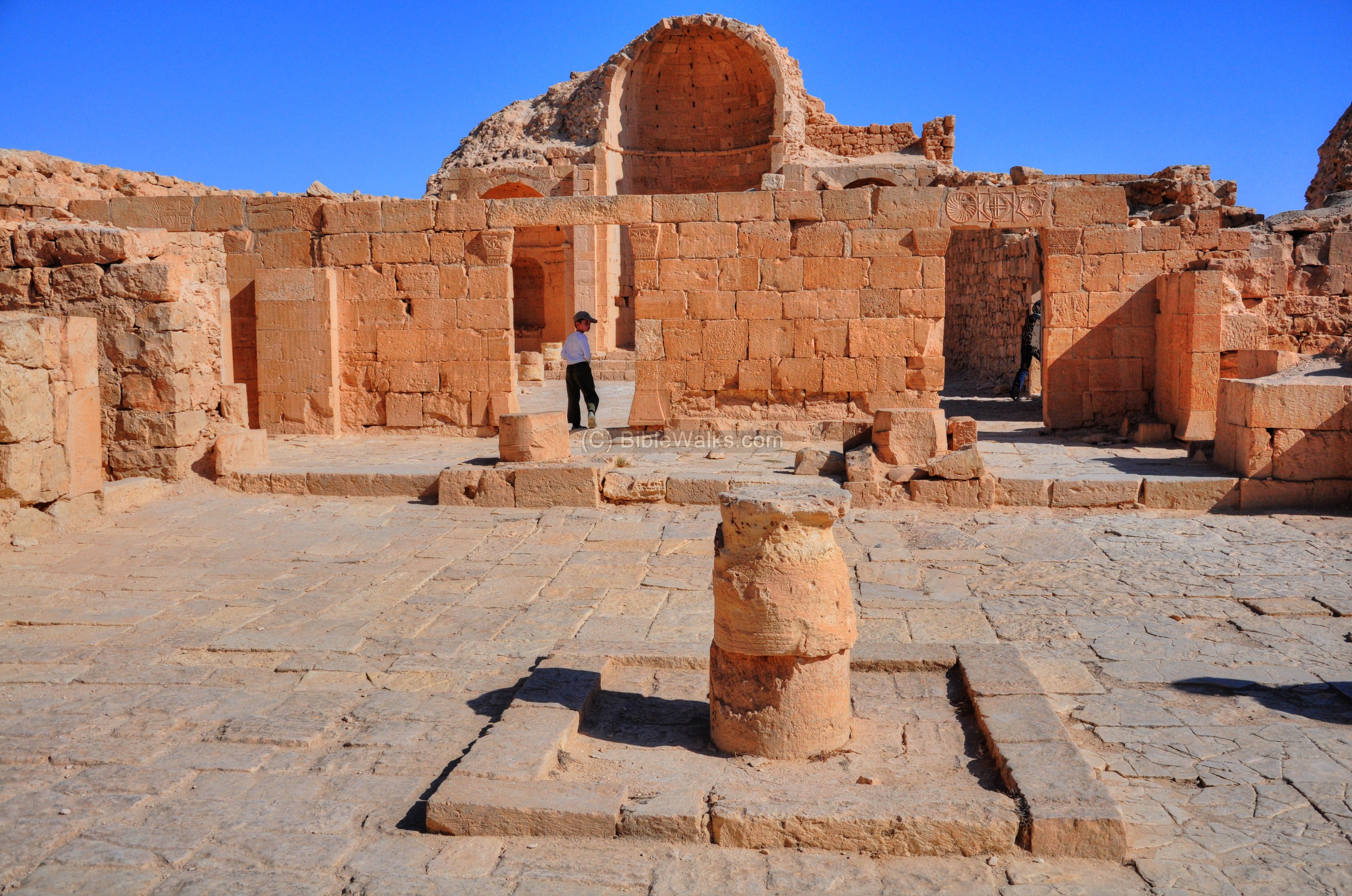
- Atrium
The Atrium of the Northern church is the largest in Shivta, with the dimensions of 26m by 19m. The following picture shows a south view of the atrium, the two entrances, and behind it the entrance gate from the northern plaza. In the corner on the left side is a stone bed, which may have served the monk responsible for the reception to the monastery.
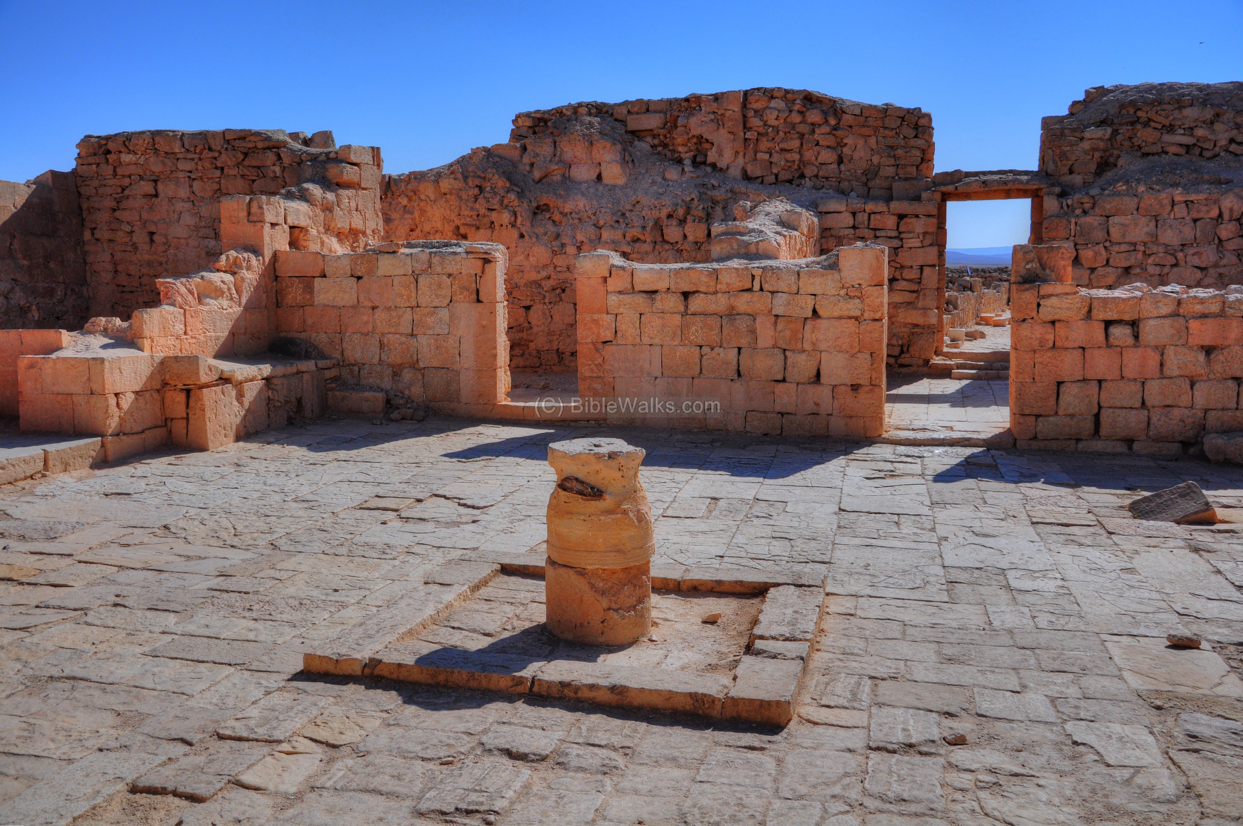
Column drum:
A stump of a column drum is located within a 2 x 2m square in the center of the atrium. This was probably a stand of a decorative vase, or served as a memorial to a holy monk.
Some scholars consider that this holy monk was a Stylite (pillar-saint) – a monk who stood for years on a pillar preaching, fasting and praying – and this was actually his pillar. The first and most famous pillar-saint was St Simeon Stylites the Elder, who lived for 37 years on a small platform on top of a pillar near Allepo in Syria (he died there in 459AD). Simeon’s fame spread across the Byzantine empire, and other stylite monks followed his way of monasticism. Perhaps such stylite lived here on the Shivta column, and attracted pilgrims to see this amazing way of life. 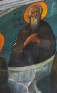 Simeon the Stylite – painting in St. Gerassimos
On the rear side of the atrium, facing the west, are a number of rooms, including a long hall which was probably the dining room. A number of steps are located at the corner that lead to the second floor, which was supported by the arches. Along the west and north sides of the atrium are columns.
- Entrance from the Atrium to the Church
From the Atrium is a triple entrance to the basilica. The access is through a narthex (passageway), which measures 10 x 12m, seen at a slightly higher level than the pavement.
The southern entrance to the basilica is shown below.
A closer view of the lintel above the southern entrance – with sun spirals, geometric forms and a cross:
The central entrance to the basilica has just one symbol in its center:
Inside the center symbol, on both sides of a cross, are the letters Alpha (Α) and Gamma (Ω, which is damaged). This is similar to the design above the entrance to the Atrium.

- South wall
An opening on the south wall of the church leads to to more chapels.

The first chapel, closer to the church, is seen in the picture below. A marble tombstone has an inscription which names abbot Thomas, dated to the 6th century.

The next chapel on the south side of the church has a large, cruciform baptismal. This chapel also served as a cemetery, and its western section has a dozen marble gravestones with names of priests and monks buried in the 7th century (one of them is the Monk Arsenius, son of Abraamios – who died in 630).
The cruciform baptismal was hewn out of one piece of rock. Its large size indicates that it was built before the middle of the 5th century, since after that time the large adult baptisteries were not constructed in churches. Furthermore, baptisteries were forbidden to be used as burial places in 578AD.
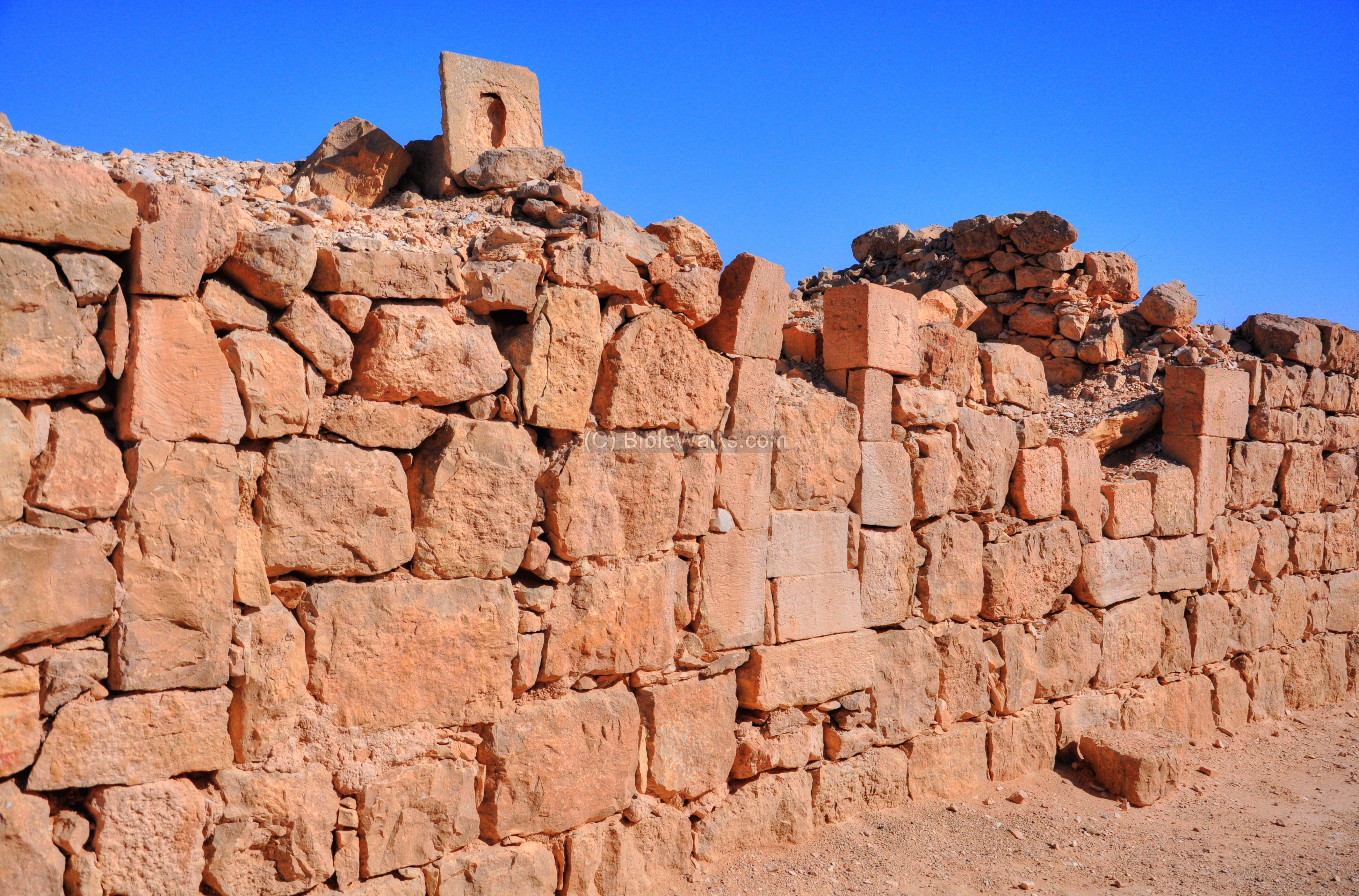
(l) North Exterior side of the City
The west view shows the northern wall and the Northern church behind it.
On the north-west side of the Shivta is a wine press. It features a large treading floor paved with stone slabs, where the grapes were pressed. The grape juice flowed through clay pipes into tanks.
The present state of the area around the site is a dry barren desert. However, during the Roman and Byzantine periods, the farmers converted the desert to an oasis. An orchard is located 800m to the north, where the ancient farming techniques were reconstructed by Prof. M. Even Ari. This was based on ancient methods of the collection of runoff rain water and irrigation by terraces.
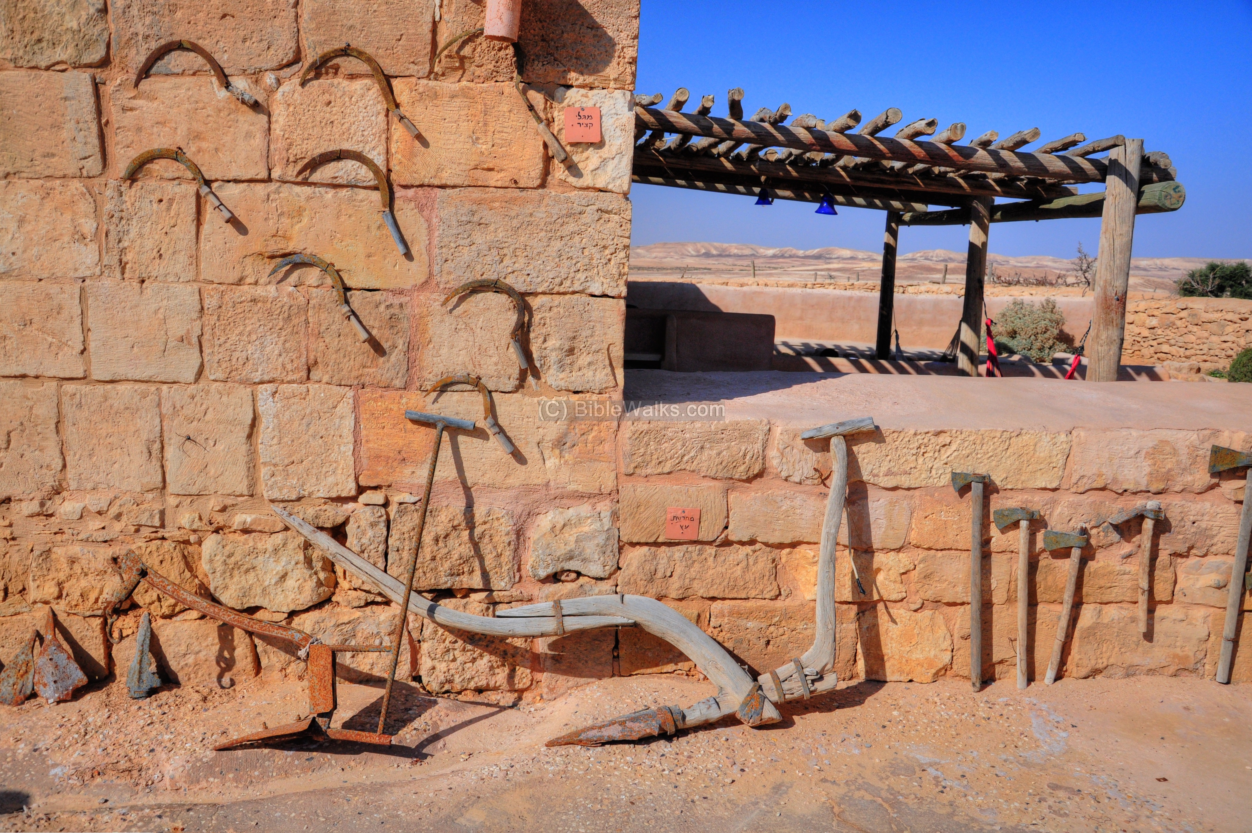
(m) Colt Expedition Building
The stone structure on the south side of the parking lot was built by the Colt expedition. The archaeological team, led by Dunscombe Colt, conducted extensive excavations in Shivta (during the years 1933-1938). The structure was the team’s headquarter, and serves today as a desert inn. A collection of ancient farming tools is displayed on its wall.
Etymology (behind the name):
- Shivta (Shivtta) – name of the site, a modern name based on the Arabic name.
- Subeitta – Arabic name of Shivta. Based on the Greek name.
- Sobeita, Sobata – referred in a 5th century AD book. Unknown source.
Links:
* External links:
- UNESCO world heritage site – Includes: Incense route from the Arava to Avdat, Haluza, Mamshit, Shivta
- Shivta National Park
- “Architecture and society of a Byzantine settlement in the Negev” (German) a dissertation by Constanze Röhl , directed by Prof Dr. Fischer (Cologne, May 2010) – a great source!
- Shivta – special project on reuse and conservation (Hebrew) – interesting concept
- Binated Churches in the Holy Land – S. Margalit (pdf)
- Conservation of the “Governor’s House” (Hebrew)
- Monks and monasteries in the Negev desert (pdf) P.Figueras, 1995 (pp 436-442) – great source
* Other nearby BibleWalks Negev sites:
* Other related BibleWalks sites:
BibleWalks.com – Ancient wonders in the Negev desert
Avdat <—previous Negev site—<<<All Sites>>>—next site—> Be’erotayim
This page was last updated on MAr 19, 2023 (add AI illustration)
Sponsored links: