Ruins of a Byzantine monastery located on a small hill on the north-west side of Karmi’el.
Home > Sites > Beit Kerem > Karmi’el > Khirbet Madrasah (Madrasa)
Contents:
Background
Location
History
Photos
* General view
* Foothills
* Top South
* Top North
* Views
Links
Etymology
Background:
Khirbet Madrasah is the ruins of a Byzantine monastery located on a small hill on the north-west side of Karmi’el, near Givat Ram neighborhood.
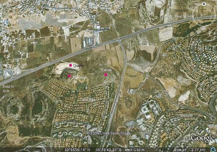
Location:
The site is located on a small hill (270M) on the north-west corner of Karmi’el, 50M above the Beit-Kerem valley. It is close to Katzir street in the neighborhood of Givat Ram. The easiest access to the hill is from this street which is located on its south-west side.
Across the main highway (Acre/Zefat) are the Arab villages of Bi’na (north) and Maj’d El-Krum(west).
History:
Byzantine:
During the Byzantine period the area of western Galilee was mostly populated by Christians. The area within the municipal area of the city of Karmiel was the densest in this region – a total of nine (!) Byzantine monasteries were excavated here or identified as such.
The site of Khirbet Madrasah was one of the Byzantine sites, with a possible monastery on top of the hill.
The sites were destroyed in the 7th or 8th century during the Persian or Arabic conquests. Khirbet Madrasah was in ruins since then, and was not excavated.
Ottoman Period:
The site was not mapped during the PEF survey (1881-1883). Only the adjacent site, Khirbet Kabrah (Kabra, Qabra), was listed on their maps, as well as the villages (Majd el Krum, el Baneh, Die el Asad).
Zvi Gal wrote about this: “Guérin visited only some of these sites in 1860 – there were so many of them that he was probably unable to stop at each one during a single day of surveying (Guérin 1985:303-307)”.
British Mandate:
During the 1930s and 1940s several stone quarries operated in the vicinity of the area of Karmi’el, prior to its establishment. One of these quarries cut away the northern hillside of Khirbet Madrasah, leaving an ugly scar which is visible from the main road.
Modern times:
Karmiel was established in 1964, and has grew since then to a large and beautiful city with over 50,000 residents (2008).
A new neighborhood in Karmiel, named Givat Ram (“the high hill”), was constructed on the south side of Khirbet Madrasah.
Photos:
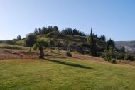
(a) General view
A view from Khirbet Kabarah, a nearby ancient site, is seen below from the east side of the site.
Click on the photos to view in higher resolution…
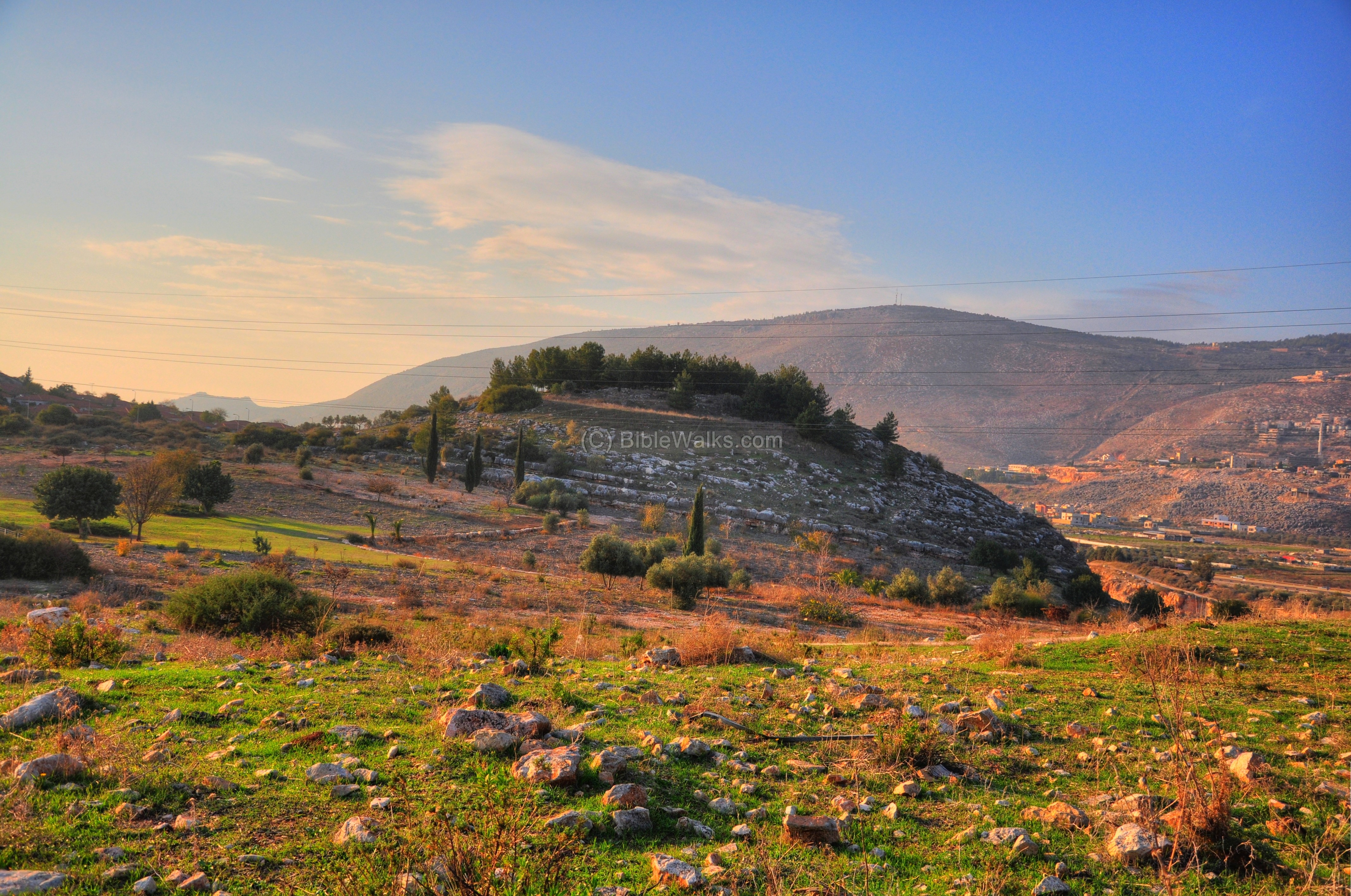
Another view of the site is seen below, taken from the west side. A section of the quarry is seen on the left side of the hill.

(b) Foothills
A herd of cows graze on the western foothills of the site. A small olive grove was planted around it, while the top of the hill is covered by pine trees.
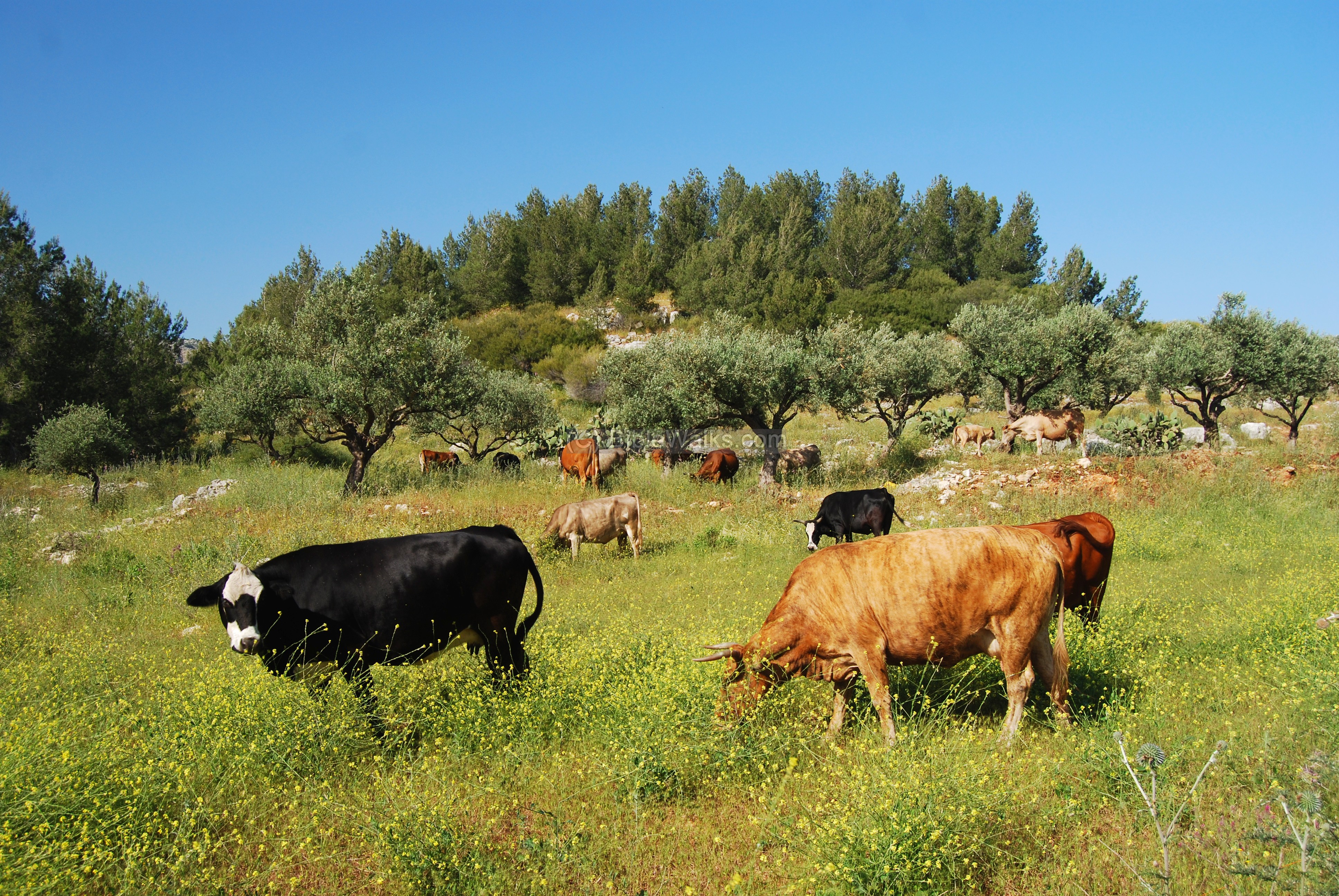
The photo below shows the friendly cows chewing the weed, closer to the peak of the hill (270M).

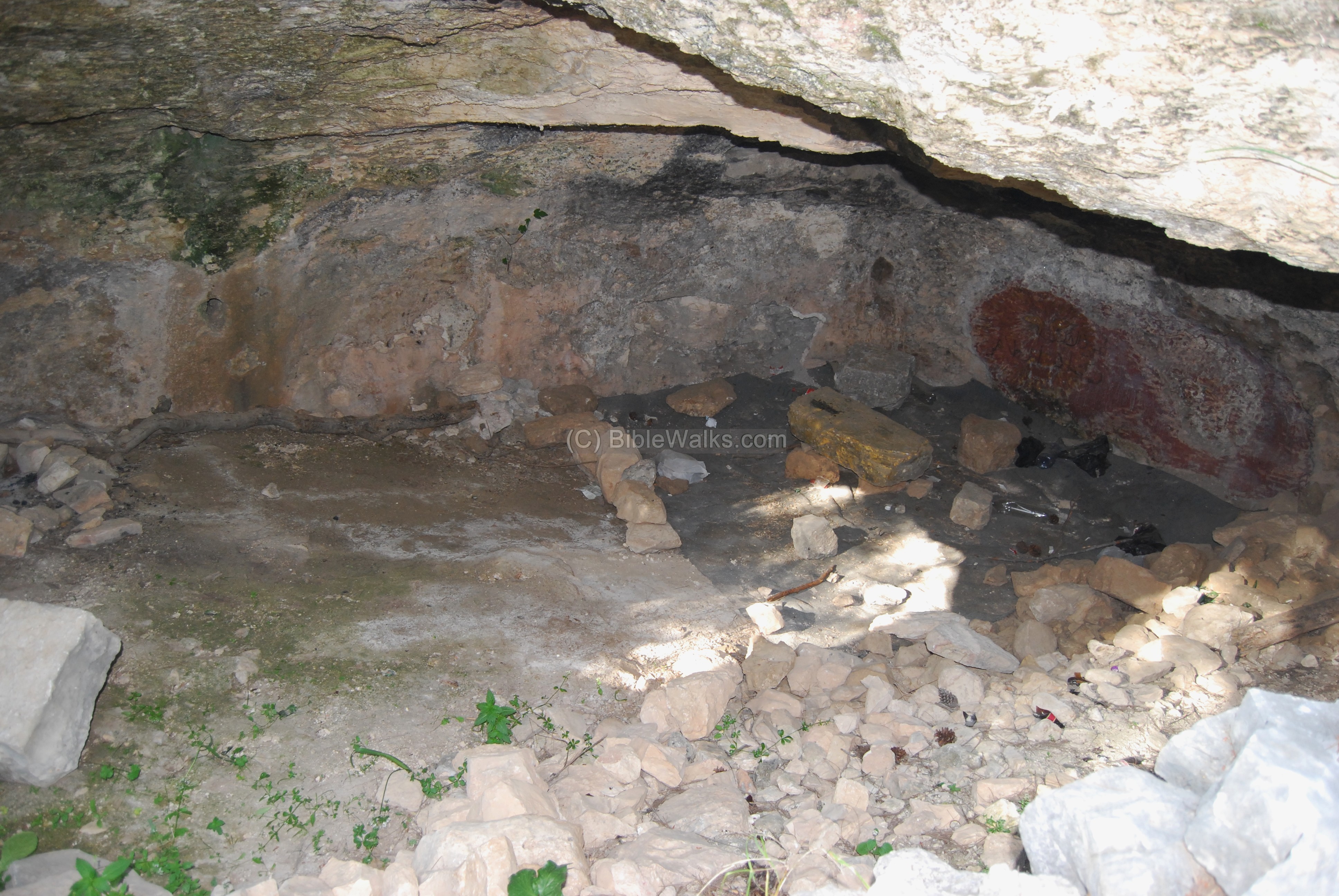
(c) Top of the hill – South side
A cave is located on the top of the hill, on the south side.
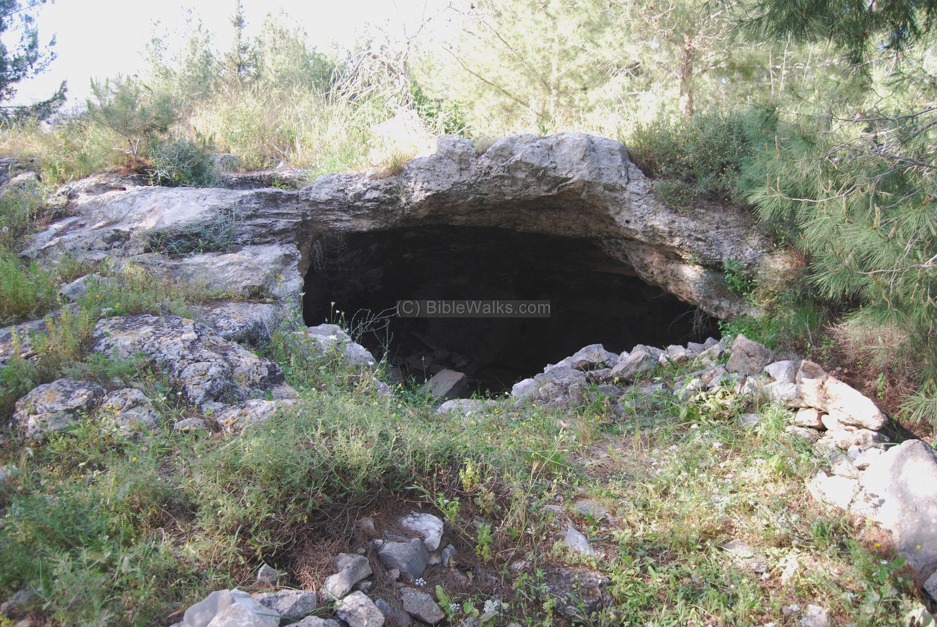
The interior of the cave is seen below. This was probably an underground section of the structure, a possible monastery.
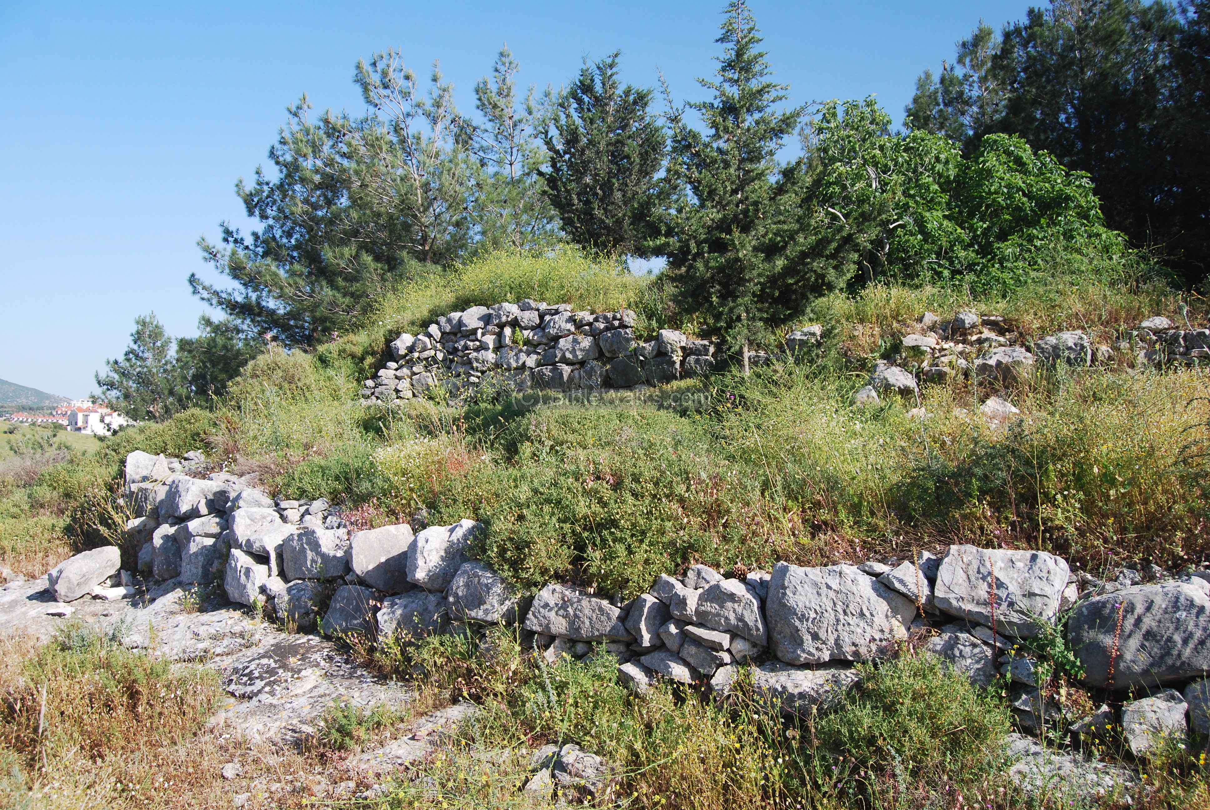
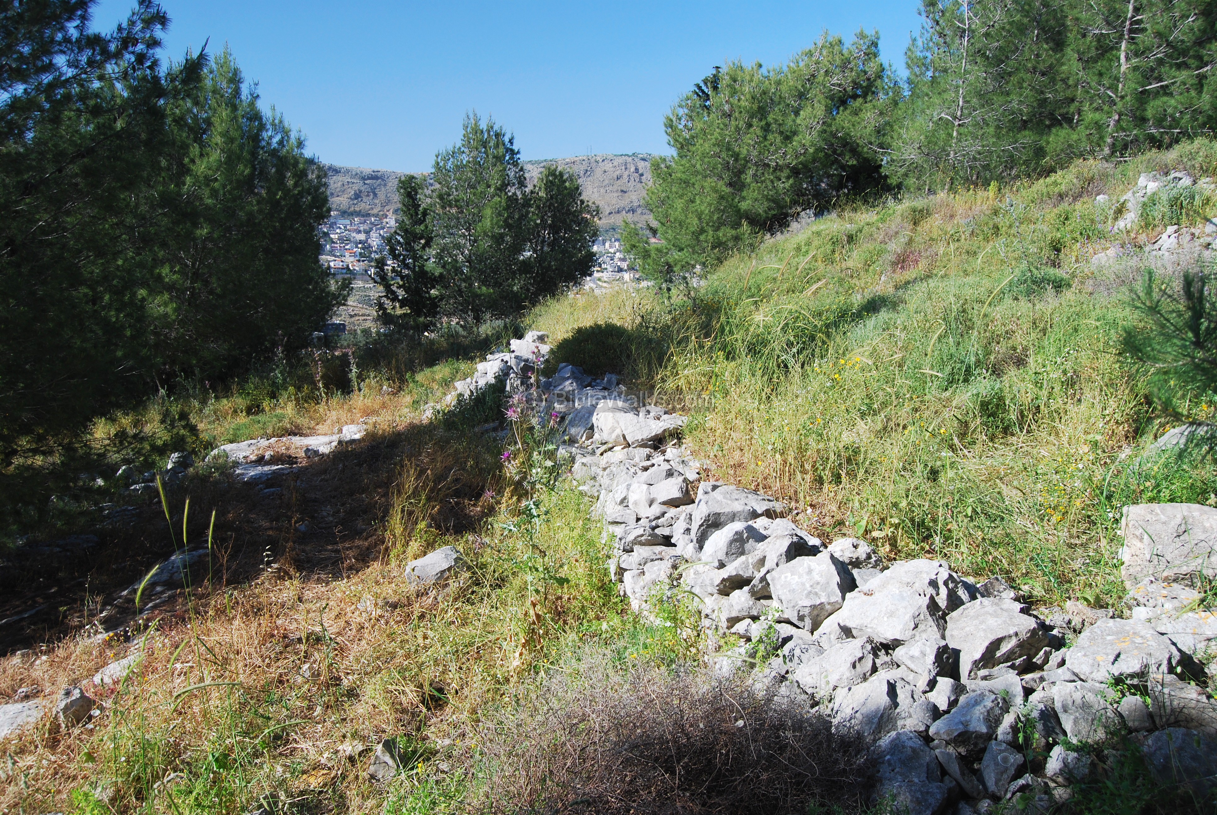
(d) Top of the hill – North side
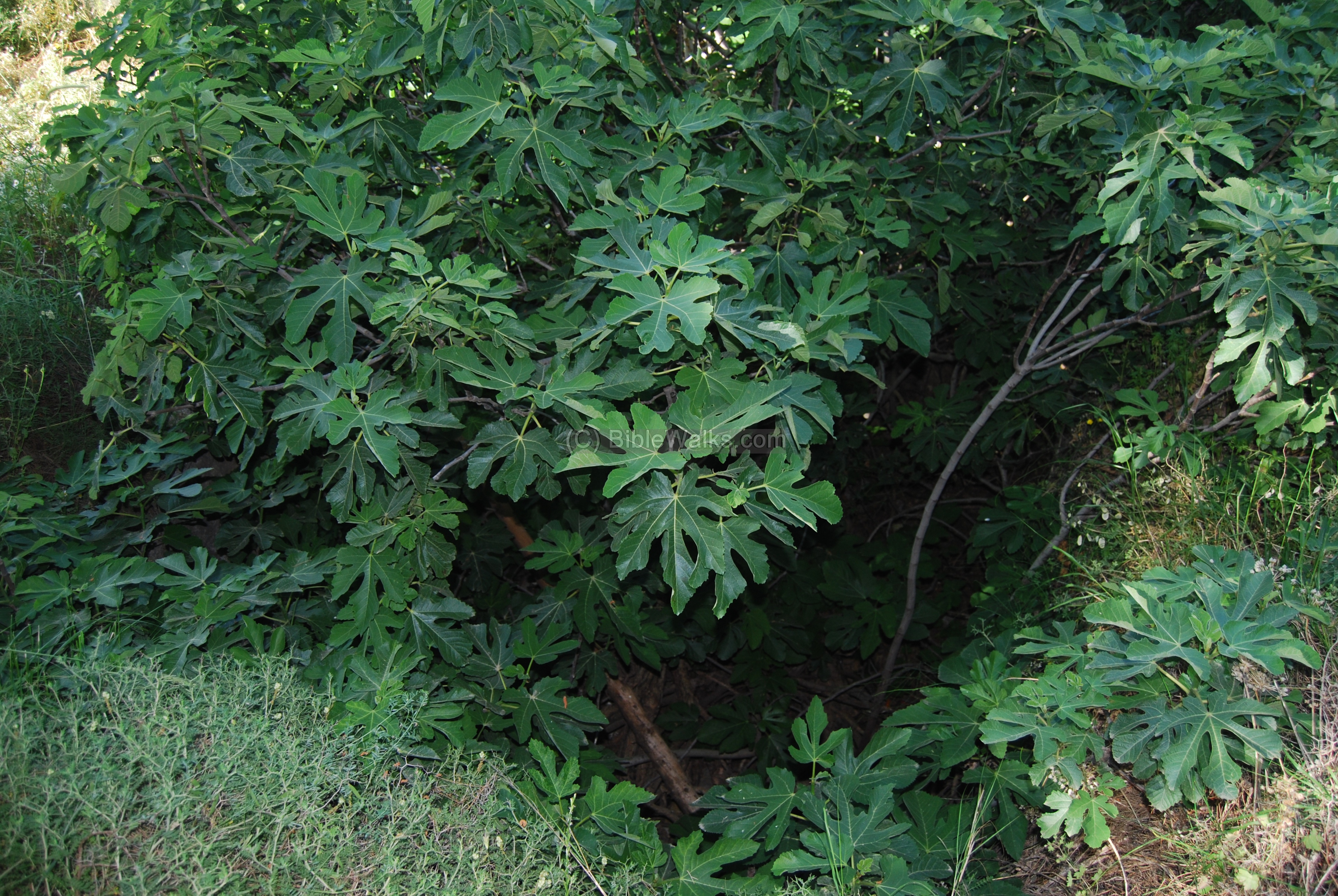
On top of the hill are traces of ruins, walls and cisterns. The photo below shows the view on the north side. A fig tree, seen on the right side, grows out of a cistern.
The fig tree is shown from closer view, growing out of a cistern.
On the north-west side of the top of the hill are more walls and traces of ruins.
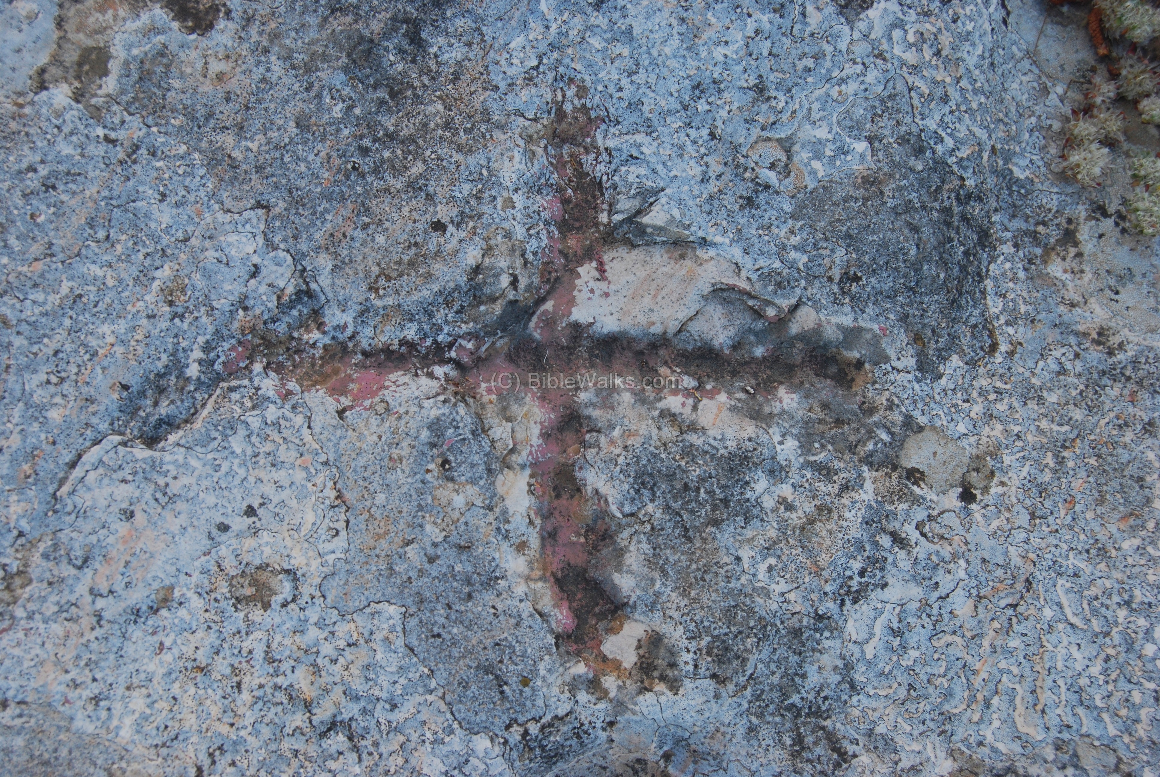
On the north slopes, just below the wall, is a sign of a cross engraved into the rock.
(e) Views from the hill
A view towards the north side is seen below. The mountain ridge in the background is called “Matlul Zurim” (meaning: “steep cliffs”), which towers to the height of 570M (350M above the valley). The Arab village of Deir-el-Asad is seen on the left background, and Bi’na (el-Ba’neh) in the center.
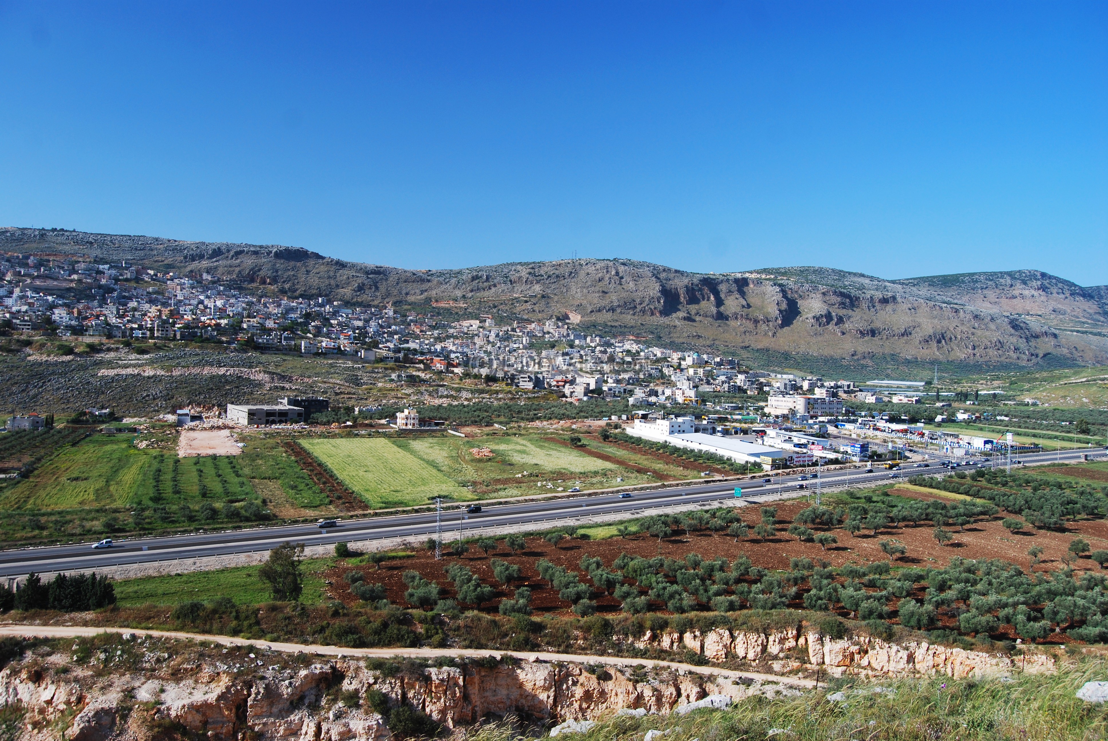
A view towards the north-east is seen below, with the city of Karmi’el on the right background and the valley of Beit HaKerem on the left and center. The olive groves that grow in Beit Hakerem, seen in the foreground, gave the city Karmi’el its name – “olive groves of God”.

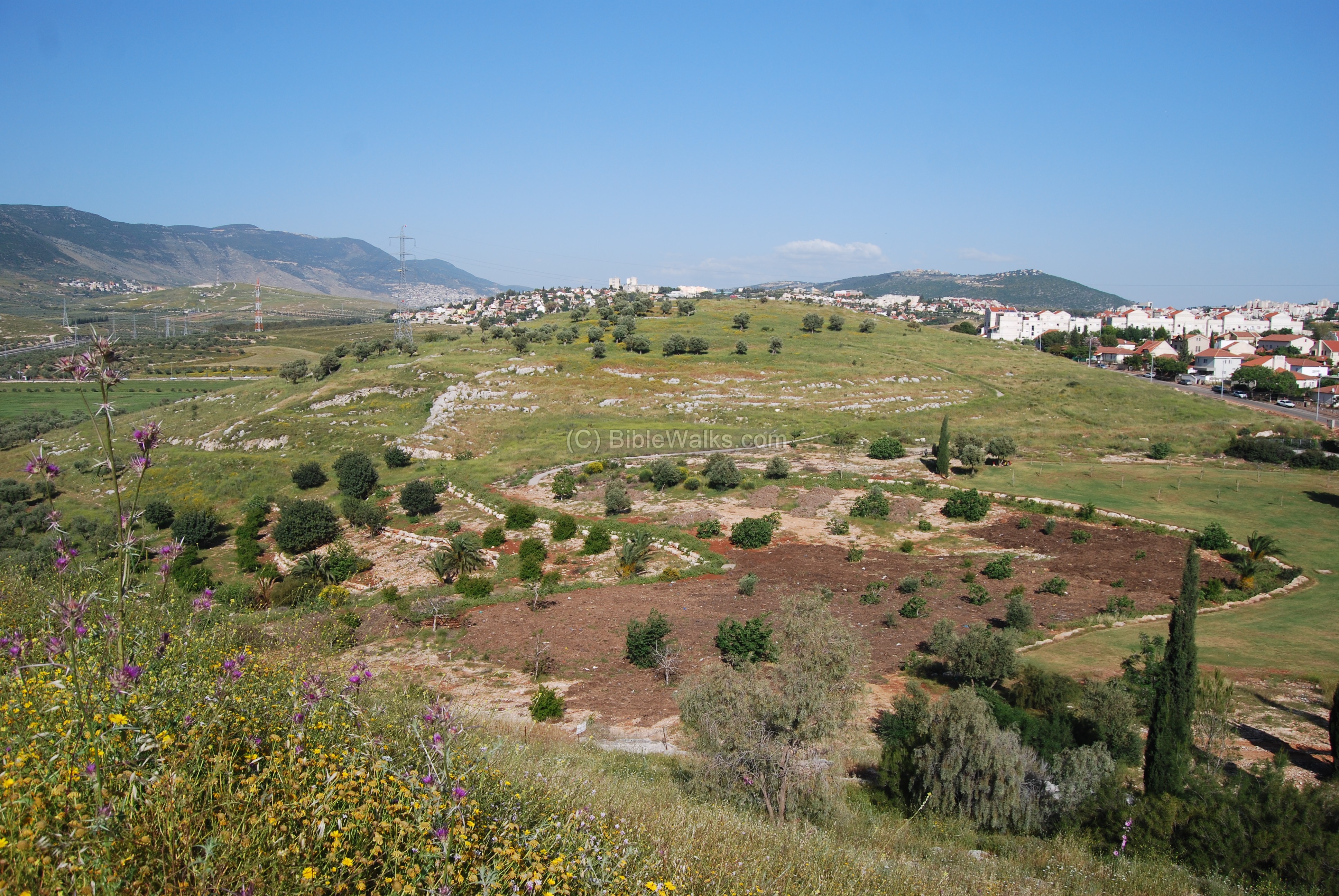
A view towards the west side is seen below. On the adjacent hill, across the park, is another Byzantine site – Khirbet El-Kabrah (Qabra). To its right is the edge of Givat Ram. A section of the ancient north-south road passed between the two hills in the direction of Hilazon (snail) creek.
Links and references:
- Archaeological sites around Carmiel – Power point (Hebrew)
- Conservation in Urban areas – Karmiel as a test case (Hebrew)
- Conservation in Urban areas – Karmiel as a test case – Zvi Gal (English)
- Aviam M. 2004: Jews, Pagans and Christians in the Galilee (Land of Galilee 1). Rochester. Pp. 181-204.
Etymology (behind the name):
- Madrasah (Madrasa) – Arabic: “school”. It is not known why this site was called with this name.
- Beit Kerem (Beth Cerem) – Hebrew: House of the vineyard (or olive grove). In Jeremiah 6:1 there is reference to another site near Jerusalem with the same name”… and set up a sign of fire in Beth Haccerem: for evil appeareth out of the north, and great destruction”.
- Karmi’el (Carmiel) – Hebrew: Olive grove (Kerem) of God (-EL). Kerem means also vineyard, so the name also can mean “Vineyards of God”. The city’s name was based on the name of the valley – Beit Hakerem.
- Matlul Zurim – Hebrew: Steep Cliffs.
BibleWalks.com – Putting the Bible on the map
Pigeons Caves<<<–previous site—<<<All Sites>>>—next Beit-Kerem site–>>> Kh. Kabra
This page was last updated on Jan 6, 2011
Sponsored links: