A large natural cave that overlooks the Bezet creek, a famous rappelling place. The caves around the site are prehistoric sites and were in use also in later periods.

Home > Sites > Upper Galilee > Keshet (Arch) cave
Contents:
Background
Location
History
Photos
* General view
* The cave
* View from the cave
* Rappelling
* Namer caves
* Mankhir cave
* Road to Adamit
Etymology
Background:
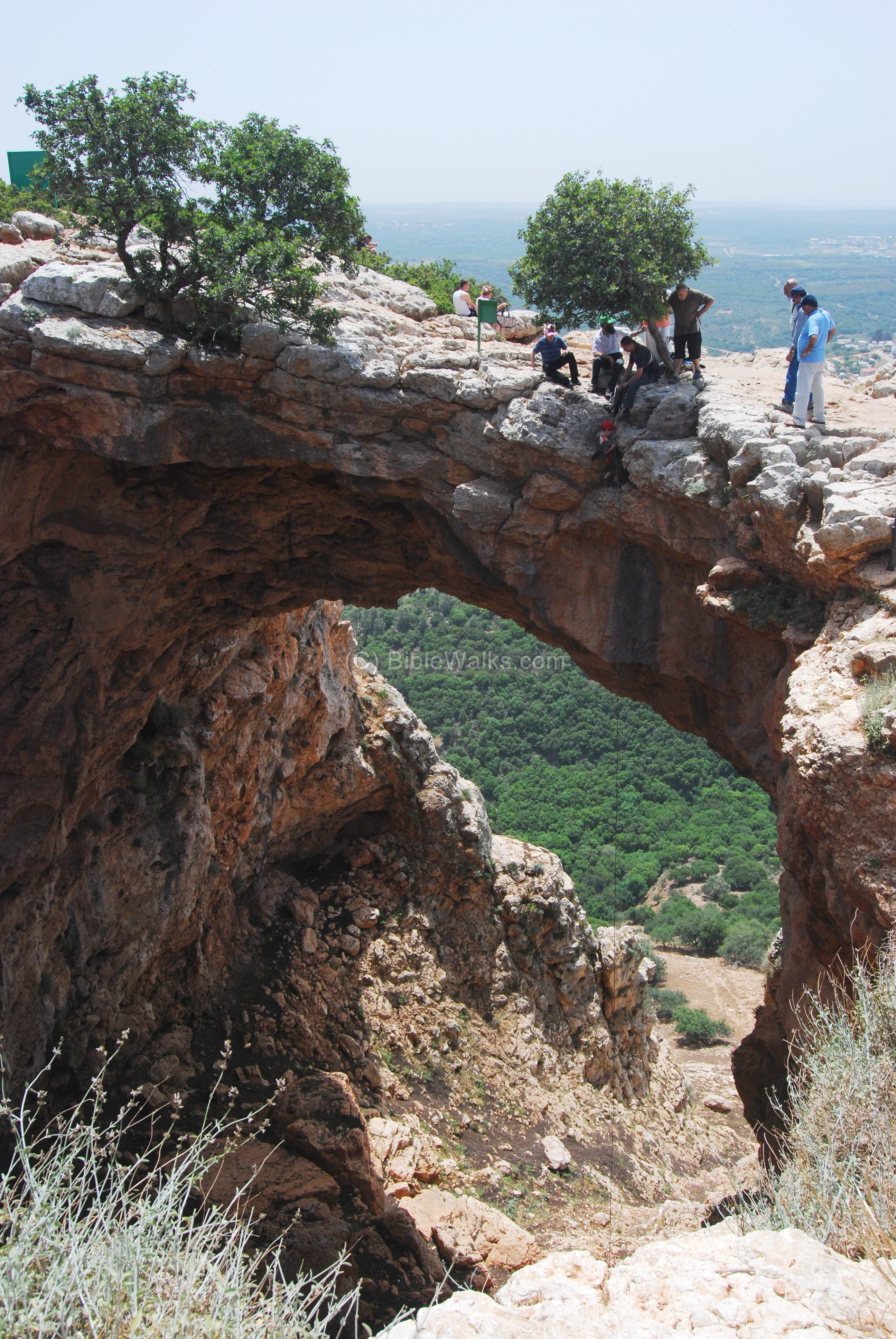
This large cave is located on the south edge of the mountain ridge that separates the upper Galilee and Lebanon, overlooking the Bezet creek. The ceiling of the cave collapsed in the past, leaving only an arch – which is the source of the name.
Nearby this cave is a prehistoric cave – Magharat Mankhir. There are other prehistoric caves in the vicinity, such as the Eder and Kukhim caves, in the nearby creek.
Location:
The cave is located on the Adamit mountain ridge, 8KM east to the coast of Rosh Hanikra. It is accessed from a path that starts from the road to Adamit. There are two paths to the cave (see aerial map below): a lower one to reach the bottom of the cave, and a higher one with a public parking lot and a paved path that reaches to the top of the cave.
An aerial photo of the area around the cave is shown below, indicating the major points of interest. The site is located on a foot of a high cliff, on the north side of Bezet creek.

History:
- Prehistory and Biblical
Along the Bezet and Kziv creeks there are many prehistoric findings starting from the Neolithic period (8,300 BC- 4,500 BC) and expanding in the Chalcolithic period (4,500 BC to 3,150BC). The area was ideal for the Early Man – shelter in the caves, water and game in the creek and the valley around, and fish in the sea just 9 KM to the west.
Inside a nearby cave, called Magharat Mankhir, the archaeological survey identified flint tools from the Chalcolithic period (4,500 BC to 3,150BC). The survey also identified pottery, on the rim of the cave, from the Iron age I (1200-1000 BC, a period after the Israelites invade Canaan), and the Persian period (6th to 4th century BC).
Additional findings from that period were found in the caves of the nearby Namer creek (the Eder caves).
- Later periods
About 500M above the Keshet cave are the ruins of a small site called Tell Ademet (Idmit), which was inhabited from the Early Bronze period until the Ottoman period, with a peak in the Byzantine period. This continued the urbanization cycle – the cave men moved from the natural houses into the man-built villages.
The survey also identified, in the nearby Mankhir cave, fragments of pottery from the times of the Crusaders and the Mamelukes (11th – 16th century AD). Therefore, the activity in these caves continued even in later times.
- Modern times
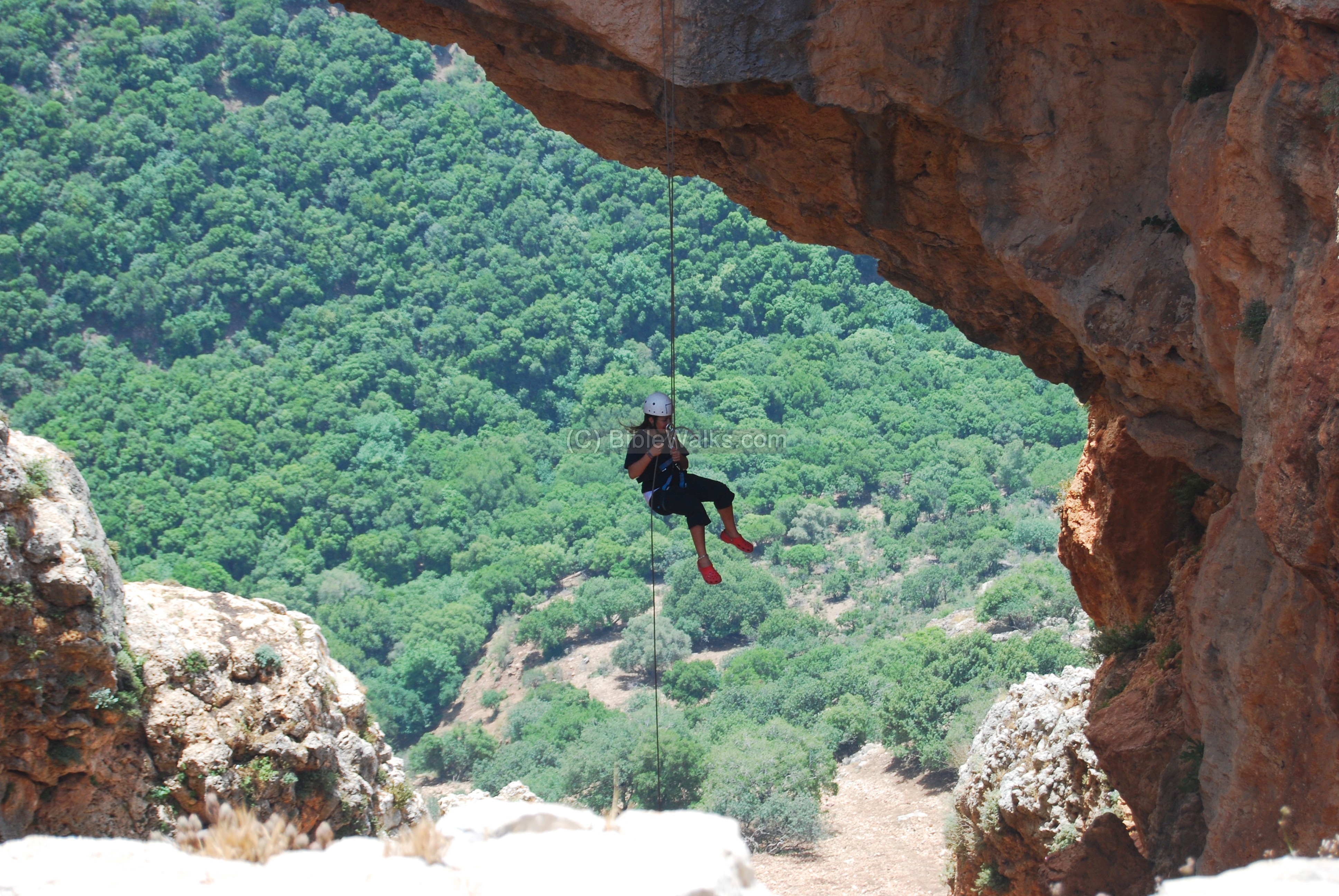
The cave is today a Mecca for rappelling, a seen below. Many arrive here to descend the arch by rope.
From the cave is also a great panorama of the Western Upper Galilee, overlooking the Bezet creek. The easy access of the public parking, and the good paved path down to the terrace overlooking the cave, makes it a popular tourist site.
Photos
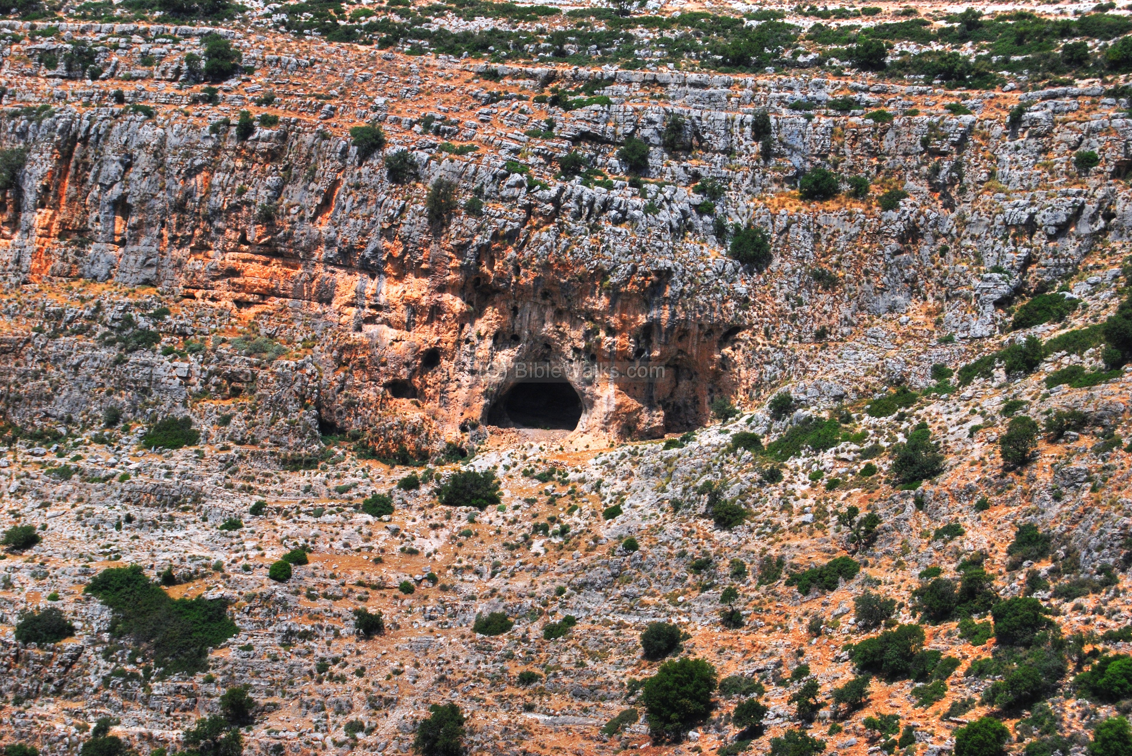
(a) General view
The photo below shows a view from the south – from Moshav Yaara. The large cave is seen on the edge of the high cliffs that overlook the deep Bezet creek.
Click on the photos to view in higher resolution…
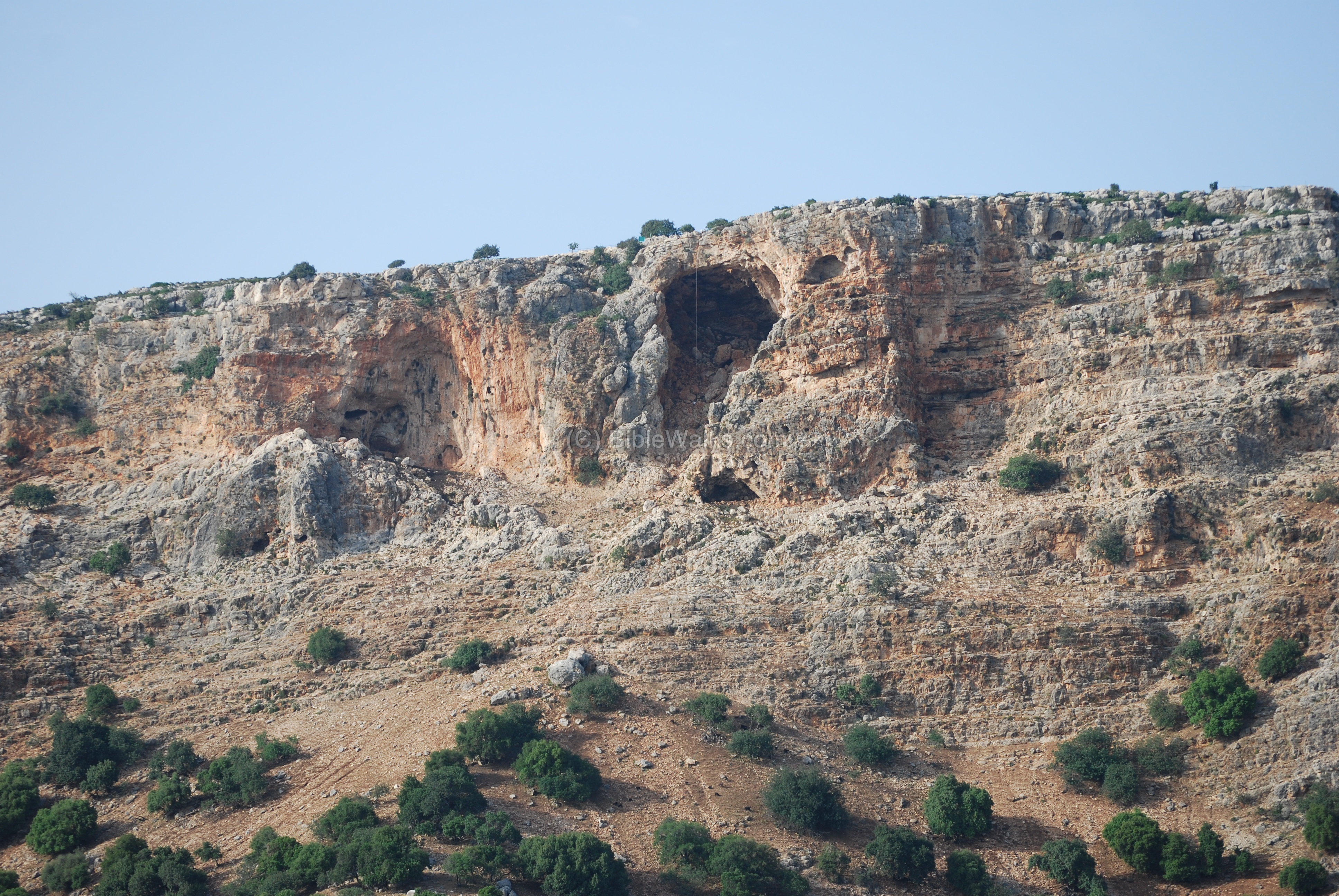
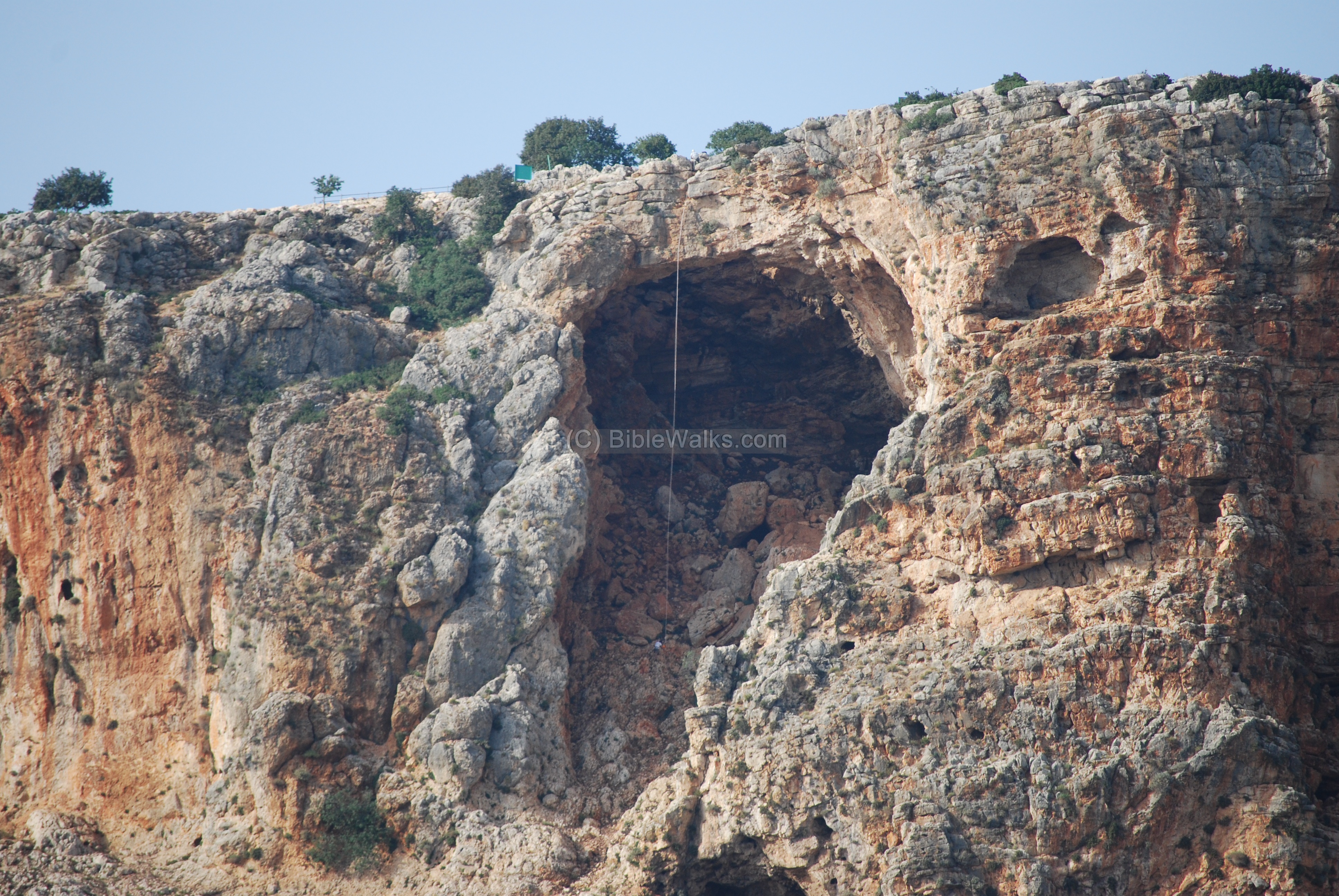
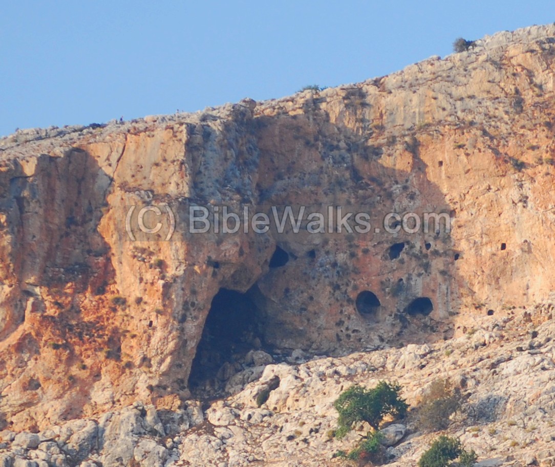
A closer view of the cave is seen below. The arch is not seen from this angle….
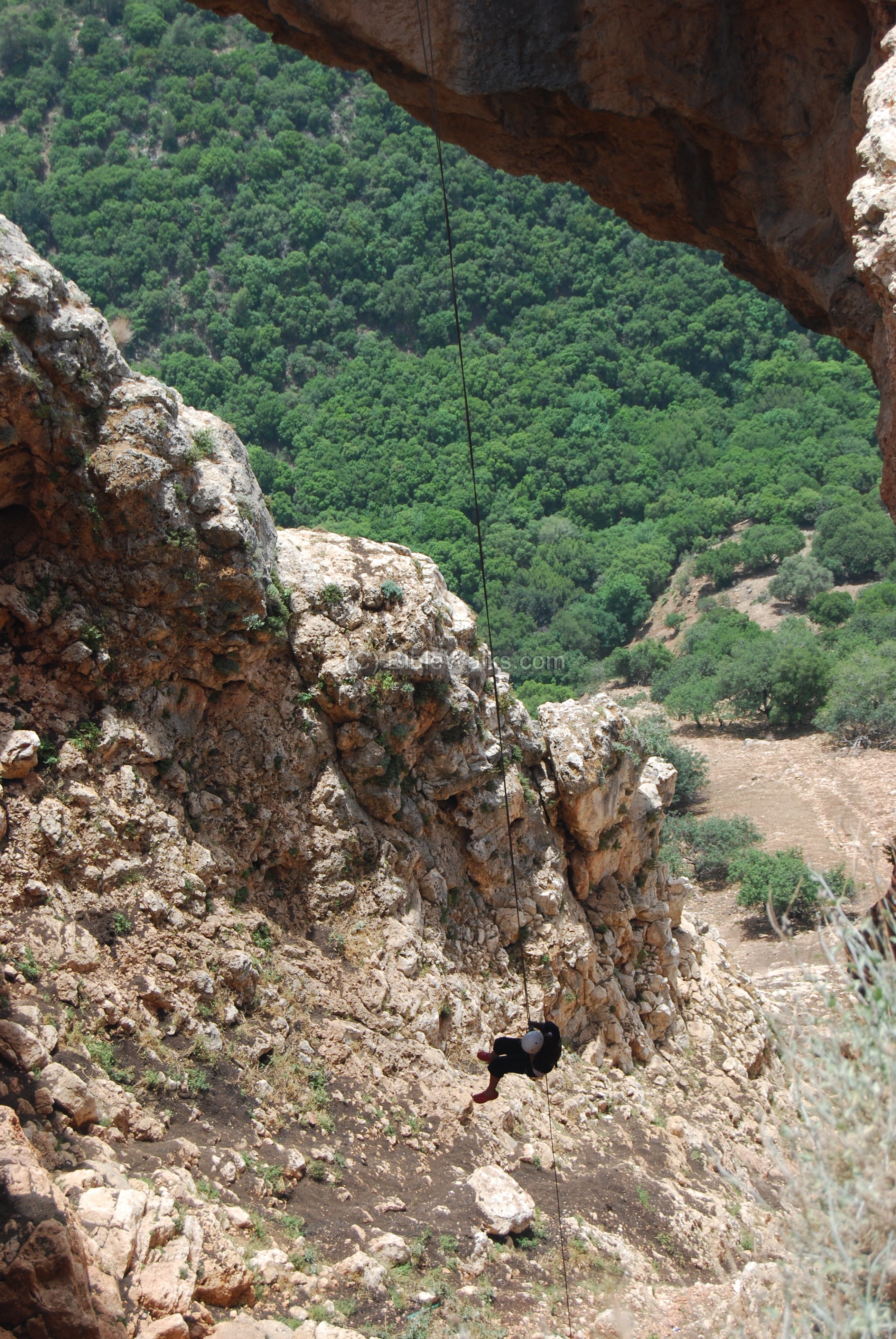
The long rope is used by the mountain climber, who just reached the bottom of the cave, a 40-50M drop from the top.
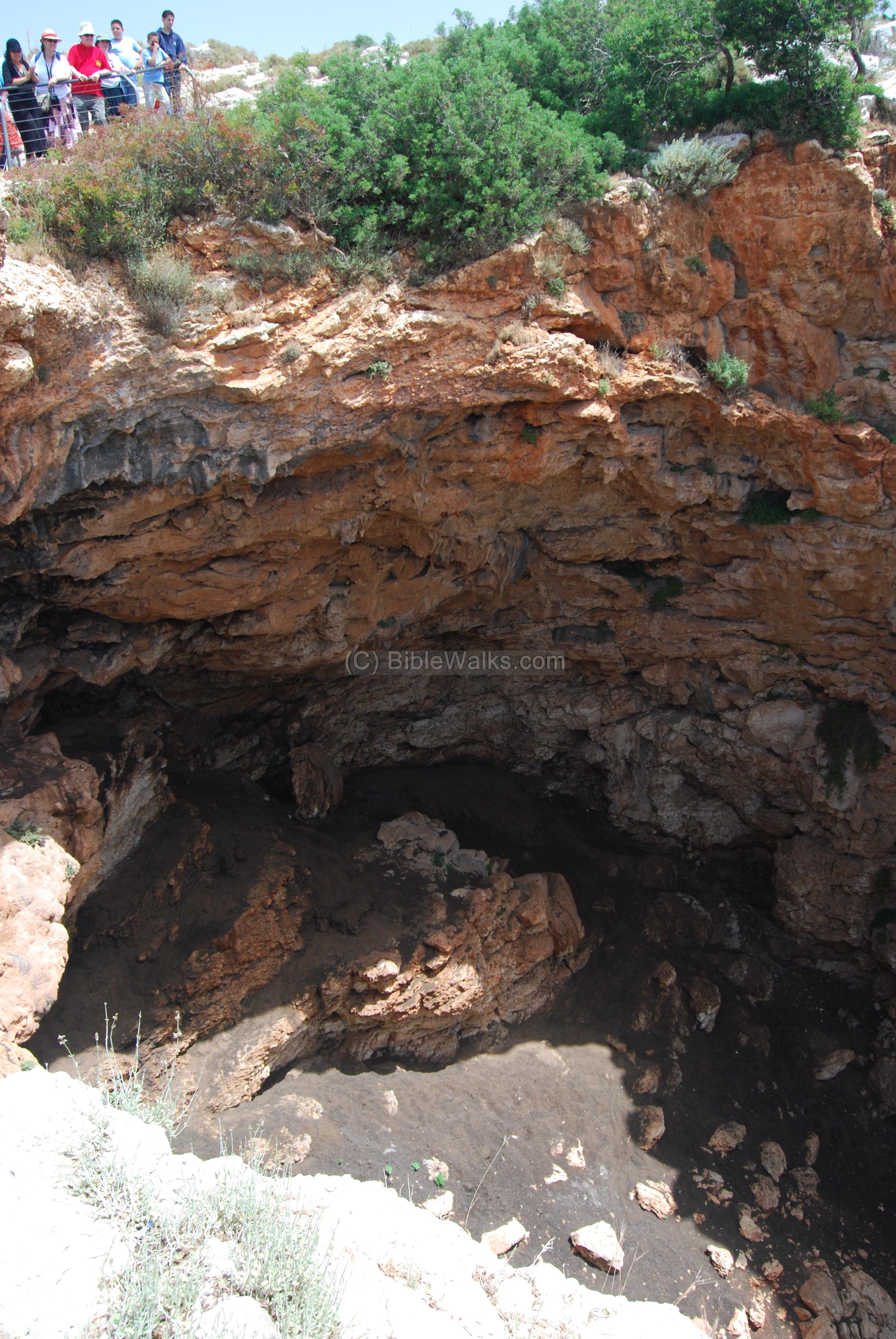
(b) The Keshet cave
From the parking lot there is an easy path to the balcony above the cave. After reaching the cave, this is the view from the north side. The arch connects the tow sides of the cave, and you can walk over it. In the photo below the group is preparing one of the kids to climb down the cave from the inner side of the arch.
A view of the northern edge of the cave. The group is standing on the edge of the balcony above the cave.
A wider view on to the arch, looking south towards the Bezet creek.
Amit, Rotem’s sister, is standing on the right side of the arch.
(c) View from the cave
The panorama from the cliff at the top of the cave is breathtaking, especially on clear days. The whole western Galilee can be seen here.
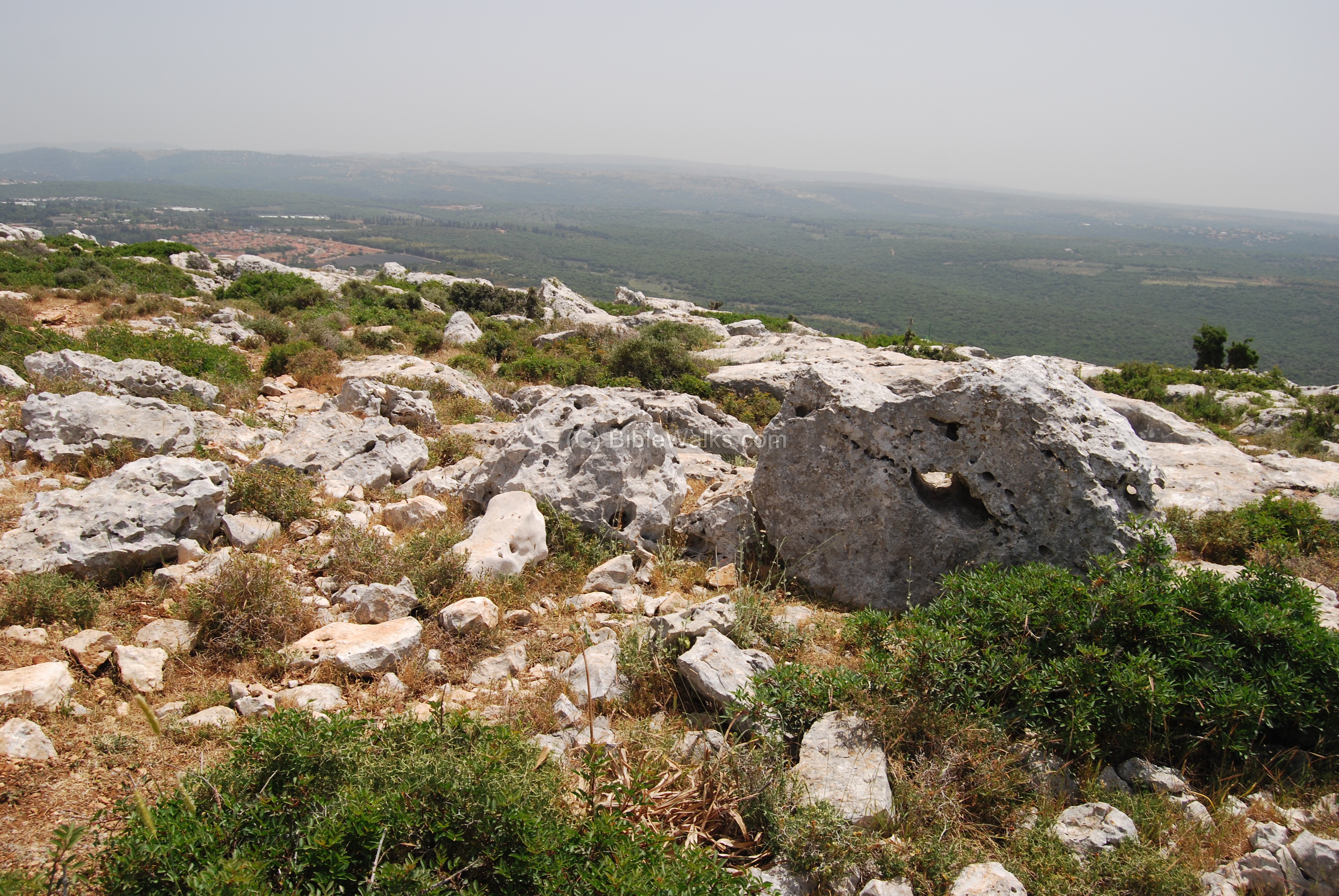
The photo below is seen from the edge of the cave. The village of Yaara is seen on the left side.; the town of Shelomi is seen on the right side, while Rosh Hanikra is on the far right side.

(d) Rappelling
The cave is a favorite site for rappelling (snappeling). The height is 40-50M, and the descent is from both sides of the arch. The following photos are of a group of children that descended down from the top of the cave – down to the bottom of the cave.
(e) Namer creek (Eder) caves
A cluster of caves are located on the north-west side of the Namer creek. The caves are seen while climbing up the road towards the Keshet cave. This group of caves is called “Eder” caves.
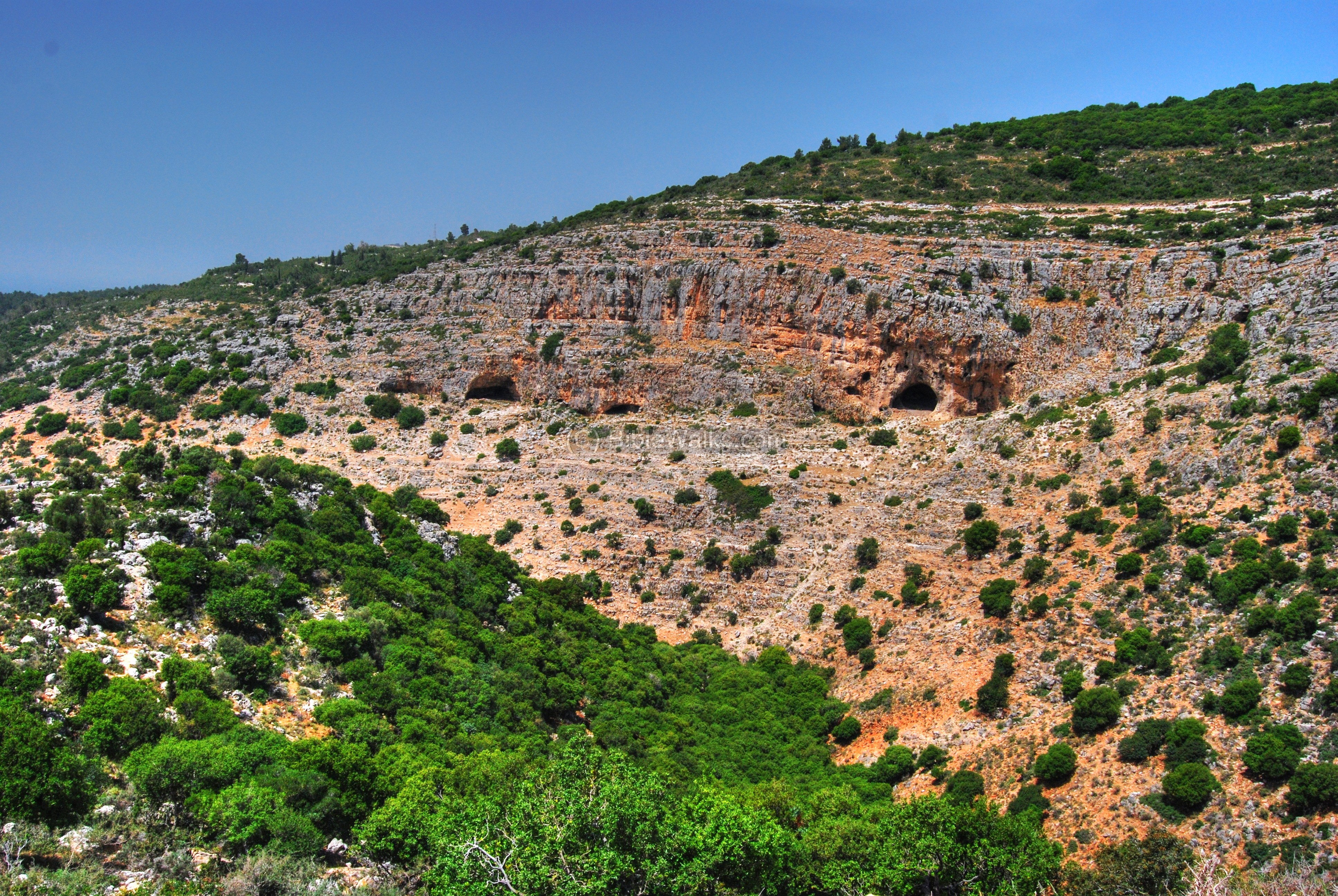
The largest cave is located on the east side of the group, and is seen below. Its size is 30 X 20M by 20M height.
In front of the cave and below it are traces of an ancient wall, as seen in the detail below. Additionally, there are fragments of pottery scattered in front of the cave. These caves might have been used by monks who went to seclusion in the caves during the Byzantine period. One of the cave sites in the Namer creek are named, in Arabic, as the “caves of the monks”.
Another cave is 20 wide x 15M deep, and there are traces of Prehistoric dwellings (flint-stones, bones). The archaeological survey also found in these caves ceramics, spanning from the Iron age to the Mameluke period.
There is also a narrow grotto (23M long) on the slopes above the cliff above the cave with fragments of Iron age pitchers.
(f) Mankhir cave
This is a large 25 x 8.5M karst cave located west of the Keshet cave, with a 20M high chimney. The archaeological survey identified Chalcolithic flint stones and Iron I, Persian and Crusader-Mameluke pottery.

A closer view of the cave. Narrow corridors lead eastwards to a small chamber with two hatches facing the south.
Notice the people above the cave – probably walking towards the Keshet cave.
Below the cave are breathtaking views of Bezet creek and the cliffs. This path is accessible from the lower parking lot on one of the winding turns of the road that climbs up to Admit.
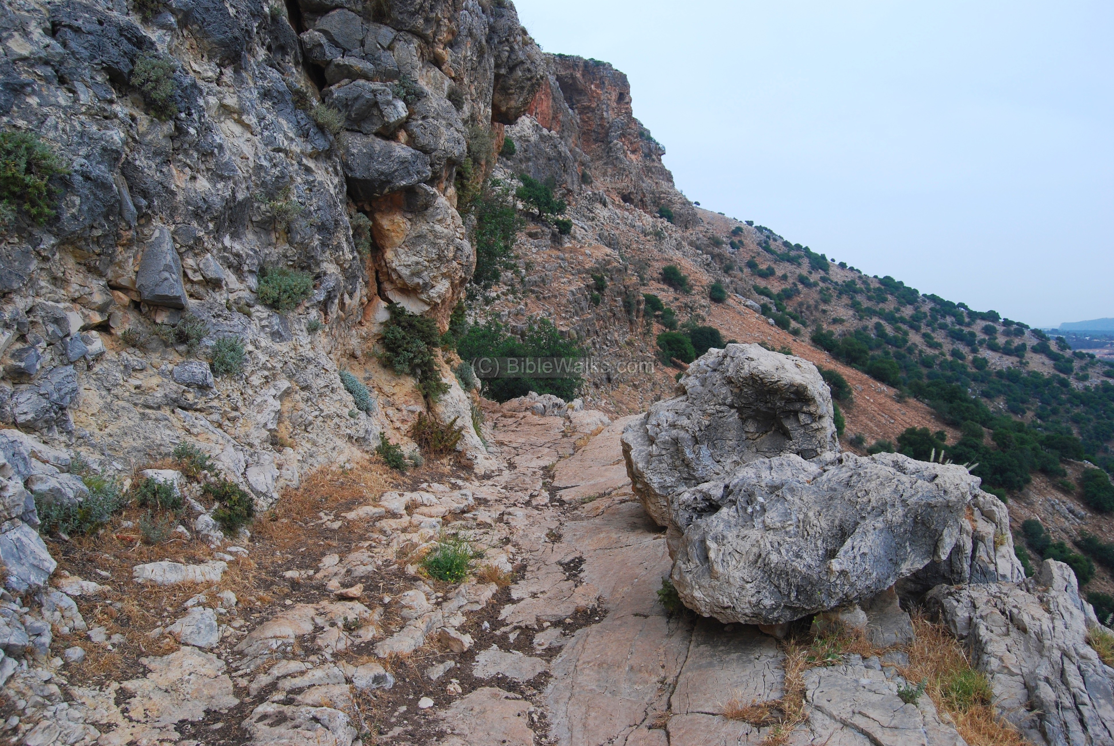
Another view of the cliffs is seen below.

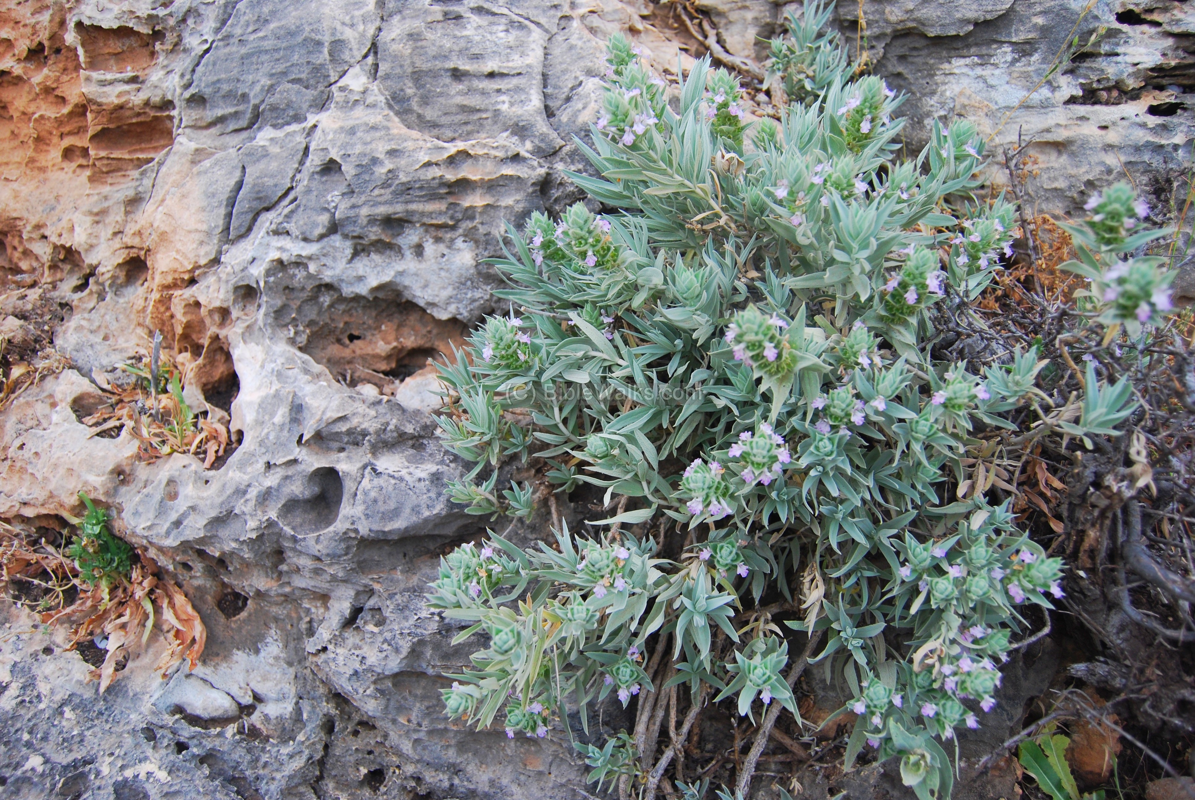
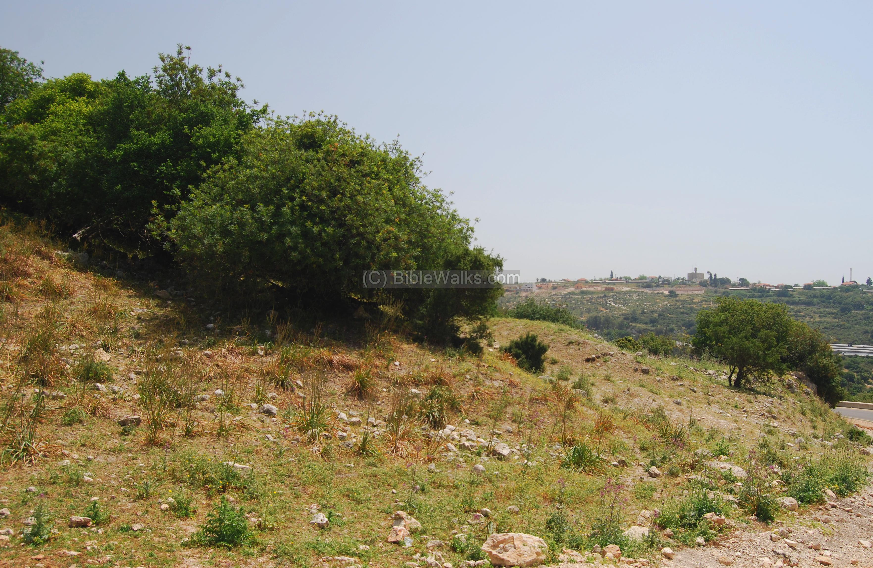
The path under the cliffs are mostly barren, due to the lack of soil and the strong winds, but there are some interesting plants between the rocks.
(g) Road to Adamit
The photo below shows the view from the winding road that climbs up the cliffs towards the Keshet cave and the platue of Adamit. The view is towards the sea (westwards), looking on the Bezet valley and the town of Shelomi (far right background).
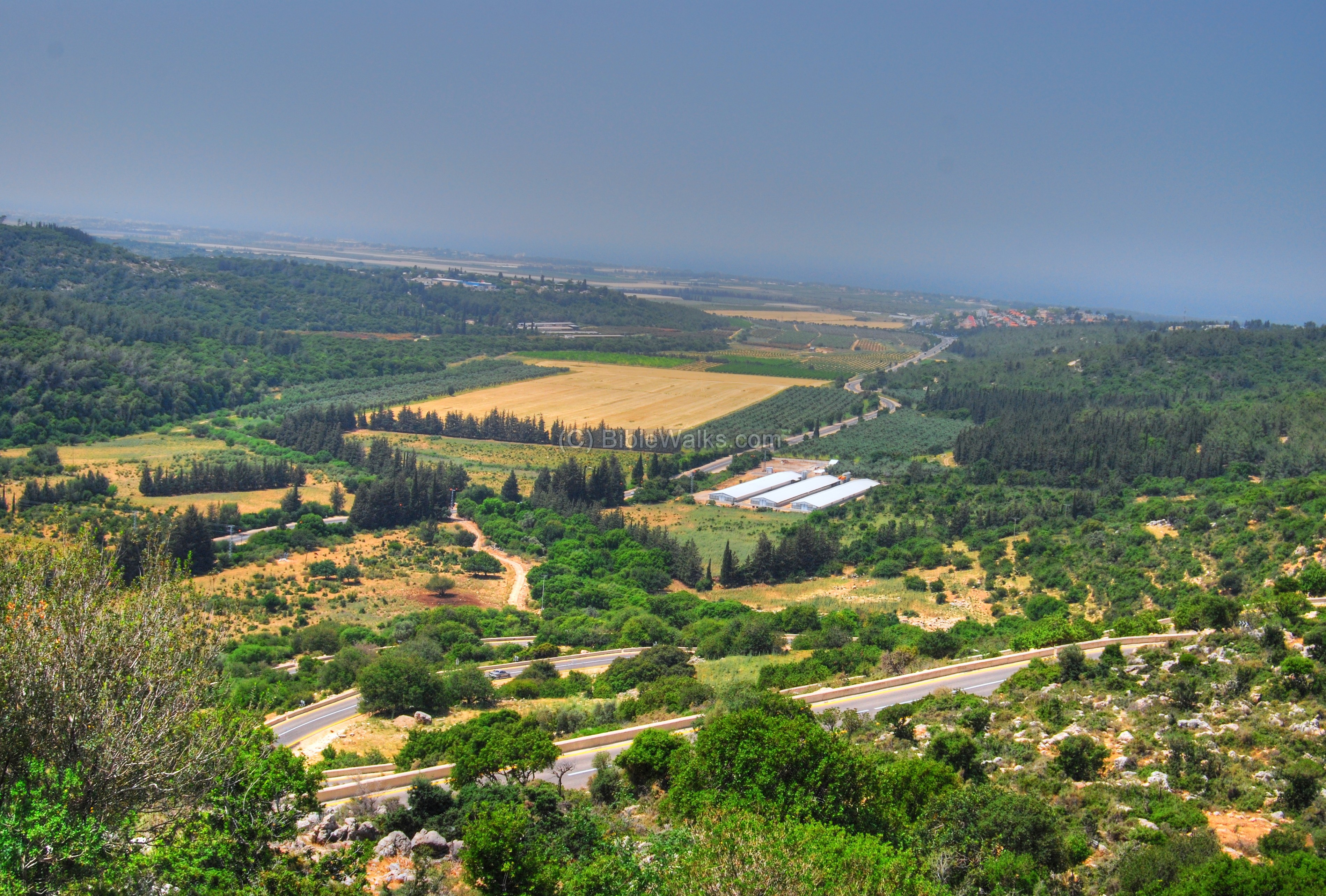
Along the first three curves of the winding road are the ruins of Khirbet Bannay, a site from the Roman/Byzantine and Crusade/Mameluke periods. It is identified in Crusade accords as “la Beyne”, “Benna” or “Bene”.
The site is in poor condition due to the damage from the road.
Etymology (behind the name):
- Keshet – Hebrew for: arch.
- Ma’arat Keshet – Hebrew: the cave of the arch, since the upper side of the cave is like an arch.
- Namer creek: This is the name of the nearby creek. In Hebrew “Namer” is: tiger or leopard.
- Bezet creek: name of the nearby creek. In Arabic – Nahal Karkara. The creek is named after Bezet, a modern Moshav that is named after the ancient site.
References:
-
Arch. Survey of Israel – Hanita Map (2) – R. Frankel & N. Getzov [1997] ,
-
site # 70.2: Mugharat Mankhir (located 200M west to Keshet cave)
-
site #66.2: Khirbet Bannay (Benna, Banna) – located on the way up to Adamit
-
site #64.2: Eder caves – located nearby in Namer creek
-
site #47.2: Tell Idmit – Khirbet Edmet (located 500M north-west of Keshet)
-
Links:
- 360 degrees Video (Hebrew titles; useful video)
- Rappelling:
BibleWalks.com – walk with us through the sites of the Holy Land
Khirbet Suggar<<<–previous Upper Galilee site—<<<All Sites>>>—-next site—>>> Mi’ilya
This page was last updated on Oct 25, 2008
Sponsored links: