Today an Arab city (Kabul) 8KM from the bay of Haifa, on the west hills of the Galilee. It was destroyed by Cestius in the wake of the Jewish revolt. In Roman times – a large Jewish city.
Home > Sites > Hilazon > Kavul (Chabulon, Zabulon, Kabul, Cabul, Damun)
Contents:
Background
Location
History
Photos
–General
–Cemetery
–Ancient game
–Well
Biblical
Historical
Etymology
Identification
Links
Background:
In the Roman times – Kavul was a large Jewish city close to Acre. It was burnt by Cestius in the wake of the Jewish revolt. In late Roman period an important Jewish village. Today the site is in ruins, and a new Arab village of Kabul is located nearby. A ruined village of Damun, east of Kabul, is located over a Roman period site.
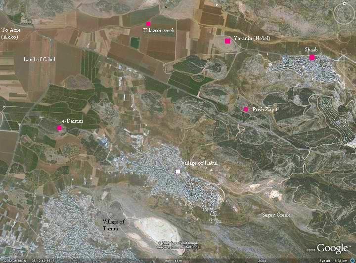
Location:
Today Kavul is an Arab city (Kabul) 8KM from the bay of Haifa, on the west hills of the Galilee. This city is located at the edge of the western hills of the Galilee, south of the valley of the Hilazon (snail) creek.
The ancient city is strategically located close to the north-south Via-Maris road.
The ruins of Damun is located on a hill, about 0.5KM from the junction, and is adjacent to the modern road to the Kabul village. An aerial map is seen below.
History of the place:
-
Biblical periods
The ancient city was mentioned in several biblical texts (see references below): it was part of tribe of Asher (Joshua), but was later given by king Solomon to Hiram King of Tyre as exchange for his assistance in building the temple (Kings).
The Biblical site is not positively identified, and is not in the village of Kabul where the earliest findings were Hellenistic. Therefore, other sites were suggested. According to some scholars and recent excavations it may be located in Khirbet Rosh-Zayit, which is located nearby. The site was established during the period of the Kings (start of 11th century BC), and destroyed in the 8th century BC. It relocated during the Hellenistic period to a site closer to the modern village of Kavul.
-
Hellenistic and Roman
In the Roman times the city was burnt by Cestius Gallus, the Governor of the Roman province of Syria, during his attempt to crush of the Jewish revolt (66 AD). He was later defeated in Beit Horon so he was eventually punished for his cruel acts in Israel. According to Josephus, Kavul was regarded as a beautiful city, and named “the city of men”.
The city was later restored and was an important Jewish village in the Roman period (2nd-4th century AD). The Schenia Cohenic family, a distinguished family that used to serve the Temple (as referenced in Chronicles I 24:11 “… the tenth to Shecaniah”), settled here – an indication of its importance.
The city was destroyed, as most of the villages in the Galilee, at the Persian/Arab conquest (6/7 century AD).
-
Ottoman period
In the Middle Ages, Kabul was a small agriculture village. Later, in the 16th century , there were several Jewish families in the village.
-
Modern times
Today, a large Arabic village, Kabul, is located on top of the ancient site. Inside the village there are tombs and other findings from the Roman period.
Another Arab village, et-Damun, was established in the 18th century on a hill west of Kavul, closer to the north-south trade road. The site was a Roman period village and perhaps earlier periods. The Arab village was destroyed in 1948 and is in ruins since then.
Photos:
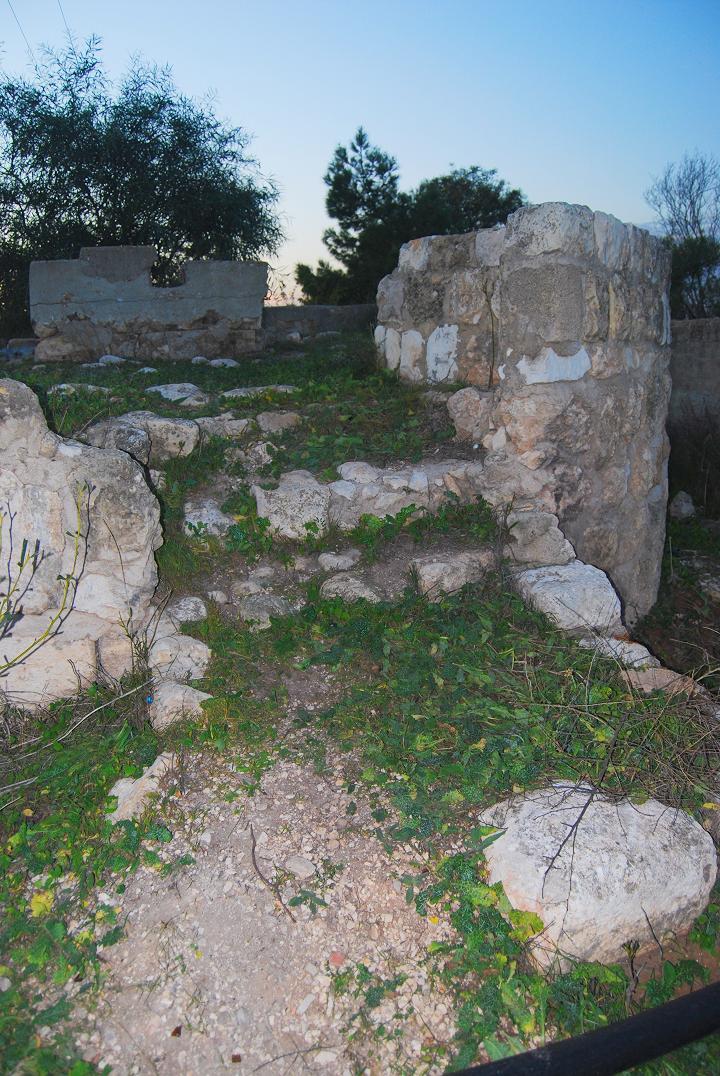
(a) et-Damun:
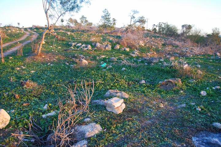
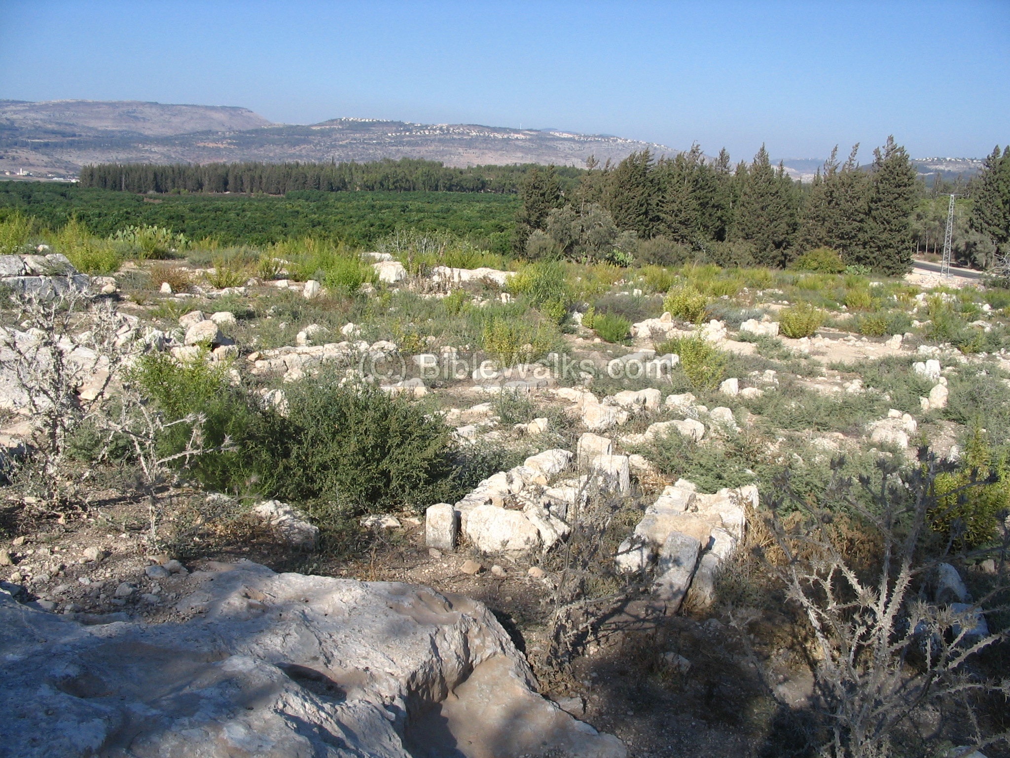
The site of et-Damun is located on a low hill, about 10M above the plains, and close to the north-south road. The hill is covered with the ruins of an Arab village, which may have been built over Roman/Byzantine period levels and perhaps earlier levels. Some scholars even identify Damun as Biblical Dimnah (Joshua 21 34-35) since the names are similar.
Most of the site was covered by low trees and brushes. After a fire in 2006 the hill is mostly barren. The south side of the site is chopped away by the extension of the road to Kabul.
Click on the photos to view in higher resolution…

A view of the center of the hill is seen below, after the fire cleaned away the trees and bushes. The village was leveled in 1948 and it remained in ruins since then.
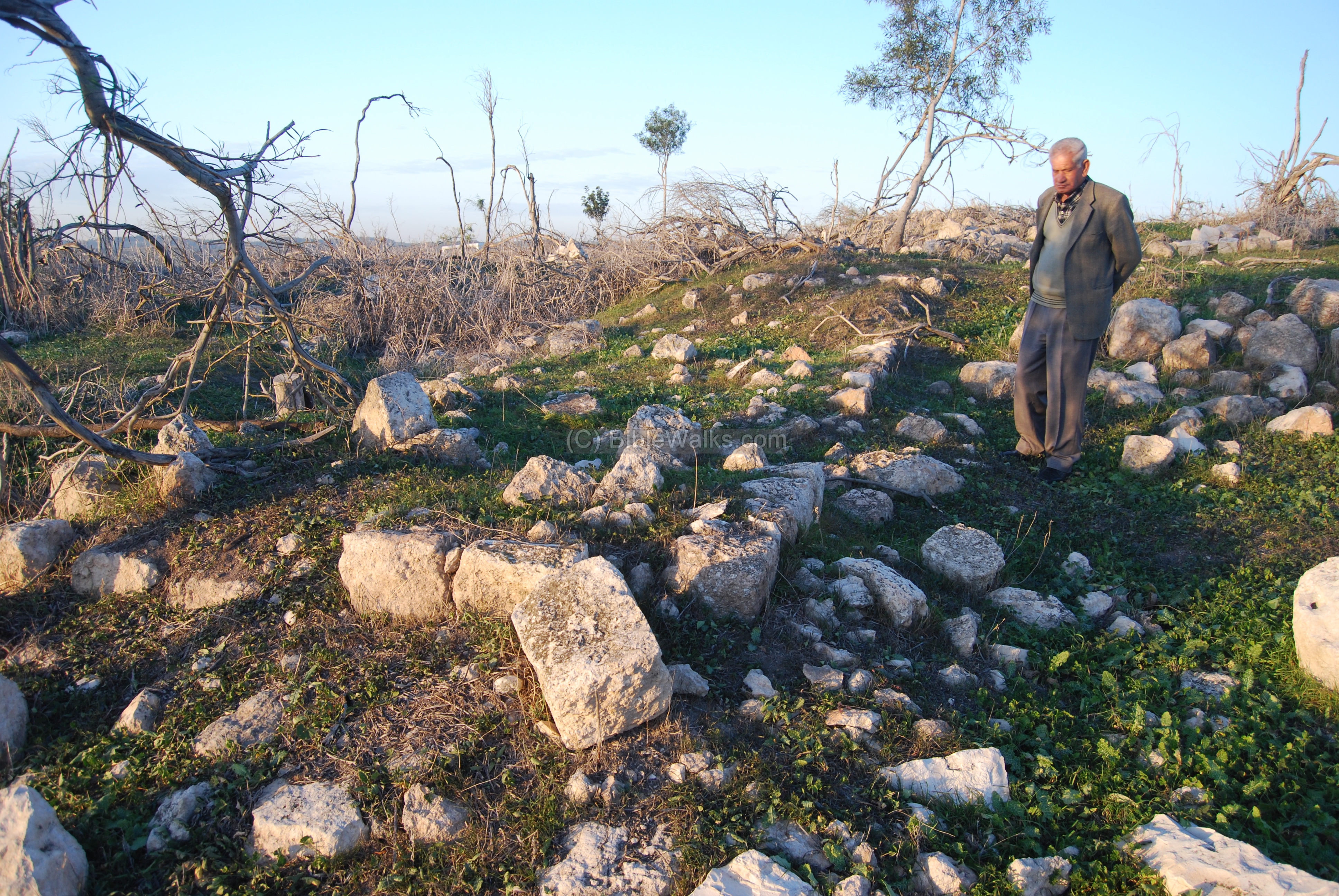
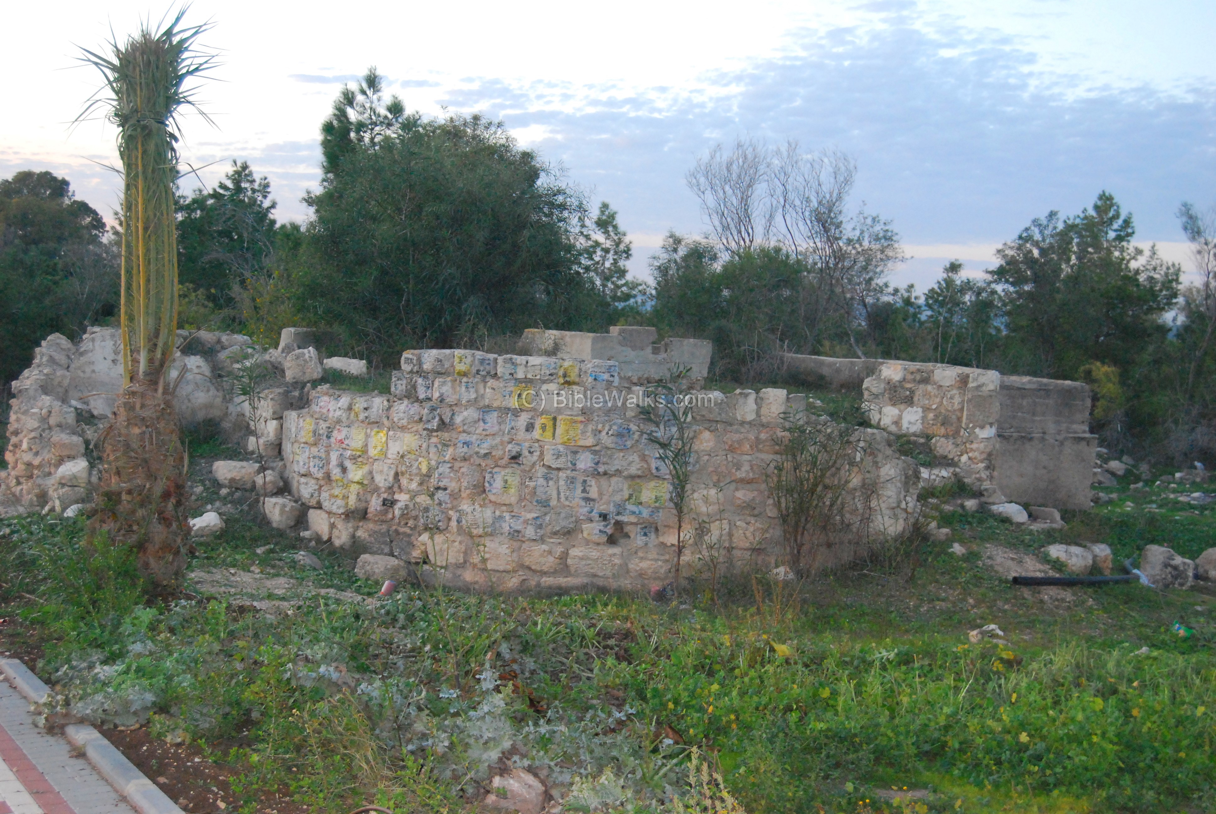
On the south-west side of the village are the ruins of a large mosque. It was designed around 1800 by the same Egyptian architect of the Acre’s Al-Jazzar mosque, and was very similar in size and design. That architect is buried in the grounds of the mosque, but the grave is unmarked. In the photo below the 71 year old native of Damun, Boshkar Yoseph Mohammed, is standing near the southern entrance to the mosque. He lives today in Kabul, 2Km to the east.
According to Mohammed, the size of the mosque (6 Dunam) was used as a “yardstick” unit (called “the rope”) throughout the Galilee for measuring the standard size of parcels of land.
(b) Cemetery:
On the east side of the ruins there is a large cemetery of several dozen graves. In the photo below – a view of the graves, and the hills above the valley of Khilazon.
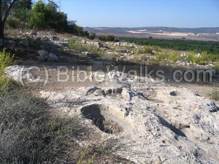
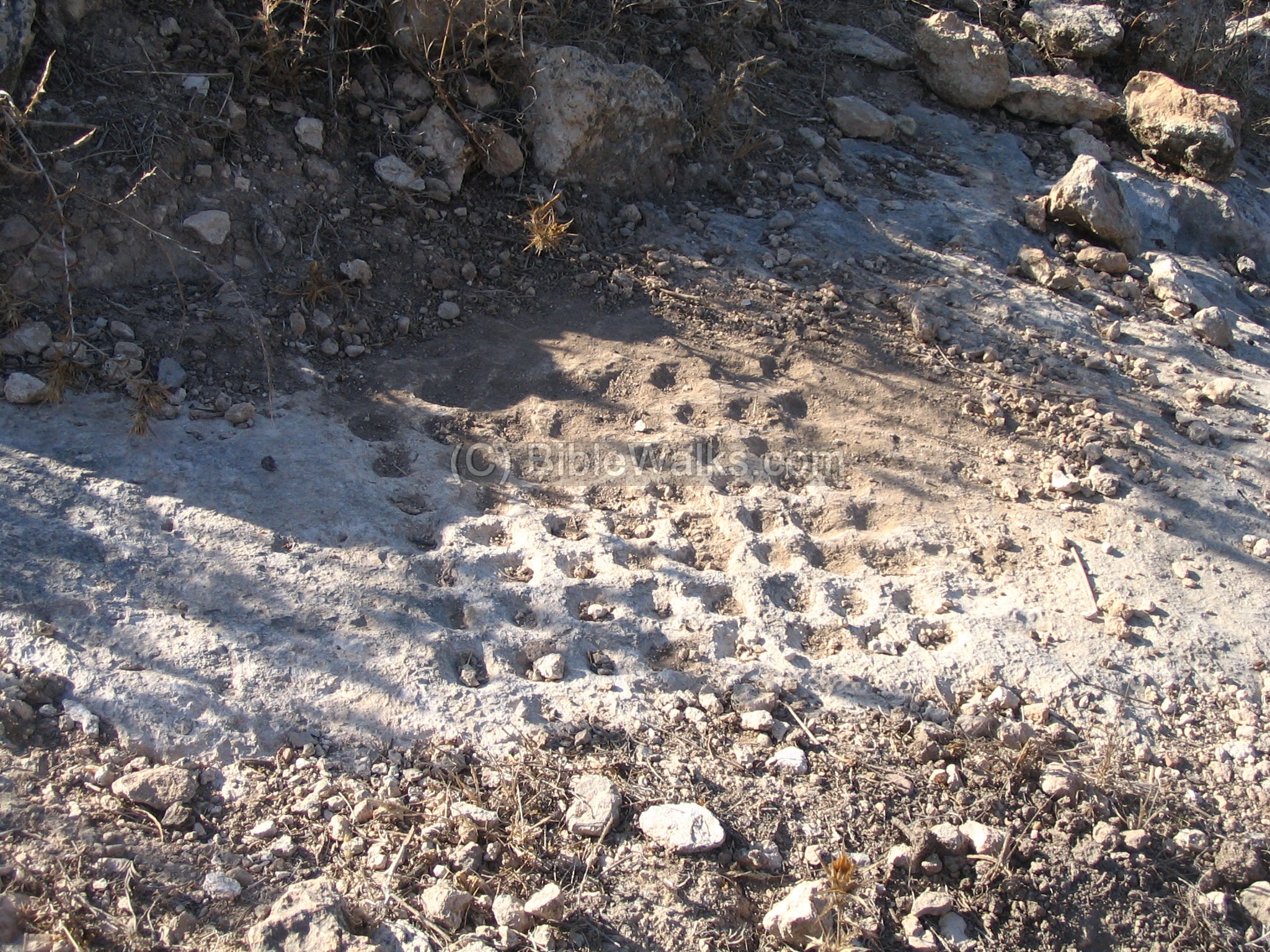
(c) Ancient games:
The photo below shows an ancient game that was carved into the rock. It consists of 8 x 8 round holes, similar to Chinese checkers. The players used stones in different colors to play in this game.
This rock is located at the eastern side of Damun, north of the cemetery. On the same rock there are 2 such games.
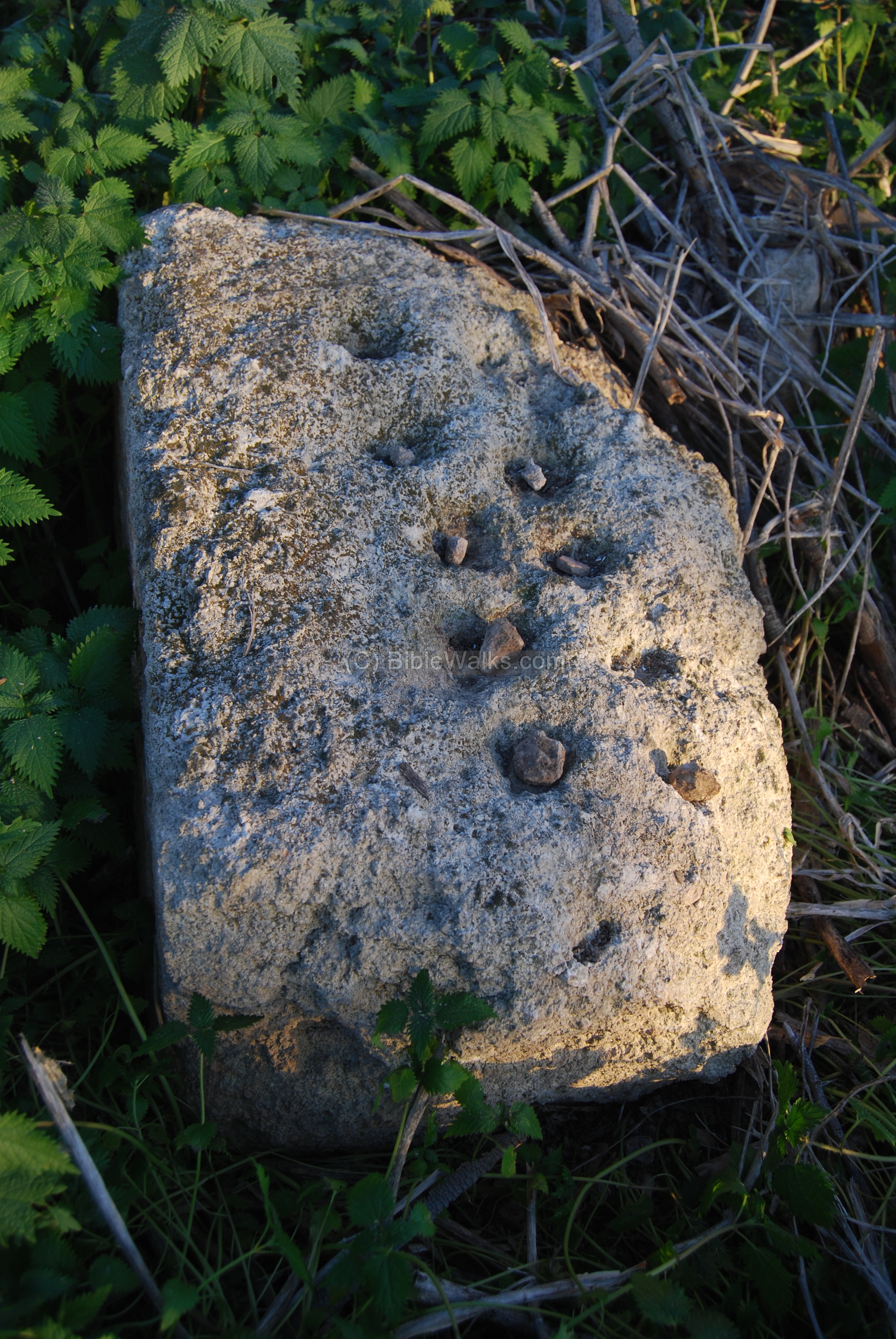
Another stone, which was a base for a game, is located near the ruins of the large mosque, located on the south-west side of Damun. According to Mohammad Boshkar, who lived here as a child, the game was played before and after the prayers.
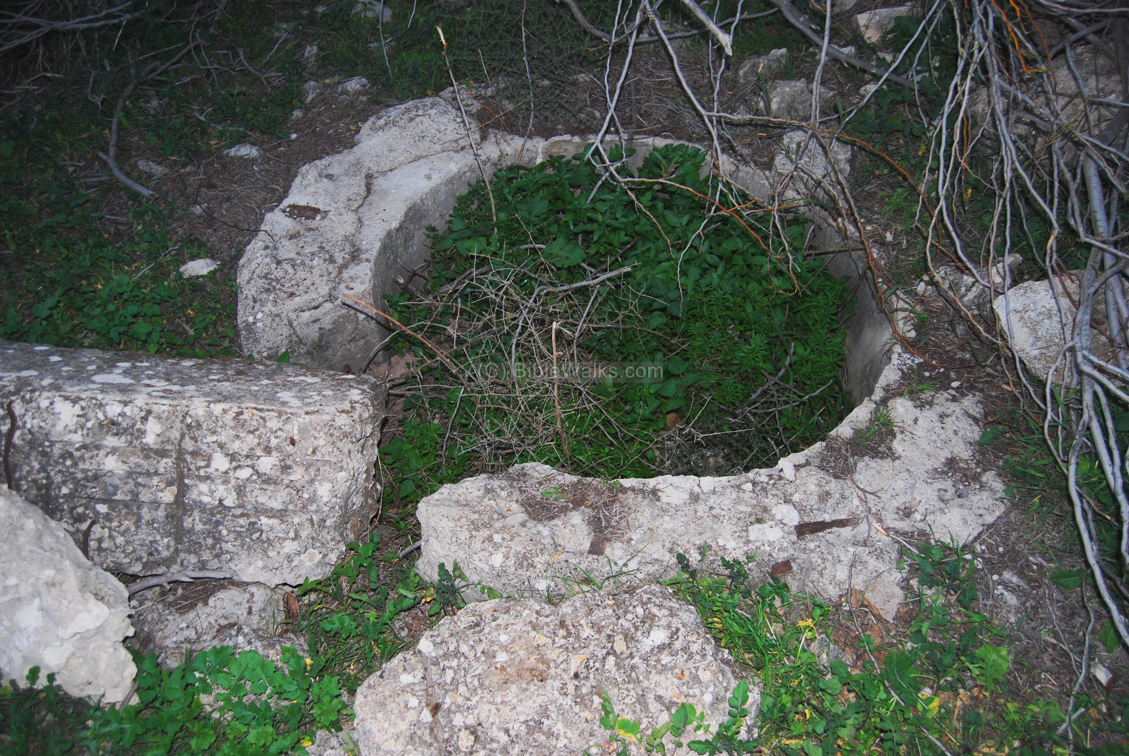
(d) Well:
On the west side of Damun, near the entrance road to Kabul, is a deep well, which was one of the sources of the water for the village of Damun. It was constructed around 1800 in order to resolve the water supply for the growing village.
The water was raised by buckets to a small pool, then flowed into a water trough. Here the animals would drink the water, and the water was also hand carried to the village.
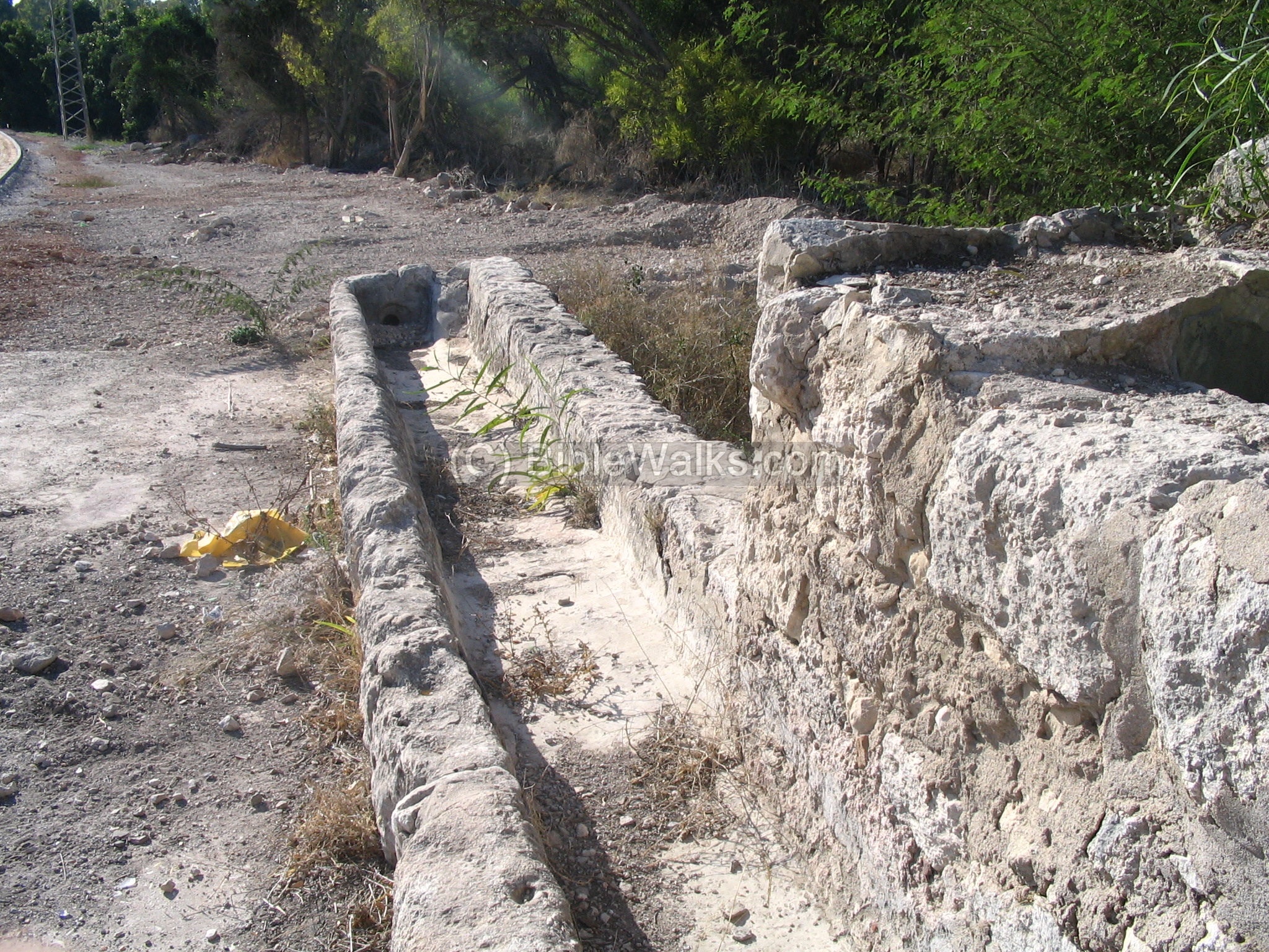
The roof of the well is seen below. Several steps were used to lead a mule or donkey up to the roof, where the animal was used to pump the water.
The mule or donkey encircles the center, turning a vertical pole. This moved a vertical chain which carried a number of buckets, fetching the water from the well up to the water channel.
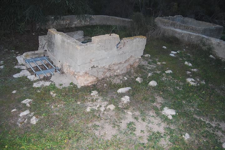
In 1943 an oil press and wheat mill was constructed on the north side of the well, belonging to Enkula El Khaik. The photo below shows the basin where the oil was collected after bring crushed with a machine.
There are plans to reconstruct the well and its surroundings, creating a small park. According to Mohammed, funds were already raised for this project.
Biblical References:
(a) Joshua (19, 24-27)
This text tells about the boundaries of the Asher tribe, which included the city of Cabul.
“And the fifth lot came out for the tribe of the children of Asher according to their families.
And their border was … And it turned toward the sunrising to Beth-dagon, and reached to Zebulun and to the valley of Iphtahel northward at Beth-emek and Neiel; and it went out to Cabul on the left hand”,
(b) 1 Kings (9: 11-13)
This text tells about the Solomon-Hiram agreement, where the area of west Galilee (land of Kavul/Cabul) was traded with the Phoenicians. The implied reason was that King Solomon had to pay for his debts (to pay the cost of the timber, labor and other goods), and he paid with prime real estate (although Hiram was not pleased as per the Biblical text). Actually, this old treaty lasted for 3000 years until Israel was founded, since the area of west Galilee always remained under the Phoenician control.
“now Hiram the king of Tyre had furnished Solomon with cedar-trees and cypress-trees, and with gold, according to all his desire–that then king Solomon gave Hiram twenty cities in the land of Galilee. And Hiram came out from Tyre to see the cities which Solomon had given him: and they pleased him not. And he said: ‘What cities are these which thou hast given me, my brother?’ And they were called the land of Cabul, unto this day”.
(c) Joshua 21 34-35
This text describes the cities of the Levites, who settled among the other tribes. In the tribe of Zebulun a place called “Dimnah” may have referred to the village later called Damun.
“…out of the tribe of Zebulun, Jokneam with her suburbs, and Kartah with her suburbs, Dimnah with her suburbs…”
Historical References:
(a) Josephus Flavius (Wars Book 2: 18:9)
This text tells about the beginning of the conquest of the Romans during the Jewish revolt, and refers to Cabul (written here as Zabulon):
“…so Cestius took part of his forces, and marched hastily to Zabulon, a strong city of Galilee, which was called the City of Men, and divides the country of Ptolemais from our nation; this he found deserted by its men, the multitude having fled to the mountains, but full of all sorts of good things; those he gave leave to the soldiers to plunder, and set fire to the city, although it was of admirable beauty, and had its houses built like those in Tyre, and Sidon, and Berytus. ”
(b) Josephus Flavius (Wars Book 3: 3:1)
In this text is a location of the site (Zabulon, which is another form of Cabul):
“Now Phoenicia and Syria encompass about the Galilees, which are two, and called the Upper Galilee and the Lower. They are bounded toward the sun-setting, with the borders of the territory belonging to Ptolemais, and by Carmel; … As for that Galilee which is called the Lower, it, extends in length from Tiberias to Zabulon, and of the maritime places Ptolemais is its neighbor”.
Etymology (behind the name):
- Kavul – In Hebrew, a muddy soil which is found in swamps, and is a deposit of decaying plants in swamps.
- Chabulon, Zabulon, Cabul – other names of the site
- Kabul – the name in Arabic
- Damun – unknown meaning; perhaps based on the Biblical city of Dimnah (Joshua 21).
Identification of Biblical Cabul:
Where was the location Biblical Cabul?
The modern village of Kabul preserved the ancient name of Kavul, and therefore there is a high probability that the Biblical site may be found in its vicinity. However, there are no Iron age sites inside the village.
There are other possible candidates at the nearby sites which have a Iron age level (see map above):
-
Khirbet Rosh Zayit – 2KM north-east to modern Kavul; 1KM south-west to Shaab
-
Khirbet Ya-anin (Ne’iel)- 3 KM north to Kabul; 1KM west to Sha’ab
-
Tell Kisson – west to the modern road near Kabul
Links:
- Salvage excavation in Kabul [2003]
- Salvage excavation in Damun [2006] – first excavation on the site; revealed findings from British Mandate, Ottoman and Roman period.
- An Early Byzantine-Period Burial Cave at Kabul – [Atiqot 66]: “The burial cave excavated at Kabul … is of the chamber-tomb type, surrounded by six vaulted chambers, each containing two troughs. The finds in the cave consist of glass vessels, jewelry and a coin; no pottery vessels or lamps were discovered all dating to the late fourth century CE; a New Kingdom scarab was apparently reused in a piece of jewelry. The cave was probably used for family burial, possibly of a Jewish family, based on the finds and rabbinic sources describing Kabul as a Jewish town”.
- Ancient Games – BibleWalks info page
BibleWalks.com – walk with us through the sites of the Holy Land
Nei’el<<<–previous Hilazon site—<<<All Sites>>>–next Hilazon site—>>> Fachir
This page was last updated on Apr 12, 2023 (new link)
Sponsored links: