Ruins of an 8th-6th Century BC Israelite walled city, located on the side of ancient routes; mentioned as one of the southern Judean cities during the time of King David. It was one of the most important Biblical cities in the Negev during the Judean Kingdom.
* Site of the Month June 2012 *
Home > Sites > Negev > Tel Aro’er of Judea
Contents:
Background
Location
History
Photos
* Aerial Views
* Ground view
* North West
* North
* North East
* South
* Roman Fortress
* Far South
* West
* Panoramic
Etymology
Links
Overview:
On Tel Aro’er are ruins of an 8th-6th Century BC Israelite walled city, located on the side of ancient routes. It was mentioned as one of the southern Judean cities during the Kingdom of David. 1 Samuel 30 26, 28: ” And when David … sent of the spoil … And to them which were in Aroer…”.
It was one of the most important Biblical cities in the Negev during the Judean Kingdom. Note that yet another city named Aroer is mentioned by the Bible in the area of Moab on the east side of the Jordan river.
A smaller occupational phase was during the early Roman period (1st century BC).
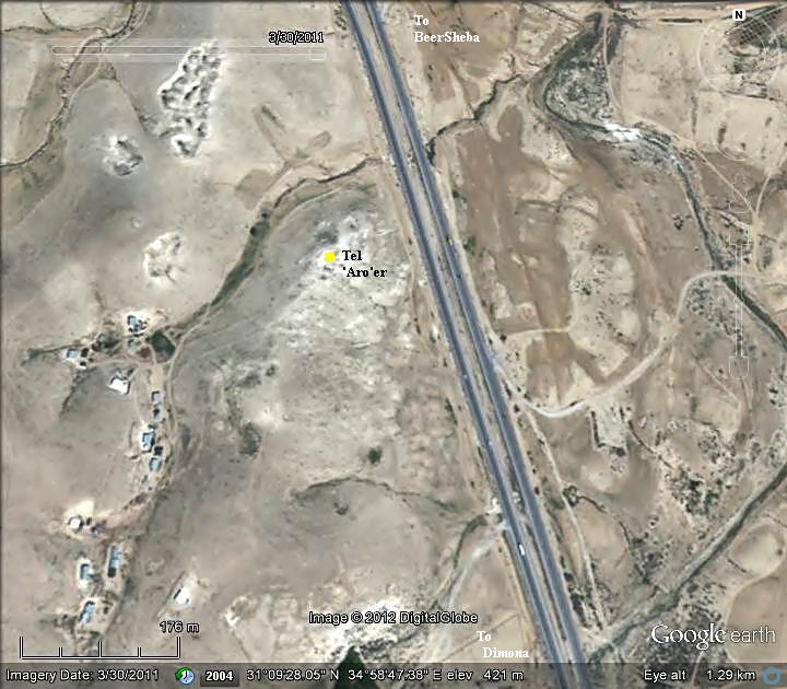
Location and Map:
Tel Aro’er is located in the southernmost point of the Beersheba Valley. The ruins of the city are located on a hill on the south side of the road to Dimona, about 22 km southeast of modern Beersheba.
History:
- Roads:
This Biblical city guarded strategic routes in the southern Judea area. A map of the area around the site is shown below, indicating the major cities and routes during this period. According to David Dorsey’s “The roads and Highways of Ancient Israel” these were the main roads passing at Aro’er during the Bronze and Iron ages:
- A road descending to the Arava valley thru the Ascent of the Akrabbim and Tamar (appears as a dashed line).
- Route ‘N2’ – NE to Malhata, and from there to Arad
- Route ‘N3’ – NE via Malhata to Hebron
- Route ‘N4’ – NW via Tel Masos, and from there to Beersheba, Tel Shoqet and Tel Halif (on the ‘SH1’ road)
Recent theories suggest that the road to the south was important for the Judean Kings in the 10th-9th century as it was directed to the source of copper mining, which was at that time in Funon (Wadi Feinan or Faynan), 30 KM south east of Tamar. Another but farther mining center was in Timna, 130km south. The copper mining industry, which reached a peak during this period, was an important source of income for Kings David and Solomon. It was perhaps a major factor of the Judean Kingdom’s prosperity, and one of the commodities that Solomon traded with the southern kingdoms. Aroer is located on the route from Funon to Judea, and therefore the fortress was constructed to safeguard the route. According to archaeologist Nelson Glueck this was one of the reasons why King David conquered Edom, where the copper mining center was located (1 Chronicles 18:13): “And he put garrisons in Edom; and all the Edomites became David’s servants”.
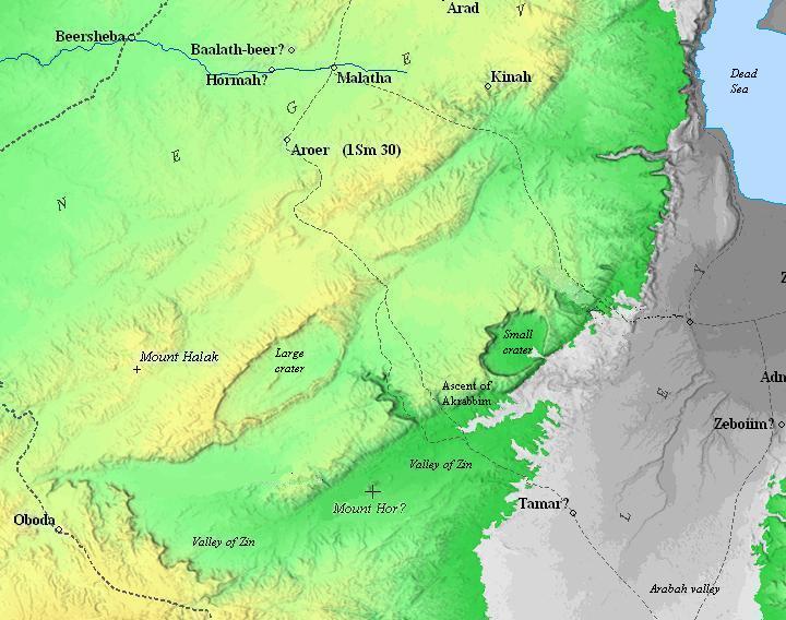
Map of the area around Aroer – during the Canaanite to the Israelite periods (based on Bible Mapper 3.0)
-
Biblical period – Iron Age I-IIa (10th-8th century BC)
Aro’er was one of the cities in the region of Judea, and listed as one of the cities that received presents from King David during the 11th Century BC (1 Samuel 30 26, 28):
“And when David came to Ziklag, he sent of the spoil unto the elders of Judah, even to his friends, saying, Behold a present for you of the spoil of the enemies of the LORD;… And to them which were in Aroer…”.
During the reign of the Israelite king David, the city was captured by the Ammonites. The Second Book of Samuel, chapter 24, verse 5, states that David’s general Joab pursued the Ammonites to Aroer and besieged the city.
- Shishak’s conquest (926-925 BC):
After the split of the Unified Kingdom, Shishak invaded the land of Israel and captured Aroer as well as other fortified Judean cities. Shishak (also known as Sheshonk I) was an Egyptian pharaoh who ruled from 945-924 BC. He is known for his military campaigns in the Near East, including his invasion of Israel in 925 BC. The Bible wrote about this campaign (1 Kings 11:40; 14:25-26; 2 Chronicles 12:2-9). These verses are from 2 Chronicles 12:2-4:
“And it came to pass, that in the fifth year of king Rehoboam Shishak king of Egypt came up against Jerusalem, because they had transgressed against the LORD, With twelve hundred chariots, and threescore thousand horsemen: and the people were without number that came with him out of Egypt; the Lubims, the Sukkiims, and the Ethiopians. And he took the fenced cities which pertained to Judah, and came to Jerusalem”.
In this relief on the wall of the Great Temple at Karnak, the pharaoh listed the places he conquered in his campaign. The name Aroer was not deciphered, but it could have been not included.

Karnak: Commemoration of Shishak’s victory over Rehoboam
Photo of the Library of congress (American Colony, taken 1900-1920)
-
Late Iron Age (Israelite IIb-III) – 8th-6th century BC
After this inquest the city was rebuilt.
The archaeologists examined several excavation areas on the mound, and identified the majority of the structures as Late Iron Age – 8th to 6th Century BC. The city covered at the time the entire top side of the mound and some of the surrounding foothills. The total area was 27 Dunam (2.7 Hectares), with an upper city of 10 Dunam and a lower city (outside the fortified area) of 17 Dunam. It was one of the most important Biblical cities in the Negev.
The city was protected by a massive casemate wall (double walls with a chambers between them). The wall is 4m wide, which is a common Iron Age design. It was destroyed at the beginning of the 6th Century BC, according to an accumulation of ash found on this layer. In the excavated areas the archaeologists unearthed Judean, Assyrian and Edomite vessels.
It is unclear when the city of Aroer was finally destroyed, as there are no historical records that provide definitive information on its fate. However, it is likely that the city was abandoned or destroyed during the Babylonian conquest of the region in the 6th century BC, which marked the end of the independent Kingdom of Judah.
-
Roman Period (1st BC-1st AD)
Another occupational phase came in centuries later. It started in the Hellenistic period. During the early Roman period (1st Century BC) a fortress was built on top of the hill and above the ancient layer. The site was damaged in the Great Revolt and was finally abandoned following the Bark Kokhba revolt in 135 AD.
-
Modern Period
Tel Aro’er was first excavated in 1975 under the direction of Prof. A. Biran and R. Cohen. Additional excavation seasons were held in 1976, 1978, 1980-1982, under the direction of Prof Biran.
Photos:
This section is ordered ‘clockwise’ from north to west, after the aerial views.
(a) Aerial Views
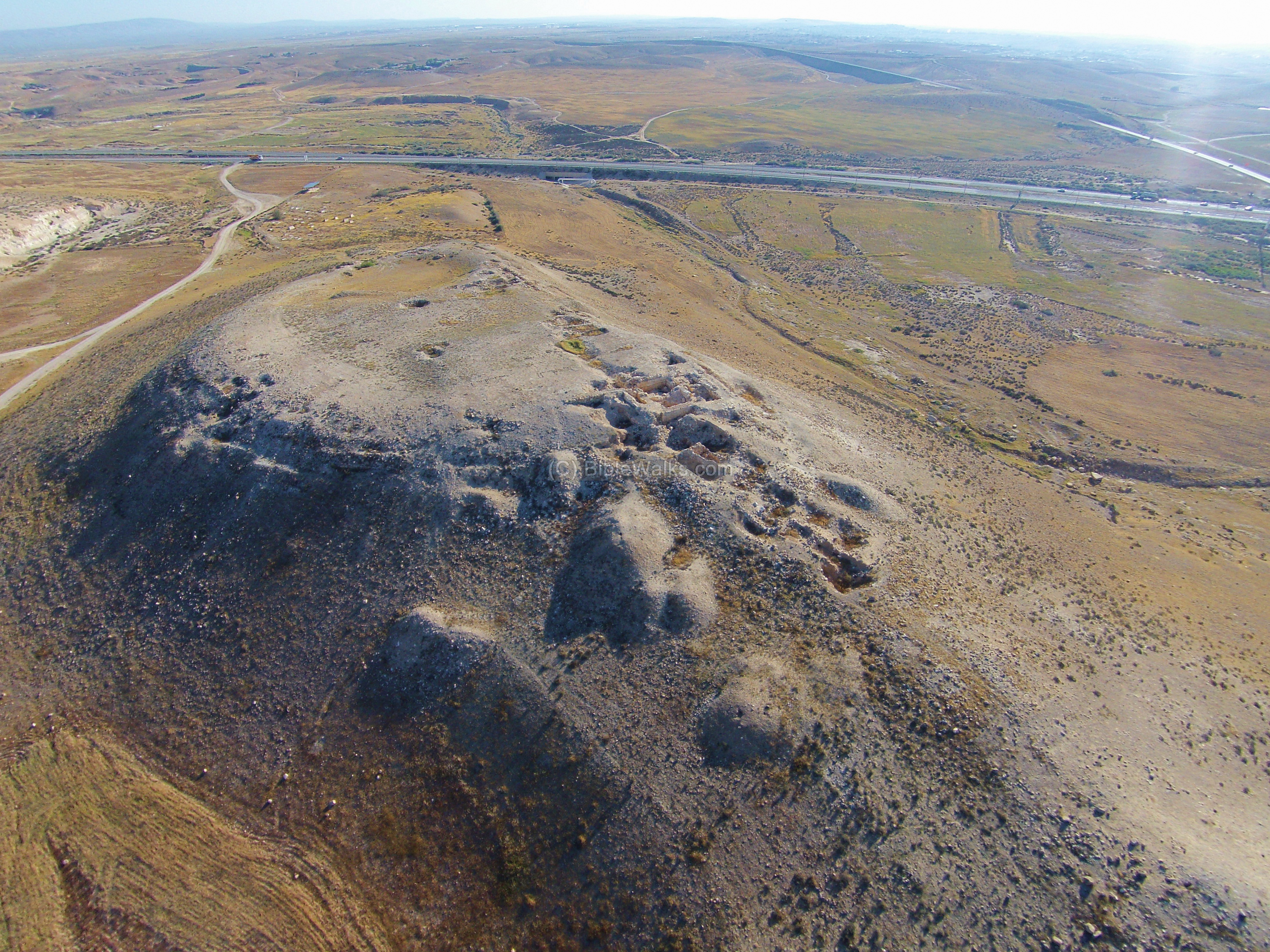
A drone captured this northwest aerial view of Tel Aro’er. Notice the city wall along the edges of the top of the hill.
Click on the photos to view in higher resolution…
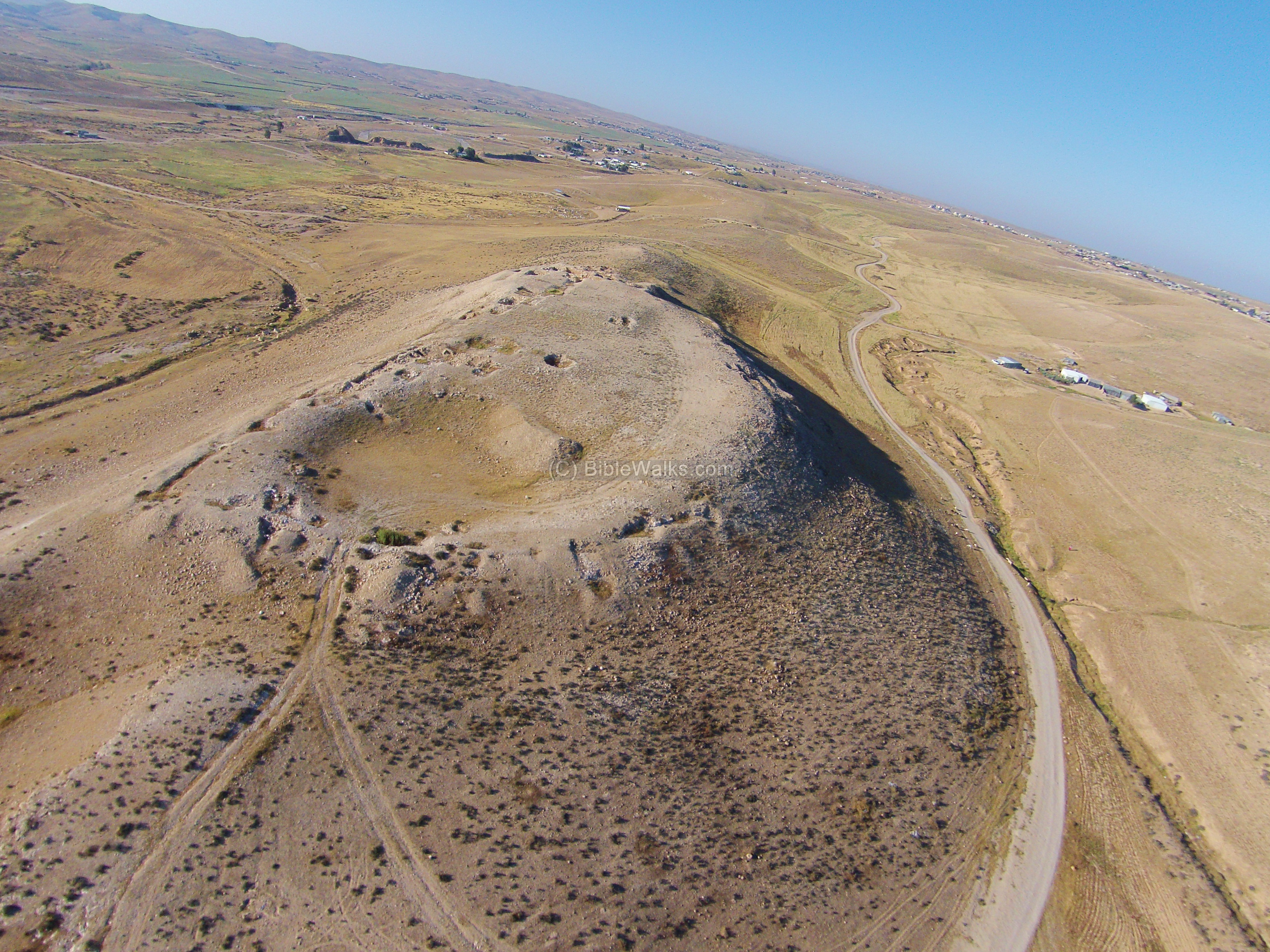
The next aerial view, also captured in April 2016, is from the southwest side. Extensive excavations were conducted on this south side.
Behind the mound is highway #25 from Beersheba to Dimona, close to Aroer junction on the far right side.
![]() The following YouTube video shows a flight of a drone over the north and south sides of the mound.
The following YouTube video shows a flight of a drone over the north and south sides of the mound.
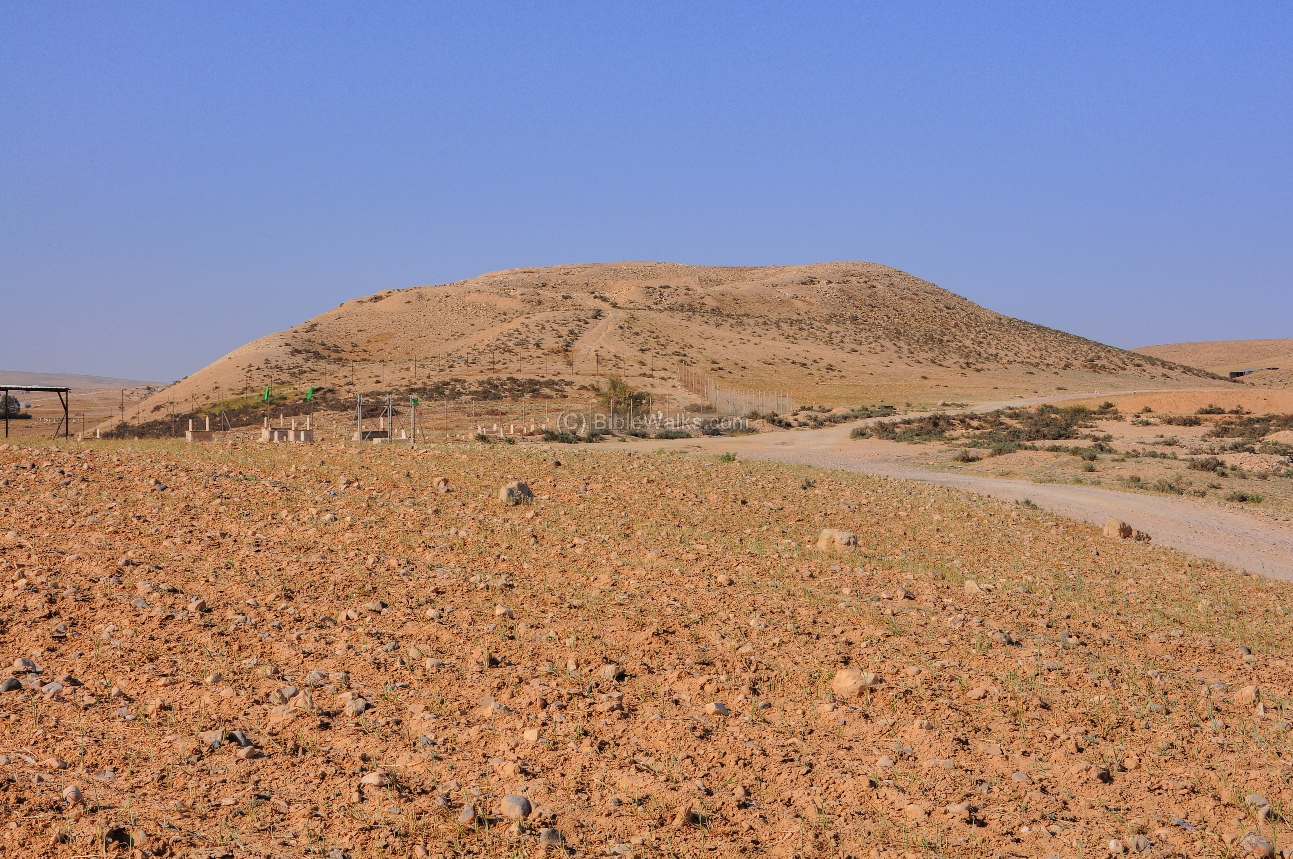
(b) Ground views
The mound of Aro’er is visible from the road from Beersheba to Dimona. If you have some time to explore the site, simply stop at the side of the road just before reaching to the junction of the modern ‘Ar’ara village, which preserved the ancient name.
In front of the mound, on its northern side, is a Bedouin cemetery.
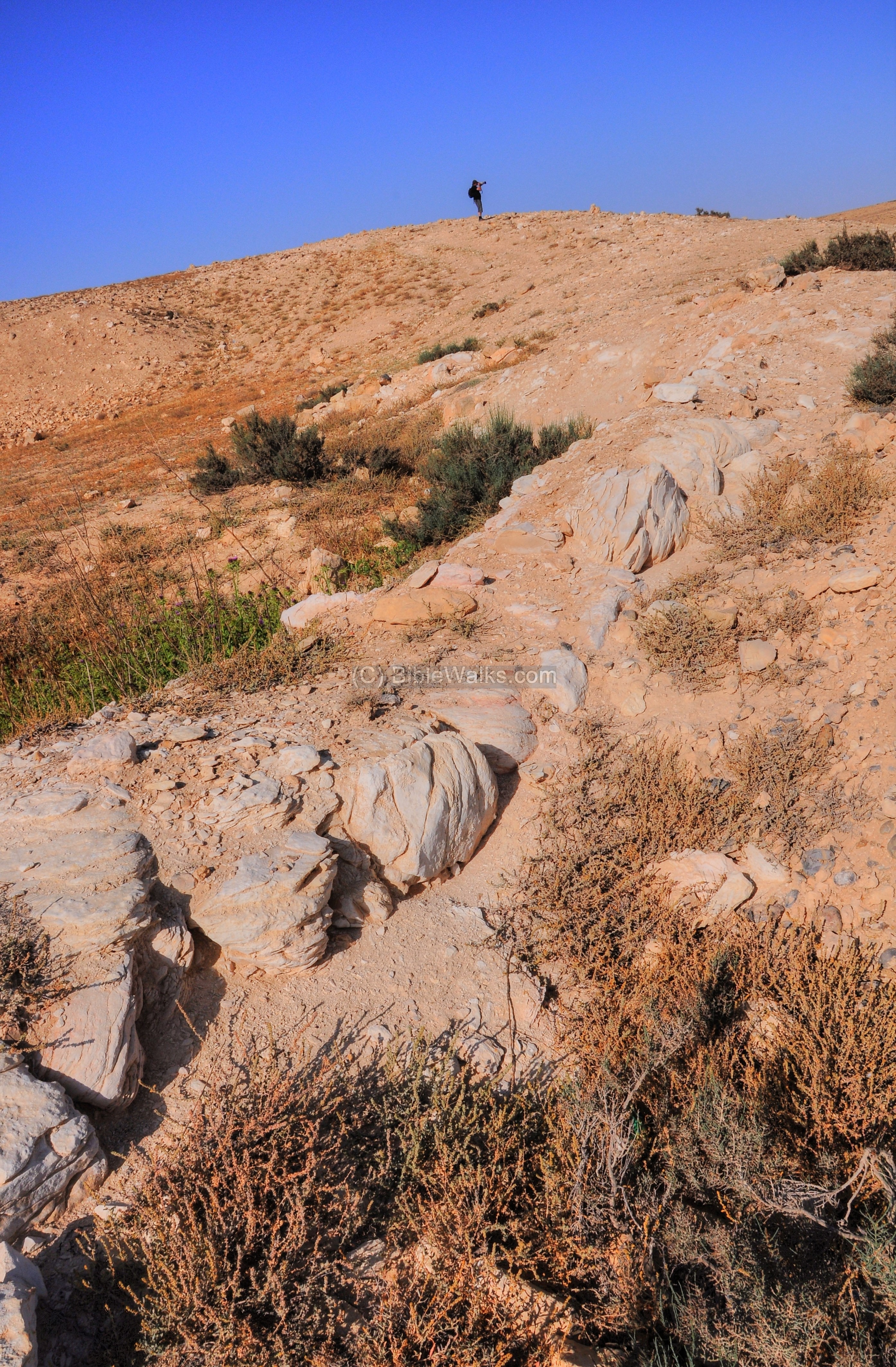
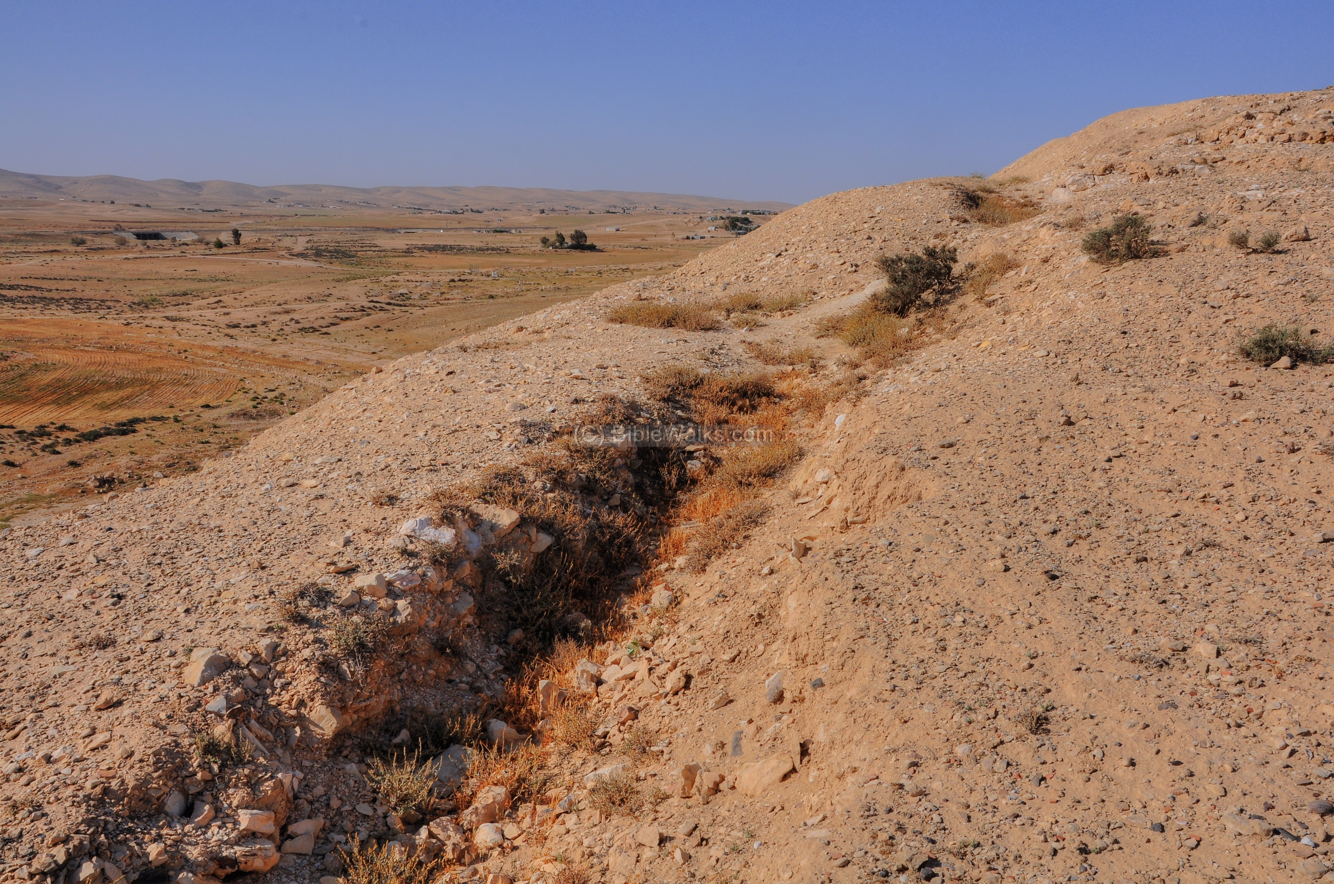
- North/West side – Area Y
The mound rises over the valley. On the north side of the mound was the lower city, an area of 17 Dunam. A small section of the western side of this section was examined in an area named ‘Y’, which included a section of the Iron Age city wall and few structures behind the wall.
A section of the city wall is visible here, as a result of the excavations.
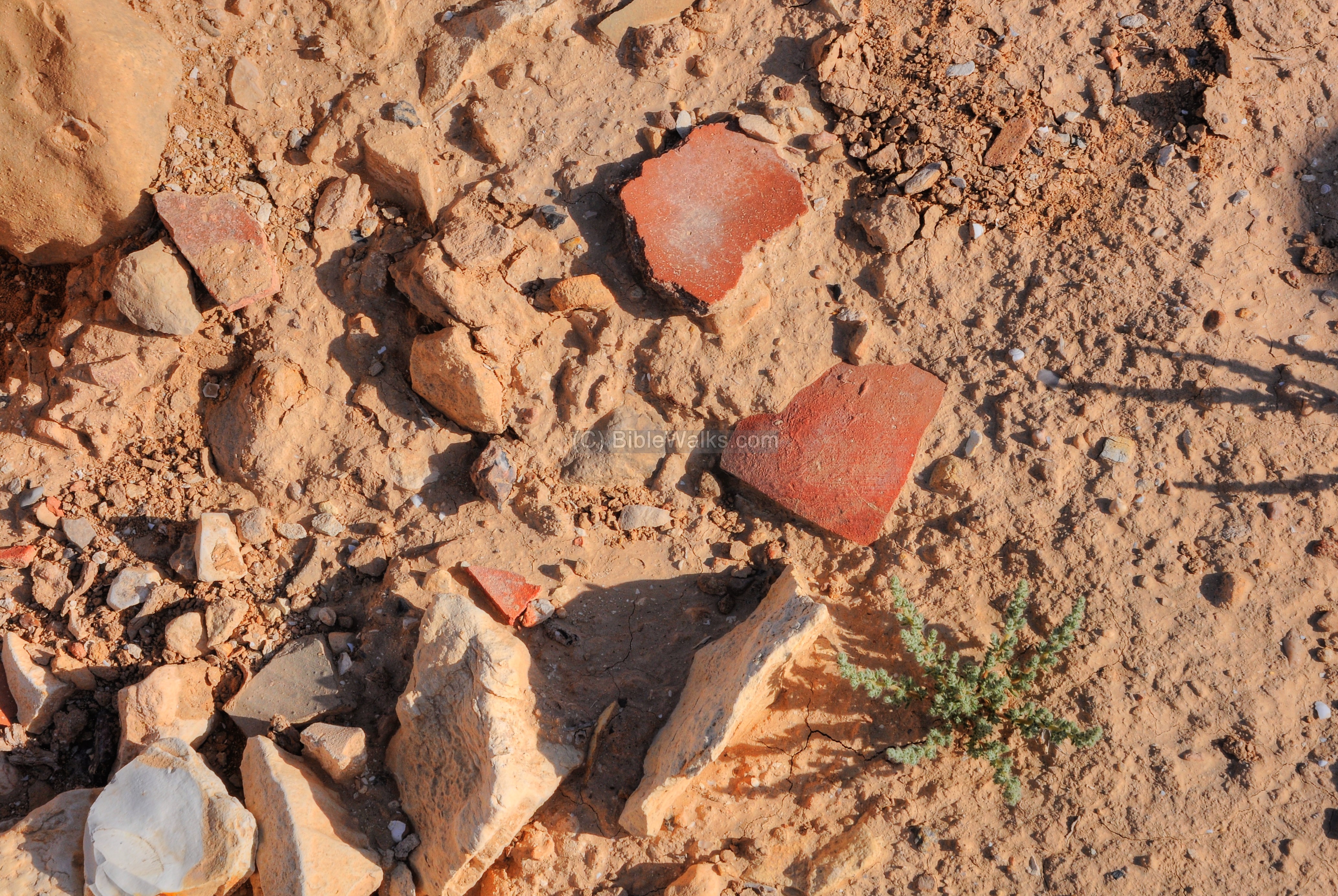
Scattered ceramic fragments are seen all over the site.
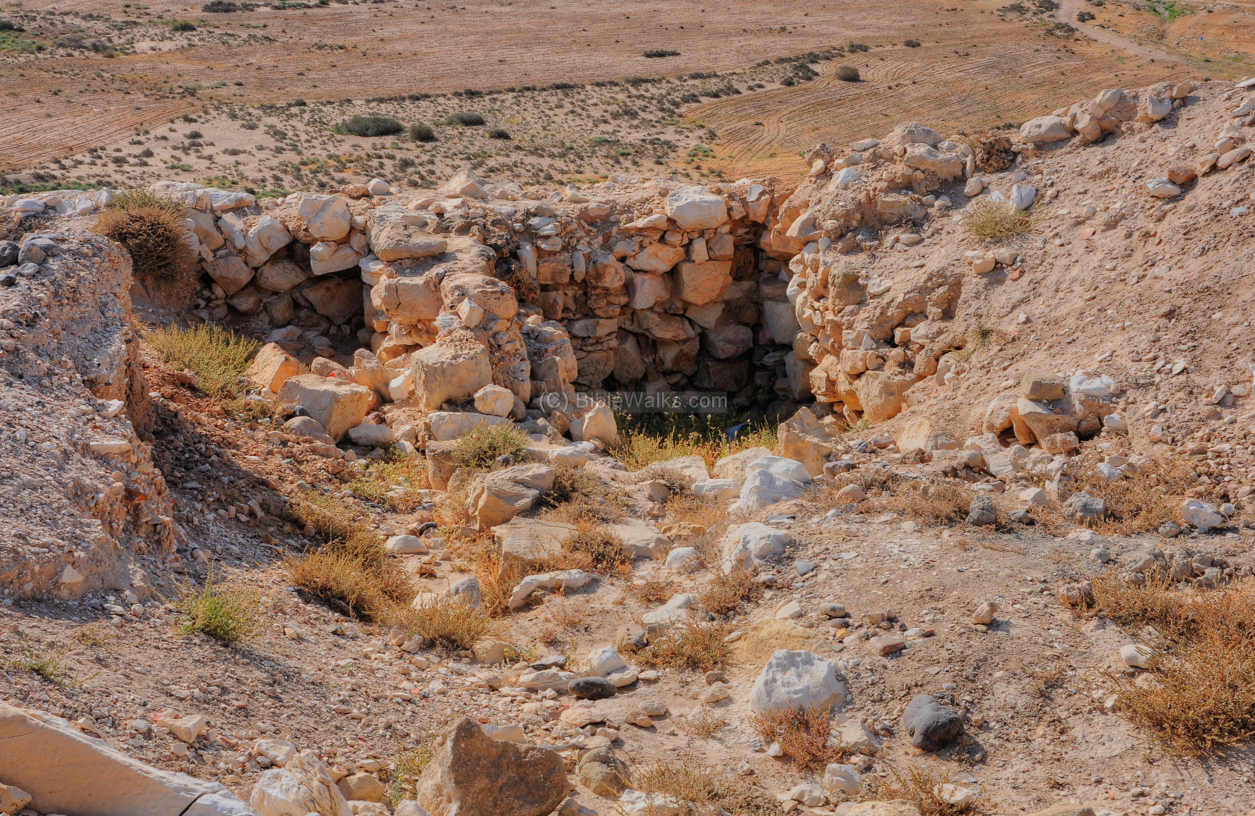
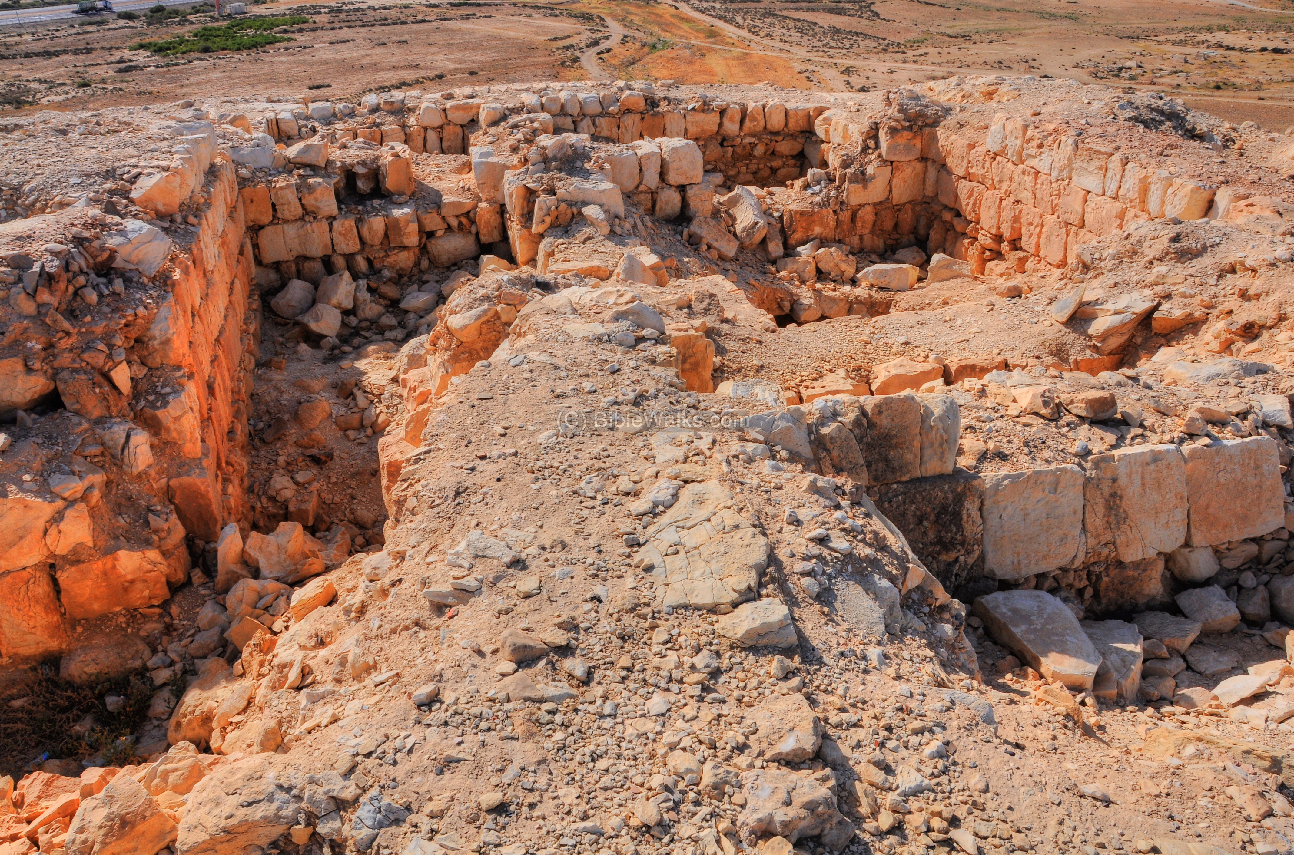
- North Side – Area B North
Another excavation area (‘B’) is located on the north edge of the lower city. The photograph below shows a section of the city wall. Behind it is a large round area cut into the surface, perhaps a reservoir from a later date. Beyond it is the top of the hill – the location of the “upper city”.
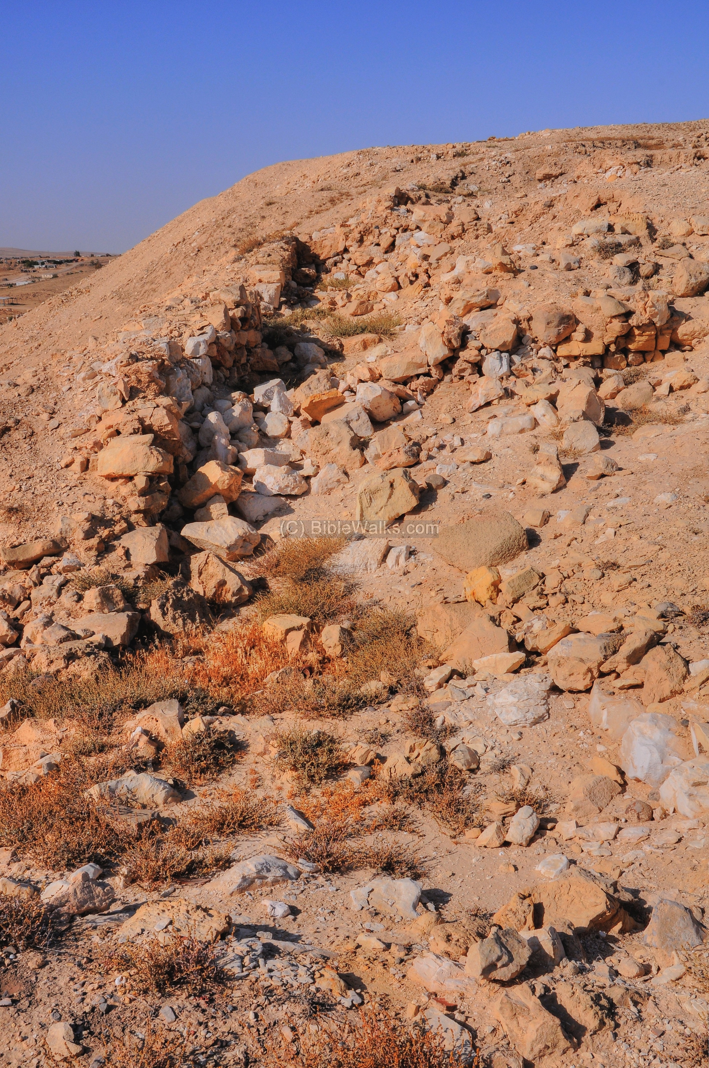
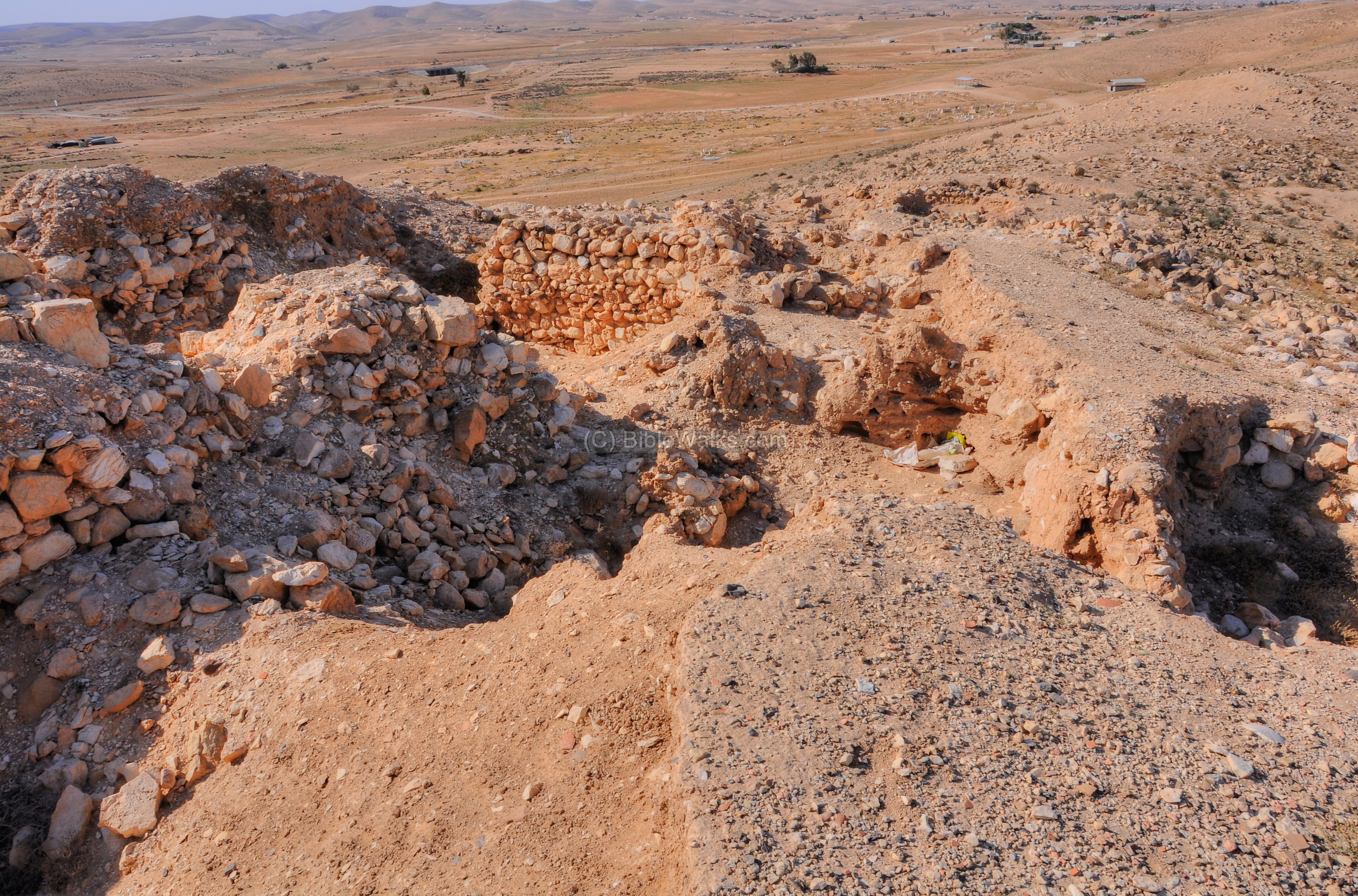
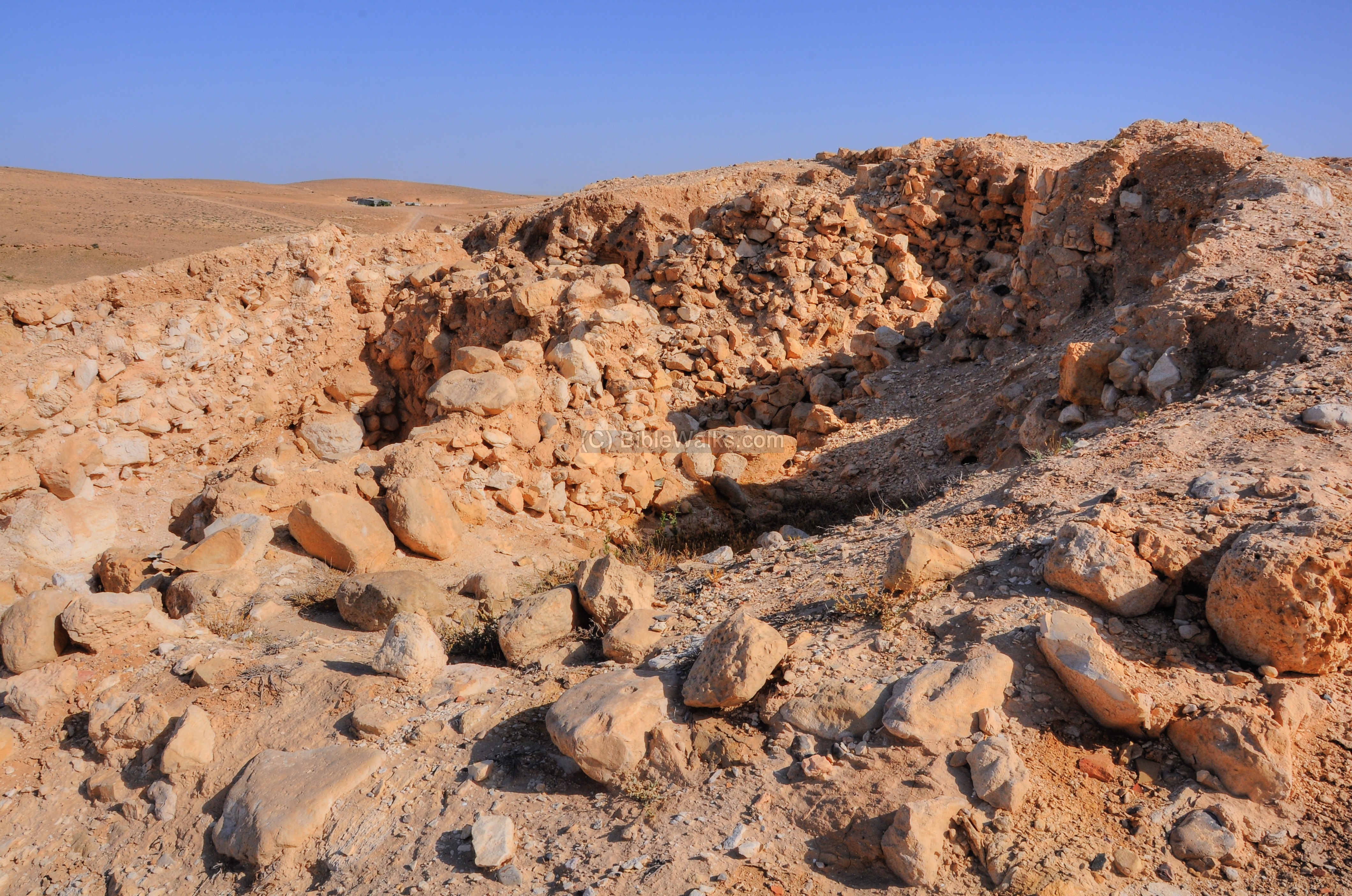
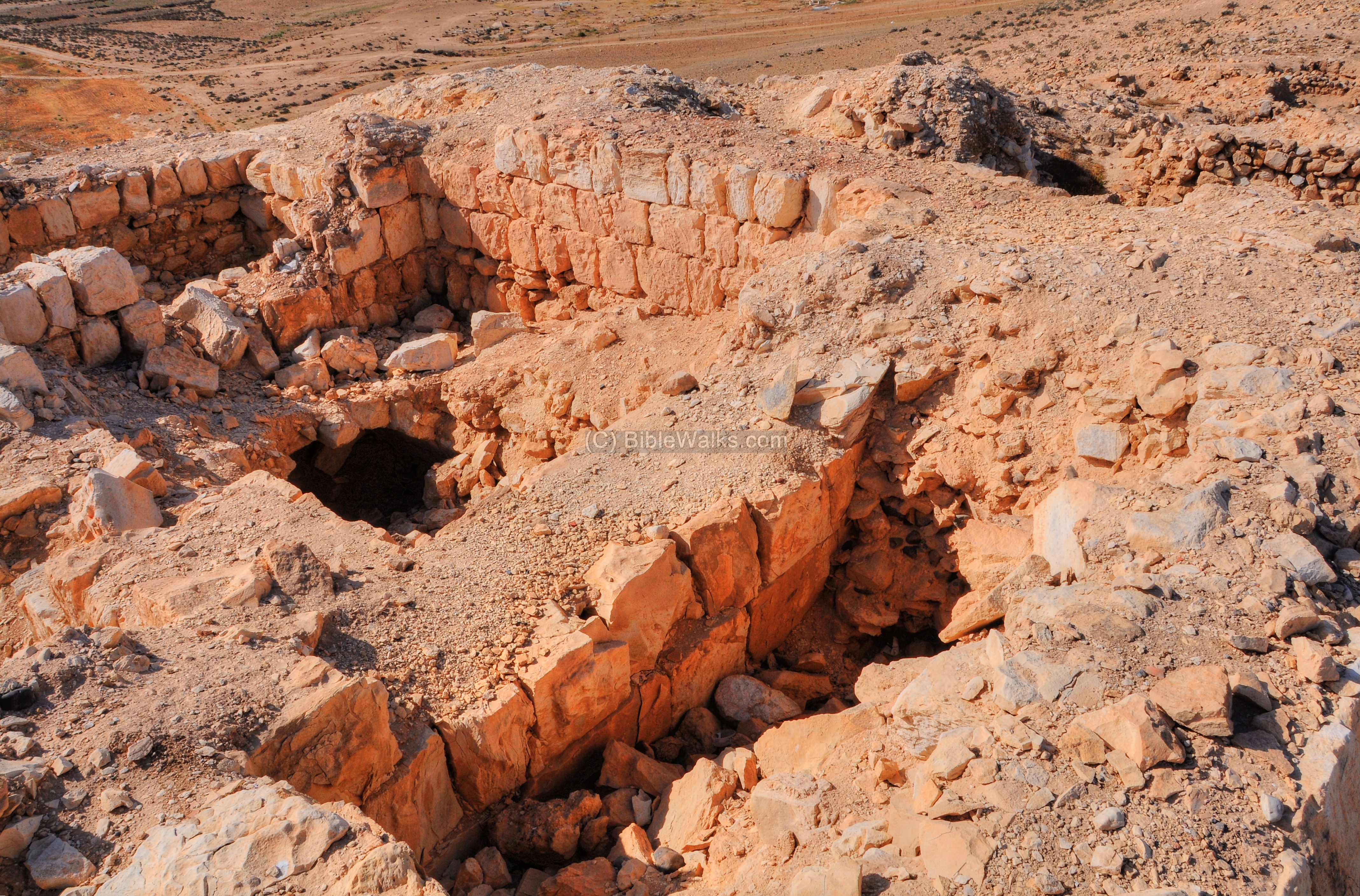
- North-East – Area B
Another section of the Iron Age city wall is visible on the eastern side.
This wall climbs up along the hillside towards the top of the hill. The excavators marked this area as ‘B’, which included the wall and the structures along it.
A great view of the valley on the east side is seen behind the wall. The valley is about 50m lower than the top of the hill. The names of the valley and the stream is “Ithnan”, named after one of the Judean cities (Joshua 15 22-23): “And the uttermost cities of the tribe of the children of Judah toward the coast of Edom southward were … And Kedesh, and Hazor, and Ithnan“.
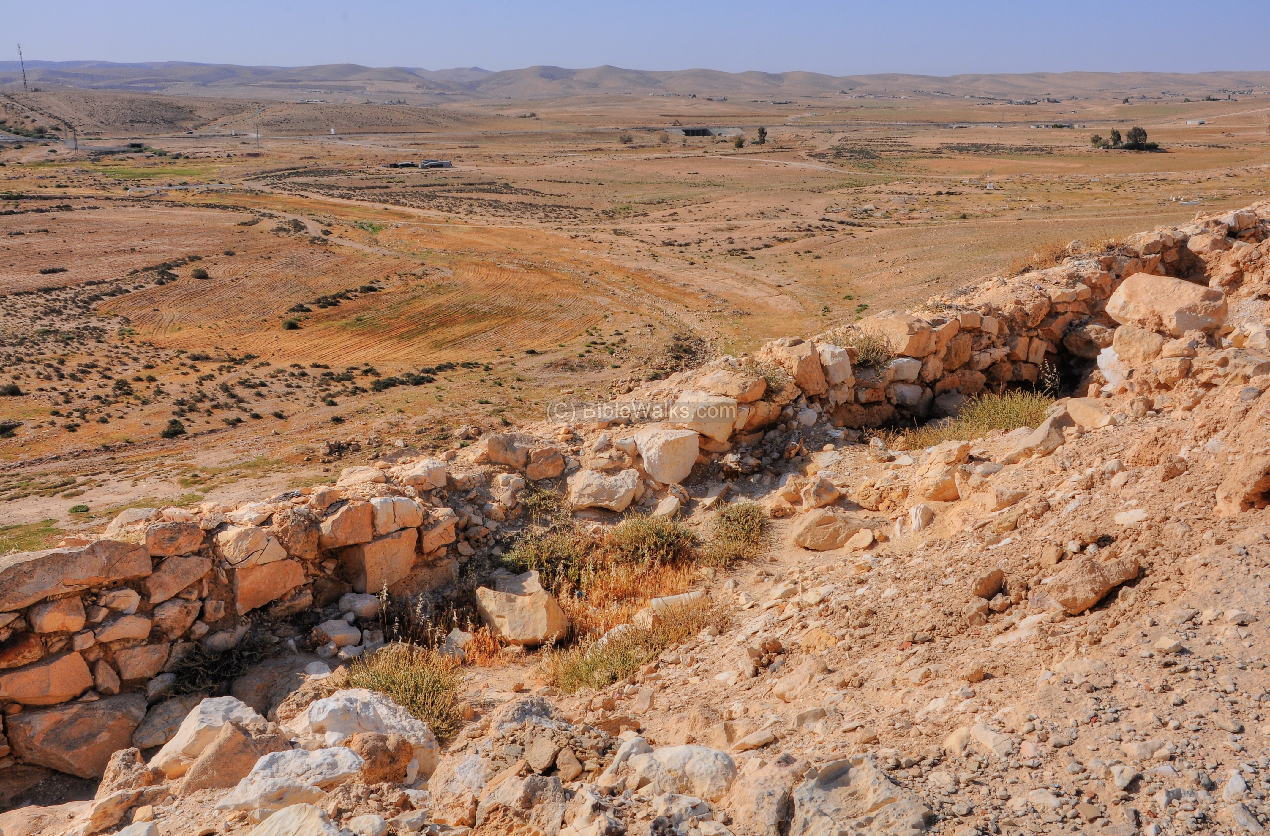
The Iron Age city wall was built in a casemate form (double walls with a chambers between them). Dwelling rooms touched the border of the inner wall. This architecture is seen in the photograph below.
The casemate form (Hebrew: “Sogarim”) is based on two parallel walls (one external and one internal), which are connected at small intervals with inner walls, thus creating chambers. The chambers – 4m wide – were used for storage and dwelling, and during war it could be reinforced by filling them with earth.
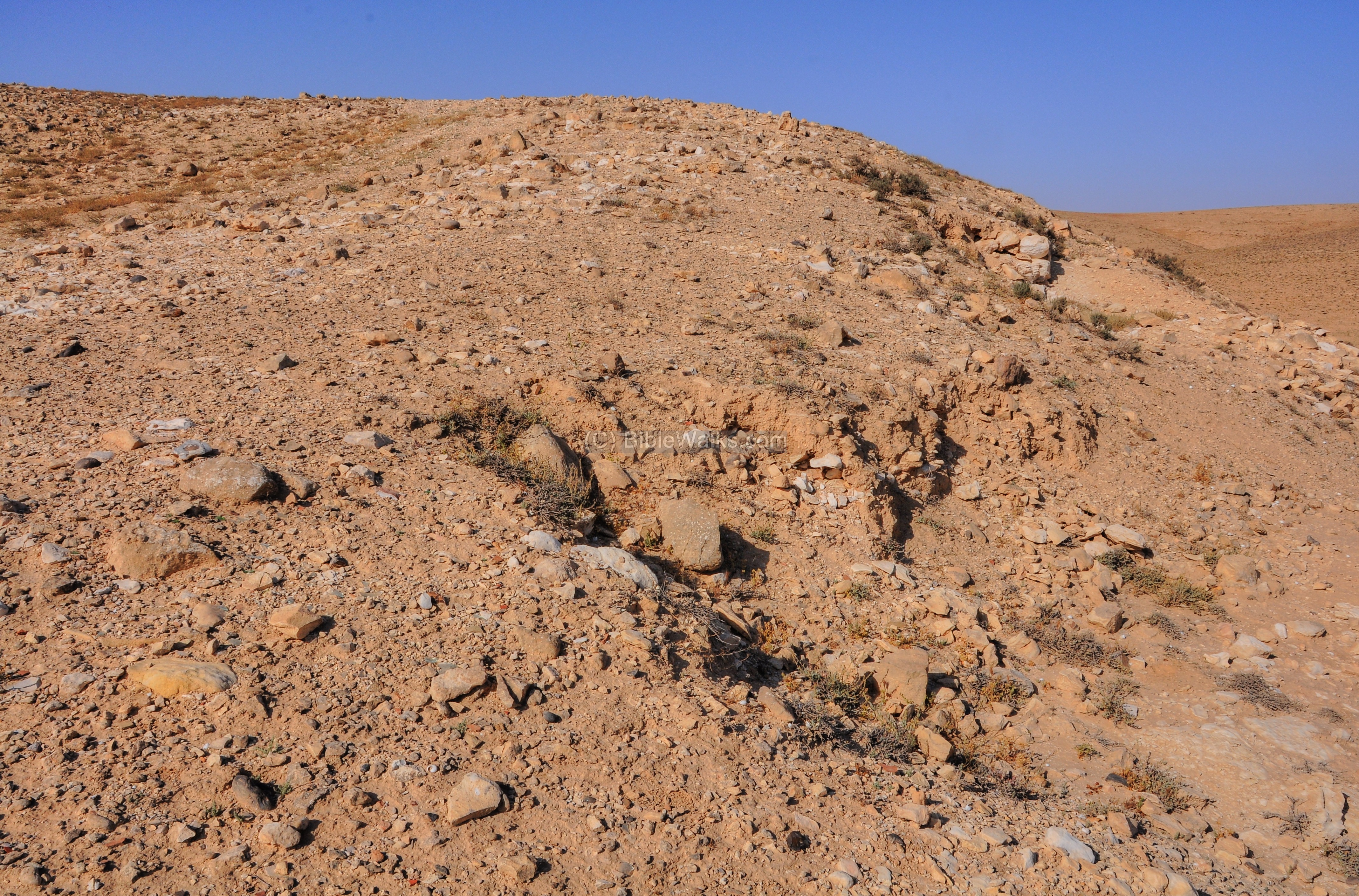
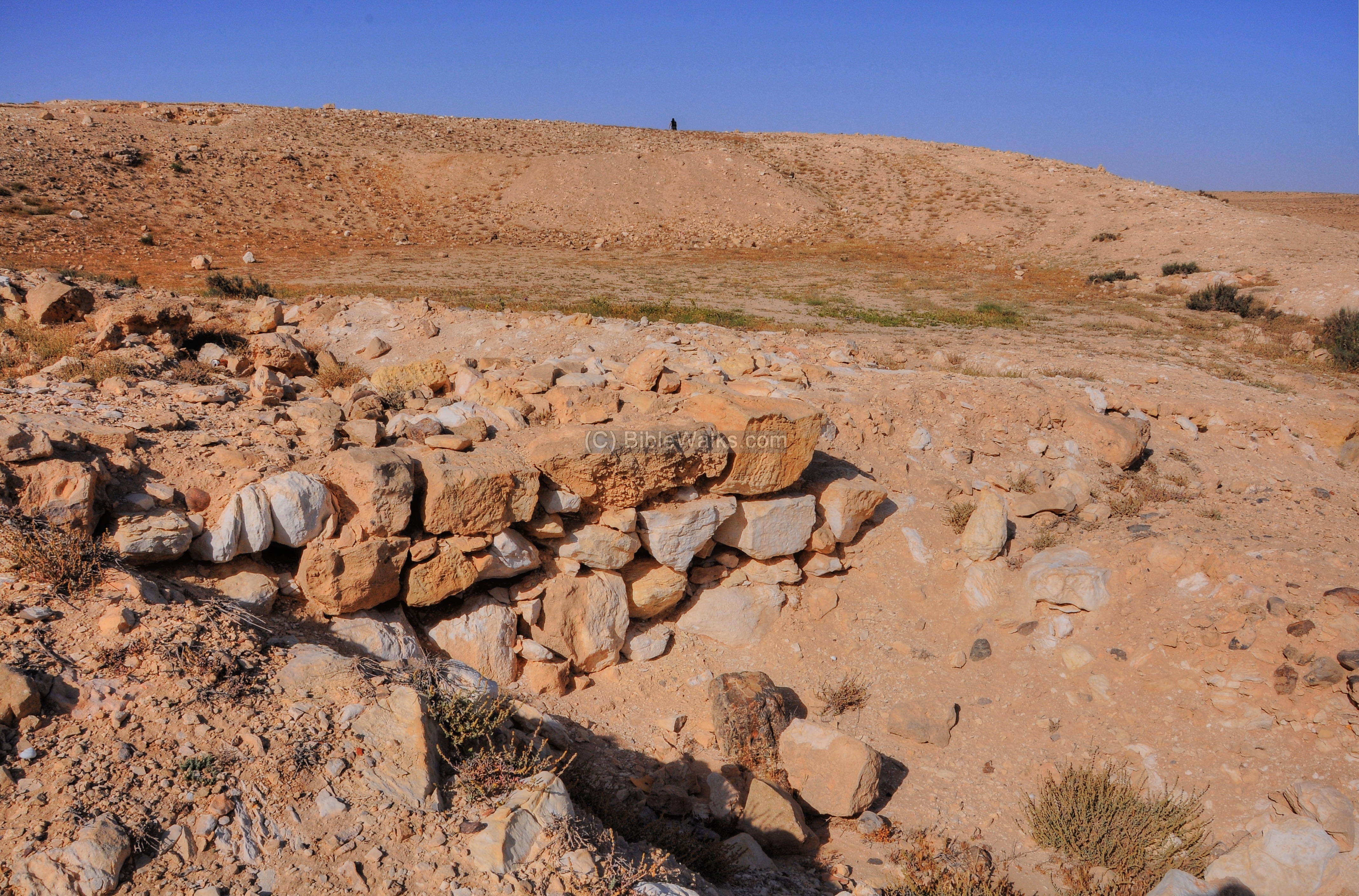
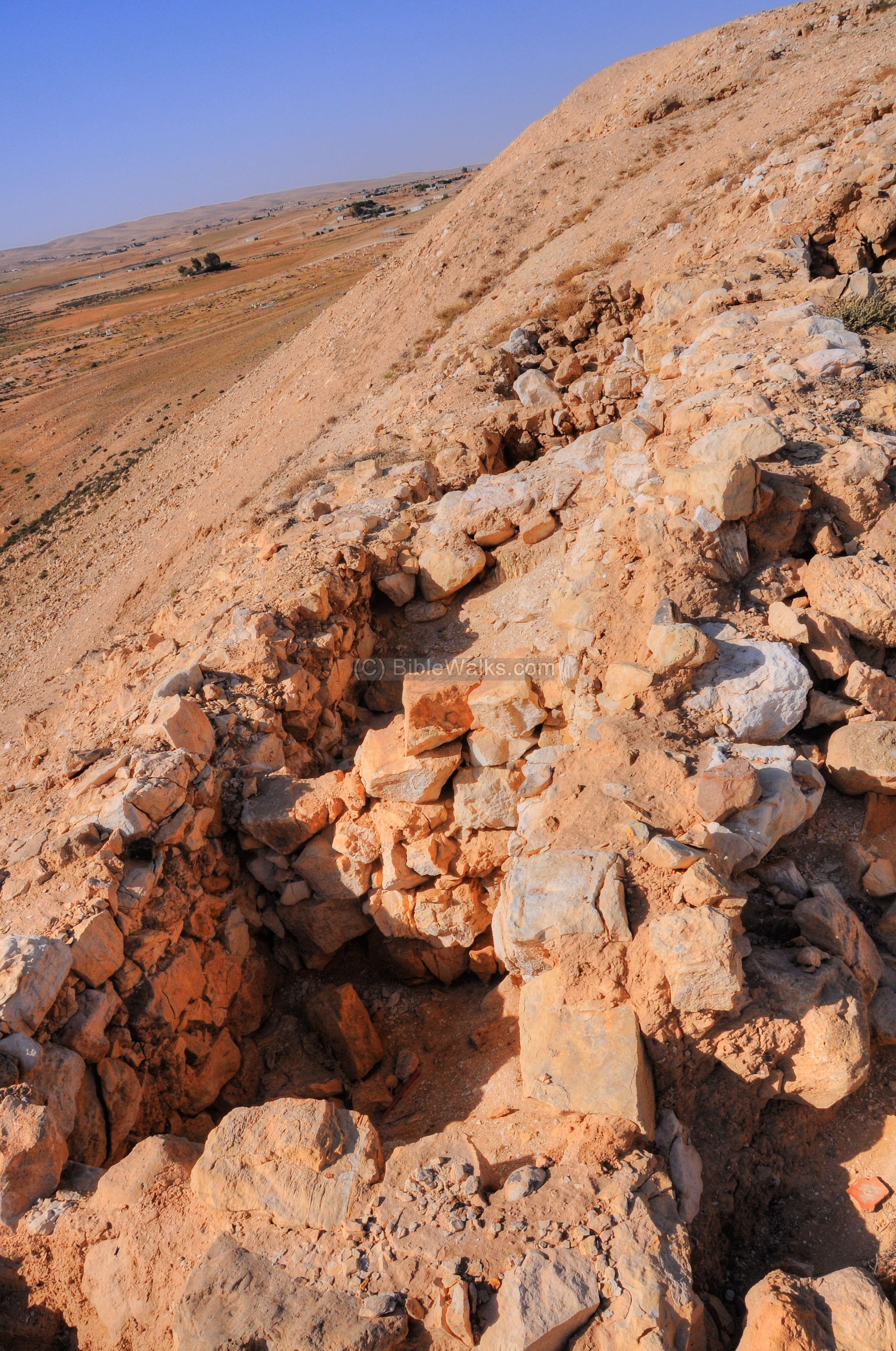
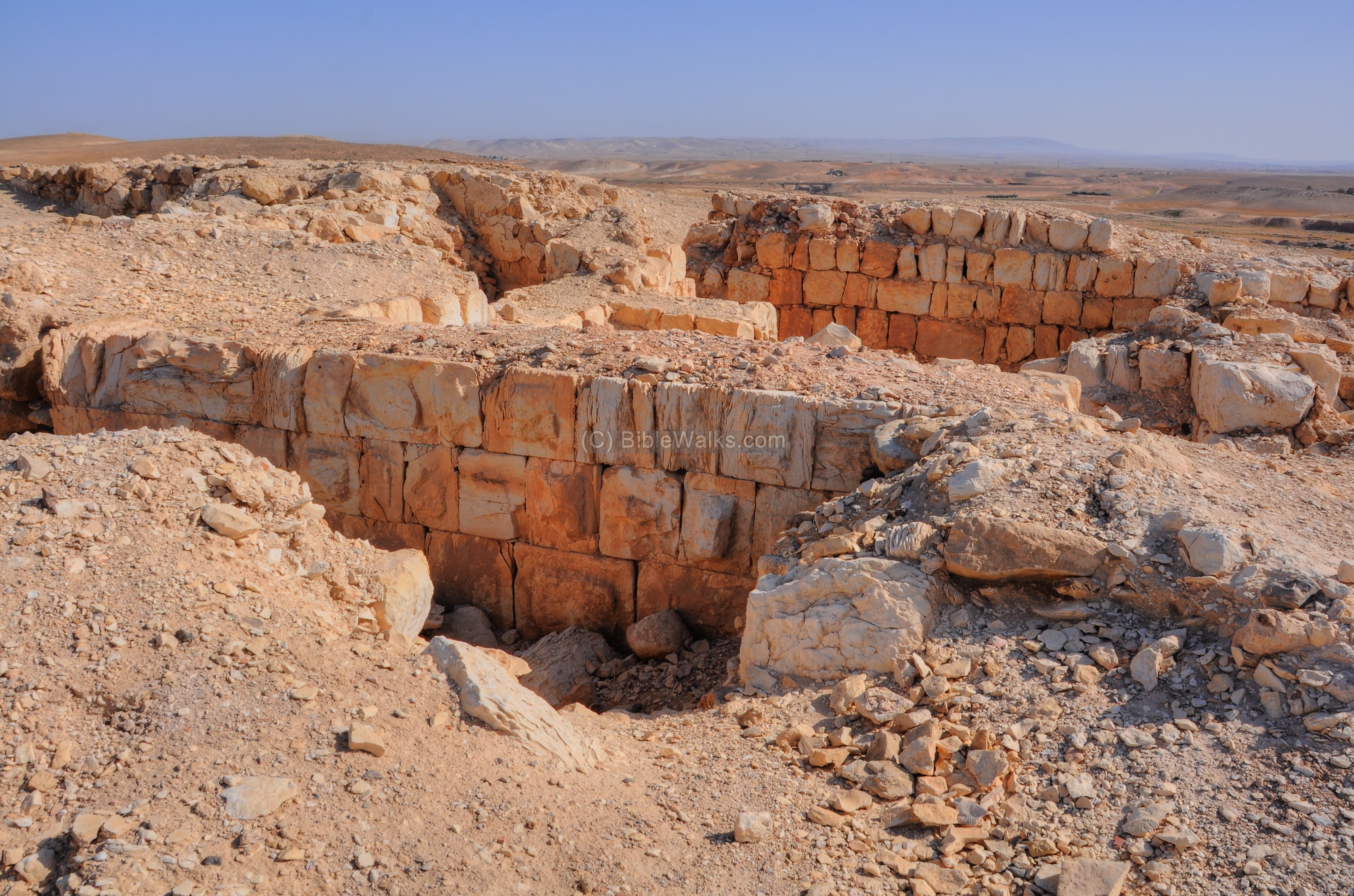
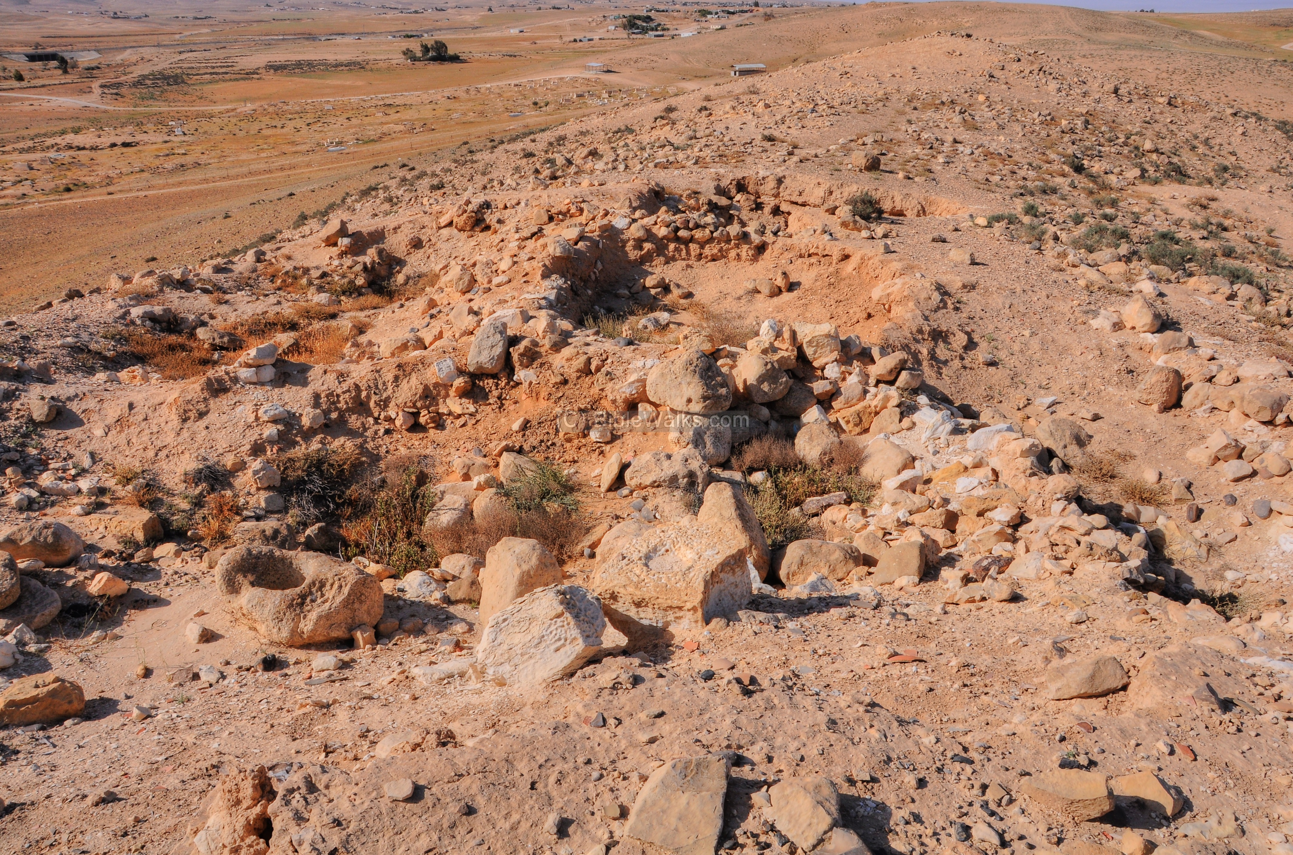
- South side – Area D & A
Around the top of the hill (at an altitude of 445m) are the remains of an Late Iron age city, dated to the 8th to 6th Century BC. You can notice in the picture below the un-hewn rocks which are part of the city wall and the bases of the houses.
The Iron age structures were damaged by the Roman period fortress, which was built many centuries later over the ruins of the earlier structures. The structures were built behind the city walls at the top of the hill, and also beyond the city walls on the slope of the hill.
- Iron Age Inn?
Yifat Thareani published a comprehensive report on a unique Late Iron Age structure (late 7th to early 6th century BC) found in Area A on Stratum II. The structure is located outside of the Iron Age city wall. She rules out that this structure was a typical four-room dwelling house or a store house. Rather, she suggests it served as a caravanserai (khan, fondouk, inn), based on its location (outside the city wall, and near a trade route), existence of sleeping accommodations, food preparation and consumption area, animal pens, and being on a secured location on top of the hill.
An illustration of this khan is shown below.
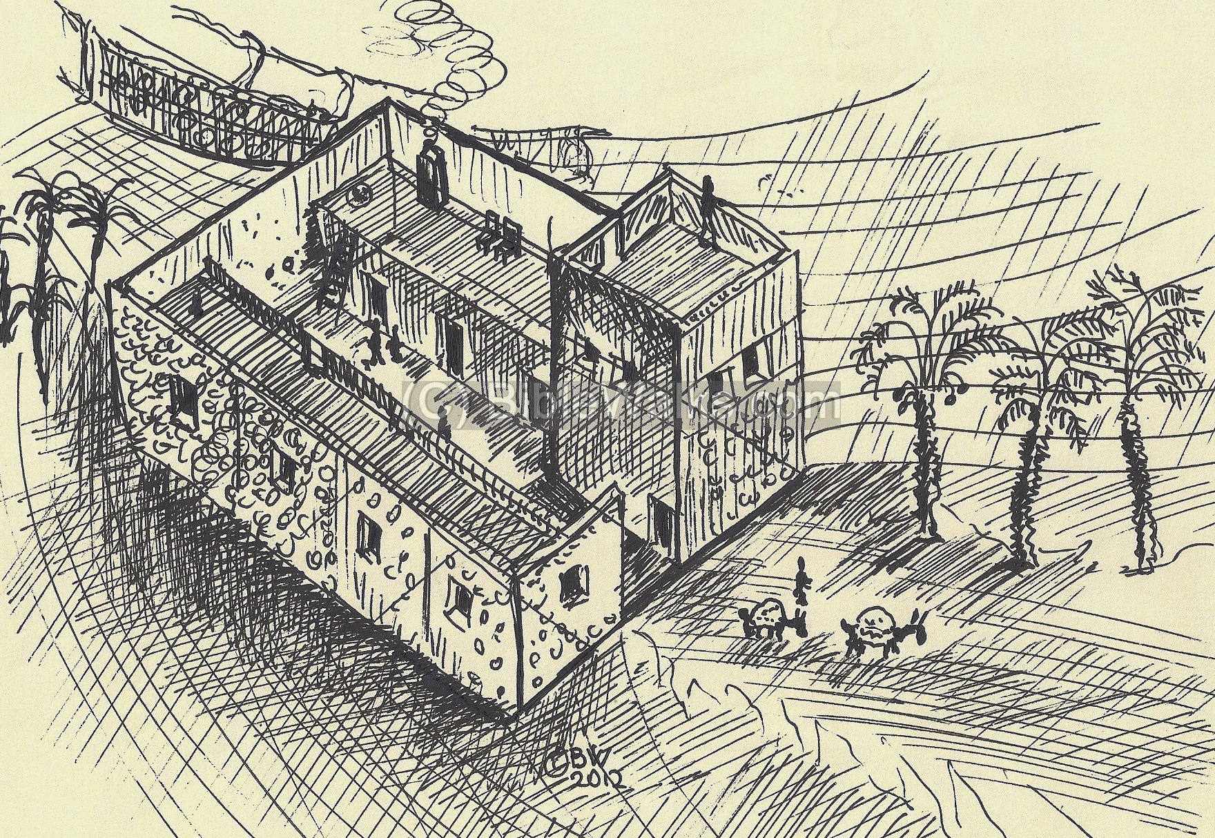
Illustration of the late Iron Age Caravanserai structure (see text)
- Roman fortress – Area D
An early Roman period fortress was built on top of the earlier Iron Age structures, at the top of the hill. The opening to the structure is located on the north-west side (here, on the bottom left side).
The internal design of the fortress is based on four rooms.
The external size of the fortress is 12.5m by 11.25m, and its walls are 125cm wide.
Notice that these stones are nicely cut, unlike the crude cut stones of the Iron age structures.
- Far South – Area C
Beyond the top of the hill is another section of the Iron Age city, which was revealed in the excavation Area ‘C’.
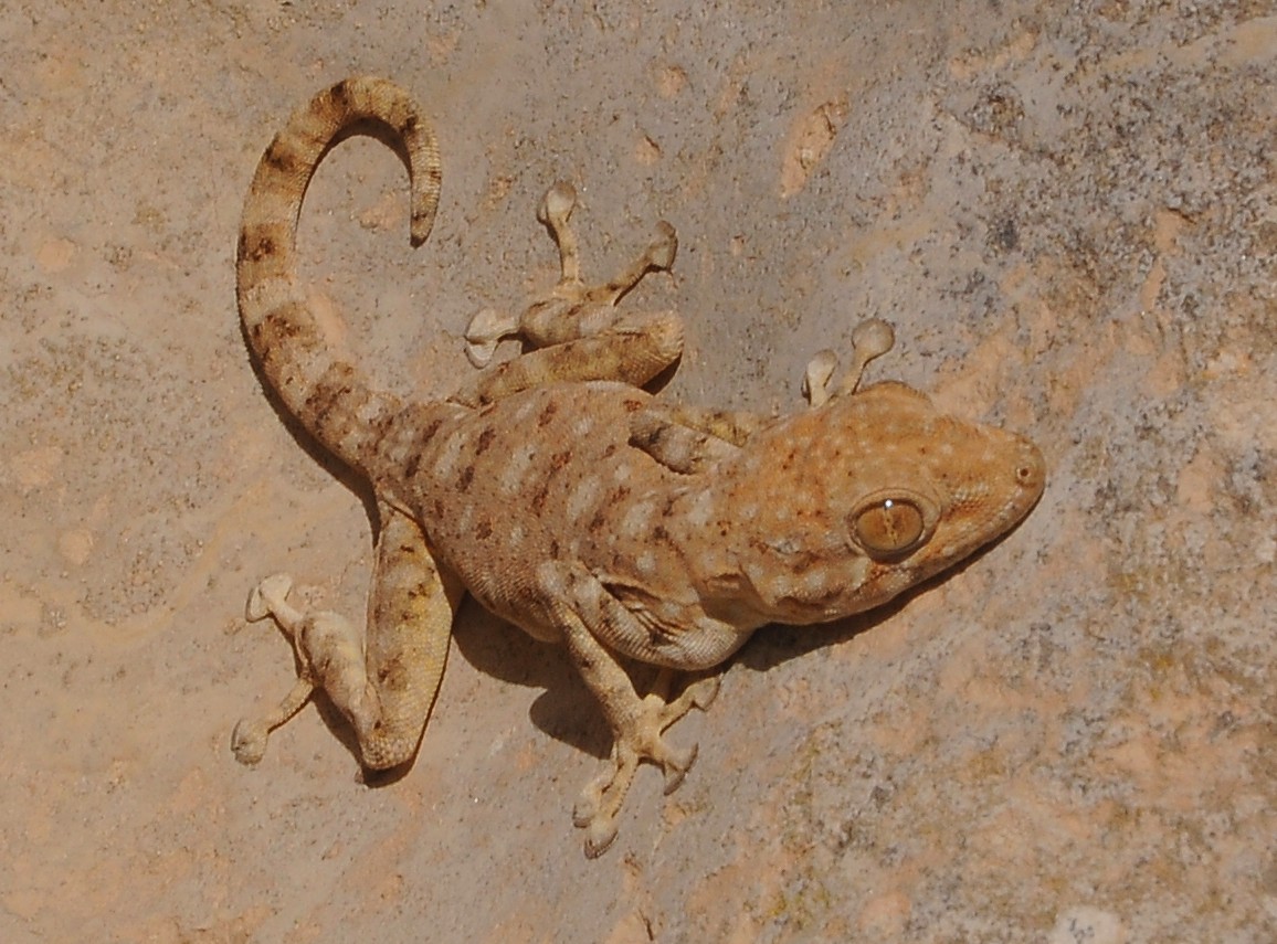
A stone vessel is one of the few architectural elements found here. A lizard seems to enjoy the sunny side of the center of the vessel.
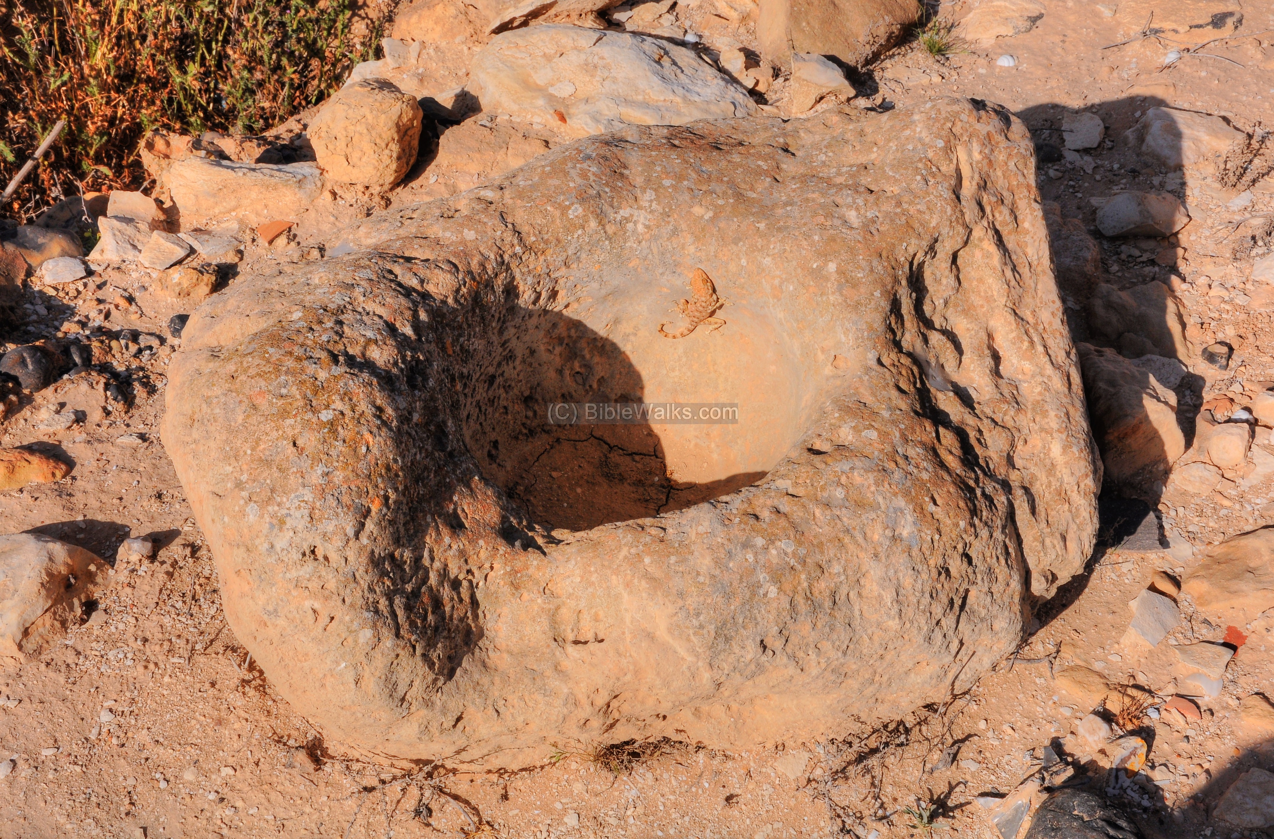
A closer view of the lizard is shown below. Oz from the Israel Insect World identified it as Ptyodactylus Guttatus (common name: Sinai Fan-fingered Gecko, or Hebrew: “Manipanit Metzuya”).
Lizards are mentioned in the Bible in several places, such as in the list of non-kosher ‘creeping’ things (Leviticus 11 29-20): “These also shall be unclean unto you among the creeping things that creep upon the earth… And the ferret, and the chameleon, and the lizard, and the snail, and the mole”.
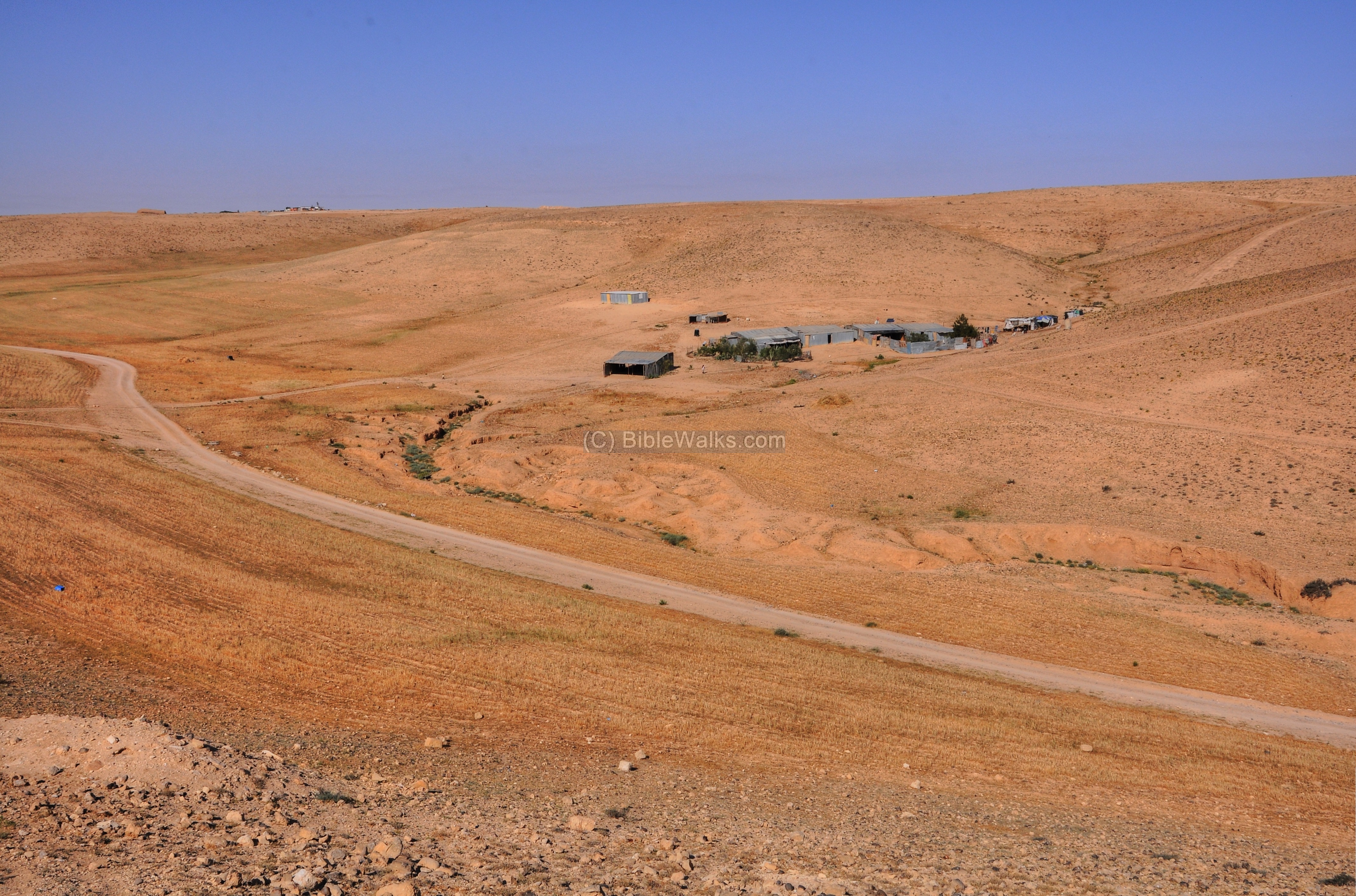
- West of the Tel – Bedouins
The valley on the west side of the mound is seen here, with a herd of cows and sheep. Some green patches remain here after the winter, so the cattle has some fresh food to eat.
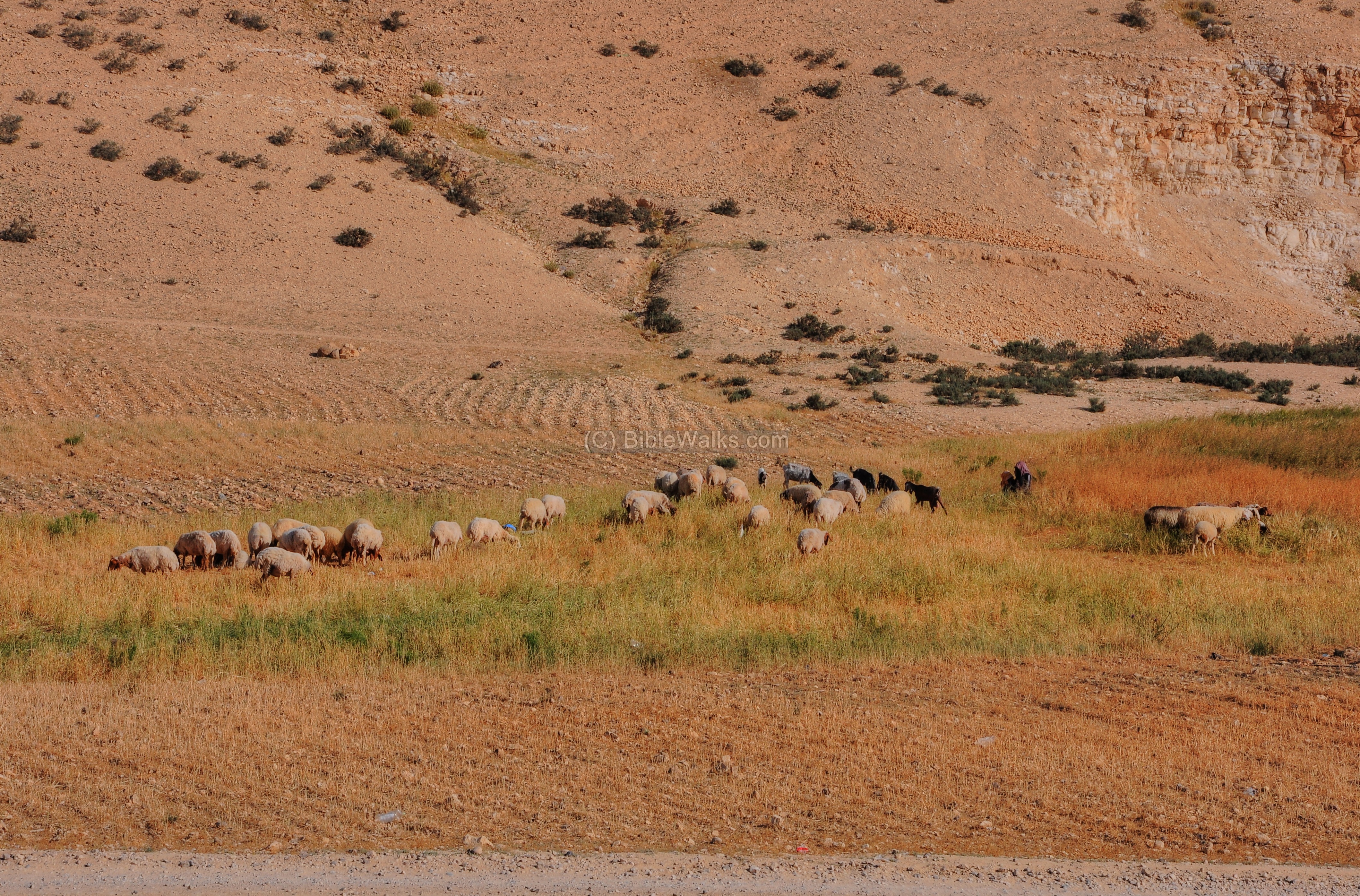
Two shepherd girls watch the herd.
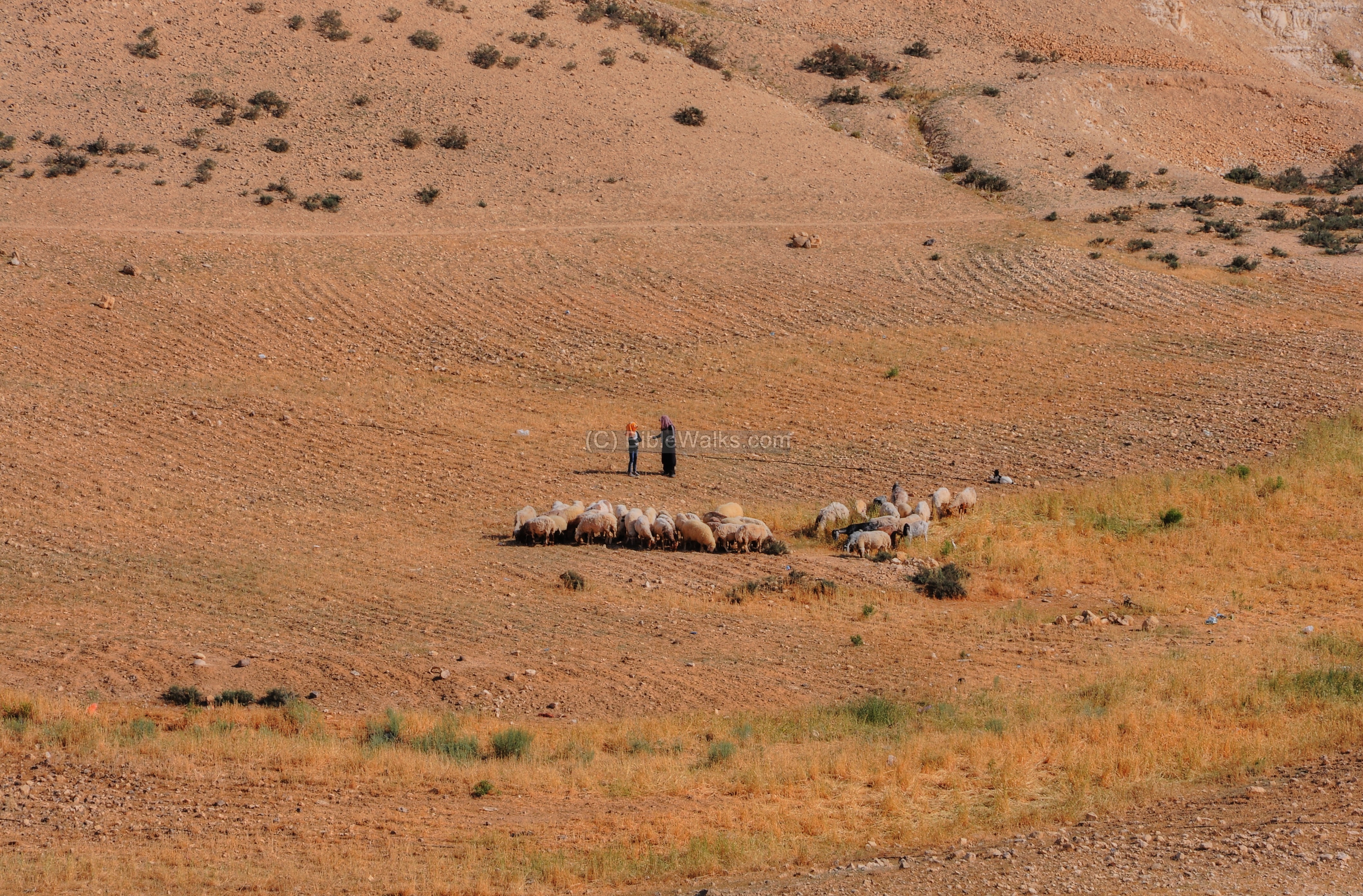
They were on the way to the Bedouin compound located near the mound.
-
Panoramic view
A 360 degrees Panoramic view from the top of the north side of Tel Aro’er a is shown below.
If you press on the picture below, the image will popup, and then you can zoom into the image.

View from the top of the mound – Dated Apr 2012
Etymology (behind the name):
- Aro’er – Hebrew name of this site (Hebrew: ערוער); there were other cities in the Levant with this name
- Extramural – term: exists outside the walls; in the Bible it is called in Hebrew: “Huzzot” (2 Kings 20: 34; Jer. 37: 21)
Links and references:
* External:
- Tel ‘Aroer – An Iron Age II Caravan Town and Roman Fort in the Negev
- Extramural Neighborhoods in the Iron Age II Negev – Yifat Thareani-Sussely (2008; text: pp202-205, figures: pp289-290; pdf)
- Ancient Caravanserais – Archaeological view from ‘Aroer – Yifat Thareani (2007; pdf pp 129-139)
- Shishak’s campaign – Karnak relief (Bible.ca)
- Tel ‘Aroer – Nelson Glick school of Biblical archaeology
* Internal links:
- Drone Aerial views – collection of Biblical sites from the air
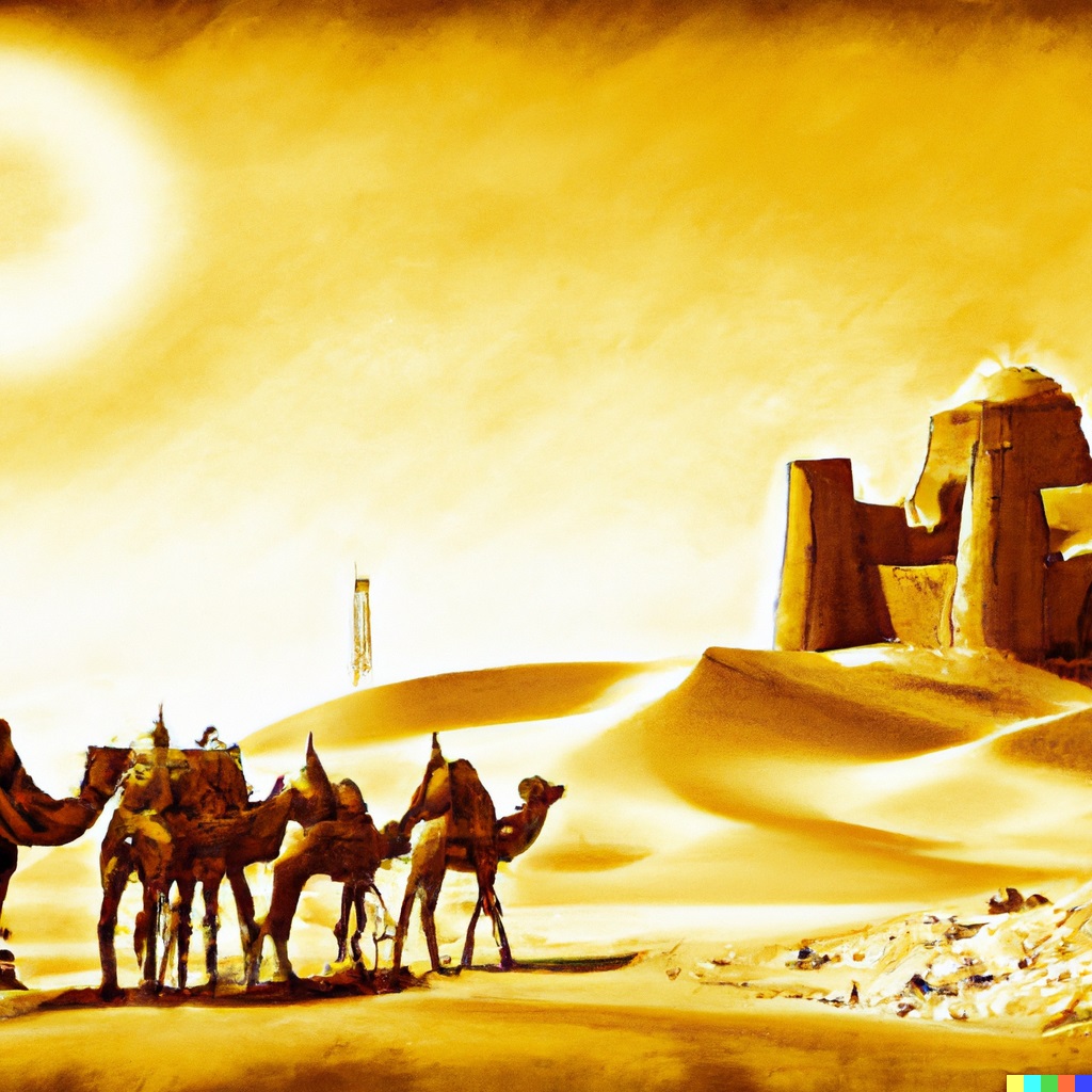
Illustration by DALL-E 2 – Caravans passing near a desert fortress
BibleWalks.com – Ancient wonders in the Negev desert
Mamshit Water <—previous site—<<<All Sites>>>— next Negev site —>>> Small Crater
This page was last updated on May 7, 2023 (expand history)
Sponsored links: