The Aqueduct brought running water to the old city of Caesarea, along a raised aqueduct. The source of the water was the springs of Shummi, 10KM away. Herod build the aqueduct in the 1st century BC. later, in the 2nd century AD it was expanded by the Romans. Later, 2 more aqueducts were built.
Home > Sites > Caesarea > Aqueduct
Contents:
Background
History
Location
Photos
* Southern
* Along the beach
* Aerial views
* Beit Hanania
* Jiser e-Zarka
Links
Background:
The old city Caesarea required a steady flow of running water. Initially its waters came from the local wells. However, as the population grew to several hundred thousand people, a large scale aqueduct was required to bring the water from a distance. The aqueduct was built in several phases, starting from King Herod.
History of the place:
The first aqueduct was built by Herod (37 BC to 4 BC), at the time the new city was founded and dedicated to the Roman Caesar, Augustus. It brought the water from the southern side of Mount Carmel, at Shummi, about 10KM to the north east of the city. The water flowed on a single raised canal, and in one section it is dug into the rock (at Jiser e-Zarka, an Arab village north of Caesarea).
Since even this was not sufficient, a second aqueduct was built by the Legions of the Emperor Hadrian (2nd century AD). It brought water from Tanninim (Crocodiles) river, farther from Shummi. This section, with a tunnel of about 6KM long, was tapped into the older aqueduct, and doubled its capacity. This new source of water was added to the right of the first canal, and the aqueduct was thus doubled in width. The builders used the same building materials and style, so it is hard to see that the pair of tunnels were built in different ages.
These twin parallel aqueducts, termed today as the High-level aqueducts, continued to supply water for 1200 years. During the ages it was repaired several times. In the marsh lands east of Jiser e-Zarka a bypass canal was built to overcome the damages.
After that time the aqueduct was beyond repair. Therefore, in the Crusaders period (12th century AD), a third, smaller, canal was built that replaced the first two. At that time the City was smaller and required less water, so the third smaller canal was sufficient.
Another (forth) lower aqueduct was built during the Byzantine period in order to satisfy the growing needs for fresh water supply to the large city. This aqueduct started from a new source of water: the springs at Maagan Michael, several kilometers north to Jiser-e-Zarka. Since the water level was too low, a dam was built in order to create a lake, thus raising the water levels at the source. Then, a canal was dug in the sandstone ridge and brought the water to the city. This canal was laid lower and to the east of the raised Aqueduct.
Location:
The aqueduct can be seen in several easily accessible places:
- on the main highway between Caesarea and Haifa, near the village Jiser- a- Zarka.
- the underground section inside the village of Jiser e-Zarka
- east of Modern town of Caesarea, where a long section of the aqueduct is seen on the beach
- The aqueduct goes underground, under Mount Carmel, in the section close to the springs. A tour takes you through these tunnels (Park Alona).
- At the new Archaeological park south of Maagan Michael.
Photos:
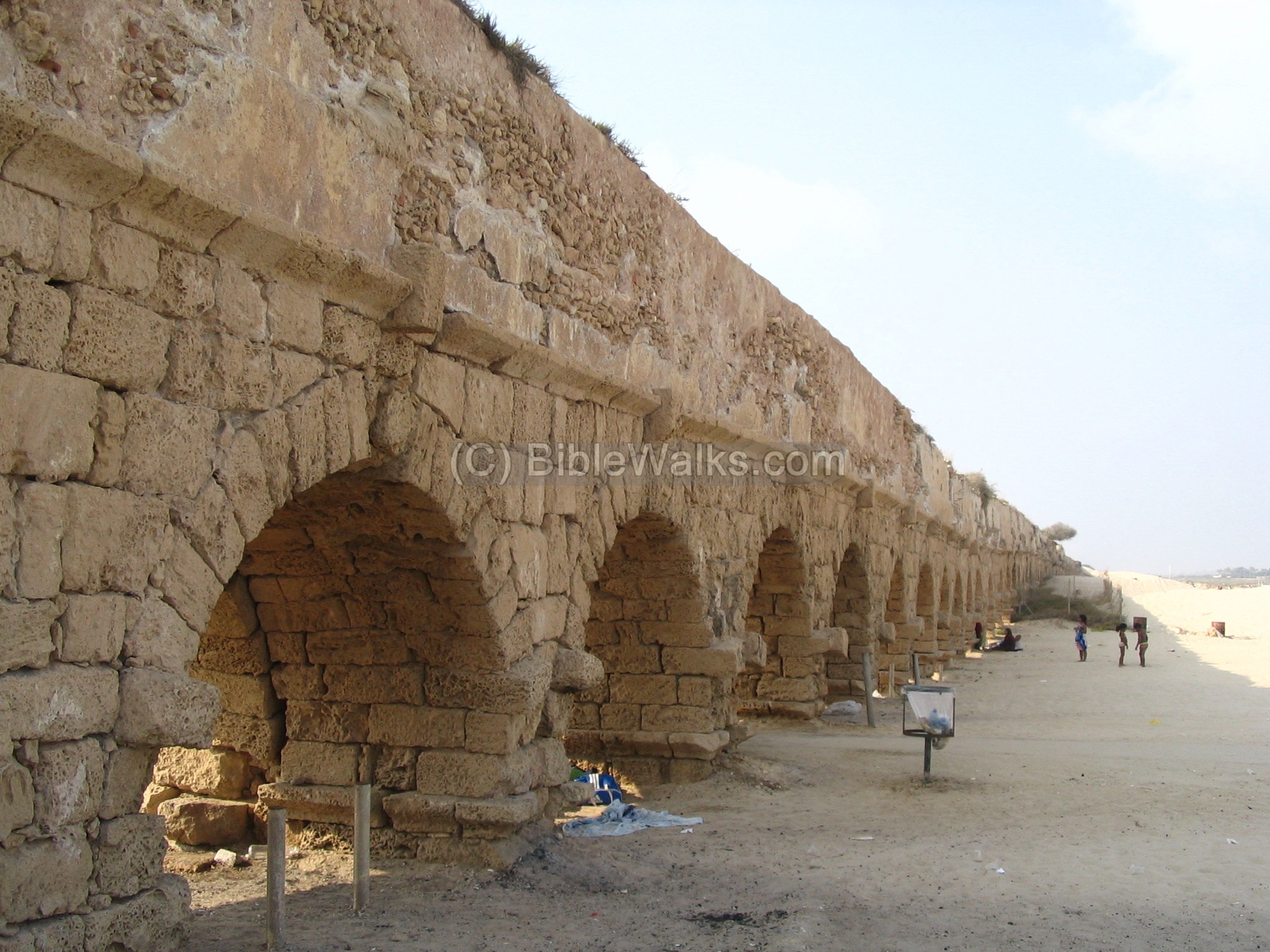
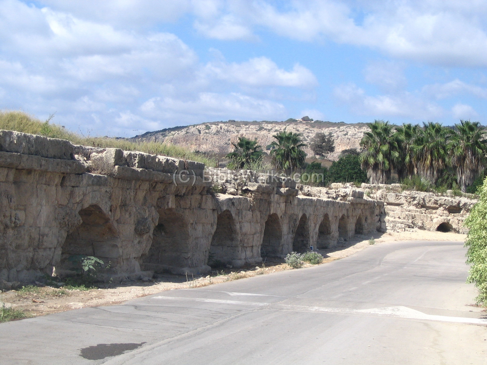
(a) Southern edge of the Aqueduct:
The following photo shows the southern end of the aqueduct from the beach side, just north of the old port. It is easily accessible from Modern town of Caesarea, and has a popular beach. Although it seems that the aqueduct ends here, it once continued on south into the city, but that section was damaged by the sea.
Click on the photos to view in higher resolution…

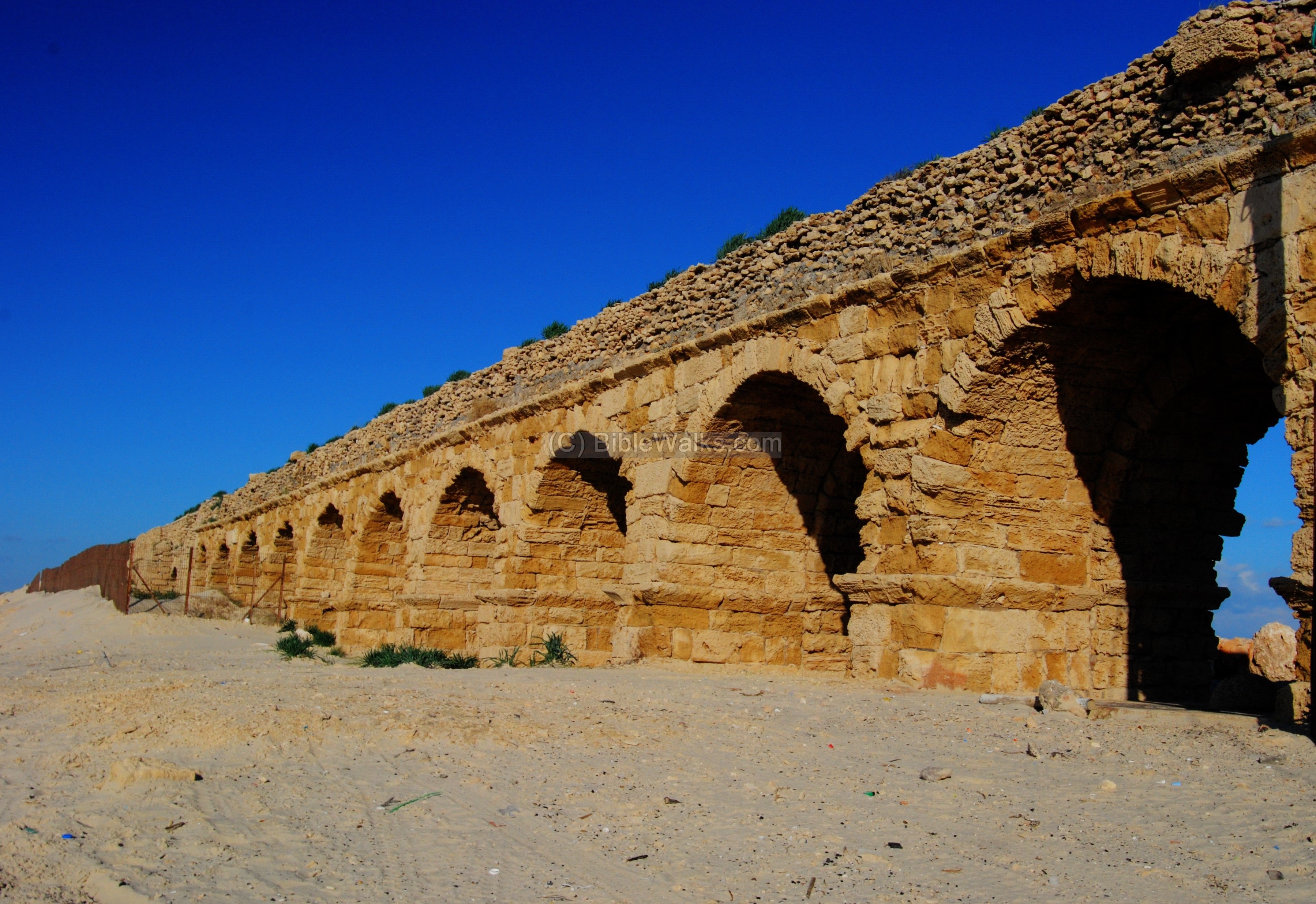
Note that the left canal of the aqueduct, broken at the middle of the photo above, is actually older by 150 years than the right side.
Another view from the land side (from the parking lot, towards north) is seen below:
A sun-baked view of the southern edge is seen below:
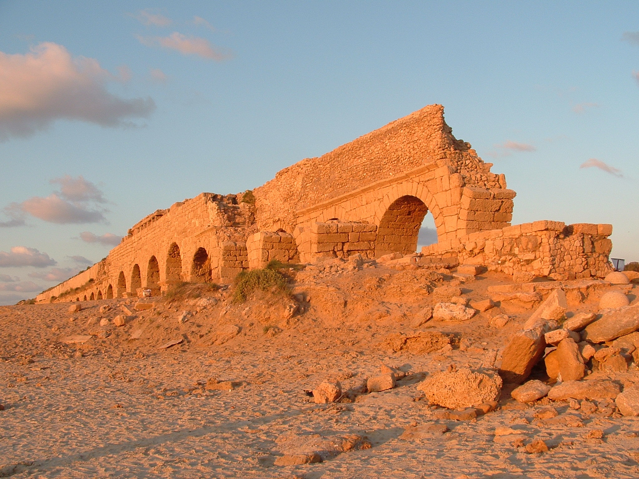
photo by Gal Shaine
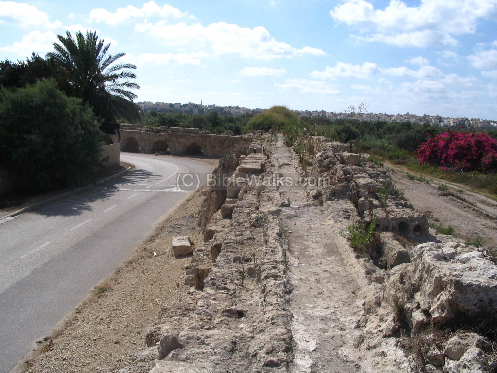
- Lower -level aqueduct:
Another covered aqueduct is located about 100M to the east, as seen below. This is the lower-level aqueduct, which was added during the Byzantine period to satisfy the growing needs of water supply to the large city.
This view is towards the north, and the arched aqueduct is seen on the far left side, buried in the sand dunes. Mount Carmel is seen on the right background.
(b) More photos along the beach
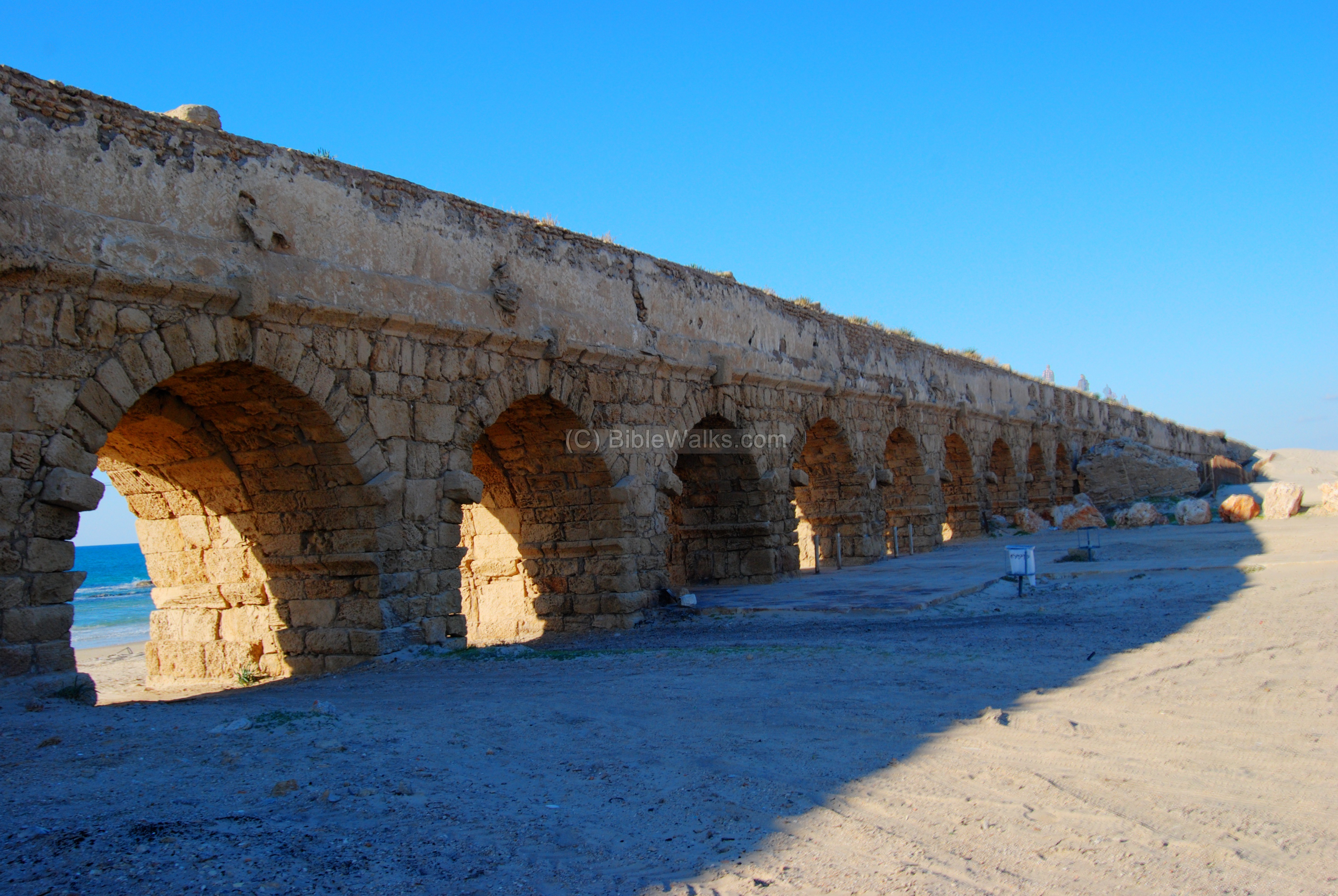
You can walk along the sandy beach and see other sections of the aqueduct. The following photo is another view, at a more northern section.
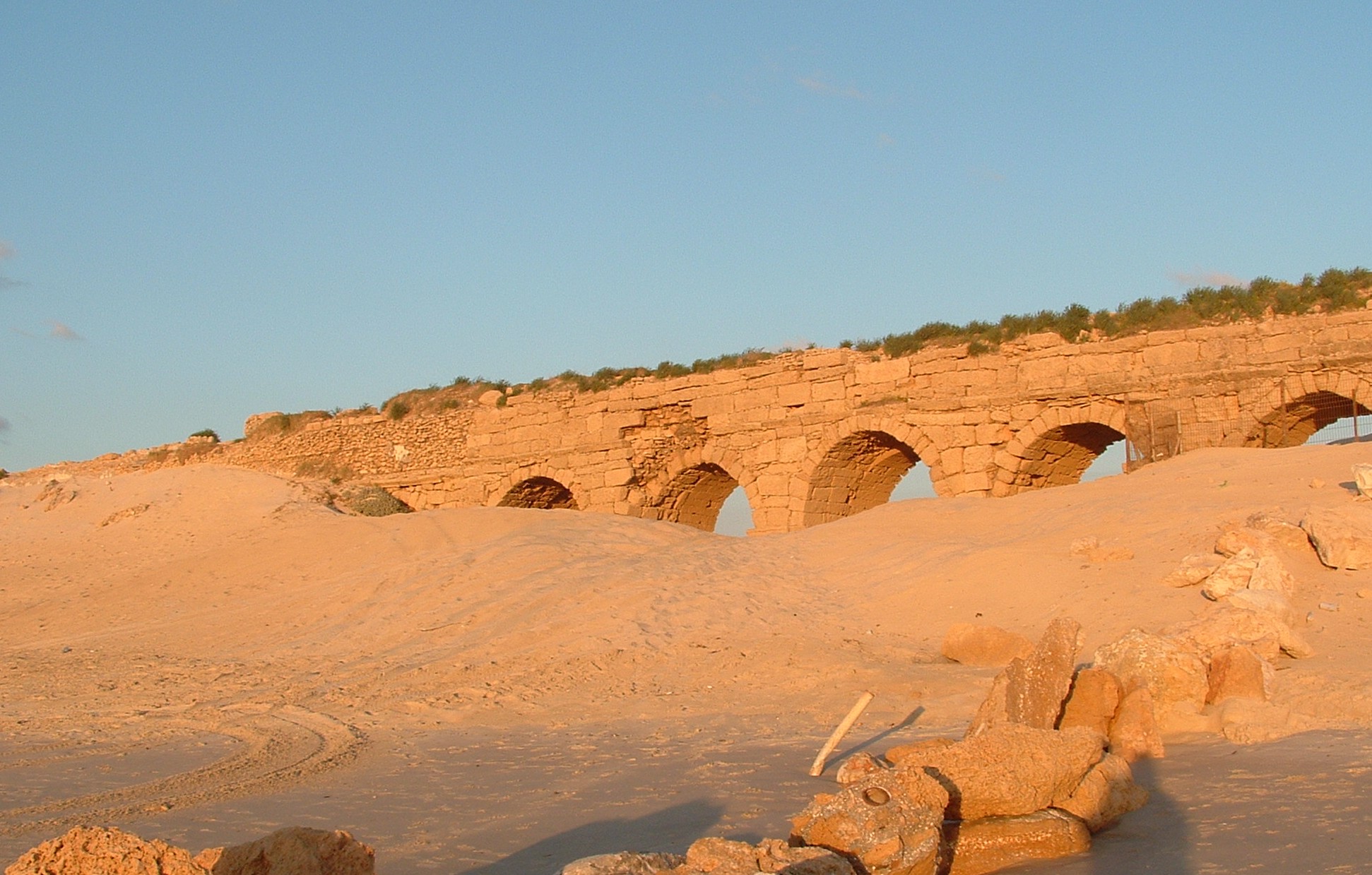
photo by Gal Shaine
Yet another view of another section (the magical view is irresistible!). Notice that the upper level was fixed at a later stage with smaller stones.
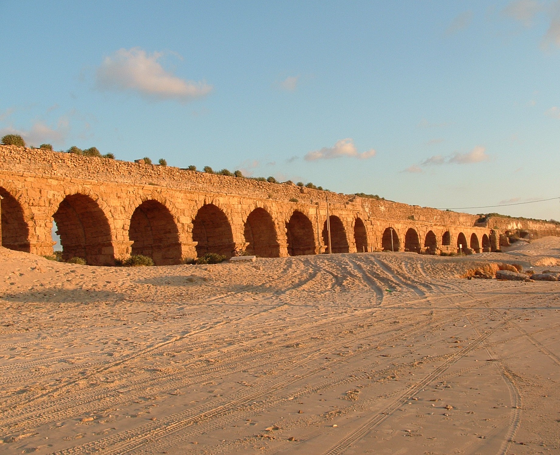
photo by Gal Shaine
Some enhanced photos from the west side:
A view from the east side:
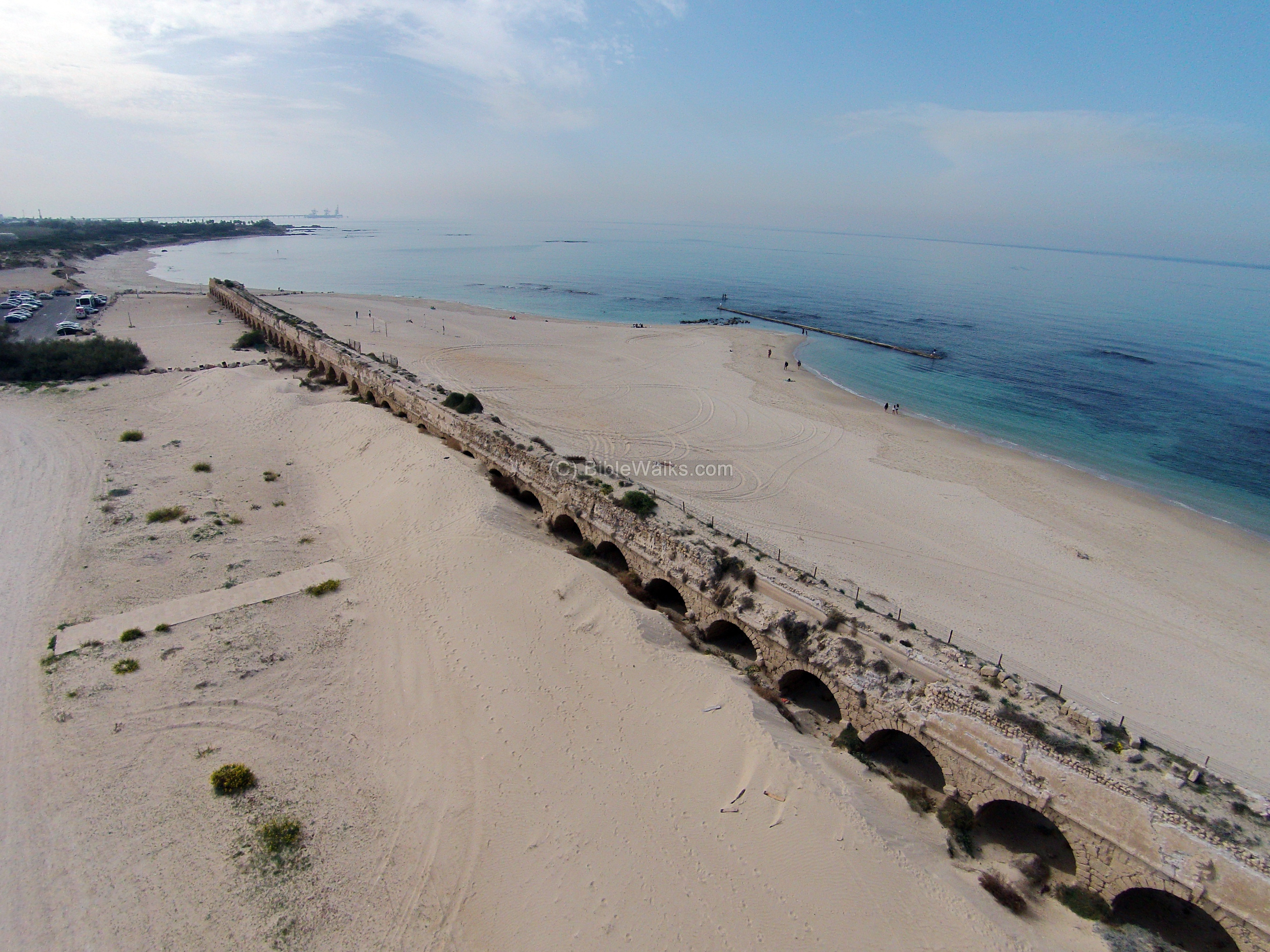
(c) Aerial views
An aerial view of the aqueducts is seen in the photo below. Two parallel aqueducts are seen: the closer one is the famous (higher) aqueduct, while the other (lower) aqueduct is seen in the background. The ruins of Caesarea are located in the right background.
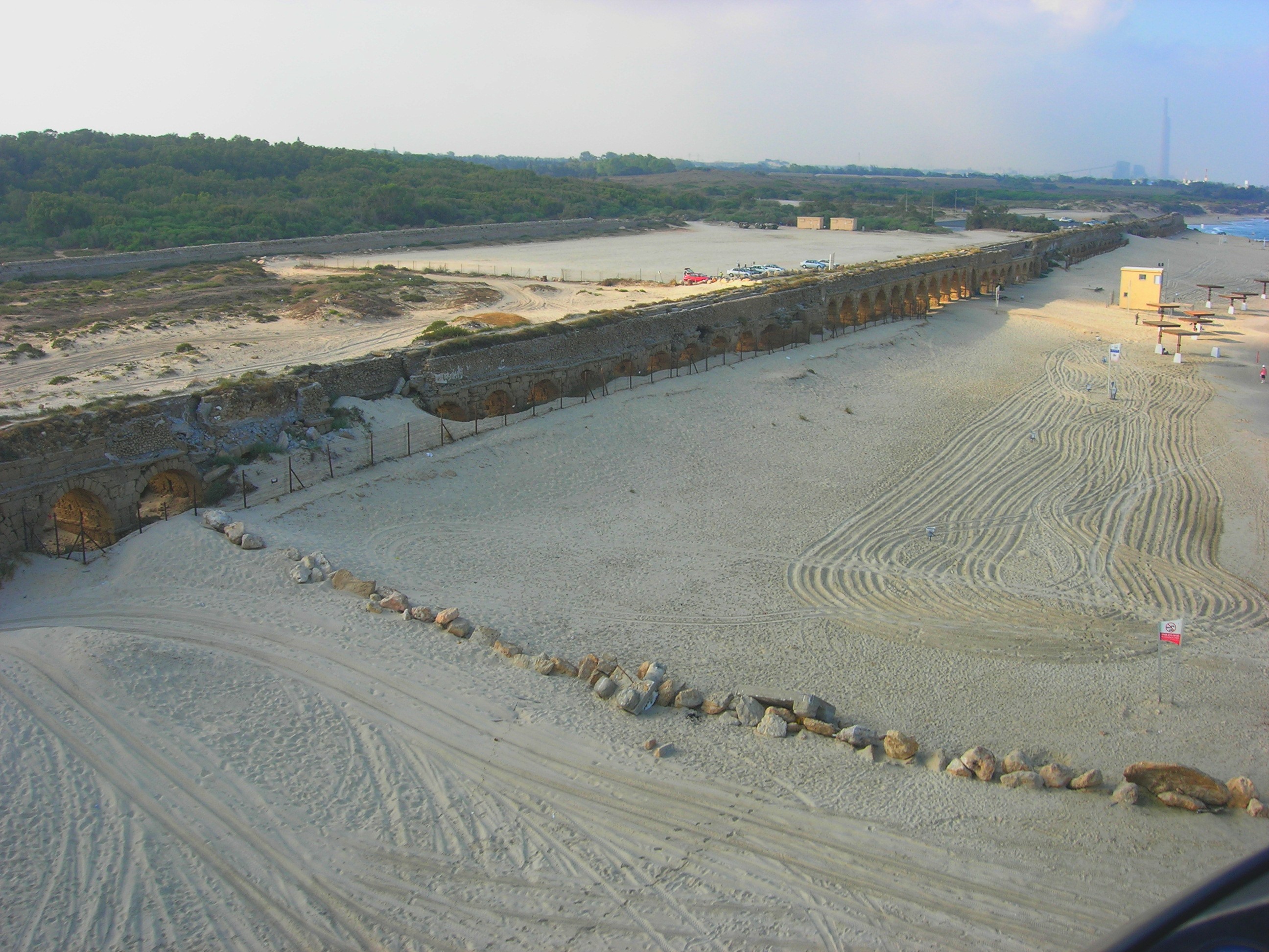
Photo by Y. Mizrachi
A view of the southern section is shown in the next photo, with a view towards the southwest.
A view towards the north is shown in the next photo. The aqueduct reaches the town of Jiser e-Zarka, then turns eastwards (right) to Mt. Carmel (seen on the right far background).

The next photo is taken closer to the ancient city. The two aqueducts, badly damaged from the waves, merge together and enter the city.
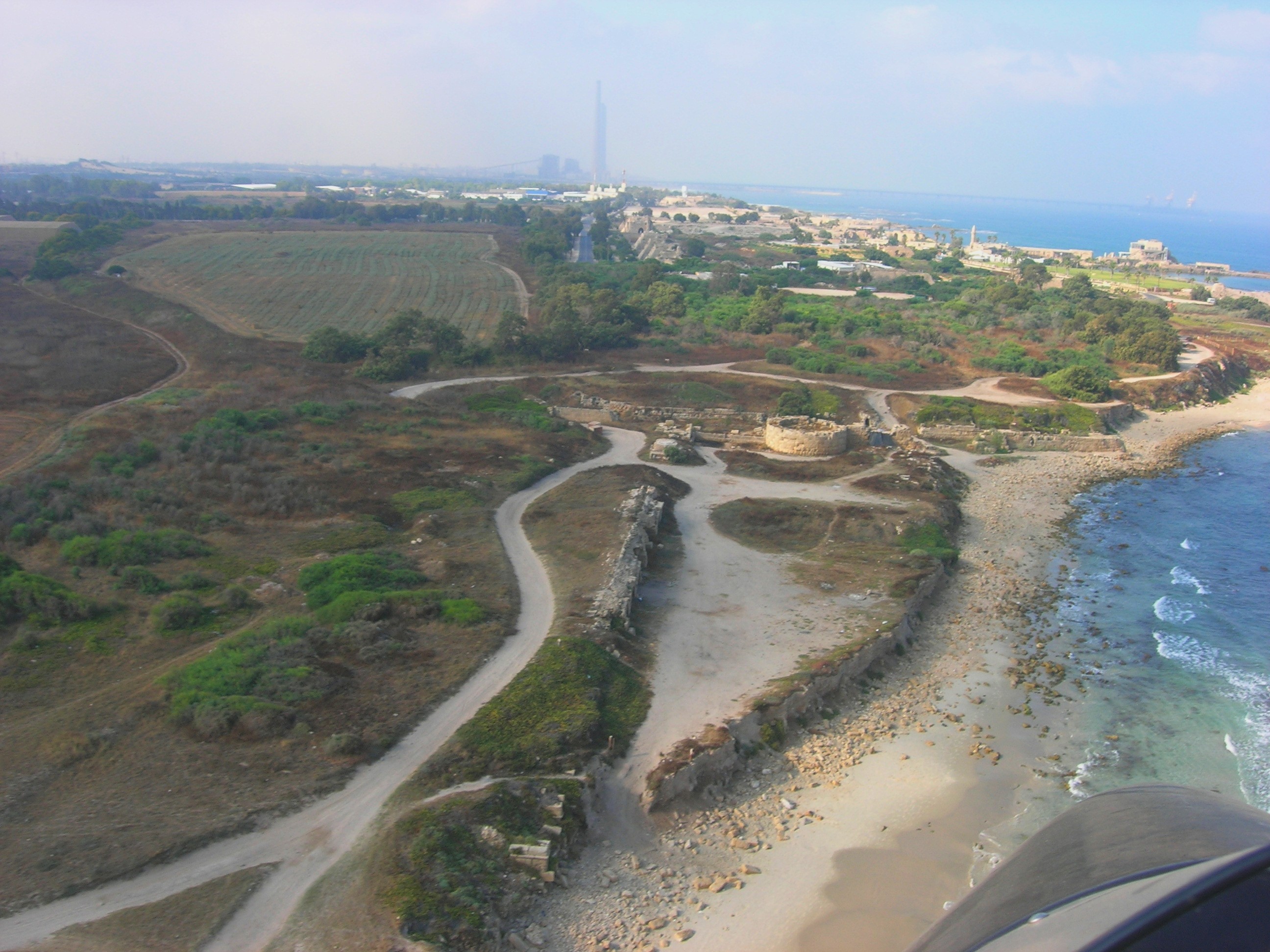
Photo by Y. Mizrachi
(d) View in Beit Hanania:
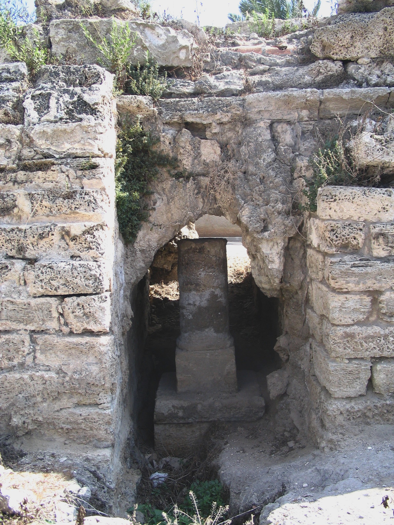
In the entrance of Beit Hanania, a community close to the south edge of Mount Carmel, the northern section of the aqueduct is located here, and the second aqueduct (Hadrian’s time) connecting to the older one (Herod’s time ). The following photo shows the aqueduct and the Carmel in the background.
In this photo, taken towards the west, there is a split in the aqueduct. The main aqueduct goes straight towards westwards to the sea through the underground pass at Jiser- a- Zarka (seen in the far background). Another aqueduct, which was a bypass section that was built to overcome the issues posed by marshlands, turns south (left), but later joins the main section.
Over the long years of use, the deposits from the water accumulated in some spots, as in the photos below.


You can notice that the right side of the aqueduct is based on clay pipes. At this section there were 3 pipes.
In the aqueduct there are 10 tablets that were placed by Roman soldiers that fixed the aqueducts. In this section there are two stone tablets were built into the wall by its builders- the Legions of the Emperor Hadrian (2nd century AD). The right tablet clearly shows: “IMP CAES(ar) TRIAN HADR(ianus)”. The other tablet is of the tenth Legion.
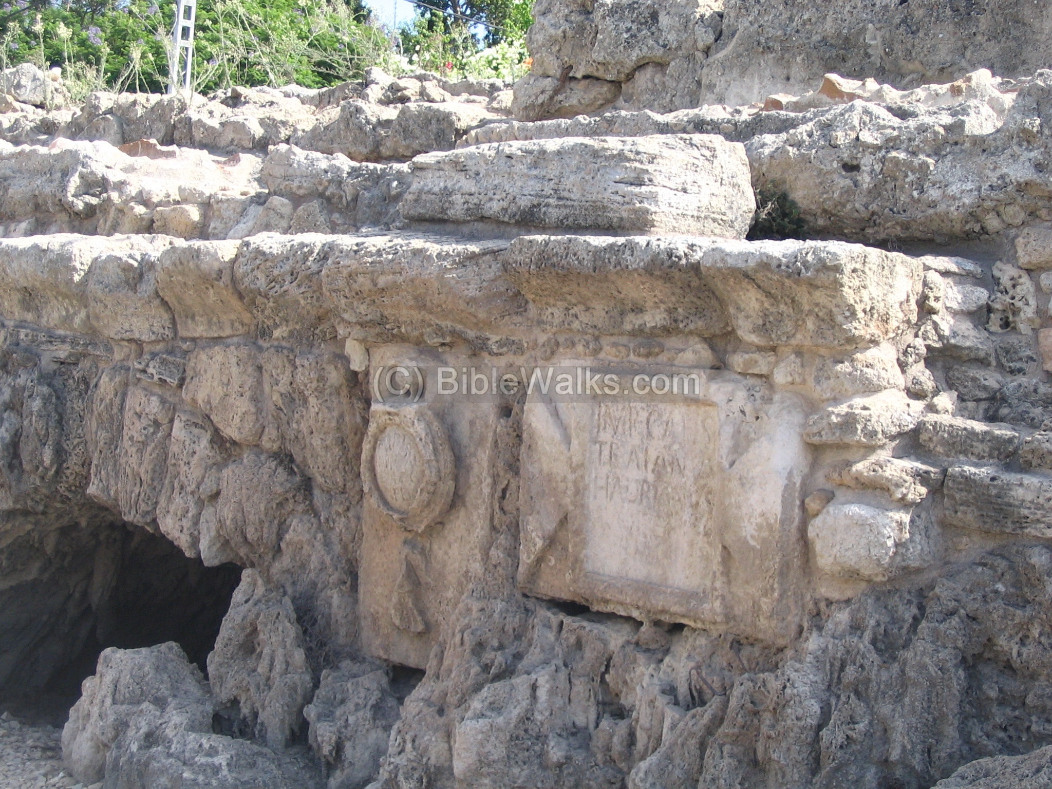
A Roman milestone is located under one of the arches, dated to the 2nd or 3rd century AD . It indicated the distance of 4 Roman miles, probably the distance along the coastal road from Caesarea.
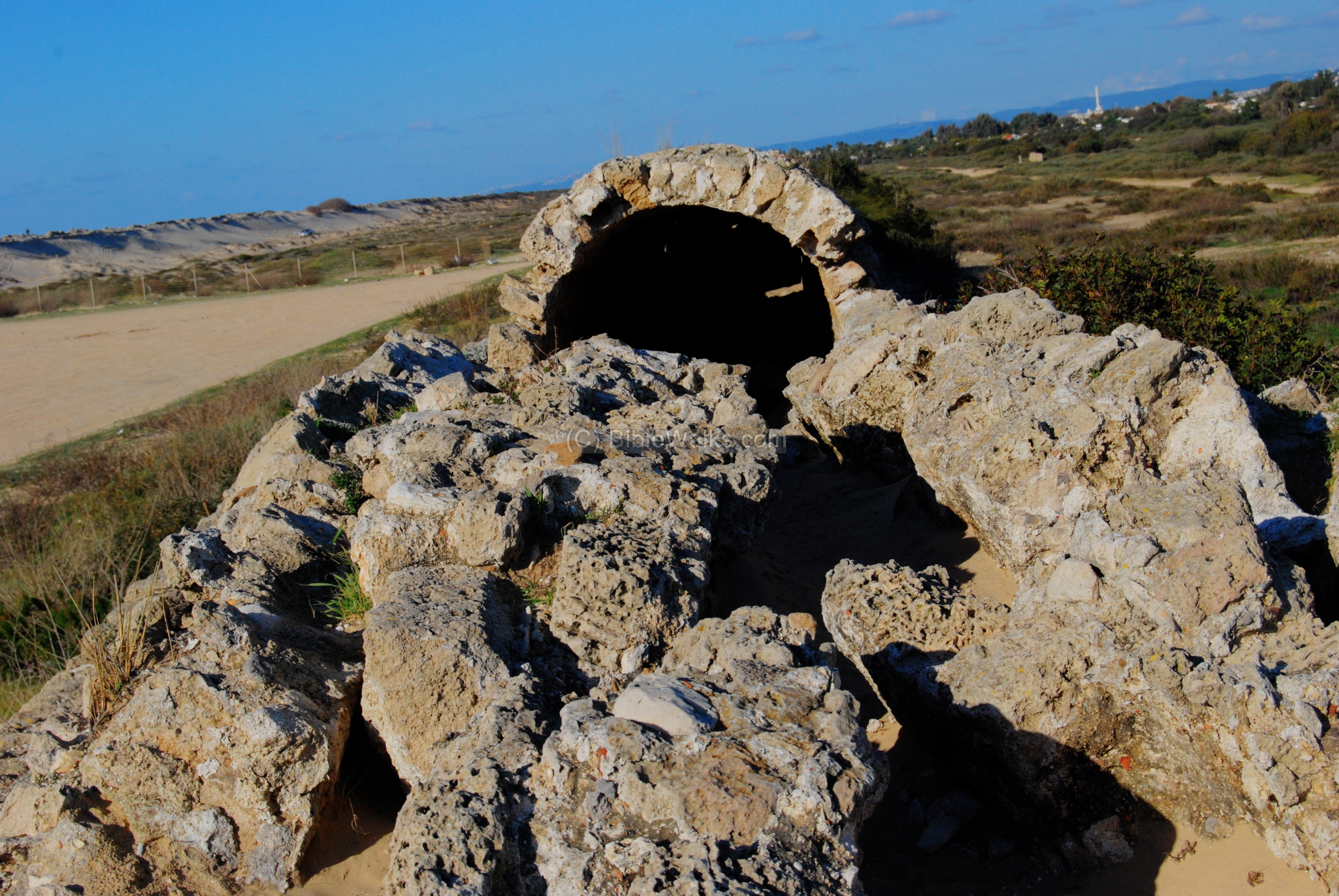
(e) Jiser e-Zarka:
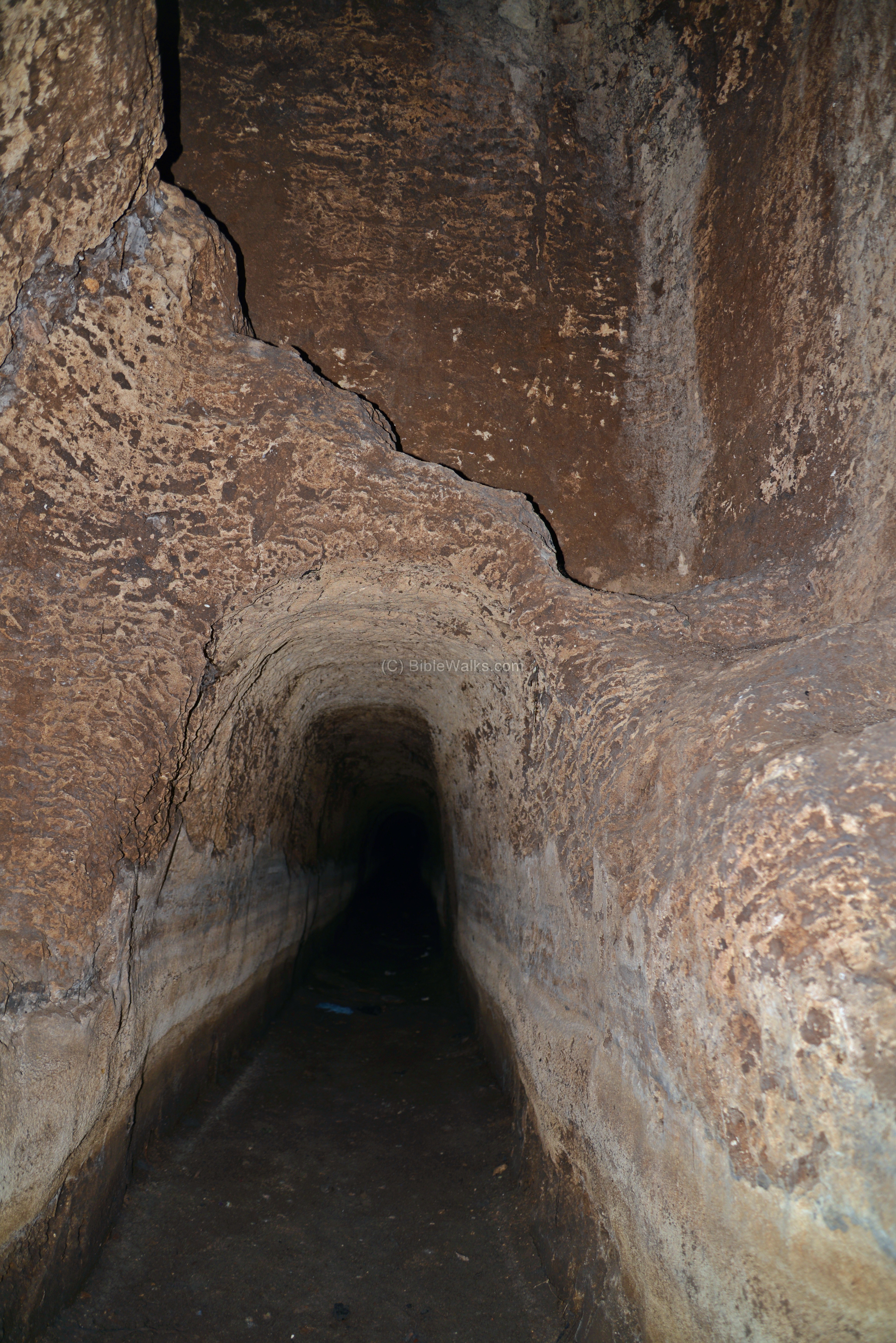
The Roman high-level aqueduct passes through a sandstone ridge, where the town of Jiser e-Zarka is located. A tunnel was hewn into the ridge.
![]() See more about the tunnel in a separate page.
See more about the tunnel in a separate page.
Links:
External links:
- High Aqueduct – Nahal ‘Ada – salvage excavations (2001) north-west of Beit Hannania
- Tel Tanninim – IAA final report of the lower aqueduct excavation (English and Hebrew)
Internal links:
- Jiser e-Zarka aqueduct tunnel
- You can also check the Acre-Akko Aqueduct which is a similar water project
- See other aqueducts that are featured in Biblewalks info page
Other Links:
- Aerial views of the Holy Land sites
Etymology (behind the name):
- Beit Hannania:
- Hannania – in Hebrew: “God (-ia) has pardoned (Hannan-).
- Beit – in Hebrew: house
- Beit Hannania – in Hebrew: the house where God has pardonedNote that there are other places with this name, such as Kefar Hannania in the Galilee
BibleWalks.com – walk with us through the sites of the Holy Land
Caeserea <<<–previous site—<<<All Sites>>> —-next Sharon site —>>> Gilgal (in Sharon)
This page was last updated on Nov 15, 2014 (Added aerial views)
Sponsored links: