The Tel is located on the coastal section of the ancient Via Maris road, south of Afek. It was inhabited from the Bronze period through the Byzantine period.
Home > Sites > West Galilee >Tel Zavat (Tsvat, Subat)
Contents:
Background
Location
History
Ancient Roads
Photos
* General view
* Sights around
* Dig 2007
* Nature -summer
* Nature – winter
Etymology
Links
Background:
The site is located on the coastal section of the ancient road of Via Maris (Derech Hayam), the major highway that connected for centuries the south and the north of Israel. (Isaiah 9,1):
“…the way of the sea… in Galilee of the nations”.
Tel Zavat was one of the sites along this ancient road. According to archaeological survey, the majority of the findings are from the Israelite period through the Byzantine period.
Today the site is in ruins and was badly damaged by residential houses on its eastern side, farming on the south and west side, and a busy road on its north side.
A new highway was built on its eastern side, and 2007 emergency excavations may have found a section of the ancient road.
Location:
The site is located in the plains south to Afek, south of Acre (Akko), on the south side of the modern agriculture village of Kefar Bialik. It is easily accessed from Kalaniot street.
The oval shaped mound is 6M higher than the fields around it, and its size is roughly 100m x 150m. Most of the antiquities are buried under the fields around the Tel at depths of up to 3M, so the actual size of the Tell in its peak size during the Hellenistic period was much larger (10 dunams).
History of the place:
-
Prehistoric periods, Bronze period
Archaeological excavation (S. Yankelevitz, 2001) dated the earlier periods in the site to the Middle Bronze period IIb (1750-1550 BC). Other surveys surveys also suggested an earlier Bronze period (3150-2000 BC) and Chalcolithic periods (4500-3150 BC).
The 2001 excavation revealed 5 levels. The excavation summary, according to Ron Beeri (p. 58), was:
A. The findings from Stratum V indicate that the site was founded, at the latest, during the Middle Bronze Age IIA.
B. The structure and the courtyard above them (Strata IV–III) existed at least until the Middle Bronze Age IIB. Above this structure, “White Slip V” Cypriot potsherds were found, testifying that human activity continued at least until an advanced stage of the Middle Bronze Age IIC.
C. During the first phase of the Late Bronze Age, there was no settlement at the Tel.
D. The site was resettled during the Late Bronze Age II.
Late Bronze, Iron Age periods
Excavations on th eastern foothill by S. Yankelevitz (2001) determined that the site continued through the Late Canaanite period II (1300 BC – 1200 BC). Other surveys dated the site to the Israelite and Persian period (1200-332 BC).
- Hellenistic period
The settlement peaked at the Hellenistic period (332 BC – 37 century BC), probably as a Phoenician site under the Seleucid Kingdom ruled from Tyre. Most of the pottery on the west side is dated to that period.
A Biblical map of the area shows the position of the city (marked with a yellow square, south of Gedora). It lies along the main coastal highway coming from the coast of Mt. Carmel, via Tell Abu-Huwam (a harbour, on the banks of the Kishon River). The coastal highway continued north thru Tel Zavat and Tel Gedra (Jidru) to Aphek and Acco.
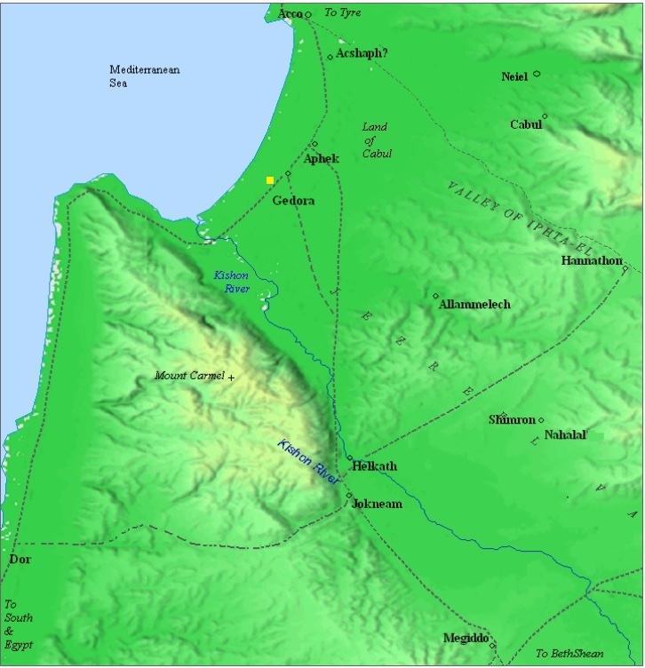
Map of area around the site (yellow square) – from the Canaanite thru the Roman periods (based on Bible Mapper 3.0)
Roman/Byzantine periods
The site continued as a smaller village through the Roman and Byzantine periods (1st century BC thru 6th century AD). Numerous sherds, mosaic tesserae and pieces of glass vessels were found in the Haifa East survey. The site was ruined in the Arab period (7th century) and remained in ruins since then.
According to recent excavations, the shore was much closer to the site in antiquity than it is today. Over the years sand accumulated in the bay of Haifa, receding the shoreline.
A section of the Roman coastal road, or a branch that connects to that road, may have been unearthed in 2007 excavations, 100m east of the top of the mound.
-
Ottoman period
The area was examined in the PEF survey (1866-1877) by Wilson, Conder and Kitchener. A section of their map is seen here, and the site appears as Tell es Subat.
In their report (PEF Volume I, Sheet 5, p. 353) they described the site merely as: “Tell es Subat —A low mound. Remains of pottery and glass.”.
This section of the map there is a line of ancient sites: Jidru (Horvat Gedora), Tell es Subat (Tel Zavat) and Tell en Nahal (Tel Nahal). They were part of the road that turned south-west, crossing the Kishon River, toward the ancient port town at Tell Abu Huwam (east of modern Haifa), and then around Mt. Carmel to continue south.
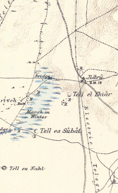
Part of Map sheet 5 of Survey of Western Palestine,
by Conder and Kitchener, 1872-1877.
(Published 1880, reprinted by LifeintheHolyLand.com)
- British Mandate
A section of the 1940s British Mandate map shows the area around the site. It appears as “Tell es Subat”.
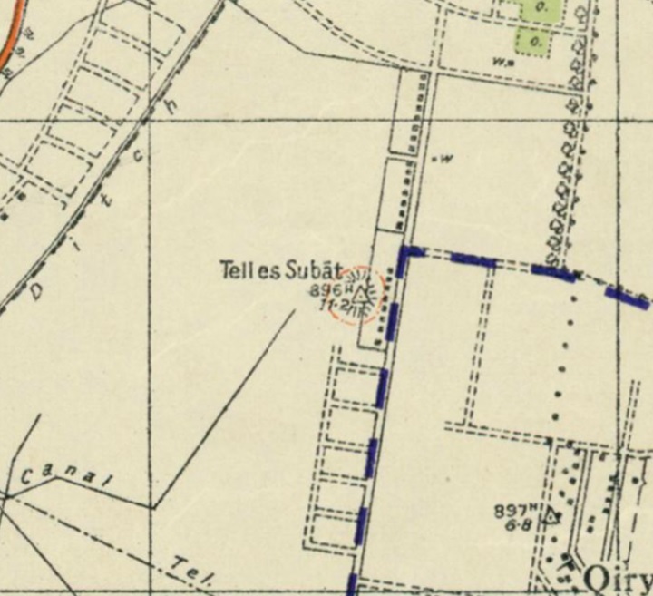
British survey map 1942-1948 – https://palopenmaps.org topo maps
License: public domain under the UK Copyright, Designs and Patent Act 1998
-
Modern Times
The swamps have been drained in the past century with canals that let the water flow to the Kishon river and out to the Mediterranean sea. The major canal appears on the British map as ‘Ditch”. It is named Nahal Gedora, but the common name is “Fuwara” (Arabic for gushing waters). This canal removed the winter marshes as appear on the Ottoman period map.
In the 1940s several residential houses were built along its eastern side, a neighborhood called Rasco-Gimel. In recent years most of these houses were rebuilt and replaced by modern houses, and incorporated into Kefar-Bialik, an agriculture village that was established in 1934.
In 2007 excavations were conducted on the north- eastern side of the Tell, as part of the preparations for a new highway that is designed to pass on the east and south side of the Tell. A section of Via Maris may have been found in one of the trial square pits.
Ancient Roads:
a. Bronze/Iron Age:
Via Maris (“Derech Hayam” – the way of the sea) was the major highway that for centuries connected the center and south of the Holy Land (Egypt and Africa) – to its north and beyond (Syria, Mesopotamia and Asia Minor). This trade road was the spine of the fertile crescent.
The road had two Galilee branches – the western (coastal) branch which passes at Tell Zavat, and the eastern branch that passes through the Sea of Galilee.
The coastal road came down from Akko (Acre) in the North, passing at this point and splitting to two roads going south:
-
a south-western road – towards Tell Abu-Huwam near Haifa, then around Mount Carmel along its shore,
-
a south-eastern road – towards Yokneam, then around Mount Carmel on its eastern side. It also continued on to Megiddo and connected to the eastern section.
David Dorsey (“The roads and Highways of Ancient Israel”, 2018, p. 79, Map 3) marked the main Bronze/Iron age highway thru Tel Zevat as “I1”, connecting it to Tel Par, Tel Regev then Geva Shemen. Another fork was “I27” connecting thru Tel Nahal and Tel el Idham to the port of Tell Abu Huwam (east of Haifa). Both roads then converged after passing mount Carmel, about 30KM south, and continued along the coast through the heart of Israel towards Egypt.
Tel Zavat was one of the sites along the south-western road. In the aerial view below you can see how dense the sites were along the ancient road: there was a site almost every Kilometer, and the location of the sites was selected due to their proximity to the road, the natural higher ground (a hill) and close to source of water (wells).
The following aerial view shows the estimated location of these roads that split somewhere near Tell Zavat.

b. Roman/Byzantine period:
The Romans perfected the art of road building, and enabled them to effectively manage the vast empire by improving the links between the cities, especially for military purposes. The Peutinger map (Peutingeriana tabula) of the 4th century Imperial Roman roads shows the coastal way from Acre (“Ptolemaide” in the top center) through Dor (“Thora”) to Caesarea Maritama (“Cesaria” on the top left). The position of Zavat is shown on the map, close to the Kishon river.
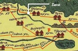
The split of the Roman road was probably at Khirbet Gedora, a few hundred meters north of Tel Zevat. The choice of Gedora as a splitting point is based on the topography and is enforced by the fact that its name, “Gedro”, is written as a landmark in a Roman milestone in Nahariyah. A large Roman stone tablet was found near the Roman road in Nahariyah. It has the following inscription:
” IMP[ERATOR] NER[ONI] CAESARI COL[ONIA] PTOL[EMAIS] VETER[ANORUM] VICI NEA COM[E] ET GEDURA”.
The tablet is dedicated to Nero Caesar (54-68AD), by the Roman veterans in the Acre Colony (Col Ptolemais). It indicates the road connected two towns: “New village” (maybe Shavey Zion, where two milestones were found) and Gedro (the site near Kefar Bialik, where via Maris splits).
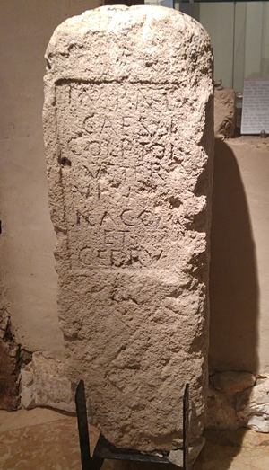
Nero stone tablet from Nahariyah
Courtesy Hecht Museum
Photos:
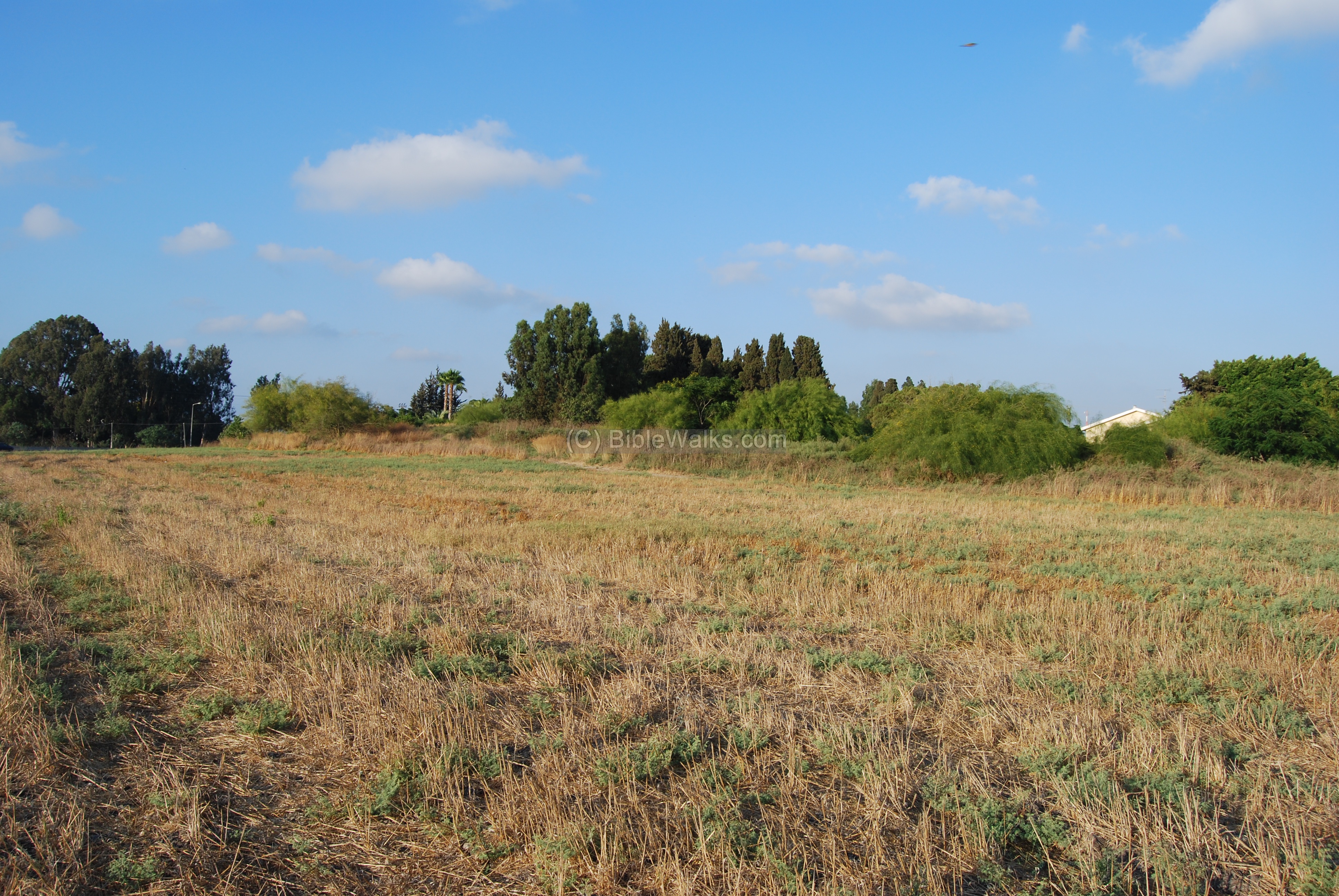
General view:
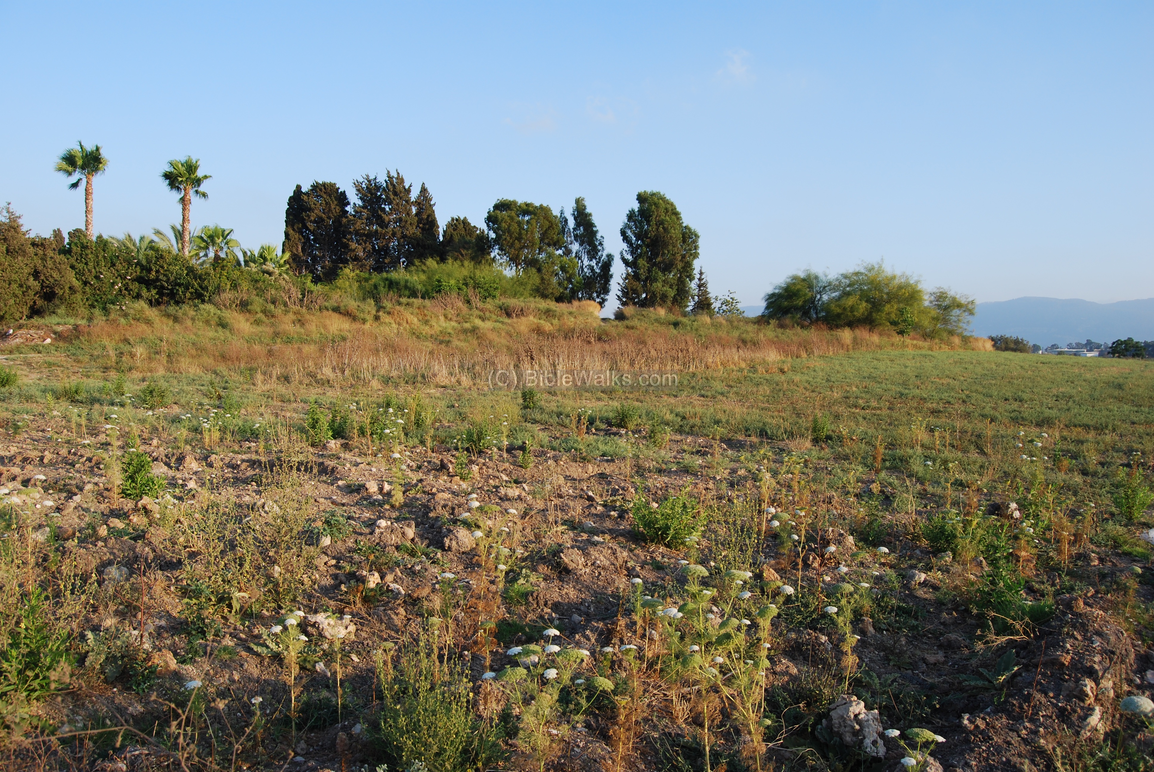
The photo below shows the Tell from the south-west side. The agriculture fields around it leveled most of the site, while the residential houses (one of them is seen on the right background) cut it away on the eastern side. On top of the Tell, near the trees, was a well, but it is covered today.
Click on the photo to view it in higher resolution…
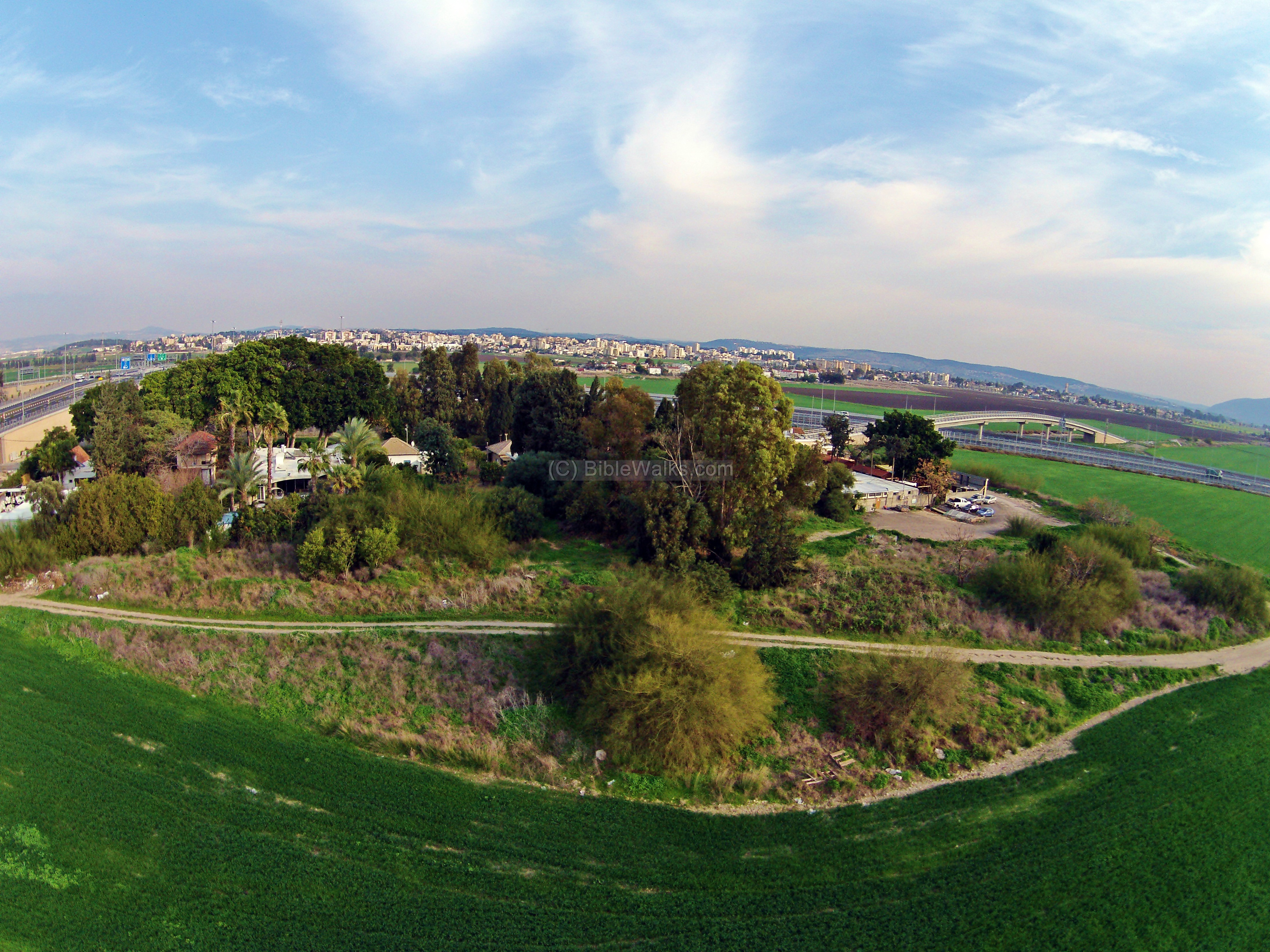
The next picture is an aerial view of Tell Zavat, as seen from the west side. On top of the ancient site are several modern residential houses. In the left and right backgrounds are sections of the new Kerioth-Bypass (“Kvish Okef Kerioth”) highway. Behind the site, in the far background, is Kyriat Ata, and farther – the hills of lower Galilee.
Although the mound is small, it is the tip of the iceberg: the actual ancient city was once standing dozens of meters around the center, but the intensive farming wiped out most of the remains.
This photo was captured with a DJI Phantom 2 Vision flying camera (“Quadcopter”) in February 2014.
Sights around the site:
On the west side of the Tell is a modern dirt road, used by the farmers, which followed the path of the ancient road. The next ancient site along the path is located at the center of the trees in the far background. Behind the trees is the north side of Mount Carmel.
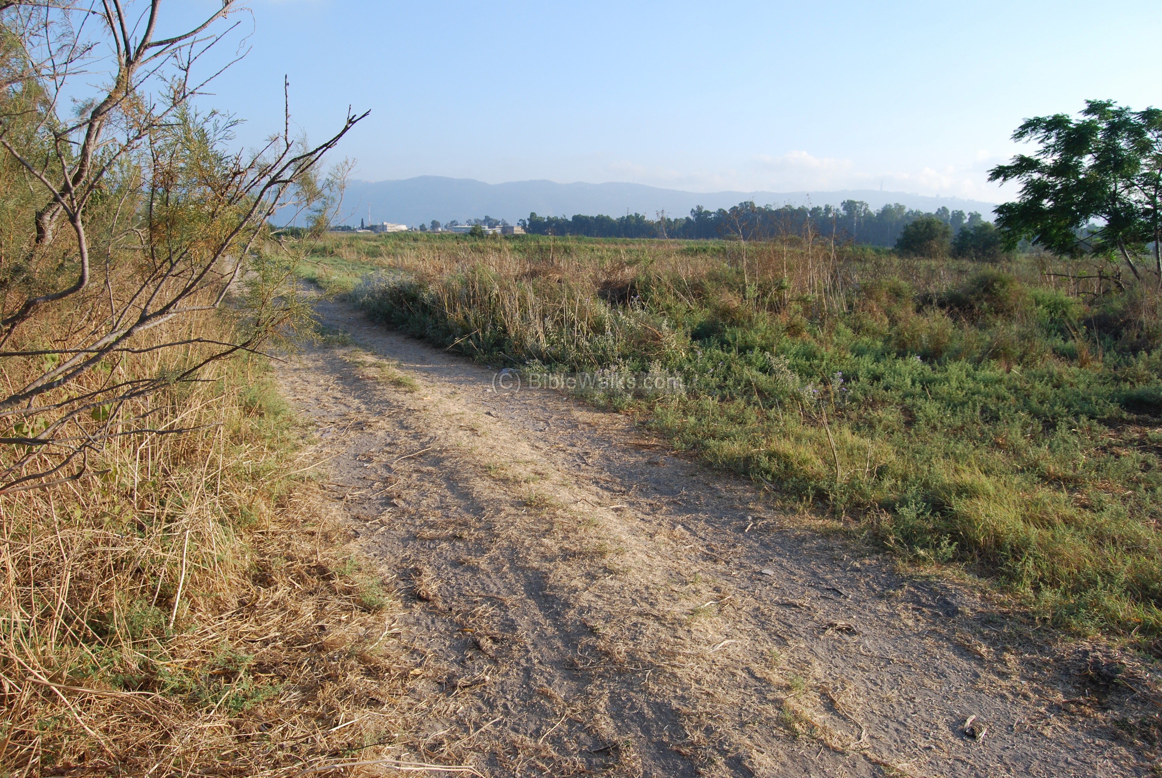
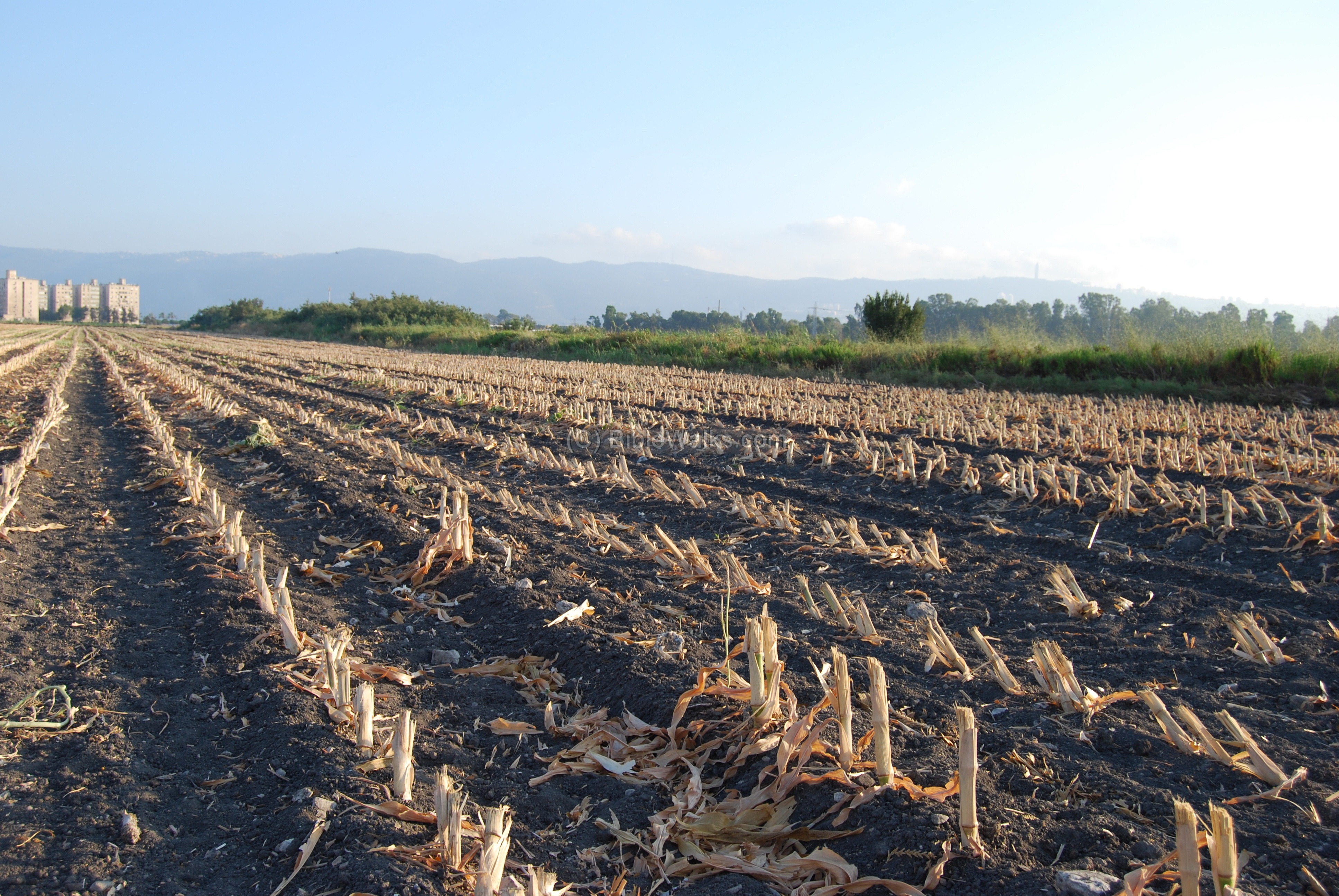
The photo below is a view from the south side. The corn field is located on top of the edge of the site, and the soil contains numerous fragments of ceramics, stones, glass, basalt stones, and mosaic stones.

A view from the south side towards mount Carmel is seen below. The city of Haifa is located on top of the Carmel on the right side, while on the left side are the high rises of Kiryat-Atta.
A new highway (Kerioth-Bypass – Kvish Okef Kerioth) is planned to pass at this point, following the same ancient route towards Haifa.
Dig 2007: Was the ancient road found?
A new highway, the Kerioth-Bypass (Kvish Okef Kerioth, highway #22), bypasses the Kerioth of Haifa, the northern residential neighborhoods in the bay of Haifa. The modern road follows the path of the ancient highway, and it passes about 50M east to the Tell.
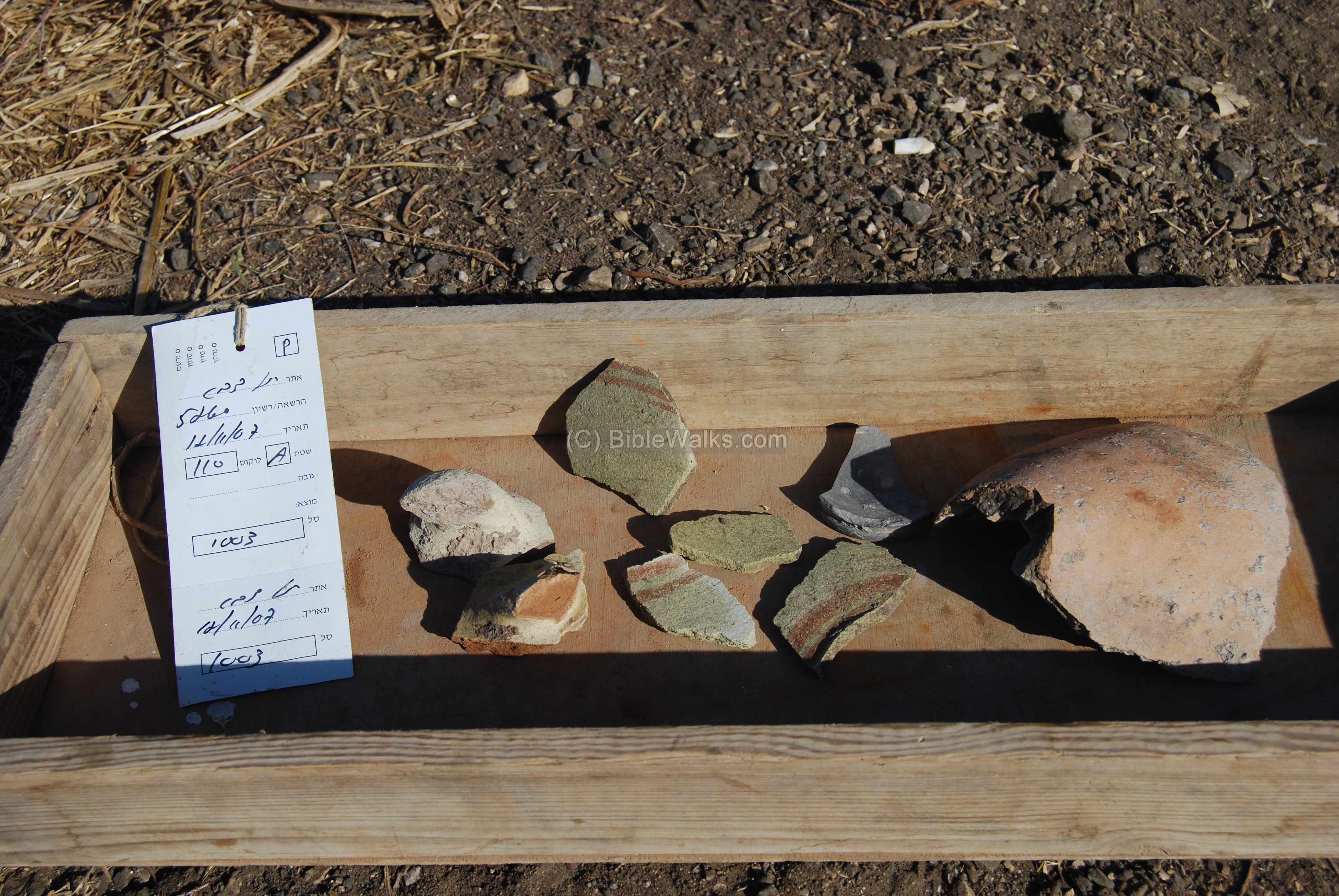
Excavations were conducted in November 2007 on the eastern side of Tell Zavat in order to reveal and possibly salvage the ancient ruins along the path of the new highway. The archaeological work was headed by Amit Shedman of the Israeli Antiquities Authority. It started by cutting 8 trial square pits, as seen in the photo below, in a narrow section along the Ha’Amakim road and close to the junction.

The depth was about 4M to the bedrock. The photo below shows some of the pottery found in the pits, possibly dated to the Roman period.
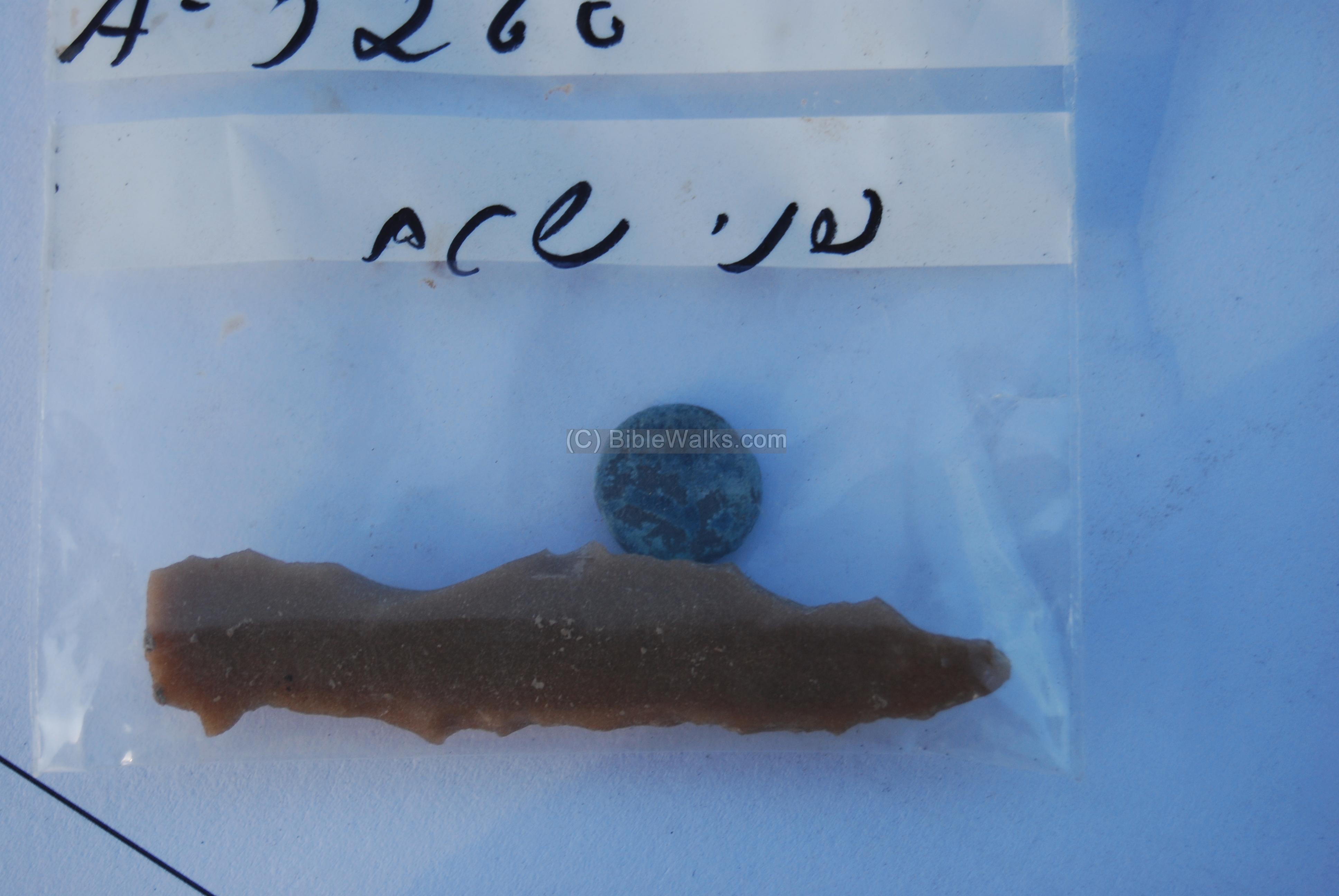
Some of the findings were found on the surface, as seen in the following bag – containing a flint-stone arrow head and a bronze coin.
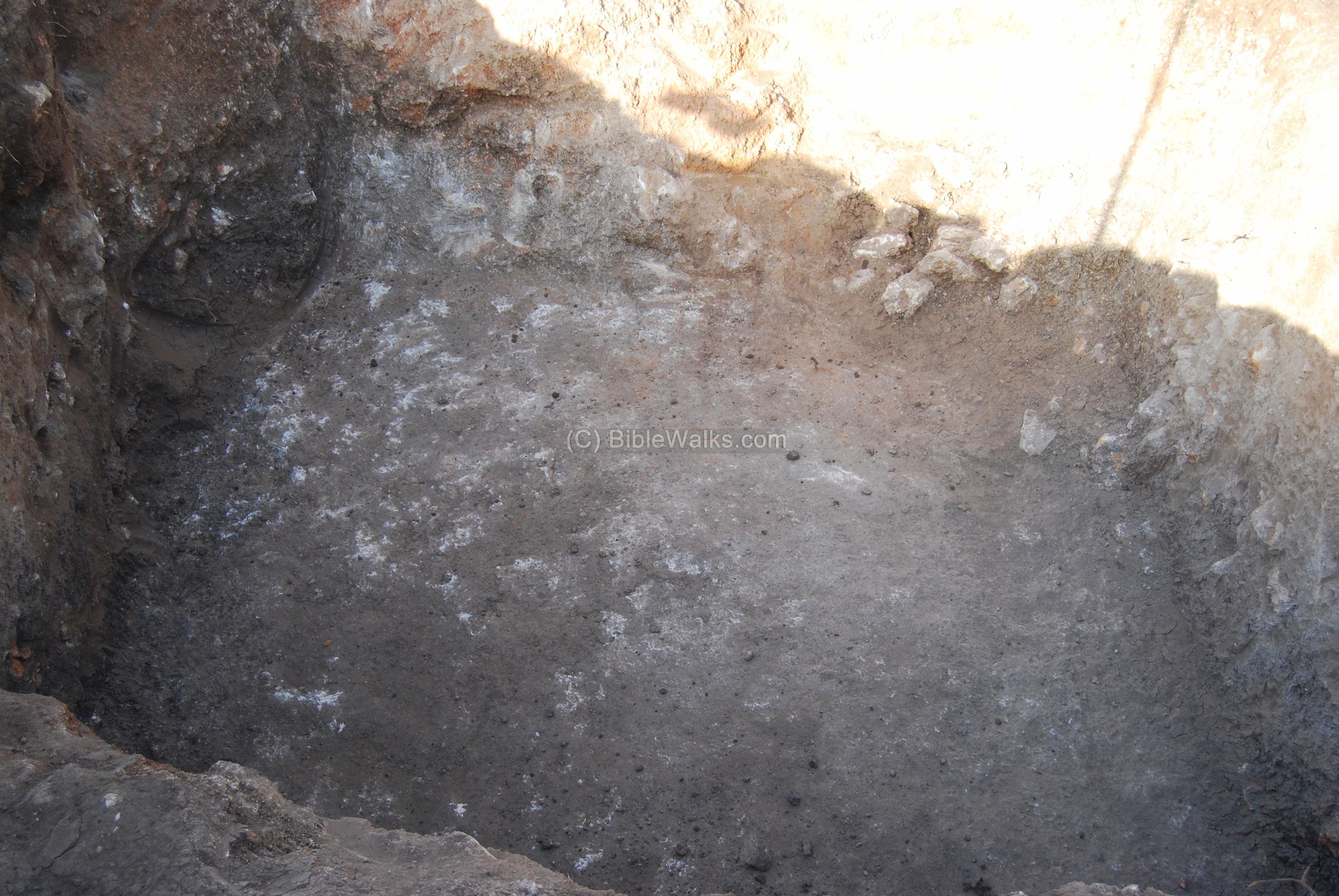
Most of the 8 pits did not yield much results. However, the eastern one, closest to the mound, did reveal an interesting finding, making the archaeologists really excited: maybe they have stumbled upon the discovery of the ancient road.

This is what was surfaced after cleaning the soil: a deep cavity in the sandstone bedrock, at a width of about 3M and depth of 2M into the rock. This may be, perhaps, a section of the ancient road that passed at this point and was cut into the rock. It passed in the north-south direction, and may have been part of the coastal section of Via Maris, as shown in the map above.
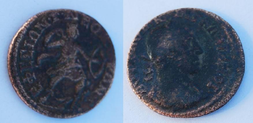
A 3rd/4th century Roman coin has been found in the pit. The coin cannot be used to date this section since it may have fallen into it. The observe side is on the right, with the bust of the Caesar. The reverse side is seen on the left photo, with a Roman soldier pulling an arrow out of the pouch; the letters around the figure are in Greek. It was a coin from Ephesus, dated to the reign of Valerian (253–260 CE).
The current work permit limits the work to this narrow section. However, the archaeologists are waiting to dig up more sections of the road, maybe during the construction of the new highway. As it happens many times in Israel, modern constructions brings back to life old constructions.
The snails:
This medium-sized marine snail (Hilazon in Hebrew, Murex trunculus as scientific name) was one of the important sources of dye colors in antiquity. The Canaanites, Hebrews of the Zebulun tribe, and especially the Phoenicians produced the deep-purple indigo dye which was used for the textile industry. The Old testament specifies a blue dye (Tekhelet) for use in the Priestly garments as well in the layman’s tzizit (fringes). For example (Exodus 28:6): “And they shall make the ephod of gold, of blue, and of purple, of scarlet, and fine twined linen, with cunning work”.
According to Greek legend, the purple dye was discovered by chance: the patron gods of Tyre, Melqart and Tyros, were walking along the shore with their dog. The dog bit a snail, and came to his master with his mouth stained with color. Melqart collected more shells and prepared a purple robe for Tyros. Later, the Phoenicians of Tyre and around the Mediterranean coast skilled in purple dyeing. The Greek name of “Phoenician” means red-purple, based on their production and trade of the purple cloths.
Since 60,000 murex were needed to produce one pound of dye, the dye was highly prized in ancient times. Their shells are found in most of the Phoenician sites along the coast in Israel and Lebanon.
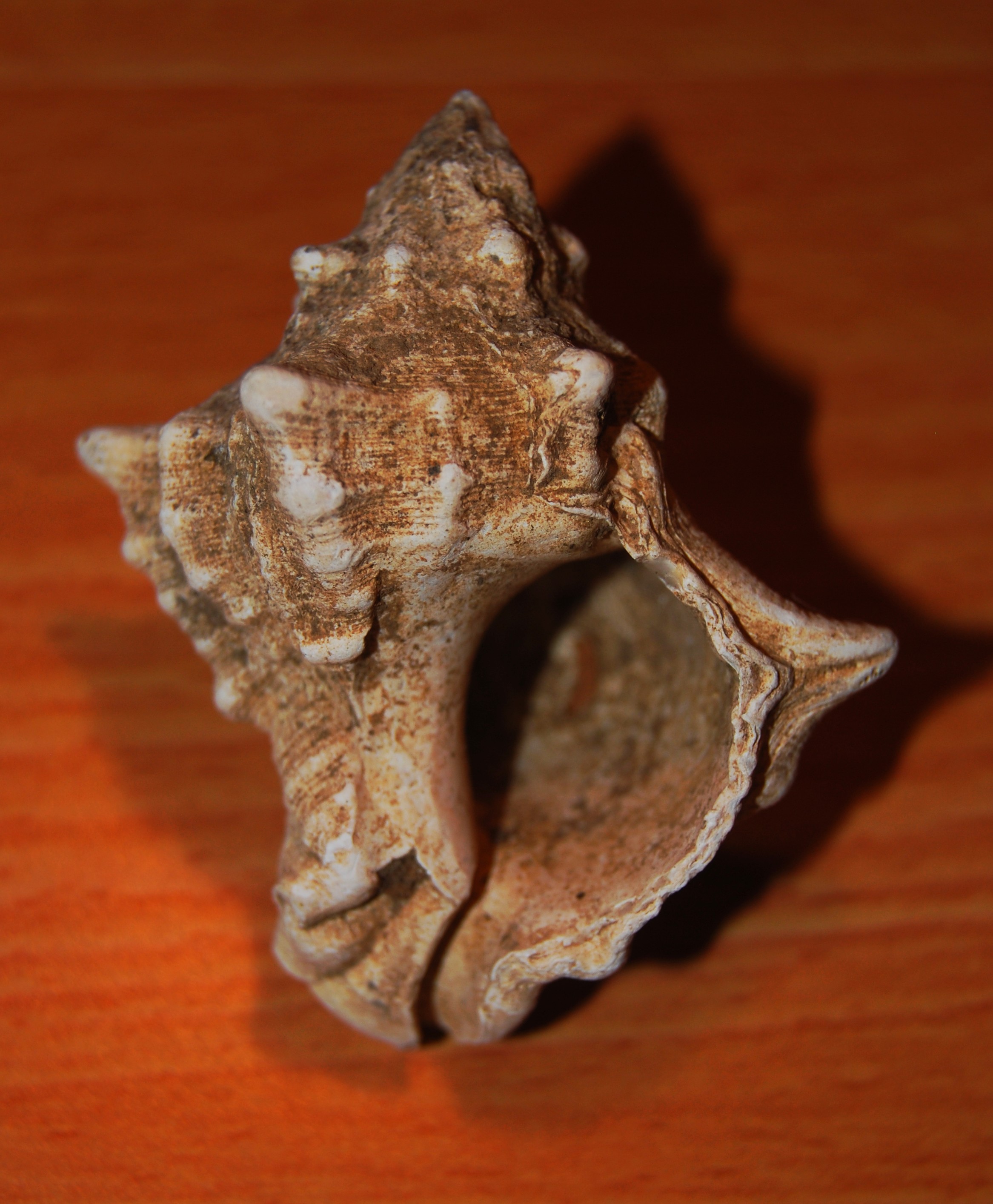
Shell of the Hilazon – Murex trunculus
Dozens of these shells can be found in the fields around Tell Zavat.
Judging from the number of shells found around the site, there could have been a purple dye industry workshop near the site.
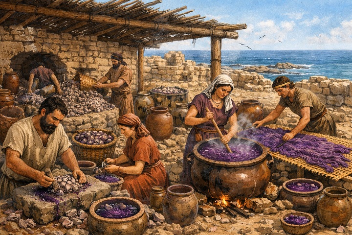
Illustration of purple dye workshop near Tel Shikmona (Image created by AI using OpenAI’s ChatGPT)
Nature photos – Summer:
The common Kipodan (common Globe-thistle, or: Echinops adenocaulos) is a thorn that flowers in June -July, and is widespread in many areas of Israel.

Another wild flower, found in the fields around the site, is common in agriculture farms – barns, cowsheds and poultry enclosures. This flower is called Solenum (Silverleaf Nightshade, or: Solanum elaeagnifolium), which flowers between May-August.
Its fruits are small, round berries that start green, turning yellow/orange as they ripen. They are eaten by bats and birds, who spread it through their droppings. Warning: the fruits and other parts of this plant are poisonous if eaten by humans, and may even cause death!
Nature photos – Winter:
During winter, the heavy soil around the site gets swampy. A field of daffodils (Narcissus) blossoms between the green fields.
A closer view of the flower. Its rich, heavily fragrance, coupled with its beauty- is divine.
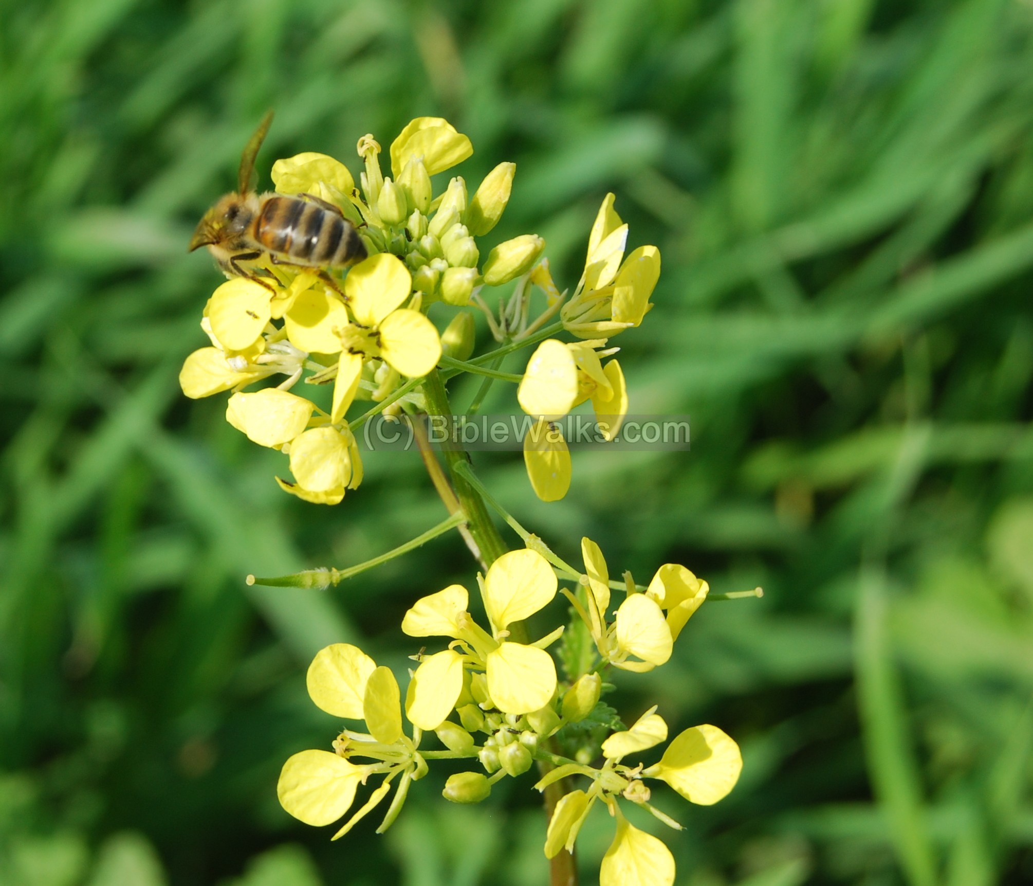
Wild white mustard flowers cover the sides of the roads. The photo below shows a bee sucking nectar from the flower.
Etymology (behind the name):
-
Tel, Tell – a layered mound (read about the story of the Tells, including our animation)
-
Subat – in Arabic: sleeping. Therefore the Tell may be translated as the “sleeping Tell”.
-
Tell es Subat – the name in PEF survey maps (1881-1883). It shows a road crossing east-west on its south side, with winter marsh areas on its western sides. A creek (el Fuwara) and a bridge is located 400M to its west side.
-
Zavat – the Hebrew name of the Tell, based on the Arabic name (the closest name that sounds the same). Means in Hebrew: pinched.
-
Derech Hayam – Hebrew – the way of the sea. In Latin; Via Maris. Biblical reference (Isaiah 9,1): “Nevertheless the dimness shall not be such as was in her vexation, when at the first he lightly afflicted the land of Zebulun and the land of Naphtali, and afterward did more grievously afflict her by the way of the sea, beyond Jordan, in Galilee of the nations”.
References:
- David Dorsey (“The roads and Highways of Ancient Israel”, 2018) – pp. 78-81
Links:
-
Tell Zavat – Final report of excavation 2007, Amit Shadman 2016
-
SWP (Survey of Western Palestine) Conder & Kitchner 1881-1883 I p. 353
- Tel Akko and the Urbanization of Akko Plain in the First Half of the Second Millennium BCE – Ron Beeri, 2008; pp 58-59
BibleWalks pages:
- Horvat Gedora (Jidru) – nearby site
-
Roman Roads – in BibleWalks
BibleWalks.com – touring the sites of the Holy Land
Roman Road, Usha<<<–previous West Galilee site—<<<All Sites>>>—->>>Horvat Gedora
This page was last updated on Feb 1, 2026 (add map, note on the flower)
Sponsored links: