The ancient town of Usha was, for two times, the seat of the Sanhedrin during the Roman period.
Home > Sites > West Galilee > Horvat Usha
Contents:
Background
History
Location
Photos
* West side
* East side
* Winepresses
* North side
* Public structure
* Sanhedrin Trail
* Nature photos
Talmud Refs
References
Etymology
Background:
Usha (also known as Osha) was a Jewish village in Galilee, located about 8 kilometers southwest of the city of Nazareth. It is an ancient site that played an important role in the history of Judaism and the development of the Mishnah, a key text of Jewish law and tradition.
According to tradition, Usha was the site of a gathering of Jewish sages in the aftermath of the Bar Kokhba revolt (132-136 AD), a Jewish rebellion against Roman rule in Judea. The sages gathered in Usha to reestablish the Sanhedrin, a Jewish court that had been disbanded by the Romans. This gathering is believed to have led to the establishment of a new center of Jewish scholarship and law in the Galilee region.
Usha became an important center of Jewish learning and culture, and it is believed that many of the discussions and debates that took place there were recorded and later incorporated into the Mishnah. Usha remained an important center of Jewish scholarship for several decades, until the Sanhedrin was moved to other locations.
Today, the site of Usha is marked by the ruins of an ancient synagogue, which is believed to date back to the Roman period. The synagogue contains several inscriptions and architectural features that provide insights into the history and culture of the Jewish community that lived there. The site is open to visitors and is a popular destination for tourists interested in Jewish history and culture.
Location:
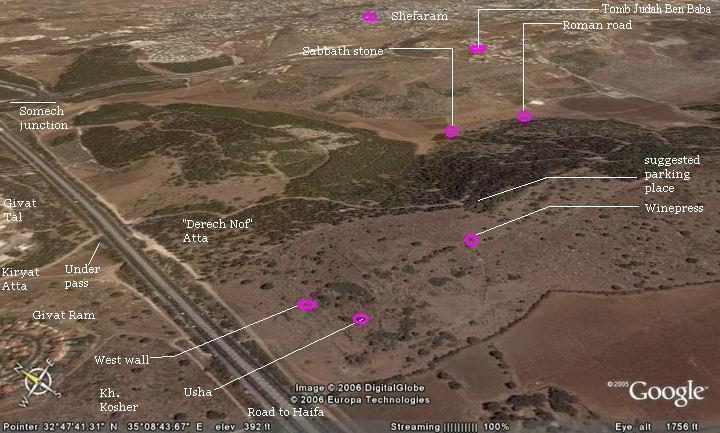
Horvat Usha can be reached by the park road (“Derech Nof”) that starts from Givat Ram/Tal in Kiryat Atta. See map below – the suggested parking place is marked on the right side of the map. It is 128M above sea level.
The following aerial view shows the points of interest and a map of the area.
History:
-
Early history
Around the village are stone quarries, which were probably in use during the Hellenistic period or earlier during the Iron age. A Hebrew seal was found in the vicinity of Usha, dated to the Israelite Kings (8th century BC).
-
Roman period
In the Roman times this was a small village, one of many agriculture villages in the area. Two major Roman roads passed near the village, connecting Acre to Sepphoris on its north side, and the western wing of Via Maris (Way of the Sea) on its south west side.
Sanhedrin
The Jewish religious and administrative leadership, the “Sanhedrin”, moved to this small village in years 80-116AD. After some time in Yavne (Yabne or Jamnia, in the center of Israel) it returned here once again in 140AD for 10 years.
The choice of this small village as the seat of this council was deliberate – to keep its activities on a small key. At these times the Romans were suspicious of any political and religious activities, following two revolts (67-70, 131-135). After the second revolt the Romans restricted some of the Jewish practices, such as ordinating (=giving a degree of a Rabbi) to others, with a penalty of death. Usha was selected due to its animosity as the seed for the renewed Jewish presence in the Galilee, following the total destruction of the Judean center. Rabbi Judah Ben Baba (link) was one of the first to ignore the penalty, and was killed by 300 spears at the age of 70. He is regarded as one of the ten martyrs in the era following the destruction of the second temple.
In 150 AD, 15 years after the end of the second revolt , the security of the Jewish population in the Galilee improved, and it was time to move on to larger towns. The Sanhedrin relocated to Shefaram, its twin village located about 2 KM north-east. The Sanhedrin relocated later (163 AD) to Beit-Shearim, Sepphoris and finally to Tiberias.
-
Byzantine period
During the Byzantine period (4th-7th century AD) there was a synagogue in the village, but only fragments of the structure were found since the site was not yet excavated. Most of the village’s larger stones were removed from the site and many can be found in the private houses in the nearby Kibbutzim.
The village continued until the Arabic period, and was destroyed in the 8th century, probably due to an earthquake that devastated the village.
-
Ottoman period
The ruins of the site (appears as Kh. Husheh”) were examined in the Palestine Exploration Foundation (PEF) survey (1866-1877) by Wilson, Conder and Kitchener. A section of their map is shown below. Notice the double dashed line south of Khirbet Husheh (Horvat Usha). This is a section of the western wing of Via Maris (Way of the Sea) – going north to Acre.

Part of map sheet 5 of Survey of Western Palestine,
by Conder and Kitchener, 1872-1877.
(Published 1880, reprinted by LifeintheHolyLand.com)
They identified Husheh with the place of the seat of the Sanhedrin (Vol 1, Sheet V, p 289):
“Osheh.A seat of the Sanhedrin in Galilee, mentioned with Shafram, from which it was two Sabbath days’ journey (Tal. Bab. Abodah Zarah, 8 b). Two and a half English miles south-west of Shefa ‘Amr (Shafram) is Khirbet Husheh. This would give the correct distance within a few hundred yards”.
The site was reported shortly on page 311:
“Kh. Husheh Heaps of stones ; a small makam (Neby Hushan) on the south-west”.
The ruins were also visited by Guerin (p. 311), which provided a more detailed report:
‘The ground is everywhere covered with small fragments, with which are mixed cut stones. The remains of a considerable building attracted my attention. It is completely demolished, but the fine blocks which lie on the ground where it stood, and a broken capital, prove that it was built with care and adorned within by columns. Perhaps it was a synagogue, for the Khurbet Husheh is very probably the ancient Usha, often spoken of in the Talmud in connection with Shefa’Amr, to which it was contiguous, A little before the fall of Beittar the Sanhedrin left Yabneh to establish itself here. They would then naturally build a synagogue at Usha, unless there was one here already’.
‘ Not far from the ruins of this building may be remarked in a valley to the west a circular well fairly well built with stones of middle size, to which belongs a reservoir. To the south is seen, on a neighbouring hill covered with fine oaks and brushwood, an arched vault constructed of cut stones of ancient appearance, at the end of which is constructed a little niche for a mihrab. Rags are fastened over this wely a kind of ex voto offerings. It is consecrated to Neby Hushan, the Prophet Hosea, according to Mussulman tradition, which places the tomb of the prophet in this place. But according to a rabbinical tradition the prophet was interred at Safed’.
-
British Mandate
During the beginning of the 20th century, an Arab village was rebuilt using the ancient village stones, and was called Hushe (also Hoshe, Husha or Hawsha) – preserving the ancient name. The villagers in Hushe came from Algeria. Another village, also with North African Muslim Arabs, was established on the hill west to the site – called Kassair or Kasayir (Hebrew: Horvat Kosher). The villagers came to the area to work in the port and refineries of Haifa, and in the newly established Jewish communities.
These villages were destroyed in April 1948 during Israel’s independence war, after fierce battles.
-
Modern times
In 1937 a Kibbutz was established 3 KM to the west of the site, and was named Kibbutz Usha. There are two other Kibbutz near the site – Ramat Yochanan (2KM west), and Kefar Maccabbi (2.5KM west). All three are called Gush Zevulun – the cluster of Zebulun.
In 2018 the site was incorporated into the newly established “Sanhedrin trail“, a connecting all sites of the administrative leadership sites with a hiking discovery trail. Excavations are conducted by the IAA together with students of nearby schools.
Photos:
(a) West side
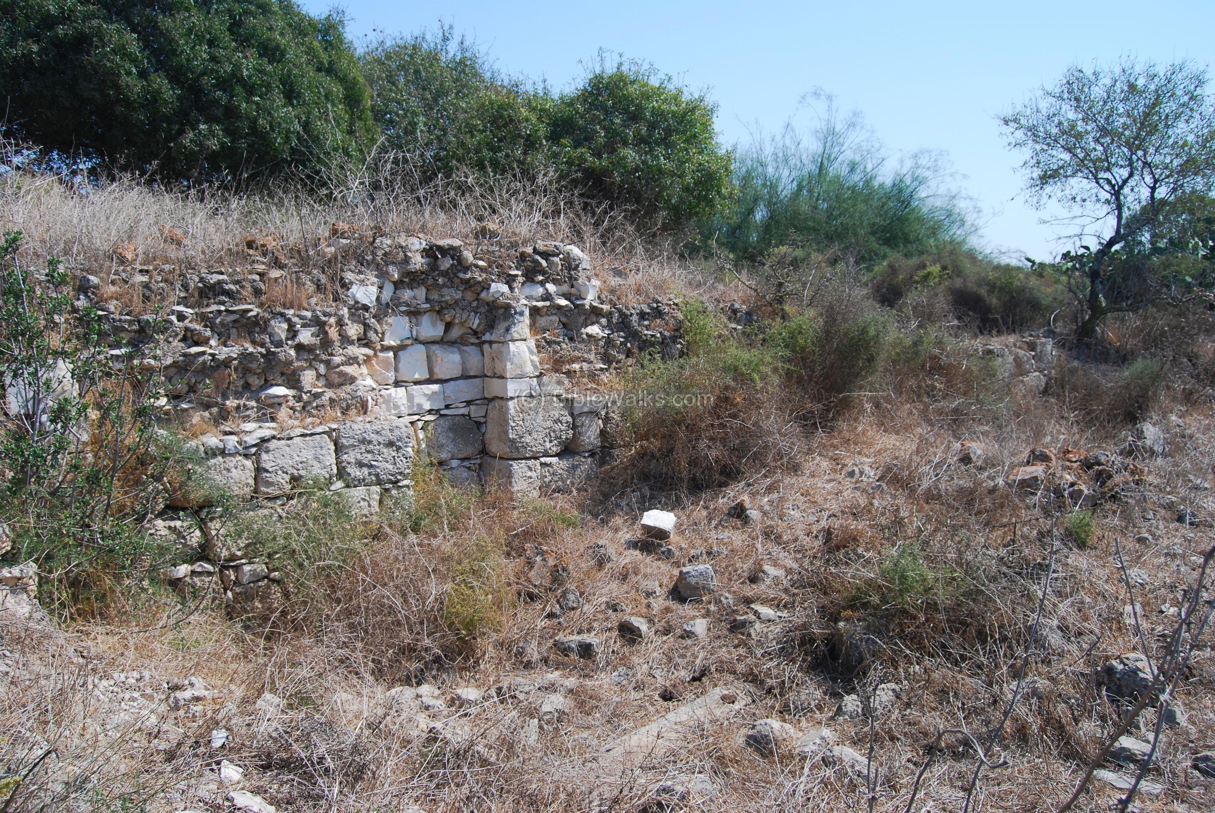
The photo below shows the ruins of one of the Arab houses on the west side of the ancient village. Behind it, in the far background on the left side, are the modern houses of Givat Ram – a superb of Kiryat Atta.
Click on the photos to view in higher resolution…
A wall stretches along the west side, just above the hillside. Integrated in this wall are ancient building elements and a well.
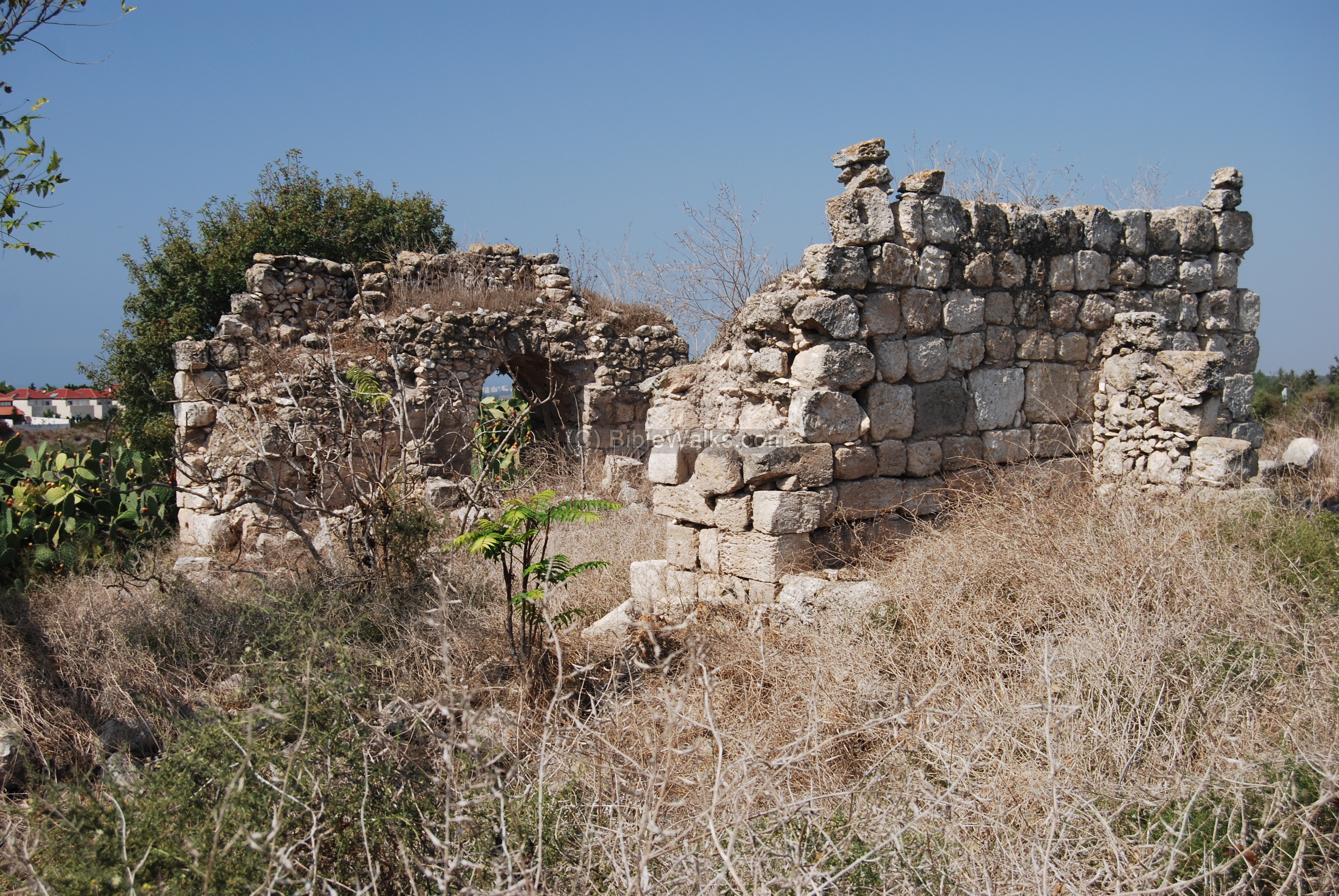
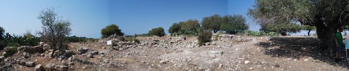
(b) East side
The quad copter view shows the eastern side of Usha, looking towards the north-west. Scattered ruins are all what remained from the Arab village, which was built on the west side of the Roman-period village. On the far left background are the modern houses of Givat Tal, a superb of Kiryat Atta.
A view of a large tree ( anacardiaceous Pistacia, or Ella Atlantit in Hebrew) is seen below.

The ruins of the Arabic village are seen in the panoramic photo below – to the left of the great tree.
Clicking on the photo will open a flash viewer, which will allow you to move around and open a full-screen view.
(c) Wine presses:
A group of 3 Roman-period winepresses are located on the located on the east side of the village. A quadcopter view shows the winepress complex from above.
The winepress complex shares a common collecting vat – seen on the right side. The grapes would be placed on the left side, and the workers would crush them with their feet. The grape juice would stay in the treading floor during the fermentation process. After then, the wine juice would allowed to pour thru a blocking and filter groove into the collecting vat.
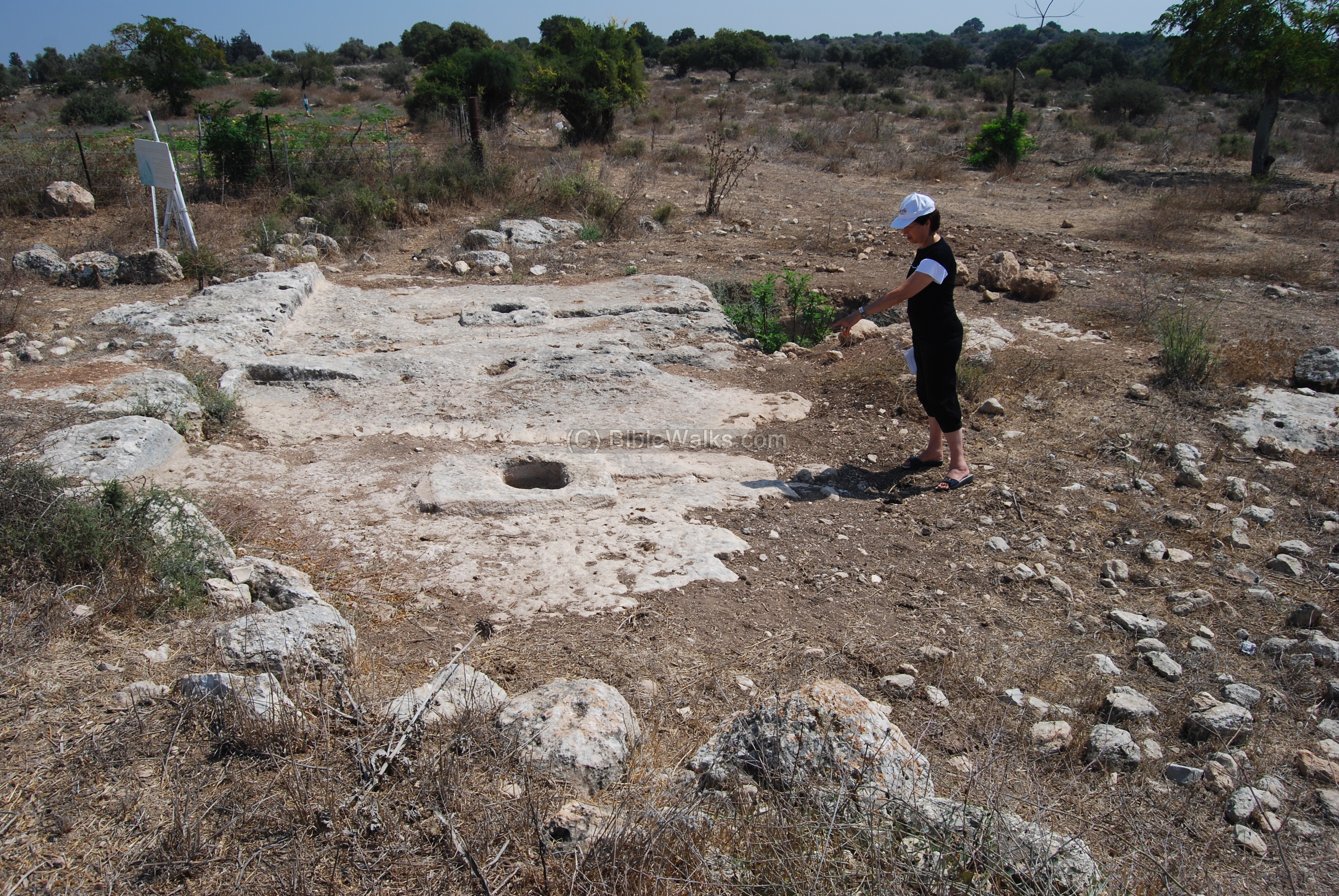
The photo below is a close-up of the middle wine press. The groove led the extracted wine juice into the pit. Steps lead into the bottom of the pit (seen on the right side) in order to allow the workers to step down and collect the juice into jars, then store them for subsequent fermentation.
The hole in the center was used for secondary extraction of the juice using a single fixed-screw press. The press squeezed out the must left in the grape skins and stalks after treading. The remains of the crushed grapes would have been collected into the hole, and a pole was used to crush them once again in order to extract the lower quality grape juice.

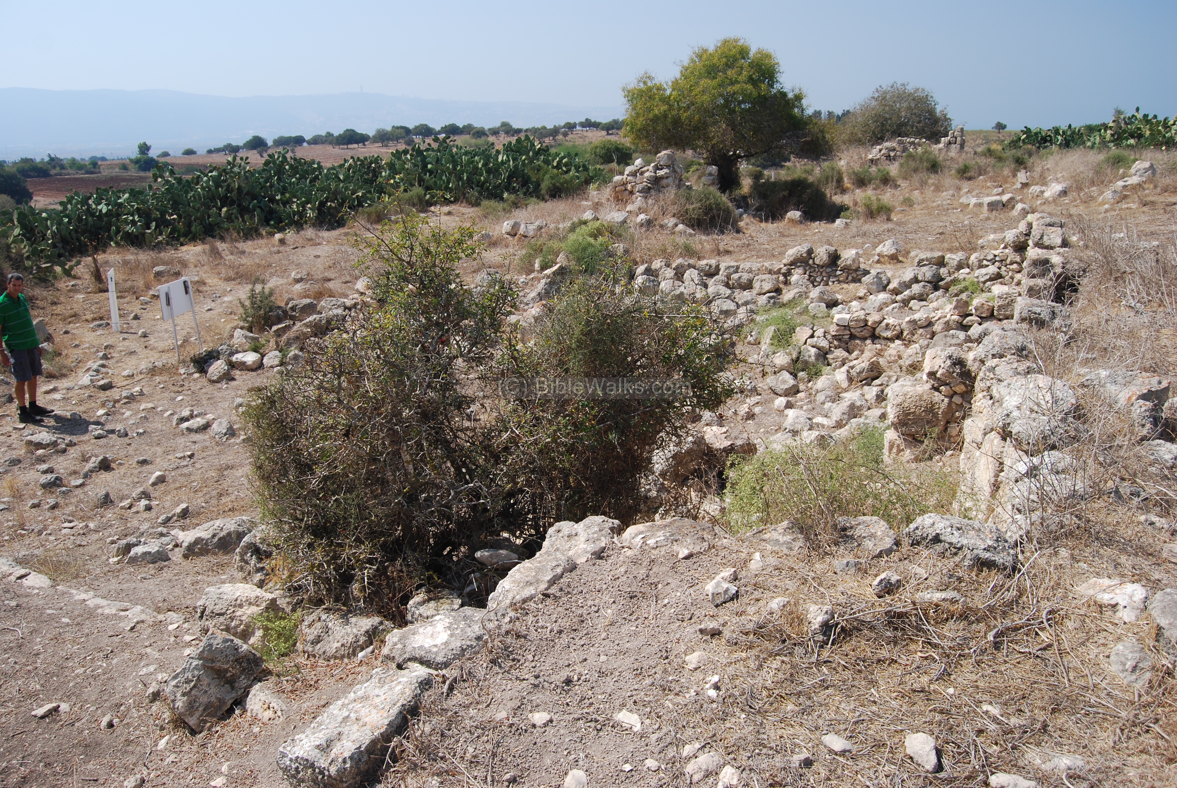
(d) North side
A panoramic view of this section, looking towards north, is seen here. There are many cactus fences in the village that were used for protection. During the end of the summer you can pick their sweet fruits (Sabre)- but beware of these tiny thorns.
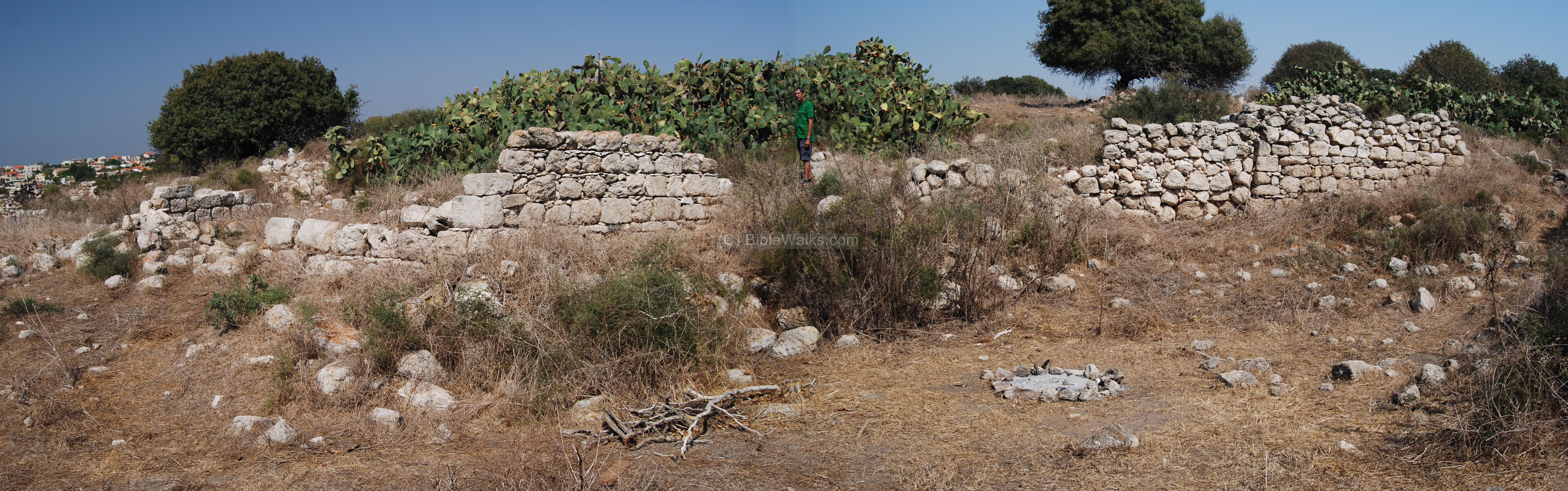
A detail is seen below, with a view towards the south.
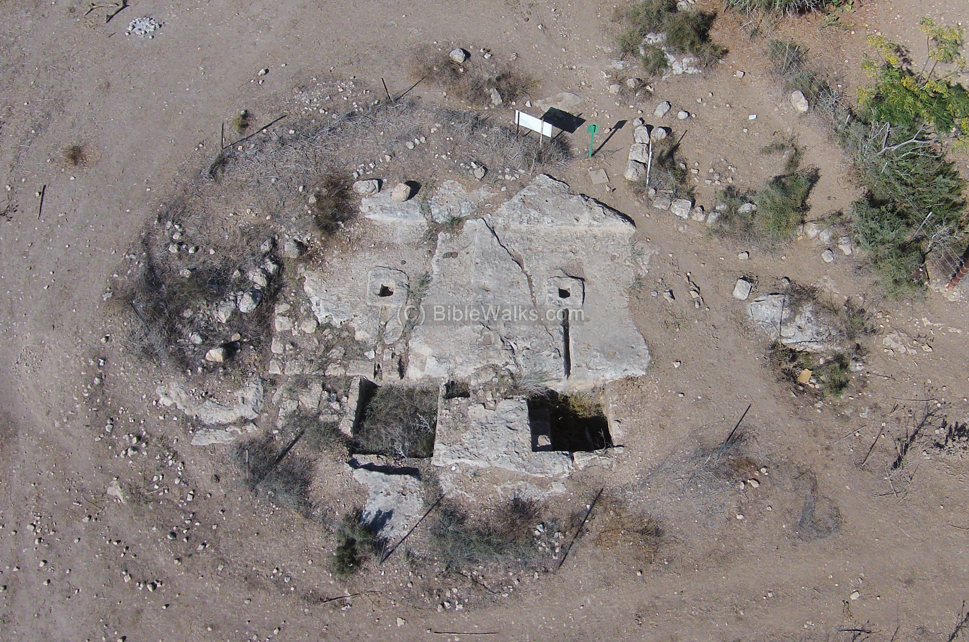
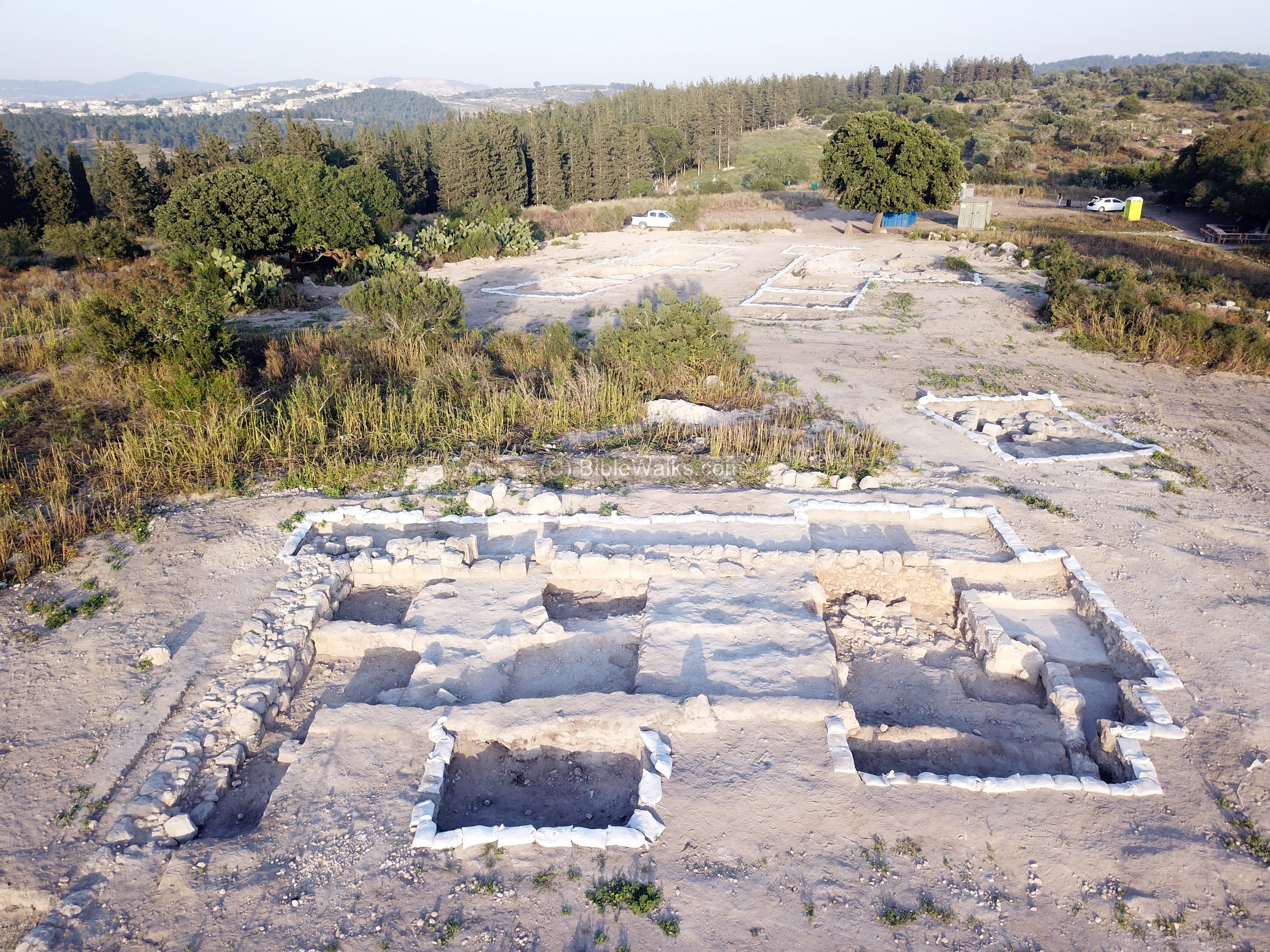
(e) Public structure
A base of a large public structure was found on the north side. This may have been the synagogue, or later converted to a monastery. It could also have been the house of Rabbi Yehuda Hanasi, the compiler of the Mishnah (compilation of Jewish oral traditions) and the president of the Sanhedrin, who spent his youth in Usha in the second century.
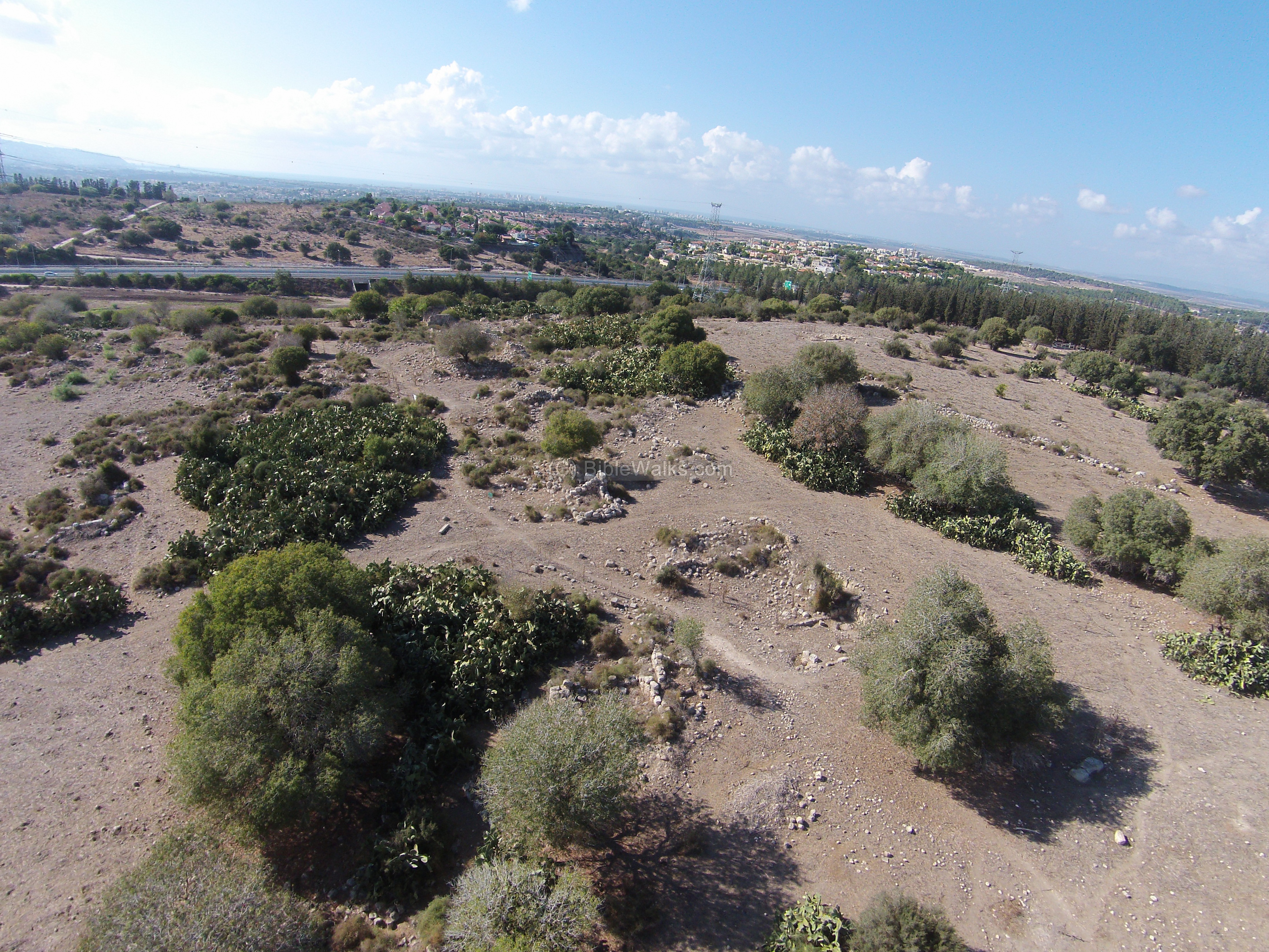
This aerial view, captured in 2014, shows the traces of the walls prior to the excavations.

In 2018 some sections of the structure was exposed by IAA archaeologists together with students from nearby schools. The excavations revealed additional sections of the structure, with an entrance on the east side. A section of a mosaic floor of a wine press was exposed on the south (right) side.
The structure was built in the Byzantine period, and destroyed by an earthquake before the 8th century. A layer of charcoal indicates a fierce fire at some time.
An oil lamp, decorated by an eight-branch Menorah, was found on the north wall.
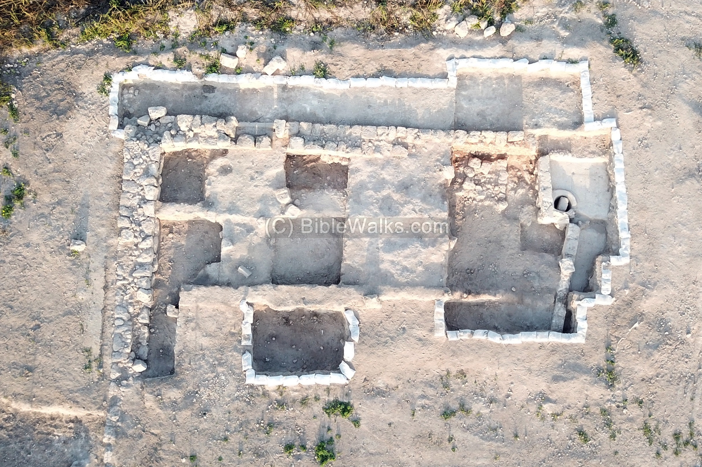
The excavations continue, and would reveal more sections of this structure, its dating and purposes.
The recent excavations also revealed an area of installations east of the structure.
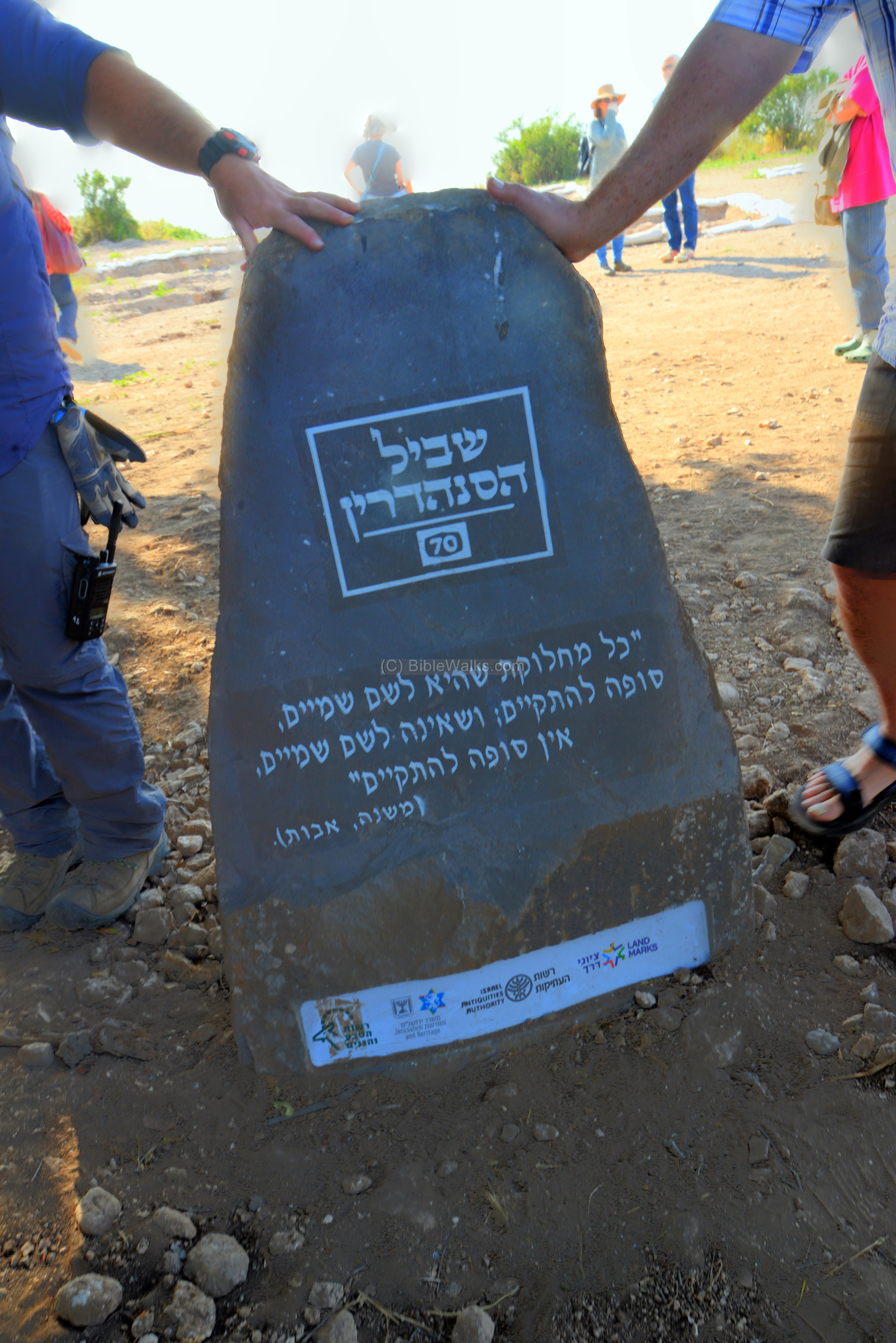
(f) Sanhedrin Trail:
In April 2018 the Israeli Antiquities Authority (IAA), together with neighboring communities, held a ceremony in Usha to officially open the new Sanhedrin hiking trail. The trail starts in Usha, then passes the other places where the Sanhedrin operated, finally reaching Tiberias. The 70km trail was launched on the 70th anniversary of the state of Israel, and commemorates the 71 wise men of the Sanhedrin. Thousands of students and volunteers took part in excavations in the project.
One of the speakers was the head of the IAA, Mr. Israel Hasson.

Marker stones were placed along the trail.
(g) Nature and “other” photos :
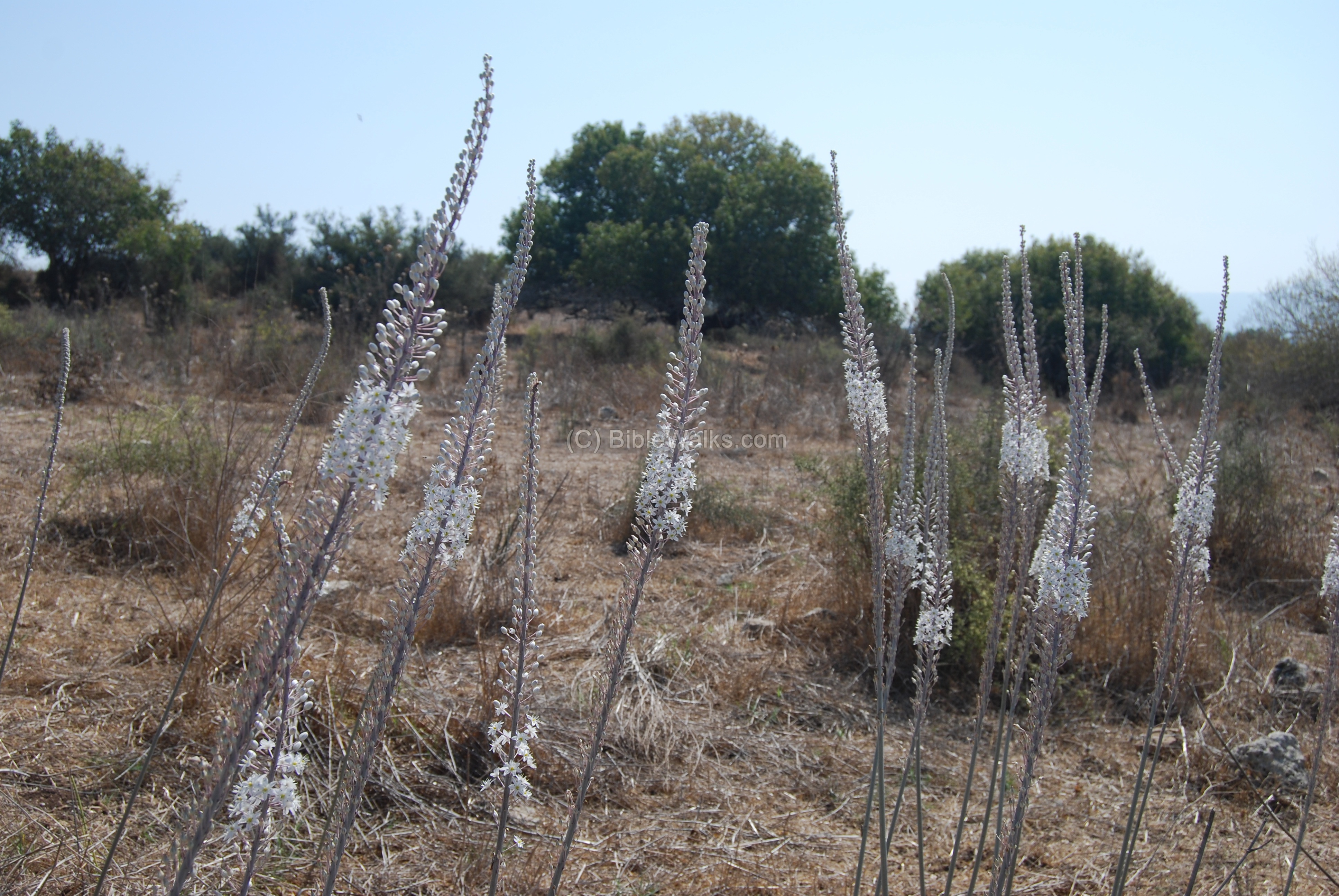
In the village you can notice the Hazav (squill, or: urginea maritima) flowers. They flower at the end of the summer (September/October), signaling the beginning of the Autumn season. Their bulbs were also used to mark the edge of a field or lot, an ancient practice that is widespread in the Holy Land. A legend even held that Joshua used the squill bulbs to mark the borders between the tribes.
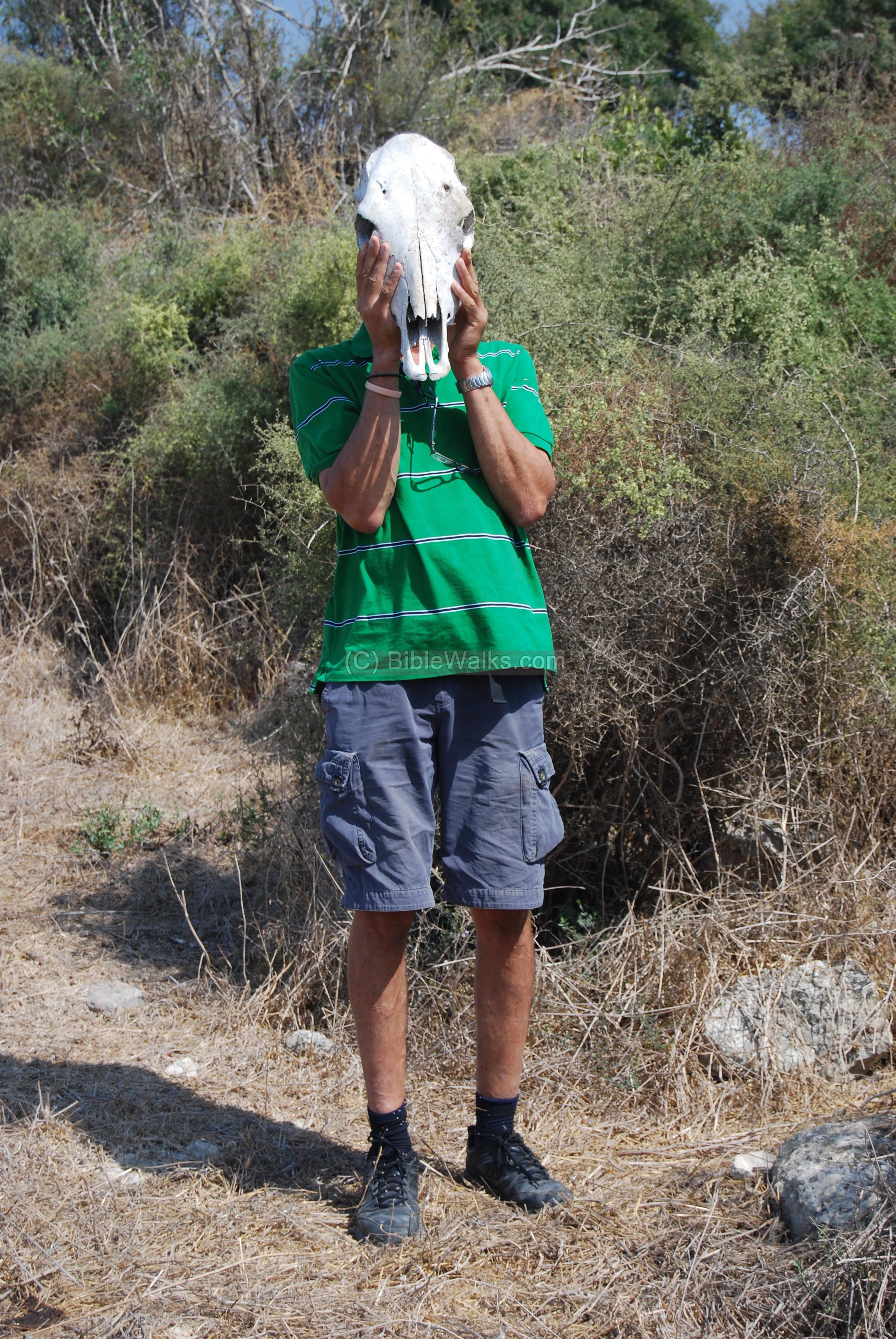
Amnon, the nature protector and the uncle of Webmaster Rotem, could not resist replacing his head with a skull of a cow…
References:
Archaeology:
-
Arch. Survey of Israel – Shefr’am Map (24) – Y. Olami & Z. Gal [1982] , site #74: Khirbet Usha.
See also in related BibleWalks sites:
The Roman road near Usha
The Sabbath stone near Usha
Wine production:
-
Wine & Oil Production in Antiquity in Israel & other Med. Countries [ISBN 1850755191 1998]Frankel, Rafael.
-
See also our wine press information page.
Other:
-
Usha – the first location of the Sanhedrin
-
Hazav – article in Hebrew about ancient references
-
Quadcopter Aerial views – collection of Biblical sites from the air
Etymology (behind the name):
- Usha – the source of the name is not certain, but Encyclopedia Ariel suggests that the name is based on a Hebrew root name “Aoshiah” – which is the base of the walls. There is one place in the Bible that uses this word: Jeremiah 50, 15: “Shout against her round about: she hath given her hand: her foundations are fallen, her walls are thrown down: for it is the vengeance of the LORD: take vengeance upon her; as she hath done, do unto her”.
- Kh. Husheh – name in the Conder/Kitchener map (1881-3)
- Kh. Hoshe – name in the British mandate map (1941)
Note:
-
Kh. – Khirbet, meaning in Arabic: ruin;
-
H – Horvah, meaning in Hebrew: ruin;
BibleWalks.com – walk with us through the sites of the Holy Land
Khirbet Sharta<<<–previous West Galilee site—<<<All Sites>>>—>Roman Road, Usha
This page was last updated on Mar 16, 2023 (new overview)
Sponsored links: