Yizreel was a major Biblical city, located on the ancient trade route, and the northern capital of the Kingdom of Israel. The Bible tells about events around and inside the city.
Home > Sites > Yizreel Valley > Tel Yizreel (Jezreel)
Contents:
Background
Location
History
Photos
* Aerial View
* The Mound
* Zar’in
* Crusaders Church
* Roman Winepress
* Iron Age winepress
* Ain Jalut Monument
* Spring
Biblical
References
Etymology
Background:
Yizreel (Jezreel) was a major Biblical city, and at the 9th Century BC it was the northern capital of the Israel Kingdom. The Bible tells about many events associated with the city: the King’s palace in the city; the battle of the Gilboa when King Saul was killed; the Naboth vineyard and the plot of Jezebel to posses it; the fate of Jezebel and her son.
1 Kings 21:23: “The dogs shall eat Jezebel by the wall of Jezreel”.
The site continued to be inhabited until the establishment of the state of Israel. Excavations in the 1990s found some of the Israelite structures, as well as other periods. Renewed excavations since 2012 continue to explore the history of the ancient city.
Location:
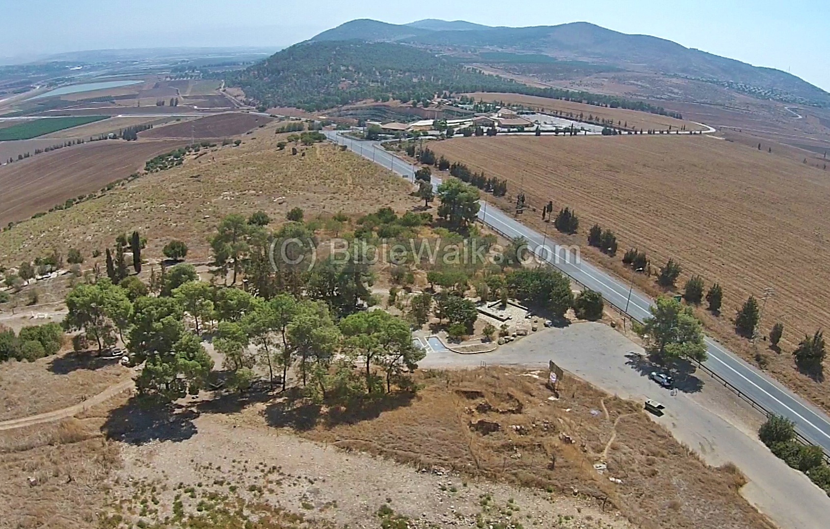
Tel Yizreel (Jezreel) is located on a hill on the western edge of the Gilboa mountain. It is adjacent to the major ancient road from the Galilee to Jerusalem – via Ganim (Jenin). The city was a gateway to the road and hence its importance.
An aerial photo of Yizreel is shown below, indicating the major points of interest. The Tel is seen in the center located on a high hill.
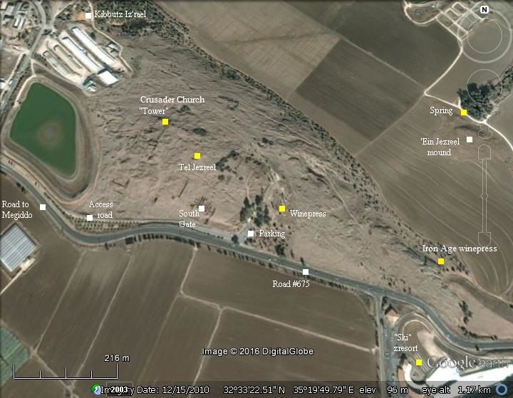
The Tel rises 100m above the Jezreel valley. It is located east to the modern Kibbutz by the same name – Yizreel – on the road from the Yizreel valley to the west (Ta’anach/Megiddo/Afula). A parking lot is located on the south side of the Tel, and can be accessed from a service road that starts at the entrance to the Kibbutz. On the south-east side of the Tel are picnic tables and walking trails. One of the trails leads down to the Yizreel spring, which is also reachable by car from a road closer to the junction of Afula / Beth-Shean.
History:
-
Prehistory
Excavations dated the earlier findings to the Chalcolithic period (about 4,000 BC, Wadi Rabah culture), with findings of flint stone instruments and ceramics. Early Bronze III pottery was collected on the hill, its slopes and on a small mound south of the spring.
-
Biblical times
According to the excavations, the city was inhabited in the Canaanite/Late Bronze period (starting from the 15th Century BC) and Israelite/Iron period. The city belonged to the region of the tribe of Issachar. Its important location on the entrance to the north-south trade route – made the city a gate keeper, just like Megiddo and Yokneam which are located west to here on the other routes to the south.
The archaeological findings from the Iron age include a large enclosure surrounded by a moat, gate with six chambers and large towers. They dated the construction of the compound to 880 BC, during the reign of King Omri and Ahab, the same time the Biblical events happened..
The city was the center of a great battle: The Philistines, based in the southern Sharon area, planned to expand their territory to the Galilee. King Saul tried to block this move and prepared the Israelite armies near the city. He camped in the Yizreel spring on the foothills of the city.
The Philistines, assisted by Saul’s arch enemy (later King) David, set their camp in Shunem (at the foothills of Hamoreh hill, across the valley).
(1 Samuel 29 1): “Now the Philistines gathered together all their armies to Aphek: and the Israelites pitched by a fountain which is in Jezreel”.”.
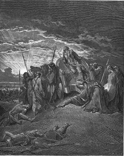
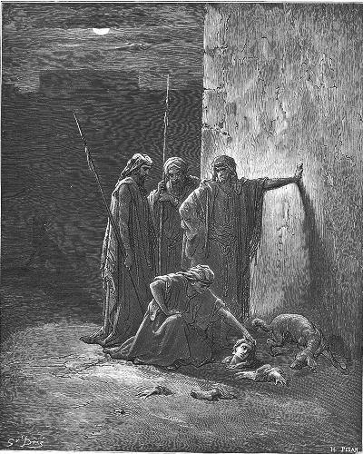
The battle was fought in the valley and the Israelites fled to mount Gilboa, where King Saul died together with his 3 sons in this battle. The victorious Philistines held Yizreel and the cities of the valley of Yizreel.
Death of Saul and his sons -by Gustav Dore (French artist, 1832-1883)
-
House of Saul (10th Century BC)
Yizreel became a regional capital city during the short reign of Saul’s son, Ishnoseth (2 Samuel 2:9):
“And made him king over Gilead, and over the Ashurites, and over Jezreel, and over Ephraim, and over Benjamin, and over all Israel. Ishbosheth Saul’s son was forty years old when he began to reign over Israel, and reigned two years. But the house of Judah followed David”.
- House of Omri (9th Century BC)
Jezreel reached to a higher status after the split of the Kingdoms. It became the northern capital of the Kingdom of Israel, while their other capital city was Samaria (1 Kings 21:1): “in Jezreel… by the palace of Ahab king of Samaria”. The city was protected by high walls and its topographic location gave it a natural defense. The Israeli Kings held a palace here, and it may have been their winter dwelling.
Omri reigned for 12 years (882-869 BC), and was replaced by his son Ahab (1 Kings 16 28-29):
“So Omri slept with his fathers, and was buried in Samaria: and Ahab his son reigned in his stead. And in the thirty and eighth year of Asa king of Judah began Ahab the son of Omri to reign over Israel: and Ahab the son of Omri reigned over Israel in Samaria twenty and two years”.
Ahab, son of Omri, continued his father’s defensive acts against the danger from the north, and also made the Kingdom stronger and prosperous. Evidence of his fortifications and the wealth of his Kingdom can be found in the excavations of the main cities of the Northern Kingdom: Hazor, Jezreel, Megiddo and Rechov (Stratum IV).
Aram-Damascus (Syria) fought 3 wars against the Northern Kingdom. The first intrusion occurred in 855 BC, when the Syrians placed a siege on the capital city of Samaria. (1 Kings 20 1): “And Benhadad the king of Syria gathered all his host together: and there were thirty and two kings with him, and horses, and chariots; and he went up and besieged Samaria, and warred against it”. Ahab defeated the Syrians and saved the city (1 Kings 20 20-21): “And they slew every one his man: and the Syrians fled; and Israel pursued them: and Benhadad the king of Syria escaped on an horse with the horsemen. “.
Ahab continued to fight Aram-Damascus in two more battles, but was killed (850) in the last one in Ramoth-Gilead, and was buried in Samaria (1 Kings 22 35-38):
“And the battle increased that day: and the king was stayed up in his chariot against the Syrians, and died at even: and the blood ran out of the wound into the midst of the chariot. And there went a proclamation throughout the host about the going down of the sun, saying, Every man to his city, and every man to his own country. So the king died, and was brought to Samaria; and they buried the king in Samaria. And one washed the chariot in the pool of Samaria; and the dogs licked up his blood; and they washed his armor; according unto the word of the LORD which he spake”.
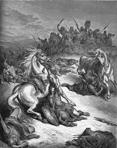
Ahab’s son Yoram (Joram) continued to confront the Syrians, and was wounded in a battle. Jehu, one of Ahab’s generals, ended the house of Omri in a military coup that occurred in Jezreel (842 BC). Jehu killed Ahab’s wife Queen Jezebel, Ahab’s son and heir King Yoram, and the king of Judah who came to visit Yoram in Jezreel.
Fall of King Ahab in Ramoth Gilead
Drawing by Gustav Dore (French artist, 1832-1883)
Aram-Damascus continued their assaults: An intrusion, headed by Hazael in 815-810, captured and enslaved the Northern Kingdom, as per Biblical accounts (2 Kings 8:12, 12:18-19, 13:3+7; Amos 1:3) and (2 Kings 10 32): “In those days the LORD began to cut Israel short: and Hazael smote them in all the coasts of Israel;”. Yizreel was captured and destroyed.
This grip on Israel was released by the Assyrians, who captured Damascus (806 BC), thus weakening Aram-Damascus, but left Israel alone. The city returned to the control of the Northern Kingdom. For the following 74 years, the Northern and Southern Kingdoms of Israel managed to expand their territories and prosper. This expansion also brought friction between the two Kingdoms: in the fields near Beth Shemesh the two Israelite kingdoms clashed at 786 BC. The Northern Kingdom defeated the Kingdom of Judah, and Jerusalem was sacked.
The Northern Kingdom then captured the area of Aram-Damascus, thus expanding their area north of Damascus. These were the golden years of the Northern kingdom. However, the danger was not over, and prophets such as Amos tried to warn against the smugness of the kings (Amos 6 1): “Woe to them that are at ease in Zion, and trust in the mountain of Samaria, which are named chief of the nations, to whom the house of Israel came!”.
-
Assyrian intrusions (8th Century B.C.):
The Assyrian empire conquered Syria and the North of Israel during the reign of the Assyrian king Shalmaneser III. The Assyrian king, named in the Bible as “Shalman”, invaded to Syria and the northern part of Israel in the first Assyrian intrusion (841 BC). This conquest continued in a second intrusion (738 BC) by the great Assyrian king Tiglath-Pileser III.
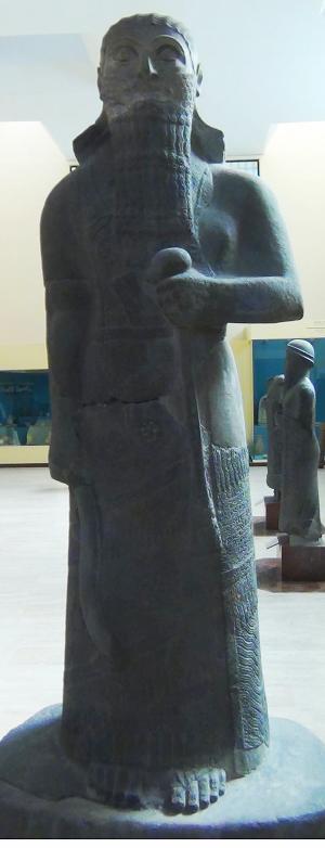
Basalt stele of Shalmaneser III (858-824BC), city of Assur
[Istanbul Archaeological Museum]
Pekah son of Remaliah, the king of the Northern Israelite kingdom, tried to block the Assyrians. He attempted to create a coalition with the Rezin king of Aram-Syria and with the Judean Kingdom. However, King Ahaz (the grandson of Uzziah) refused to join them. Therefore, Pekah tried to replace Ahaz with the son of Tabeal (Isaiah 7 6):
“And it came to pass in the days of Ahaz the son of Jotham, the son of Uzziah, king of Judah, that Rezin the king of Syria, and Pekah the son of Remaliah, king of Israel, went up toward Jerusalem to war against it, but could not prevail against it”.
This attack also encouraged the Adomites and the Philistines to attack Judah (2 Chronicles 28 18). Ahaz was under pressure from all fronts, and therefore called the Assyrians for help, although prophet Isaiah warned against this move (Isaiah 7 4):
“Take heed, and be quiet; fear not, neither be fainthearted for the two tails of these smoking firebrands, for the fierce anger of Rezin with Syria, and of the son of Remaliah”.
The Assyrians quickly came to the help of Judah: In 734 BC was an intrusion to the North of Israel by the Assyrian King Tiglath-Pileser III. The Assyrians first captured the coastal cities until Gaza, subduing the Philistines. At a second intrusion (732) they captured some of the cities of the Northern Israelite Kingdom, including Jezreel (as per 2 Kings 15: 29):
“In the days of Pekah king of Israel came Tiglathpileser king of Assyria, and took Ijon, and Abelbethmaachah, and Janoah, and Kedesh, and Hazor, and Gilead, and Galilee, all the land of Naphtali, and carried them captive to Assyria”.
-
Hellenistic/Roman/Byzantine
The city returned to its glory at the Hellenistic period, and was part of the Hasmonean Kingdom.
The city prospered during the Roman/Byzantine periods, covered the entire area of the hill, and was called Izrella or Stradella.
In Jesus times this was probably the route he took several times, from Galilee to Jerusalem and back via Samaria.
-
Crusaders
During the Crusaders period the site was a small village and called “Parvum Gerinum” or “Le-Petite Gerin”, since Jenin was called “Le-Grand Gerin”. It occupied the north western side. The archaeologists uncovered a church (possibly built during the Byzantine period), and a small tower, which later became the Sheikh’s house during the Ottoman period. It was built on top of a section of the moat.
In 1183 the Crusaders prepared to launch a strike against Saladin and assembled a force. After their defeat the city was deserted.
-
Ottoman Period
An Arab village called Zar’in was established here in 1830 by Ibrahim Pasha by several Egyptian families, and the village was expanded in 1858.
A photo below, captured in the years 1890-1900, shows the “tower” of Jezreel – remains of the Sheikh’s house on the west side of the mound. It may have been built on the ruins of a Crusader structure.
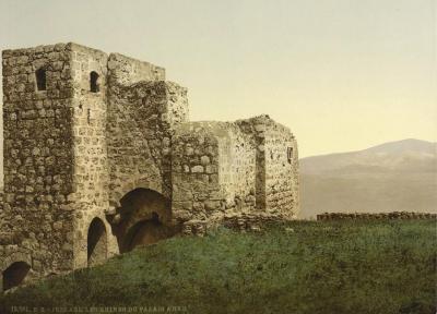
Photos of the Library of Congress, 1890-1900
Conder and Kitchener surveyed this area during the Survey of Western Palestine (SWP) in 1873. A section of the survey’s map, part of Sheet 9, is shown here. Many ancient roads (double dashed lines) pass near the site, indicating its strategic position.
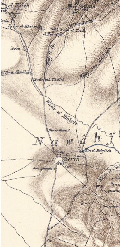
Part of map Sheet 9 of Survey of Western Palestine,
by Conder and Kitchener, 1872-1877.
(Published 1880, reprinted by LifeintheHolyLand.com)
Their report of 1873 in Sheet IX (Volume 2, pages 88-89) described the Arab village and the archaeological findings:
Zer’in – A village of moderate size, built of stone, surrounded by rocky ground and standing on a spur projecting from the Gilboa range. A modern tower or taller house stands in the centre of the village. The position of Zer’in is very remarkable. On the south the ground slopes gently upwards towards the site, and on the west also the place is accessible. On the east occurs a saddle separating the high point on which the town stands from the Gilboa chain, and a road here passes beneath the village. On the north the ground is extremely rugged and falls rapidly, the road ascending from the valley and the neighbourhood of ‘Ain Jalud. The top of the hill is 284 feet above this spring, which is visible beneath. Thus the site is naturally strong, except on the southwest, and conspicuous from the plain. It commands a view down the valley to Beisan and the trans-Jordanic ranges, and on the west to Carmel : on the south to the hills near Jenin ; and on the north, the opposite range of Jebel ed Duhy is visible, with all the villages at its feet. The site is well supplied with water from the ‘Ain el Meiyiteh, which represents probably the ‘Fountain in Jezreel.’ (i Sam. xxix. i.)
A well, called Bir es Suweid, also exists north of the town. The houses stand on a mound of rubbish, and in this a great number of ruined cisterns (Major Wilson estimates them at the high figure of 300) exist among the houses. No very ancient buildings appear to exist at present. The number of the modern houses is, perhaps, 20 or 30 in all. The ancient vineyards of Zer’in appear to have been to the east, where rock-cut wine-presses now exist. (Cf. i Kings xxi. i.)
Zer’in has always been recognised as the ancient Jezreel, which is placed by the Jerusalem Itinerary 12 Roman miles from Scythopolis (Beisan), and by the ‘ Onomasticon ‘ between this place and Legio (el Lejjun).
The Crusaders also recognised it, and in the Middle Ages it was called Stradela, Zarzin, Little Gerin, and Little Gallina (as distinguished from Great Gallina, Jenin)”.
Victor Guerin also visited the site in 1870, and is quoted in the SWP report (pp 130-131):
“‘On our left Mount Gilboa grew gradually lower. Presently we climbed the slopes, partly rocky, of a plateau scarped to east and north, but on the west and south of small elevation and nearly on a level with the surrounding plain. These slopes, like those on the north, are pierced by numerous excavations ; some are ancient tombs and others old quarries ; some of them were for a refuge for the shepherds and their flocks. On arriving at the plateau we proceeded to examine the western side ; on the way I remarked a certain number of ancient cisterns cut in the rock, and some small enclosures crowned by a girdle of cactus. We then passed the village of Zer’in, the miserable remains of Jezreel, which formerly in all probability occupied the whole of the plateau which I have just mentioned. At present it is nothing but a confused heap of poor houses which cover the western part of the plateau on the side by which it slopes by a gentle incline to the plain.
Almost in the middle of the village, on a small hillock, rises a house of square form, like a towerthe residence of the Sheikh. It is very ruinous, like most of the other houses, and appears to be of Arab originbut it may have replaced an older tower. … I put up my tent lower down, west of the village, close to a little shallow birket, not built, but consisting of a simple depression in the soil. Near it I found an ancient sarcophagus of white marble. It was 3 feet 3 inches broad and 7 feet 6 inches long. The four sides were decorated with sculptured ornaments, which have suffered from time and the hand of man. The lid was wanting. – Guerin, ‘Samaria,’ i. 31 1.”.
A 19th Century photo of the Arab village of Zar’in, is seen in the following photo. The “tower” of Jezreel is in its background. Victor Guerin summarized this village as “Zer’in, the miserable remains of Jezreel”.
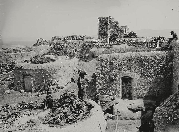
Photos of the Library of Congress; American Colony, Matson collection; photo captured between 1898-1914
-
Modern Times
In April 1948 the village of Zar’in became a base of the Iraqi and Syrian forces of Kaukji, who blocked the roads and shelled the area. It was attacked by the Jewish soldiers of Palmach (“Strike Forces”), but they were forced to retreat. A local monument commemorates their dead. The village was finally captured and destroyed by the Israeli forces a month later, following the declaration of Independence.
In 1948 a Kibbutz was established on the west side of the Tel, and was named after the Biblical city – Yizreel.
First excavations were conducted in 1987-1988, followed by large scale excavations (headed by D. Ussishkin and J. Woodhead, 1990-1996, Tel Aviv University). Renewed excavations since 2012 reveal more of the history of Jezreel.
The site is open to the public, and a great place for a picnic and hiking place.
Photos:
(a) Aerial views
A drone captured these views in September 2015. This view shows the east side of the site, with Mt. Gilboa in the background and the Jezreel valley on the left background. Under the shade of the pine trees, on the east side of the site, is a picnic area and parking place.
Click on the photos to view in higher resolution…
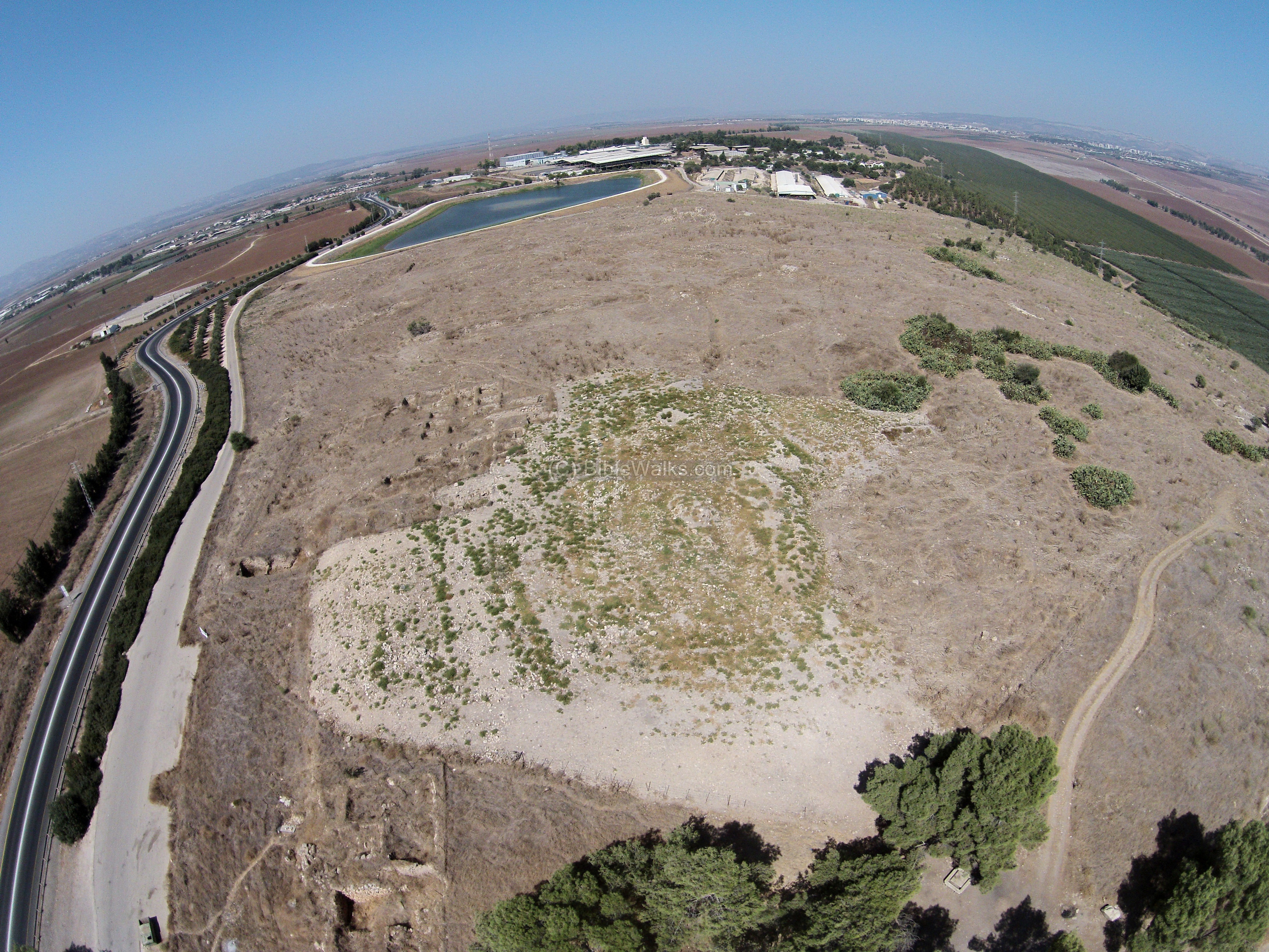
The next aerial view shows the center of the site, with a view towards the west side. To the right is the valley of Jezreel, with the city of Afula in the far background. In the middle background, behind the fish pond, is Kibbutz Yizreel.
- City Plan:
The archaeologist unearthed an Iron age casemate wall (double walls with chambers between them). It surrounded the rectangular compound. The walls are 289m long and 157m wide, covering an area of 45 dunams (4.5 hectares). The wall was built over a layer of rough stones, and above it with mud bricks. The area between the parallel casemate walls was filled with brown-reddish soil.
A rock-cut moat, 8-12m in width and about 6m in depth, was cut into the limestone bedrock on 3 external sides (west, south and east) along a total of 670m. The north side did not require a moat, as the slopes on that side provided a natural defense. Digging the moat was a major construction project, cutting 36,000 cubic meter of rock as per the archaeologist’s estimate.
The moat is seen on the illustration as red lines. Between the moat and the wall is a wide embankment of raised earth, making the crossing of the moat a more difficult task for the attacking forces. At the inner edge of the moat was a supporting wall. The total size of the complex was 332m long by 184m wide, or a total of 61 dunam (6 hectares).
On each of the corners were square towers that extended out of the walled area. Only 2 towers were excavated – on the north and south east. These solid structures, using large hewn stones, were built 6m over the bedrock.
The archaeologists dated the construction of the compound to 880 BC, during the reign of King Omri and Ahab.
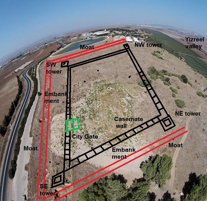
City Gate:
The main and only city gate was on the south side, half way from the center and the south eastern corner tower. It had four (or six) chambers, as seen in the illustration above (in green).
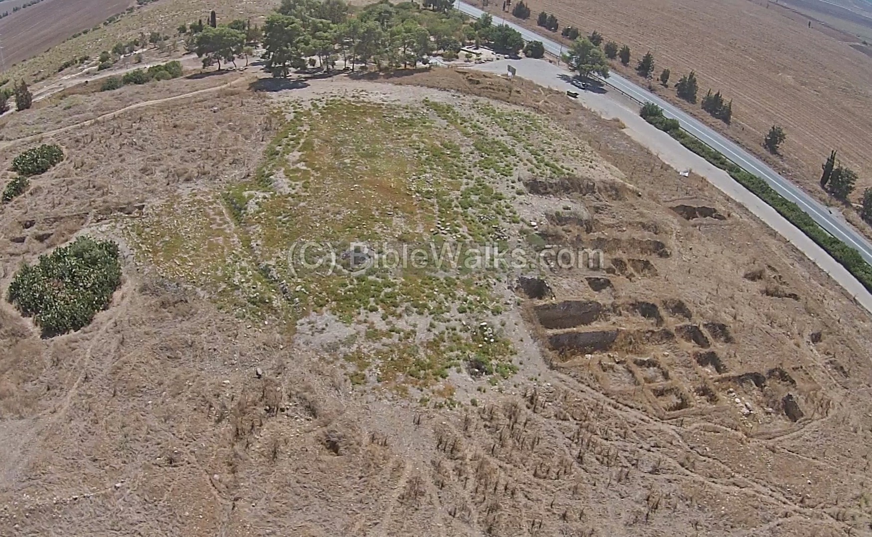
The next view shows the east side of the mound. The trenches of the previous excavations (seasons 1990-1996) are seen on the right, in an area named “A”. On the right (south) side is the area of the city gate.
The area at the entrance to the gate was probably where Jehu displayed the heads of the 70 sons of Ahab (2 Kings 7-8):
“And it came to pass, when the letter came to them, that they took the king’s sons, and slew seventy persons, and put their heads in baskets, and sent him them to Jezreel. And there came a messenger, and told him, saying, They have brought the heads of the king’s sons. And he said, Lay ye them in two heaps at the entering in of the gate until the morning”.
The next aerial view is a view towards the north.
- North-East corner tower:
On the left side of the bottom of the photo are the excavation squares of the north-east corner tower. This tower was probably where the watchman noticed the arrival of Jehu from Ramoth Gilead (2 Kings 9:16-17): “And there stood a watchman on the tower in Jezreel, and he spied the company of Jehu as he came, and said, I see a company…”.
The valley of Jezreel extends to the left towards Afula, and to the right towards Beit Shean. To the north of Tel Jezreel, under the shade of the trees, is the famous Ein Yizreel – the spring of Jezreel.
South of the spring is a small mound – Tel ‘Ein Jezreel. The 2014 excavations (Area “S”) identified a settlement starting from the Early Bronze Age, and was also occupied in the Iron Age, Roman and Crusaders period.
On the foothills, in area “K”, a large Biblical period rock-cut winery, and a Middle Bronze age burial cave. that were excavated in the 2013/2014 season.
Aerial Video:
![]() Fly over the site with this YouTube video:
Fly over the site with this YouTube video:
(b) The Mound
The defense walls of Biblical Jezreel, the winter palace of the Northern Kingdom, were probably impressive. They are described in several places in the Bible:
-
The fate of Jezebel was promised by God (1 Kings 21: 23): “The dogs shall eat Jezebel by the wall of Jezreel“.
-
Jezebel was indeed thrown over the wall (2 Kings 9 35): “So they threw her down: and some of her blood was sprinkled on the wall“.
-
Another text on the fate of Jezebel’s son, Yoram (Joram), is also related to the wall: (2 Kings 9 17: “And there stood a watchman on the tower in Jezreel…”).
Death of Jezebel – by Gustav Dore (French artist, 1832-1883)
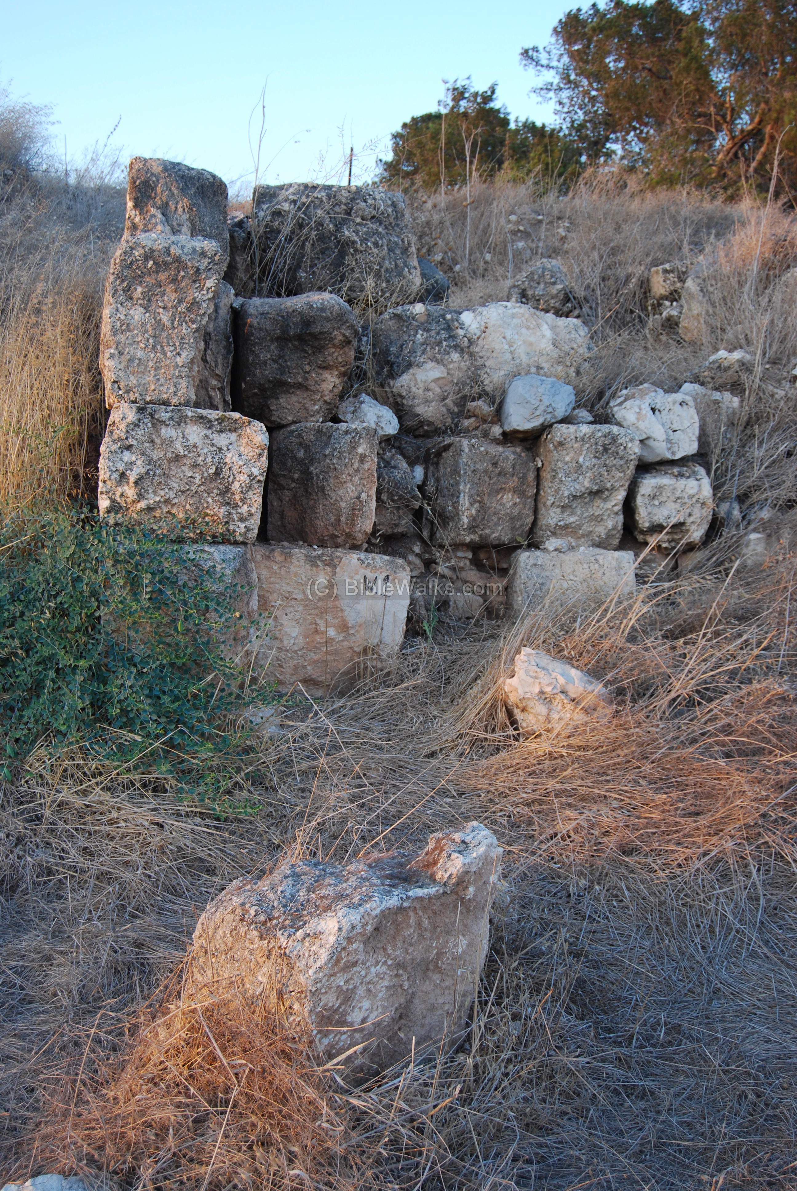
The photo below shows an excavated section of the walls, part of the Israelite city (9th century BC). A tower was unearthed here on the south eastern corner of the compound, one of the four corner towers that were located on the Iron Age fortified compound. The corner towers extended from the line of the wall. These hewn stones were part of the tower’s south-western wall.
There were signs of a limited destruction which may have been caused by Hazael of Aram-Damascus in 830 BC.
(c) Zar’in
On the eastern and northern foothills of the Tel are ruins of the Arab village of Zar’in. The name of the village is based on the ancient Hebrew name.
The following photo shows the ruins of the “tower” on the west side of the Tel. It is the only structure remaining from the Arab village. It may have been built on the ruins of a Crusader tower.
(d) Crusader Church
During the Crusaders period this was a small village and called “Parvum Gerinum” or “Le-Petite Gerin”. On the north west section of Tel Yizreel, between the ruins of Zarin, the archaeologists uncovered the Crusaders Church.
This is a view from the entrance to the Church on the west side. The church has a long hall, 24.3m long, which ends with an apse on its east side.
Another view from the east side is below.
Part of the church was actually built over the remains of the western moat of the Iron age city. This is why the archaeologists dug down under the floor of the church.
(e) Roman/Byzantine Winepress
On the eastern side of the Tel is a large winepress, among other installations and cisterns. The crushing area is a rectangular pit with a mosaic floor, typical of Roman/Byzantine wine presses.
The wine production process was as follows: the grapes would be placed on the floor, and the workers would crush them with their feet. The extracted grape juice would first sit for fermentation together with the squashed grapes. There it passed through a filter and poured into the large pit, which is seen below. Steps lead into the bottom of the pit in order to allow the workers to step down and collect the juice into jars, then store them for subsequent fermentation.
(f) Iron Age winepress
The Bible tells about the vineyard of Naboth in the city of Yizreel (Jezreel), and how Ahab and Jezebel plotted to posses it (1 Kings 21:1): “And it came to pass after these things, that Naboth the Jezreelite had a vineyard, which was in Jezreel, “. A winepress dated to the Biblical period has recently been excavated on the north east end of Tel Yizreel, and may have been used in this famous vineyard.
The winepress was cut into the limestone bedrock. The archaeologists date this installation to the first half of the first millennium BC, during the latter part of the Iron Age. This dating is based on stylistic and technological features which were common in Iron Age winepresses. It continued to be in use until the Roman period. Then, the majority of the winepresses were then built on top of the hill.
Within an area of 12m x 12m the archaeologists revealed the following:
- a treading floor (3.2m x 3.2m), with a roughly hewn triangular depression in its center;
- an attached vat (Vat1 – 1.35m x 1.2m and 1.55m deep);
- another vat was abandoned due to a basalt bolder they encountered inside (Vat 2 – 1.3 x 1.2m and 1.26 deep;
- a deep oval basin (90cm diameter, 1.4m deep)
- and 20 rock-cut depressions (about 20cm rim diameter, 50cm deep).
A 3D model of the winepress was generated and shown below. The major elements of the winepress are illustrated on this photo.
Pressing on the following photo will open a mp4 video player where the model can be viewed from different angles. Use pinch & stretch to magnify the view.
3D model of the Iron Age winepress – scanned by Scaniverse app on iPad Air Dec 2023
(g) Battle of ‘Ain Jalut
The Battle of Ain Jalut, which took place on September 3, 1260, was a significant confrontation between the Mongol Empire and the Mameluke Sultanate of Egypt and Syria. This battle is notable for being one of the few instances where the Mongols faced a decisive defeat.
A Mameluke monument was erected on the northern foothills of Tel Yizreel. It overlooks the Jezreel valley where this decisive battle was held. The structure, behind the palm tree, is now in ruins.
(hi) Spring of Jezreel
The spring is located on the north-east foothills of Tel Yizreel. The waters from the spring are diverted through a water channel, seen below, to a pond. In the summer time this spring might be dry.
This spring is described in the Bible in the context of the battle on the Gilboa (1 Samuel 29:1): “Now the Philistines gathered together all their armies to Aphek: and the Israelites pitched by a fountain which is in Jezreel“. This is a description of the preparation of the Israelites on the eve of the fatal battle with the Philistines and their alley, the future King David. The Israelites, headed by King Saul, pitched their camp near this spring.
The water from the spring fill up a pond, seen below. Eucalyptus trees were planted around the water.
In the center of the pond are foundations of a British-mandate period structure, which used to house a water pump.
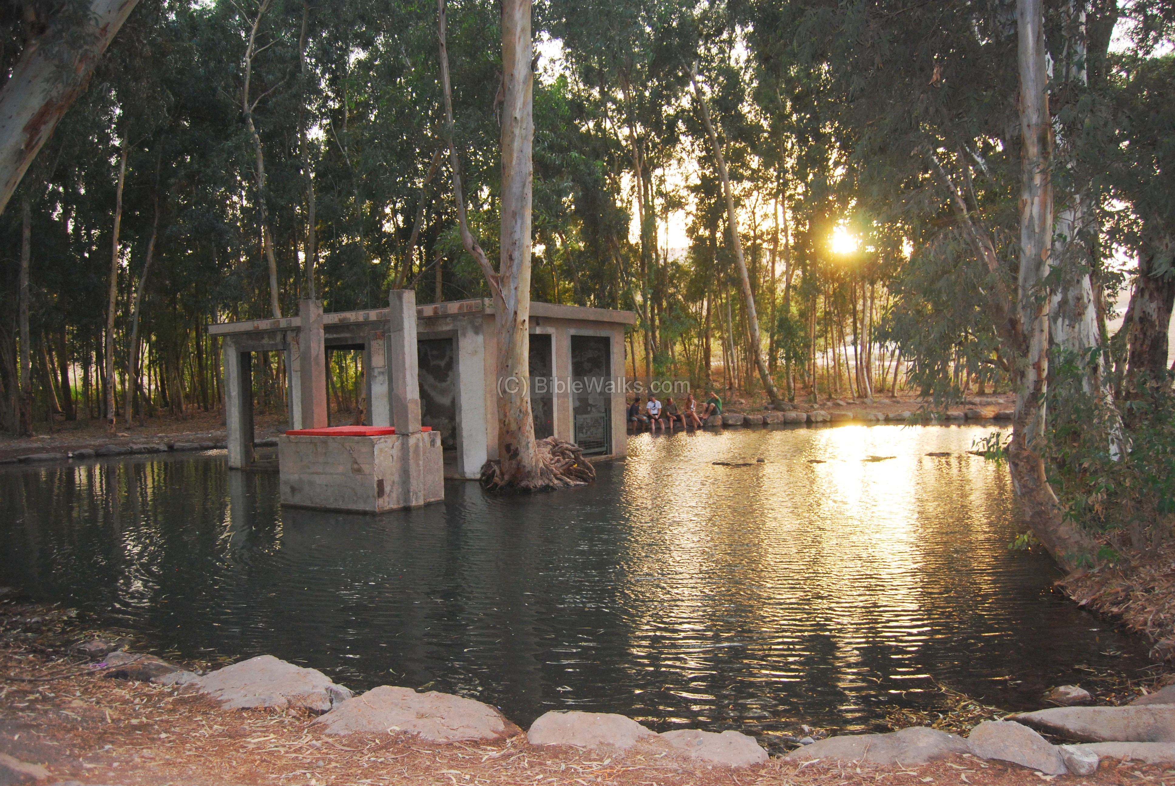
It is recommended to visit the spring, which easily accessed by car. If you look around, you might visualize King Saul and his army bathing in the water, getting ready for the fatal fight against the Philistines. King Saul, the first King of Israel, who suffered a tragic defeat in the battle, indeed deserves your visit.
Biblical References:
(a) Joshua 19: 17,18
This text describes the region of the Tribe of Issachar:
“And the fourth lot came out to Issachar, for the children of Issachar according to their families. And their border was toward Jezreel, and Chesulloth, and Shunem,”
(b) 1 Samuel 29:1
This is a description of the preparation of the Israelites, headed by King Saul, on the eve of the fatal battle with the Philistines and their alley, the future King David. The Israelites pitched their camp near the spring of Jezreel, north to the foothills of the city. Their tactic was to gain the higher grounds due to their inferior weapons, and set their armies on the hills. The battle was fought in the plains and on mount Gilboa on the next day. King Saul died fighting this battle together with his 3 sons.
“Now the Philistines gathered together all their armies to Aphek: and the Israelites pitched by a fountain which is in Jezreel”.
(c) 2 Samuel 2:9
After Saul’s death, his son made the city a regional capitol.
“And made him king over Gilead, and over the Ashurites, and over Jezreel, and over Ephraim, and over Benjamin, and over all Israel. Ishbosheth Saul’s son was forty years old when he began to reign over Israel, and reigned two years. But the house of Judah followed David”.
(d) 1 Kings 18: 45-46
This is the text on Elijah the prophet and the slaughter of the Baal prophets. King Ahab contested the prophet against his false prophets, and Elijah -with the help of the true God – prevailed. At the end of the contest Ahab returns back to the city, which became the winter capital of the Kings of Israel.
“And it came to pass in the mean while, that the heaven was black with clouds and wind, and there was a great rain. And Ahab rode, and went to Jezreel. And the hand of the LORD was on Elijah; and he girded up his loins, and ran before Ahab to the entrance of Jezreel“.
(e) 1 Kings 21: 1; 1 Kings 22: 35-38;
The texts tells the story of the vineyard of Naboth, and how Ahab and Jezebel wanted to buy or exchange it, but Naboth refused.
“And it came to pass after these things, that Naboth the Jezreelite had a vineyard, which was in Jezreel, hard by the palace of Ahab king of Samaria”.
The wicked queen forged a libel about Naboth, who was then stoned to death, and Ahab possessed the vineyard. This angered God, and Elijah the prophet delivered God’s punishment on this cruel plot:
“And thou shalt speak unto him, saying, Thus saith the LORD, Hast thou killed, and also taken possession? And thou shalt speak unto him, saying, Thus saith the LORD, In the place where dogs licked the blood of Naboth shall dogs lick thy blood, even thine”.
Note that the statement “Hast thou killed, and also taken possession?” is one of the strongest moral lines in the Bible.
God punished Ahab 3 years later, who was killed by an arrow in the battle of Ramothgilead, and the prophecy was fulfilled (1 kings 22):
“And the battle increased that day: and the king was stayed up in his chariot against the Syrians, and died at even: and the blood ran out of the wound into the midst of the chariot…..
So the king died, and was brought to Samaria; and they buried the king in Samaria. And one washed the chariot in the pool of Samaria; and the dogs licked up his blood; and they washed his armor; according unto the word of the LORD which he spake”.
Fall of King Ahab and son Yoram – by Gustav Dore (French artist, 1832-1883)
(f) Fall of Jezebel 1 Kings 21 23; 2 Kings 9:10, 30-35
God punished the wicked queen Jezebel, as was promised to Elijah (1 Kings 21 23): “And of Jezebel also spake the LORD, saying, The dogs shall eat Jezebel by the wall of Jezreel”. And another text: “And the dogs shall eat Jezebel in the portion of Jezreel, and there shall be none to bury her”.
The fall of Jezebel is detailed in the end of this chapter, when Jehu orders to push her over the wall of Jezreel. He later finds the remains of Jezebel (2 Kings 9 30-35):
“And when Jehu was come to Jezreel, Jezebel heard of it; and she painted her face, and tired her head, and looked out at a window. And as Jehu entered in at the gate, she said, Had Zimri peace, who slew his master? And he lifted up his face to the window, and said, Who is on my side? who? And there looked out to him two or three eunuchs. And he said, Throw her down. So they threw her down: and some of her blood was sprinkled on the wall, and on the horses: and he trode her under foot. And when he was come in, he did eat and drink, and said, Go, see now this cursed woman, and bury her: for she is a king’s daughter. And they went to bury her: but they found no more of her than the skull, and the feet, and the palms of her hands. Wherefore they came again, and told him. And he said, This is the word of the LORD, which he spake by his servant Elijah the Tishbite, saying, In the portion of Jezreel shall dogs eat the flesh of Jezebel: And the carcass of Jezebel shall be as dung upon the face of the field in the portion of Jezreel; so that they shall not say, This is Jezebel”.
Jehu finds remains of Jezebel – by Gustav Dore (French artist, 1832-1883)
(g) 2 Kings 8:29 9:15 9: 16-24
King Yoram (Joram), son of Ahab, stayed in the palace in Jezreel, recuperating from his wounds:
“And he went with Joram the son of Ahab to the war against Hazael king of Syria in Ramothgilead; and the Syrians wounded Joram. And king Joram went back to be healed in Jezreel of the wounds which the Syrians had given him at Ramah, when he fought against Hazael king of Syria. And Ahaziah the son of Jehoram king of Judah went down to see Joram the son of Ahab in Jezreel, because he was sick”.
Jehu conspired against King Joram and killed him outside of the city. The text talks about the watchman on the tower of the city.
“But king Joram was returned to be healed in Jezreel of the wounds which the Syrians had given him, when he fought with Hazael king of Syria.) And Jehu said, If it be your minds, then let none go forth nor escape out of the city to go to tell it in Jezreel. So Jehu rode in a chariot, and went to Jezreel; for Joram lay there. And Ahaziah king of Judah was come down to see Joram. And there stood a watchman on the tower in Jezreel, and he spied the company of Jehu as he came, and said, I see a company. And Joram said, Take an horseman, and send to meet them, and let him say, Is it peace? So there went one on horseback to meet him, and said, Thus saith the king, Is it peace? And Jehu said, What hast thou to do with peace? turn thee behind me. And the watchman told, saying, The messenger came to them, but he cometh not again. Then he sent out a second on horseback, which came to them, and said, Thus saith the king, Is it peace? And Jehu answered, What hast thou to do with peace? turn thee behind me. And the watchman told, saying, He came even unto them, and cometh not again: and the driving is like the driving of Jehu the son of Nimshi; for he driveth furiously. And Joram said, Make ready. And his chariot was made ready. And Joram king of Israel and Ahaziah king of Judah went out, each in his chariot, and they went out against Jehu, and met him in the portion of Naboth the Jezreelite. And it came to pass, when Joram saw Jehu, that he said, Is it peace, Jehu? And he answered, What peace, so long as the whoredoms of thy mother Jezebel and her witchcrafts are so many? And Joram turned his hands, and fled, and said to Ahaziah, There is treachery, O Ahaziah. And Jehu drew a bow with his full strength, and smote Jehoram between his arms, and the arrow went out at his heart, and he sunk down in his chariot”.
Links:
* External:
-
- Tel Yizreel excavations (Tel Aviv University)
- Jezreel Expedition home page
- Conservation project
- Wine & Oil Production in Antiquity in Israel & other Med. Countries [ISBN 1850755191 1998] Frankel, Rafael.
- Excavation report (2007) – a testing dig on the eastern side (Hebrew)
- An ancient winery at Jezreel – JEMAH, Vol 8, No 1, 2020 pp 6-25 (N. Franklin et al.)
- Biblical pictures by Gustave Doré (1832-1883) – public domain
* Internal:
- Winepresses – BibleWalks info page
- Harod Spring – more on the battle of “ain Jalut
Etymology (behind the name):
- Yizreel (Jezreel) – from Hebrew; Izra-El, God (=El) will plant seed (=Izra).
- Zar’in – the name of the ruined Arab village in Yizreel, which preserved the ancient name.
- Elijah – In Hebrew: Eliyahu. Means in Hebrew: Eli (my God) + Yahu (the Lord, the Hebrew God). Thus the name means “The Lord is my God”. Elijah came from a place called Tishbi, in the region of Gilad – east to the Jordan river. Biblical reference: 1 Kings 17:1: “And Elijah the Tishbite, who was of the inhabitants of Gilead, said unto Ahab, As the LORD God of Israel liveth, before whom I stand, there shall not be dew nor rain these years, but according to my word”.
- Ahab – In Hebrew: Ach is brother and Av is father. The name means: “my father (God) is my brother”. Ahab was one of the great Kings of Israel.
- Joram – There were two Israelite Kings with this name. The source of the name in Hebrew is Yoram, which means: Yo (God) + Ram (tall). Thus the name means “God is tall”. Another form is Jehoram, meaning the same.
- Jezebel – the daughter of the king of Sidon, and Ahab’s wife. In Hebrew: I’zevel. The source of the name is Phoenician, meaning “I-” is brother or father, and “Zevel” is leader. In Hebrew “Zevel” is also garbage, filth – and there may have been a reason for using this form, since the Bible treats her as a wicked queen.
See also an article on the interpretation of names in the story of Ahab and Elijah (in Hebrew).
BibleWalks.com – armchair tours of the Bible places
Bethlehem Galilee <<<—previous Jezreel site—<<< All Sites>>>—next site—->>> Beit Alpha
This page was last updated on Jan 7, 2024 (updated text)
Sponsored links: