Ruins of a multi-period city, located at a junction of major ancient crossroads in the Jezreel valley.
![]()
Home > Sites > Yizreel Valley > Shimron (Simon, Shimon)
Contents:
Background
Location
History
Photos
* Aerial Views
* South-East
* South view
* South Gate
* North-West
* North Gate
* Top Panorama
* Preparations
* Excavations
Etymology
Links
Nearby sites
Background:
Tel Shimron, a hill near the Nahallal junction, is an ancient site with thousands of years of history. A major fortified Biblical city was located on and around the hill.
Joshua 12: 1, 20: “Now these are the kings of the land, whom the children of Israel smote, and possessed their land… the king of Shimron-meron, one;”
The main periods of settlement were the Early and Bronze period, and the second Temple period. Excavations on the site are conducted since 2017.
In an adjacent cemetery are several famous graves (such as General Moshe Dayan and Astronaut Ilan Ramon).
Location:
An aerial map of Shimron is shown below, indicating the major points of interest.
The height of the top of the hill is 185M, 85M above the Yizrael (Jezreel) valley around it. The area of the entire site is large – about 150 Dunam (15 hectares). The site can be divided into two major sections – a lower city on the west side, and an upper city on the eastern edge.
Near the Tel there are 5 sources of waters (springs and wells) which was an important factor for the growth of the city in ancient times.
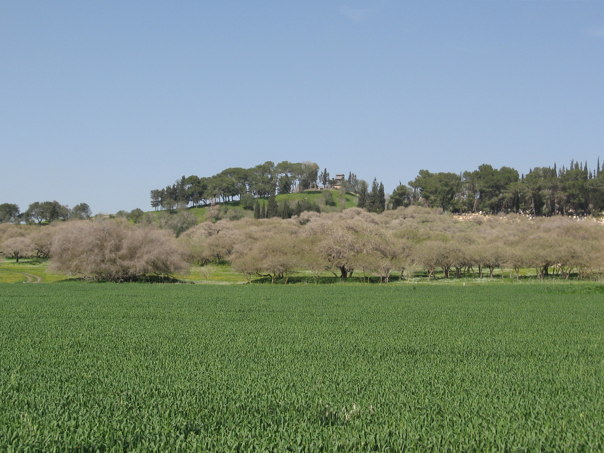
On the south side of the hill is a nature reserve. On this side, and along sections of the western foothills, are unique layers and deposits of basalt stone.
![]()
History:
-
Early Bronze (3150-2200 BC)
According to the Archaeological survey, Tel Shimron area was first inhabited in the Chalcolithic period (4,500-3150BC). The city continued to be populated and fortified in the Early Bronze period (3150-2200 BC). It was centered on the upper city and on the south-western side.
- Middle Bronze periods (2200-1550 BC)
The city reached a peak in the Middle Bronze (Caananite) period (2200-1550BC). It covered the majority of the hill and the acropolis, with a massive area of 400 dunams (40 Hectares) – the largest city in the Jezreel valley at that time. Sections of the Middle Bronze wide peripheral walls, made of sun dried mud bricks, were unearthed in recent excavations on the acropolis, with an area of 7 dunams. Recent (2023) excavations unearthed a section of the tower and an arched corridor that led down into the city. The monumental tower raised the height of the hill by 5m.
References to the Canaanite city were found in an Egyptian source. The 19th century BC (12th Dynasty) enemy-curse (execration) clay tablets list it as “Shim’on”. It was one of the 64 places listed in the second group of tablets, which were aimed to bring disasters to the enemies of the Pharaohs. These inscriptions appear on small figures in the form of prisoners.
- Late Bronze period – 1550- 1200BC
In the late Bronze period the city expanded on the top. The top of the hill was built with a double Acropolis (one top above another top). A steep glacis was built around the top of the hill to protect it. Three wide levels were built around the top, with steep walls between the levels, which in some cases reached 20M height.
Shimron was an important city in this period: It was mentioned in Amarna letters as “Shimron”. This 14th century BC Egyptian archive of 350 small clay tablets was discovered in 1888 in the capital city of Akhet-Aten (“Horizon of the Sun”), 312km south of Cairo. The archive has two letters from the Governor of the city, Shemu-Ada, which addresses the Egyptian Pharaoh.
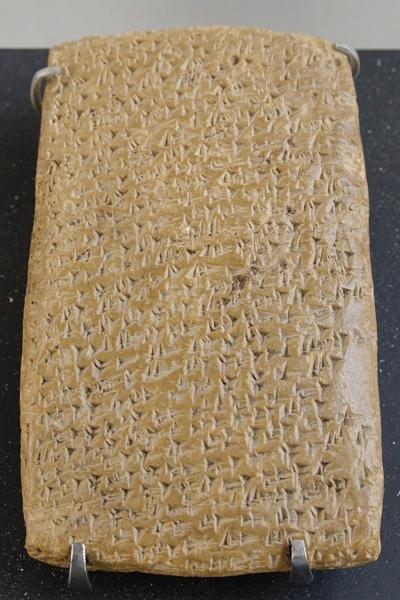
One of the Tell Amarna letters (Louvre Museum, Public domain CC 2.5)
Cuneiform writing on a clay tablet.
A Biblical map shows the position of the city in the center of the Jezreel valley (marked by a yellow circle). The site is located near ancient crossroads, which gave the city a strategic importance during the ancient times.
![]()
Map of the area around Shimron -From Canaanite/Israelite periods to the Roman period – 15 century BC through 3 century AD (based on Bible Mapper 3.0)
-
Israelites
The Bible tells that the city was a part of the Northern coalition of Kings who attempted to block the Israelites, headed by Joshua (Joshua 11: 1):
“And it came to pass, when Jabin king of Hazor heard thereof, that he sent to Jobab king of Madon, and to the king of Shimron, and to the king of Achshaph,… And all these kings met together, and they came and pitched together at the waters of Merom, to fight with Israel”.
However, the Canaanite coalition was defeated by the Israelite armies (Joshua 12: 1,20):
“Now these are the kings of the land, whom the children of Israel smote, and possessed their land…the king of Shimron-meron, one; the king of Achshaph, one”.
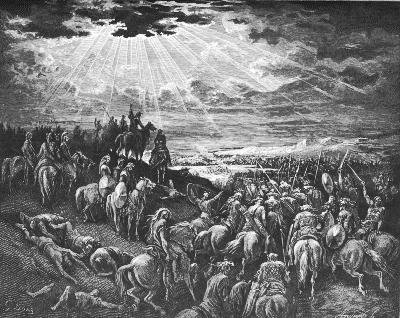
Joshua in another battle against the Canaanites
Drawing by Gustav Dore (French artist, 1832-1883)
Shimron, as an Israelite city, became one of Zebulon tribe cities (Joshua 19: 15):
“And the border turned about it on the north to Hannathon; and the goings out thereof were at the valley of Iphtahel; and Kattath, and Nahalal, and Shimron, and Idalah, and Beth-lehem; twelve cities with their villages. This is the inheritance of the children of Zebulun according to their families, these cities with their villages”.
-
Iron Age (1200-586 BC)
According to the survey, Shimron continued to be a major city during the Iron Age. Only few remains of this period were found in previous excavations, but recent excavations (2022-23) explored the Iron Age layers deep under the Roman layer in the center of the lower city. These excavations unearthed administration structures, an industrial structure and a part of a silo.
Continued excavations will reveal more about this period.
- Assyrian conquest
In 732 BC was an intrusion to the North of Israel by the Assyrian King Tiglath-Pileser III, who annexed the area (as per 2 Kings 15: 29): “In the days of Pekah king of Israel came Tiglathpileser king of Assyria, and took … Galilee…and carried them captive to Assyria”. This intrusion affected the north of the Kingdom.
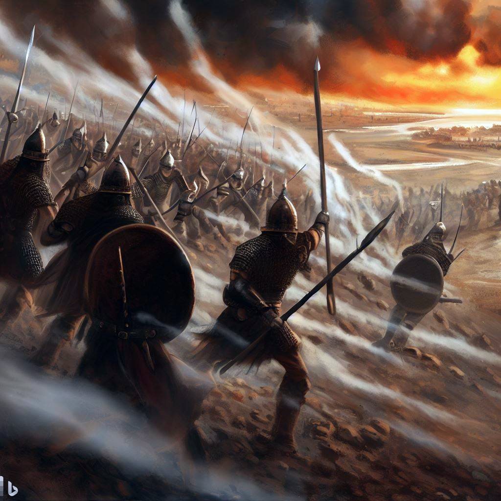
Assyrian forces attacking – AI generated by Bing
Following the death of Tiglath-Pileser, the Egyptians encouraged the people in the occupied territories of the Assyrians to revolt. Hoshea, King of Northern Israel, joined this mutiny, but made a fatal mistake. This time the Assyrians crushed the remaining territories of the Northern Kingdom. The intrusions of Shalmaneser V and Sargon II in 724-712 ended the Northern Kingdom (2 Kings 17: 5-6):
“Then the king of Assyria came up throughout all the land, and went up to Samaria, and besieged it three years. In the ninth year of Hoshea the king of Assyria took Samaria, and carried Israel away into Assyria, and placed them in Halah and in Habor by the river of Gozan, and in the cities of the Medes”.
The villages in the Galilee and Samaria were destroyed or abandoned, including this site. A burnt layer in one of the Iron age structures was unearthed in 2023 in the center of the lower hill. It was dated to the mid 8th century – probably due to the Assyrian conquest.
-
Persian, Hellenistic, Roman periods (5th century BC-4th century AD)
During the Second temple period the Jewish town was called Simonia. The Jerusalem Talmud, a 3rd century AD compilation of Rabbinic notes on the Mishna, explained that the old name ‘Shimron’ changed at those times to Simonia (Megila page 2 , 2 1:1, Hebrew): “And Shimron – Simonia”.
The town was spread over the hills around the Biblical Tel. The foundations of Simonia can be seen all over the area, including caves, cisterns, wine and oil presses, and quarrying sites.
The village flourished from its commercially strategic location. A major road, paved by the Romans from Sepphoris to Legio (Roman Megiddo), passed on the western foothills – where the modern road to Zarzir exists today.
The Historian Josephus Flavius (ex Commander of the Jewish Revolt ) describes his acts during the preparations to the revolt (66-67AD). He tells us that one of his permanent headquarters was Simonias (Shimron), and he conducted battles against the Romans in Gibea (Geva) (Life:24):
“Now king Agrippa sent an army to make themselves masters of the citadel of Gamala, and over it Equieulus Modius; but the forces that were sent were not allow to encompass the citadel quite round, but lay before it in the open places, and besieged it. But when Ebutius the decurion, who was intrusted with the government of the great plain, heard that I was at Simonias, a village situated in the confines of Galilee, and was distant from him sixty furlongs, he took a hundred horsemen that were with him by night, and a certain number of footmen, about two hundred, and brought the inhabitants of the city Gibea along with him as auxiliaries, and marched in the night, and came to the village where I abode. Upon this I pitched my camp over against him, which had a great number of forces in it: but Ebutius tried to draw us down into the plain, as greatly depending upon his horsemen; but we would not come down; for when I was satisfied of the advantage that his horse would have if we came down into the plain, while we were all footmen, I resolved to join battle with the enemy where I was. Now Ebutius and his party made a courageous opposition for some time; but when he saw that his horse were useless to him in that place, he retired back to the city Gibea, having lost three of his men in the fight. …”
The village was apparently not damaged during this revolt.
Sections of building in the form of a basilica (synagogue?) were reported in 1933 on the south-western side. “Remains of columns standing in four rows and a lintel and basin”. Prof. Sukenik was permitted to excavate the site, but it is not clear whether the structure was excavated.
Recent excavations (2017 thru 2021) unearthed structures of the village on the western foothills, above the Simonia spring. A Roman period ritual bath (miqveh) was unearthed in one of the residential houses.
- Byzantine period (5th-7th century)
The Roman village was destroyed at the end of the 4th century AD, either due to the Gallus revolt (351-352) or following the massive 363 earthquake.
The settlement continued during the Byzantine period, centered on the north west foothills. It was abandoned at the end of this period.
- Mameluke period 1250 (AD – 1517 AD):
A Mameluke period farming village was established on the western foothills, at a level higher than the Roman period village. Tombs were unearthed on the top of the hill.
- Ottoman period:
Until the beginning of the 20th century was a small Arab village was located at the site, on the basalt hill south east side of the mound. Its name, Semunieh, preserved the ancient name. A group of German Templars settled in Semunieh in the second half of the 19th century, but abandoned it.
The area of was examined in the Palestine Exploration Foundation (PEF) survey (1866-1877) by Wilson, Conder and Kitchener.
The map is a section of their survey results. Notice the double-dashed line that passes near the Arab village of Semunieh, which was one of the main roads to Nazareth.
![]()
Part of map sheet 5 of Survey of Western Palestine,
by Conder and Kitchener, 1872-1877.
(Published 1880, reprinted by LifeintheHolyLand.com)
The site is briefly described in their report (Vol 1, Sheet V, page 355):
“In 1867 a colony of about twelve Germans established itself at Semunieh, and endeavored to cultivate the plain, living in huts. They all fell ill, and died of fever”.
-
Modern periods
In 1921 Jewish settlers came to the nearby foothills in order to establish a new settlement. Shortly after they managed to dry out the marshlands with the deadly mosquitoes, the settlers relocated to the valley 2Km south of Shimron, where the modern Moshav of Nahalal is located today. A cemetery on the south east side of the summit is still in use by the Nahalal residents, with famous people buried here such as the late General Moshe Dayan and Astronaut Ilan Ramon.
After the independence of Israel dozens of temporary houses were erected on the west side, and their cement platforms are still visible there on the western slopes. The immigrants then relocated to a nearby new city, Migdal-Haemek.
Nearby, on the north-east side, a new community settlement of Timrat has been established in the 1981.
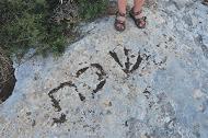
In July 2011 BibleWalks helped to discover a Roman period marking in Hebrew, with the letters “Sha-ba-t”. It is located nearby in Timrat, within the range permitted for walking on a Sabbath. This was the first ancient Sabbath marking found in Hebrew in the Galilee.
New archaeological excavations started in 2016 with a thorough survey. The first dig started on June 2017 and is planned for 15 years. Many exciting findings will no doubt surface…
Photos:
(a) Aerial Views:
A drone captured this photo from the south side. The ancient city occupied the entire hill, while the “upper city” was located on the summit – here on the upper right. The western side of Timrat are just behind the upper right side.
The white rectangles on the hillside are the foundations of the abandoned immigrant camp (Ma’abara). Its temporary residents were relocated in 1954 to the city of Migdal Haemek.
Click on the photo to view it in higher resolution…
![]()
Date of Photo: July 2021
![]() The following YouTube video shows a flight of a drone over the site, making a full turn around Tel Shimron, starting from the south west side and turning clockwise. The video was captured on August 2, 2021.
The following YouTube video shows a flight of a drone over the site, making a full turn around Tel Shimron, starting from the south west side and turning clockwise. The video was captured on August 2, 2021.
(b) South-East side:
The following photo the view from the south, on the road to Nazareth. On the top of the steep hill, on the right side, there is an observation tower. This is the acropolis of the city. The 2 lower levels of the city are seen in the center and on the left.
The views of the trees (white Acacia) in the foreground are unique and rare in this area and look like African prairie lands. On the western slopes, at the left, lies the ancient city. The cemetery is in the hidden right side, and the public access road passes from that side. You can drive up to the parking lot behind the cemetery.
![]()
Another view from the south, during the winter time. The ruins of the upper city is seen in the center where the modern tower is located. The modern cemetery of Nahalal is seen on the right side.
(c) South Side:
The following photo shows the Tel from the south-west side, from Nahallal junction. On this side there is an extension of the city on the slopes of the hill. The Bronze-age city was built with 3 levels: the acropolis (the top), the upper city (below the top), and the lower city (beyond the left side).
In the left side of the front trees was the south entrance to the city, which led to the lower city. The city also had a second gate, on the north side of the hill.
On the right side is the cemetery and the community settlement of Timrat.
![]()
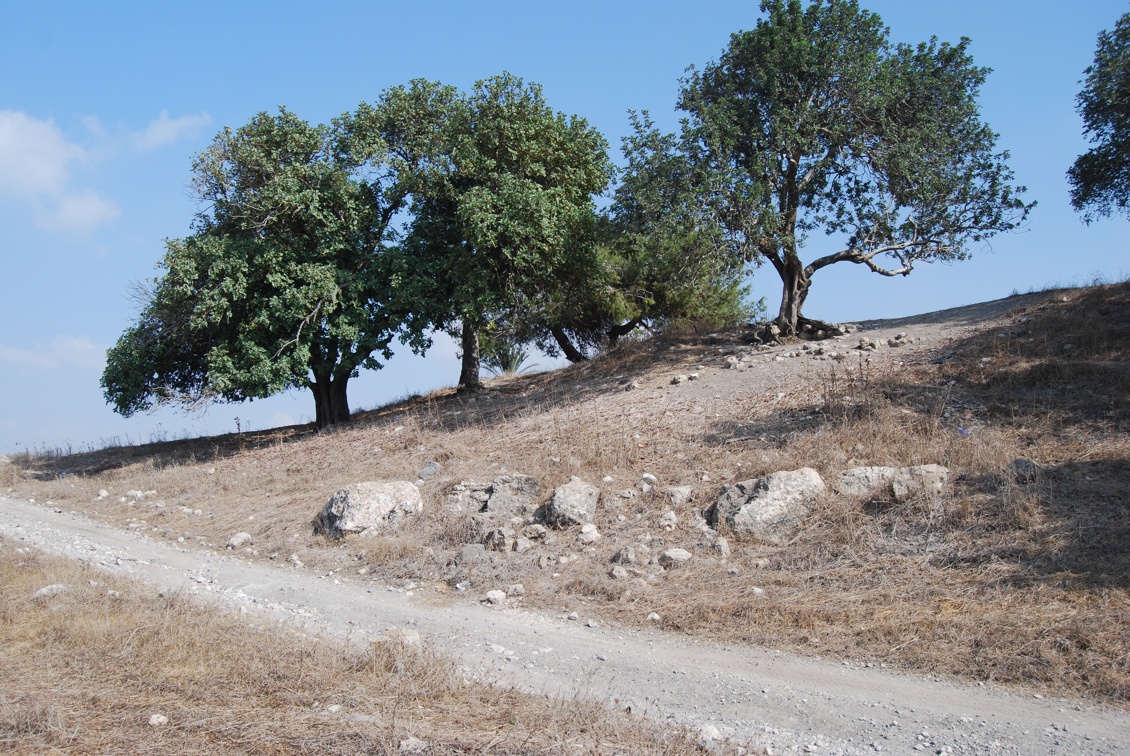
(d) South Gate:
A closer detail of the ruins of the south gate is seen below, where the modern dirt road follows the path of the ancient gate. According to the survey, the length of the gate was 20M and its width was 6M, and it was based on columns on both sides. The large rough stones, seen in the photo, are part of the right wing of the gate which lies on the base of the high walls behind it, before the trees . The left wing of the gate was located along the bottom of the photo and is missing – it collapsed and fell down the slopes. Below it was a high wall that supported the south side of the entrance road.
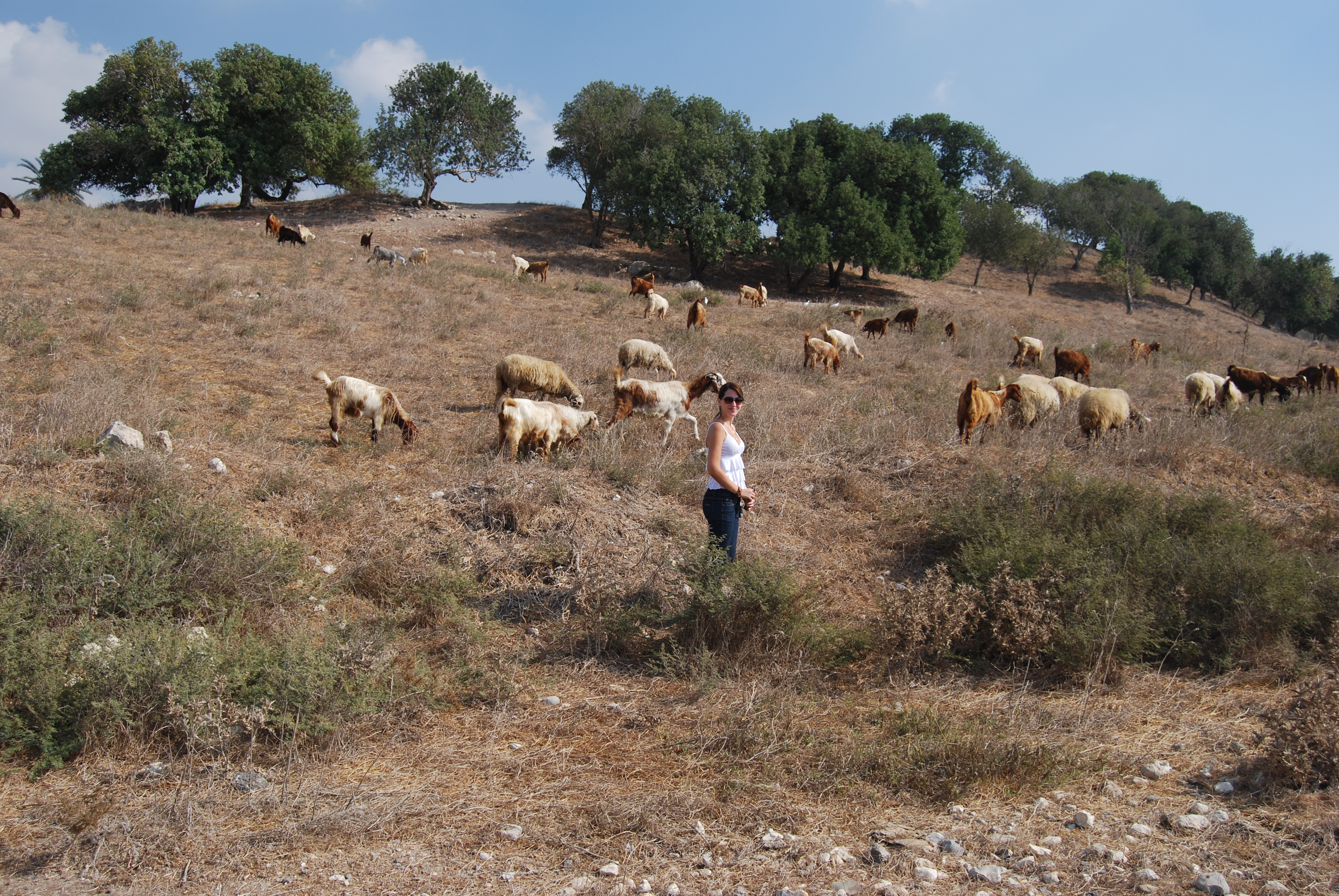
Khaled, the local Arab shepherd, is seen in the photo below with the herd of goats grazing along the hillside, below the place of the south gate – which is seen on the top right side. The top left side is the location of the Bronze-age lower city.
![]()
Webmaster Rotem makes friends with the goats. The entire view of the south entrance behind her. The ancient road went up the hill from right to left, just below the tree line..
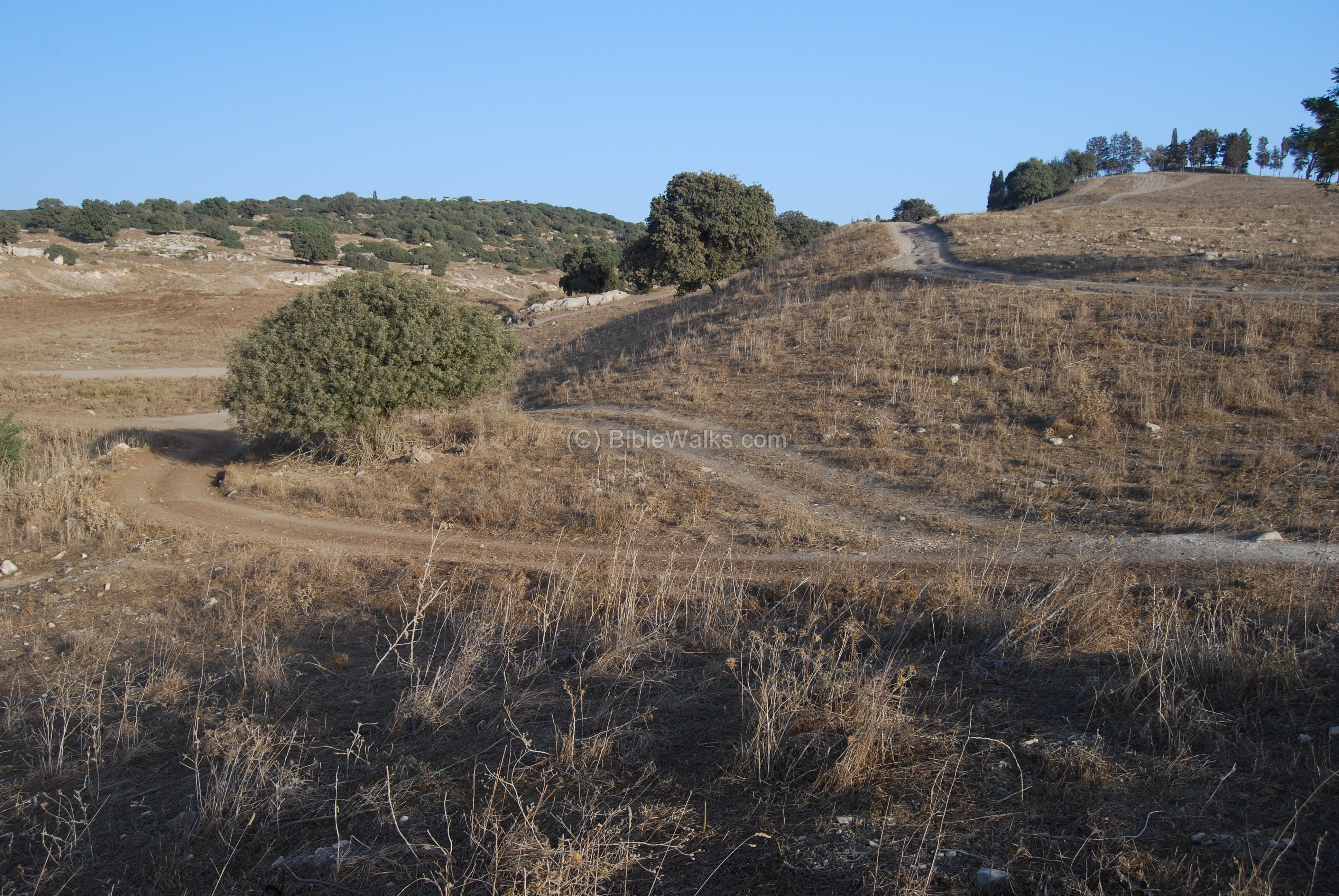
(e) North-West side:
Another photo from the north-west, from the lower city. The top of the hill, above the “upper” city, is seen in the top center. The lower city is located on the right side.
From this photo you can realize the large size of the site.
![]()
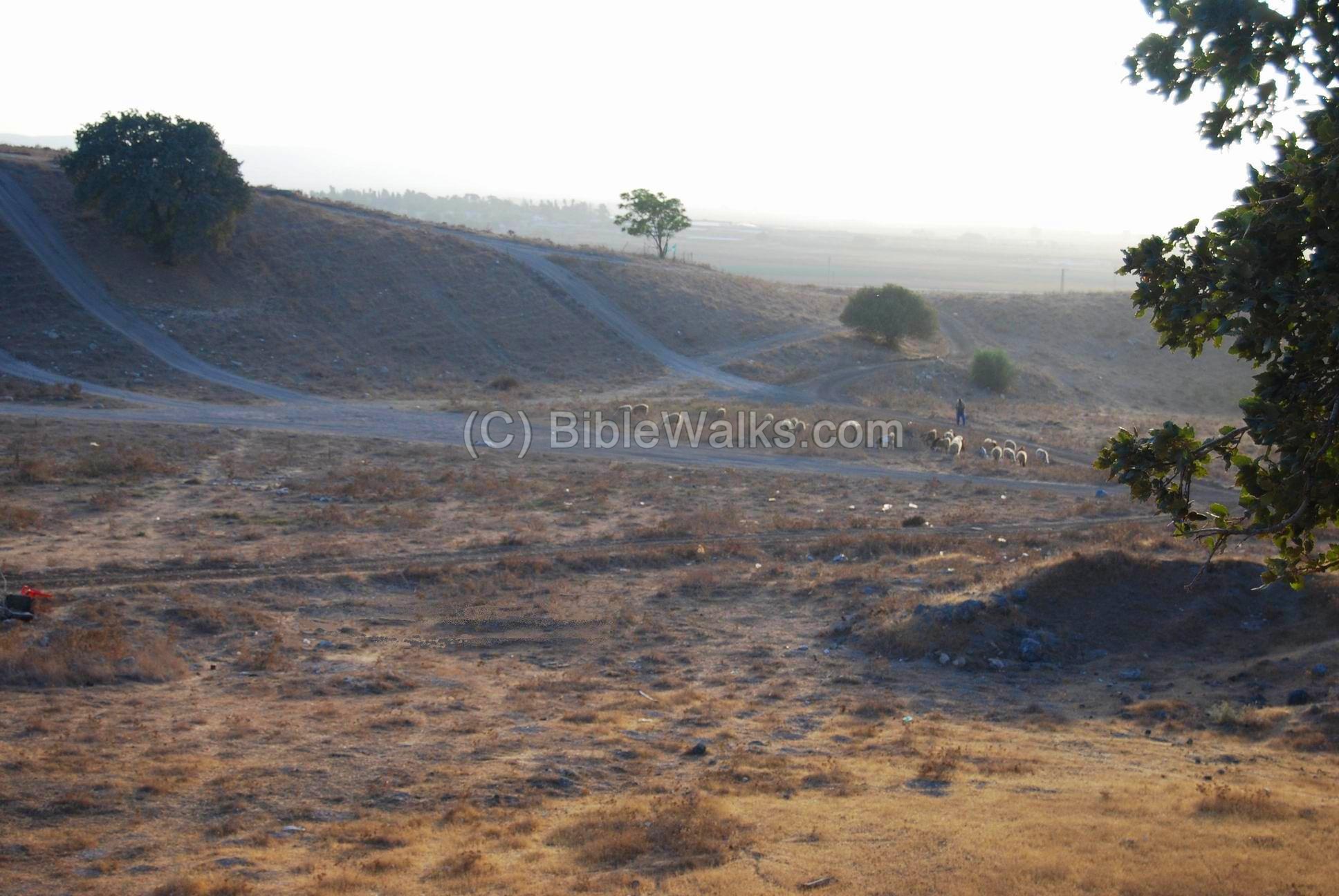
(f) North Gate:
The photo below shows the place of the north gate. The ancient entrance turned around at this point (from left to right, and up to the upper city on the right). This configuration is similar to the gate on the south side, and allowed the defenders to control the gate from the top.
Another view of the north gate, taken from the north side. A shepherd (not the same from the south gate) is seen with a herd of goats . According to the shepherd, the small tree on top of the north gate, marked by green flags, is the place of the Arab cemetery and the tomb of a sheik.
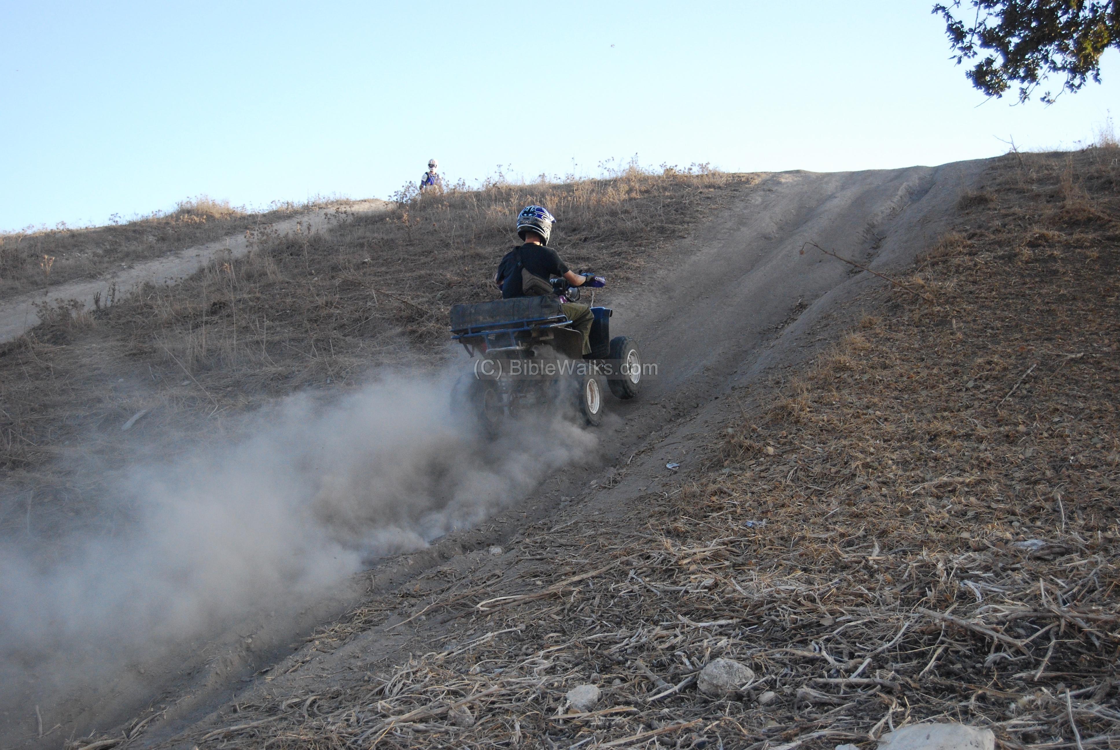
Also notice the traces of the motor bikes and all-terrain vehicles (ATVs), which enjoy the steep hillside which used to be the ancient north walls of the city.
The photo below shows the biker shooting up his ATV up the northern walls. His friend, with a motor bike, is waiting on the top. You can also visit our extreme sports page for more photos at Biblical sites.
(g) Top view – Panorama:
On top of the hill was an observation tower, built of a base of a bunker. It offered great views of the area around Tel Shimron.
![]()
The wooden section was dismantled, as captured in 2018 in the photo below. The new excavations cleared out this area in order to excavated the Bronze period city.
![]()
(h) Excavation preparations (2016):
A new excavation project started in 2016 with a complete survey of the site. The team is headed by Dr. Daniel M. Master and Dr. Mario Martin, and assisted by other professionals and volunteers.
The first season included the use of ground penetrating radar to map the underground structures. A ceramics survey of all surfaces provided a map of the historical periods across Tel Shimron. These inputs helped to compile a comprehensive survey report on Tel Shimron, which is used to plan the future excavations.
![]()
(h) Excavations:
The first digging team started to cut squares in June 2017. Three major areas were planned for 2017, focusing on the Middle Bronze (MB) areas- on the northern foothills (where the bikers used to shoot up the foothills), on the south west side (city walls and gate), and on the summit (the acropolis).
Follow up their progress in the expedition’s home page
Bronze Period:
Sections of the Middle Bronze wide peripheral walls, made of sun dried mud bricks, were unearthed in recent excavations on the acropolis, with an area of 7 dunams. Recent (2023) excavations unearthed a section of the tower and an arched corridor that led down into the city.
![]()
Roman level:
The Roman period level was unearthed in the middle of the western hillside, just below the surface. Recent excavations (2017 thru 2023) unearthed structures of the village on the western foothills. A Roman period ritual bath (miqveh) was unearthed in one of the residential houses.
![]()
Iron Age:
In recent excavations (2023) the archaeologists explored the Iron Age level in the middle of the hillside. They found it deep under the Roman level, as seen in the photos below, with the upper level being Roman and the Iron Age at a lower level. The excavations unearthed administration structures, an industrial structure and a part of a silo.
![]()
Etymology (behind the name):
-
The Canaanite name was Shimron.
-
The name of the Jewish town in Roman times was Simonia, or Simon. This name may have been in honor of Simon the Maccabee or the tribe of Shimon.
-
The Arabic name (Semunieh) kept the Jewish name. It is shon on the PEF map.
-
Another name from Jacotin map (1826): Sammonia
Links
* External Links and references:
- Tel Shimron Excavations – home page
- Perplexing MB gate found -Archaeologists Find Perplexing 4,000-year-old Canaanite Arch in Northern Israel (Haaretz Aug 17, 2023)
- Giant trove of Canaanite cultic artifacts found – Nov 2024
- Hadashot Arkhioloyot – V133 2021: 2017-2019 seasons
- Semunieh – British mandate reports – IAA archives
- Arch. Survey of Israel – Nahalal Map (28) – Avner Raban [1982] , site #83
- Massive Monument on Tel Shimron -TOI, Aug 2023
* Internal links:
- Sabbath boundary marker found near Shimron/Simonia
- Drone Aerial views – collection of Biblical sites from the air
* Amarna letters:
- Tel el-Amarna letters – high resolution images
- Tell el-Amarna period – Carl Niebuhr (1903) – pdf, 62 pages
- Amarna letters in Reshafim web site
- Hi-Res images of the letters – Museum of Berlin (more than half of the tablets were acquired by the museum)
* Enemy curse tablets:
-
Land of the Bible [y. Aharoni1979] – pp 144-147
Other ancient sites close to Shimron:
On the old road to Nazareth there are the remains of two ancient villages east of Shimron:
- Mahlul (Maalul)– ruined Arabic village about 2KM east. The site is in ruins from 1948, and only 2 Churches remain intact but closed. The site may be reached on foot. The site is identified as ancient Nahalal.
- Migdal Haemek – the city is located 3 KM SE. There are here a few remains from the Roman and Arabic village, but the old Churches remained intact and can be visited.
BibleWalks.com – walk with us through the sites of the Holy Land
Armaggedon <<<—previous site—<<<All Sites>>> —Next Yizreel Valley site—>>> Nahalal
This page was last updated on Nov 9, 2024 (add link)
Sponsored links: