Quest for Herod’s great temple: This web page traces the location and form of the ancient gates of the second temple.
Home > Sites > Jerusalem > Temple Mount > Second Temple Gates
Contents:
Overview
History
Photos
* South-West
* Barclay’s
* West
* Warren Gate
* South-East
* South
Historical Refs
Etymology
Links
Overview:
This web page traces the major gates of the second temple, constructed by Herod the Great at the end of the 1st century BC. Following the total destruction by the Romans in 70AD and after almost two thousand years, these gates were lost and forgotten. Excavations starting in the 19th C and accelerated after Israel reclaimed the old city, the gates and other parts of the second temple are coming back to life.
Josephus Flavius, Ant. 15 11: “Now in the western quarters of the enclosure of the temple there were four gates…”
These findings are of a great interest to both Jews who cherish this area as the Holy of Holies and for the Christians who follow the footsteps of Jesus.
History:
Herod the Great, King of Israel under the Romans (37- 4BC), enlarged and rebuilt the second temple, and made it a magnificent temple. In order to support the huge number of worshippers who came to the temple, especially on the three major religious holidays, Herod constructed large gates and bridges. The major gates were located on the south and west side of the temple mount. The destruction in 70 AD, after the Jewish revolt against the Romans, left most of Herod’s second temple in rubble, and its gates were sealed and virtually lost.
These were the gates of the second temple:
-
Western gates:
According to Josephus Flavius (Ant 15 11), there were four gates on the western wall: “Now in the western quarters of the enclosure of the temple there were four gates; the first led to the king’s palace, and went to a passage over the intermediate valley; two more led to the suburbs of the city; and the last led to the other city, where the road descended down into the valley by a great number of steps, and from there up again by the ascent for the city…”.
The four western gates, identified by Josephus, are described below:
South-West bridge (Robinson’s Arch)
Western bridge (Wilson’s arch)
Warren’s gate (40M north of Wilson’s arch, part of Western Wall tunnel)
Barclay’s gate (identified by scholars as the Kiponus gate)
-
Eastern gates:
Shushan gate – somewhere near the Golden gate
-
South gates:
-
North Gates:
Tadi gate – a sealed gate, somewhere on the north side
The location of the second temple gates, along the walls of the Temple mount, is indicated as red squares on the illustration.

These ancient gates are sealed and are not in use, and are embedded in the existing walls of the temple mount.
Two additional minor gates (north and east) have not yet been identified, but are referred in ancient texts:
-
The north gate (Tadi) was mostly closed during the second temple period.
-
The eastern gate (Shushan) was in limited use, probably only as part of the rituals of the Red Heifer (“Parah Adumah”, Numbers : 19) when it was marched off to Mount of Olives, then slaughtered and burnt as a national sacrifice.
For more information on the sites of the temple mount – see the Temple mount overview page.
Photos:
The gates are ordered “clockwise” – starting from south-west, then west, north, east and ending in the south gates.
(a) South-West Bridge (Robinson Arch):
The “Robinson arch” was part of the structure of the bridge and staircase between the temple mount and the lower city. It is named after the American researcher, Edward Robinson, who discovered it in 1838.
Remains of this gate are located on the external wall of the temple mount, close to the south-west corner. Its location is indicated as a red square on the map of the temple mount. Other sections of the bridge were reconstructed below the gate, and can be seen in the southern-wall archaeological park.

The south-west side of the walled temple mount is seen in the photo below. The Al-Aqsa mosque, with its silver dome, is located along the southern wall. Near the south-western corner are the remains of the gate.
Click on the photos to view in higher resolution…

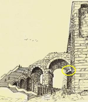
A closer look on the “Robinson arch“, which was the eastern base of the bridge and staircase.
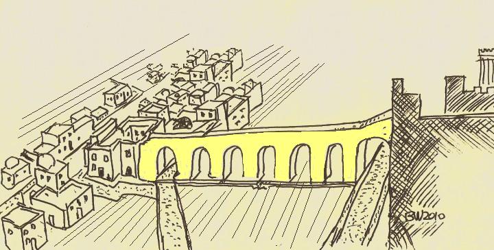
The Robinson arch was part of a wide pathway that led the pilgrims from the street level, up through a staircase, cross over the street, then into the south-western entrance of the temple mount. This was one of the three bridges that led into the temple.
The arch that once existed at this place connected the staircase to the base on the wall, as indicated on the illustration with a yellow circle. The base is 11m above the level of the street. The diameter of the arch was 13m. Under this arch, at a total height of 19m, passed a paved street which was lined with stores. The walls of the temple were higher than the entrance – they raised to a staggering height of 32m(!) high.
Base of the Robinson arch on the south wall
The following illustration shows a reconstruction of this south-west corner at the times of the beginning of the 1st Century.
![]() To read more on the arch and the Herodian street under it – see the South Wall web page.
To read more on the arch and the Herodian street under it – see the South Wall web page.
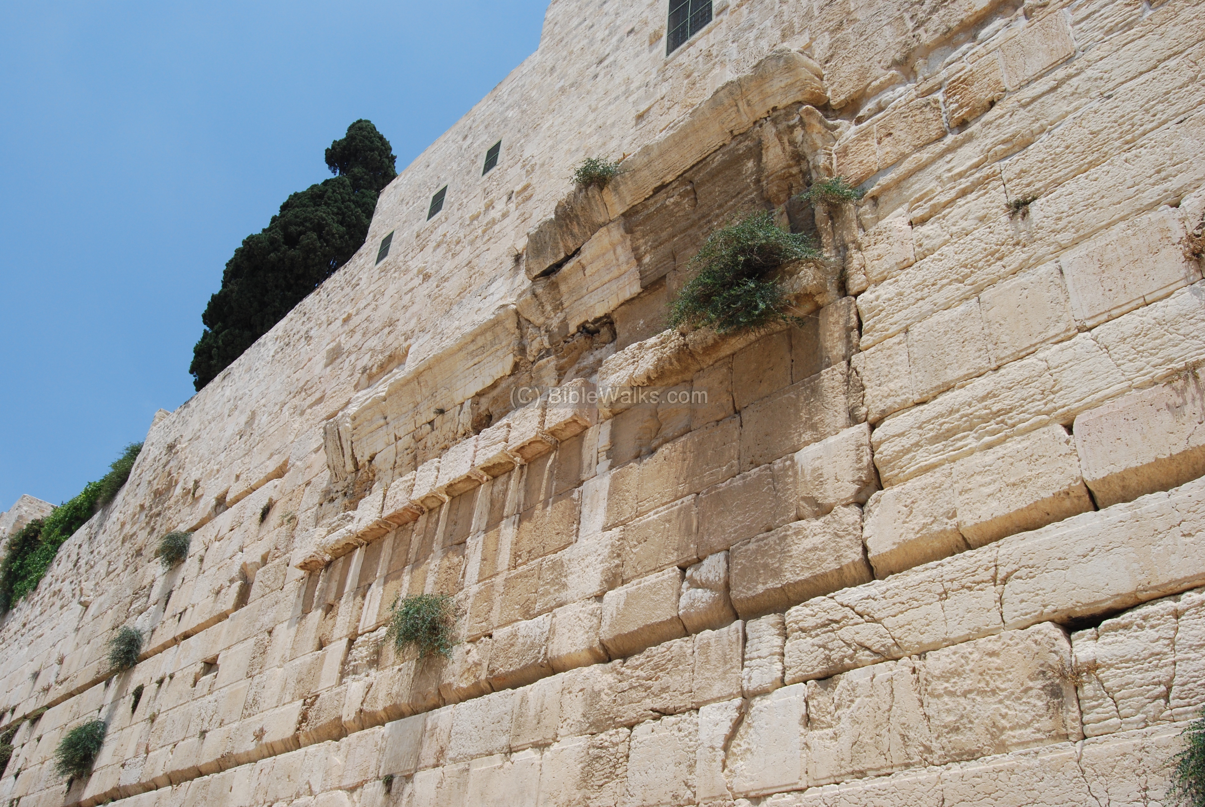
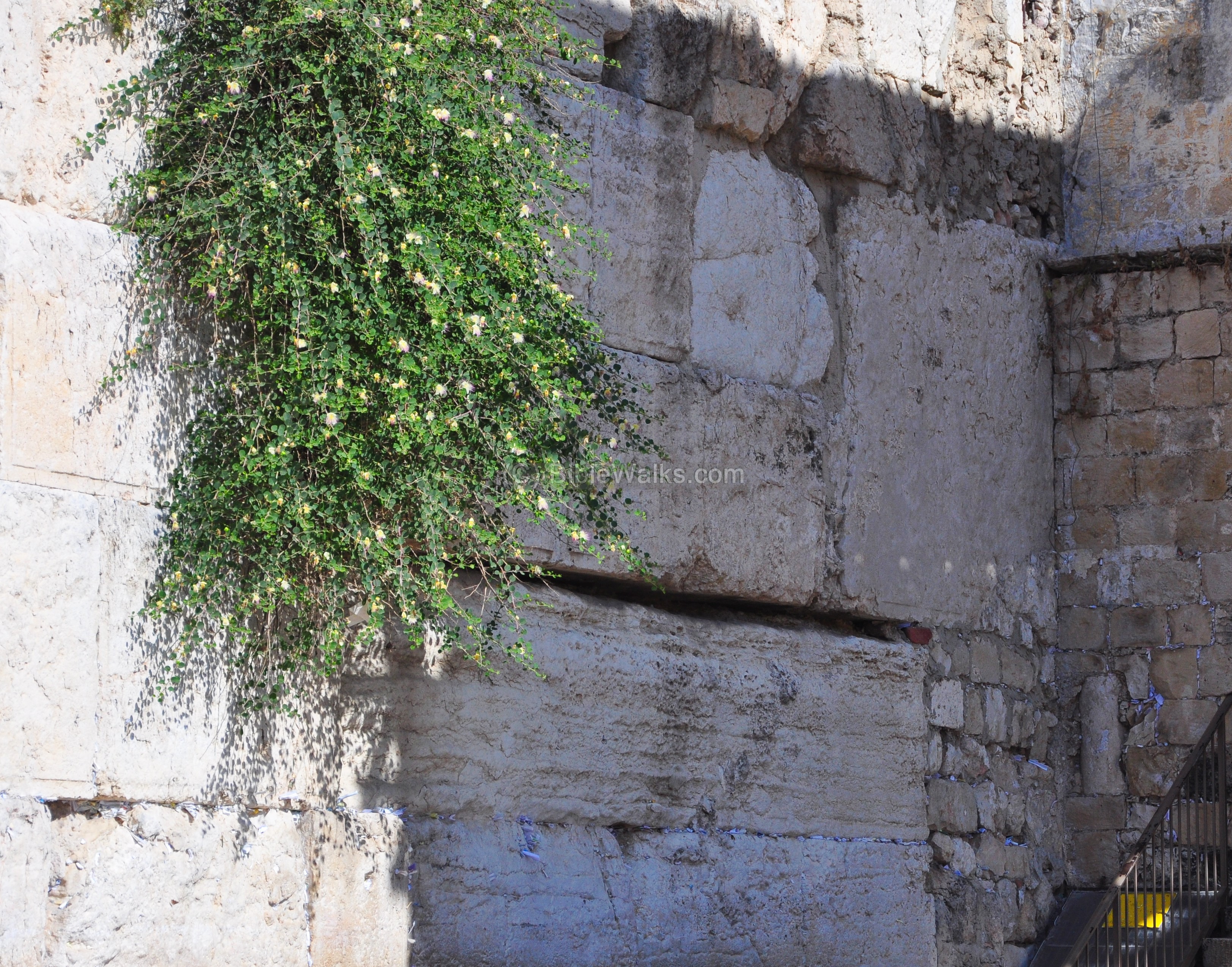
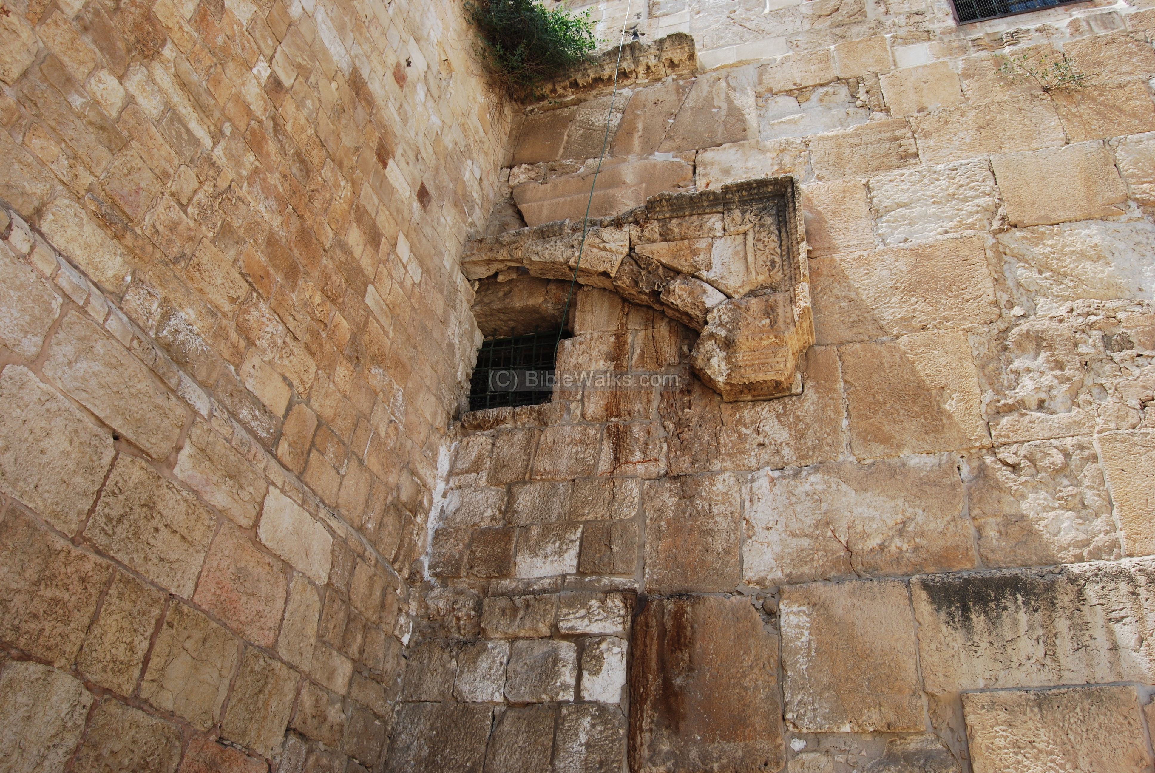
(b) Western (Barclay’s) Gate
On the south side of the western (wailing) wall, between the women’s praying section and the Mugrabim (North-African) gate ramp, is a visible section of another gate. It was discovered by Barclay, the American consul at the end of the 19th century, who researched it on the temple mount side.

Several scholars identified this gate as the Kiponus gate, a temple gate which was referenced in the 2nd century Mishna.

The illustration on the left shows the location of the gate.
A 50 ton lintel (7m length, 2 m high) is seen above what looks like a gate. Under this enormous doorpost was the opening of the gate, which is now filled up with small stones, as indicated on the illustration.
The width of this gate is 5.6m and its height, mostly below the ground, is estimated at 11.2m.
A larger picture is seen below.
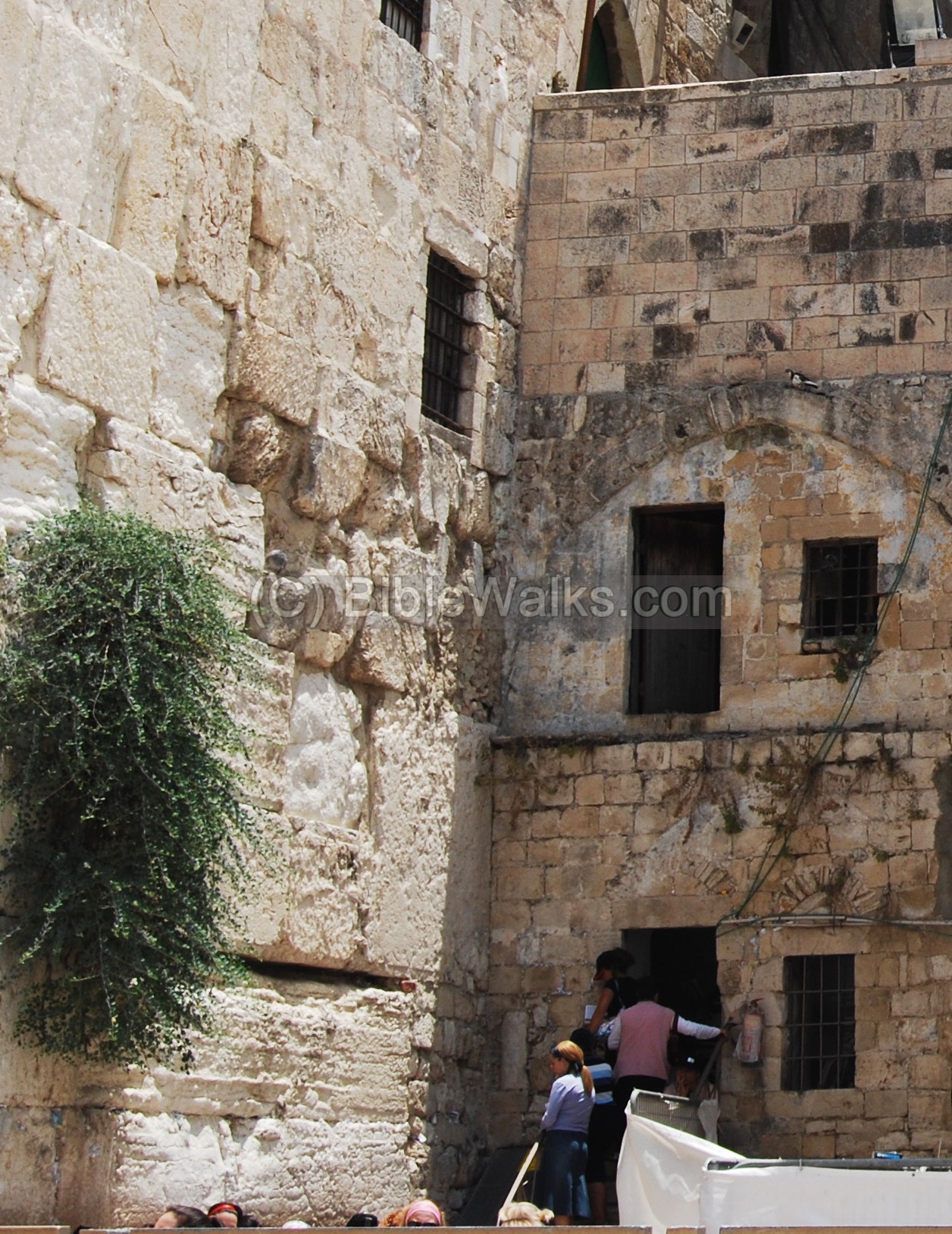
A closer view is seen below. The opening of the gate was located on the bottom of the right corner, near the steps.
Further excavations on this site in 2009 encountered fierce protests from the Muslim community and international groups. This is an explosive issue and the archaeologists have to operate cautiously in this tense atmosphere.
(c) West Bridge (Wilson Arch)
Another bridge to the second temple was found near the Western (Wailing) wall by the English expedition headed by Charles Wilson (1867). Its location is indicated by a red square on the illustration.

Wilson’s expedition identified a set of arches – the foundation of a 100m bridge that connected the temple mount to the upper city. This was another east-west bridge that entered the temple mount.
A reconstruction of the bridge is shown in the following illustration. It was excavated along the northern side of the wailing wall plaza, starting from the temple mount and heading west, just below the Chain (Silsila) road of the modern city.
This long bridge is dated to post-temple periods – hundreds of years after the destruction of the second temple. It may have been constructed in the Byzantine period or the early Arab period. The original Herodian bridge was probably shorter. It is described by Josephus on several occasions: the description of the attack by Pompey in 63BC (Wars 1 7 2): :”Aristobulus’s party was worsted, and retired into the temple, and cut off the communication between the temple and the city, by breaking down the bridge that joined them together”; the description of the construction of the Herodian temple (Ant. 15 11); and during Titus’s attack in 70AD (Wars 6, 6 2): “…a bridge that connected the upper city to the temple”.
The eastern side of the first arch is visible below, connected to the western wall. This area under the arch, 13m in length, serves today as a synagogue as part of the western wall prayer complex.
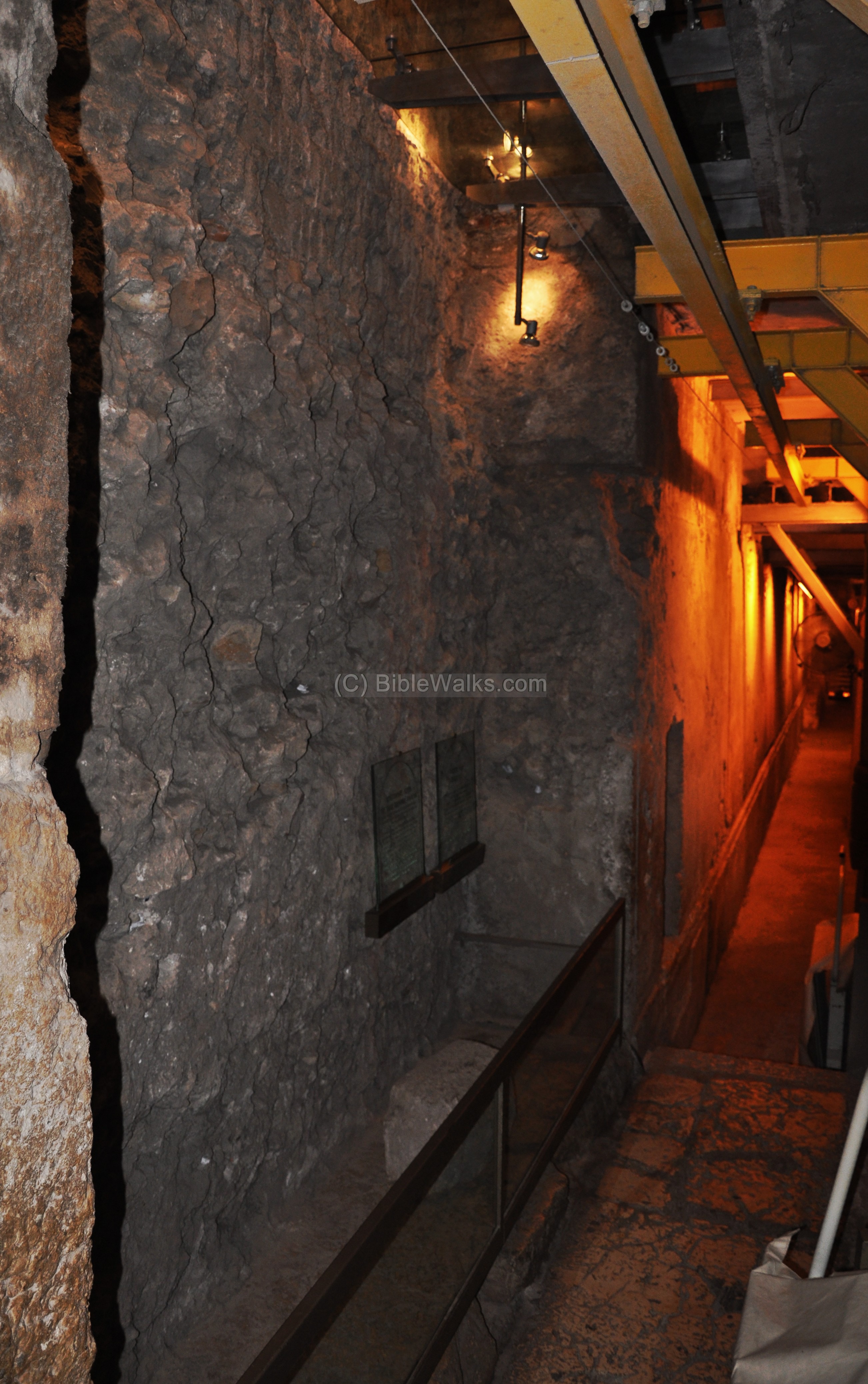
Charles Warren, a member of Wilson’s team, dug into the bottom of this arch in order to research what lies below the western wall. Two vertical shafts and horizontal tunnels were created, which revealed that the present level of the western wall is is 8M above the Herodian level, with its original stones laying on its bottom. This is typical of most of the ancient cities and tells (mounds) – the height of the ground level increases after each destruction.
The picture below shows one of the “Warren shafts”, revealing the beautiful carved stones typical of the Herodian construction.
Another arch, located further away from the western wall, serves today as the north entrance to the wailing wall plaza. The arch, dated to the Arab period (8th-11th century), is based on an earlier arch – perhaps from the second temple period. A paved Roman/Byzantine road (2nd to 6th century) passes here under the arch; it connected the north Damascus gate to the south Dung Gate.
Another large hall (“Free Mason’s Hall) was located by Warren and is dated to the end of the second temple period. It was part of a large public structure.
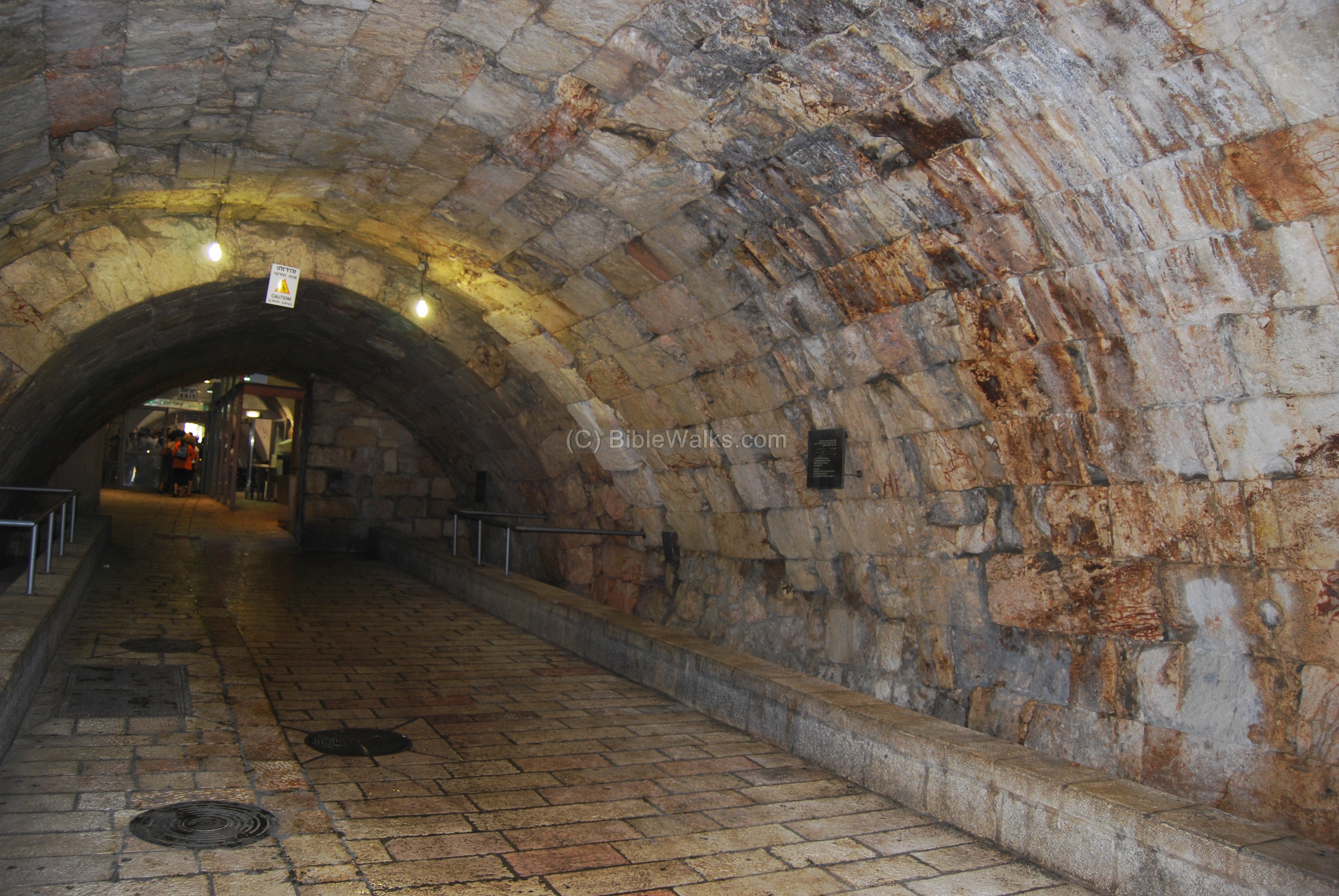
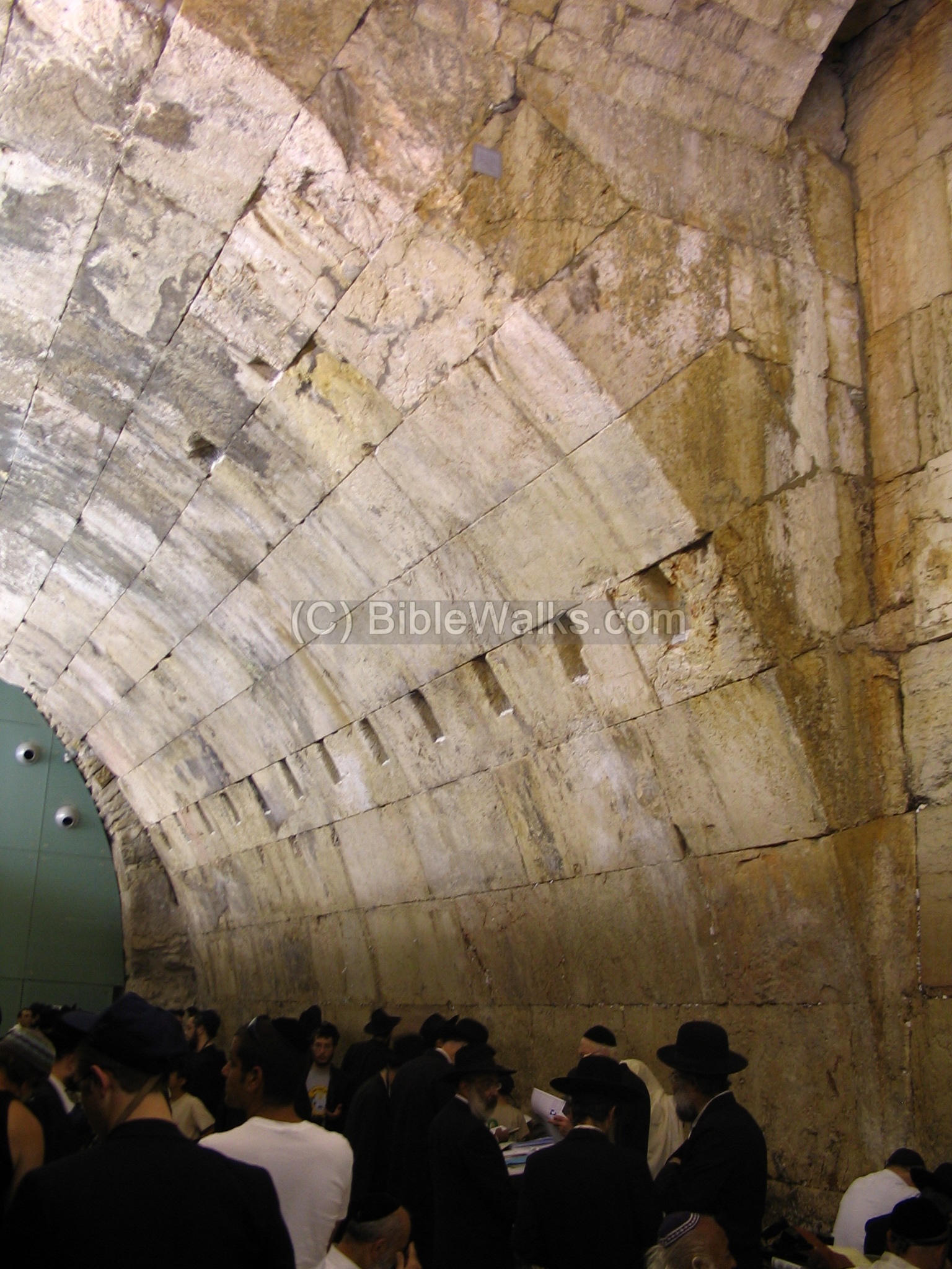
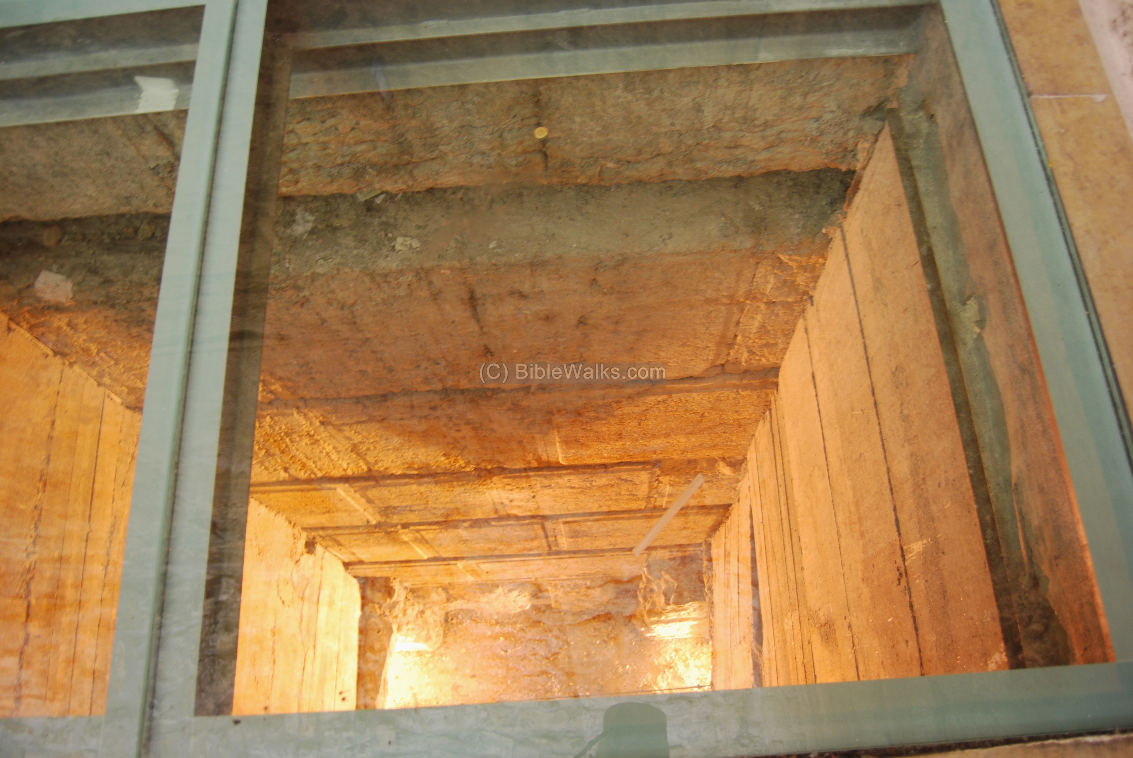
(d) Warren’s gate (facing the Holy of Holies)
This underground gate, now sealed, is located 40m north of the Wilson arch. The entrance here is located at the bottom of the temple mount ancient walls, at a depth which was the street level during the second temple period.

The opening of this gate faces the Holy of Holies structure and the foundation stone, and therefore is considered the holiest gate. It was discovered in 1867 by Charles Warren, and can be seen while taking the tunnels tour.
![]() Would you like to read more on the Western Wall tunnels?
Would you like to read more on the Western Wall tunnels?
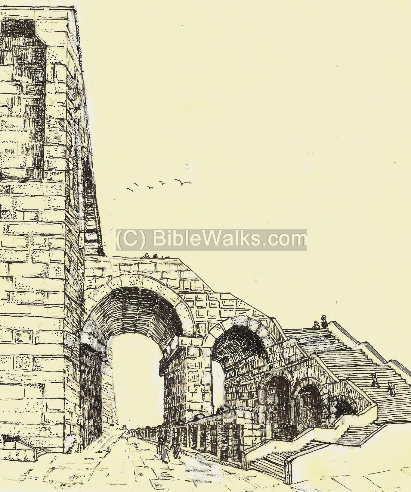
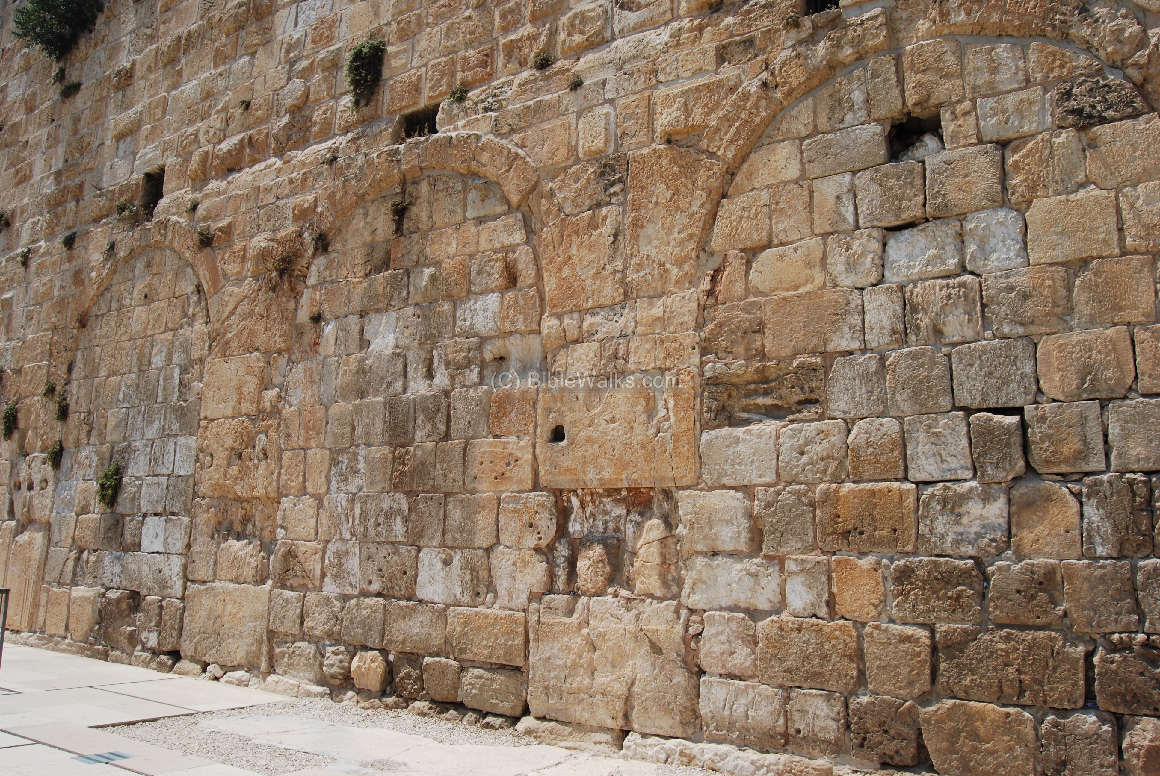
(e) South-East Bridge
On the south-east corner of the current temple-mount are remains of an
other bridge, which was identical to the structure of the south-west bridge. Its location is indicated as a red square.

The photo below shows the south-east corner of the temple mount. A vertical stitch is visible on this section, located 32m from the corner (seen under the black cloth on the wall). The shapes and sizes of the lower levels of the stones are different on each side of the stitch.
The south side was actually an extension to the Hasmonean wall, which was embedded into Herod’s second temple. Herod added this new south wing, 32m long, to the south side of the earlier city walls – reaching a total of 460m. Herod also expanded the temple mount to the west, adding the western wall and its bridges.
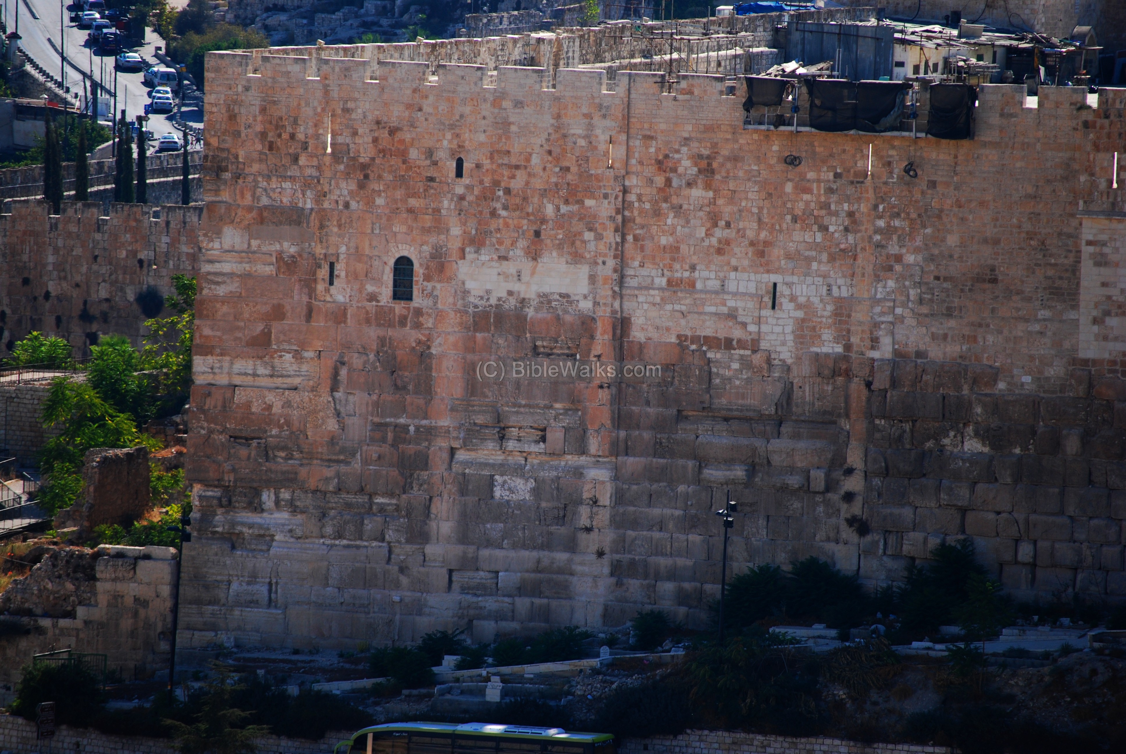
On this south-east side, adjacent to the stitch, was another staircase and bridge like on the western side. It is almost completely gone, and only traces of its footprint is visible.
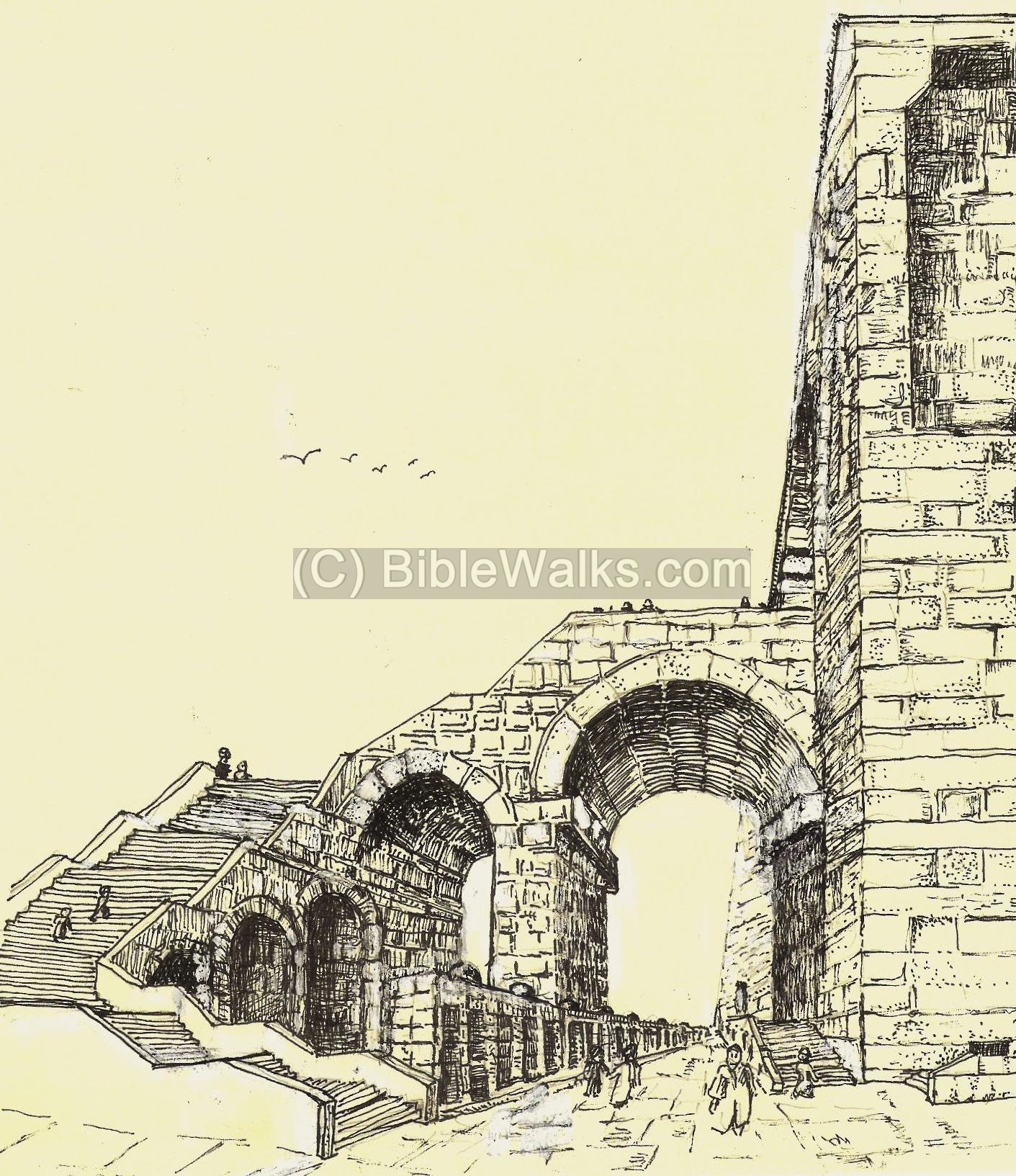
A detail of the picture is magnified below. The base of the ancient bridge is seen in this section of the wall. The opening of the gate, above the large horizontal stones, was filled up with smaller stones in order to seal up the gate.
The arch on the eastern side was, according to the theory, almost identical to the Robinson arch of the western side. On the inner side of the wall the bridge entered into underground halls under the temple mount, known as “Solomon’s stables”. On the external side, the bridge crossed a road on the eastern side of the wall which lead to the north-east side of the temple mount. The staircase lead down, south, to the road level. Beyond, on the right (east) side of the staircase, are the foothills that reach down to the Kidron valley.
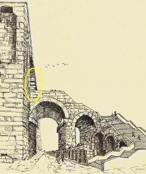
A reconstruction of the eastern staircase is illustrated above, with a yellow circle indicating the location of the base on the wall.
Below is a larger size of this illustration.
(f) South Gates (Hulda)
A pair of gates are located on the south walls of the temple mount, and are called the Hulda Gates.

During the times of the second temple they were used for entry (on the eastern triple arched gate) and for exit (through the double arched doors on the western side).
The triple-arch Hulda gates on the eastern side is seen below. The gate is 15M wide and was designed as a triple arch to support this width. The grand decorated capitols that once were part of the gates were smashed after the fall of Jerusalem. The excavators found many of the second temple fragments that once decorated these gates.
The double-arch gate on the western side are mostly hidden by the medieval structure. Only the east most side is seen. This section has a decorated capitol on top of the arch, which is missing today on the eastern triple-gate.
![]() To read more on the Hulda Gates and the grand staircase leading to these gates – see the Ophel and Hulda Gates web page.
To read more on the Hulda Gates and the grand staircase leading to these gates – see the Ophel and Hulda Gates web page.
Historical References:
(a) Josephus Flavius (Jewish Antiquities; Book 15 Chapter 11)
Josephus, the Commander of the Jewish revolt against the Romans, and later a historian of the period. He writes about the construction of the 2nd temple by Herod, which expanded the previous temple of the returnees. Note that cubit unit is about 44cm.
“So Herod took away the old foundation, and laid others, and erected the temple upon them, being in length a hundred cubits, and in height twenty additional cubits, of which [twenty], upon the sinking of their foundations fell down; and this part it was that we resolved to raise again in the days of Nero.
Now the temple was built of stones that were white and strong, and each of their length was twenty-five cubits, their height was eight, and their breadth about twelve; Now in the western quarters of the enclosure of the temple there were four gates; the first led to the king’s palace, and went to a passage over the intermediate valley; two more led to the suburbs of the city; and the last led to the other city, where the road descended down into the valley by a great number of steps, and from there up again by the ascent for the city lay near to the temple in the manner of a theater, and was encompassed with a deep valley along the entire south quarter; but the fourth front of the temple, which was southward, had indeed itself gates in its middle, as also it had the royal cloisters, with three walks, which reached in length from the east valley to that on the west, for it was impossible it should reach any farther: and this cloister deserves to be mentioned better than any other under the sun; for while the valley was very deep, and its bottom could not be seen, if you looked from above into the depth, this further vastly high elevation of the cloister stood upon that height, insomuch that if anyone looked down from the top of the battlements, or down both those altitudes, he would be giddy, while his sight could not reach to such an immense depth. This cloister had pillars that stood in four rows one near to the other all along, for the fourth row was interwoven into the wall, which [also was built of stone]; and the thickness of each pillar was such, that three men might, with their arms extended, fathom it round, and join their hands again, while its length was twenty-seven feet, with a double spiral at it basis; and the number of all the pillars [in that court] was a hundred and sixty-two. Their chapiters were made with sculptures after Corinthian order, and caused and amazement [to the spectators], by reasons of the grandeur of the whole. These four rows of pillars included three intervals for walking in the middle of this cloister; two of which walks were made parallel to each other, and were contrived after the same manner; the breadth of each of them was thirty feet, the length was a furlong, and height fifty feet; but the breadth of the middle part of the cloister was one and a half of the other, and the height was double, for it was much higher than those on each side; but the roofs were adorned with deep sculptures in wood, representing many sorts of figures. The middle was much higher than the rest, and the wall of the front was adorned with beams, resting upon pillars, that were interwoven into it, and that front was all of polished stone, insomuch that its fineness, to such as had not seen it, was incredible, and to such as had seen it, was greatly amazing”.
Etymology (behind the name):
Sha’ar – Hebrew: Gate.
Bab – Arabic: Gate.
Links and References:
* External:
- Wilson’s arch and the Great Causeway HAESI V123 2011
*Internal:
- Ophel and Hulda Gates – on the south-east side
- Western Wall – the wailing wall
- Western Wall tunnels
- Temple Mount
- Al-Aqsa mosque
- Dome of the Rock
* Books:
Meir Ben-Dov: “The dig at the temple mount” (Keter #533340; 1982)
BibleWalks.com – walk with us through the sites of the Holy Land
Temple Mount Sites<—previous site–<<< All Sites >>>—next Jerusalem site–> Western Wall tunnels
This page was last updated on July 22, 2010
Sponsored links: