A large mound located in the Beit She’an valley, with remains from the Canaanite and Israelite periods.
Home > Sites > Jordan Valley> Tel Rechov (Tel Rehov, Rehob)
Contents:
Background
Location
History
Photos
* General
* South
* North
* Fire Art
* Other
* Video
Links
Etymology
Background:
Tel Rechov is an archaeological site located in the Jordan Valley, near the modern-day city of Beit Shean in northern Israel. It was an important city in the Biblical period, one of the largest Biblical mounds, with remains from the Canaanite and Israelite periods. Excavations at the site have revealed a wealth of information about the history and culture of the region.
The site was first identified as Tel Rechov in the early 20th century, but it was not until the 1990s that large-scale excavations began. These excavations, led by Israeli archaeologist Amihai Mazar, uncovered a large Bronze Age city, as well as structures and artifacts from the Iron Age, Persian, Hellenistic, and Roman periods.
The site also contained a large number of domestic and agricultural structures. Excavations inside a dense complex of Iron Age II buildings revealed rich findings, including a large apiary (beehives complex). The archaeologists also revealed evidence of a major fire that destroyed much of the city in the 8th century BC. This fire is believed to have been caused by the Assyrian invasion of the region during that period.
Overall, Tel Rechov is an important archaeological site that provides valuable insights into the history and culture of the Jordan Valley and the surrounding regions.
*** Special Thanks *** to Professor Amihai Mazar, Director of the Tel Rehov expedition, Hebrew University, who graciously helped us with the photos and content of this web page.
Location:
The site is located in the Beit She’an valley, 4KM south of Beit She’an. It is located in an open field – easily accessed by foot or car. Other points of interest around the mound:
-
An Islamic tomb of esh-Sheikh er-Rihab (Sheik Arehab) is located south of the mound which preserved its name.
-
A modern settlement (Rechov) is located to the south-west of the mound.
-
Ruins of a Byzantine period town, named Rechov, are located 600m to the north-west, with ruins of a synagogue
-
Several springs on the east side of the mound
History:
-
Bronze Age
Tel Rechov (Tel Rehov) was first settled in the Early Bronze period (early third millennium), at the same time when the nearby Tel Beit-Shean was established. A massive mud-brick wall with earthen glacis was built around the mound, one of the largest in the country.
-
Late Bronze age – Egyptian rulers
The city is referenced in several Egyptian sources, which indicate that Rechov was a central city-state in this region in the late Bronze age (1550-1200BC).
It is referenced in the 19th century Egyptian (12th Dynasty) enemy-curse clay tablets.
The city may have been listed as one of the cities conquered by Egyptian Pharaoh Thutmose III, just after the famous battle near Megiddo (1468 BC), which resulted in the Egyptian conquest of Canaan for 350 years. Scholars suggest the name “r-h-b” (#87 of the 119 cities listed in the Egyptian tablets) actually refers another Rechov of the Western Galilee, listed by the Bible in the region of Asher. Yet another city (#107 e-m-q, meaning “valley”) may have referred to Tel Rechov.
An Egyptian basalt stele dated to 1318 BC was found in 1928 on Tel Beit She’an (see photo). It commemorates an Egyptian military victory: during the reign of Pharaoh Seti I (~1294-1279 BC) a coalition of several rebelling cities attempted to seize the headquarters in Beit She’an, and were crushed by the Egyptians. The stele described the city-state Rechov as loyal to Egypt, and told how their enemies had the city under siege.
The city is also referred in Ramses II satirical story (papyrus Anastasi I, 1270 BC). In this story an Egyptian scribe asks his colleague: “acquaint me with Rehob; explain Beth-sha-el and Tereqel. The stream of Jordan, how is it crossed? ” 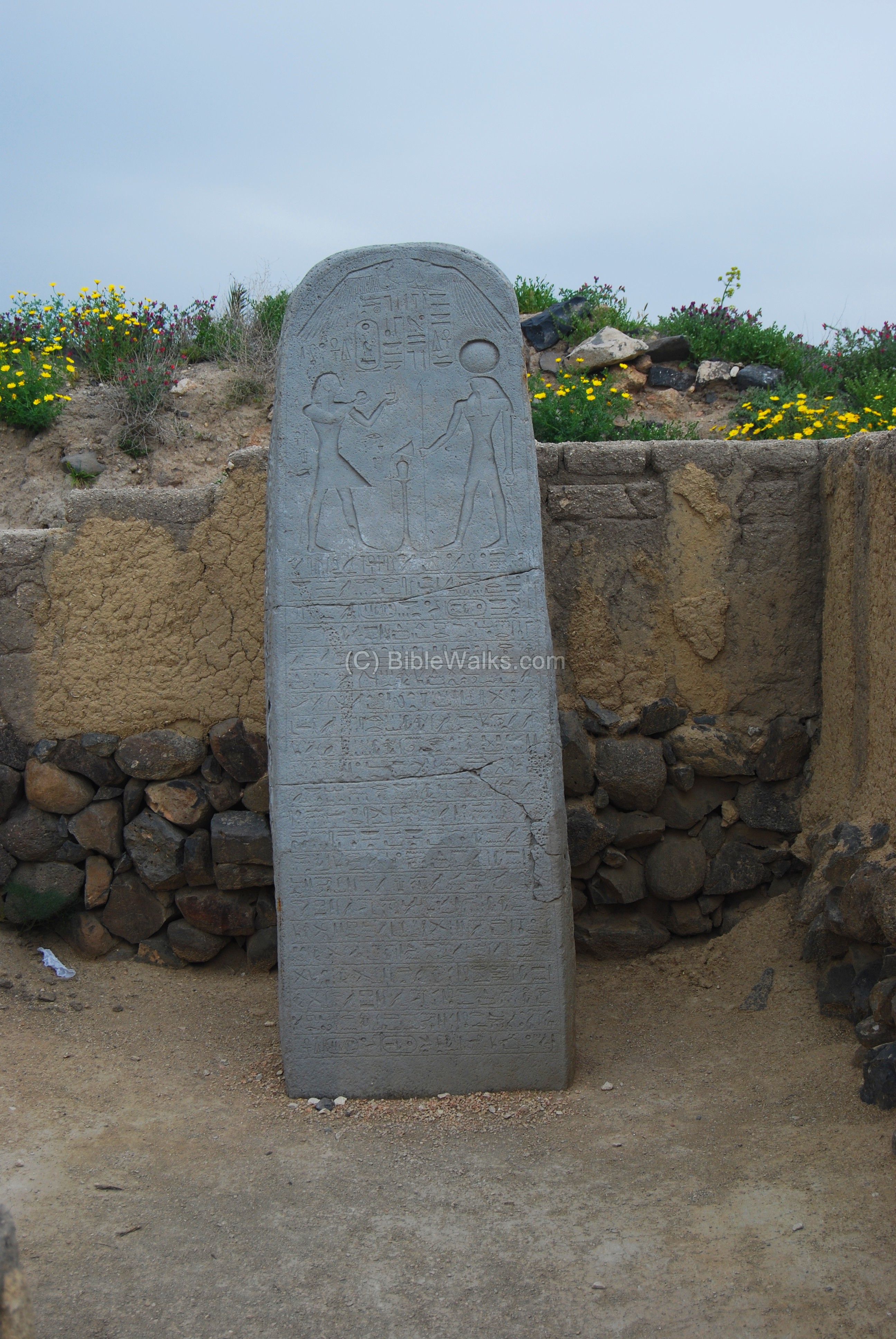
Seti I Stele found in Beit She’an
-
Biblical map
The ancient city was located in the path of major ancient crossroads, connecting to Beit She’an (north), the Jordan valley (south), Bezek (southwest), Jezreel (west), and Gilead (east). The cities and roads during the Canaanite and Israelite periods are indicated on the Biblical Map below.
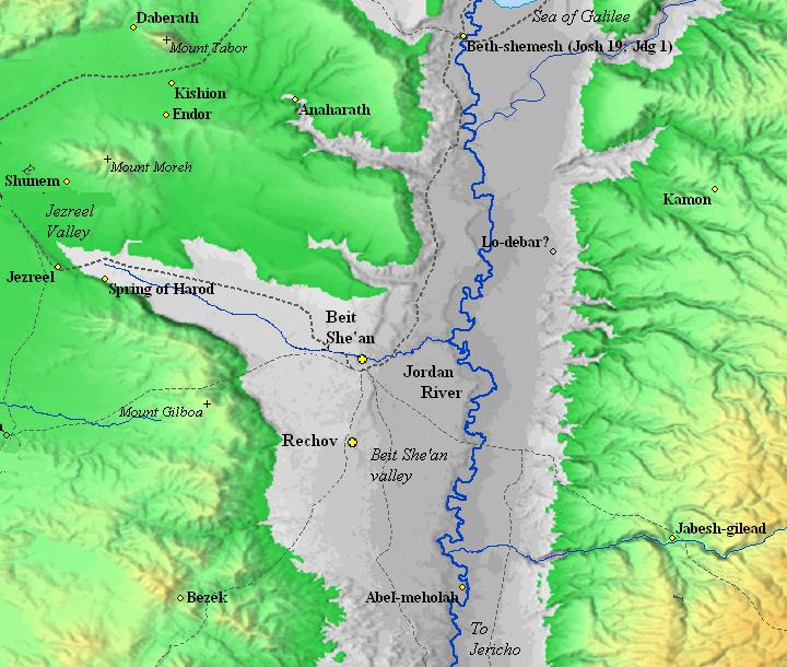
Map of the area around Tel Rechov – during the Canaanite and Israelite periods (based on Bible Mapper 3.0)
-
Israelite period (the Judges)
Rechov was built on top of a massive fortified mound, which was composed of a lower city on the north side and an upper city on the south side.
The mighty Canaanite city in Tel Rechov was not conquered by the Israelites during their conquest of Canaan in the 12th century BC. Although the Bible does not name the city directly, it does tell us that the region of Beit She’an remain Canaanite (Judges 1: 27: “Neither did Manasseh drive out the inhabitants of Bethshean and her towns“). Furthermore, the city is not mentioned in any Biblical text, although other sites with the same name are listed in the Galilee.
-
Israelite period (Saul and David)
Even the first Israelite King Saul did not manage to take this small Canaanite enclave around Rechov and Beit She’an. Only his successor, King David, managed to take it in approximately year 1000 BC, extending his empire to the upper Galilee (1 Chronicles 18 3): “…And David smote Hadarezer king of Zobah unto Hamath”). Since then, the city was under the control of the Israelites.
-
Israelite period (Northern Kingdom)
In 928 the Kingdom separated to the south (Judah) and the north (Israel), and Rechov became part of the Northern Kingdom.
After Solomon’s death, Egypt’s Shishak invaded Israel in 924 BC (1 Kings 14: 25: “in the fifth year of King Rehoboam, Shishak king of Egypt attacked Jerusalem”). According to the Pharaoh’s hieroglyphic inscriptions, Rechov is listed as one of the cities that he captured (#17 r-h-b). This destruction may be evident in Stratum V (one of the 7 main chronological periods identified in the excavations).
The archaeologists excavated at 9 areas in different sections of the mound, in both the lower and upper cities of Tel Rechov. Their findings revealed that during the Iron Age IIa (1000 to 925 BC) until the destruction of the lower city in 830BC (an estimated date), the entire top of the mound – 100 Dunam (or 10 hectares) – was occupied. Indeed, a large city for that time!
The city of Rechov was prosperous, as indicated by the rich findings, which included artifacts from Phoenicia and neighboring countries. Though the city was part of the Israelite Kingdom, the residents continue to maintain Canaanite/Phoenician and Syrian traditions.
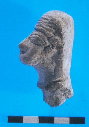
Head of clay female figurine, 9th century BC
(photo courtesy Tel Rehov Expedition, the Hebrew University)
The buildings were constructed of mud bricks without stone foundations. Wood was used for some of the foundations of the walls and floors. This architecture is unusual for this period, which was based on unhewn stones. However, these buildings were well planned, and there was an organized plan in the direction of the blocks of buildings.
-
Israelite period (House of Omri)
Omri was a general, who was made king (882 BC) over the Northern Kingdom during the mutiny of Zimri (1 kings 16 16):
“And the people that were encamped heard say, Zimri hath conspired, and hath also slain the king: wherefore all Israel made Omri, the captain of the host, king over Israel that day in the camp.”.
After regaining the control of his Kingdom, Omri turned to defend his country against their arch-enemy – Aram-Damascus – and the rising empire of Assyria.
Ahab, his son, fought against Aram-Damascus in 3 battles, but was killed (850) in the 3rd battle. Ahab’s son Yoram continued to confront the Syrians, and was killed in Jezreel (842), thus ending the house of Omri. (1 kings 22:35): “And the battle increased that day: and the king was stayed up in his chariot against the Syrians, and died at even: and the blood ran out of the wound into the midst of the chariot”.
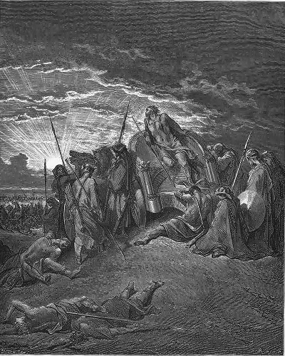
Fall of King Ahab in Ramoth Gilead
Drawing by Gustav Dore (French artist, 1832-1883)
The assaults continued from the north: the Assyrians forces – a rising force in the region- hit the Northern Kingdom in 841, and Aram-Damascus headed by Hazael invaded in 815-810, as per Biblical accounts (2 Kings 8:12, 12:18-19, 13:3+7; Amos 1:3) and (2 Kings 10 32): “In those days the LORD began to cut Israel short: and Hazael smote them in all the coasts of Israel;”. In one of these intrusions the city of Rechov was violently destroyed; the archaeologists dated this destruction to an approximate date 840-830BC (and marked it as layer called Stratum IV).
After the destruction of the city, the residents occupied only the upper city (the south side). An immense wall was added on the northern slopes of the upper city.
-
Assyrian conquest
In 732BC was an intrusion to the North of Israel by the Assyrian King Tiglath-Pileser III, who annexed the area (as per 2 Kings 15: 29): “In the days of Pekah king of Israel came Tiglathpileser king of Assyria, and took … Galilee…and carried them captive to Assyria”.
The Assyrian managed to knock down the northern walls by their mighty battering rams, slaughtered the residents, and destroyed the buildings. This destruction is evident in most of the excavation areas (marked as Stratum III).
The Assyrians occupied the ruined city for some time, but then made Megiddo the capital of the region and Tel Rechov was completely abandoned for the next 1,500 years.
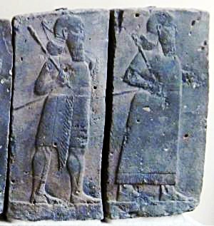
Orthostat relief – depicting soldiers from different orders of the Assyrian Army,
in procession; basalt; Hadatu Tiglath-Pileser III period (744-727BC)
[Istanbul Archaeological museum]
-
Roman/Byzantine period
A Jewish town existed in an area 600m north-west of the mound during the Byzantine period (4th to 6th century AD). Its Hebrew name, Rechov, preserved the ancient name of Tel Rechov. The ruins are located in Horvat Parva (aka Tel el Farwanah).
A large mosaic Hebrew/Aramaic inscription (4.3 x 2.75) was found on the floor of the synagogue, dated to ~500 AD. It lists names of vegetables and a long list of villages in Israel and the Galilee, including “Beit Shean”. This unique mosaic was transferred to the Jerusalem museum, and a copy of the floor can be seen in front of the synagogue of Kibbutz Ein-Hanatziv (see the photo).
The ruins of the synagogue of Rechov are located adjacent to road #90 but is covered by earth.
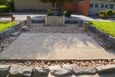
Kibbutz Ein Hanatziv:
Replica of the mosaic floor (largest Hebrew text found in Israel)
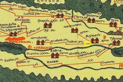
The ancient Roman highway (from Scythopolis/BethShean to Neapolis/Shechem and Jericho) actually passed on the west side of Tel Rechov, as indicated on the PEF survey (1881-1883) map below. A milestone from this road (#5) is on display in the nearby religious Kibbutz Sde Eliyahu.
This section appears in the 4th Century AD Peutinger Map (marked by a yellow circle to the left of “Scytopoli”).
-
Later periods
A small Arab village existed on top of the mound during the middle ages.
The site was examined in the PEF survey (1866-1877) by Wilson, Conder and Kitchener. It appears as “Tell es Sarem” in the center of the section of this map of 1878. It is situated near the Roman Road. They described it as “A very large artificial mound, with a spring on the south side” but nothing more.
Conder suggested an identification of the mound as Zarthan, based on King Solomon’s list of officers (1 Kings 4 12): “Bethshean, which is by Zartanah beneath Jezreel”, and on a another verse (1 Kings 7 46): “In the plain of Jordan did the king cast them, in the clay ground between Succoth and Zarthan”. Is this indeed Zarthan?
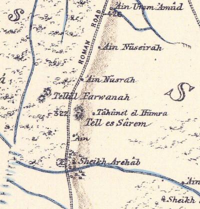 Part of Map sheet 9 of Survey of Western Palestine,
by Conder and Kitchener, 1872-1877.
(Published 1880, reprinted by LifeintheHolyLand.com)
- British Mandate
A section of the British map of the 1940s is shown here. The mound is named Tell es Sarim.
Springs are marked on the north and east sides (‘Ain et Tell, ‘Ain et ‘Arida). A canal flows on its south side, receiving waters from Ein Moda (‘Ain Maddu).
To the north west is an Arab village (Farwana), now demolished, where the synagogue was excavated. To the south east are the ruins of Esh Sh. Rihab (Horvat Rechov) – a Byzantine and Islamic period settlement. Its name (Rihab) preserved the ancient name.
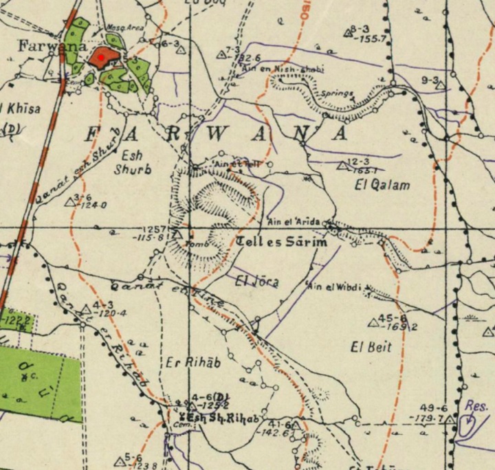
https://palopenmaps.org – Palestine 1940s 1:20,000 map
-
Modern Times
An agriculture settlement, Moshav Rechov, was established in 1951 on the south-west side of the mound, and preserved the ancient name.
Excavations in Tel Rechov are conducted since 1997, managed by the Hebrew University, Jerusalem. The project is directed by Prof Amihai Mazar.
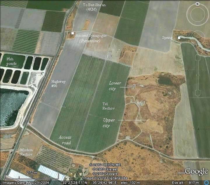
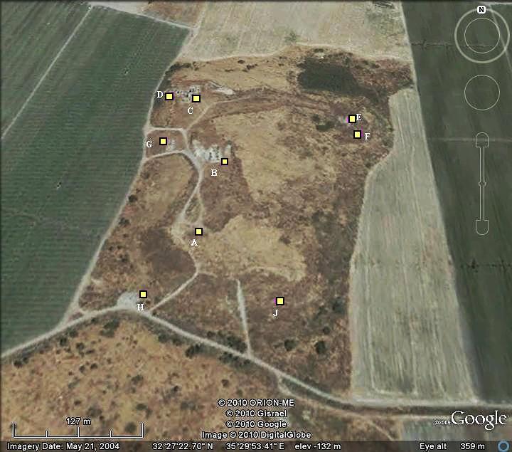
Excavation areas:
The 9 excavation areas are numbered ‘A’ through ‘J’, and are indicated on the map below.
The main chronological layers of Tel Rechov were classified as Stratum I thru VII (ordered in descending chronological order, where:
-
- I=Early Islamic,
- II=Iron Age IIb/c after 732BC,
- III=Iron Age IIb until 732 BC,
- IV-VI=Iron Age IIa 980-830BC,
- VII – 980BC and earlier).
Each area had a local stratigraphy which was marked by the area prefix and a running index, such as “C-2”, and mapped to the general stratum classes.
Photos:
(a) General and Aerial Views
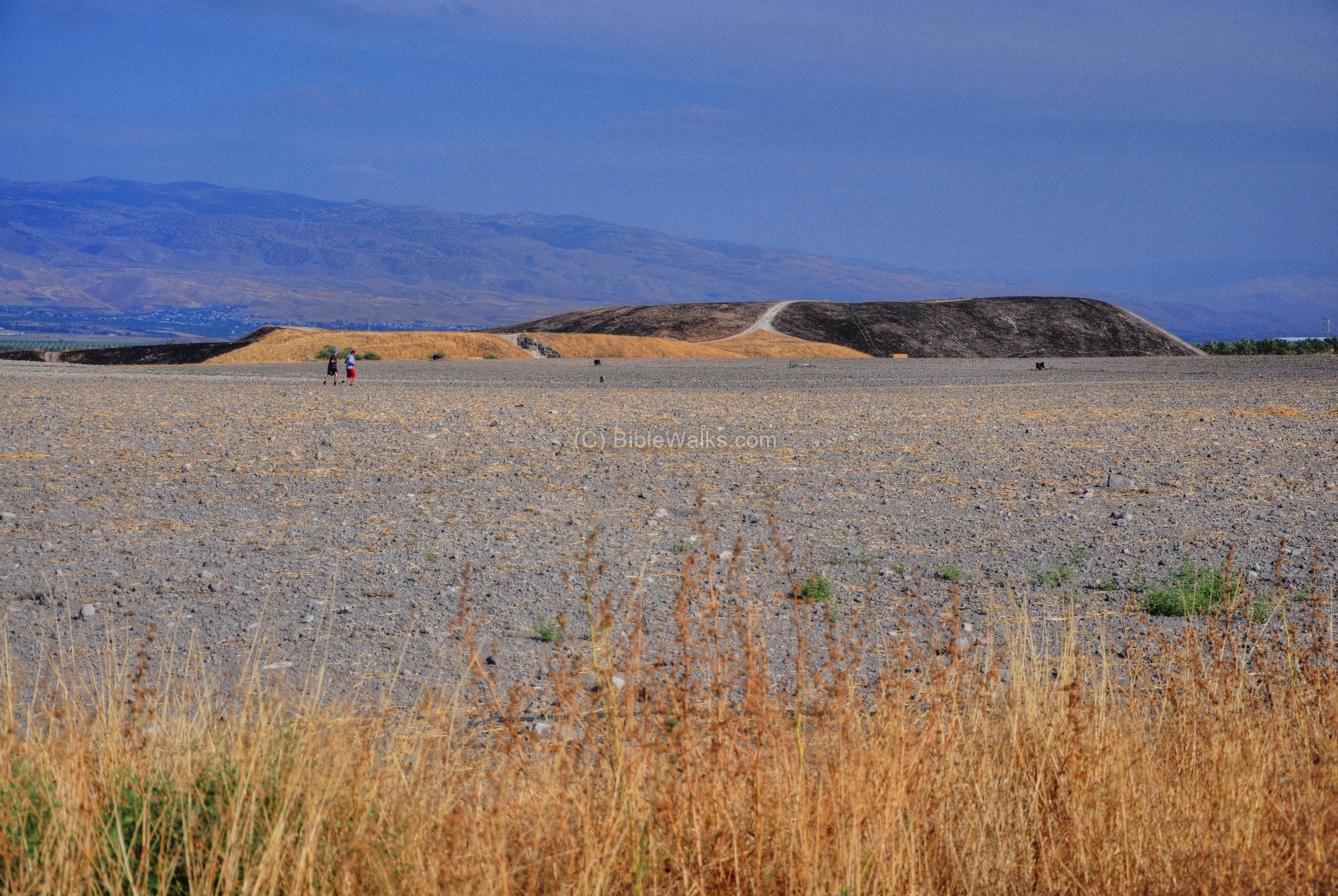
This is the view of the ancient Tel, as seen from the west. Its area is roughly 275m wide (west to east) by 750m long (north to south). The remains on the top of the mound cover 100 Dunam (10 hectares) – one of the largest Canaanite and Israelite cities in Israel. In the far background, behind the mound, are the mountains of Trans- Jordan (the Biblical Gilead). The Jordan river flows from left to right, in the valley to the east of the site.
The site has a “lower city” on the north side (the yellow hill in the photo below, with an altitude of 128m under sea level ), and an “upper city” on the south (the burnt hill in the photo, altitude: 116m under sea level).
Click on the photos to view in higher resolution…
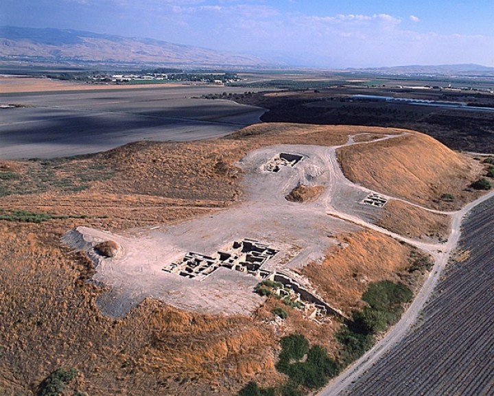
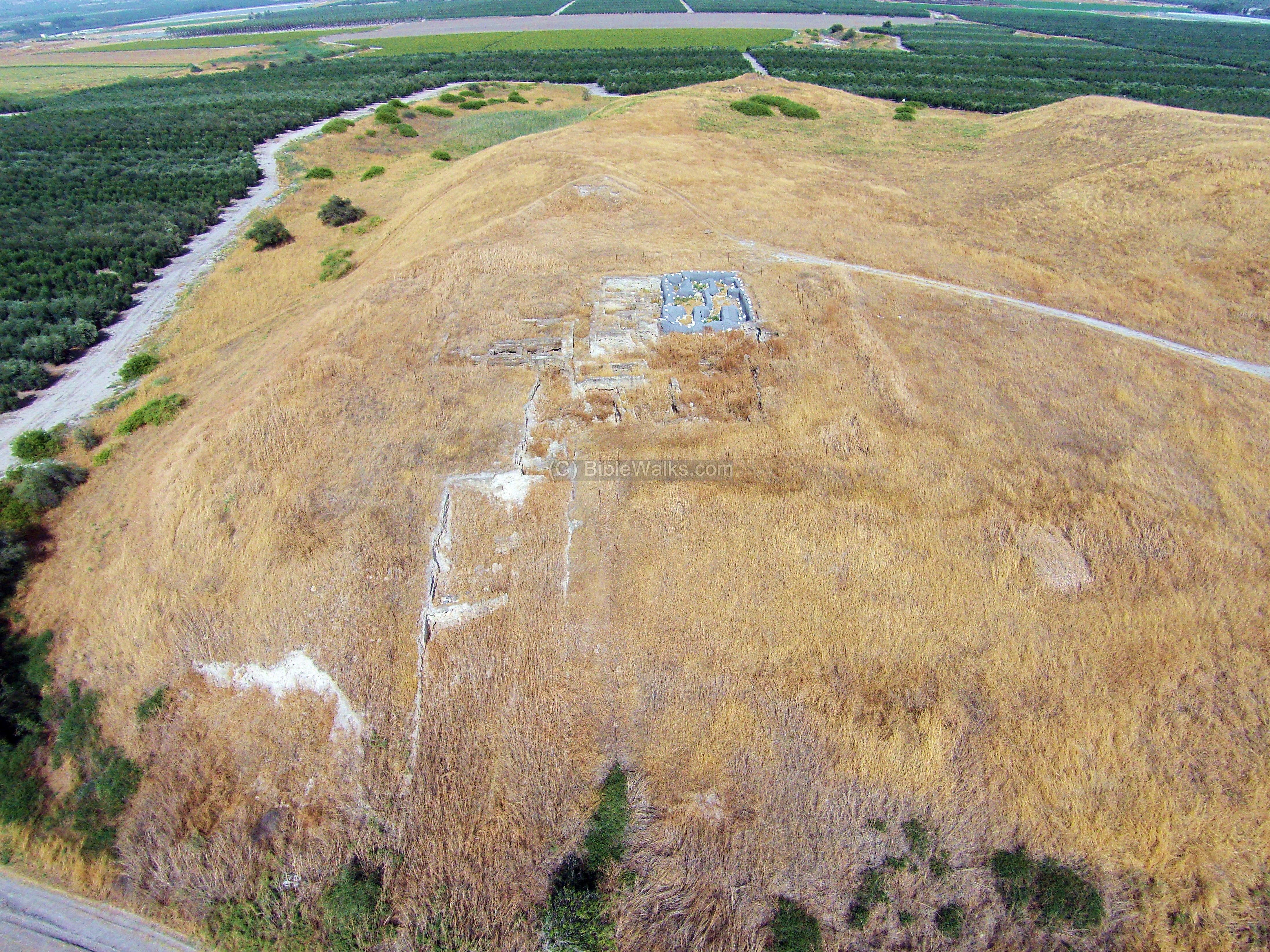
An aerial view of the mound during the excavations, in south-east direction (photo courtesy Tel Rehov Expedition, the Hebrew University):
![]() Fly above and around the site with this YouTube video. The drone scans the east and north sides.
Fly above and around the site with this YouTube video. The drone scans the east and north sides.
Video and photos captured on March 2023
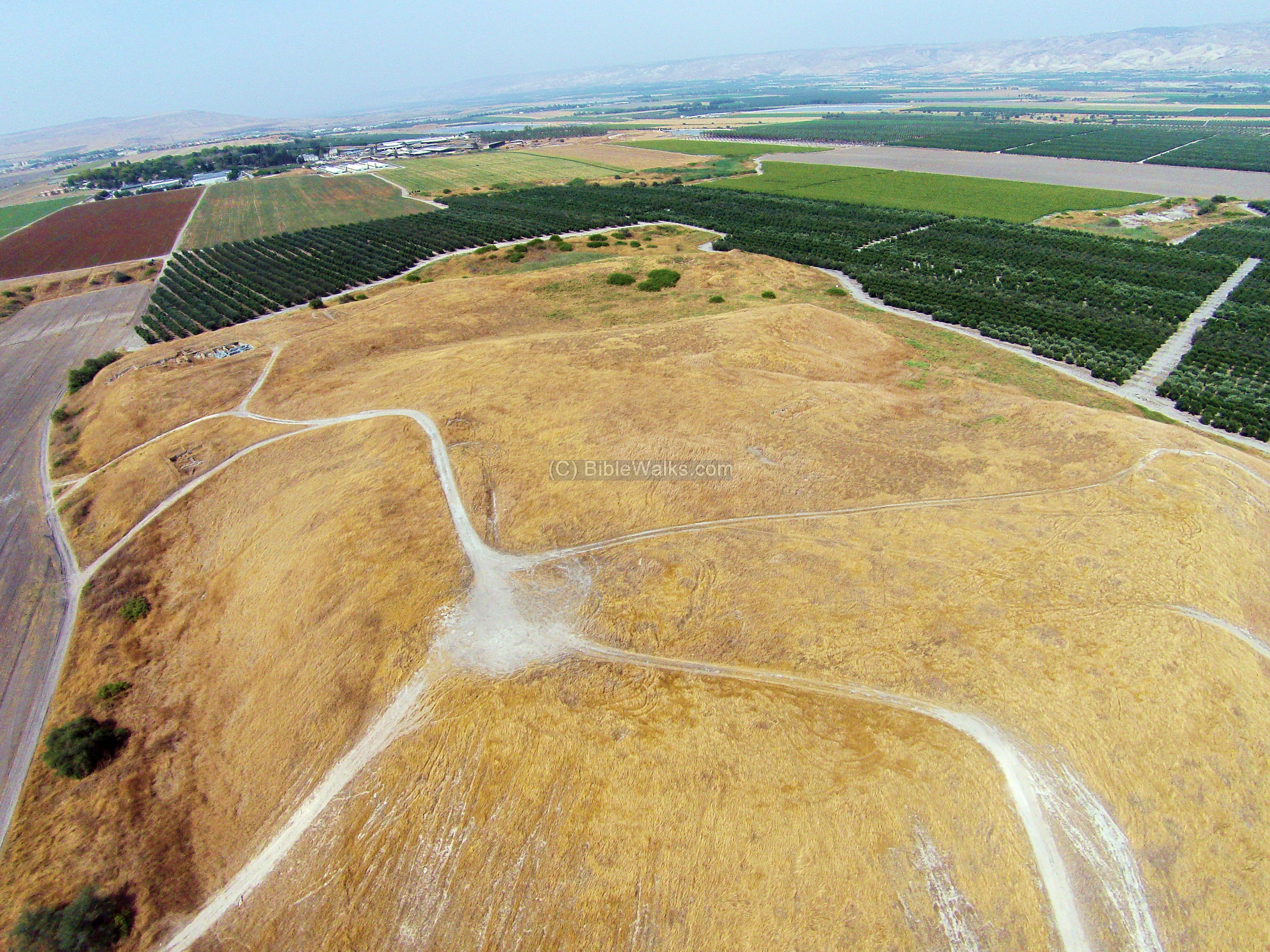
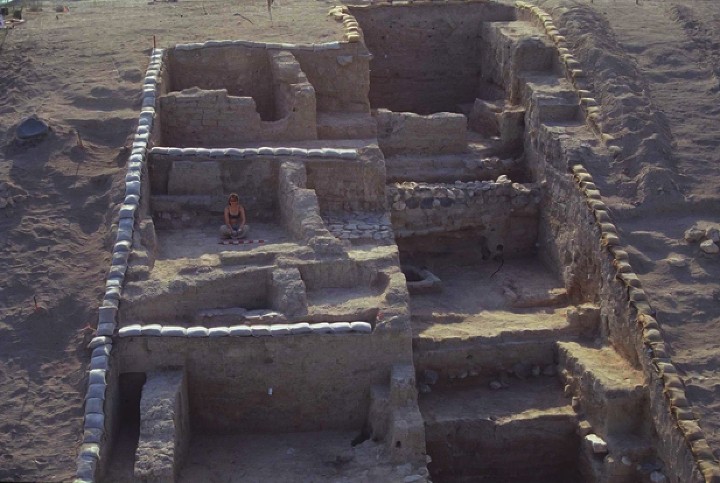
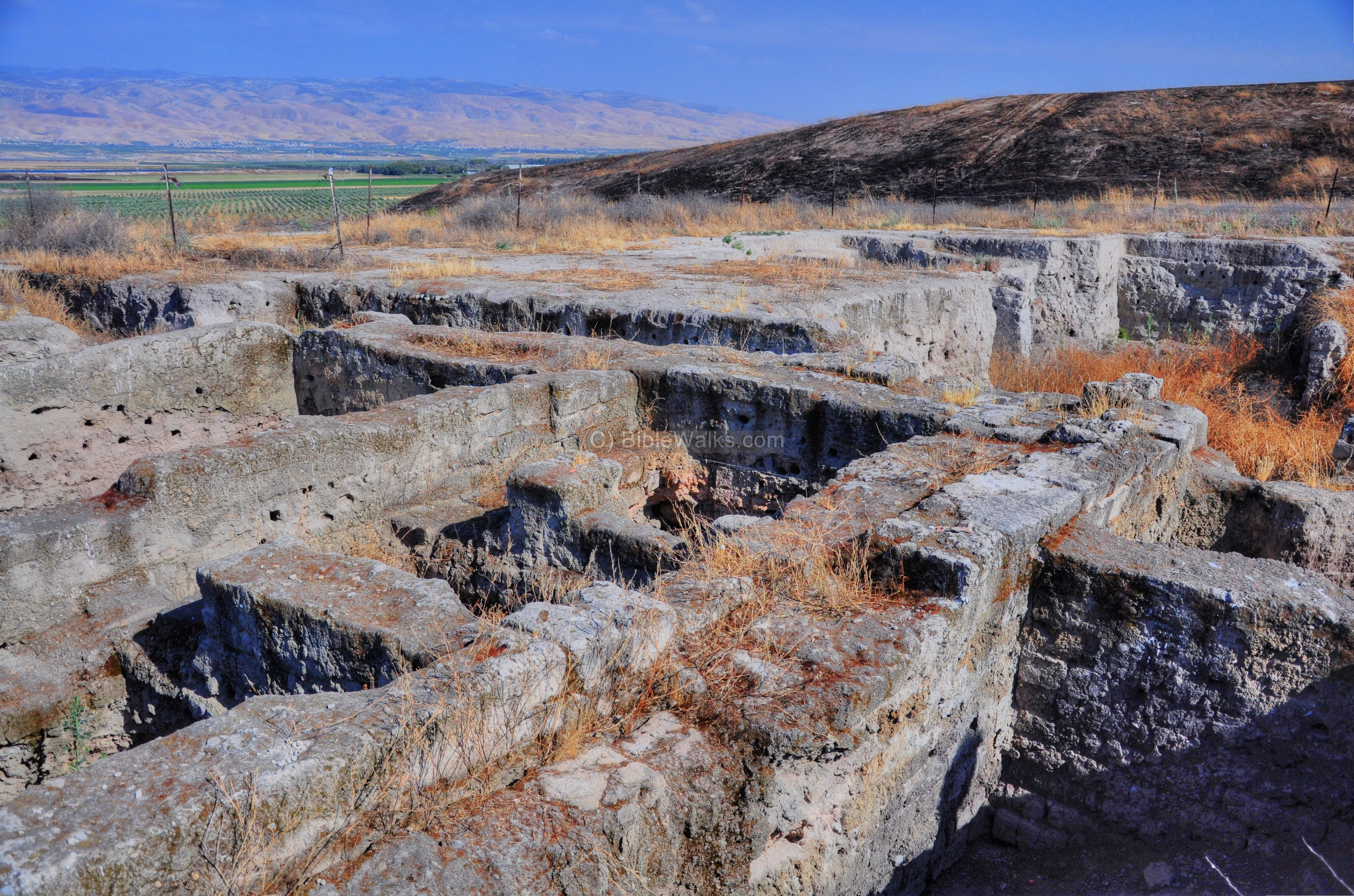
(b) South side – Upper city
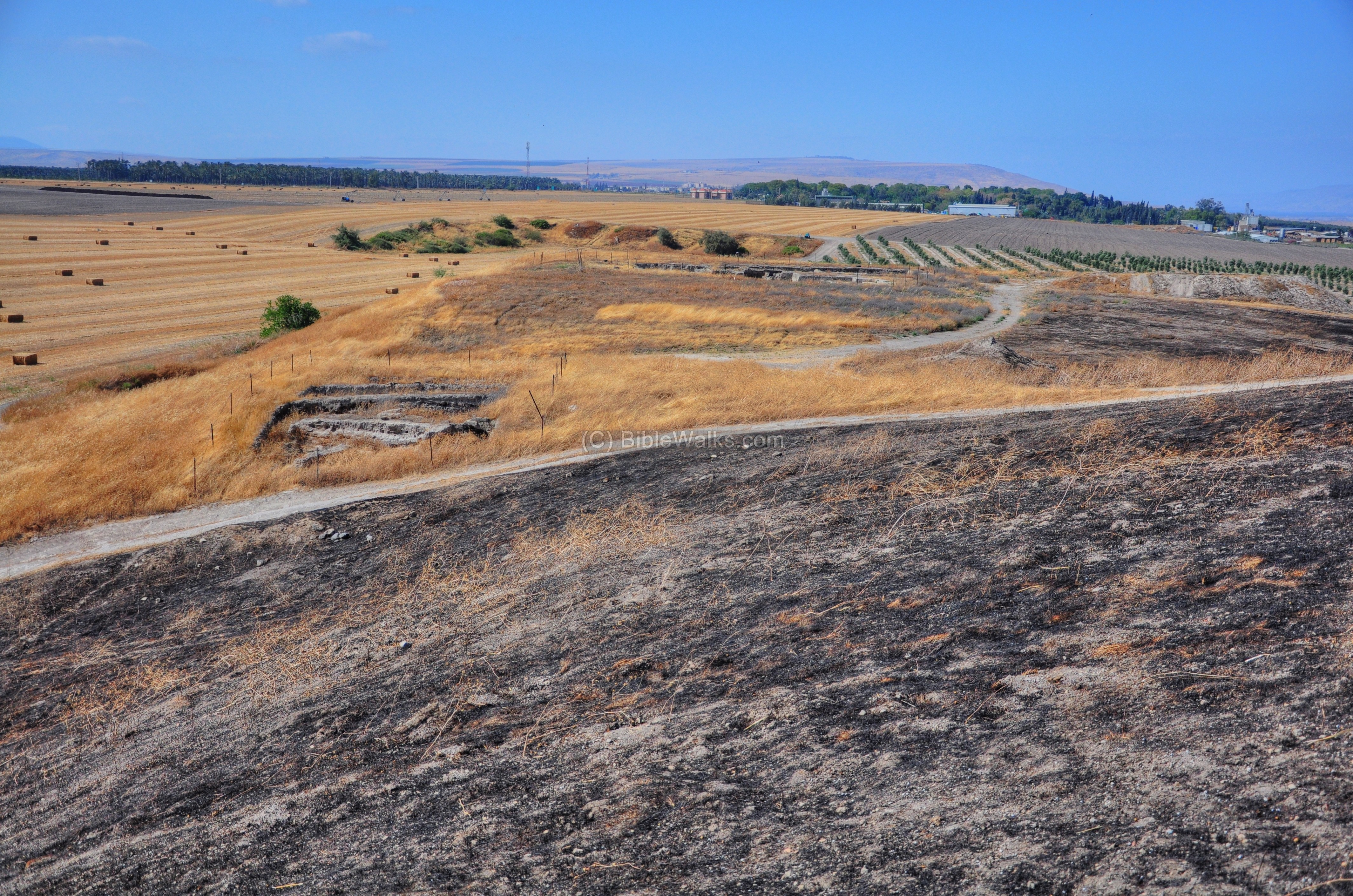
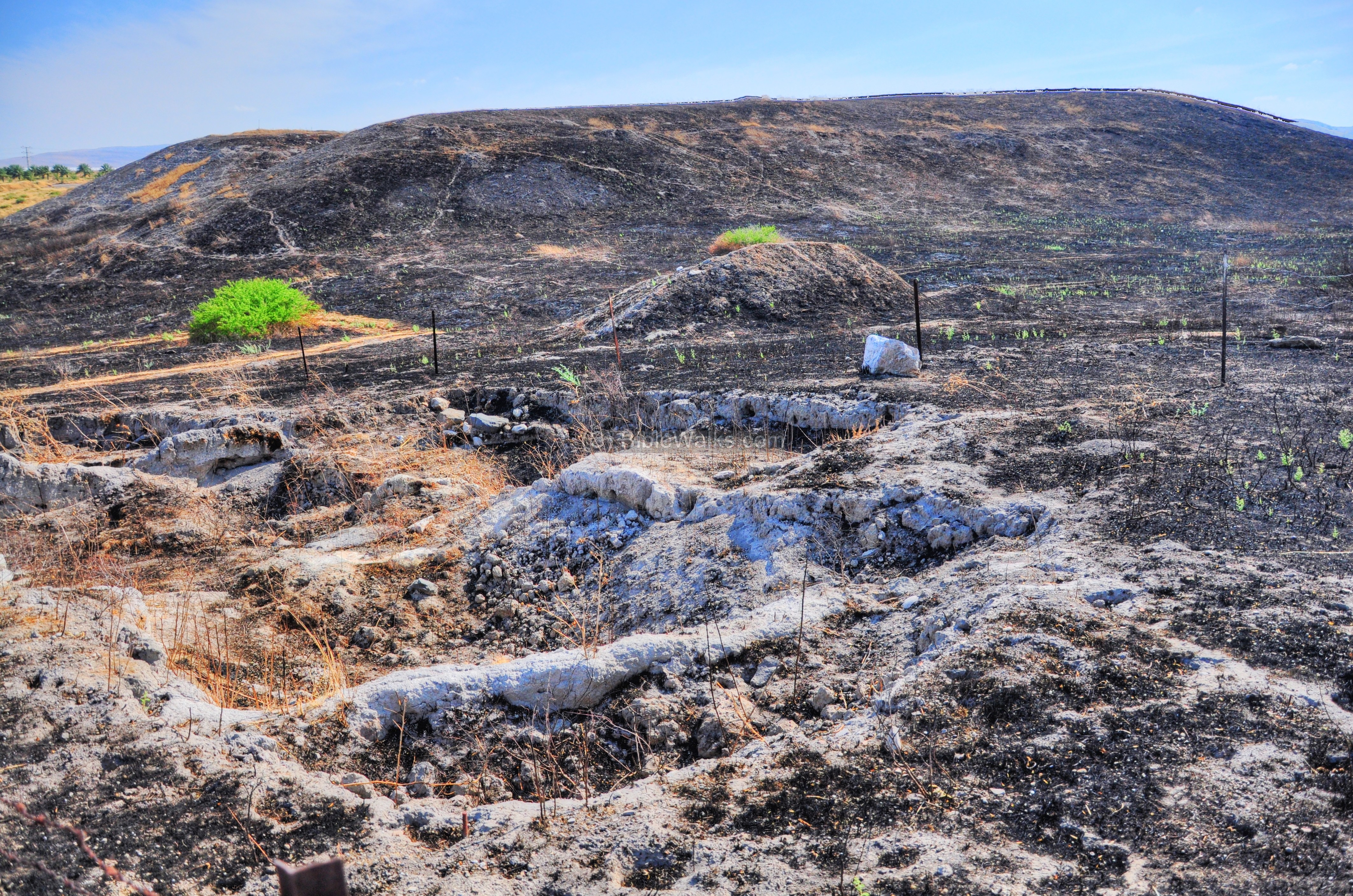
The aerial photo (captured May 2015) shows the southern side – the “upper city”. This side rises 24M above the level of the field – a steep climb, which provided protection to the inhabitants of the Bronze/Iron age city. It was occupied from the Early Bronze age until the Assyrian conquest at the end of the 8th Century BC.
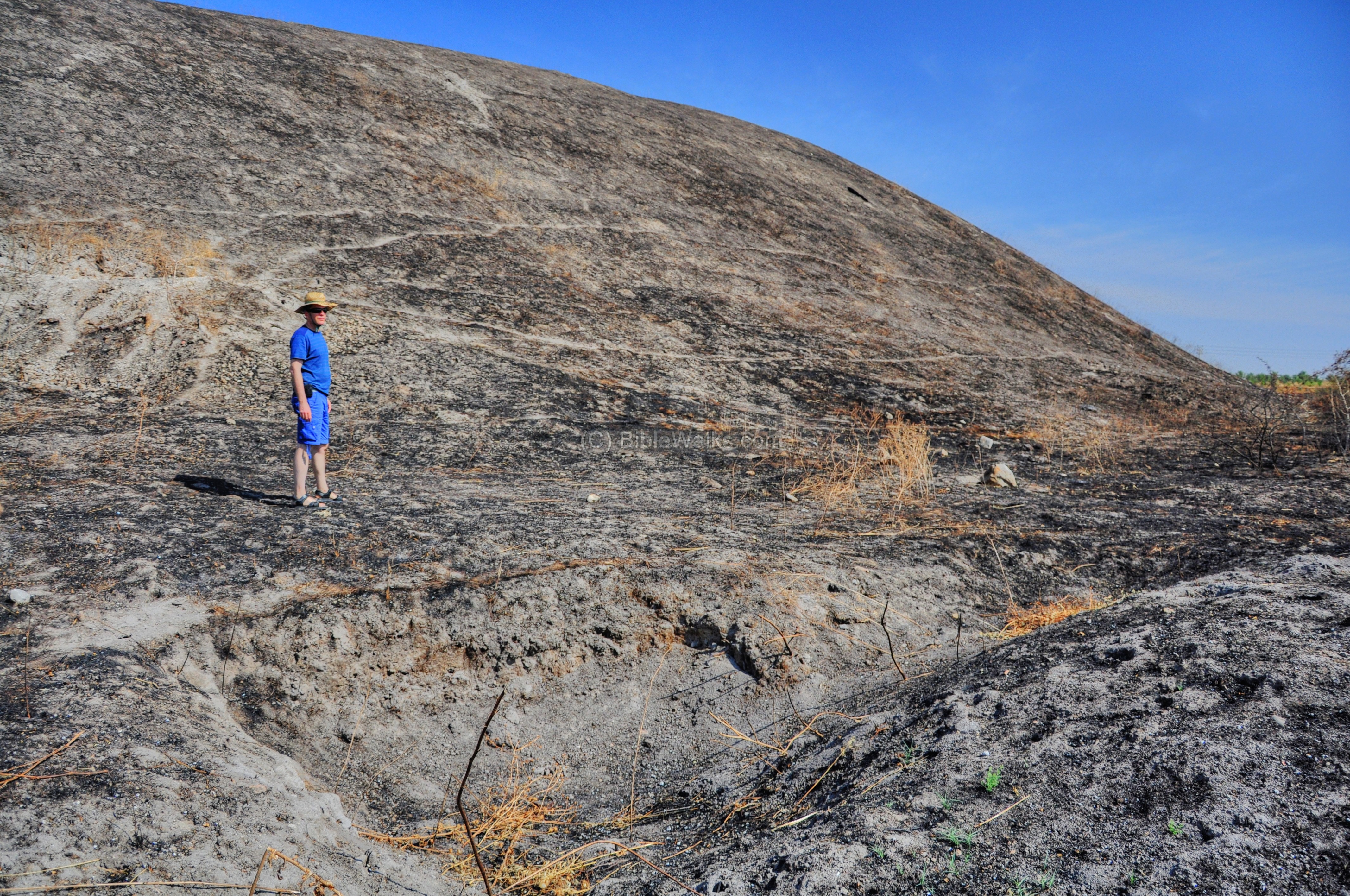
In May 2010 the south side of Tel Rechov was completely burnt, as attested by the black soil. Although the fire cleared out the dry weed, it slightly damaged some of the excavation trenches. Here, Uncle Ronnie stands on the western slope of the burnt hill.
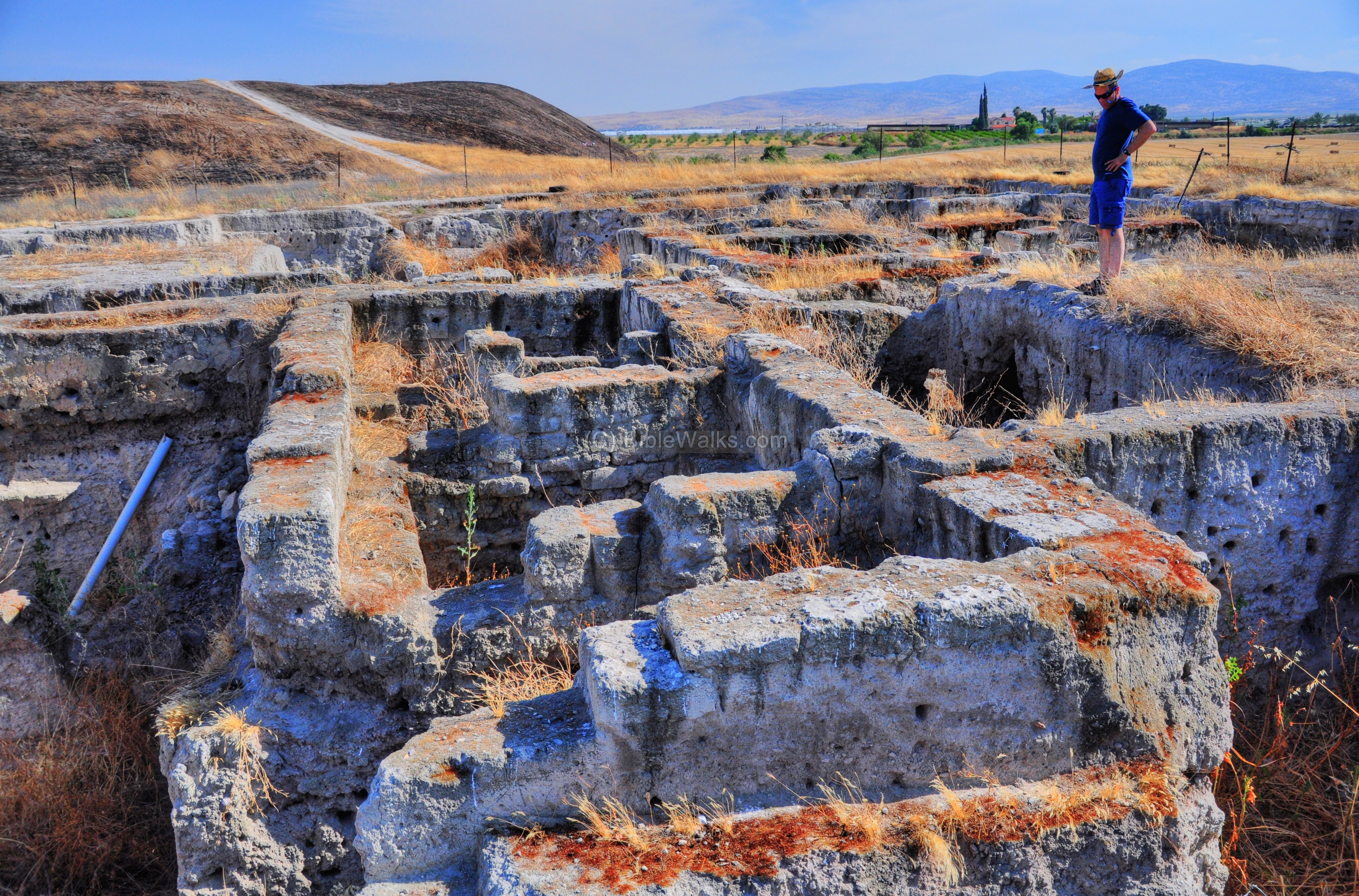
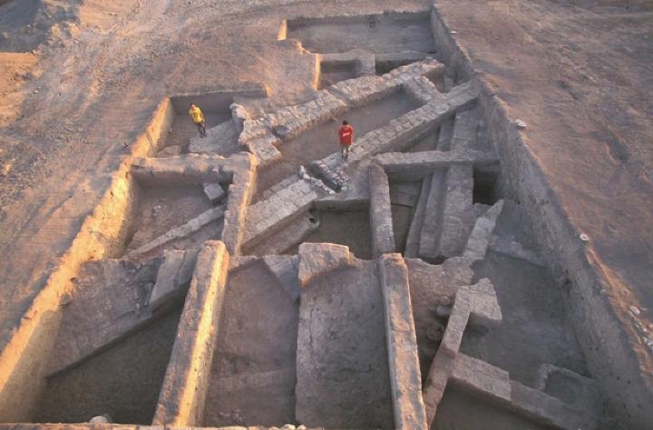
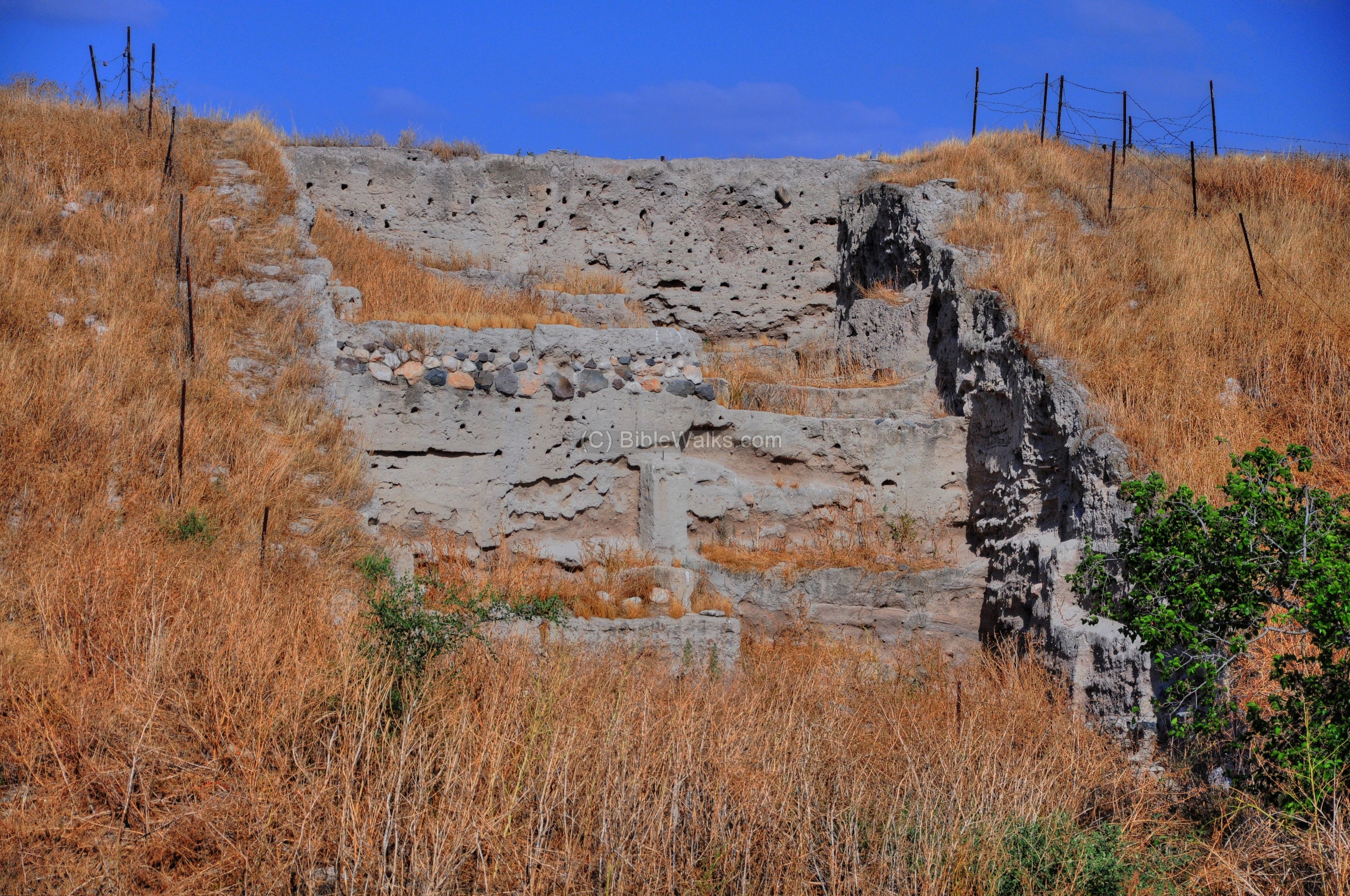
- Area B – NW side
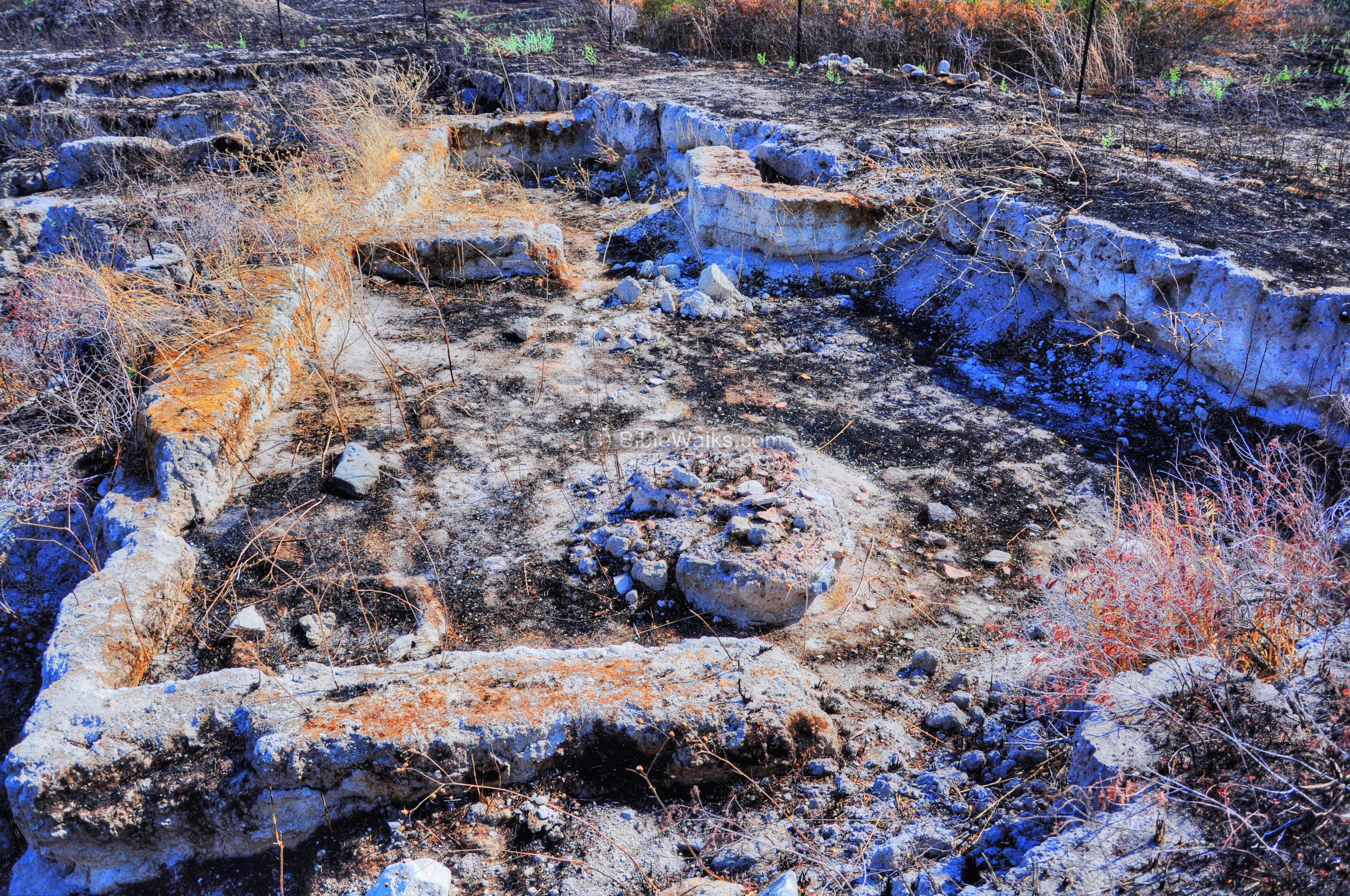
A trench on the north-west side of the upper city. A photograph of the excavated area is shown below, while the diagram shows 3 layers out of the 7 layers that were identified in this section (photos courtesy of Tel Rehov Expedition, the Hebrew University).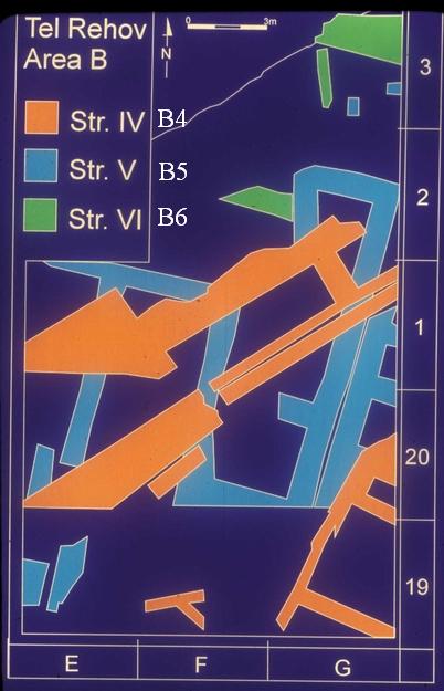
The earlier layers (“B-6” = Str. VI in green, “B-5” = Str. V in blue) consisted of residential buildings.
The highest layer “B-4” (Str. IV in orange), dated to the end of Iron Age IIa (830-840BC), changed its design and purpose: a double defense wall and a tower were constructed instead of the buildings. In the photo, both of the excavators are standing on the defense wall. This wall failed to save the city in the assault in 830-840BC, when the city was destroyed.
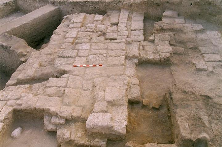
After the destruction of the city (at about 830BC), the residents occupied only the upper city (south side). An immense wall was added on the northern slopes of the upper city. The higher wall was built over the double-wall from the B4 layer. A section of the defense wall (Layer B3 – Str. III – from 830-840BC) is shown in the next photograph, a layer which was “pealed off” on the previous photograph.
This reinforcement of the wall, which ran above the earlier double wall – came after the lower city was abandoned, and there was a need to further fortify the upper city. However, the defense wall eventually failed to withstand the Assyrian empire assault in 734-732BC. Its collapse caused the brick material to cover an area north of the wall.
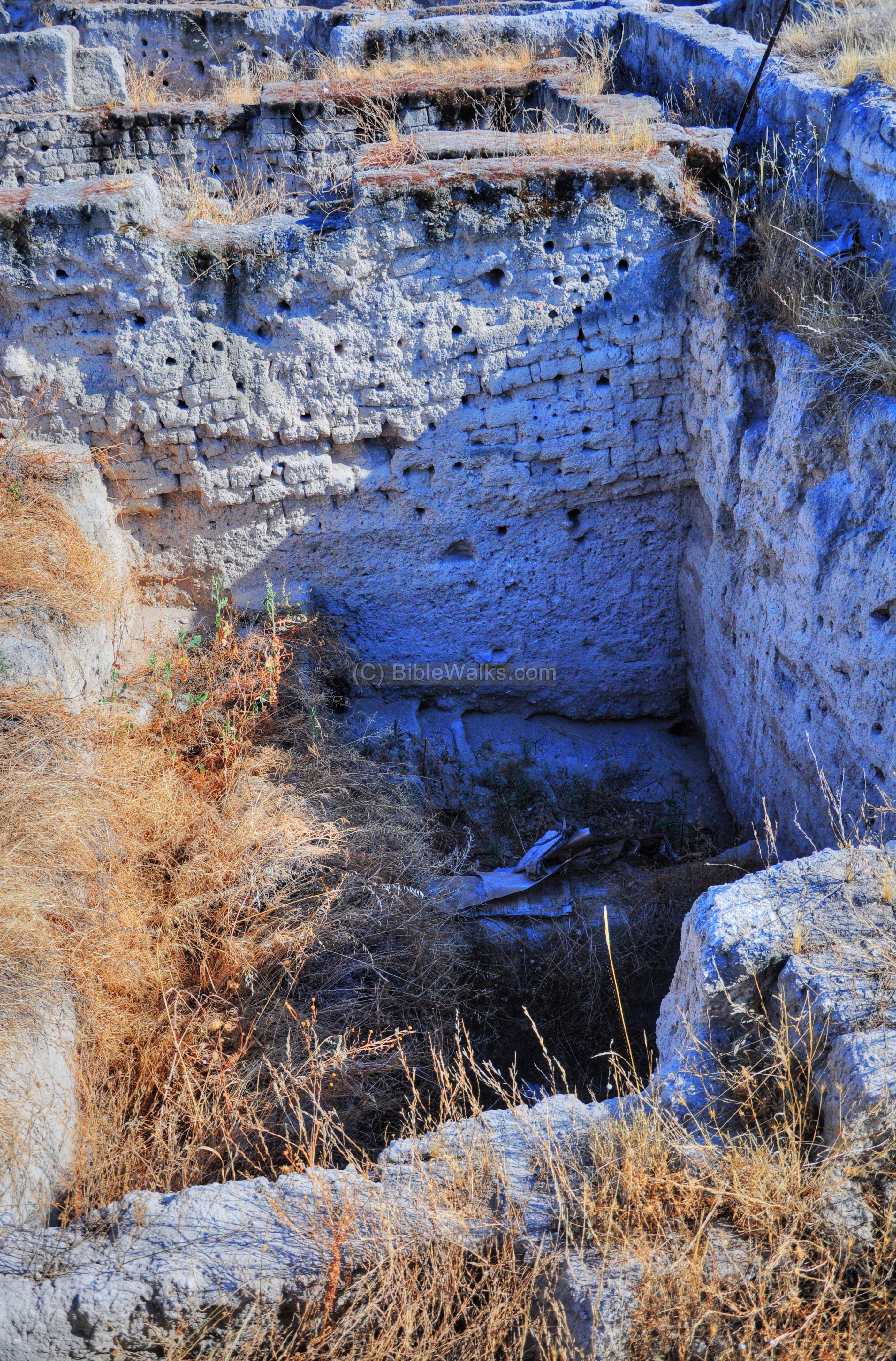
- Area A – East
Excavation area “A” is located in the center of the south hill, facing the Jordan valley and the mountains of Jordan. It is located above a small ravine that descends down to the east side.
The excavations revealed 3 layers of Iron age IIa (from 980 BC to 830-840BC). In the topmost layer the excavation team found two human skulls, one of them decapitated, attesting to the slaughter of the people of Rechov during the Assyrian conquest.
- Area J – SE foothills
This area is located on the south-east corner, cut into the edge of the mound and the south foothill, with 5 excavation squares. The goal was to discover the continuation of the Iron Age IIa city wall, as found in Area B, and to detect possible earlier fortifications on the slope of the Tel. No walls were found here, only residential buildings from that period (Stratums VI to IV).

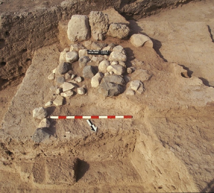
- Area H – SW foothills
A narrow trench in the south-western corner, where the archaeologists revealed an Early Bronze Age II/III (3050-2300 BC) fortification wall. It is a massive mud brick wall, 9.5m wide and 6.5m high, with a earthen glacis 13m wide and 3.5 m high. This finding suggests that Rechov was a central city-state as early as the third millennium.
(c) North side – Lower city
The “lower city”, on the north side of Tel Rechov, was occupied from the Late Bronze age until the 9th Century BC, when it was severely damaged.
The north hill was spared from the fire, and is covered by dried out weed. The excavation area “D”, which cuts deep into the foothills, is seen on the left side of the hill.
Another view of the north hill, as seen from the south, is below. The excavation area “G” is the closer area on the left, while area “C” is seen at the edge of the mound. Kibbutz Ein-Hanaziv is seen in the far background.
More updated photos were captured by a drone on May 2015:
A closer view of the excavation area:

-
Area D – Western Slopes
This narrow area borders the Area C, and was cut into the western slopes of the lower city.
The excavations revealed a dense continuous occupation from the Late Bronze age (1550-1200BC) and the Iron Age I (1200-1000BC) to the Iron Age IIa (1000-925). A total of 11 layers were exposed (D1 thru D11). The lowest and most ancient (“D11”, LB 16th Century BC) is 1.2m below the level of the field, indicating that many other parts of the city are covered by the field around the mound. (view to the east, Iron Age I strata, photo courtesy of Tel Rehov Expedition, the Hebrew University).
Another view, from the south-east, as this section was seen after the excavations. The Iron Age IIa structures, which were part of the buildings in adjacent area C, were found without fortifications.

-
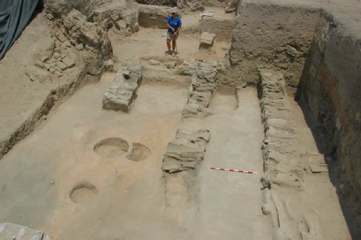
Area E – Dwelling and Sanctuary
Area E is located on the north-east side. The archaeologists identified here a dwelling and an open air sanctuary. The sanctuary, referred in the Bible as “Bama”, serviced the local neighborhood, and is dated to the Israelite period – the Iron Age IIa (mid to late tenth C). It includes a wide, open courtyard, bounded by a brick wall on the north (bottom-right of the photo). In the courtyard are clay bins, ovens and benches – their remains are seen near the lower wall. (view to the south, photo courtesy of Tel Rehov Expedition, the Hebrew University)
The western structure (on the left side) included a main hall and two large rooms on either side. In its northeast corner was a mud-brick platform with a smaller stone platform on top, and three stones were embedded into it, serving as ritual standing stones (“Masseboth”). This is seen on the following photograph (photo courtesy of Tel Rehov Expedition, the Hebrew University).
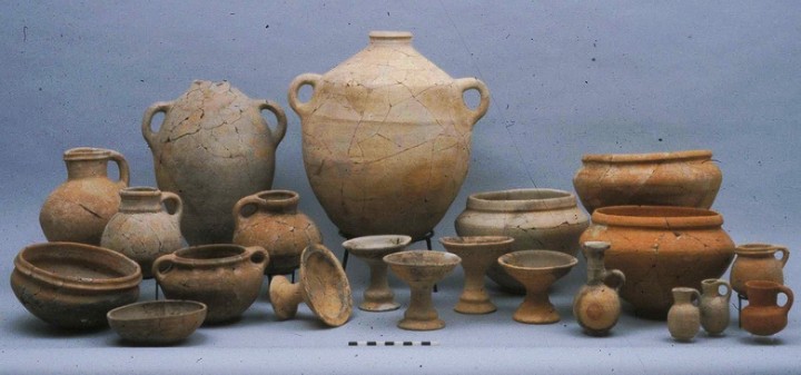
A group of pottery vessels, shown below, were found at a single room. They are dated to the 9th century BC. (photo courtesy of Tel Rehov Expedition, the Hebrew University).
Area E was damaged by the fire of 2010. Remains of ceramic vessels in the sanctuary ( seen on the excavation photo on the bottom right corner), were baked by the fire and cracked:
-
Area F
This small excavation area is located on a north-eastern ridge, south of Area E. The upper city is seen behind.
Four layers have been identified here, dated to the Iron Age II. The walls are parallel to those of Area E, which testify to a good urban planning with well defined blocks of buildings.
-
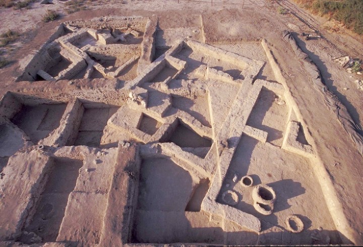
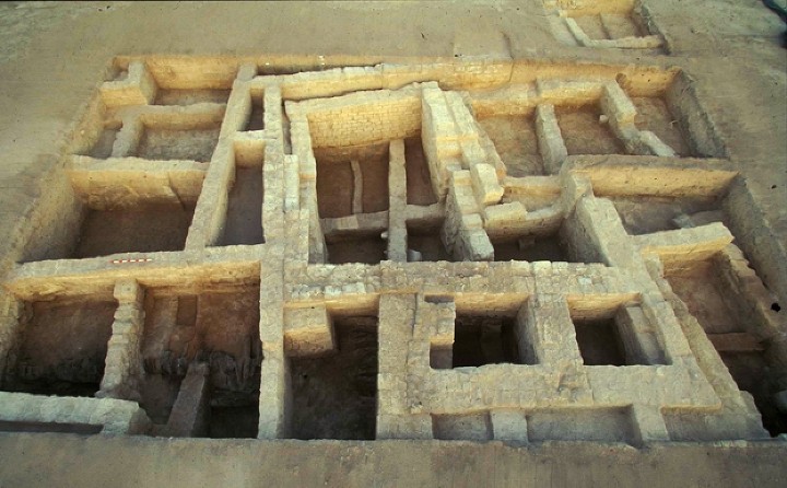
Area C – The primary excavation
Area C is the primary excavation site, which revealed a complex of densely built buildings. Their construction is dated to the Iron Age IIa period (1000-925 BC ) – the Kingdom of David and Solomon.
In the photo below is a view towards the south-west, with the upper city in the left background.
The complex on the lower city was destructed in about 830BC, probably as a result of the conflicts between the Israelite Kingdom (Kings Omri and Ahab) with Aram-Damascus. Evidence of the violent blaze was found in most of the rooms.
The construction of the buildings was made entirely by mud bricks without a stone foundation, which was unusual for the period of Iron Age II. Wood foundations were used in some walls and floors.
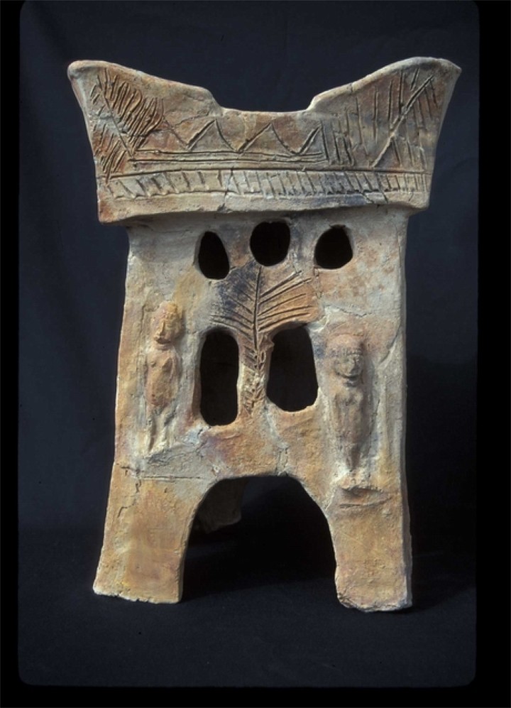
The archaeologists unearthed many rich findings among Area C ruins – ceramic vessels, metal and stone objects, seals and ivories, bones, flint, clay altars and shrines. One of the fine examples of these findings is a horned ceramic altar, dated to the 10th century BC (photo courtesy of Tel Rehov Expedition, the Hebrew University). It was found in association with the apiary. Notice the two female figures and other decorative details.
In 2013, a rare finding was found on the north east section of area ‘C’: An ostracon with an inscription with the name of Elisha, best known as the name of Biblical Prophet Elisha, Elijah’s pupil and successor. A nearby site, Abel Meholah (Abu Sus Sakut?), is mentioned as the home place of prophet Elisha, the successor of Elijah (1 Kings 19:16): “…and Elisha the son of Shaphat of Abelmeholah shalt thou anoint to be prophet in thy room…”.
Three levels were identified in the lower city –
-
the lowest layer “C-2” (general Stratum VI, early to mid 10th Century BC): probably destroyed by an earthquake, as attested by fallen bricks and cracked walls
-
an intermediate layer “C-1b” (general Stratum V, mid 10th to late 10th BC): retained some of the earlier plan, was partially destroyed
-
the highest layer “C1-a” (general Stratum IV, ninth Century BC): renovated the earlier layer, ended in the Aramean destruction. The burnt debris covered many of the findings and structures.
A look into the bottom of the house in the south-west area:
-
Area C Apiary
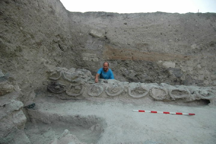
One of the interesting findings was an ancient apiary – with dozens of beehives arranged as rows of clay cylinders. Each beehive was 80 cm long and 40 cm in external diameter; each cylinder stored 56 liters of honey. The apiary was on the south-eastern corner of Area C, which is seen below behind the 3-room structure labeled “G”. It is dated to the 10th century BC, and is a unique archaeological find.
It was surprising to find an industrial complex within a dense residential neighborhood, with about 1 million bees buzzing around the houses…. The answer to this puzzle was probably the need for protection of the flow of income (and honey).
A closer view of the excavations on the south-east corner is seen below. The beehive complex was located in the center of the large courtyard on the lower left side. The archaeologist team first removed the upper layer (a room labeled “L”) from the “C-1a” layer (the last layer which was burnt by the Assyrians). Then, they reached a set of clay cylinders that were later identified as hives.
The apiary area with its three rows, during its excavation, is shown below (view to the north, photo courtesy of Tel Rehov Expedition, the Hebrew University):
The eastern row of hives (photo courtesy of Tel Rehov Expedition, the Hebrew University):
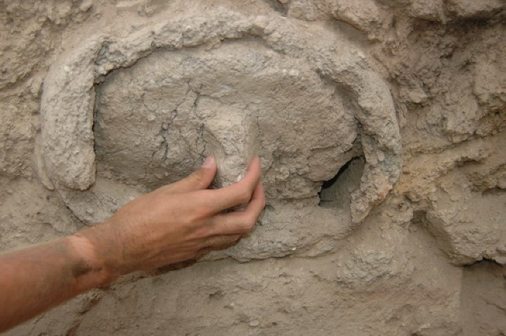
A detail of one of the beehive clay cylinders is seen in the next photograph, with the hand holding the clay lid (photo courtesy of Tel Rehov Expedition, the Hebrew University):
Based on the excavation results and the special article (“Beekeeping at Tel Rehov, Mazar and Panitz-Cohen”), the operation of the apiary is illustrated in the following drawing. The cylinders are arranged such that the holes where the bees fly through do not face the workers, thus reducing the risk of getting stung while extracting the honeycombs.

Exodus 13:5 “…a land flowing with milk and honey”
You can read further information about this fantastic finding in the web site of of Tel Rehov Expedition.
Ayelet Keidar added a story on the early period of modern Jewish settlement in the Jordan Valley: In the 1920s Mussa Goldenberg of Kibbutz Beit Alpha visited the Arab village of Samariya, 3km south of Tel Rechov, in order to purchase bees for their new settlement. The local peasants sold him beehives that they grew in clay drums and were arranged as a wall, just like the practice in the Iron Age period.
-
Area G
This small section is located on the south-west side of the lower city, south of area C. Dwellings from the Iron Age IIa were found here.

(d) Fire artifacts – the exhibition
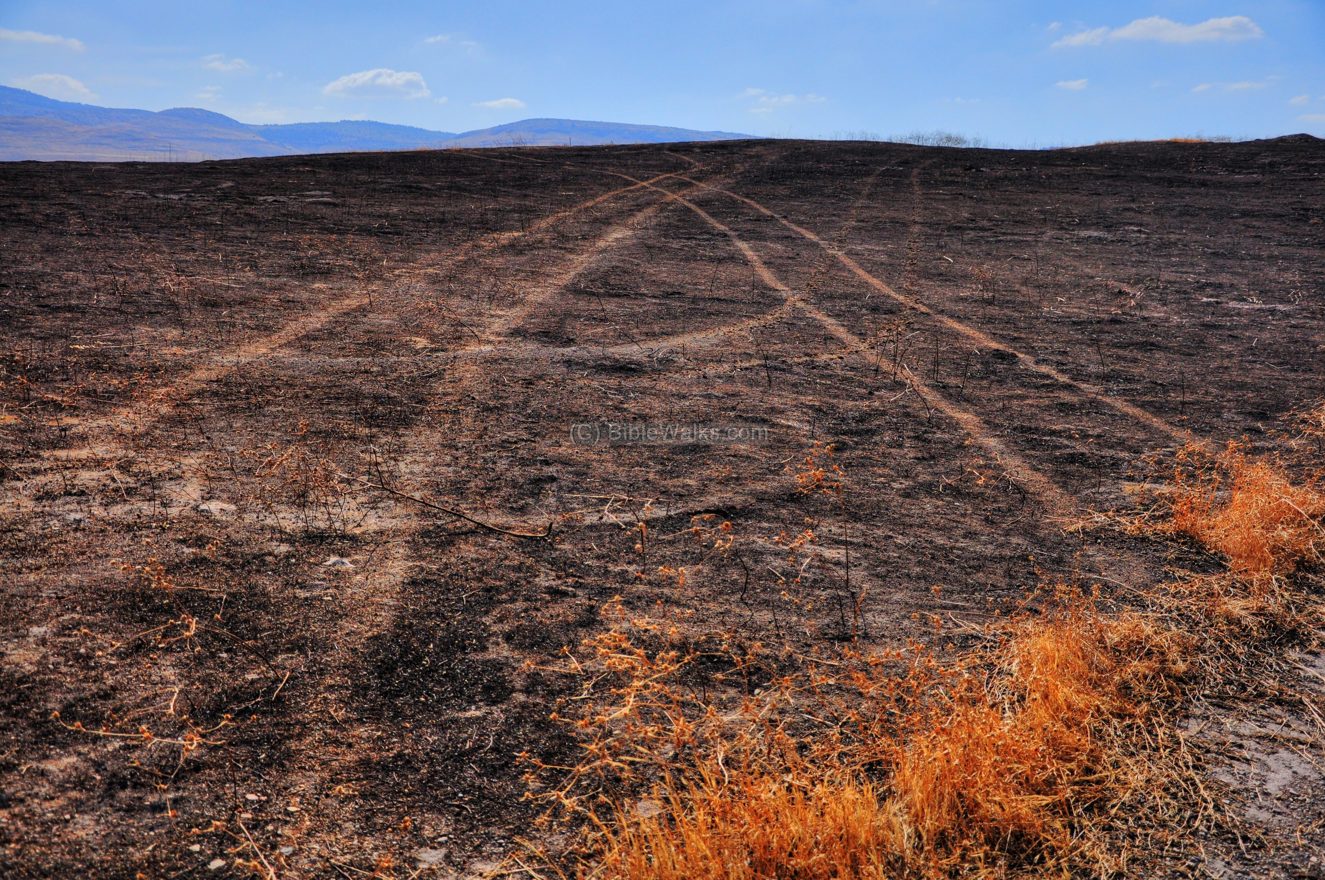
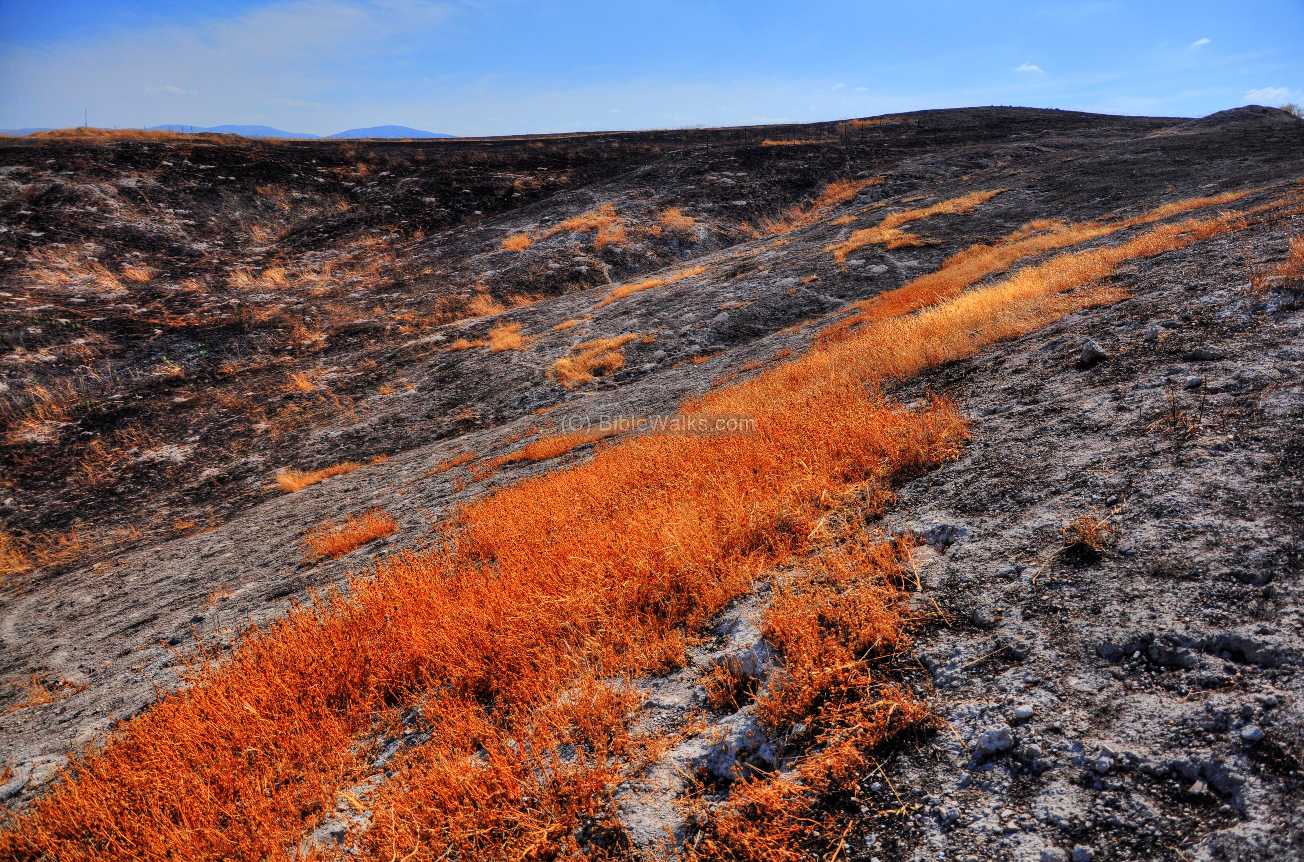
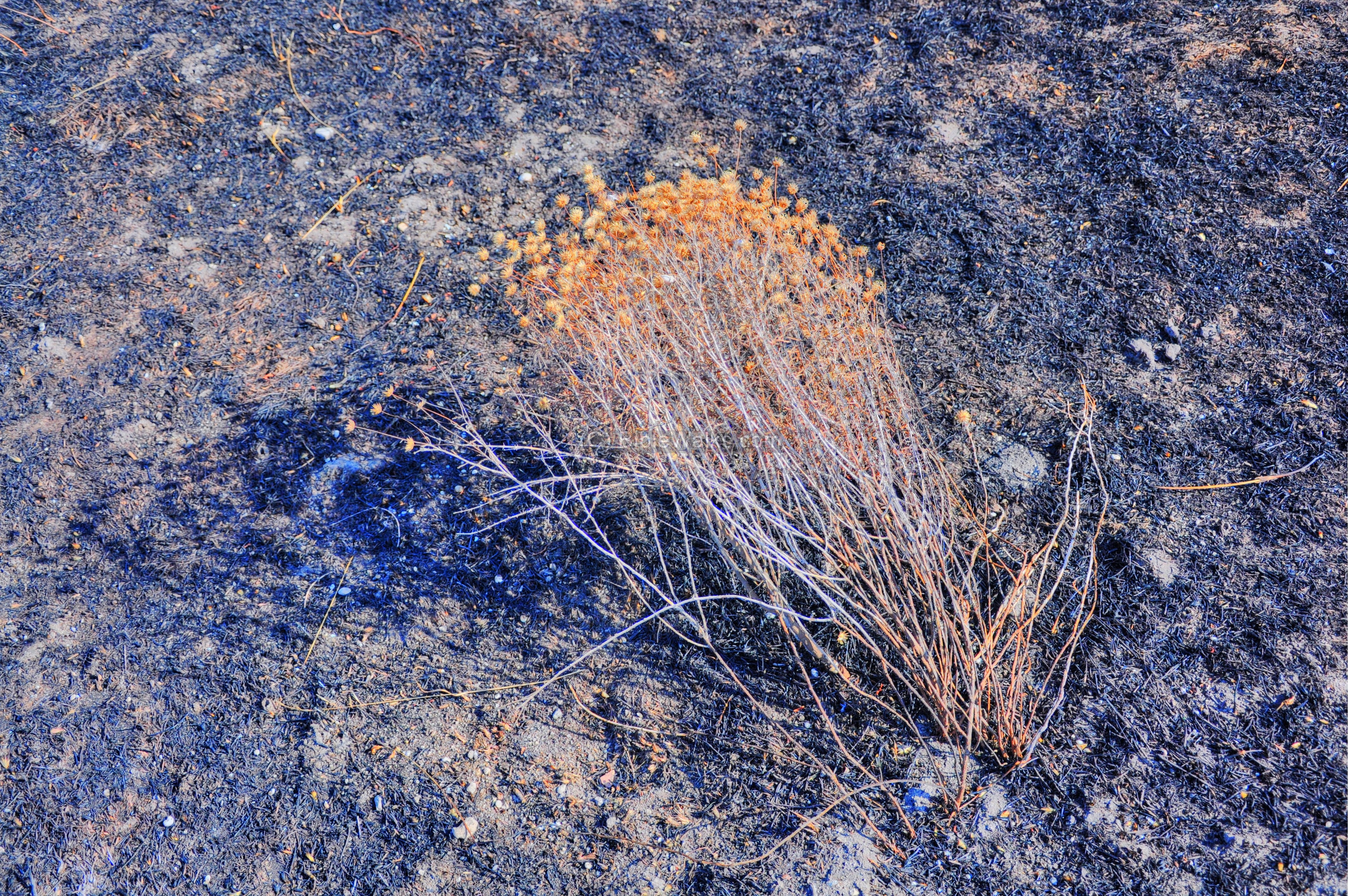
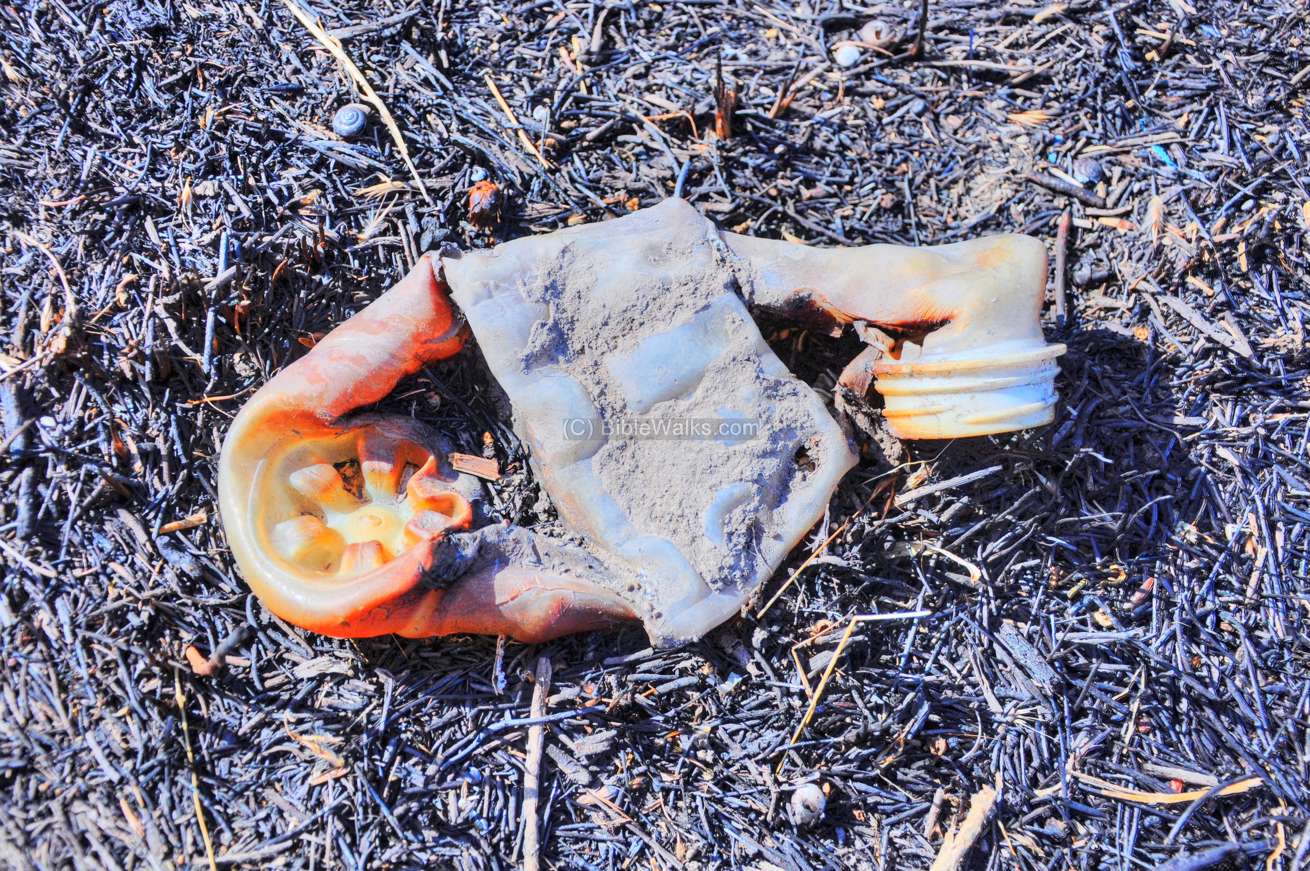
The south hill was burnt in May 2010, clearing out the dead weed. One of the side effects of the fire was a creation of interesting artifacts that caught our attention. The following pictures are some of the remains from the fire – a remarkable outdoor exhibition.
- The barren hillside and tracks:
- Weed on hillside, adding a golden touch to the vast nothingness:
- The lone thorn, which miraculously managed to resist the raging fire :
- Plastic bottle, melted into a piece of art:
- Horse stirrup iron and leather strap, a memory of the galloping horse that once passed here:

(e) Other photos of the area
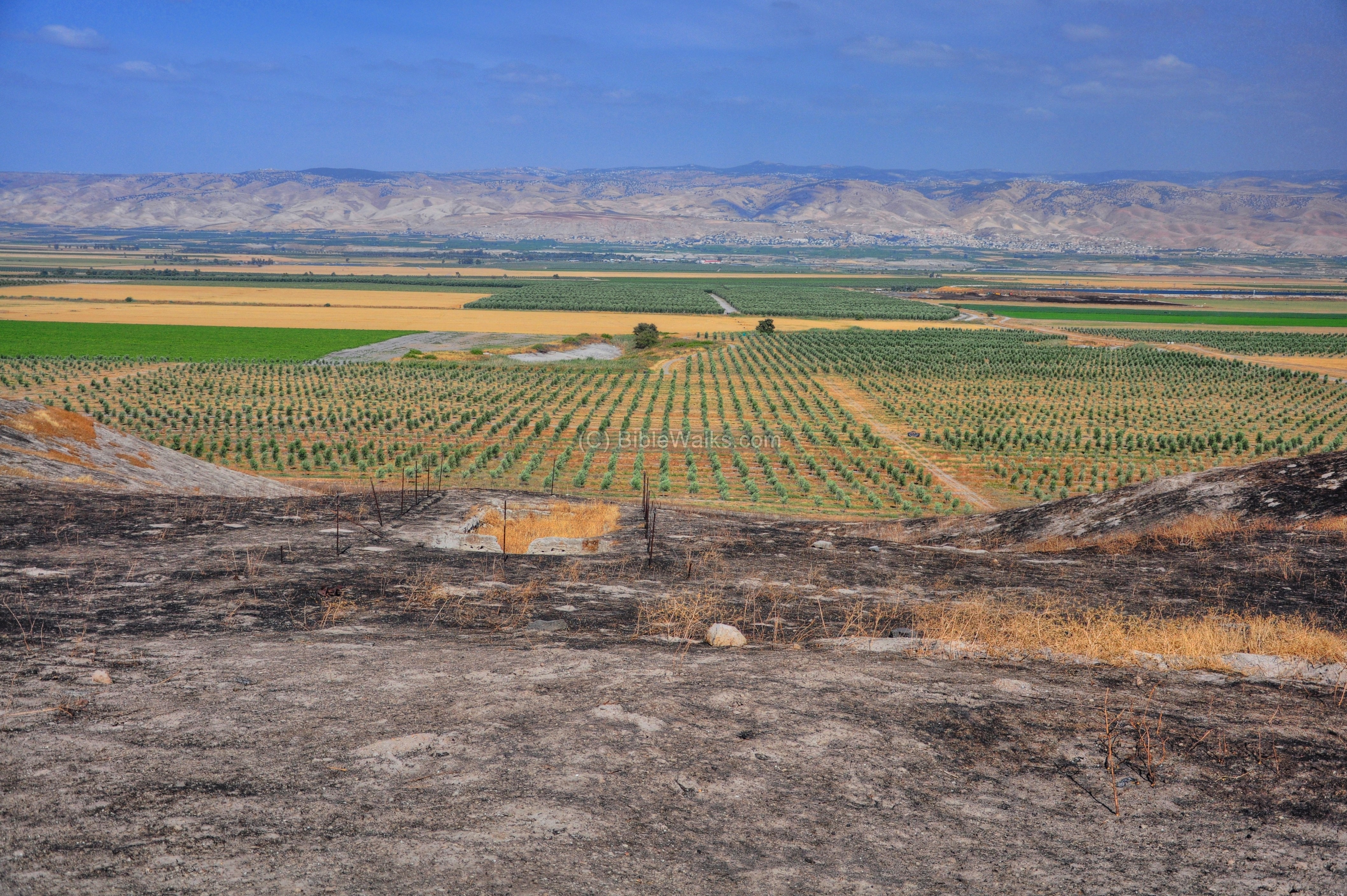
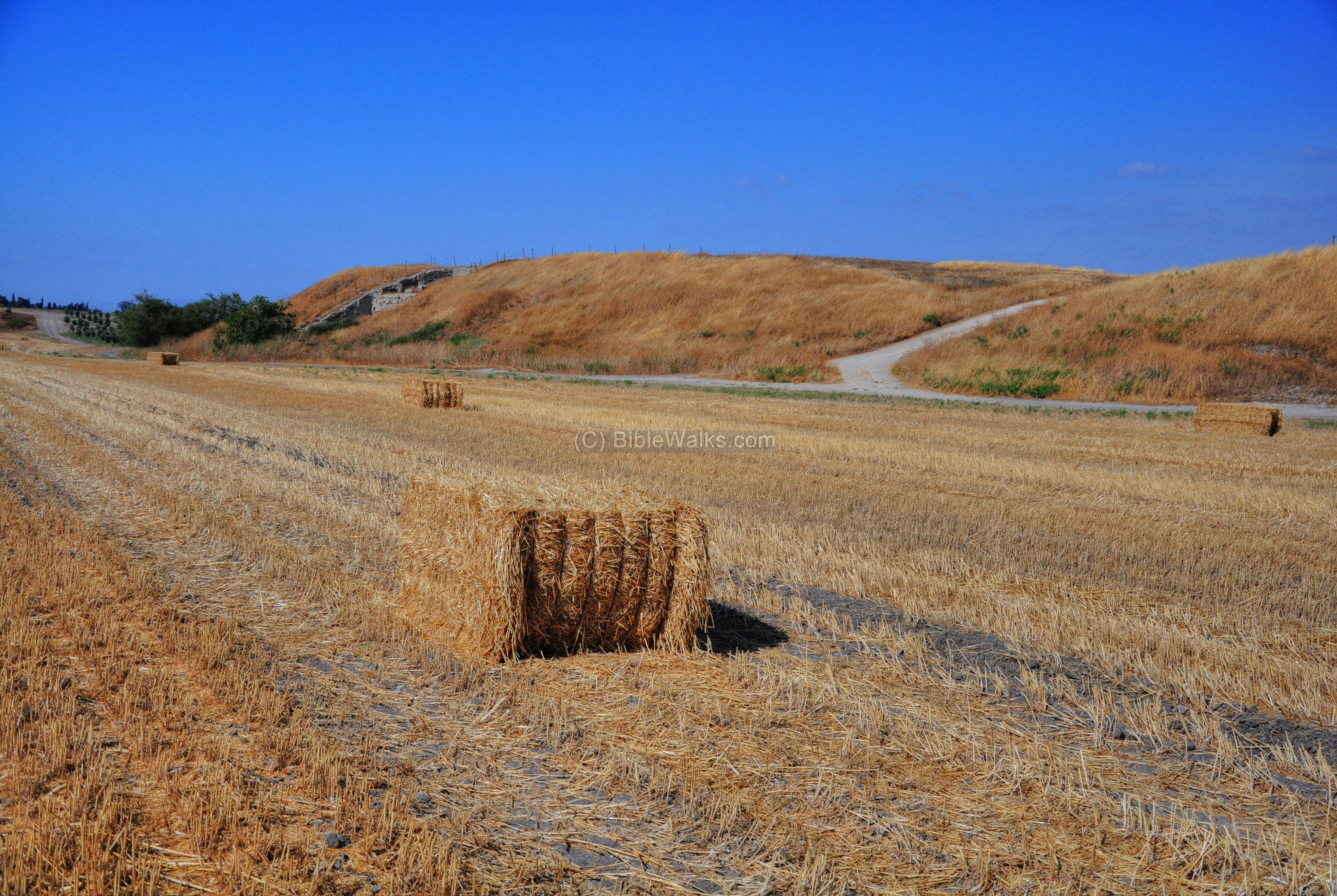
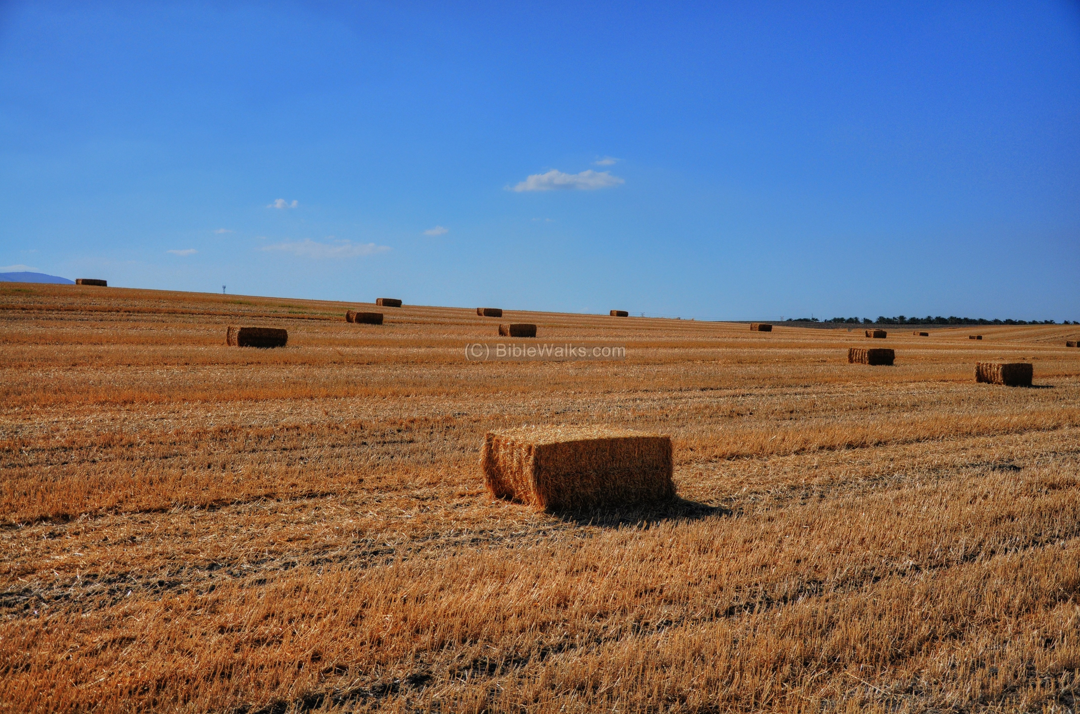
The wheat field on the north-west side, after harvest, is seen below. Large sections of the area around the mound were also part of the ancient site, but are now covered by the farming land.
Video presentation:
A day in the life of an archaeology expedition on Tel Rehov, Israel.
(Scottsdale Community College Archaeology Professor, Dr. Lisa Cole)
Part 1:
Part 2:
Links:
* External:
-
Tel Rehov – Hebrew Univ
-
Tel Rehov – chronological table (with a stratigraphy legend)
-
Papyrus Anastasis I – reference of Rehob
- “והקרן עודנה קיימת” – Mussa Goldenberg, memories; 1965 (p. 86)
- “Reconstructing biblical military campaigns using geomagnetic field data“. Yoav Vaknin, Ron Shaar, Oded Lipschits, and Erez Ben-Yosef (2022). Proceedings of the National Academy of Sciences. 119 (44).
* Other:
- Biblical pictures by Gustave Doré (1832-1883) – public domain
* Internal:
- Tel Rechov Revisited – exclusive meeting with Prof. Mazar on the mound he excavated – Jan 2025
- Tel Nissa – nearby Bronze/Iron age site
-
Drone Aerial views – collection of Biblical sites from the air
Etymology (behind the name):
- Tel (Tell) – mound (See more on the story of a Tel).
- Rechov – Hebrew: street, road, piazza (in Biblical Hebrew).
- Rehov, Rehob – there are several such cities mentioned in the Bible, but are other sites. In the area of the tribe of Asher, for example, there was another city by this name (Joshua 19 24, 30): “And the fifth lot came out for the tribe of the children of Asher… Ummah also, and Aphek, and Rehob“.
- Tell es Sarem – name of the site in the PEF survey (1881)
- Moshav Rechov – nearby agriculture settlement; established in 1951
BibleWalks.com – exploring the ancient sites of Israel
Gerassimos <<<—previous site—<<< All Sites>>> — Next site—>>> Tel Issachar
This page was last updated on Jan 21, 2025 (add “Tel Rechov Revisited”)
Sponsored links: