A resort town located on the junction of Via Maris and the Ga’aton river, near the border with Lebanon. A number of archaeological places were excavated in the city, including a Canaanite temple a Byzantine church.
Home > Sites > West Galilee > Nahariyah (Nahariyya, Nahariya)
Contents:
Background
Location
History
Photos
* Temple
* Church
* Tombs
* Roman Road
Etymology
Biblical refs
Links
Background:
Nahariyah (“River of God”) is a northern coast town, close to the border with Lebanon. Its location on Via Maris, the north-south ancient highway, made it a prime location during the history. There are several ancient sites within Nahariyah: Tel Nahariyah, an ancient temple, a Byzantine church, and a section of the Roman paved road.
Psalms 65 9: “Thou visitest the earth, and waterest it: thou greatly enrichest it with the river of God, which is full of water: thou preparest them corn, when thou hast so provided for it.”
Location:
The resort town of Nahariyah is located on the Mediterranean coastline, in the north-west side of Israel. It grew around the Ga’aton (Gaathon) river, which flows through its center.
The ancient sites are located in different places, hidden between the modern buildings: the Biblical Tel is located south of the mouth of the river; the Canaanite temple is located on the coast 900M north to the river; the Byzantine church is located in Park Katzenelson – a hill east to the main highway; the western section of Via Maris Roman road section is located downtown in Weizeman avenue.
An aerial photo of Nahariyah is shown below (indicating the major points of interest). The city is located along the coast and along the east side of the highway to Haifa.

History of the place:
-
Bronze Age
Nahariyah’s prime location on the coastal section of Via Maris (“way of the Sea”), the marine port, and the source of waters, made it an ideal place.
According to Archaeological excavations, Tel Nahariyah was populated from the Middle Bronze period (20th Century BC). It had probably a harbor at the Ga’aton river bay. The ruins of Tel Nahariyah are mostly covered by modern houses. It is located on the south bank of the river, close to the mouth of the river.
Another site, 900M north to the river’s mouth, is an ancient Bronze age temple (20-15th Century BC), which was probably a Canaanite temple for the Goddess Ashtoreth-Yam (Sea).
Port of Tel Kabri? The port and the fortress in Nahariah may have belonged to a Kingdom centered in nearby Kabri. During the Middle Bronze the city state of Kabri, east of the city of Nahariah, expanded to the areas of the western Upper Galilee. The kingdom was a strong regional center and coastal power between 1750 to 1600 BC, with ties to Egypt, Cyprus and the Aegean. It held fortresses in Kabri, Nahariyah, Ein Tamir, Akhziv and Avadon. The most significant discovery at Tel Kabri is a well-preserved palace complex dating to the 18th century BC, which is associated with the Canaanite city. This palace is notable for its well-preserved wall paintings, including vivid murals depicting various scenes and motifs. These paintings provide valuable information about the artistic and cultural aspects of the Canaanite civilization. In addition to the palace complex, the excavations have also uncovered evidence of residential areas, administrative structures, storage facilities, and a sophisticated water system at Tel Kabri. The site’s location near the Mediterranean coast suggests that it played a role in maritime trade during the Bronze Age. The discovery of large storage jars, some of which contained traces of ancient wine, is particularly noteworthy. The wine jars and evidence of a winemaking facility indicate that the Canaanites of Tel Kabri were involved in wine production and may have had a thriving wine industry.
-
Iron Age
The small port city continued in Tel Nahariyah during the end of the Iron/Israelite period (7th-6th century BC), and during the Persian period (6th-4th century BC).
-
Roman Period
In 56 AD the Romans started the construction of a Roman road along the Via Maris, shortly after the region was declared by Claudius as a Colony (Col Ptolemais). The coastal road connected Acre and Antiochia. A section of the road and a milestone (numbered 307, meaning 7 miles from Acre) was found in Nahariyah.
The Peutinger map (Peutingeriana tabula) of the 4th century Imperial Roman roads shows the coastal way from Acre (“Ptolemaide” in the top left) to Tyre (“Tyro”). The distance is indicated as “XXXII”, meaning 32 Roman miles – or 48KM. The position of Nahariyah is located near the mileage marking.

-
Modern times
Nahariyah was established in 1934, and the majority of the citizens were German descendent. It was initially based on a model of a Moshav, where each family received a small parcel of land. One of the major industries was tourism. Later, it grew into a city.
Due to its proximity to the Lebanese border, the city is occasionally shelled from the North. In the summer of 2006 it was hit many times by rockets and missiles, damaging some of the civilian houses. However, the town is peaceful and offers the visitor a nice place to rest and as a base for tours around the north side of Israel. The favorite sites are strolling along the Ga’aton avenue, eating there in one of the restaurants or coffee and ice cream parlors, and walking along the beach walkway.
Photos:
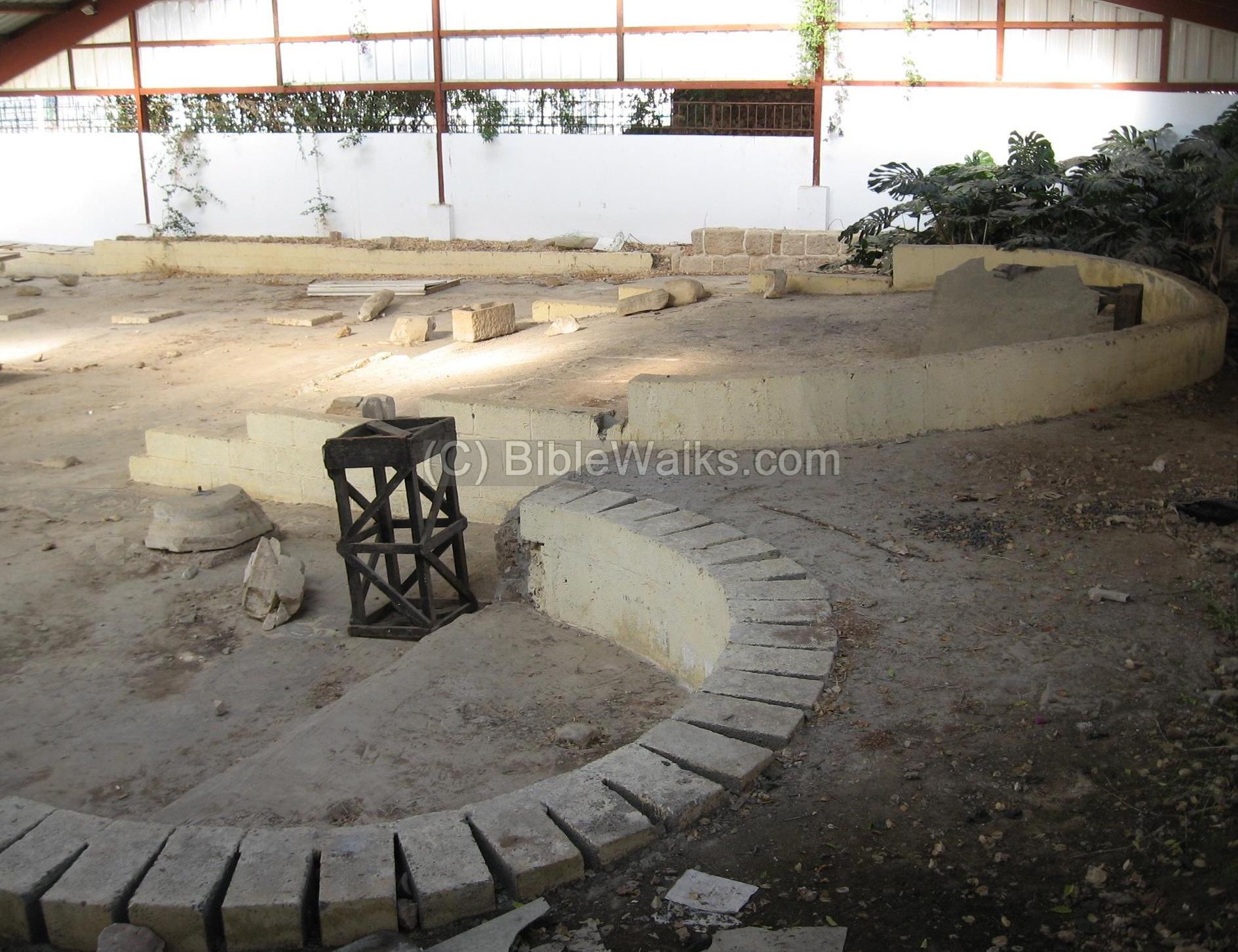
(a) The Canaanite Temple:
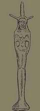
This site is located on a small (40 x 40M) mound, 900M north to the Ga’aton river, hidden between two residential houses. This was a temple for Ashtoreth-Yam, a Canaanite goddess (see Biblical reference below). The site is close to a natural spring which is located on the beach, and was important for the ritual services.
In the excavations (1947, 1954) several artifacts were unearthed, including a stone mold for producing Ashtoreth bronze statues. The statue was of Ashtoreth represented as a woman with two horns on her head. The site was dated to 17-18th century BC.
The photo below shows the main room from the coast (west) side. It had three openings – on the left and right, and in the front (facing the sea). Behind the rear wall there was an inner room.
Click on the photo to view it in higher resolution…

(b) The Byzantine Church:
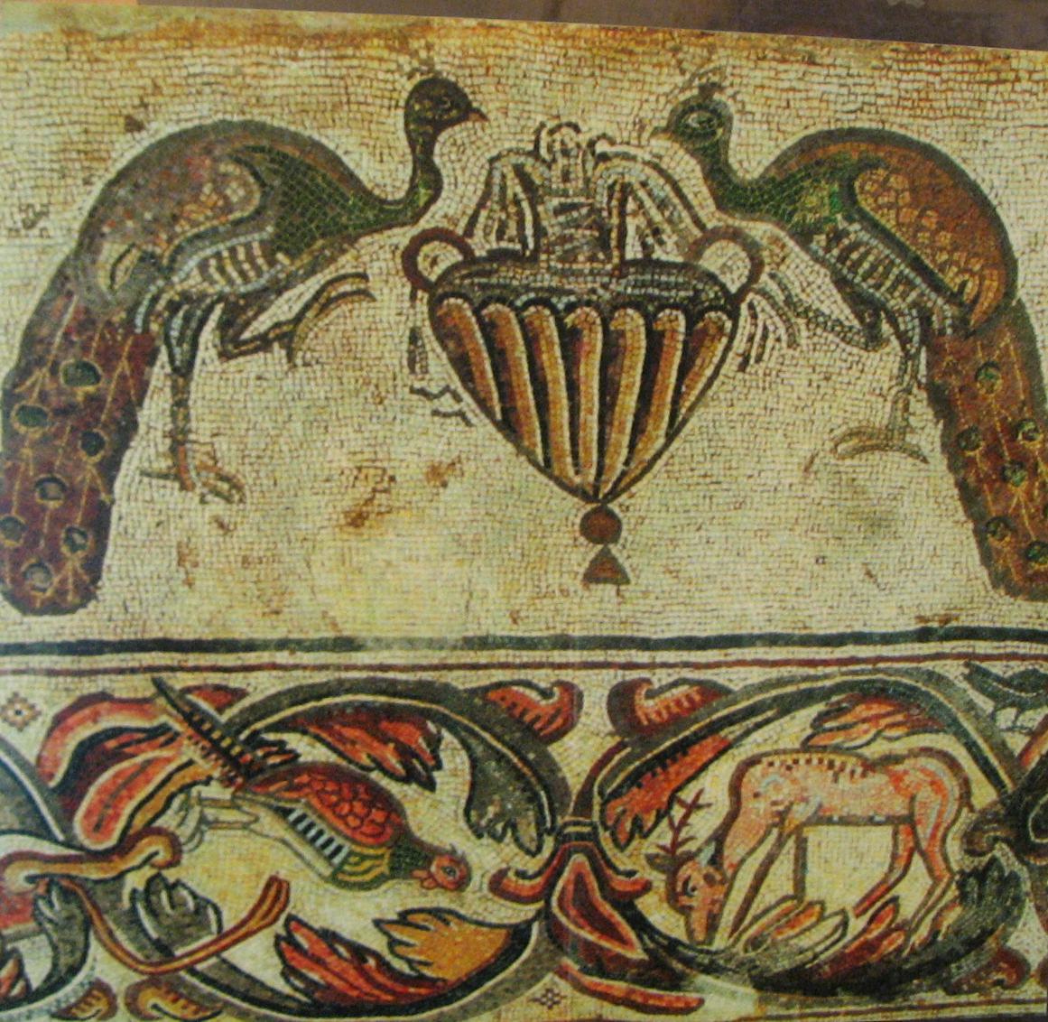
The Byzantine church is located in Katzenelson park, on a hill east to the Haifa highway. The site is called Khirbet Ittaim (or in Arabic, Taharath el-Khamima). Here, a beautiful 6th century AD Byzantine church was excavated. The church had a basilica with 3 apsises (apsides), and two rows of 6 marble pillars in each row. A mosaic inscription refers the construction of the church to the episcopus (bishop) of Tyre in 555AD.
In the photo below, two of the north apsises.
The church is covered with a remarkable mosaics, although the photo below shows this floor in a neglected condition. At the edges of the floor are scenes with figures, animals and plants. In the south apsis side, for example, is a scene with a hunter and spear (center), attacking a tiger (top-left side).
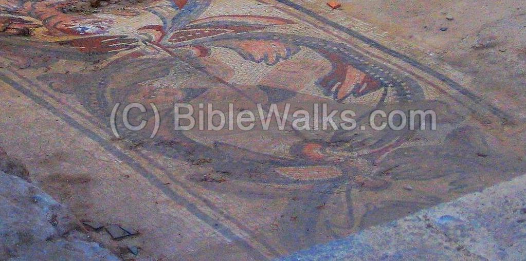
Another section in the mosaic floor is seen below. The mosaics show also other scenes, such as a man with a horse, sitting man, playing a flute, etc.
The church was burnt in 614 AD (the year of the Persian conquest), and left in ruins since then. It is closed today, and is unfortunately neglected. We hope that the municipality will clean the site and arrange it for visits.
(c) Tombs:
In the eastern hills of Nahariyah, along the highway to Haifa, there are many rock-hewn tombs, especially from the Roman period . The tombs were rich with ceramics and glassware. For example, a tomb of a priest from Tyre, from the 1st century AD.
(d) Roman road:
Along Via Maris, the main ancient north-south road, a section of the Roman road passed through the town, about 400M from the shore. In Nahariyah a milestone was found (numbered 307, or mile 7 from Acre-Ptolemais).
A small section of the road can be seen in Weizman avenue, one of the major streets in Nahariyah. The road was 7M wide and paved with stone.
A large Roman stone tablet was found near the road (see photo below). It has the following inscription:
” IMP[ERATOR] NER[ONI] CAESARI COL[ONIA] PTOL[EMAIS] VETER[ANORUM] VICI NEA COM[E] ET GEDURA”.
The tablet is dedicated to Nero Caesar (54-68AD), by the Roman veterans in the Acre Colony (Col Ptolemais). It indicates the road connected two towns: “New village” (maybe Shavey Zion, where two milestones were found) and Gedro (a site near Kefar Bialik, where via Maris splits).

Nero stone tablet from Nahariyah
Courtesy Hecht Museum
Etymology (behind the name):
-
Nahar – Hebrew; river. Named after the Ga’aton (Gaathon) river which flows through the city.
-
Nahariyah (Nahariyya, Nahariya) – Hebrew: river of God.
Biblical References:
There are several old testament references to Ashtoreth, which was often associated together with Baal regarding pagan worship.
1 Kings 11:5:
This text tells us that even King Solomon (!) worshipped Ashtoreth, the goddess of the Zidonians (the Phoenicians). A temple for the goddess was excavated in Nahariyah.
“For Solomon went after Ashtoreth the goddess of the Zidonians, and after Milcom the abomination of the Ammonites”.
This act made God furious, and was the reason that God cast a split unto the Kingdom (928BC) following Solomon’s death.
Links:
- Trial Excavations – Balfour street [2005]
- Trial Excavations – Ha’Maapil [HA ESI 2014]
- Mosaics – info page
- Remains of 3,400-year-old fortress found in Nahariya
BibleWalks.com – walk with us through the sites of the Holy Land
Shave-Zion <<<–previous site—<<<All Sites>>>—next West Galilee site–>>> Achziv
This page was last updated on May 15, 2023 (add Kabri)
Sponsored links: