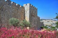
Mount Zion is located on the south-west side of the old city, outside of the present walls. In Greek and Roman times this was the southern side of the walled city, the place of the Jesus last supper and the home of the high priest high priest Caiaphas.
Home > Sites > Jerusalem > Mount Zion (overview)
Contents:
Overview
Location
History
Photos
* West
* Dormition
* East
* Gallicantu
* Son of Hinnom
* Excavations south
Biblical
Etymology
Links
Overview:
This overview page summarizes the sites of Mount Zion.
Mount Zion is located on the south-west side of the old city, outside of the present walls. In the second temple period, mount Zion was part of the “Upper” city, and was fortified. Psalms 48:2: “Beautiful for situation, the joy of the whole earth, is Mount Zion, on the sides of the north, the city of the great King”.
In Roman times this was the southern side of the walled city, the place of the Jesus last supper and the home of the high priest high priest Caiaphas.
Mount Zion is a significant site in Judaism, Christianity, and Islam, and has played an important role in the history and religious traditions of the region for thousands of years. In Jewish tradition, Mount Zion is believed to be the site of King David’s tomb, and is considered a holy site. In Christian tradition, Mount Zion is believed to be the location of the Upper Room, where Jesus and his disciples shared the Last Supper, as well as the site of the Dormition Abbey, which commemorates the death and ascension of the Virgin Mary. In Islamic tradition, Mount Zion is known as Jabal An-Nabi Daoud, and is believed to be the site of the tomb of the prophet David.
Today, Mount Zion is a popular destination for tourists and pilgrims, who come to explore the historical and religious significance of the site. Visitors can explore a number of important sites on the hill, including the Church of the Dormition, the Room of the Last Supper, and King David’s Tomb. The area around Mount Zion is also known for its stunning views of the Old City and the surrounding landscape.
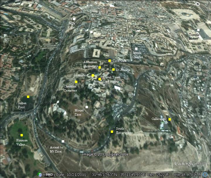
Location:
Mount Zion is an area on the south-west side of the old city. This aerial map indicates the major points of interest.
History:
- First temple period
The area of Mount Zion was first populated in the first temple period, but the City of David was centered in the “lower city”, east and down from Mount Zion.
According to Jewish, Christian and Muslim traditions, Mount Zion is the site of the tomb of King David.
- Second temple period
Only during the second temple period this higher hill was incorporated into the newly expanded “upper city”.
The walls from that time (2nd century BC) are gone today, but excavations held in 1894 (F.G. Bliss) and 2008 (Y. Zelinger) revealed the foundations of the walls, gates, paved streets, and foundations from the Greek and Roman period.
- Herod – Early Roman period
A model of the Herodian city is shown here, focusing on the south side. The area of Mount Zion is marked by a yellow ellipse. The first (old) wall is located on the south west side of the city.

Jerusalem Museum model of Herod’s Jerusalem – south side, with Mount Zion area marked.
According to Christian tradition, Mount Zion was the site of the palace of high priest Caiaphas, and the location of the house where Jesus held the last supper. It was also the place where his mother Mary is buried (in the Dormition). Therefore, the area has been a prime site for Christian churches, institutes, and cemeteries.
- Late Roman period
The area of mount Zion was excluded from the Roman city planned by Hadrian (Aelia Capitolina, 2nd century AD).
- Ottoman period
The Ottoman walled city (built in 1540 AD) excluded Mount Zion. The area was purchased by Christians who built monasteries, churches, cemeteries and a school.
Photos:
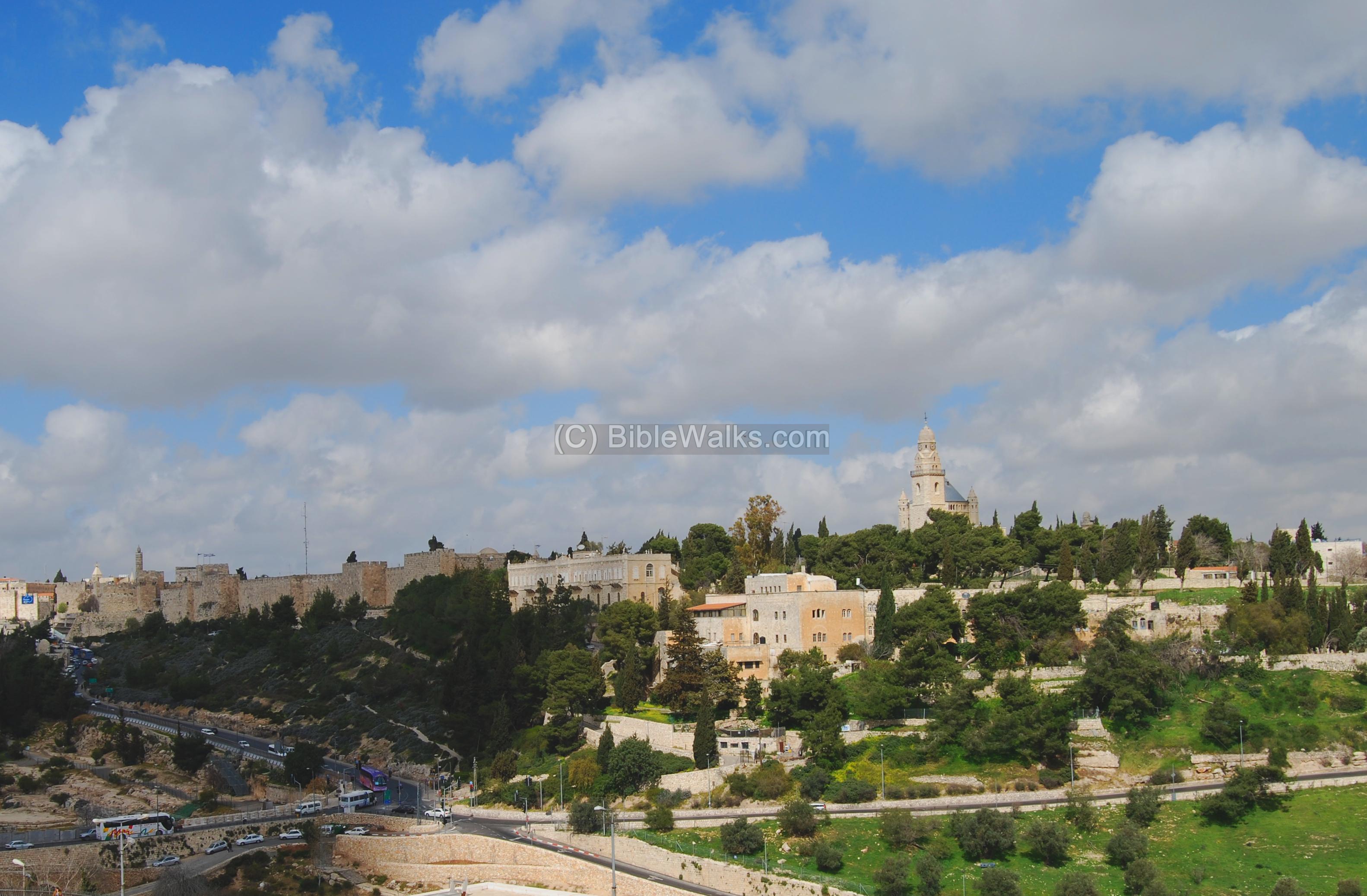
South side:
The photo below was taken from the south side – from St. Andrews. The walls of the old city are seen on the left background, with the Tower of David and Jaffa gate on the extreme left. On the right side is Mount Zion, with the Dormition abbey on the center.
Click on the photos to view it in higher resolution…
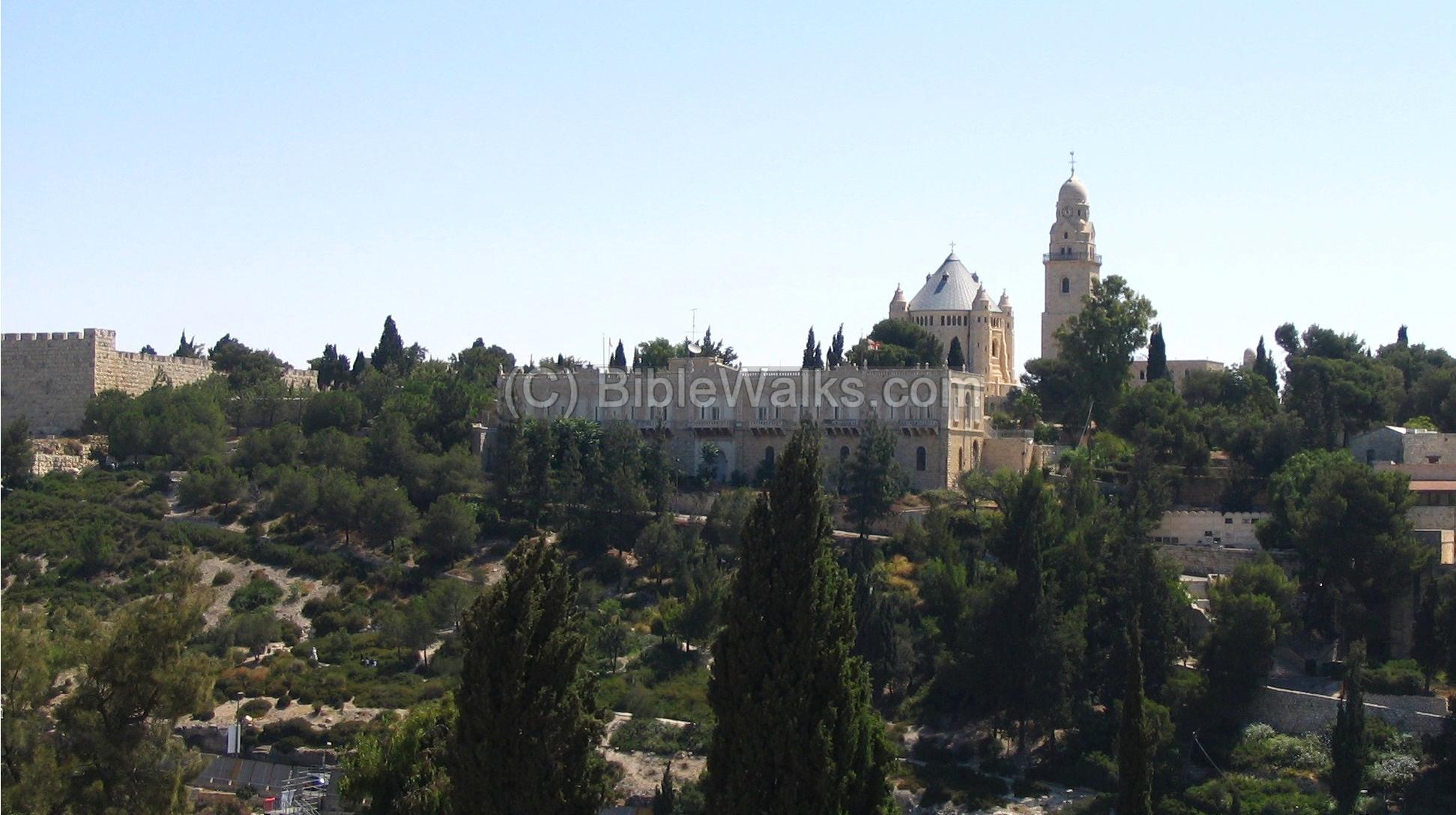
West side:
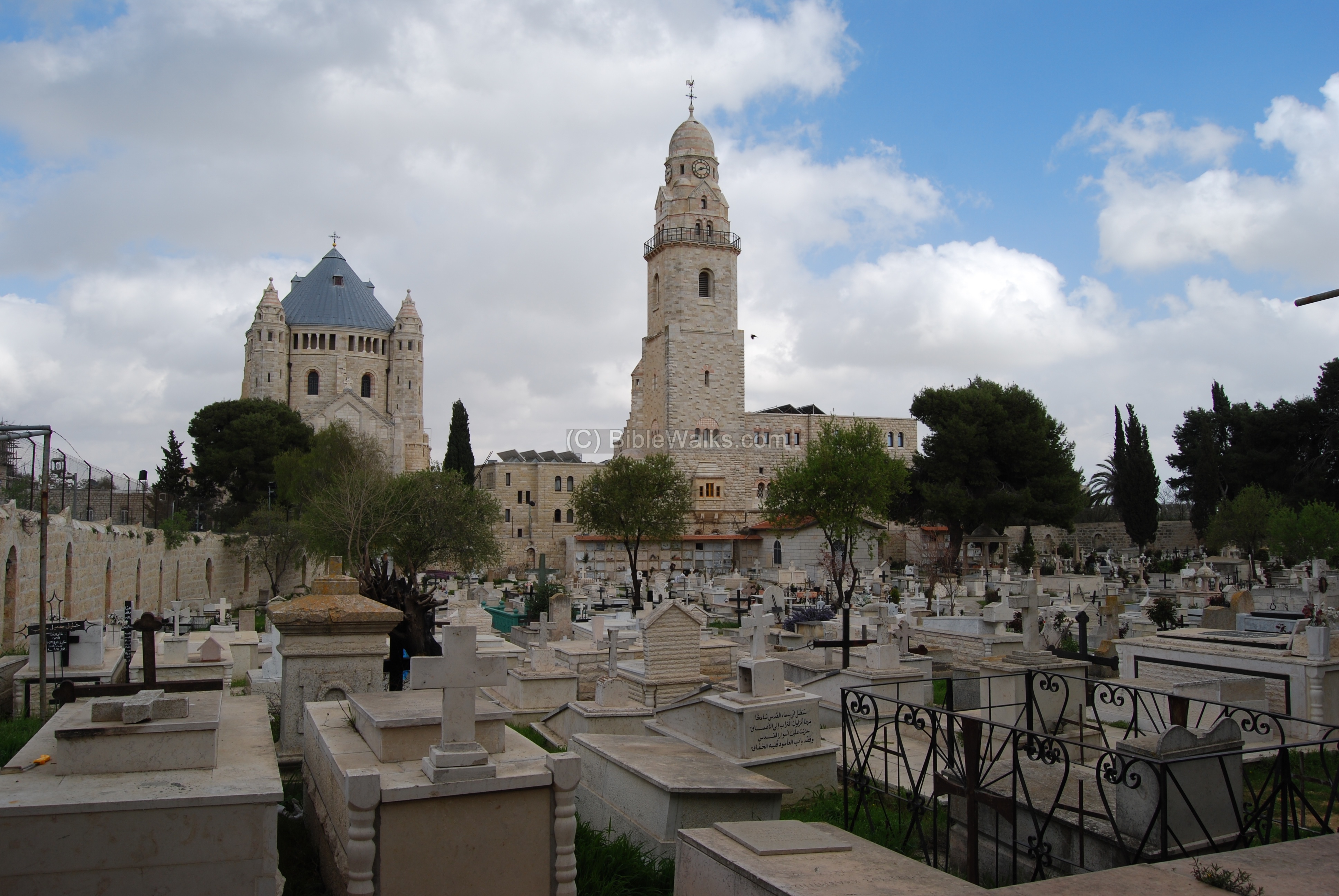
The photo shows Mount Zion from the west. On the right side are the walls of the old city. In the slopes of Mount Zion is the Gobat school structure, built in the 19th C. Beyond it is the Dormition monastery and church structure, and its bell tower. Behind the bell tower is the traditional site of tomb of King David, and the site of the Last supper.
Along the hillsides are Christian cemeteries, such as the west side of the Dormition abbey seen below.
![]() Read more about the Last supper and the tomb of King David.
Read more about the Last supper and the tomb of King David.
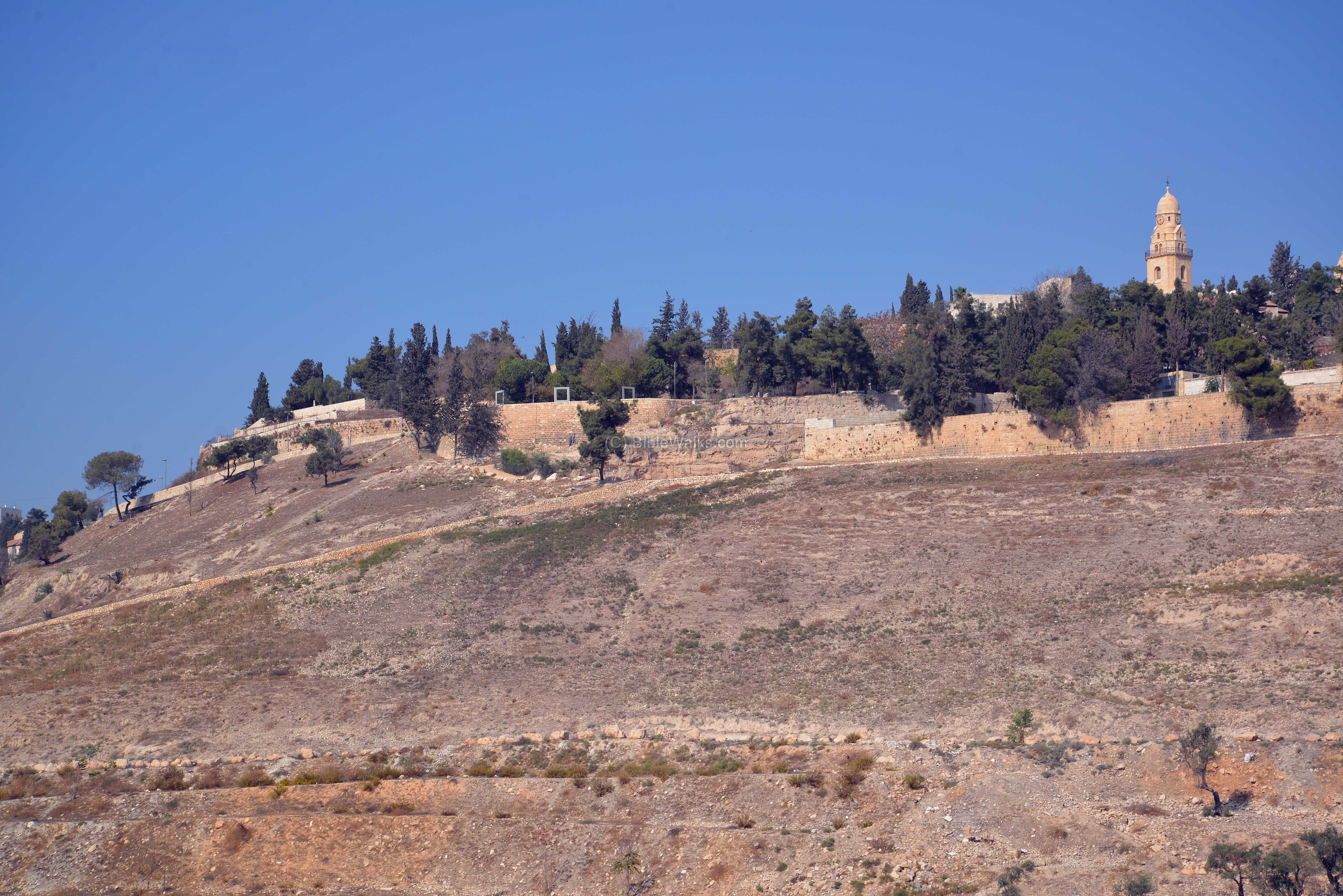
East side:
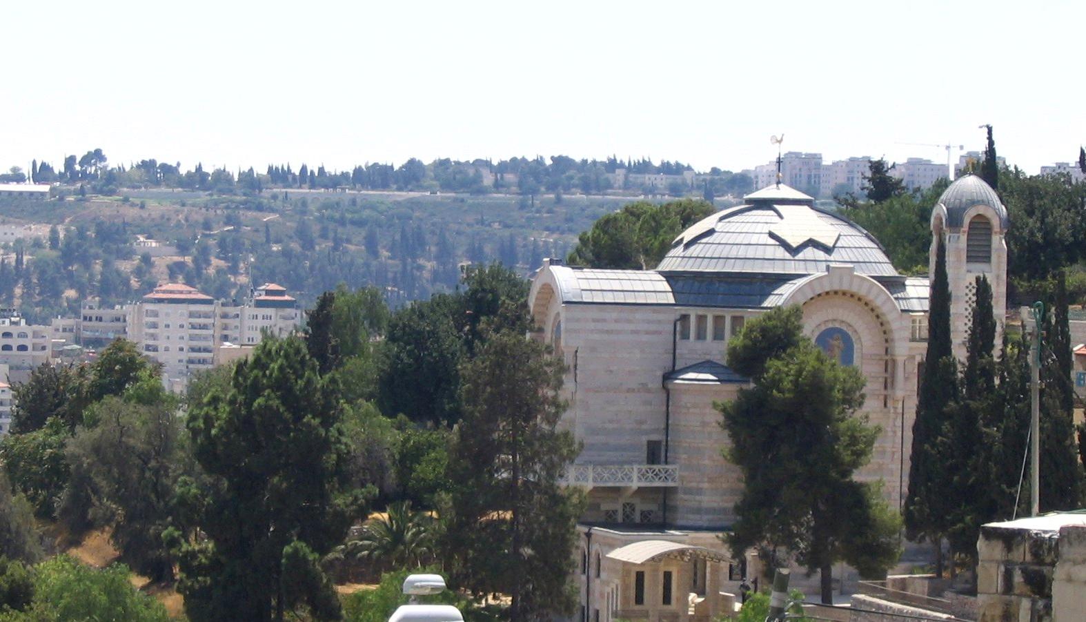
A view of the Dormition church, as seen from the “lower city”. As can be seen, the height differences to mount Zion make the walk up the mountain a challenge on a hot day.

The cornerstone laying ceremony was held in March 1906. The grand Abbey was designed by Heinrich Renard, and constructed in the years 1901-1910. It included a large church, a bell tower and a number of buildings. It was named “Dormitio Beatae Mariae Virginis” or “Holy sleep of Virgin Mary”, and in short the “Dormition”.

![]() Read more about the Dormition church.
Read more about the Dormition church.
Gallicantu church:
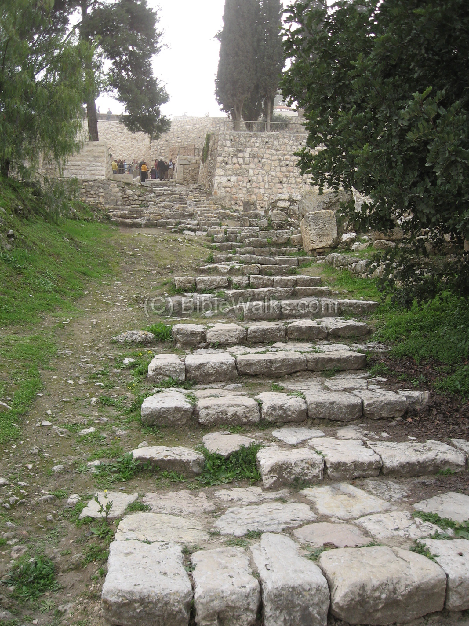
The fabulous Saint-Peter-in-Gallicantu Church is built in the eastern slopes of mount Zion. It was built in 1931. According to tradition, this was the place of the palace of high priest Caiaphas. Its name (Gallicantu, means the cock’s crow) is given after the story of Peters triple denial of Christ and the cock crowing twice.
At the sides of the church is an ancient staircase – perhaps the passage from the lower city to the upper city during the first temple period.
![]() Read more about Saint-Peter-in-Gallicantu Church.
Read more about Saint-Peter-in-Gallicantu Church.
North side
The north side of Mt Zion reaches the Ottoman walls of the Old city.
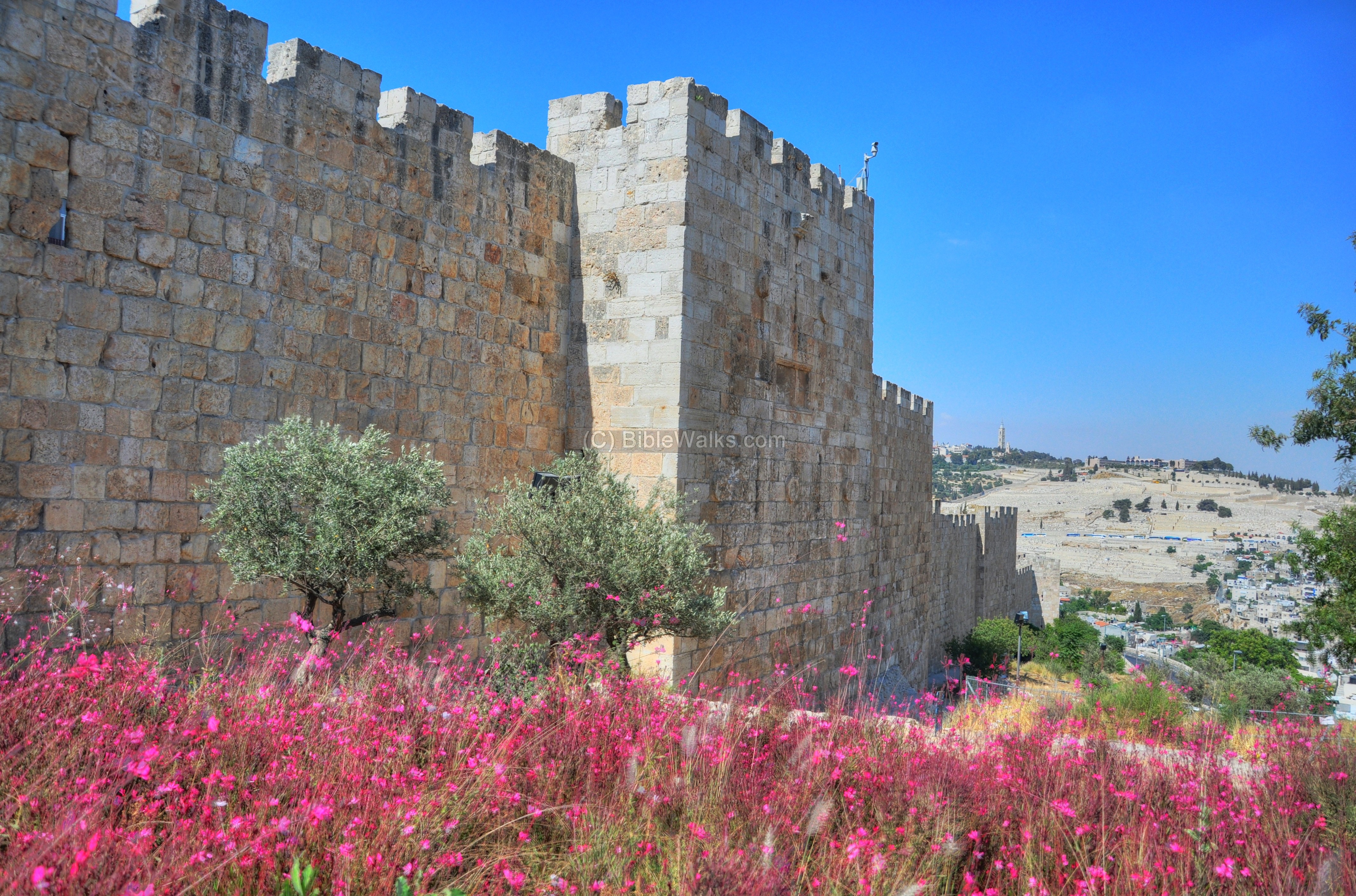
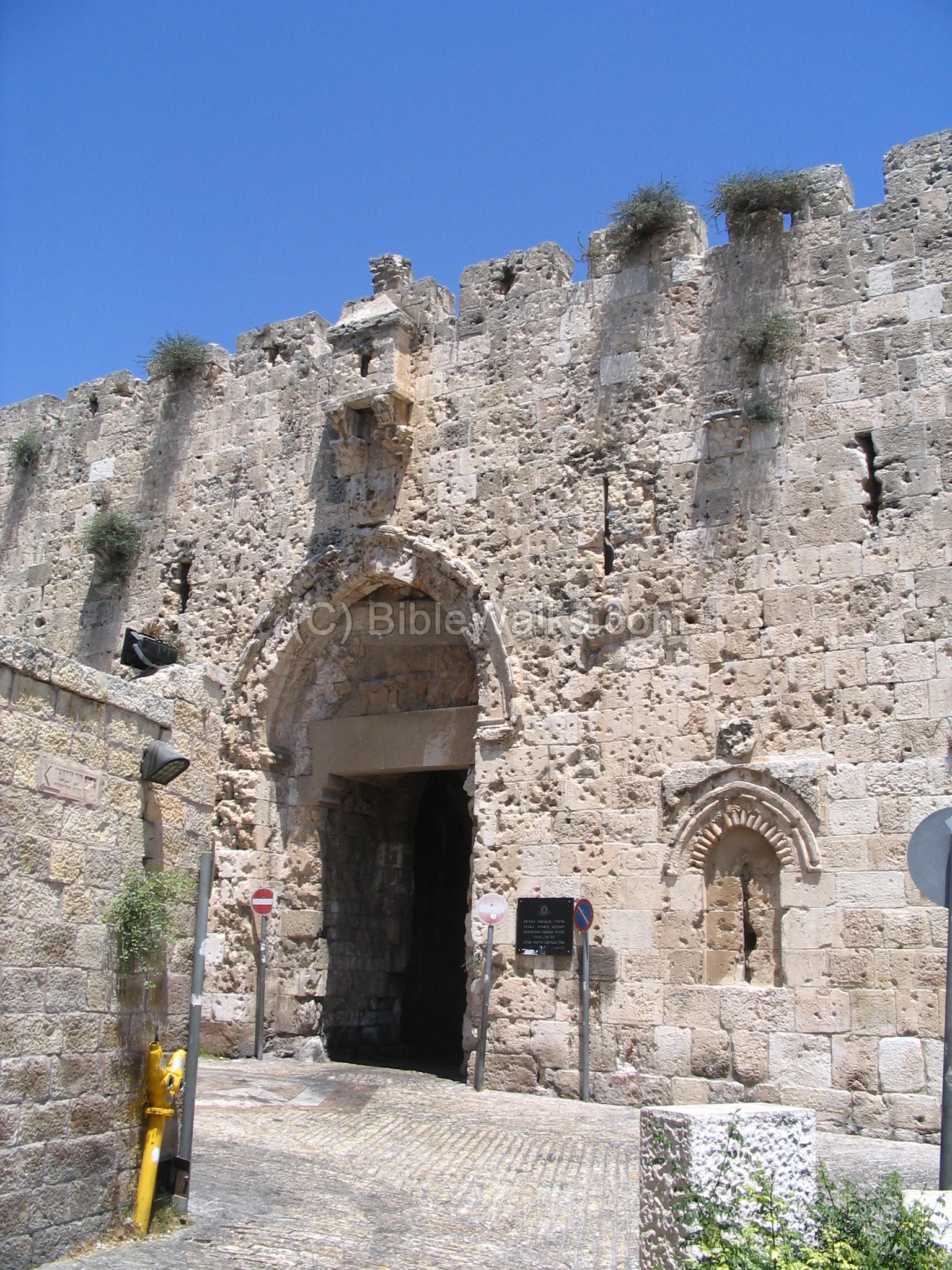
The Zion Gate is located on the south-west western side of the old city . It is one of the gates leading to the Armenian and Jewish quarters. Adjacent to the gate is the Franciscan convent (Monastery) of Mount Zion.
![]() Read more about the Zion gate.
Read more about the Zion gate.
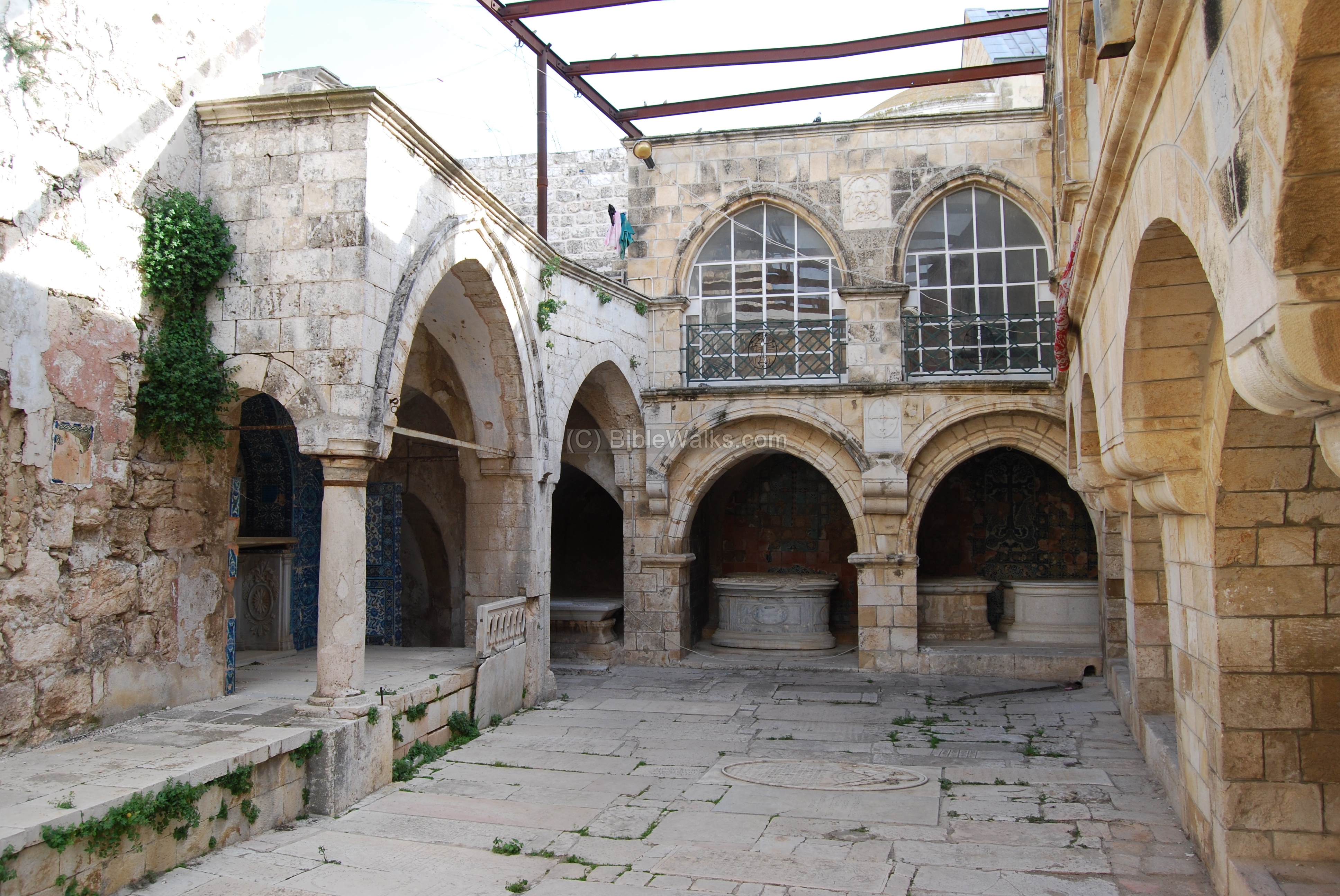
According to Armenian tradition, the site on Mount Zion is the location of the house of Caiaphas, the high priest of the Jews at the time of Jesus. At this house Jesus was arrested, then delivered to the trial which led to his crucifixion. This photo shows the cloister (court yard) of the church of the house of Caiaphas, which is inside the Armenian church of Mt Zion.
![]() Read more about the Armenian Church.
Read more about the Armenian Church.
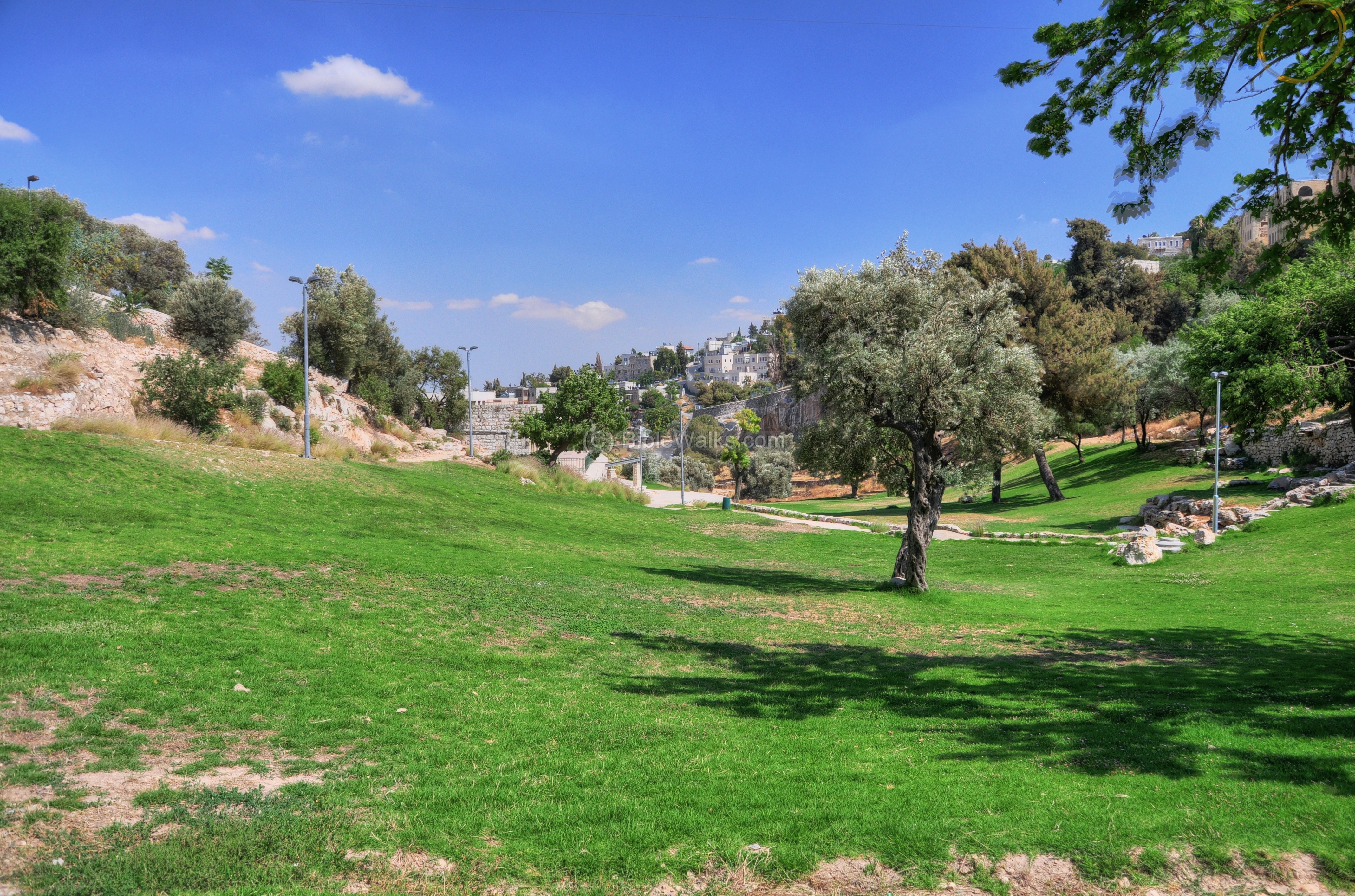
Hinnom Valley
The valley below the slopes of Mount Zion is Gey Ben-Hinnom (“valley of the son of Hinnom”). This valley starts from the southwest side of the old city (a location known as the “Sultan pool“), and reaches the Kidron valley to the east of this location.
The valley is named in Hebrew “Gei ben Hinnom” , meaning the valley of the son of Hinnom (who this person was, or why the valley was named after him, is not clear). The valley is the source of the Hebrew word for Gehinom (Gehenna, Tephet, Hell). The symbol of evil is based on the fact that in ancient times children were sacrificed to the pagan god Molech; later the city garbage was burnt here. There are many Biblical references: (Jeremiah 7: 31: “And they have built the high places of Tophet, which is in the valley of the son of Hinnom, to burn their sons and their daughters in the fire; which I commanded them not, neither came it into my heart”).
The photos above and below show the valley at the southern foothills of Mount Zion, which are seen on the left side. This deep valley made Mount Zion protected from this south side and the west side.

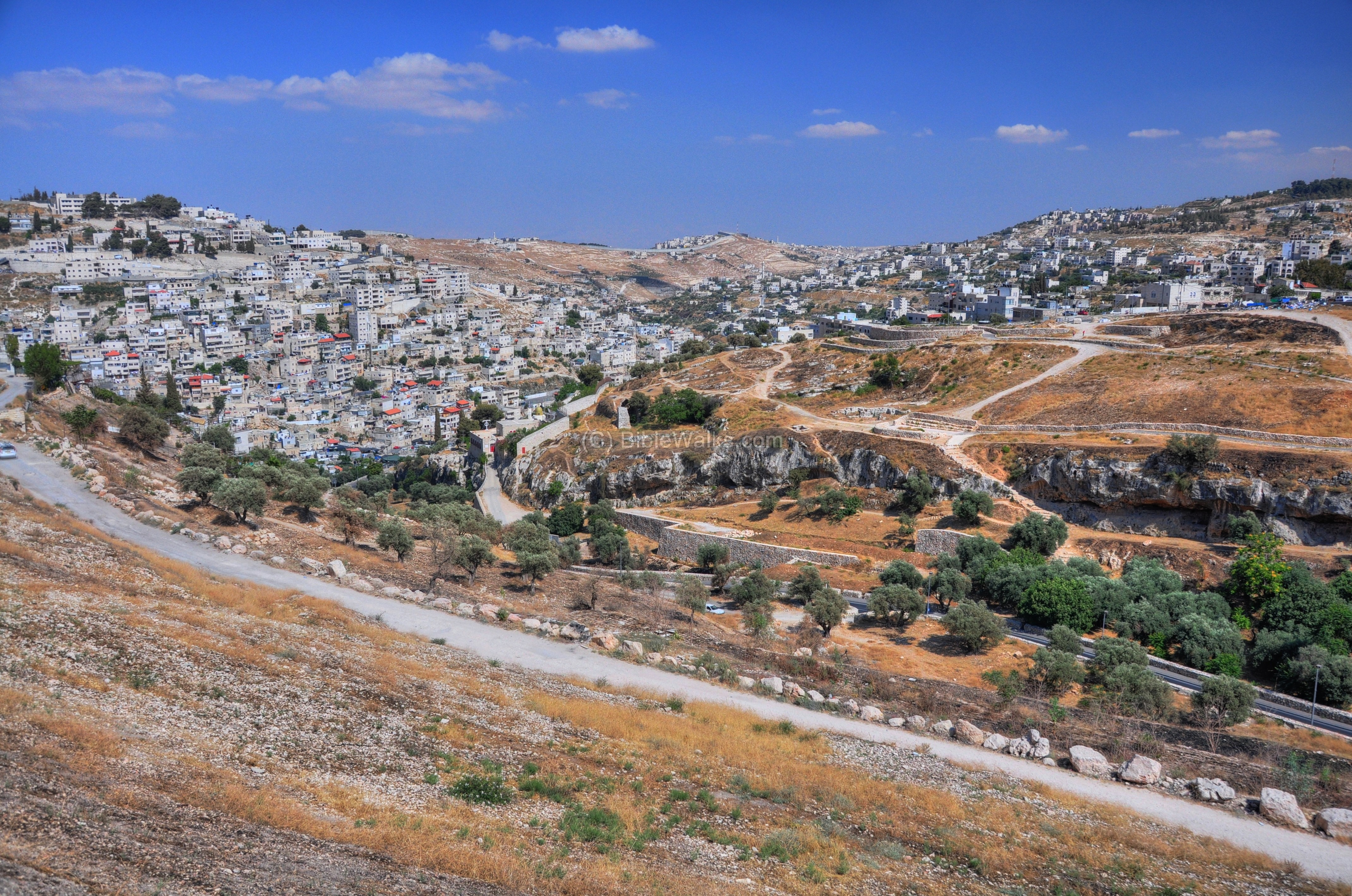
The next photo shows the view from the lower end of Mt. Zion, towards the valley of Hinnom. The village of Silwan is in the left background, and its southern superb Abu-Tor on the right side. Along the southern bank of the valley are rock hewn tombs.
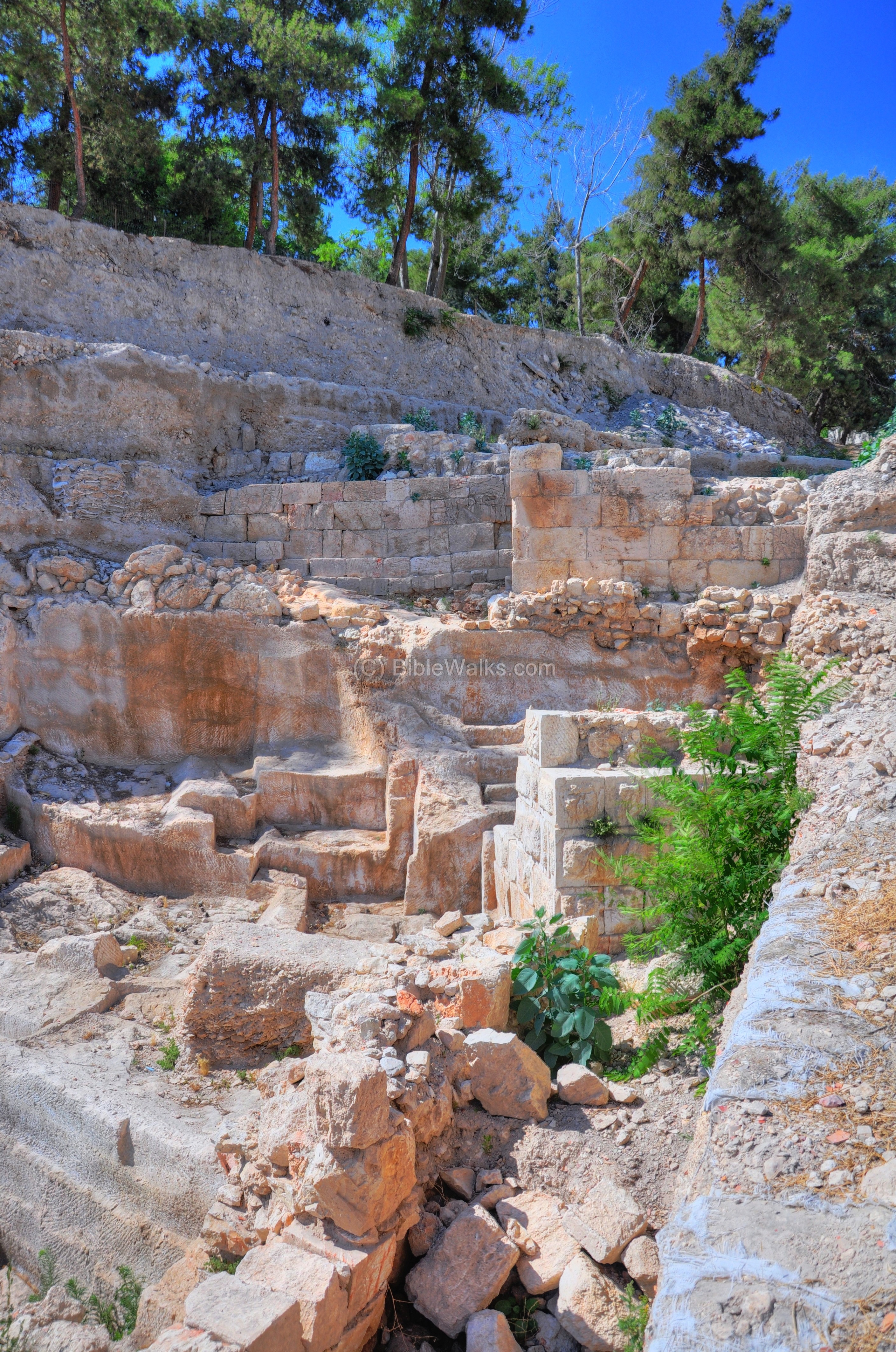
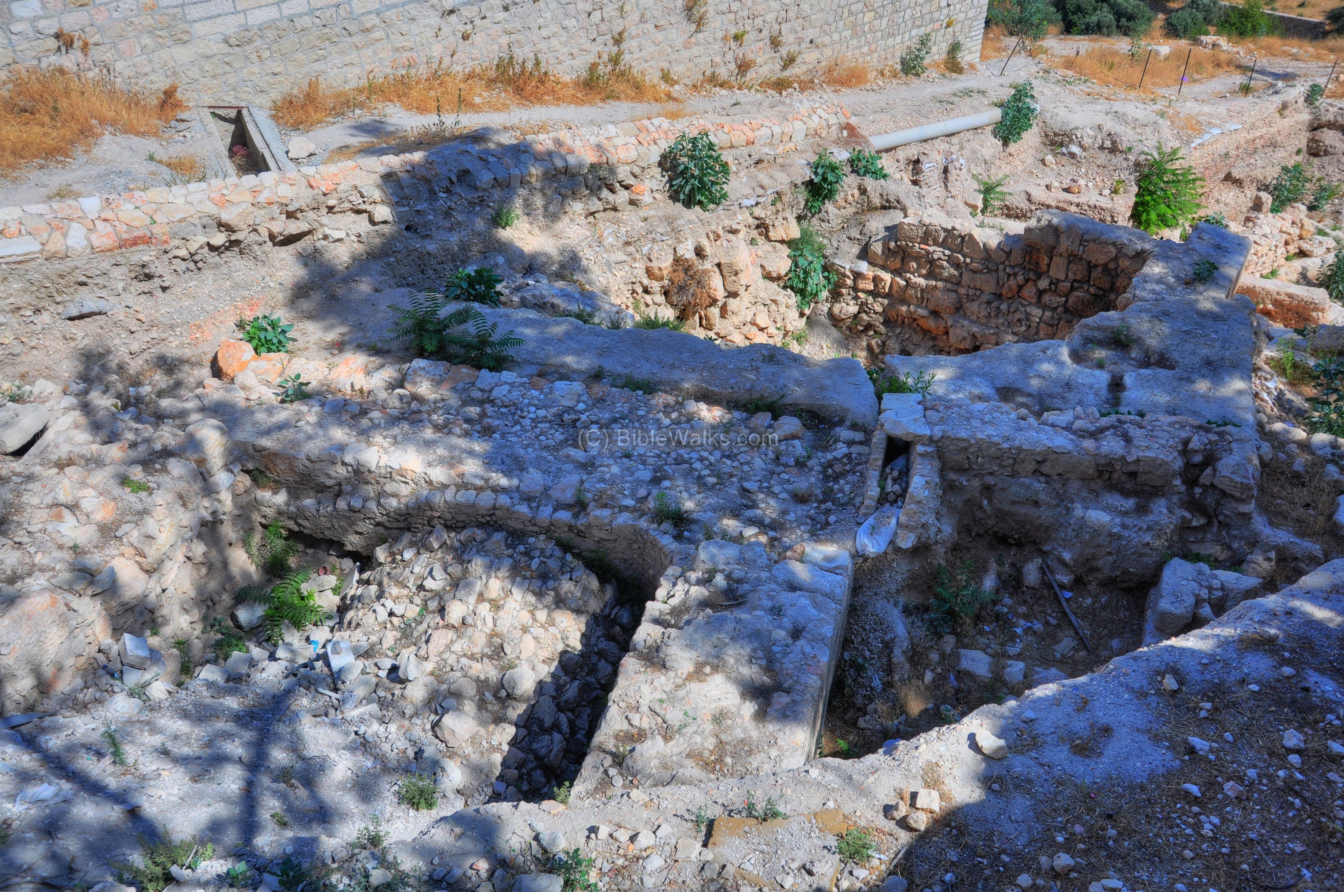
South side excavations
Sections of the City walls, dated to the second temple and Byzantine periods, were excavated on the southern slopes of Mt Zion, west of the Catholic cemetery. The excavations (conducted 2007-2008, directed by Yehiel Zelinger) are part of a grand plan to incorporate these city walls in the Jerusalem walls national park. Earlier excavations of Bliss and Dickie (1894-1897) have traversed the external contours of the walls.
The excavation site is viewed from Abu-Tor, south of Mount Zion, across the valley of Hinnom. The location of the excavations are at the top of the path.
The next picture shows the various layers found in the excavation. Three lines of fortifications were identified, part of the walls that protected the south and west sides of Mount Zion – Iron Age II, Hasmonean and Byzantine.
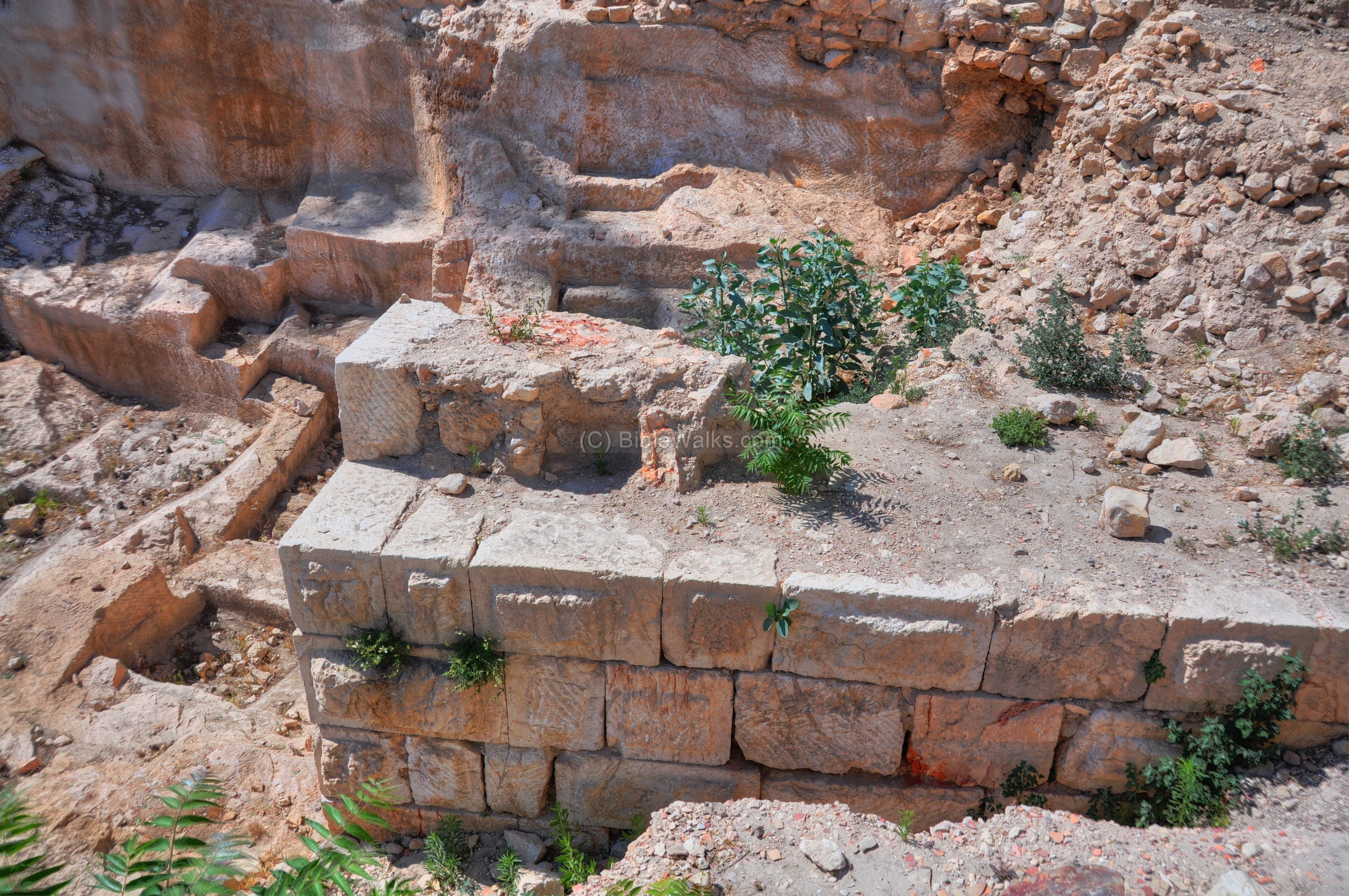
- Hasmonean fortifications
The lower section is dated to the second temple period, where the south west corner of a tower was identified. Its wall was constructed with large well dressed stones, laid over leveled bedrock.
The tower walls were preserved at a height of 3.5 meters. The base of the tower is of the Hasmonean (Hellenistic) period, as attested by the headers and stretchers pattern (Hebrew: “Rashim & Patinim”), where the stones are laid in vertical and horizontal structure.
The location of the tower is indicated as a yellow square on the illustration.

The tower was part of the first (“old”) wall, as described in 1 Maccabee 10: “Jonathan… rebuilding the walls of Jerusalem and fortifying it all around”. These fortifications, probably completed during the rule of Simon Maccabeus or John Hyrcanus, were in use until the great revolt (70A.D.).
- Earlier walls?
The archaeologists also identified ruins of the first temple period (Iron Age II), as this section was also part of Jerusalem. The Hasmonean tower and walls were built over these earlier fortifications.
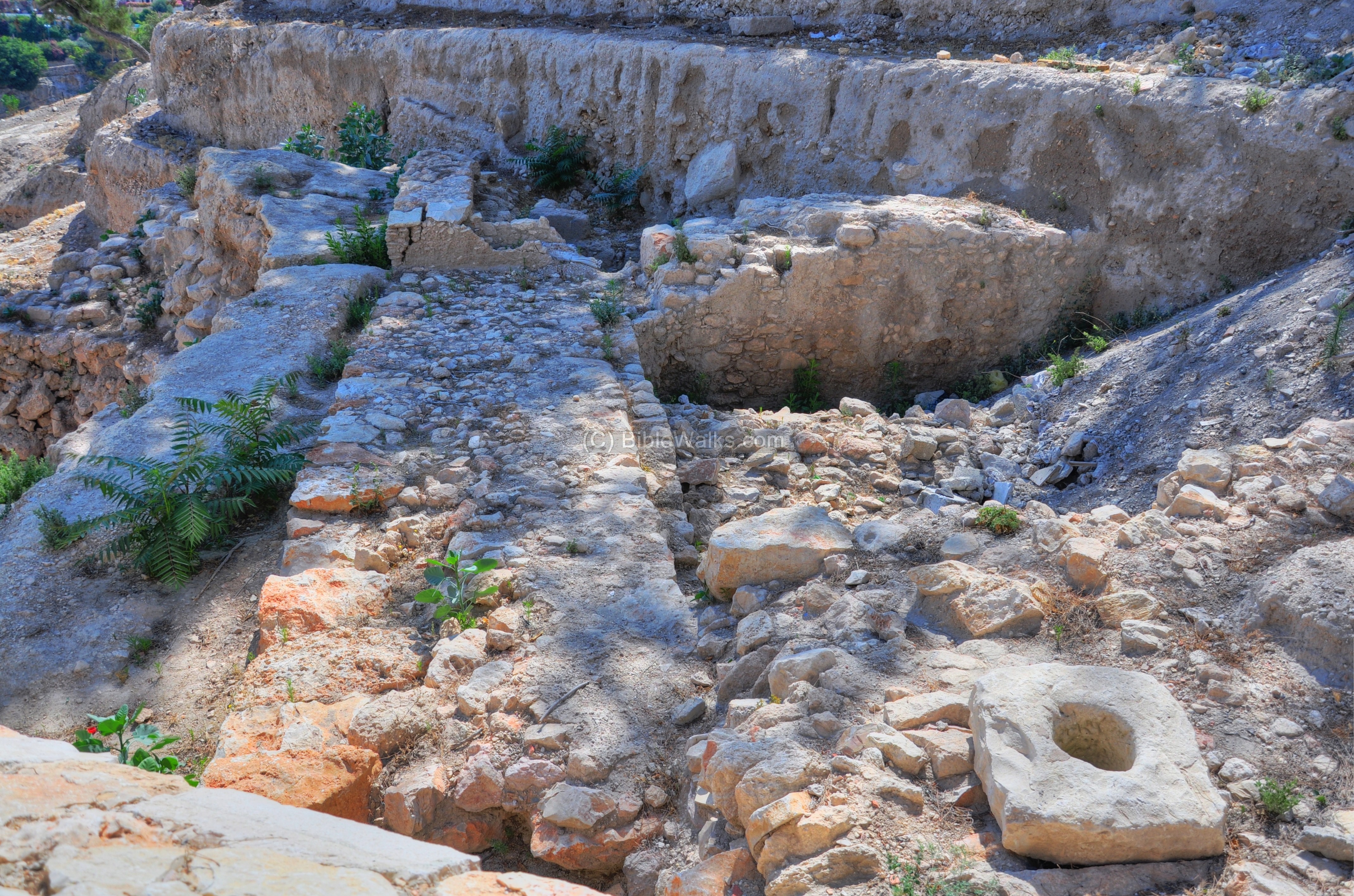
The Iron Age II wall is located on a higher bedrock step than the Hasmonean wall. This fortification is 3M wide and 0.8m high, made of two parallel walls of large unhewn boulders, with a fill of smaller stones between them. It is seen from two views in the photos above and below.
Since its construction method is different from the Hasmonean wall, the excavators assumed it predated that wall. It may have been constructed during the times of King Hezekiah, in the wake of the Assyrian intrusion of 701 B.C. (2 Chronicle 32 5): “Also he strengthened himself, and built up all the wall that was broken, and raised it up to the towers, and another wall without, and repaired Millo in the city of David, and made darts and shields in abundance”.
-
Byzantine fortifications
On a higher level of the second temple fortifications are remains of a Byzantine wall and tower, dated to the 5th Century A.D.. These fortifications were conducted during the residence of Empress Aelia Eodocia Augusta in Jerusalem (from 443 to 460). Eodocia, wife of the East Roman Emperor Theodosius II, lived during these days in Jerusalem, and was behind several construction projects, including the church of the Shiloah pool and a monastery in Munttar.
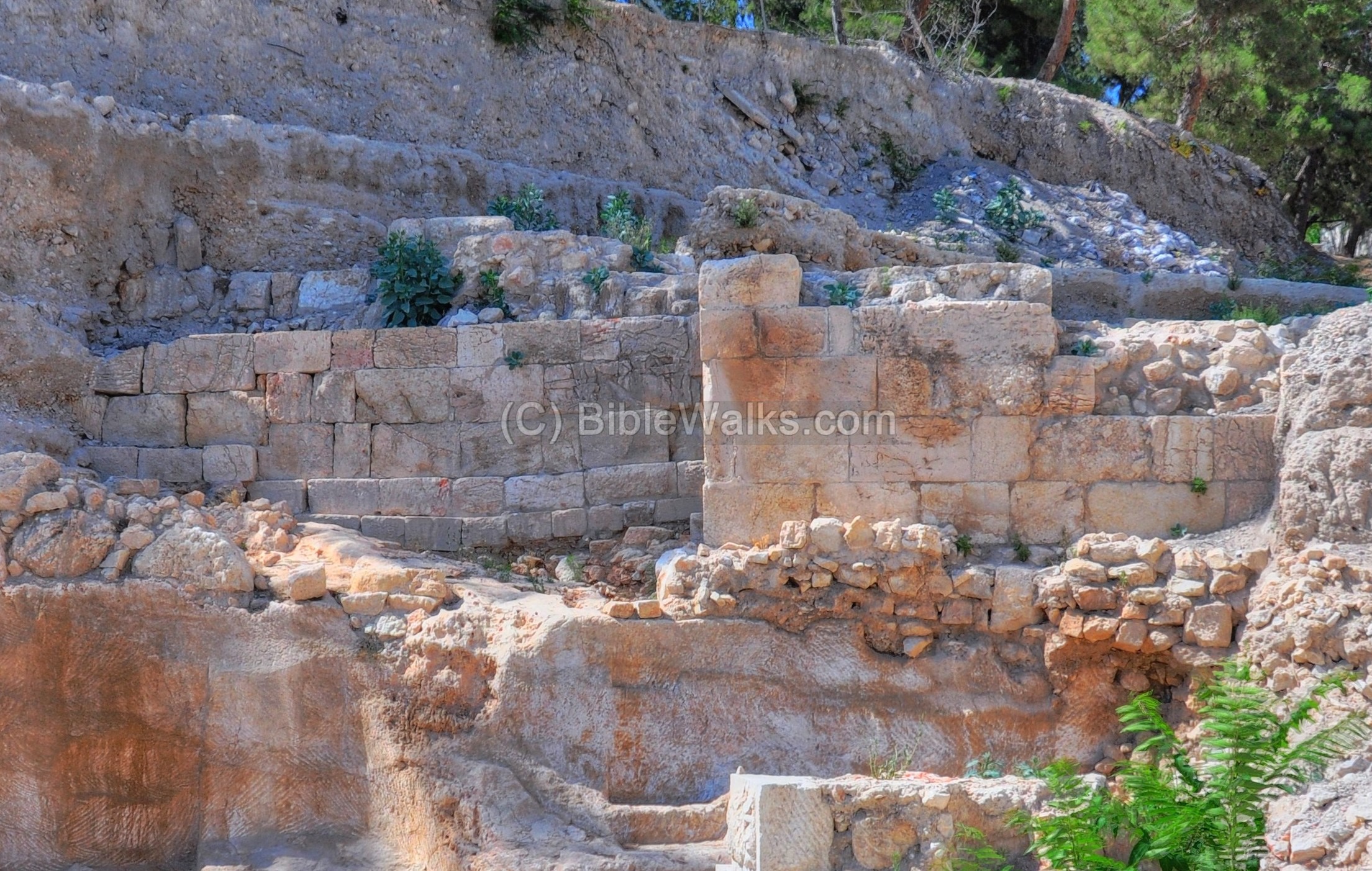
The Byzantine wall, 2.8 m high and 2.5 wide, is built of dressed stones laid over the bedrock. This can be seen in more detail on the right side below.

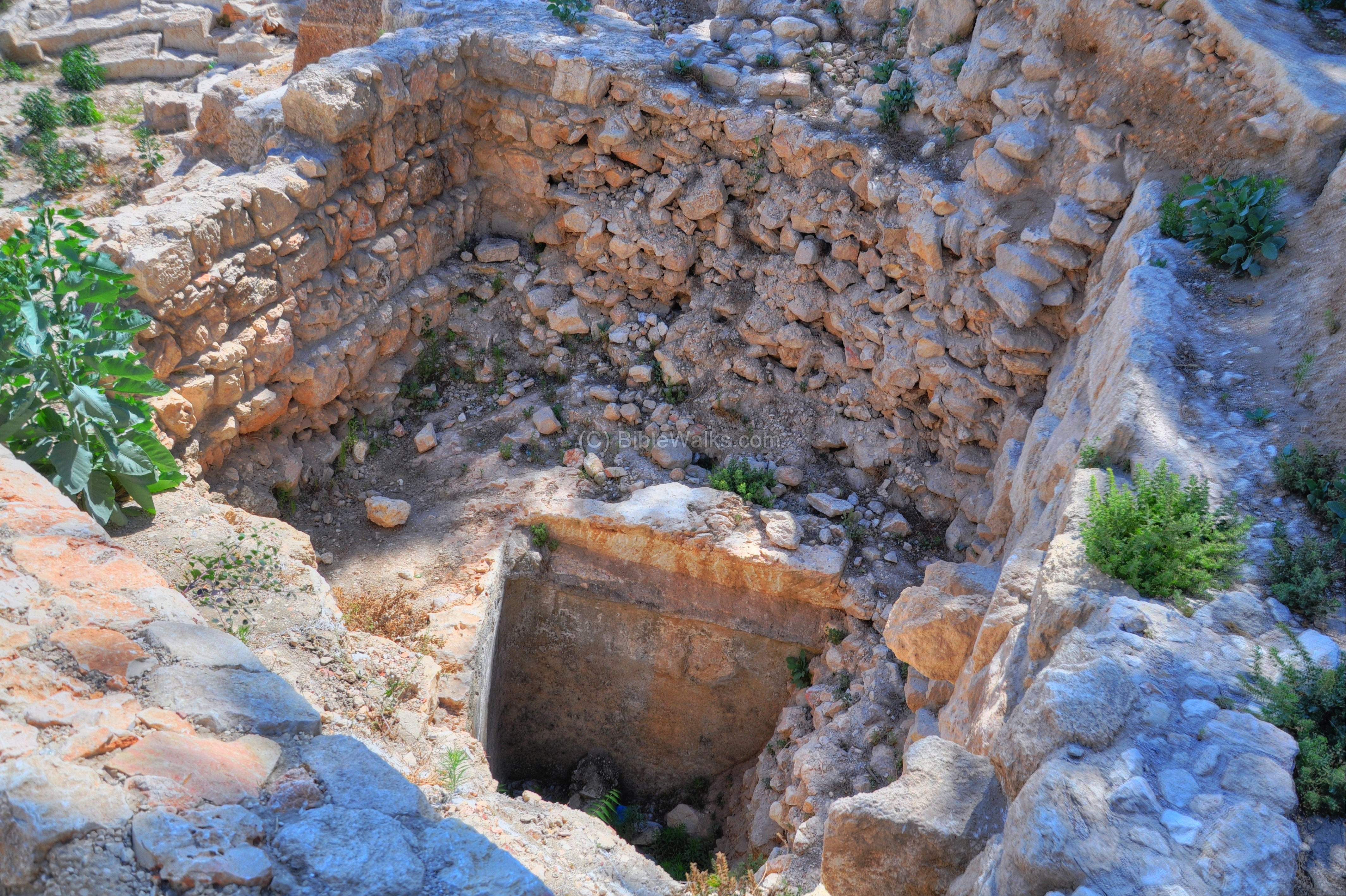
- Second Temple period cistern
Under the Byzantine tower is a second temple period cistern, seen in the photograph below. This water reservoir was part of the water supply solutions during the siege of 70 A.D. It was filled up after the destruction of the city. The top of the fill included 22 Byzantine coins and Ceramics, which enabled the dating of the tower to the time of Empress Eodocia.
Other sites
See more information on sites in the area of Mount Zion:
- Gallicantu church
- Zion Gate
- St. Francis convent
- Dormition abbey
- David’s Tomb
- Last Supper
- Armenian Church (house of Caiaphas)
References:
(a) Old Testament references to Mount Zion
There are dozens of references to Mount Zion, most of them refer to the entire city rather to the hill itself.
Psalms 48:2: “Beautiful for situation, the joy of the whole earth, is Mount Zion, on the sides of the north, the city of the great King”.
(b) King David burial
King David was buried in his city, Jerusalem:
1 Kings 2: 10: “So David slept with his fathers, and was buried in the city of David”.
Etymology (behind the name):
- Zion – As a place, Zion is the name of the hill in the south-western section, one the hills of Jerusalem. It later was one of the names of Jerusalem, and then extended to refer to the whole land of Israel. (Biblical text: Samuel II, 5: 7 “…David took the stronghold of Zion; the same is the city of David”).
Links:
- IAA press release – Second temple and Byzantine walls excavated on Mt Zion (9/2008)
- Excavations of the slopes of Mt Zion (Dr. Yehiel Zelinger, Hebrew, Dvar-Avar May 2012 pp 31-33)
BibleWalks.com – exploring the “joy of the world”
New Gate<—previous site–<<< All Sites >>>—next Jerusalem site–> Western Wall
This page was last updated on Mar 21, 2024 (remove pano)
Sponsored links: