An impressive table shaped hill located in the valley of Zin, identified as Mount Hor – the burial place of Aaron.
* Site of the Month – Aug 2012 *
Home > Sites > Negev > Mount Zin (Mount Hor)
Contents:
* Mt Zin
* Bulbus
Overview:
An impressive table shaped hill located in the valley of Zin, within the area of the Zin phosphate plant. According to some scholars, it is identified as Mount Hor (Hor Ha’Har) – the burial place of Aaron.
Numbers 20 22: “And the LORD spake unto Moses and Aaron in mount Hor”
Location and Map:
Mount Zin is a natural reserve, which is located in the center of the Zin phosphate mining plant. A parking place and observation point is located north of the mountain.

History:
-
Prehistory (190 Million – 8,000 years ago)
The Valley of Zin starts from Sede-Boker and flows eastwards to the Arabah valley. It was formed by great geological forces and events that shaped the Negev desert.
These events started from the effects of the Tethys ocean covering the area (190-35 million years ago), when sedimentary layers accumulated under the Ocean. Tectonic pressures between the south and the north plates created the mountains and the valleys.
The second phase was the creation of the Syrian-African depression due to Tectonic pressure between African and Arabian plates (35-22.5 million years ago). This caused the area of the Arabah (Arava), 15km south-east to the valley of Zin, to drop about 500m under the level of the Negev surface.
The third phase was the erosion that created the wide valley of Zin. The Arabah depression drained the soft layers out from the valley of Zin. The valley widened, but some places with harder rock layers remained intact. One of them was Mount Zin, which stands high in the middle of the valley. Its altitude is 276m above sea level, while the Zin stream is at a lower altitude of 80m (about 200m difference).
-
Biblical times (Israelite period):
Mount Zin:
During the Exodus, the desert of Zin was one of the stations of the Israelites journey from Egypt to the Land of Israel. There are many references to the “desert” or “wilderness” of Zin.
After the conquest of the Land by Joshua, the valley of Zin marked the southern board of the tribe of Judah.
Mount Hor=Mount Zin?
According to some scholars and traditions, Mount Zin was the location of the burial site of Aaron, the brother of Moses and one of the leaders of the Exodus. The Bible says that Aaron died on the mountain top of Mount Hor (Numbers 20: 22-29): “And the LORD spake unto Moses and Aaron in mount Hor, by the coast of the land of Edom, saying,… and Aaron died there in the top of the mount…”. According to the Bible, there were hundred of thousands of people that gathered around the burial site. Based on the Biblical description, the probable location for such burial site and place of the Israelites gathering, Mount Hor is Mount Zin.
Note that there are other traditional sites for Aaron’s burial site on Mount Hor, such as Jabal Harun in Petra, or near Mount Sinai in the Negev or Sinai desert.
A Biblical map is illustrated below, with the location of Mount Hor, as located at the location of Mt Zin, in the valley of Zin.
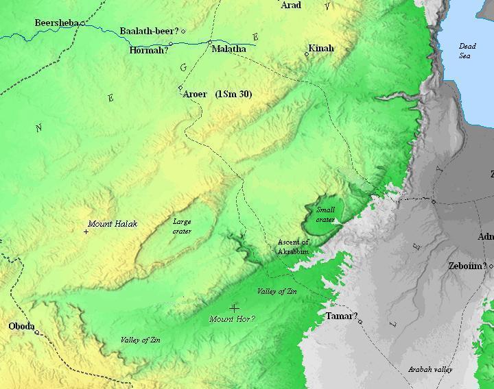
Map of the area – during the Biblical periods (based on Bible Mapper 3.0)
Photos:
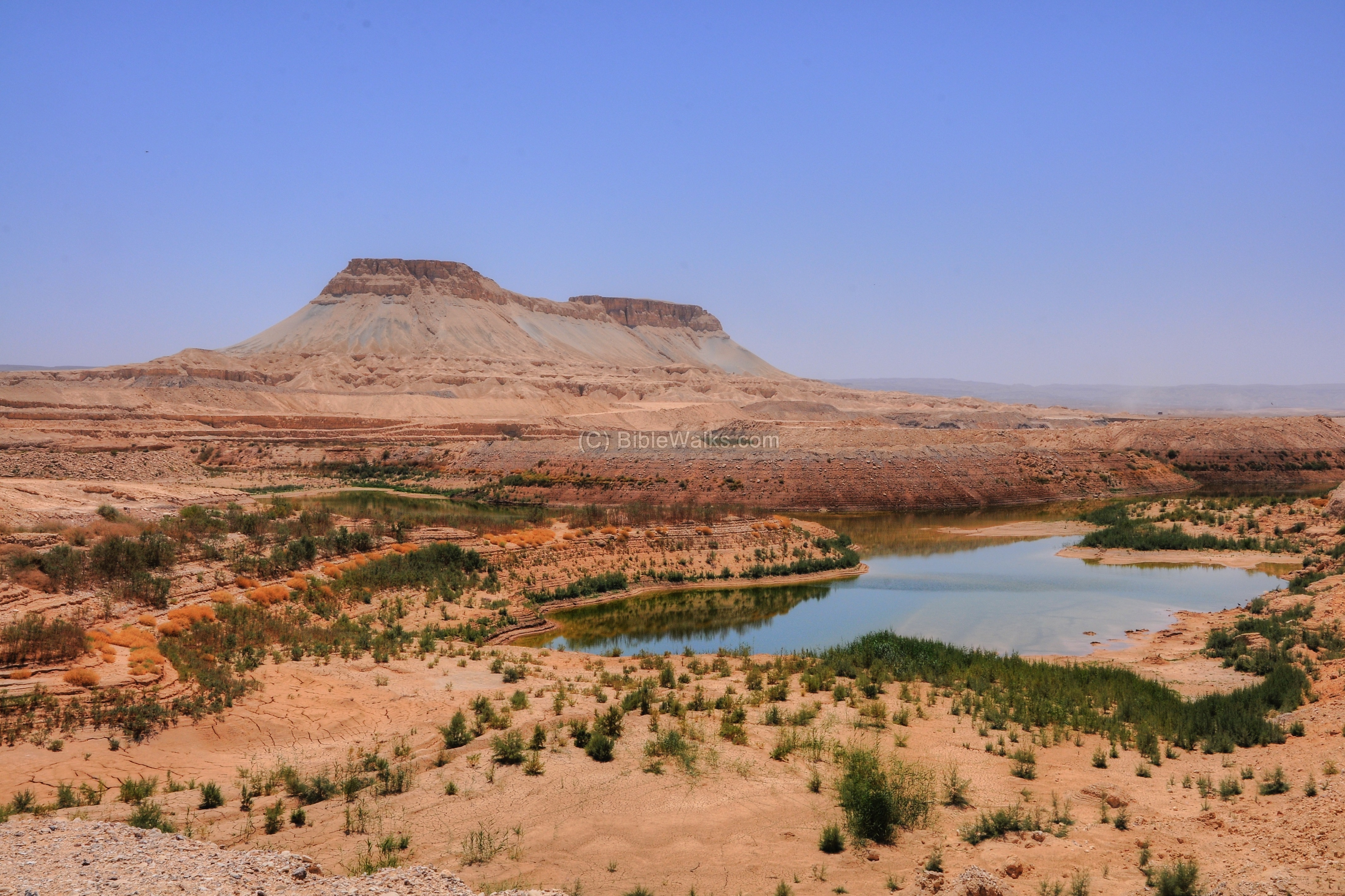
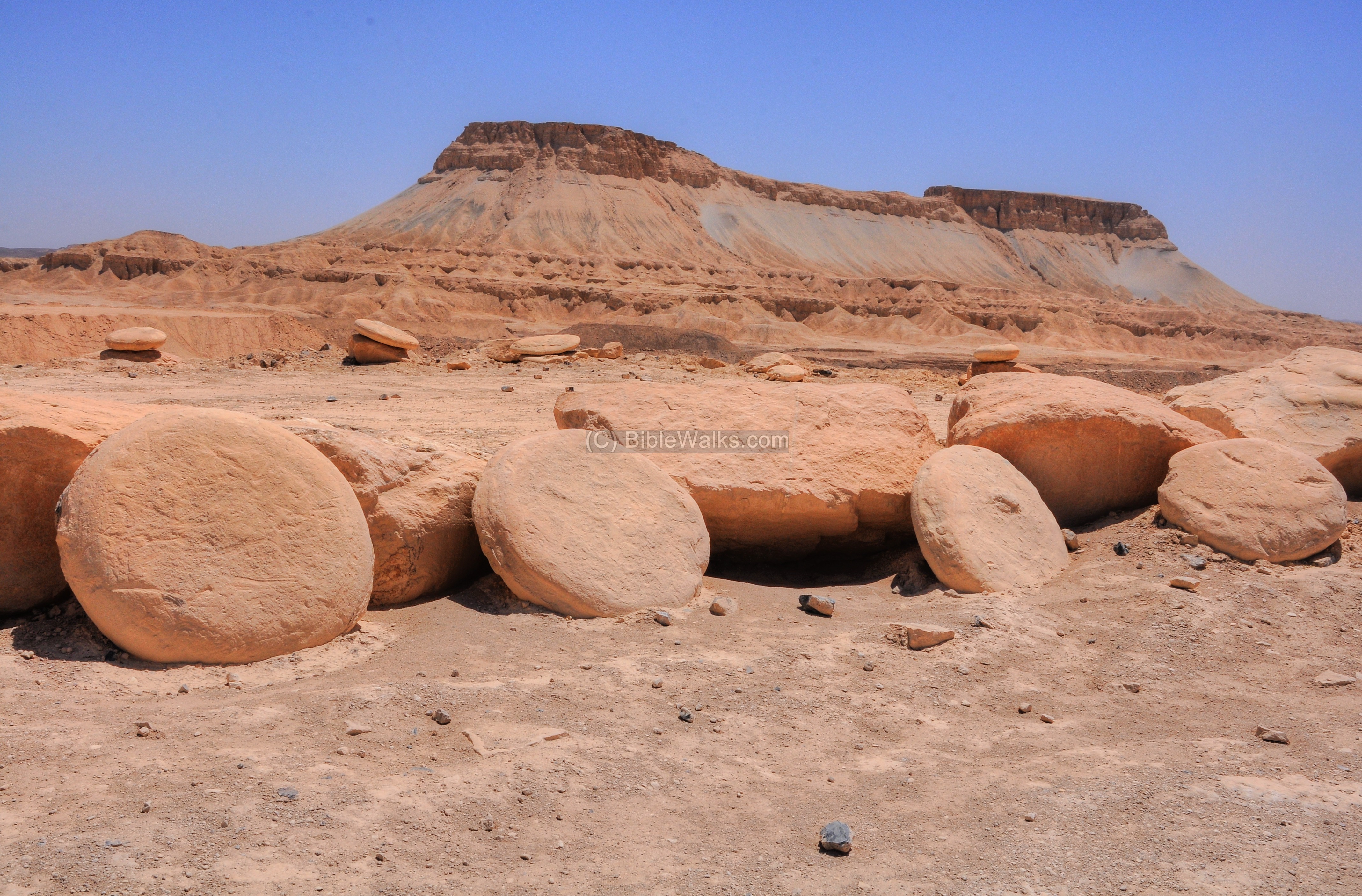
Mount Zin
A northern view of Mount Zin is seen here. The depression of the lake was created by excavations of the phosphate plant, while the water fills up during the winter.
Click on the photos to view in higher resolution…
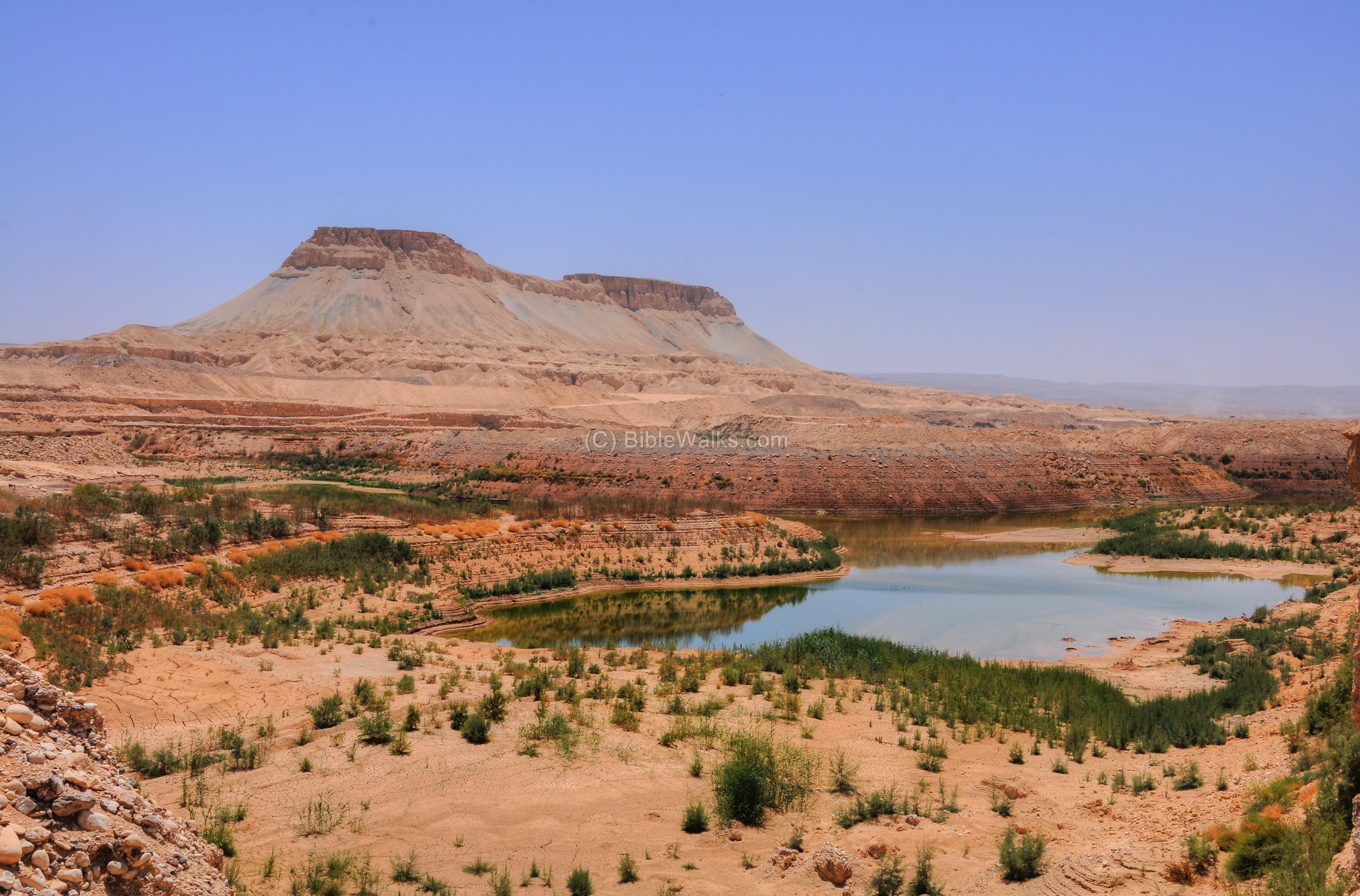
The next picture shows another northern view of the mountain. Notice the ancient geological layers are exposed along the foothills of Mount Zin.
The rock layers making up Mount Zin are dated to the Eocene period (65-35 million years), when the Tethys Ocean covered the surface. The mountain layers are made of chalk and clay, with a harder limestone layer on top.
Bulbus
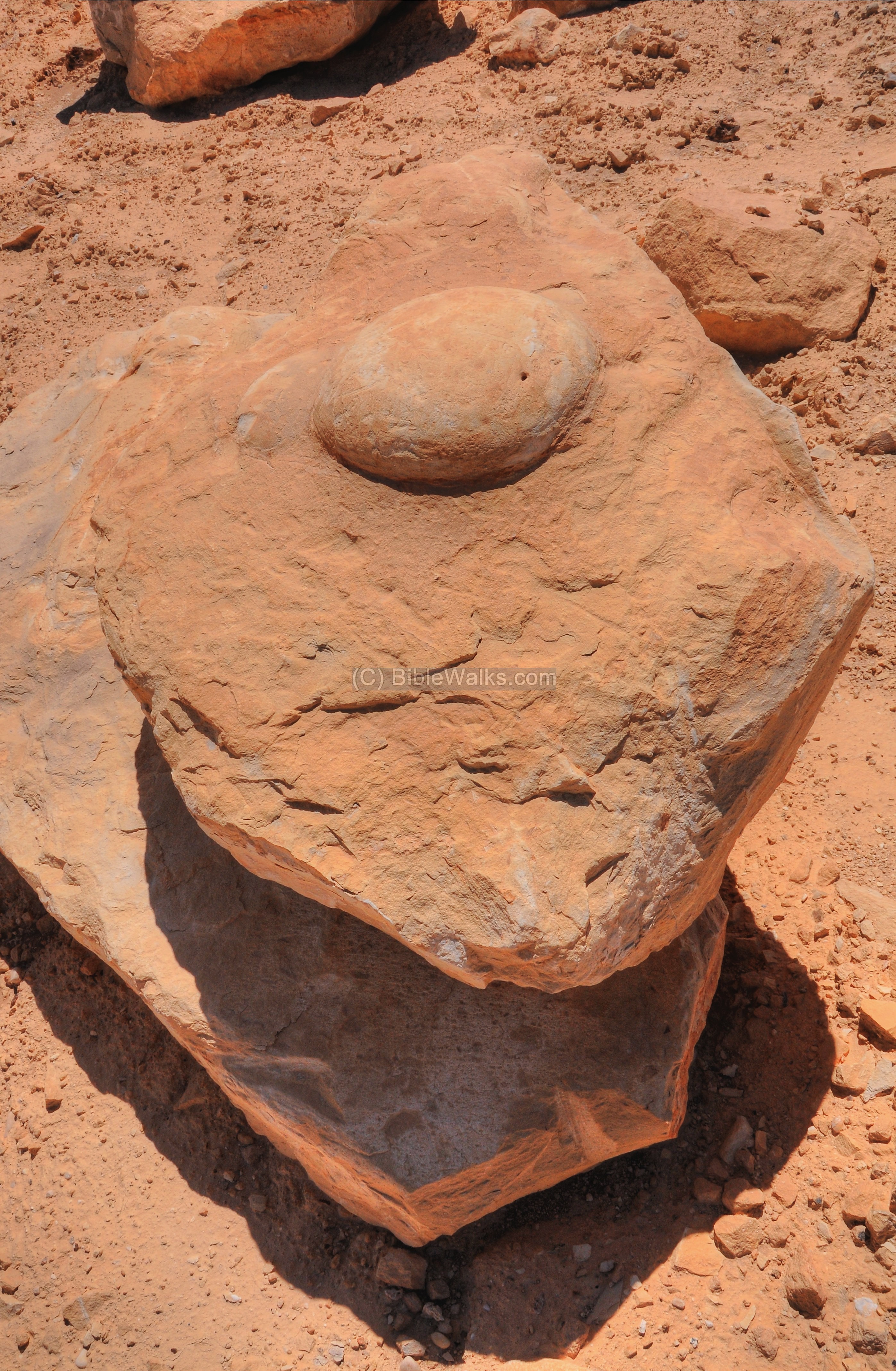
Bulbus is an Arabic name for potatoes. The potatoes-shaped rocks, found in thousands near Mt Zin, were named “Bulbus”.
The large field is located on the south side of the Mount Zin. A collection of such rocks were assembled around the observation parking place north of the mountain, seen in this photograph.
The Bulbus rocks were created 60Million years ago, when the Tethys ocean covered the Negev. In its nucleus is usually an organic remains, such as a skeleton of a fish. These remains laid on the bottom of the sediment. Gradually, minerals of Calcite crystallized around it. The Calcite minerals later dissolved or fossilized the organic matter.
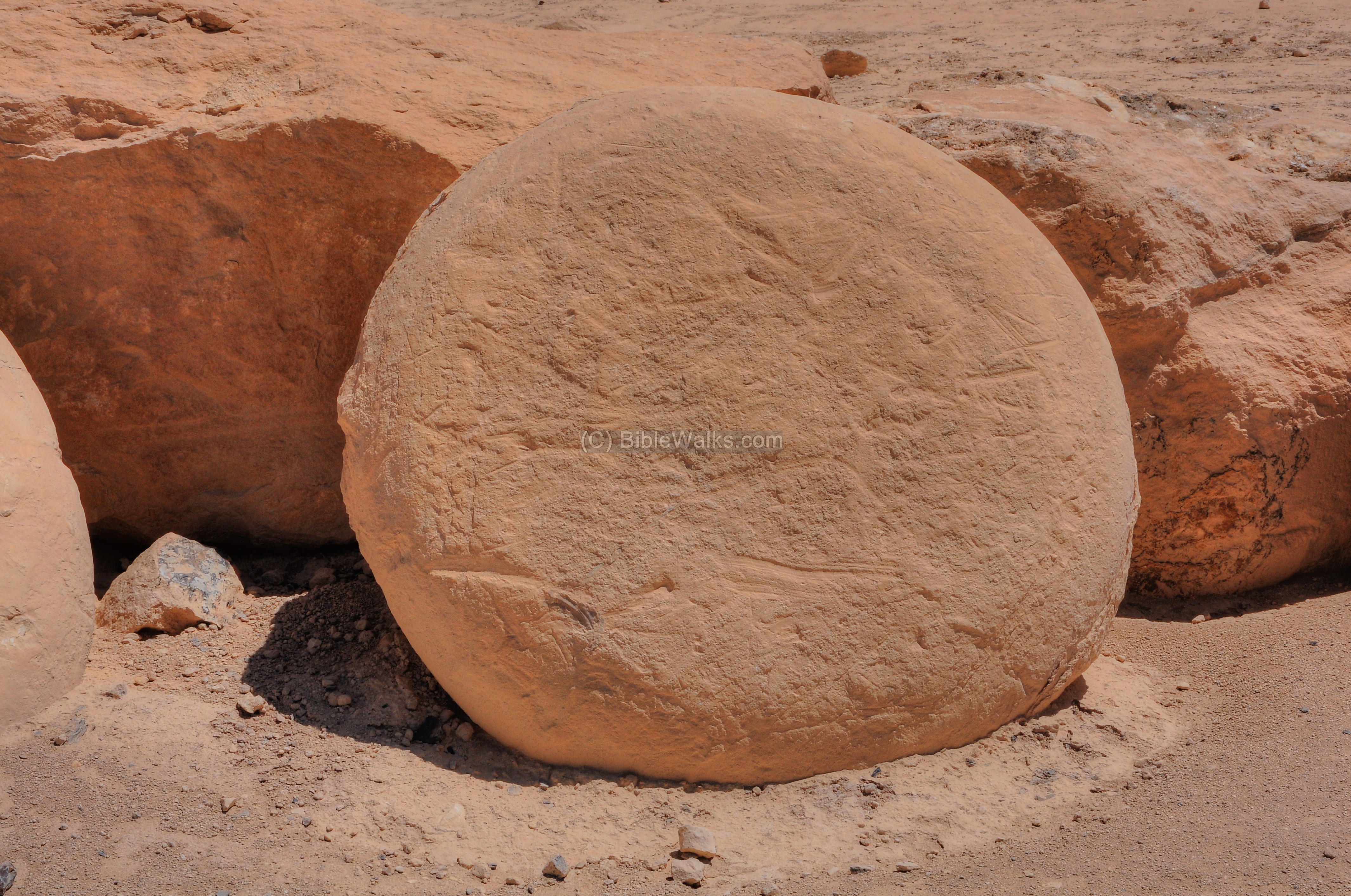
Rather than evolving into a round ball of Calcite, the pressure of the ocean pressed the ball into a potato-shaped rock.

Remains of fossils can be seen among some of the Bulbus rocks.
Yet another example:

And another one:
Phosphate Plant
The phosphate mining plant is located near Mt Zin. The phosphates are rich with phosphorus which are vital nutrients for the growth of plants, so they are used as a chemical fertilizer for the agriculture sector. The phosphorus is also used for producing laundry detergent softeners, tooth pastes, matches, explosives and other products.
The Zin mining complex is one of the three phosphate plants in Israel (the others are located in Oron and Rotem). These plants mine every year about 8 million tons of the mineral ore, and sell the products to the local market and to the worldwide market.
The rock deposits, several meters thick, belong to the Late Cretaceous to the Early Eocene geological periods (90-45 Million years ago). They are part of the Mediterranean phosphate belt which extends from Turkey to Morocco. The phosphates were deposited at the time when the Tethys ocean covered the Negev for the second time, starting at 100 million years ago and ending at 45-35 million years ago.
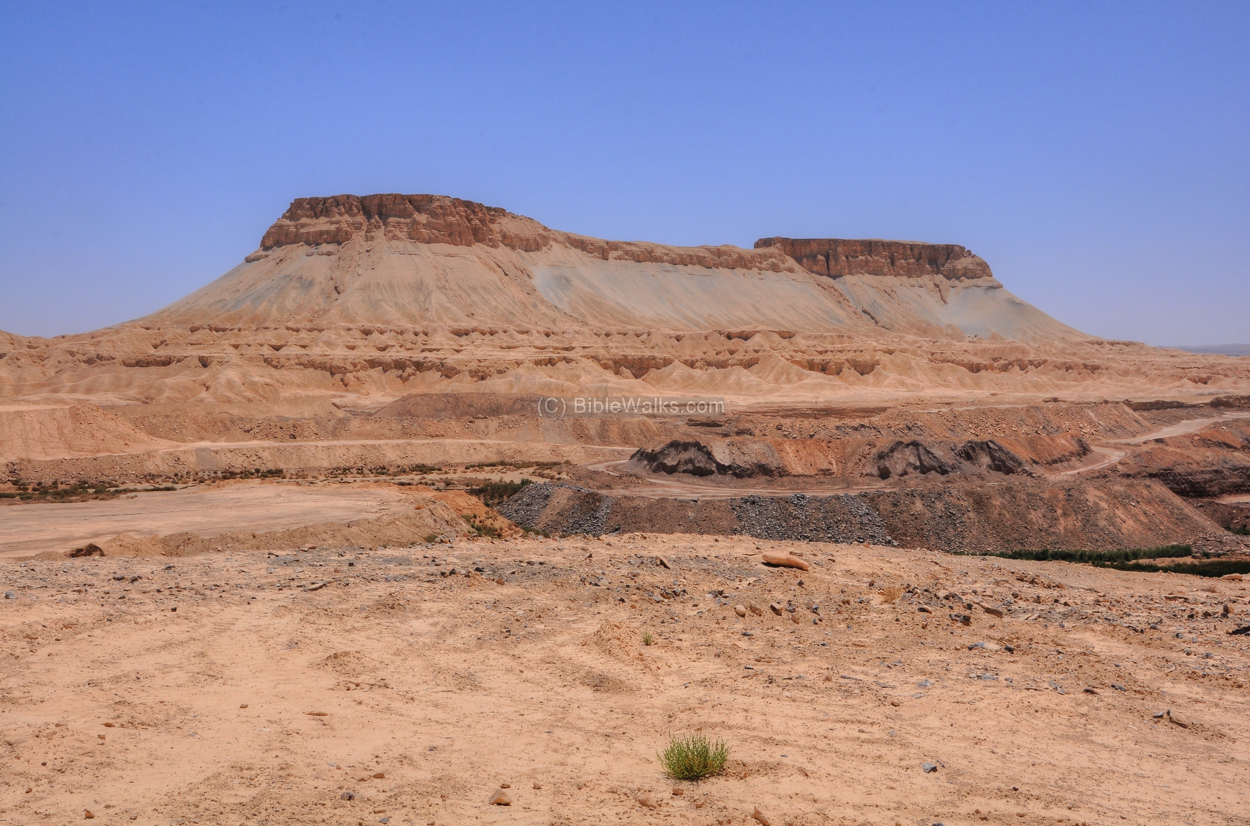
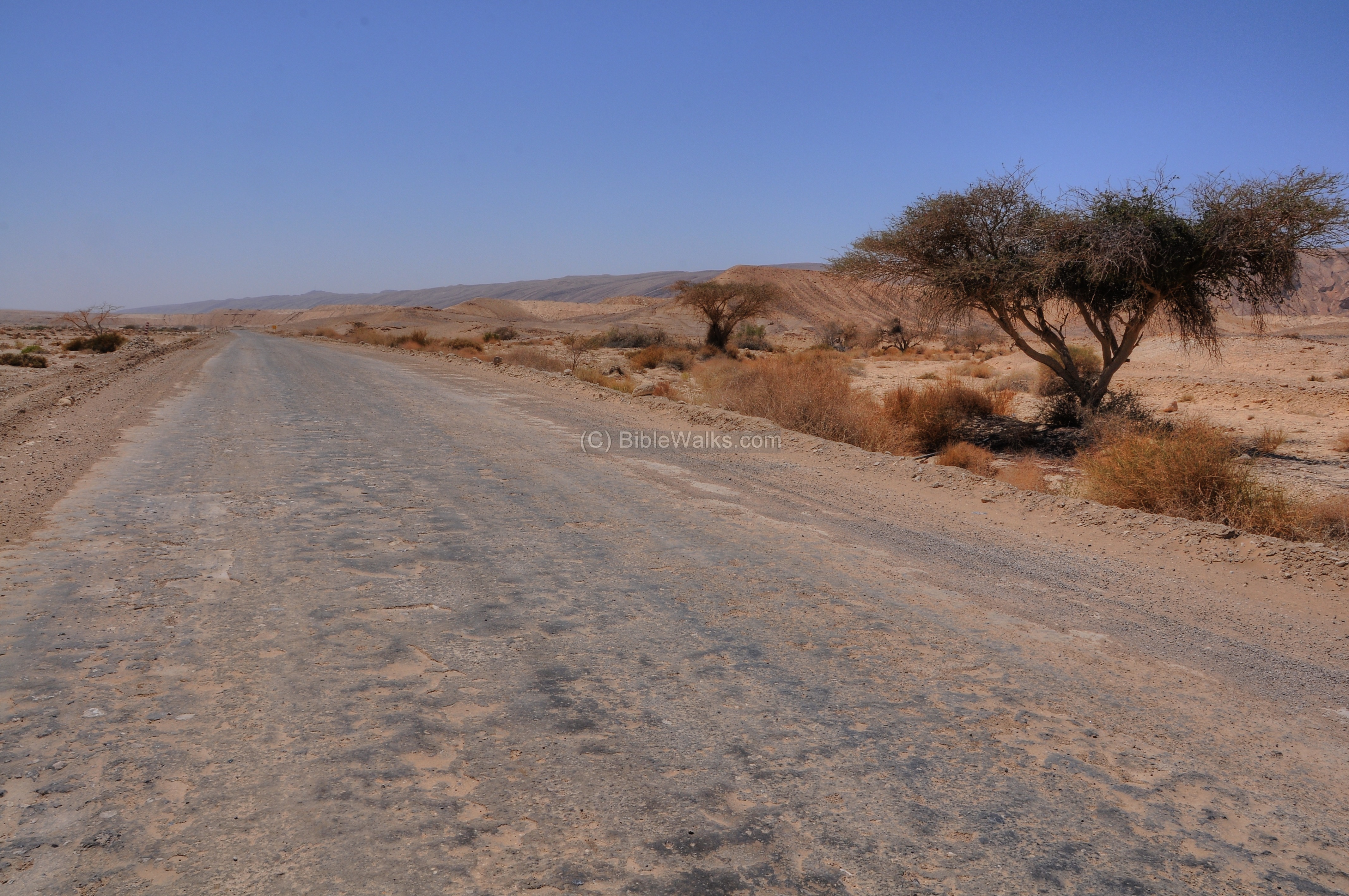
This road leads to the observation place near Mt Zin, and passes through the area of the plant. Around it are sections of the plant with hills of extracted rocks.
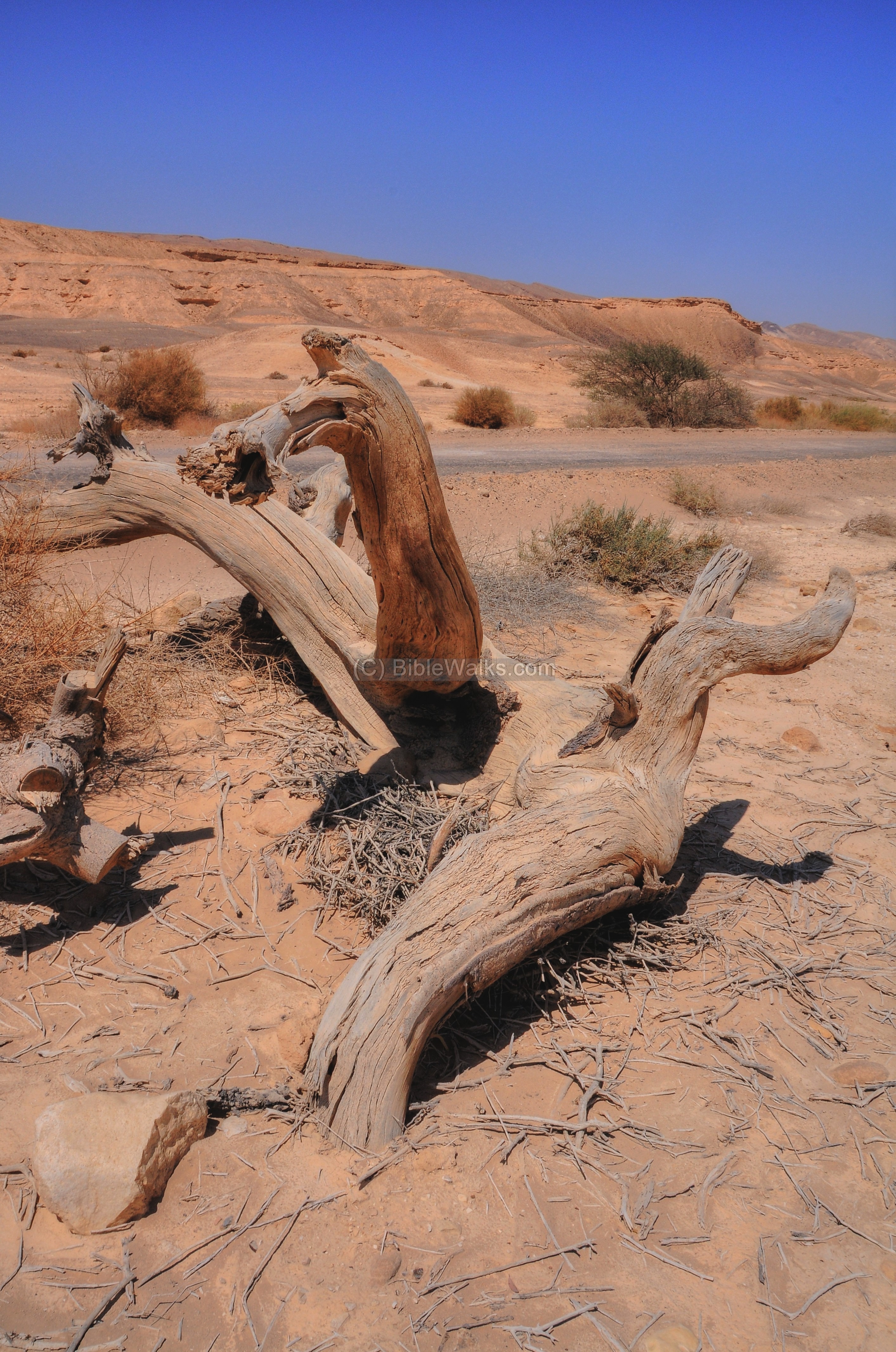
Natural Sculpture
Inside the Zin valley, on the side of the phosphate road, are remains of dead trees. One of them caught our attention…

Below are some views of the remains of the tree.

A limb looking like the head of a horse or a dog (imagination helps here):
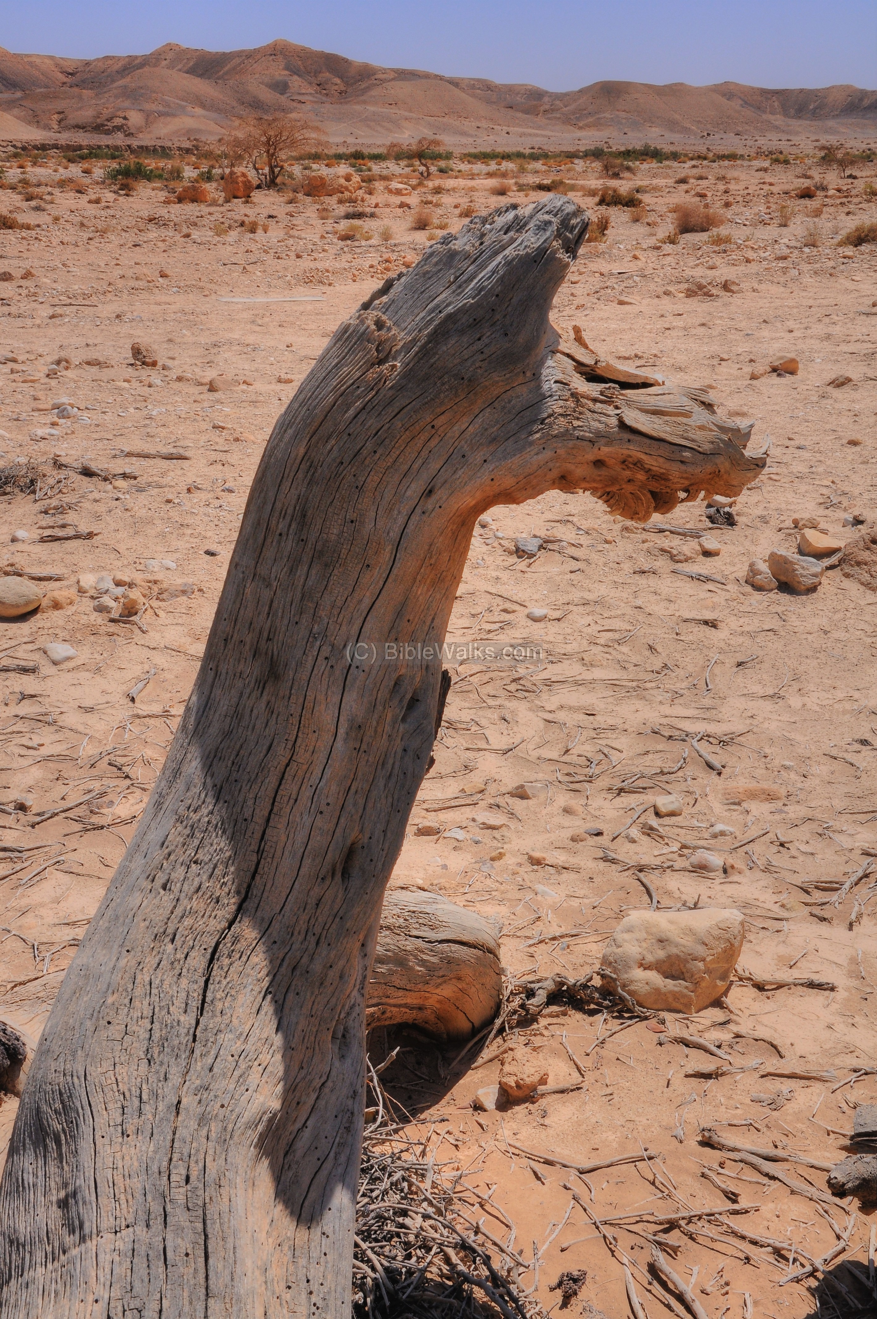
On the next photo – the “horse’s head” from the other side…
In the closer background is the main road from Ma’ale Akrabim junction (road #227) to the phosphate plant. Behind, in the far background, are the cliffs above the north side of the valley of Zin. The bible gives the same directions when describing the borders of the Land of Israel (Numbers 34:4): “And your border shall turn from the south to the ascent of Akrabbim, and pass on to Zin”.
Biblical References:
Zin
- Moses sends the spies into the Land of Israel.
Numbers 13:21: “So they went up, and searched the land from the wilderness of Zin unto Rehob, as men come to Hamath”.
- The Hebrews arrived to Zin, near Kadesh:
Numbers 20 1: “Then came the children of Israel, even the whole congregation, into the desert of Zin in the first month: and the people abode in Kadesh; and Miriam died there, and was buried there”.
- The desert of Zin is also called Kadesh:
Numbers 33 36: “And they removed from Eziongaber, and pitched in the wilderness of Zin, which is Kadesh”.
- Zin was on the southern border of Israel, as promised by God and as conquered by Joshua:
Numbers 34 33, 34: “Then your south quarter shall be from the wilderness of Zin along by the coast of Edom, and your south border shall be the outmost coast of the salt sea eastward: And your border shall turn from the south to the ascent of Akrabbim, and pass on to Zin: and the going forth thereof shall be from the south to Kadeshbarnea, and shall go on to Hazaraddar, and pass on to Azmon:”
Joshua 15 1: “This then was the lot of the tribe of the children of Judah by their families; even to the border of Edom the wilderness of Zin southward was the uttermost part of the south coast”.
Mount Hor:
Mount Hor is the burial site of Aaron, brother of Moses, during the time of the Exodus.
Numbers 20: 22-29: “And the children of Israel, even the whole congregation, journeyed from Kadesh, and came unto mount Hor. And the LORD spake unto Moses and Aaron in mount Hor, by the coast of the land of Edom, saying, Aaron shall be gathered unto his people: for he shall not enter into the land which I have given unto the children of Israel, because ye rebelled against my word at the water of Meribah. Take Aaron and Eleazar his son, and bring them up unto mount Hor: And strip Aaron of his garments, and put them upon Eleazar his son: and Aaron shall be gathered unto his people, and shall die there. And Moses did as the LORD commanded: and they went up into mount Hor in the sight of all the congregation. And Moses stripped Aaron of his garments, and put them upon Eleazar his son; and Aaron died there in the top of the mount: and Moses and Eleazar came down from the mount. And when all the congregation saw that Aaron was dead, they mourned for Aaron thirty days, even all the house of Israel”.
Etymology (behind the name):
* Names of the site:
- Zin (Cin) – a desert and stream in the south part of Israel, referred many times in the Bible. The Hebrew name may have referred to a type of palm tree.
- Hor Hahar – the burial site of Aaron, brother of Moses. Identified as Mt Zin.
- Jebel Madiera, Madurah – Arabic: the mountain of the distress
- Wadi Fikre or Fiqre – Arabic name of valley of Zin
Links:
* Internal:
- Ma’ale Akrabbim – nearby attraction (and road #227)
- Biblical Tamar, Hazeva – nearby attraction
* External:
- Phosphates deposits in Israel (pdf)
- Edom – did it extend west of Arabah?
- The location of Mount Hor
BibleWalks.com – following the paths of the Bible
Ma’ale Akrabbim <—previous site—<<<All Sites>>>— next Negev site—>>> Tamar
This page was last updated on June 15, 2012
Sponsored links: