Mount Gerizim is a holy and historic site, located on the south side of Shechem. On the top are ruins of a Samaritan city dated to the Persian and Hellenistic periods, and a Byzantine Church.

* Site of the Month Oct 2012 *
Home > Sites > Samaria > Mount Gerizim
Contents:
Background
Location
History
Structure
Photos
* Aerial Views
* South West
* South East
* Fortified enclosure
* Byzantine Winepress
* Hellenistic Mansion
* Western Walls
* Twelve stones
* Church
* Sacred Precinct
* Isaac’s sacrifice
Etymology
Links
Overview:
Mount Gerizim is a holy and historic site, located on the south side of Shechem. The Samaritan ruins include a temple precinct and city built during the Persian and Hellenistic periods, which was destroyed by the Hasmoneans. The Byzantine ruins include a church and monastery built in two phases on top of the Samaritan ruins.
The site was opened to the public in 2012 and administrated by the Israel nature and parks authority.
Location and Map:
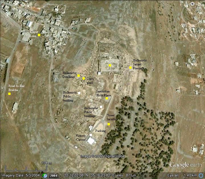
Mt Gerizim archaeological park is located on top of the mountain. The access to site is thru Kiryat Luza, which can be reached from the road that leads to the Har Brakha community.
History:
-
Biblical periods
Mount Gerizim is a Holy hill, located on the south side of Shechem (today’s Arabic city of Nablus). On the opposite side of Shechem is Mount Ebal. Both of these hills witnessed the mass ceremony held by Joshua after his entry to Canaan, following the return of the Israelites from the Exodus in Egypt. The ceremony took place according to the commands Moses received earlier from God – to gather the people between the two facing hills – Gerizim and Ebal – and bless the former while cursing the latter.
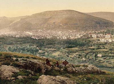
Mt Gerzim and Nablus – view from Mt Ebal
[ Dated: 1890-1900; p/o Views of the Holy Land; Library of Congress]
The blessing of Mt Gerizim is described in the Bible (Deuteronomy 27, 11-13): “And Moses charged the people the same day, saying, These shall stand upon mount Gerizim to bless the people, when ye are come over Jordan; Simeon, and Levi, and Judah, and Issachar, and Joseph, and Benjamin: And these shall stand upon mount Ebal to curse; Reuben, Gad, and Asher, and Zebulun, Dan, and Naphtali”.
Both mountains are about the same height (881m for Gerizim, 940m for Ebal). Between them, in the valley, is the city of Shechem (Nablus). The Canaanite/Israelite city was located to its east (“Tel Balata”).
A Biblical map is shown here, with Mt Ebal and Mt Gerizim on both sides of Shechem. Many major routes passed near Gerizim – the north-east to Beit Shean (Skythopolis), the east to Adam crossing over the Jordan river, South to Jerusalem, west to the coast, and north through Shomron/Samaria to Jezreel and the Galilee.
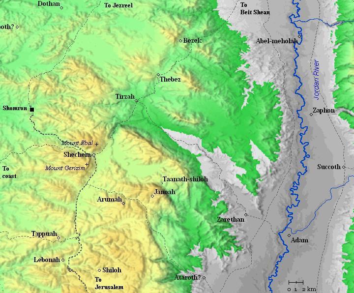
Roads and cities during the Israelite period, 12th to 7th century BC (based on Bible Mapper 3.0)
In 928 BC the Israelite Kingdom separated to the south (Judah – 2 tribes) and the north (Israel – 10 tribes), and Gerizim became part of the Northern Kingdom.
-
Assyrian conquest
At the end of the 8th century BC, the Assyrian empire – a rising force in the region – conquered the Northern Kingdom in a series of intrusions:
The first intrusion was in 732 BC by the Assyrian King Tiglath-Pileser III, who annexed the area (2 Kings 15: 29): “In the days of Pekah king of Israel came Tiglathpileser king of Assyria, and took … Galilee…and carried them captive to Assyria”. The Assyrians conquered the Galilee, but the center of the Northern Kingdom based in Samaria was left intact. But not for long…
The intrusions of Shalmaneser V and Sargon II in 724-712 ended the Northern Kingdom (2 Kings 17: 5-6): “Then the king of Assyria came up throughout all the land, and went up to Samaria, and besieged it three years. In the ninth year of Hoshea the king of Assyria took Samaria, and carried Israel away into Assyria, and placed them in Halah and in Habor by the river of Gozan, and in the cities of the Medes”.
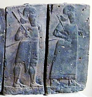
Orthostat relief – depicting soldiers from different orders of the Assyrian Army, in procession;
basalt; Hadatu Tiglath-Pileser III period (744-727BC)
[Istanbul Archaeological museum]
-
Origin of Samaritans
According to inscriptions from Sargon’s palace at Khorsabad, the Assyrian king claims that 27,290 people in Samaria were relocated to Assyria, and the capital city Samaria (Shomron) was destroyed and later rebuilt by Sargon. As a common Assyrian conquest practice, the Israelite exiles were replaced by people from Mesopotamia and other areas (2 Kings 17 24-26): “And the king of Assyria brought men from Babylon, and from Cuthah, and from Ava, and from Hamath, and from Sepharvaim, and placed them in the cities of Samaria instead of the children of Israel: and they possessed Samaria, and dwelt in the cities thereof”.
These new people brought with them pagan beliefs. However, the new arrivals were a minority among the Israelites, and so they absorbed the Jewish religion.
The Bible writes that only after God punished them by sending lions – they converted their religion (2 Kings 17, 25-26):
“And so it was at the beginning of their dwelling there, that they feared not the LORD: therefore the LORD sent lions among them, which slew some of them. Wherefore they spake to the king of Assyria, saying, The nations which thou hast removed, and placed in the cities of Samaria, know not the manner of the God of the land: therefore he hath sent lions among them, and, behold, they slay them, because they know not the manner of the God of the land”.
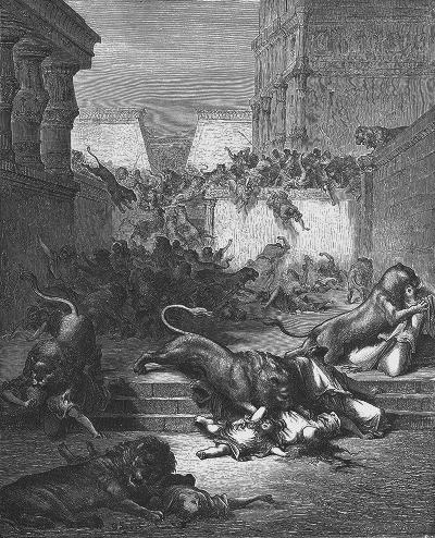
God sends lions – by Gustav Dore (French artist, 1832-1883)
Thus, the Bible summarizes the origin of the Samaritans (2 Kings 17, 29): “Howbeit every nation made gods of their own, and put them in the houses of the high places which the Samaritans had made, every nation in their cities wherein they dwelt”. Therefore, the Samaritans came from other parts of the Assyrian empire, and converted to the local faith. They are often called “Cuthans” – named after one of the cities where they came from (40 km northwest of Babylon). Evidence of this origin may have been found in the excavations (Reisner & Fisher, 1908-1911) of the capital city Samaria/Shomron (Sebastia), where a 8th Century South-Mesopotamian vessel was found by the archaeologists.
After the Assyrian destruction, followed by the Babylonian conquest, there were still many Israelites living in the territories of Samaria. The Bible tells of several events that involved Israelites from this area (2 Chronicles 30; 34; Jeremiah 39 8-10).
Most of the Southern Kingdom of Judah were also damaged in 701BC by Assyrian intrusion of Sennacherib, son of Sargon II, but the city of Jerusalem resisted this onslaught (2 Chronicles 31 1). However, in 586 BC it fell to the Babylonians, and its people were exiled to Babylon.
-
Persian period (6th – 4th century BC)
The Persians defeated the Babylonians (539 BC), and King Cyrus “the Great” allowed the Judean exiles to return back to Israel (Zion) and rebuild their temple in Jerusalem.
Cyrus restored the vessels of the temple, as illustrated here (Ezra 1:7-8): “Also Cyrus the king brought forth the vessels of the house of the LORD, which Nebuchadnezzar had brought forth out of Jerusalem, and had put them in the house of his gods;”.
The returnees, headed by Ezra and Nehemiah, started to rebuild the destroyed city of Jerusalem.
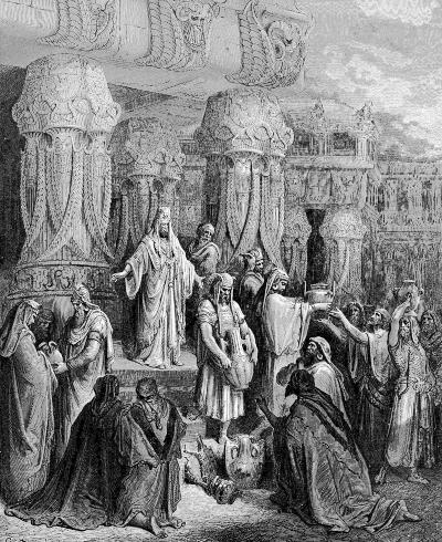
Cyrus restores the temple vessels – by Gustav Dore (French artist, 1832-1883)
A small group of native Israelites from the North, who remained in Samaria and Galilee during the Babylonian exile, requested to assist in the reconstruction of the temple in Jerusalem. The Samaritans were now devoted Jews and followed the strict Biblical laws, and so they expected to be welcomed by the newcomers and share the reconstruction of the nation. However, Zerubbabel and the other Judean elders refused to absorb them into their community. This crisis, as told below by the book of Ezra, was the starting point of the conflict, which separated the Samaritans from “main stream” Judaism and the two religions departed.
(Ezra 4 1-5): “Now when the adversaries of Judah and Benjamin heard that the children of the captivity builded the temple unto the LORD God of Israel; Then they came to Zerubbabel, and to the chief of the fathers, and said unto them, Let us build with you: for we seek your God, as ye do; and we do sacrifice unto him since the days of Esarhaddon king of Assur, which brought us up hither. But Zerubbabel, and Jeshua, and the rest of the chief of the fathers of Israel, said unto them, Ye have nothing to do with us to build an house unto our God; but we ourselves together will build unto the LORD God of Israel, as king Cyrus the king of Persia hath commanded us. Then the people of the land weakened the hands of the people of Judah, and troubled them in building, And hired counsellors against them, to frustrate their purpose, all the days of Cyrus king of Persia, even until the reign of Darius king of Persia”.
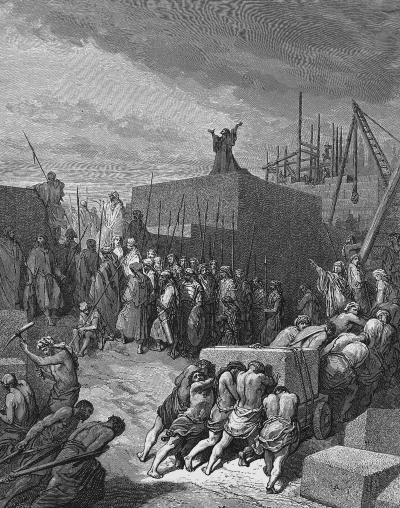
Rebuilding the temple in Jerusalem – by Gustav Dore (French artist, 1832-1883)
Since they were banished from the Judean temple in Jerusalem, the Samaritans established their own rival temple city on Mount Gerizim, which served as the religious and administrative center for the Samaritans. This construction at the end of the 5th century BC was headed by Sanballat, the Governor of Samaria (credit Ofer M. for correcting). The Samaritan temple substituted the one built in Jerusalem, and became the spiritual, religious and administrative center for the Samaritan people.
-
Hellenistic period (4th – 1st Century BC)
During the Hellenistic period, with a peak in the 2nd century BC, the city around the temple flourished. The city covered 400 Dunam (40 Hectares) with a population of 10,000, mostly priests who served the temple and supported the Samaritan pilgrimage from Samaria and beyond.
The city was destroyed at the end of the 2nd Century BC (112/111 BC) by the Hasmonean King John Hyrcanus I (Josephus Ant. 13 10:3): “And when Hyrcanus had taken that city, which was not done till after a year’s siege, he was not contented with doing that only, but he demolished it entirely, and brought rivulets to it to drown it, for he dug such hollows as might let the water run under it; nay, he took away the very marks that there had ever been such a city there”. Many of the Samaritans were then forced to bring back to Judaism.
-
Roman/Byzantine (1st century BC – 6th century AD)
After the Roman conquest, the Samaritans gained again their freedom, and their communities flourished in the region. However, they were not allowed to rebuilt the temple city.
During the Roman times the Samaritans increased in size (a million people) and wealth. They populated Samaria and beyond, with dozens of villages in the Holy Land.
The Samaritans reached a peak from the 2nd century AD (following the Bar-Kochba revolt) to the middle of the 5th Century AD. However, their success brought upon them a fierce reaction from the Christian population. The Byzantine ruler Zenon constructed a church in 484 AD on the ruins of the holy precinct, which caused the Samaritans to mutiny. After 100 years of struggles the Samaritans were forced to convert or were exiled. Since then their numbers were reduced to a few hundred.

Map of Mt Gerizim area, with Luza indicated by a yellow marker
- Ottoman period:
In the PEF map (1878) the site is listed as Jebel et Tôr, with an altitude 2848 ft.
The authors Conder and Kitchener write about Mt Gerizim in the Survey of Western Palestine – SWP (Vol 2 pp. 187-190). Excerpts of their reports are provided in the appropriate sections in this web page.

Part of map Sheets11 of Survey of Western Palestine,
by Conder and Kitchener, 1872-1877.
(Published 1880, reprinted by LifeintheHolyLand.com)
In addition, they summarized their report in the introduction to the survey (Vol 1 p 13):
“On Mount Gerizim numerous excavations were made, under the direction of Lieutenant Anderson. Within the ruin known as the ” Castle” the foundations of an octagonal church were laid bare, probably the one known to have been built there by Justinian. On the eastern side of the church is an apse, on the northern side the main entrance, and on each of the others doors leading to small side chapels. In the interior are the piers of a smaller octagon, apparently intended to carry a dome. The church and castle were found to be built on a rough platform of large stones laid together without mortar, and of thiswhich may possibly be that on which the Samaritan Temple stoodthe so-called “twelve stones” form a portion. No trace of large foundations could be found on the southern portion of the small plateau on which the castle stands. Close to the Holy Rock of the Samaritans a number of human remains were dug up, but no clue could be obtained to their age or nationality”.
-
Modern times
The archaeological excavations started in 1982 and continued for 22 seasons, directed by Y. Magen of the Archaeological staff for Judea and Samaria. These excavations shed light on the history of the Samaritans, and proved the accuracy of the book of Nehemiah and the historical accounts of Josephus Flavius.
Mt Gerizim is under full Israeli control (aka, “C” zone), and therefore can be accessed by Israelis.
Structure:
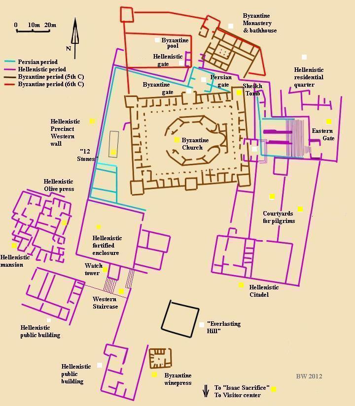
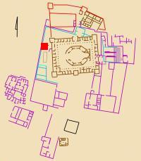
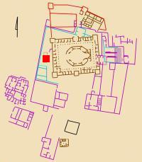
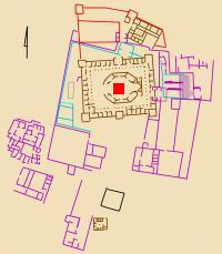
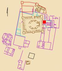
The plan of Mount Gerizim is illustrated in the following diagram, as identified by the archaeological excavations of Tel Gerizim. There are 4 main periods, illustrated in 4 colors: Persian period (late 5th Century BC), Hellenistic period (2nd Century BC), Byzantine periods (5th and 6th century).
Photos:
Aerial Views
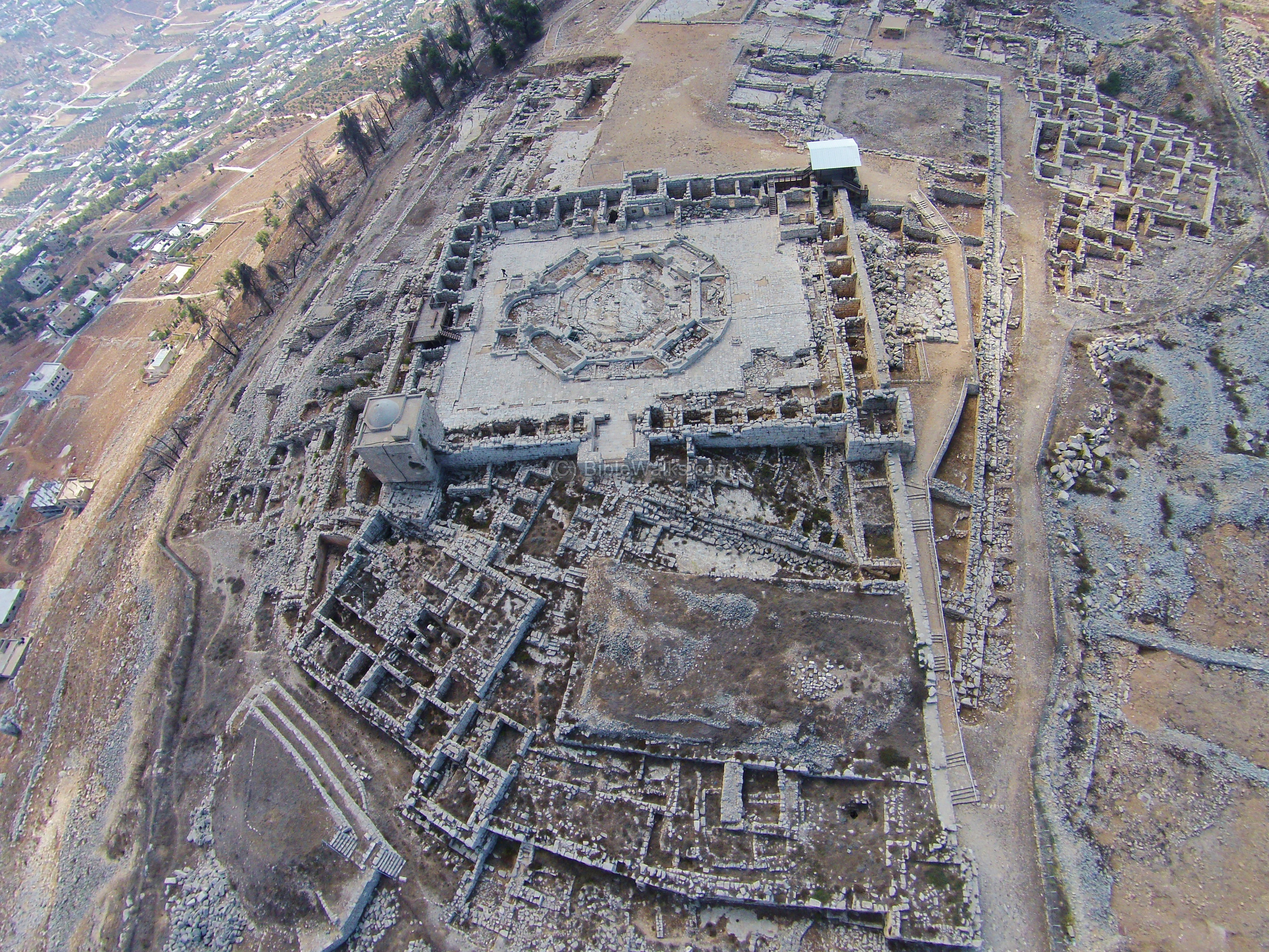
A drone captured these views of Mount Gerizim area. The first view is from the north side of the ruins towards the south. The Byzantine church is in the center of the view, with ruins of multiple periods around it.
The next aerial view is from the opposite side – facing the north. The modern city of Shechem is seen on the top left side, and Mt. Ebal behind it. On the far right side of Mt. Gerizim foothills is Balata camp, where ruins of Tel Shechem (the Biblical city of Shechem) and the tomb of Joseph are located.
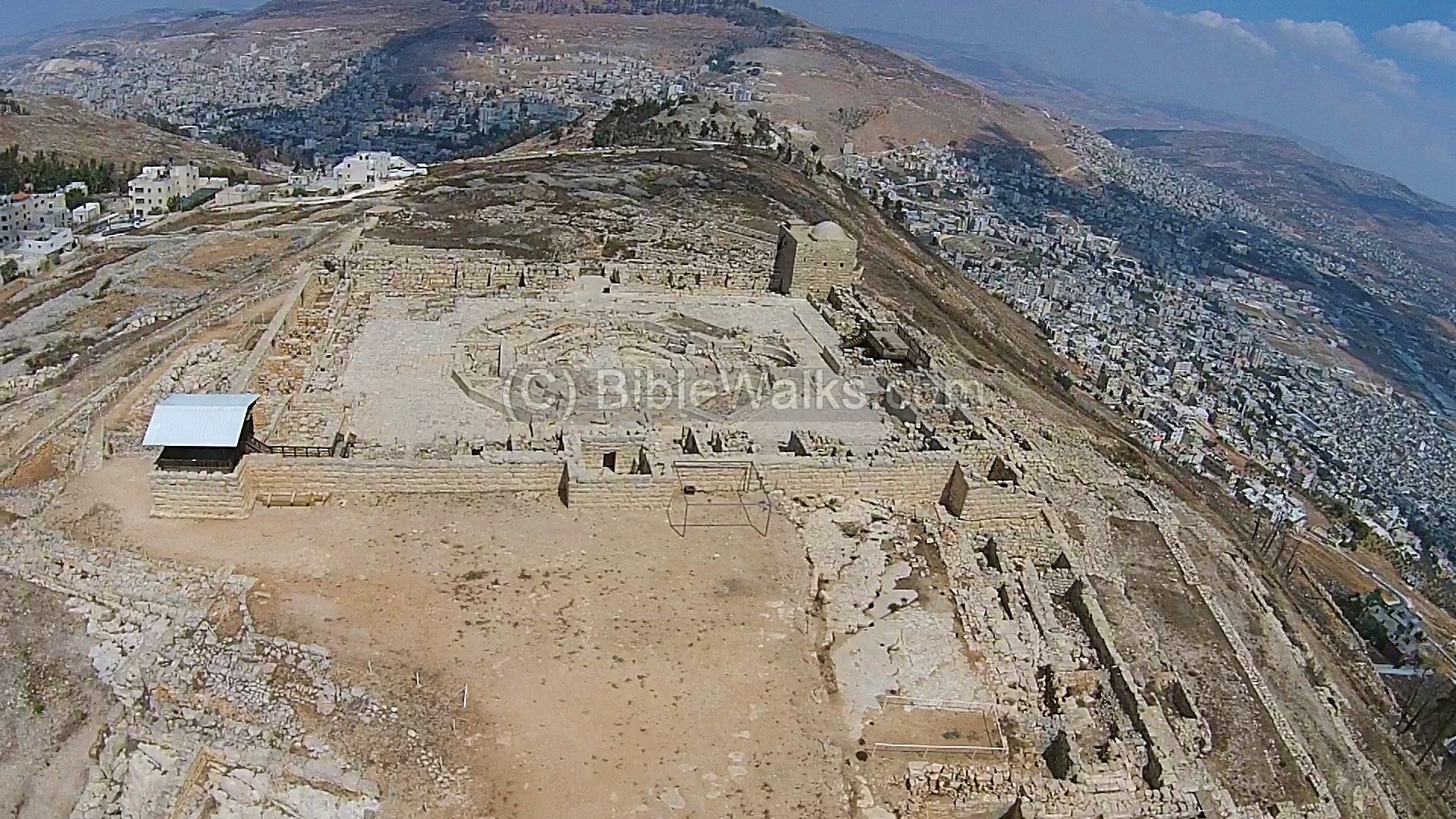
Another north view is in the next photo, focusing on the northern foothills of Mt Gerizim. Notice the large area of ruins that cover the foothills. The hill at the lower side is called Tel e-Ras, where ruins of a Roman/Byzantine are located.
![]() The following YouTube video shows a flight of a drone over the site. It is best seen when you select “full screen” after running the video.
The following YouTube video shows a flight of a drone over the site. It is best seen when you select “full screen” after running the video.
South West
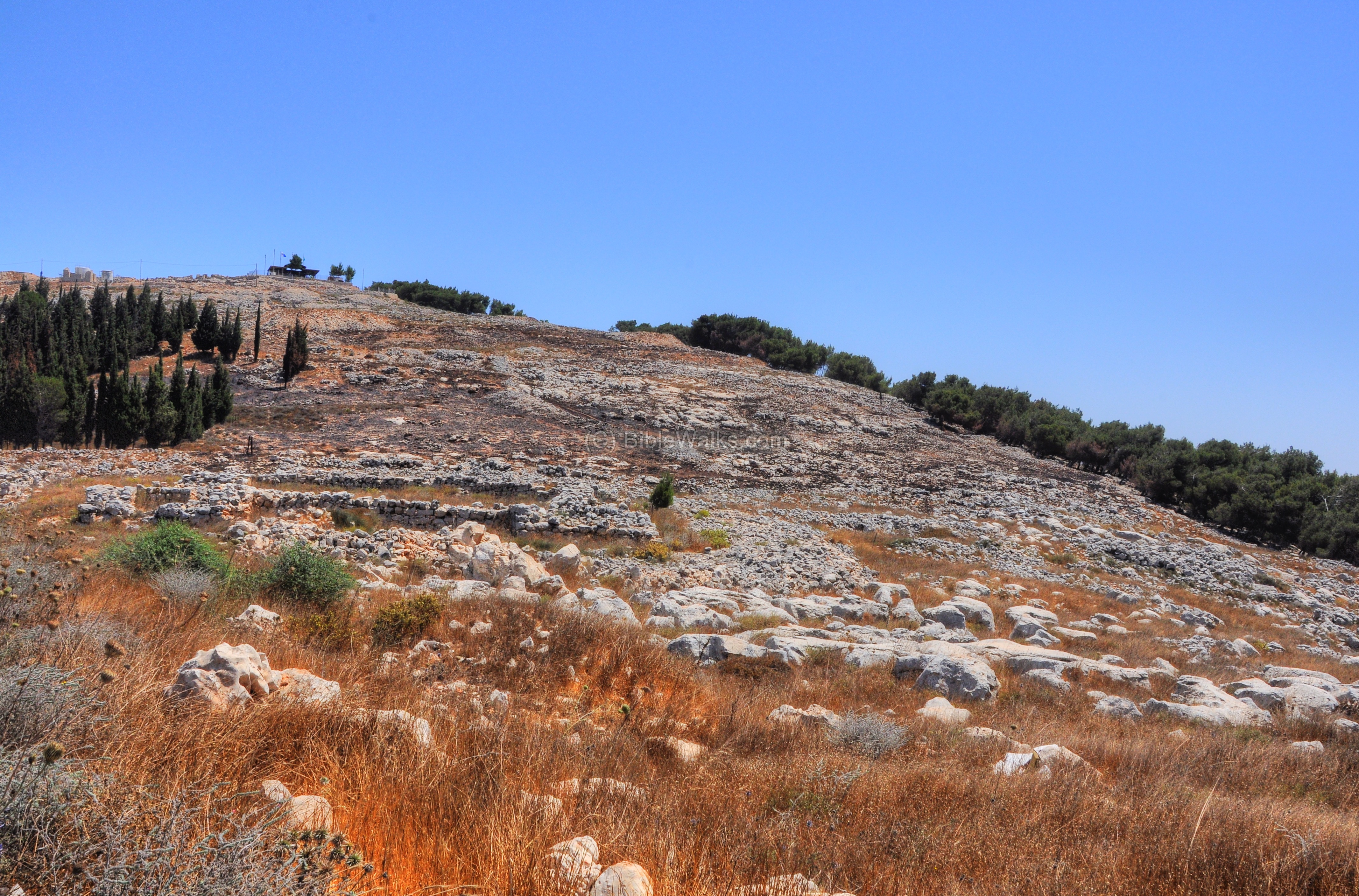
Mt Gerizim is seen here on this southwest view. Around the hill are traces of ruins, most of them not yet excavated. During the Hellenistic period, with a peak in the 2nd Century BC, the city covered 400 Dunam (40 Hectares) with a population of 10,000, mostly priests who served the temple (covering an area of 30 Dunam) and supported the Samaritan pilgrimage from Samaria and beyond. The city was destroyed at the end of the 2nd Century BC by the rival Hasmoneans.
The ruins of the temple and holy sites, as well as the visitor center and the parking, are located on the top of the mountain. This is approached by a road ascending from the Samaritan village – Kiryat Luza.
Click on the photos to view in higher resolution…
South-East side of the Hellenistic precinct
The tour of the site starts from the visitor center where the car is parked. Then, the pathway leads the visitor north towards the southeast side of the temple area.
This section is marked on the map as a red square.
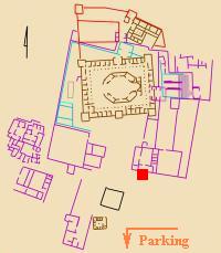
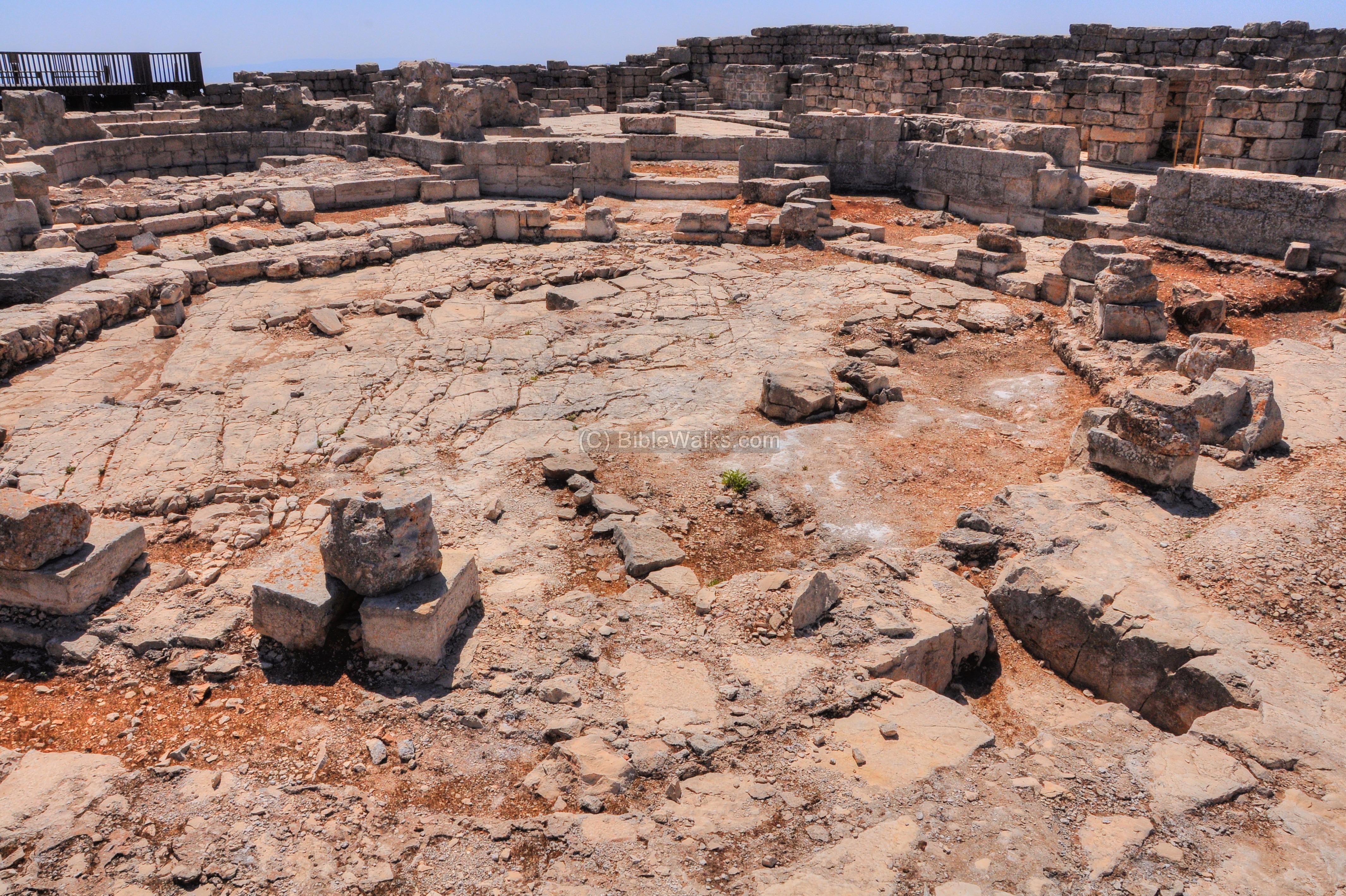
The ruins of a south east side of the Hellenistic period sacred precinct are seen below in the foreground, with the walls of the Byzantine Church and the Sheik’s tomb in the background.
In the center of the sacred precinct was the Samaritan temple, which stood on the highest point in the city and was well fortified. The temple stood where the Byzantine church now stands. The precinct measured 136m east-west and 212 north-south, with two main gates on the north and east sides. Around the precinct are remains of the unwalled city. The temple and the city were totally destroyed by the Hasmoneans at the end of the 2nd Century BC.
A view of the south east walls and the citadel that was embedded in its wall are seen in the next picture. The citadel protected the southeast side of the Hellenistic sacred precinct and included watchtowers and a well preserved hall.
In the background are the houses of the city of Nablus (Shechem) and Balata.

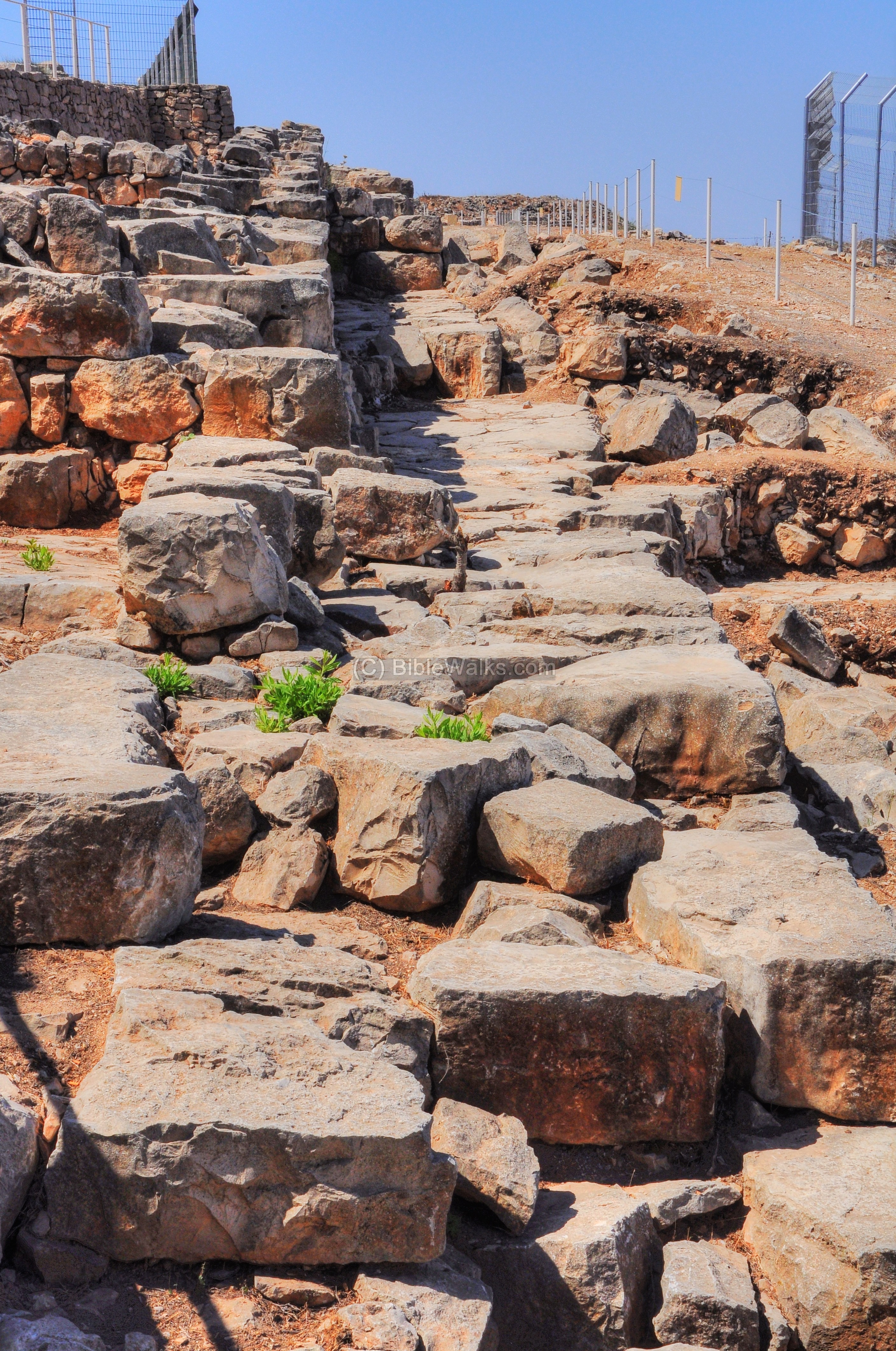
Hellenistic Fortified enclosure
On the south western side of the sacred precinct was a wide staircase which connected the west side of the city to the top of the hill, where the temple once stood during the Hellenistic period.
A public structure and a fortified courtyard were located to the north of the staircase. It is indicated as a red square on the map.
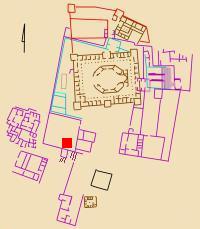
This courtyard is seen in the photo below, and behind it is the location of the staircase.
The visitor center is seen here on the far left background, while the community of Har Brakha is on the far right background.
Below – a eastern view of the area of the staircase, which is used today to descend to the residential area. To the right of the stairs, on the south east side of the courtyard, was a watch tower that protected the gate.
The staircase is 8.5m wide, and leads to a paved plaza. Upon this plaza the archaeologists found small hearths containing small animal bones, which were sacrificed during the annual Passover gatherings.
In the far right background are the houses of the modern Samaritan quarter – Kiryat Luza.
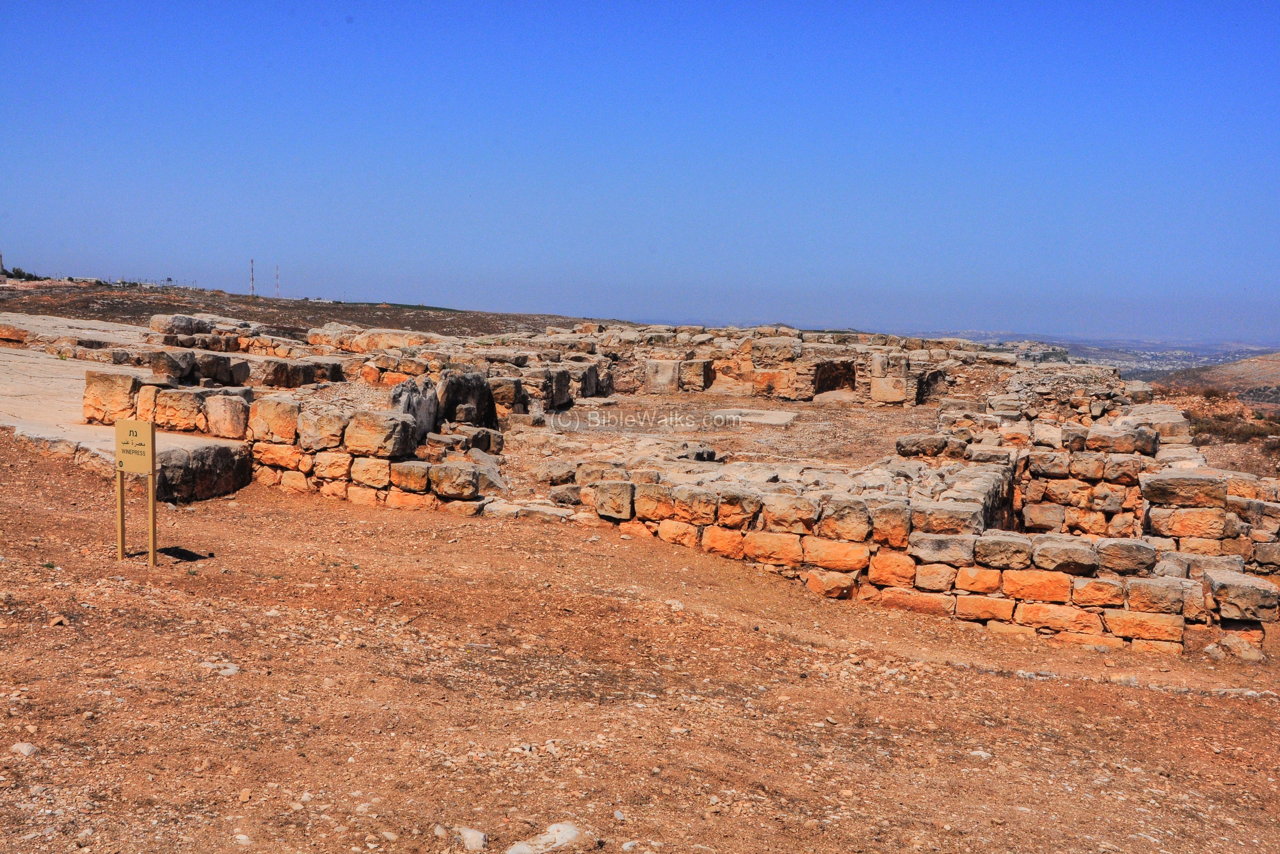
Byzantine Winepress
On the south western side of the site is a large wine press dated to the Byzantine period. Its location is shown on the map as a red square.
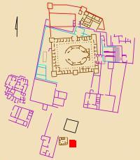
The number of winepresses increased considerably during the Roman/Byzantine period, and its production and export was one of the leading incomes. Hundreds of winepresses are found in the fields, villages, monasteries and cities of the Holy Land. The winepress served the monastery and also provided an income. You can read on winepresses in the info page.
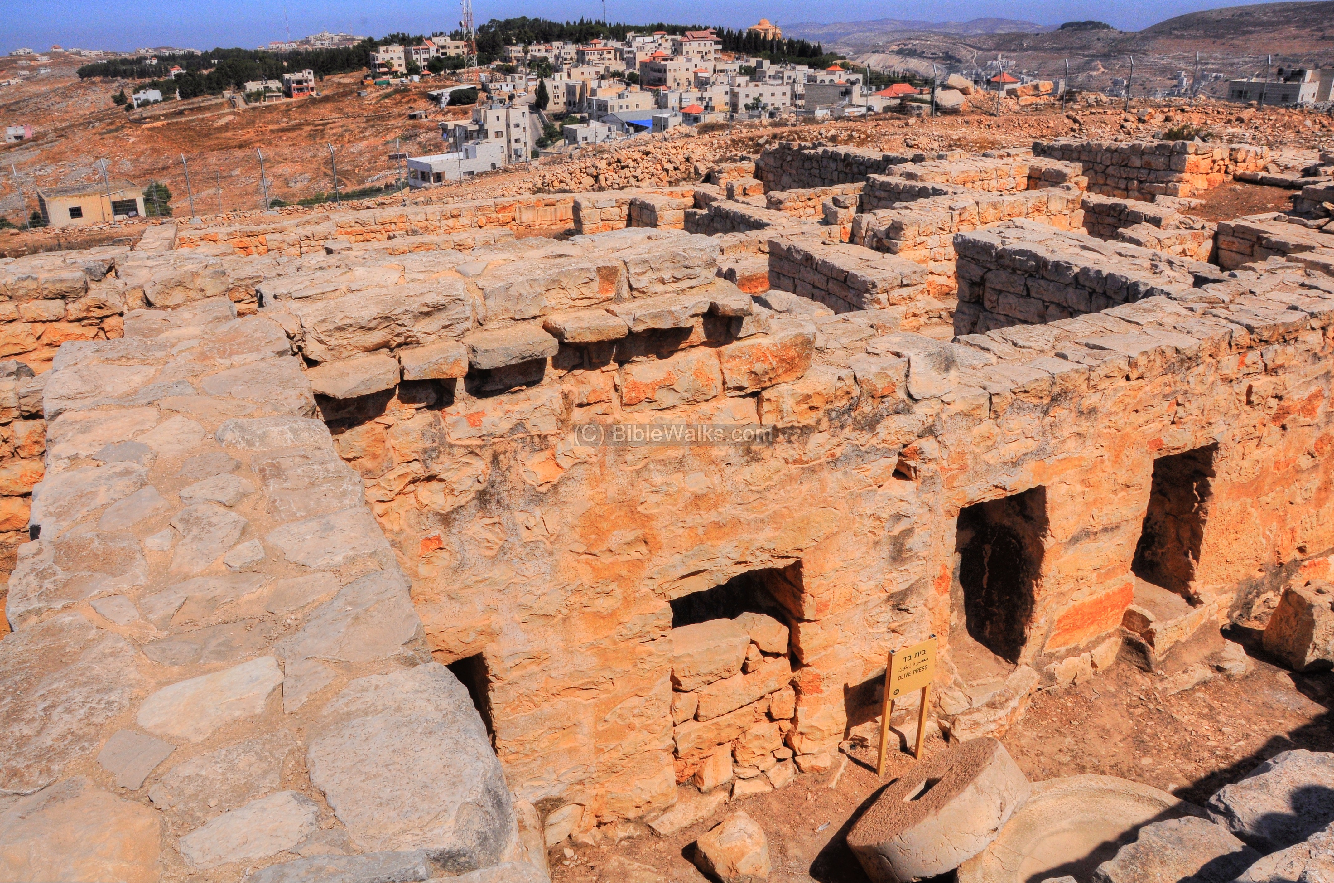
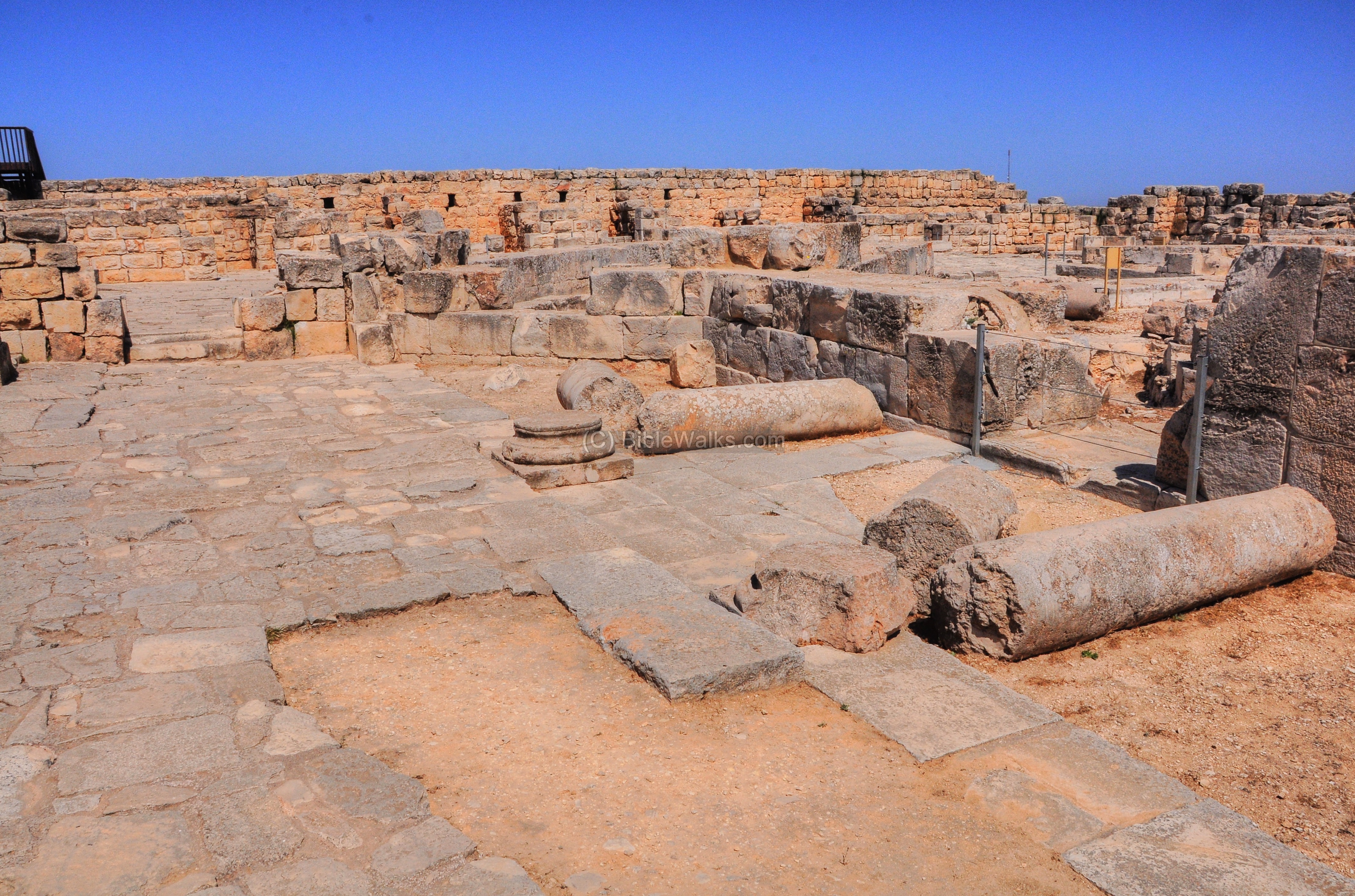
Hellenistic Mansion
During the Hellenistic period, the city around Mt Gerizim covered 400 Dunam (40 Hectares) with a population of 10,000.
One of the structures that were excavated and reconstructed is a large complex, located to the west of the temple walls. Its location is shown on the map as a red square.
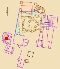

The mansion was composed of two buildings around a central courtyard, covering an area of 40m x 40m. It included courtyards, living rooms, dining halls, cooking areas, and an oil press.
The entrance to this side of the mansion was by a wide (1.8m) staircase, descending from the street on the western side of the sacred precinct down into a small courtyard.
The staircase seen in the photograph indicates that the mansion had a second level.

Another entrance to the mansion was through a paved street from the north side. This paved street passed through the complex, as seen here on the south side of the mansion:

Inside the mansion was an oil press, which was adjacent to the street below the sacred precinct. It measured 19 x 22m and was entered through the north side.
A crushing stone (1.16m diameter) and basin (2.1m diameter), seen in the rear, crushed the olives as the first step. Then, the crushed olives were collected into a basket. The second step is the oil press, a lever based installation consisting of elements which are seen on the front side – pressing weights and axis are seen here. The juice poured into the collecting vat on the lower left side. The third step was to collected the olive juice into jars, then move them to the storerooms on the right.
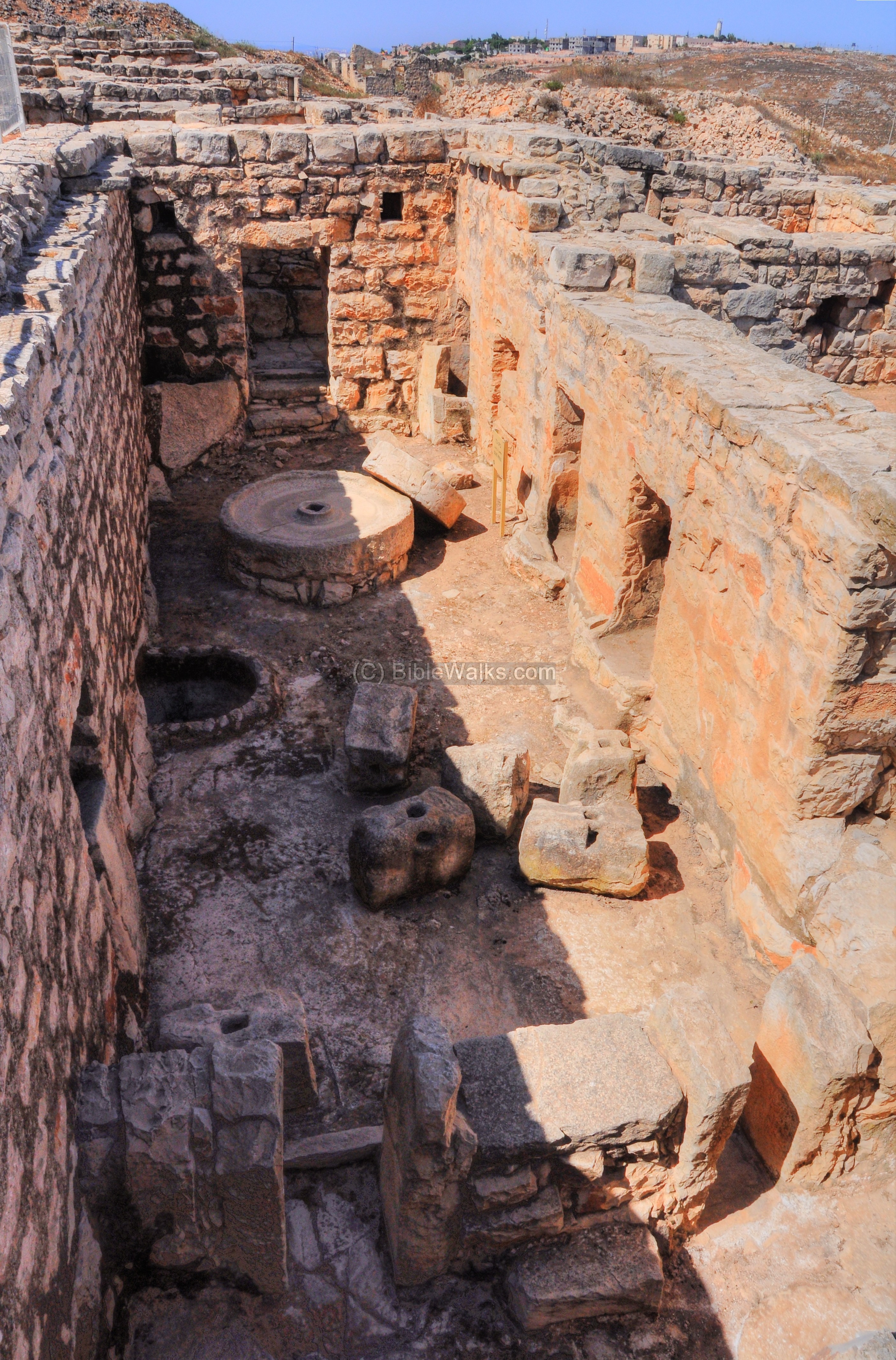
The following picture shows a view of the rear and top side of the oil press. Notice the square niche above the sign on the western wall – this held the wooden beam which held the pole of the crushing stone.
You can read more on oil presses in the info page.
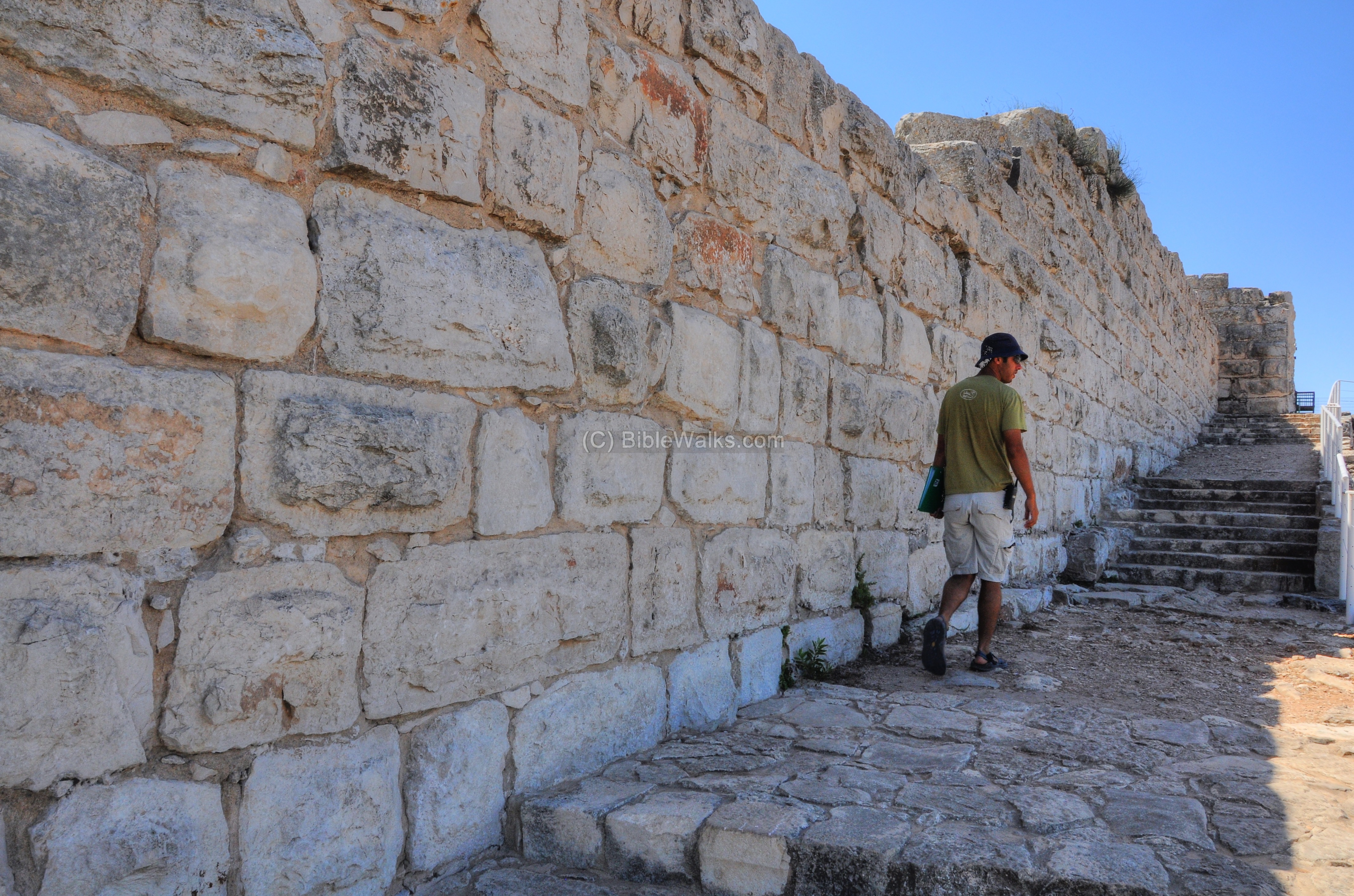
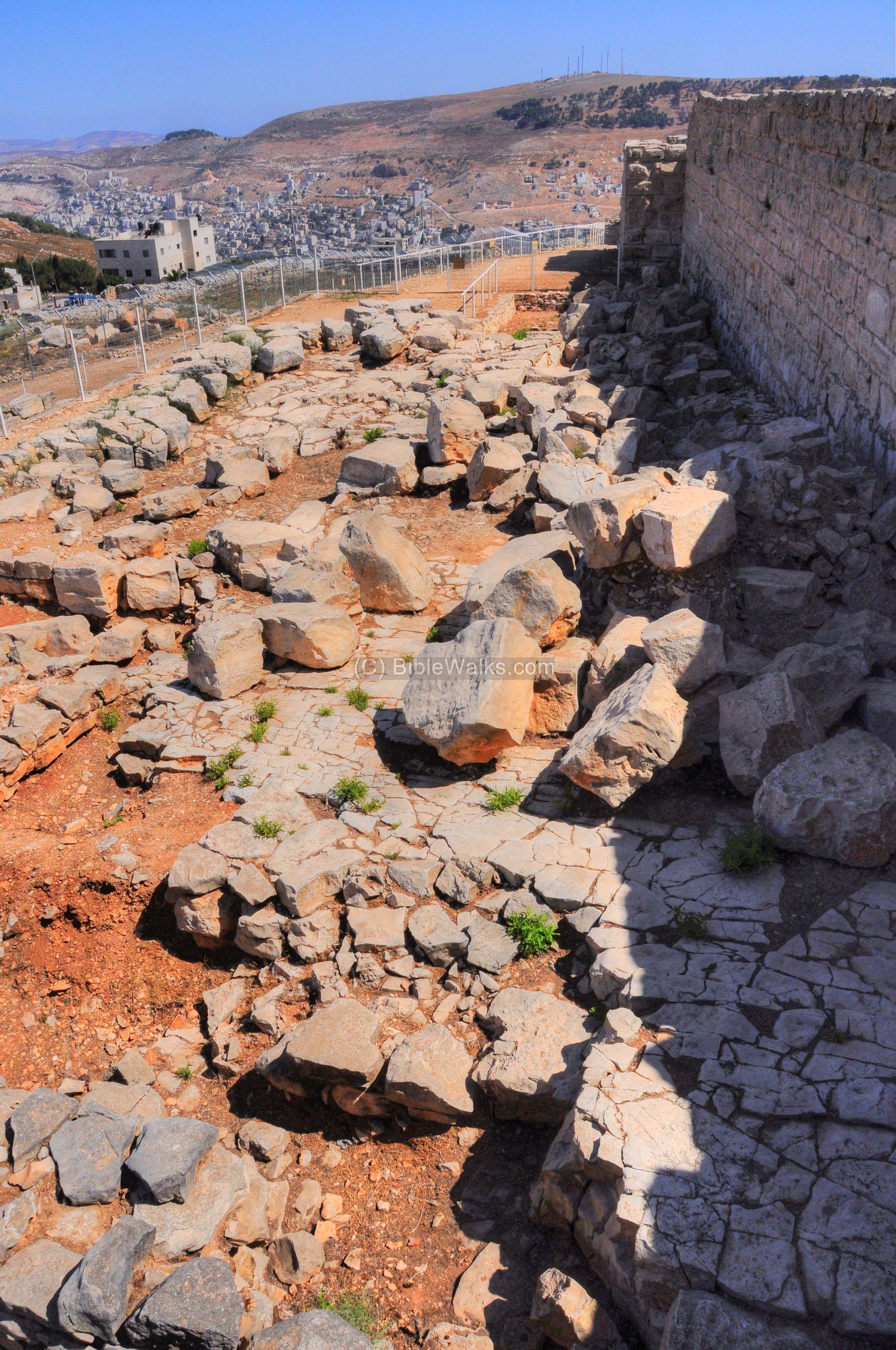
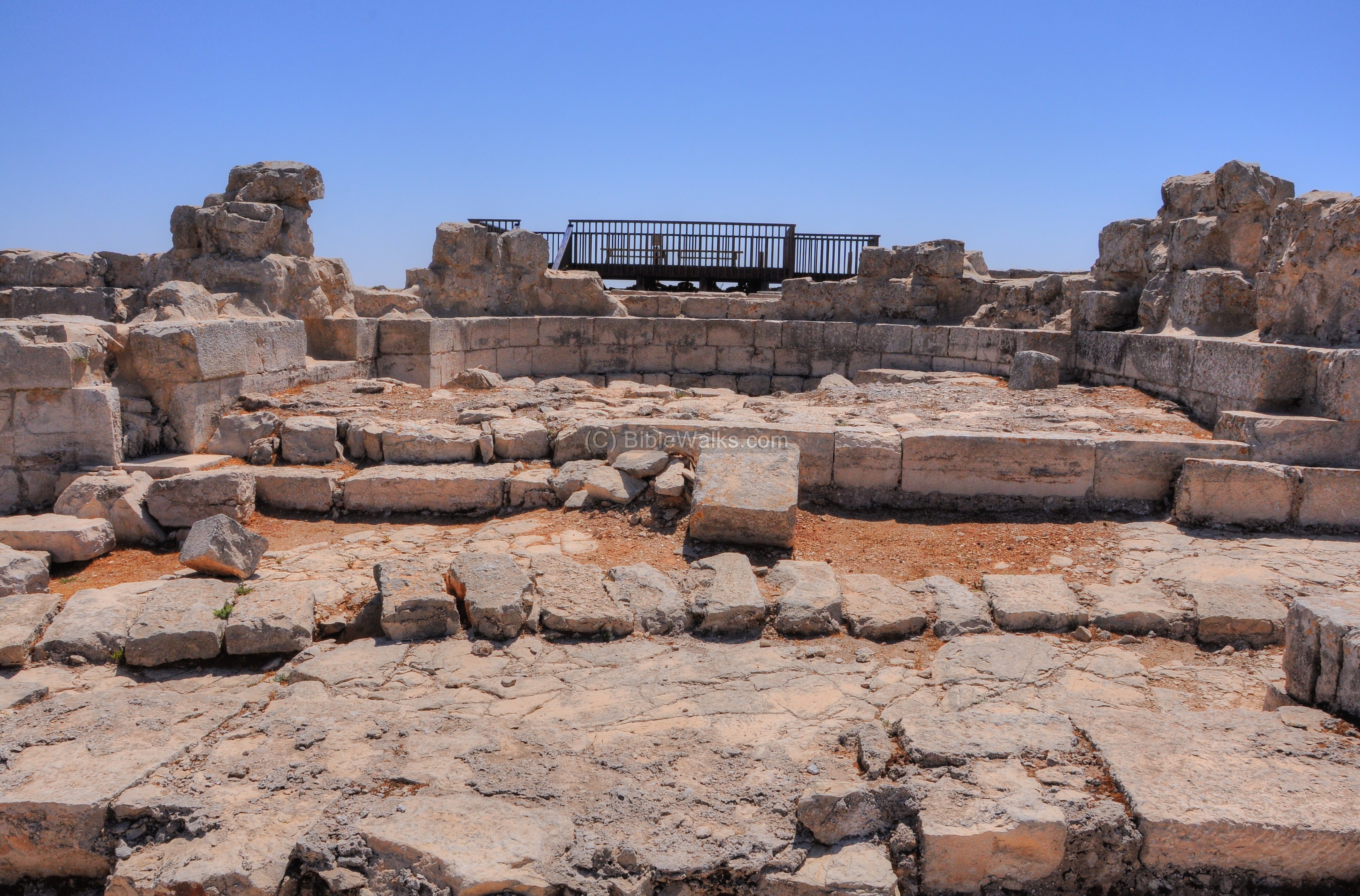
Western Walls
On the western side of the mountain, three walls were discovered: the earlier Persian wall, the Hellenistic wall and the Byzantine wall. Their location is shown on the map as a red square.
The following photo shows the three phases of walls – the front wall dated to the Hellenistic period, behind it the Persian period wall, and behind the modern fence is the Byzantine period wall.
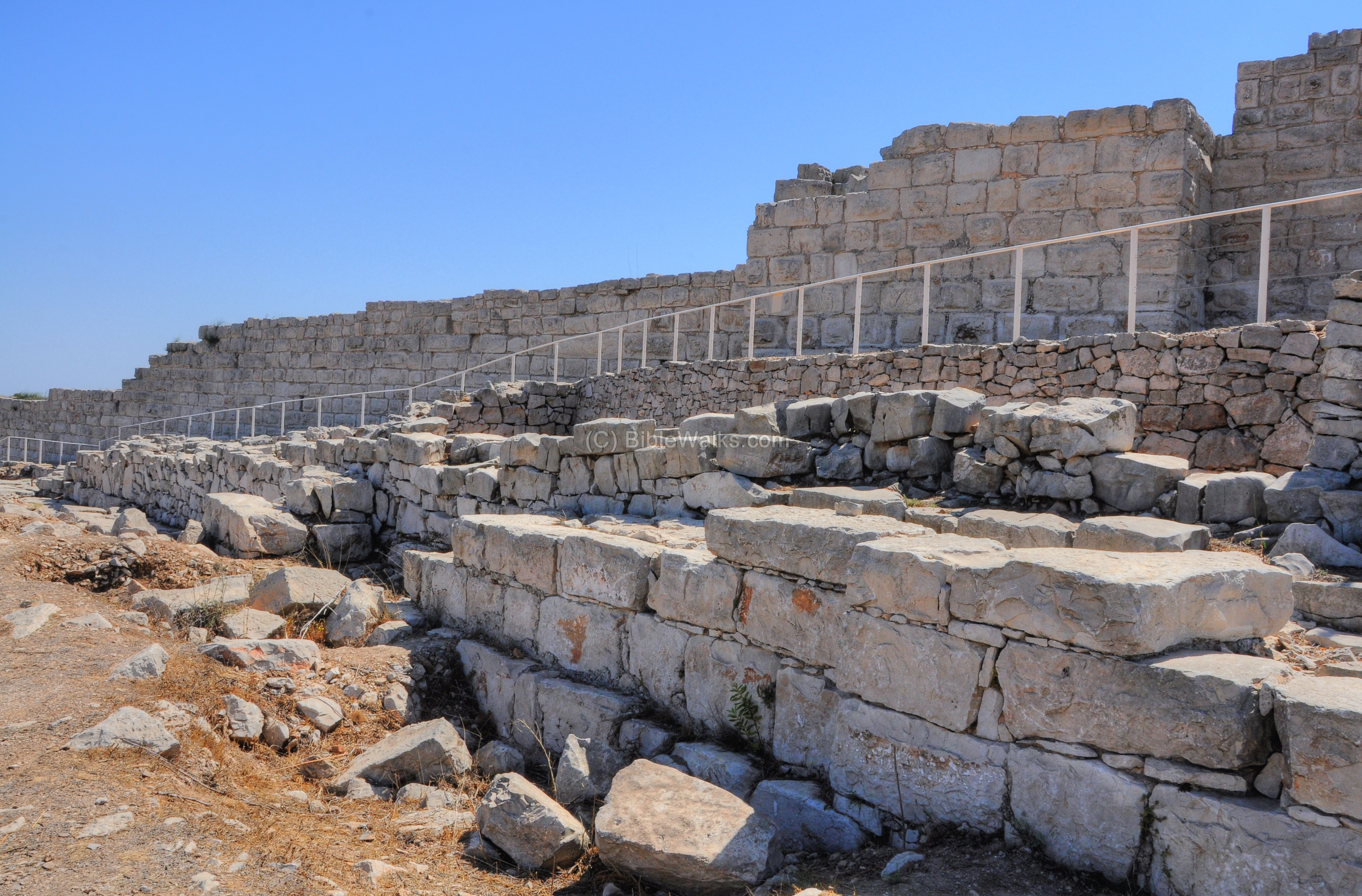
The Persian wall, dated to the end of the 5th century BC, was part of the the first construction of the sacred precinct. At that time the holy complex was smaller in size – 96m by 96m. It large gate, with two triple chambers, was located on the north side (facing Shechem). This wall was constructed of fieldstones.
The later phase of construction is dated to the beginning of the 2nd century BC, during the Hellenistic period. In this period the area of the sacred precinct was enlarged by a factor of 3 – to 212m (north-south) by 136m (east-west). However, the western walls remained at the same line, while the area was increased on the east and the south sides.
The Hellenistic wall was made of trimmed quarry stones, as shown in this section of the wall.

During the Byzantine period, a section of the precinct was converted into a monastery and Church in 484 AD. This fortified wall and towers were added only later (529 AD), after the Samaritans attacked the church. The Byzantine wall is located on a higher level, and protected a smaller area – the monastery size is 100m (north-south) by 83m (east-west).
The gate to the complex was located on the north side, following the location of the gates of the earlier constructions.
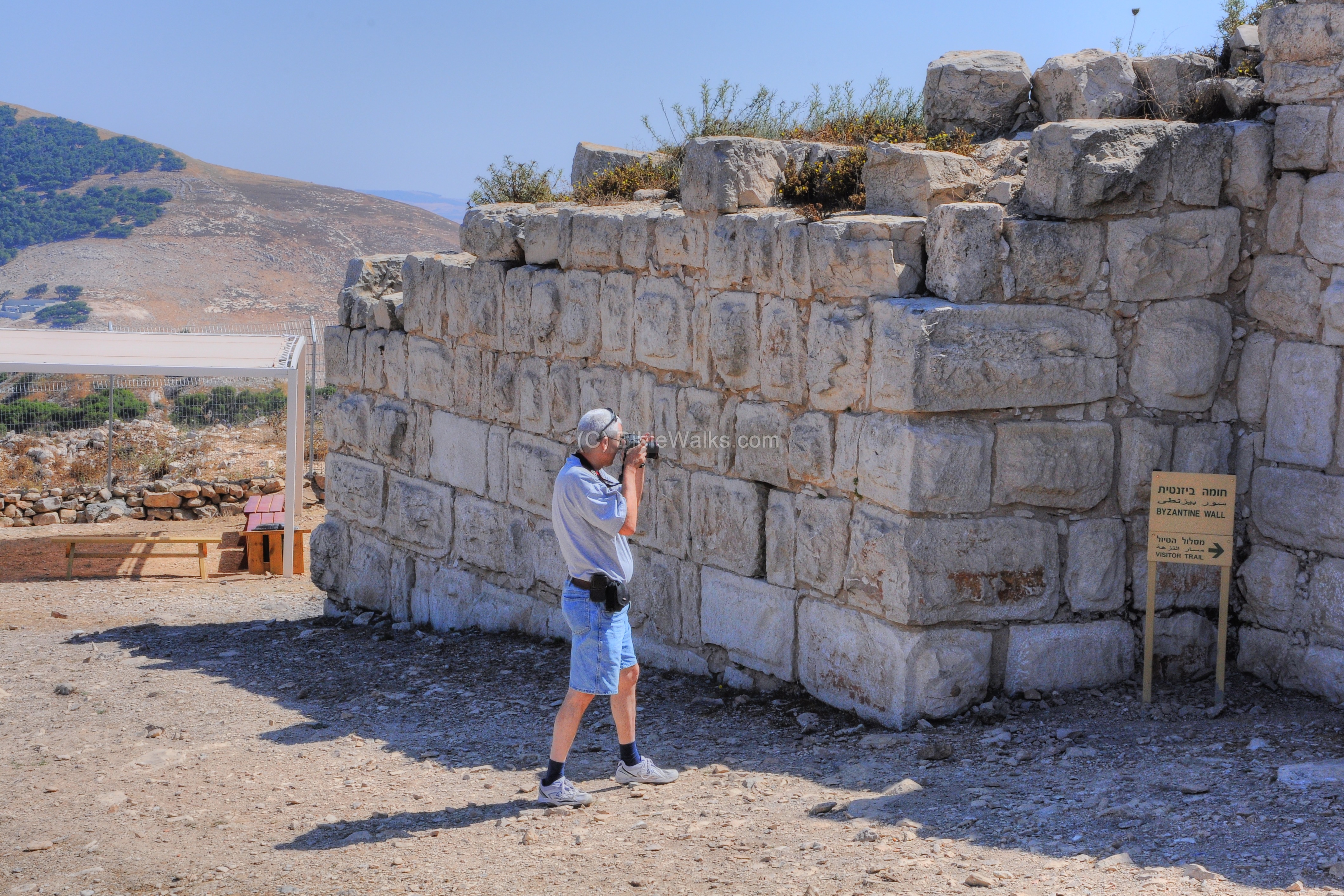
The tour takes the visitor along the Byzantine walls and up to the south-west tower where there is an entrance to the complex.
“Twelve stones”
Along the western Byzantine wall is a Samaritan holy place, known as the “Twelve stones”. Their location is shown on the map as a red square.
According to the Samaritan tradition, this place was the altar that the Joshua and the Israelites built after crossing the Jordan after returning from the exile in Egypt.
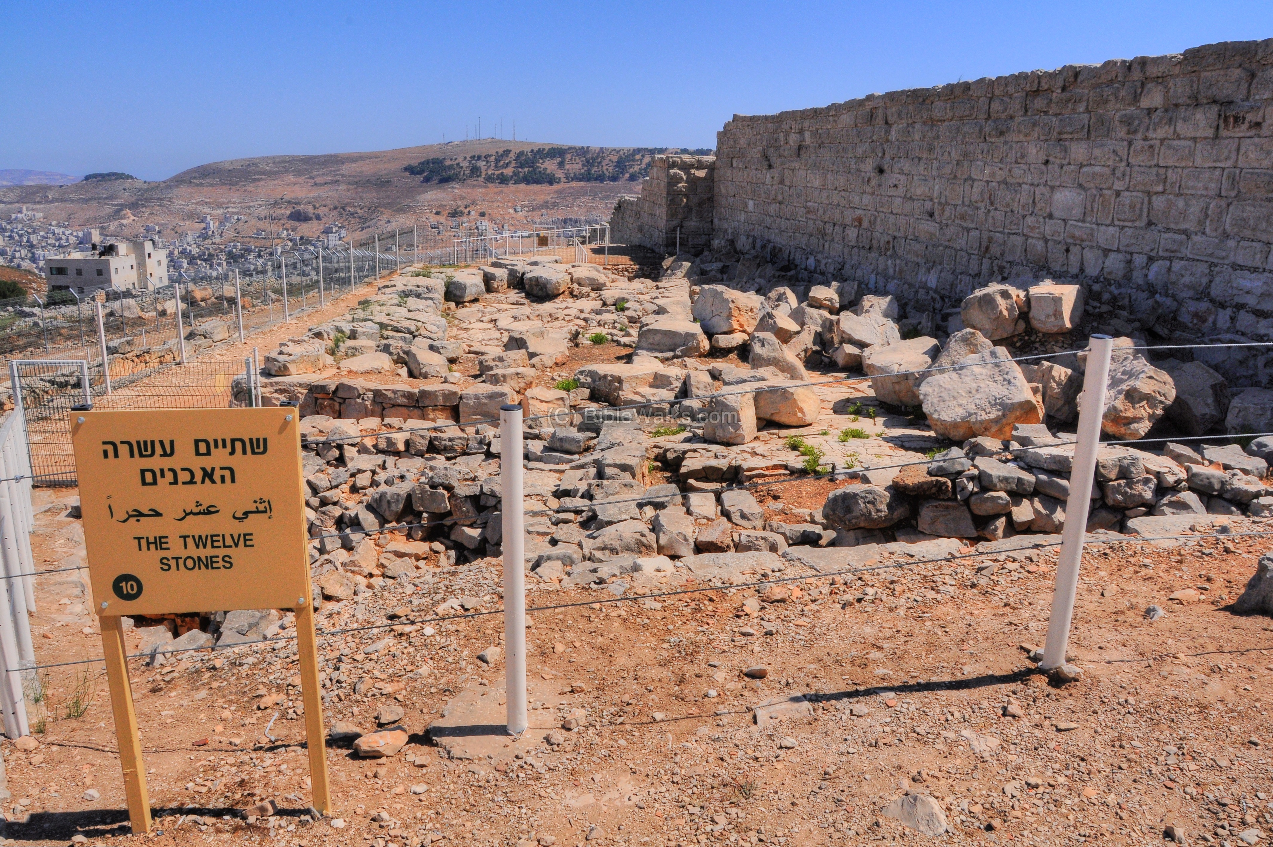
The Bible writes about the command to build the altar (Deuteronomy 27 4-8): :Therefore it shall be when ye be gone over Jordan, that ye shall set up these stones, which I command you this day, in mount Ebal, and thou shalt plaster them with plaster. And there shalt thou build an altar unto the LORD thy God, an altar of stones: thou shalt not lift up any iron tool upon them. Thou shalt build the altar of the LORD thy God of whole stones: and thou shalt offer burnt offerings thereon unto the LORD thy God: And thou shalt offer peace offerings, and shalt eat there, and rejoice before the LORD thy God”. And thou shalt write upon the stones all the words of this law very plainly”.
The command in Deuteronomy was actually to build it on Mt Ebal, not on Har Gerizim. However, the Samaritan version of the Torah has a slight change in these verses – rather than Ebal it is written HarGrizim (“Mount Gerizim”). Thus, the location of the alter is here rather than on Mount Ebal (which is seen in the picture below in the far background).
The PEF report of 1872/1875 writes about this place (SWP Vol 2 p 188):
“The Twelve Stones, traditionally said to have come from Jordan, form a corner of a platform; they were excavated by Captain Anderson in 1 866. They are large masses of rock, quite unhewn, and appear natural, but underneath them are two other courses of stones rudely dressed and not squared. The upper course of the three thus formed has a height 2 feet 2 inches, and the length of the stones varies from I foot 10 inches to 2 feet 8 inches. Thus they are not of very great size.
It seemed difficult in 1875 to be certain whether there were twelve or thirteen. The north-west corner of the platform was laid bare by the excavation in 1876. …
The platforms, including the twelve stones and those on the east, may perhaps have formed part of the temple on Gerizim said to have been built by Sanballat”.
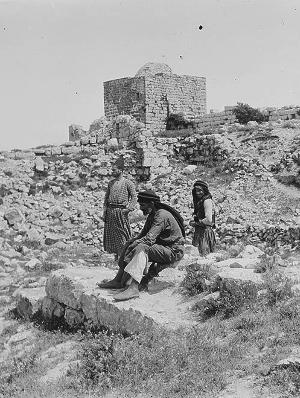
“Samaritan chapel on Mt. Gerizim” The site as it looked during the PEF survey.
[ Dated: ~1898; Matson collection; Library of Congress]
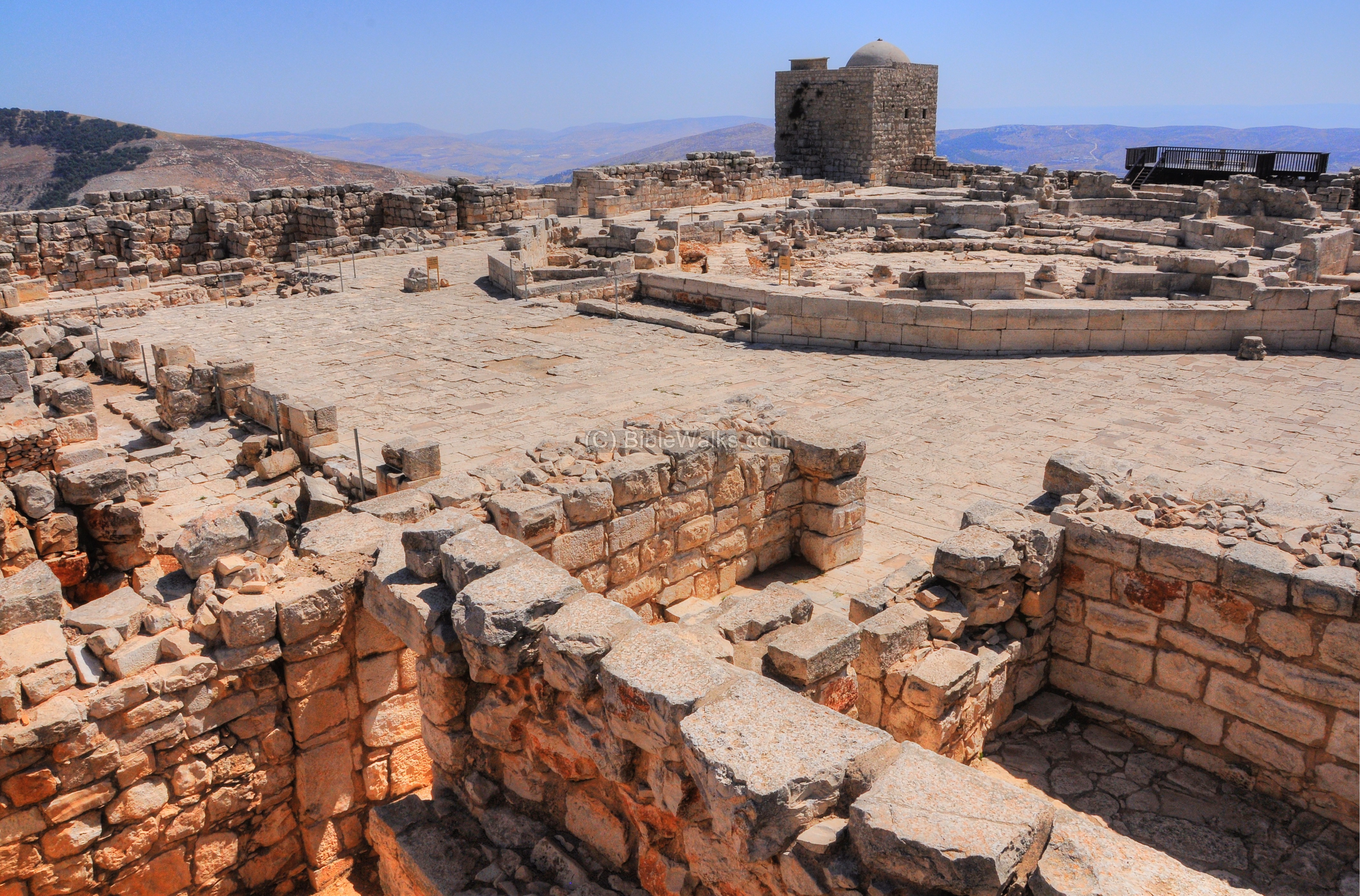
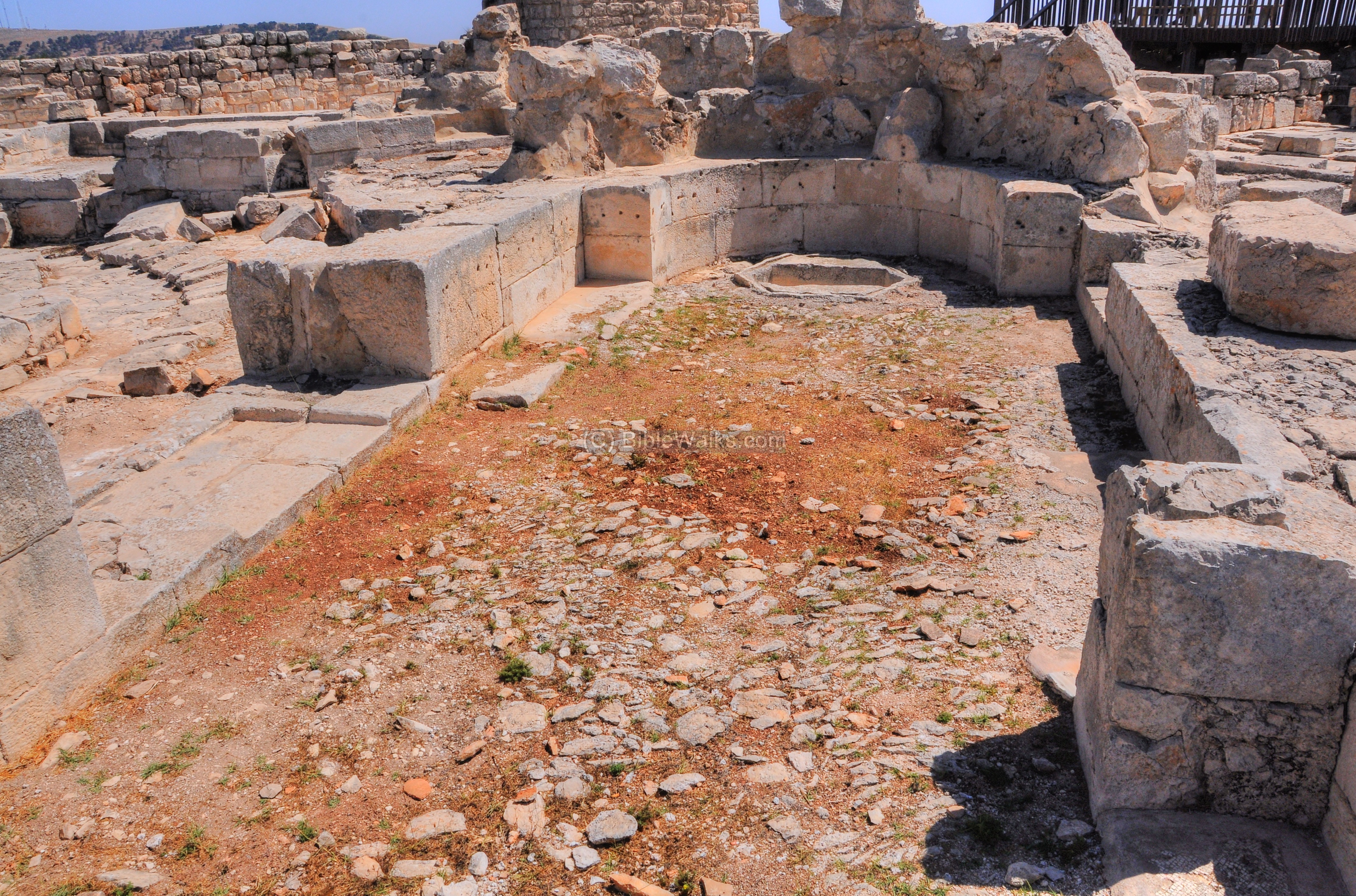
Byzantine Church
The Byzantine ruler Zenon constructed a monastery and a church in 484 AD on the ruins of the holy precinct. Later it was enlarged by the ruler Justinian in 529 AD. It was dedicated to Mary ‘Mother of God’, or: Theotokos (Greek for “God-bearer”).
The area of the Monastery complex is 100m x 83m, which includes a church in its center, a gate and water reservoir on the north side, and a monastery building and bathhouse on the northeast side. The monastery is protected by an outer wall, while the church is located in a precinct protected by an inner wall of 55m by 70m.
A view of the church is seen here from the southwest tower. Behind it is a 12th century Sheikh’s tomb which was erected in the northeast tower of the church.
The form of the church is that of an octagon typical of the commemorative Byzantine churches, such as the Kathisma (which was also named Theotokos), St. Peter’s house in Capernaum. According to scholars, the Kathisma was the original design and its unique architectural design was copied to the other structures.
The church is built in the form of two concentric sets of walls, with the area between the walls forming four chapels. The two closest chapels to the apse are larger than the two western chapels.
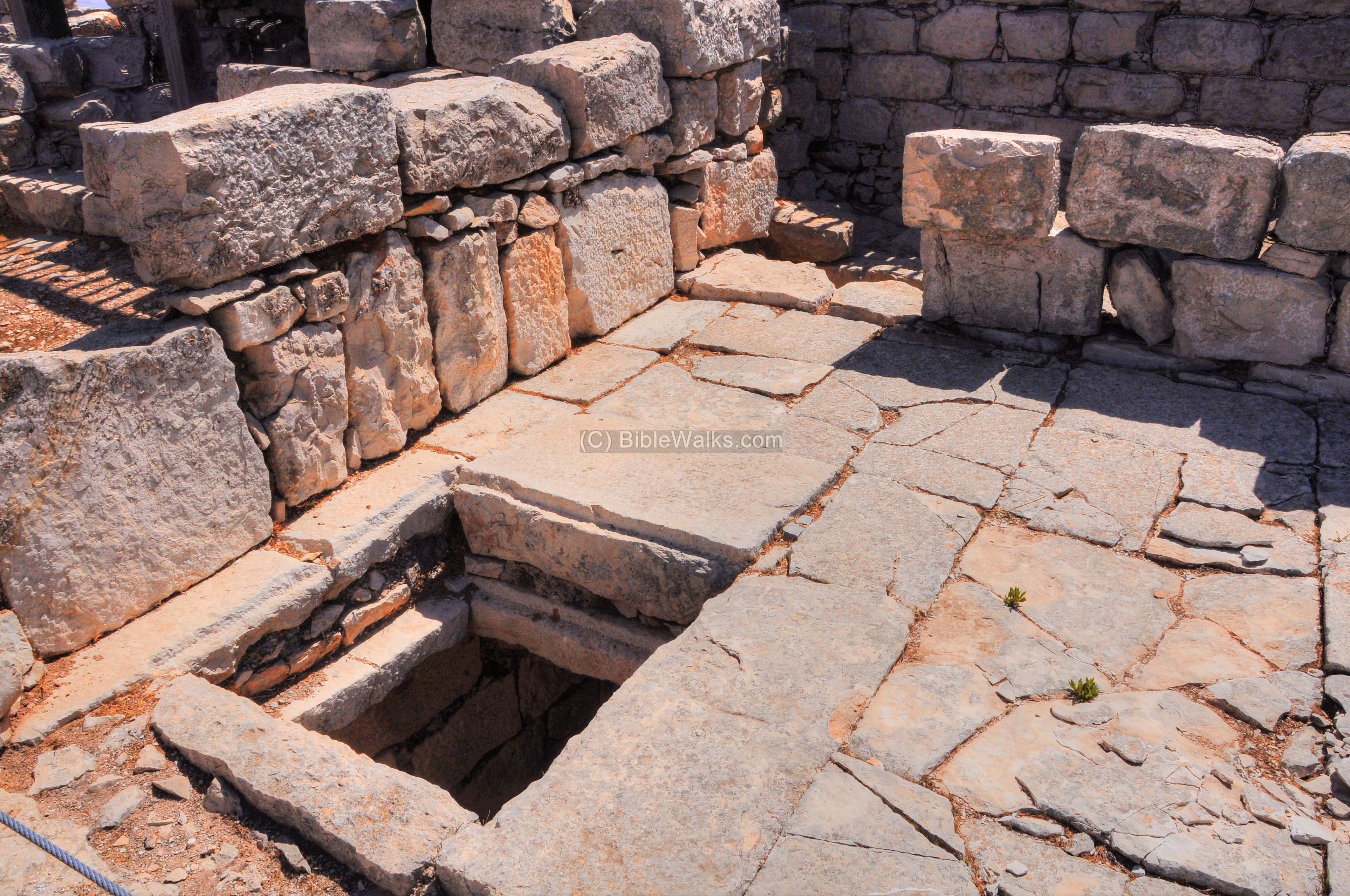
The center area inside the inner wall constituted the main hall of the church with an apse (seen below) in its eastern end. Two additional, square rooms flanked the apse.

The south side of the church:
The south-east chapel, one of the four chapels along the octagonal shape, is seen in the following picture. A hexagonal stone installation at the apse was probably the baptismal of the church.
A closer view of the south-east chapel is seen next, with the hexagonal shaped baptismal.
Notice also the holes in the wall, which once held the marble stones which decorated the walls.
Stairs lead to the second floor on the southeast corner of the church:
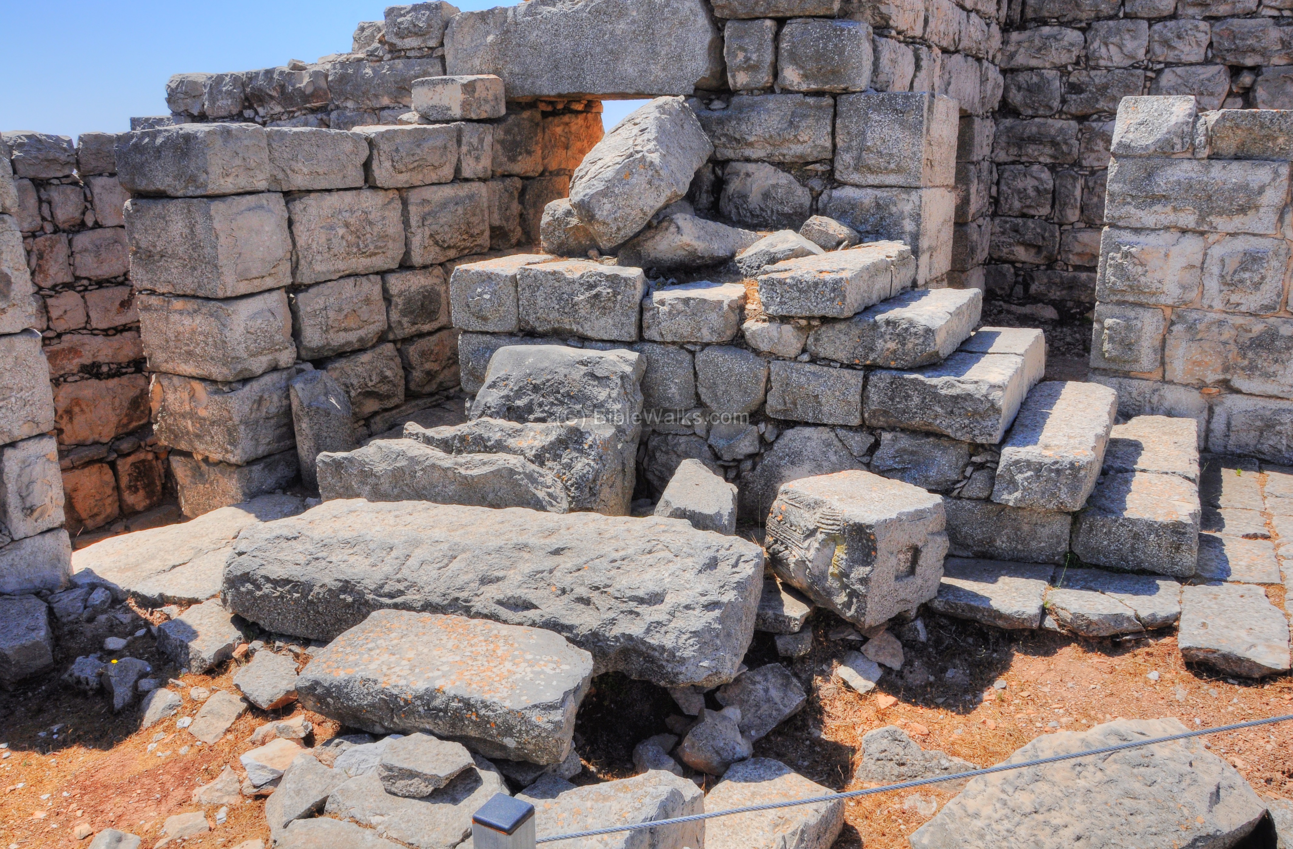
A crypt was located on the east side of the apse. The remains of several skeletons and glass bottles were found inside the crypt.
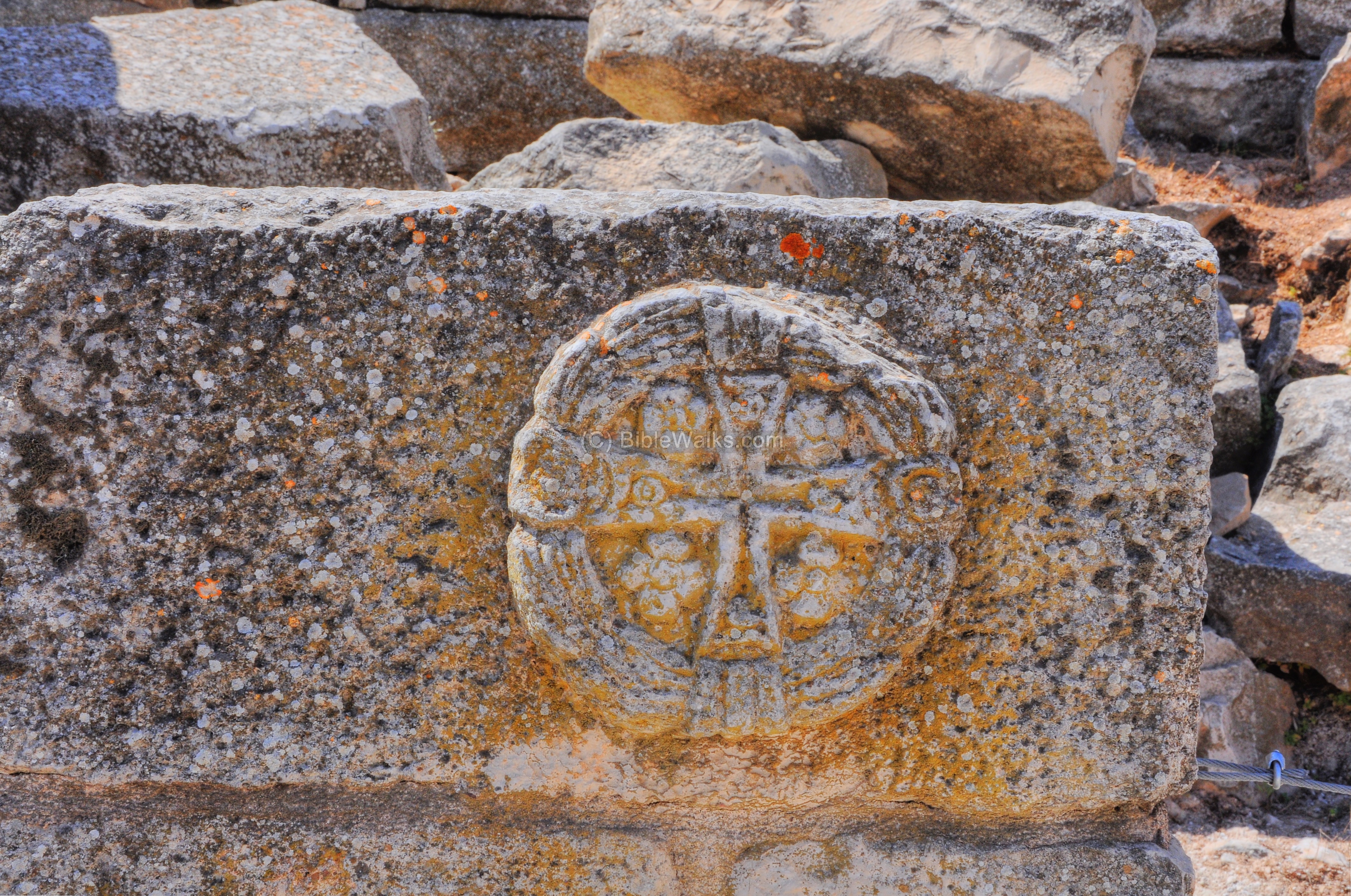
One of the decorated stones with a cross:
The PEF report of 1972/1875 wrote about the church (SWP Vol 2 pp 18-189): “Christian Ruins: these consist of a church surrounded by a rectangular fortress with corner towers, and with a large tank on the north. The church is an octagon, with an apse to the east and small side chapels except on the west and north, where were apparently entrances ; only the foundations remain. An inner line of eight pilasters divided a surrounding corridor from the central area, which was probably surmounted by a dome.
The church measures 70 feet across inside, east and west (inscribed circle of the internal octagon). The east apse is 1 5 feet diameter. The side-chapels are 27 feet long inside, with apses 9 feet diameter ; their walls are thinner than those of the church.
This church is related by Procopius to have been erected by the Emperor Zeno not earlier than 474 A.D., and to have been dedicated to the Virgin.
The surrounding fortress (el Kulah) measures 180 feet north and south by 230 feet east and west, with walls about 9 feet thick. There are four corner towers, and one central on the south wall ; they are about 30 feet square outside ; entered from the inner court. The north-east corner tower has been rebuilt in later times with a rude modern dome, and is now a sacred spot dedicated to Sheikh Ghanim, or, according to the Samaritans, the tomb of Shechem Ben Hamor. A flight of steps leads to the roof.
The court has a gate 10 feet 10 inches wide on the north, and the whole seems once to have been surrounded by small chambers built against the wall inside, one of which measured internally 11 feet 9 inches by 14 feet 4 inches along the line of the wall. This is just east of the gate. Outside on the north are modern walls.
This exterior wall is related by Procopius to have been built by Justinian (after 529 a.d.). It is thus one of the most valuable monuments of Byzantine art in Palestine, as being dated, and the masonry deserves special attention.
The interior masonry and that of the church is better dressed, and not drafted. The work is finished with a blunt-pointed chisel used at right angles to the stone, forming a mottled surface, instead of lines, such as are made by the toothed instrument. The great reservoir north of the Kulah measures 120 feet east and west by 60 north and south, and is lined with similar drafted masonry. Such reservoirs occur in most of the great ruined monasteries of the Byzantine period.
A cross is cut over the entrance of one chamber on the east wall. There was a debased Corinthian capital found in 1866. The flooring of the church was then found to be partly of marble, partly of tiles, on a platform of rough masonry. The walls of the church have been entirely demolished, but five or six courses of the outer fortress wall remain in sittu”.
Panoramic view:
A 360 degrees panoramic view, as seen from the center of the church, in shown in the following picture. Pressing on it will download the view.

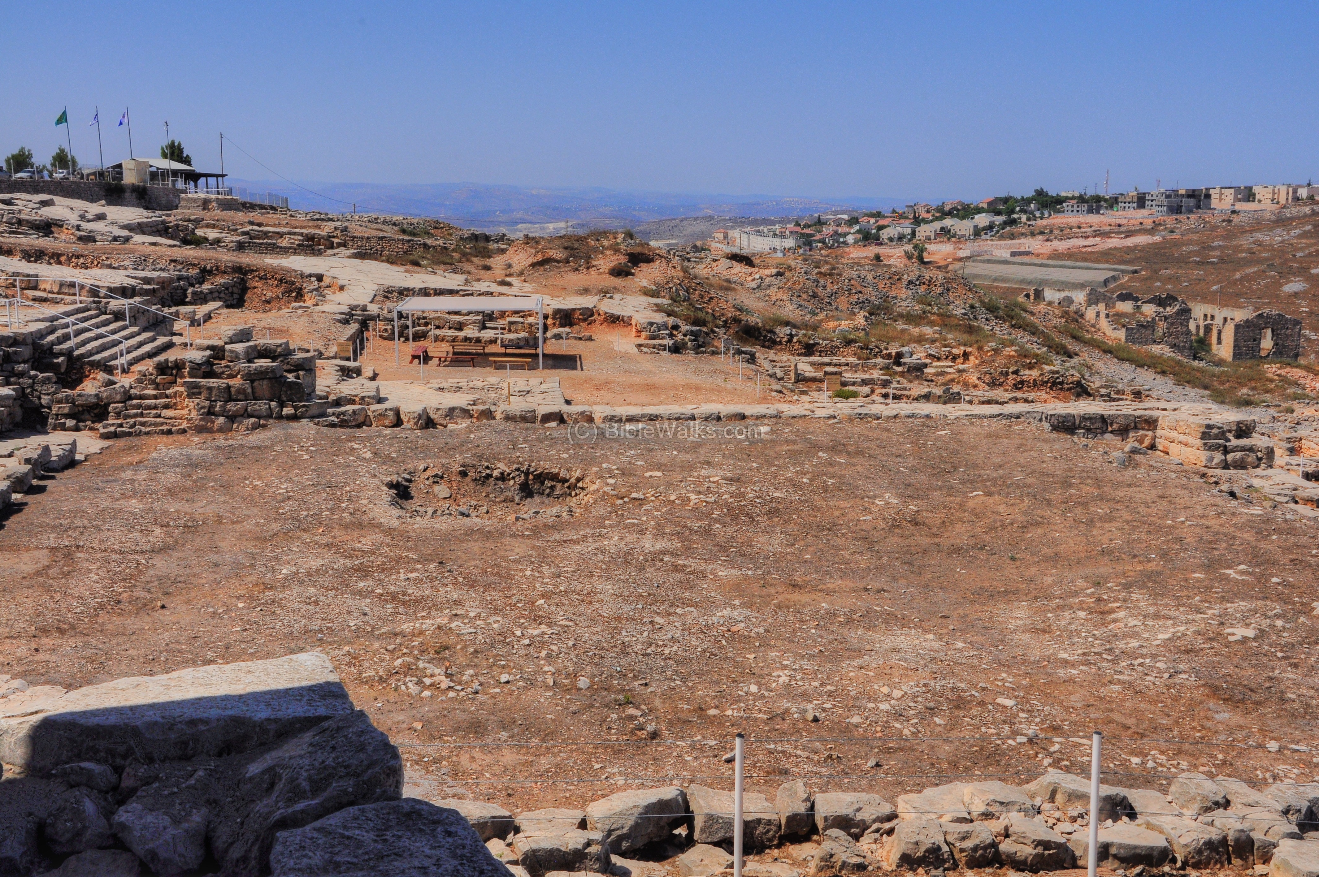
Hellenistic Sacred Precinct – East
The east side of the sacred precinct is facing a steep fall, and so the designers of the Hellenistic-period city had to build thick walls and supporting beams in order to cope with the angle of the descent.
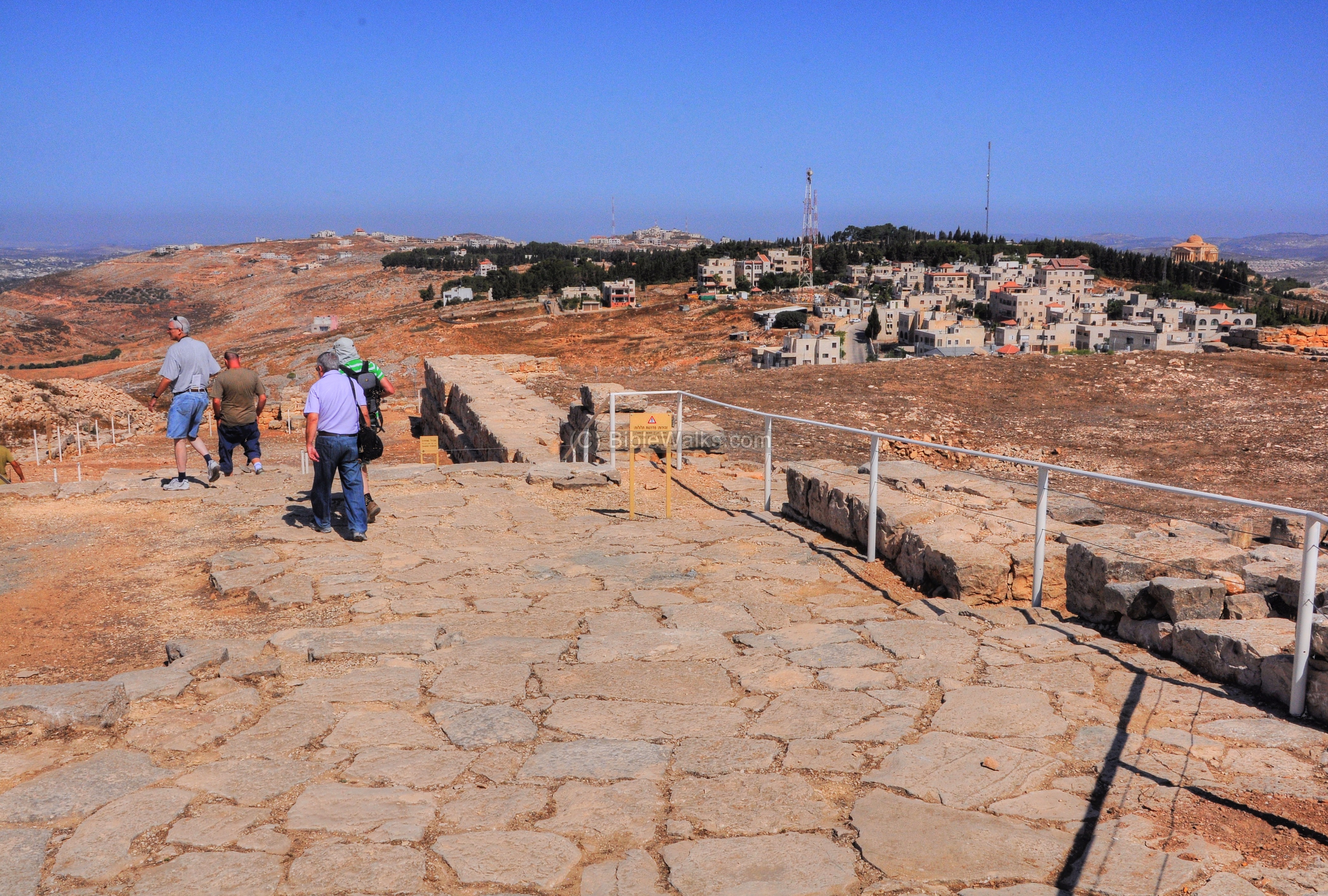
Three parallel thick walls were built along different levels, and the cavity between them was filled up with soil in order to create two long courtyards parallel to the top of the mountain. These courtyards were used as a camping area for the pilgrims and visitors to the temple. A wide staircase, up to 20m wide, led up to the two-chambered eastern gate which is located just under the eastern wall of the church. From the gate the pilgrims would have entered into the temple.
The photo shows the section of the eastern gate and the area of the staircase below it.

To the south of the gate and staircase was a watch tower, seen here in the center. South of it were two courtyards, to the right of the watch tower. On the south-west side of the courtyards was a citadel.
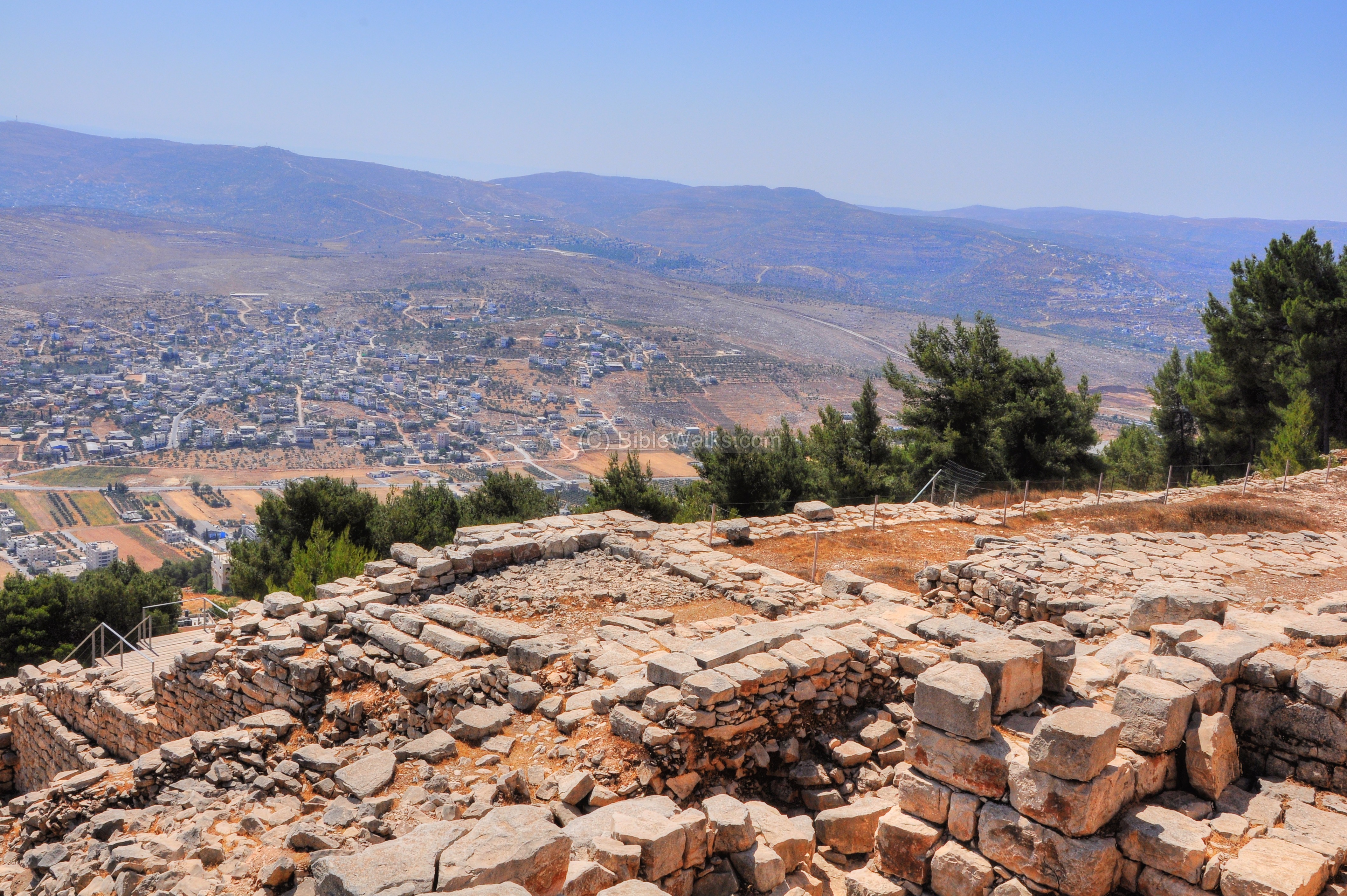
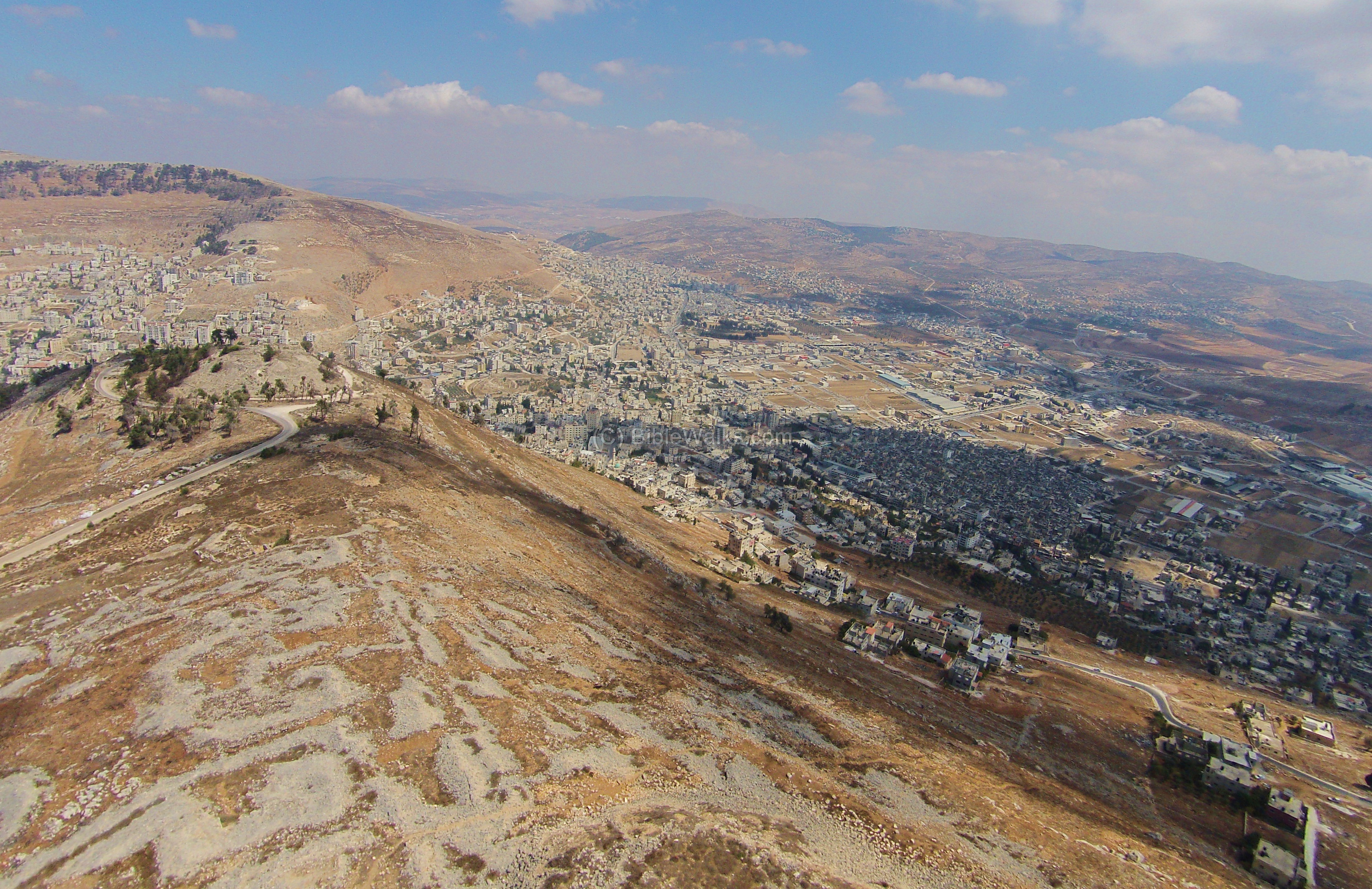
From this side of the mountain is a great panorama of the valley of Michmethah, the town of Balata (left) and Rujib (right), the valley of Beit Dejan (far center) and Salim (far left). The mountains beyond the Jordan valley are seen in the very far background.
In the center of the picture, beyond the houses of Rujib, is a small hill (altitude 613m) with ruins dated to the early Israelite period. The place is called Kh. Juliejil on the PEF map, and its name may have preserved the Hebrew name of the Gilgal facing Shechem (Deuteronomy 11 29-30): “And it shall come to pass, when the LORD thy God hath brought thee in unto the land whither thou goest to possess it, that thou shalt put the blessing upon mount Gerizim, and the curse upon mount Ebal. Are they not on the other side Jordan, by the way where the sun goeth down, in the land of the Canaanites, which dwell in the champaign over against Gilgal, beside the plains of Moreh?”.
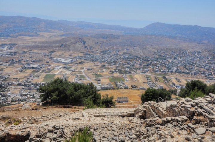
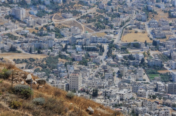
Tel Balata – the mound of the Canaanite city – is seen here on the center of the left side, surrounded by modern houses of the Arab town of Balata al-Balad (“the village”). The modern town covers a third of the ancient mound and is a suburb of Nablus. Additional historic sites in this town includes Joseph’s tomb (also seen here in the center) and Jacob’s well.
To the south-east of Balata al-Balad is the largest refugee camp in the West Bank – also named Balata.
Panoramic view:
Another 360 degrees panoramic view, as seen from the east side of the church, in shown in the following picture.
To open the viewer, simply click on the photo below.

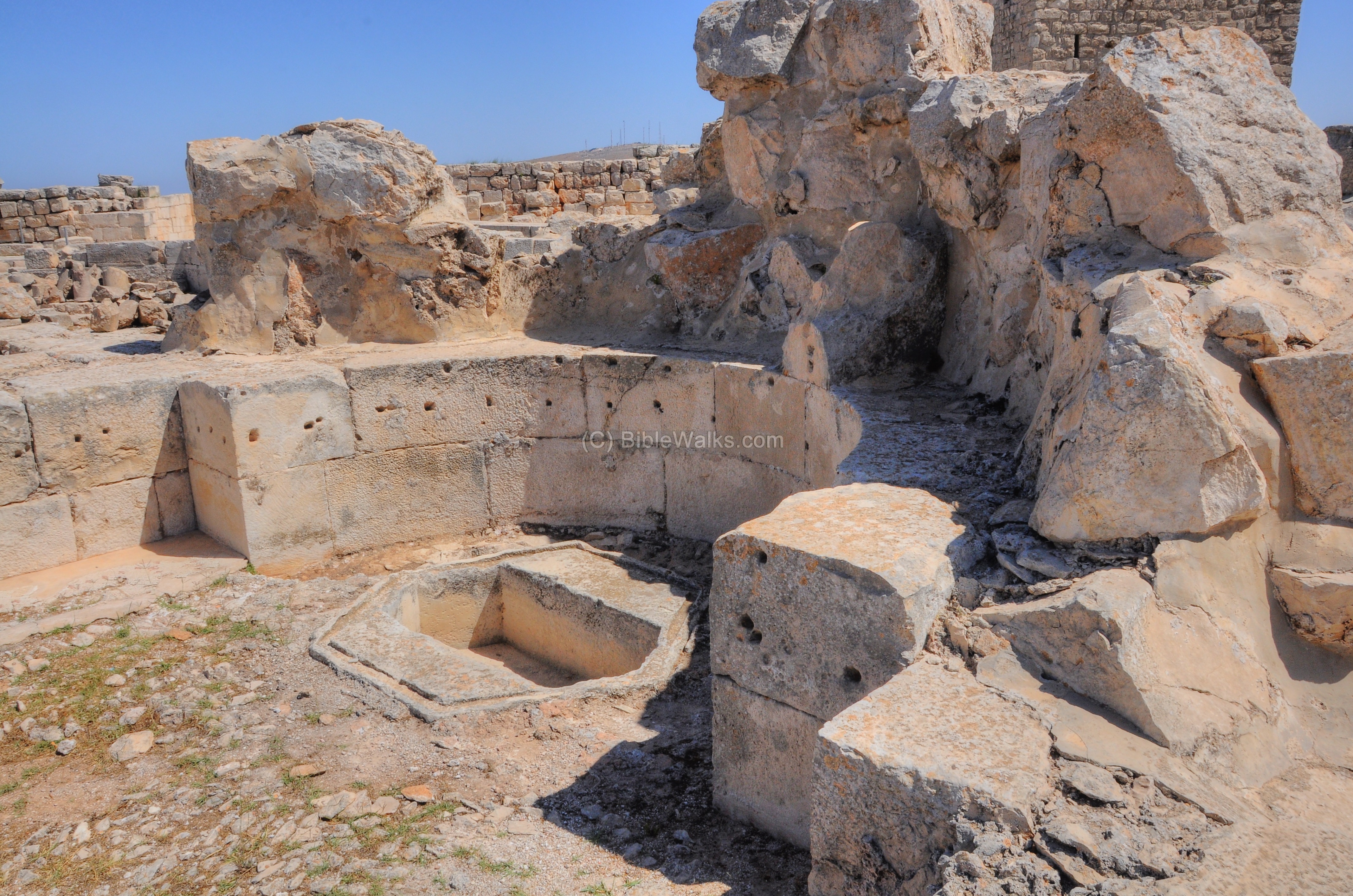
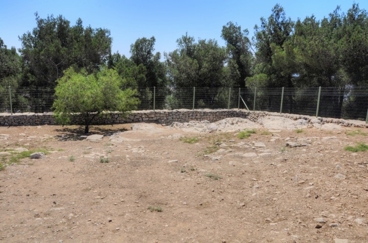
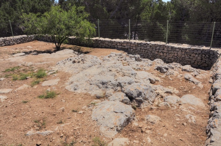
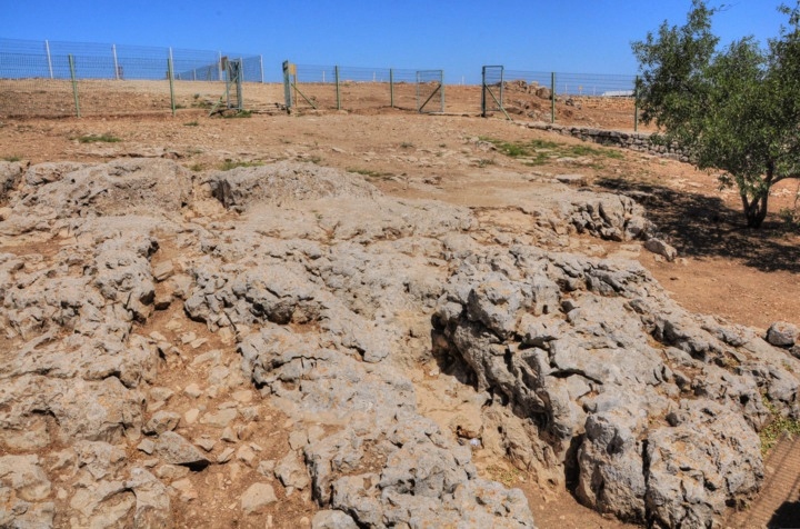
Altar of Sacrifice of Isaac
A small fenced area close to the parking lot is, according to the Samaritan tradition, this was Mt Moriah – the place of the altar upon which Abraham was commanded to sacrifice his son.
The PEF report (of 1872 and 1875) provided a description of the altar (SWP Vol 2 p 188):
“The Place where Abraham offered Isaac, according to the tradition of the Samaritans, is a little rock-sunk trench at the southeast corner of the plateau, on the summit of Gerizim. It resembles the trough used for the Passover feast, and measures about 8 feet by 5 feet.
A semicircular flight of seven steps (traditionally called the Seven Steps of Adam out of Paradise) leads down in this direction from the west”.
A closer view of the “Rock Moriah” is shown below.
A historic photo as the place was 80 years ago:
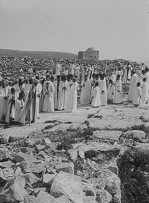
The Samaritan Passover on Mt. Gerizim. Pilgrimage
on the “Rock Moriah” – the altar of the sacrifice of Isaac.
[ Dated: 1936; Matson collection; Library of Congress]
According to the Bible (Genesis 22 1-4):
“And it came to pass after these things, that God did tempt Abraham, and said unto him, Abraham: and he said, Behold, here I am. And he said, Take now thy son, thine only son Isaac, whom thou lovest, and get thee into the land of Moriah; and offer him there for a burnt offering upon one of the mountains which I will tell thee of.
And Abraham rose up early in the morning, and saddled his ass, and took two of his young men with him, and Isaac his son, and clave the wood for the burnt offering, and rose up, and went unto the place of which God had told him. Then on the third day Abraham lifted up his eyes, and saw the place afar off”.
Isaac was spared, after Abraham was told not to harm his son, and substituted the offering by a ram (Genesis 22 14): “And Abraham lifted up his eyes, and looked, and behold behind him a ram caught in a thicket by his horns: and Abraham went and took the ram, and offered him up for a burnt offering in the stead of his son”.
Etymology (behind the name):
* Names of the site:
- Har Brakha – Hebrew: Har – Mountain; Brakha – Blessing. Refers to Mt Gerizim, the mountain which received the blessing.
- Jebel et Tor, Jebel e-Tur – Arabic name of Mt Gerizim
Links and References:
* Internal:
- Har Brakha – nearby Jewish community on Mt Gerizim (south)
- Kiryat Luza – Samaritan village on Mt Gerizim (northwest)
- Mt. Ebal and Joshua’s altar
- Itamar – Community east of Gerizim
- Elon Moreh – community on Mt Kabir, east of Gerizim
- Drone Aerial views – collection of Biblical sites from the air
- BibleWalks YouTube channel (join!)
* External:
- Archaeological staff for Judea and Samaria the excavators
- “Mount Gerizim excavations Vol II – A temple city” Y. Magen ISBN 978-965-406-207-7 (2008)
- Library of Congress – historic pictures of the site
- “Nation has born” – A great book by Adam Zertal, with discussion on Mt Gerizim on pp 210-239 (ISBN 965-448-805-1; Hebrew; 2000)
* Other:
- Biblical pictures by Gustave Doré (1832-1883) – public domain
BibleWalks.com – bringing the Bible Alive!
Luza <<<—previous site—<<<All Sites>>>—next Samaria site—>>> Joseph Lookout
This page was last updated on Apr 11, 2024 (drop the pano)
Sponsored links: