The west side of Nahal Zippori (Sepphoris stream) has several ancient sites, including a fortified biblical city and agriculture villages.
Home > Sites > West Galilee > Khali
Contents:
Background
Location
History
Photos
* Aerial view
* Allil
* West Khali
* Govit
* Sasey
* Migdal Usha
* Aerial Video
References
Biblical
Etymology
Links
Background:
The Zippori stream flows year round into the Kishon river. It starts from the springs near the ancient city of Sepphoris (Zippori), and winds down and westward in a valley between the hills of lower Galilee.
Close to the plains of the bay of Haifa, where the stream flows into the Kishon river, there are a number of ancient villages in the last 3 KM before the end of the valley, including a biblical city and satellite agriculture villages.
This page reviews the ancient sites in the western side of the stream of Sepphoris (Zippori), which flows into the Kishon river. For information on other sites in this area, you can look up West Nahal Zippori.
Joshua 19:24-25:“And the fifth lot came out for the tribe of the children of Asher according to their families. And their border was Helkath, and Khali, and Beten, and Achshaph”
Location:
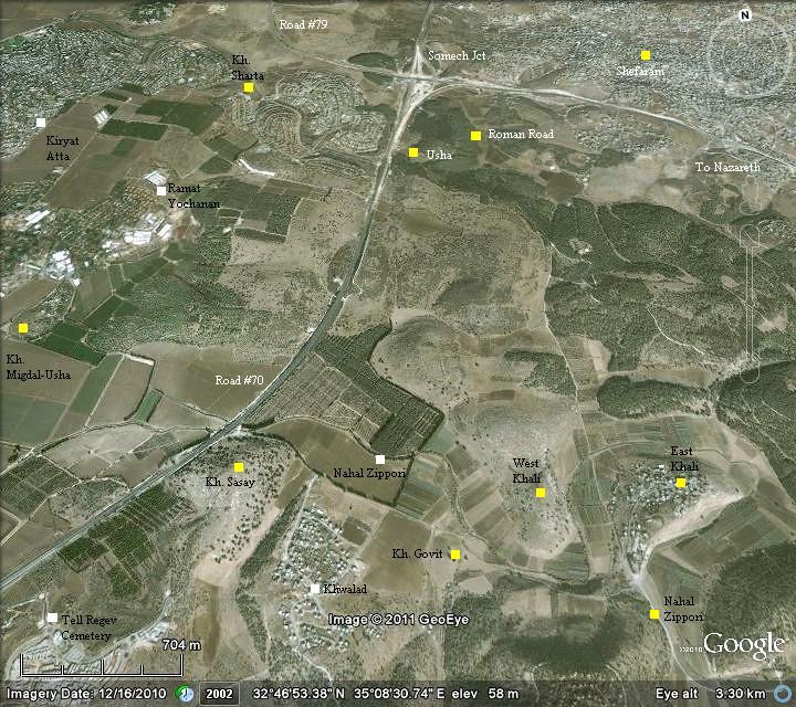
The entrance to the valley is 3 KM south-east of Kiryat Atta, or 4KM south of Somech junction. It can be approached by driving off the highway, following directions to Khwalad, an Arab village in the entrance to the valley. The ancient sites are located on the western hills and in the valley.
The following aerial view shows the points of interest.
History of the place:
- Early man
Along the stream there are many sites, starting from prehistoric times. See more information in West Nahal Zippori page.
- Later periods
The surveyors (reference) have identified pottery and structure remains of the following historic periods, listed in ascending order:
- Tell Allil (Khali, Ras ‘Ali) was a Bronze age site (3150-1200 BC), and may be Khali which is referred by Joshua.
- Tell West Khali and Khirbet Govit were from the middle/late Israelite period (1000-586 BC)
- Khirbet Govit (Kh. Jibyatha) and a site near Harduf were from the Babylonian/Persian period (586-332 BC).
- Khirbet Sasay (Kh. Sa’sa) was from Hellenistic (332-37 BC).
- In Roman/Byzantine periods(37 BC-640 AD) there were Khirbet Sasay, Tell West Khali and Migdal-Usha
- In later periods there were Khirbet Sasay and Migdal-Usha
- Roads
A Biblical map of the area shows the position of Khali (marked with a red circle). It lies east of the main coastal highway, and situated along the valley of the Zippori (Sepphoris) river. A road connected the coastal highway to the east along the valley.
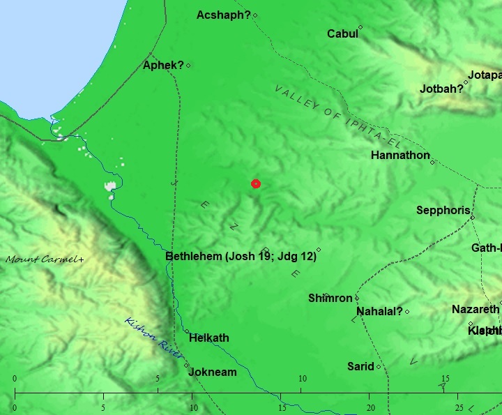
Map of area around the site (red circle) – from the Canaanite thru the Roman periods (based on Bible Mapper 3.0)
According to David Dorsey (“The roads and Highways of Ancient Israel”, pp. 88-90) two roads passed at Khali:
- East-West – route “I35” – along the Zippori (Sepphoris) valley. This route was also used to bypass the Kishon river pass, connecting Jokneam to Acco .
- South-North – route “I34b” – connecting Jokneam thru Tivon to Khali
- British Mandate
A 1940s British map shows the area around the sites in detail.

British survey map 1942-1948 – https://palopenmaps.org topo maps
License: public domain under the UK Copyright, Designs and Patent Act 1998
- Modern period
Tell Allil is inhabited by the modern village of Ras ‘Ali, while Tell Western Khali as well as Khirbet Sasay and Govit are in open public area.
Photos:
(a) General view:
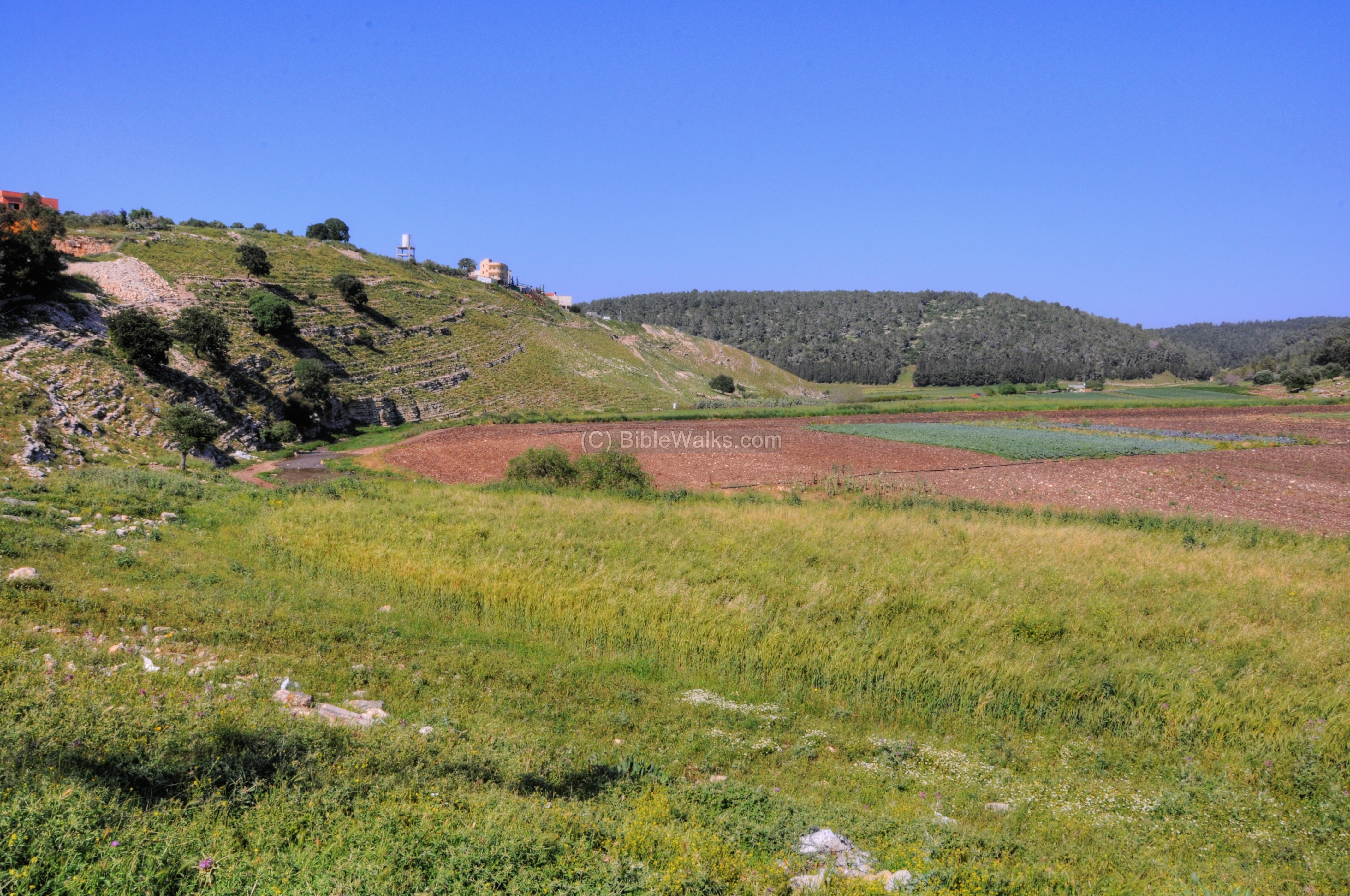
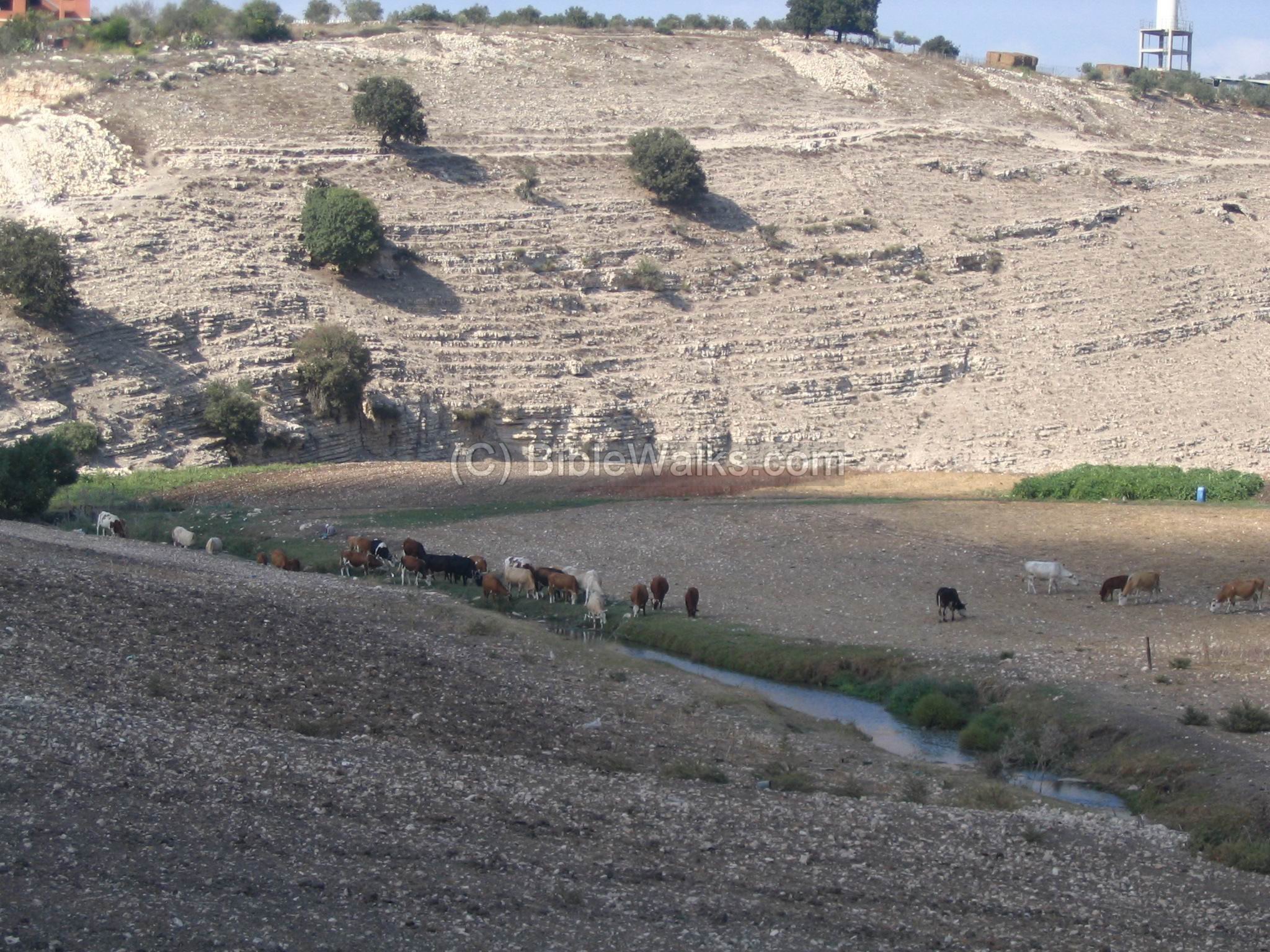
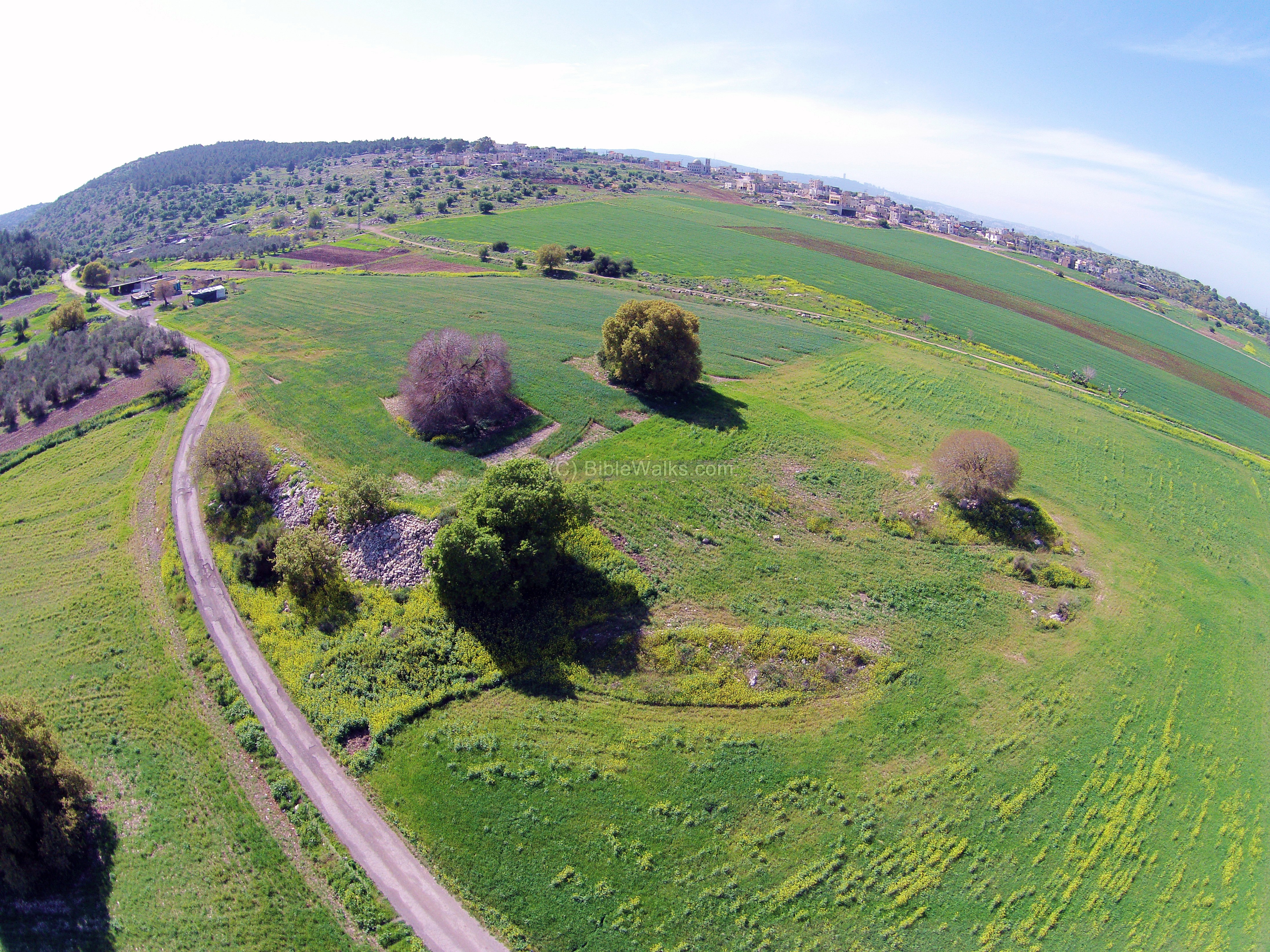
An aerial view from a drone flying above the Zippori stream on the west side is seen in the following photo. The modern village of Ras ‘Ali is in the far left background. Nahal Zippori loops around the Ras ‘Ali to the left, then back around to the right. On the left side is the hill where the ancient site of West-Khali is situated.

(b) Tell Allil (Ras ‘Ali, Khali):
This round steep hill is almost completely surrounded by the stream. It is accessible only from the south, and thus was naturally protected – an important asset for a fortified city. On the hill, with an area of 5,000 sq m, there are few remains except ancient pottery from Early Bronze to and Iron I (spanning 3150-1000BC).
This site may be Khali – one of the cities that Joshua lists, since the pottery that was identified was from the Israelite period, which fits the biblical text and preserved the name.
Click on the photos to view in higher resolution…
The city’s purpose was to protect the agriculture villages and farms in the area, and control a road that passed along the valley. This pattern of settlements – a series of agriculture villages and a regional fortified city – was typical in the Iron/Israelite period. For example – see Khirbet Oren in the Carmel.
A closer look on the Tell: In the photo below you can see the small stream (the photo was taken at end of summer, hence the water levels are low). The stream winds around the Tell, creating a natural wet and muddy moat, another important asset for a fortified city.
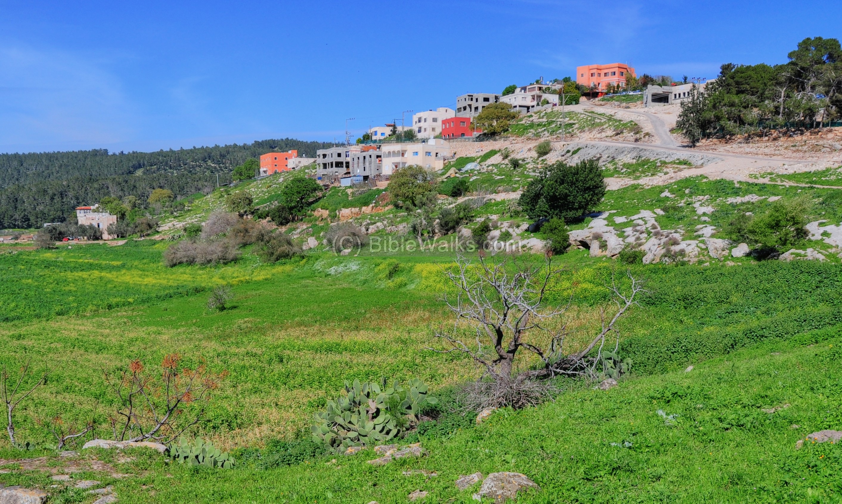
Today there are new buildings on the hill, a small village called Ras ‘Ali (Ras is top/head in Arabic, and Ali maybe is a part of the name Allil or Hali – preserving the biblical name). Its houses are seen below on the west side of the hill.
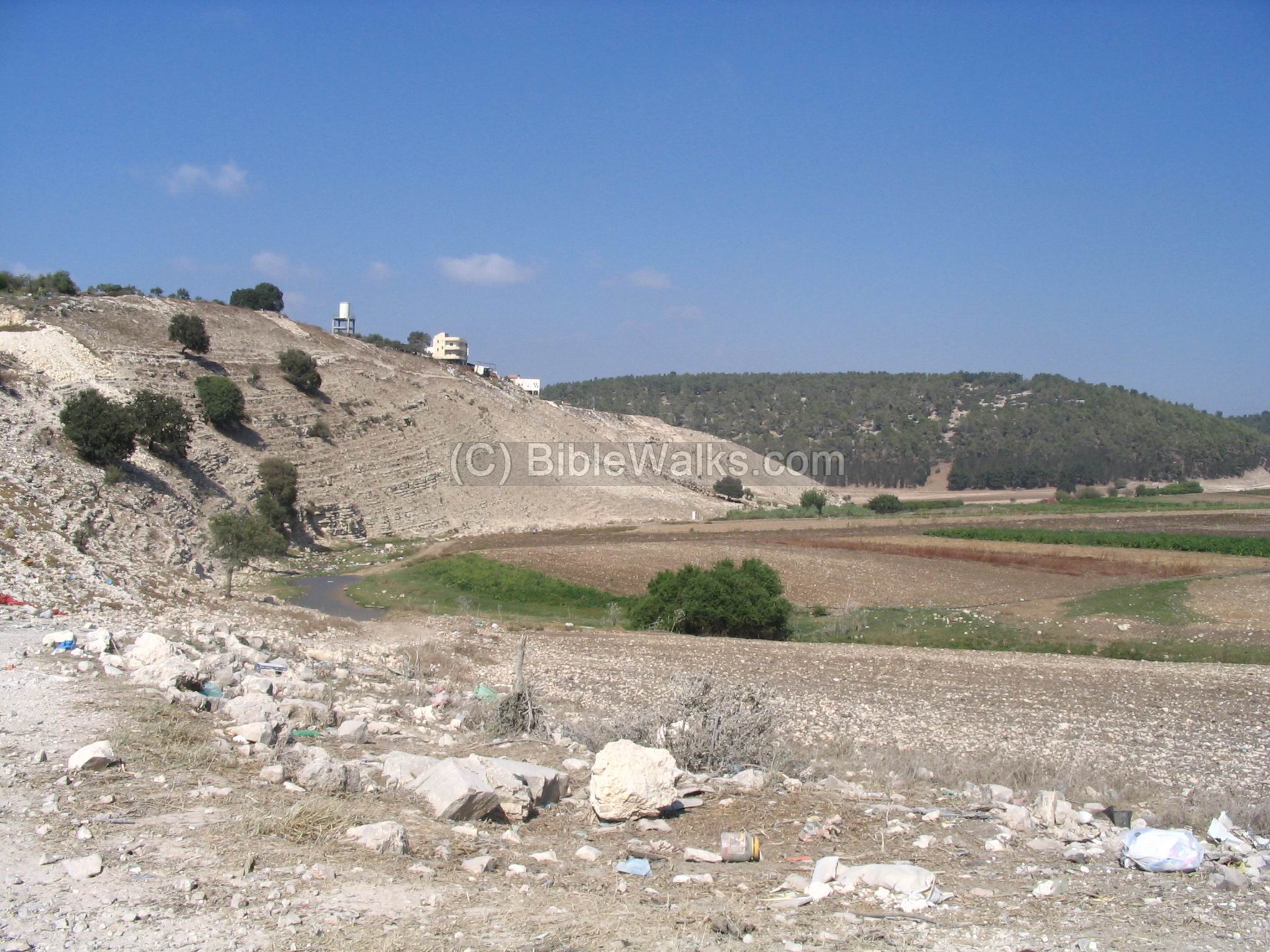
(b) Tell West Khali – An Israelite fortified city:
West Khali (Arabic: Kh. El Kasabir) is located in the entrance to the valley, on a round hill, west of Tell Allil (Khali).
According to the survey, this site was settled in the Israelite Iron II period, Babylonian/Persian and up to the Roman period. It is called “West Khali”, since the east Khali hill is another ancient site.
This view is from the south side. The Zippori stream flows at the foothills.

Another view from the south side is also seen in the next photo, using a drone to fly above the stream.
On the left background are the houses of Ras ‘Ali covering the hill of Tell Allil.
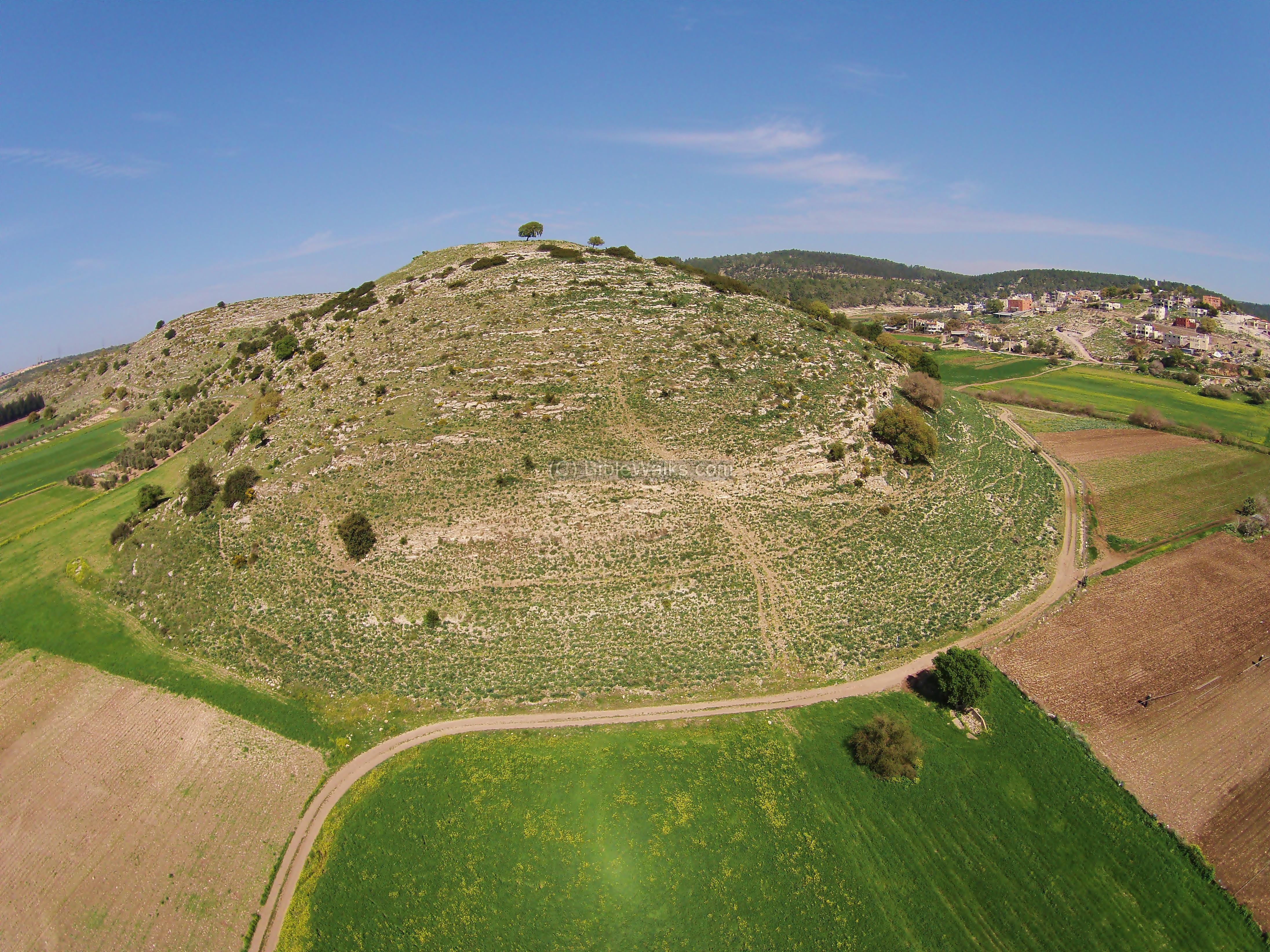
On the top of the hill (133M height, 700 square meters) is a flat area – the center of the fortified small city. It was dated, according to the survey, to the Iron Age II (Israelite period, 950-730 BC).
This view is towards the south. Notice a wall at the edge of the hill and a steep slope towards the valley below.

The city wall surrounded the top of the fortified city. The wall is built with offset-inset pattern (קדמות ונסגות, also known as crenels and merlons wall). This architectural design involves constructing the wall with alternating sections that are set back or protrude outward from the main line of the wall.
On the slopes of the hill is a constructed glacis that surrounds the city. Glacis played a vital role in fortifying Iron Age cities, providing an additional layer of defense against a variety of potential threats. The steep slope of the glacis made it challenging for infantry to ascend rapidly or maintain formations, thus slowing down any potential attackers.
There are also traces of other walls, such as this one that is perpendicular to the eastern city wall.

On the south side of the summit is a formidable oak tree. Father Yoram and sister Amit pose here in front of the tree.

The following is a view of the south west side of the hill, and a section of the city wall.

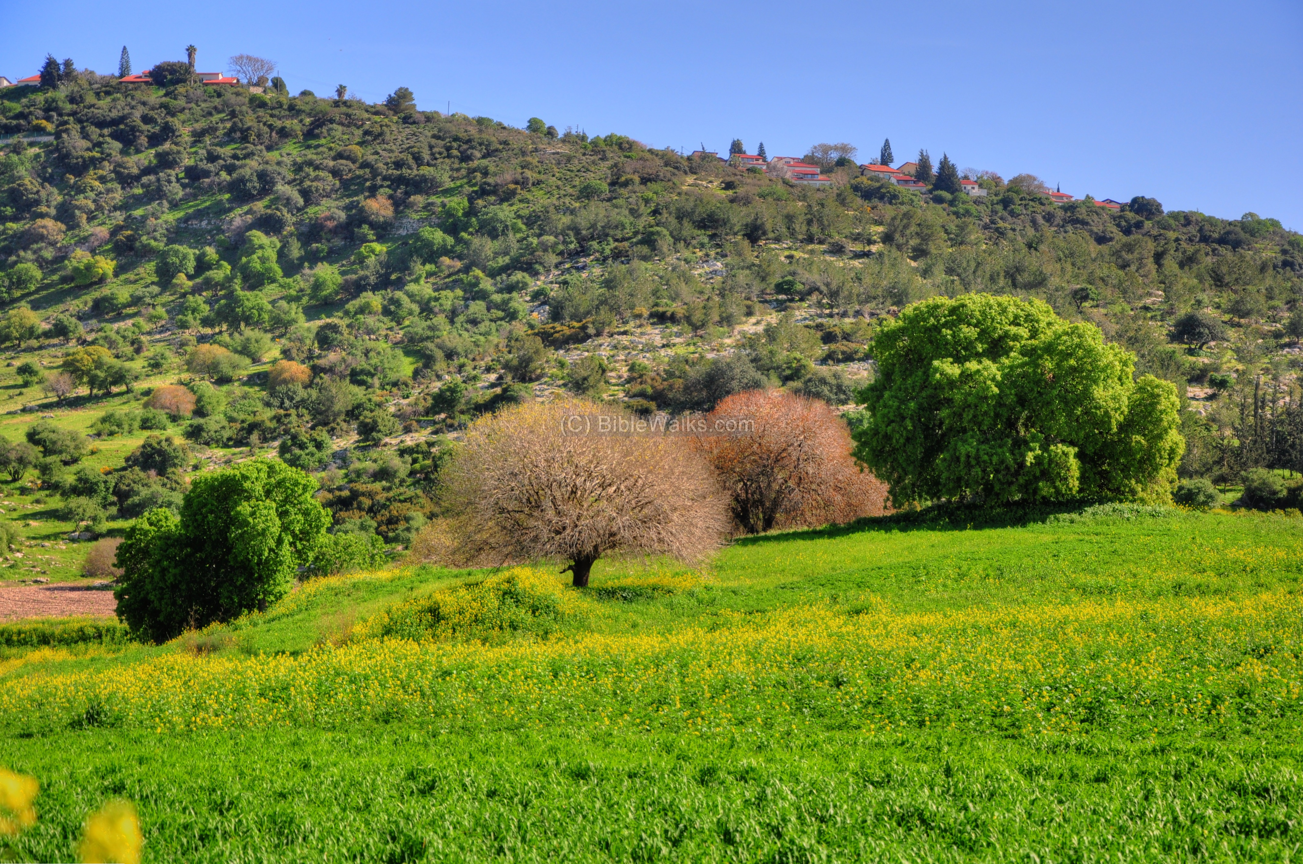
The hill provides great views of the area – Zippori stream in the foreground, the village of el-Khawaled farther west, and Mount Carmel in the far background.

Findings:
In our short visit on the hill we noticed many ceramics. Past surveys dated the pottery to Iron age II (majority), Persian (few), and Roman.

A basalt grinding stone was also seen. It is flat on the bottom, and was used to grind the grain into flour.

A small base of an oil press was also seen on the hill:

A closer view of the installation:

There are also dozens of rock-hewn pits that were used for grinding grains:

Access to the site is from the north side.
In the north of the top of the hill are remains of a 6 x 10M rectangular tower, which may be the gate to the city.

Driving back down the hill we crossed the Zippori stream. Below is a view from the north east side of the hill.
The stream naturally curves around the fortified city. This natural moat-like barrier created by the looping stream provided strategic defense advantages: providing a natural obstacle, limiting the access only to the north side, providing better visibility for approaching enemy, and was also the water supply for the city.

(c) Khirbet Govit:
Khirbet Govit was one of the agriculture villages that were under the protection of the fortified city (Tell Allil or West Khali). It is located in the valley south west of Tell West Khali, and was a small farming village (300o sqM), located on the road to the west. The pottery in this site is from the late Israelite and Persian period.
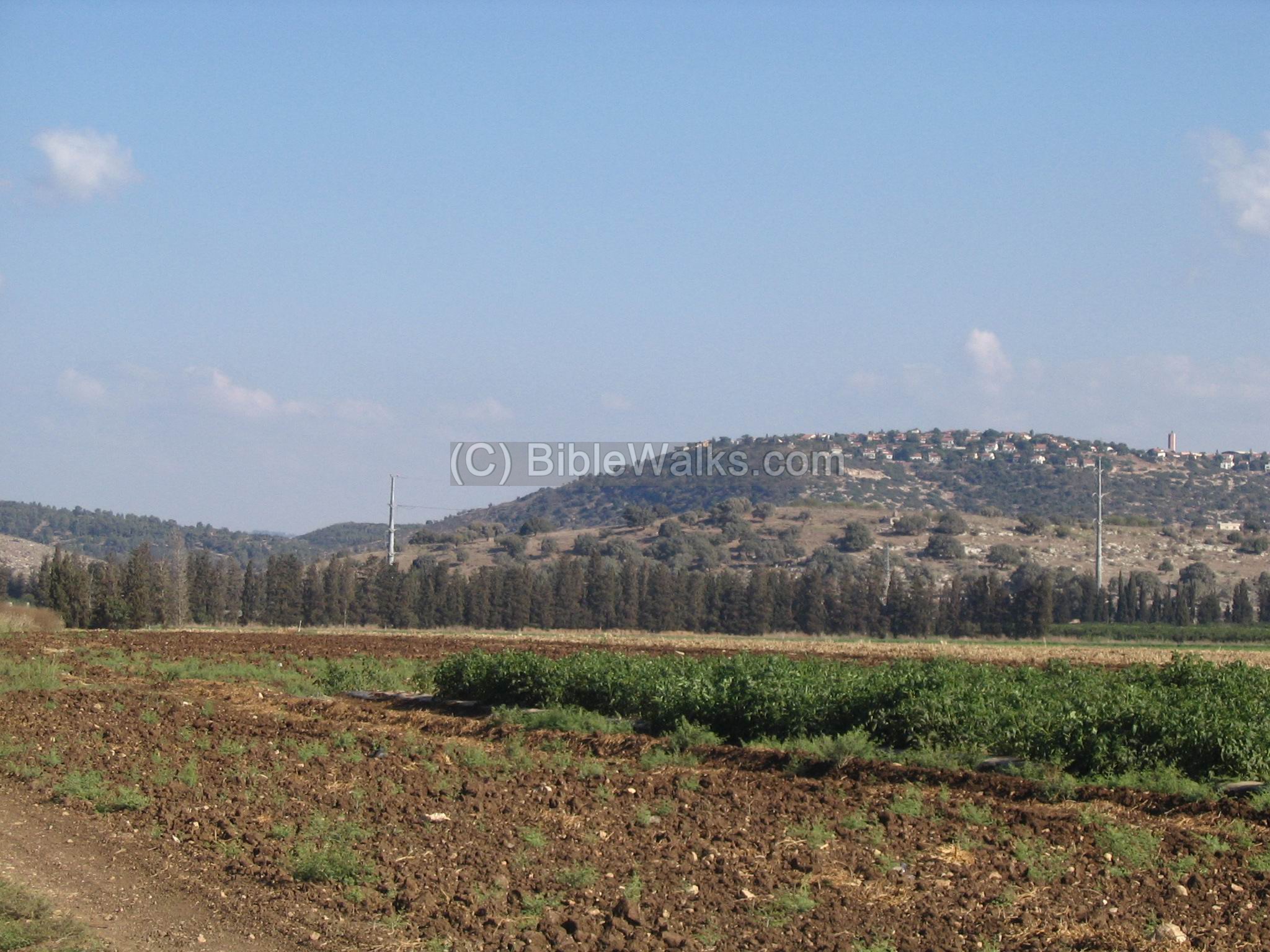
Below is a view from the north. In the far background, high above the valley, is the new settlement of Nofit (Pi-Ner), which is a large residential neighborhood (established 1984).
The following photo is a view from the air, using a quad copter. The view is from the northeast side.
(d) Khirbet Sasay:
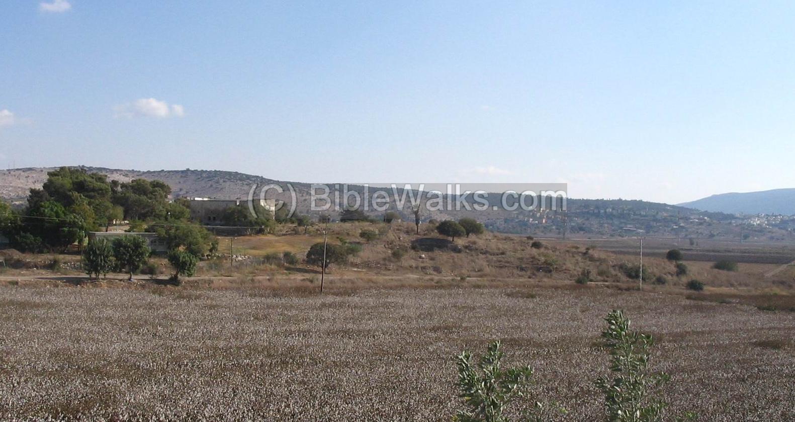
On the western edge of the valley, close to the highway, is the ancient ruins of Khirbet Sasay (or Sasey). It is seen here only in the far background. This site, located at 70M height, was from the Hellenistic, Roman, Byzantine and Ottoman periods.
On top of the hill are the remains of an Ottoman road hotel (Khan), consisting of rooms around a courtyard. On the east side of the structure is a Muslim cemetery.

Another view from the west. The site is seen above the trees. In the background – the new settlement of Nofit (once called Pi-Ner). On the left background is the West Khali site and the entrance to the Zippori valley.
(e) Migdal-Usha (El Mejdel, Kh. El Majdal):
On the western side of the highway, 2KM from Khirbet Sasey and 0.5 KM south of Kibbutz Ramat Yochanan, is another Roman/Byzantine site, called Khirbet Migdal-Usha. It was was inhabited also in later periods (Crusader, Mameluk and Ottoman periods). As in Khirbet Sasey, the site was also a road side hotel. A new Khan (hotel) was built (10x20xM) in the Ottoman periods and stands today on top of the site. Around the site, on the hill side, there are ruins and many rock-cut cisterns and tombs.
(f) Video:
![]() To watch a video clip, captured by a quad-copter above Kh. Govit, see it on Youtube.
To watch a video clip, captured by a quad-copter above Kh. Govit, see it on Youtube.
References:
-
Archaeological survey of Israel Map of Shefar’am (24) Y. Olami, Z. Gal [ISBN 965-406-157-0, 2003]
-
Carta’s Atlas of the Bible – Y. Aharoni [Carta Jerusalem 1974] – Shop for this must-have book.
Maps: 72 (Asher tribe region), 113 (Solomon’s Kingdom)
Biblical References:
(a) Joshua 19:24,25
This text, describing the land of the tribe of Asher, may relate to Tell Allil (Khali):
“And the fifth lot came out for the tribe of the children of Asher according to their families. And their border was Helkath, and Khali, and Beten, and Achshaph”
Etymology (behind the name):
-
Zippori – Sepphoris in Hebrew. Zippor is “bird”, so the stream is named after the birds.
-
Nahal (Nakhal) – In Hebrew: Stream, creek, brook.
-
Khali – unknown word. In Hebrew Khalila means “again and again”, maybe the word refers to the turn of the water around the hill.
-
Alil, Allil – Arabic name, may have preserved the Biblical name of Khali.
-
Ras – Arabic: head (means a hill)
-
Khirbet – ruins in Arabic. In Hebrew “Hurvat” – from the root name (Kharav) means ruin.
-
Migdal – tower in Hebrew
- Wadi el Malik – Arabic name of the Zippori valley; Malik meaning: ruler, king
Links:
* Nearby sites:
Visit the following sites, which are around this site:
-
Tell Par & Khirbet Ibtin – ancient sites located 3KM to the south. The former site is from Tell Khali’s biblical times, while the latter from Roman times.
-
Tell Regev Located 5KM south of this site, and was the major city in the area in the biblical times.
-
Horbat Sasay – Hadashot Arkheologiyot 129 2017 – salvage excavation
* Internal links:
- Quadcopter photos – collection of aerial views
BibleWalks.com – walk with us through the sites of the Holy Land
West Nahal Zippori<<<–previous site—<<<All Sites>>>–next West Galilee site —> Tell Regev
This page was last updated on Apr 28, 2024 (update West Khali, add maps and roads)
Sponsored links: