This site is located on an extinct volcano. It was a Canaanite and Israelite city (Adamah?), but best known for the crucial battle between Saladin and the Crusaders in 1187.
* Site of the month – Aug 2018 *
Home > Sites > Sea of Galilee> Horns of Hattin, Hittin
Contents:
Background
Location
History
Photos
* Aerial views
* General views
* Western entrance
* Crater
* South Horn
* Eastern side
* North Horn
* Hittin Spring
* Hittin
* Nature
Videos
Biblical
References
Etymology
Links
Background:
“Horns of Hattin” is a steep hill that dominates the area around it. It is an extinct volcano, and due to its twin peaks (“horns”) on each side of the crater it has the form of a bull. A Canaanite and Israelite city were located on the southern horn, perhaps the site of the Biblical city of “Adamah”.
Joshua 19 32-6: “The sixth lot came out to the children of Naphtali, … And the fenced cities are … Rakkath, and Chinnereth, and Adamah, …”
The decisive battle of the Crusaders and Saladin was held in the valley below it in 1187, signaling the beginning of the end for the Crusaders Kingdom in the Holy Land. From the site is a great view of the area and is a recommended site to visit.
Location:
The site is located on the road to Tiberias. The site was in a strategic location and was easy to defend due to its height (326M above sea). There are roads on the north and south, and the hill is higher by 300M and 125M, respectively, which is quite steep.
In ancient times the road from the sea of Galilee to the west passed north to the hill. On this ancient road was the battle between the Crusaders and the Arab armies, when the former army advanced from Sepphoris to Tiberias, in hope to break the siege off the Crusaders’ fortress in the city. In modern times the road passes to the south of it. When driving from Golani junction towards Tiberias, the hill dominates the area on the left side of the road.

On top of the hill there are traces of walls that were built around the edges. In the center of the hill is the crater, with traces of very large stones that were part of its inner defense line. In the south side of the hill, on a higher peak, are dual defense walls.
Below the hill was the Roman and Arabic village of Hittin, now in ruins. A spring (Hittin) flows there all year long, and was the place where the thirsty Crusaders tried to get to during the battle. Near it is the holy Druze tomb (Nebe Shueb), which is according to their tradition the tombs of Jethro (father-in-law of Moses) and Zipporah (wife of Moses).
The modern agriculture village (a Moshav) of Ein-Zeitim is located north to Neby Shueb. Another Moshav, Hittin, is located closer to Tiberias.
History:
- Prehistory
The volcano, now extinct, was active some 3-4 million years ago. It erupted out of a layer of limestone, which was deposited 40 million years ago. The eruption phases started with covering the area with volcanic ash (which hardened into tuff rocks), blowing out volcanic “bombs” (agglomerate rocks), and ending with a flow of lava (molten rock) which cooled down into layers of black basalt stone. The volcanic activity ceased 3 million years ago.
- Bronze Age
The hill was inhabited from the late Bronze age. The city walls from this period were built on the southern “horn” (peak), dated to the 14th-12th century BC.
There are several attempts to identify the city:
-
Madon – from Joshua 11:1 (see references below). This identification was based on the name of the ruins of Khirbet Middin, which is located near the hill.
-
Shemesh Adam – a Canaanite city that is listed in the conquests of Amenhotep II (1431,1429 BC). The city then changed its name to Adamah, from Joshua 19: 36.
-
“Mei-Merom” – according to the book of Joshua, this was where the Israelites fought the Canaanites (Joshua 11:5): “And when all these kings were met together, they came and pitched together at the waters of Merom”.
- Iron Age – Israelite period
The Israelites replaced the Canaanites. A city from this period is dated to the 10th-8th century BC.
A Biblical map is shown here, with the site marked as a red dot, marked as “Madon?”. According to D. Dorsey (“Roads and highways of ancient Israel”, p. 98, route T1c), the major road during the Bronze and Iron Age periods passed near the site, descending to Rakkath and Magdala on the shores of the Sea of Galilee.
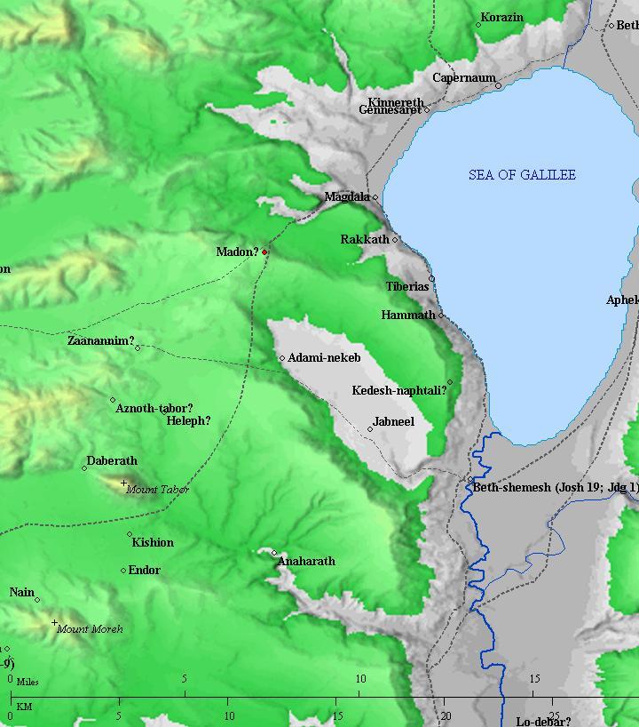
Roads and cities during the Canaanite/Israelite periods thru the Roman period, 20th BC- 1st century AD (based on Bible Mapper 3.0)
- Hellenistic period
In the Hellenistic period (3rd-4th century BC) the city relocated to the village under the hill – located in Khirbet Hittin. This relocation was typical to all Tells in Israel, due to the limited size and the lack of water required for a greater population.
- Roman/Byzantine period
According to some Christian traditions, this hill was the place where Jesus gave his important sermon on the mountain (Mt 5, Lk 6:20) to the multitude that assembled to see and hear him. Yet another tradition holds the location closer to Capernaum – on Mt Beatitudes.
-
Crusaders
The Crusaders arrived from Europe to the Holy Land in order to liberate the Holy Land and free Jerusalem. They accomplished the mission in 1099, and established the Crusader Kingdom. Ever since their arrival, the Arab forces attempted to crush them.
In the second half of the 12th century, the great opponents of the Crusaders were the Ayyubid Muslims. This dynasty was founded by Saladin (Salah ad-Dīn Yusuf ibn Ayyub). The Ayyubid Muslims ruled Syria and Egypt in the years 1171-1341.
Saladin, a Muslim of Kurdish origin, was the first Ayyubid Sultan in 1174 and reigned until 1193. His mission was to drive the Crusaders out of the Holy Land and the Levant, a mission that was mostly accomplished.
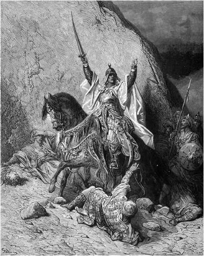
Saladin – by Gustave Dore (French artist, 1832-1883)
A decisive battle of the Crusaders and Saladin was held in the valley below it in 1187. The events of this battle are as follows:
- July 1, 1187 Saladin crosses the Jordan
- July 2 (day) Part of Saladin’s army takes Tiberias, starts siege on its fortress
- July 2 (day) Main part of Saladin’s army camps in Kefar Sabet (east to Sede Ilan).
- July 2 (night) Tiberias sends messengers to Sepphoris, asking for help
- July 3 (day) Crusaders forces attacked on the way from Sepphoris to Tiberias and blocked from getting to Hittin spring (the only source of water in the area)
- July 3 (evening) Crusaders camp in Mishkana (near Golani junction and west to Hittin)
- July 4 (dawn) Arab forces torch the fields in attempt to block the Crusaders
- July 4 (morning) Arab forces attack the thirsty and tired Crusaders below the Horns of Hattin
- July 4 (day) The crusaders split their forces, making it easier for the Arabs to win the battle
- July 4 (evening) Most of the Crusaders are either dead or captured
- July 4 (evening) Some of the knights flee to the top of Horns of Hattin; eventually surrender there
The Crusaders defeat was the beginning of the end for the Crusaders Kingdom in the Holy Land. All their territories west of the Jordan river were lost in that year. By 1189 the Crusaders were driven out of all areas in the Levant, except for small pockets in Northern Syria. However, the third Crusade (1189-1192) brought them back to the Holy Land.
-
Ottoman period
Conder and Kitchener surveyed this area during the Survey of Western Palestine in 1882. A section of their map is seen here:

Part of map Sheet 6 of Survey of Western Palestine,
by Conder and Kitchener, 1872-1877.
(Published 1880, reprinted by LifeintheHolyLand.com)
This is what they wrote about the sites (SWP Vol 1 pp. 384-5):
“Hattin – There are a number of rock-cut tombs to the west of this village. South of the village is the ‘wely’ of the Neby Shu’aib, who is no other than Jethro, father in-law of Moses, buried here according to Mohammedan tradition. Here they show his tomb and the imprint of his foot upon a piece of marble. A short distance from this place is a sepulchral chamber, said to have contained the remains of his daughters, now called Wely Benat Neby Sh’aib.
Kurn Hattin – A tradition of the fifteenth century identifies this hill with that in which the Sermon on the Mount was delivered ; it is also said to be the place where the Lord’s Prayer was first given to the disciples.
The hill with the adjacent plain was the scene of the disastrous battle of Hattin (July 3, 1187), when the Christian army was crushed by Saladin, and the Latin kingdom destroyed”.
“The whole hill was formerly surrounded in its upper part by a wall, and special fortifications seem to have been constructed at the two horns. Judging from the nature of the materials, of every form and size, which lie scattered about the ground, the wall must have been built hastily. The inhabitants of Hattin say that here was once a little town, long since levelled. To the indistinct ruin they give the name of Kh. Medinet el Tuwileh, ‘ruins of the long tower.’ … At the south-east point of the hill is seen an oblong cavern, cut in the rock, and cased with cement ; it is in great part destroyed. It was either a tomb or a cistern. Beside it are the foundations of a small square building, measuring eight paces on each side; it passes for an ancient wely, having succeeded a Christian church. Others see in it the ruins of a tower.”
-
Modern Age
In Israel’s independence war the villagers of lower Hittin used the hill to attack the traffic to Tiberias. They built communication trenches and fortifications on the edges of the hill. After a night attack on July 18, 1948 the Israeli forces captured the fortress.
Today the hill is a national park (“Qarne Hittin”), and open to the public. The site is accessed from the Tiberias-Golani road (#77), by a dirt road that starts from the underpass to the Lower Galilee industrial park. It is best to arrive from the direction of Tiberias.
Photos:
(a) Aerial Views:
A drone captured this view of the site from the east side. On the left side of the hill is the southern “horn”. The olive trees are planted along the eastern rim of the extinct volcano, where traces of ancient walls are found.
Click on the photos to view in higher resolution…
Another view of the site is from the south side. The valley of Hittin is on the back (north) side of the hill.
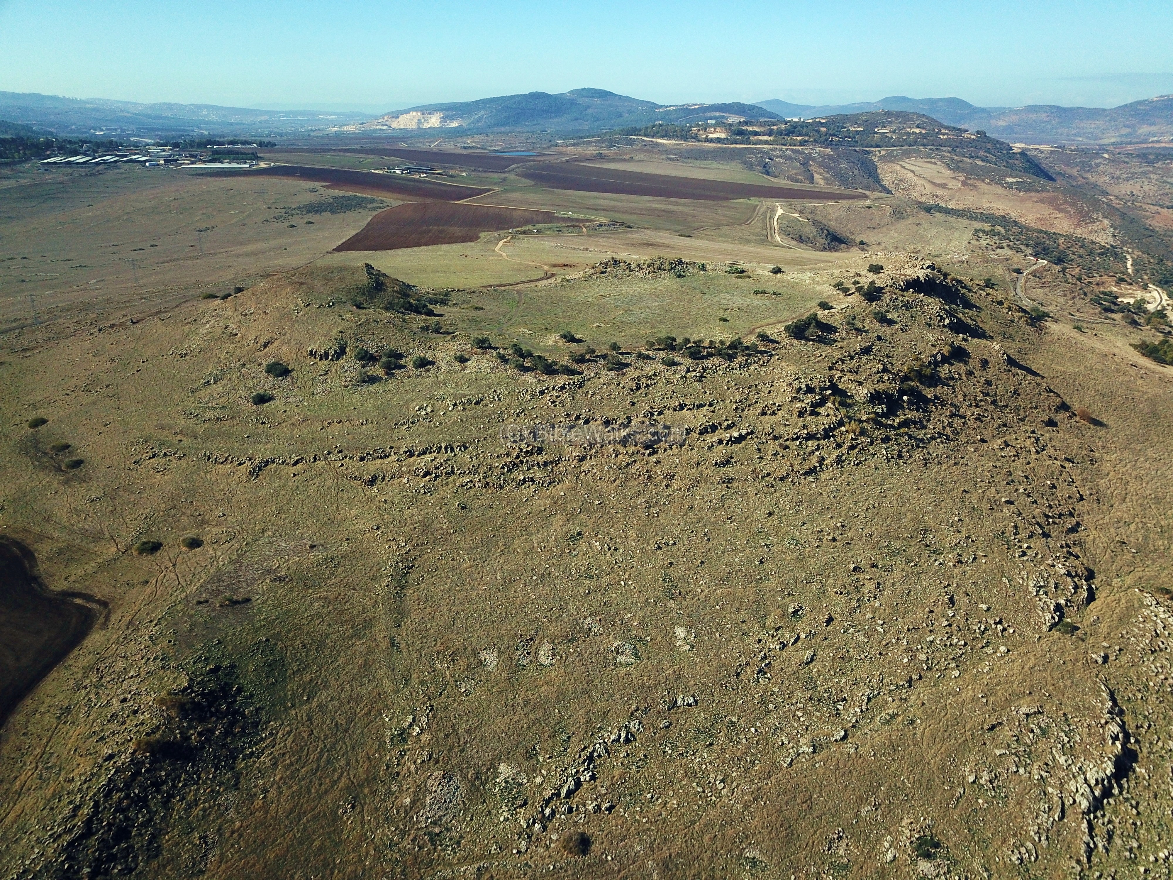
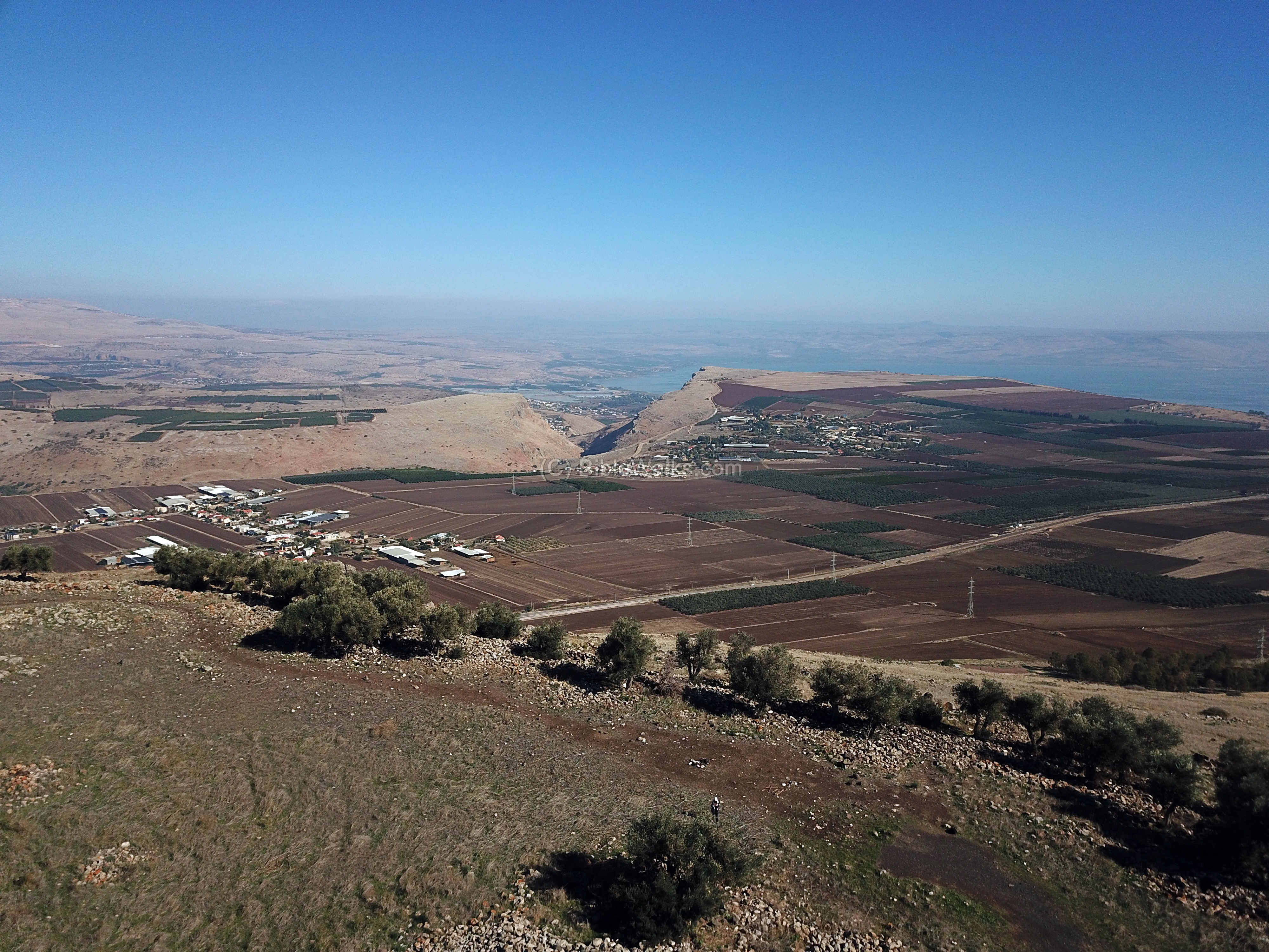
Another aerial view is from the west side. In the far background is the Sea of Galilee.

(b) General ground views:
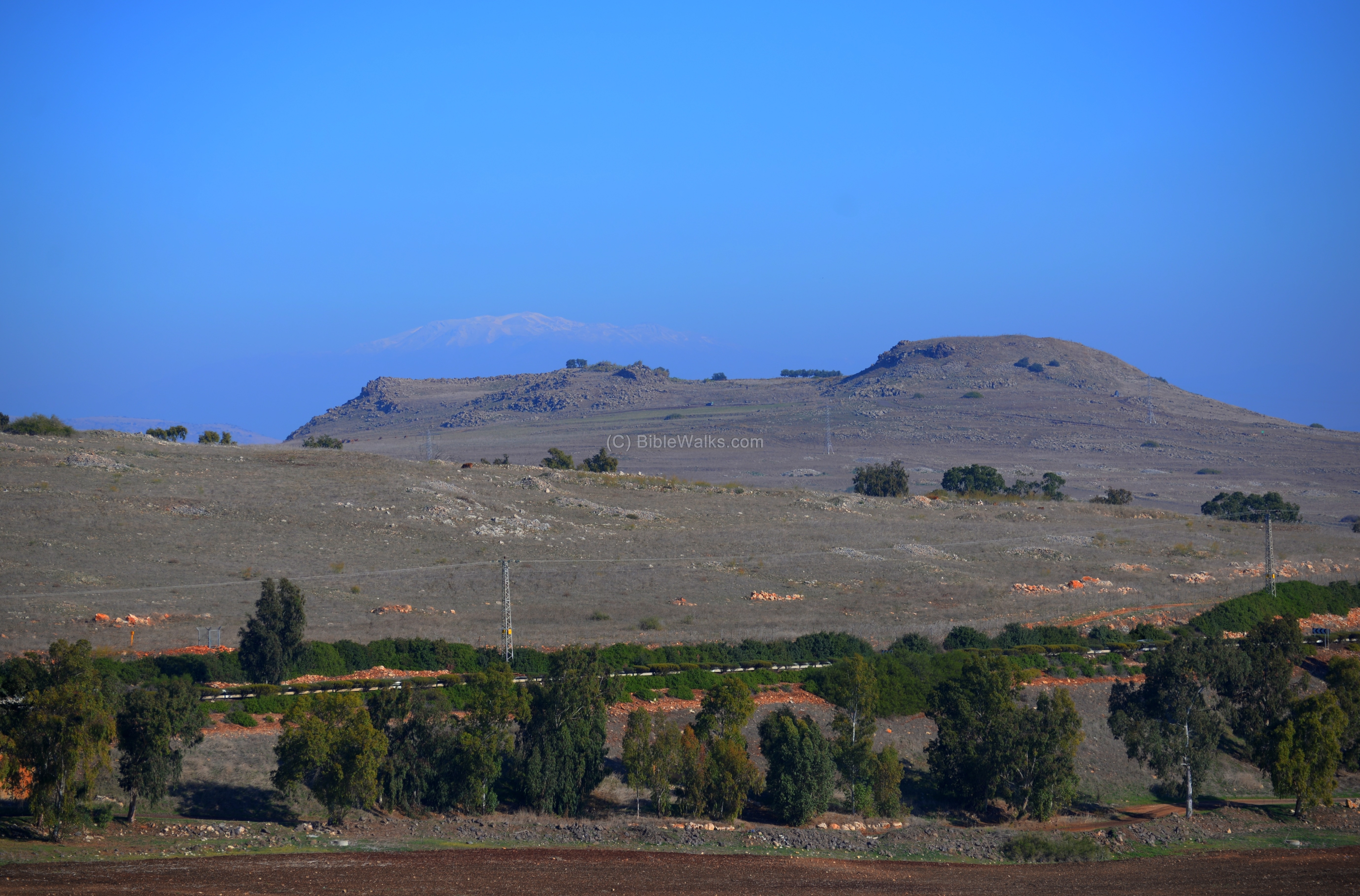
The Horns of Hattin dominates the eastern Galilee area. Behind the Horns of Hattin, in the far background, is Mt. Hermon (covered by a light snow cover).
This photo was taken from Givat Avni, a new community south of the site. The road to Tiberias passes in front. Ruins of an ancient Mameluke khan (caravanserai) are located nearby, once servicing this ancient road.
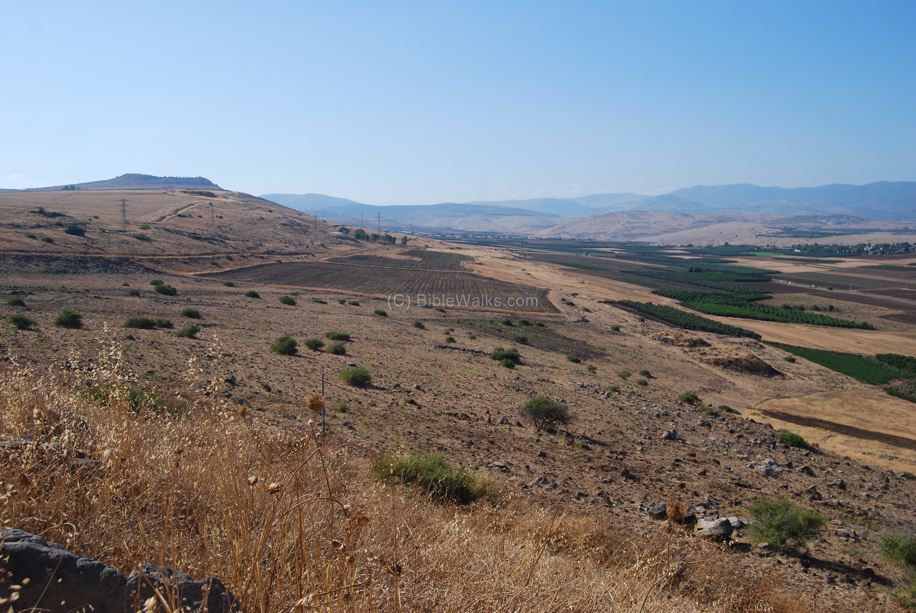
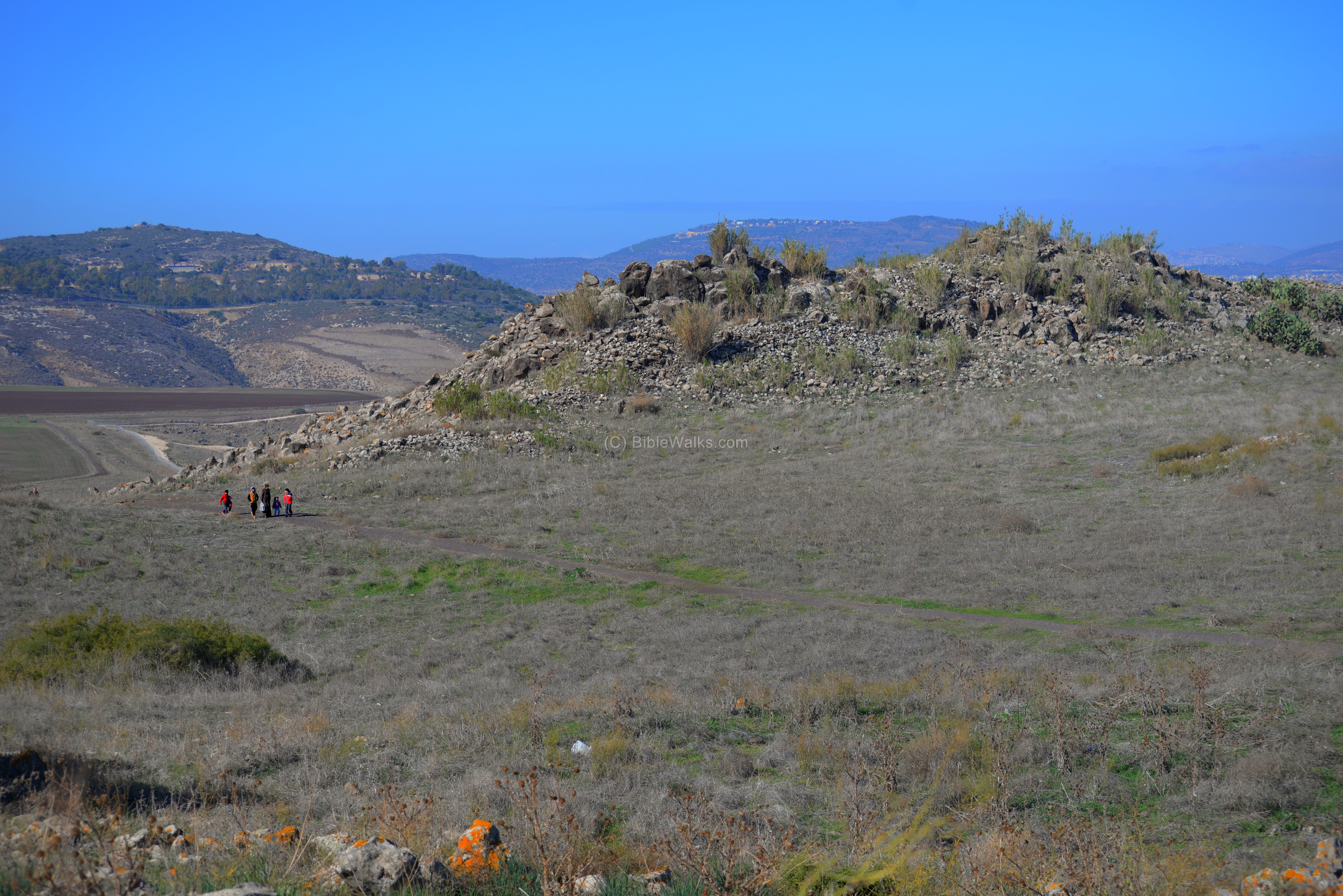
The following photo shows a view of the valley of Hittin from the east. The Horns of Hattin is seen on the left (south) side. Notice the double peaks of the hill, which is the source of the name (horns of a bull). The place of the battle is on the right (north) side. The road along the valley is where the Crusaders were heading towards Tiberias, in an effort to remove the siege.
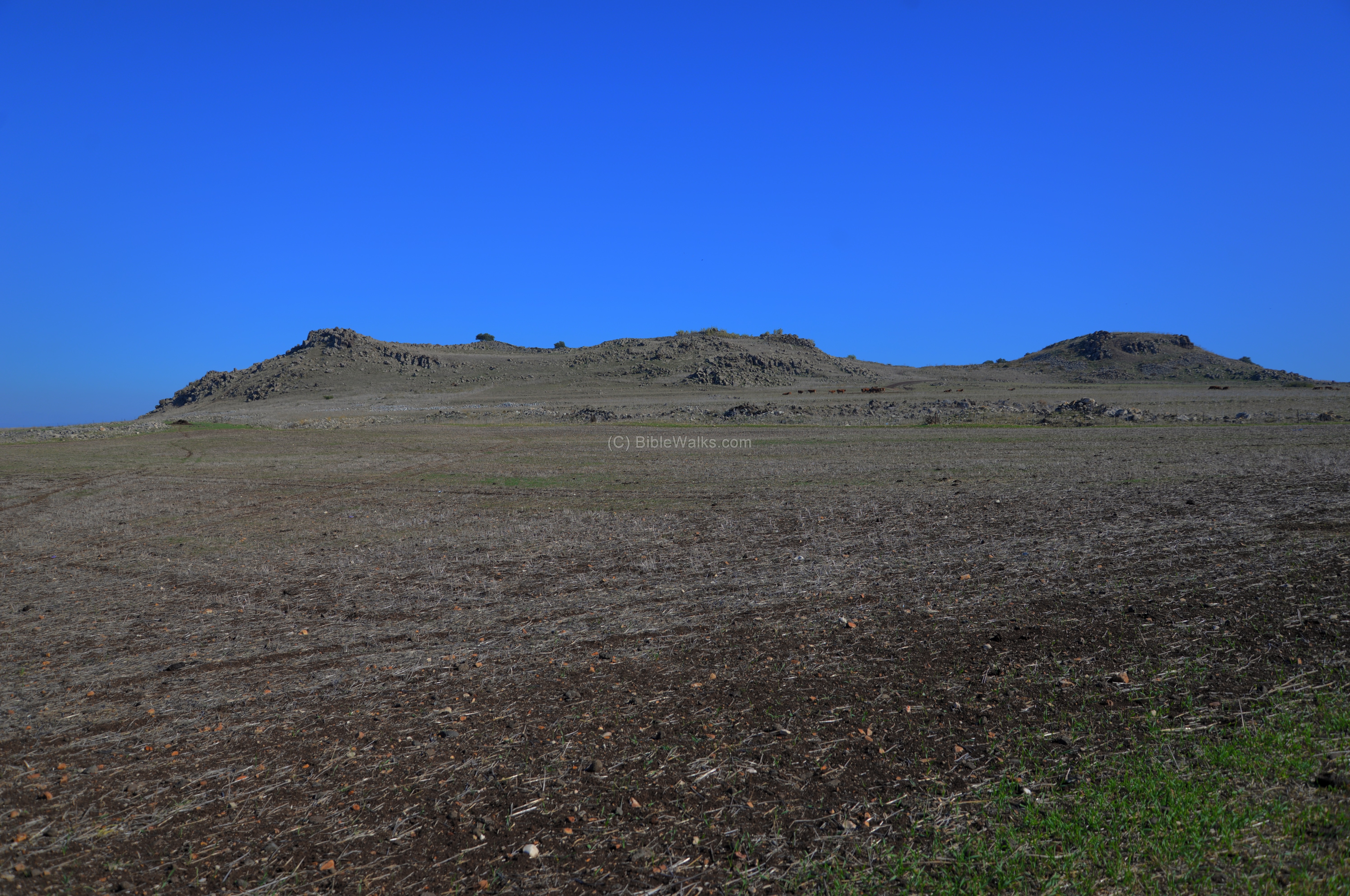
A western view of the Horns of Hattin:
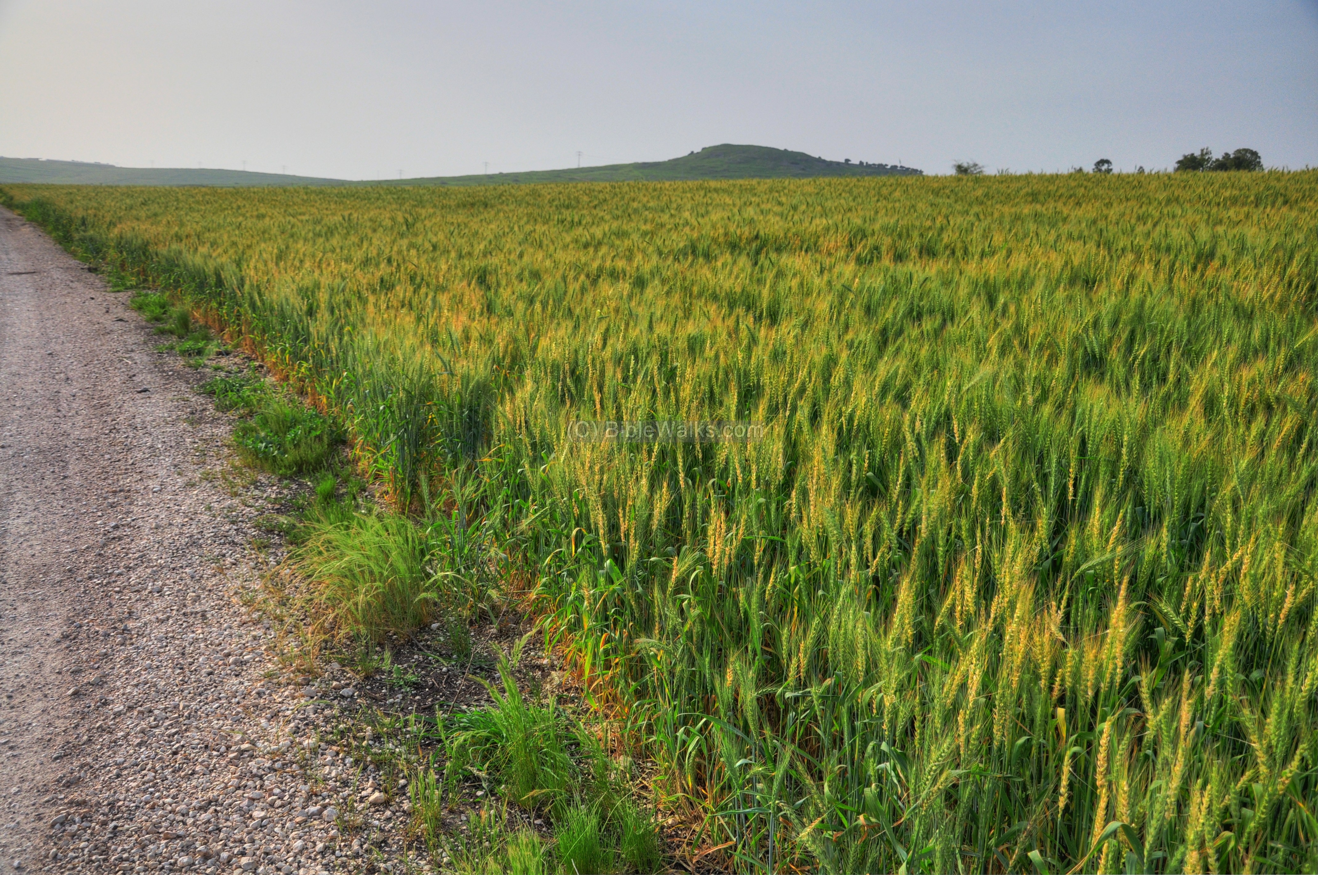
A field of wheat is seen in the photo below, with the Horns of Hattin in its background. The Hebrew word Hittin/Hittin means “wheat”.
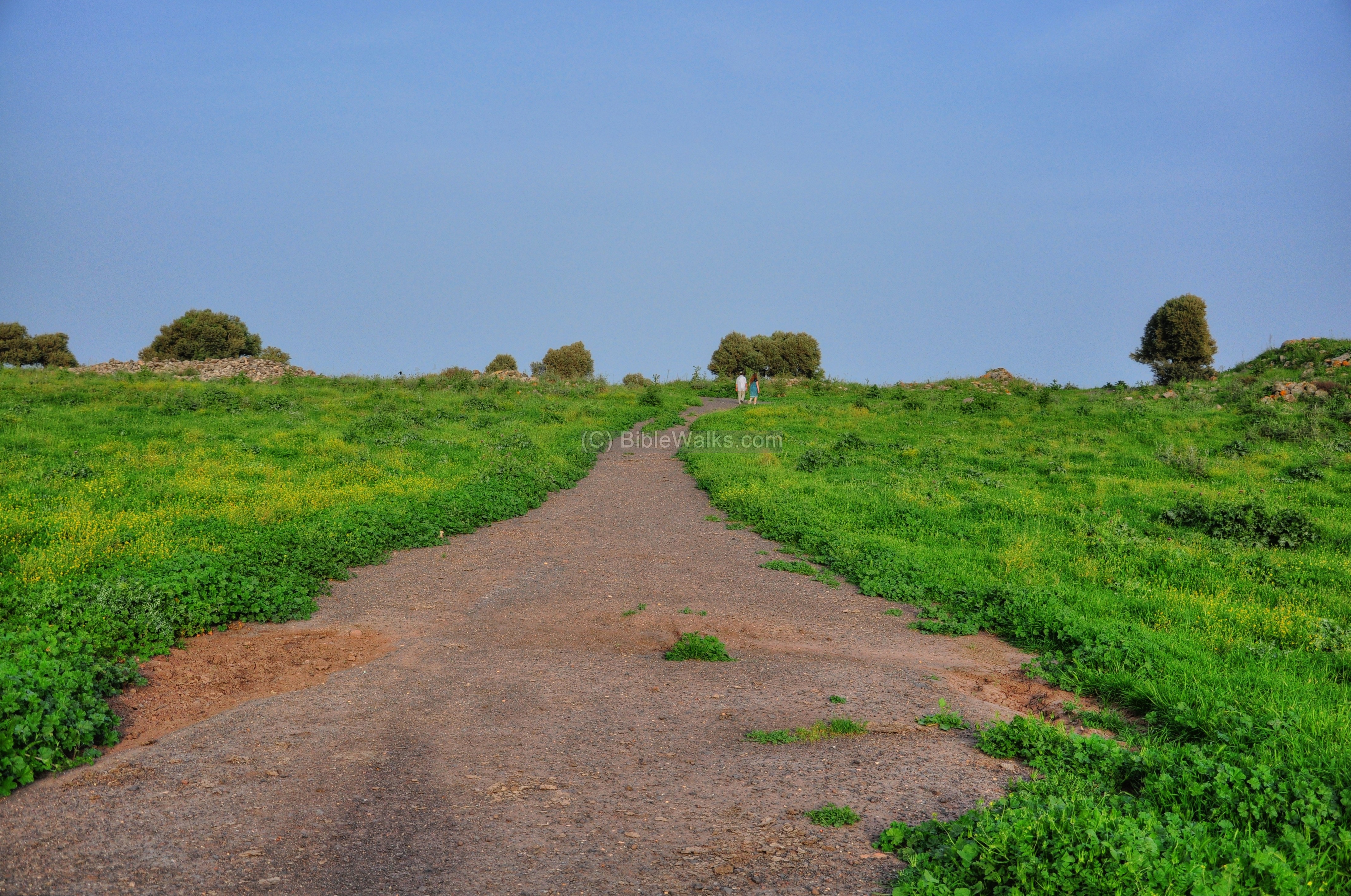
The following sections review the site counter clock wise starting from the entrance on the western side.
(c) Western side:
The entrance to the crater is on the western side. Park your car on the foothills below this side.
Notice the large walls on the western side.

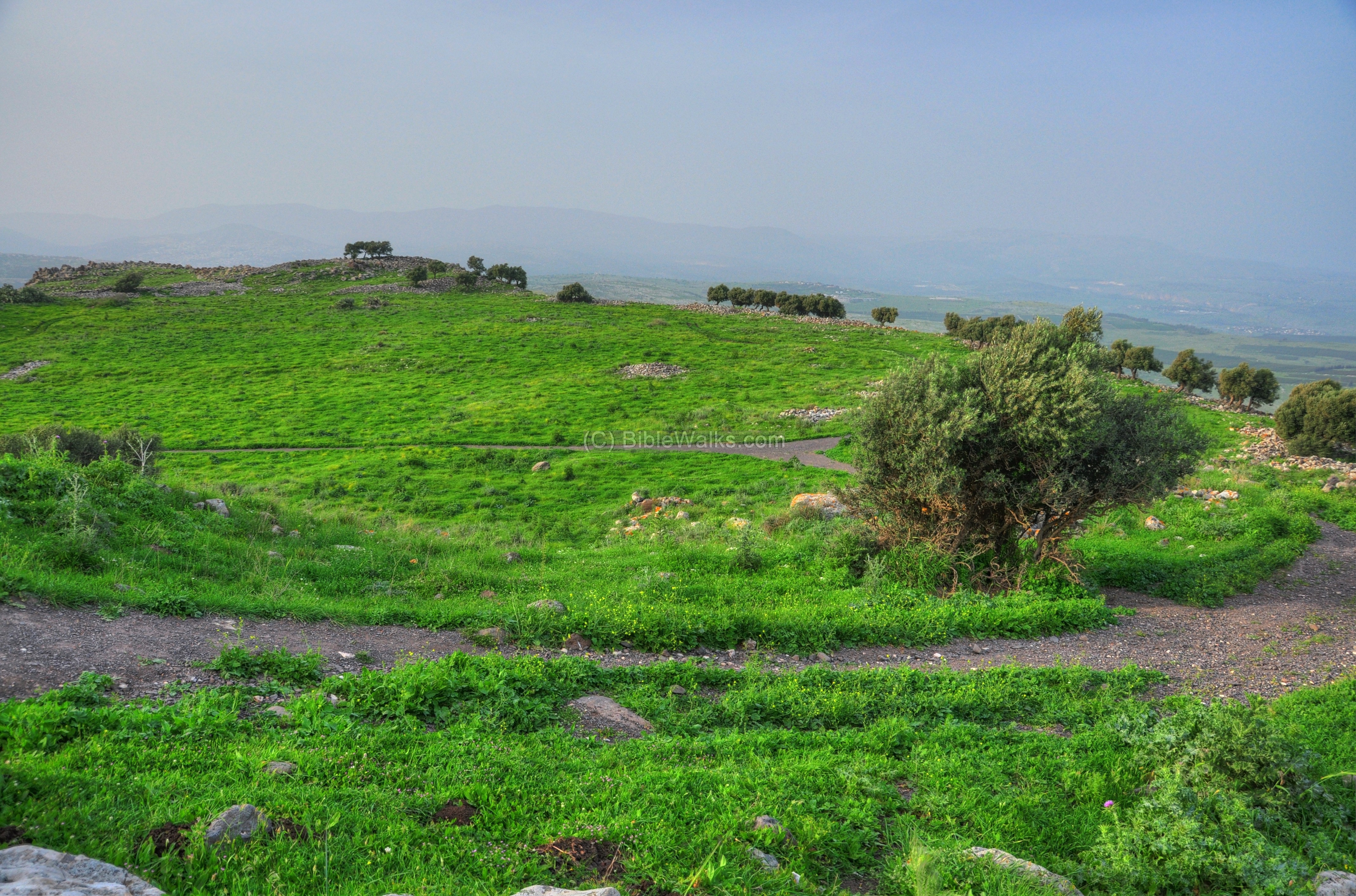
After entering into the top of the hill from the western side, the road enters a large flat area. This is the center of the hill – a deep crater of the extinct volcano.
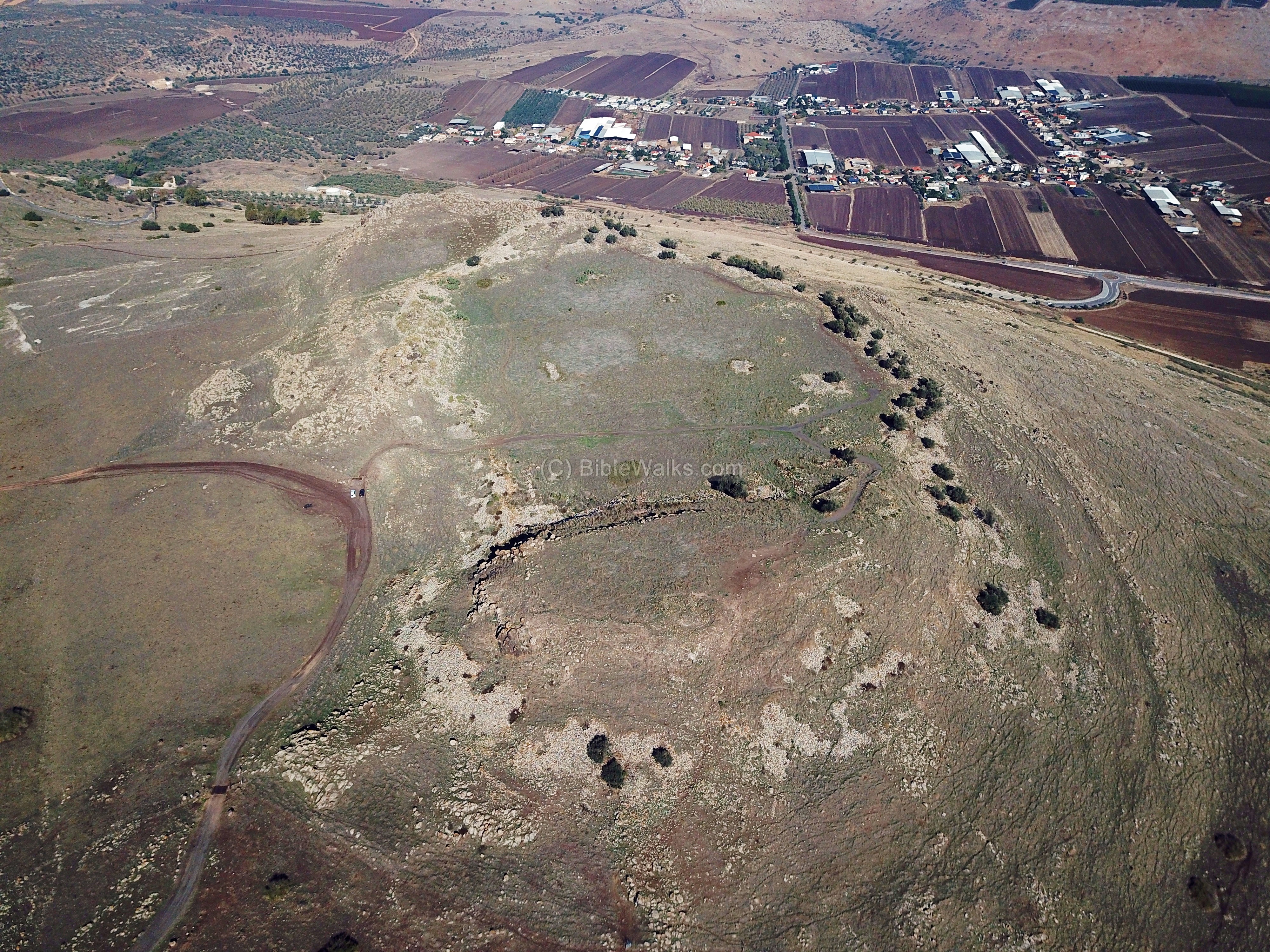
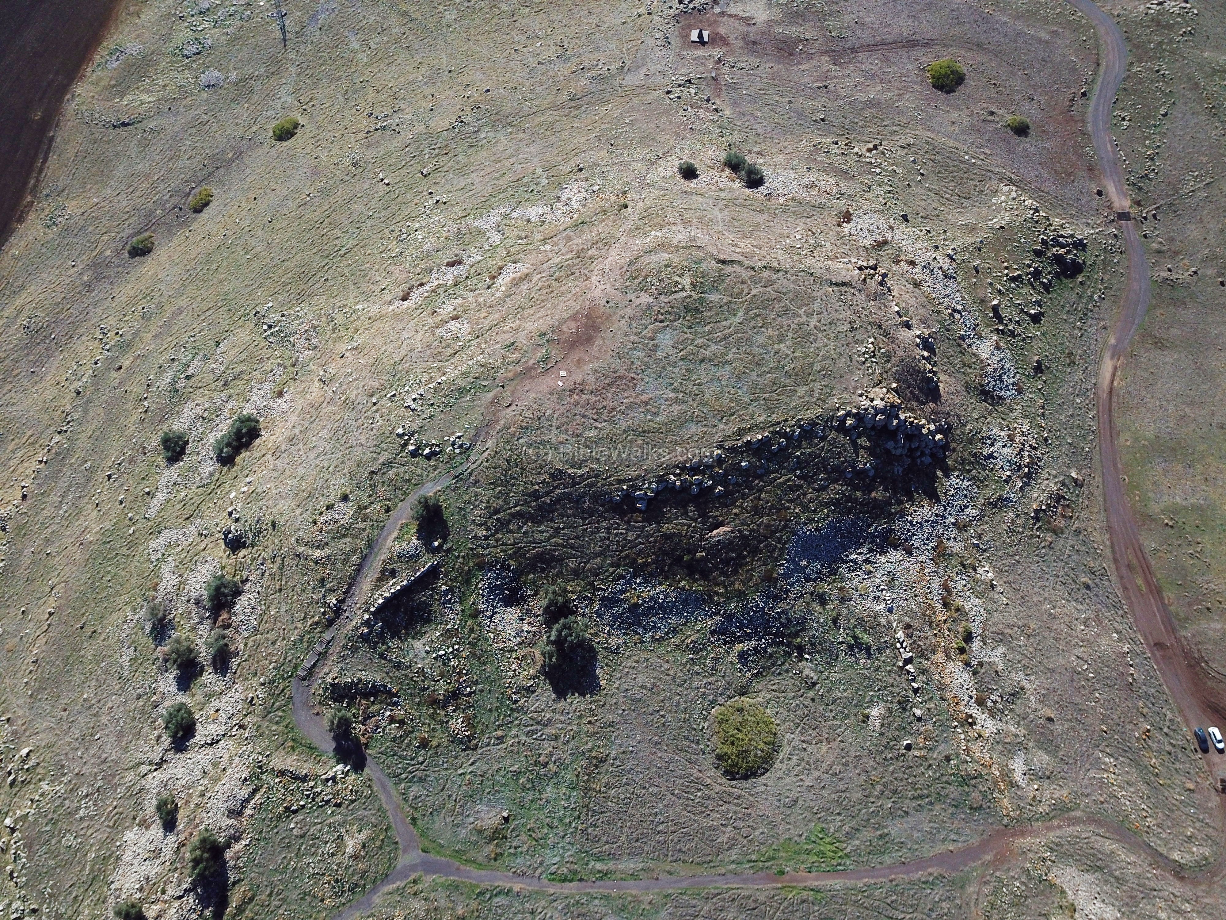
(d) The Crater:
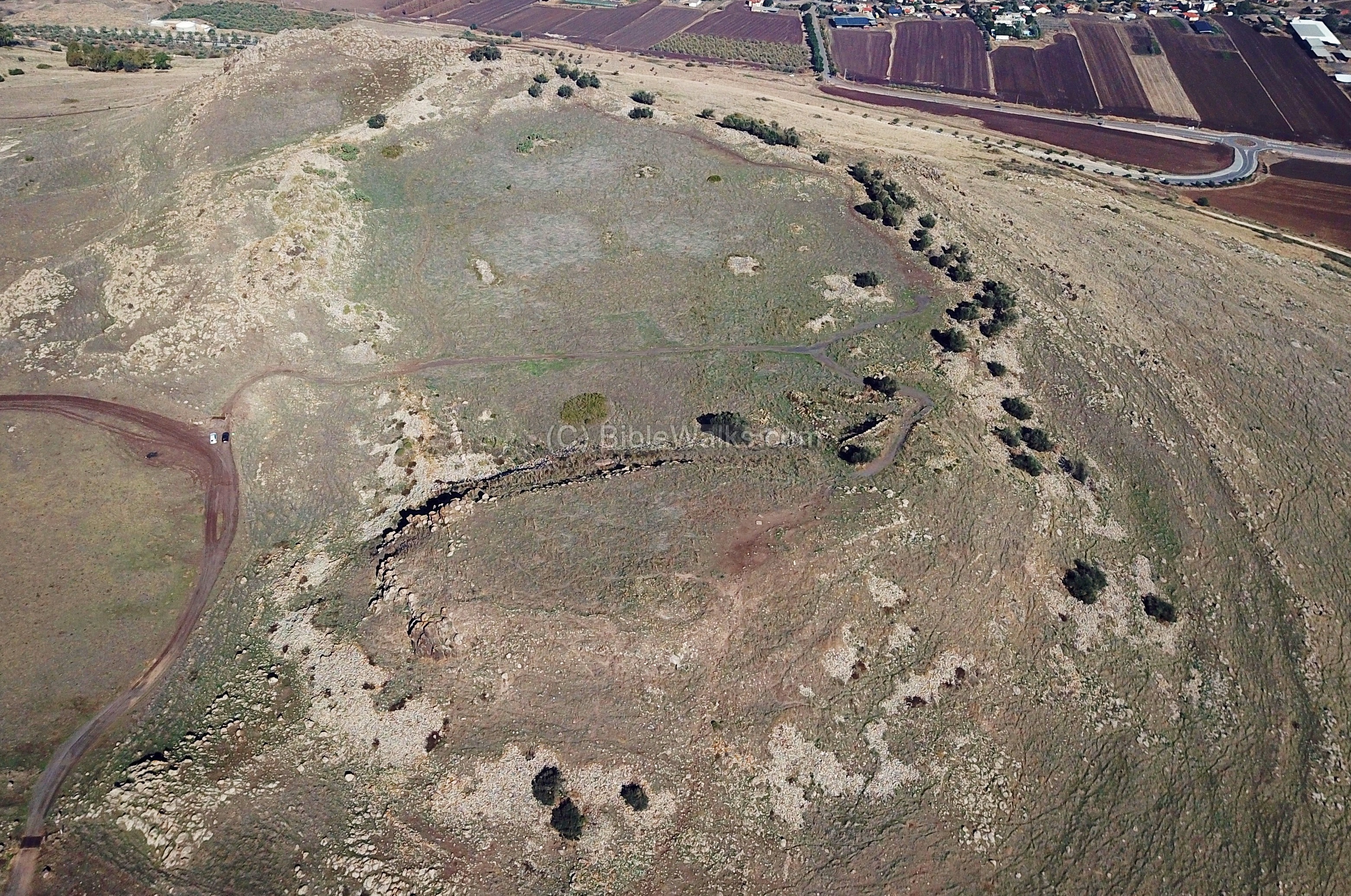
An aerial view shows the area of the flat center of the crater. As seen in this view, traces of an ancient peripheral wall are seen surrounding the entire area of the crater.
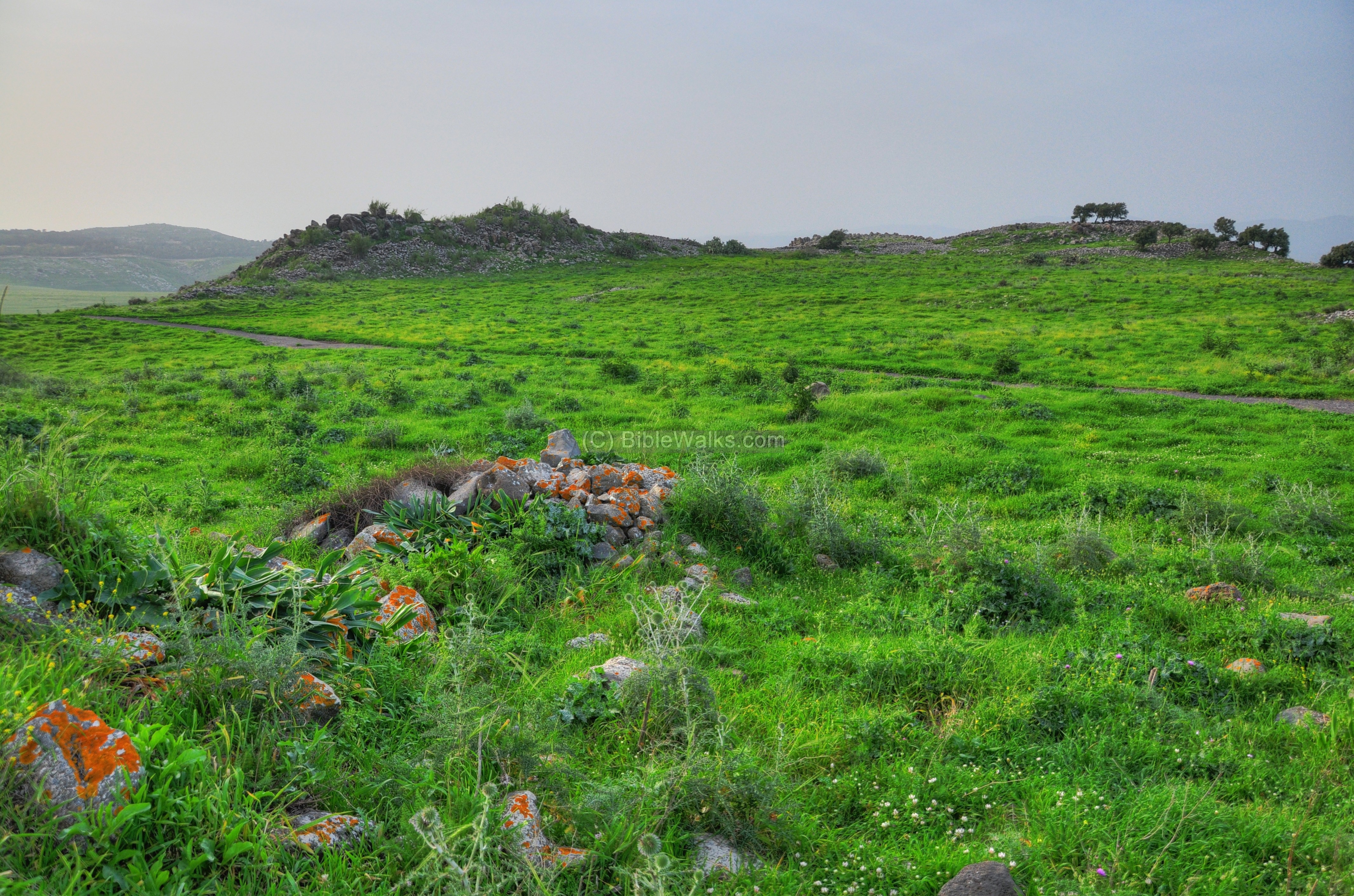
The view below is observed from the south “horn” looking towards the north “horn”. Note that it was captured during the winter time when the hill was covered by weed.
The road crosses the crater from the western entrance to the east side of the hill, seen here in the background.
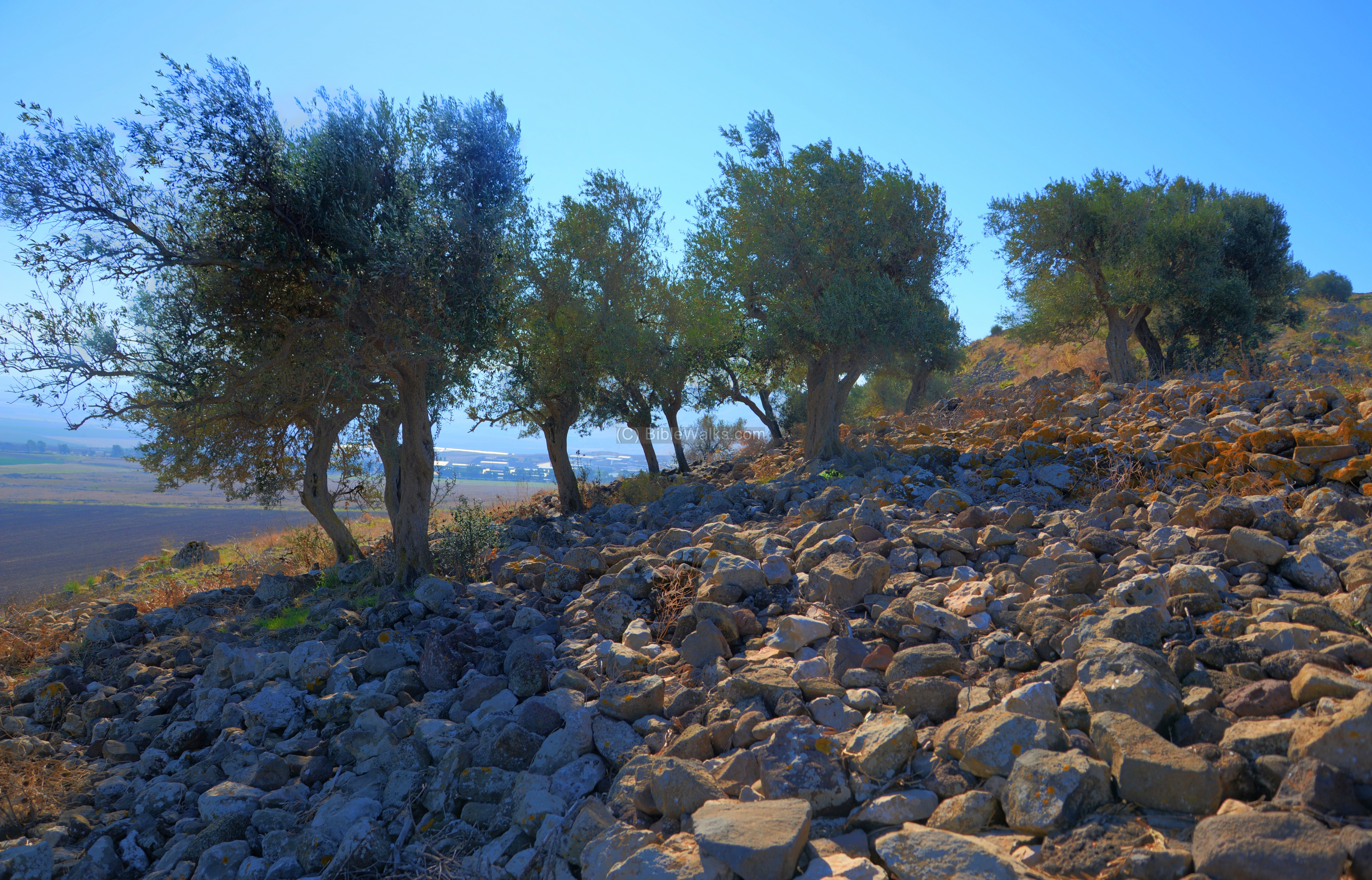
The following photo shows another view of the crater. Along the rim of the crater are olive trees and the ruins of a low wall from an unknown date.
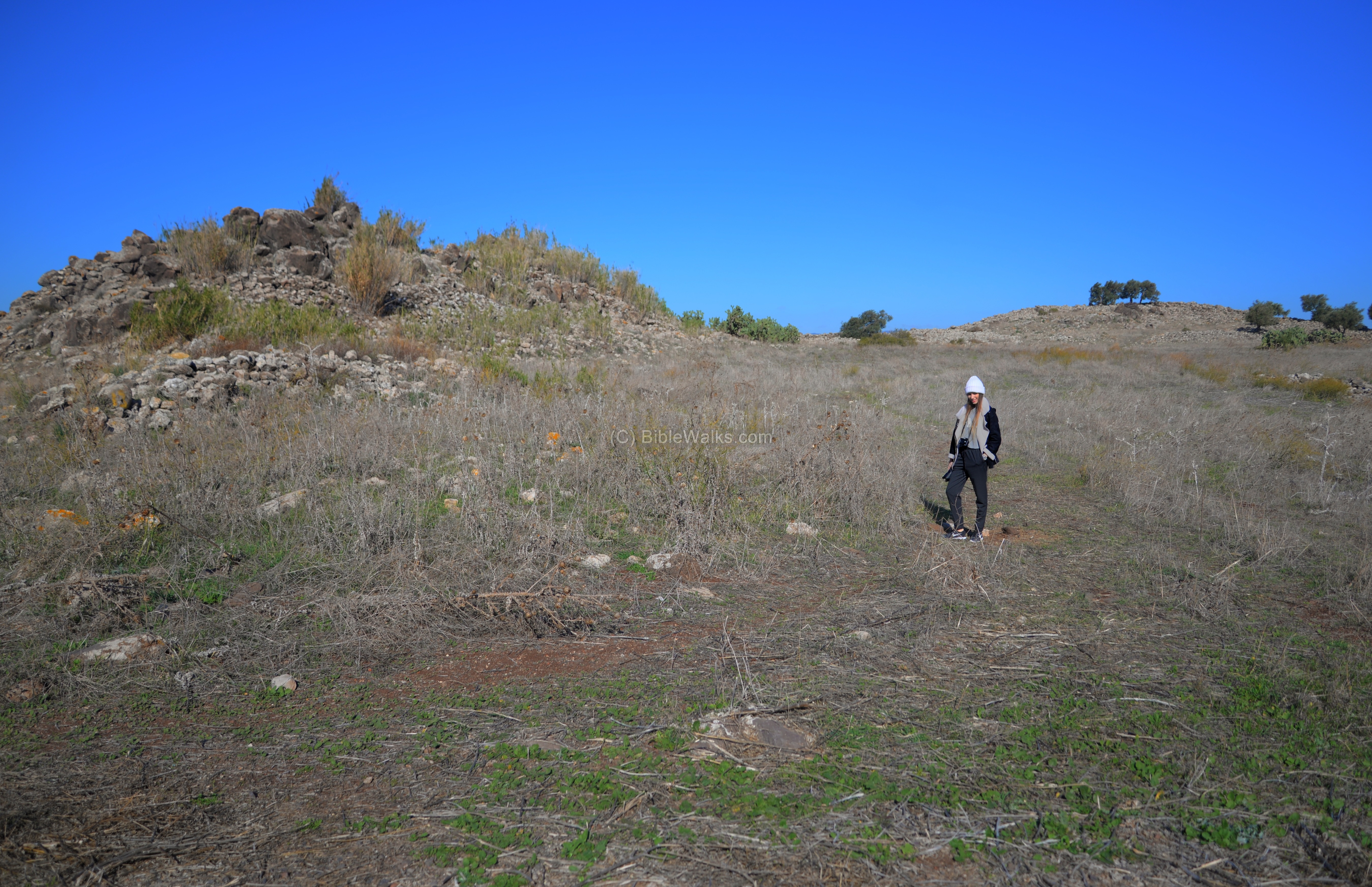
(e) South Horn:
The southern “horn” was the location of two cities – a Canaanite city, dated to the 14th-12th century BC, and an Israelite Kingdom city, dated to 10th-8th century BC.
There are traces of two set of walls, which are visible in the aerial view above:
- The lower (larger) wall is located along the foothills, covering an area of 9 Dunam. It was built in the Late Bronze (Canaanite) period.
- The upper (but smaller) wall surrounds the peak with a total area of 5 Dunam, and was built in the 8th ninth century during the Israelite Kingdom.
A section of a wall, on the north east side of the horn, is seen in the following picture.

A closer view of this wide wall is in the next photo.

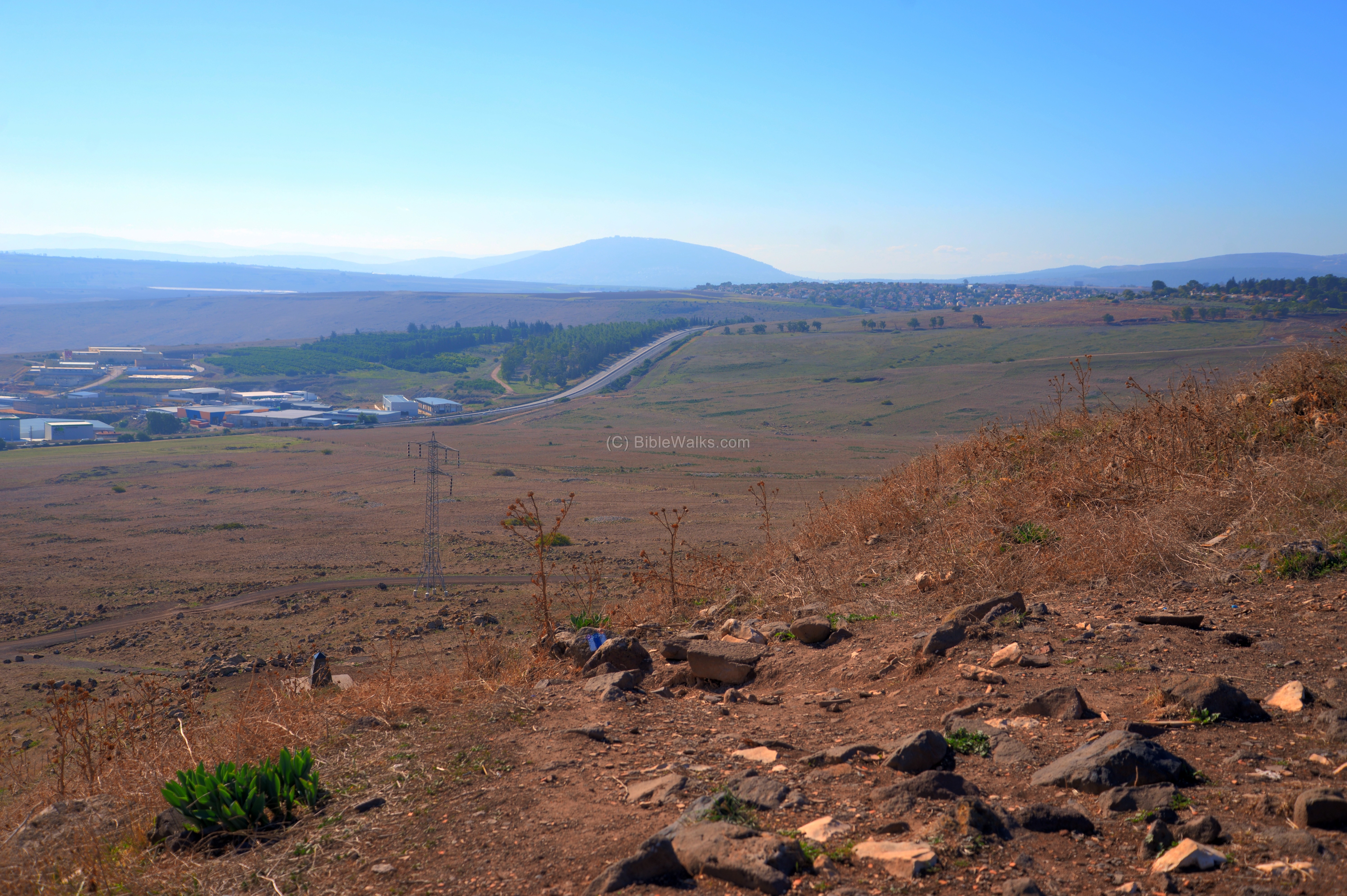
From the summit are views of the road to Tiberias. Mount Tabor is in the far background.
A monument is located on the south side of the hill, constructed by a Christian order – The Church of God, Cleveland Tennessee. This was erected in order to mark the place where, according to their belief, was the location of the sermon on the mountain. There are two inscriptions with verses from Deuteronomy (27 2-3): ” thou shalt set thee up great stones, and plaster them with plaster: And thou shalt write upon them all the words of this law…” and from Mark (3 13): “And he goeth up into a mountain, and calleth unto him whom he would: and they came unto him”.

(f) Eastern side:
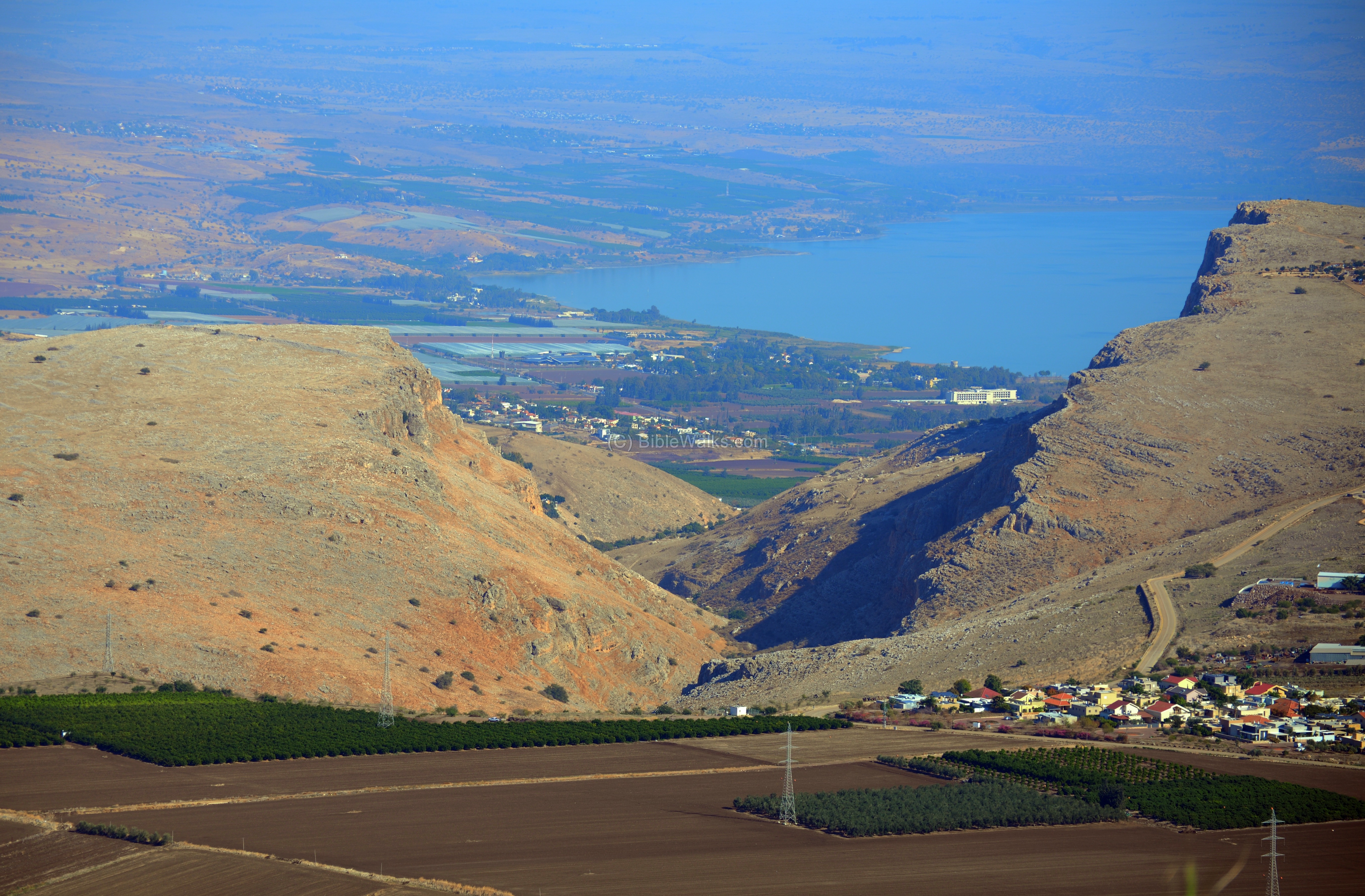
The great views of the area are the highlights of the visit to the site. The vast and fertile valley of Hittin stretches out from west to east. In the background are the Arbel cliffs and the northern section of the Sea of Galilee.
Along the eastern rim is a line of olive trees.

Between and behind the trees are traces of a wide wall extends along the edge.
The next photo is a closer view of the Arbel cliffs on the north east direction. Farther away in the distance is the Sea of Galilee. On the right side are the houses of the modern agriculture Moshav Arbel, named after the Roman/Byzantine village whose ruins are located on its northern side, including a grand ancient synagogue.
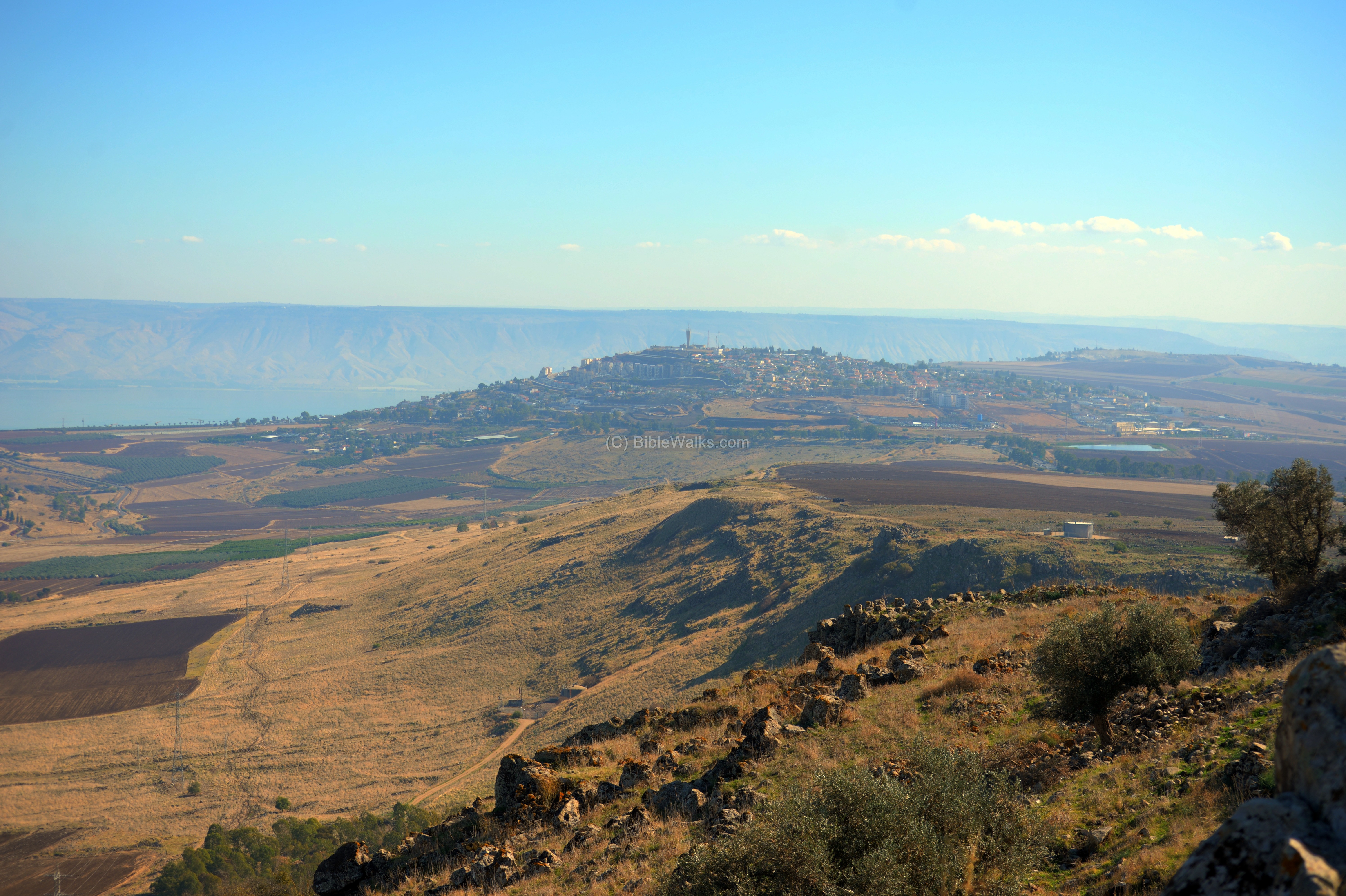
The south-eastern slopes are shown in the picture below. The upper side of the city of Tiberias is visible on the right background.
(g) North Horn:
On the north side of the crater is the second “horn”. This aerial view shows the hill (altitude 345m) and its steep foothills leading down to the valley of Hittin (300m lower than the hilltop).

A ground view of the northern “horn” is below. In the background are the high mountains of the Upper Galilee.

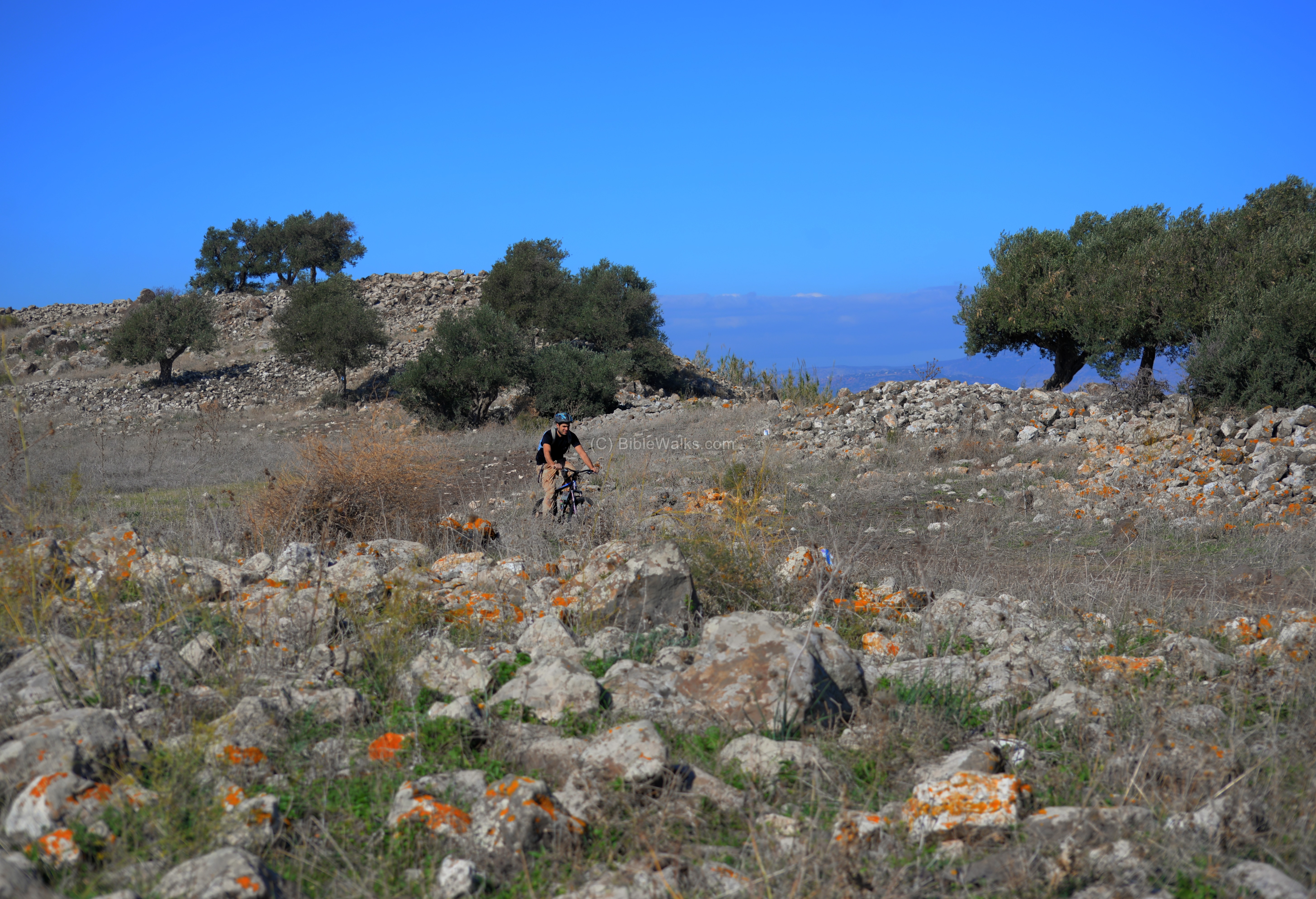
The eastern side of the north hill is in the next view. A biker rides along the trail, which follows the eastern rim of the crater. Traces of the ancient wall are seen on the right side.
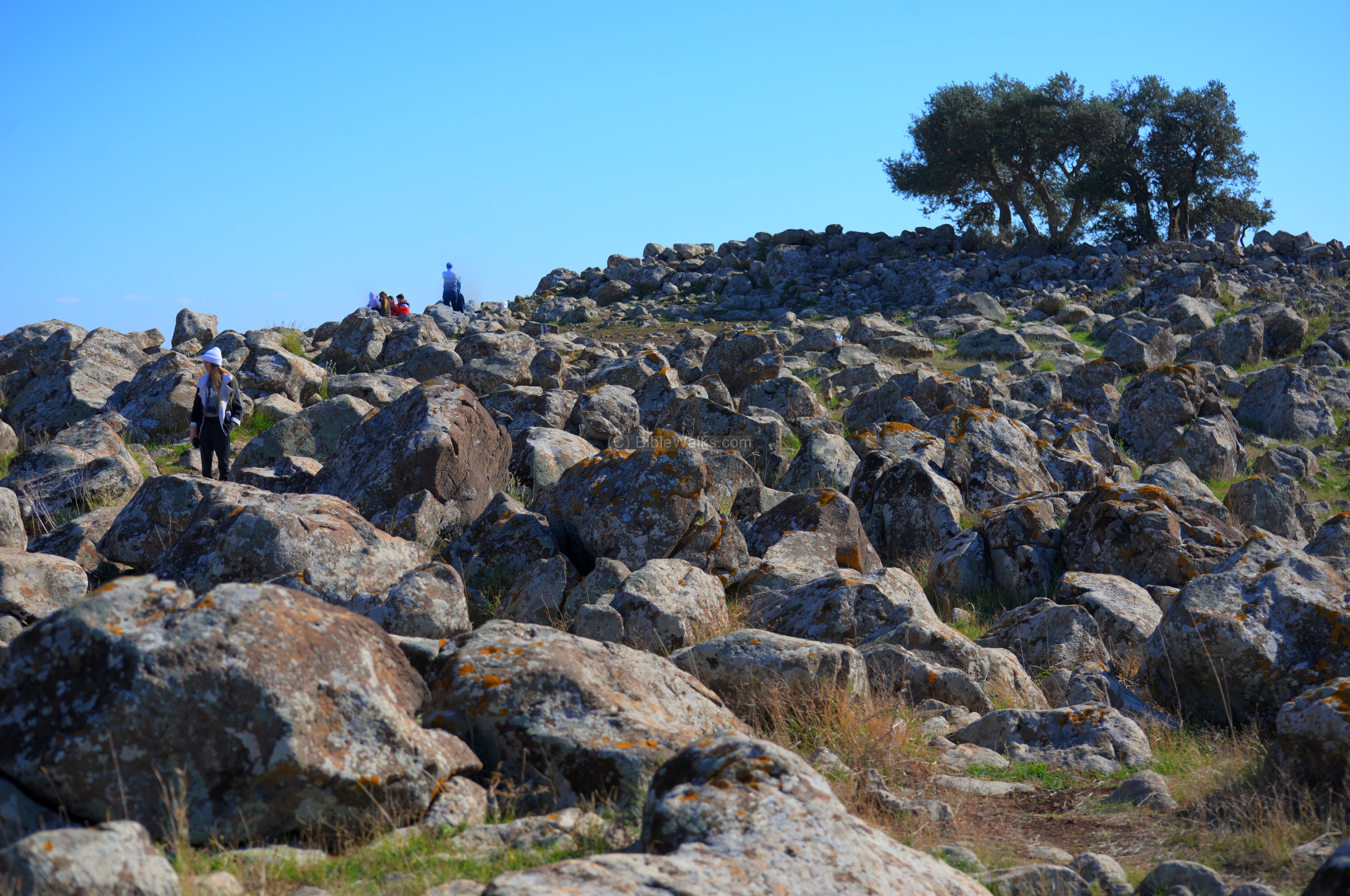
The northern hill is covered with numerous basalt rocks. These volcanic “bombs” (agglomerate rocks) were created during the eruption of the volcano.
Interesting man-made carvings are found here, including this large rock with a hole in the center of a raised circle.
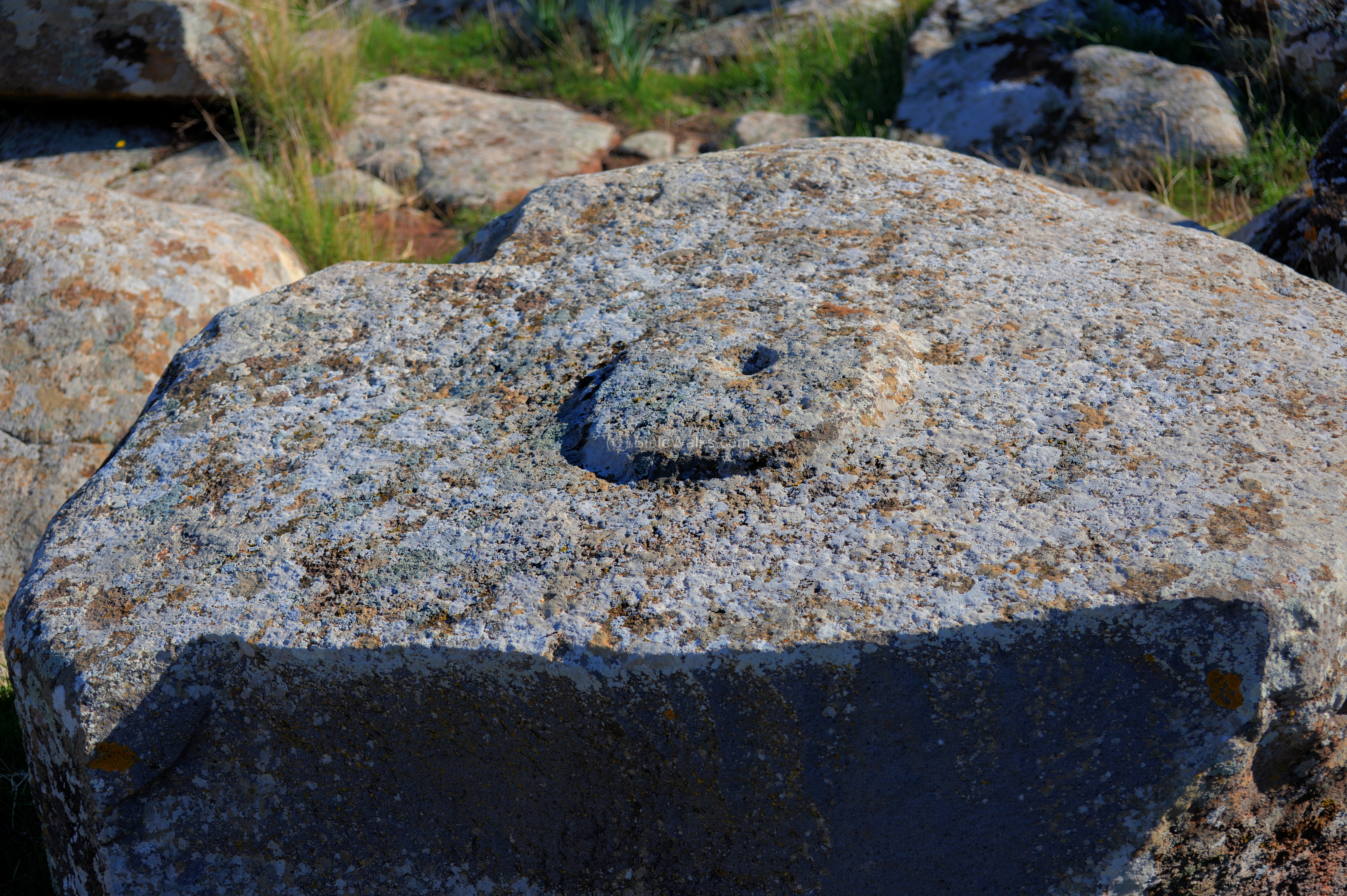
An adjacent rock has carved lines inside a smooth carved surface. Is this a place used for ritual practices?

Great views of the surrounding area are seen from the north hill.
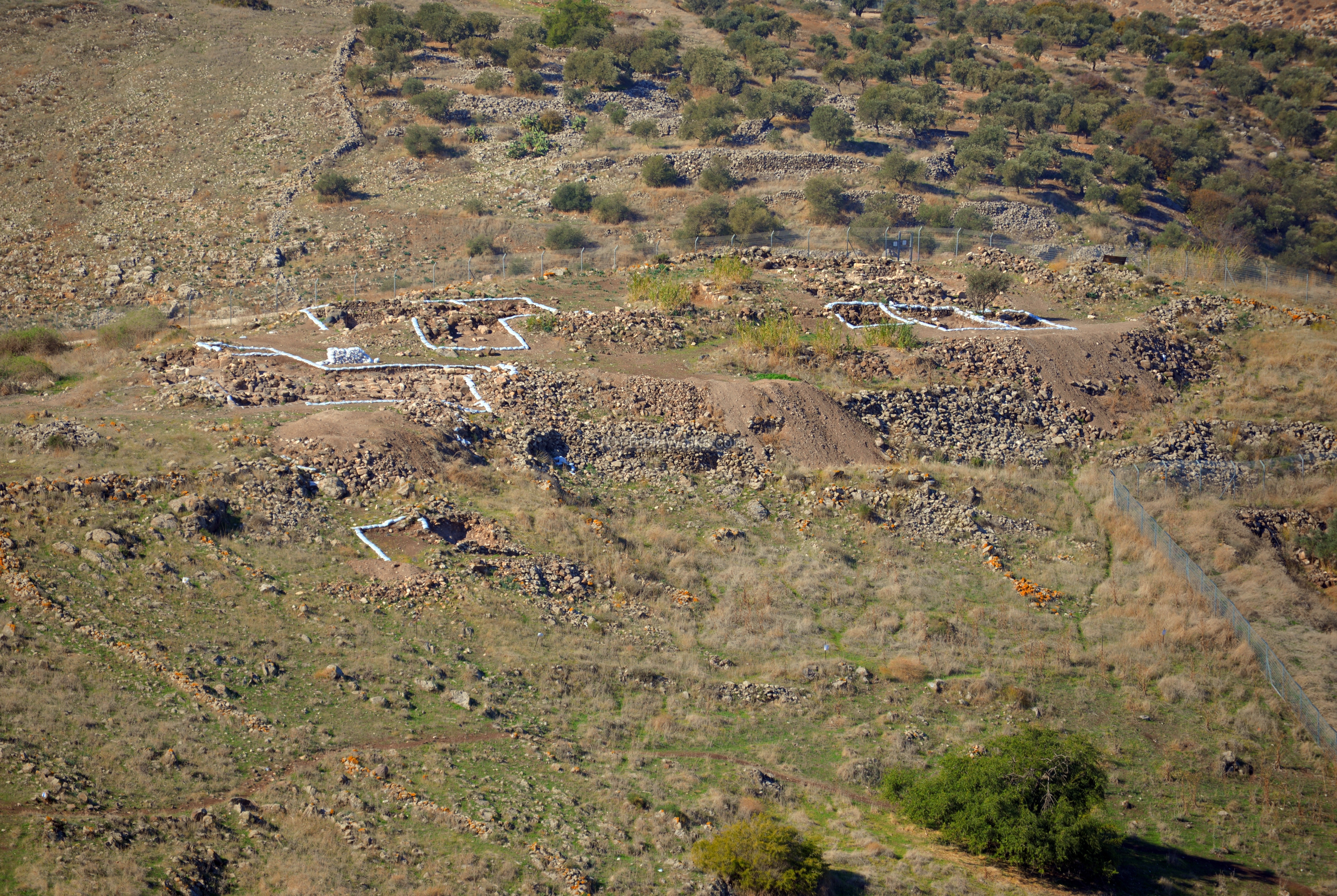
On the nearby ridge, seen here in the center of the view, are visible trenches of a new excavation which is currently conducted.
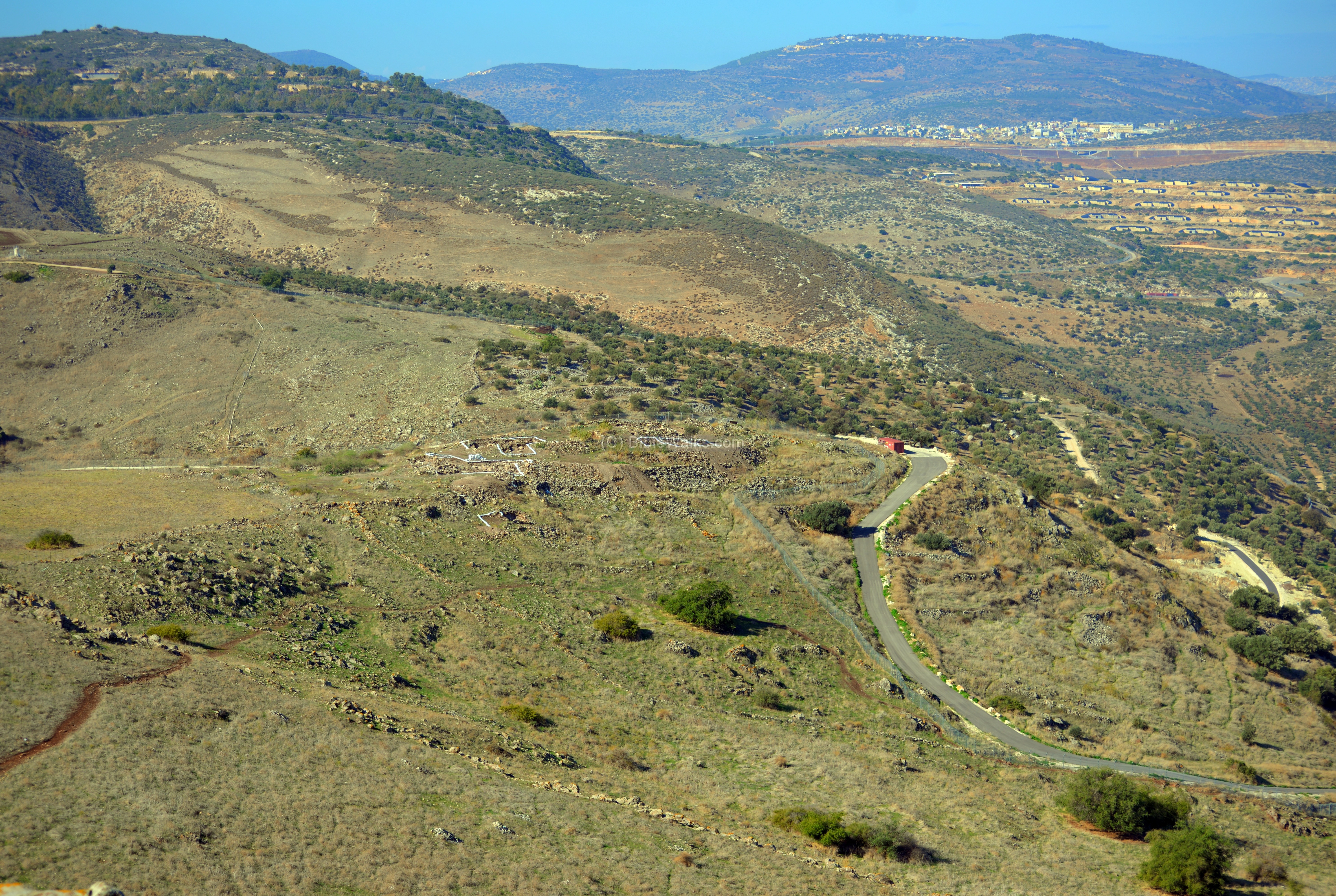
The excavations are conducted in the ruins of Khirbet el-‘Eika – a Hellenistic period settlement that existed until the mid 1st century BC. Its Arabic name is Hattin al-Qadim (ancient Hittin), and the PEF survey named it Kh. Madin. The ruins cover an area of 15 dunams.
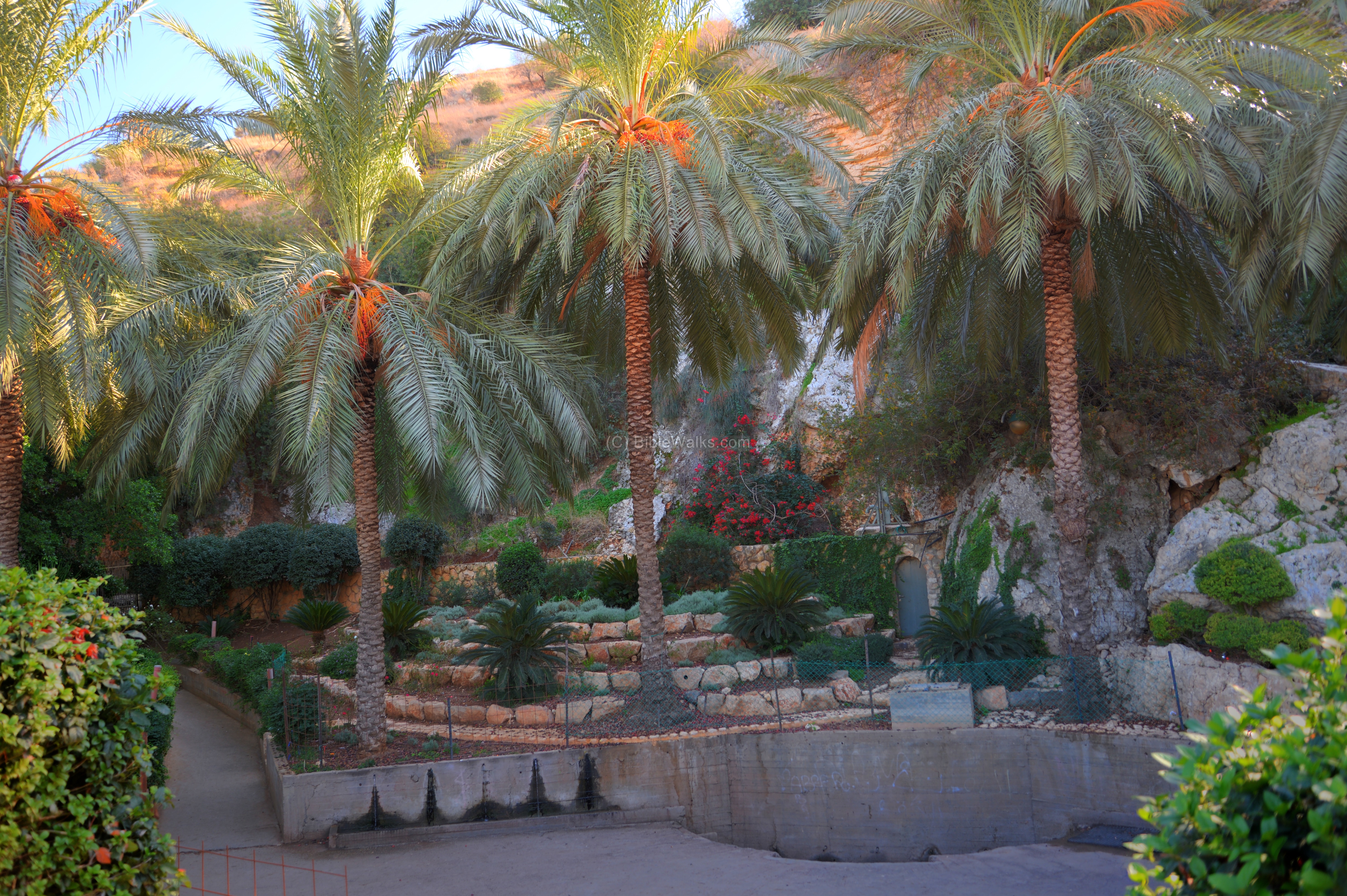
(h) Hittin spring:
The only source of water in the area is the spring of Hittin, under the north west foothills. The source of the water is from the deep limestone layer under the upper basalt layers of the extinct volcano. The spring flows year round at a flow of 18 cubic meters (18,000 liters) per hour.
During the 1187 battle, the Arabs prevented the Crusaders to seize the spring in order to supply water to the Knights. The heat of the sunny day, combined with the fires that the Arabs lit in the fields of the Valley of Hittin, brought the thirsty Crusaders in their heavy armor to exhaustion, leading to their tragic end.
The spring is located in the grounds of the sacred tomb/shrine of Neby Shu’eb, which according to Druze faith this was the tomb of Jethro, father-in-law of Moses.
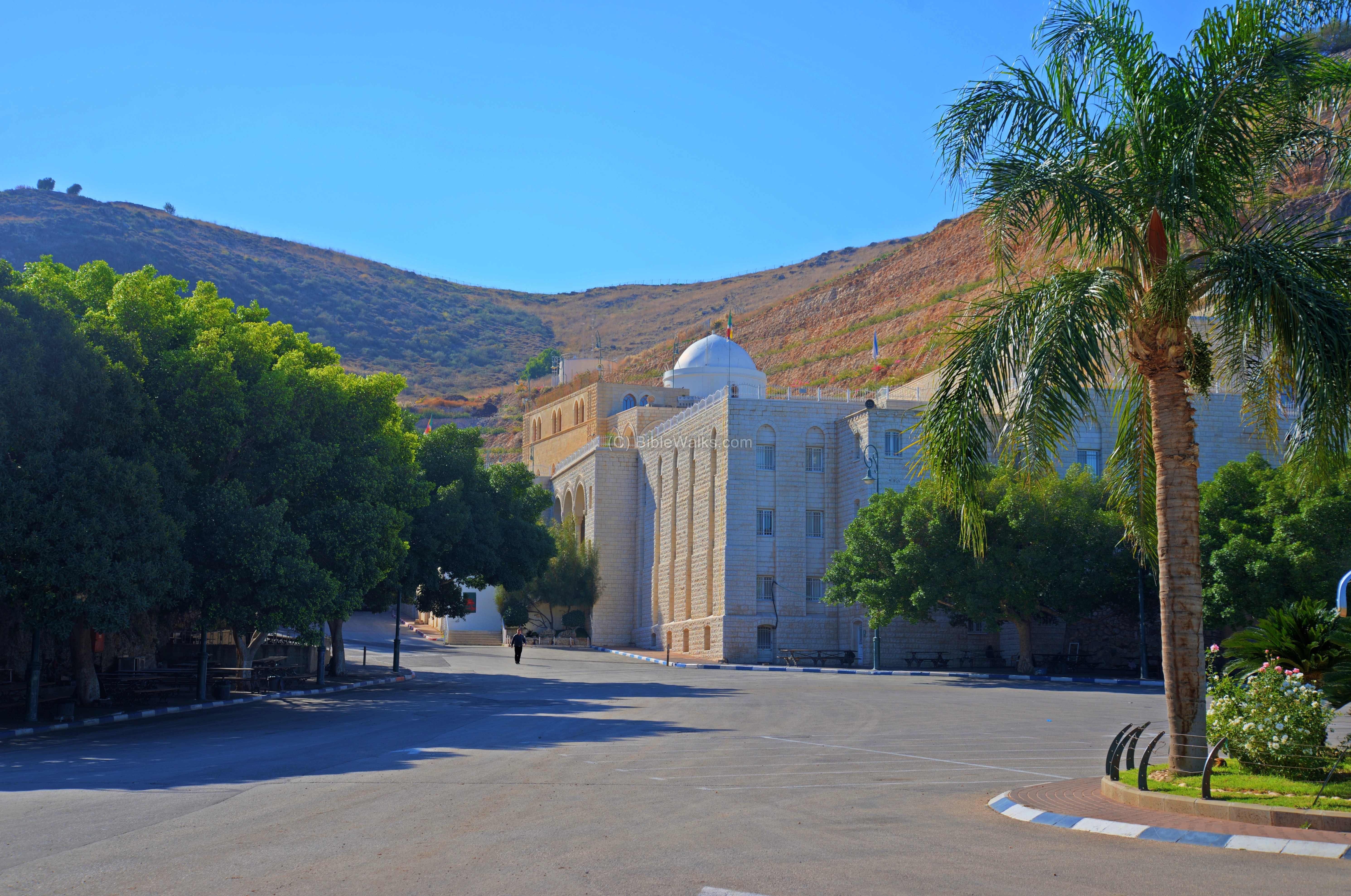
Shu’eb (Shuaib, Shu’yab) means in Arabic “who shows the right path”, referring to the Midianite prophet identified as Jethro. Shu’eb is mentioned 11 times in the Quran. Muslim tradition locates his tomb in Wady Shu’eb in Jordan, while the Druze have it here in the foothills of Hittin.
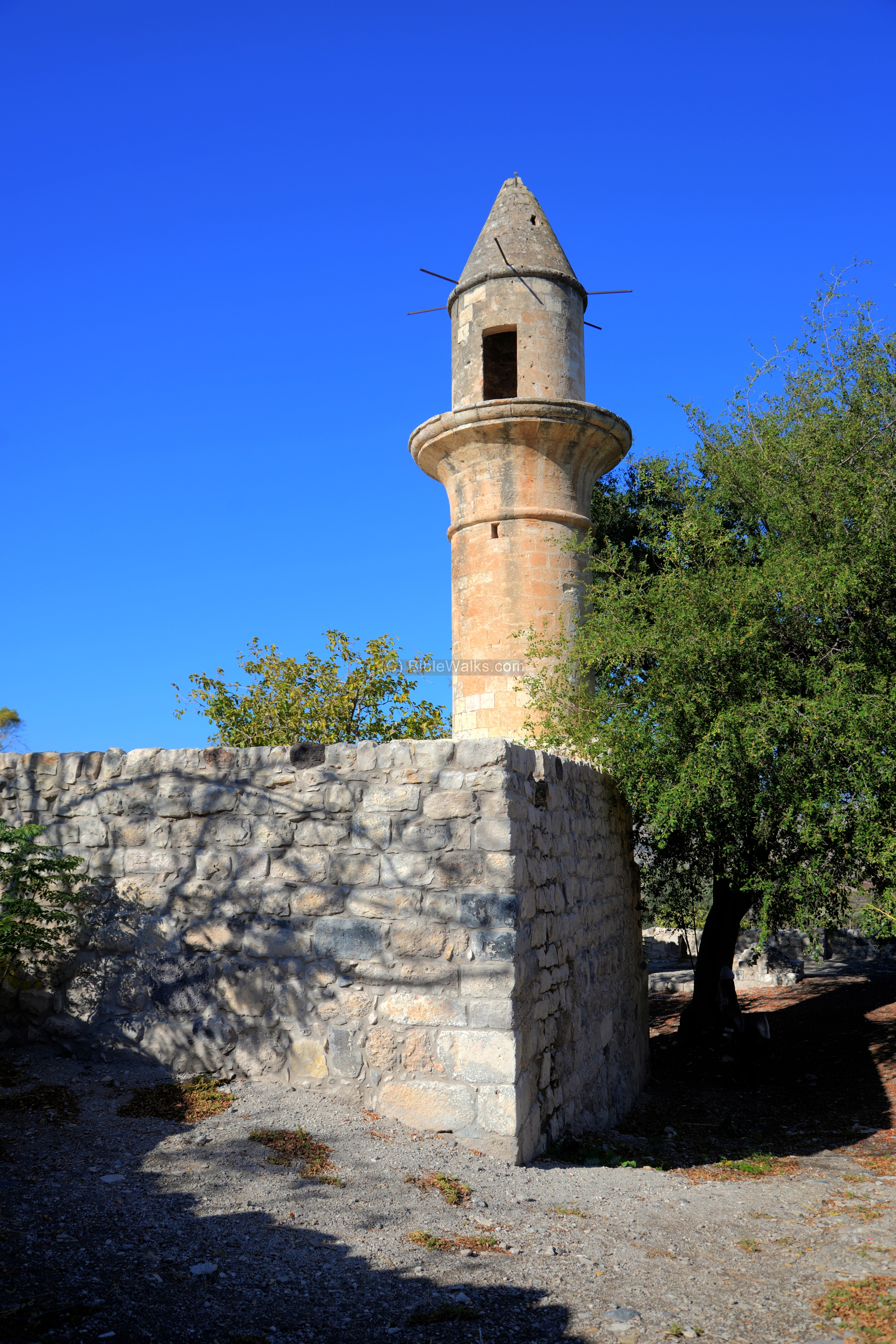
(i) Hittin:
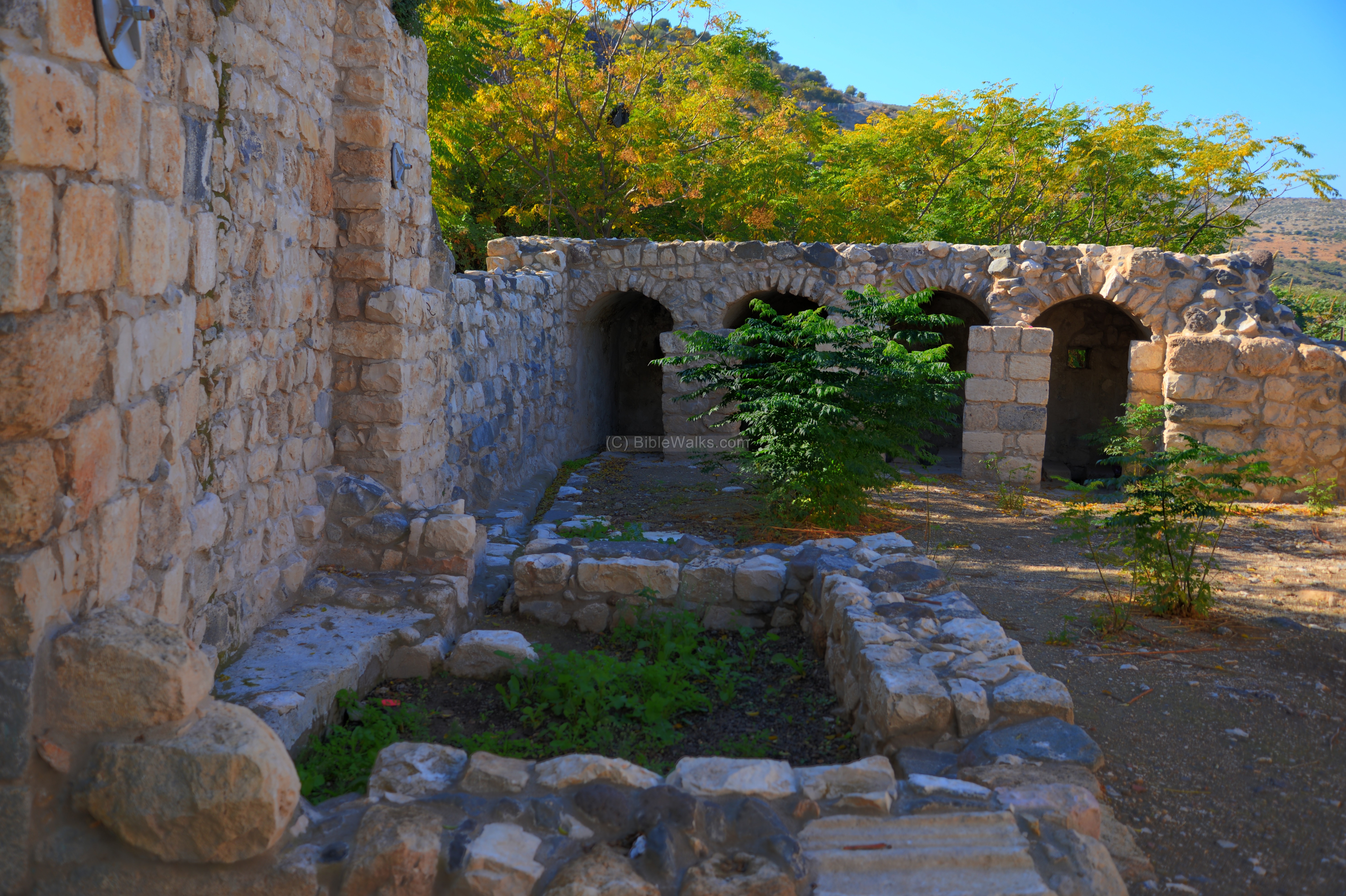
Near the spring are ruins of an Arab village of Hittin.
The village, destroyed in 1948, was built on top of the ruins of earlier period villages. According to scholars, it was known as the Canaanite city of Ziddim (Joshua 19: 32, 35): “The sixth lot came out to the children of Naphtali…And the fenced cities are Ziddim”. It was later renamed Kefar Hittim (“village of grain”) and in the Roman period was known as a Jewish village (Kefar Hittaya). The settlement was probably established by the Hasmoneans.
The ruins cover an area of 25 dunams, scattered along the stream originating from the Hittin spring.
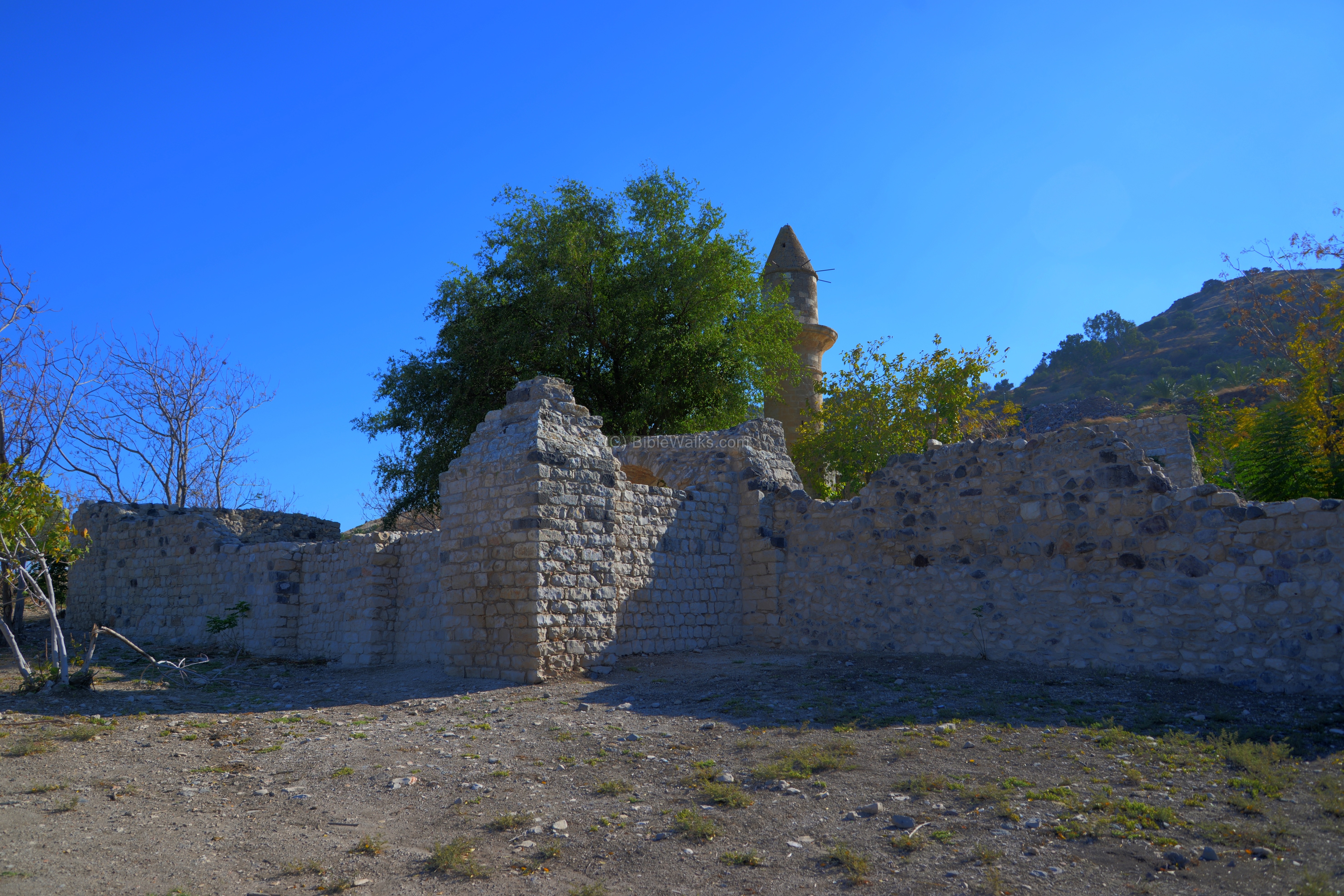
The mosque is the only complete structure that remained from the Arab village. The IAA conducted historic preservation works and the structure and its courtyard are clean and tidy.
The minaret tower has scars of bullet hits near the window, perhaps the remains of the 1948 Independence war.
Laurence Oliphant visited the site in 1884 and noted that the mosque was built over the ruins of a Byzantine church. According to the surveys, it is believed that the ruins were of the Synagogue.
The next photo shows the rear side of the mosque. The waters of the spring once filled up the pool inside the courtyard of the mosque. Behind the pool are public toilets.
(j) Nature:
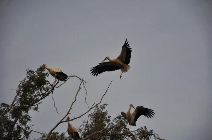
A flock of white storks were observed at the south-east side of the site. The area along the Jordan valley is a major route of migrating birds. They travel between eastern Europe (spring and summer) and central Africa (winter and fall). According to Zechariah, the stork is a high rising bird that swiftly moves between continents (5,9): “… and the wind was in their wings; for they had wings like the wings of a stork: and they lifted up … between the earth and the heaven”.
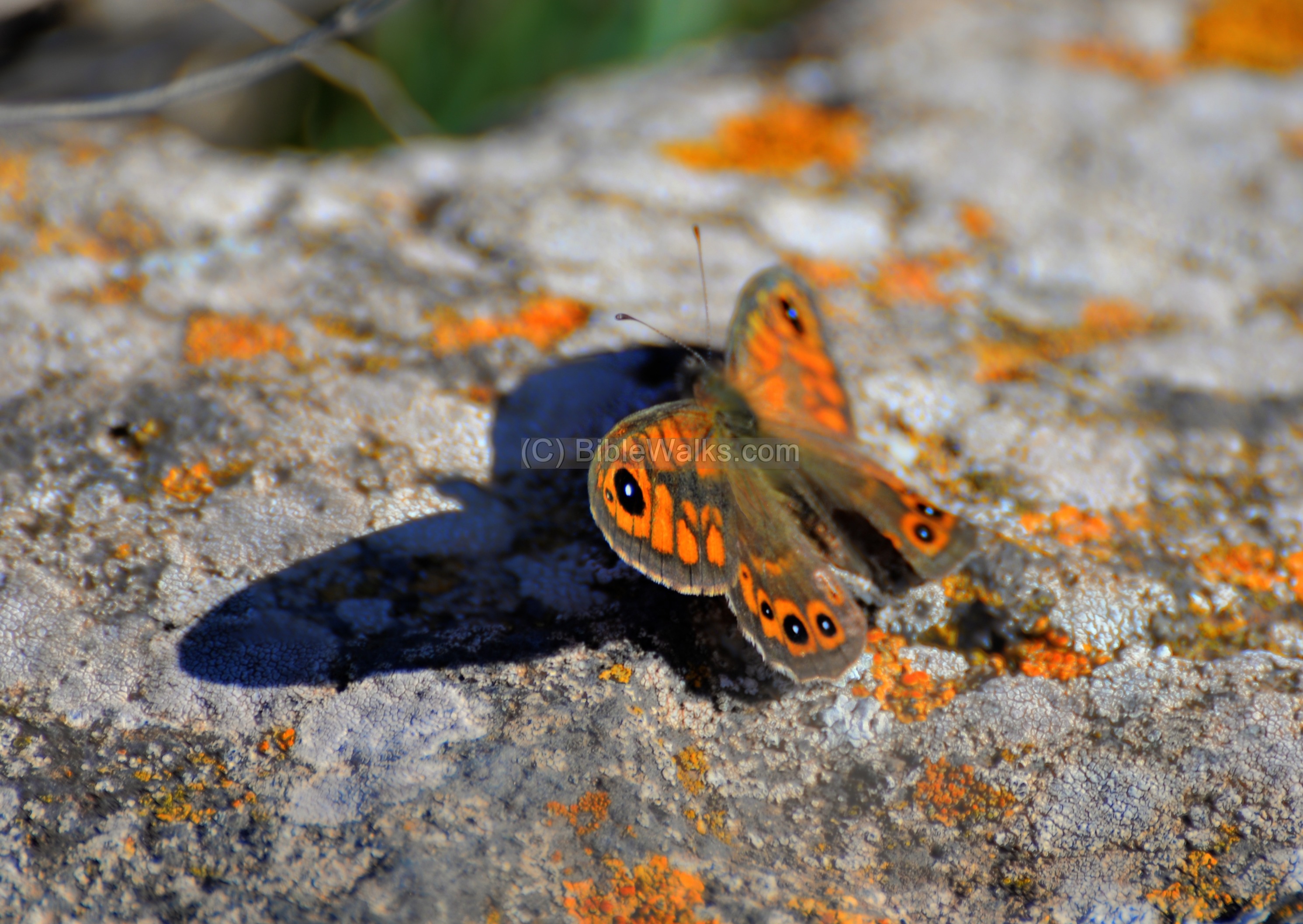
Butterflies were also captured during our visit to the site in December 2017. Notice how the colors of this butterfly fits the rusty colors of the rock. This butterfly type is Lasiommata Maera orientalis (Hebrew: Satirit Hiblit).
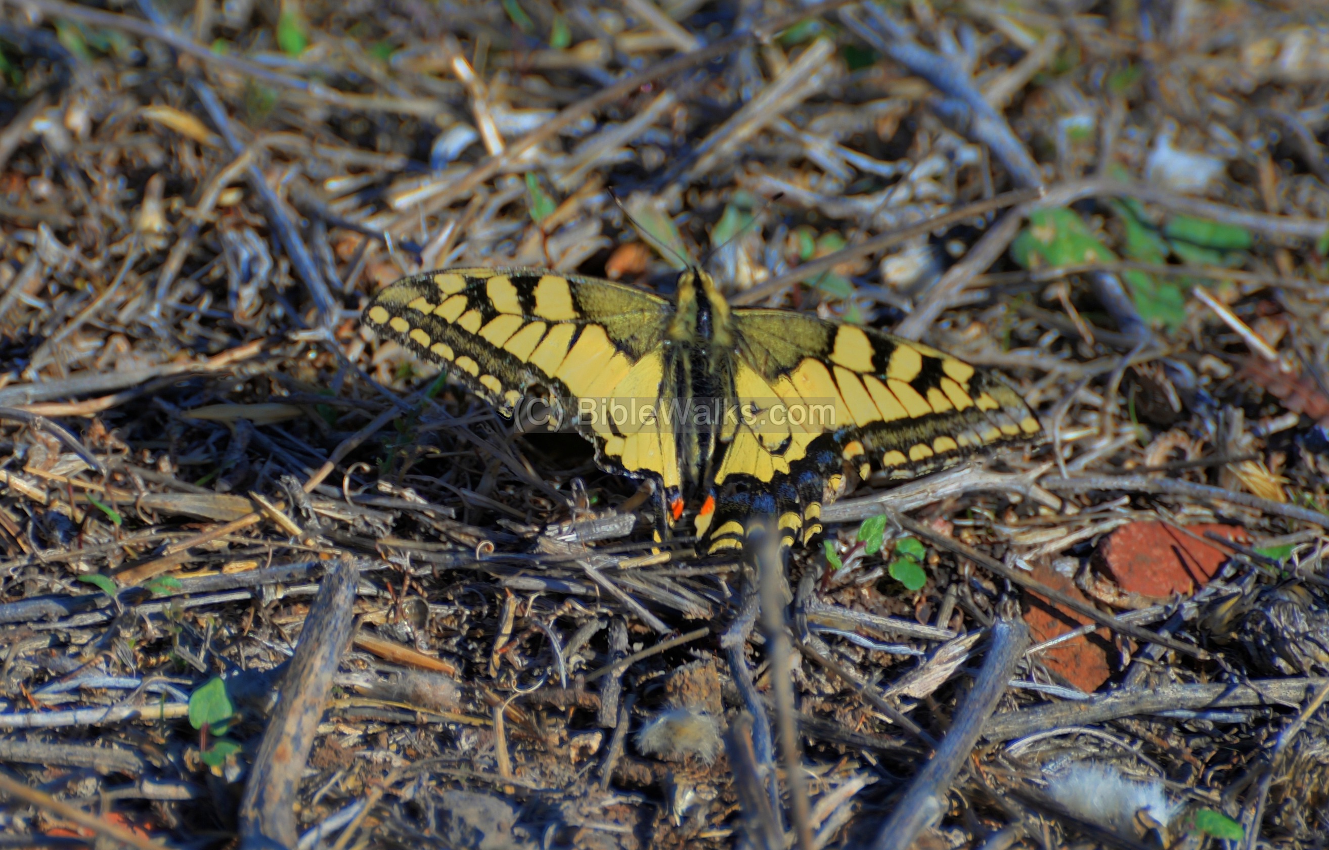
Another butterfly, which is common in most parts of the Holy Land (type: swallowtail, Latin: Papilio machaon, Hebrew: Znav Snunit Na’ah):
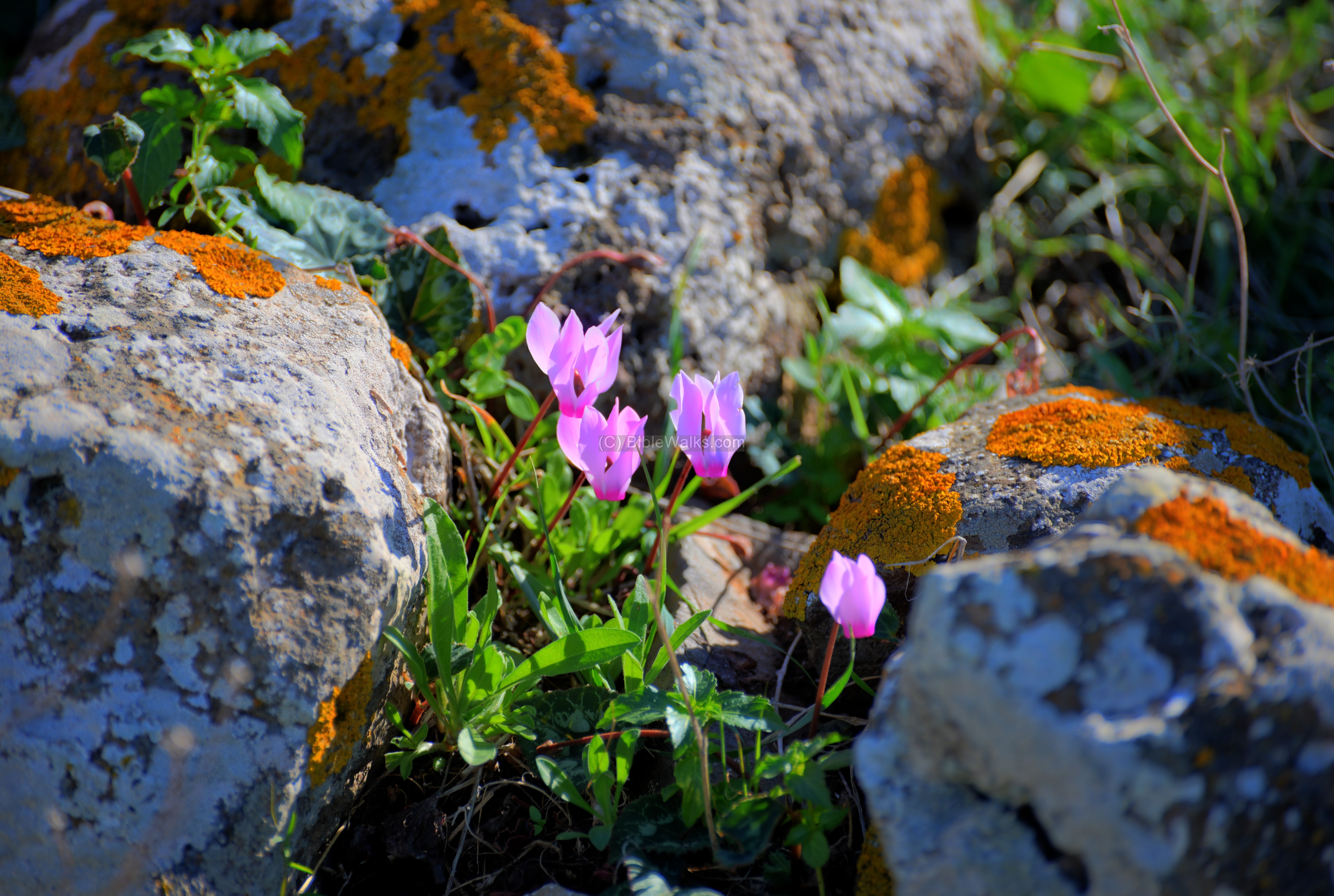
And some flowers to bright up the page: the gracious Cyclamen winter wild flowers (Hebrew: Rakefet) that peep up among the rocks.
Videos:
![]() This YouTube video shows a flight of a drone over the site, and a view of its surroundings.
This YouTube video shows a flight of a drone over the site, and a view of its surroundings.
A video tour of the site:
Biblical References:
(a) Joshua 11:1
This text lists Madon (“quarrel” in Hebrew) as one of the Canaanite cities that arranged forces against the Israelites. Madon was one of the candidates for the identification of Horns of Hattin, but this suggestion is less likely than the next one.
“And it came to pass, when Jabin king of Hazor had heard those things, that he sent to Jobab king of Madon, and to the king of Shimron, and to the king of Achshaph,”
(b) Joshua 11:5-9
Another suggestion is “Waters of Merom”, where Joshua beat the coalition Canaanites:
“And when all these kings were met together, they came and pitched together at the waters of Merom, to fight against Israel. And the LORD said unto Joshua, Be not afraid because of them: for to morrow about this time will I deliver them up all slain before Israel: thou shalt hough their horses, and burn their chariots with fire. So Joshua came, and all the people of war with him, against them by the waters of Merom suddenly; and they fell upon them. And the LORD delivered them into the hand of Israel, who smote them, and chased them unto great Zidon, and unto Misrephothmaim, and unto the valley of Mizpeh eastward; and they smote them, until they left them none remaining. And Joshua did unto them as the LORD bade him: he houghed their horses, and burnt their chariots with fire”.
(c) Joshua 19:32, 35, 36
This text describes the region of the Naphtali tribe, and the fenced city Adamah (earth in Hebrew) is another candidate for the city in the Horns of Hattin. This suggestion, by Y. Aharoni, is the preferred identification, and was also validated by the archaeological survey of the external walls on top of the hill, dating from the Israelite period (9th century BC).
“The sixth lot came out to the children of Naphtali, even for the children of Naphtali according to their families….
…
And the fenced cities are Ziddim, Zer, and Hammath, Rakkath, and Chinnereth,
And Adamah, and Ramah, and Hazor,”
(d) Exodus 3:1
Jethro’s tomb is according to the Druze tradition is located at the footsteps of the horns of Hattin:
“Now Moses kept the flock of Jethro his father in law, the priest of Midian: and he led the flock to the backside of the desert, and came to the mountain of God, even to Horeb”.
(e) Matthew 5: 1,2
This text describes the sermon on the mountain (chapters 5-7), believed by some Christians to be located at the Horns of Hattin:
“And seeing the multitudes, he went up into a mountain: and when he was set, his disciples came unto him:
And he opened his mouth, and taught them, saying, And he came down with them, and stood in the plain, and the company of his disciples, and a great multitude of people out of all Judaea and Jerusalem, and from the sea coast of Tyre and Sidon, which came to hear him, and to be healed of their diseases”;
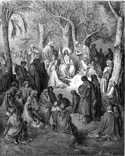
Sermon on the mountain – by Gustav Dore (French artist, 1832-1883)
(f) Luke 6:17-20 ; Luke 7:1
This is another text on Jesus sermon before the multitude, believed to be at the horns of Hattin by some traditions:
“And they that were vexed with unclean spirits: and they were healed. And the whole multitude sought to touch him: for there went virtue out of him, and healed them all. And he lifted up his eyes on his disciples, and said, Blessed be ye poor: for yours is the kingdom of God”.
However, the next chapter reads: “Now when he had ended all his sayings in the audience of the people, he entered into Capernaum.” Thus, the mountain is located near Capernaum as believed by most Christians (on Mt Beatitudes).
References:
- Laurence Oliphant “Haifa, or Life in Modern Palestine”
His article was published on May 27, 1884, with the title “Religious Druze Festival”, where he tells his readers about his visit to the footsteps of the horns of Hattin, where the holy Druze tomb (Nebi Shu’eb) is located.
- Uzi Leibner – Settlement and History in Hellenistic, Roman and Byzantine Galilee – an Archaeological survey of Eastern Galilee. [2009, M S Tübingen]
- The Tale of a ‘Tailing Pile’: The role of a Palaeolithic flint extraction and reduction site in the Frankish defeat in the Battle of Hattin, 1187 (Rafael Y. Lewis , Rona S. Avissar Lewis & Meir Finkel ; Oct 2020)
Etymology (behind the name):
Horns of Hattin – in Hebrew the name of the hill is “Karnei Khittin”, or the horns of the wheat, since in Hebrew these words mean Karnei = Horns, Hittin = wheat.
This name was derived from the fact the the fields under the hill were used (and still are) to grow wheat, and the hill has two peaks (looks like bull’s horns). Since the population of Biblical Israel were mostly farmers, the places are normally called after agriculture terms.
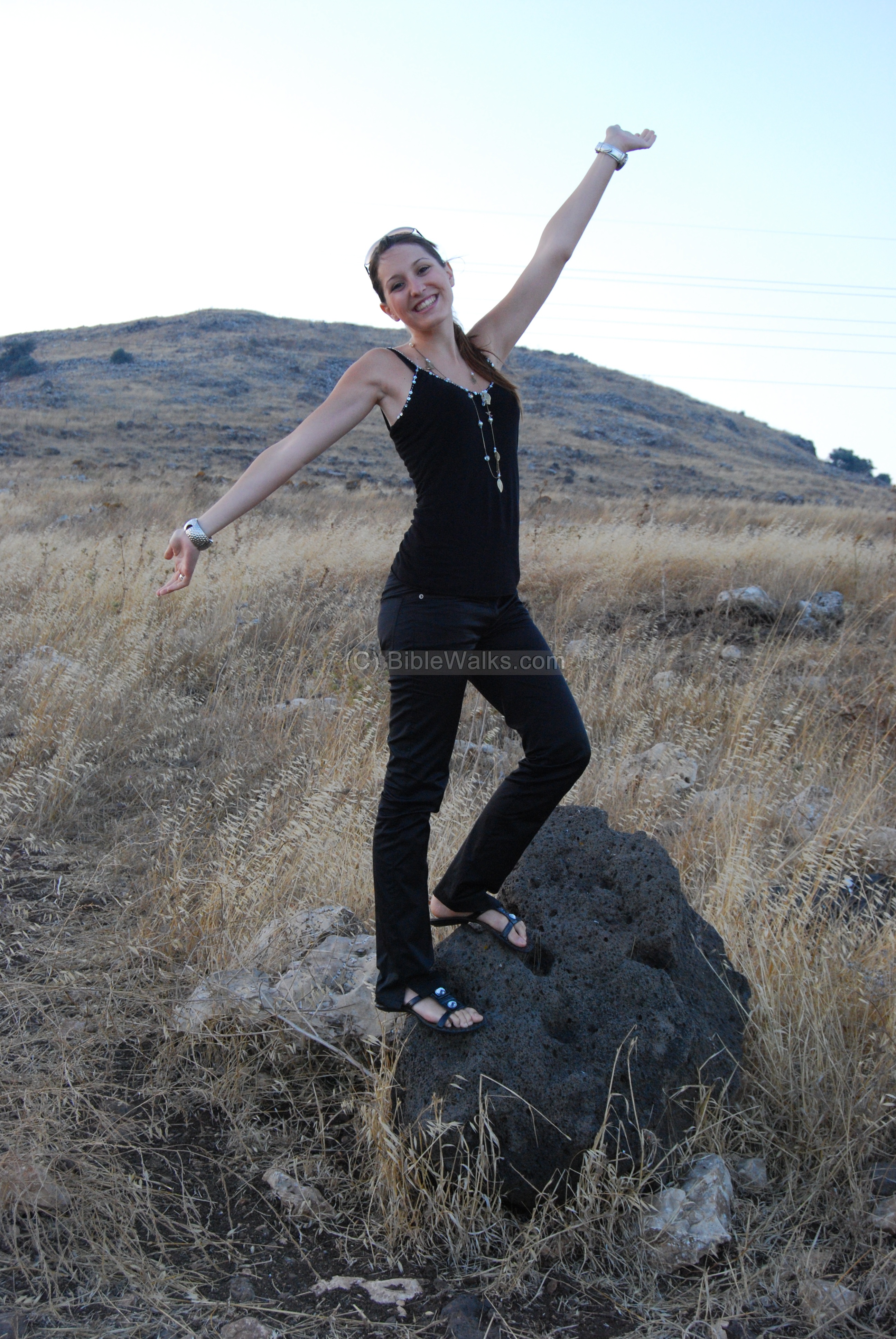
Webmaster Rotem posing before the horns of Hattin,
seen from the south (photo taken in 2007)
Links:
- Beatitudes – the traditional site of the sermon
- Biblical pictures by Gustave Doré (1832-1883) – public domain
* Nearby sites:
- Kh. Kankuza – ritual structure and walled settlment – 1KM east
- Tel Adami – Canaanite/Israelite city – 5KM south
BibleWalks.com – walk with us through the sites of the Holy Land
Rakkath<<<–previous Sea of Galilee site—<<<All Sites>>> —-next site –>>>Kankuza
This page was last updated on July 2, 2026 (misc update)
Sponsored links: