Tel Hazor is one of the largest, most important biblical sites in the Canaanite and Israelite periods. The Bible gave it the title: “the head of all those kingdoms”.

* Site of the month Sep 2018 *
Home > Sites > Upper Galilee > Tel Hazor (Hatsor)
Contents:
Background
Location
Structure
History
Photos
* Solomon’s Gate
* Canaanite
* Water works
* North city
* Citadel
* South side
* North side
* Reconstruction
* Lower city
* Aerial video
Biblical
Links
Etymology
Background:
Tel Hazor is an archaeological site located in northern Israel, about 10 kilometers north of the Sea of Galilee. It is believed to have been one of the largest and most important cities in the region during the Bronze Age and Iron Age. The bible gave it the title: “the head of all those kingdoms”. Joshua 11:10: “And Joshua at that time turned back, and took Hazor, … for Hazor beforetime was the head of all those kingdoms.”
The site consists of a tell, or mound, that covers an area of over 200 acres. Archaeological excavations have revealed evidence of settlements at Tel Hazor dating back to the third millennium BCE. It is thought that the city was destroyed and rebuilt several times over the centuries.
During the Late Bronze Age (ca. 1550-1200 BC), Tel Hazor became a major center of trade and culture in the region. It was likely the capital of the powerful Canaanite kingdom of Hazor, which controlled much of northern Israel at the time. The city was destroyed by fire around 1200 BC, possibly as a result of an invasion by the Israelites.
After a period of abandonment, Tel Hazor was rebuilt during the Iron Age (ca. 1200-586 BC). It continued to be an important city during this period, and was mentioned in several ancient texts, including the Bible. The city was again destroyed, this time by the Babylonians in the 6th century BC, and was not rebuilt.
Today, Tel Hazor is a UNESCO World Heritage site (since 2005) and an important archaeological site in Israel. Excavations are ongoing, and the site is open to the public for visits and tours. Indeed, the travel to the excavated site is an exciting experience, bringing you back 3-4 thousands years to the times this mighty city was the gateway between Egypt and Mesopotamia.
Location:
Tel Hazor is located on the east of the northern part of Israel, the upper Galilee. Its prime location on the main ancient road through Syria to Babylon, made it an important city. This road bypassed the impossible way through the desert, and was an important link between the two strong empires of the ancient world: Egypt on the south, and Mesopotamia (Babylon, Assyria, Persia) on the north.
The ancient city was located at a strategic location near the two major routes: north-south Via Maris (“Way of the Sea”) and North Eastern pass over the Jordan river. The Biblical map below shows the location of the site and the major roads and cities during the ancient times.
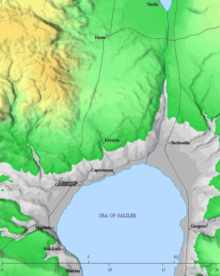
Roads and cities during the Israelite period thru the Hasmonean period, 12th- 1st century BC (based on Bible Mapper 3.0)
You can reach the site, a national park, by driving north from Rosh-Pina (Highway #90). The museum that hosts most of the archaeological findings is located in another location: in the nearby Kibbutz, Ayyelet Ha-shachar, 0.5KM north to the park’s entrance. Additional findings are displayed in the Israel Museum in Jerusalem.
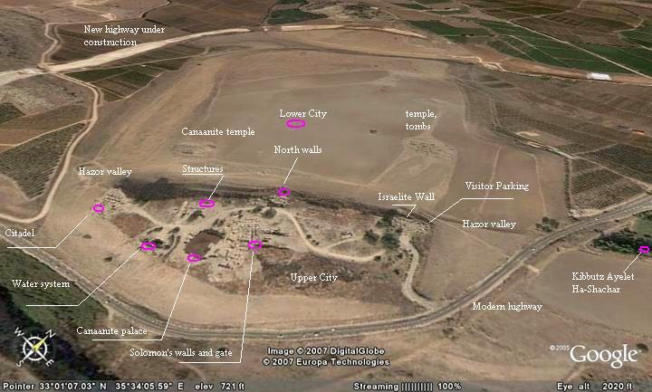
An aerial map of Tel Hazor is shown below (indicating the major points of interest). This view is from the south. In the center is the upper city, and the section above it is the lower city across the Hazor valley which crosses the cities. The old highway bypasses the Tel from the south, while a new highway is built that bypasses the Tel from the west and north.
Structure:
Tel Hazor is a tale of two cities:
-
Upper city – 40M above the south side of the valley. The size of the upper city is 100 Dunam (10 Hectares), and is protected by massive walls. This is the major part of the city, with the palaces and temples. Only this section is opened to the public, but there is a great view down to the lower city.
-
Lower city – the larger city is located on the north side of valley Hazor. Its size is huge: 700 Dunam (70 Hectares). It is protected by a large rampart.
History:
| 32-22 century BC | Early settlement in the upper city (Early Bronze period) | |
| 18th century BC | The city was established in both upper & lower cities; referenced in Egyptian texts | |
| 18th century BC | mentioned in texts in Mari (Euphrates river, Mesopotamia) | |
| 15th century BC | Mentioned in the Amarna letters , a 14th century BC Egyptian archive of clay tablets: a correspondence between Hazor’s king and the pharaoh.
Mentioned in several other Egyptian military campaigns in 15-14 century BC. |
|
| end 13th century BC | City was destroyed, as found in excavations.
After then the upper city was rebuilt, but the lower city was not settled again after the 13th century BC. |
|
| 11xx BC | A battle (Judges 4) led by Sisera, Jabin’s general, against Judge Deborah and Barak Ben Avinoam, is won by the Israelites near Mount Tabor and Jezreel Valley. | |
| 11xx BC | Mei-Merom battle (Joshua 11: 13); Canaanite coalition led by Hazor’s King Jabin is defeated to Israelites; Hazor is burnt (as per the Bible, apparently verified in excavations) | |
| 12-10 century BC | Upper city is resettled by Israelites. | |
| 968-928 BC | New gate and walls built by the Israelites (King Solomon) – written in the bible, verified in excavations. Only the upper city was resettled. | |
| 9th century BC | King Ahab expands the city, digs the water system, adds citadel, storehouses and public buildings. | |
| 885 BC | Syria’s Ben-Hadad intrusion along the North Jordan valley (1 Kings 15 20); damages to Hazor | |
| 841 BC | Intrusion of Shalmaneser III marks first Assyrian expedition; damages to Hazor | |
| 815-810 BC | Intrusion of Syria’s Hazael (2 Kings 8:12, 10:32-33, 12:18-19, 13:3+7; Amos 1:3); Hazor damaged. | |
| 734-732 BC | Intrusion Tiglath-Pileser III (Kings II 15: 29; verified by excavations). Hazor is totally destroyed | |
| 7th century-2nd century BC | small settlement on western citadel; after then the Tel is abandoned | |
| Modern times | Archaeological Excavations (1875,1928, 1955-8, 1968-9, 1990+) |
- Note: some of the dates are based on Carta’s Atlas of the Bible – Y. Aharoni [Carta Jerusalem 1974]
Photos
The photos are arranged in the following order: (a) Solomon’s Gate and walls, (b) Canaanite palace, (c) Water works, (d) North city walls, (e) Israelite west Citadel, (f) reconstructed structures and (g) the lower city.
(a) Solomon’s Gate and Walls
The following photo shows the reconstructed gate from King Solomon’s period, the 10th century BC.
Click on the photos to view in higher resolution…

The gate is symmetric on both sides of the entrance, and is composed of two towers, three rooms within each tower, and two bastions projecting on both side.
An aerial view of the gate is in the following photo, captured from the west side.
This style is similar to the gates in Megiddo and Gezer, and proves the Biblical text that Solomon built these three major cities (as per 1 Kings 9).
The following photo shows the eastern walls from King Solomon’s period (10th century BC) on the south side of the gate. It is a double wall “casemate” type, which extends north and south to the gate, and actually around the whole walled city.
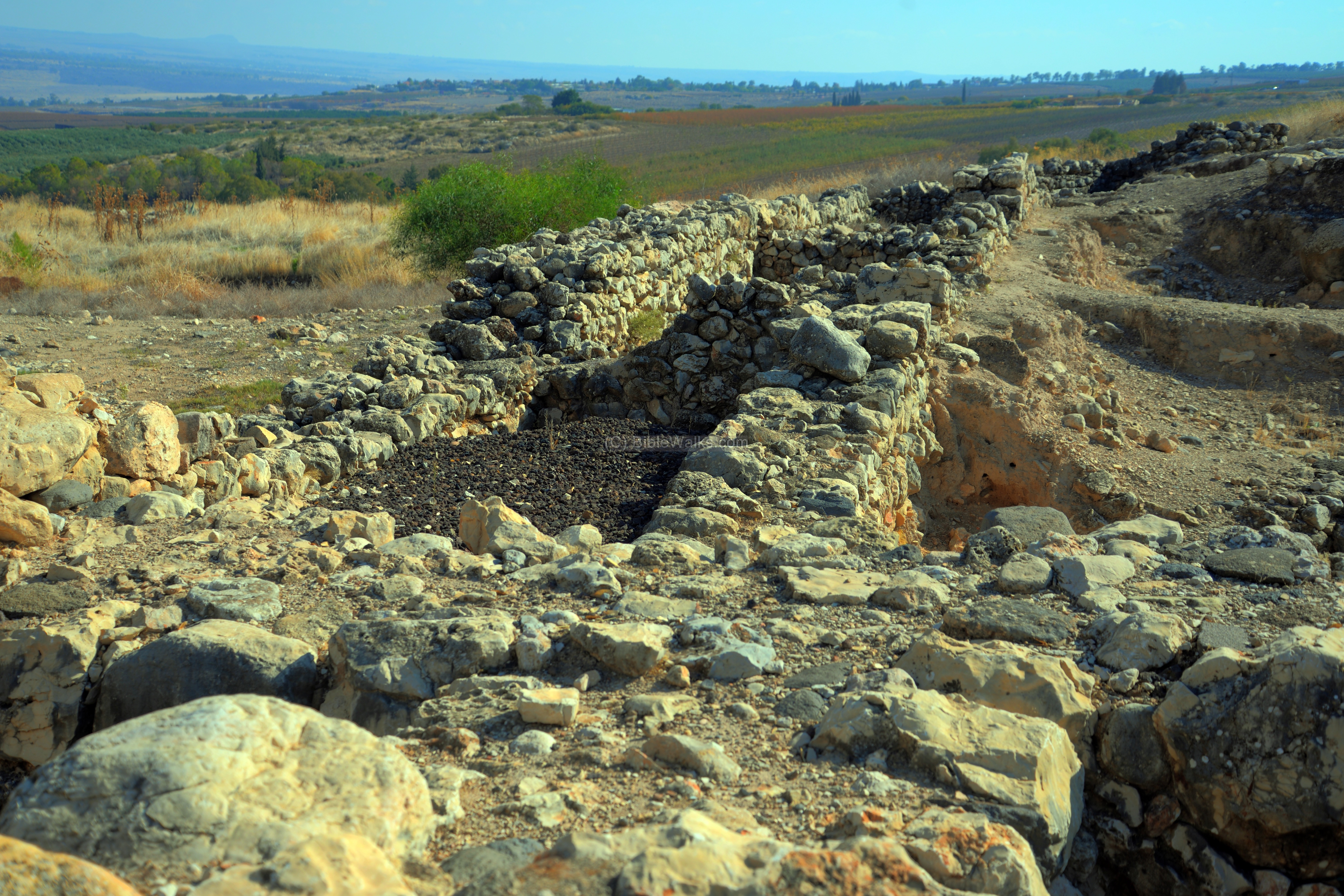
A smaller section of the casemate wall is seen also on the north side of the gate.

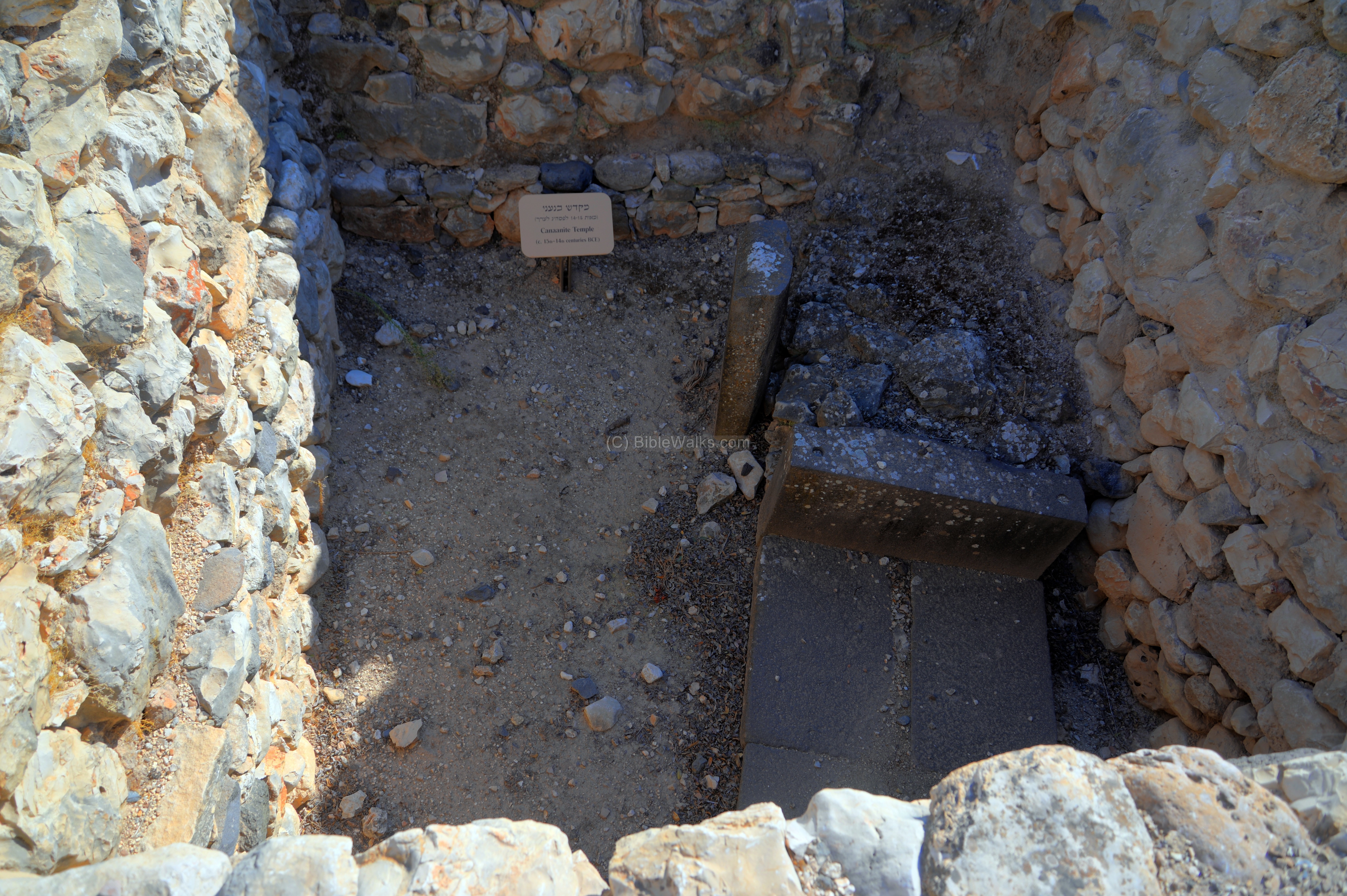
An earlier layer, from the Late Bronze I age (Canaanite period, 15-14th century BC), is seen on the left side of the wall, at a 20 degrees orientation difference than the later layer. In this layer was a Canaanite temple, with a staircase that led to the sacred area.
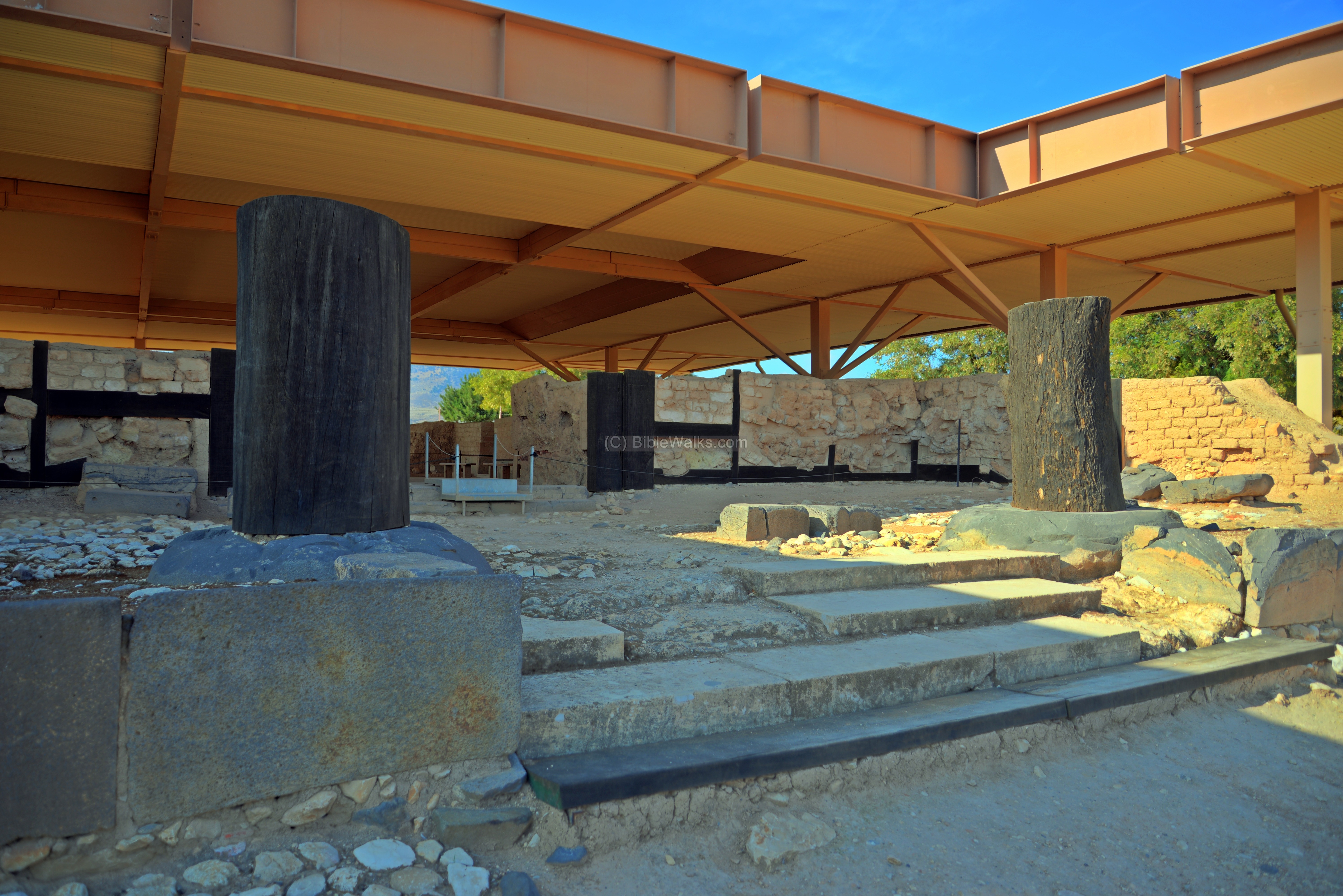
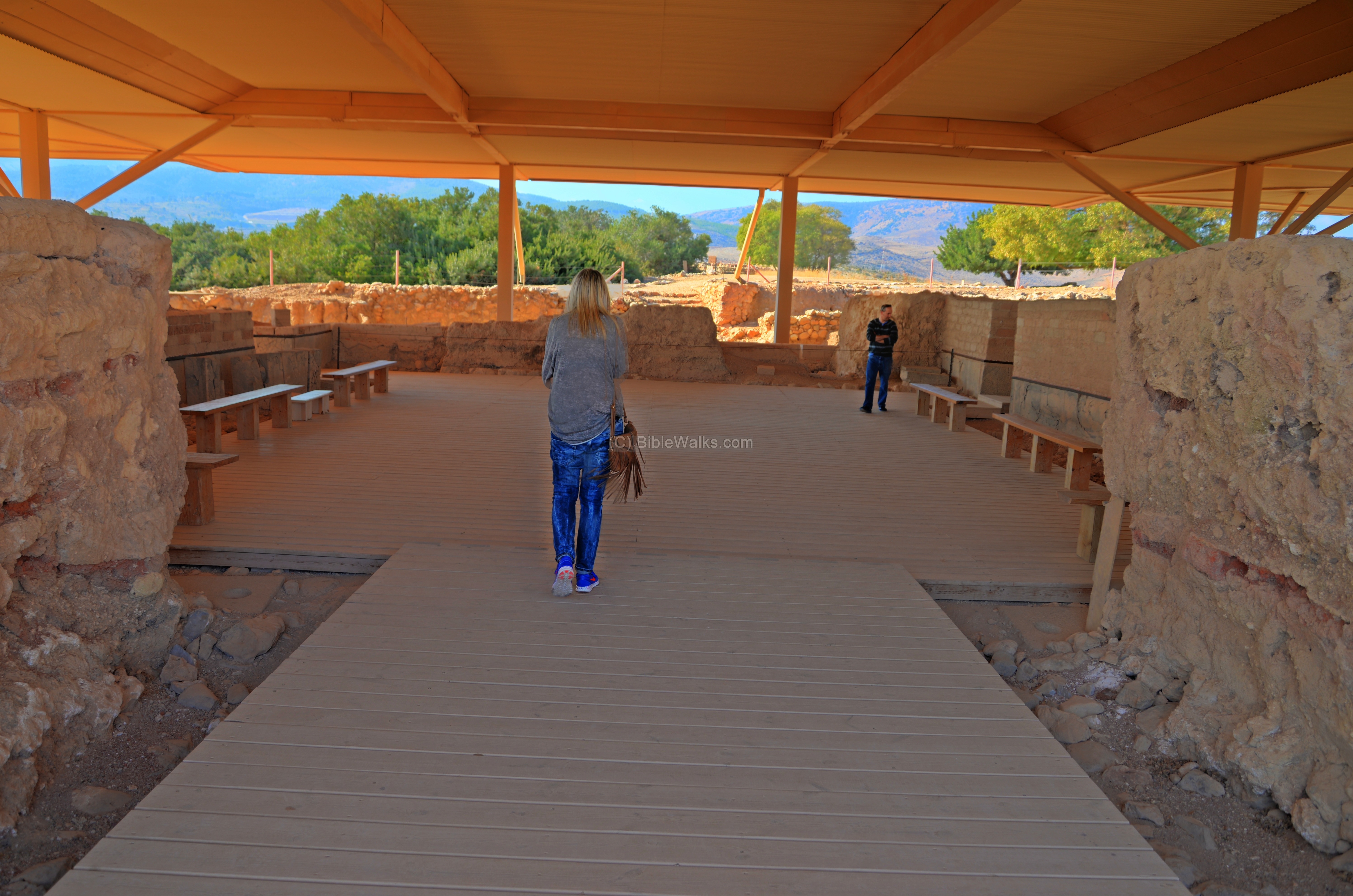
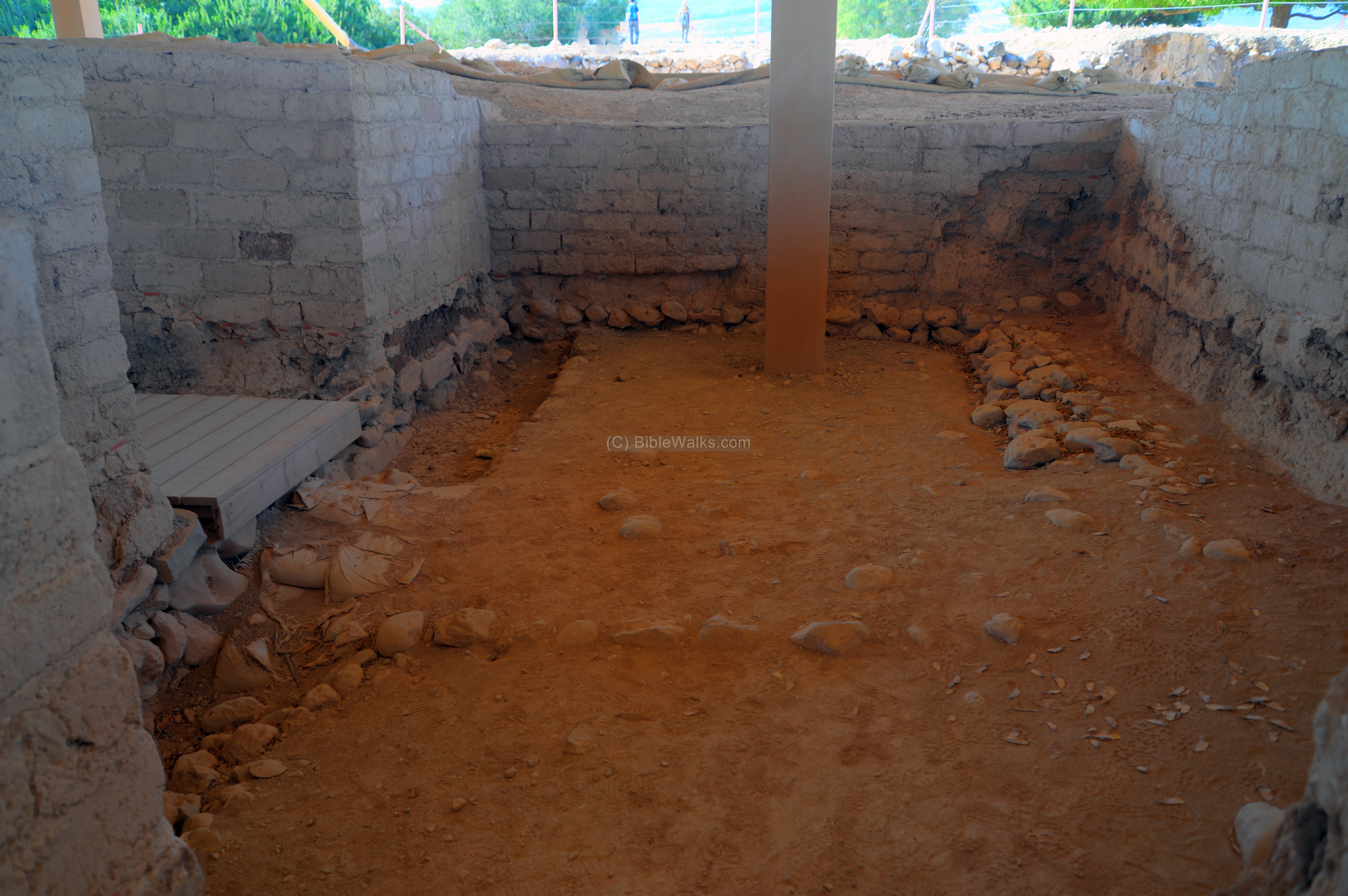
(b) Canaanite Palace
A royal palace from the Canaanite period – Late Bronze Age II (14-13th century BC) is located west to the gate. A roof was built over the structure to protect it.
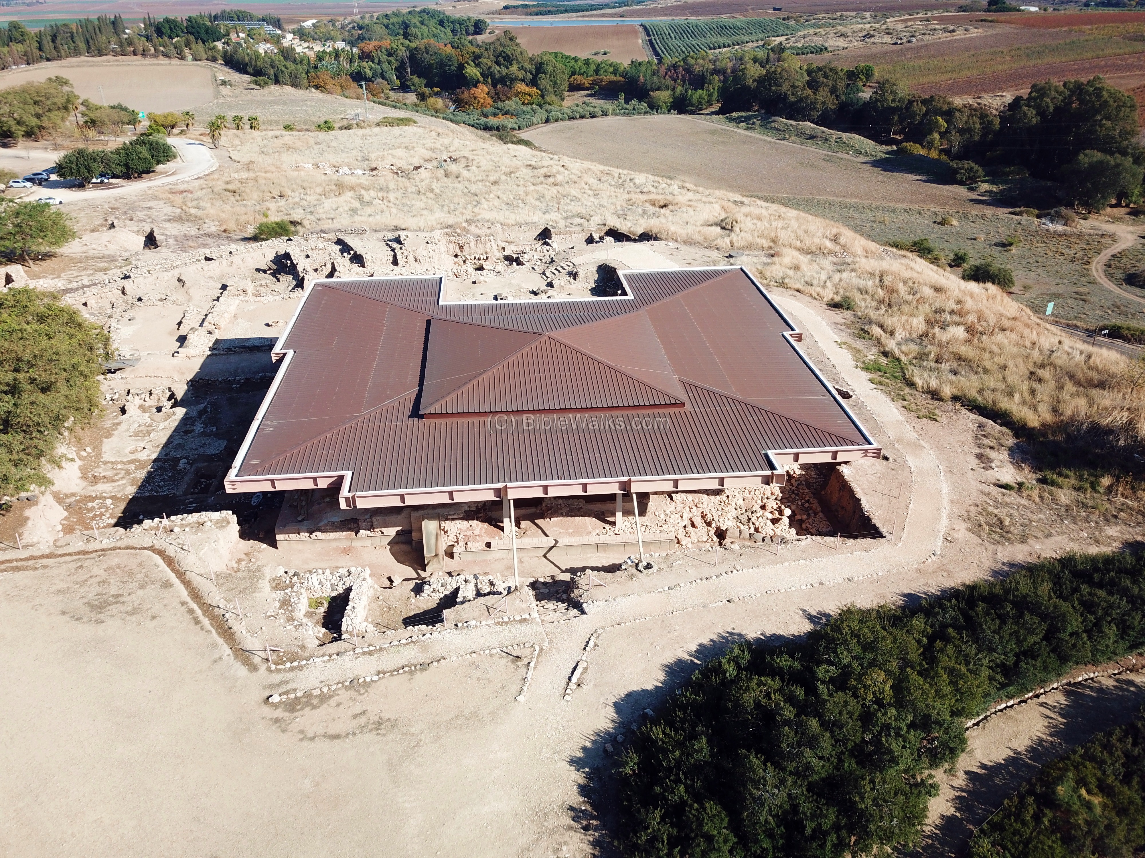
In front of the structure, on the east side, is a large courtyard with a platform.
The palace was burnt down, perhaps by the Israelites led by Joshua (as per Joshua 11:11) “…and he burnt Hazor with fire”.
The palace was built with mud bricks, lined with huge black basalt sliced stones as a base, as can be seen in the photo below.

Around the main throne room were rooms on three sides. The excavators found several clay tablets, stone and bronze statues.
A view from the west side:
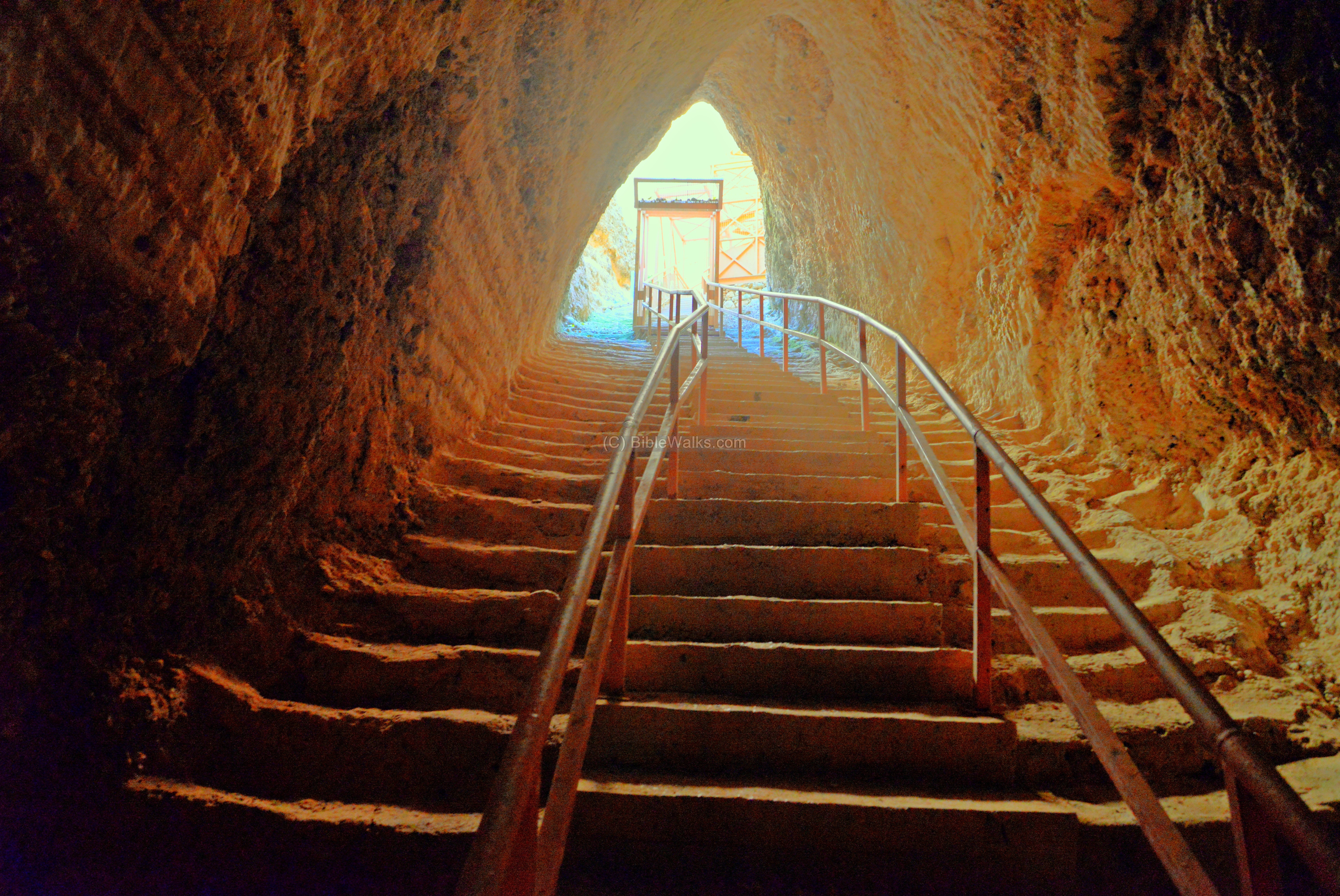
(c) Israelite water system
A huge system to supply fresh water is located in the south west side of the upper city. This system was built in the 9th century BC, during the time of King Ahab. It was designed after similar inner-city water systems, such as in Tel Megiddo, Gezer, Lachish, and possibly the “conduit” (“gutter”) the King David captured in Jerusalem (2 Samuel 5:8).
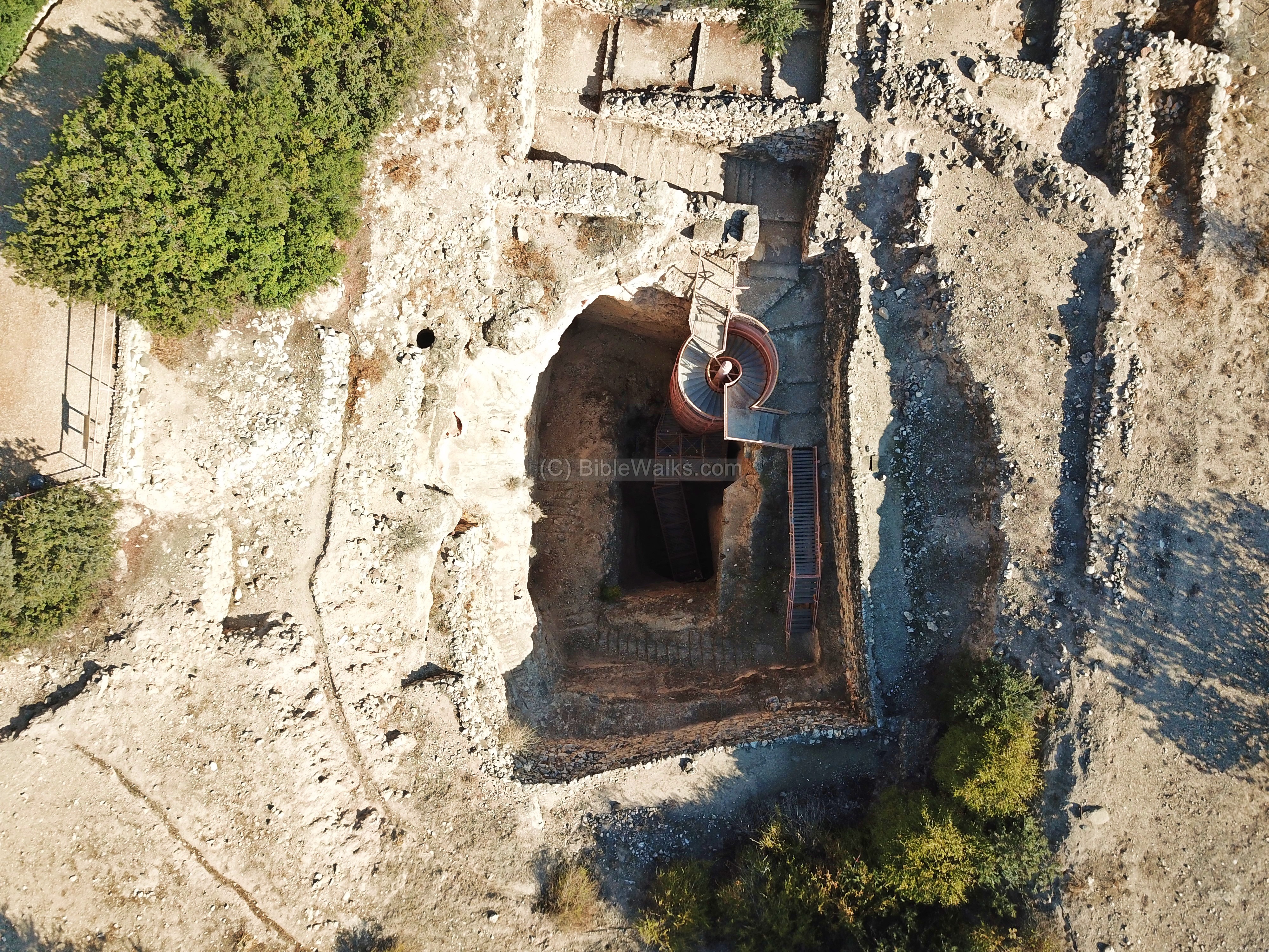
The builders dug into the ground, going through earlier Iron age levels, and supporting the dig with large walls. They dug down 46M deep in a square vertical shaft – until reaching bedrock.
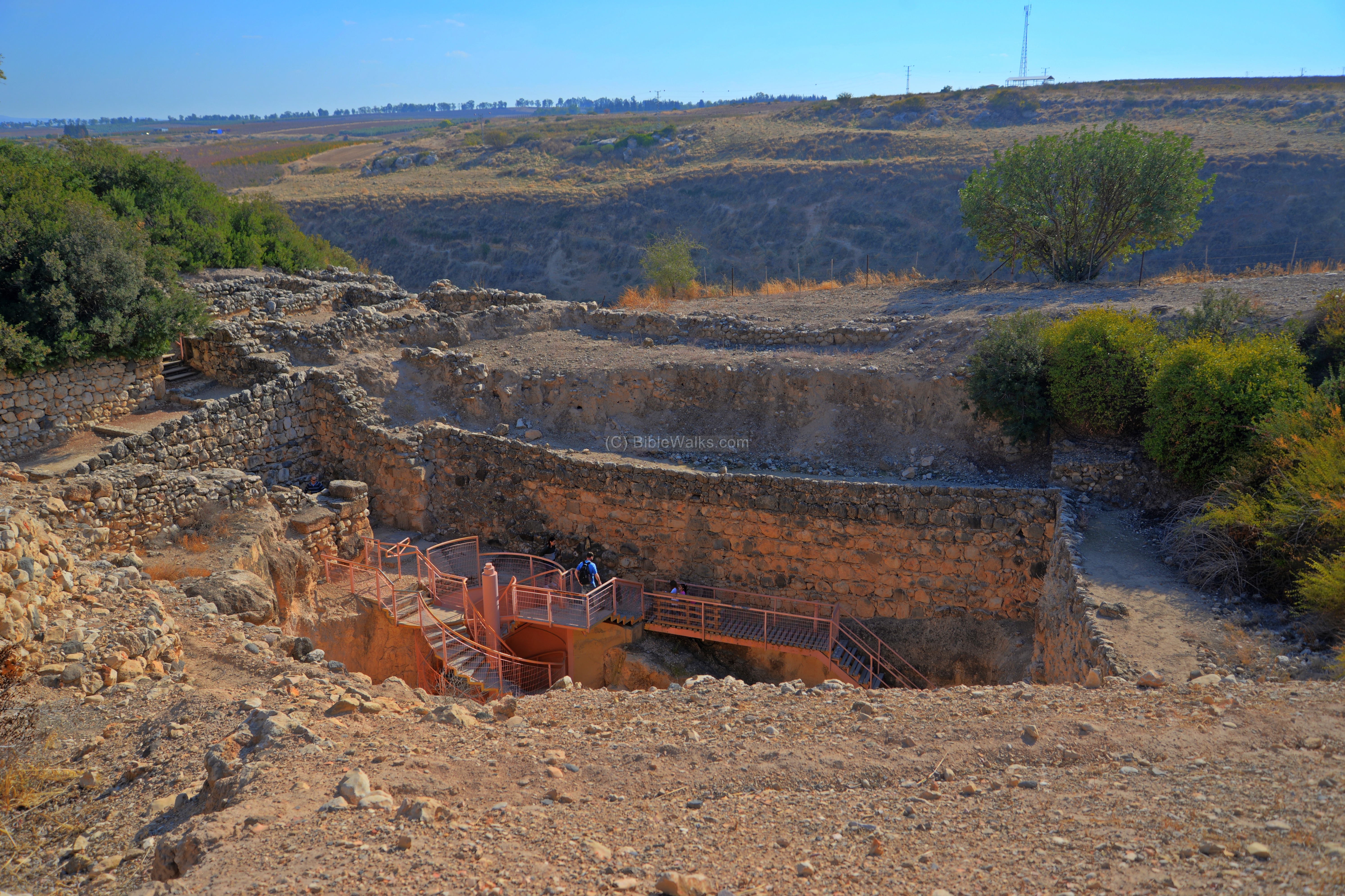
There are a total of 123 wide steps that enabled access to the water at the bottom. The steps were covered with rough chalky plaster. A drain is located at the left side to prevent slippage, and to drain the water.

The site was excavated in 1968, and since the whole cavity was filled with debris, this required great efforts and funding to clean out the soil.
A modern steel structure was built for the modern visitors. The way down is easy, but climbing up is a challenge – although worth the experience.
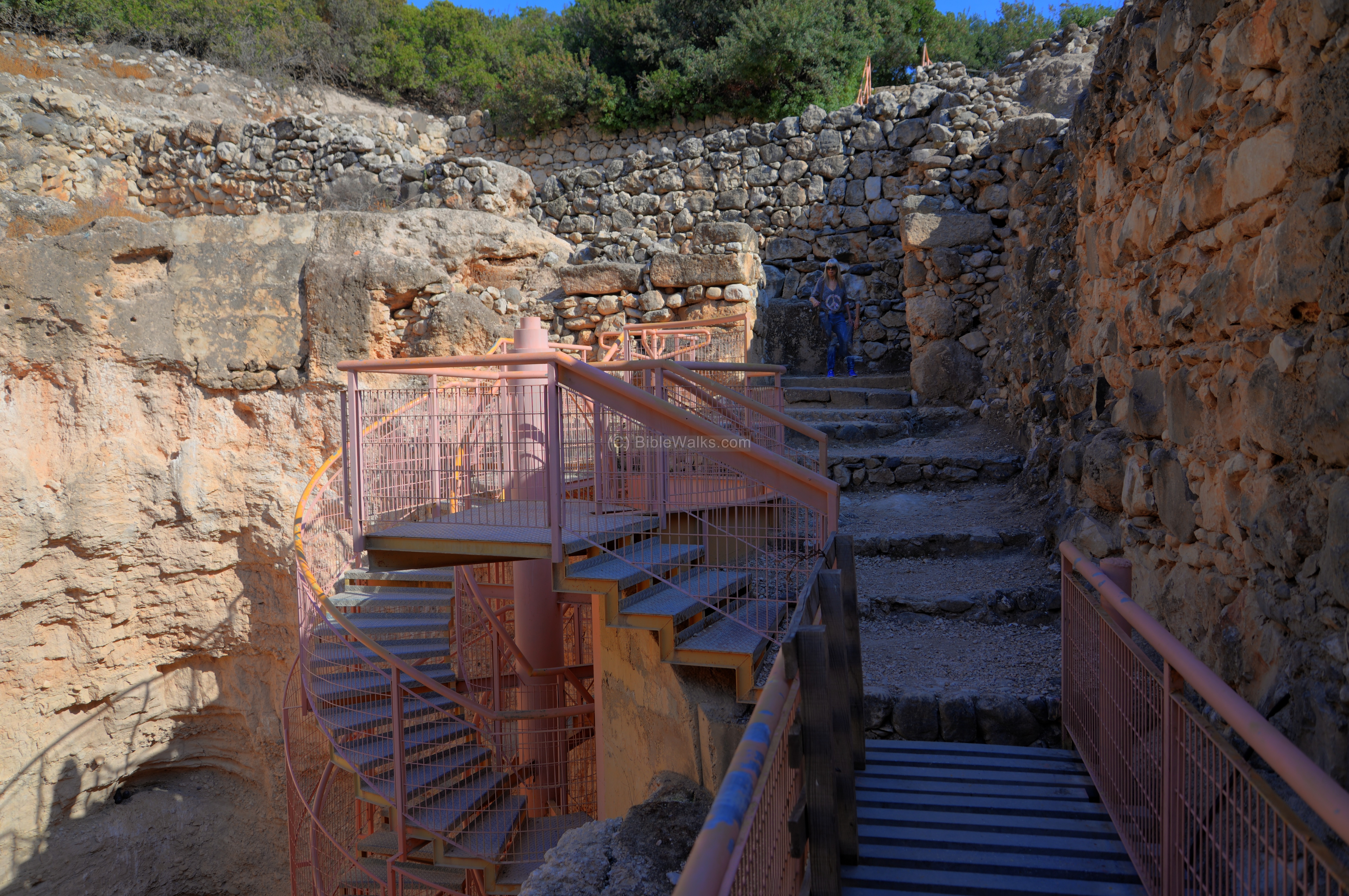
At the edge of the shaft is a tunnel that was cut into the rock, and leads to the water pool.
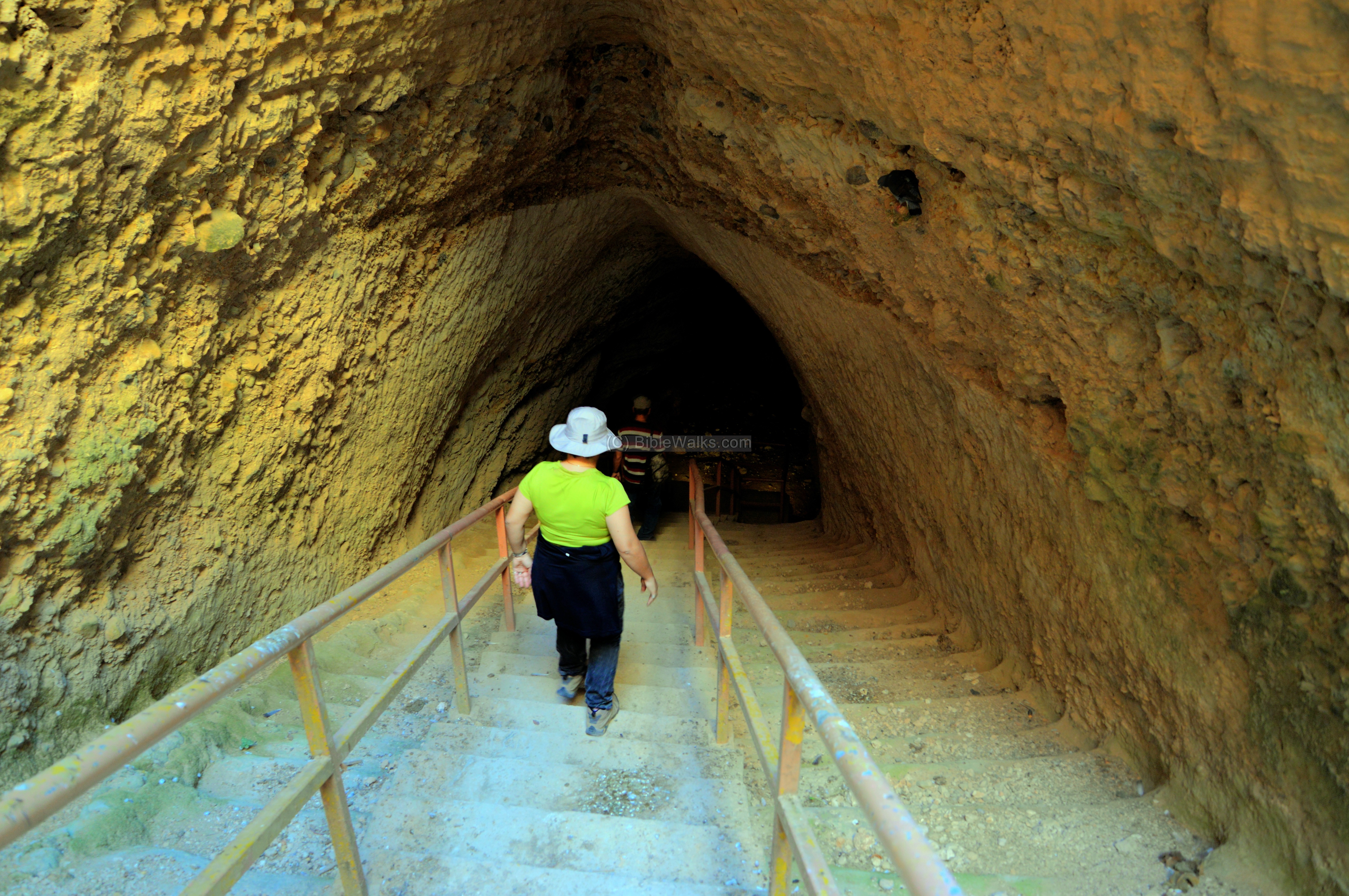
The water was precious at a time of siege, and enabled the defenders to continue living without access to the water wells in the valley.
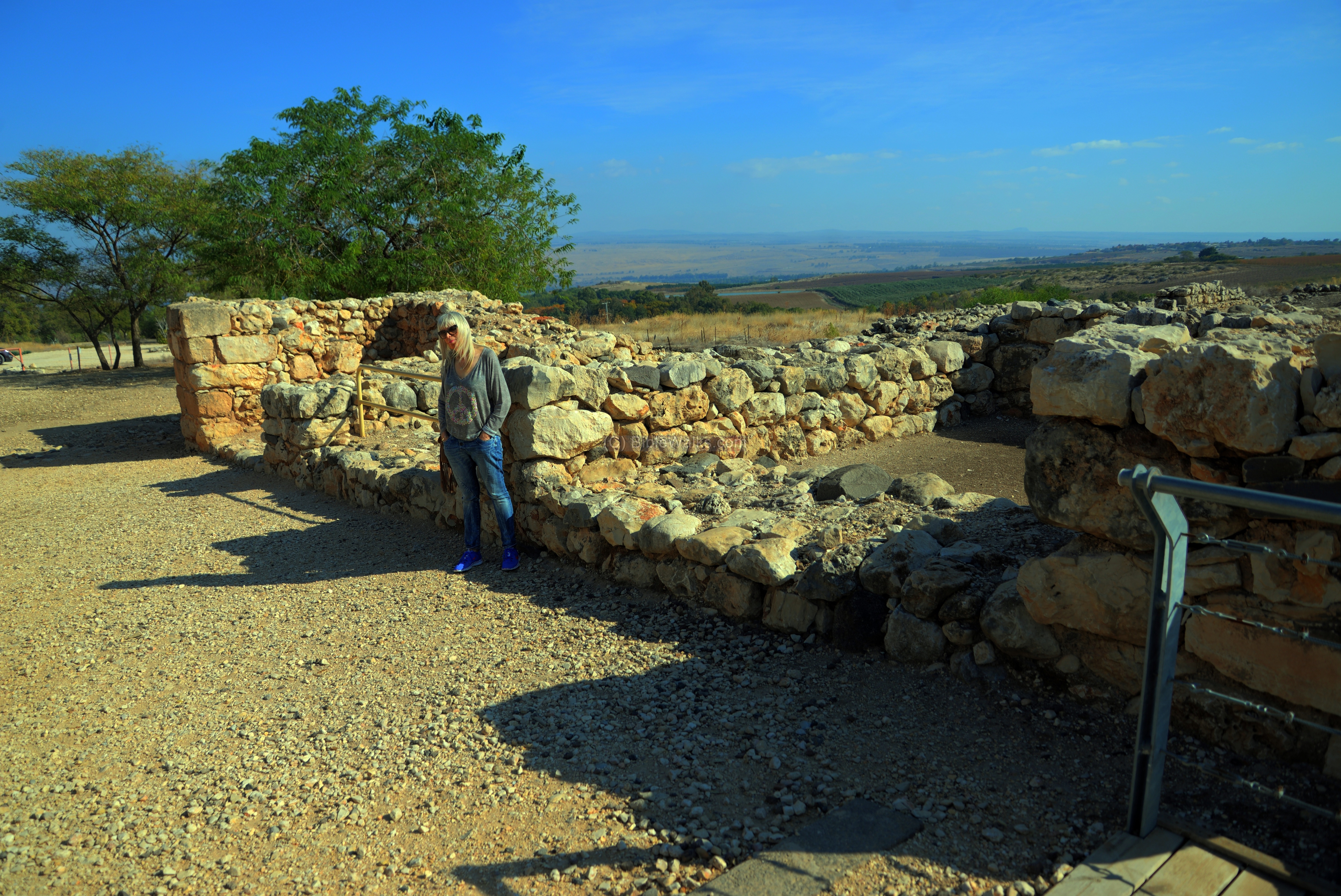
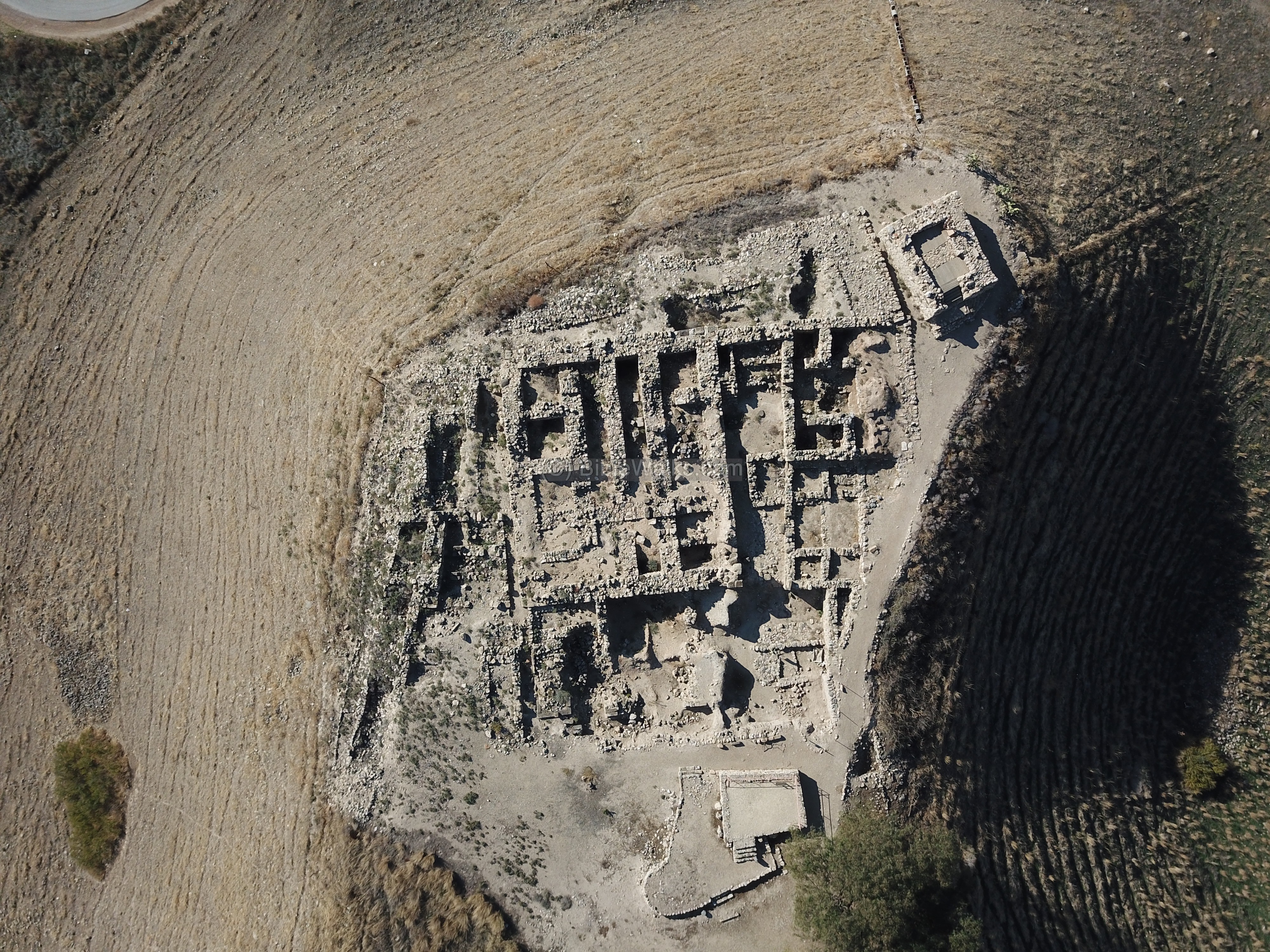
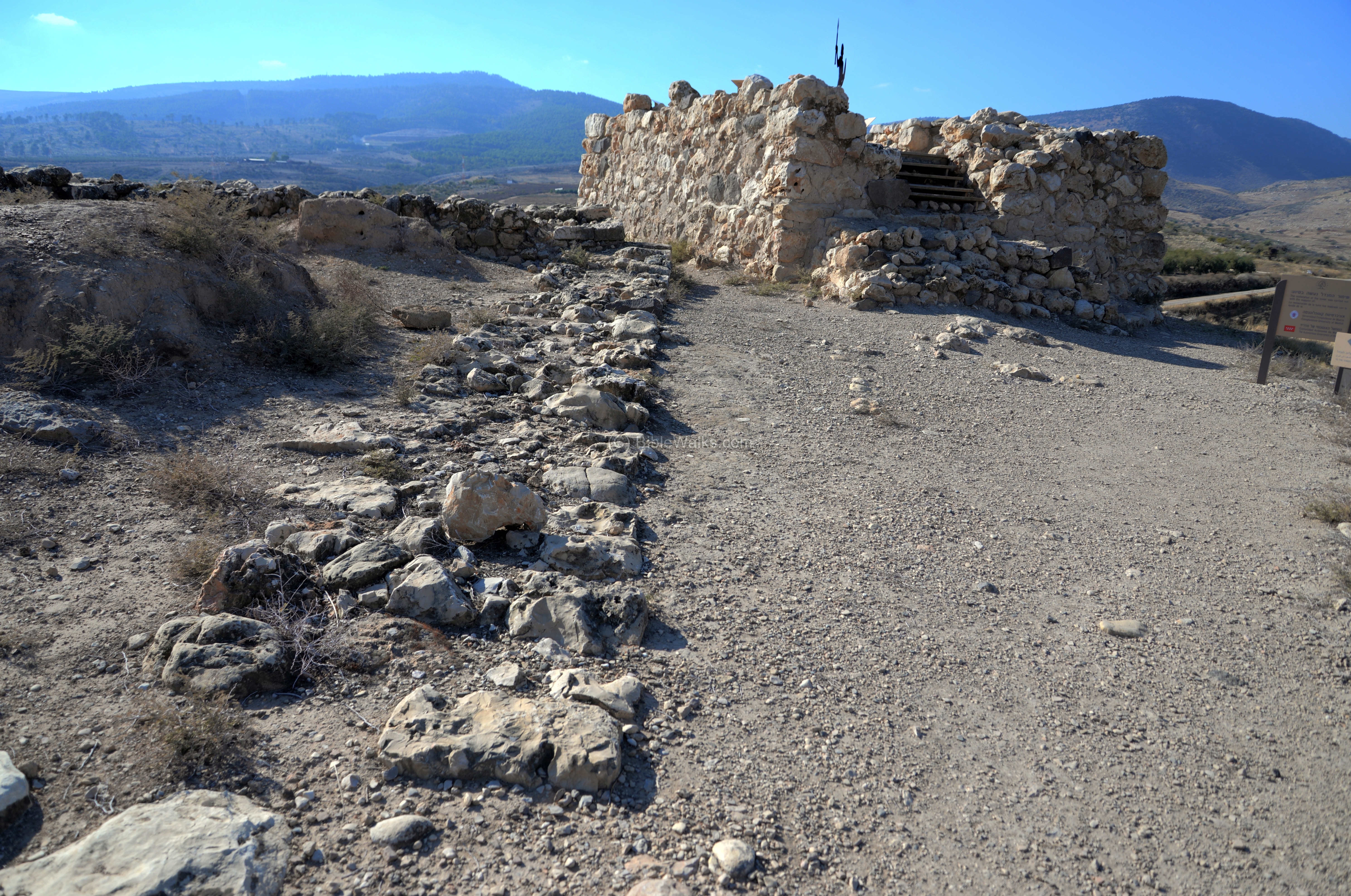
(d) Israelite city
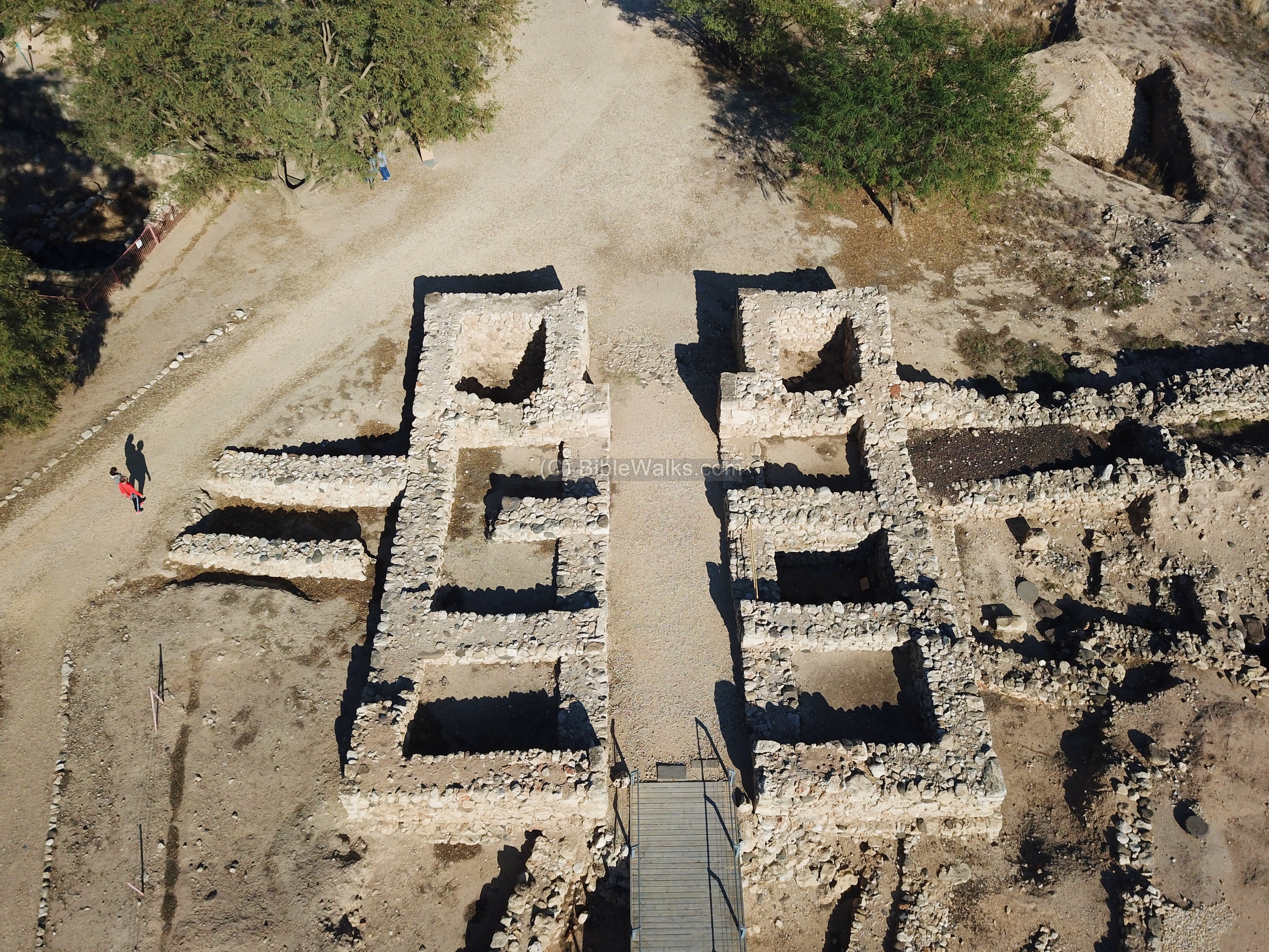
In the western side of the upper city are the ruins of an Israelite city from the 9th century BC. This aerial view was captured from the north side. Notice the height difference…
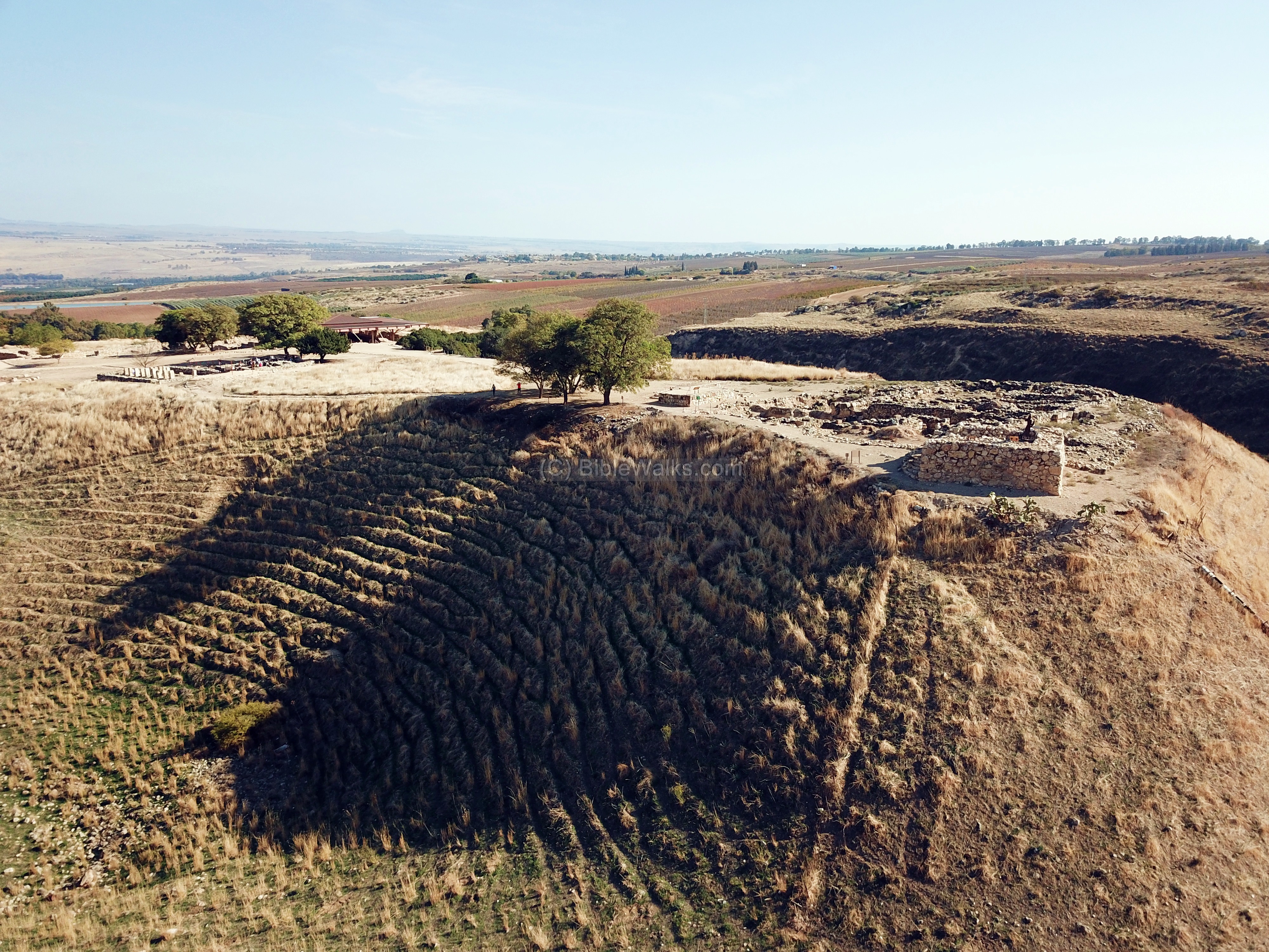
Another aerial view, vertically over the ruins, is seen next:
The next photo shows the ruins from the east side. The Israelite Kingdom city was destroyed in 734-732 BC by the Assyrians.
A monumental entrance gate protected the citadel. The doors were adorned by a pair of capitals depicting stylized palm trees (a pattern similar to the public structure in Megiddo).
The Israelite city was built over several layers of previous periods.
A 11th century BC high-place is seen on the foreground. A closer view of the sacred place, dated to the period of the Judges, is seen below.
On the western side of the city are the remains of the double wall “casemate” type from Solomon’s city.

(e) Israelite citadel
On the western edge of the city are remains of an Israelite tower (8th century). This tower was the last Israelite construction in Hazor, built to strengthen the defenses before the Assyrian onslaught.
The city fell in 732 BC (2 Kings 15:29): “”In the days of Pekah king of Israel came Tiglathpileser king of Assyria, and took …Hazor… and carried them captive to Assyria”..
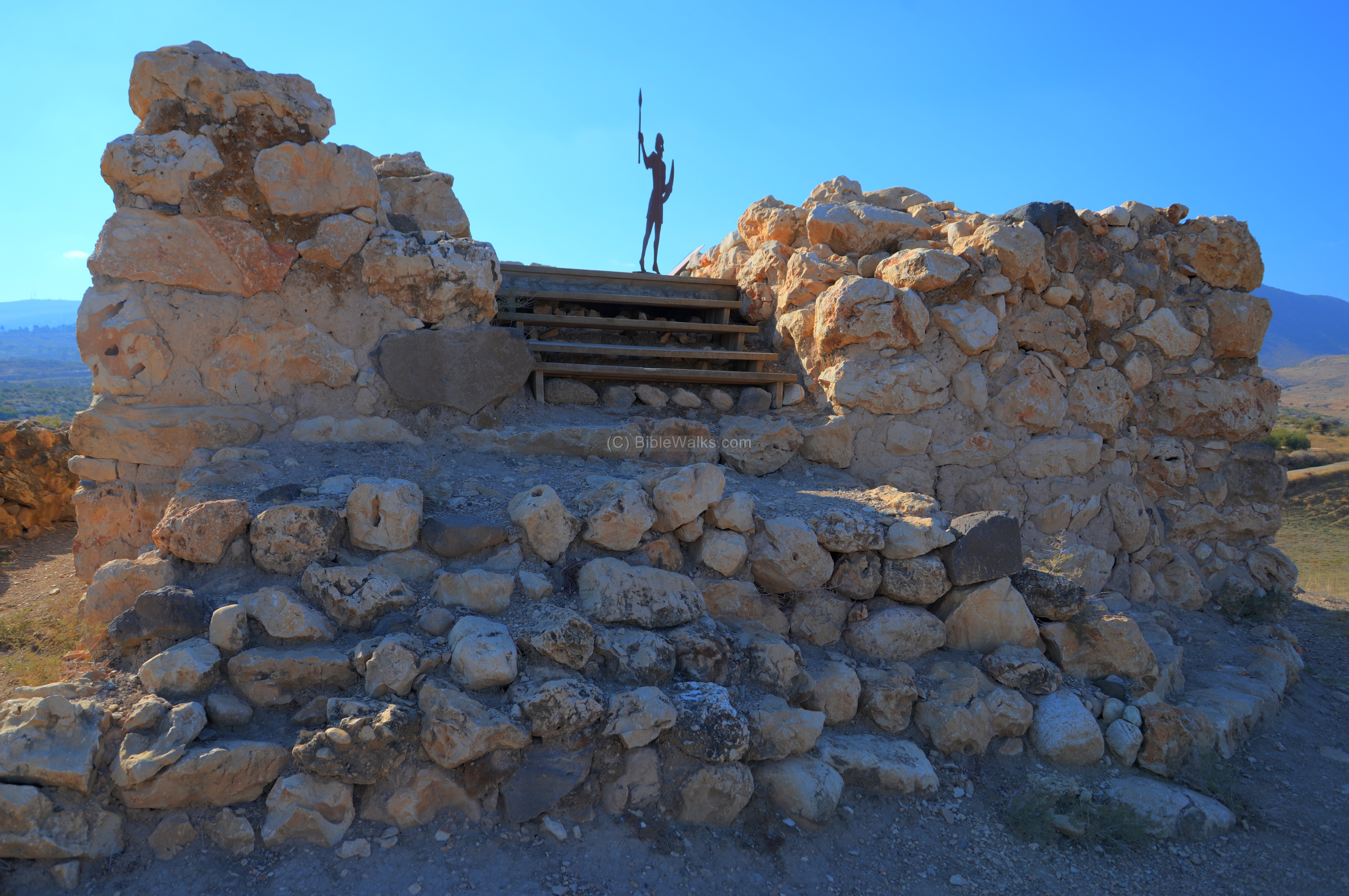
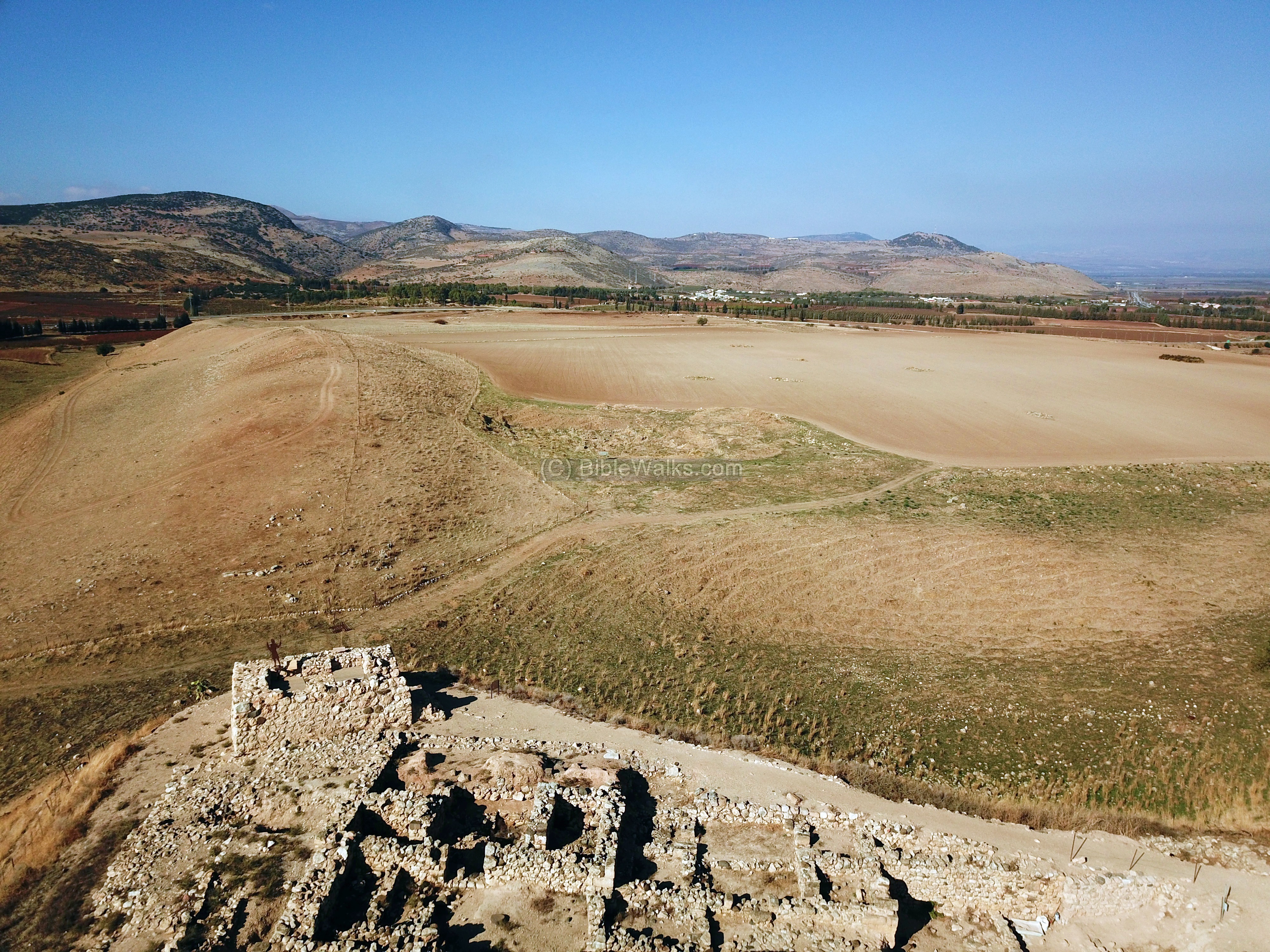
The tower overlooks the lower city:
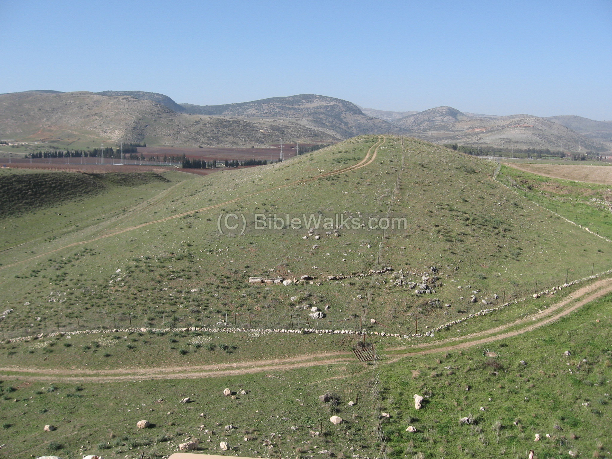
(f) South side
The following is a view of the south side of the upper city. Notice the height difference of 40M above the ground, making the city a defendable site. The old highway bypasses the Tel from the south, while the new highway was constructed to bypass on the west side. In the background is Mount Canaan.

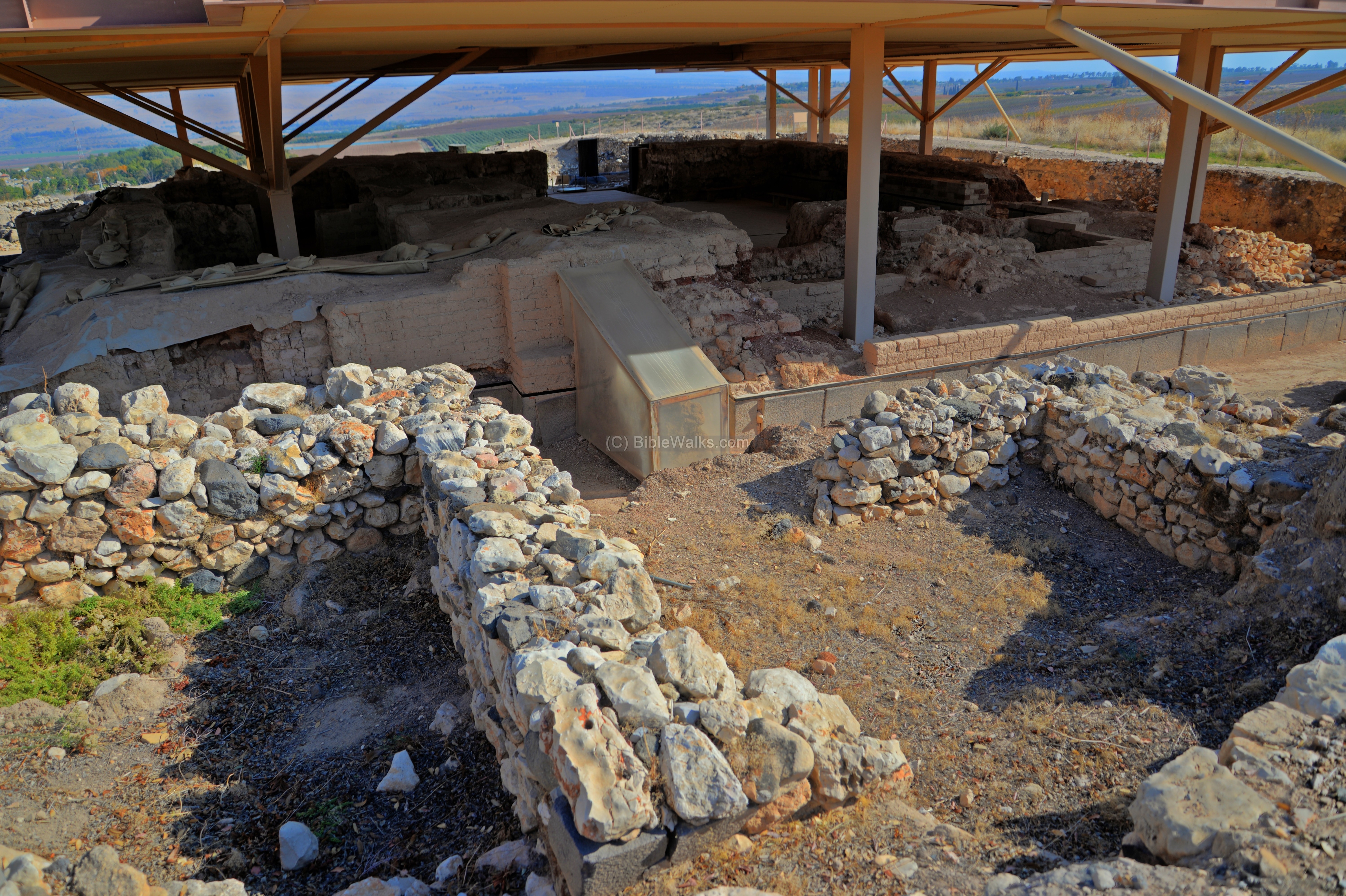
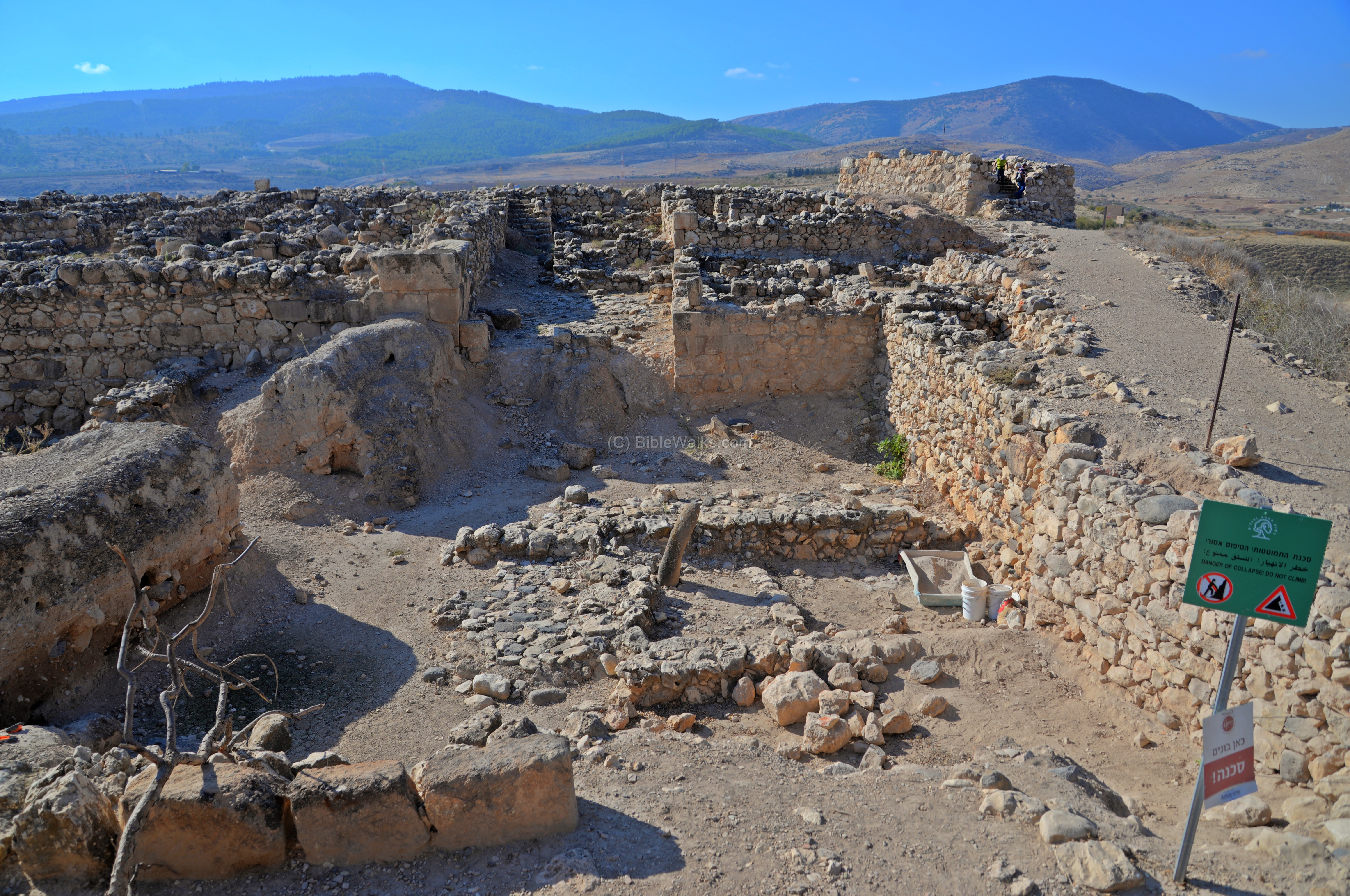
(g) North Walls
A deep section was cut into the north east edge of the upper city. These excavations, overlooking the lower city in the far background, reveal a mix of 3 periods.
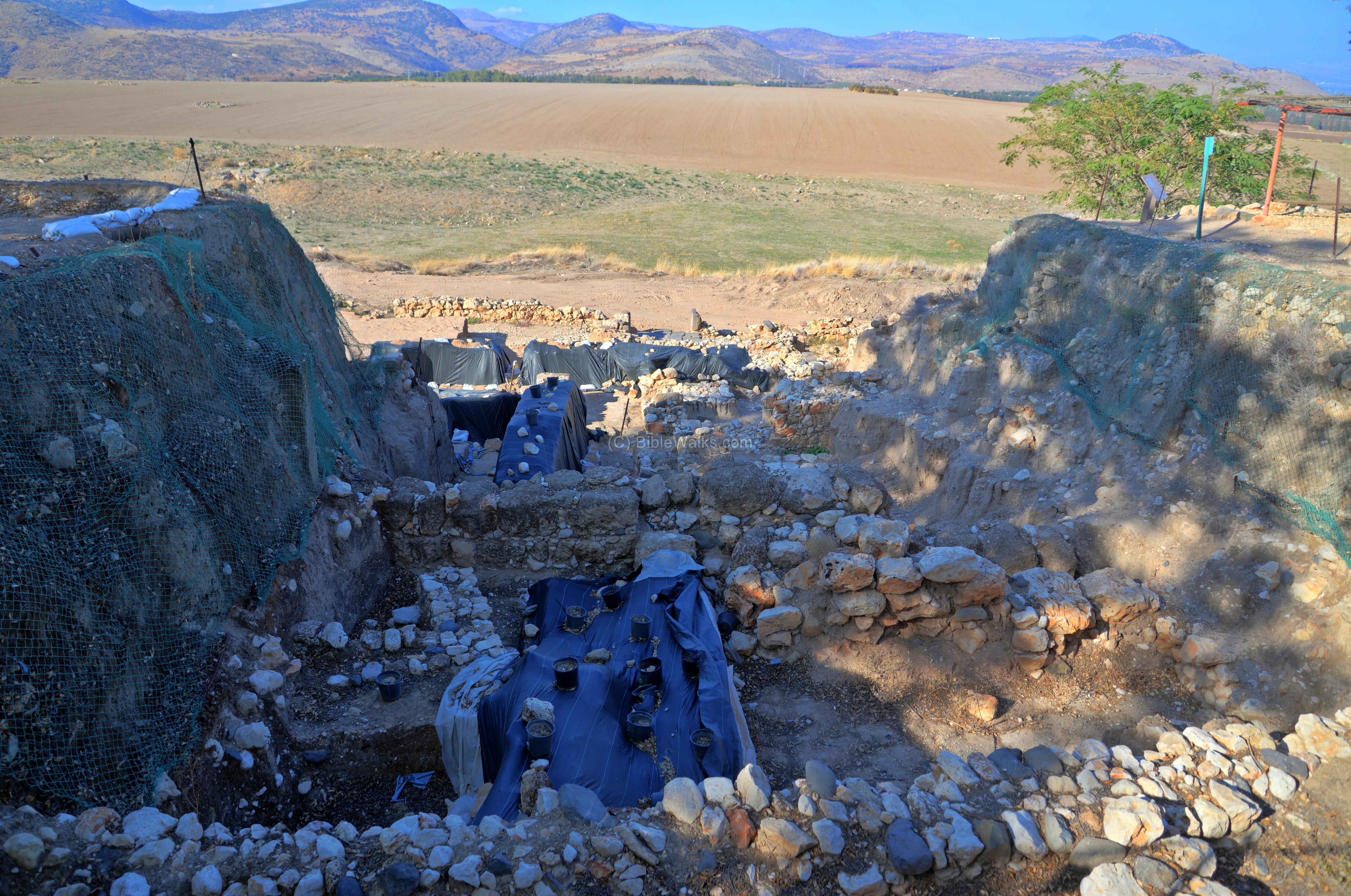
A view towards the west shows the sections of the excavated area (‘M’) which was excavated in 2012. Here a monumental structure was exposed, with several rooms, and was dated to the 13th century (Late Canaanite period).

The lower section of these excavations is seen in the next photo.
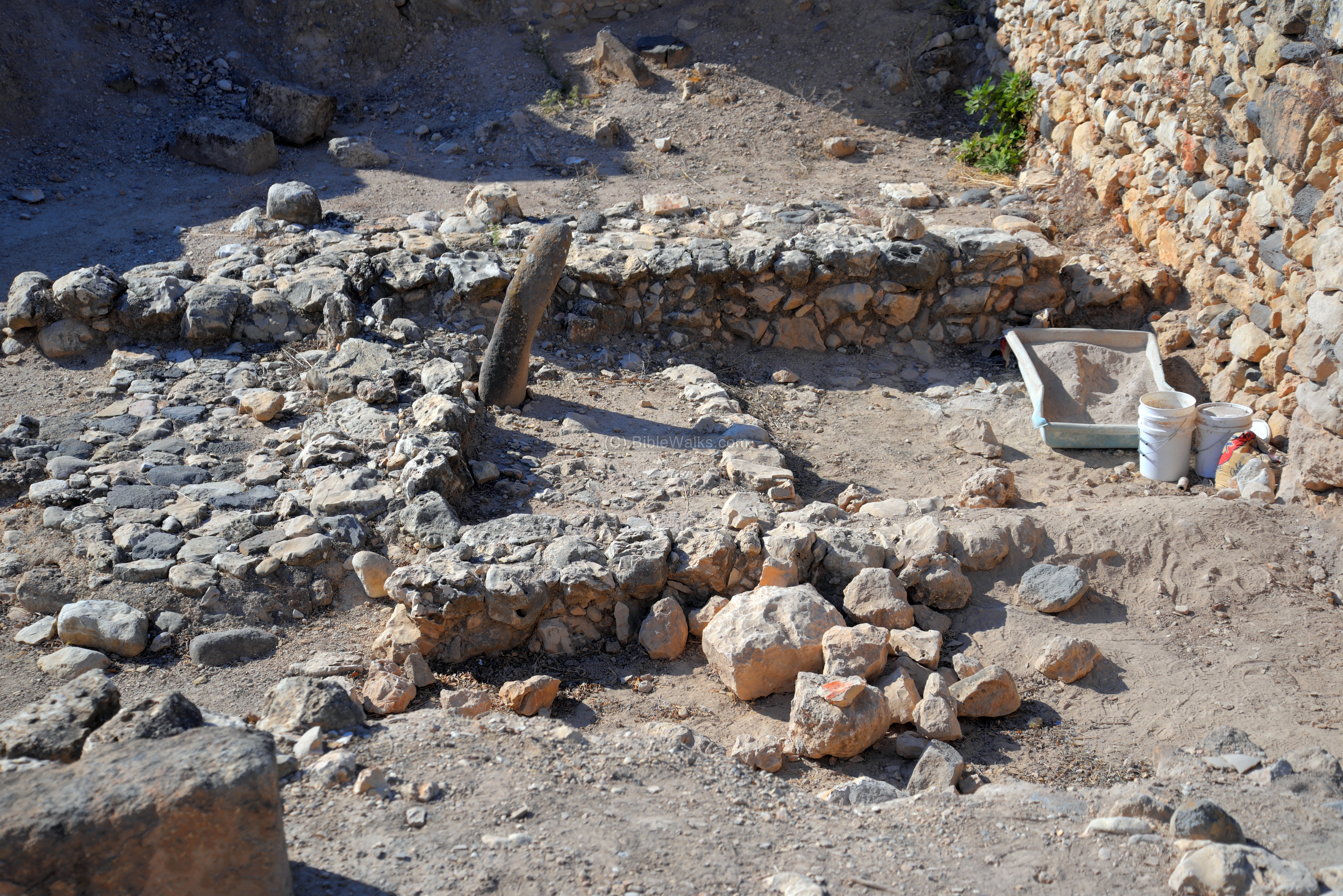
Solomon’s wall (10th century) is seen on the left side, and was the north-east corner of the fortifications. The later period structures (9th century) are located at the center and right side. Beneath it is a Canaanite period staircase (14-13 century) that connected the lower and upper cities. A paved area contains a podium.
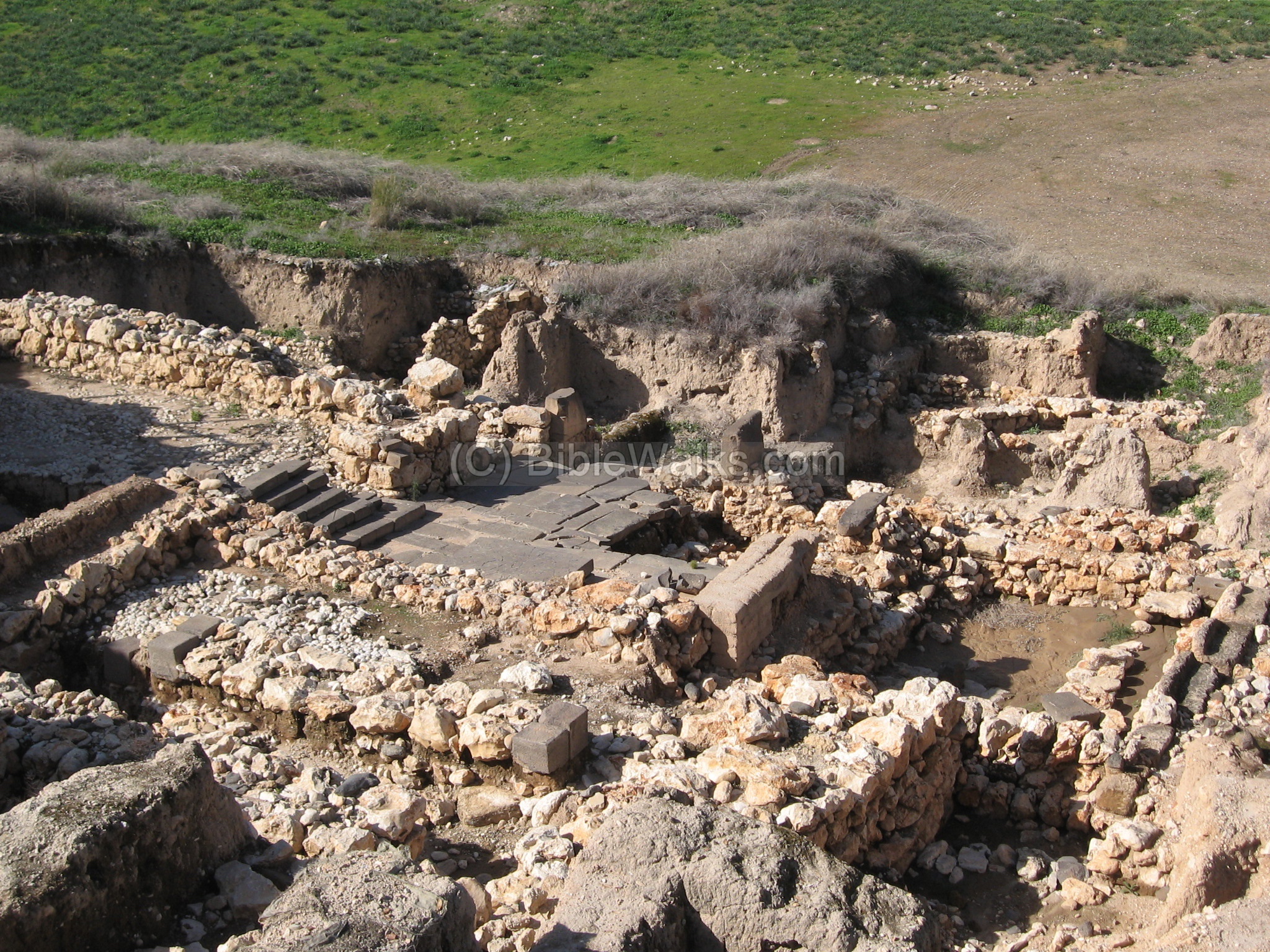
A new section of the 3500 years old monumental staircase, leading up to the Canaanite palace, was revealed in 2019. The staircase is 4.5m wide, and made of large basalt slabs. Seven steps were unearthed so far in this section.

Like other public Canaanite structures on the Upper city, this monumental structure was also violently destroyed in the 13th century (following the Israelite conquest). As per Joshua 11:10-12: “And Joshua … took Hazor, and … smote all the souls that were therein with the edge of the sword, utterly destroying them: there was not any left to breathe: and he burnt Hazor with fire”.
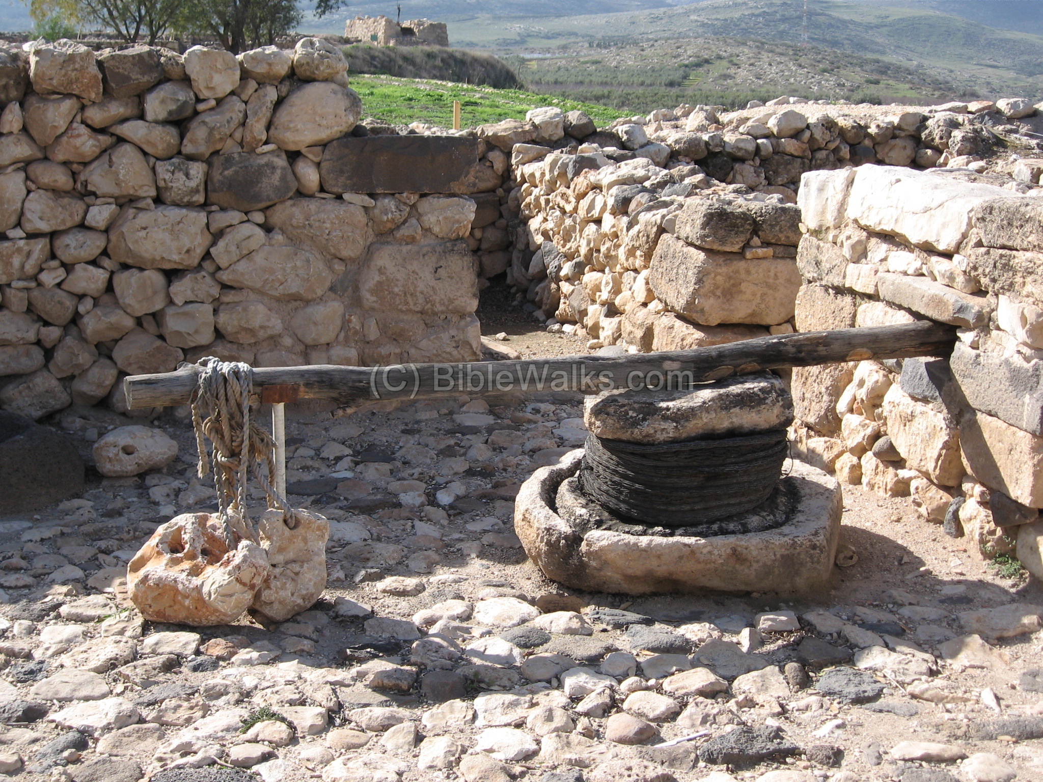
(h) Reconstructed Structures
In the north-west area the excavators rearranged two facilities that were originally located in another place – the Canaanite palace. They were removed and reconstructed in order to reach lower levels.
A reconstructed oil press, seen below, was found in a 8th century BC four-roomed house above the palace. The stone weight on the edge of the lever pushed the stone on the basket and squeezed the olives, extracting the precious olive oil unto the grooves of the base stone.
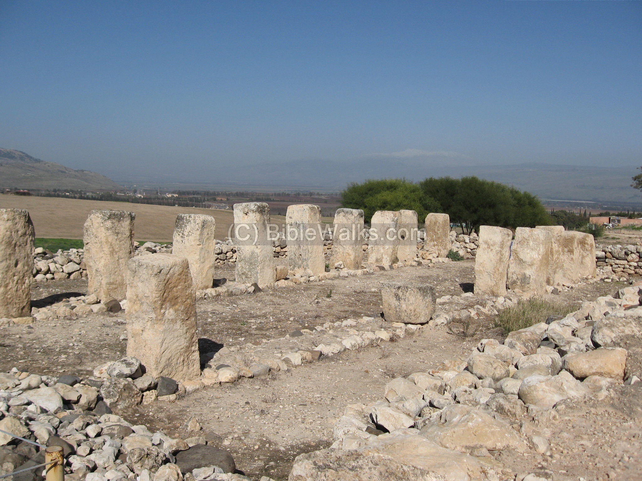
In the photo below – a reconstructed 8th century BC public store house with pillars. It was also transferred in order to dig under the structure into the Canaanite palace.
(i) Lower city
The lower city is a huge area (700 Dunam, 70 Hectares) located north to the upper city, across the Hazor valley. The following photo is a mosaic of 3 images as seen from the west citadel area (you can see each one of them in detail- left-west to right-east -: A, B, C ).
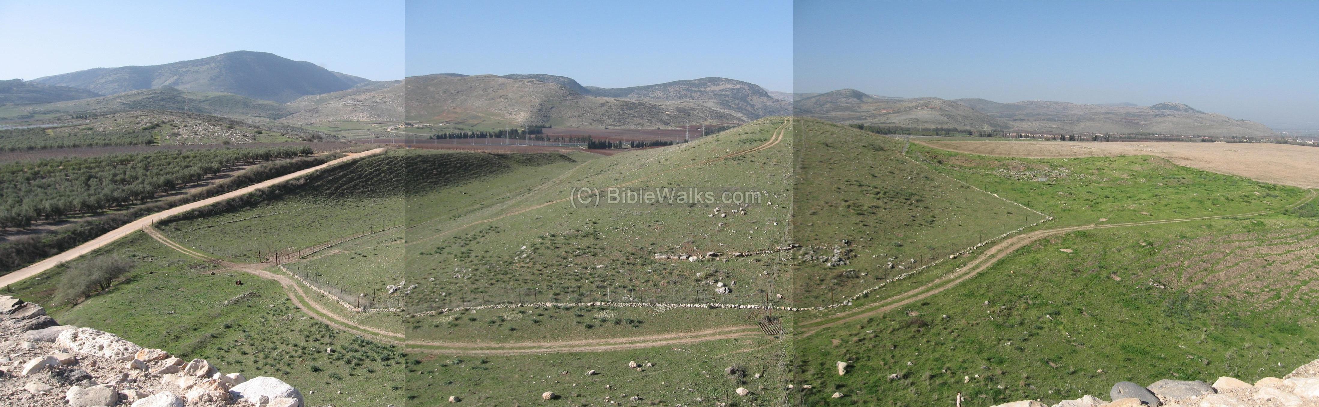
The lower city is surrounded by a rampart, and a narrow strip extending to the east. The central section is detailed below. In the lower city the following were unearthed in various areas: a Canaanite temple (13-14 century BC) with statues; remains of structures, tombs and pits (18-13 century BC); Canaanite temples (18-13 century BC); four gates of the lower city found on top of each other (18-13 century BC); five gates (18-13 century BC). Thus, the lower city functioned from the 18th to the 13th century BC.
(j) Aerial Video
![]() The following YouTube video shows a flight of a drone over Hazor. The drone approaches the site from the south western part of the Canaanite lower city. It passes above the ruins of the Israelite tower (8th century BC), then over the Israelite Citadel (9th century BC), finally reaching above the underground water system (9th century BC):
The following YouTube video shows a flight of a drone over Hazor. The drone approaches the site from the south western part of the Canaanite lower city. It passes above the ruins of the Israelite tower (8th century BC), then over the Israelite Citadel (9th century BC), finally reaching above the underground water system (9th century BC):
A 22 minutes video tour was captured on July 31, 2025.
Biblical References:
Joshua 11:10-13:
This text talks about the conquest of Hazor by Joshua, and described Hazor as “the head of all those kingdoms”.
“And Joshua at that time turned back, and took Hazor, and smote the king thereof with the sword: for Hazor beforetime was the head of all those kingdoms. And they smote all the souls that were therein with the edge of the sword, utterly destroying them: there was not any left to breathe: and he burnt Hazor with fire. But as for the cities that stood still in their strength, Israel burned none of them, save Hazor only; that did Joshua burn
Judges 4:2 , 17:
“And the LORD sold them into the hand of Jabin king of Canaan, that reigned in Hazor; the captain of whose host was Sisera, which dwelt in Harosheth of the Gentiles”….”Howbeit Sisera fled away on his feet to the tent of Jael the wife of Heber the Kenite: for there was peace between Jabin the king of Hazor and the house of Heber the Kenite”.
1 Kings 9:15:
King Solomon builds Hazor:
“And this is the reason of the levy which king Solomon raised; for to build the house of the LORD, and his own house, and Millo, and the wall of Jerusalem, and Hazor, and Megiddo, and Gezer”.
2 Kings 15: 29:
The Assyrian Tiglat Pileser destroys Hazor:
“In the days of Pekah king of Israel came Tiglathpileser king of Assyria, and took Ijon, and Abelbethmaachah, and Janoah, and Kedesh, and Hazor, and Gilead, and Galilee, all the land of Naphtali, and carried them captive to Assyria”.
2 Samuel 5:8:
King David captures the “conduit” (gutter) in Jerusalem, considered to be a water system similar to the one in Hazor.
“And David said on that day, Whosoever getteth up to the gutter, and smiteth the Jebusites, and the lame and the blind that are hated of David’s soul, he shall be chief and captain….”
Links:
* External:
-
Tel Hazor Bronze age Photo Gallery (youtube)
-
3500 years old staircase of a Biblical palace revealed – July 2019
* Internal:
-
Biblical Water works – other sites with impressive water systems
Etymology (behind the name):
-
Hazor – the source of the word is in Hebrew: a yard (Hazer) or a cattle yard. There are several biblical sites with this name in Israel.
-
Ayyelet Ha-shachar (Ayelet Hashahar) – In Hebrew – Morning star. It is the nearby Kibbutz, and its museum holds some of the archaeological findings from Tel Hazor. The Kibbutz was established in 1917/1918.
BibleWalks.com – walk with us through the sites of the Holy Land
<<<All Sites>>> —Next Upper Galilee site–> Tel Yaaf
This page was last updated on Aug 1, 2025 (add video tour)
Sponsored links: