The Crusaders fortified the frontier city of Banias in the 12th century. Sections of its gate, walls and towers are located in the ruins of the ancient city.
Home > Sites > Golan > Banias > Banias Crusaders city
Contents:
Background
History
Photos
* Western walls
* SW tower
* South Gate
* South walls
* SE tower
* East walls
* NE tower
Etymology
Links
Background:
This page focuses on the Crusader city in Banias. The Crusaders heavily fortified it since this frontier city was regarded as a strategic asset. Sections of its gate, walls and towers can be seen in the ruins of Banias.
For other pages and an overview on Banias – see: Overview page
Location:
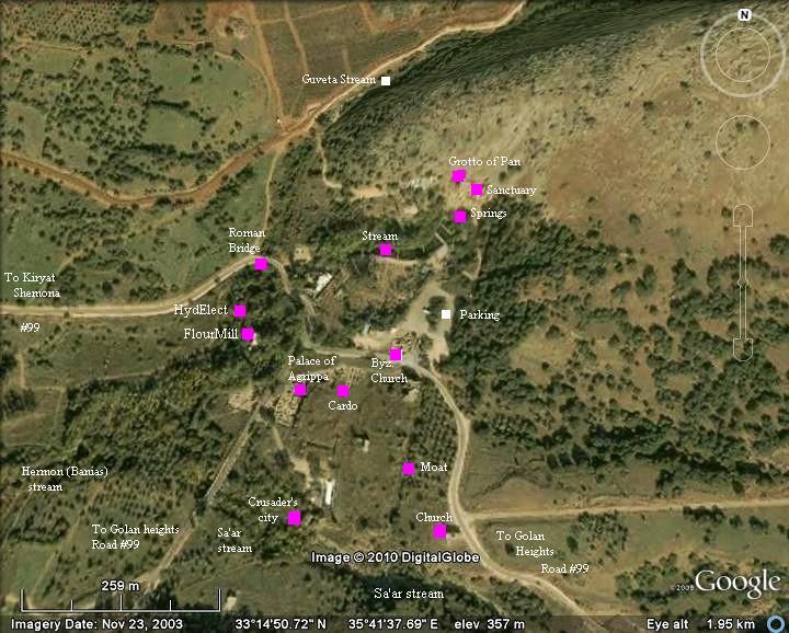
The Crusaders city is located on a large area south of the entrance to the park.
History:
This section focuses on the history of the city during the Crusaders and the Medieval times. For a complete history – check the Banias overview page.
-
Crusaders
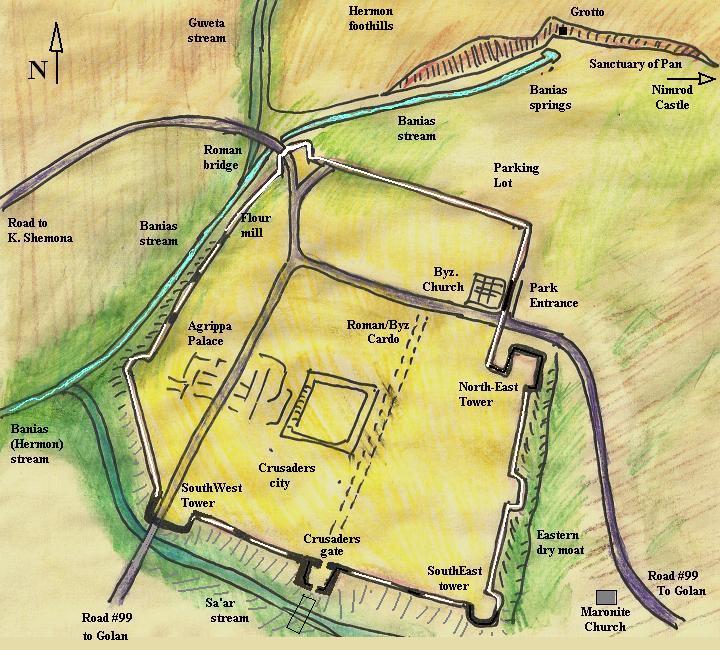
The Crusaders arrived in the Galilee in 1099 and in Banias at 1129 AD. This frontier city, located on the trade road to Damascus, was a strategic asset. The Crusaders hoped to win the war against the Arabs by conquering Damascus, and Banias was the key for this strategy. The Crusaders invested enormous efforts in its fortifications during the three years of their control of the city (1129-1132). A large wall and towers were added around the city, closely matching the walls of the Roman/Byzantine city, and reusing their building blocks. These impressive ruins are visible today along the southern walls. A plan of the city is illustrated below, with indication of its major sites and other points of interest in the park. The Crusaders city is colored in yellow, and protected by a wall (marked in white where the sections are missing). Only small parts of the walls survived or reconstructed so far by the archaeologists.
The Crusaders also fortified the Arab fortress of Kil’at Subeiba (“Large cliff”), located 6KM above the city, calling it by the Biblical name – Nimrod fortress (detailed in another web page). The fortress and the city switched sides for some time (1132-1151), but the Crusaders regained the city and fortress until 1164 when it was conquered by the Syrian ruler Nur al-Din. Since the city was a key gateway to the small Crusader enclave, they tried to regain it in other Crusades (1217, 1253) but the city remained under Arab control.
-
Medieval times – Mongols, Mameluks and Ottomans
The city was conquered by the Mongols (1260), and in the same year it fell to the Mamelukes. The city regained its status as regional governing city in the 15th century and the Nimrod fortress became the seat of the governor reporting directly to the Sultan of Cairo. It was a major station along their most important link – the Cairo-Damascus route.
After 1516 the Turkish Ottoman empire from Turkey controlled the land and the city declined into a small village.
Photos :
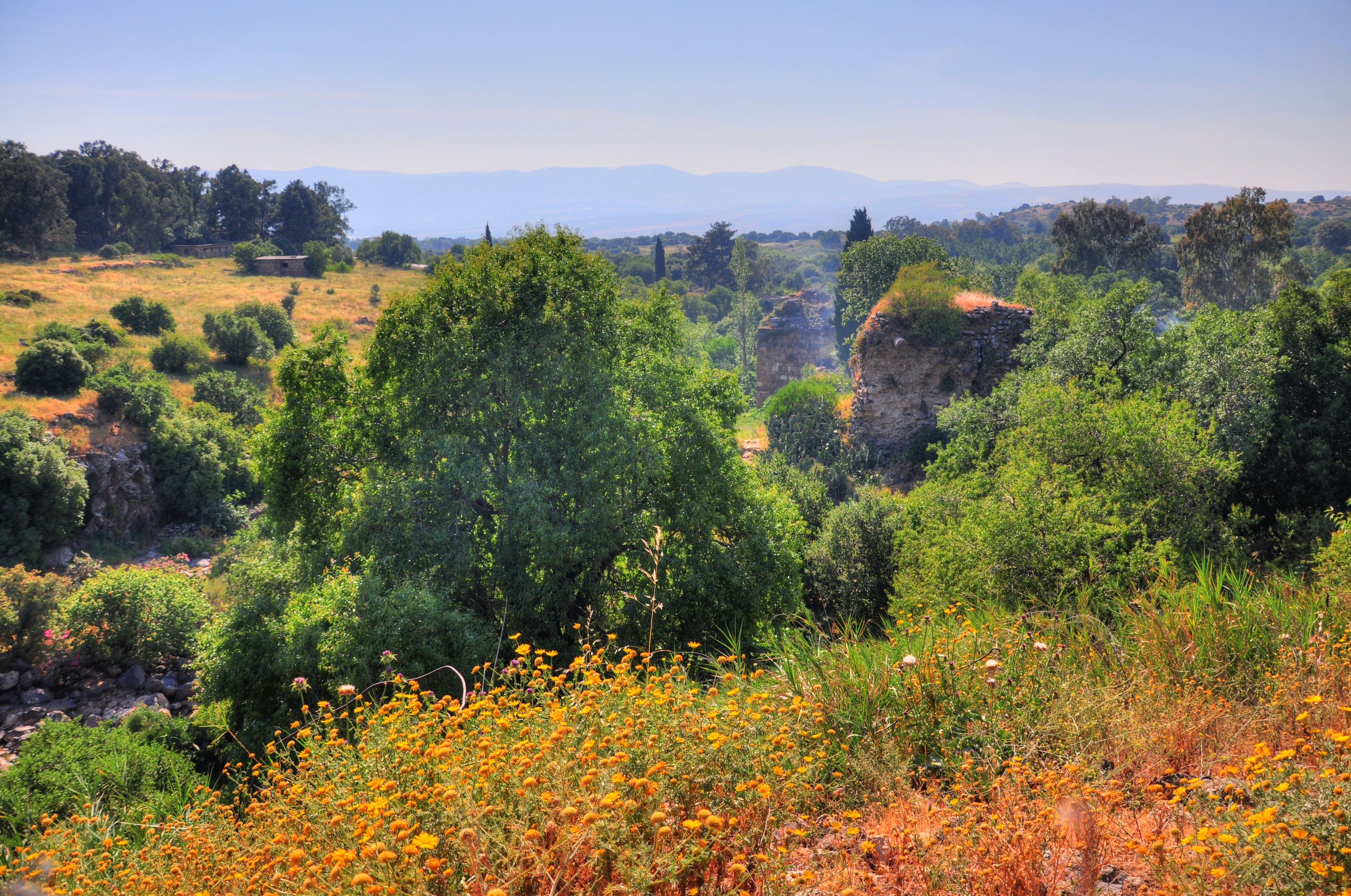
The order of the photos is from west, through south, and then east – following the path of the circular trail.
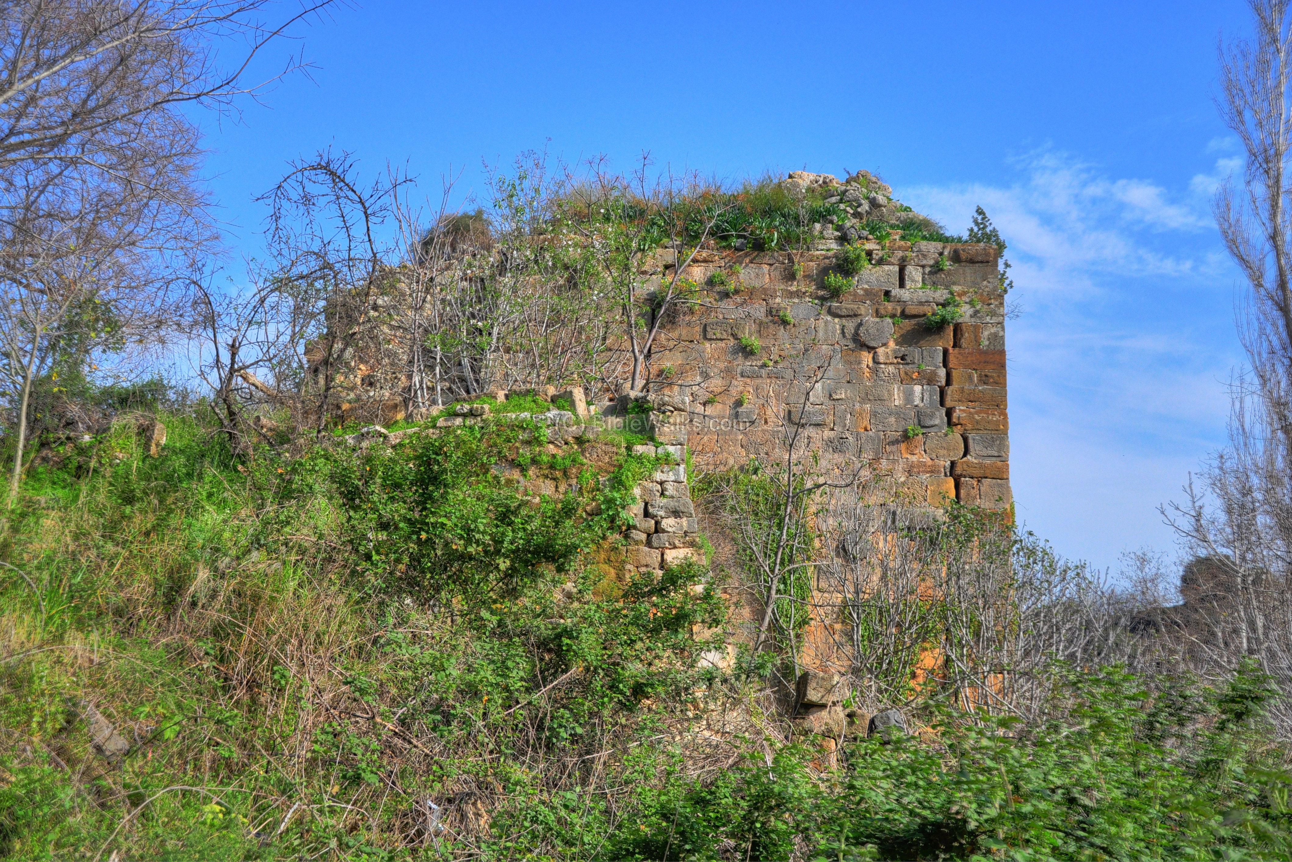
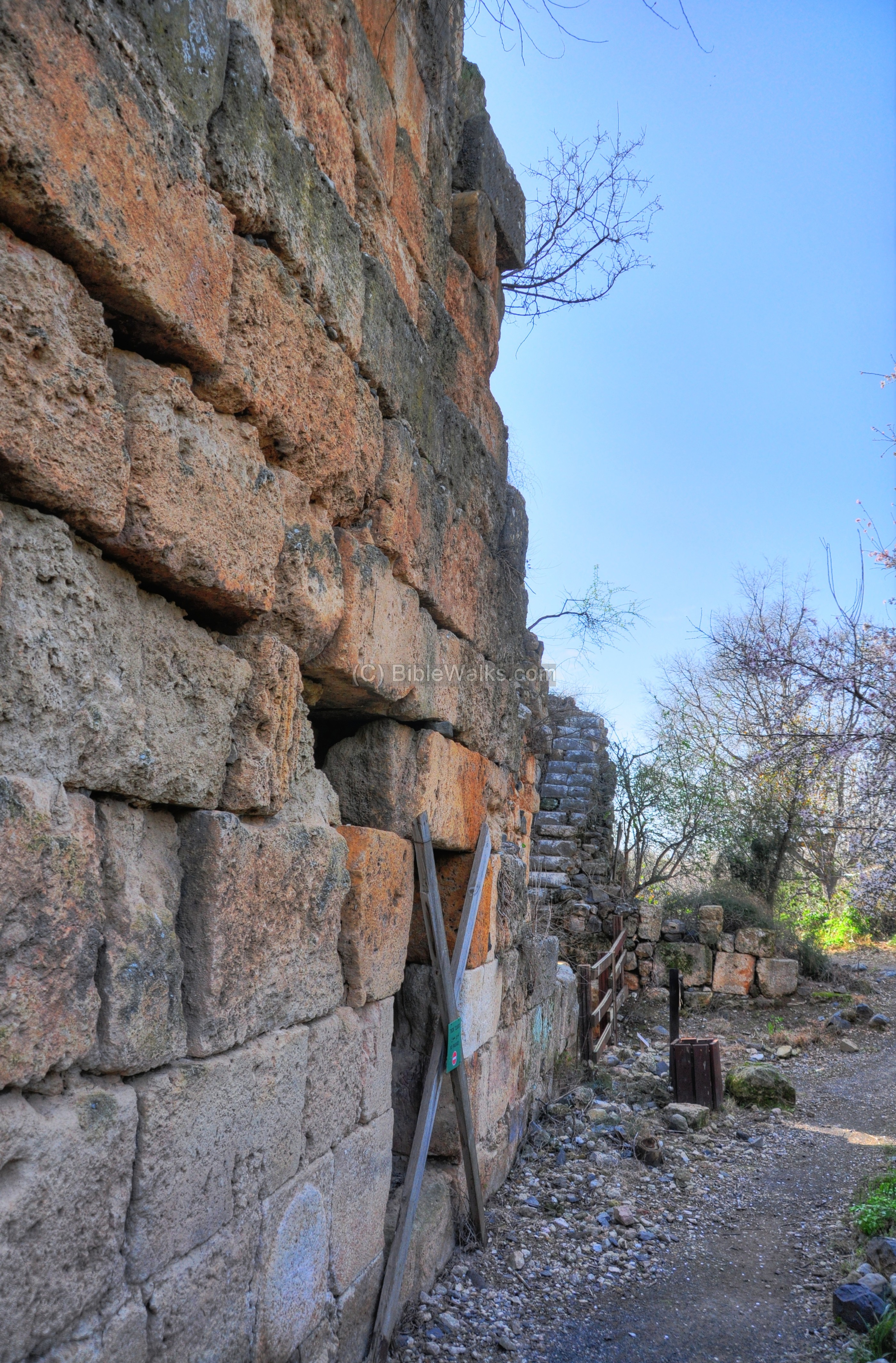
(a) Western side :
Sections of the western side of the Crusader and Roman/Byzantine walls can be seen along the trail of the Banias stream. They are partially covered by the trees and bushes.

These walls are indicated on the map as a red square.

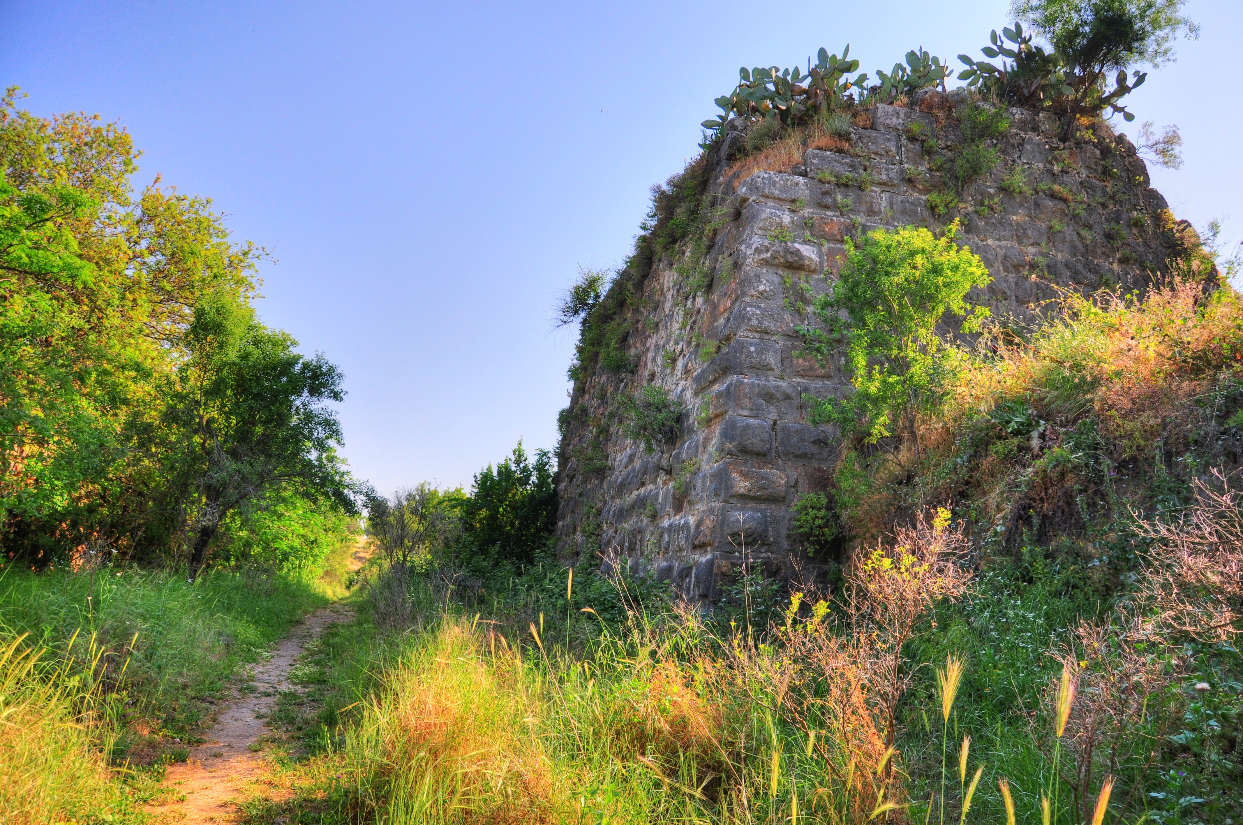
(b) South-West corner:
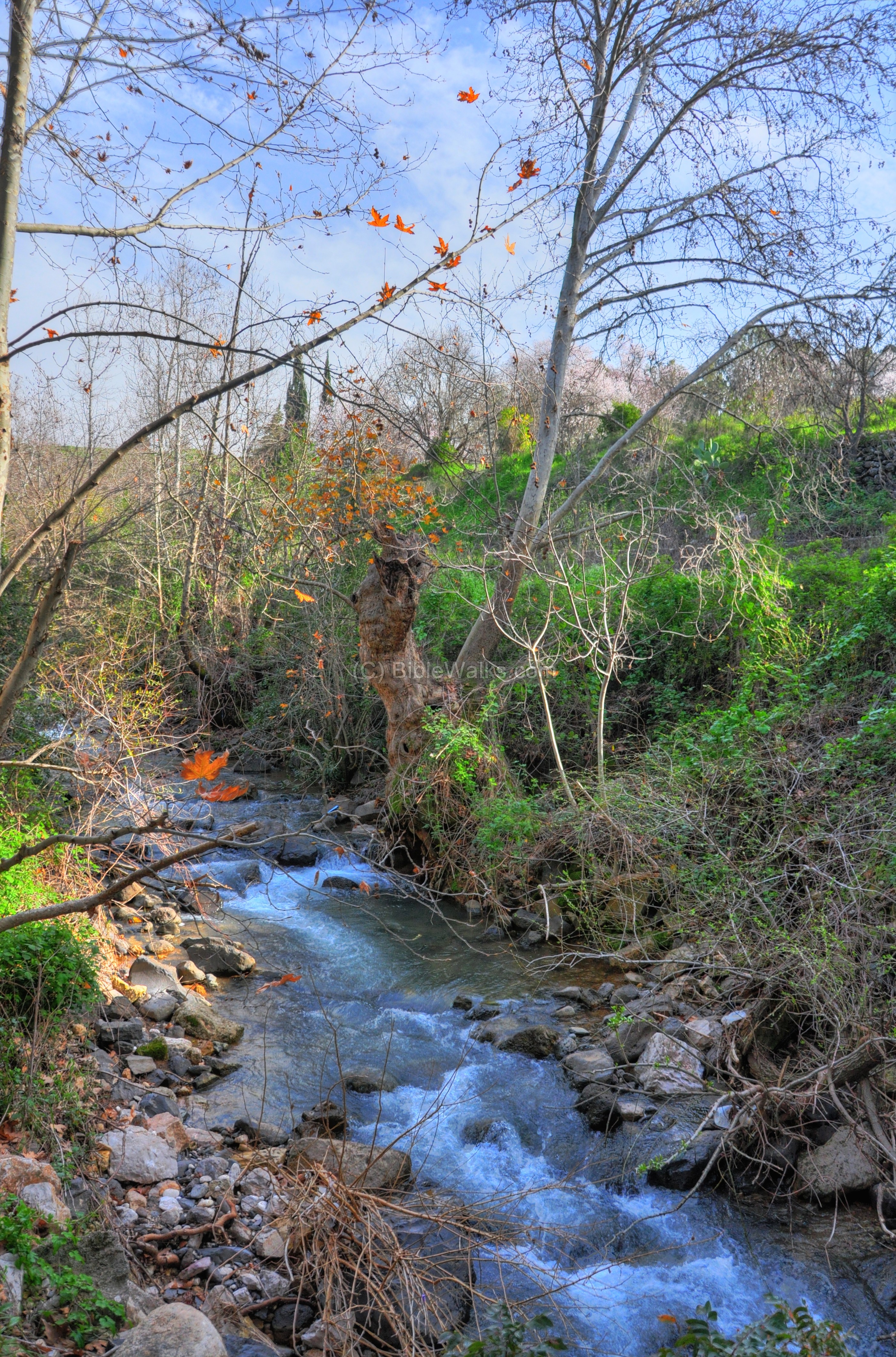
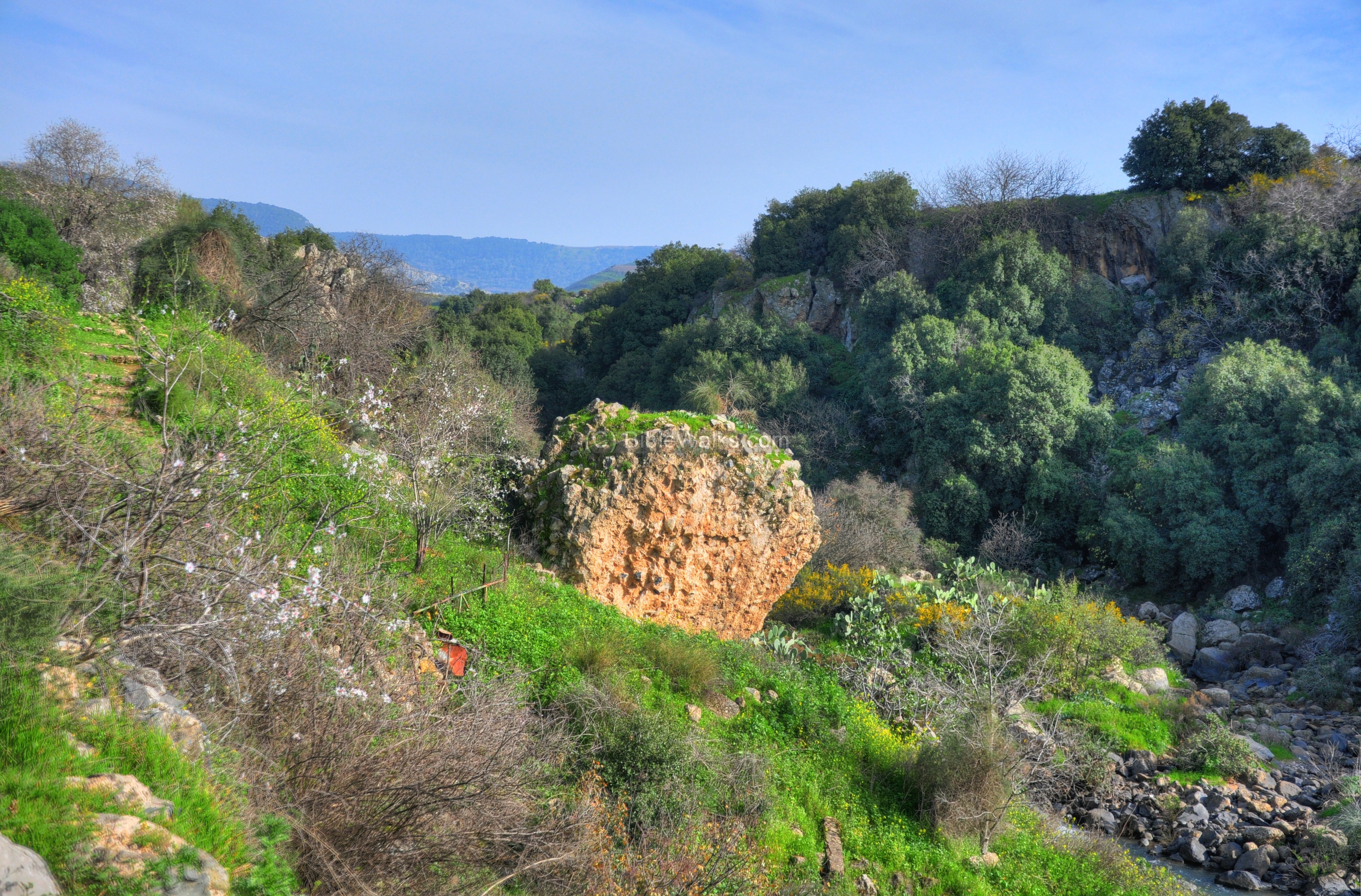
The southern walls of the Crusaders city follow the path of the Sa’ar (“stormy”) stream , which receives its waters from the south-western slopes of the Hermon. The photo shows a view of the stream at late winter, although during the spring and summer times it is dry. It joins the Banias (Hermon) stream not far away from the south-western corner of the Crusaders city.
The stream served as a natural wet moat, an important defensive measure during the ancient times. Perhaps the entire city was surrounded by water during the ancient times, providing an effective protection.
- The South-West Tower
The modern bridge, on which the Banias-Golan road travels over the Sa’ar stream, rests on an ancient square structure. This was once the south-western tower of the Crusader city.
Its location is indicated as a red square on the map – located under the modern road.

The ruins of the tower were excavated (see the IAA report), revealing a two phase construction.
The first phase, probably built by the Muslims in the 11th century, included a small tower (10.6M x 15.7M) with a small interior.
The second phase, built by the Crusaders in the 12th century, enlarged the area of the tower by 3 times (18.8 x 26.0M) and was built around the older tower. The city walls at this corner were 2.4M wide.
Click on the photos to view in higher resolution…

Under the modern bridge are remains of a ruined concrete bridge, which was blown by the retreating Syrian forces during the six-day-war (1967).

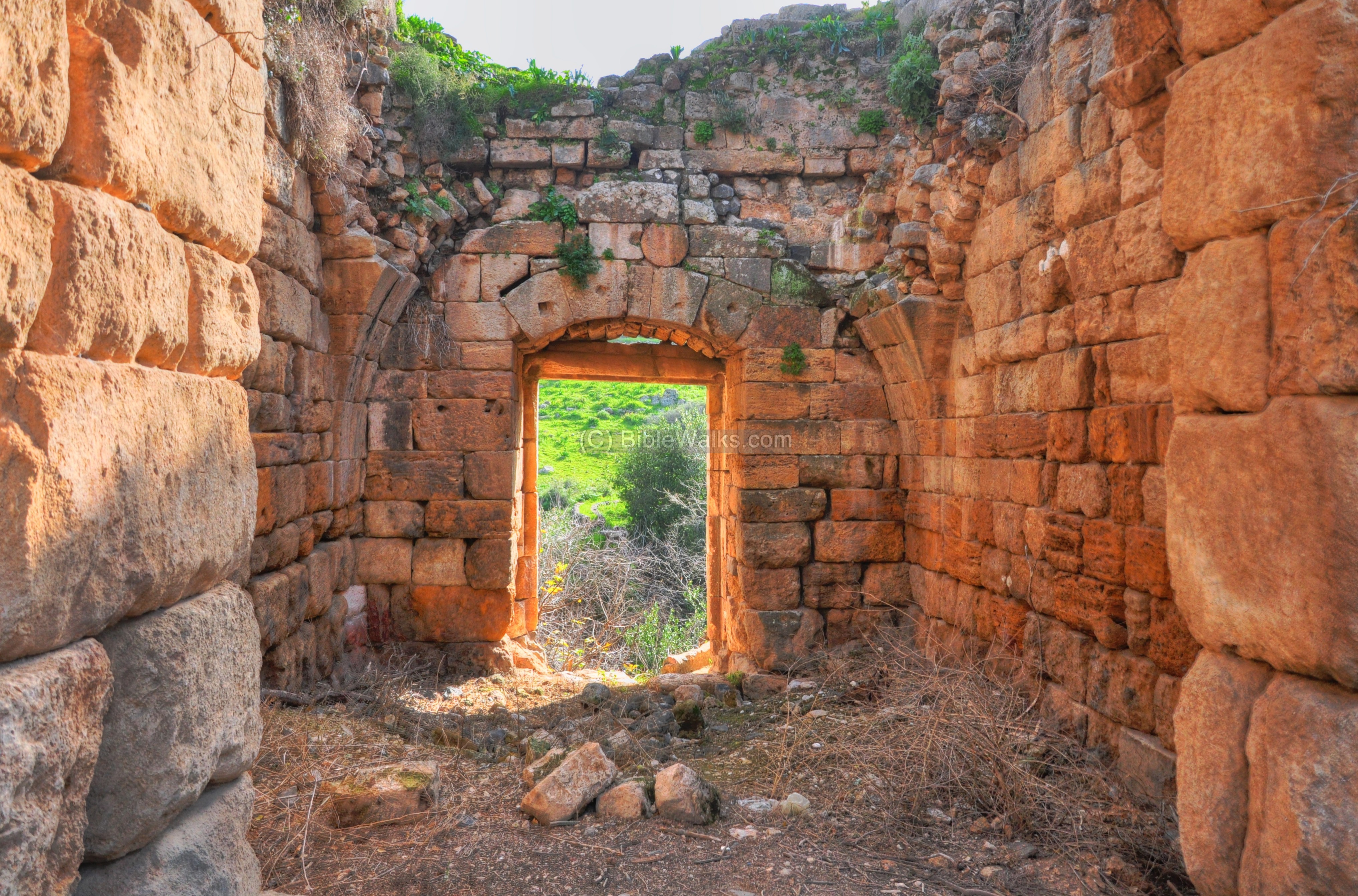
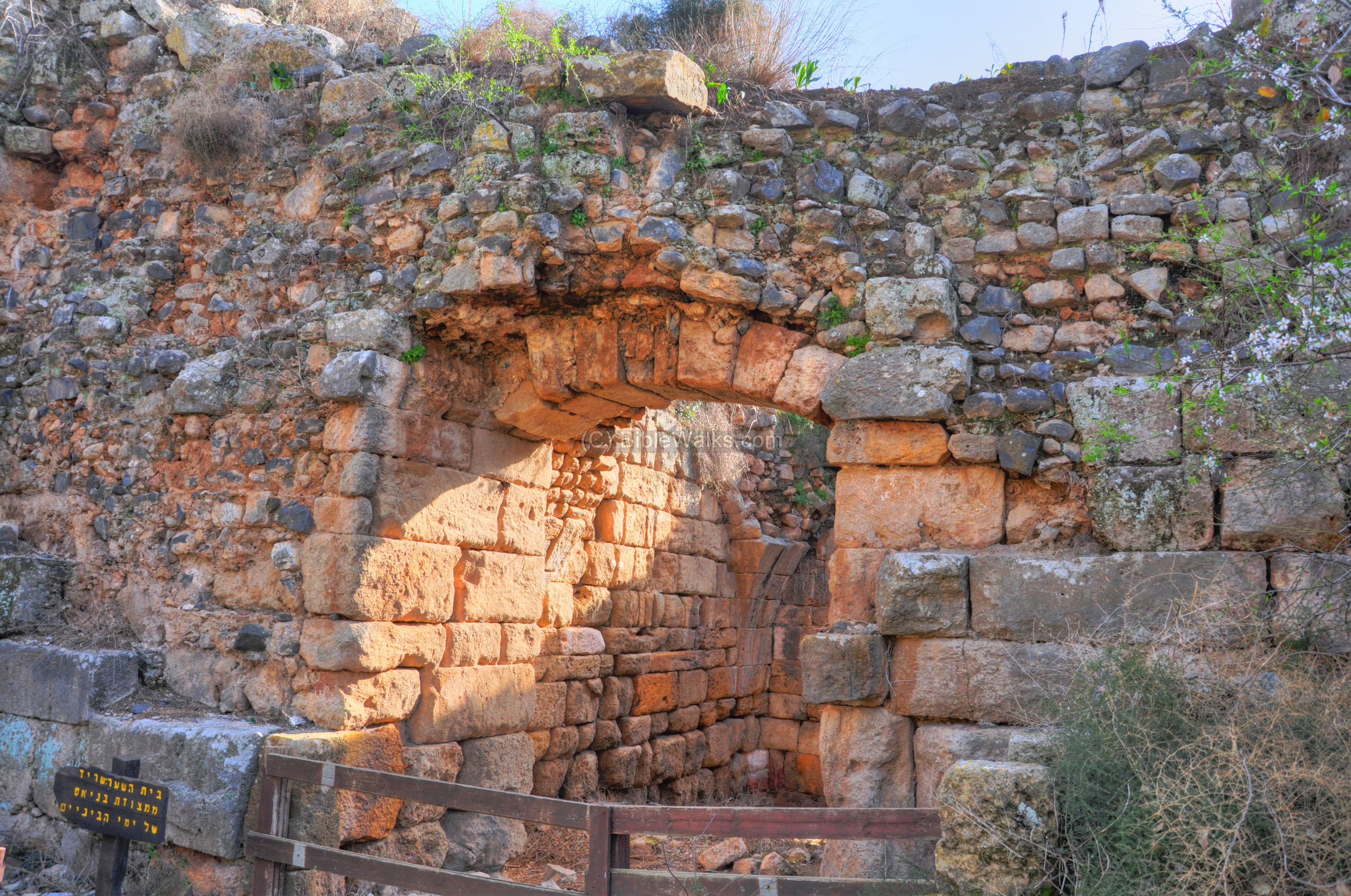
(c) Crusaders city gate:
After climbing up the steps around the Crusader tower, and walking along the northern bank of Sa’ar stream, the trail reaches another tower. This is the Crusader tower which protected the south gate of the city.
Its location is in the center of the southern wall, as indicated on the map as a red square.

A western view of the gate tower is seen in the picture below.
A closer view of the gate tower is seen in the picture below.
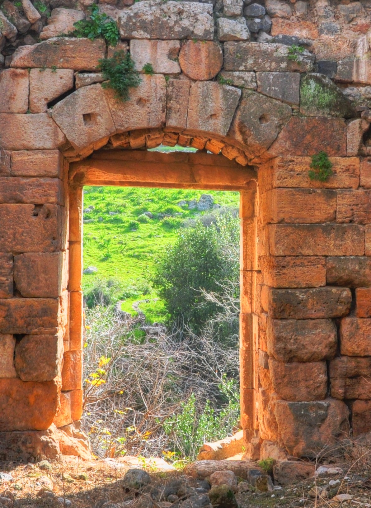
Inside this tower is the entrance to the Crusader gatehouse.
The room of the gatehouse is 11m long by 7m wide.
The room has a 7m high ceiling and 2m thick walls.

Through the exterior door is an access to the Sa’ar stream. A bridge once connected both banks of the stream, but it was destroyed in the 19th century. An Arabic inscription is located above the door on the exterior side.
A staircase leads to the upper floor of the gatehouse and tower.

The following picture shows a side view of the gate.
Continuing eastwards along the bank of the Sa’ar stream, there is a great view of the gate’s tower from that side. A large number of Roman columns were reused during the construction of the tower.
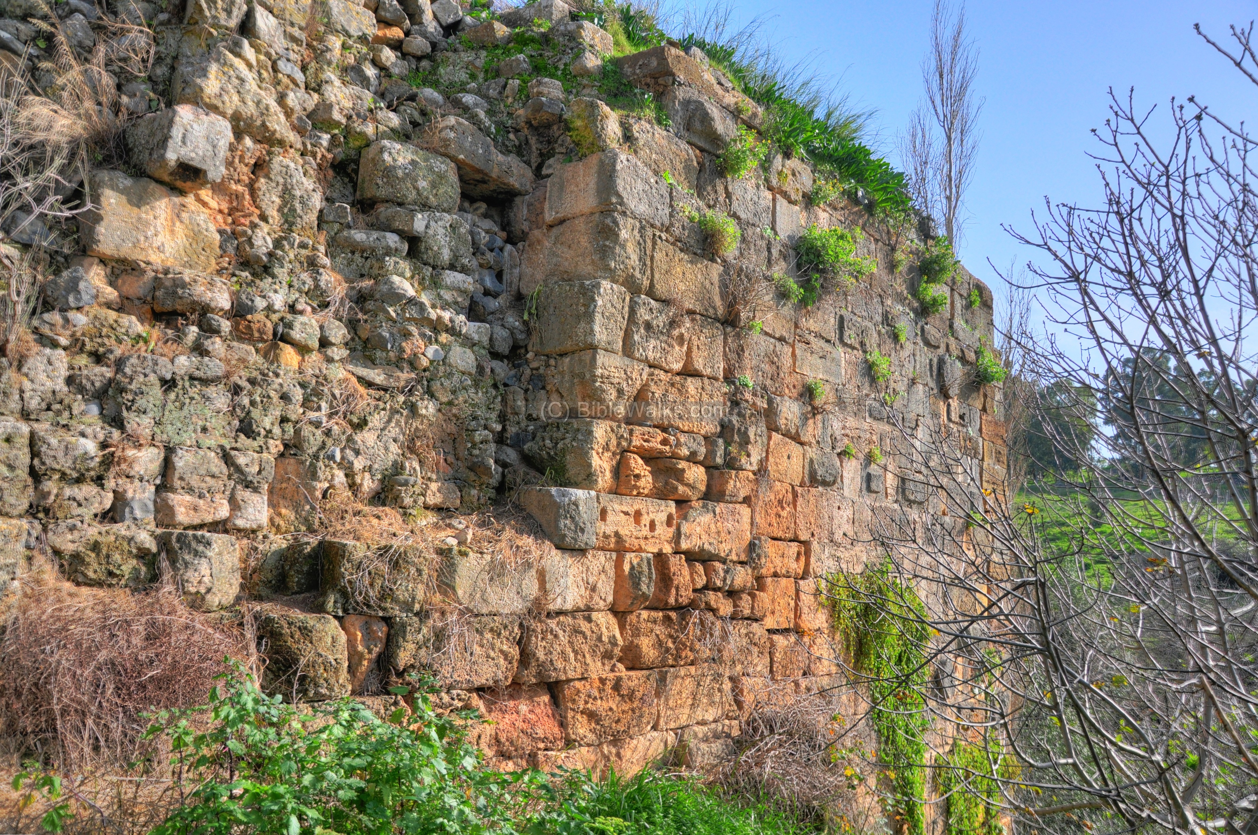
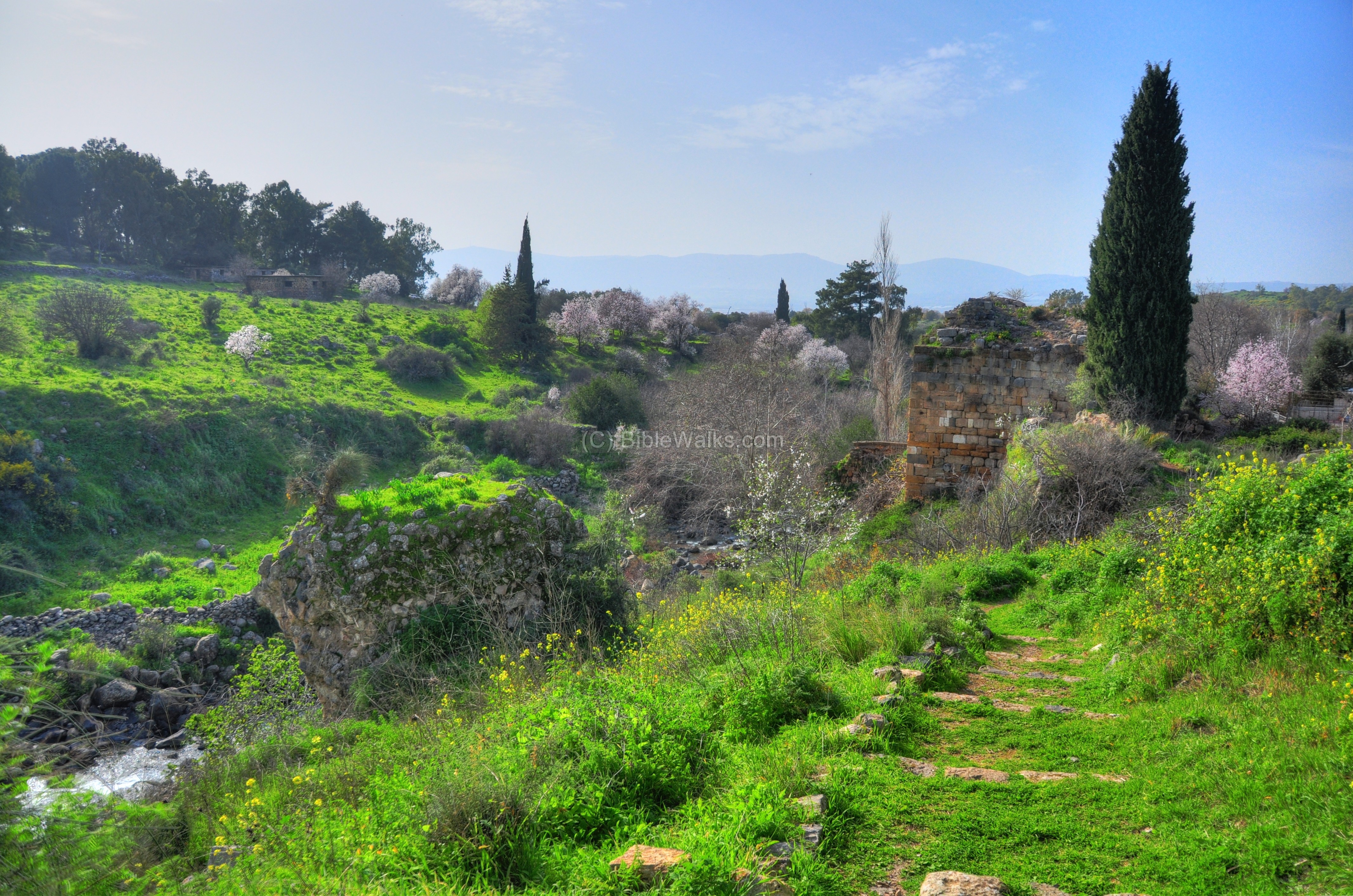
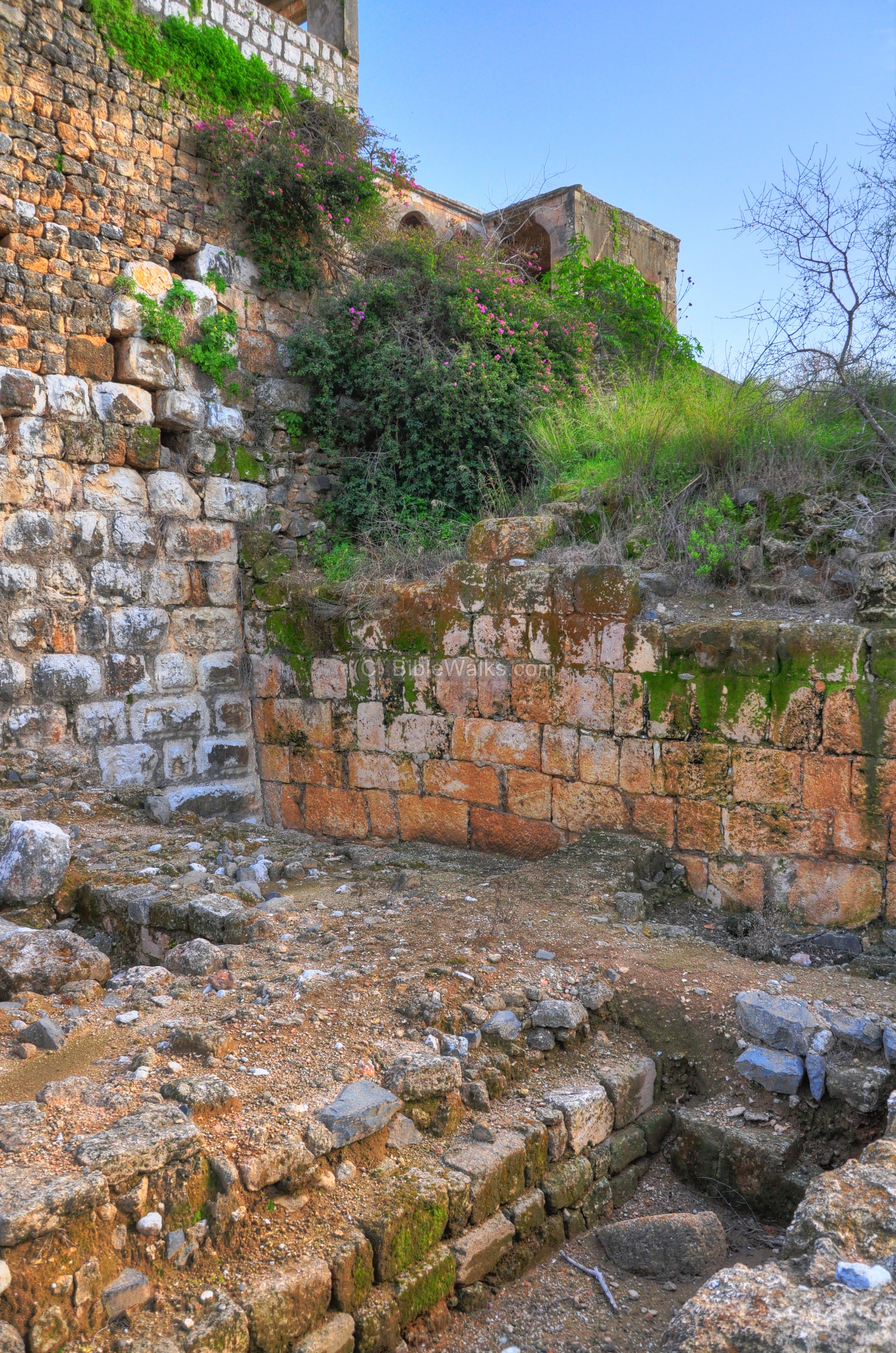
(d) Southern walls:
Walking further along the southern walls, which follow the path of the Sa’ar stream, you can see additional sections of the walls of the Crusader city.
A view of that section from the other side is seen in the next picture.
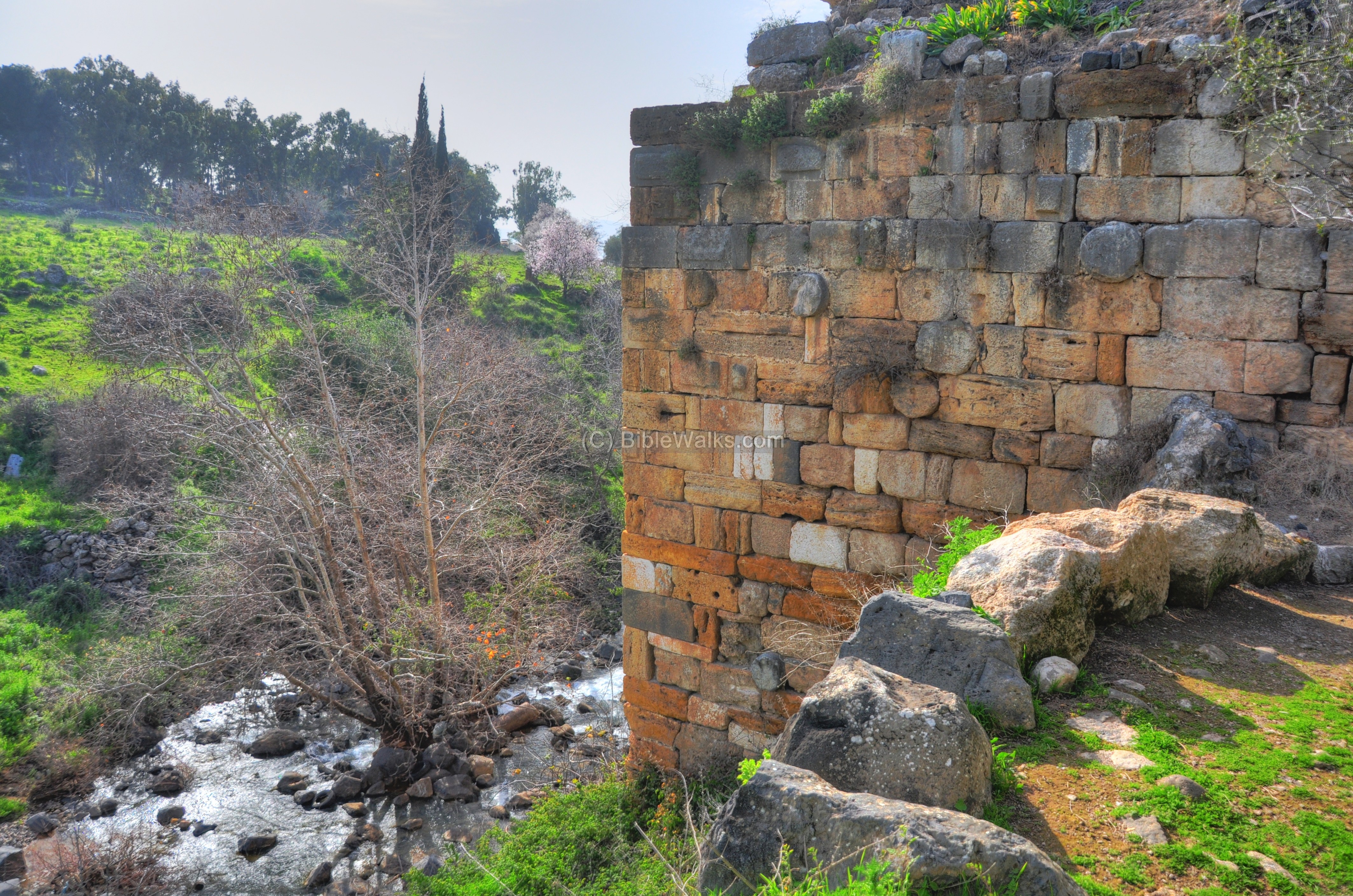
(e) South-East tower:
On the south-east corner of the city are the ruin
s of another Crusader tower. Its location within the area of the Crusader city is marked as a red square.

A view of this tower is shown below – from the west side.

A closer view of the ruins of the tower:

The other side of the tower is seen below. An ancient column sticks out from the wall, probably the builders reused one of the columns from the ruined Roman structures.
Under the ruins are cactus bushes. These cactus were useful as fences and are common in many ancient sites.

The corner tower, south walls and Sa’ar stream are seen in the eastern view below:
(f) Eastern Walls & Moat :
Across the North-East tower is a moat, which provided protection along the eastern walls of the city. It is indicated as a red square on the map.

This dry moat is approximately 8m wide. On the western side of the moat are the walls of the city, while the eastern side was supported by a wall.
The center of the eastern walls is seen below, looking from the bottom of the moat towards the north. The north-east tower is seen in the far background.

A view from the north side:
The southern section can be seen below. Behind it, in the background, is a Maronite church.

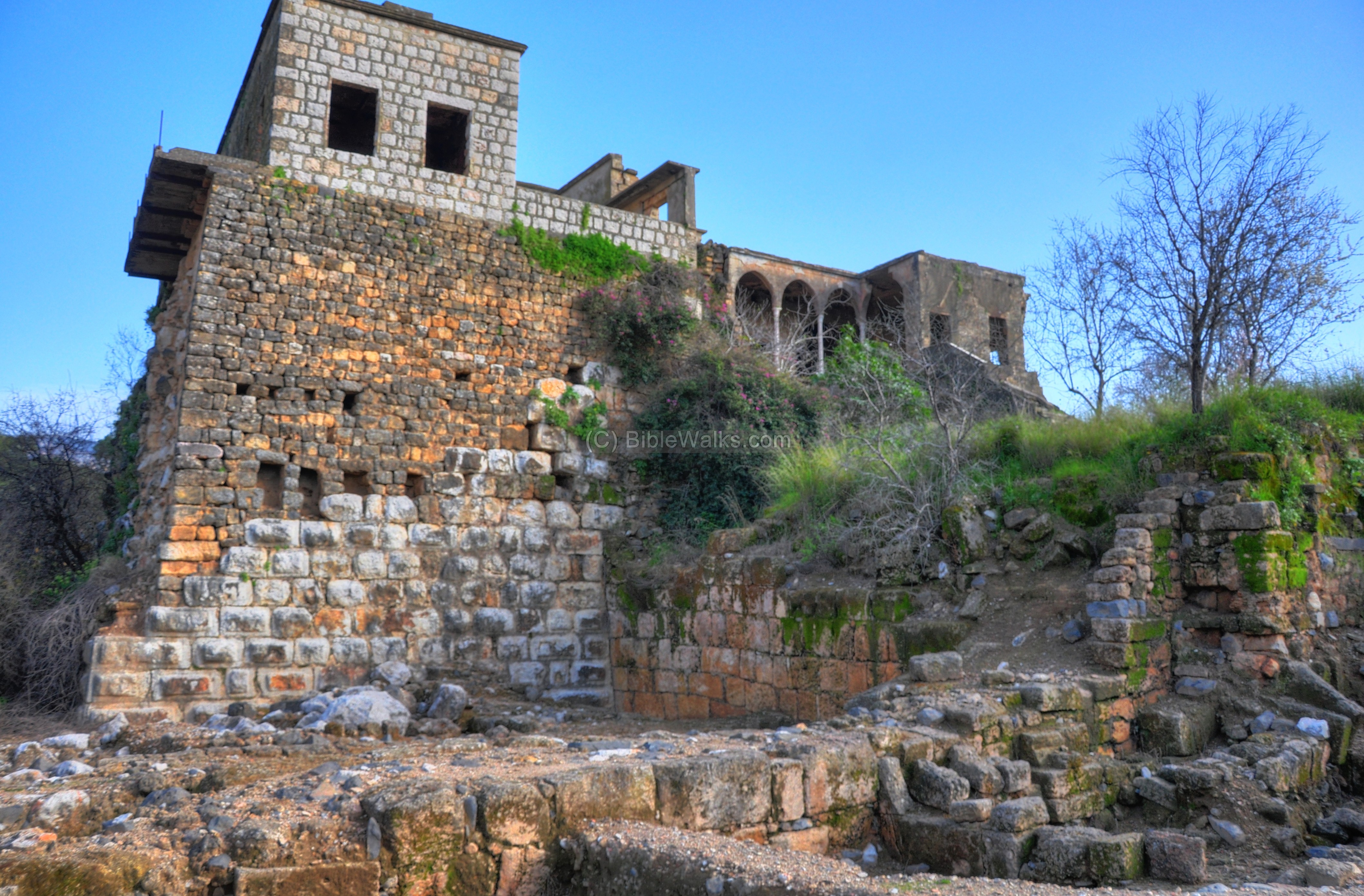
(g) North-east tower:
On the north-east side, near the entrance to the Banias park, are the ruins of a tall Syrian house. It is actually located on the ruins of the North-Eastern tower.
The map shows its location as a red square.

There are five construction phases which are visible from this side (from lower level upwards): 1. Roman-Byzantine (lower, large blocks); 2. Crusader (brown blocks on the right vertical wall); 3. Ayyubid (white blocks on the lower left vertical wall); 4. Ottoman (smaller brown stones on top); 5. Modern Syrian (top level).
Another view of the bottom of the tower:
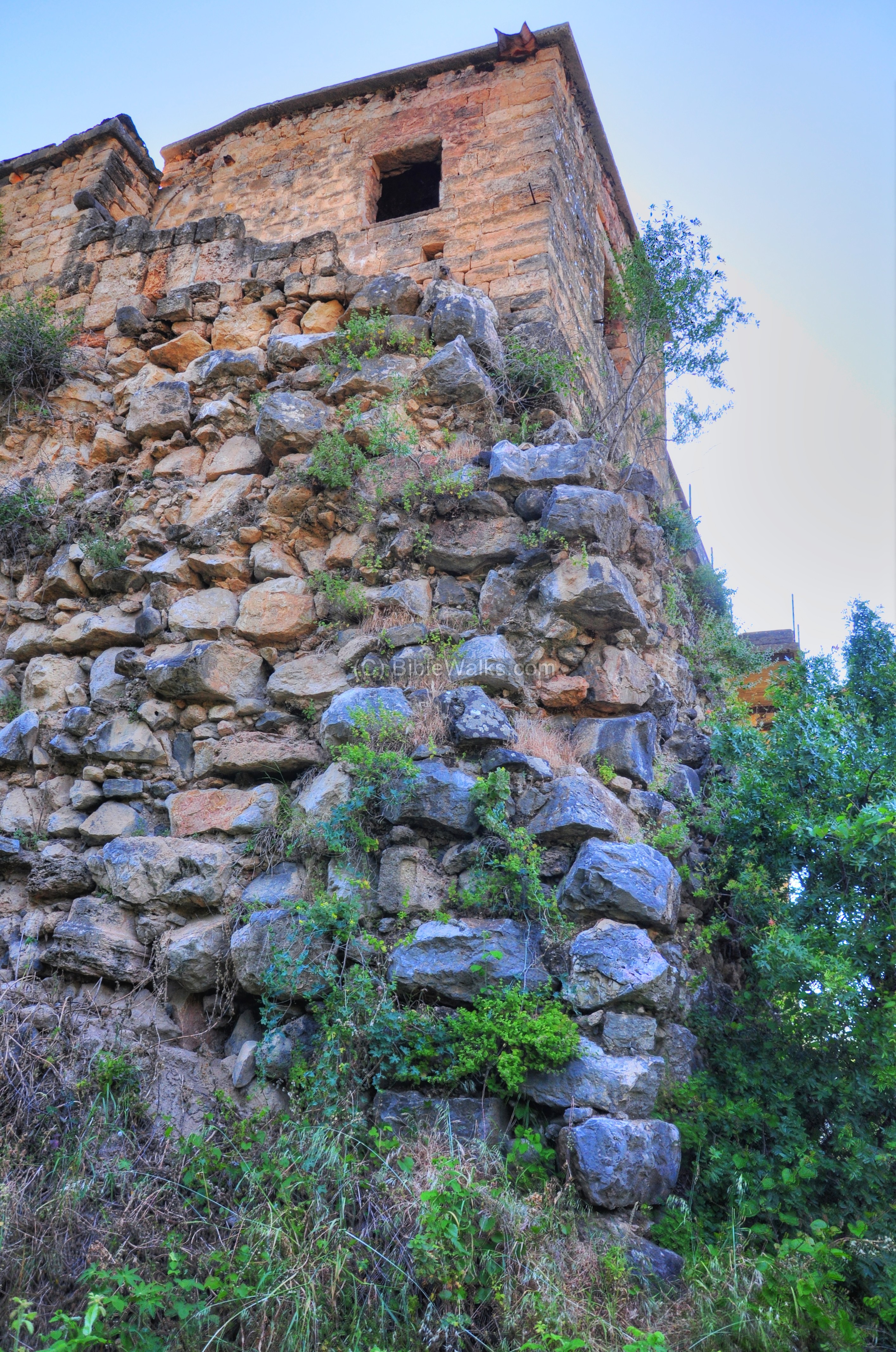
The following picture shows a closer view of the Crusader wall – the brown vertical wall on the right side. At the ground level are the Roman/Byzantine period walls.
Etymology (behind the name):
* Names of the city-
- Paneas – The city of Pan – Greco-Roman God of shepherds and flocks, mountainside, hunting and rustic music
- Panias, Panium, Panaeon – other forms of “city of Pan”
- Banias – the Arabic name of the village – preserved its name
- Caesarea-Philippi – Caesarea is the city of Caesar; Philippi – named after Herod’s son who made the city is capital
*Other:
- Sa’ar – Name of the stream; Hebrew: stormy, tempest (due to the power of water after heavy winter storms). Biblical reference: (Jeremiah 30 23):”Behold, the whirlwind of the LORD goeth forth with fury, a continuing whirlwind”.
Links:
* External links:
- Nature reserve
- Banias – the southwestern tower – IAA excavations report
* Internal links:
- Banias Overview page
- Banias temples
- Banias stream
- Banias Roman/Byzantine city
- Nimrod fortress – Crusaders/Arab/Mameluke fortress above the city
BibleWalks.com – have Bible will travel
Banias Roman city <<<–previous site—<<<All Sites>>>—Next Golan site —->>> Nimrod
This page was last updated on Aug 26, 2010
Sponsored links: