A Nabatean city on the Incense Route, which became an impressive desert city during the Roman and Byzantine periods.
Home > Sites > Negev > Avdat (Oboda)
Contents:
Background
Location
History
Plan
Photos
* South
* South Villa
* Roman Tower
* Byzantine Qrtr
* City Fortress
* Nabatean Temples
* South Church
* Lookout
* Baptistery
* Repairs
* Eastern side
* City Caves
* Visitor Center
Etymology
Links
Background:
The ancient city of Avdat (Oboda) was initially a station on the Incense Route in the Negev highlands. It was developed to a city by the Nabateans starting in the 3rd century BC. During the Roman period the city was part of the defense and transportation systems of the Empire, and flourished during the Byzantine period with the construction of Churches, structures, workshops and vast agriculture farming. The city was finally abandoned in the 7th century following an earthquake. It became a National park and World Heritage site, a recommended site on the road to the south.
Isaiah 16 1:”Send ye the lamb to the ruler of the land from Sela to the wilderness”.
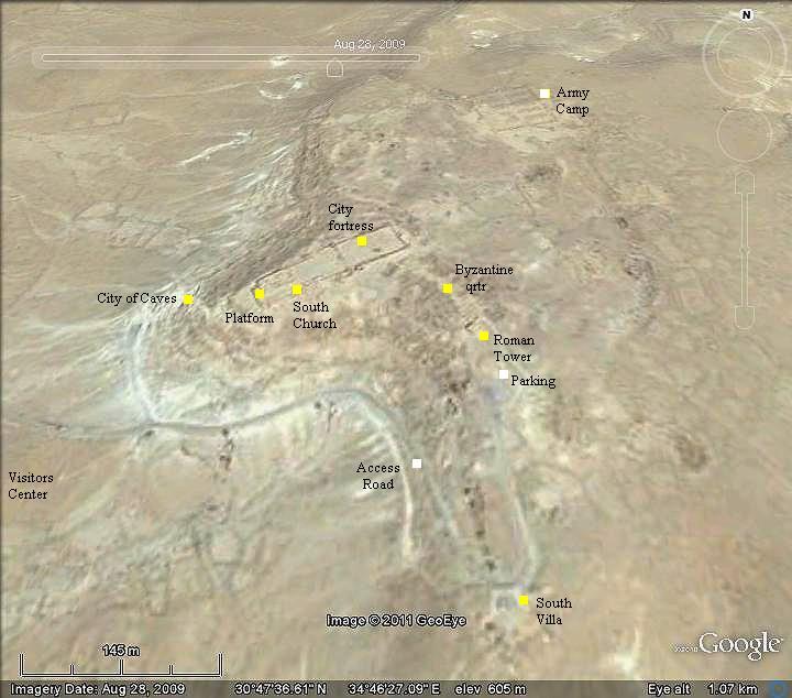
Location and aerial map:
The site is located in the middle of the Negev desert highland, between Beer Sheba and the Ramon Crater. The ruins of the ancient city are located on the edge of a high plateau, east side of highway #40.
If you travel south to Eilat via Mizpeh-Ramon, Avdat is a great place to stop – even for just one hour. There is an easy access road from the visitor’s center up to the ruins, which leads to the parking place near the Roman Tower.
History:
- The Incense / Spice route
The Incense & Spice route connected the east (Yemen and Oman), through Arabia, via the Nabatean capital city Petra, to the port city of Gaza on the shore of the Mediterranean Sea. This road, with a total length of 2,400 km, passed through harsh desert areas. It was used by the Nabateans to export the incense and spices from southern Arabia and the Far east to the Classic world of Greece and Rome. 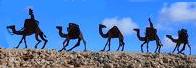
Caravans of camels carrying the merchandise along the Incense route
The Biblical map below shows its path, with Avdat (Oboda) in the center of the Negev desert. The city started in the 3rd century BC as a fortified station (number 62) along this route, and protected the valuable cargo from robbers. It also supplied water, food and shelter to the caravans.
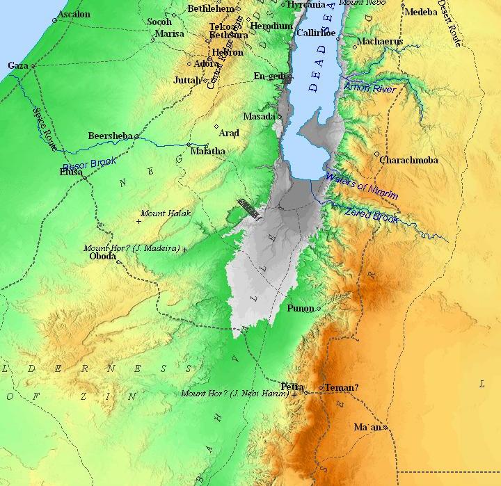
Map of the Incense/Spice route – during the Nabatean and Roman/Byzantine periods (based on Bible Mapper 3.0)
- The Nabateans
The Nabateans originated from Arabia, where they have been nomadic tent dwellers. The name “Nabat” may have originated from the word meaning “of-Arab”, a name which is known since the 10th century BC. Their language was Aramaic and many of their words were Arabic. The Nabatean script is similar to the Moab script. Although they have not left any books, the research of their history is based on the inscriptions on tombs, and on Greek and Roman historians, such as Diodorus Siculus (half of 1st century BC) and Josephus Flavius (half of 1st century AD). The Nabateans excelled in ceramics, mastered in collecting the desert water, and were skilled merchants.
The Nabateans prospered from the operation of the Incense and Spice route, and established stations and cities along the route. This commercial enterprise started around the 5th or 4th century BC, and made these merchants rich. Their new capital city in Edom, called Petra, based on the Greek word for Rock. In the Bible it is also named ‘rock’ (Sela in Hebrew). Judges 1 36: “And the coast of the Amorites was from the going up to Akrabbim, from the rock, and upward”, Isaiah 16 1:”Send ye the lamb to the ruler of the land from Sela to the wilderness, unto the mount of the daughter of Zion.” Petra was the center of a vast Kingdom: the kingdom included the Negev and Sinai, Northern Arabia, Moab and Hauran (Houran). The Nabateans mastered the utilization of the scarce rainfall in the desert area, by collecting the surface runoff into hidden cisterns, and then used it for their water supply and the development of desert agriculture.
The Nabateans arrived to the Negev during the Persian period (about the 4th century BC). Prof A. Negev, the excavator of Avdat and other Nabatean sites, defines 3 periods in the history of the Nabateans in the Negev:
-
Early Nabatean period (4th-1st century BC) – the nomad period during the Persian and Hellenistic periods
-
Middle Nabatean period (25BC to 50/70AD) – the trade empire – during the Early Roman period
-
Late Nabatean period (70/80 to 150AD) – the urban agriculture period – during the Early Roman period
-
Alexander the Great (332 BC) and successors – Hellenistic period
When Alexander the Great arrived to the area (332 BC), the Nabateans suffered from his Army. The Greeks set siege on Gaza, their important outlet to the Sea, and conquered it after 2 months. The entire population was killed or sold to slavery, and replaced by new residents. The Greeks also fought against their allies, the Nabateans, and attacked Lachish. This was a major setback to the Nabateans.
After Alexander’s death, the Greeks continued to hit the Nabateans. Learning about the riches of Petra, the Greek general Antigonus sent his forces in 311 to capture and loot their capital city Petra. Although the Nabateans managed to retrieve the stolen treasures after one night, they learned their lesson – the Incense route must be protected.
- Establishment of Avdat (3rd century BC)
In order to support & protect the Incense route, the Nabateans established stations and fortresses along the road. One of these stations, located in the Negev highland, is Avdat. It was established in the 3rd century BC, and was later named after their king Avdat/Obodas.
- Hasmonean-Nabatean battles (2nd -1st century BC)
During the Hasmonean dynasty, the early Jewish Kings worked together with the Nabateans. This changed when in about 100 BC the Hasmonean King Alexander Jannaeus conquered the port city of Gaza, the final station of the Incense route. Gaza was under Nabatean control since the Persian period, and the loss of the city was a major defeat for the Nabateans, causing their cities along the route to decline. On the other hand, the possession of Gaza made the Hasmoneans richer and was one of the important sources of income for the Jewish Kingdom.
King Obodas (Avdat) I ruled the Nabatean Kingdom from 96-85 BC. He defeated Alexander Jannaeus in a battle northwest of Philadelphia (modern day Amman) in 95BC. This Nabatean victory gave the city its name.
Later, King Obodas III (ruled 30-9BC) developed the city and was buried there. His silver coin is illustrated here, with his bust on the left side with the word “Avdat” to his right. His queen is seen on the reverse side of the coin, with the mint date and also an inscription of a blessing by the Nabatean God Dushara.
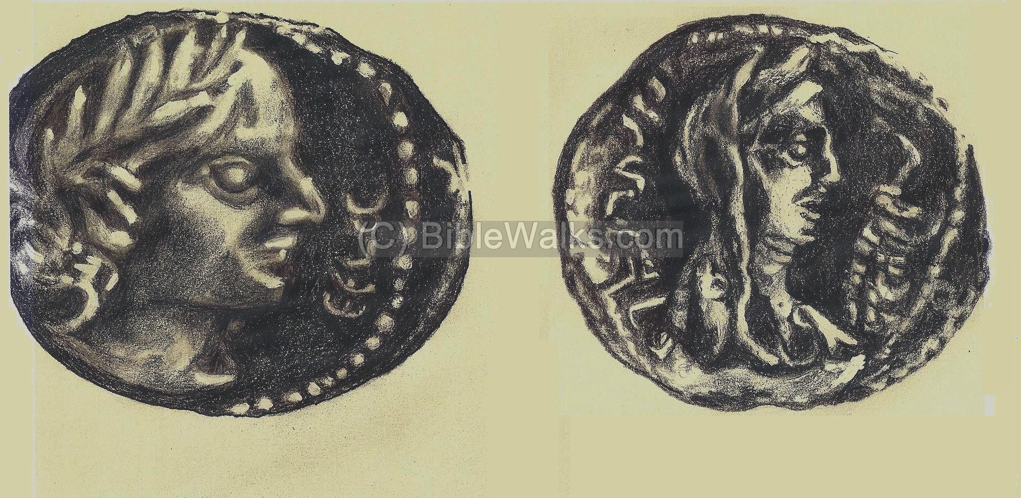
Nabatean coin of Obodas III (30-9BC) – Drawing by Rina
Left Obverse: bust of Obodas III, “Avdat”
Right Reverse: draped queen “Year — Barcat Dushara”
The Hasmonean Kingdom controlled Gaza until the Roman conquest by Pompey the Great forty years later (63BC).
- Early Roman period (1st century AD)
Only during the time of Herod the Great (37-4BC) the Mediterranean ports were reopened and the Incense route revived, bringing Avdat a new era of prosperity. The city continued to prosper and develop under the reign of the Nabatean King Areta (Khartat) IV (9-40AD). This period is the Nabatean’s golden age, with fifty years of prosperity. The acropolis of Avdat, the pottery workshop, the army camp, and other remains of structures date to this period. At this time there were few residential houses in the city, and the majority lived in tents in the area outside the city walls.
Avdat was damaged by attacks of Arab tribes (the Thamuds and other Arabian tribes) during the middle of the 1st century AD. An evidence of fire was found in most of the excavated areas. The city was later reconstructed and further developed by King Rabbel II (70-106AD) who managed to deal with the invasion of the tribes and the economic changes following the decline of the Incense route.
The Incense route started to decline at the end of the 1st century AD, since it was replaced by other routes through the Roman empire. The Nabateans gradually switched to the development of desert agriculture and providing support to the Roman army and travelers along the desert roads. This successful transition – from the operation of the route to desert agriculture – revived the wealth of the Kingdom. According to some archaeologists, the desert farming was brought in only during the Byzantine period.
- Roman Annexation (106AD)
In 106AD the Romans annexed the Nabatean Kingdom. It became part of the defense and road systems of the Roman empire, and appears on the Peutinger map (based on a 4th century Roman military road map) as “Oboda” (marked by a red square) as a station on the road from Jerusalem to Eilat. Note that the orientation of the Roman map is north on the right side. The Incense route is not shown on the map.
The Roman annexation brought a substantial religious change – from the Nabatean Semite religion to the paganism of the Roman world.
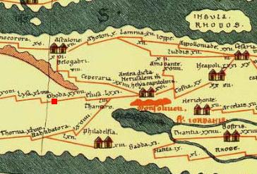
Peutinger Roman Military Map: Oboda/Avdat (in red) is a station along the Jerusalem to Eilat road
- Byzantine period (4th – 7th century AD)
The Nabateans converted to Christianity and their temples were replaced by two Churches and a monastery. A large residential quarter was built, as well as other installations and structures. The city continued to develop, but reached a tragic end following a massive earthquake in around 630BC. This led to the abandonment of the city.
- Rediscovery (19th century)
The Arabic name of the ruins was Eboda, which preserved the ancient name. Palmer and Drake were the first researchers who correctly identified the location of Avdat (1870). The first archaeological detailed survey was conducted by Musil (1902), and the first excavations were by Colt (1937), Avi-Yonah (1958), and A. Negev (1959-1960). These were followed by excavations by A. Negev and R. Cohen (1975-1977), P. Fabian (1993-1994, 1999) and T. Erikson-Gini (1999-2000). Recent restorations are conducted (2010-2011) after the site was vandalized.
The site became a UNESCO World heritage site in 2005, and was listed together with the Incense route from Avdat to Moa in the Arava (65KM long).
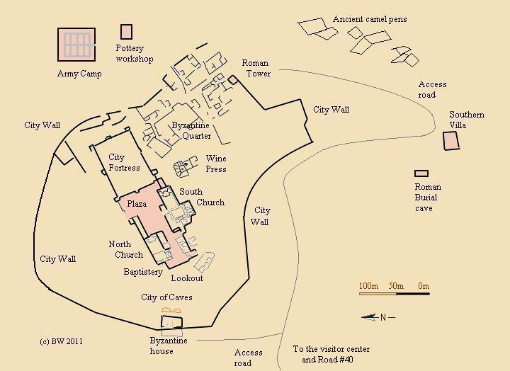
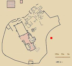
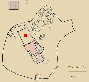
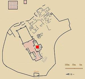
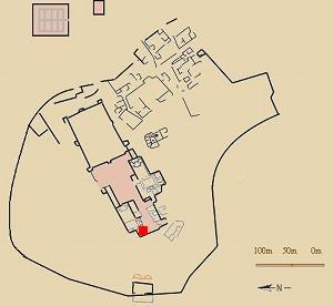
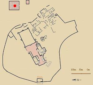
City Plan:
The city is located on a high (alt 620m) plateau, about 160m above above the valley to the west (where the ancient road passed, and the modern road and visitor center are located).
A plan of the ancient city is seen in the diagram below, highlighting the major sights. The pink areas are dated to the Nabatean and Roman periods, while other areas date to the Byzantine period.
Photos:
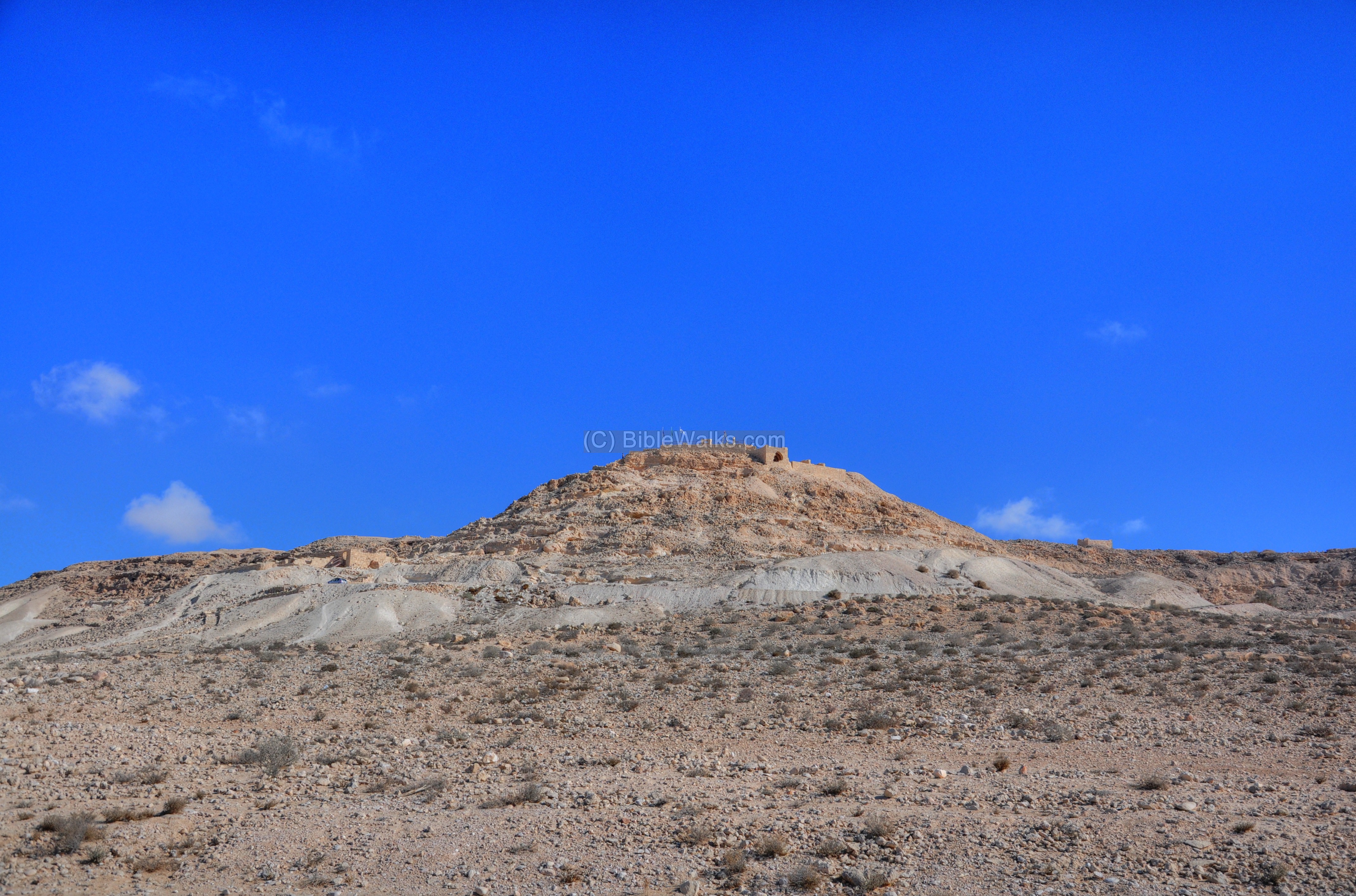
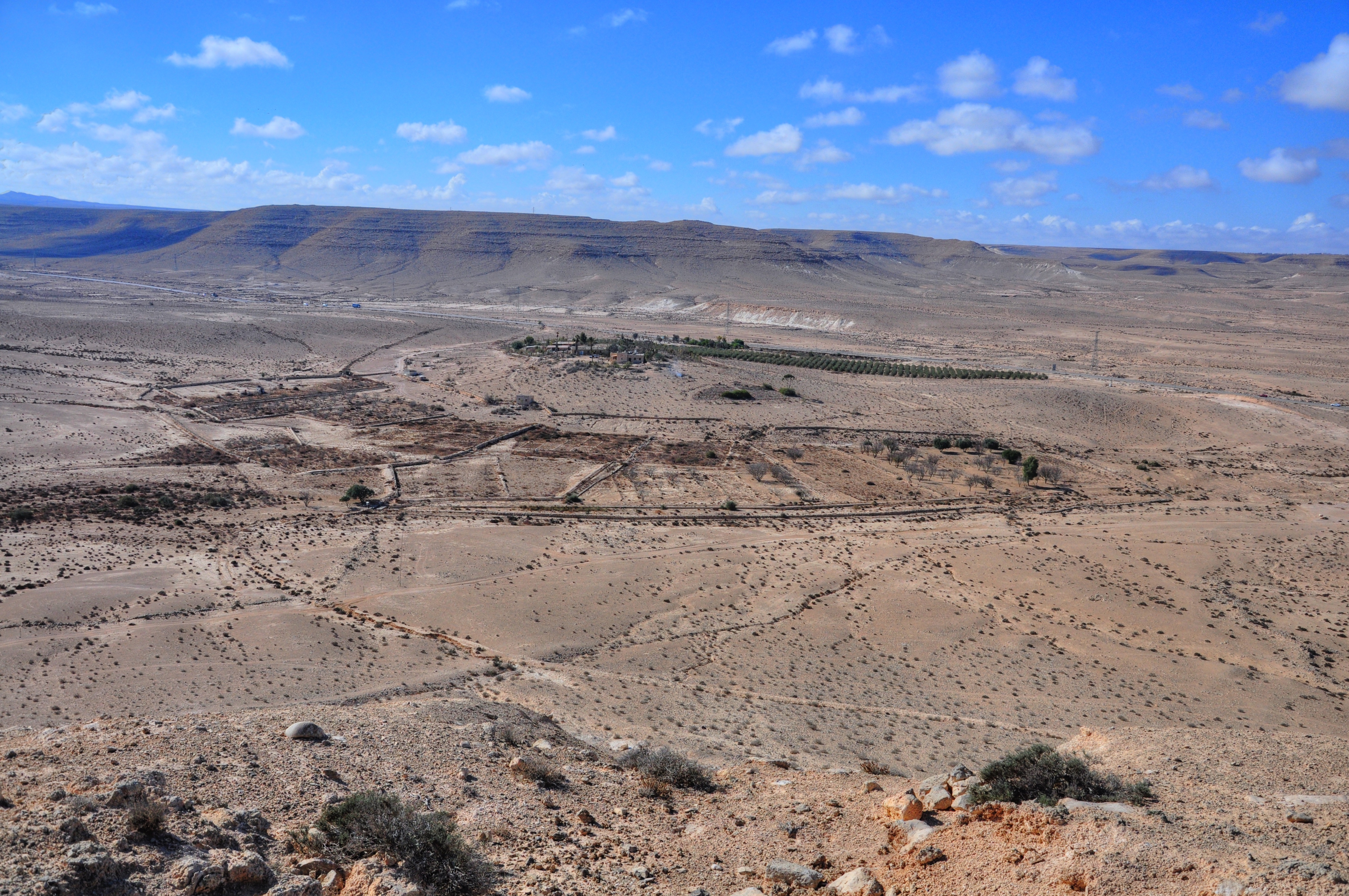
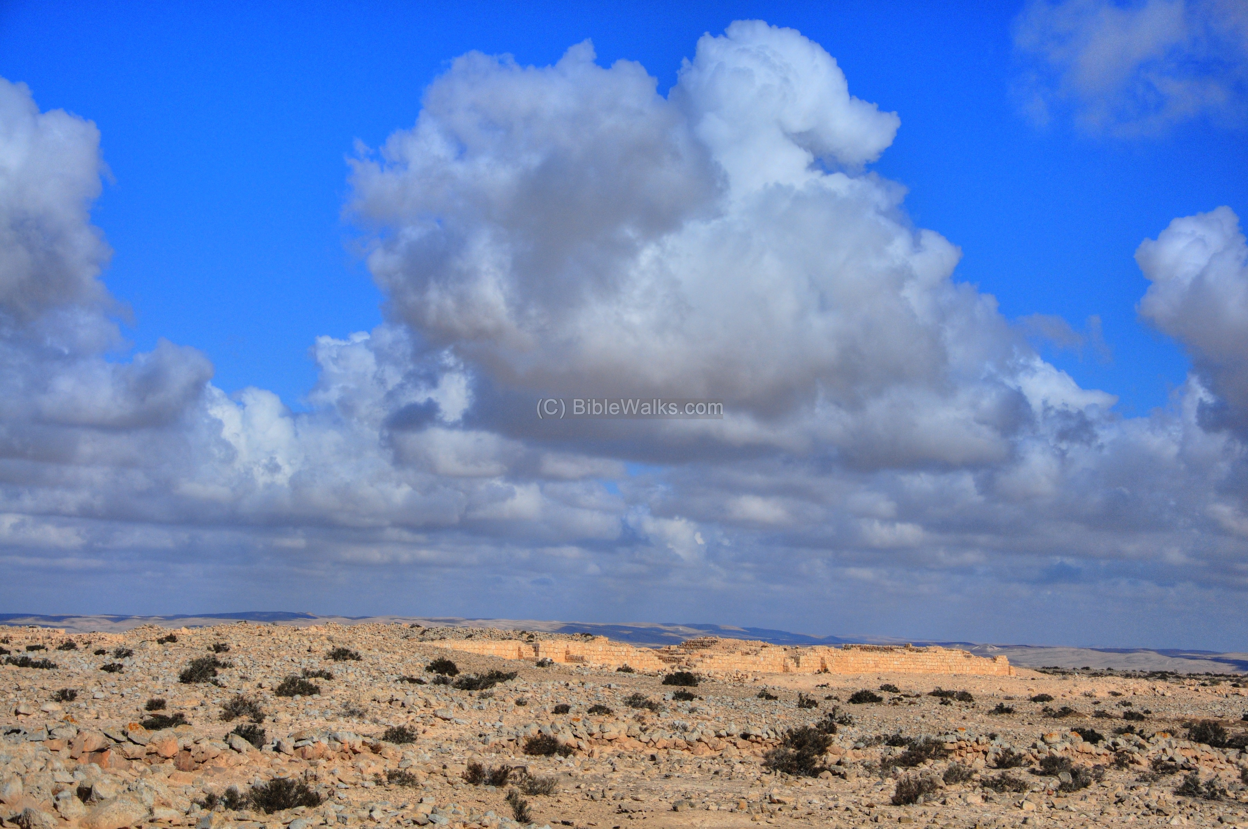
(a) General View
The western edge of the city is seen from the visitor’s center. The ruins of the city are located on a plateau high above the course of the road.
Click on the photos to view in higher resolution…
A panoramic view, as seen from the Roman tower towards the city, in seen in the following picture. If you press on it, a panoramic viewer will pop up. Using this flash-based panoramic viewer, you can move around and zoom in and out, optionally click on hotspots and view the site in full screen mode. Note that it may take minutes to upload.
To open the viewer, simply click on the photo below.
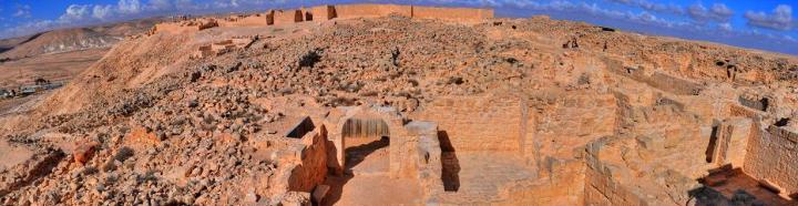
(b) South hillside
The access road ascends from the visitor center up to the Roman tower, along the southern side of the city. The red square on the plan of the city shows the position of the southern hillside. The city was once protected by a wall, and the road passes along its path.
Along the hillside are traces of the wall and other ruins, such as the house seen in the photo below.

Another view of the south-west hillside is below:

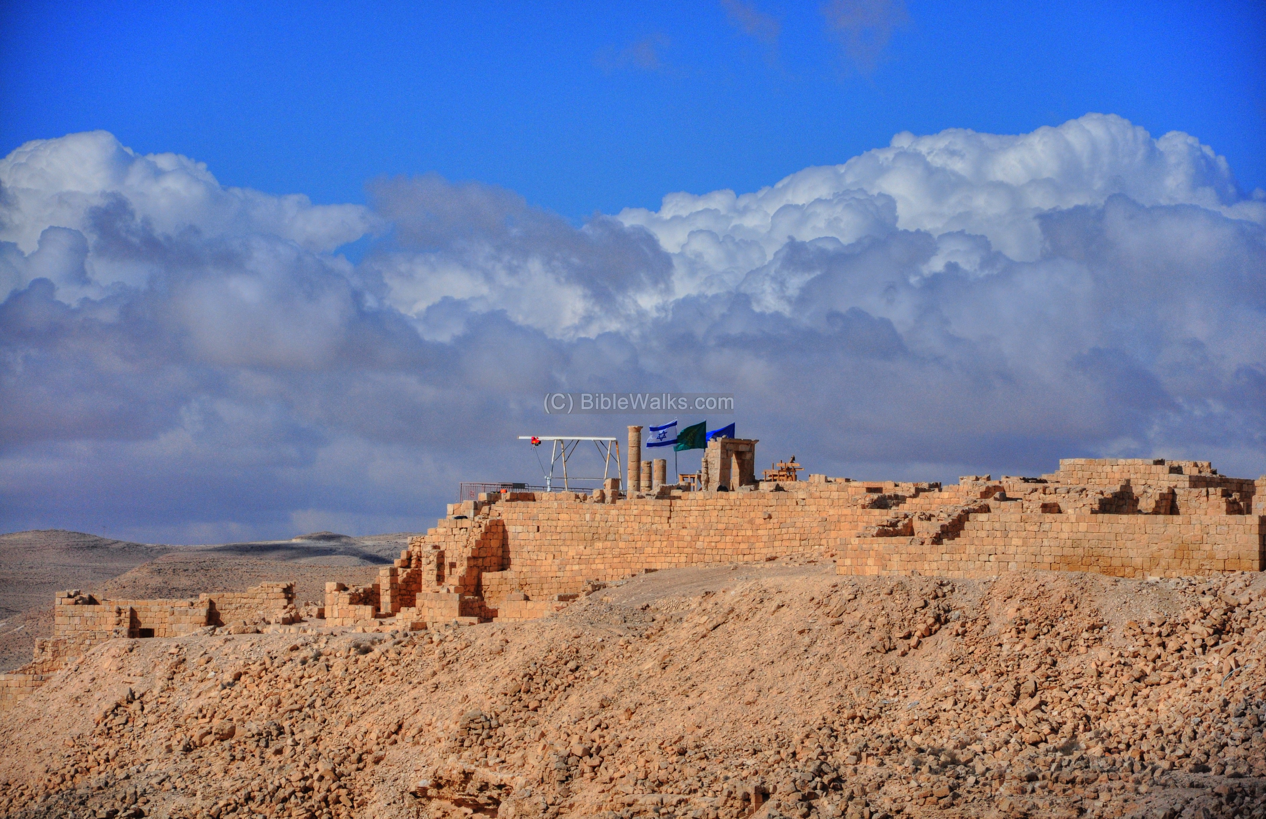
The south western side of the city – the acropolis – is better seen after climbing up the road. A lookout platform is located at the edge of the higher side, where the ruins of a Nabatean temple are in the process of reconstruction.
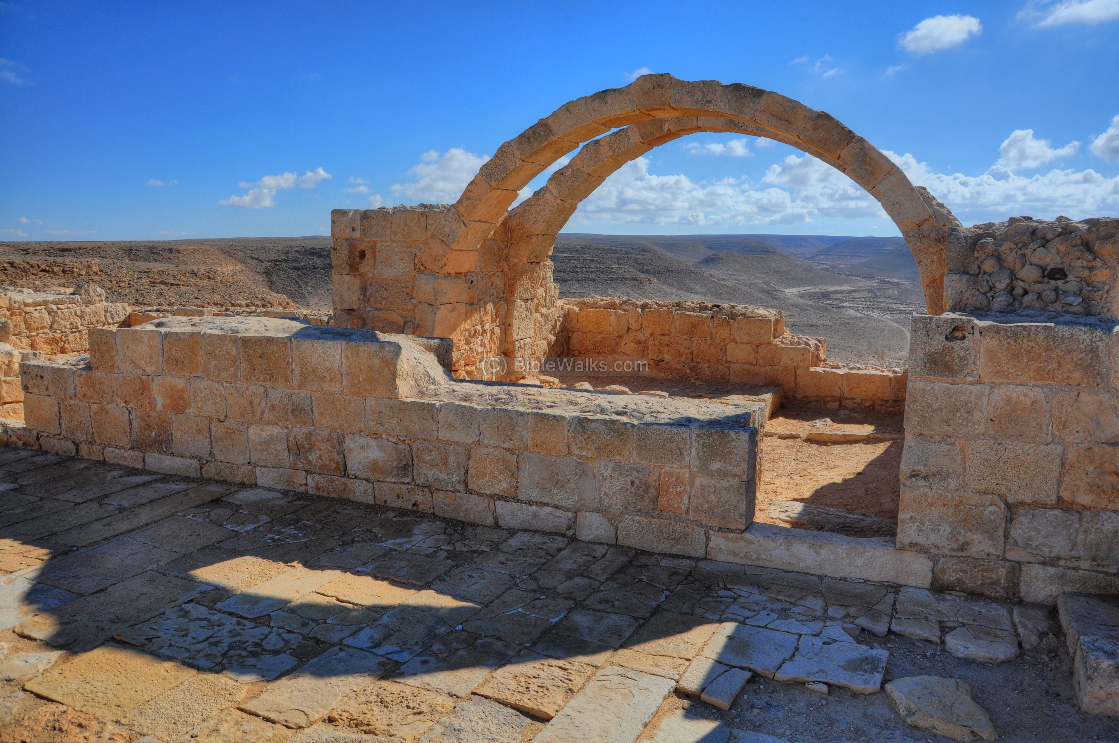
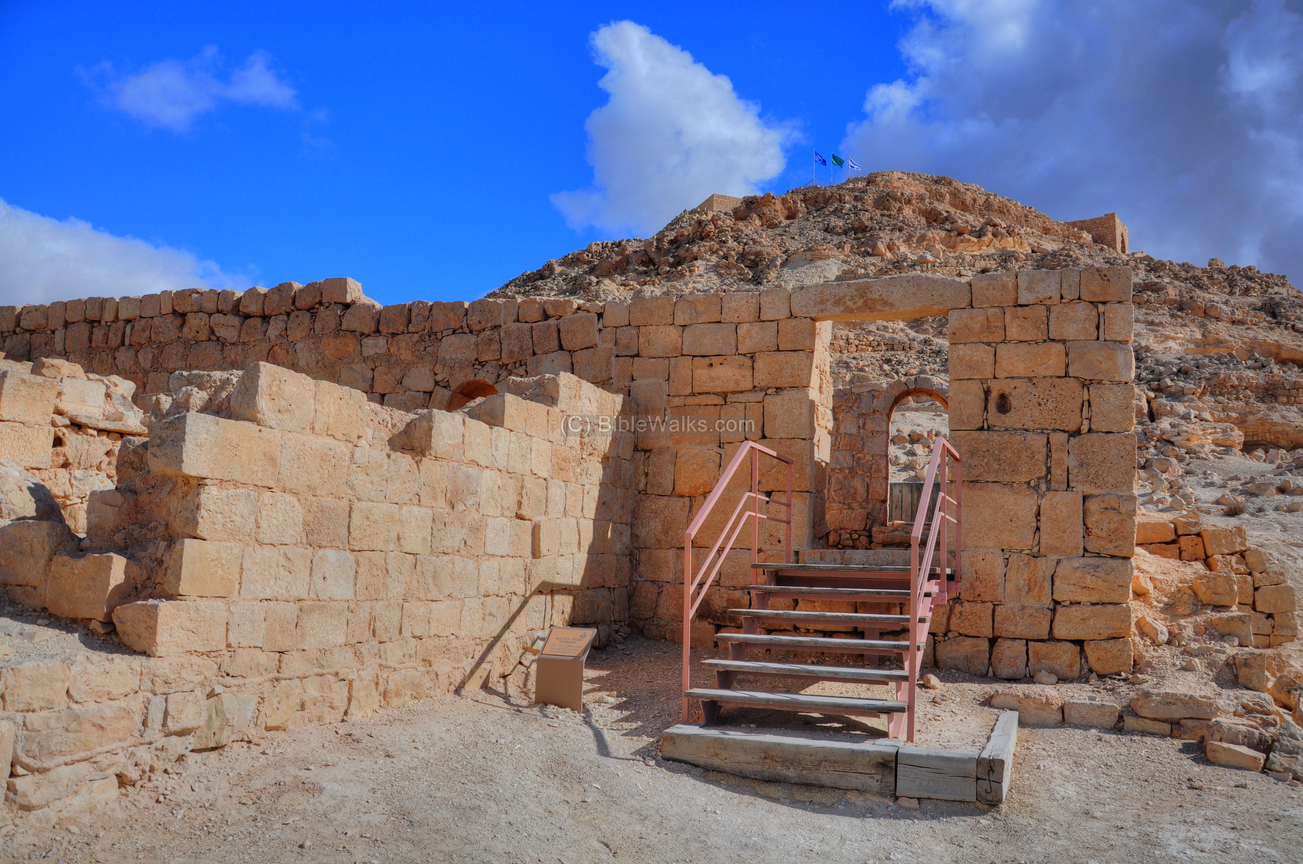
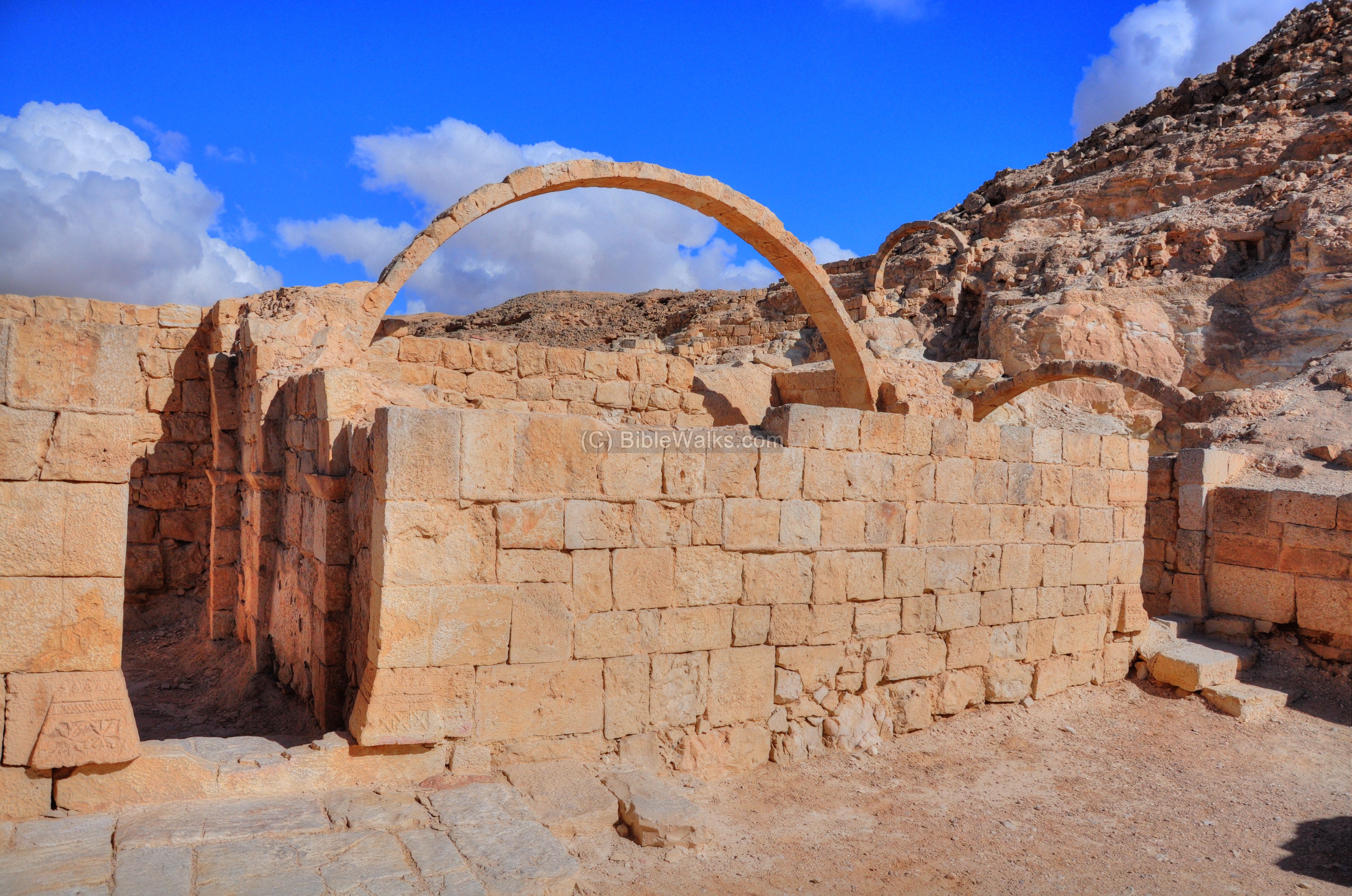
(c) Southern Villa
On the south side of the Avdat ridge are ruins of a Roman villa. This is how it looks from its north side:

The villa has several rooms which were built around a square courtyard. At the center of the courtyard is a cistern.

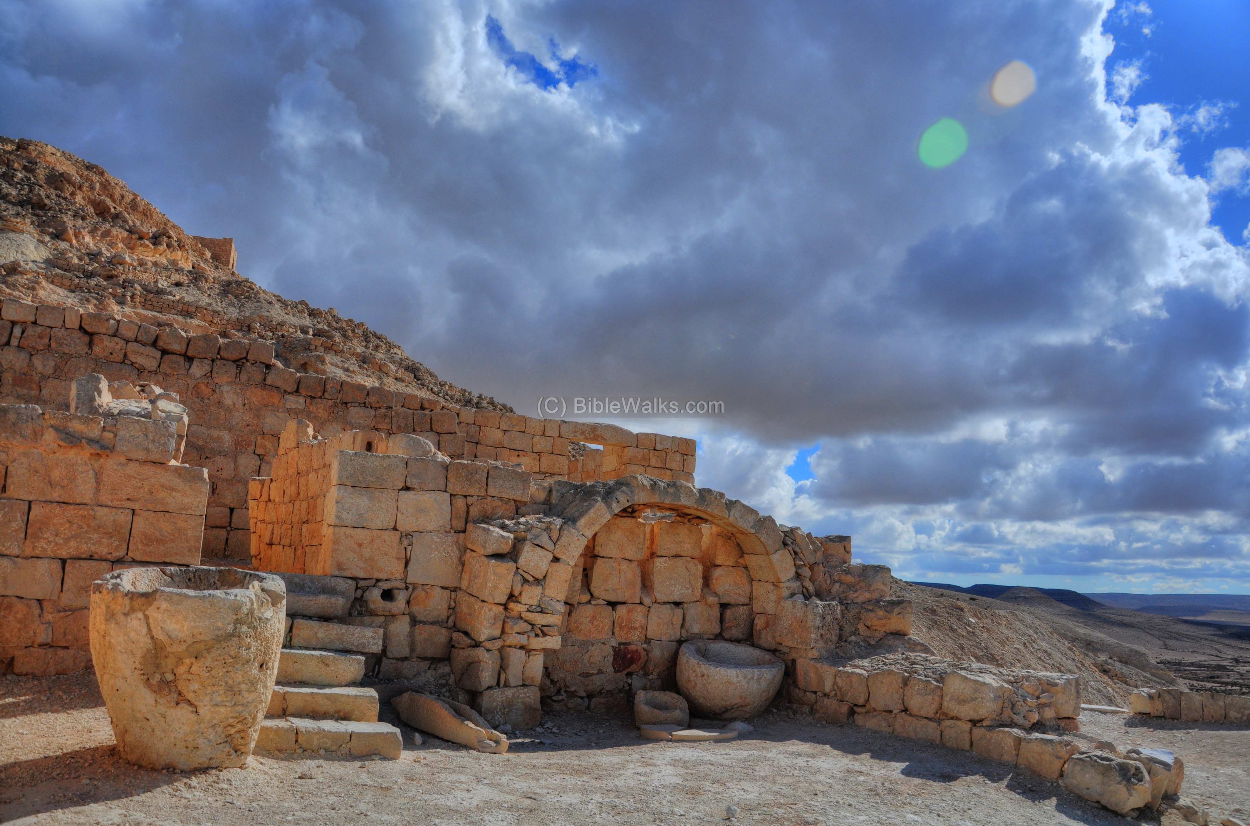
The roof was supported by arches, of which a pair were reconstructed in one of the rooms:

Another view of the arches:
From this side is a great view of the vast desert area around Avdat. This is the view towards the south:
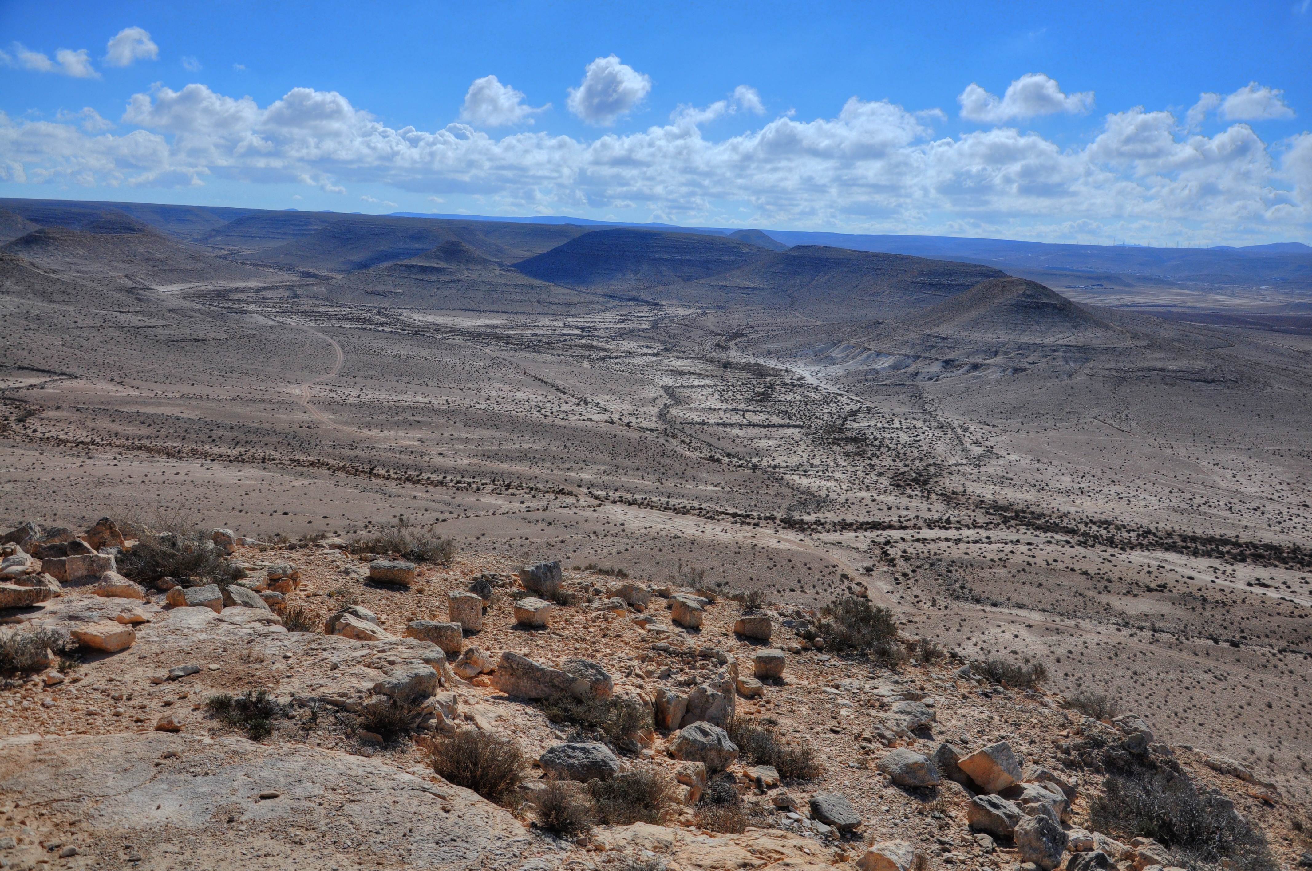
Also seen, on the south-west side, are agriculture farming areas which are reconstruction of the ancient irrigation and cultivation methods. During the Roman and Byzantine periods these farms supplied the city with fresh products, and were also one of the sources of the city’s income, since the Nabateans used to grow crops and sell it to the Army.
Another view of the villa, this one from the exterior:

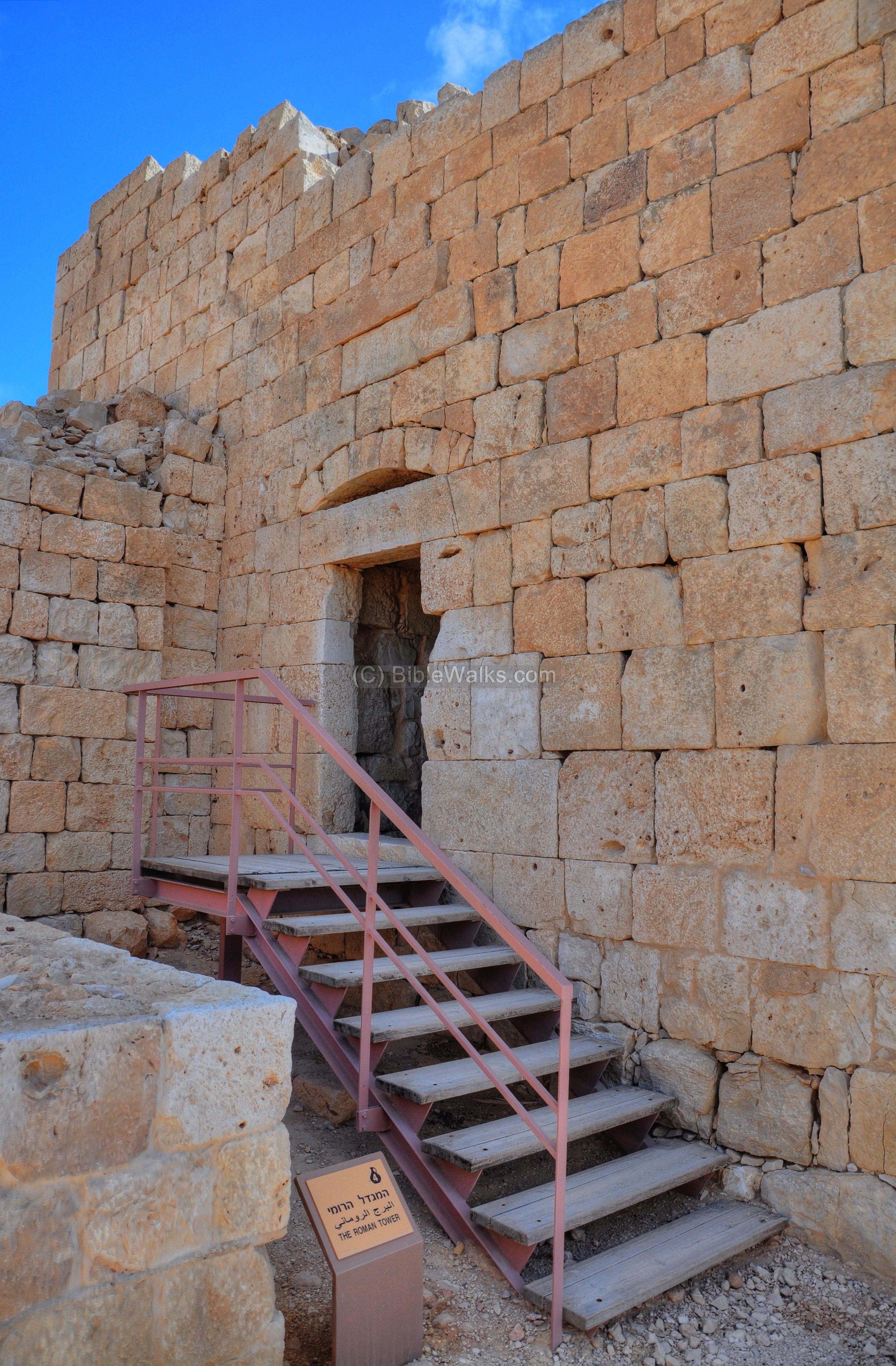
(d) Roman Tower
After completing the tour of the the southern villa, you continue to drive up the access road and reach to the parking area on the south-east side of the city. This is where the walking tour of the city begins.
A lookout tower, dated to the Roman period, is the first interest point inside the city. Its location on the plan of the city is indicated by a red square.
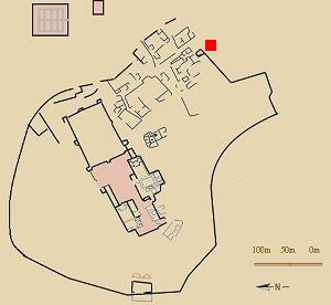
The tower is built along the city wall. It was constructed in 294 AD according to the inscription above its entrance.
A view of the tower from its west side can be seen in the picture below.

The entrance to the tower is from this side:
Another view of the tower, this one from the south-east side, is in the picture below. The roof of the tower affords great views of the area.
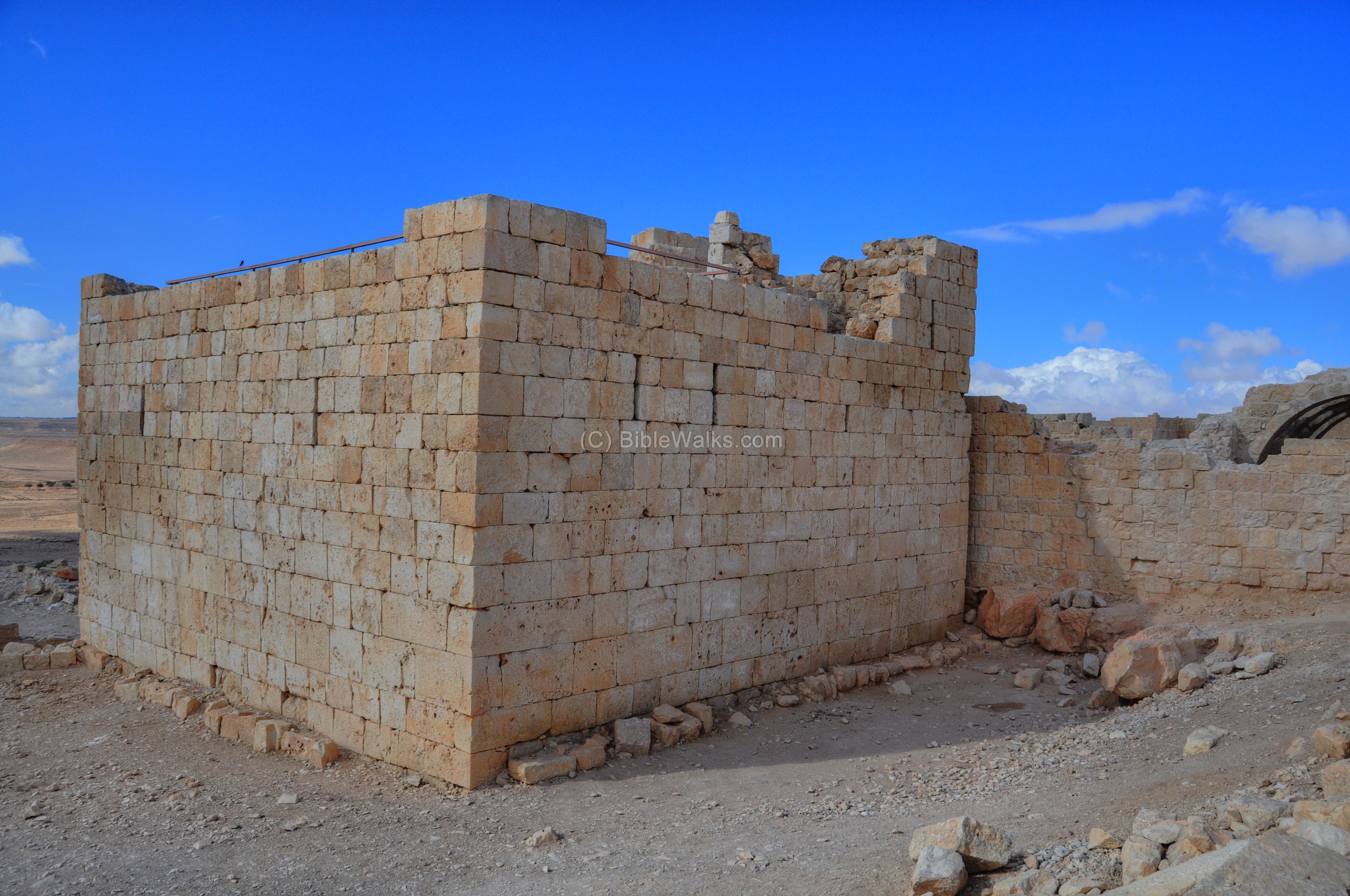
Standing on the roof of the tower, there is a great view of the Avdat acropolis and the southern hillside. (If you want to see the panorama again using the flash view, press here. Note that it loads slowly…)
The far structure, seen among the ruins, is an agriculture installation used for wine production. It is dated to the Byzantine period, and was one of the five winepress installations found in Avdat.
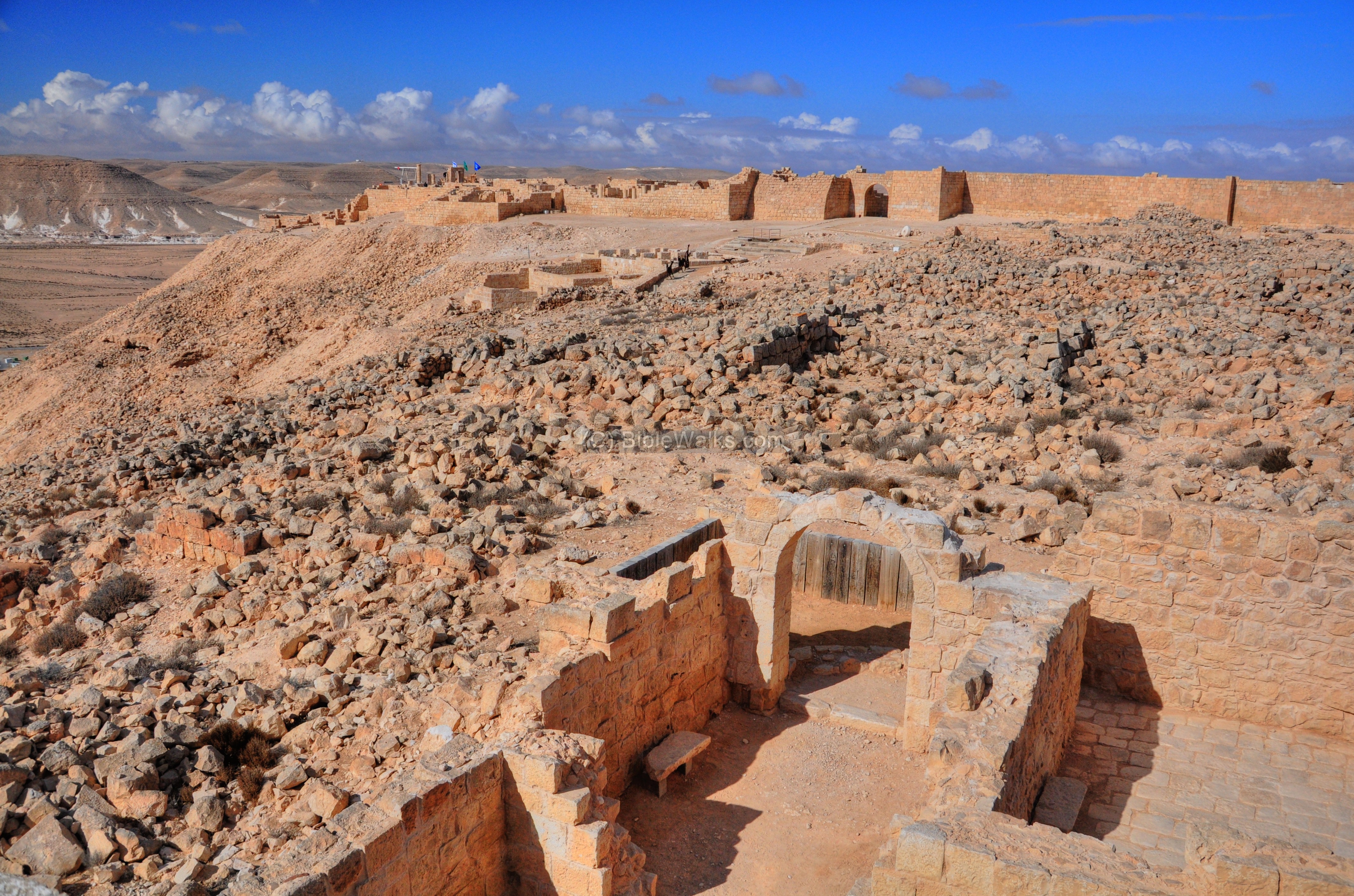
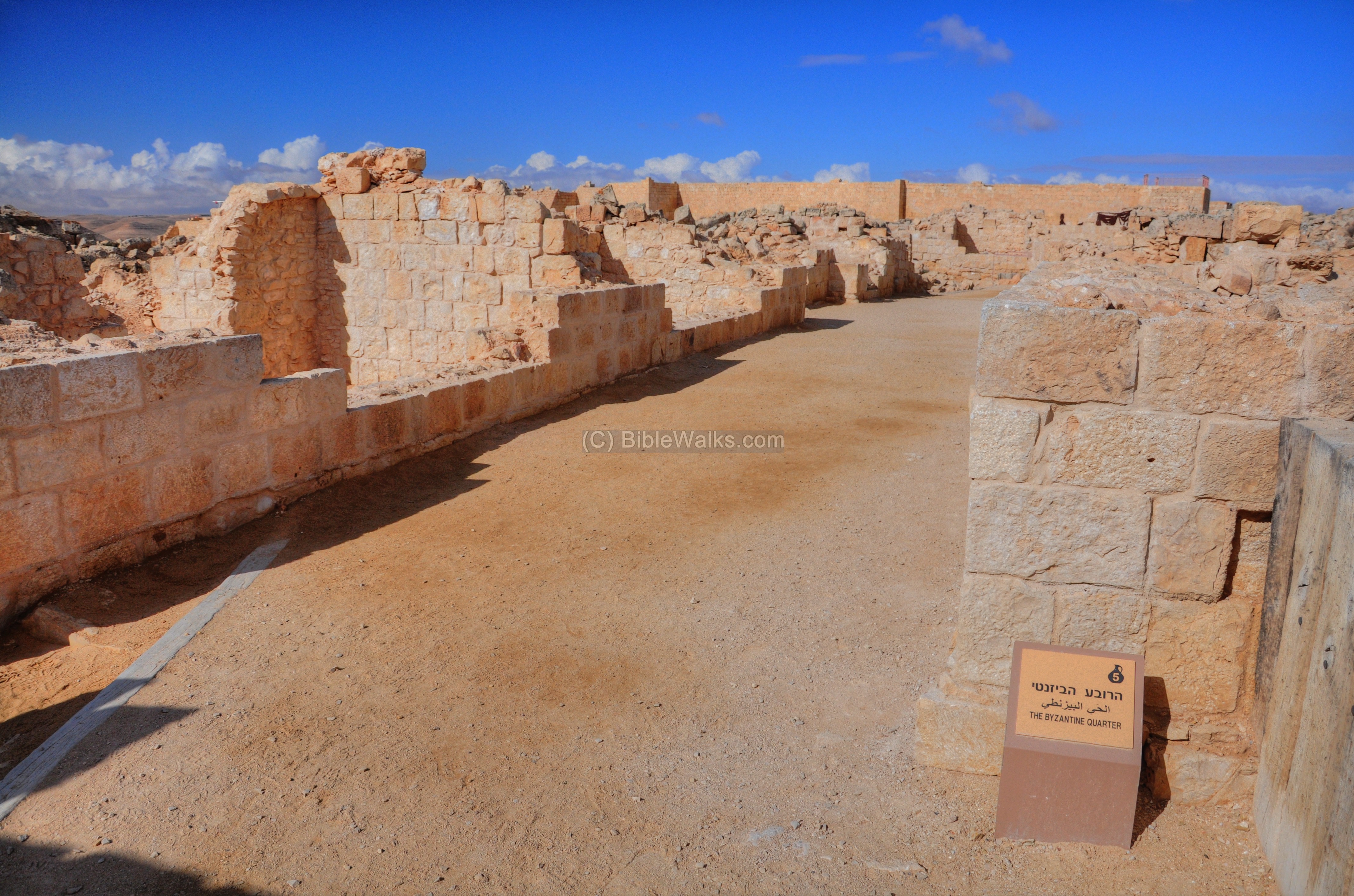
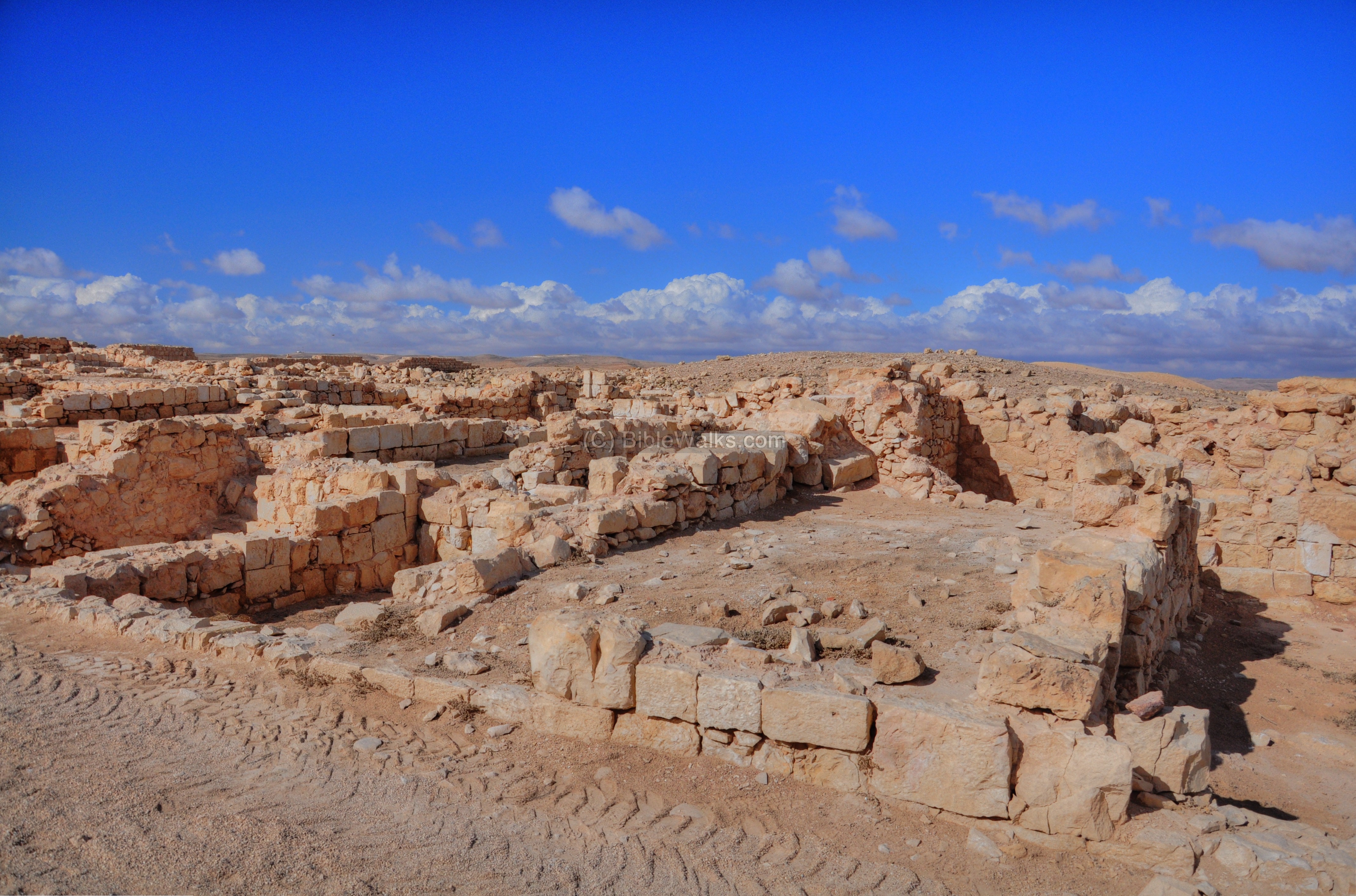
(e) Byzantine Quarter
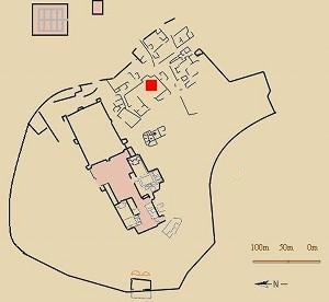
Beyond the city wall and the Roman tower is a vast area of ruins, which is still undergoing archaeological excavations and preservation. This residential quarter is dated to the Byzantine period. Its location is indicated on the map as a red square.
The quarter was first established during the Roman period, and was destroyed in an earthquake around 630AD.
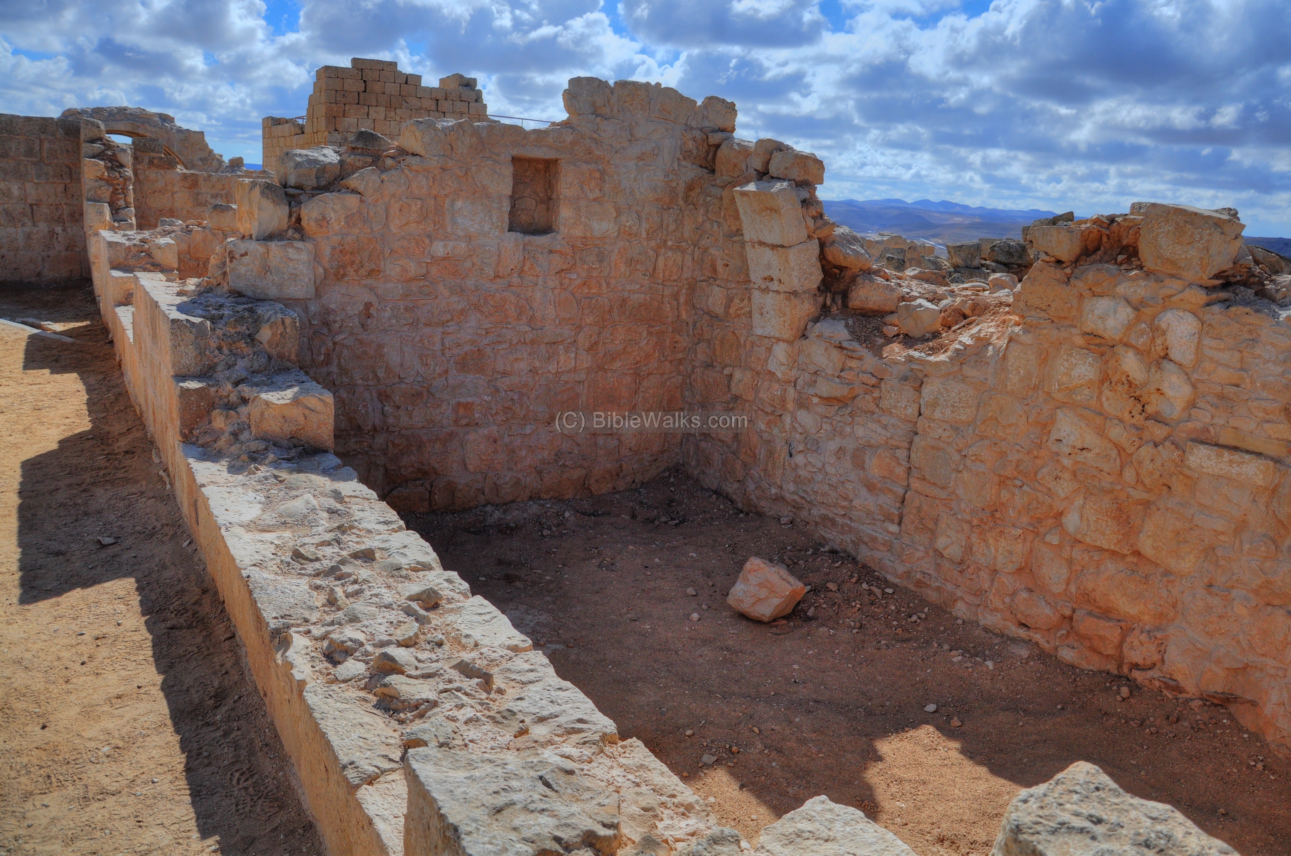
A view of one of the structures is shown below.
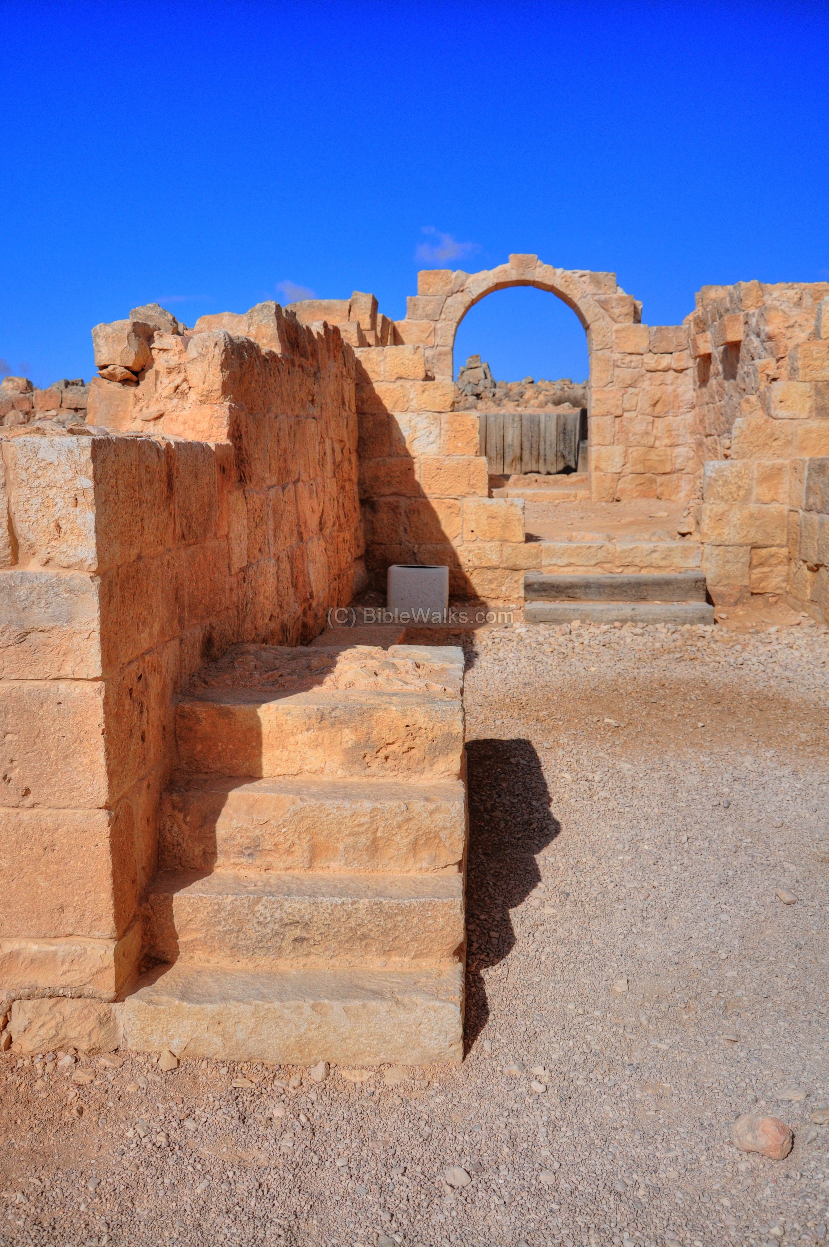
Another section of the dwelling houses:

Arches were used in order to support the roof and the second level of the house:

The Byzantine quarter consists of a main street in the direction of south-east to north-west, directed towards the fortress which is seen in the background. The dwelling structures are built on both sides of the street.
The street has a system of water channels, such as this one shown below, which lead the rain water from the roofs to collecting cisterns as seen on the lower-left side. These cisterns were the main source of water supply for the residents.
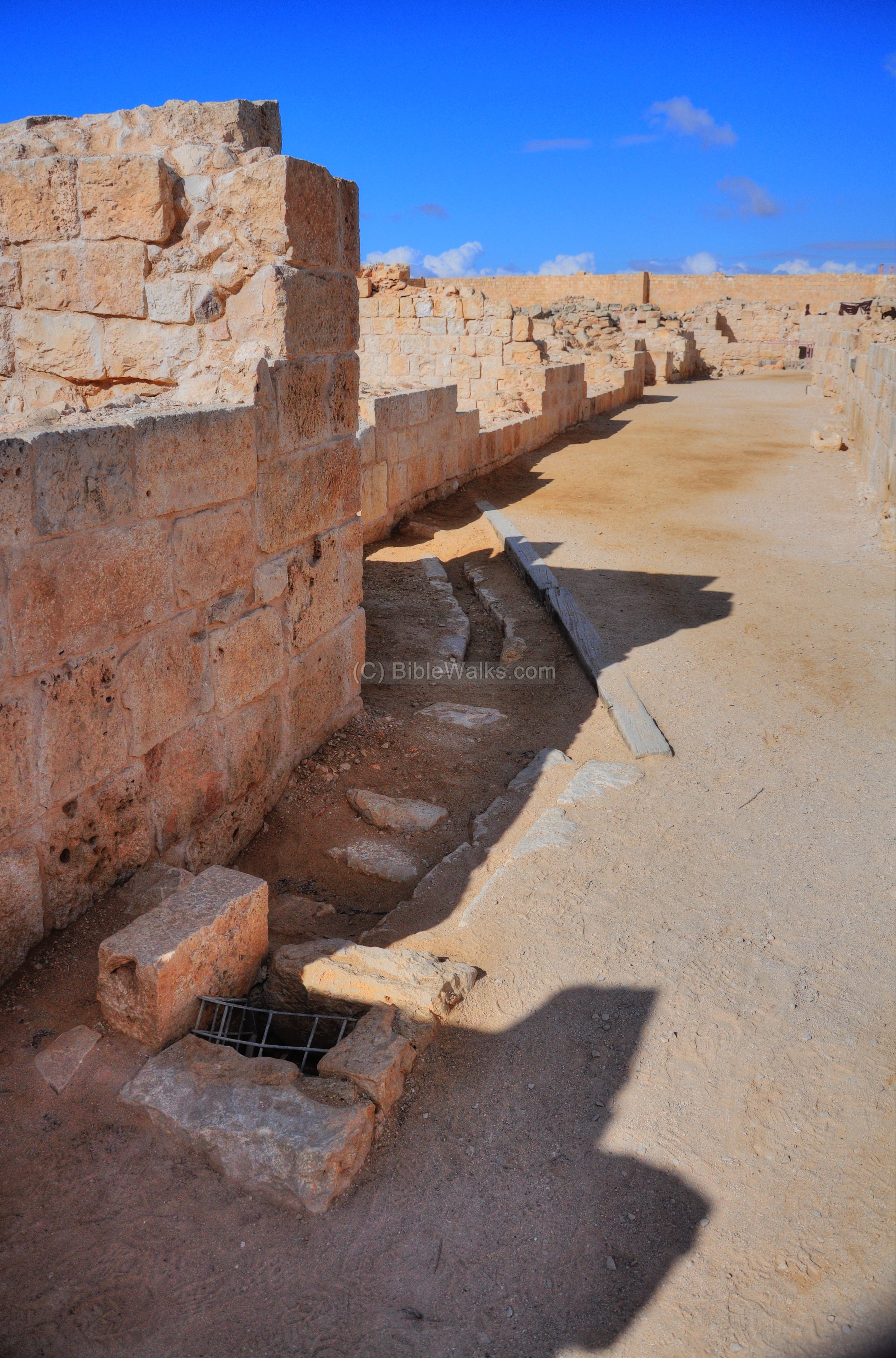
Along the main road are residential dwellings in various stages of reconstruction. The structures were leveled in the 7th century by an earthquake and remained in ruins since then, following the decline of the Incense route and the Arab conquest.
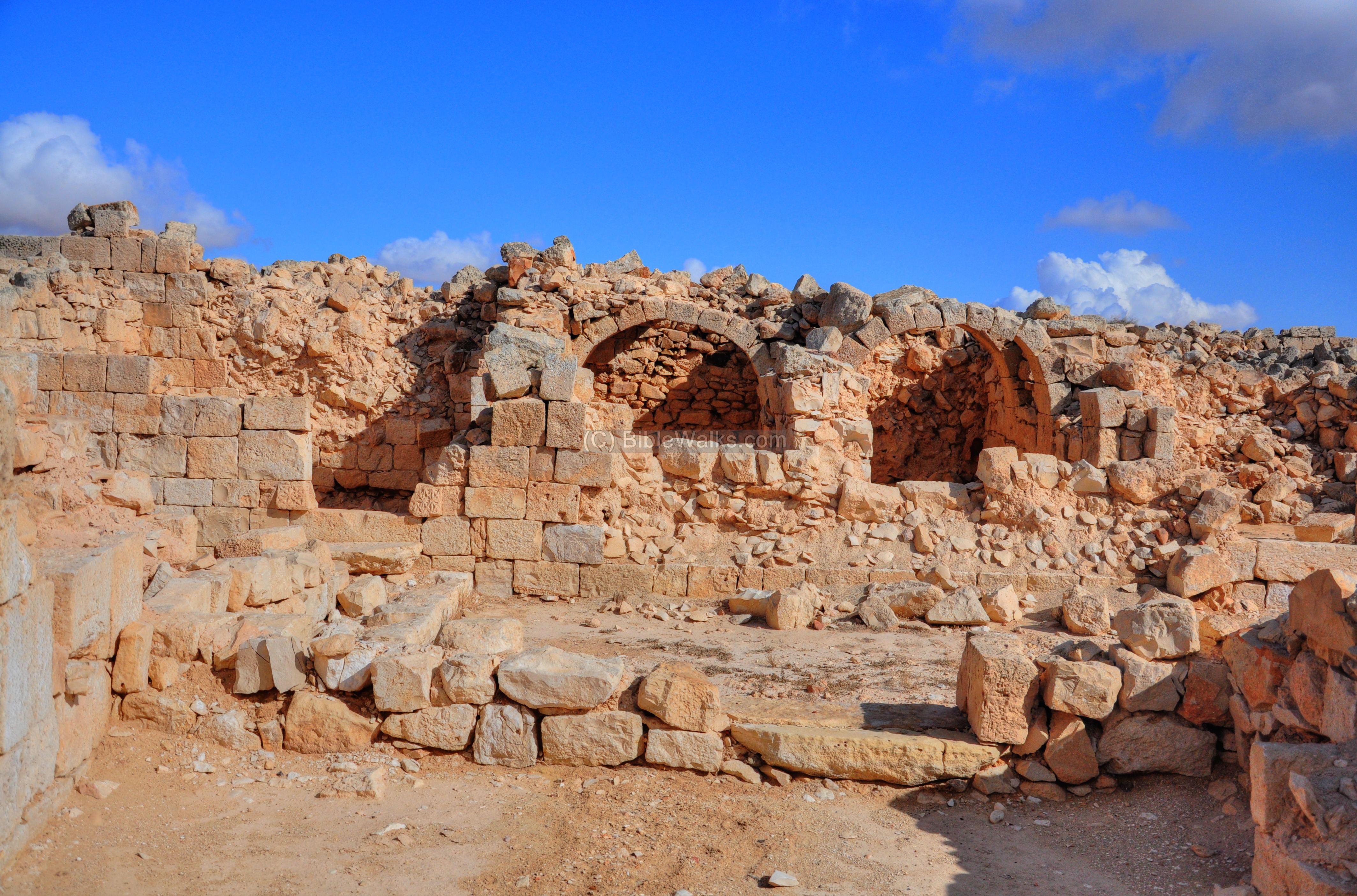
A closer view of one of the structures. The two level building uses arches to support the upper floor.
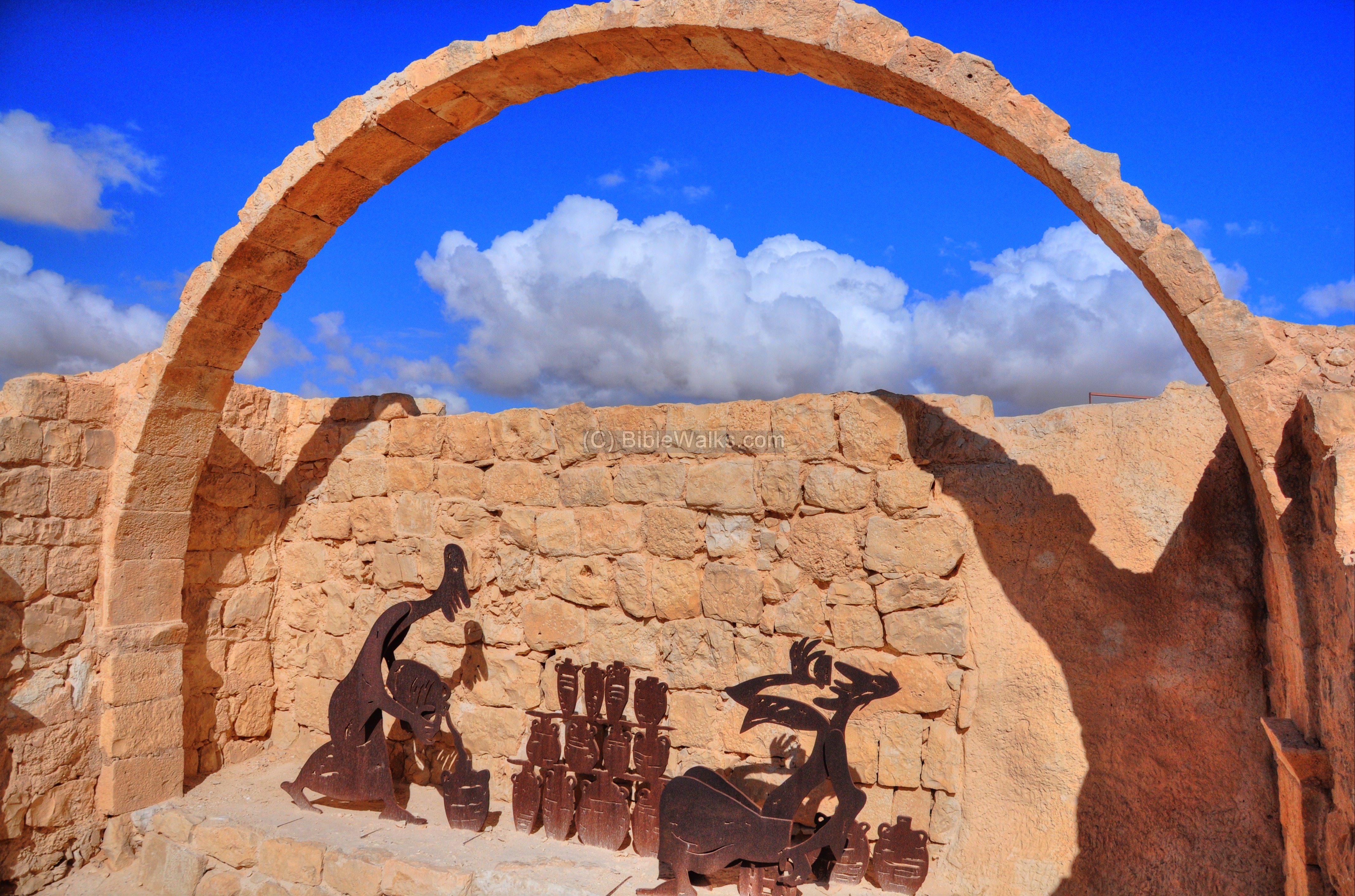
A set of sculptures, with a shepherd and his goats, highlight the ancient nature of the busy street.
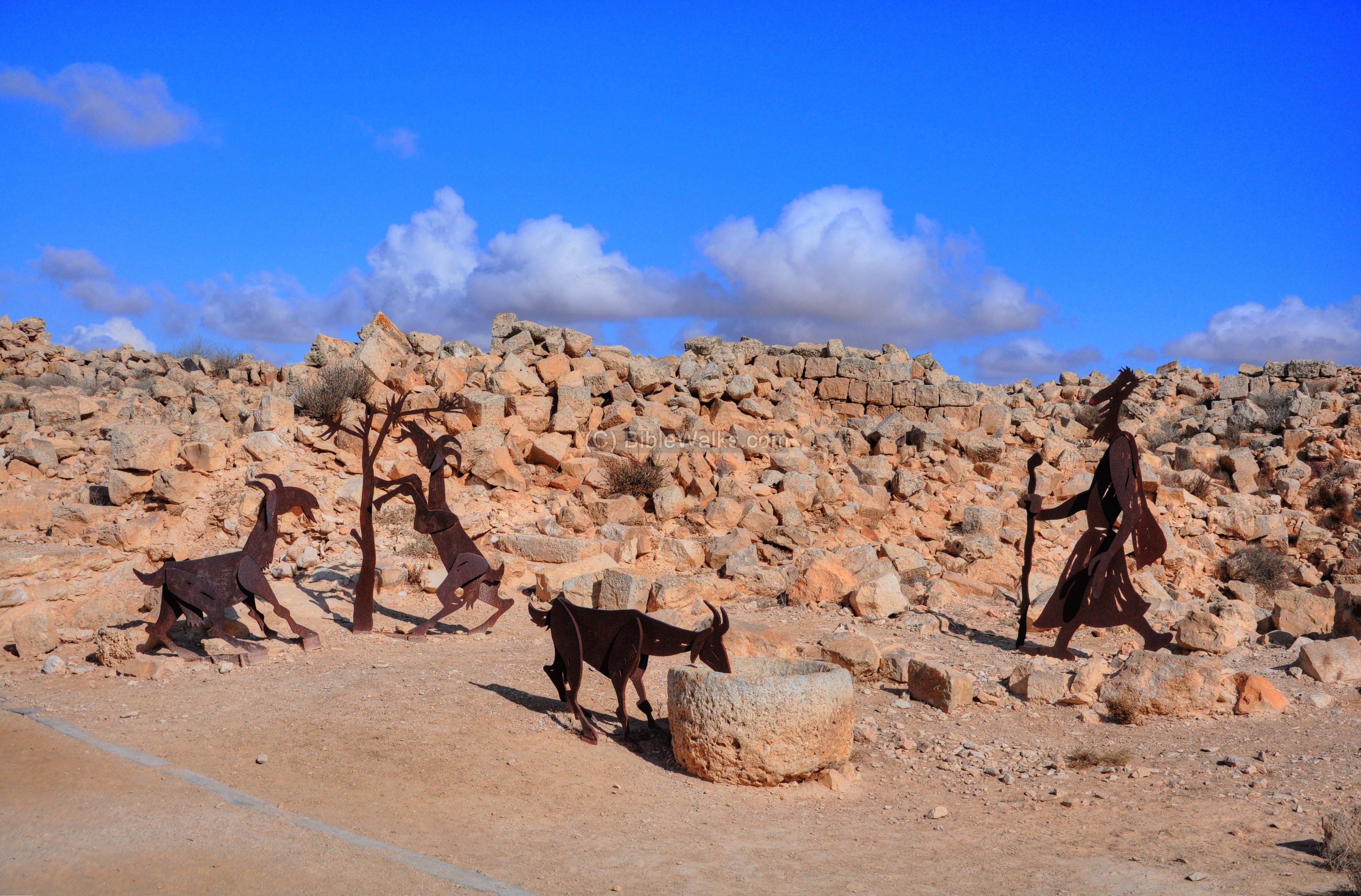
Another view of the shepherd and his goat, drinking from the water cistern, is in the next picture. During the Roman and Byzantine period the Nabatean residents became suppliers to the Army, and turned the areas around the city from a desert into green areas of farming and grazing lands.

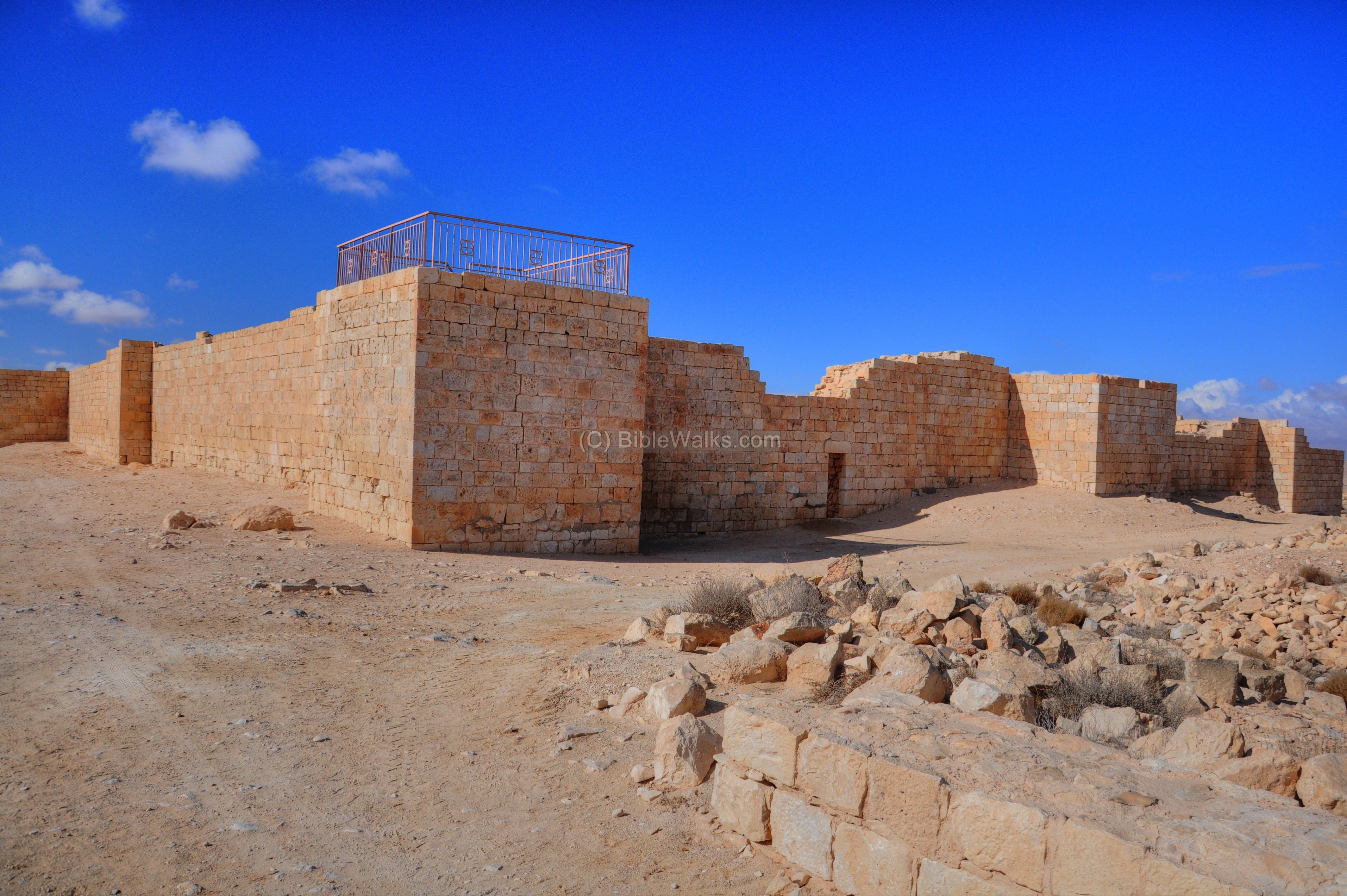
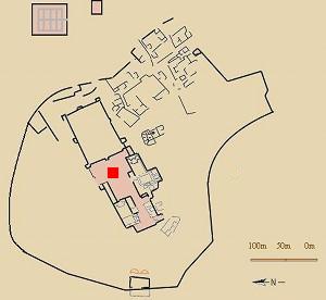
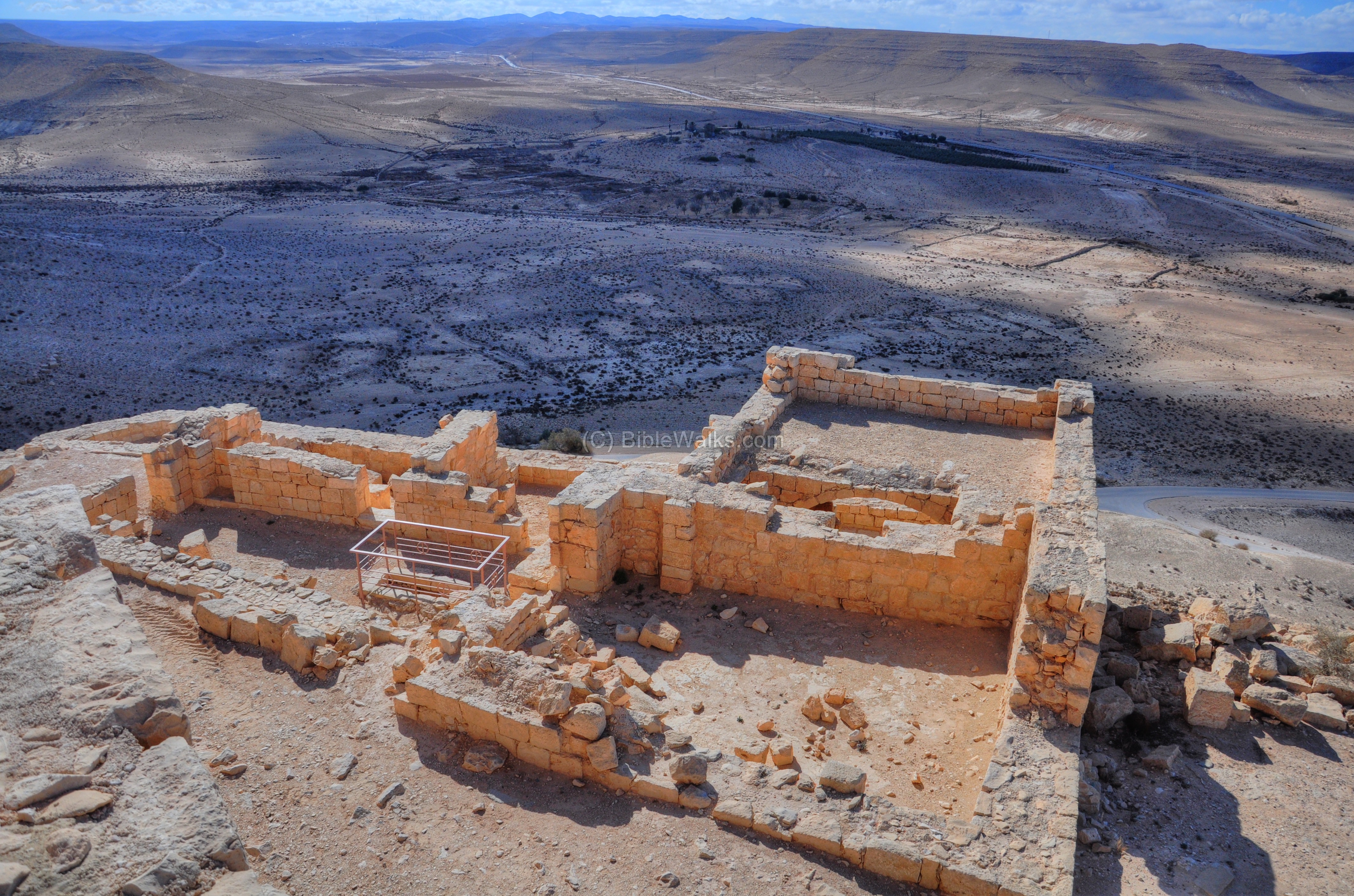
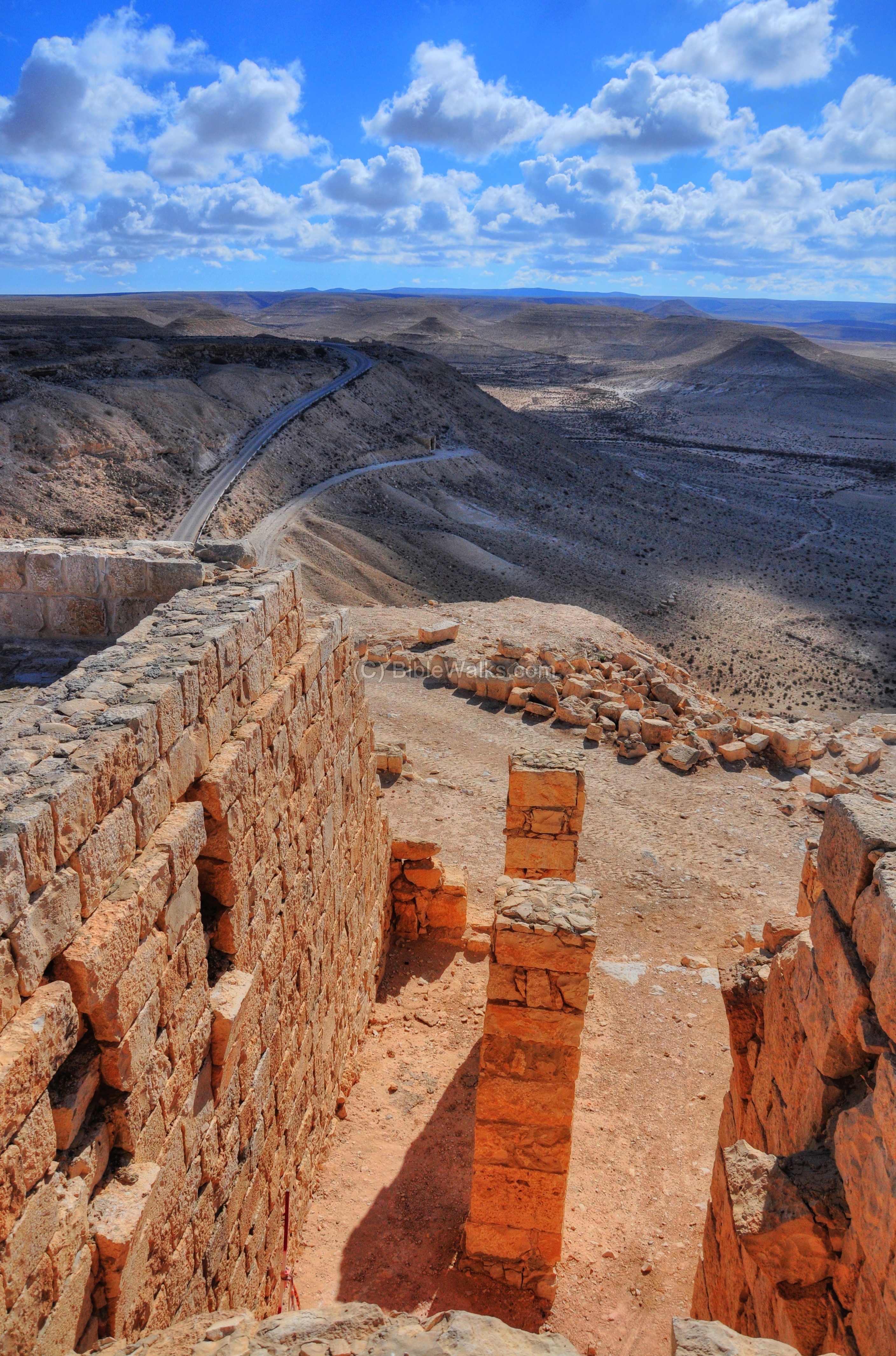
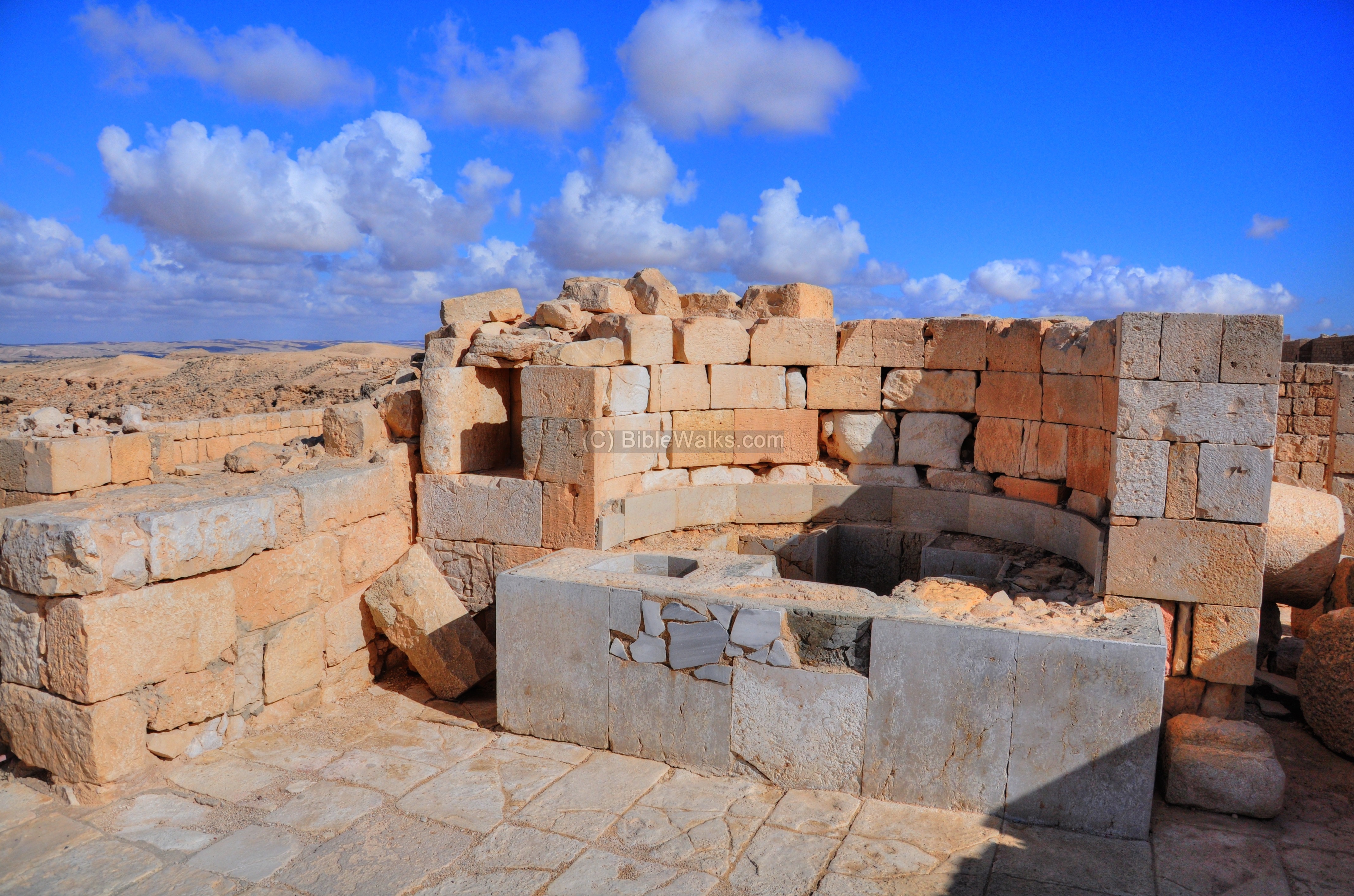
(f) City Fortress
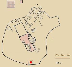
The city fortress, located at the edge of the main street, was built also in the Byzantine period. Its purpose was to protect the residents in time of attacks. Its location on the city plan is indicated as a red square.
The fortress is 63m long by 43m wide. The south-eastern tower, another good observation point, is shown in the following picture. An entrance to the fortress is on its right side.
Inside the fortress is a wide open court, with a large cistern located in its center. The water channel in the picture below feeds rainwater into the cistern. On the north side of the court is a prayer chapel (but is not seen here).
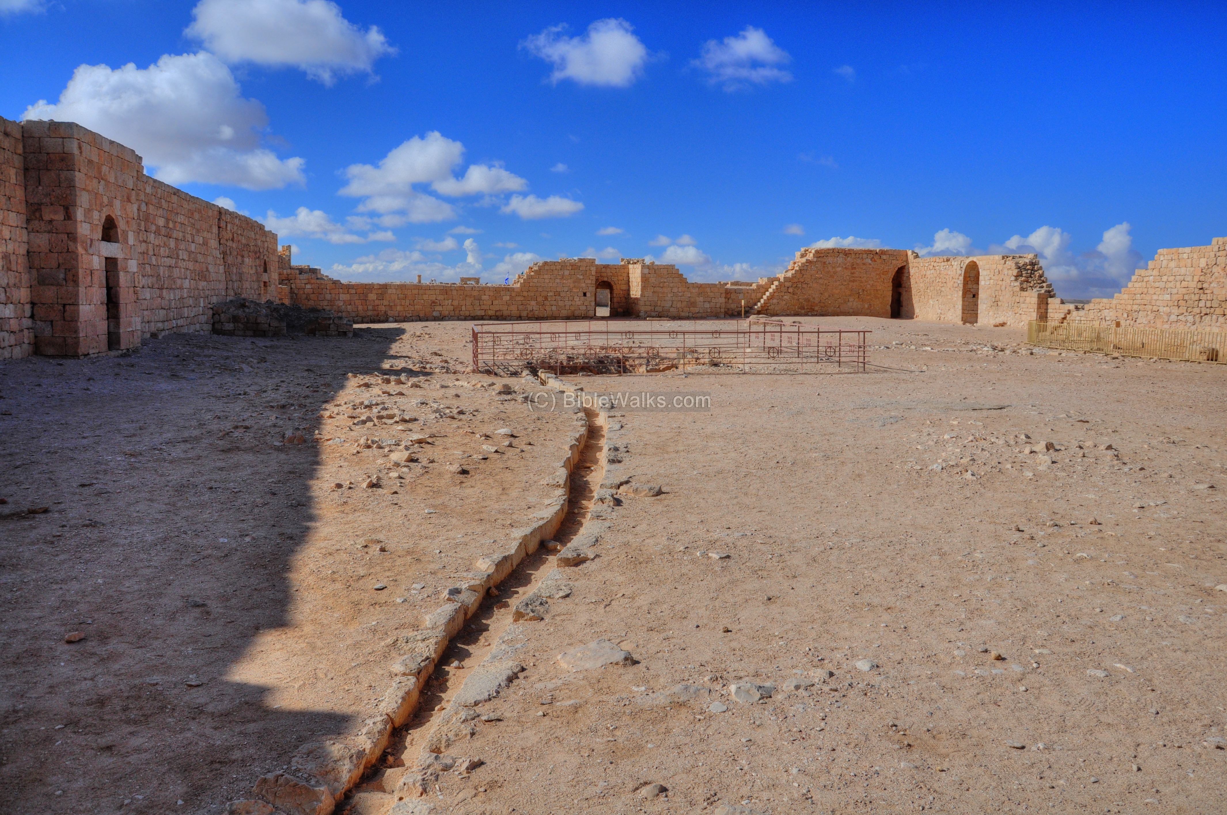
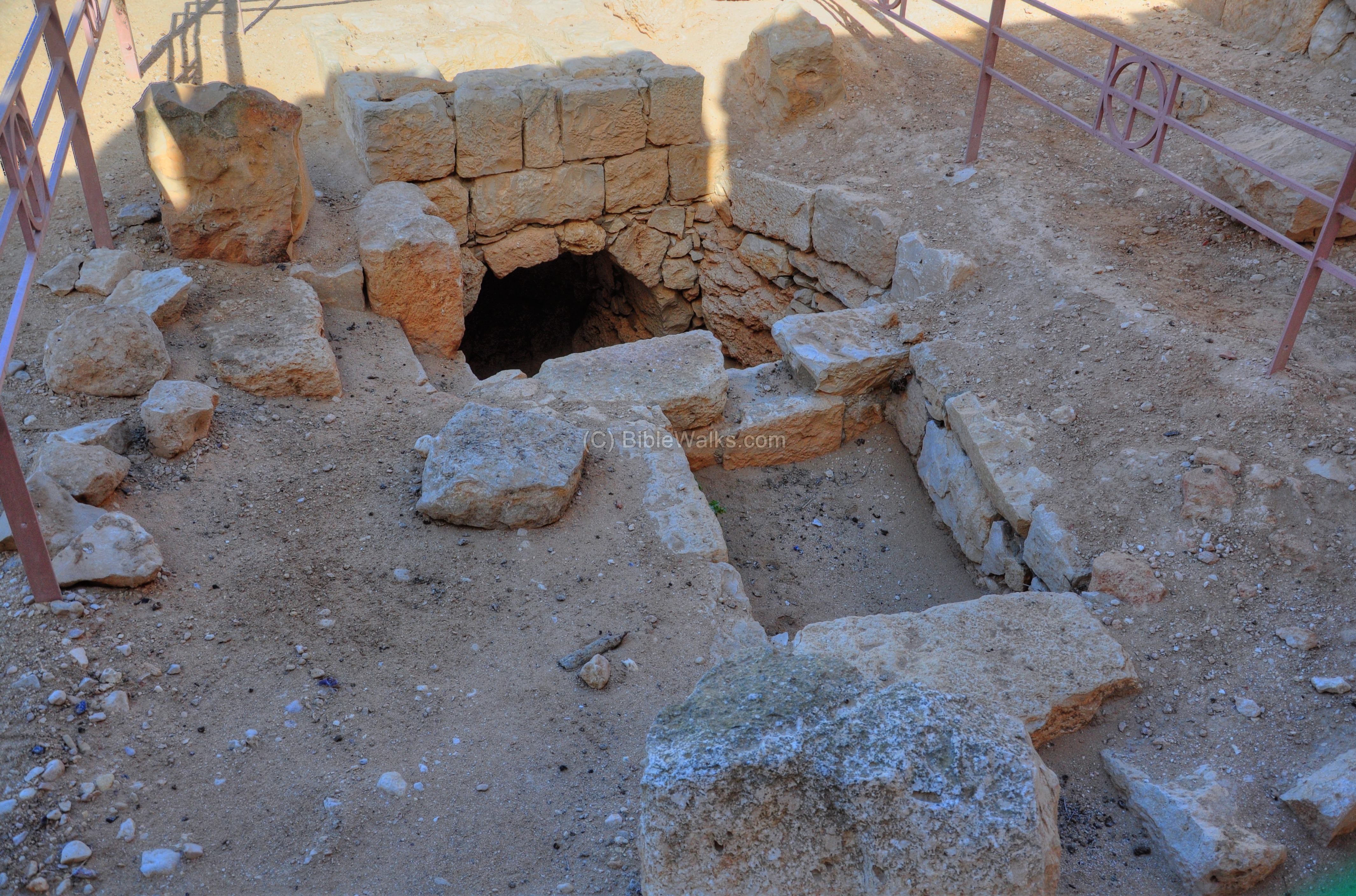
A closer view of the water reservoir is in the photo below. It is now dry, but a pair of pigeons (seen flowing away) use its shade to nest.

The entrance of the water into the underground water reservoir is shown in greater detail the next photograph. Water in this dry land, with only 80mm of annual rainfall, is precious. The surface and roof rain runoff was the only solution for this city, since there were no available springs in the vicinity to bring the water into the city.
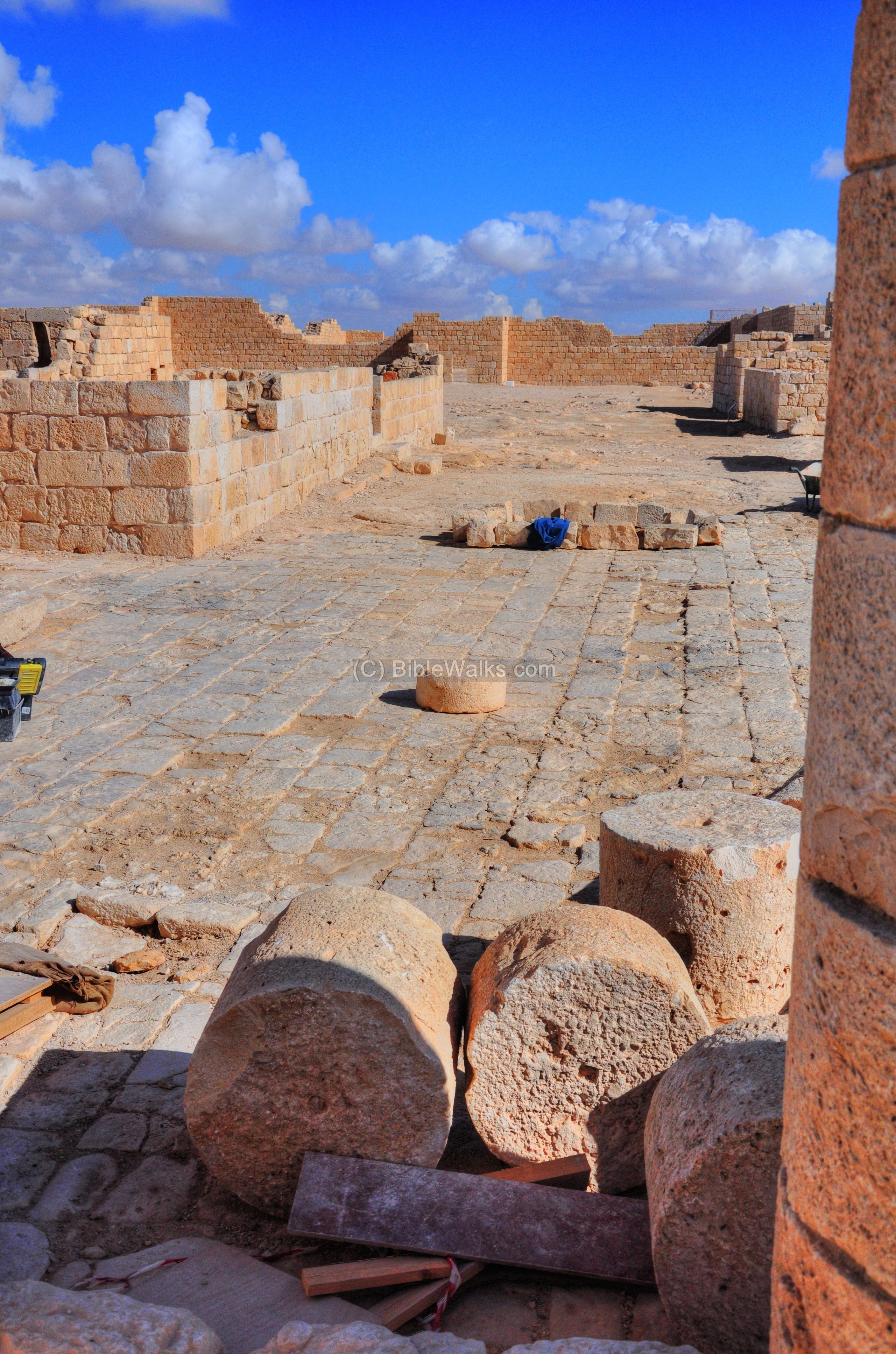
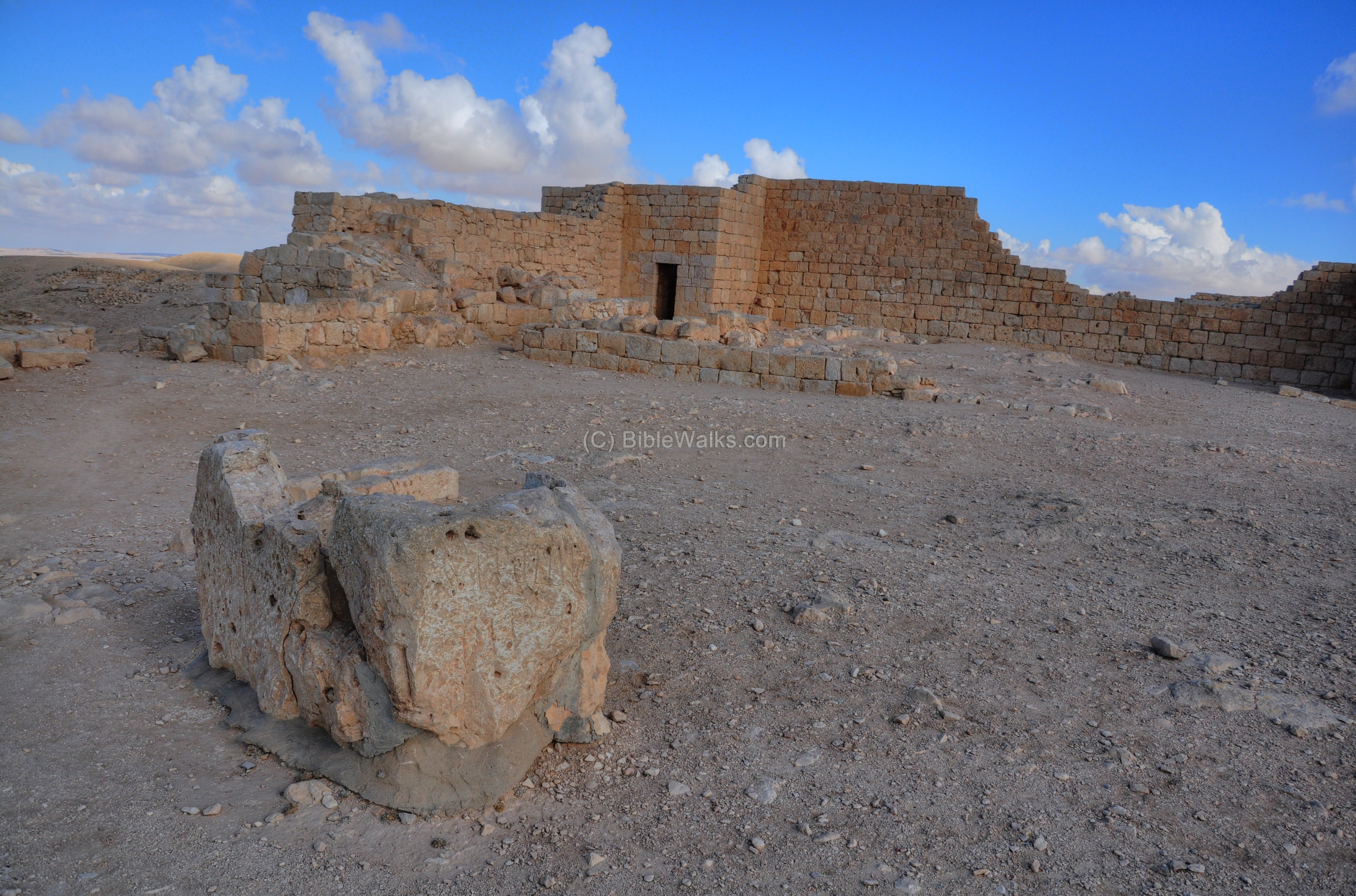
(g) Nabatean Temples
Beyond the fortress is another wide open area of the Nabatean temples and churches plaza. This area is indicated as a red square on the map.
In this area there were one or more Nabatean temples, which were later replaced by Churches.
A western view of the paved area is seen in the photo below.
On the north side of the area is a gate house:
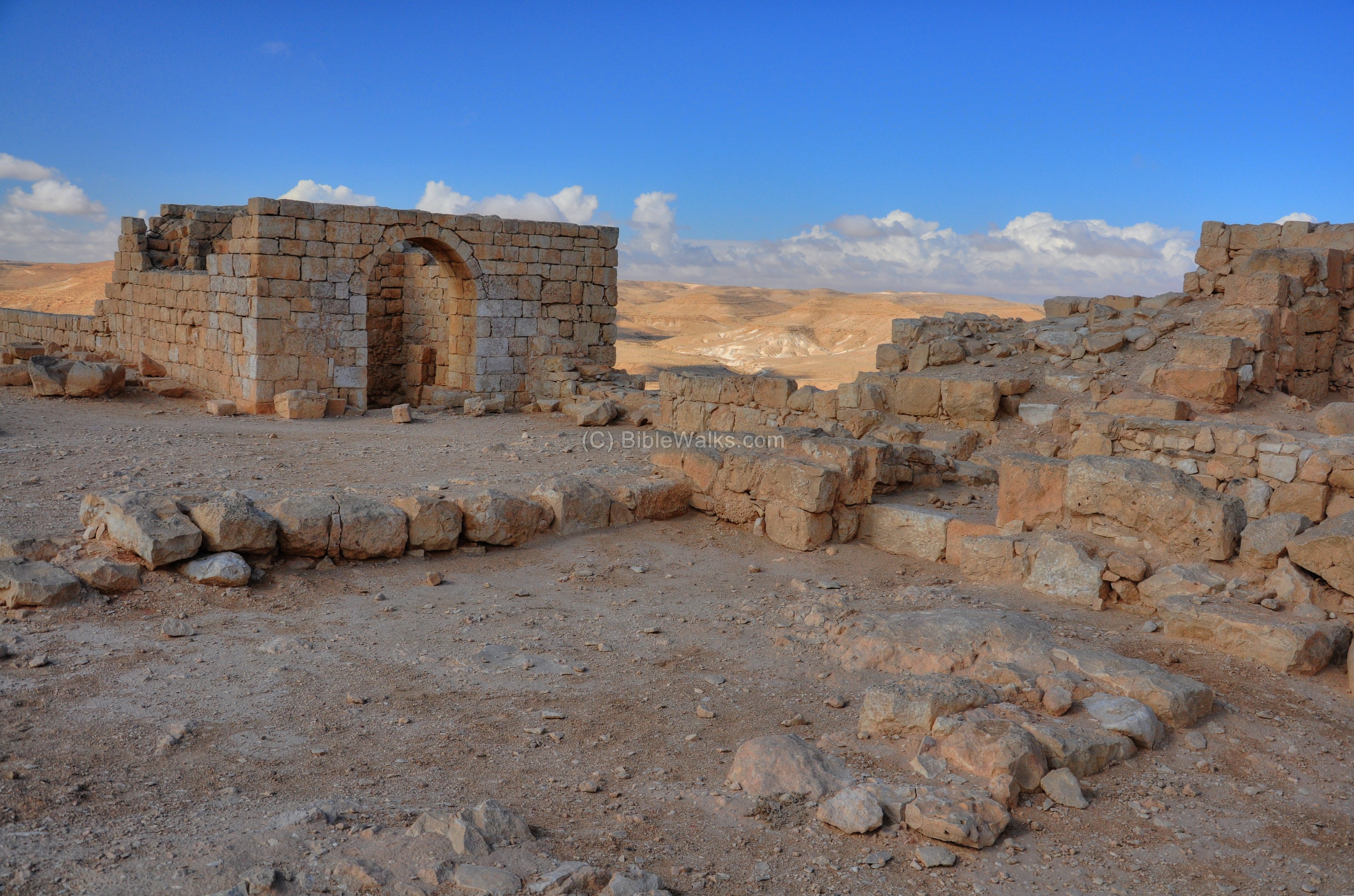
A closer view of the gate house:
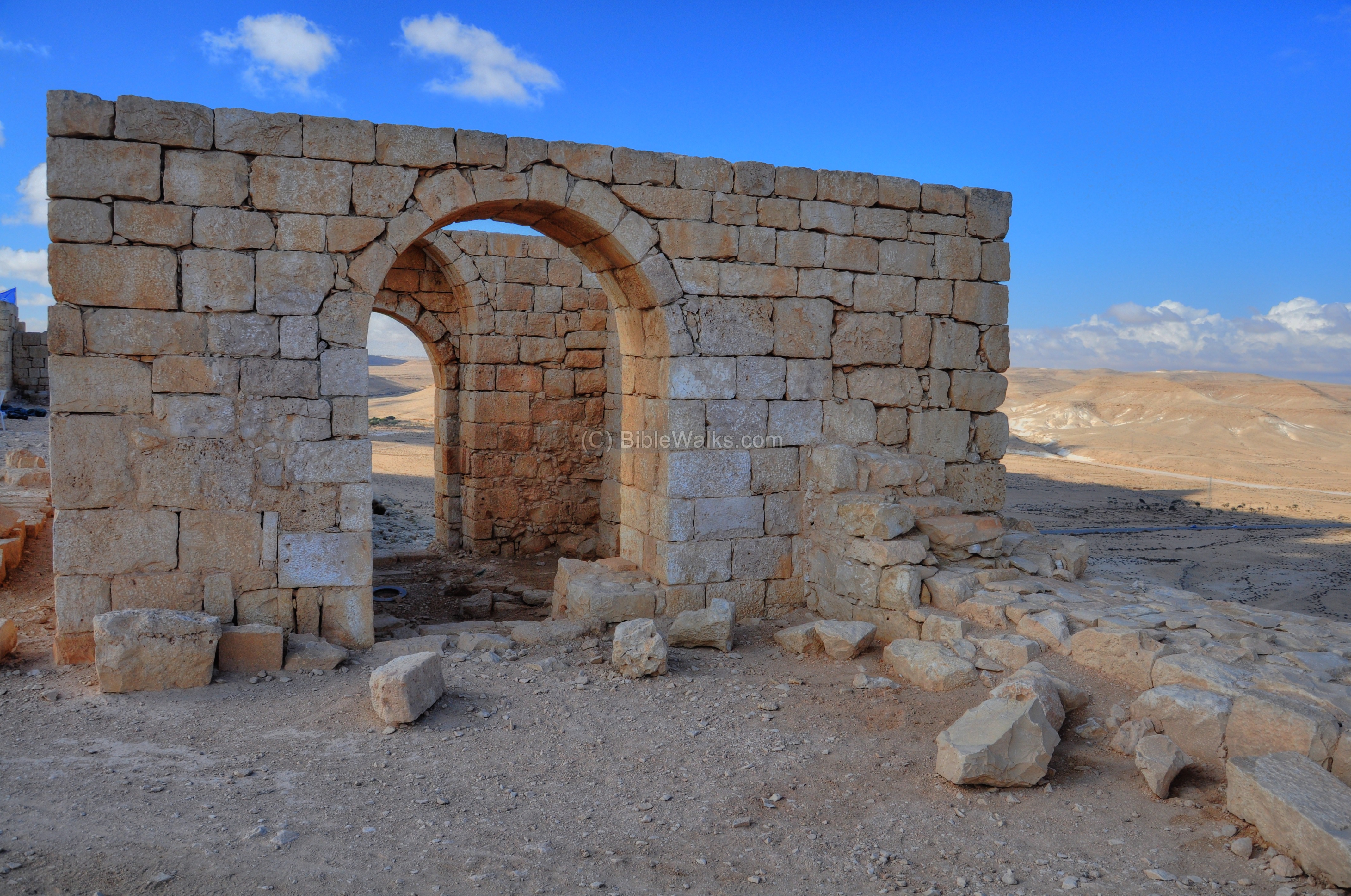
The gate opens to the north area outside of the city.
Another section of the walled area, as seen in the northwest view:
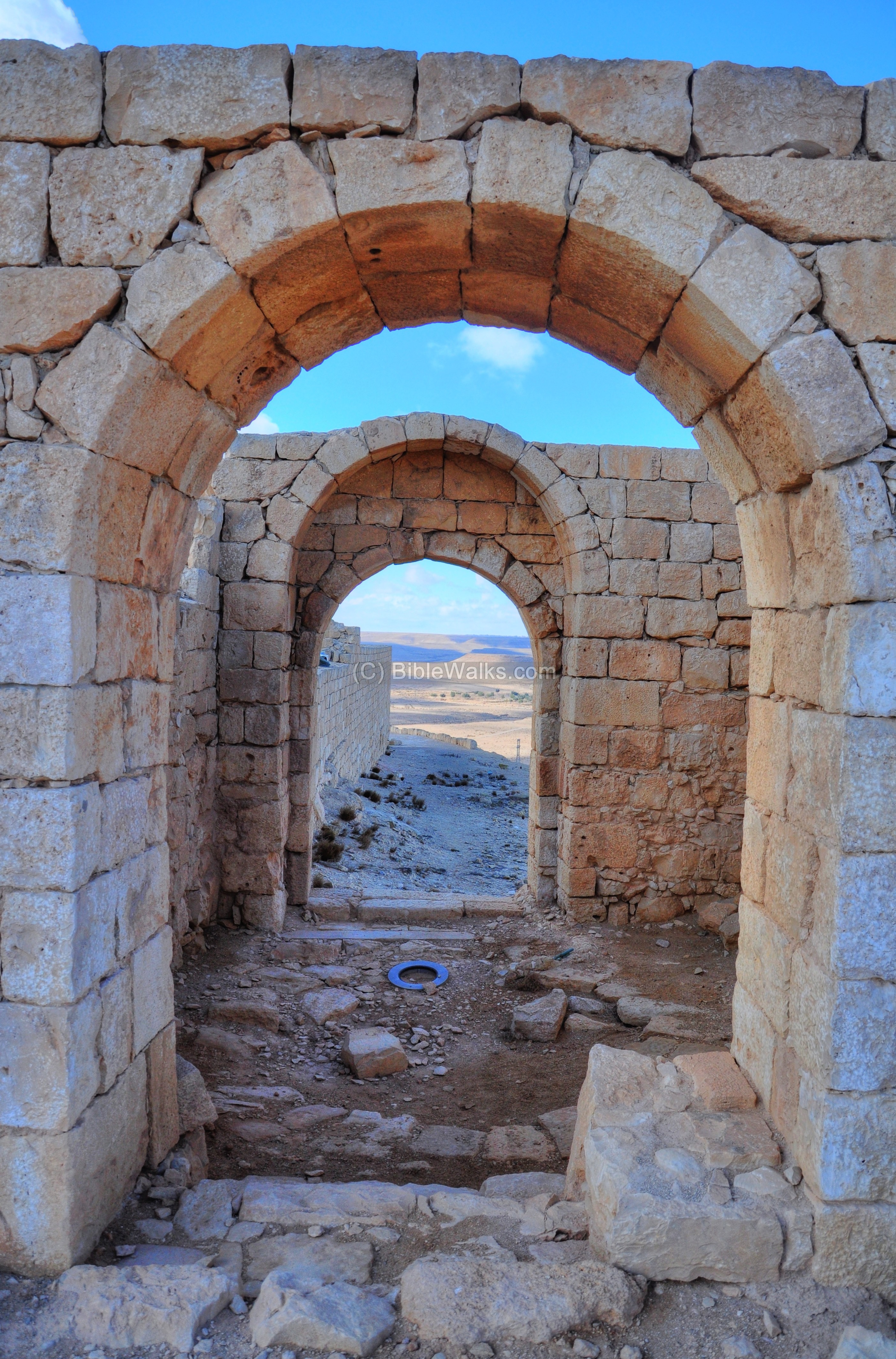
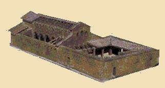
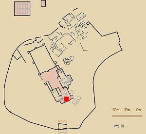
(h) Southern Church
The southern church was part of a Byzantine monastery of St. Theodoros. It is located on the south-west side of the city, as indicated on the city plan with a red square.
According to the inscriptions found on the floor of the church, it dates to the 6th and 7th century AD.
An illustration of the church is shown below, based on the model that was on display at the site:
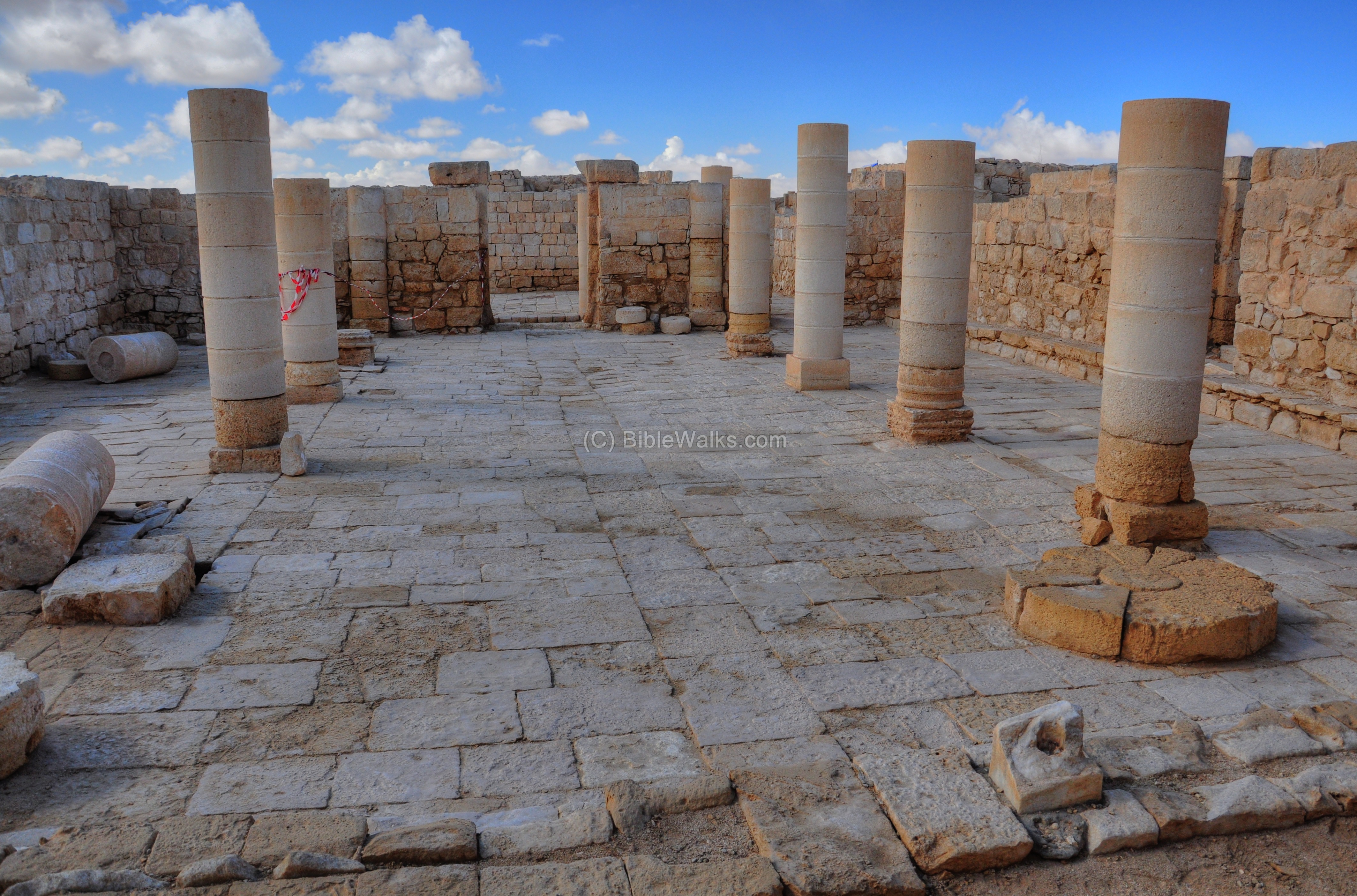
- Atrium
The Atrium, the open court before the church, is located on its west side and sizes 15 x 14m. It is paved and consists of four rows of columns. The columns, made of hard limestone, were based on the original Nabatean temples built by King Areta (Khartat) IV (9-40AD).
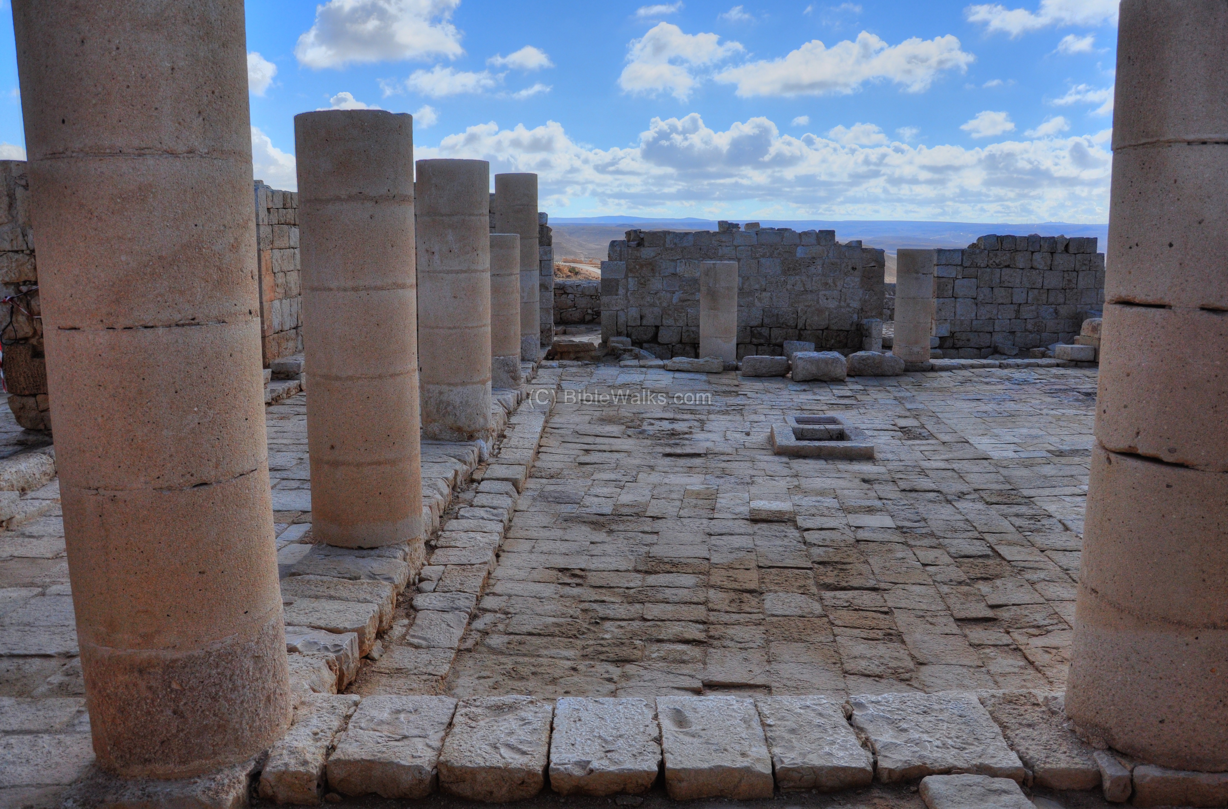
A large cistern is located under the floor of the courtyard.

A southern view of the court yard. It probably had a second floor.
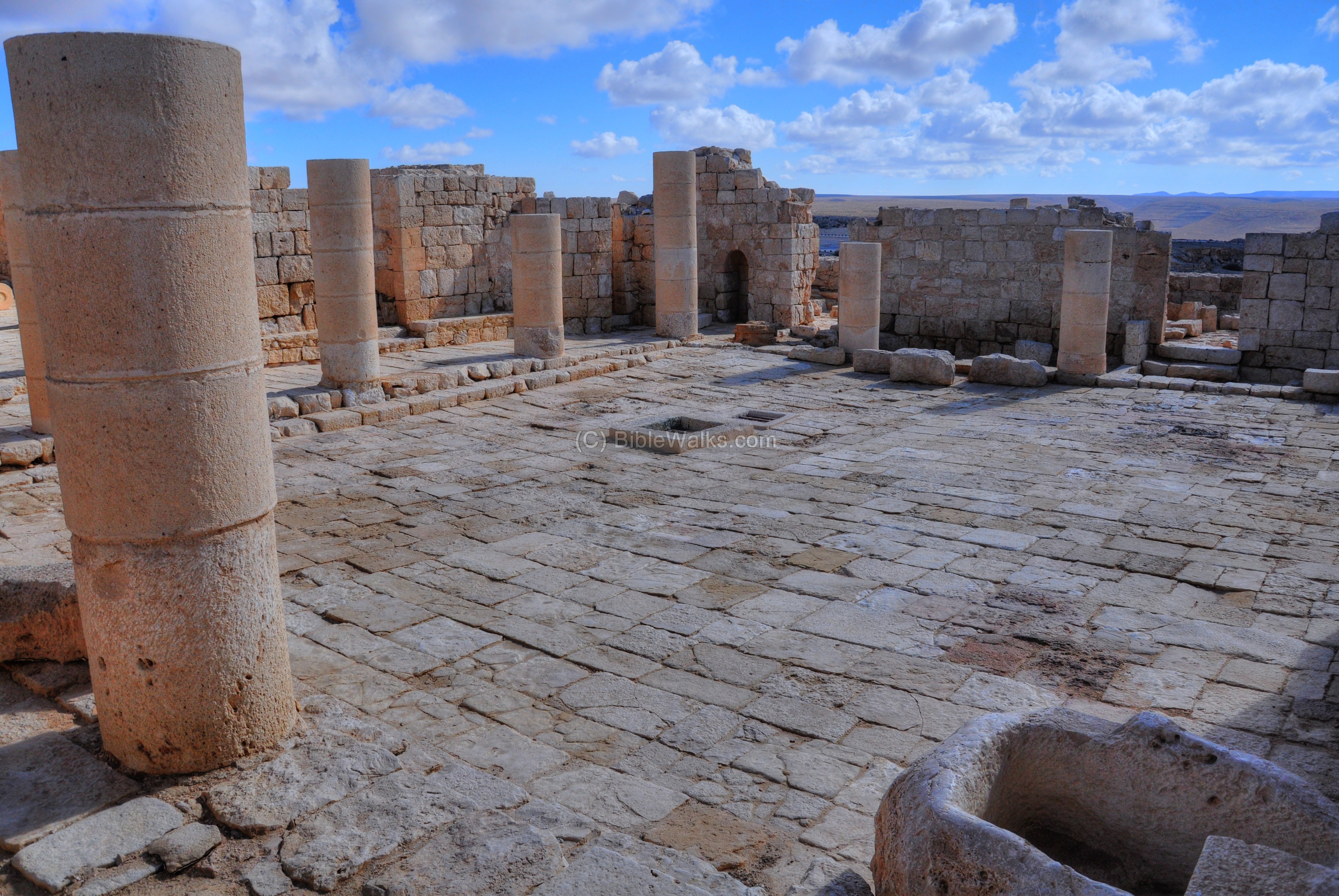
The courtyard is surrounded by rooms on its three side. The next picture shows one of the rooms on the south side of the courtyard.
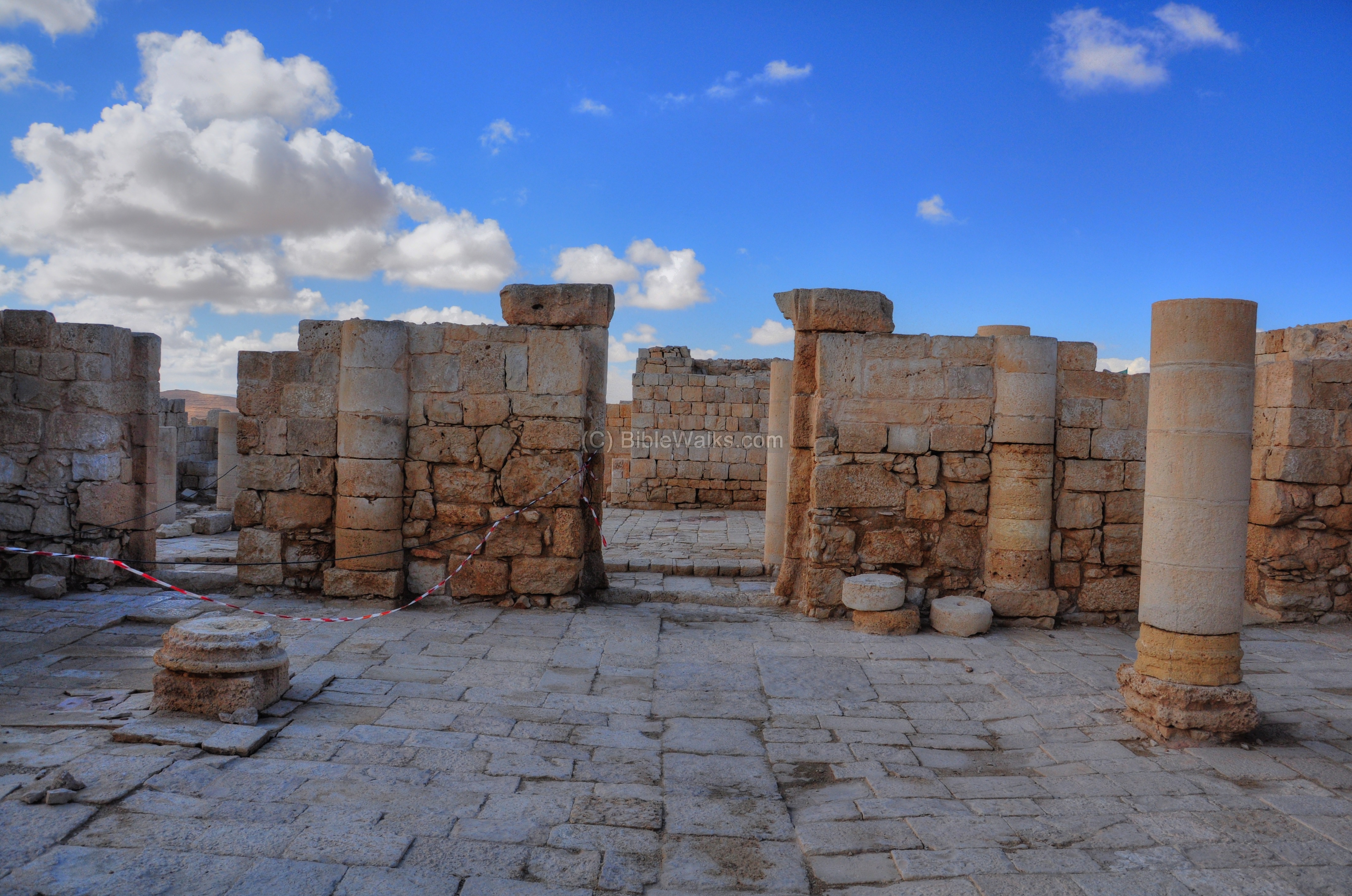
- Entrance to the Church
On the eastern wall are the three entrances to the church, seen here behind the eastern row of columns.
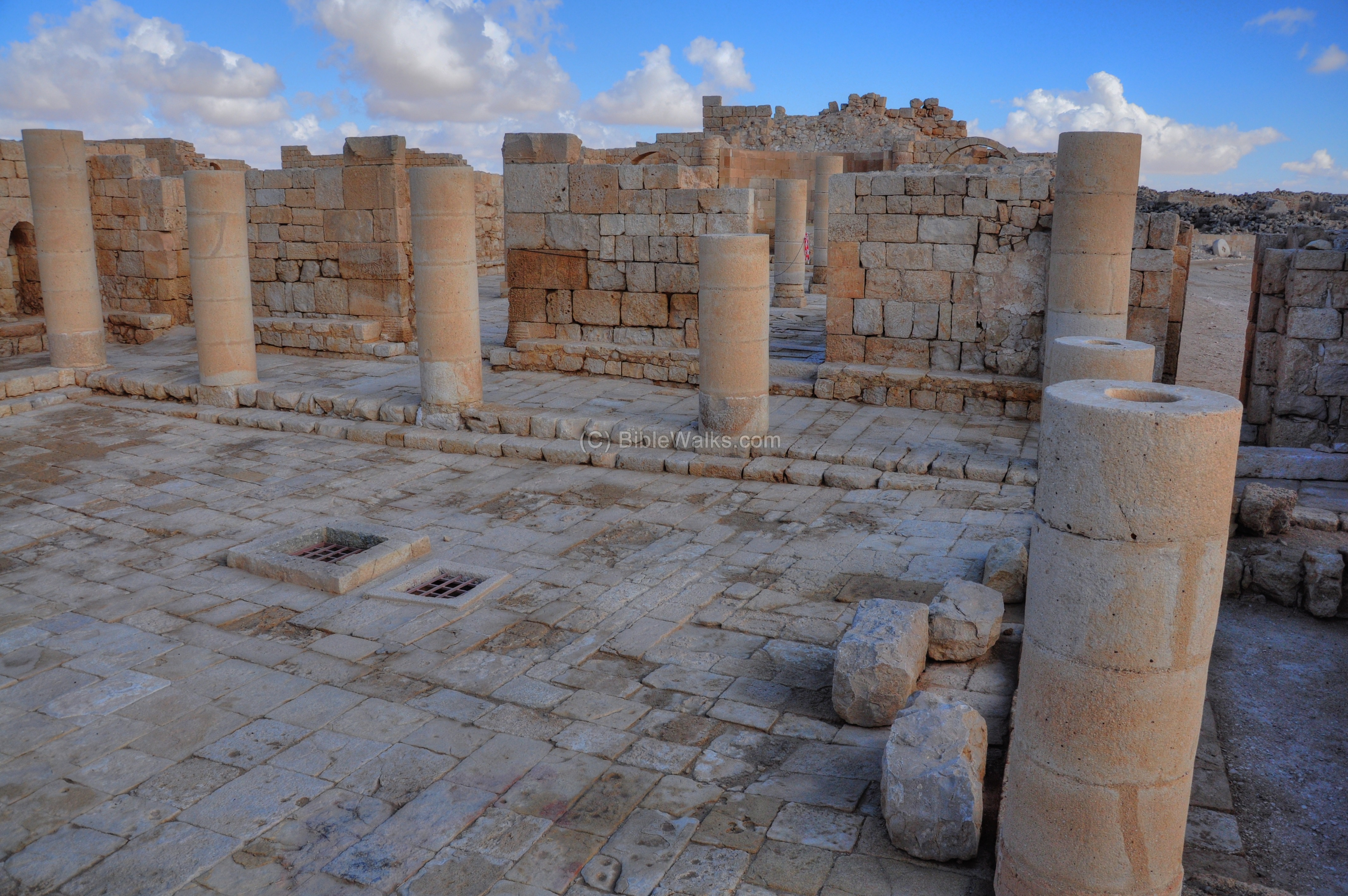
The entrance from the atrium is seen also from the inner side of the church.
- The Church
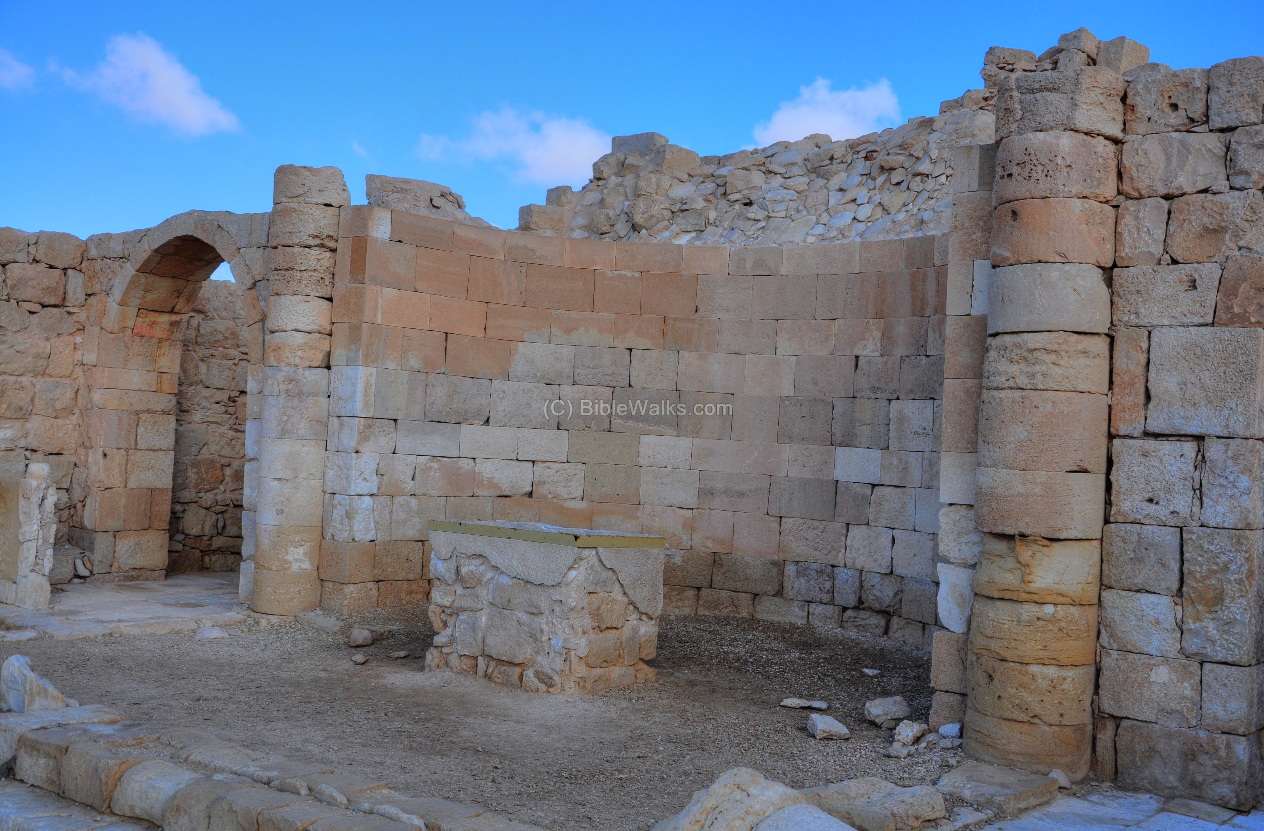
The church is a three-aisled pillared basilica with three apses. The apses are located on its eastern side (as all ancient churches). The central apse, where the main altar stands, is seen in the middle of the following picture.
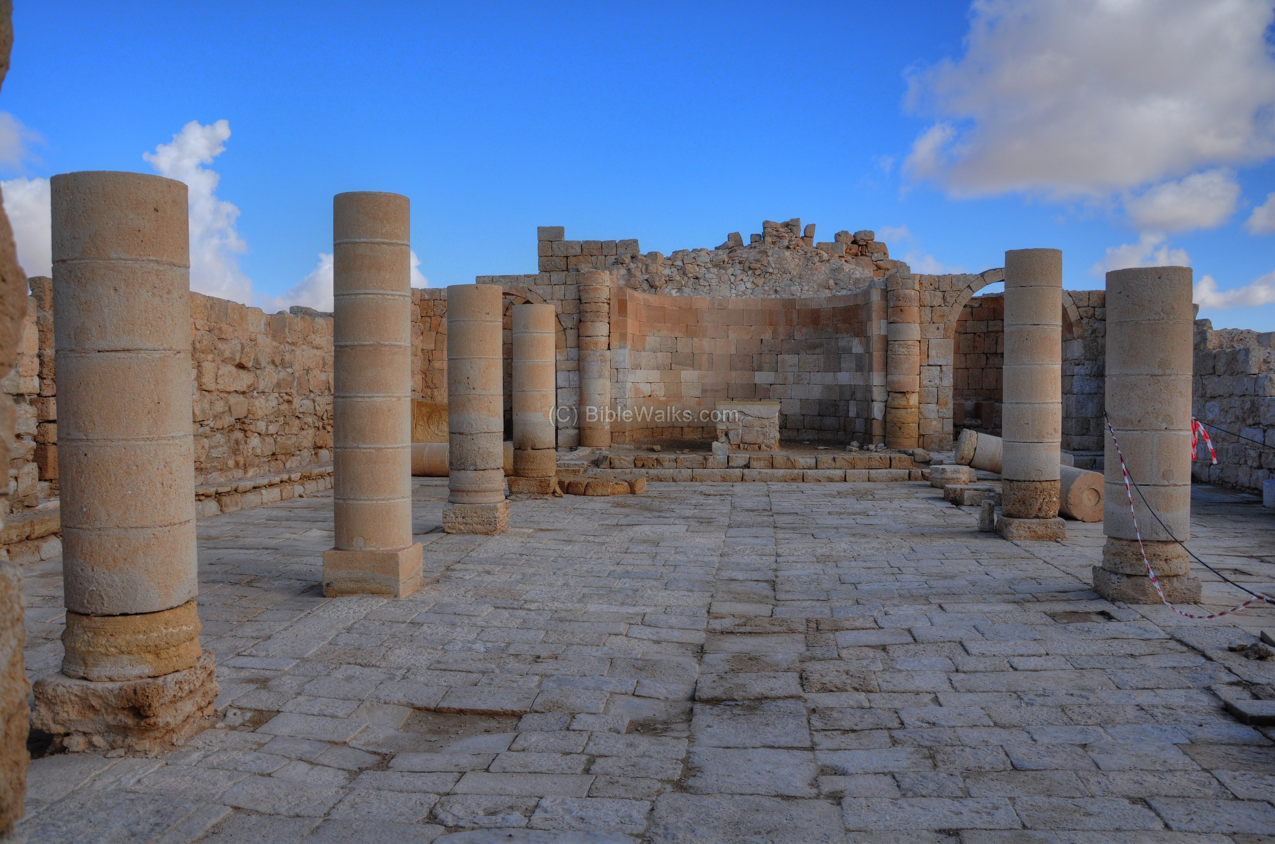
The main altar is located on a low raised platform.

The following picture shows a closer view of the main altar, with a table in the center of the apse.
A view from the main altar towards the west:
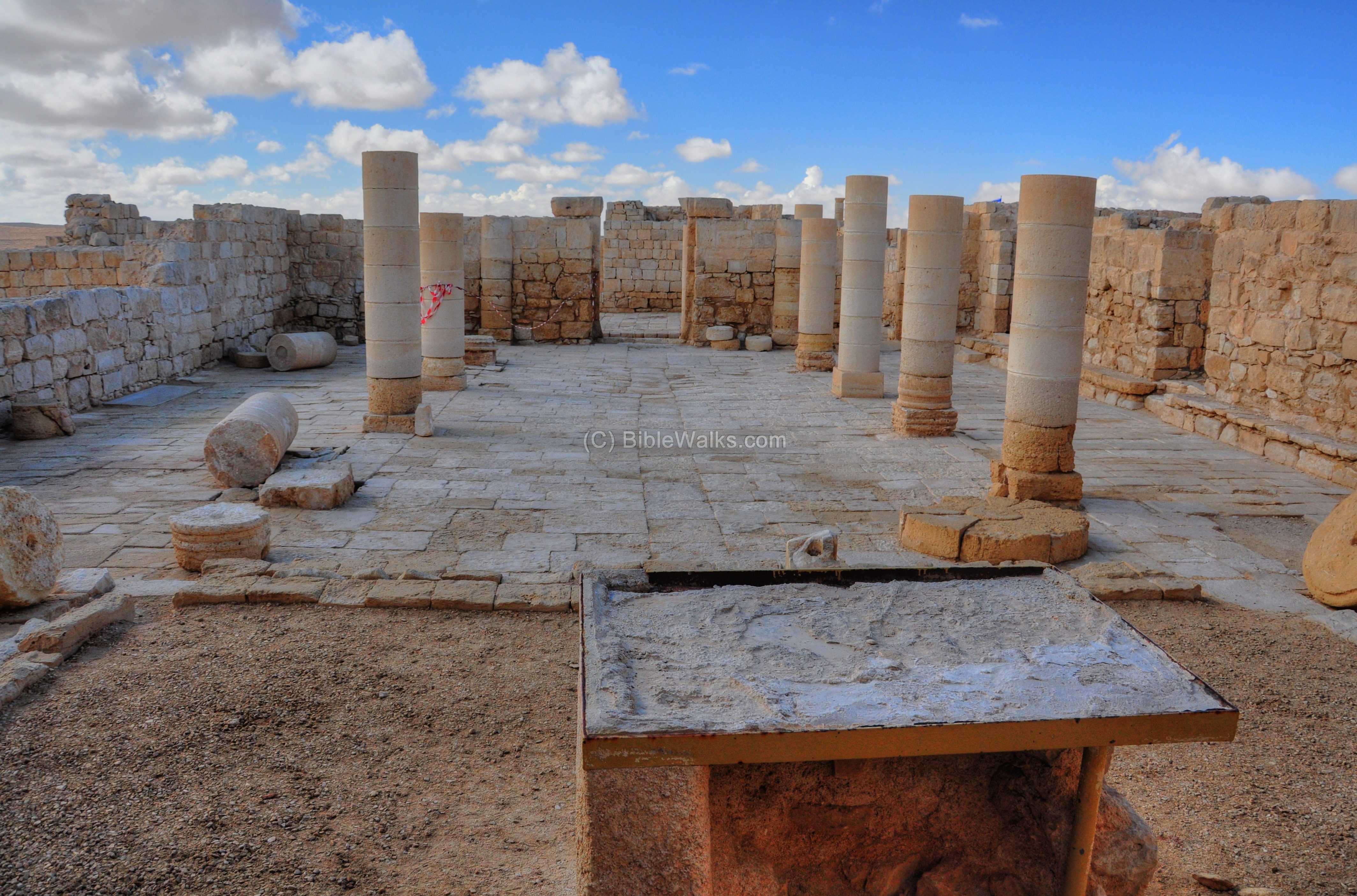
Another view of the nave – the central approach to the main altar.
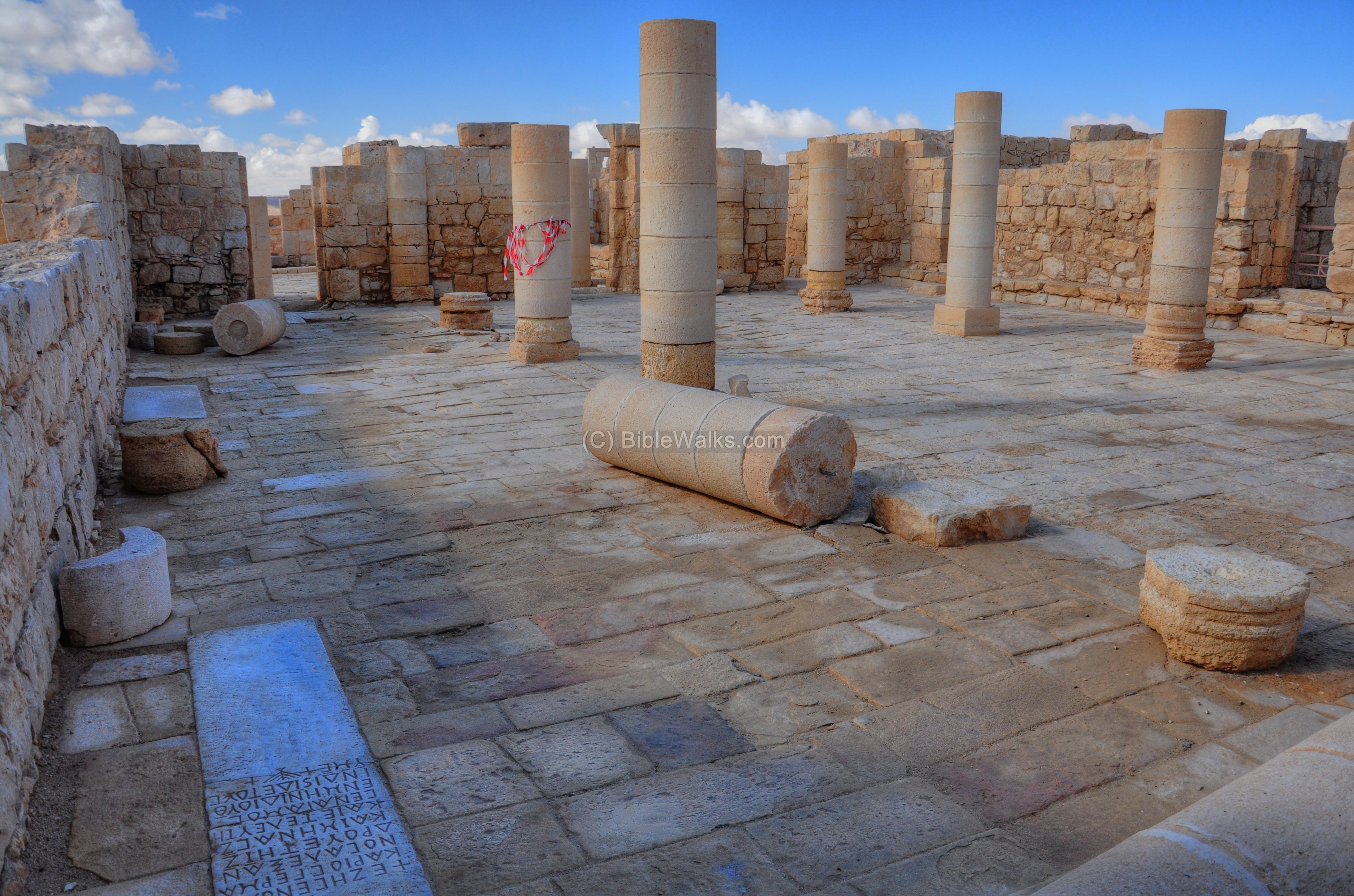
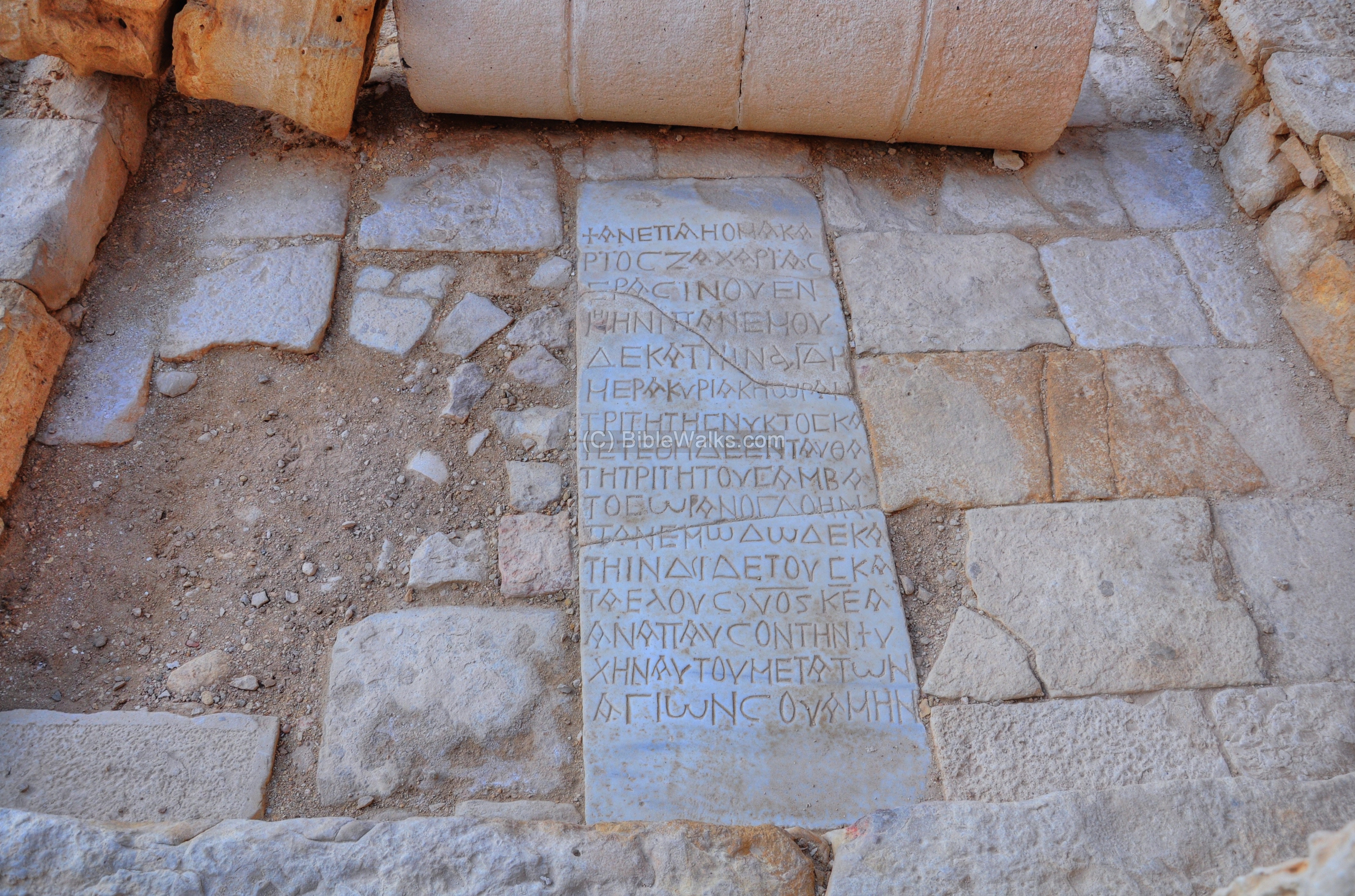
- Inscriptions
A number of tomb inscriptions (epitaphs) were found in the floor of the church. The marble slabs bear Greek inscriptions dating from 541 to 618AD. One of these tombs is seen on the south-eastern corner.
A closer view of the inscription on the south-eastern corner:
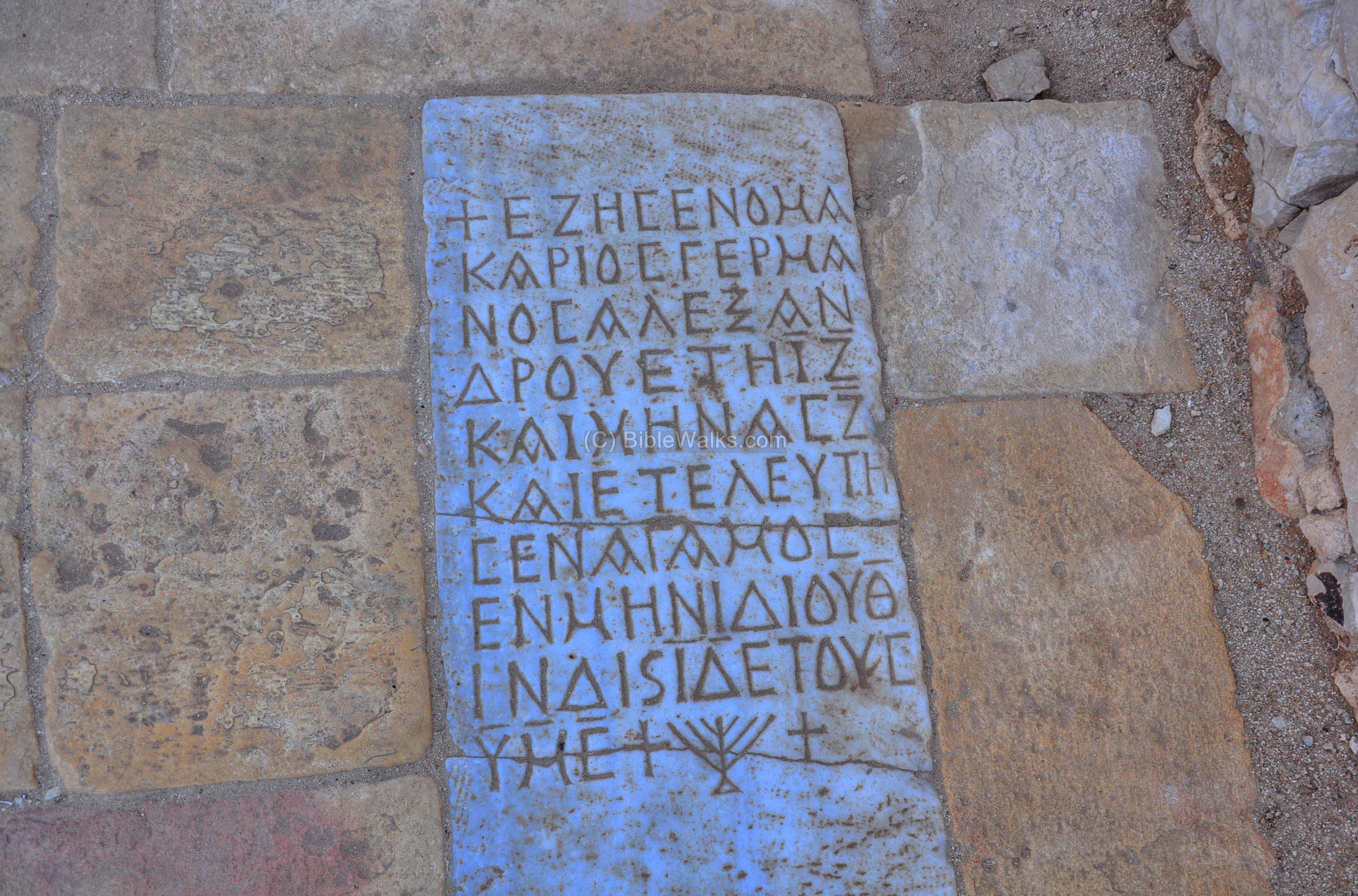
Another epitaph is located on the north-east corner, on the floor behind the fallen column.
A closer view of the inscription:
Yet another epitaph is seen in the next picture:

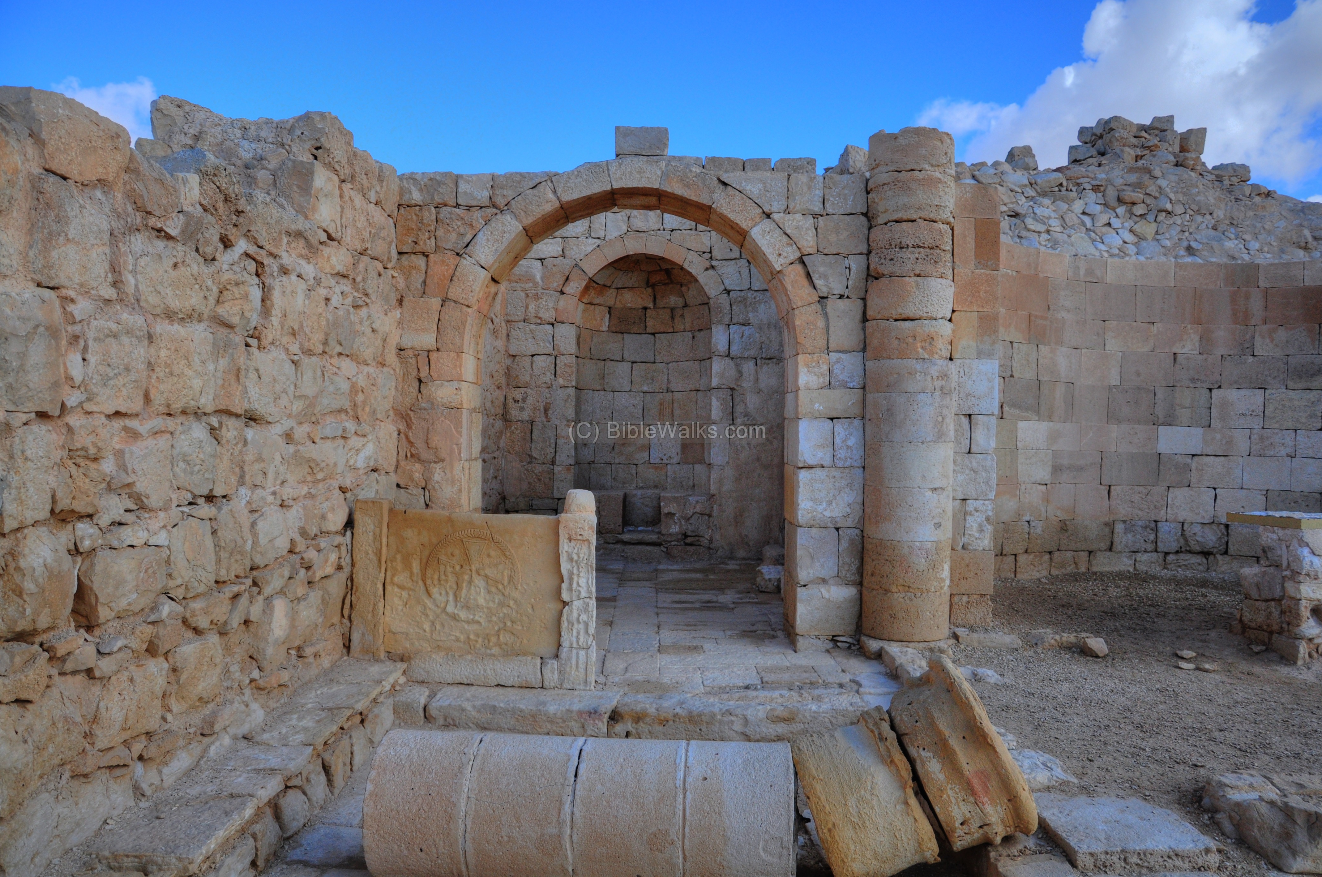
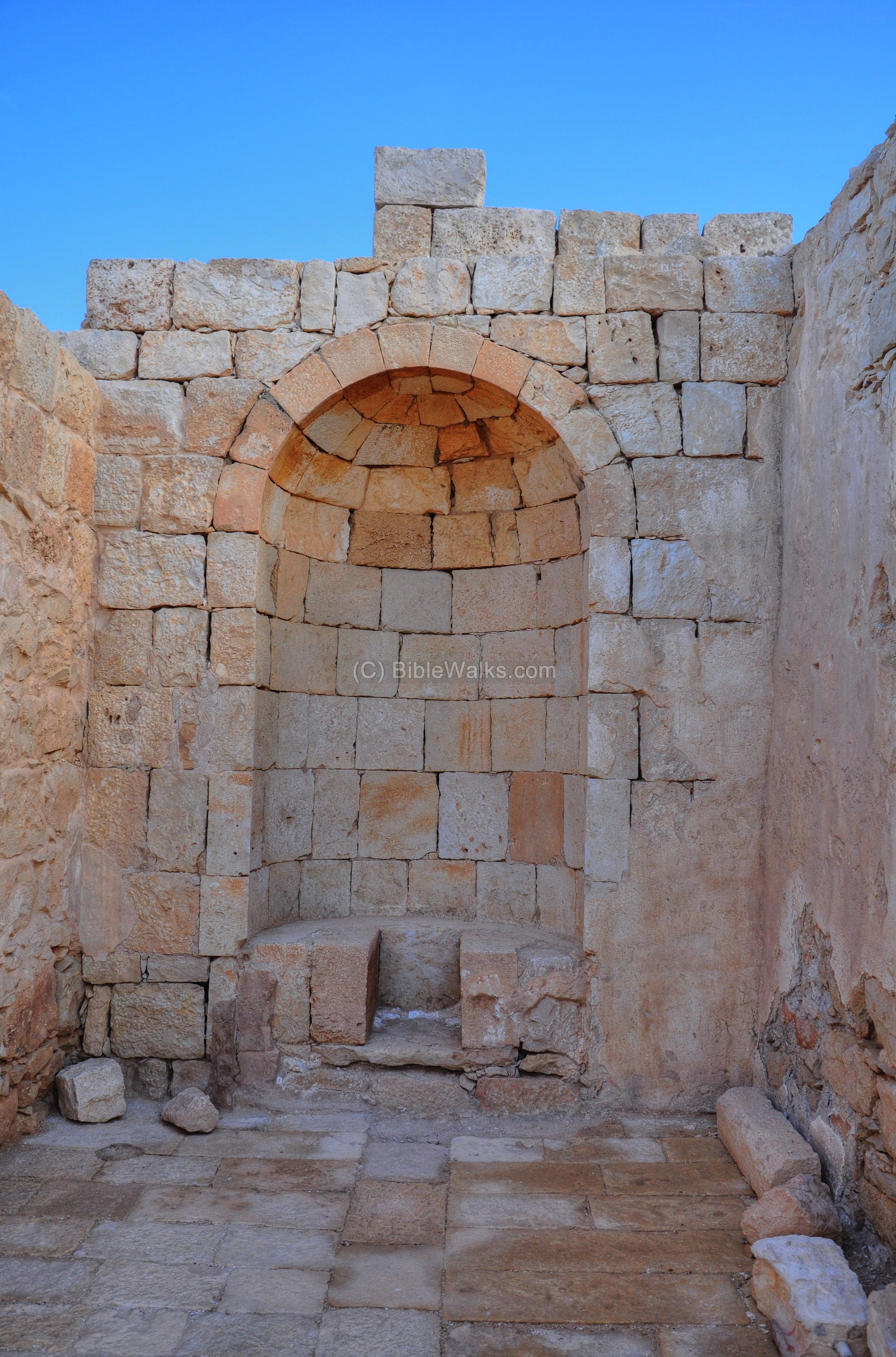
- North Apse
A limestone chancel screen stands on the path towards the northern apse.
Behind it is the northern apse.
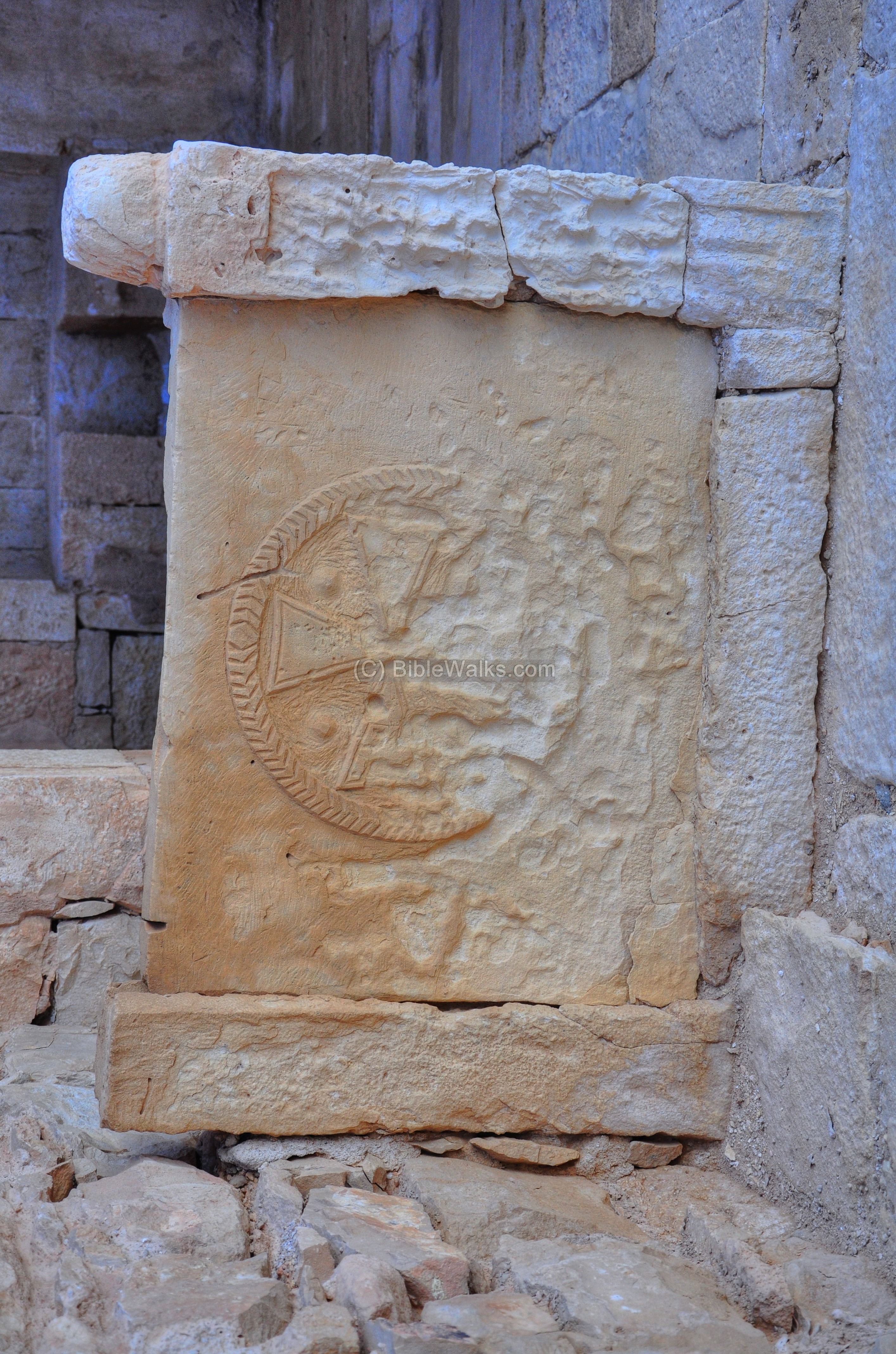
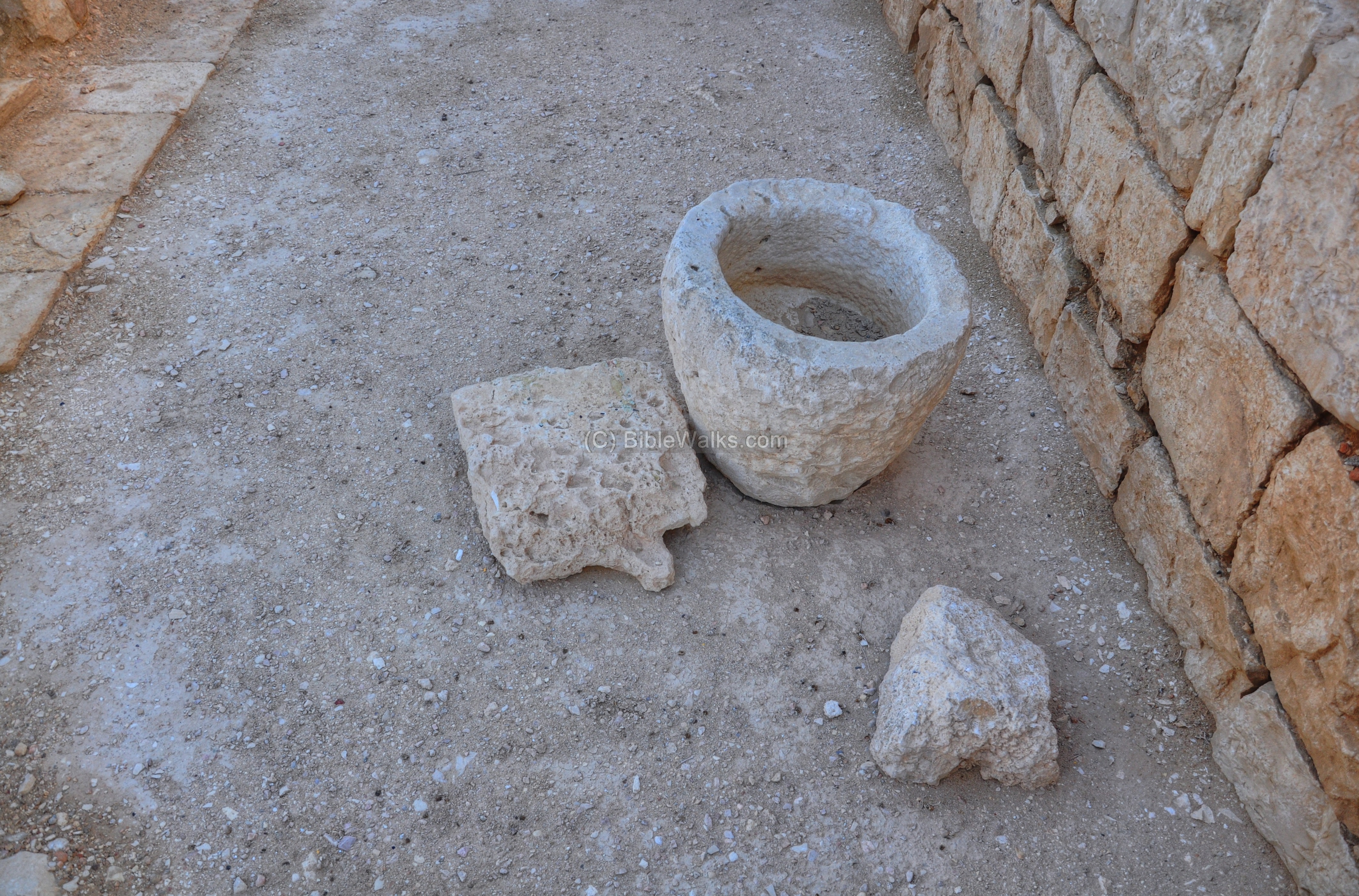
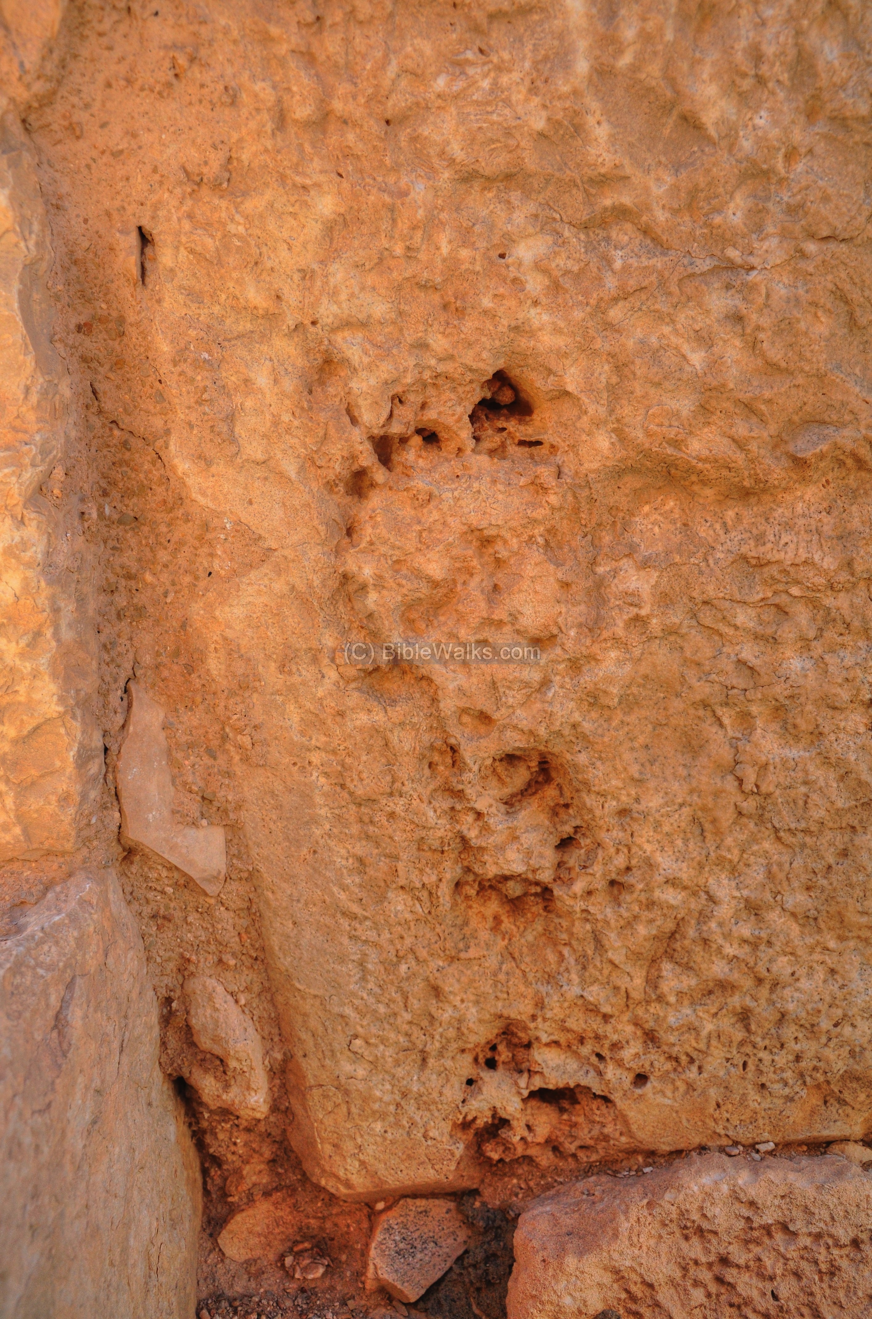
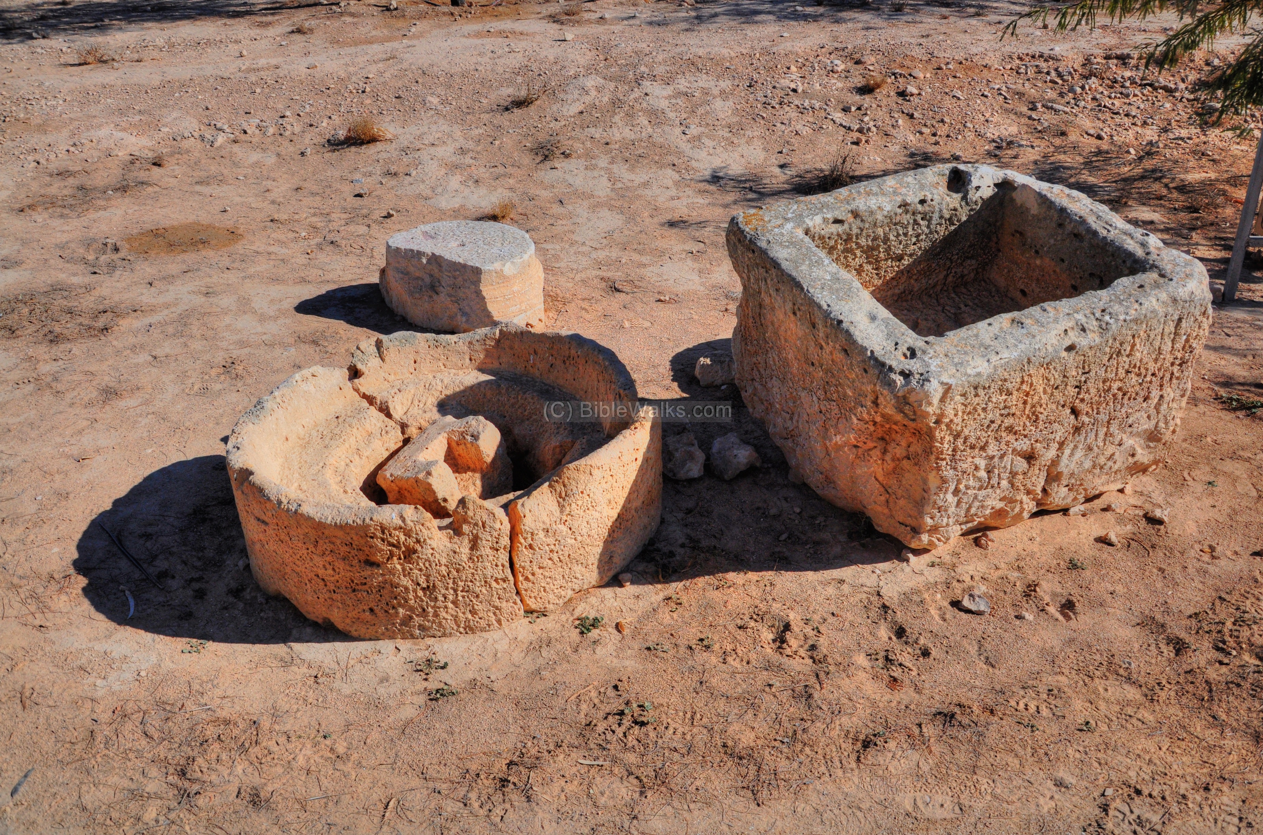
- Stones
In other rooms and locations, there are some notable stone objects, such as the water vessel below:
Another interesting carved limestone:
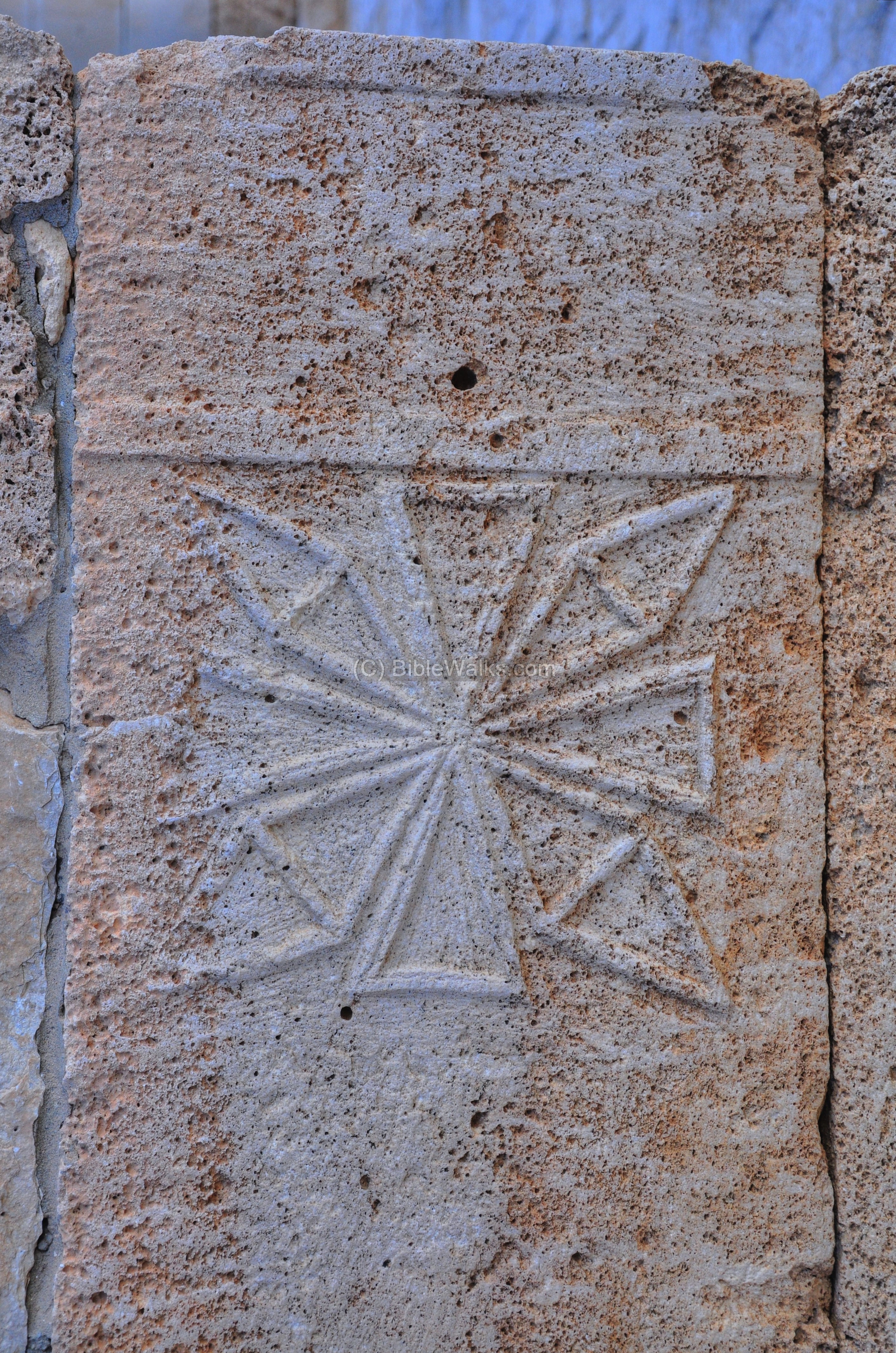
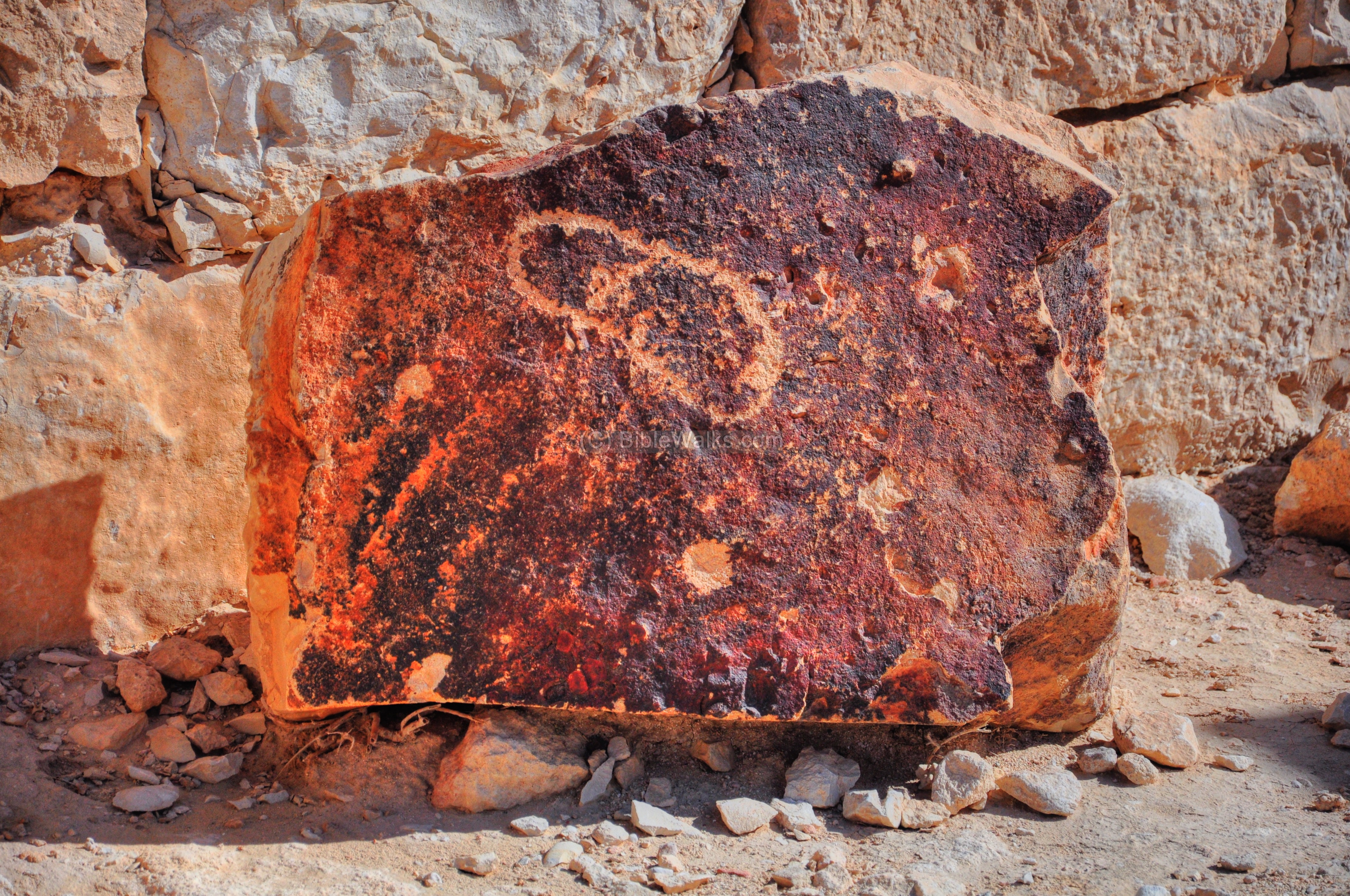
Outside of the church, embedded in the stone, seems like a footprint. What does it mean?
Another footprint is drawn on a rock painting:
(i) Lookout Platform
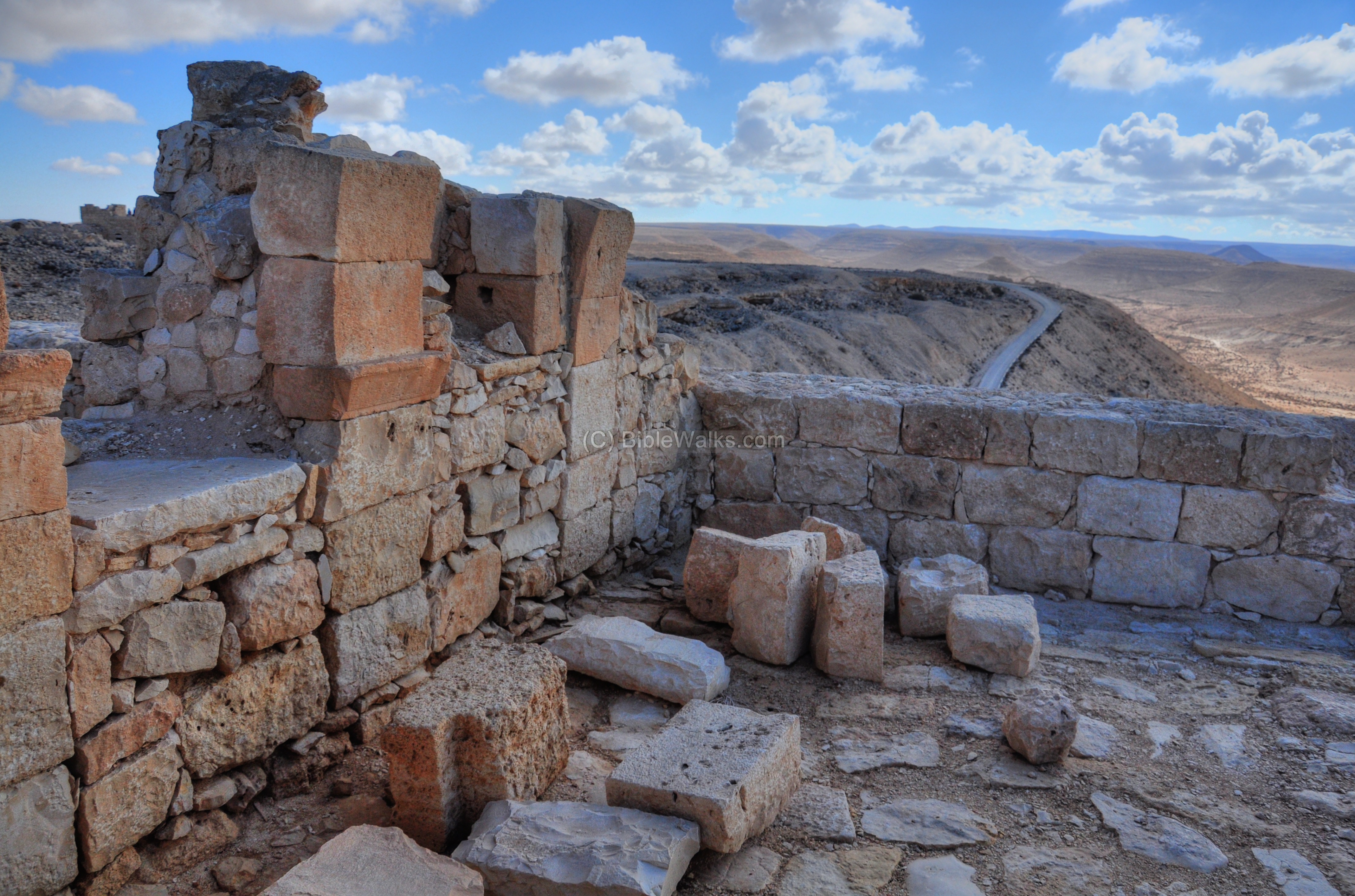
On the western edge of the acropolis is a lookout platform, which is situated on the ruins of a Nabatean temple. It affords remarkable views of the area west of the city. The location of this spot is indicated as a red square on the map.
A western view of the lookout platform is shown in the picture below. There are current (year 2011) restoration works on the site.

From the platform are great views of structures below, such as this structure on the south-west corner.
Another view of the south side is shown in the next picture.
Another base of a structure is seen on the northern hillside.
(j) Baptistery
On the north side of the lookout platform is a large Byzantine baptistery, which was part of the adjacent Northern Church complex. Its location is indicated as a red square on the map.
In the larger pool, which is in the shape of a cross (see photo below), adults were immersed in the water during the process of conversion to Christianity. On its left side is a smaller pool for babies.
A closer view of the adult (right) and the babies (lower left) baptisteries is seen next.
Note that a similar cruciform baptismal design is found in the south and north churches in Shivta and the Eastern church of Mamshit.

(k) Repairs
In October 2009 two Bedouin youths smashed and toppled columns and caused severe damages to the site. A team of archaeologists and workers are working for months to repair the damages, and continue to restore and preserve the antiquities. The photo shows a repair to the wall of the Northern Church.

The next photograph shows repairs in the area of the southern church.

(l) Eastern Side
The eastern side of the city has a number of additional sights which can be reached by foot.
One of them is a reconstructed army camp, which is marked as as a red square (its location is actually farther to the east). Near it is a structure which was a Nabatean pottery workshop.
Additional structures are located around the city area, such as the structures seen in the photograph below.
An impressive army camp was excavated, located 300m north east of the city. The camp’s size is 100m square. It contains 8 long, multi-chambered structures. About 2,000 soldiers would have been stationed here, which is a large force – the size of one legion. The scholars debate if this was a Nabatean camp or a Roman camp. Near the camp are ruins of a large house, which may have served as the camp’s brothel.
The camp was in use until the middle of the 1st century AD, and abandoned following the decline of the Incense route, probably since the Nabateans could not afford any longer to finance the large number of soldiers.
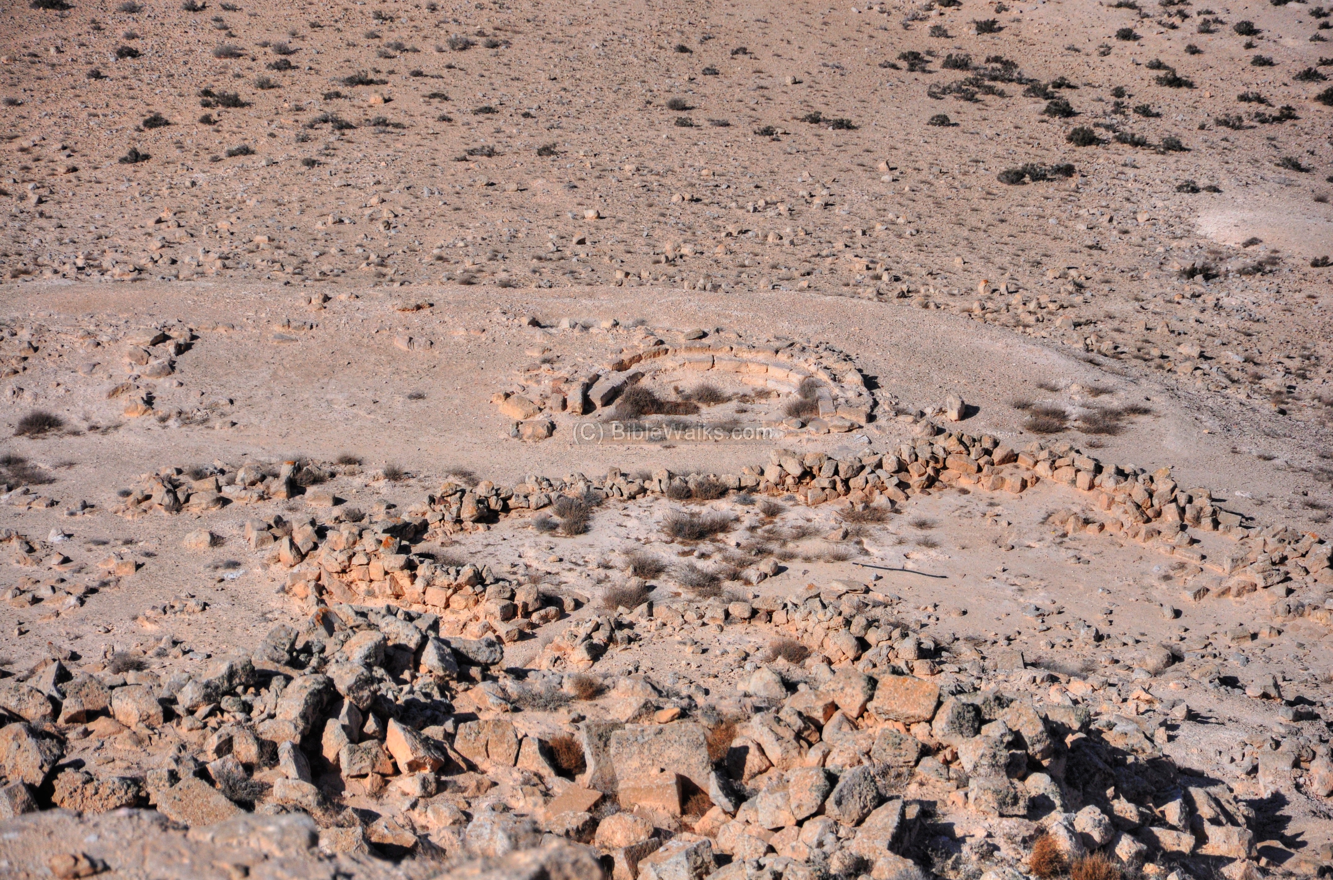
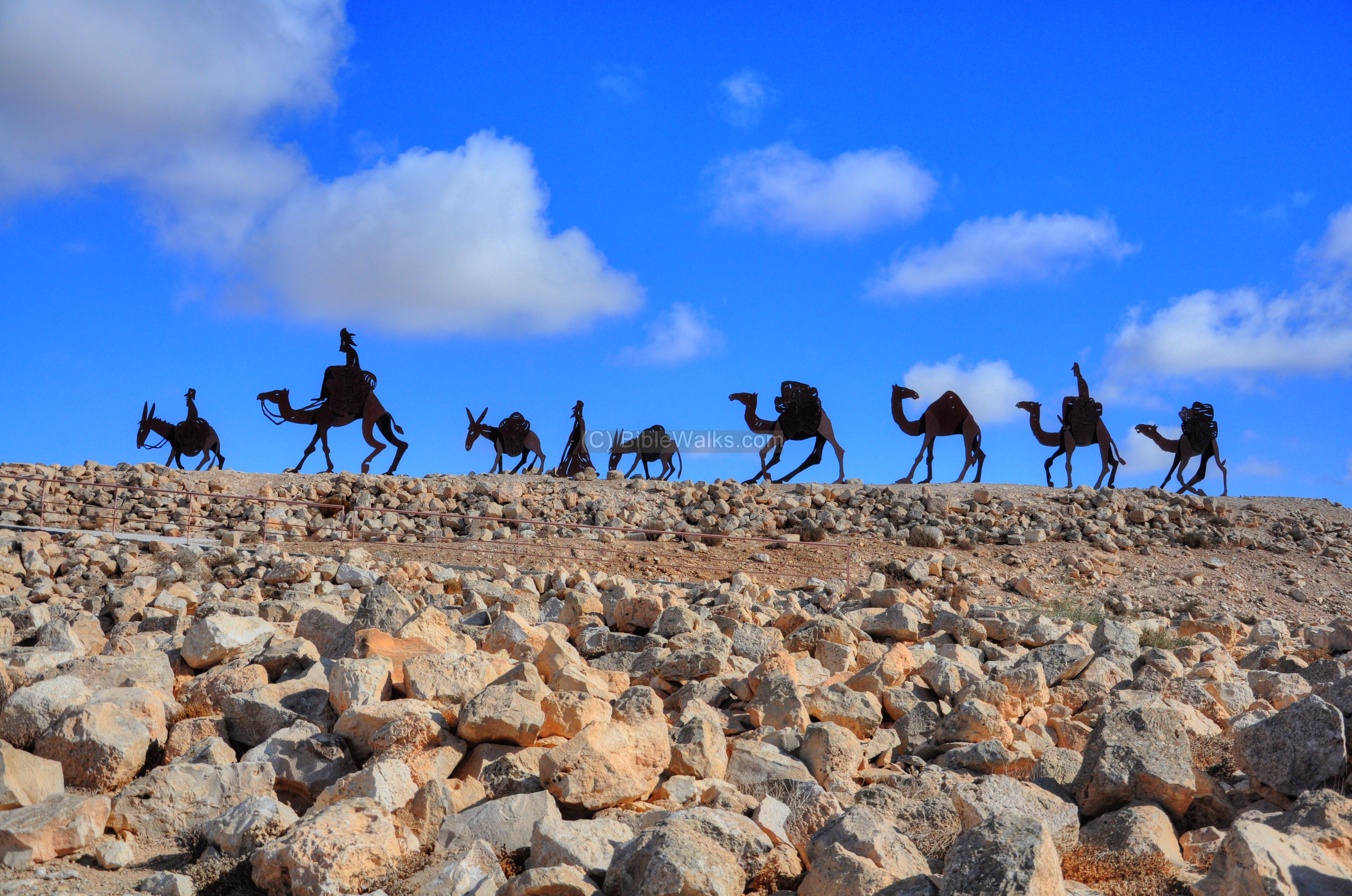
Ancient camel pens are located on the eastern side of the city. A cluster of metal sculptures demonstrate a typical camel and donkey convoy coming from Petra. Note that a typical convoy was made up to a maximum of 25 camels.
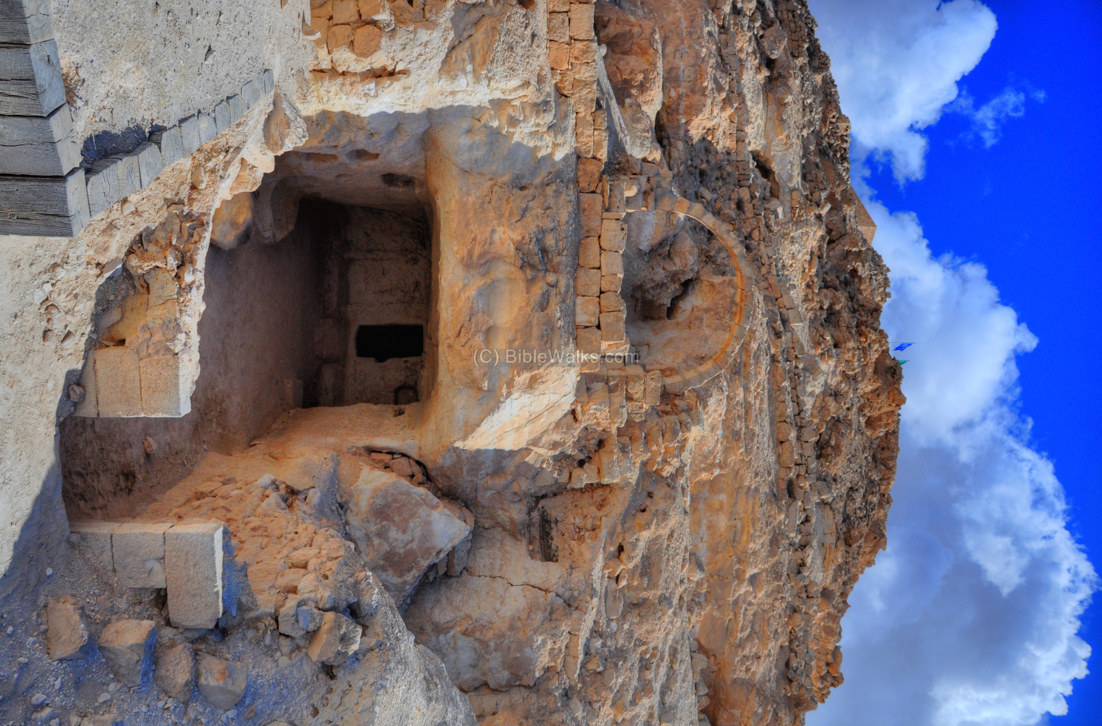
(m) West side – Reconstructed Byzantine house, City of Caves
On the western hillside, just below the lookout platform, is an area termed “the city of caves”. The location of the area open to the public is illustrated as a red square in the city map. It is accessed from a parking place, which can be reached halfway down back to the visitor center.
One of the dwellings in this area, with a large cave in its back portion, was excavated and reconstructed. Its southern side is shown in the following photograph.

The house is dated to the Byzantine period. The owner of the house may have been a wealthy wine merchant.
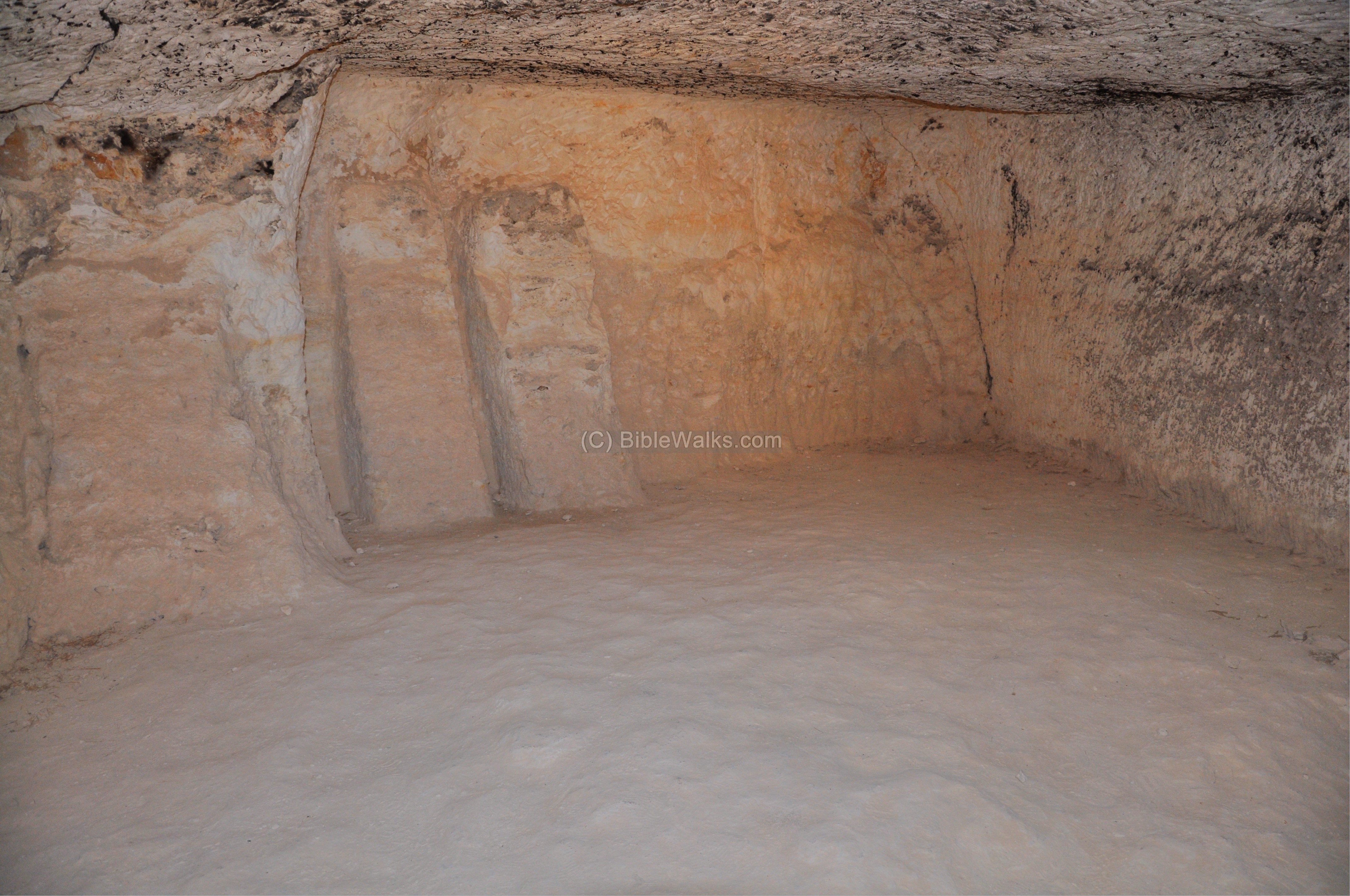
The entrance to the house leads into a courtyard surrounded by a number of rooms. One of them served as a toilet.
A view of the rooms in the house:
Inside the room, a reconstruction of the winery in operation. Wine production was one of the main sources of income in the Negev area. The desert climate, with extremely cool nights during winter with plenty of sunshine during spring and summer created an excellent quality dry wine which was in much demand during the Roman and Byzantine periods.
A large cave is located in the back of the house. The cave has two rooms, and was used for storage of wheat, dry fruit and as a winery.
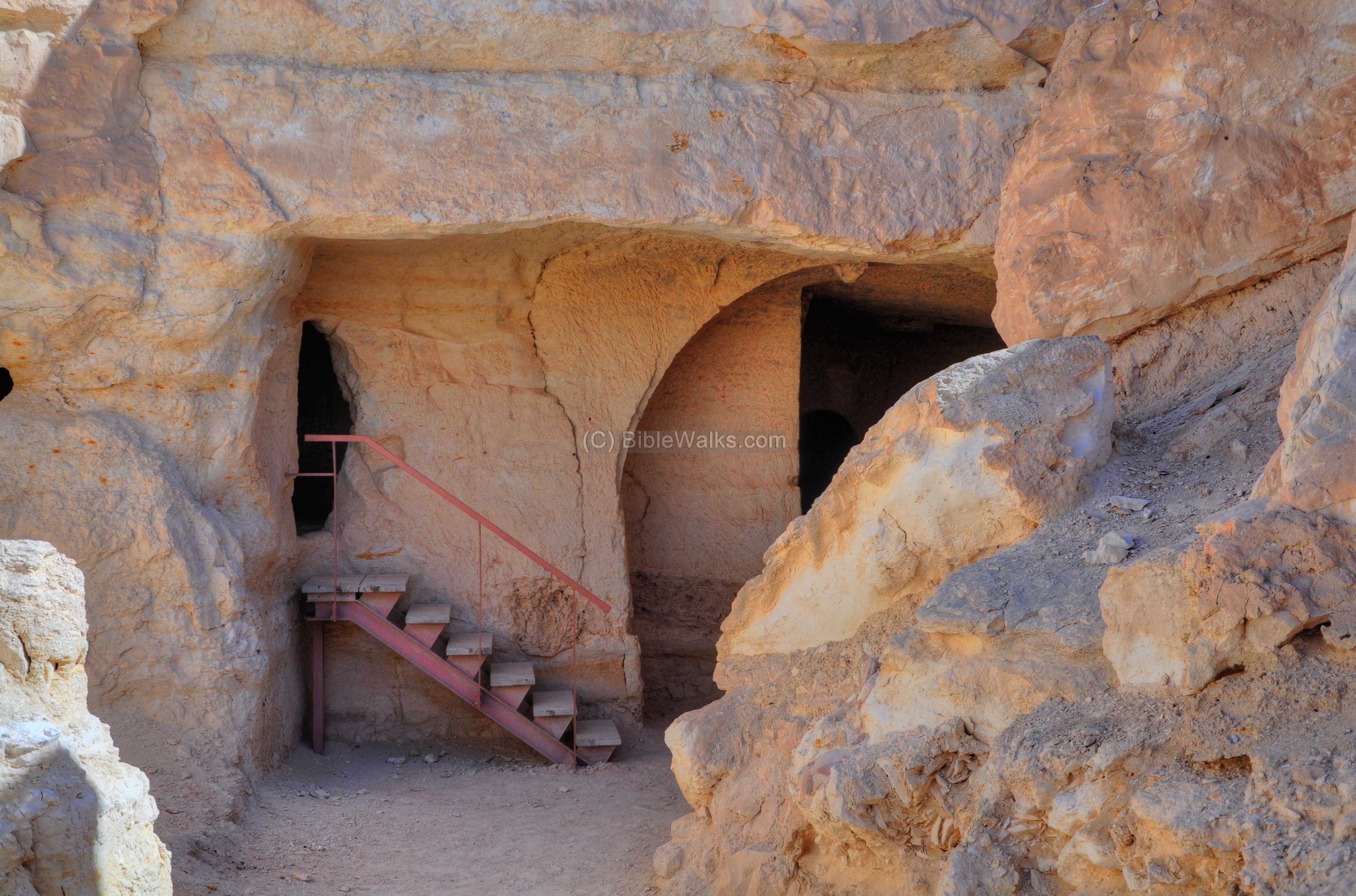
The interior of one of the rooms:

Another room:
The next picture shows a view of the other entrance to the cave, and additional structures around the house.
The city wall passes just below the house and extends to the north. The picture below shows the northern hillside where the city wall continued.

(n) Visitor center
To the west of the ruins of the city is the visitor center. The office sells entrance tickets, presents an audiovisual presentation and offers information. Several stones and vessels are on display.
Nearby, 100m to the north, is a well preserved Byzantine period bathhouse, dated to the 4th Century AD. This photo of the bathhouse was captured by a drone in November 2015, with Avdat is the background.
The reconstructed bathhouse contains a dressing room, cold and tepid rooms, two hot rooms and furnace. It was fed by a water channel from a 70m deep well, seen behind the structure.
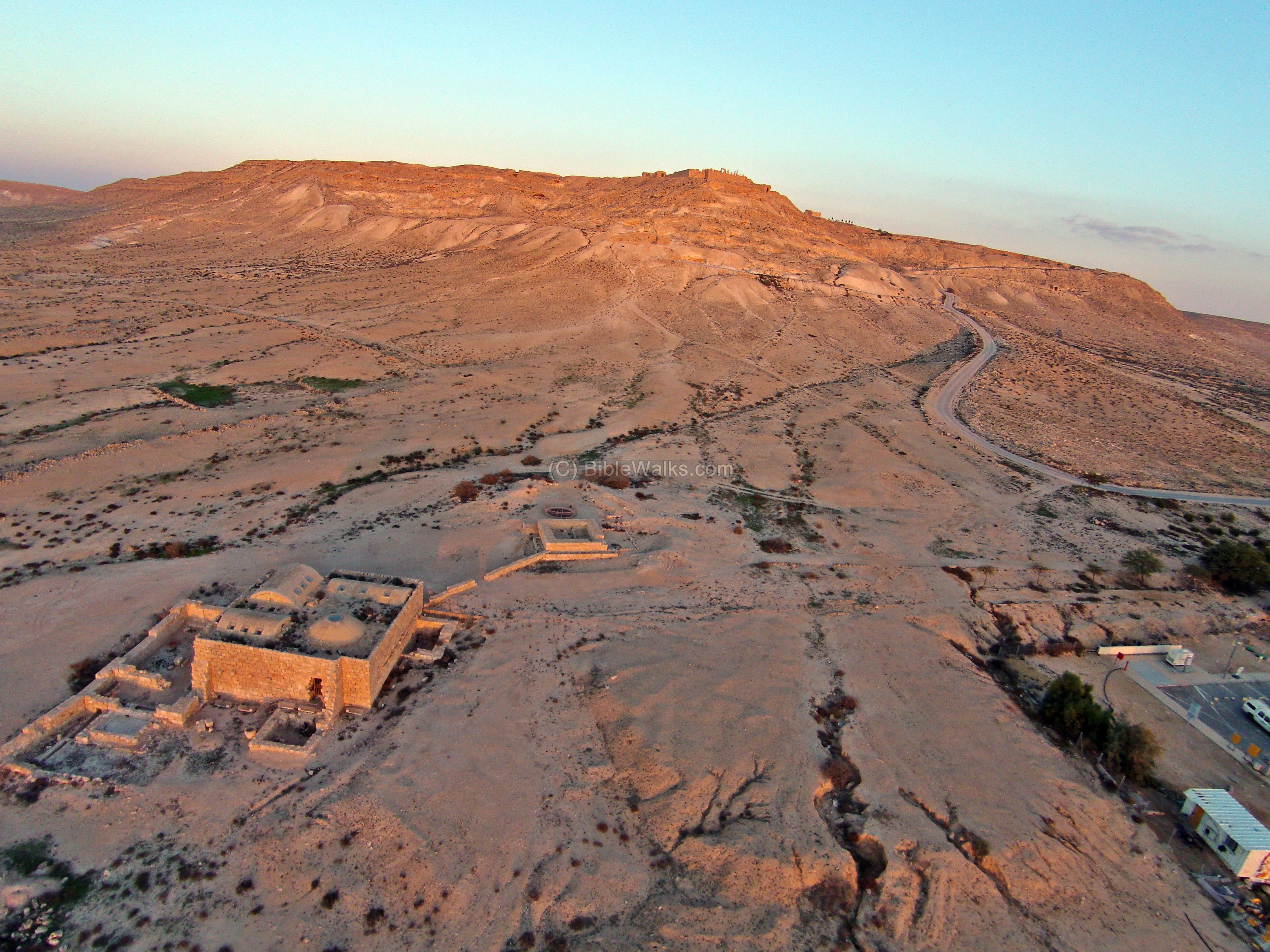
An adjacent coffee show and petrol station, seen above on the bottom right side, is a convenient place to stop and refuel. We highly recommend to have a one or two hour stops at this site on the way to Eilat or back.
Etymology (behind the name):
- Avdat, Ovdat – named after the Nabatean king Obodas. King Obodas I ruled from 90-87 BC, and defeated Alexander Jannaeus in a battle near Golan. This Nabatean victory gave the city its name. Later, Obodas III (ruled 30-9BC) developed the city and was buried there.
Links:
* External links:
- Avdat National Park
- UNESCO world heritage site – Includes: Incense route from the Arava to Avdat, Haluza, Mamshit, Shivta
- Preservation of Avdat (2010) Hebrew, pdf
- Monks and monasteries in the Negev desert (pdf) P.Figueras, 1995 (pp 431-434) – great source
- New Greek inscriptions from the Negev – (pdf) P. Figueras, 1996 (pp 265-284)
* Other Nabatean places in Negev sites:
- Shivta, Nitzana, Mamshit – Nabatean/Roman/Byzantine cities
- Ma’ale Akrabbim, Hazeva, Moa – Nabatean stations
* Other related BibleWalks sites:
- The Nabateans – history, sites, map
- Water in the desert – why water is life
- Ramon Crator – sites of Makhtesh Ramon
- Drone Aerial views – collection of Biblical sites from the air
BibleWalks.com – Following the Incense Route
Ramon Crater<—previous site—<<<All Sites>>>—next Negev site—> Shivta
This page was last updated on Dec 24, 2015 (Added aerial view)
Sponsored links: