Remains of an ancient village, dated to the Israelite and Byzantine periods. Ruins of a synagogue, fortress and agriculture installations.
* Site of the Month Apr 2014 *
Home > Sites> Judea> South > Horvat Anim (Ghuwein el Tachta)
Contents:
Background
Location
History
Photos
* General
* Houses
* Synagogue
* Cave and Hiding place
* Fortress
* Panoramic view
* Installations
Etymology
Links
Overview:
Ruins of an ancient village, located on a rocky hill in the southern Judean hills. On the hill are remains of an Iron Age period fortress and a Roman-Byzantine period synagogue. To its south are a group of agriculture installations, where these farmers once manufactured wine and olive oil, and paddocks where they kept their sheep and goats.
Joshua 15: 20, 50: “This is the inheritance of the tribe of the children of Judah according to their families… And Anab, and Eshtemoh, and Anim”
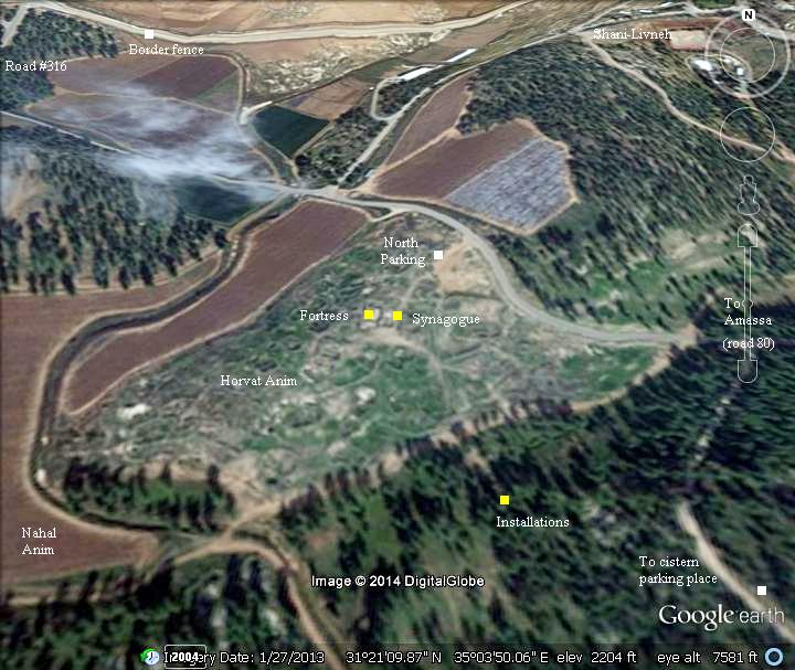
Location and Aerial map:
The ruins of Horvat Anim are located on a low ten-acre rocky hill in the Southern Judean hills, on the edge of the Negev desert, north of the valley of Arad. The hill is 669m above sea level, part of the area known as the Yattir forest – the largest planted forest in the country, which is named after an adjacent village of the same periods.
The ruins of Horvat Anim (“the lower”) are located 12KM north west of Arad, close to the pre-1967 green line, on the Israeli side. Its twin village (Anim the “upper”), once a Christian village during the Byzantine period, is located 2KM north-east but on the other side of the barrier fence. The site can be reached from the south from Highway #31 (Arad-Beersheba) via Highway #80 (from Tel Arad junction) or from highway #316 (from Shoket junction).
It is recommended to park on the south side, inside the forest, walk through the ancient agriculture installations, then ascend to the fortress and synagogue on the top of the hill.
The aerial view shows the points of interest.
History of the place:
-
Biblical (10th – 6th Century B.C.)
During the late 8th Century B.C. the area of southern Hebron hills and the Negev witnessed a growth of settlement activity, with dozens of new towns established. This growth decreased in the 7th century following the Assyrian intrusions headed by Sennacherib (701 B.C.) , and stopped at the end of the 6th century following the Babylonian intrusion headed by Nebuchadnezzar (587 B.C.).
Anim is referred in the following Biblical text, implying that it was established and inhabited during the Kingdom of Judea (10th-7th century B.C.):
Joshua 15: 20, 50: “This is the inheritance of the tribe of the children of Judah according to their families… And Anab, and Eshtemoh, and Anim“
An Iron-Age fortress is built on the top of Anim, which is dated to the period of the Judean Kingdom. It is a square structure, 21.5m by 21.5m. The fortress was built at the beginning of the 8th century B.C., or during the 7th Century.
The fortress and village was destroyed in the beginning of the 6th century, following the intrusion of the Babylonians (587 B.C.). Evidence of the destruction was found in the excavations of the fortress.
The destruction of Judea brought the Idumeans from the south to occupy the region, after they were driven out their country in Trans-Jordan by the Nabateans.
-
Hellenistic and Hasmonean periods (4th – 1st Century B.C.)
During the Maccabee revolt, the Idumeans supported the Seleucids and helped them fight the Jews, although they resisted Hellenism. This caused the Maccabees, who founded the Hasmonean Kingdom, to wage war against the Idumeans.
The area was captured in 110 B.C., by the Hasmonean King John Hyrcanus (reigned 134-104BC), as part of his campaign against the Idumeans. Thus came the end of the Idumean control of the area, as promised by the prophecy (Obadiah 1, 19):
“And they of the south shall possess the mount of Esau”.
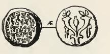
Coin of John Hyrcanus
The Idumeans were descendents of Esau, father of Edom and brother of Jacob, and had religious proximity to the Jews. Therefore, according to the historian Josephus Flavius and other historians of his times (Ptolemy and Strabo of Amesia), the Idumean cities and villages (an area around Hebron and Beersheba) were converted to Judaism by the Hasmoneans. (Antiquities 13 9:1): “Hyrcanus took also Dora and Marissa, cities of Idumea, and subdued all the Idumeans; and permitted them to stay in that country, if they would circumcise their genitals, and make use of the laws of the Jews; and they were so desirous of living in the country of their forefathers, that they submitted to the use of circumcision, and of the rest of the Jewish ways of living; at which time therefore this befell them, that they were hereafter no other than Jews”. The Jewish rituals practiced in Anim during the second temple period are evident in the findings of stone vessels in several locations.
The conversion of the Idumeans increased the size of the Jewish population, and beefed up the Hasmonean army. Furthermore, Herod the Great was born in Idumea (74 B.C.), the second son of Antipater the Idumean (a powerful official who was appointed as the governor of Idumea by the Hasmoneans). Herod later became king of Judea under the Roman influence.
-
Early Roman period (1st Century B.C. – 2nd Century A.D.)
The fate of Anim during the great revolt is not known, although the converted Idumeans were known of their brave combats against the Romans, which may have resulted in tragic results in Anim. Coins of the great revolt were found in the caves of Anim, indicating that the Jewish refugees from Judea fled and hid here.
During the second revolt against the Romans – known as the Bar-Kochba revolt (132-135 A.D.) – the village was destroyed.
-
Late Roman period (2nd – 4th Century A.D.)
As a frontier desert village, Anim was probably settled by veteran soldiers at the end of the 2nd Century. These settlers received land for raising crops, and also assisted in the protection of roads and fortresses around the site. The settlements were part of the empire’s attempts to fortify the eastern frontier of the Roman empire – the Limes Arabicus. The border line extended 1,500km from Northern Syria to the Red Sea, and its defense was based on supporting villages, forts, watchtowers and connecting roads. This protected the empire from attacks of the barbarian tribes of the Arabian desert. At the end of the 3rd century the Limes was restructured by Diocletian, renamed to Limes Palaestinae. It continued to support the defenses of the Byzantine empire until the 6th Century.
The cities and roads during these periods are indicated on the Biblical Map below. Anim is indicated as a red point, and is positioned near the road from the city of Hebron and Malatha (where the regional Roman military cavalry headquarters – the Cohors I Flavia Equitata – were located during the Byzantine period).
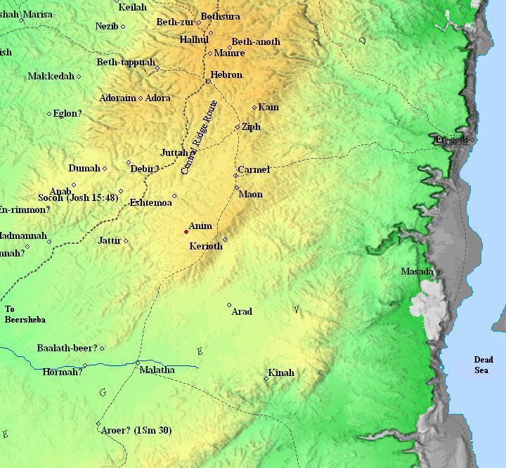
Map of the area around Anim – during the Biblical through Roman periods (based on Bible Mapper 3.0)
-
Byzantine period (4th-7th Century A.D.)
During this period, the “lower” (southern) Anim was a Jewish village, and its sister village to the northeast was a large Christian village.
Eusebius Pamphili (better known as Eusebius of Caesarea), a 4th Century Greek historian of the Church, wrote in his book “Onomasticon” about Anim (here: Aneim or Ania ) the “upper” (Christian village) and the “Lower” (Jewish village):
-
“Lower” Anim: “Also another large village of the Jews called Ania in the Daroma nine miles south Hebron“.
-
“Upper” Anim: “(In) the tribe of Juda. Another Anaia near the former (of which we spoke above) now happens to be wholly Christian (all its inhabitants are Christians) to the east of the first”
On top of the hill, close to the Judean Kingdom fortress, are the ruins of the synagogue of Anim. The synagogue, constructed in the 4th Century, continued to service the villagers until the 7th or 8th Century A.D.
-
Early Arab period (7th-10th Century) to Mamluke period (14th-16th Century)
During the Muslim periods, the village continued to be an agriculture village. The synagogue was converted to a mosque.
-
Ottoman Period (19th century)
Conder and Kitchener surveyed this area during the Survey of Western Palestine (SWP) in 1873. They correctly identified Anim as Ghuwein (Volume 3, p403):
“Anim (Joshua XV 50) a town mentioned next on the list to Eshtemoa, is probably the present ruin of Ghuwein. In the ‘Onomasticon’ (s.v. Anab), a town Anea is mentioned as a large place in Daroma, 9 miles south of Hebron, and again (s.v. Anim) a second Anea is mentioned near the other, and east of it, and is said to have been entirely inhabited by Christians. Ghuwein is about 1 1 English miles south of Hebron ; but most of the distances in this part seem incorrectly given in the ‘Onomasticon’ there are two sites, east and west, as noticed in the ‘Onomasticon.'”. 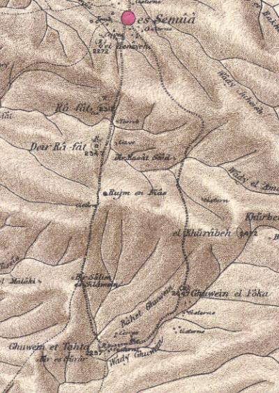
Part of map Sheet 25 of Survey of Western Palestine,
by Conder and Kitchener, 1872-1877.
(Published 1880, reprinted by LifeintheHolyLand.com)
Two sites are shown on the map: Ghuwein el Tachta (the “lower” Anim, the smaller Jewish village) and Ghuwein el Foka (“upper’ Anim, the larger Christian village).
Their report on both sites (p. 408):
- “Ghuwein el Foka. Caves, cisterns, foundations of houses, with drafted masonry, apparently Byzantine. Guerin calls this place Ghuwein esh Sharkieh.
- Ghuwein et Tahta. Resembles the last, but is a smaller ruin. Guerin calls this place Ghuwein el Gharbieh”.
- Modern Period
The synagogue was discovered by Zvi Ilan during a survey in 1972 (Kochavi, 80 #site 250) and in 1987 (Zvi Ilan). A burial cave, dated to the late Iron age, was excavated (Lander).
Excavations were performed in the 1988-1989, directed by Zvi Ilan and David Amit, focusing on the synagogue, and by Cohen who excavated the fortress. An archaeological conservation project was conducted by the IAA in June 2010.
A community was established 1KM northeast to the ancient site, near the barrier fence, and was named Shani-Livneh. In 2013 there were 120 families living in this settlement, with a majority of immigrants from former Soviet Union.
Photos:
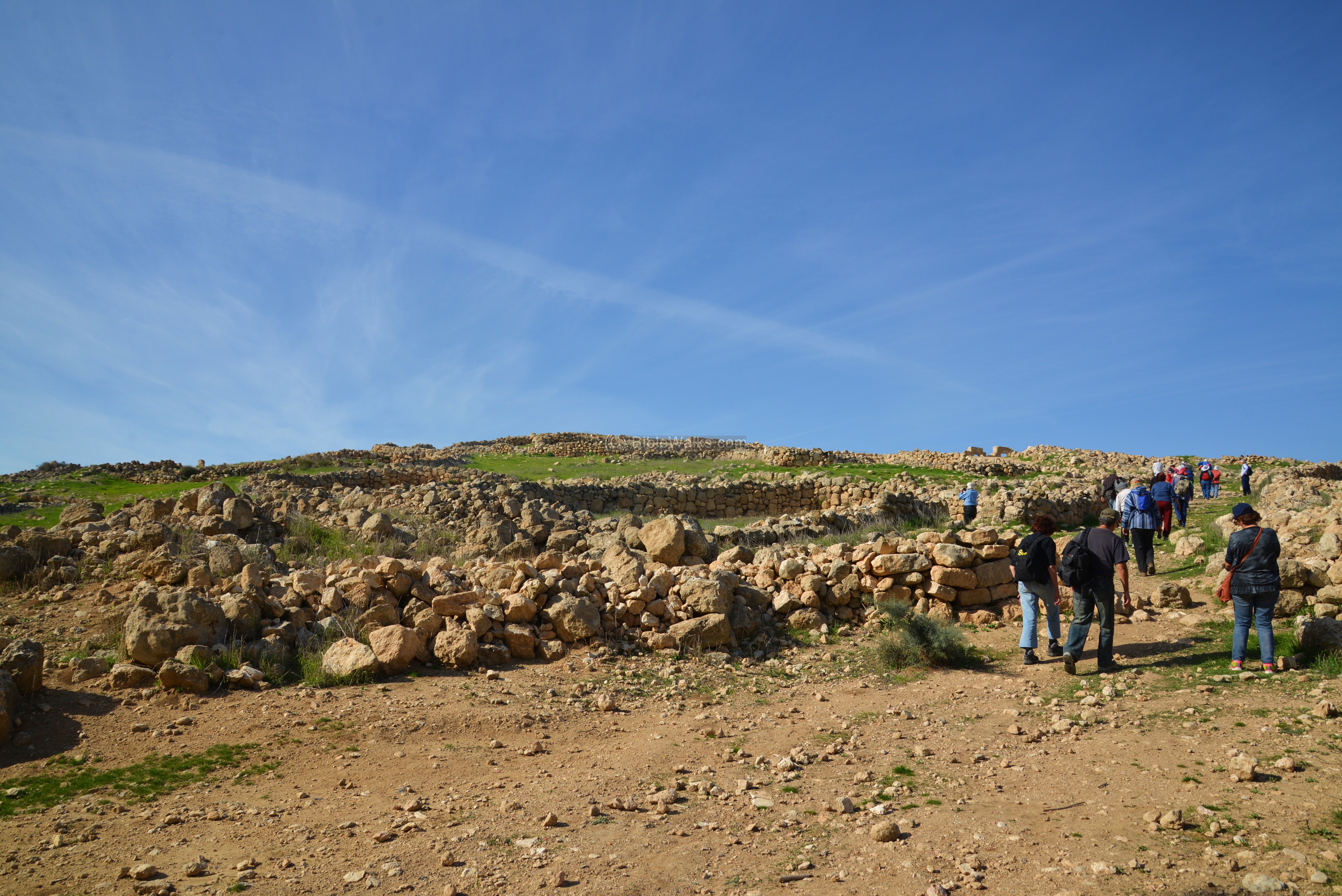
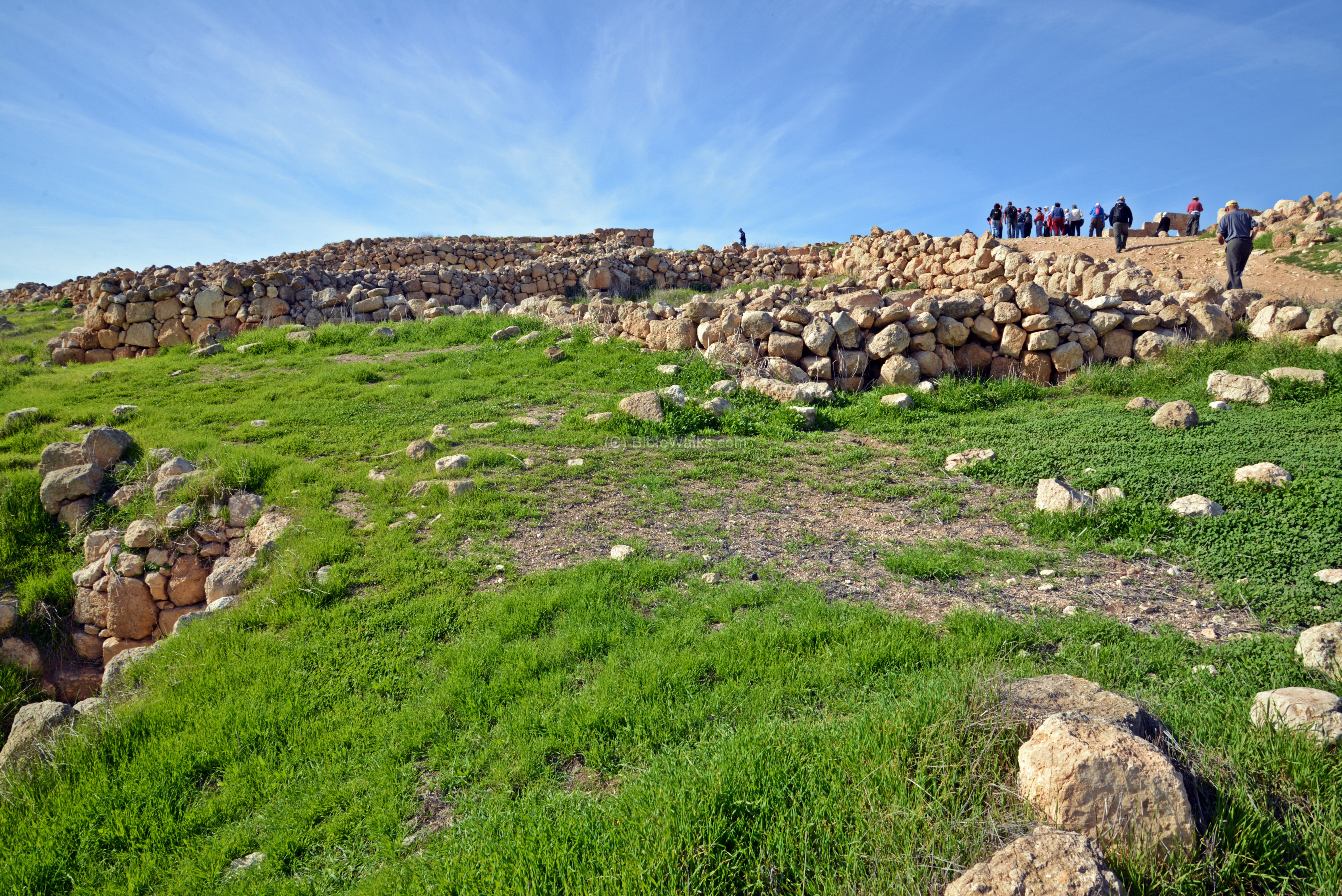
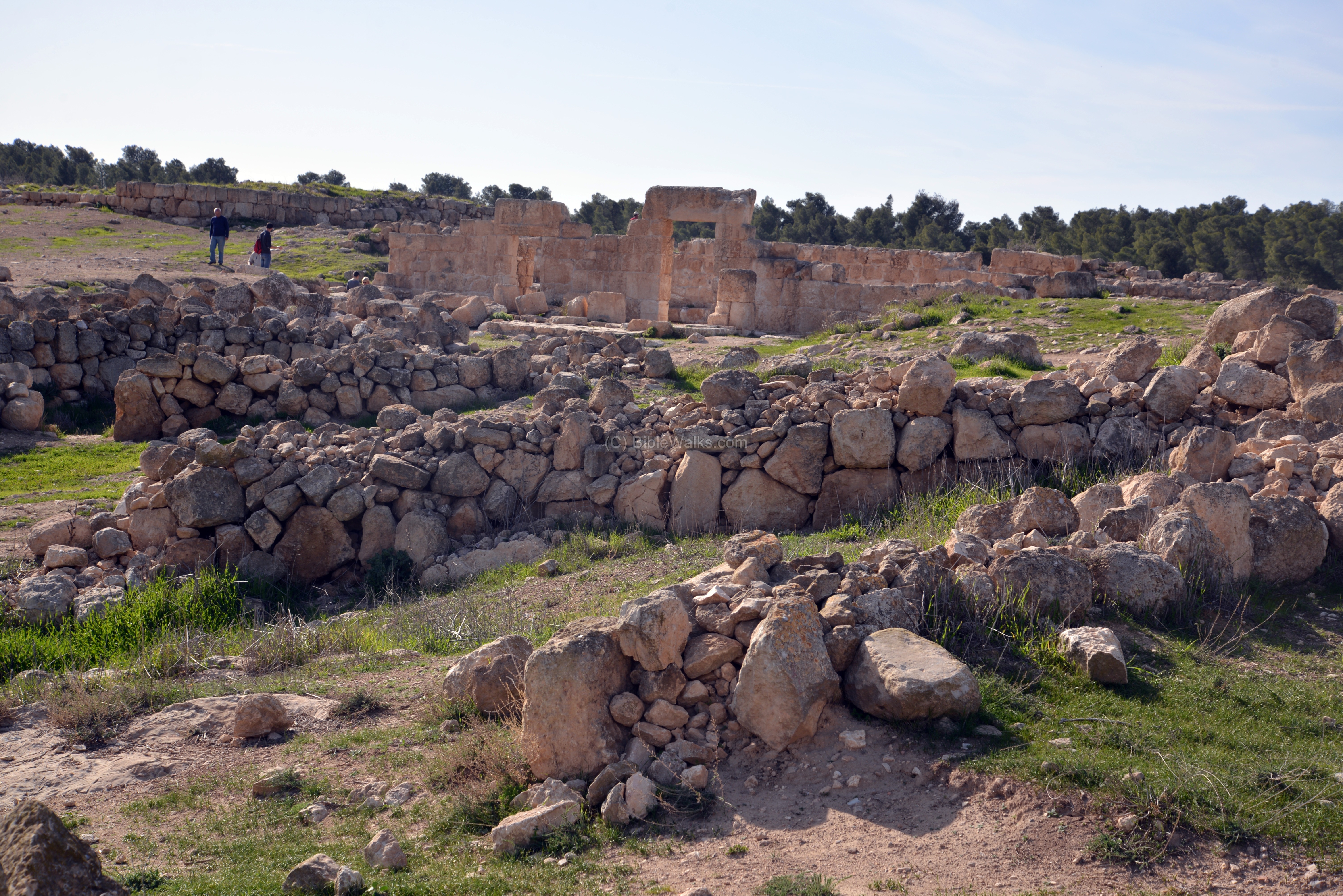
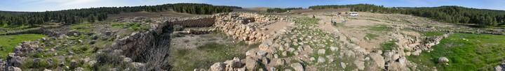
(a) Overview
View of Khirbet Anim is seen here from the south. The ruins are scattered around the hill and its surroundings.
An ancient street leads up between the ruins of the houses to the top of the hill.
Click on the photos to view in higher resolution…
This tour was produced by “Tagliot” (Hebrew: Discoveries), and was directed by the archaeologist Eli Shinhav, who was one of the excavators of the site.
(b) Houses
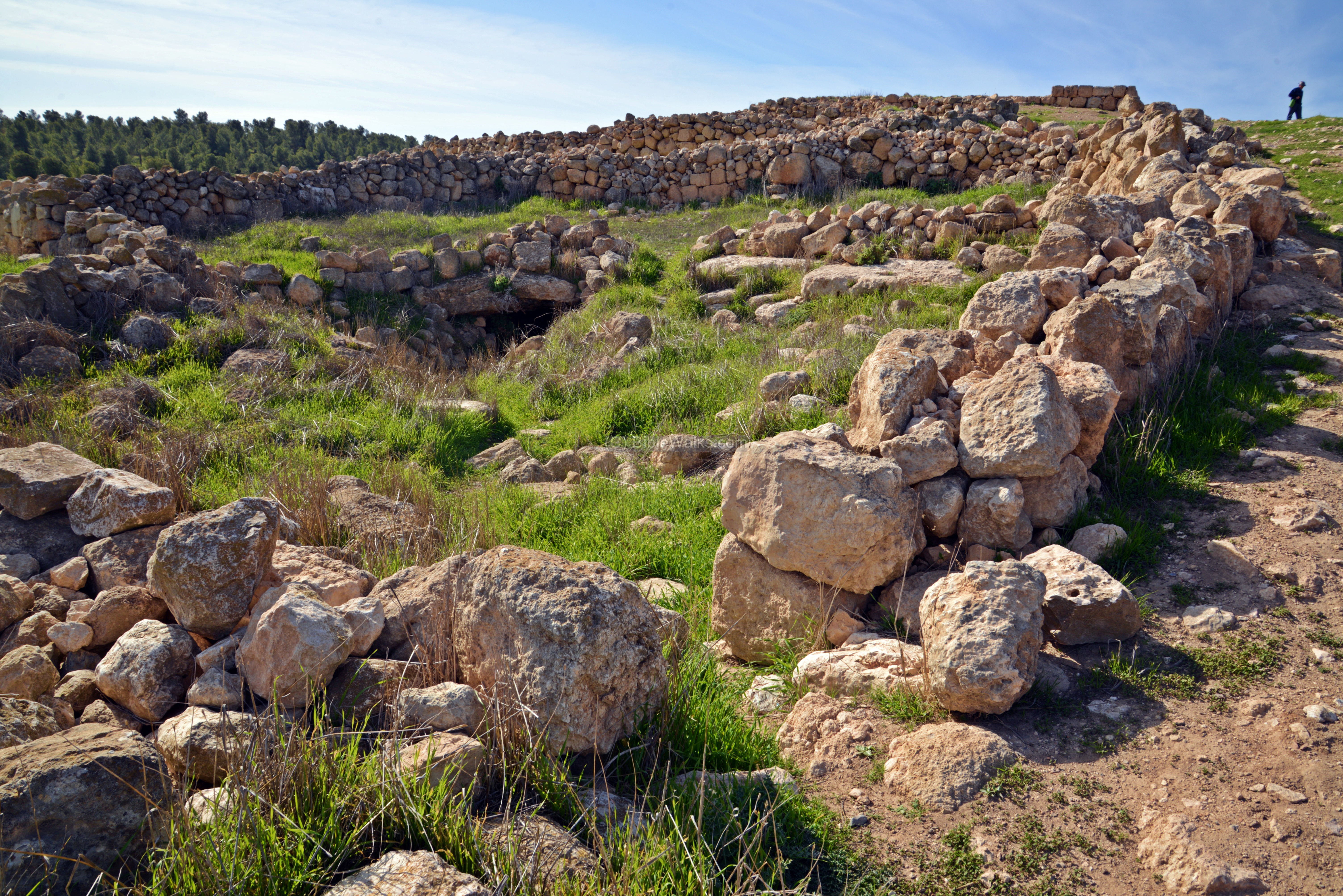
Remains of the ancient structures, caves, courtyards and streets are visible along the slopes of the hill.
The standard design of the ancient houses in Anim included a central courtyard, rock-hewn cistern serving as the local water supply, and a rock-hewn cave which was used for both dwelling and storage.
The hill was built of limestone, overlaid by thick layer of chalk, and covered by a harder crust of nari (light chalky limestone). Once piercing thru the crust, one can easily cut into the soft layer of chalk. One of the characteristics of the chalk is it blocks the passage of water, making it perfect for cutting water cisterns and caves.
The caves continue to be used for dwelling, even in modern times.
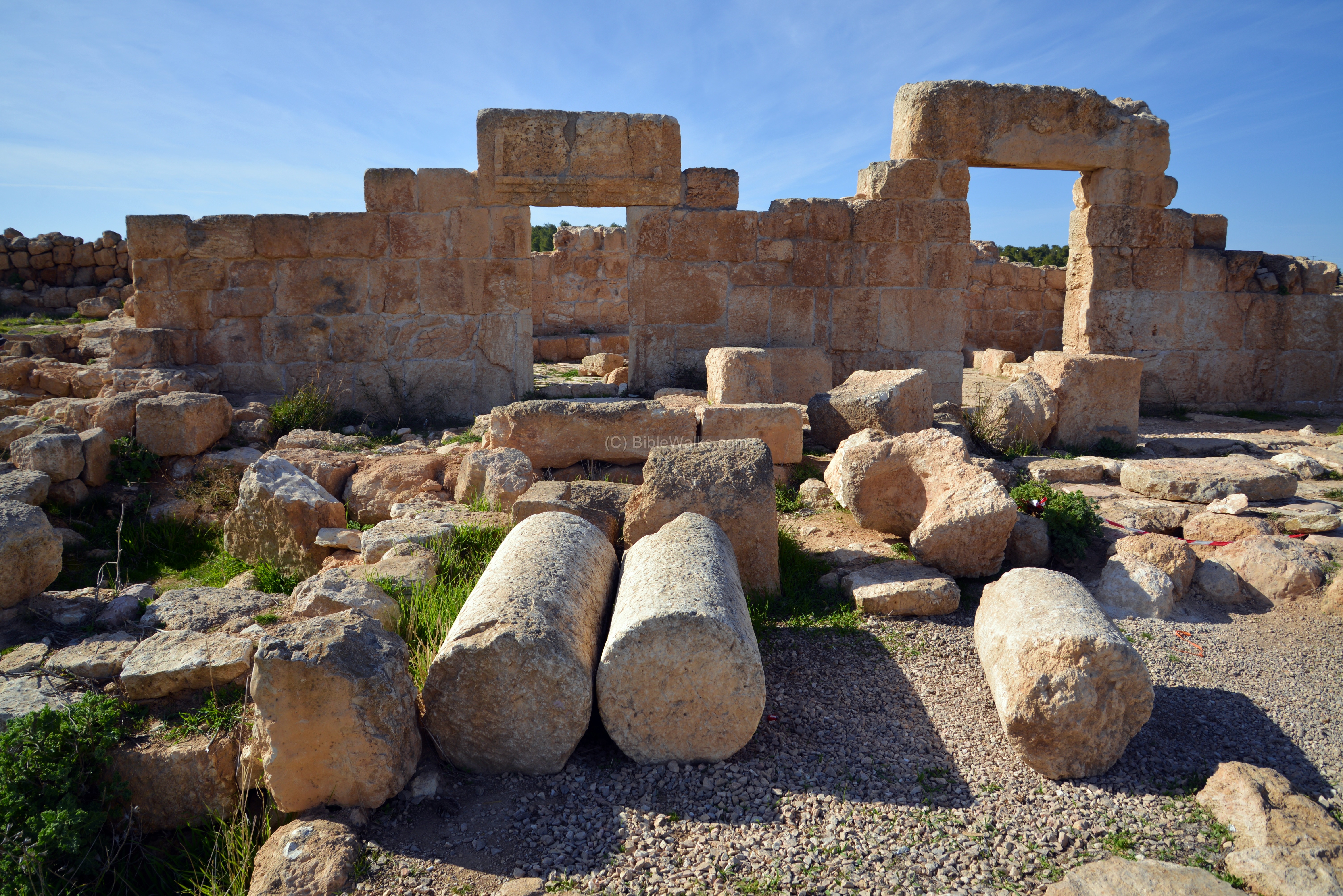
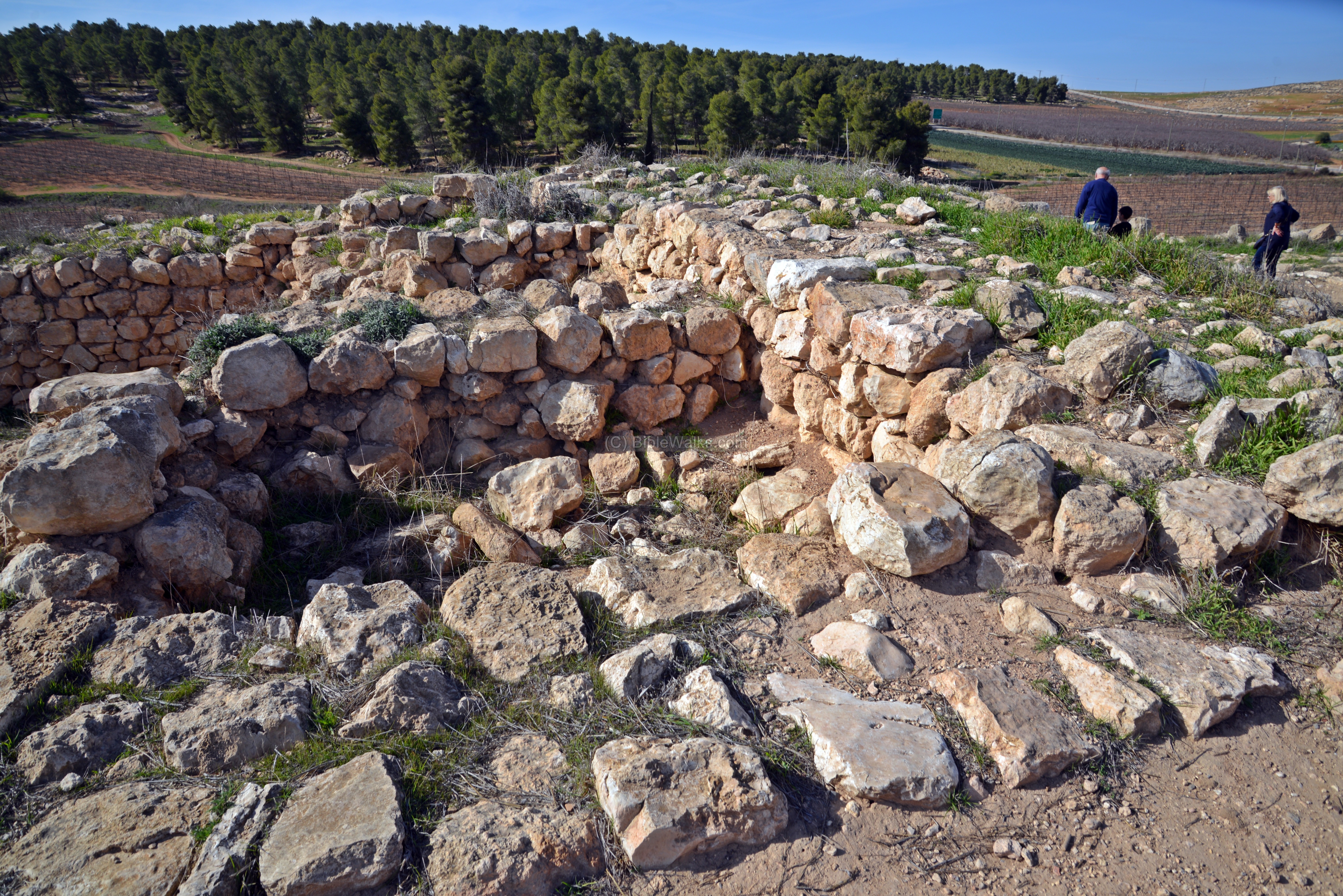
(c) Synagogue
On top of the hill, close to the Judean Kingdom fortress, are the ruins of the synagogue of Anim. The synagogue, constructed in the 4th Century, continued to service the villagers until the 7th or 8th Century A.D.
On its eastern wall, which is the front of the synagogue, are two entrances, which a common design of synagogues. The entrances are on the longer side, which are common in smaller synagogues (such as Anim and Ma’on), as opposed to entrances on the narrow side of larger structures (such as Eshtemoh and Susya).
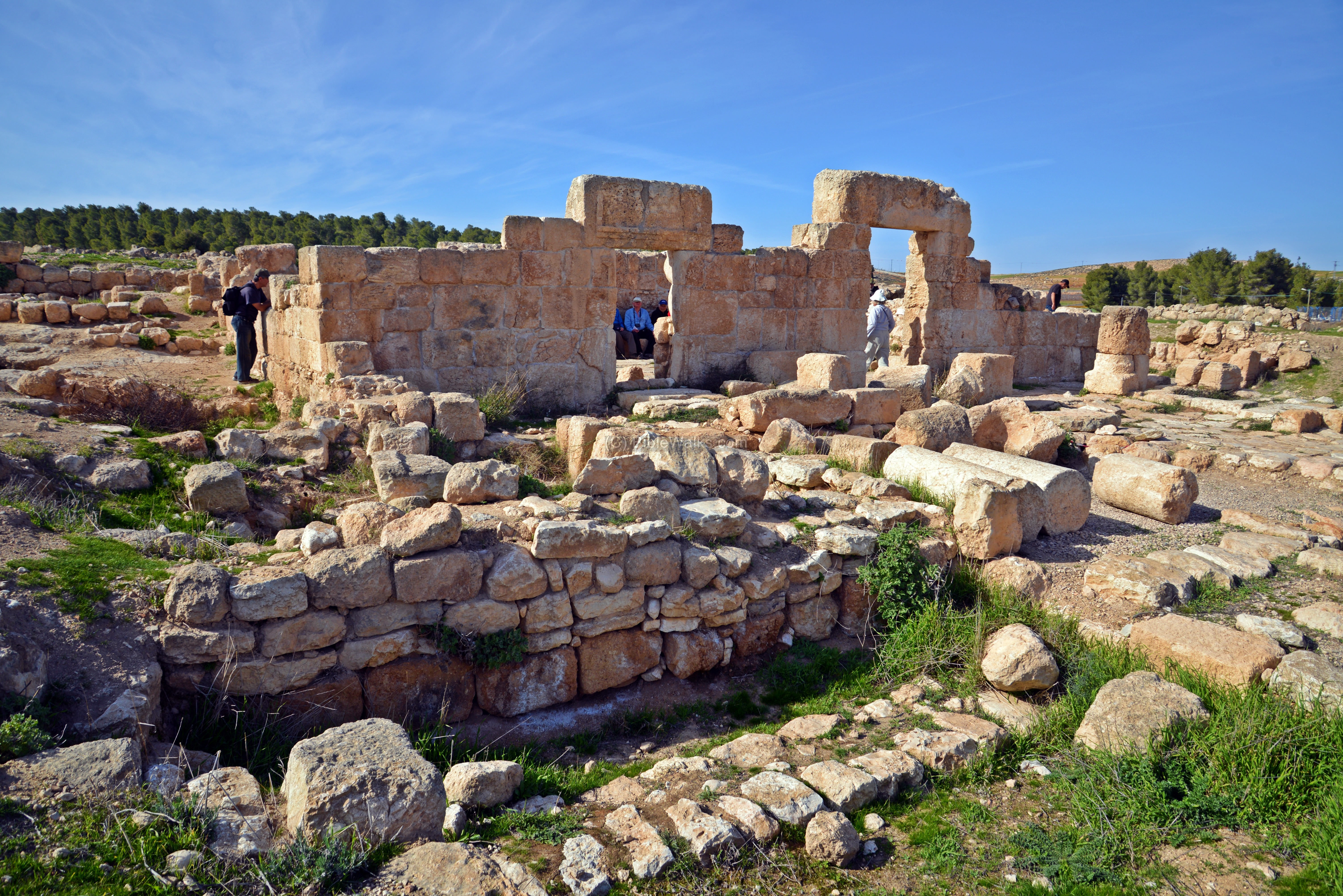
The rectangular structure external dimensions are 14.5m long (on the north-south axis) by 8.5m wide. The ruins were preserved to a height of 3.5m.

-
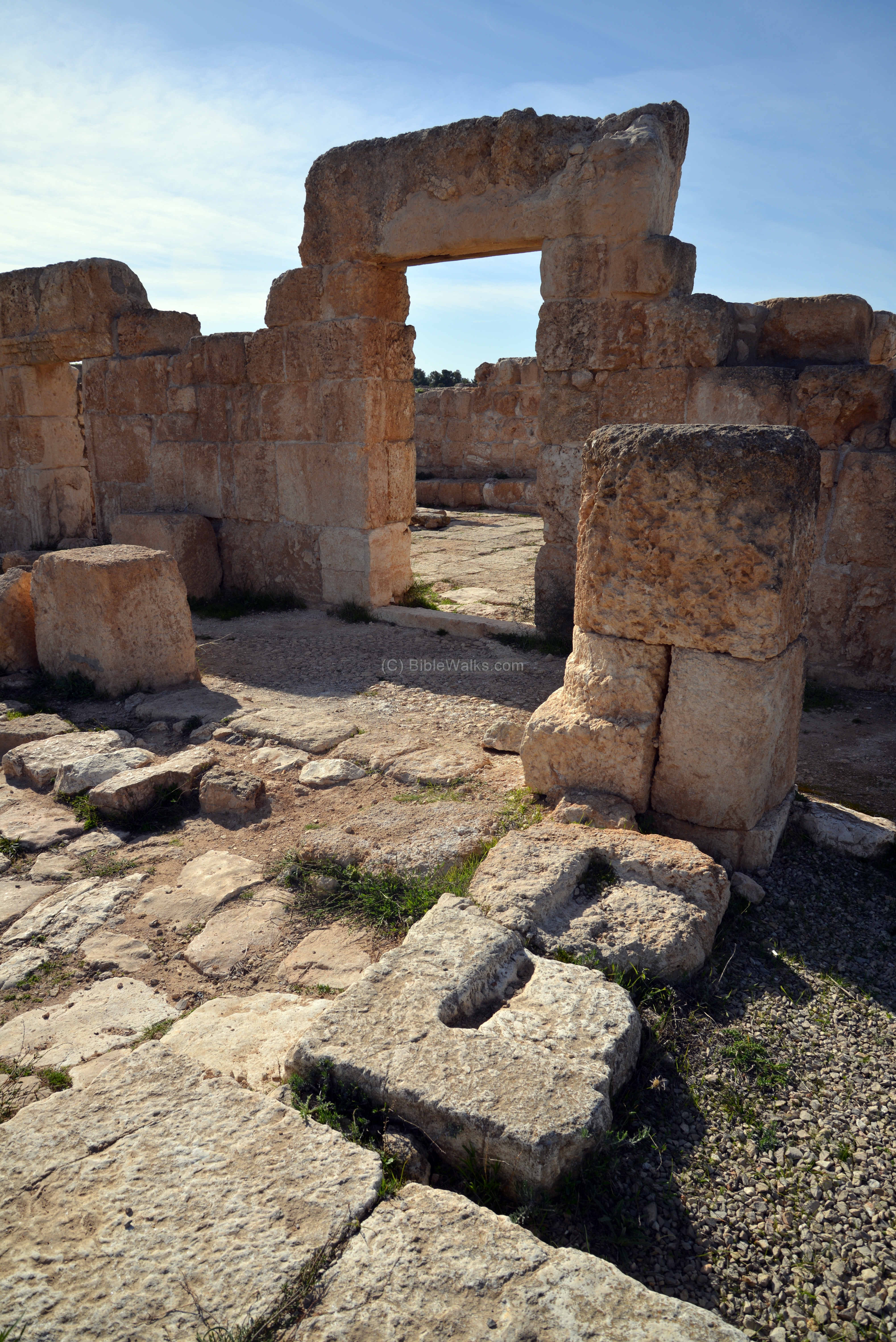
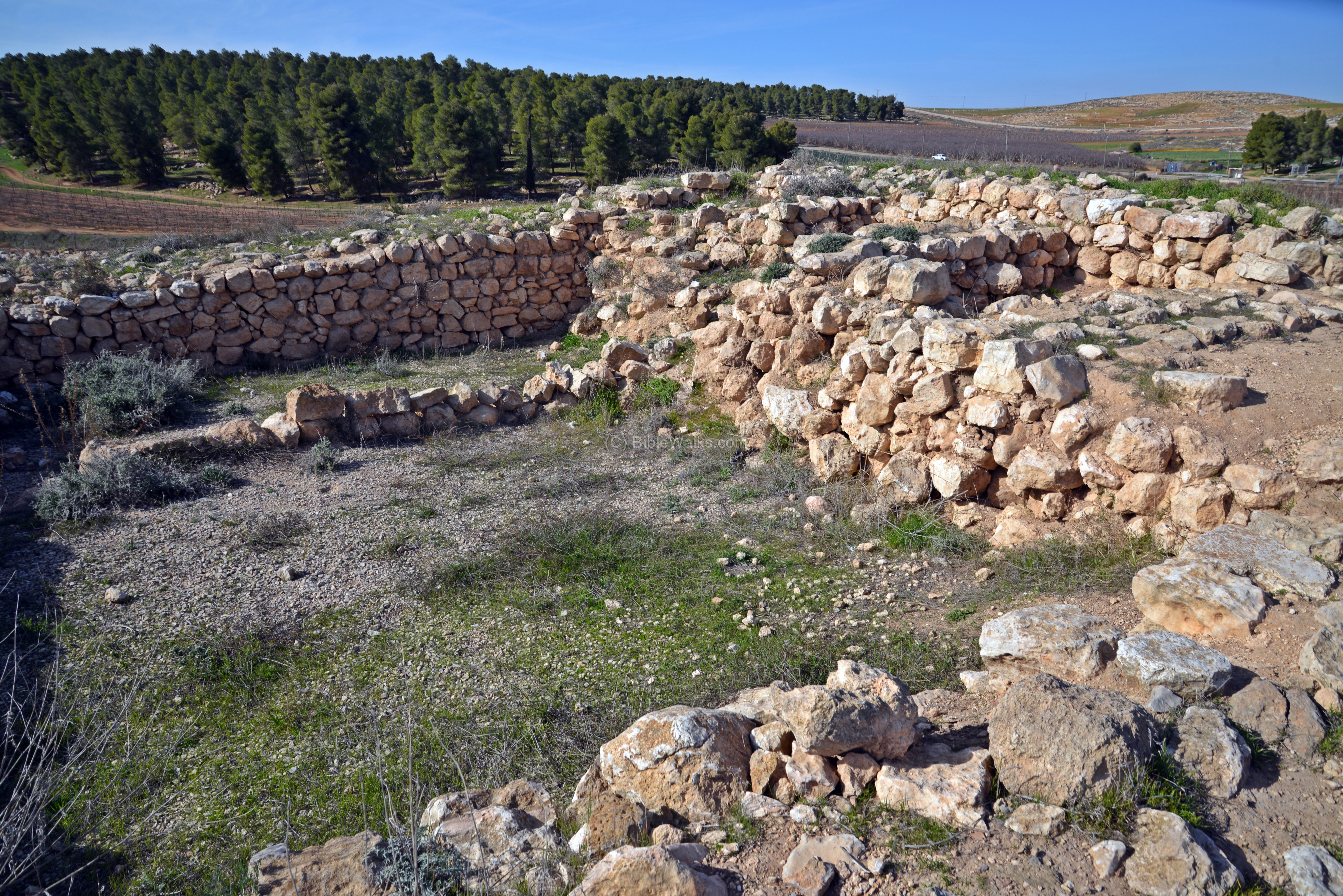
Eastern side: Narthex
Along this eastern side was the narthex (entry way). A row of columns separated between the narthex and the courtyard on the east side.
A closer view of the northern entrance is seen in the following photo. The narthex floor, 2m wide, was covered by a mosaic floor with geometric forms and an inscription, but it was removed in order to preserve it.
-
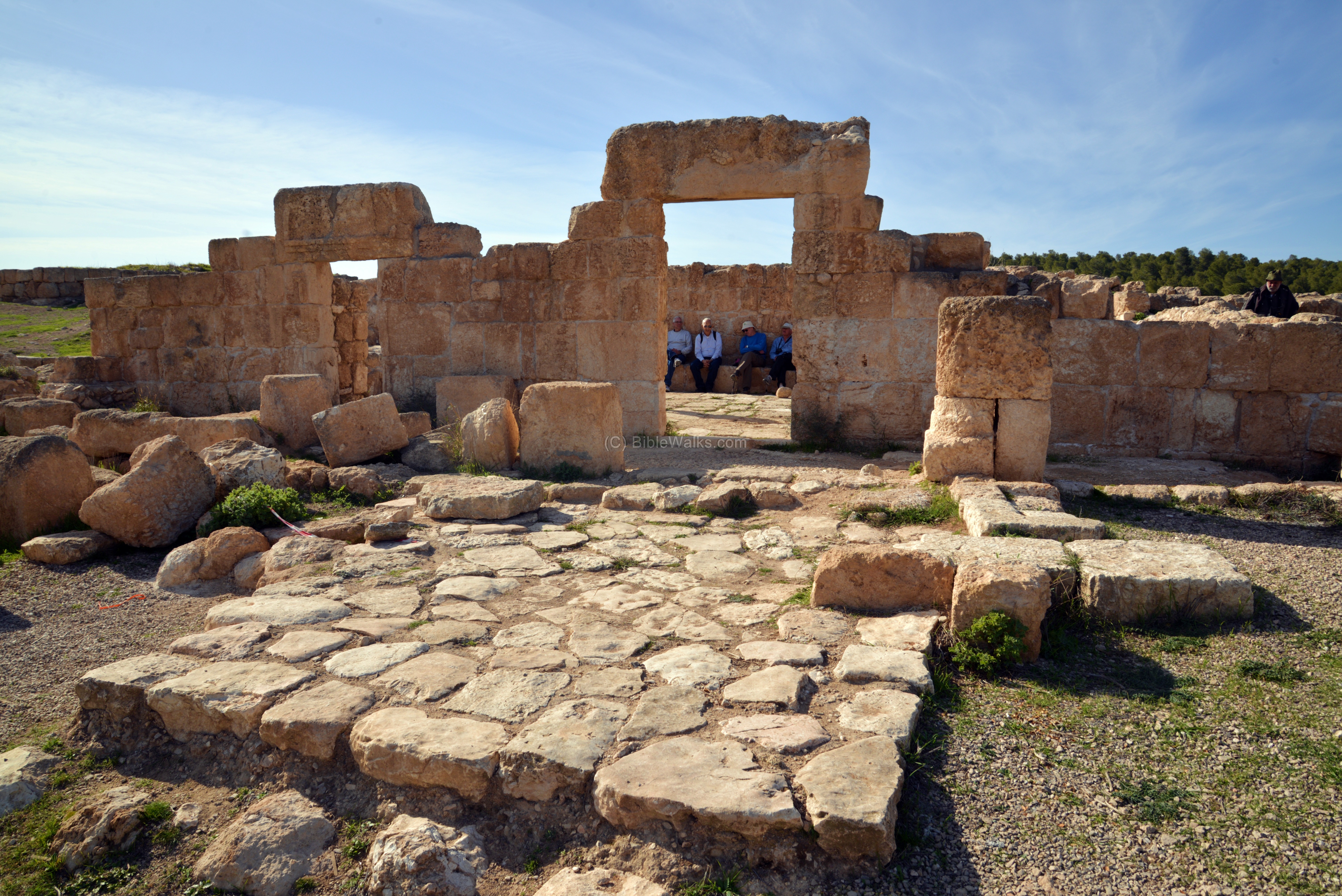
Courtyard:
The courtyard is located in front of the narthex. In the center of the courtyard is an unroofed plaza of 4m x 7m, seen below. In the courtyard is a cistern. Rooms flank the courtyard on the north and south sides.
-
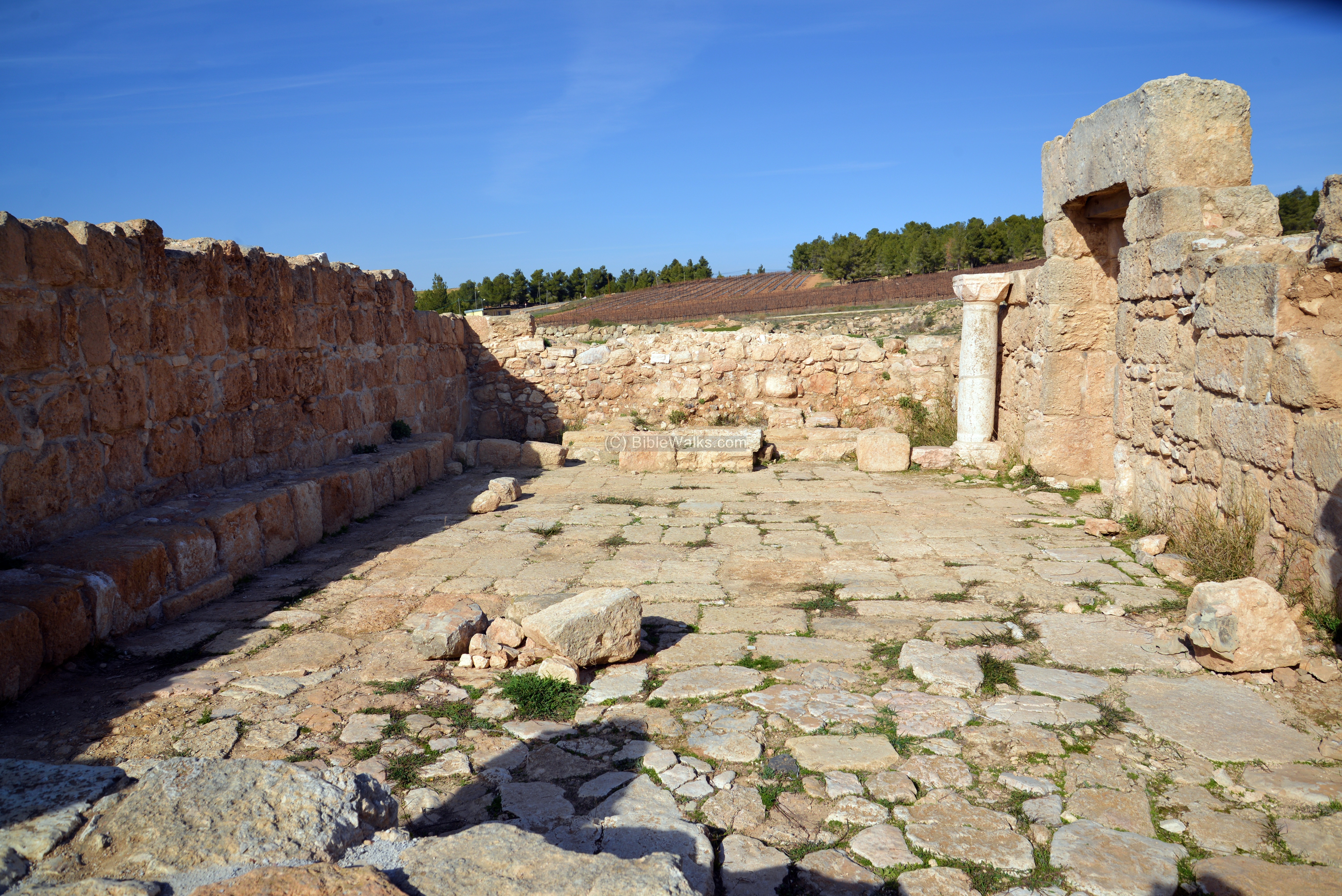
Interior:
In the photo below is the guide of the tour, Eli Shenhav, who conducted excavations at the site. Behind him are the two entrances to the synagogue.

The following photo is a view towards the north side, which faces Jerusalem.
Seats are aligned along the western wall. The walls were once plastered, and the synagogue was covered by a tile roof which was supported by the side walls.
The floor is made of large flat stone slabs, with remains of an older mosaic floor under the it.
On the northern side are remains of the place of the torah ark (seen here). A quarter of the hall was sealed off in order to define it as bimah (platform for the torah reading).

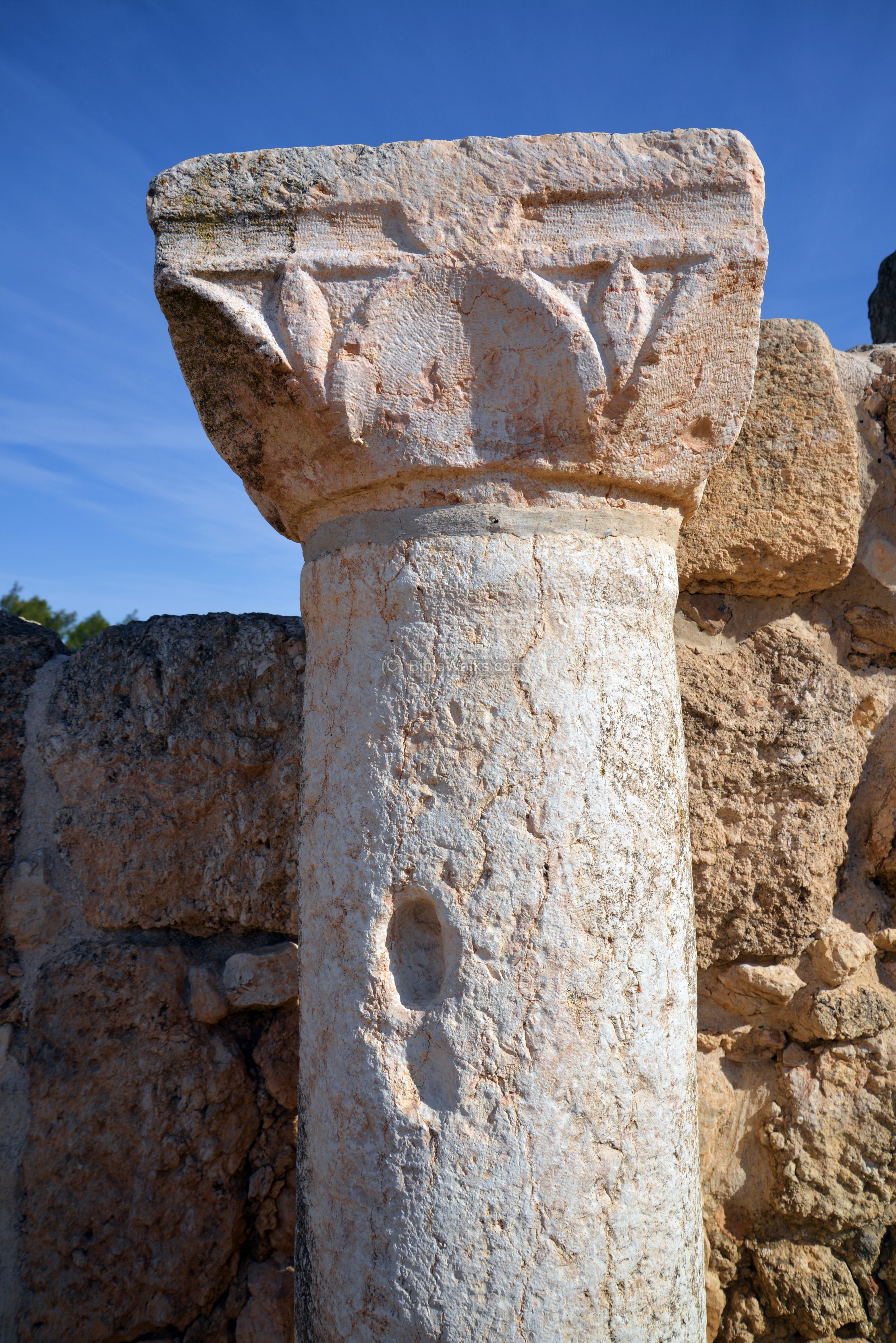
A Ionic column is located on the north side.
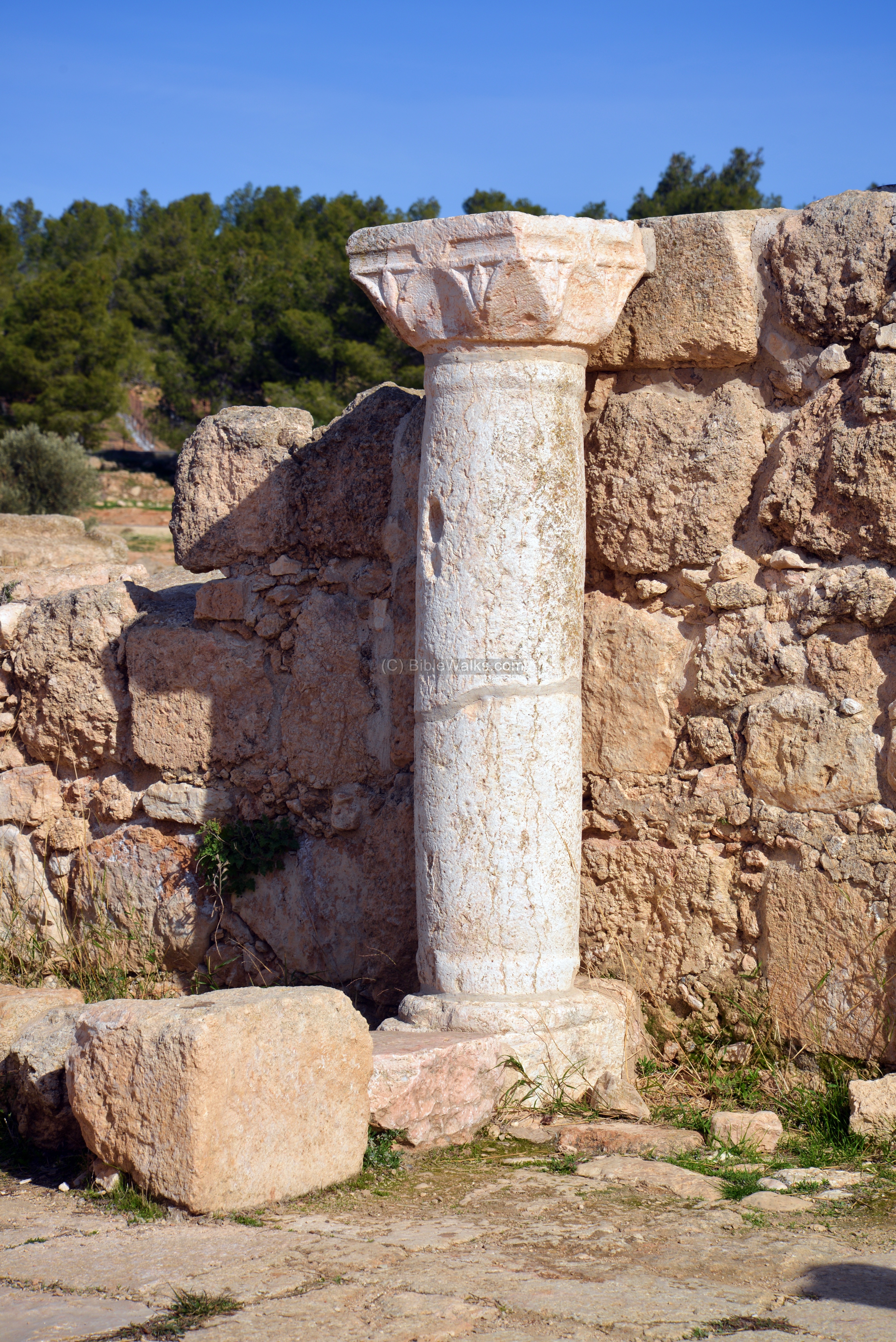
The geometric patterns on the column are of the Madonna lily flower (Hebrew: Shoshan Tsachor). This symbol became a popular Christian symbol (hence the name) during the Crusaders period. Its bulbs were uprooted by the Crusader pilgrims, causing it to be mostly extinct. Its symbol also appears on the new Israeli Shekel.
During the Muslim periods, the synagogue was converted to a mosque. A prayer niche (Mihrab), in the form of a stone altar, was added on the south wall – directed towards the Islam Holy cities of Mecca and Medina. The floor of the mosque was on a higher level of the seats.

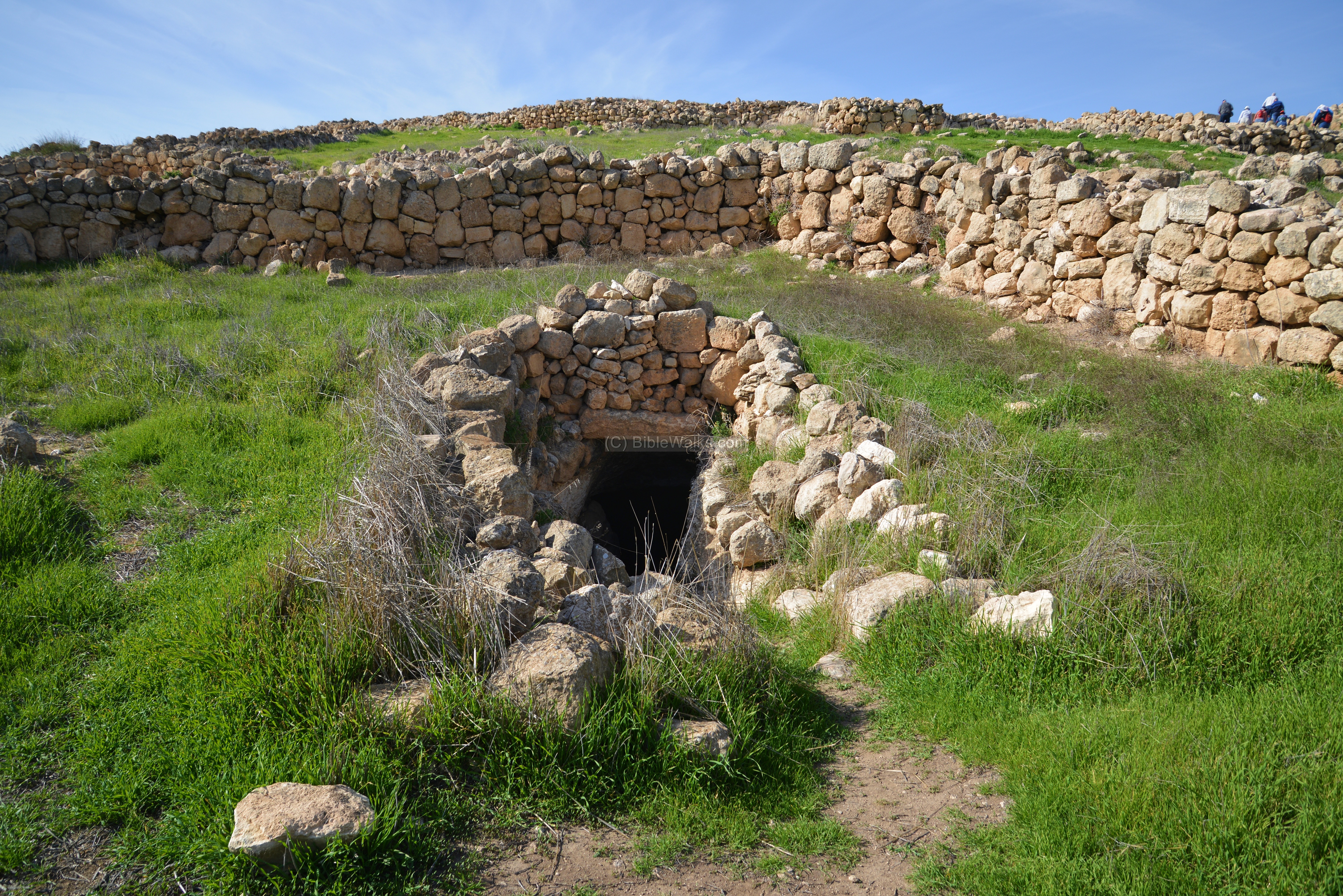
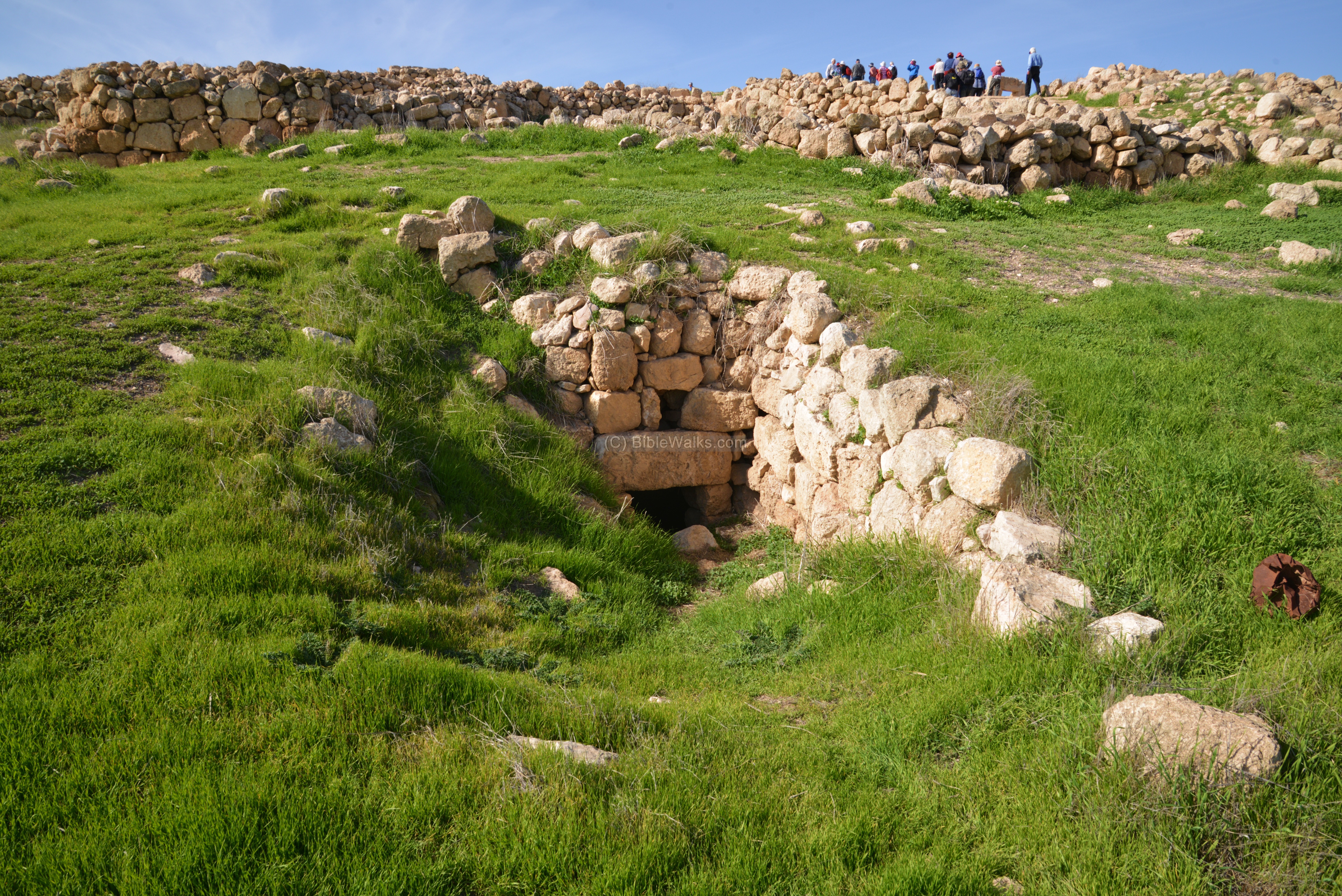
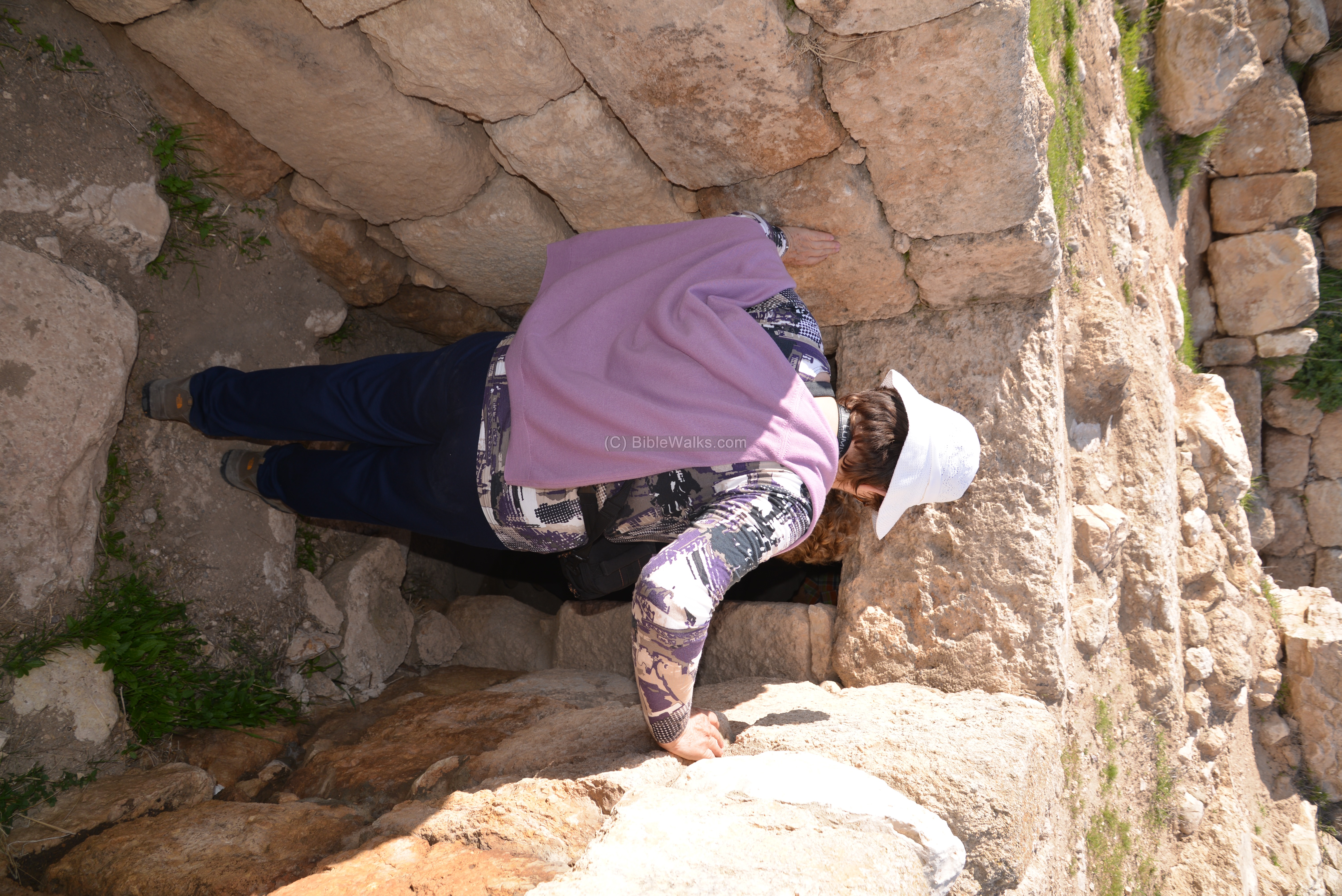
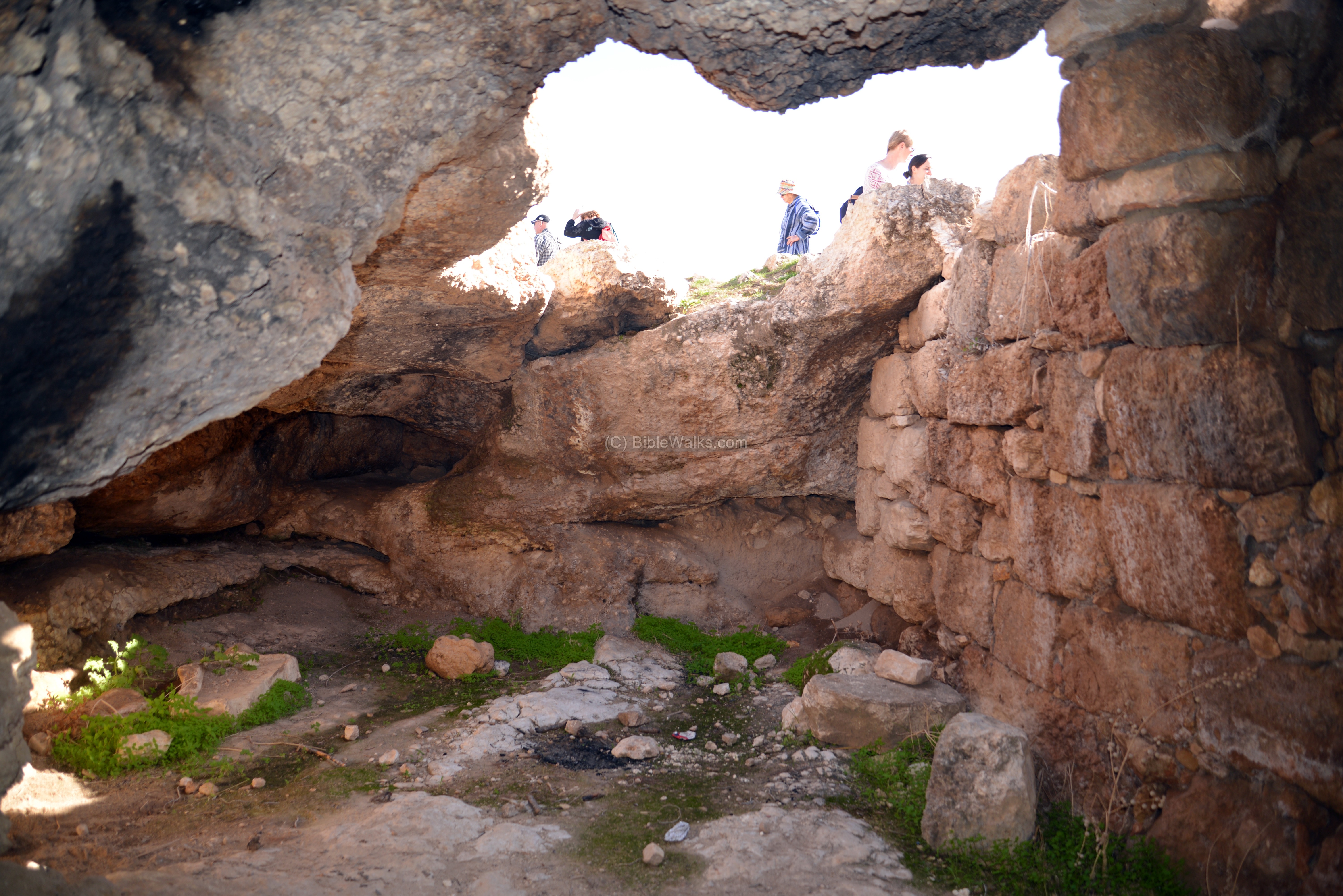
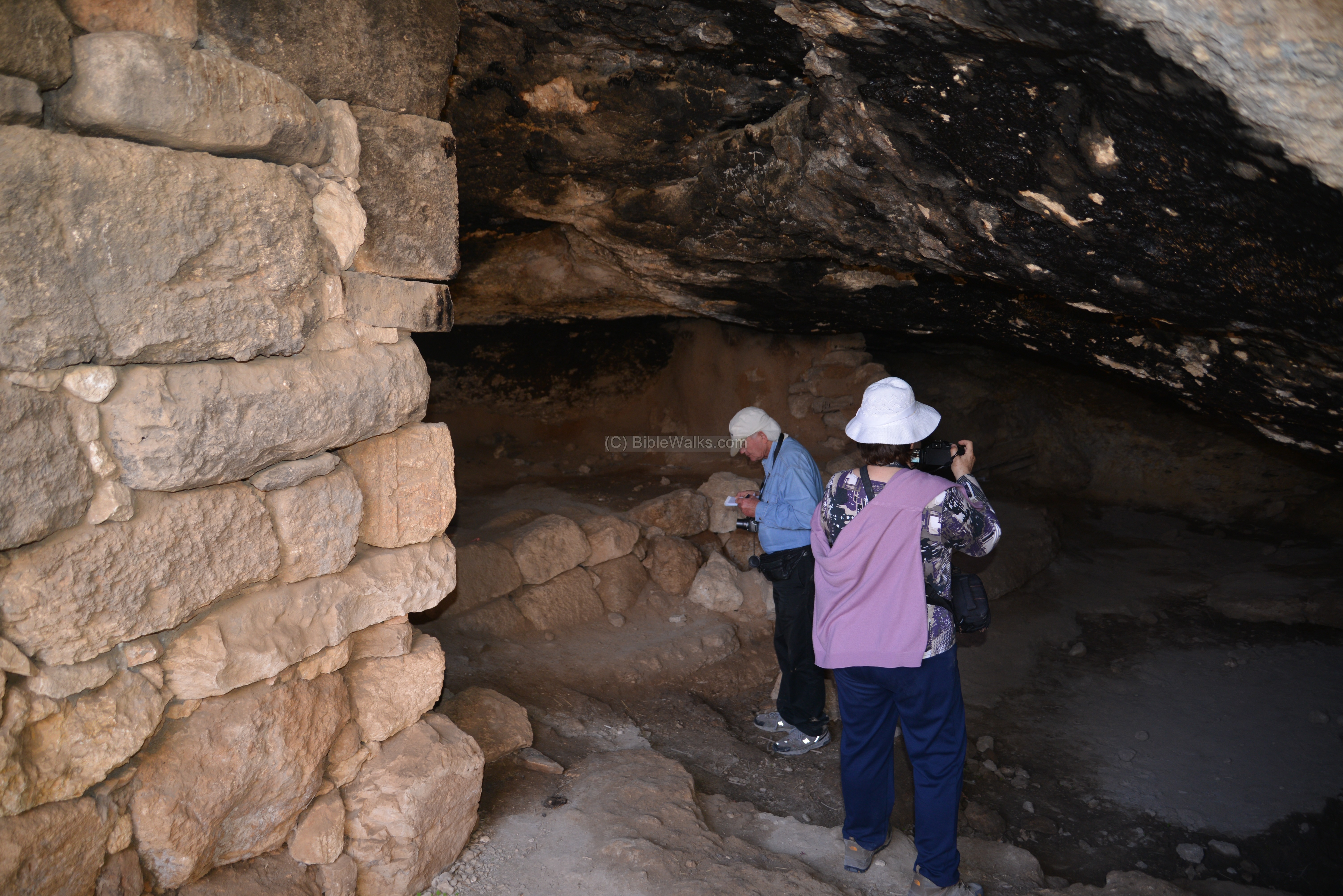
(d) Cistern, cave and hiding place
A cave, which served for dwelling and also as a hiding place, is adjacent to the synagogue. An opening is seen here on the right side.

On the side of the cave are steps that lead down to the cistern, which once was used for water supply.

A closer view of the entrance:
View from the inner side of the entrance is seen in the next photo. A wooden beam is located above the entrance.
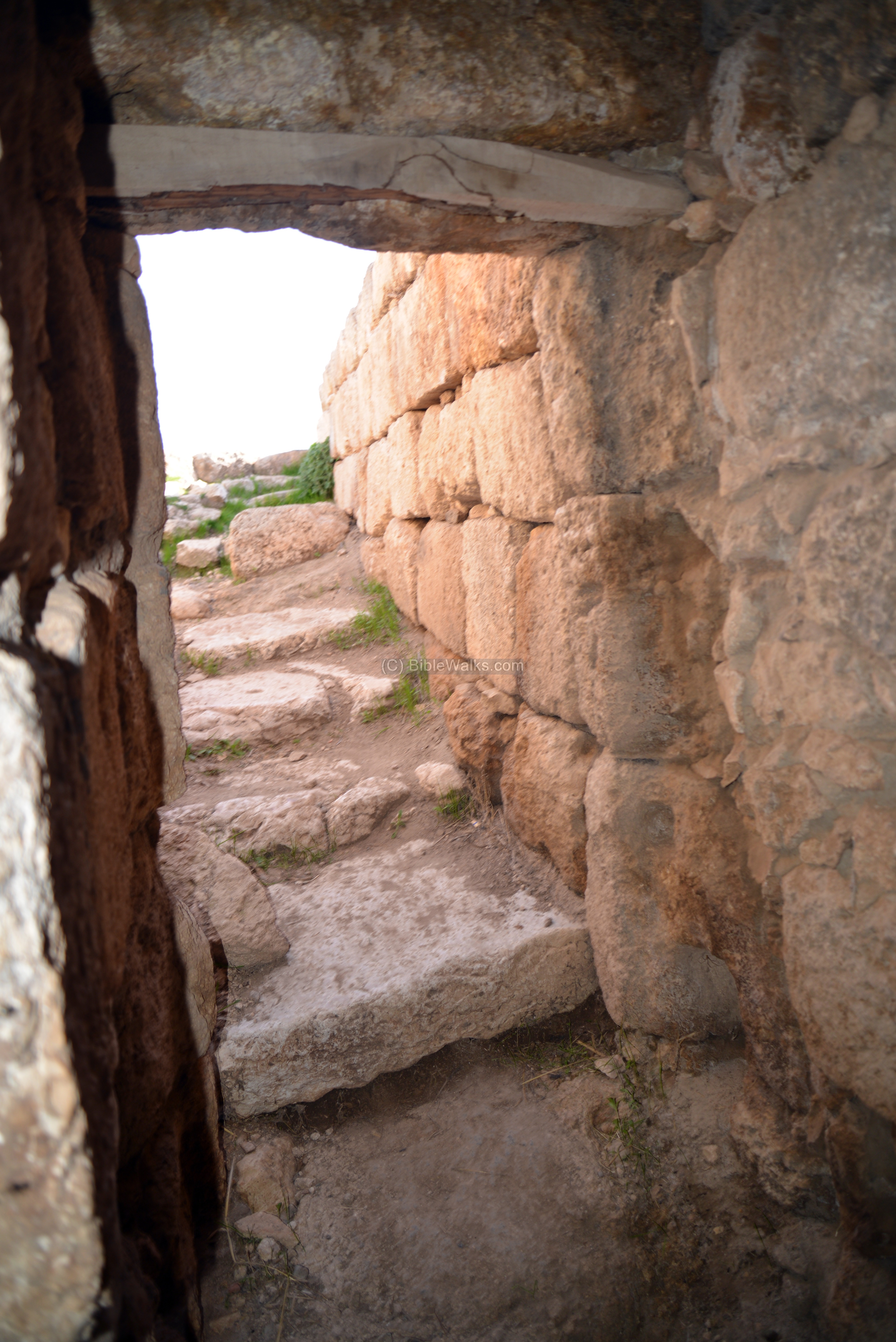
A view from the cave to the outside:
The cave was once a natural cave, and later it was expanded to serve as a dwelling place. Inside the cave are walls, which separated the higher human dwelling place to the lower area where the animals were kept.
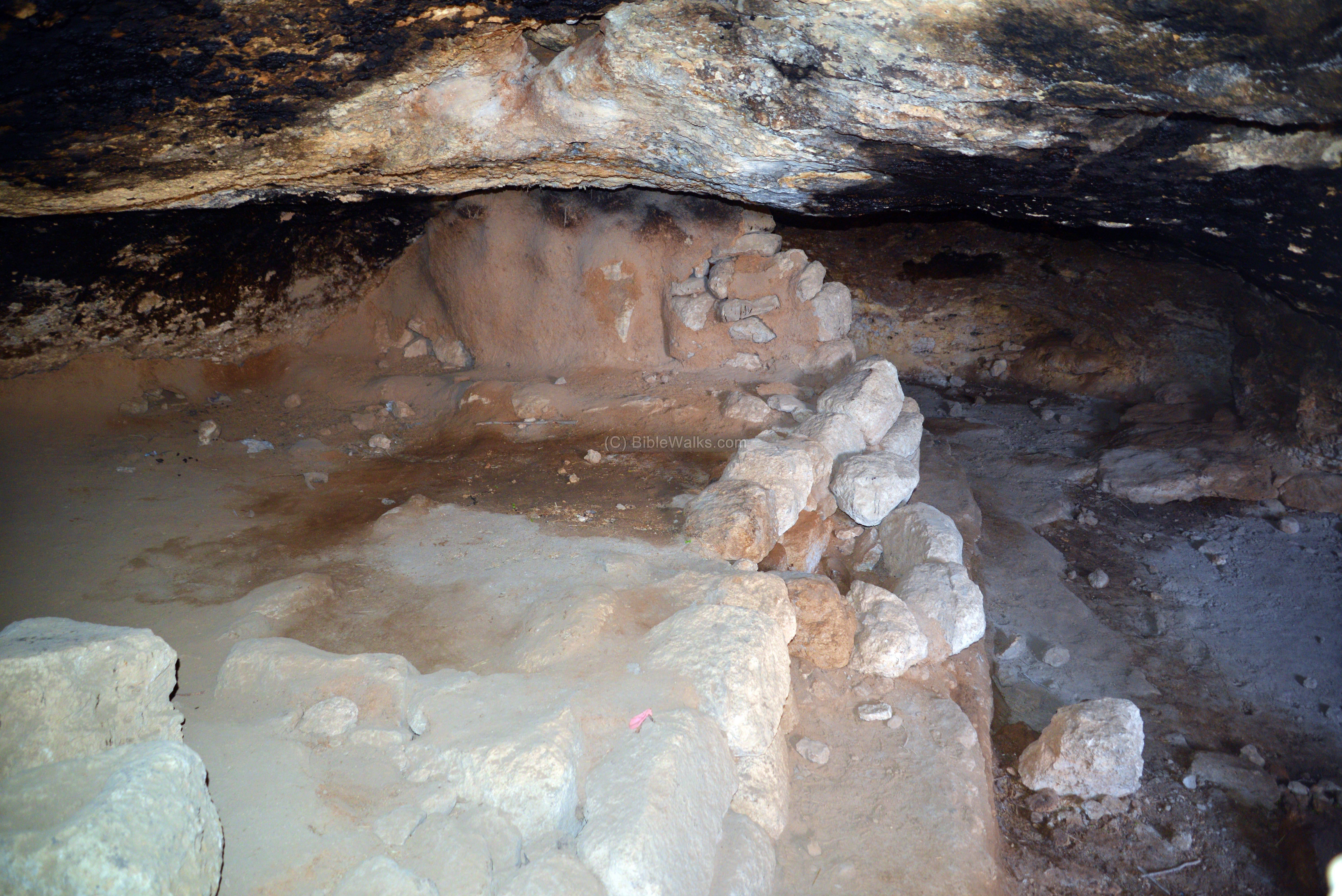
The tools and dishware were hanged on a wooden beam.

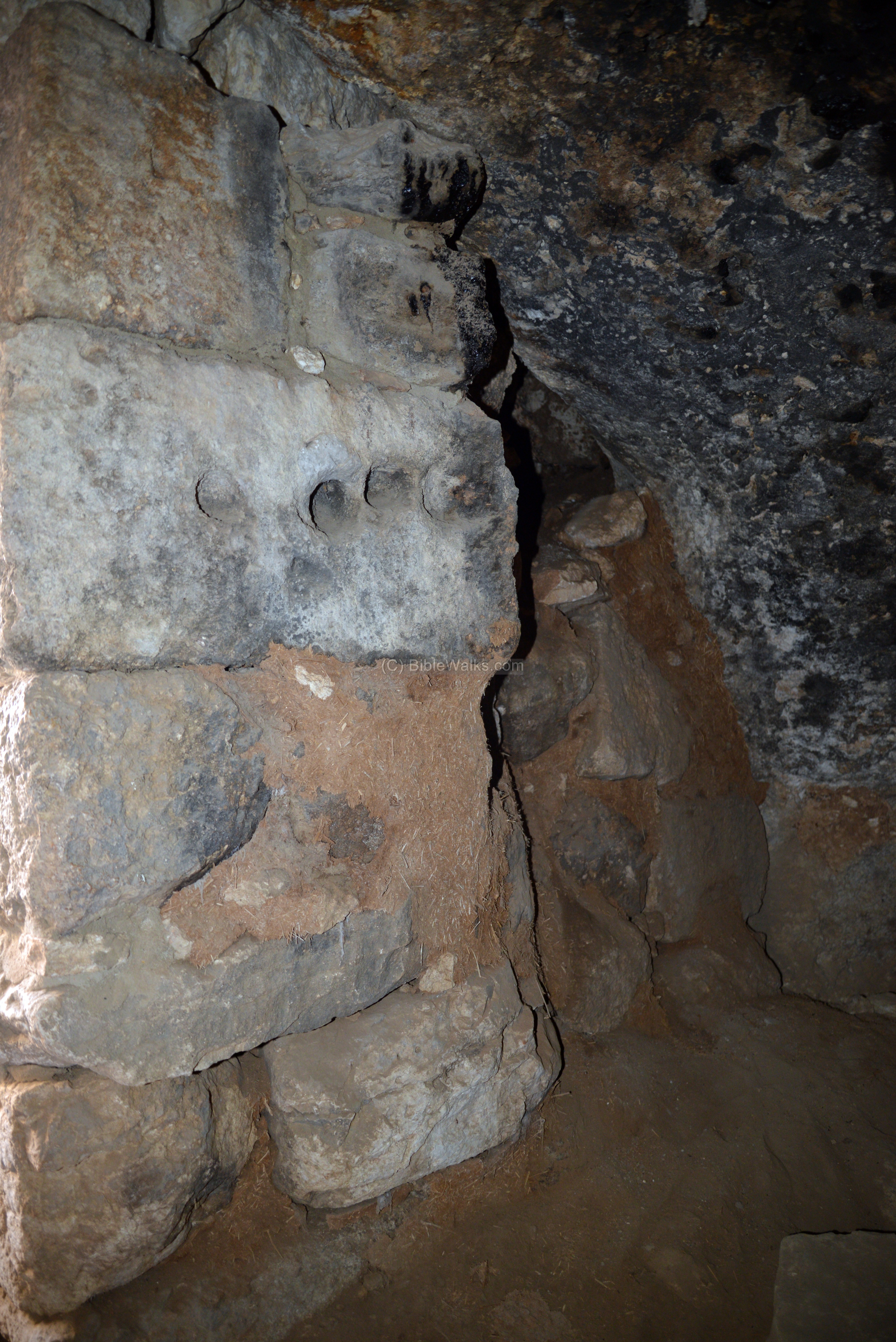
A section of the wall is seen in the following photo:
Other views of the cave and the dwelling place:
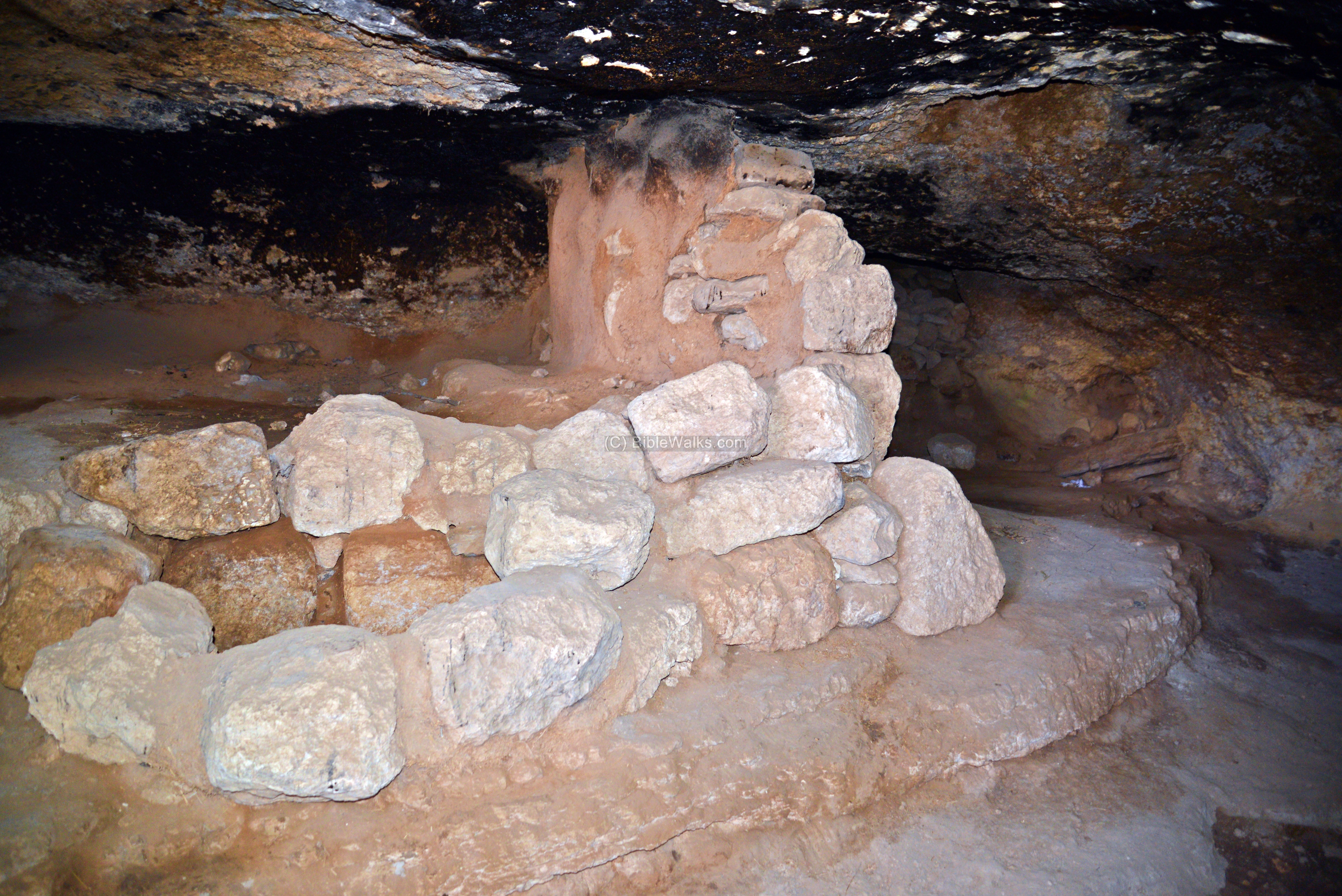
Amazingly, caves continue to serve Bedouins and poor people in modern times. The cave offers a cool place to live and keep the herds, and is also useful for hiding.
(e) Fortress
An Iron-Age fortress is built on the top of Anim, which is dated to the period of the Judean Kingdom. The fortress was built at the beginning of the 8th Century B.C., or during the 7th Century.
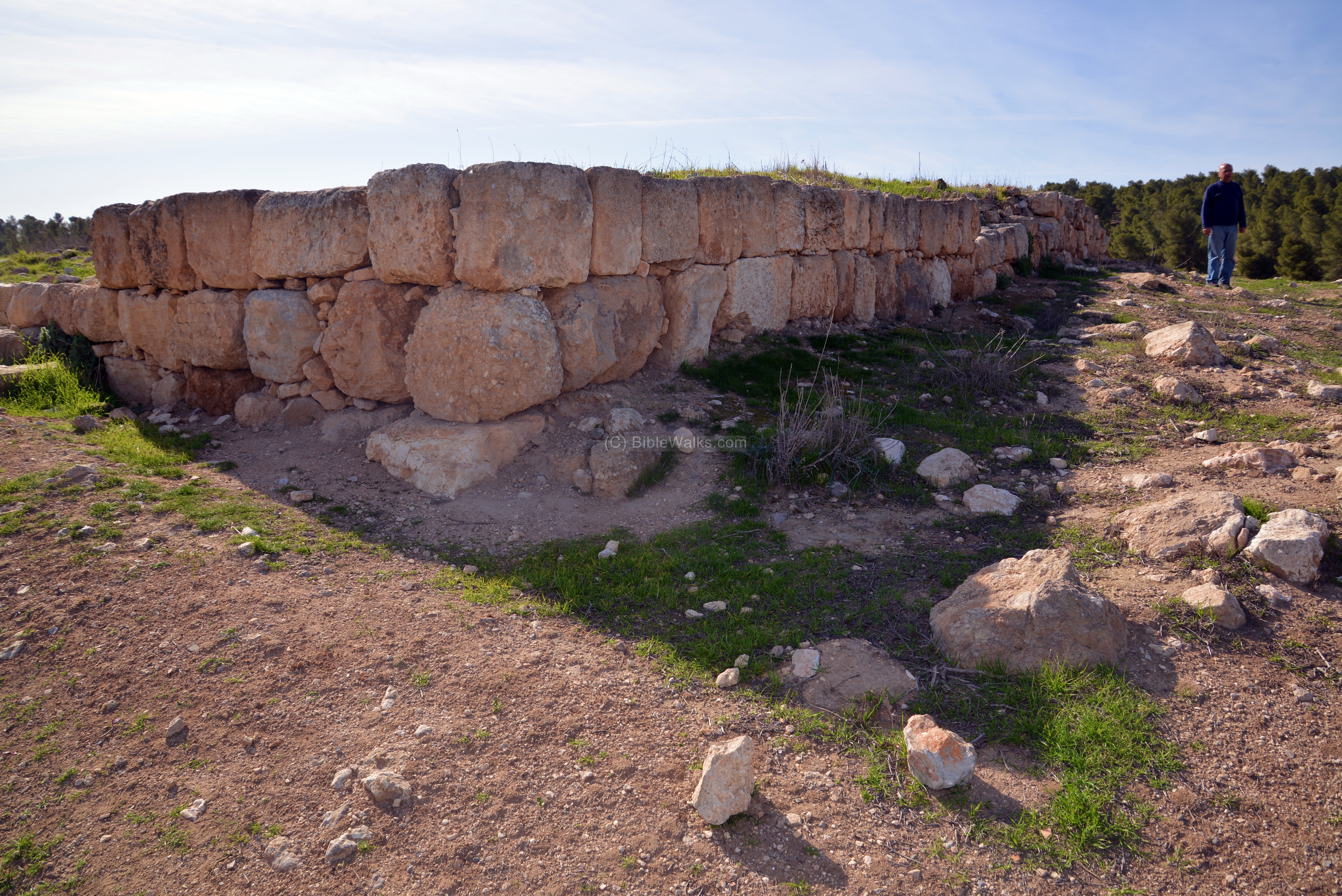
It is a square structure, 21.5m by 21.5m, with very thick walls (some 5m wide).
The area of the Iron-Age settlement around the fortress is not known, but some scholars estimated it as 20 dunams, while according to the excavations around the fortress this settlement covered just a few dunams.
A panoramic view of the sights around the fortress is seen in this next photo. Pressing on this picture will pop up the panoramic viewer. Using this flash-based panoramic viewer, you can move around 360 degrees, zooming in and out – viewing the site in the amazing full screen mode (like you are really there). Points of interest are indicated on the view. It may take minutes to upload, but then its worth the waiting time.
To open the viewer, simply click on the photo, then tour the area around:
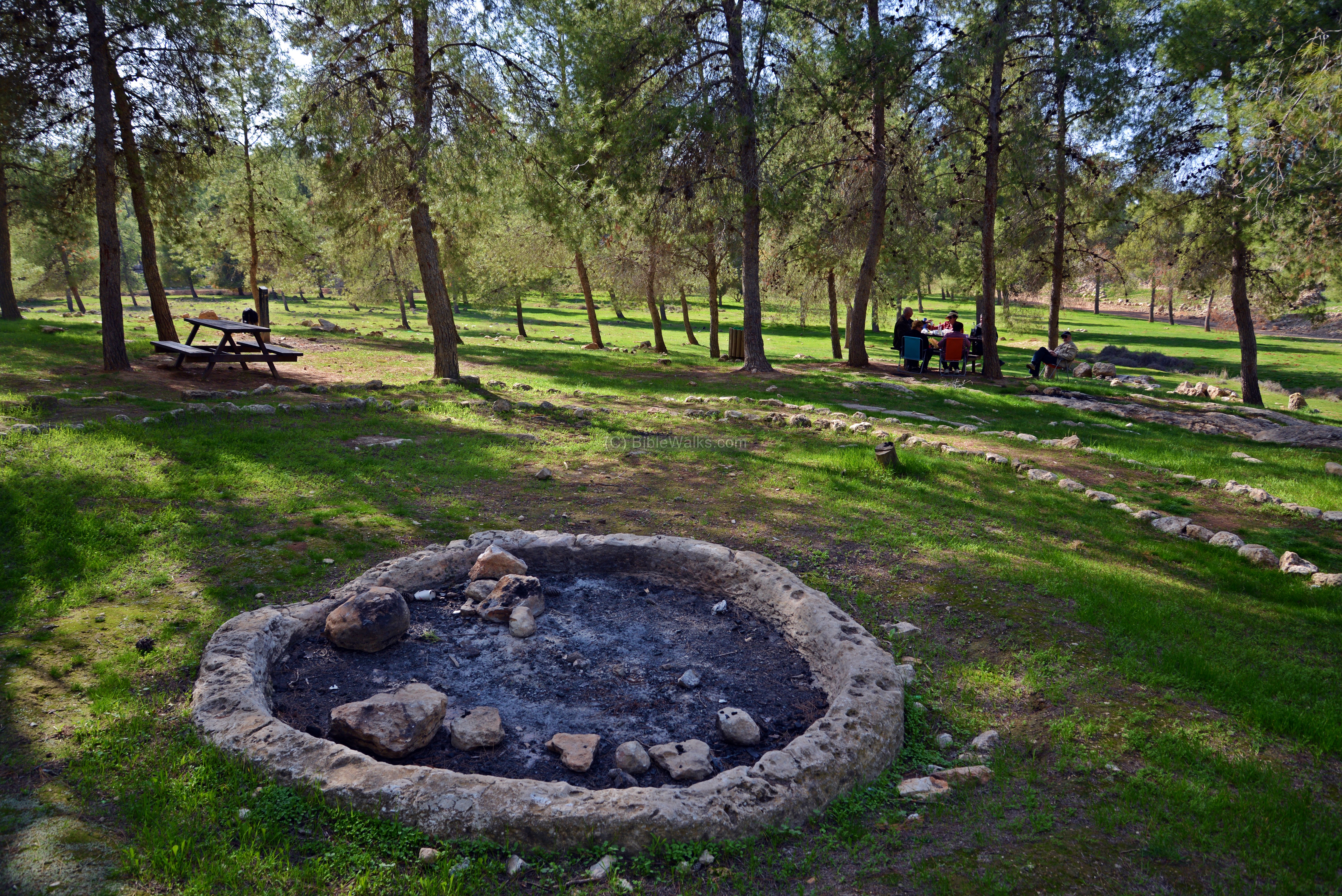
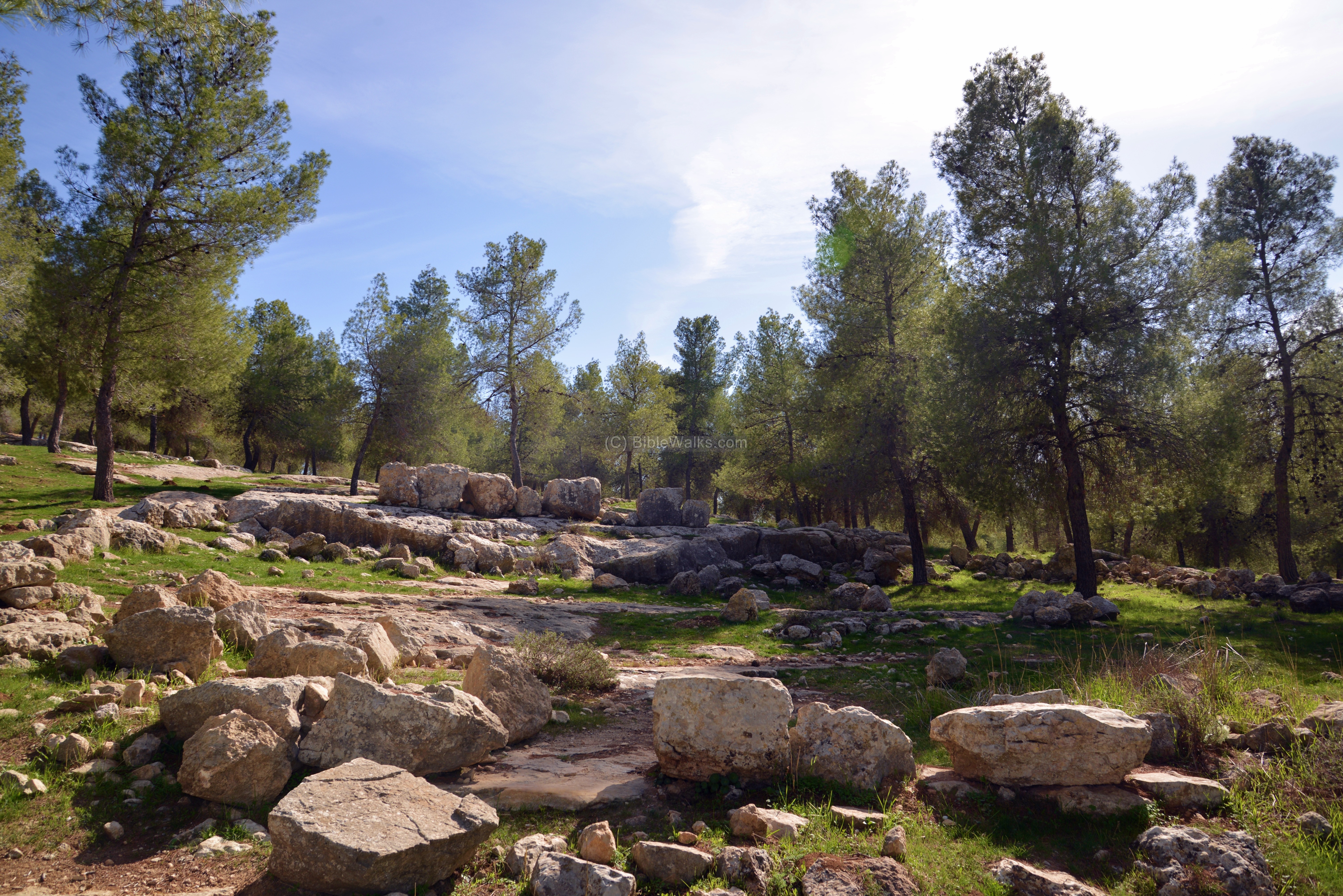
(f) Agriculture installations
On the south side of the hill of ancient Anim, among the trees, are a large number of agriculture installations. This was the industrial area of Anim, where these farmers manufactured wine and olive oil. A 600m long trail leads from the “Cistern” parking area, down the hillside towards Horvat Anim, passing through the installations.
During the ancient times, agriculture was the main occupation in the Land. The main income was based on raising sheep and goats, harvesting wheat, and producing wine and olive oil. The Bible writes about the agriculture industries, blessing the Israeli nation with successful crops and products (Joel 2: 24): “And the floors shall be full of wheat, and the vats shall overflow with wine and oil.”.
-
Winepress
The winepress is seen in the photo below, cut into the rock. It consists of a large treading (crushing) floor, 10 M2. The grapes were placed on the treading floor, and the workers would crush the grapes with their legs. The crushed grapes and juice would then sit in the floor during the fermentation process. After then, the grape juice would be let to pour thru a filter groove, on the lower side, into the small square pit, where the seeds and shells would sink, and later removed. Then the filtered grape juice would flow into the larger collecting pit. The juice would then be collected into jars, then stored for subsequent fermentation.

-
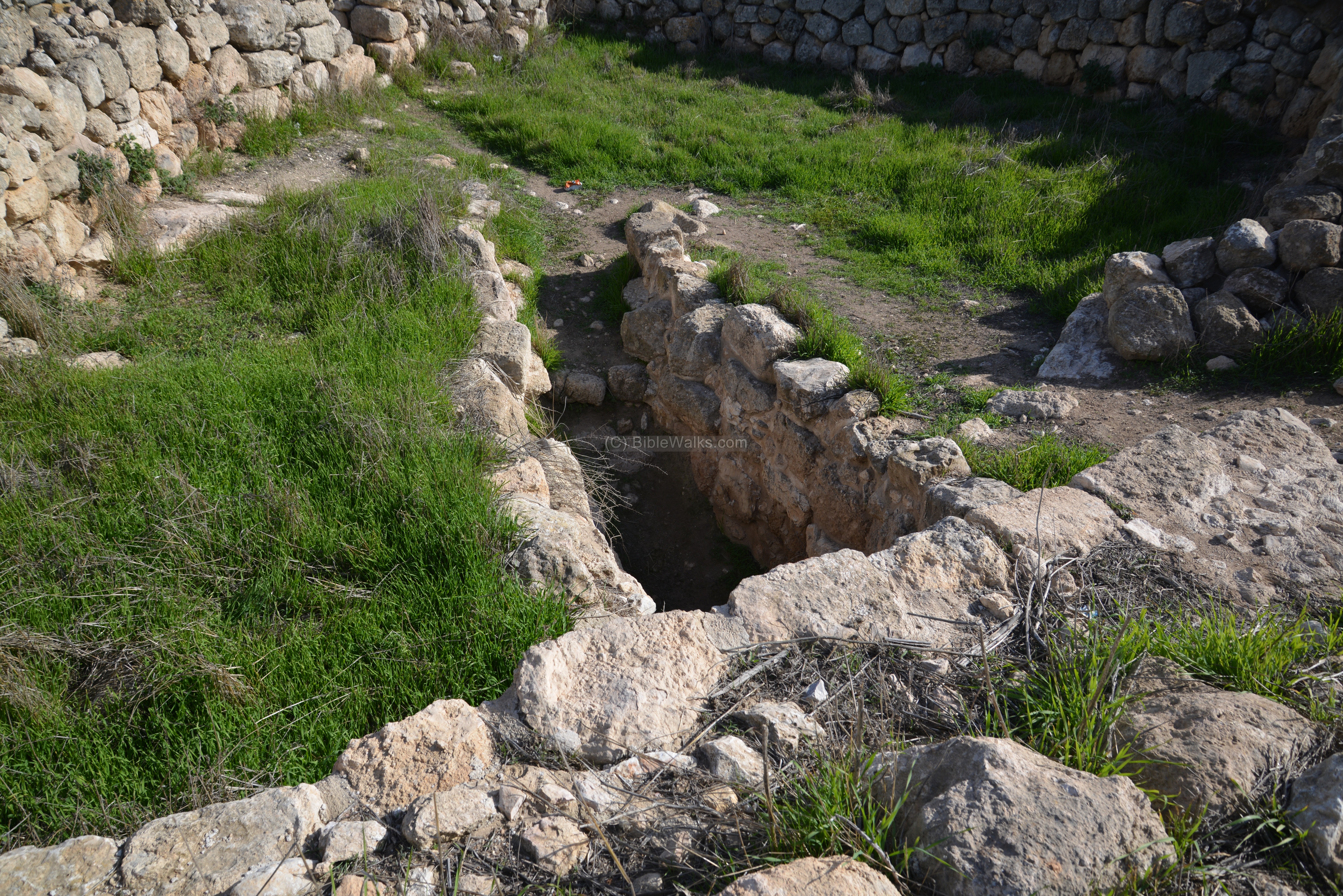
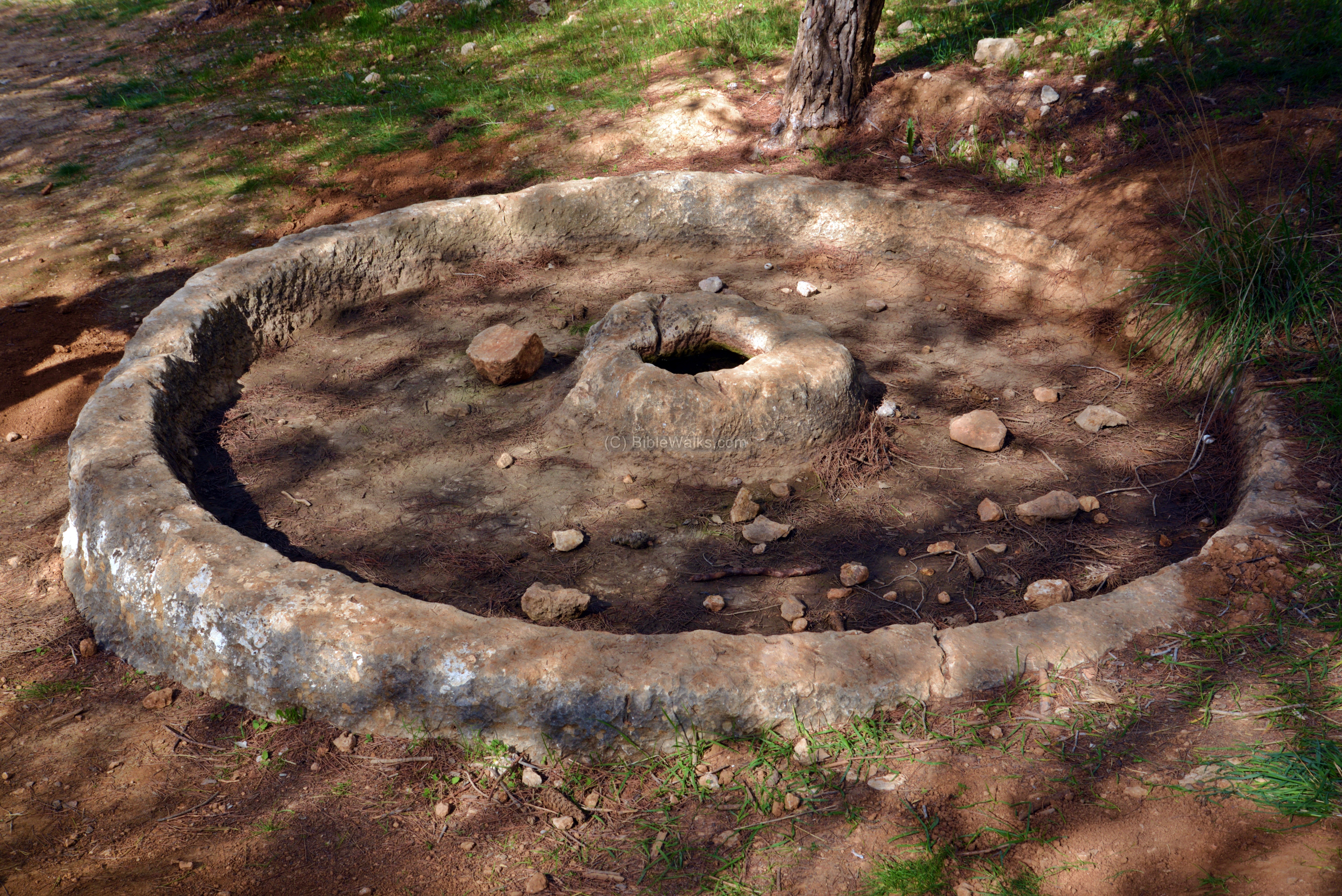
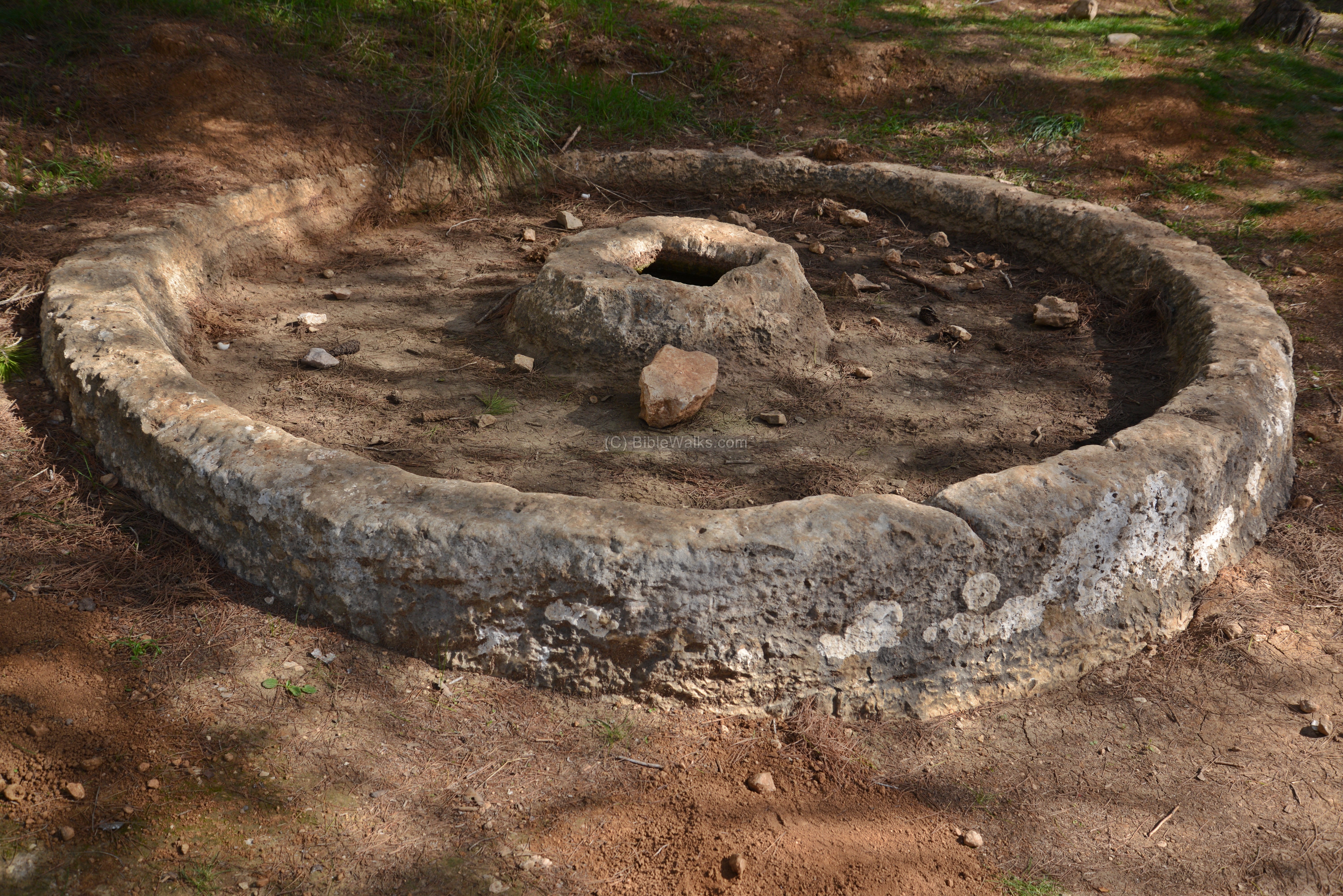
Cisterns
Water is a scarce in this area, which is located on the edge of the Judean desert.
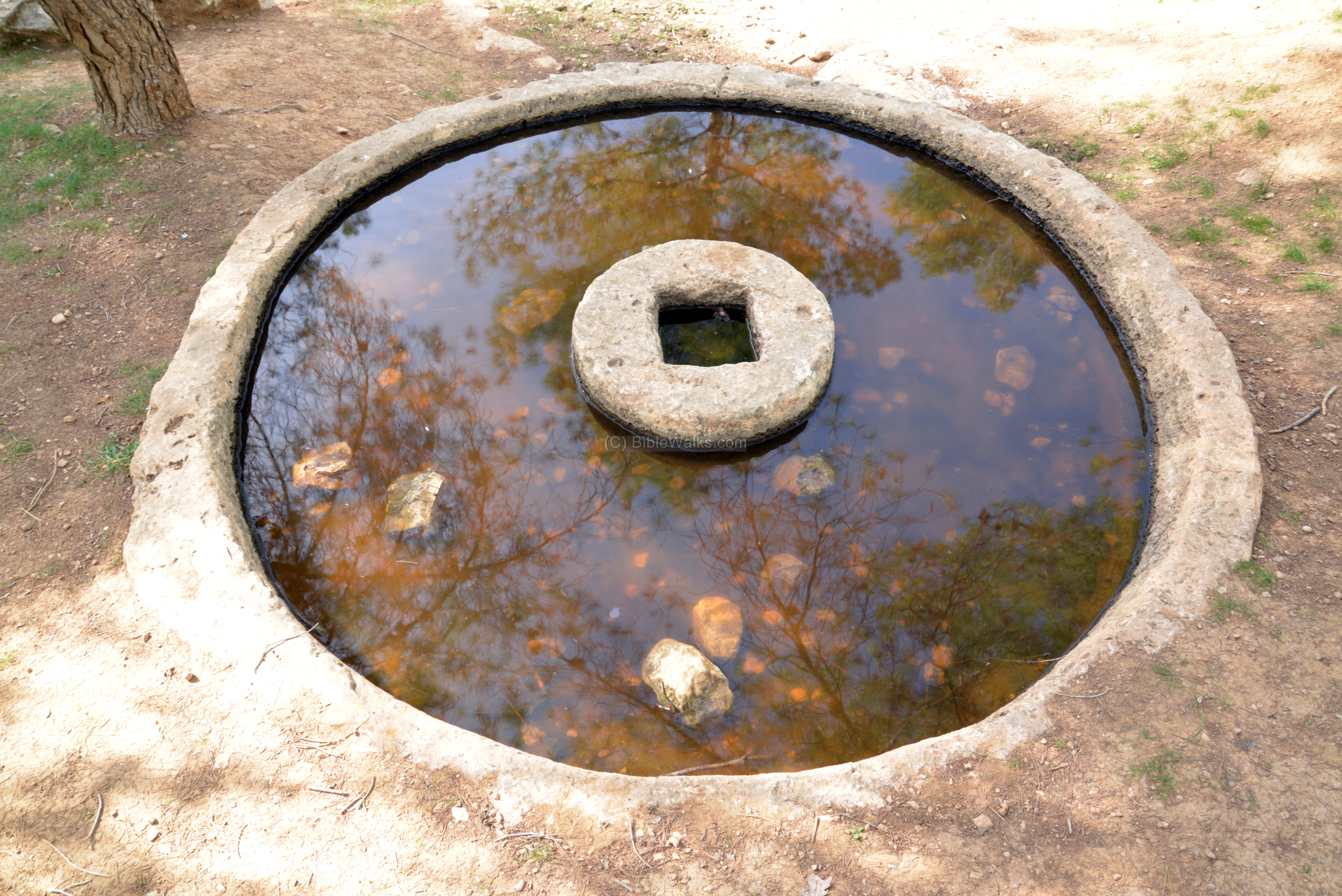
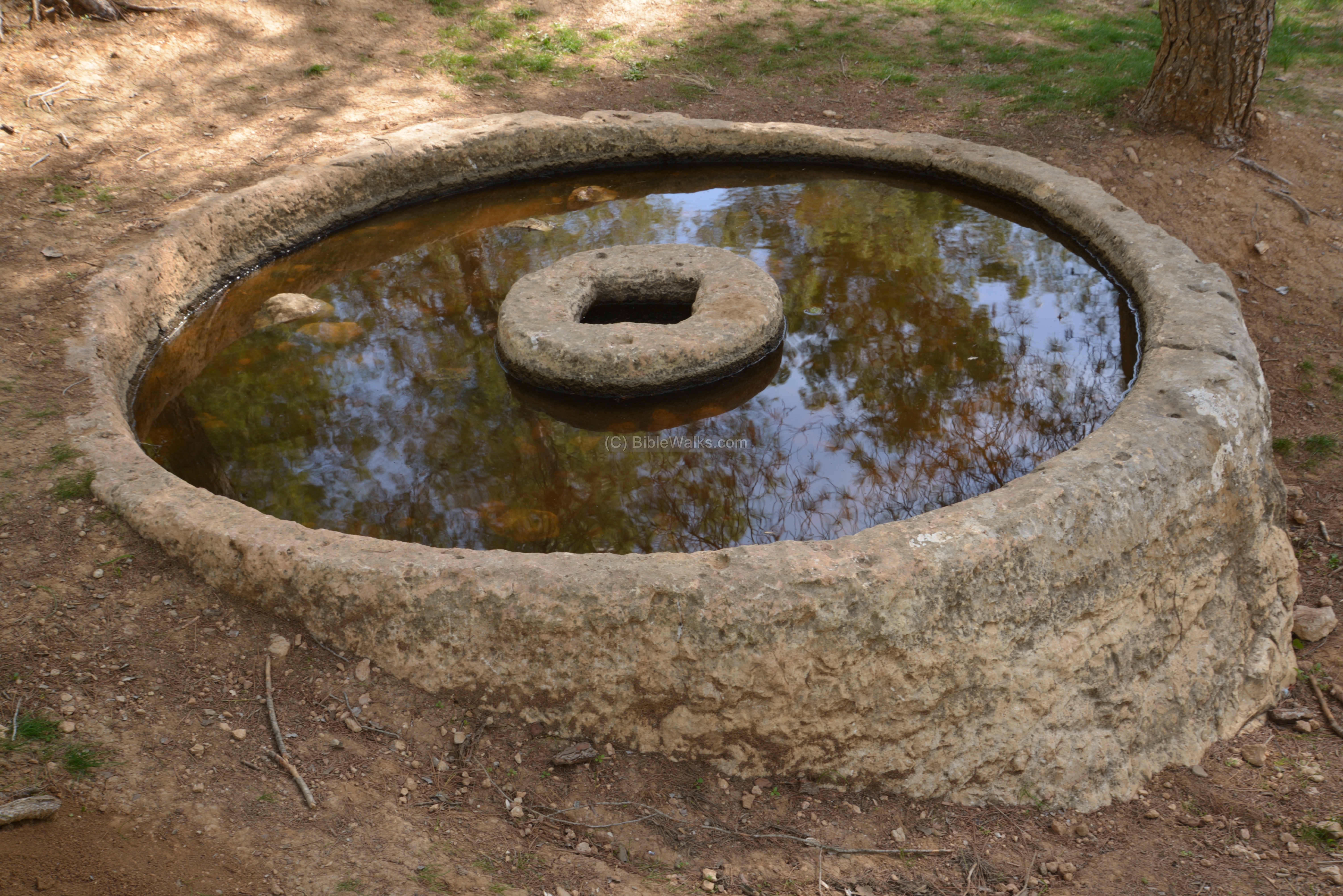
One of the techniques of supplying water was to collect the rain water in the few days of winter, lead them to a reservoir, and use the water during the rest of the year. These grooves led the run off rain water, leading the water into a cistern.
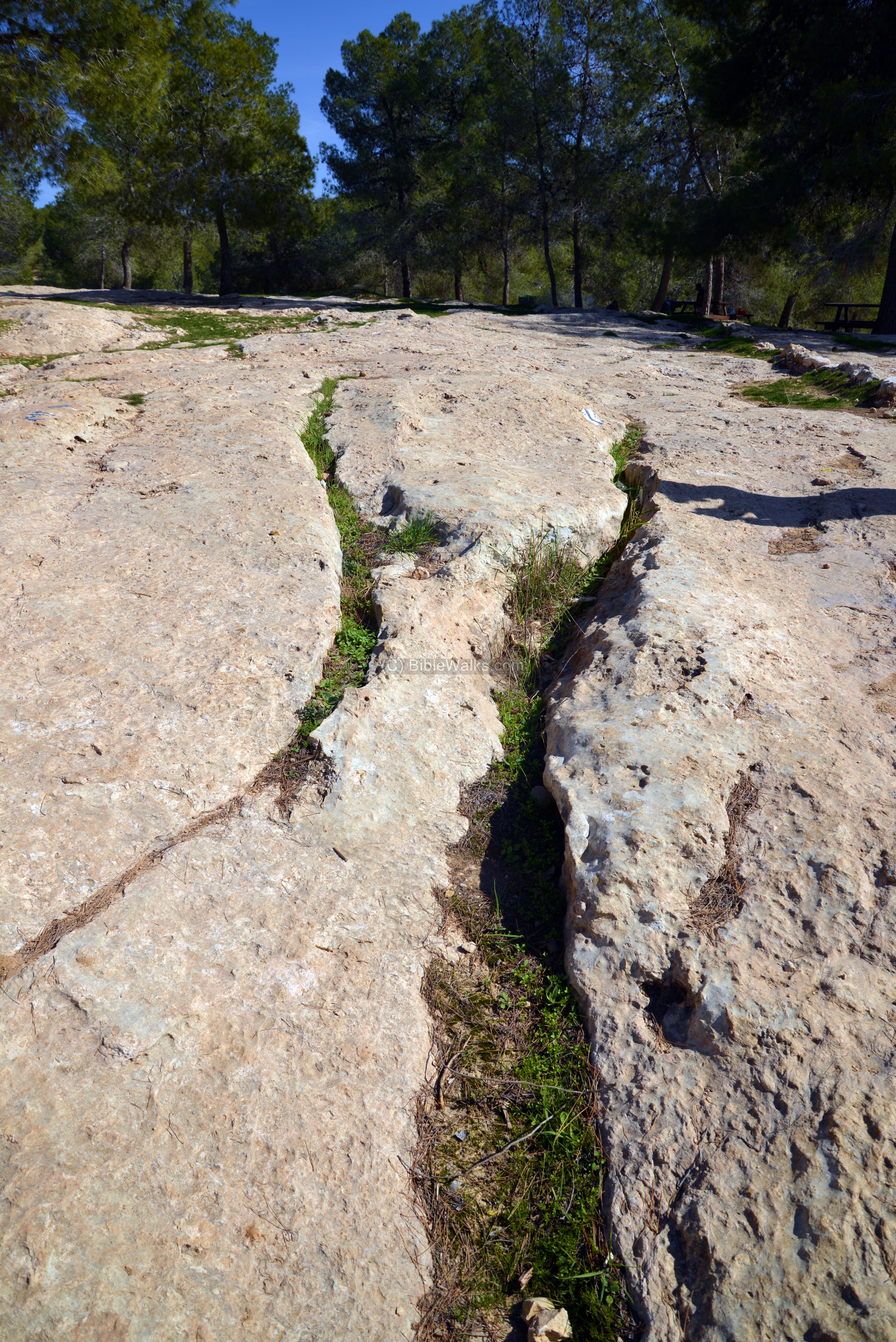
The cistern preserved the water, which was then fetched thru this opening. It was cut into the rock, with a shape of a pear – narrow on top, wider down on the lower side of the cistern.

-
Oil press crusher basins
Olive oil is produced by growing olive trees, harvesting the olives (at around September timeframe), crushing them with an oil press, and collecting the golden juice. This process started about 5000 year ago, and its popularity and worth increased ever since. During the Roman and Byzantine periods the number of oil presses was in the thousands; many farmers had their own private installations, and larger public industrial complexes generated huge amount of olive oil.
Olive oil was used as a cooking oil, food, lighting fuel, soap making, religious ceremonies and medicinal use. Its production was one of the major sources of income in the Holy Land over thousands of years, including modern times when the olive oil is an essential ingredient in the Middle East cuisine.
The olive oil production process was based on two major steps: The first step requires crushing the olives using a crushing stone, and collecting them into a basket. The second step is done on another installation: the basket is pressed with force, extracting the oil out of the crushed olives and collecting the juice into a storing vat. There were different types of machines that were used to crush the olives and then press the oil out of the crushed olives. They differed in their size, method of operation, use of human or animal power, infrastructure and capacity. Most of the oil presses had a single crushing stone and basin, and one or two pressing devices.
This oil press used a large rolling stone to crush the olives. The stone was held upright by an axis, which was connected to a long handle. The handle was pushed by humans or animals. The mashing stone rolled along a cavity on the circumference of the base, crushing the olives. The crushed olives would then be collected into a basket and then further processed by the oil press.
A number of bases of olive crushers are located along the trail, and shown in the following pictures. They are hewn into the rock, which is unique to this place.
Another installation was cut into the rock, but not completed. Its purpose is not certain.

-
Paddock
This photo shows an area of a paddock , where the sheep and goats were kept.
Etymology (behind the name):
* Names of the site:
- Anim – Biblical name (Joshua 15: 20, 50): “This is the inheritance of the tribe of the children of Judah…And Anab, and Eshtemoh, and Anim“
- Ghuwein el Tachta – Arabic name of the site, Ghuwein – based on the ancient name of ‘Anim, el-Tachta – the lower, meaning the southern village bearing the same name.
- Daroma – This Aramaic term refers to the region south of Hebron, and is referred by the Onomasticon. The term is similar to the Hebrew word: Darom (south).
- Idumea – Greek word of Edom (the Biblical name), a region south of Judea and in TransJordan.
Links:
* External:
-
Yattir forest – KKL-JNF page on the largest planted forest in Israel
-
Shani-Livneh community (pdf)
-
IAA conservation – Horvat Anim (Hebrew) – June 2010
-
Jewish synagogues in the southern Judean hills (David Amit, 1993; Hebrew)
-
The Fall and Rise of Jerusalem: Judah Under Babylonian Rule (Book, Oded Lipschitz, 2005)
-
South Hebron area – Yehuda Guvrin (Hebrew; great article)
* Internal:
* Nearby sites:
BibleWalks.com- Touring the Biblical landscape
Yattir<<<—previous site—<<< All Sites >>>— next Judah site—>>> Kerioth
This page was last updated on April 29, 2017 (fermentation process)
Sponsored links: