Tel Achziv is a major Northern coastal Biblical city with a history of over 30 centuries; located on the outlet of Kziv creek close to the border with Lebanon.
Home > Sites > West Galilee > Tel Achziv (Achzib, Al-Zeeb)
Contents:
Background
Location
History
Photos
* Aerial views
* Park
* Port
* Village
* North
* Cemeteries
* Other
Etymology
Biblical
Historical
Other refs
Links
Background:
Tel (mound) Achziv is a coastal Canaanite, Biblical, Phoenician and Arabic city that is located on a Kurkar (sandstone) hill near the outlet of Kziv creek, and close to the border with Lebanon. Today it is a national park with a public beach and private resorts.
Joshua 19 29: “And the fifth lot came out for the tribe of the children of Asher … and the outgoings thereof are at the sea from the coast to Achzib“.
Location:
Tel Achziv is located on the Northern coastline, and is located between two creeks – Kziv creek on the north and Sha’al creek on the south.
The ancient site was located on the steep hill, with an area of 70 Dunam (7 Hectares). An ancient harbor is located on the coast below the Tel, and another secondary harbor is located 700M south to the Tel in a site called Khirbet “port of Achziv”. These two harbors indicate a booming maritime business.

History of the place:
Achziv has a rich history, and was a major border city in most of the known periods.
-
Prehistory
The Tel (mound) of Achziv was populated throughout the Chalcolithic period (45-32 century BC), middle to the late Bronze periods (20-12 century BC). Excavations revealed a walled city from the Middle Bronze period, with a continued settlement during the late Bronze period. Achziv was a Canaanite city with a port and strategic location near the main coastal road.
-
Biblical times
According to the Bible (references) the city was allotted to the Asher tribe territory. However, it was not taken by the Israelites due to its strong fortifications and topographic position between 3 water flows (Kziv on the north, Shaal on the south, Med sea on the west).
Later, King David (1006-968 BC) and Solomon (968-928 BC) added the city into their Kingdom, but returned it to Hiram as part of the famous pact with King Solomon. Ever since the city became one of the Phoenician cities, under the control of Tyre and Sidon. According to the archaeological evidence, the ancient city existed in the Iron Age II (11th-6th Century BC).
-
Iron Age II
Achziv was part of the Phoenician coastal area – the land of Sidon.
In the end of the 8th Century the Assyrian empire conquered the Phoenician cities and the North Kingdom of Israel in 732 BC, destroying most of the cities and villages in the land. They exiled some of the population and introduced harsh taxations. This caused several mutinies that were handled with force by the Assyrians.
After the death of the Assyrian King Sargon II (722 -705 BC), a coalition of cities in the Levant mutinied in the attempt to free themselves from the Assyrian conquest. They were encouraged by the Egyptians who tried to push the Assyrians out of the Levant.
The Phoenician coastal cities, including Achziv, joined the rebellion. The Assyrian army came in 701 BC, led by Sennacherib, son of Sargon II . During this intrusion the Assyrians conquered the city. It appears as “Akzibi” is the Sennacherib annals (historical records).
Sennacherib’s stele with relief and inscription; Ninveh;
limestone [Istanbul Archaeological Museum]
-
Phoenicians
The city flourished during the Persian period (6th-4th century BC) and the Hellenistic period (4th-1st Century BC). The Phoenicians, under the Persian and Hellenistic control, used the port for marine commerce and the coastal road for trade. Five Large cemeteries are located 1KM east to the Tel (e-Ras), north, and 700M south to it (el-BukBuk). In the rock-hewn tombs were ceramics from the Iron and Persian periods, including several Phoenician tombstones.
-
Roman and Byzantine times
The number of Roman sites around Achziv reached a peak, and Achziv benefited from the marine and land trade. The city is referred by Josephus Flavius, who named the maritime city as the place where Herod’s brother was captured (see reference). It was also referred by Plinius (23-79 AD) and appears in the Claudius Ptolemy World map (~150 AD).
Two milestones were found south to Achziv, part of the Roman imperial coast road from Antioch to Acre- Ptolemais. Another limestone border stone tablet was found, written in Greek and dedicated to Galerius-Maximianus, Constantinus and Licinius I, dating it to 307-311AD.
The city was populated by Jews and the town was called Kziv, as the name of the creek. A synagogue existed in the place according to the Mishna (Tosefta, 7 2). They were farmers, wine makers, fishermen, sailors, and also prepared dye (Tyrian – purple color from snails). The city was regarded as the religious boundary of Israel, although other sources defined the Ga’aton (near Nahariyah) or Rosh Hanikra (as per Josephus) as this border.
-
Early Arab
During this period the city and the region have lost their importance. A coast guard was stationed here.
-
Crusaders times
The region of Achziv once again flourished during the Crusaders period, as the city became an administrative center.
The Crusaders built a fortress, calling it “Casal Humberti”, named after a knight that commanded the fort at 1104. Later it was named “Casal Umberti” (1197) and “Casal Imbert” (1256). Its purpose was to protect the coastline and the important road. A stone tablet with Christian symbols was found here, and is on display in the Louver. Baldwin III settled European farmers (circa 1153). In 1232 there was a fierce battle between the German and French Crusaders.
 Statue of Crusaders in Yehi’am fortress
In 1256 the town and the land around it was leased to the German Knights of the Teutonic Order, who also commanded the Montfort and Judin (Yehiam) castles. The German Teutons, Crusaders that came from Germany in the 13th Century AD and established the “Order of Brothers of the German House of Saint Mary in Jerusalem”, or in short: the Teutonic order. This order was formed in Acre in 1192 based on a mission to manage a field hospital, like the Hospitallers order. They were then transformed to a military order in 1198. The order was the largest landlord in the Western Galilee, and their center was the Montfort fortress until its fall in 1271.
-
Mamluke & Ottoman times
This period marked another retreat in the settlement in the region in general, which also affected the city. A village, El-Zeeb, existed on the hill during the Mamluke and Ottoman periods (12th to 20th century AD). Many of the houses of Ez Zib reused ancient boulders in the foundations.
Conder and Kitchener surveyed this area during the Survey of Western Palestine in 1881. A section of their map appears below, with the Arab village of ez Zib located near the coast. Notice the main north-south road passing on the east side and crossing the river.

Part of map Sheet 3 of Survey of Western Palestine,
by Conder and Kitchener, 1872-1877.
(Published 1880, reprinted by LifeintheHolyLand.com)
Their 1881 report of the ancient site was (SWP Volume I, p. 193):
“Ez Zib – The ruins at Zib are of small importance. Renan noticed an artificial tell and certain cubes of mosaic. Guerin says that the hill was formerly surrounded by walls, traces of which are still to be seen on the east. The greater part of the houses, he says, are built of old materials.There can be no doubt that it is the ancient Achzib of Joshua xi.x. 29 and Judges i. 31. (Not the city of the same name situated on the Shefelah and belonging to the tribe of Judah [BW: See Lavnin])). Josephus calls it either Arce or Ecdippus. After the return from Captivity it was one of the north frontier towers of Galilee; it possessed a synagogue, and was fortified. The Bordeaux Pilgrim calls it Ecdippa, under which name it also appears in the Onomasticon”.
-
Independence War
In 1946 the Israeli resistance blew up the railroad bridge over the creek. A monument exists north to the bridge dedicated to the memory of the 14 bold commandos that died in the action, part of a nation wide attacks on bridges during the British Mandate (June 17). Kibbutz Gesher-Haziv (bridge of Achziv) is named after these heroes, as well as Kibbutz Yehi’am, named after their commander (Yechiam Weitz) who died in the action.
The Arab village lasted until May 1948, when its population fled to Lebanon following the Independence war.
El-Zeeb (Al Zib) – 1928 – photo public domain. Author: G Nalbandian, Institute for Palestine Studies
-
Modern times
Achziv is a national park. Its green gardens are a background for brides and grooms that come for photo shots. The park is also a popular picnic place for families, and a summer beach.
South to the national park is Club Med resort village, built in 1961. It was closed due to a shelling incident between 2002-2005, and reopened.
Another resort spot in the north side of Achziv is Avivi-Land, belonging to the colorful Eli Avivi, which he declared as an independent micro-state in 1970. The “state” was a popular beatnik beach in the 70s and 80s, making Achziv a famous landmark.
Photos:
(a) General View:
A view of the ruins of Achziv is seen here from the south, where a beach (“Banana”) is located along the southern bay. Ruins of the Arab village occupy this side of Tel Achziv. In the far background is Mt. Rosh Hanikra – the border with Lebanon.
A closer view of the south side of the Tel is next. The white dome of the mosque, seen in the center, is on the highest point on the hill.

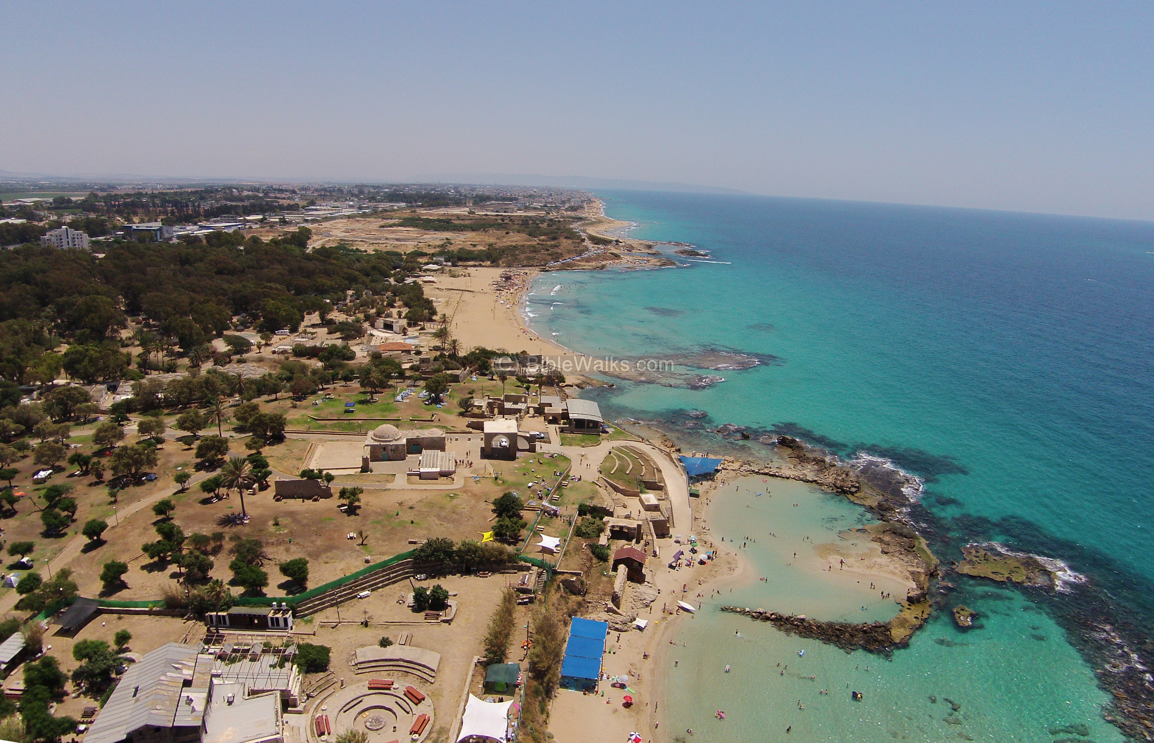
(b) Aerial views:
A drone captured this aerial view of the northern part of the Tel, looking south. The national park covers most of the hill where the ruins of the ancient city of Achziv are buried. Ruins of the Arab village and its mosque are located closer to the shore, seen here in the center of the view. To the right is the public beach. On the north (closer) side of the hill is the Avivi-Land resort.
Click on the photos to view in higher resolution…
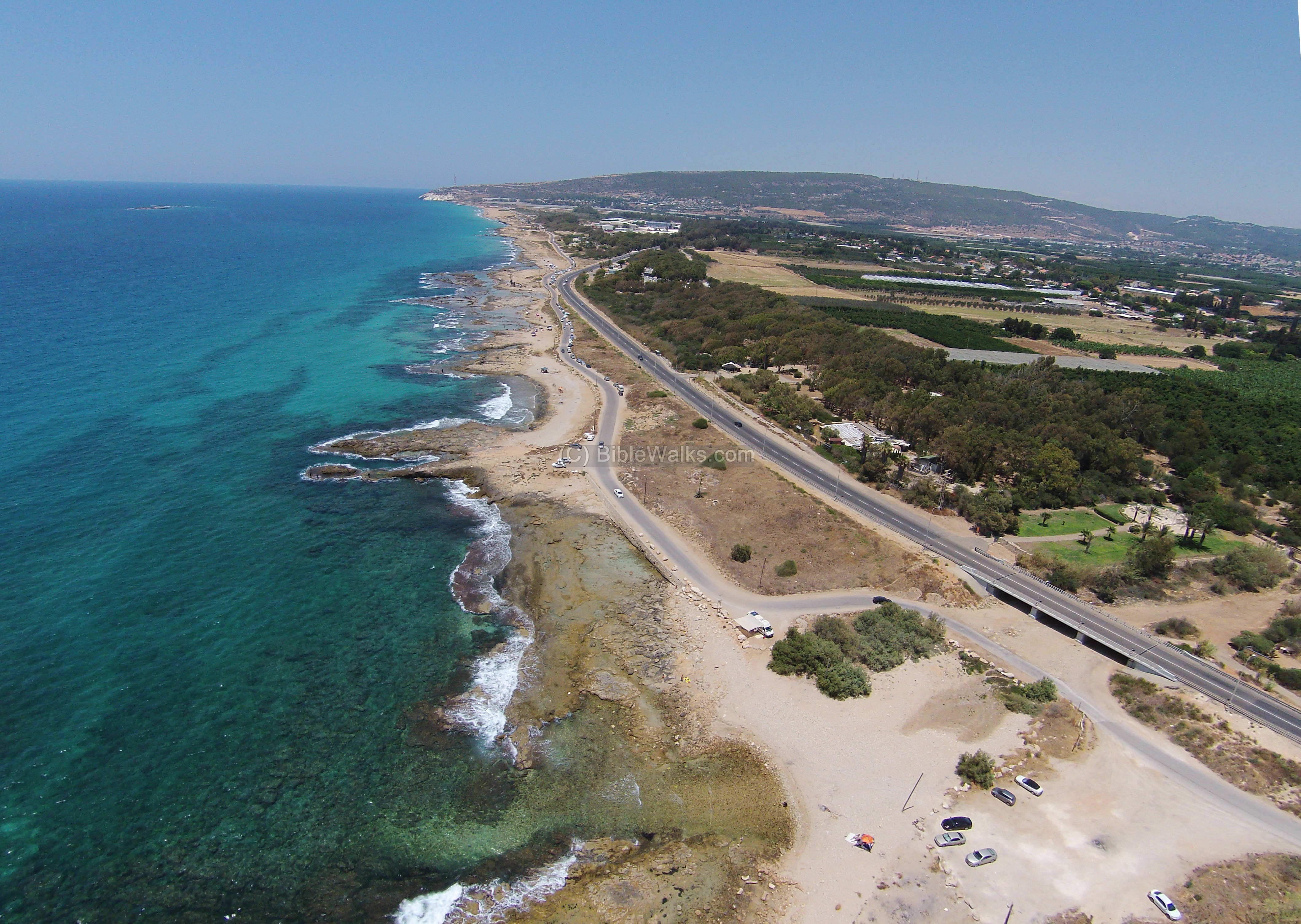
Another drone view, towards the north, is in the next photo. On the bottom of the view is the outlet of Kziv creek. Traces of the ancient harbor can be seen under the water. In the far background, where the “ladder of Tyre” ridge meets the sea, is Rosh Hanikra, at the border with Lebanon.
![]() A flight over the site can be seen in the following YouTube video, with indication of the major points of interest:
A flight over the site can be seen in the following YouTube video, with indication of the major points of interest:
(c) The park:
A view from the east towards the top of the steep hill, and the mosque on the left side.
The Tel is buried under the grass, and only parts of it were excavated. The coast is behind the hill.
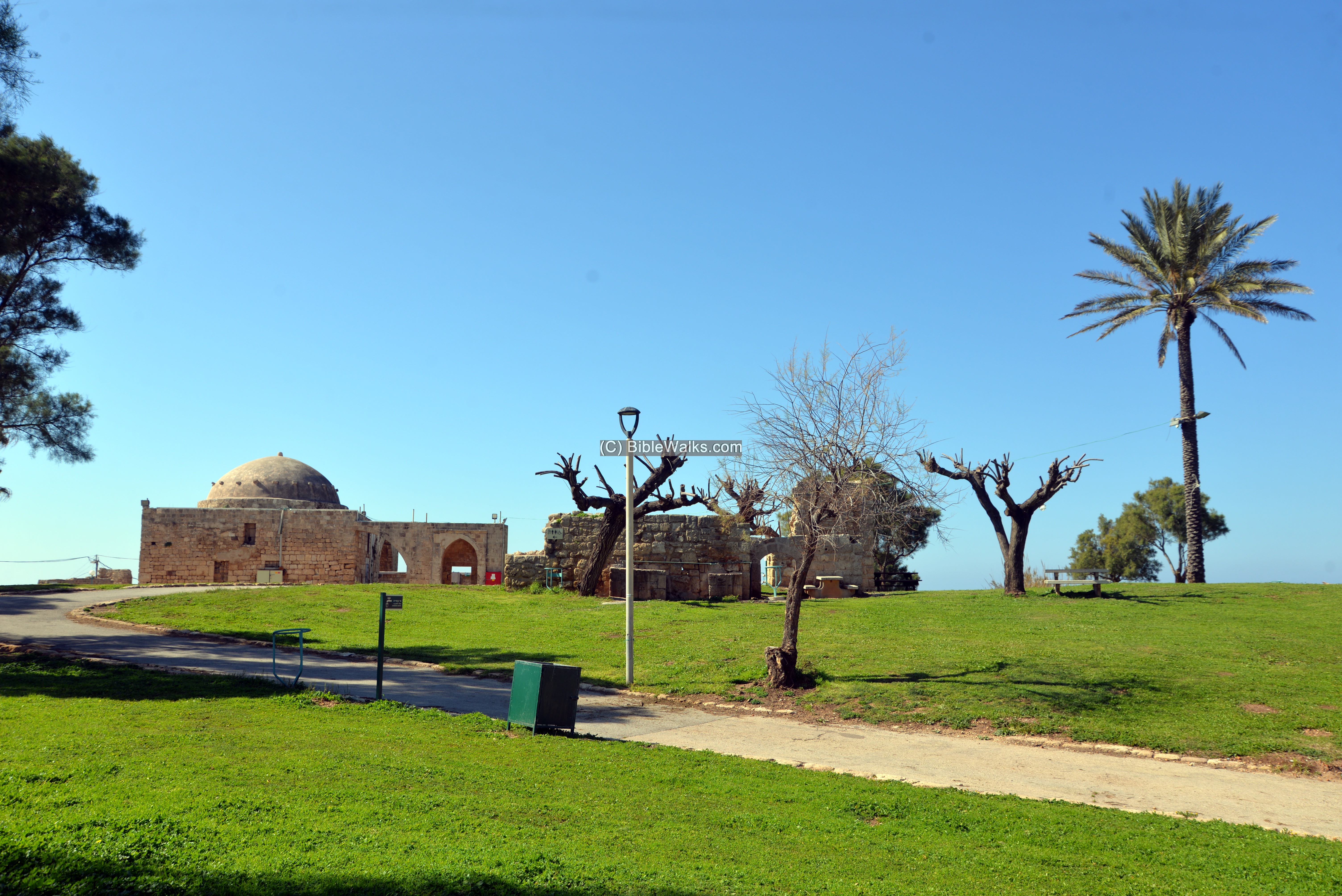
The mosque was part of the Arab village of al-Zeeb which was once located on the hill.

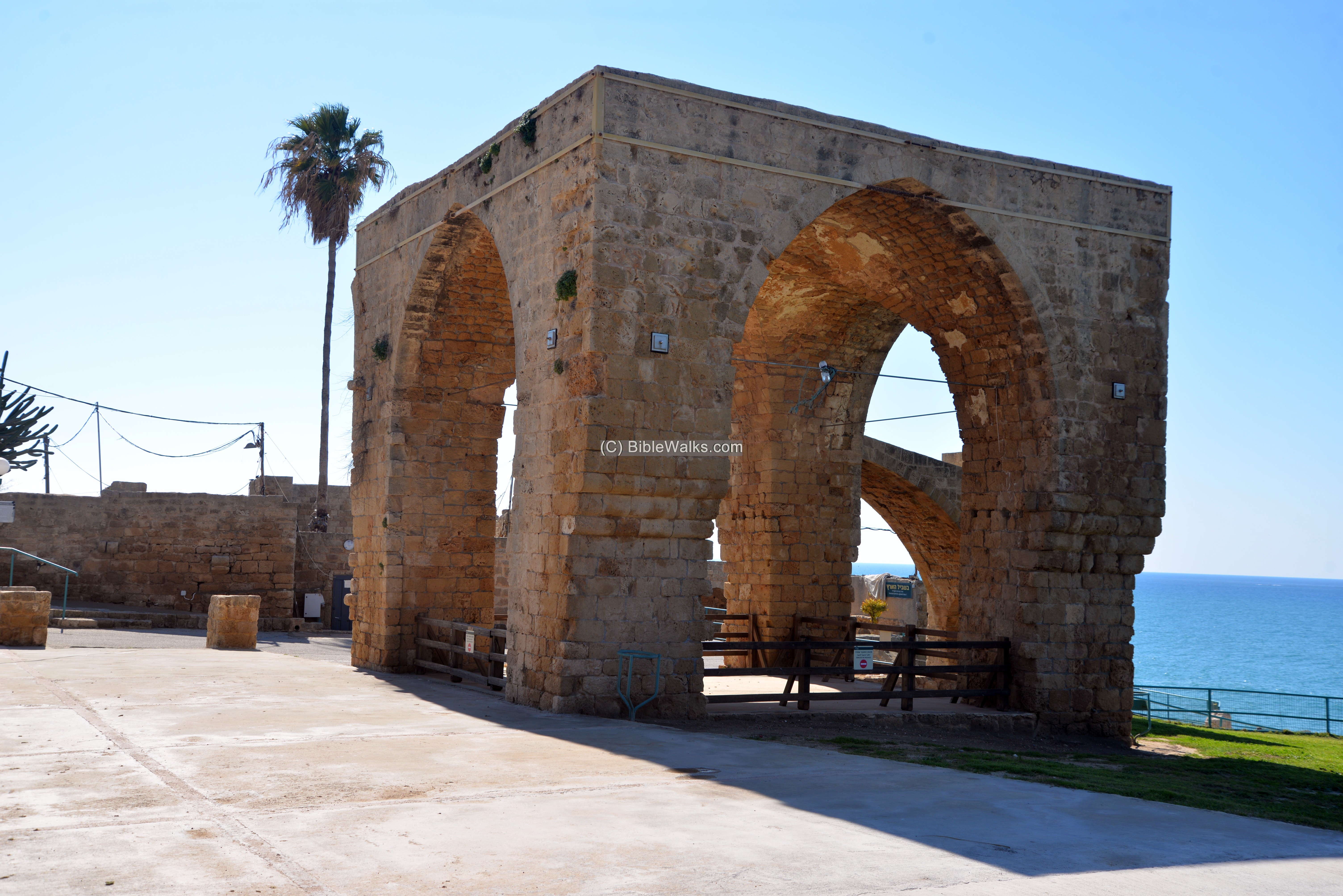
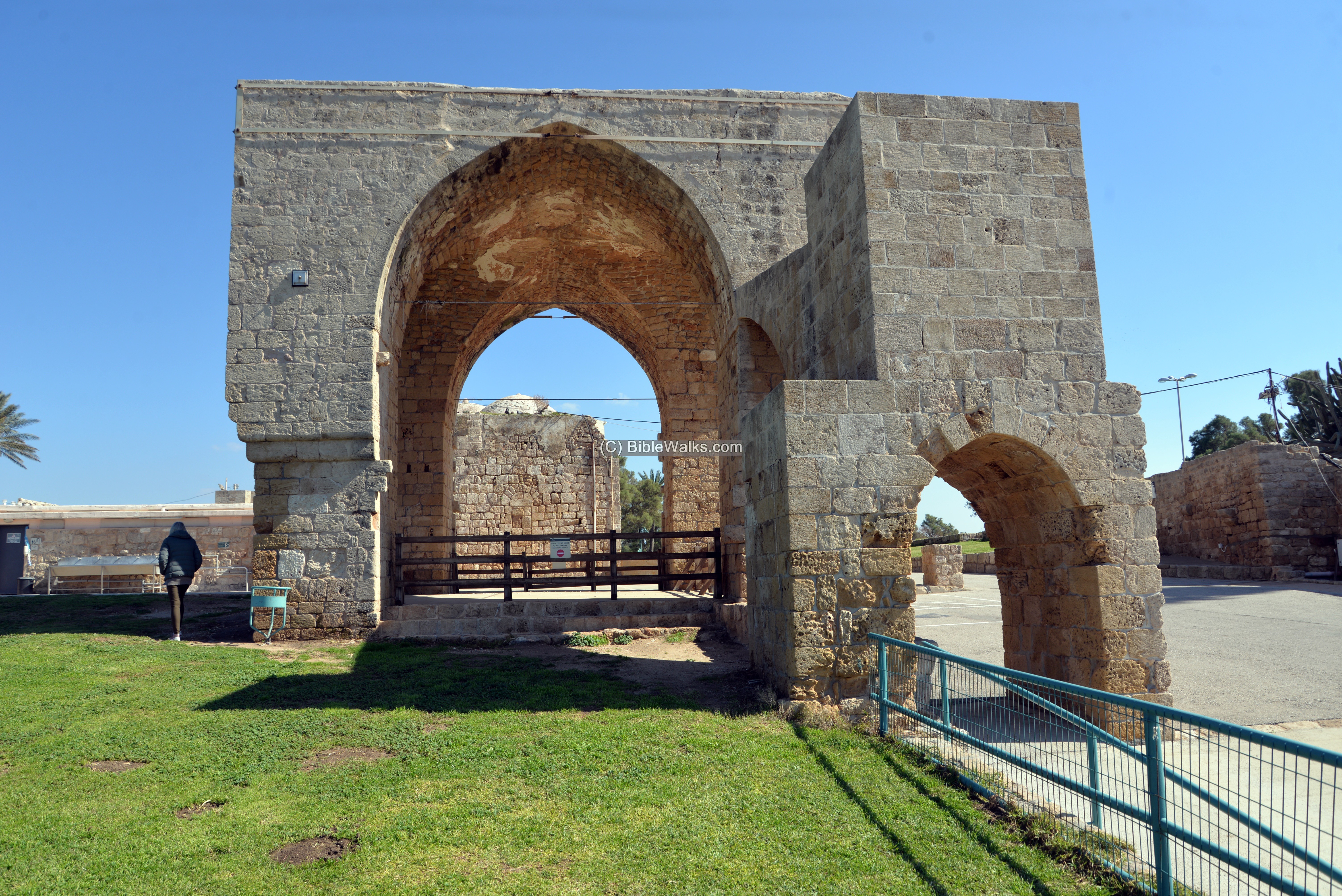
Another view of the area around the mosque:
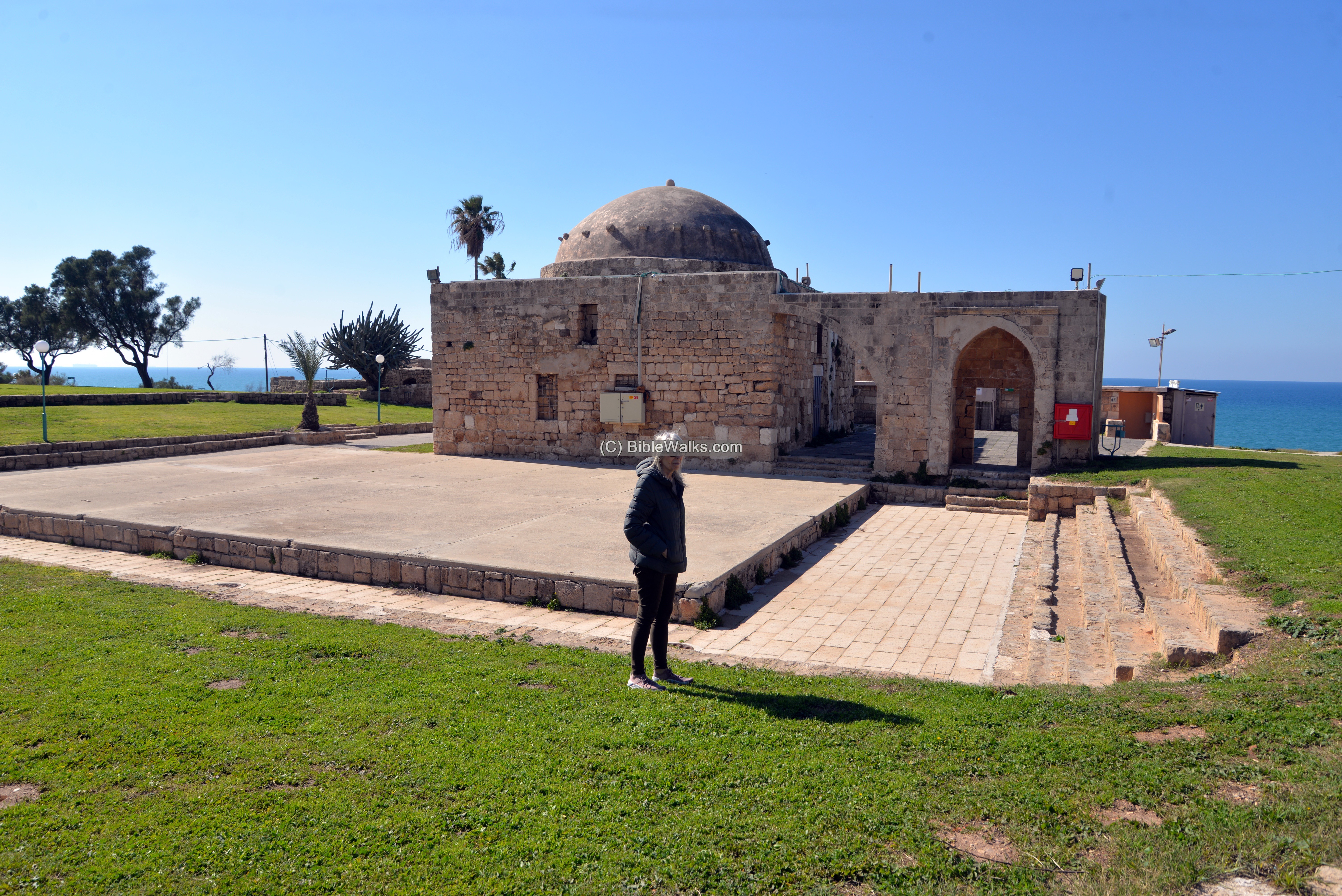
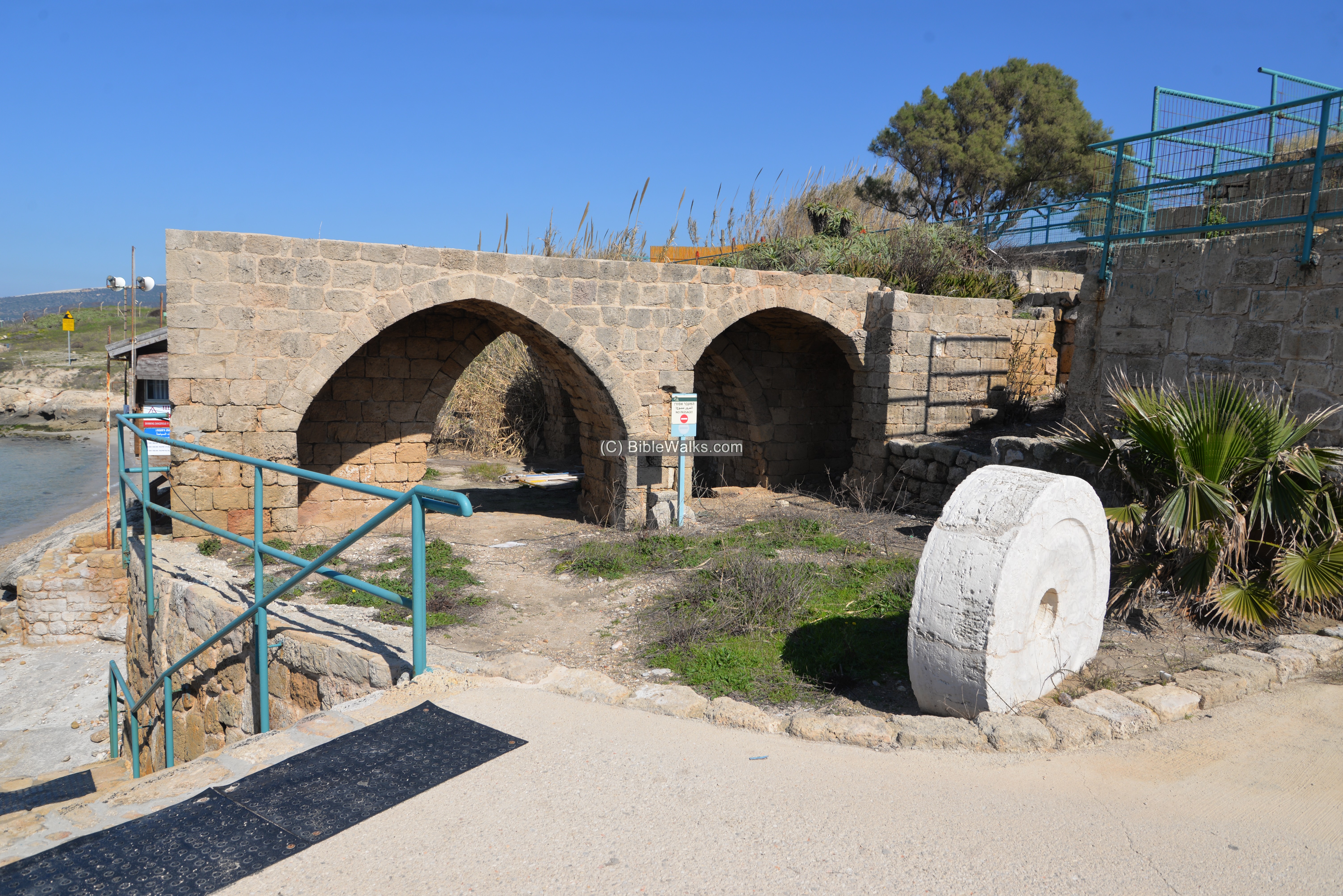
An arched structure on the west side was actually built by the Crusaders.
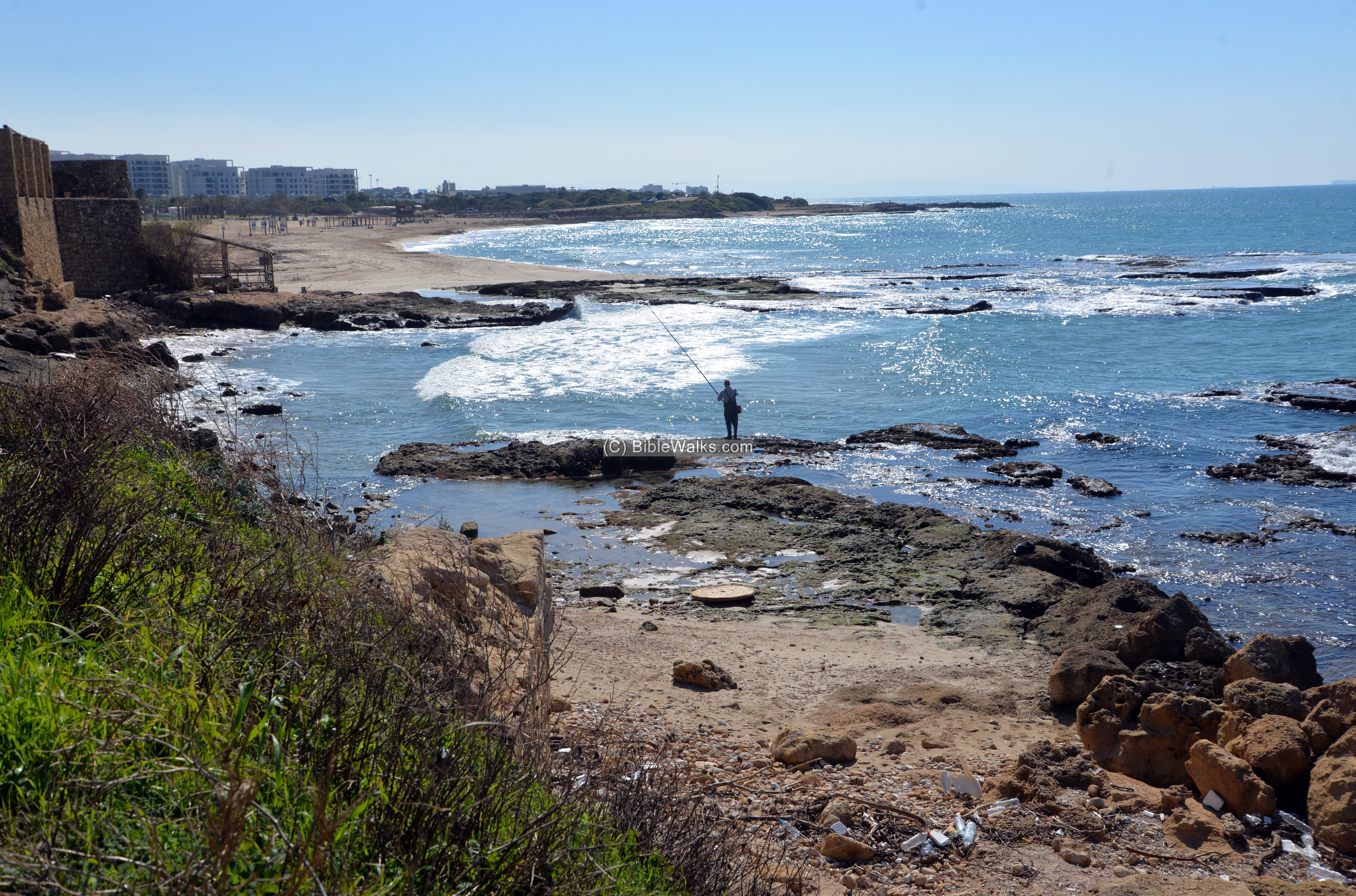
(d) Sea side:
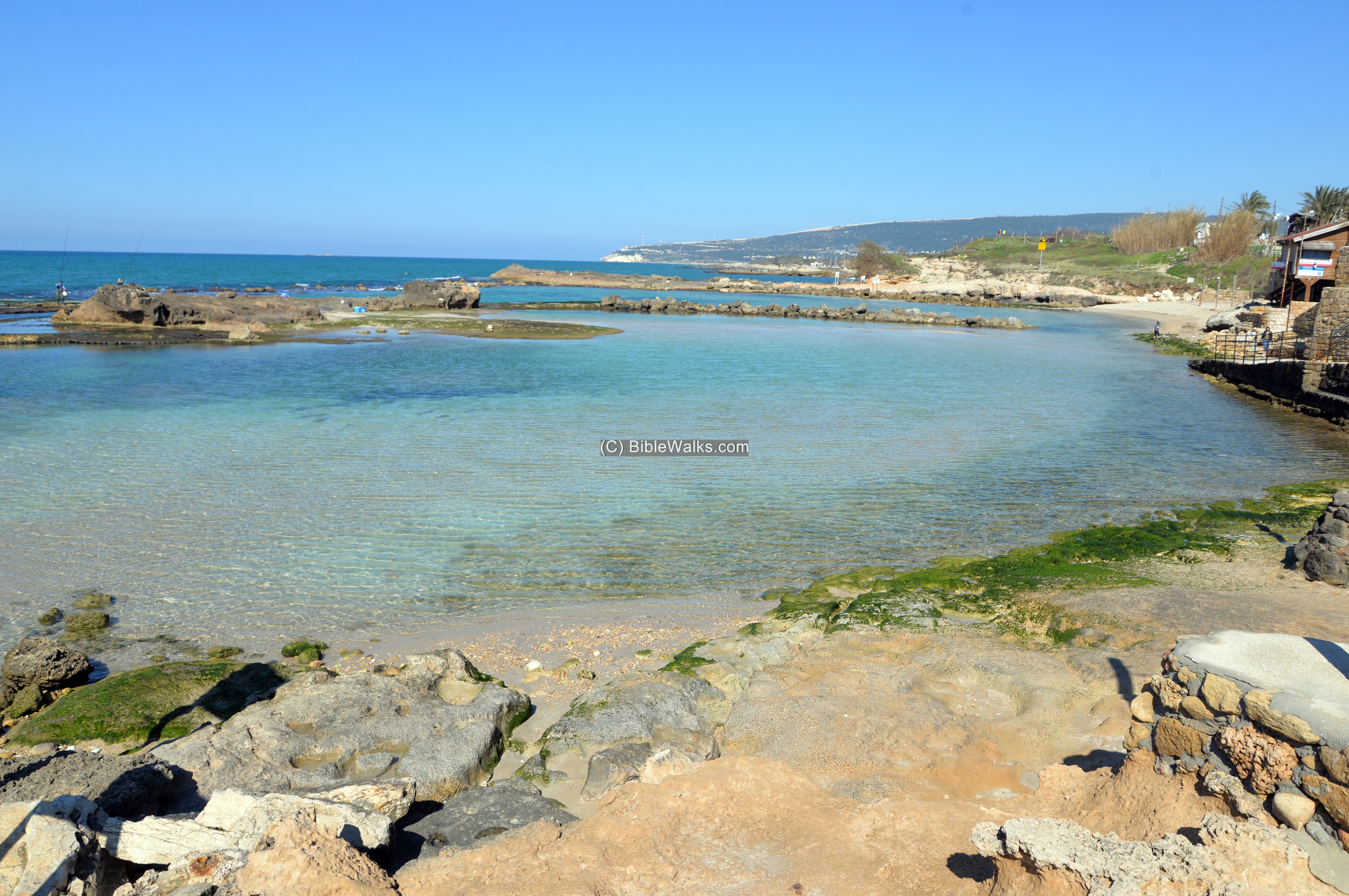
Remains of the ancient port are seen along the beach on the west side of the hill.
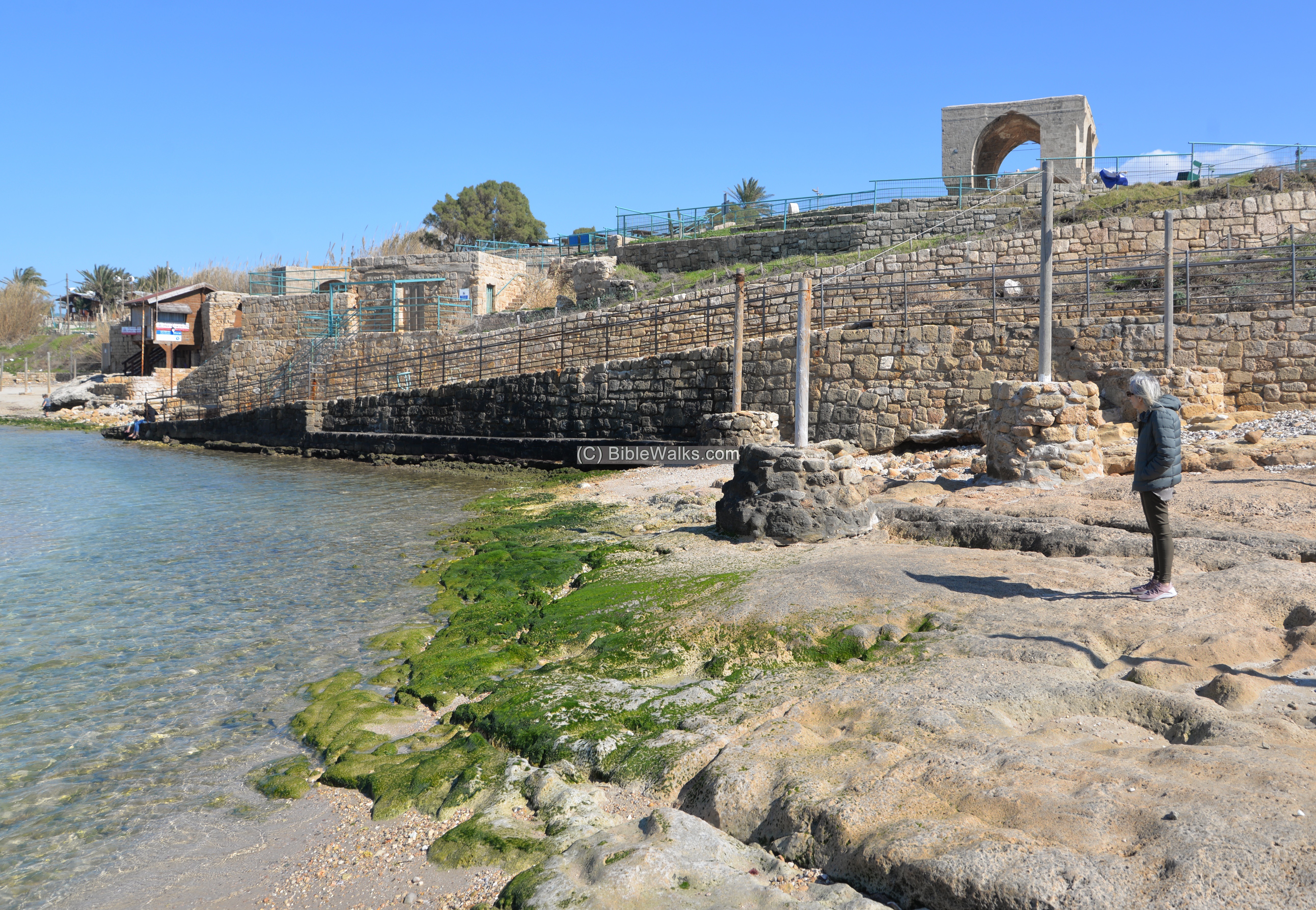
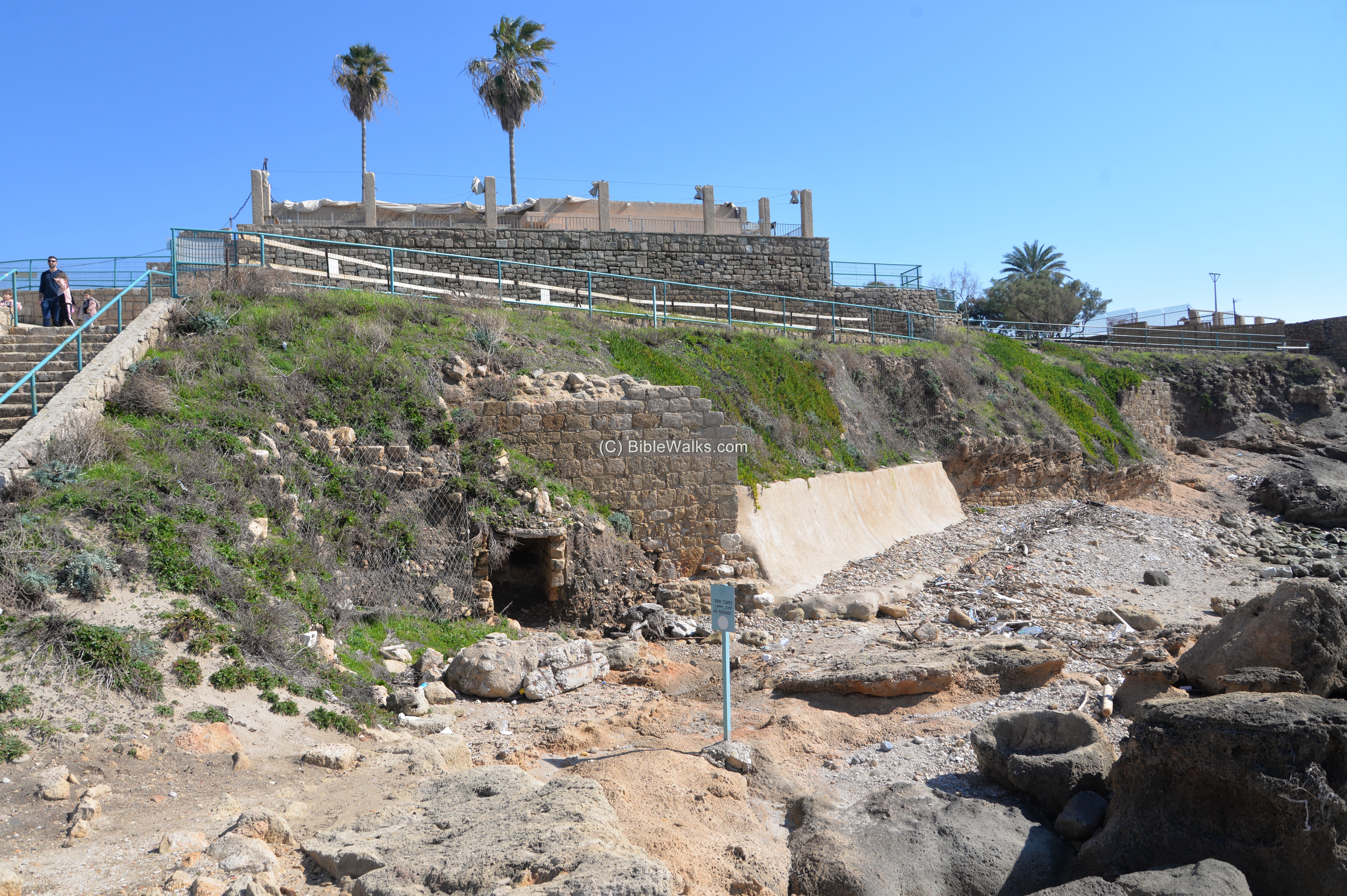
Parts of the ancient harbour and Tel Achziv are seen on the north side of the park.
In the following northern view, on the the far left background, is the white cliff of Mt. Rosh Hanikra which borders with Lebanon.
An oil press crushing stone was relocated here in front of remaining structures of the old port.
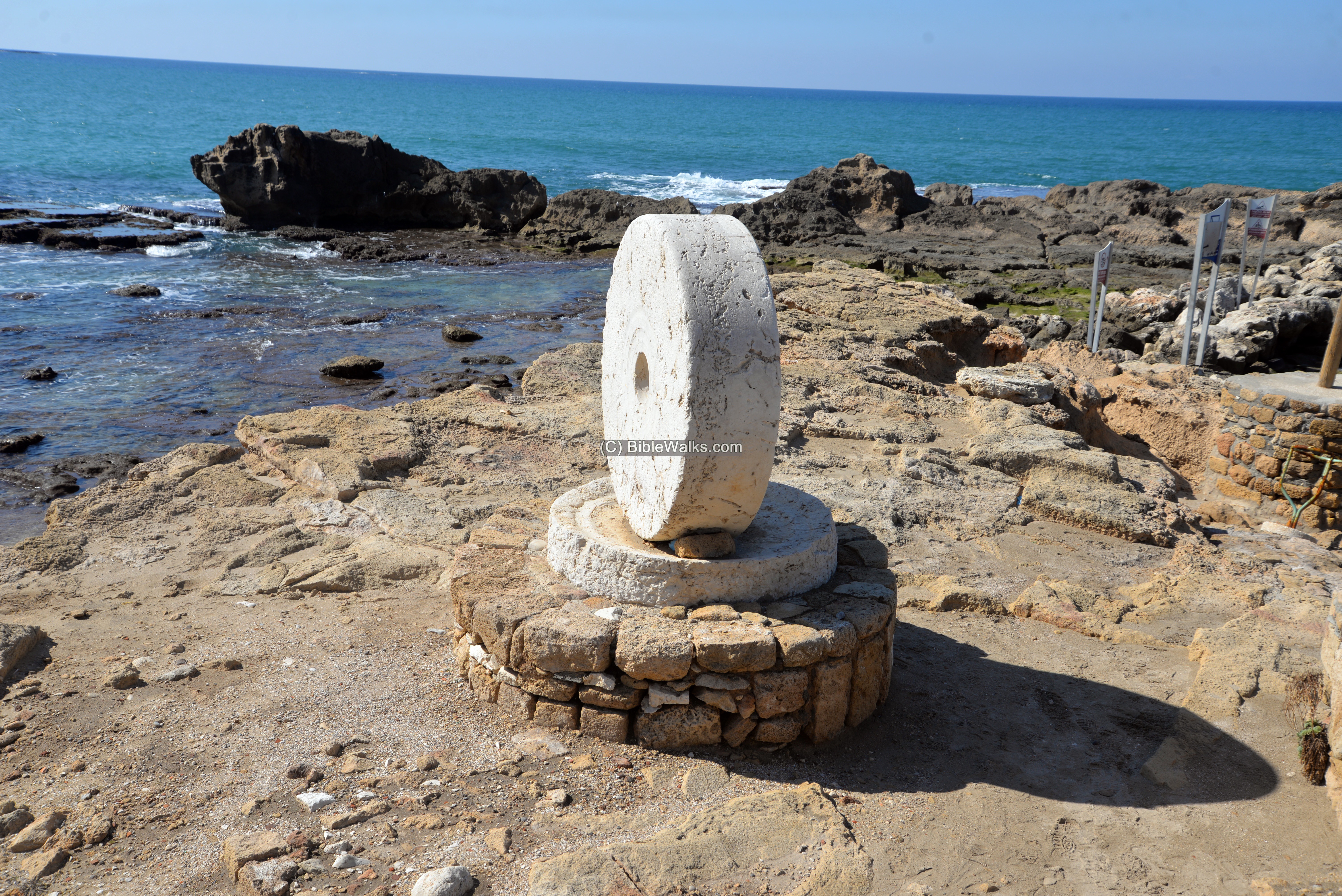
Another oil press crushing stone and its base were relocated to the seas side.
The next photo is a view towards the south:
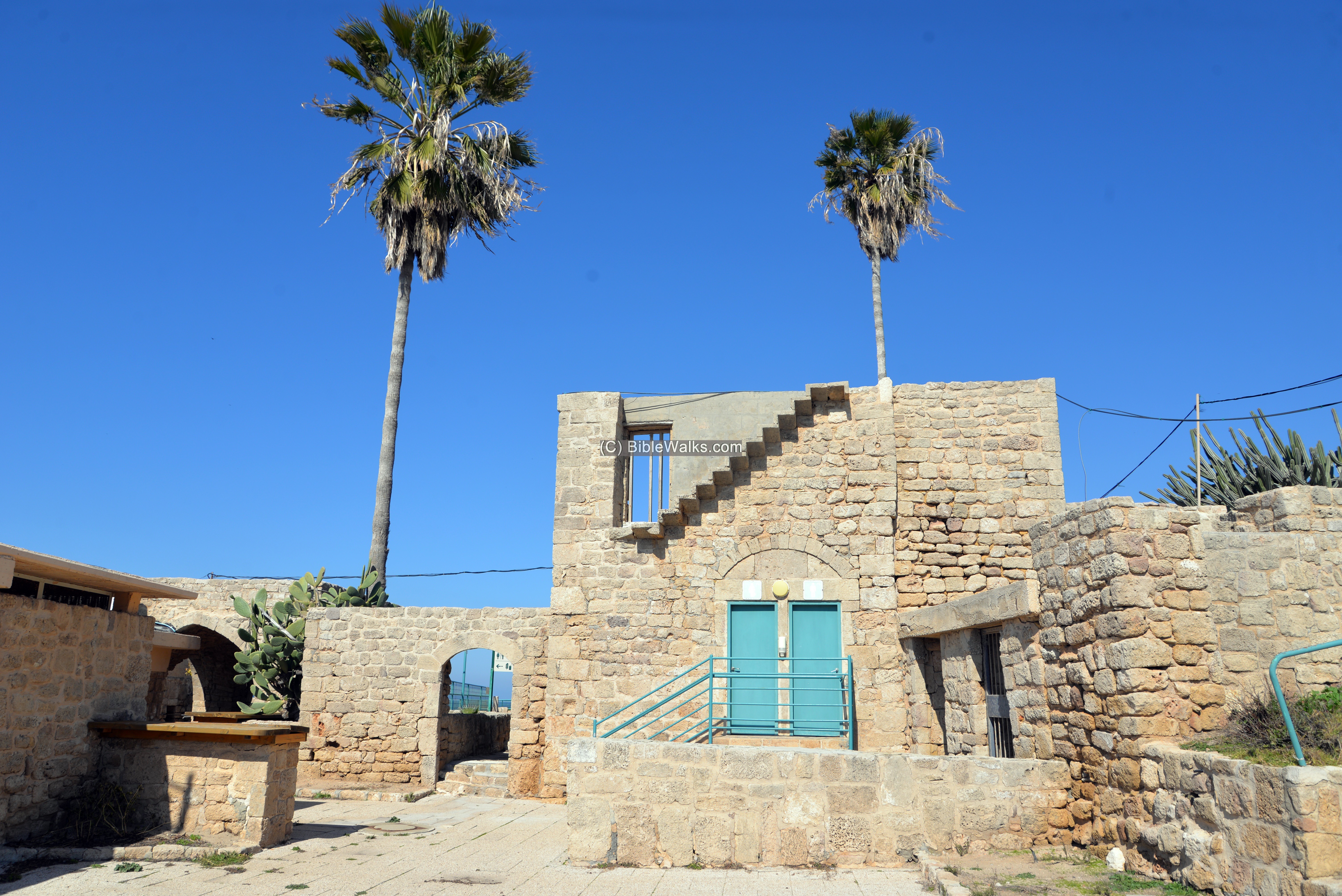
(e) The Arab village :
Some of the Arab houses were left standing. They house the park offices and museum.

This structure was the house of the Mukhtar – Mahmoud Husayn ‘Ataya – the head of the village.
A view of the structure from the south side:
(f) North Side
On the north side of Tel Achziv is the outlet of Kziv creek, as seen in the photo below. It is a popular place where people stop and walk around the beach. The north side is also the place of “Avivi-Land”, seen here on the far background where a tower is reaching out of the trees.

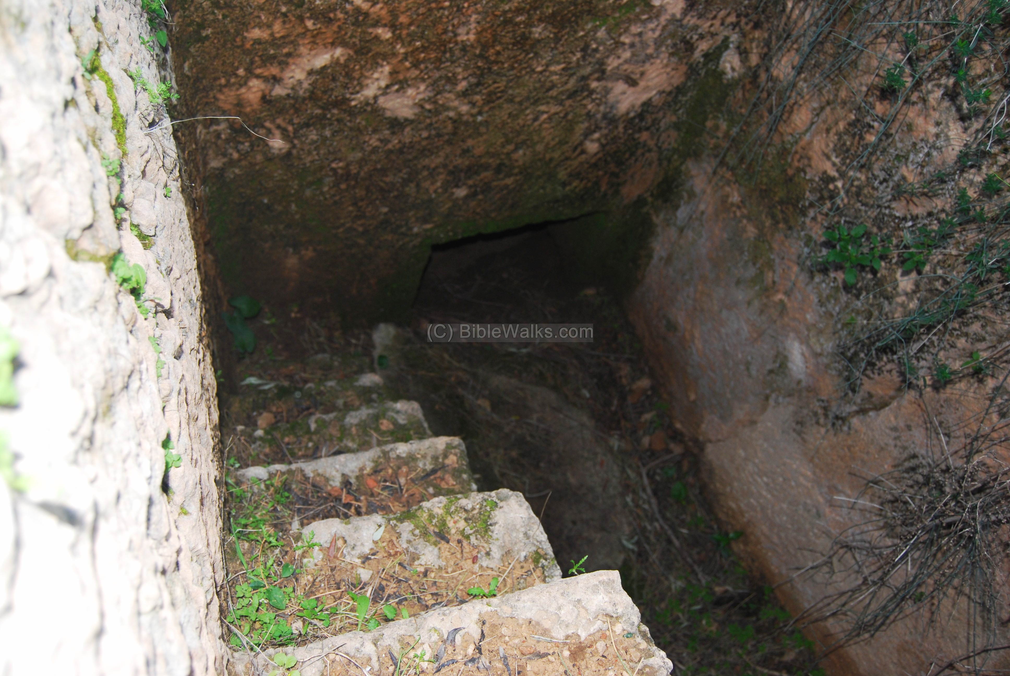
(g) Cemeteries
Five Large cemeteries are located 1KM east to the Tell (E-Ras), north, and 700M south to it (El-BukBuk). In the rock-hewn tombs were ceramics from the Iron and Persian periods, including several Phoenician tombstones.
- South:
One of the Phoenician cemeteries is located just south of the southern bay, at the side of the coastal road to Nahariyah. There are a dozen or more rock cut tombs here.

- East:
This picture shows the eastern cemetery, located to the north of the entrance to Kibbutz Gesher HaZiv.

The burial types are hewn into the sandstone bedrock, and include shaft tombs, cist tombs, and burial chambers.

Tomb stones were also found above cremation urns.
Clay vessels from the cemeteries of Achziv are on display in the Haifa University Hecht Museum. They are dated to the 11th thru 6th century BC.
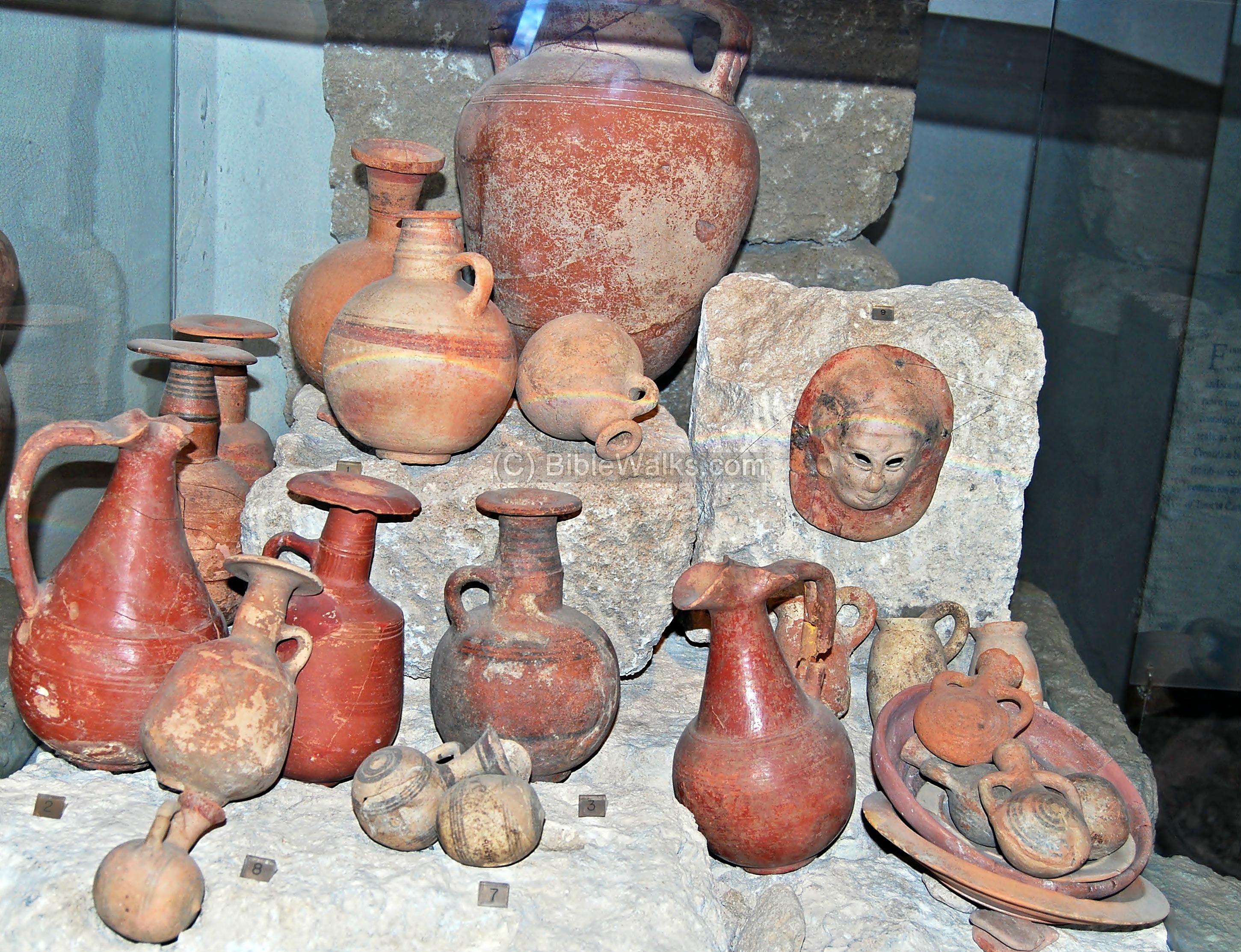
Courtesy Haifa University Hecht Museum
(g) Other
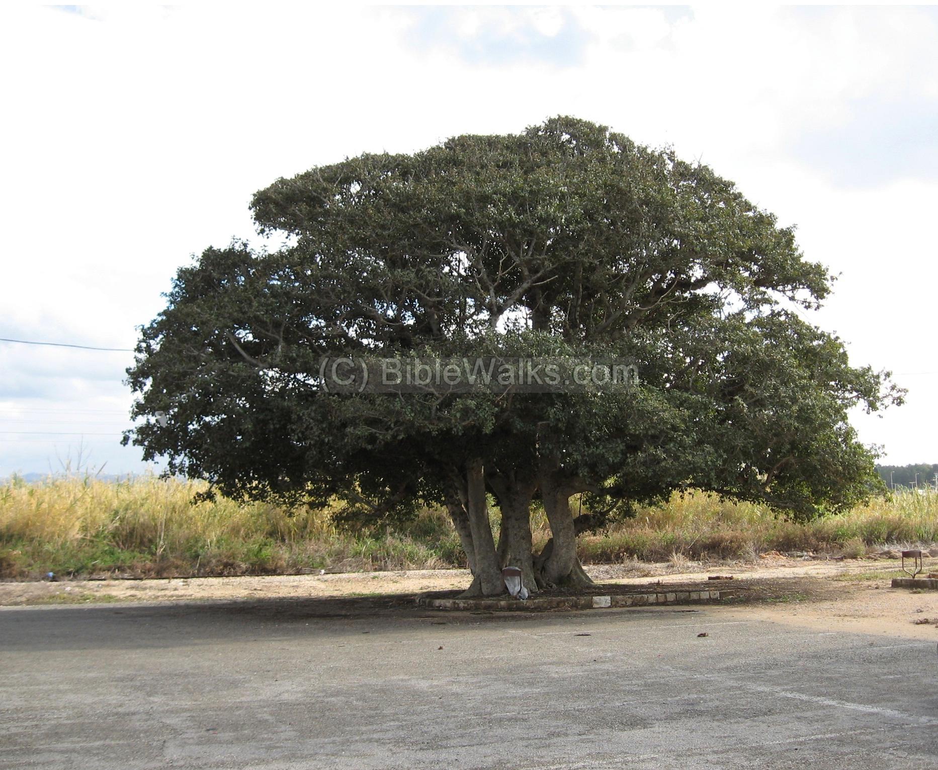
In the parking lot there are several impressive trees, including this 100 years old Sycamore Fichus.
Etymology (behind the name):
- Achziv (Akhziv) – The source of the name may be from Achzav, which in Hebrew is a creek that flows only in parts of the year.
- Kziv – name of the creek that flows at the north side, and one of the names of Achziv.
- Other names: Romans called it Ecdippa or Ecdippon, which is a form of the source name
- Crusaders called it Casale Umberti or Casale Huberti de Paci or Casal Inbert
- El-Zeeb, Zib, Ez zib, Al Zib– Arabic name of the town which preserved the ancient name.
- Also appears as Zipa in some post Crusaders Christian texts, a form of El-Zeeb
Biblical References:
There are several old testament references to Achziv. Some of them refer to another city in Judea (like Joshua 15), which has the same name. The Galilee city is referred in the following texts:
Joshua 19 24,29:
This text describes the territory of the Asher tribe:
“And the fifth lot came out for the tribe of the children of Asher according to their families…. And then the coast turneth to Ramah, and to the strong city Tyre; and the coast turneth to Hosah; and the outgoings thereof are at the sea from the coast to Achzib“.
Judges 1 31-32:
However, Asher tribe failed to drive out the population of Achziv:
“Neither did Asher drive out the inhabitants of Accho, nor the inhabitants of Zidon, nor of Ahlab, nor of Achzib, nor of Helbah, nor of Aphik, nor of Rehob. But the Asherites dwelt among the Canaanites, the inhabitants of the land: for they did not drive them out”.
(b) Kings I (9: 11-13)
This text tells about the Solomon-Hiram agreement, where the area of west Galilee (land of Kavul/Cabul) was traded with the Phoenicians. The implied reason was that King Solomon had to pay for his debts (to pay the cost of the timber, labor and other goods), and he paid with prime real estate (although Hiram was not pleased as per the Biblical text). Actually, this old treaty lasted for 3000 years until Israel was founded, since the area of west Galilee always remained under the Phoenician control.
” Now Hiram the king of Tyre had furnished Solomon with cedar-trees and cypress-trees, and with gold, according to all his desire–that then king Solomon gave Hiram twenty cities in the land of Galilee. And Hiram came out from Tyre to see the cities which Solomon had given him: and they pleased him not. And he said: ‘What cities are these which thou hast given me, my brother?’ And they were called the land of Cabul, unto this day”.
Josephus Flavius:
Wars I 13 4:
The Jewish commander against the Romans, who later became a historian, wrote about Ecdippon (Roman Achziv), where in 40BC the brother of Herod (Phatsael, Phasaelus) and Horkenous II (from the Hasmoneans), were captured in the Parthian intrusion. Their fate was bad – the former committed suicide and the latter was maimed.
“But now, when they were come to Galilee, they found that the people of that country had revolted, and were in arms, who came very cunningly to their leader, and besought him to conceal his treacherous intentions by an obliging behavior to them; accordingly, he at first made them presents; and afterward, as they went away, laid ambushes for them; and when they were come to one of the maritime cities called Ecdippon, they perceived that a plot was laid for them; for they were there informed of the promise of a thousand talents, and how Antigonus had devoted the greatest number of the women that were there with them, among the five hundred, to the Parthians; they also perceived that an ambush was always laid for them by the barbarians in the night time; they had also been seized on before this, unless they had waited for the seizure of Herod first at Jerusalem, because if he were once informed of this treachery of theirs, he would take care of himself; nor was this a mere report, but they saw the guards already not far off them”.
Other References:
- Archaeological survey of Israel, Map of Achziv (1) R. Frankel and N. Getzov [ISBN 965-406-024-8, 1997], sites #6, 8, 9
- Conder & Kitchner 1881-1883 I: 148, 155, 158, 193
- Arch. digs and surveys in 1940s (Ben Dor) and 50-60s (Prausnitz), Oren (1975), Raban and Galili (1985/6), Teper (1986), Gavish (1991)
- Israel guide – Upper Galilee – p40 (Editor R. Frankel) 1978
- Atiqot XXXIV [ISSN 0792-8424, pp 85-99]- “A wine press at Akhziv” – D. Syon. This article describes the salvage excavations, which uncovered one of the largest Industrial winepress complexes in Israel, dated to the late Roman period. Its size is 9.5 x 40M. This indicates that the city was one of the major wine centers, and exported its wine through the local port.
Links:
* Archaeology:
- Salvage excavation NE to Achziv (IAA report, 2002 season)
- Northern cemetery excavations (Univ. of Jerusalem, 2004)
- Southern cemetery excavations (Ben Dor, 1941-4)
- Wine Press from Achziv Danny Syon (2009)
- Renewed excavations on Tel Achziv – Preliminary Reports: 1st season 2014 (pdf), 2nd season 2015 (pdf), 3rd season 2016 (pdf), 4th season 2017 (pdf)
- Crusader structure preservation by Arco conservation & planning
* Trees:
- BibleWalks – trees of the Holy Land
- Survey of Israel’s ancient trees (1990-2005) – pdf; Hebrew
* Other:
- Achzib – in Judea (Horvat Lavnin)
- Drone Aerial views – collection of Biblical sites from the air
BibleWalks.com – walk with us through the Holy Land places
Nahariyah <<<–previous site—<<<All Sites>>>—next West Galilee site–>>> Shefaram
This page was last updated on Apr 2, 2022 (southern bay)
Sponsored links: