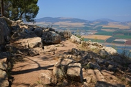
Observation point on Mt. Saul, overlooking the Jezreel valley and Mt. Gilboa.
* Site of the month Jan 2017 *
Home > Sites > Yizreel Valley > Mt. Gilboa > Saul’s Shoulder
Contents:
Background
Location
History
Photos
* Aerial views
* Observation point
* Nature trail
* Antiquities
* Monument
* Mt. Saul
* Mt. Barkan
Links
Etymology
Background:
“Saul’s Shoulder”, a mountain ridge on the northern end of Mt. Gilboa, offers a great view of the Jezreel and Beit Shean valleys. During the Biblical times, King Saul died in battle with the Philistines which gave the name to the place.
(2 Samuel 1:21): “Ye mountains of Gilboa, let there be no dew, neither let there be rain, upon you”.
Location:
The observation site “Saul’s shoulder” is located on the north side of Mt. Saul, with a peak at 302m above sea level and 360m above the Jezreel valley. Access to the parking site near the peak is from the south west side, by a road that climbs up from road #667.

History:
-
Early periods
According to the archaeological survey, there are several structures on the peak of Mt. Saul:
-
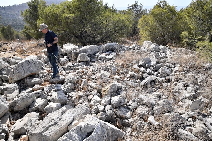
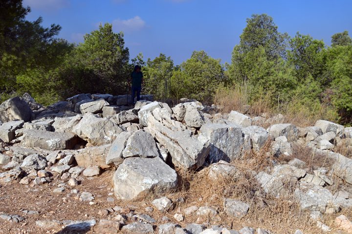
A large structure (32m x 25m), built of large limestone blocks (up to 170 x 80 cm), was found on the peak. The ceramics in this structure, which may have been a fortress, were dated to the Middle Bronze II, Persian and Byzantine periods.
-
A smaller structure (30m x 8m), also possibly a fortress, is located 30m south of the large structure. It is also built of large limestone blocks, and its ceramics were dated to the Iron Age I, Iron Age II and the Persian periods.
-
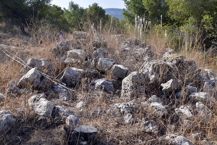
A heap of stones, 8m by 10m, is located on the peak. The survey identified flintstones of the Paleolithic period, and ceramics of the Early Bronze, Middle Bronze II, Iron Age, Roman and Byzantine.
-
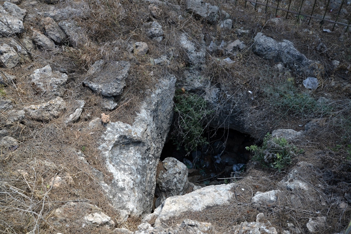
A hewn wine press was found 10m south of the peak, and nearby is a hewn burial cave with cup marks on the rock.
-
A Hyksos scarab (Egyptian style amulet) was found on Mt. Saul, dated to the Middle Bronze II.
-
Biblical map
Mt. Gilboa is located above two fertile valleys – the Jezreel valley to the west, and Beit Shean to the east. Through these valleys passed major ancient crossroads, connecting to Beit She’an, the Jordan valley (south), Jerusalem (southwest), Jezreel (west), and Gilead (east). The cities (circles) and roads (dashed lines) during the Canaanite and Israelite periods are indicated on the Biblical Map below.
Map of the area around Mt. Gilboa – during the Canaanite and Israelite periods (based on Bible Mapper 3.0)
-
Biblical times
On Mt. Gilboa was one of the great battles of the Early Kingdom – between the first King Saul and his arch enemies – the Philistines.
The Philistines, based in the southern Sharon area, planned to expand their territory to the Galilee. King Saul tried to block this move and prepared the Israelite armies near the nearby city of Yizreel, on the west side of Mt. Gilboa. Saul camped in the Yizreel spring on the foothills of the city. The Philistines, assisted by Saul’s rival (later King) David, set their camp in Shunem (at the foothills of Hamoreh hill, across the valley). (1 Samuel 29 1): “Now the Philistines gathered together all their armies to Aphek: and the Israelites pitched by a fountain which is in Jezreel”.”.
The battle was fought in the Jezreel valley and the Israelites fled to Mount Gilboa, where King Saul’s 3 sons first fell in the battle (1 Samuel 31:1-2):
“Now the Philistines fought against Israel: and the men of Israel fled from before the Philistines, and fell down slain in mount Gilboa. And the Philistines followed hard upon Saul and upon his sons; and the Philistines slew Jonathan, and Abinadab, and Melchishua, Saul’s sons”.
Saul was also wounded, and he killed himself to avoid being captured (1 Samuel 31:3-6):
“And the battle went sore against Saul, and the archers hit him; and he was sore wounded of the archers. Then said Saul unto his armourbearer, Draw thy sword, and thrust me through therewith; lest these uncircumcised come and thrust me through, and abuse me. But his armourbearer would not; for he was sore afraid. Therefore Saul took a sword, and fell upon it. And when his armourbearer saw that Saul was dead, he fell likewise upon his sword, and died with him. So Saul died, and his three sons, and his armourbearer, and all his men, that same day together”.
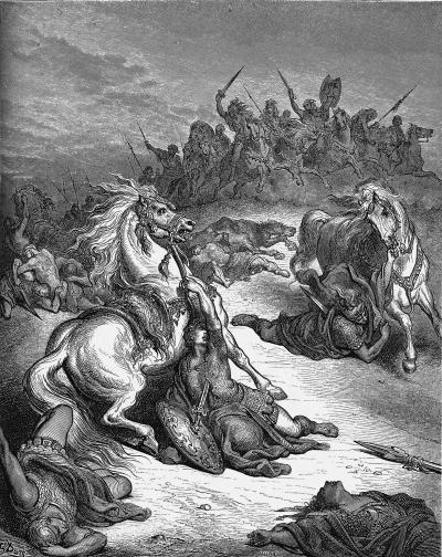
Death of Saul and his sons -by Gustav Dore (French artist, 1832-1883)
The Philistines hang their bodies on the walls of Beit She’an, and displayed Saul’s head and amour (1 Samuel 31: 8-10):
“And it came to pass on the morrow, when the Philistines came to strip the slain, that they found Saul and his three sons fallen in mount Gilboa. And they cut off his head, and stripped off his armor, and sent into the land of the Philistines round about, to publish it in the house of their idols, and among the people. And they put his armor in the house of Ashtaroth: and they fastened his body to the wall of Bethshan”.
“Neither let there be rain”: Following the events of the battle, his successor King David cursed Mt. Gilboa after the death of Saul and his sons (2 Samuel 21):
“Ye mountains of Gilboa, let there be no dew, neither let there be rain, upon you, nor fields of offerings: for there the shield of the mighty is vilely cast away, the shield of Saul, as though he had not been anointed with oil”.
Indeed, most of east side of Mt. Gilboa looks barren, although modern foresting added green colors to some parts of this side of the mountain.
A summary of the great battle is illustrated here, and follows these steps:
0. The Israelites camp near Yizreel spring, while the Philistines camp in Shunem on Mt. HaMoreh foothills
1. Saul seeks the advice of the witch in Endor (near Mt. Tabor), who gives him a gloomy outcome
2. The battle in Jezreel valley, with the Philistines upper hand
3. The Israelites flee to Mt. Gilboa
4. King Saul and his sons die on Mt. Gilboa
5. The Philistines hang their bodies on the walls of Beit Shean
-
Mamelukes (1250-1516 AD)
The Mameluke were Turkish prisoners who were sold to the Sultan of Egypt, trained by him and served as his palace guards. In 1250 they seized the control of Egypt. In 1260 they faced a major enemy who conquered vast areas in Asia and the Levant – the Mongols. They managed to block the Mongol invasion and defeat them in the valley below Mt. Gilboa. This battle, known as the battle of ‘Ain Jalud (Ein Harod), was a of the major milestones in both the Mongol and the Mameluke histories .
The Mameluke controlled the Holy Land for the next 250 years.
-
Ottoman Period – (1516-1918 A.D.)
The site was examined in the PEF survey (1866-1877) by Wilson, Conder and Kitchener. A section of their survey map below shows the Northern area of Mt. Gilboa, while Mt. Saul appears here with its Arabic name – Jebel el Kaleily, meaning: the mountain with the peaks.
Part of Map sheet 9 of Survey of Western Palestine,
by Conder and Kitchener, 1872-1877.
(Published 1880, reprinted by LifeintheHolyLand.com)
They described Mt. Gilboa (volume 2, p. 72, as quoted from Guerin):
‘This mountain lies west-north-west and east-south-east, being about eight miles long by three to five miles in breadth. It is cultivated in parts, and is divided into several plateaux and summits by valleys and ravines of greater or less depth. Here and there basaltic stones are found, but limestone predominates. The soil is for the most part of a reddish colour, and is fit for cultivation in many places. Wheat and barley grow on the more gentle slopes and on the plateaux; clumps of olives and figs, hedges of cactus surrounding gardens, and where man has not seized upon the soil, wild grass and brushwood ; at other points naked rock ;such is the appearance of this mountain, once the scene of the death of Saul and Jonathan, against which David pronounced his malediction.'”
Arab villages existed at that time around Mt. Saul – Nuris to the west, er-Rihaniyeh to the east, and el Mazar to the south west (see map above). The PEF report described both villages (Volume 2, p. 86):
“Nuris – A small village on rocky ground, much hidden between the hills. It is situate above the steeper slopes of the Gilboa chain, which face northwards and below the main ridge, and is about 600 feet above the valley.
Er Rihaniyeh – A small village of mud and stone. On the south the ground is rocky ; on the north there is plough-land. It stands on the foot of the Gilboa slopes.
El Mazar, or El Wezr – A village on the summit of the mountain. It is principally built of stone, and has a well on the south-east. A few olives surround the houses. The site is very rocky. It is inhabited by Derwishes, and is a place of Moslem pilgrimage.”.
Note that most of the Arab villages, including these, were built above or near ancient sites: Nuris (site #26 in the survey) was populated from the Middle Bronze I period through the Byzantine period; El Mazar (site #34) was populated from the Chalcolithic period through the Byzantine period; and El Rihaniyeh (site #29) was populated from the Upper Paleolithic period through the Byzantine period (the majority of the findings).
-
Modern Times
The KKL paved a road and built a public parking place near the summit of Mt. Saul, naming it in honor of King Saul. The observation site offers a convenient parking, picnic tables, hiking trails and one of the greatest panoramic views in Israel. It is also a spot where paragliders are launched, then soar above the valley.
Photos:
(a) Aerial views
A drone captured this view towards the east. The northern edge of Mt. Gilboa is seen on the right, towering over the fertile Jezreel and Beit Shean valleys.
Mt. Gilboa is a mountain range that extends from Samaria. It is oriented south to north, covering an area of 18km long and 9km wide.
Click on the photos to view in higher resolution…
Another view, towards the south east, is in the next photo. Mt. Saul (alt. 302m) is one of the hills of Mt. Gilboa, and is covered by pine trees. In the background is the northern section of Mt Gilboa, with Mt. Barkan (alt. 497m) in its far left side.
The next view is towards the north west, where the ancient city of Jezreel was located next to the ancient pass from Jezreel valley to Samaria. In the far background are Mt. Moreh and Mt. Tabor.
![]() The following YouTube video shows a flight over the site:
The following YouTube video shows a flight over the site:
(b) Observation point
From the edge of the cliff are great views of the area. This east view shows the northern edge of Mt. Gilboa, with the valley of Beit Shean in the background. Behind, in a far distance behind the Jordan river, are the mountains of Jordan.
The next photo is a closer view towards the east. It shows Kibbutz Hefzibah, where the ancient synagogue of Beit Alpha is located, with its magnificent colorful mosaic floor depicting a Zodiac and other elements. In the Kibbutz also lives Webmaster Rotem’s Uncle Ronnie and family.
The next view is towards the south east, with the north side of Mt. Gilboa. The foothills are barren, as the Bible wrote that the mountain was cursed by David after the death of Saul and his sons (2 Samuel 1:21): “Ye mountains of Gilboa, let there be no dew, neither let there be rain, upon you, nor fields of offerings: for there the shield of the mighty is vilely cast away, the shield of Saul, as though he had not been anointed with oil”.
Towards the north, past the fertile valley, are the three kibbutz settlements – Ein Harod-Ihud, Ein Harod-Meuhad and Tel Yosef.
A closer view of the valley shows a portrait etched in the wheat field of kibbutz Ein Harod-Ihud. This illustration was prepared by the artist Peter Weiner, created with a tractor guided by GPS, that chemically depletes the wheat following the lines of a sketched illustration. It covers an area of approx. 300m x 500m (150 dunam, or: 15 hectares). Amazing!
The giant wheat field portrait is changed every year. This year it depicts the bust of the late Yoram Ben Ami, and adds a title in Hebrew: “a pioneer of agriculture and Industry 1940-2014”.
The field art can be viewed exclusively from Saul’s shoulder, or from airborne platforms such as hang glides (that take off from here) and hot-air balloon rides (that sour above Mt Gilboa and the valleys).
Kibbutz Ein Harod is also known for its art museum, which was first established in the 1930s. This is perhaps why the Kibbutz sponsors the wheat field art.
(c) Nature trail
A nature trail (marked with green and double while strips) takes you along the edge of the hill, back to the parking area.
The soil washed away, leaving a barren surface. Pine trees were planted here in modern times, providing shade and the green colors.
Along the trail are the amazing views of the fertile Jezreel and Beit Shean valleys, as a juxtaposition to the barren surface of Mt. Gilboa. This panorama will for surely charge your soul – changing your mood from the brown rocky surface to the green and blue carpets of the valleys.
Huge boulders line up along the trail.
The red corn poppy flower (Scientific name: Papaver subpiriforme; Hebrew name: Pereg) grows here in the spring.
(d) Antiquities on the parking place
On the parking place area are evidences of ancient structures and installations, such as this hewn burial cave.
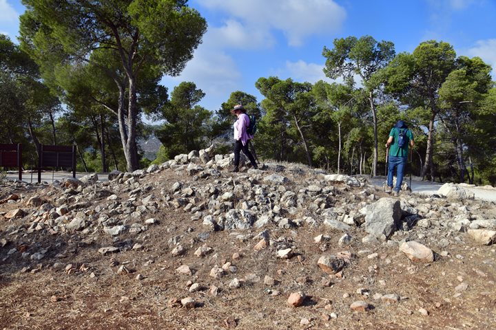
A small heap of stones is located nearby.
(e) Monument
A nature trail leads north-west from the parking area towards Givat Yonathan (Horvat Karmat, Tel el-Karam).
Horvat Karmat was the major site in this area during the Bronze/Iron age periods. Scholars suggest that it was the city of Harod, where Gideon set up his camp during the battle with the Mideanites. (Judges 7:1): “Then Jerubbaal, who is Gideon, and all the people that were with him, rose up early, and pitched beside the well of Harod: so that the host of the Midianites were on the north side of them, by the hill of Moreh, in the valley”.
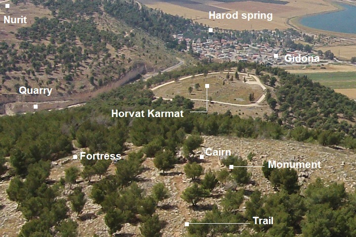
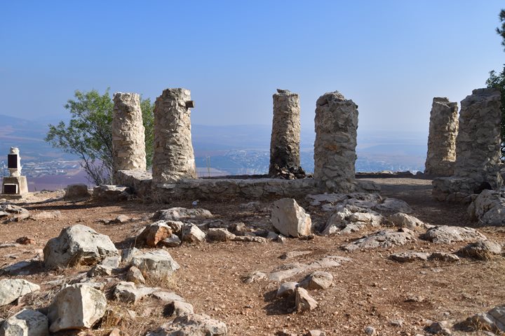
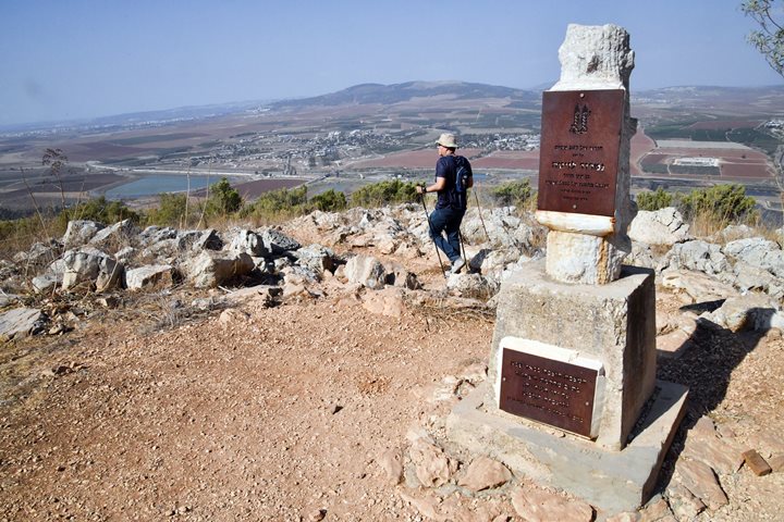
About 250m along this trail is a monument.
The monument is dedicated to fallen soldier Nimrod Levita. It overlooks the Harod valley and Kibbutz Ein Harod were he was born and raised.
In the far background is Mt. Moreh. (Judges 7:1): “… the Midianites were on the north side of them, by the hill of Moreh, in the valley”.
(e) Mt. Saul Summit antiquities
This location, on the summit of Mt. Saul (Jebel el Kaleily), was an ideal location for fortresses and watch towers during the antiquity.
Behind the monument is a small mound, 8 x 10m in area. Flint stones found near it were dated to the Paleolithic period, and pottery sherds were dated to the Early Bronze, Middle Bronze II, Iron Age, Roman and Byzantine period.
The mound may have been a lookout tower, situated at the edge of the cliff, and having a wide panorama of the area. It may have been a front observation point that supported the Bronze/Iron age city of Horvat Karmat (ancient Harod).
Remains of two ancient fortresses are located nearby on the summit of Mt. Saul.
One fortified structure is 25 x 32m in area, and is built of large limestone blocks (up to 0.8 x 1.7m). Pottery sherds were dated to the Middle Bronze II, Persian and Byzantine period.
Another structure, 30m south of the first, is smaller (8 x 30m). It is also built of large limestone blocks, with sherds dated to the Iron Age I and II and the Persian period. It was probably also a fortress.
(f) Mt. Barkan
In addition to Mt. Saul, Mt. Gilboa has another 10 peaks, with the highest is Melchishua (alt. 536m) – named after Saul’s son. Mt. Barkan is one of the other peaks, about 4km south east of Mt. Saul, at an altitude of 497m above sea level.
On Mt. Barkan is a KKL observation tower, with great views of the valleys around Gilboa and around the north east side of the mountain. KKL (Keren Kayemet LeIsrael), the Hebrew name for JNF (Jewish National Fund), is Israel’s largest green NGO. The organization, established in 1901, plants trees, establishes parks, and develops communities.
Note that at later stage the tower was dismantled.
In the following photo is a view of Mt. Saul. The observation site of Saul’s shoulder is the bright spot on the peak of the hill. Behind it is the fertile Jezreel valley.
Watch an aerial view of Mt. Barkan:
Links and references:
* Archaeological links:
-
Arch. Survey of Israel (Hebrew, English)- Map #62 – Ein Harod –
-
site #28 (Mt. Saul)
-
site #26 (Nuris, Nurit)
-
site #34 (El Mazar, Mazarim)
-
* Other links:
-
Wheat field illustration
* Internal:
-
Drone Aerial views – collection of Biblical sites from the air
-
Tel Yizreel – nearby ruins of Israeli Kingdom palace
-
Wild flowers of the Holy Land
Etymology (behind the name):
- Gilboa – Biblical name of the mountain range. A possible source of the name is Gal-Nove’a (Hebrew for gushing-waves, named after its springs along the foothills).
- Saul – Hebrew: Sh’aul, comes from the Hebrew verb Sha’al (ask).
- Jebel el Kaleily – Arabic name of Mt. Saul, meaning: the mountain with the peaks (source: PEF dictionary, p. 161).
- Wady Ridan – the valley of the meadows or gardens (source: PEF dict. p. 171)
- El mazar – Arabic: the shrine (PEF dictionary, p. 163).
- Nuris – Arabic: a private name.
BibleWalks.com – exploring the ancient sites of Israel
Tel Hammath <<<—previous site—<<< All Sites>>>— next Jezreel valley site —>>> Taibe @ Galilee
This page was last updated on Jan 12, 2024 (add Mt. Saul antiquities)
Sponsored links:
