On the west side of the Mar Elias monastery is a site named “Airplane hill” (Giv’at Hamatos, Khirbet Tabaliya).
* Site of the Month Apr 2019 *
Home > Sites > Judea > Airplane Hill (Givat Ha-Matos)
Contents:
Overview
History
Photos
* Aerial views
* General views
* Round structure
* Lime kiln
* Wine press
* Other views
* Hill top
* Upper aqueduct
* Northern ruins
* Nature
Biblical Refs
Etymology
Links
Overview:
On the west side of the Mar Elias monastery, midway between Jerusalem and Bethlehem, is a site named “Airplane hill” (Hebrew: Giv’at Hamatos, Arabic: Khirbet Tabaliya). This web page reviews the ancient points of interest on the hill.
Location:
The site, 5km southwest of Jerusalem, is located on a hilltop 500m northwest of the Mar Elias monastery and southwest of Kibbutz Ramat-Rachel. It is 817M above sea level, located on the side of the ancient road from Jerusalem to Bethlehem.

History:
-
Biblical times
The main road from Jerusalem to Bethlehem passed at the foothills between Mar Elias and the Airplane hill. This linked the site to Biblical events, such as the death of Rachel (her traditional tomb lies only 2km south of the site), while the monastery of Mar Elias commemorates Elijah’s travel to the desert.
A Biblical map shows this ancient route, and along other points of interest. The site is marked by a red square. Nearby Beth-Hakkerem (“house of the Vineyard”) is a suggested identification of Ramat Rachel – less than 1km to the north east of the site. It is mentioned in the Bible (Nehemiah 3:14): “…Malchiah the son of Rechab, the ruler of part of Bethhaccerem”.
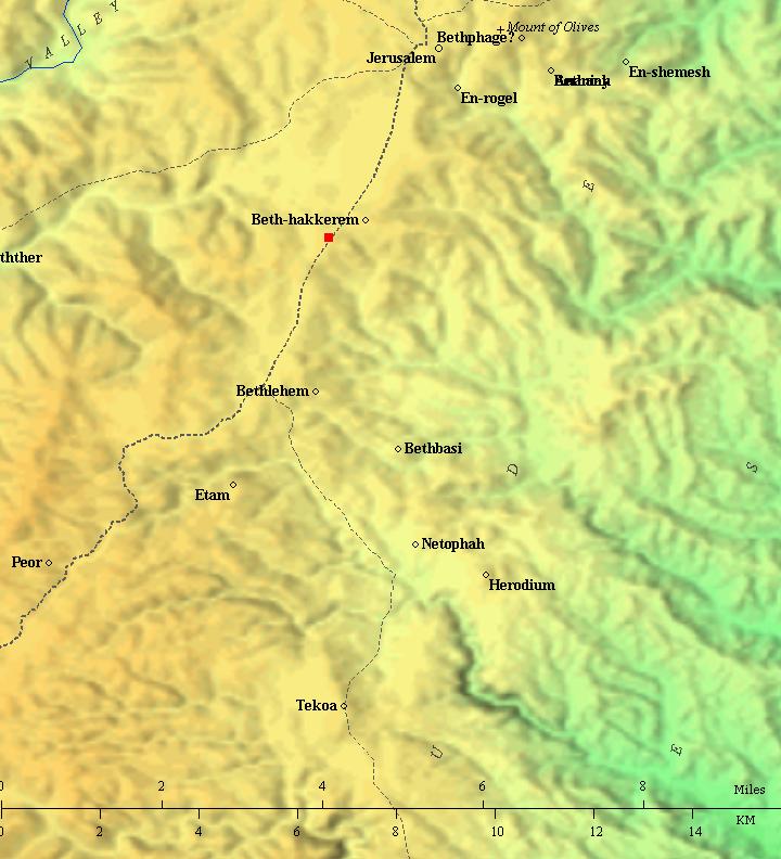
Roads and cities during the Israelite period thru the Hasmonean period, 12th- 1st century BC (based on Bible Mapper 3.0)
-
Byzantine period
Due to the holiness of this area, three monasteries were built nearby during the 5th-7th centuries: Mar Elias, east of the hill; Kathisma, north east of the hill; and Deir Tantur – 1km south west.
The monks built an underground complex on the hill, used for seclusion of hermits. A body of a hermit was discovered in one of the cells, wearing a heavy chain. The complex was later converted to a round tower that was built over it. This was discovered in the archaeological excavations held on the hill (named area ‘E’), and detailed in the article by Kogan-Zehavi, E..
On the hill was a chapel named after prophet Habakkuk, and the site was named “the field of Habakkuk”. A Christian tradition placed the hill as the location where the prophet was snatched out. According to this tradition tradition (Apocryphal book – Bel and The Dragon) Habakkuk brought food to the farmers working in the field on the hillside. An angel came down, picked up the prophet by his hair to Daniel who was in the lion-pit. After feeding Daniel the angel brought him back. This saved Daniel, and the King pulled him out of the pit. As the prophet wrote (last verse – Habakkuk 3, 19): “The lord God is my strength, and he will make my feet like hinds’ feet, and he will make me to walk upon mine high places”.
The chapel was built during the Byzantine period, but was in ruins during the middle ages, with only foundations left. The archaeologists unearthed such foundations that they dated to the 5th-6th century in area ‘G’ on the top of the hill, and considered it to be part of the monastery and church dedicated to Habakkuk.
-
Crusaders
The lands of the hill, named by the Crusaders as ‘Tyberie’, were purchased by the abbey of St. Mary on Mt. Sion from Almericus of Franclieu sometime before 1179. In the treaty of 1241 it is mentioned as ‘Tablie’.
-
Mamluke period
During this period the monastery of Habakkuk was incorporated in an Islamic settlement on the hill. Some of the residents apparently manufactured souvenirs for Christian pilgrims starting in the 14th century, a common practice in the area of Bethlehem.
-
Ottoman period
Conder and Kitchener of the Palestine Exploration Fund (PEF) surveyed the area during the Survey of Western Palestine (SWP) in 1874-75. They described a ruin on the top of the hill of Kh. Tabaliya (volume 3, pp 159-160).
“Et Tabalieh, or Beit Yunan en Neby – This ruin is near Khirbet el Khamis and the house of Count Caboq. A circular font, 22 inches in diameter, 13.5 inches deep, was found here in 1881. The sides are fluted all round.
Foundations of a building 40 yards by 30 yards, with walls 4 feet thick, also exist. The stones are well dressed, and some have a rough draft. This building seems to be of Crusading origin. There are also two rock-cut cisterns with round mouths.
Revisited 11th July, 1881.”
Their dating of the ruin to the Crusader period does not fit recent surveys, as it appears to be constructed in the Byzantine period.
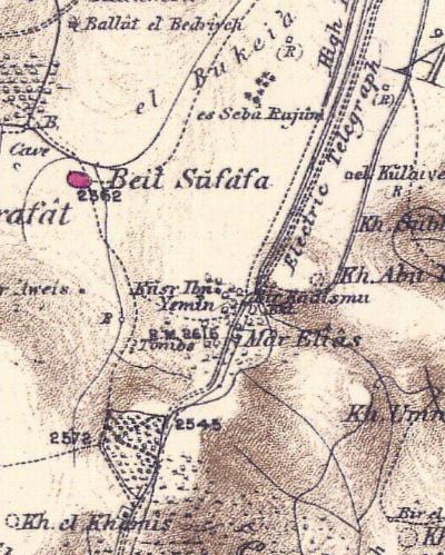
Part of map Sheets 17 of Survey of Western Palestine,
by Conder and Kitchener, 1872-1877.
(Published 1880, reprinted by LifeintheHolyLand.com)
-
Modern period
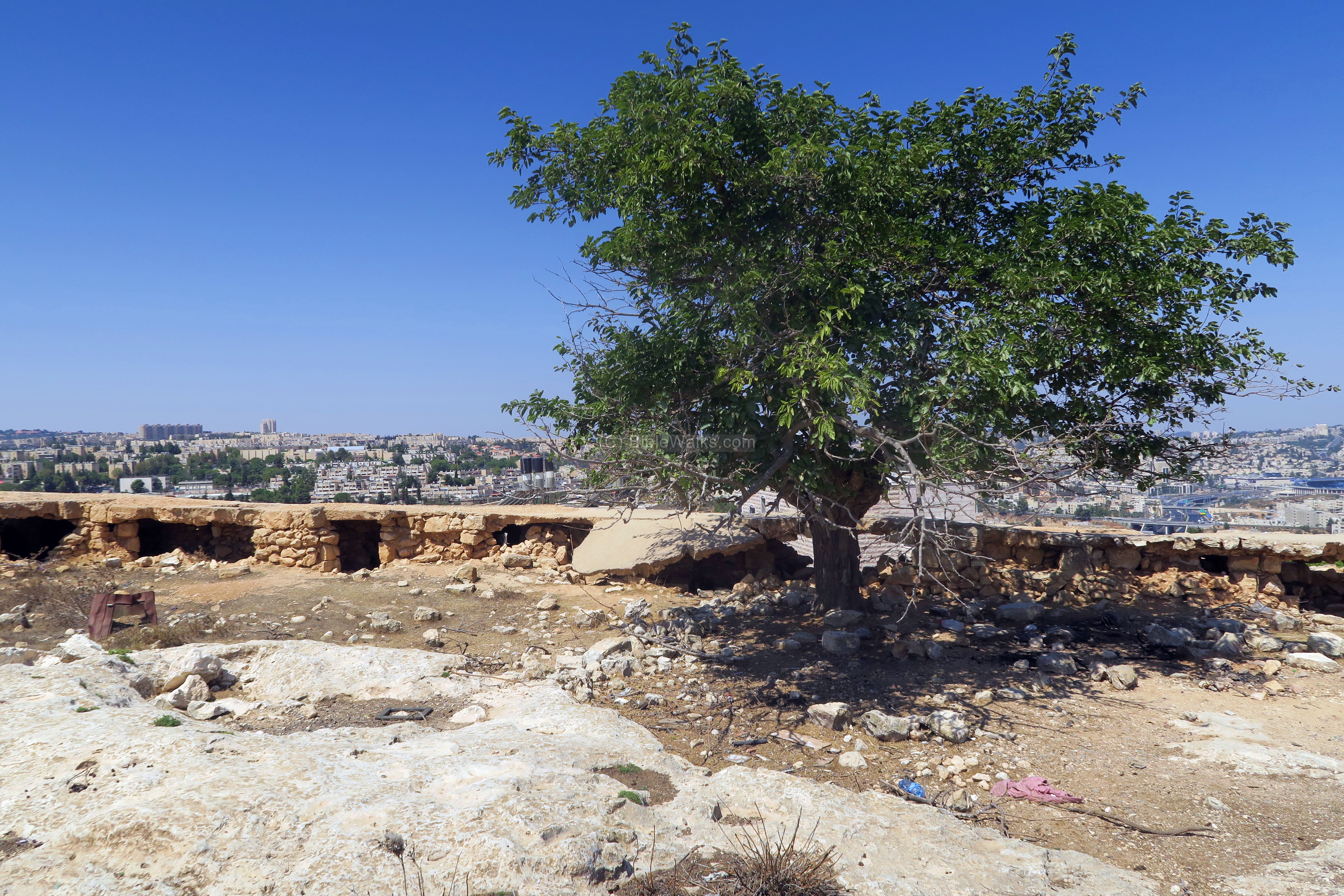
During the independence war (1948) the Egyptians held forces on this hill, and battled with the Israeli forces. Until 1967 six-day-war the Jordanians fortified the hill and installed concrete blocks on the road. The Jordanian bunkers are located on the top of the hill, overlooking south west Jerusalem. The Jordanians set up a minefield on the foothills.
During the 1967 war an Israeli jet, flied by Dan Givon, was shot down and crashed into the hill. It therefore was named the “hill of the airplane”. The area was liberated by the Israeli forces and since then is part of the greater area of Jerusalem.
In 1991 the site was excavated, as preparation for establishing a temporary housing project based on caravans for the newly arrived immigrants. The archaeologists set up 8 areas (‘A’ thru ‘H’). Area ‘G’ is on the top of the airplane hill while the other areas on the eastern foothills close to the monastery. The earliest findings were from the Iron Age (few ceramic fragments in a burial cave in area B), an early Roman period settlement (areas C and F), Byzantine period (E and G), and Mameluke period (B and G). A stone quarry with an area of 100 m2, probably used for the lime kiln, was discovered in area D near the round structure.
There are now (2018) plans to build a new neighborhood with 2,600 units on top of the hill, replacing the make shift caravan camp that was built earlier and mostly evacuated (reduced from 400 to about 30). However, due to international pressure the new building project (devised in 2014) is yet on hold.
Photos:
(a) Aerial views
An aerial view of the site was taken by a drone from the south east side. The hill is located to the east of Hebron way – the main road from Jerusalem to Bethlehem.
Click on the photos to view in higher resolution…
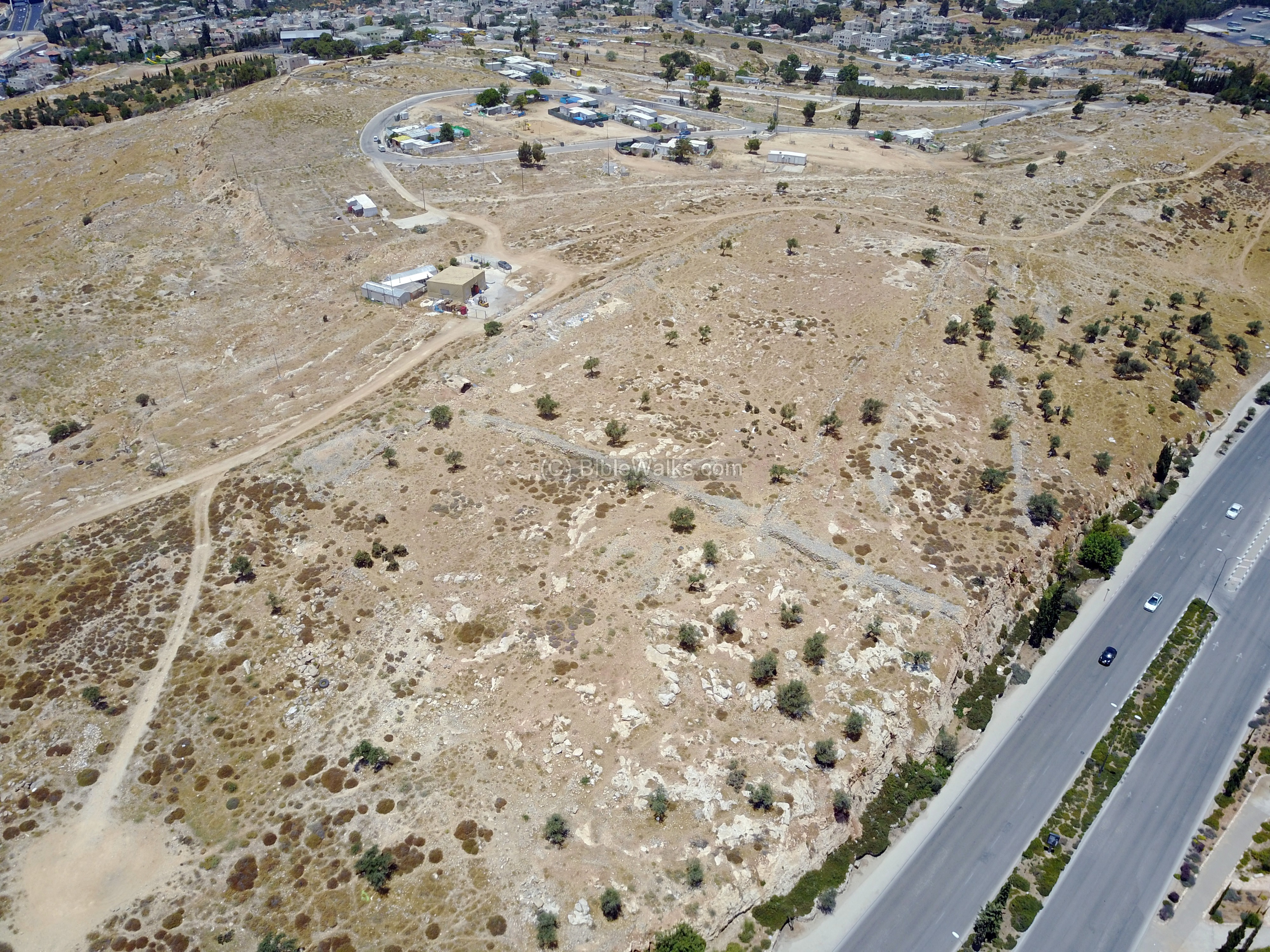
A legend of the points of interest was marked on this aerial view. Some of the findings reviewed in this page are on the eastern foothills above Hebron Way. On top of the hill are few of the caravans that once populated the hill. Near them, on the topmost section marked “kh. Tabaliya”, are remains of a large Byzantine and Mamluke structure. A section of the Roman period Upper Aqueduct crosses the hill on its western side.

(b) General views:
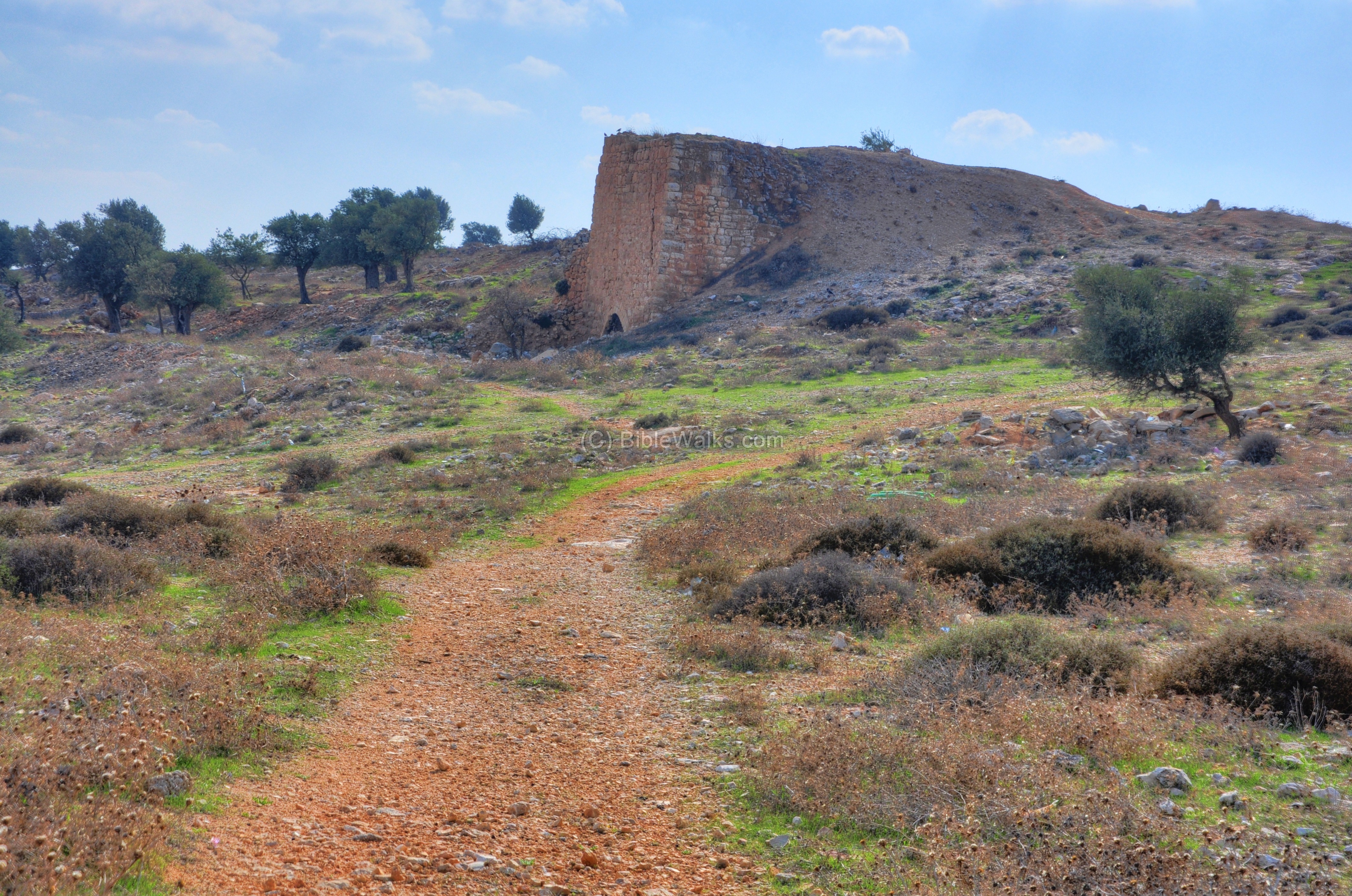
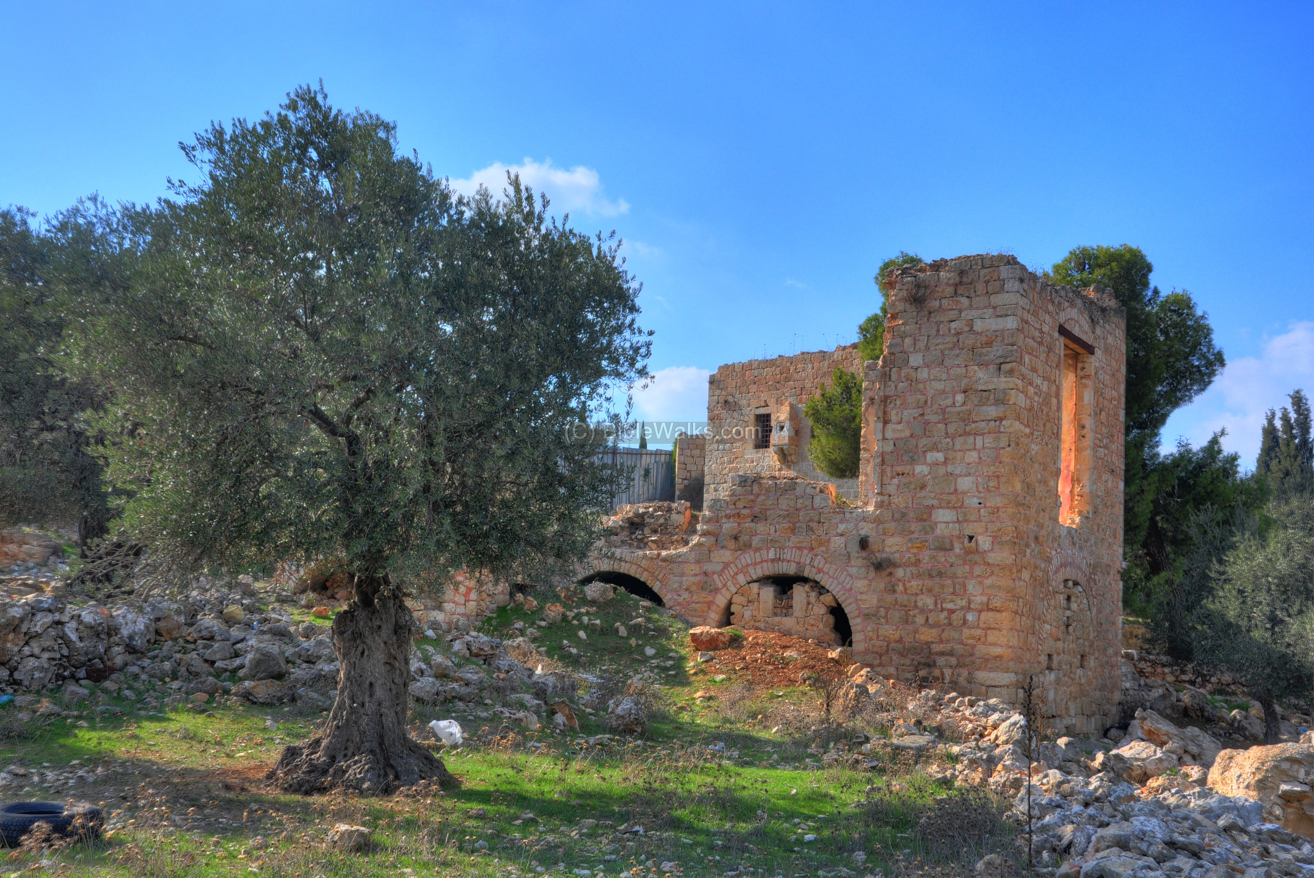
In the photo below is a view of the west hill. The main ancient structure is a lime kiln, seen here in the center.
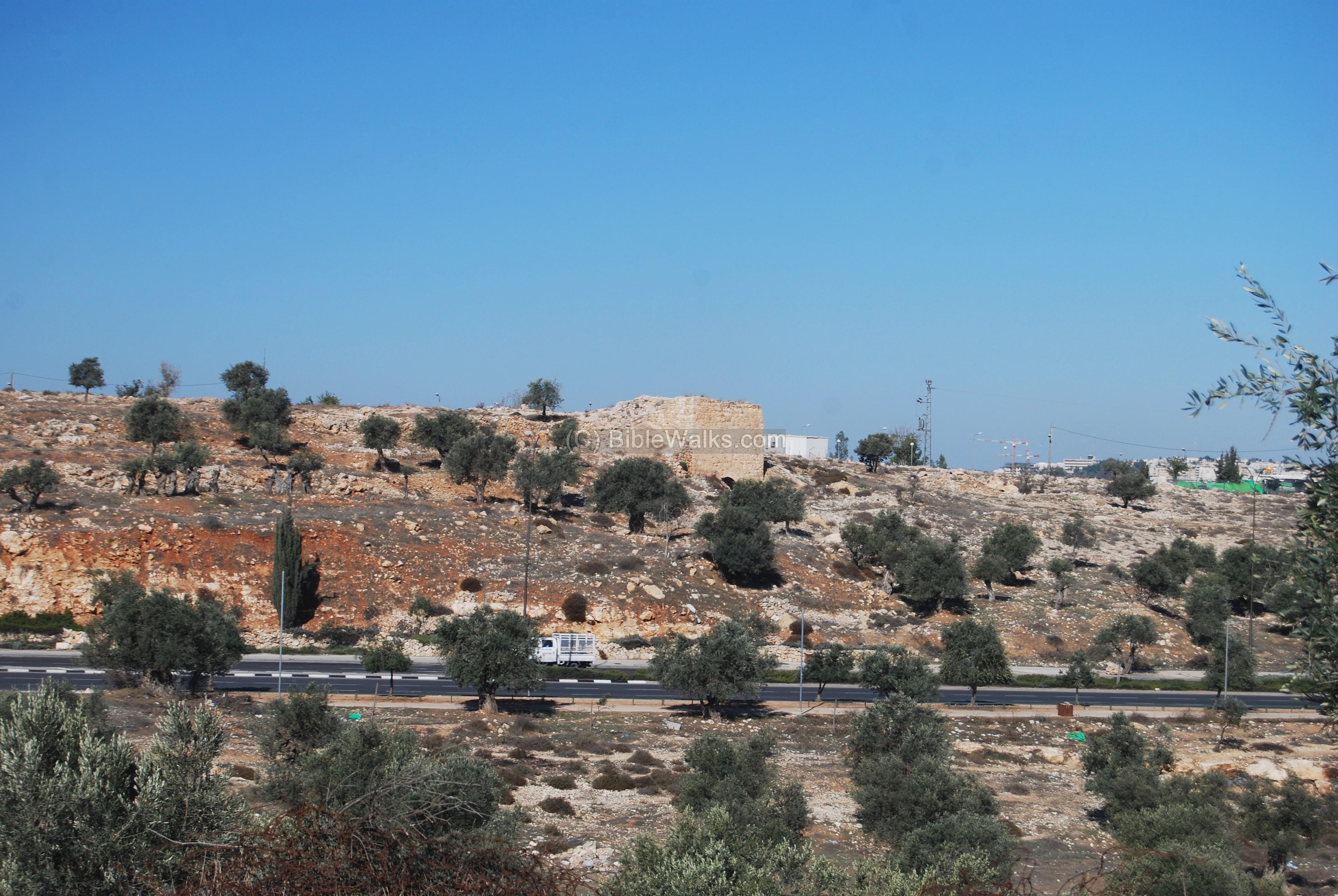
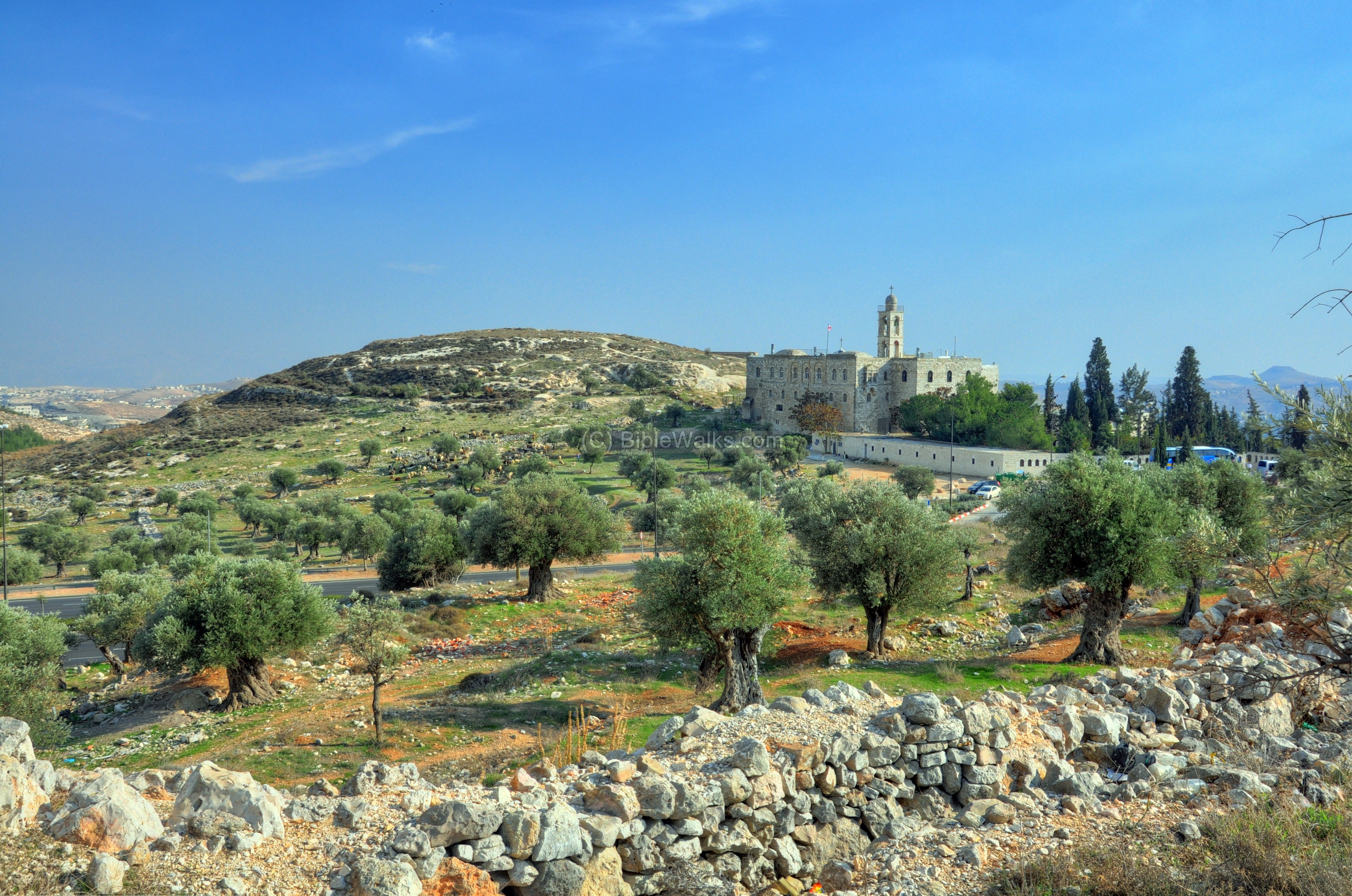
The next photo shows a view from the hill towards the monastery of Mar Elias, and the hill named “the four” (Ha’Arba’a). The main road Jerusalem-Bethlehem passes behind the olive trees.
Behind, in the far background, is a section of the Judean desert (left) and the desert fortress of Herodion (right).
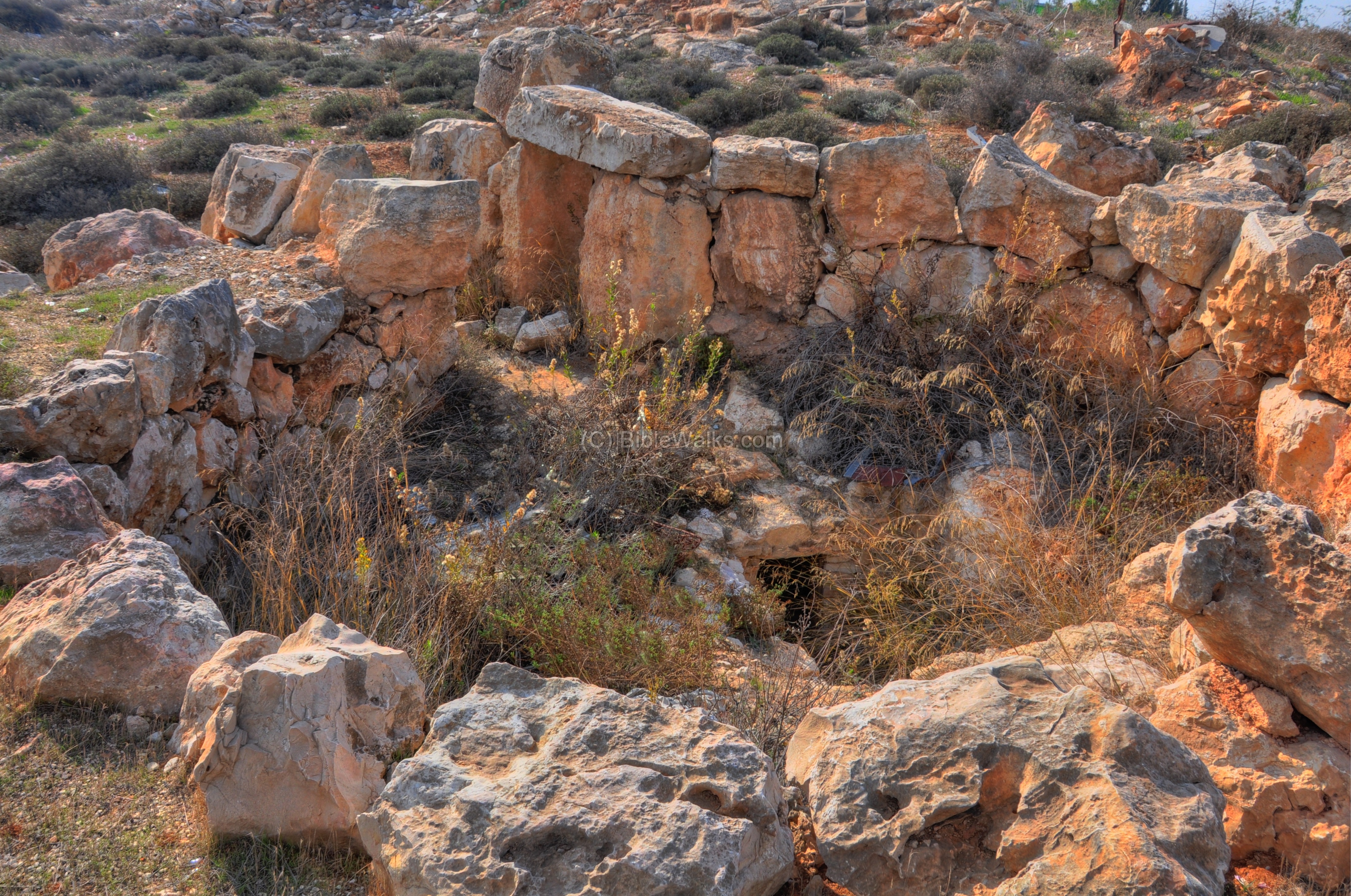
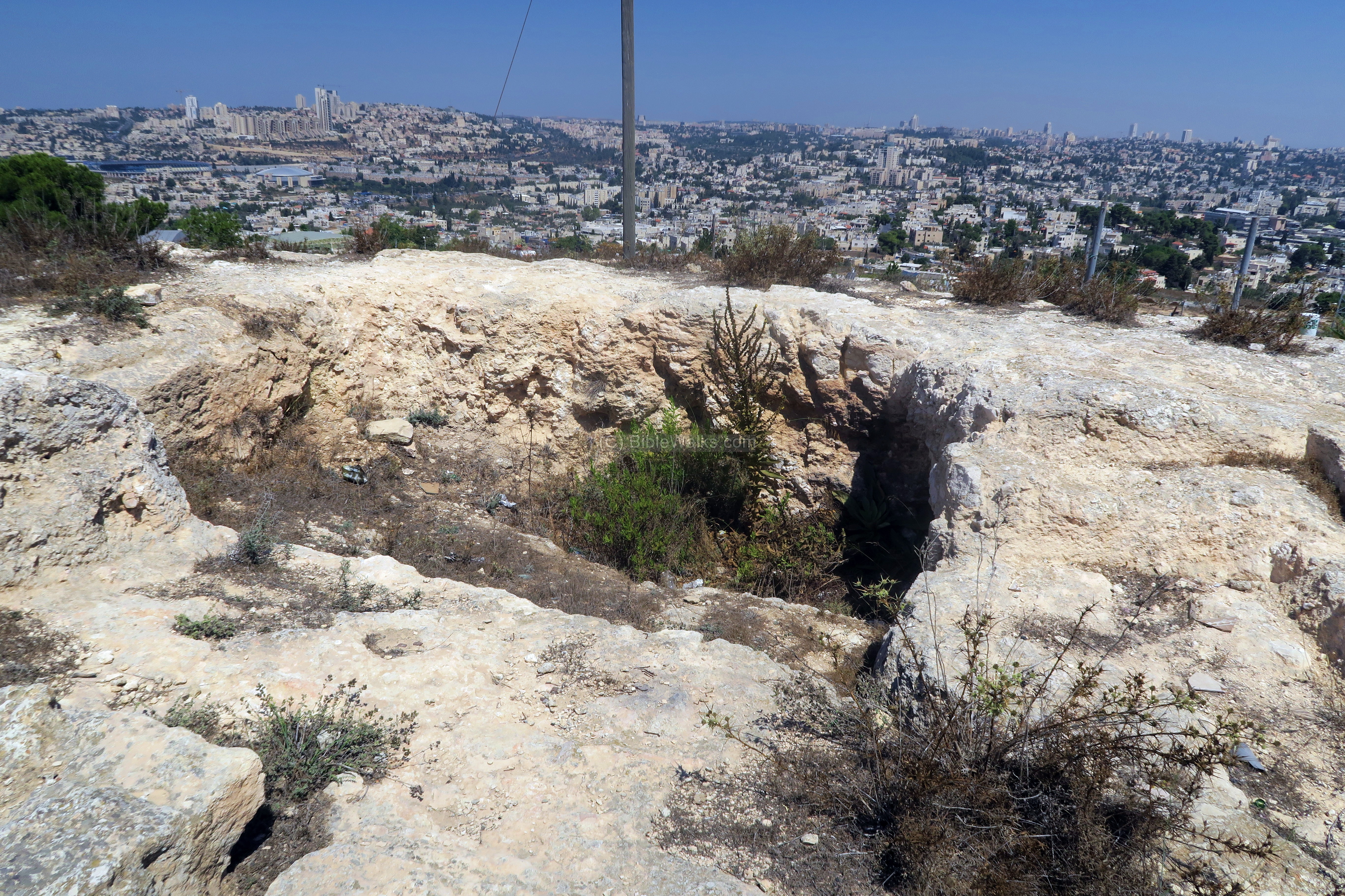
(c) Round structure:
A ruined round structure is located on the north east side of the hill. Potsherds of the Iron Age, Roman and Byzantine period were collected around the structure.
According to the excavation, it was constructed in 3 phases:
-
The first construction phase was in the Byzantine period (6th-8th century AD), when an underground complex of residential cells was cut into the rock. A skeleton and remains of a hermit were discovered in a narrow cell, wearing a heavy iron cell.
-
The second phase was the construction of a tower above the underground complex, incorporating the complex into the structure. The tower served as a memorial to a hermit who was buried in the cell.
-
The third phase was focused on increasing the height of the tower, but ignoring the underground complex. The 2 story round structure was used as a watch tower.
The round base of the tower is 9.4m in diameter, with 2 concentric walls. The parallel walls built with large stones are 1m part, and filled with fieldstones. The current height is 3 courses, but in antiquity it was considerably higher. The entrance is from the south west side, flanked by 2 monumental doorjambs of 1.5m height and 1.0m width.
The structure was built on top of an underground complex, with 2 cells and a corridor between them. Entrance to it is via a corridor under the small opening (0.65m wide x 1.2m high) seen here in the center.
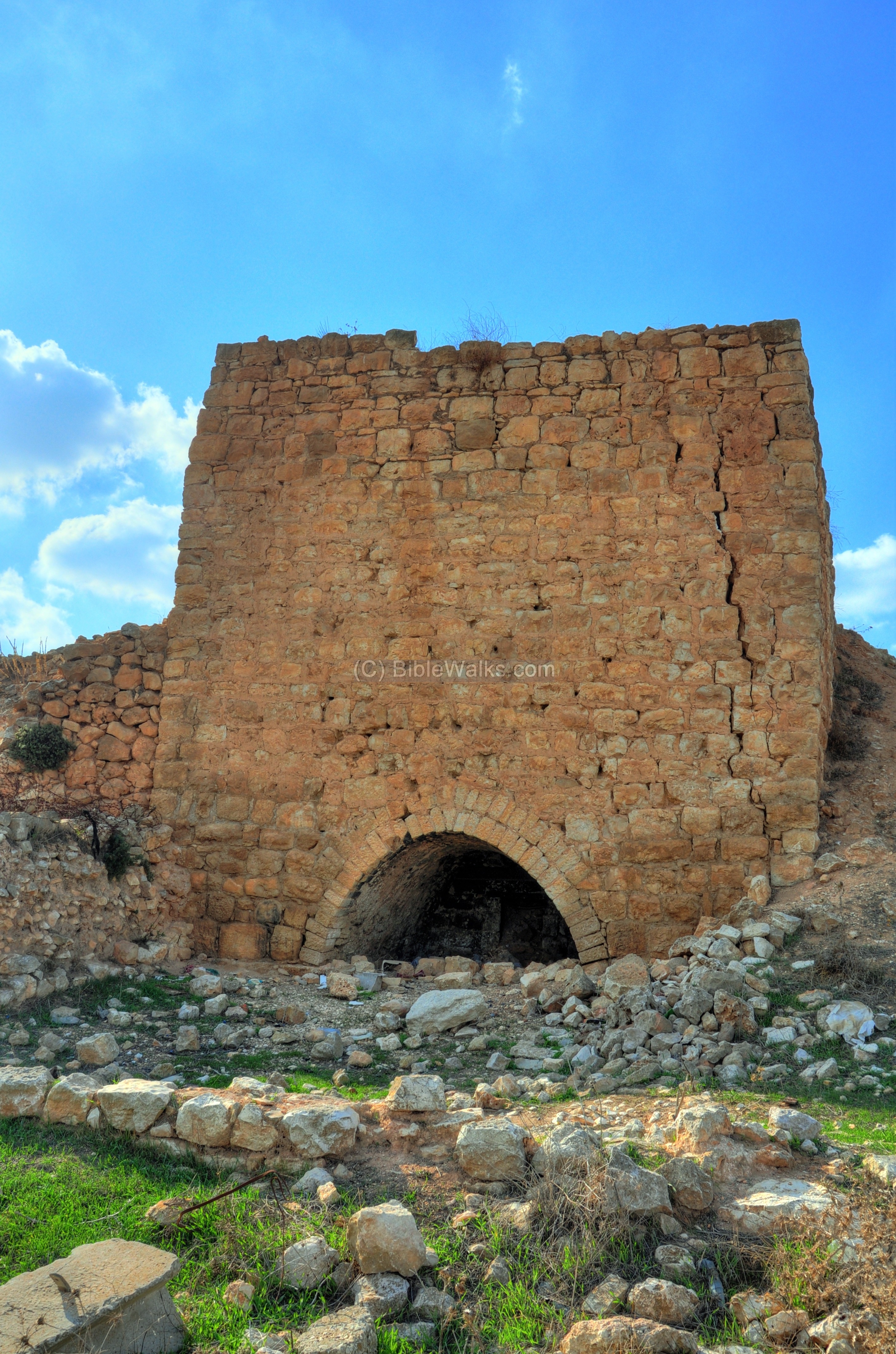
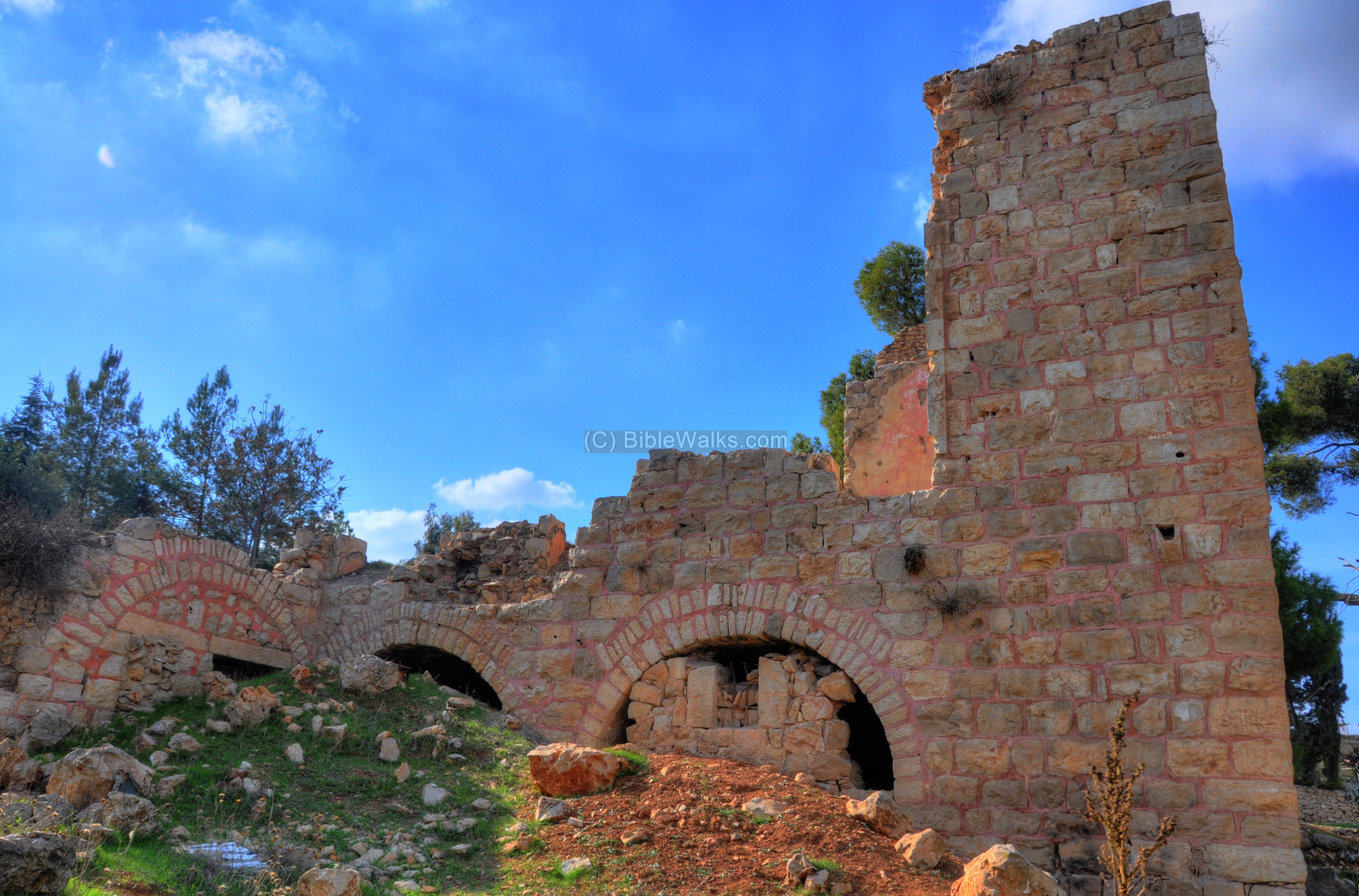
(d) Lime Kiln:
Remains of a lime kiln tower are visible from Hebron way.
The kiln was used to burn limestone in order to produce Calcium oxide (aka, quicklime or burnt lime). The lime was then used as a sealant to cover the surfaces of the cisterns, thus preserving the water in the reservoirs. It was also used as a key ingredient for making cement. Many such lime kilns are found in the Holy Land.
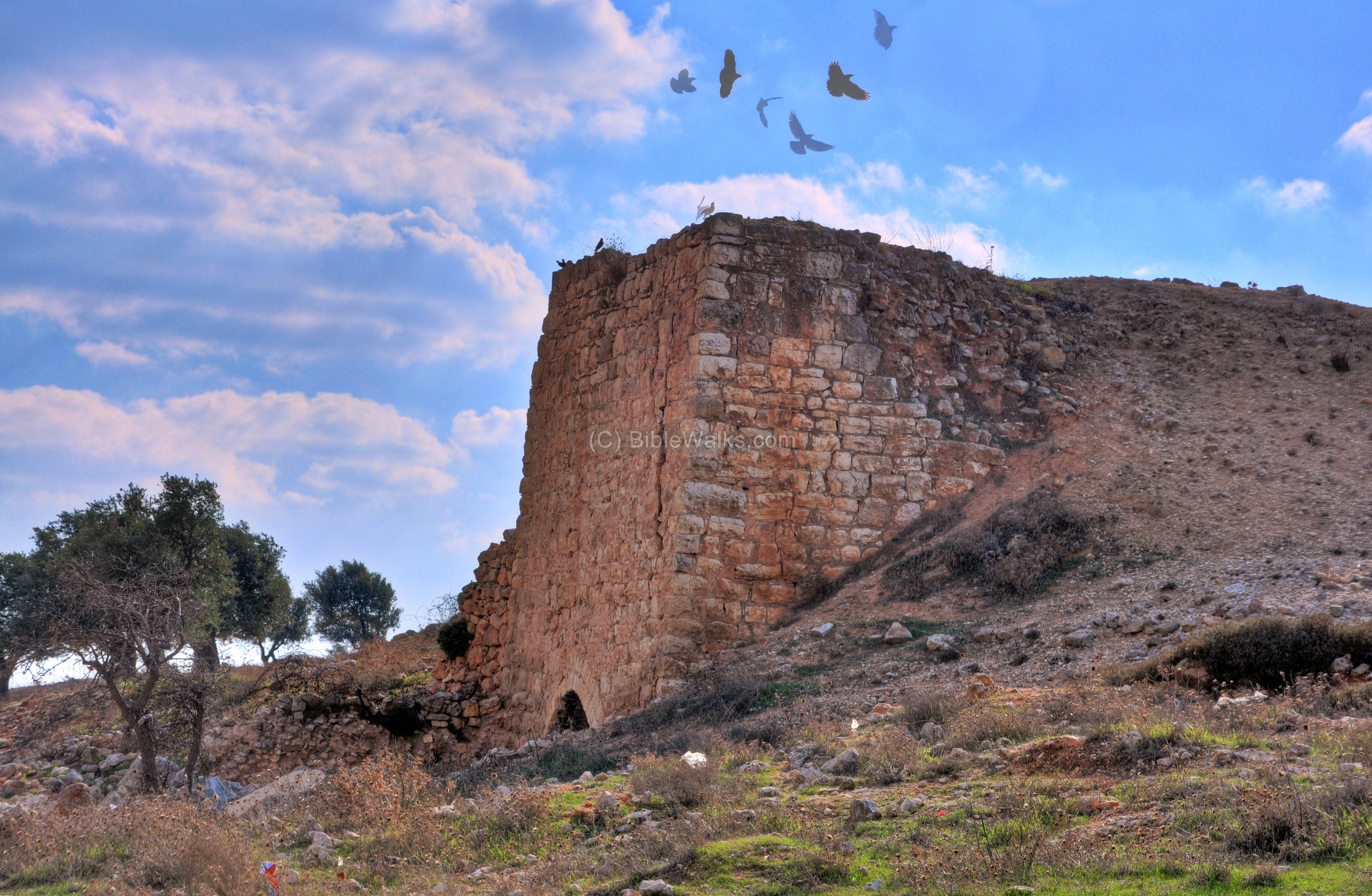
The lime kiln is dated to the end of the Ottoman period.
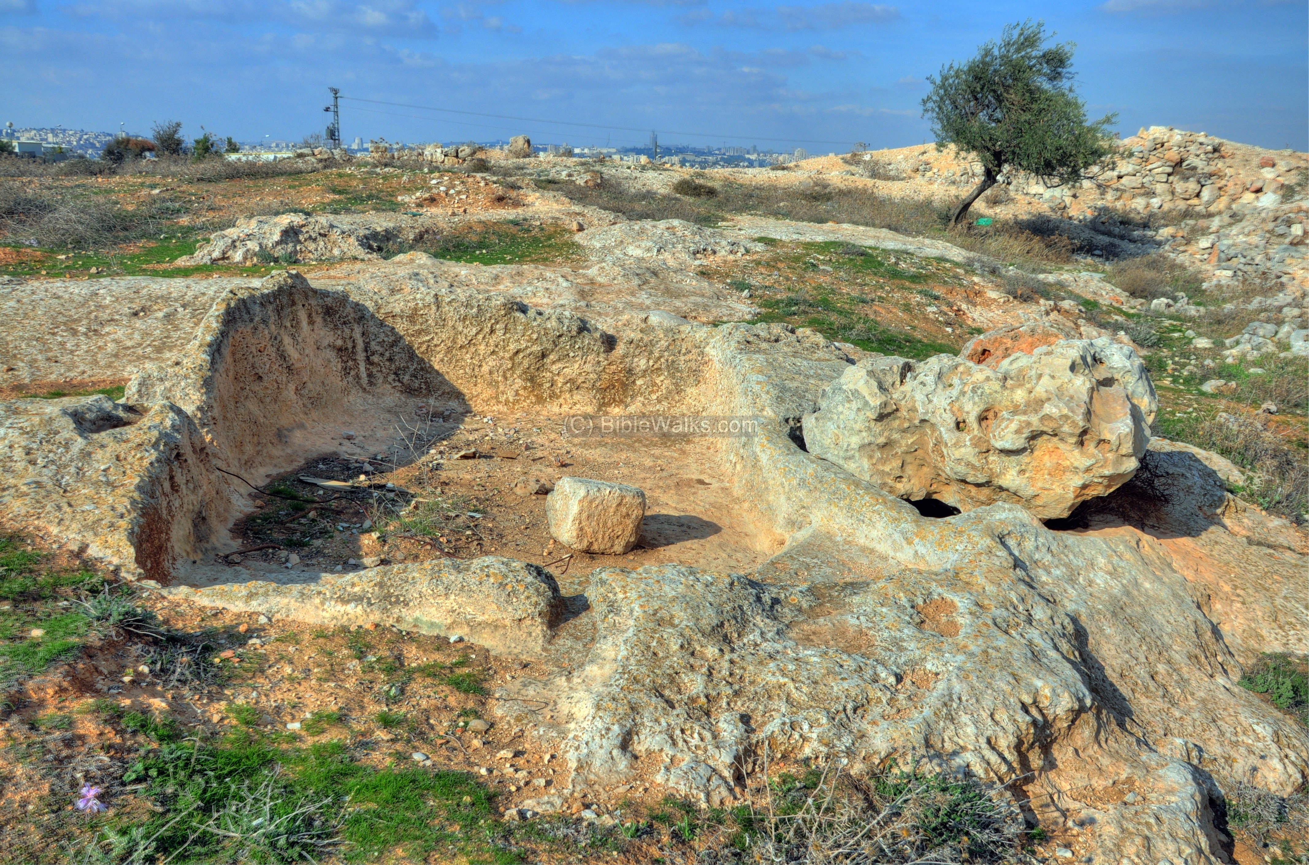
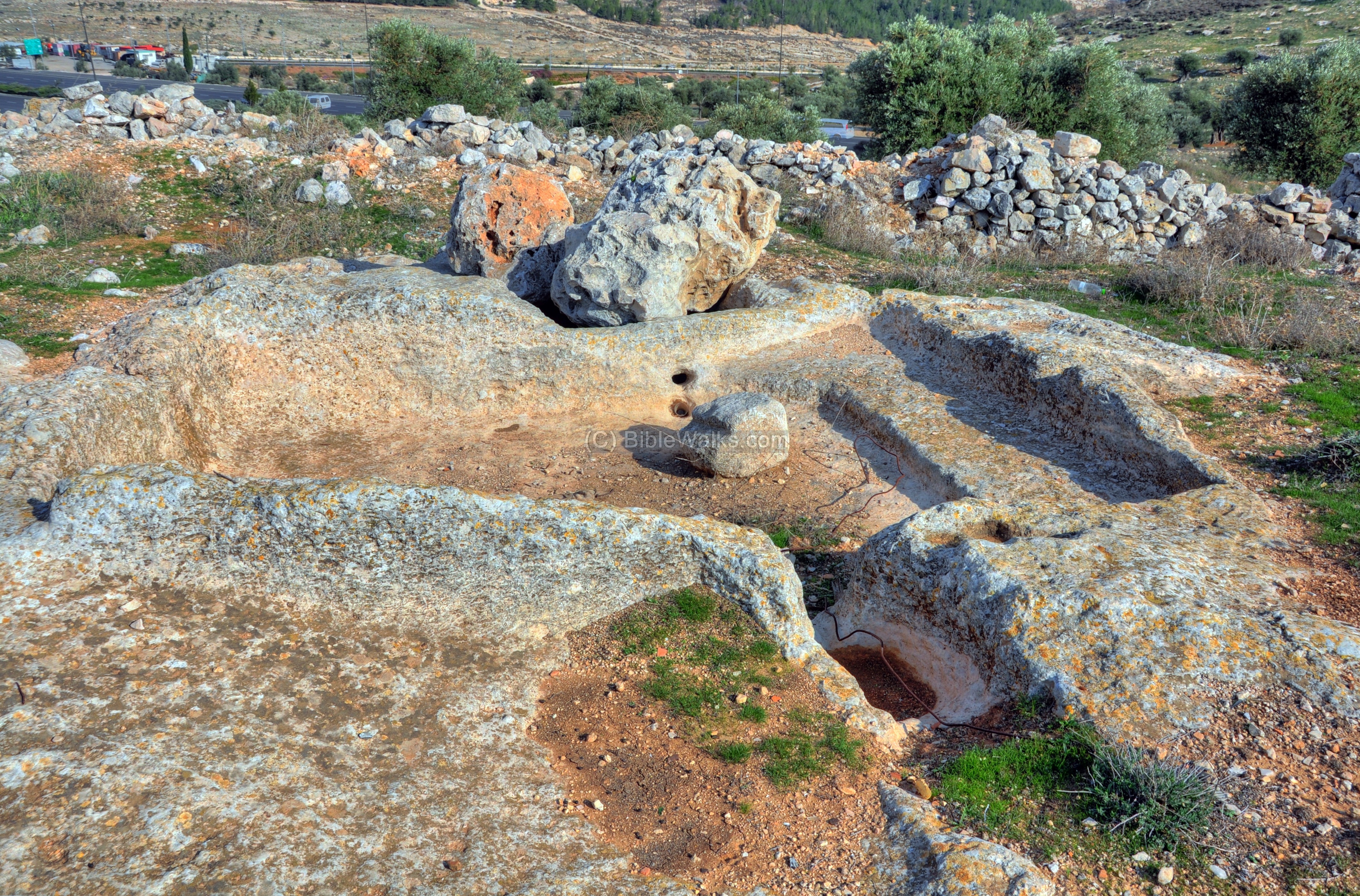
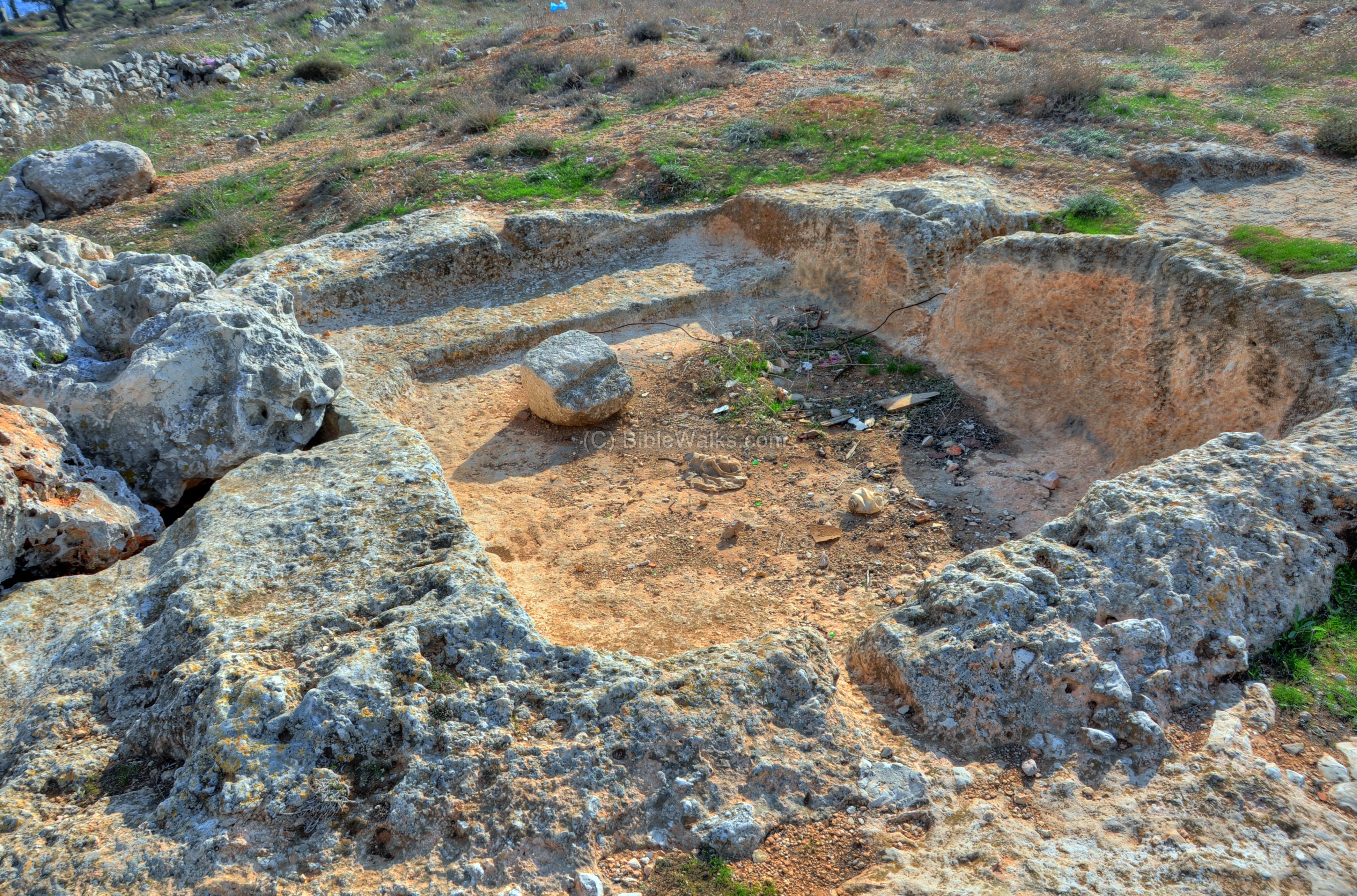
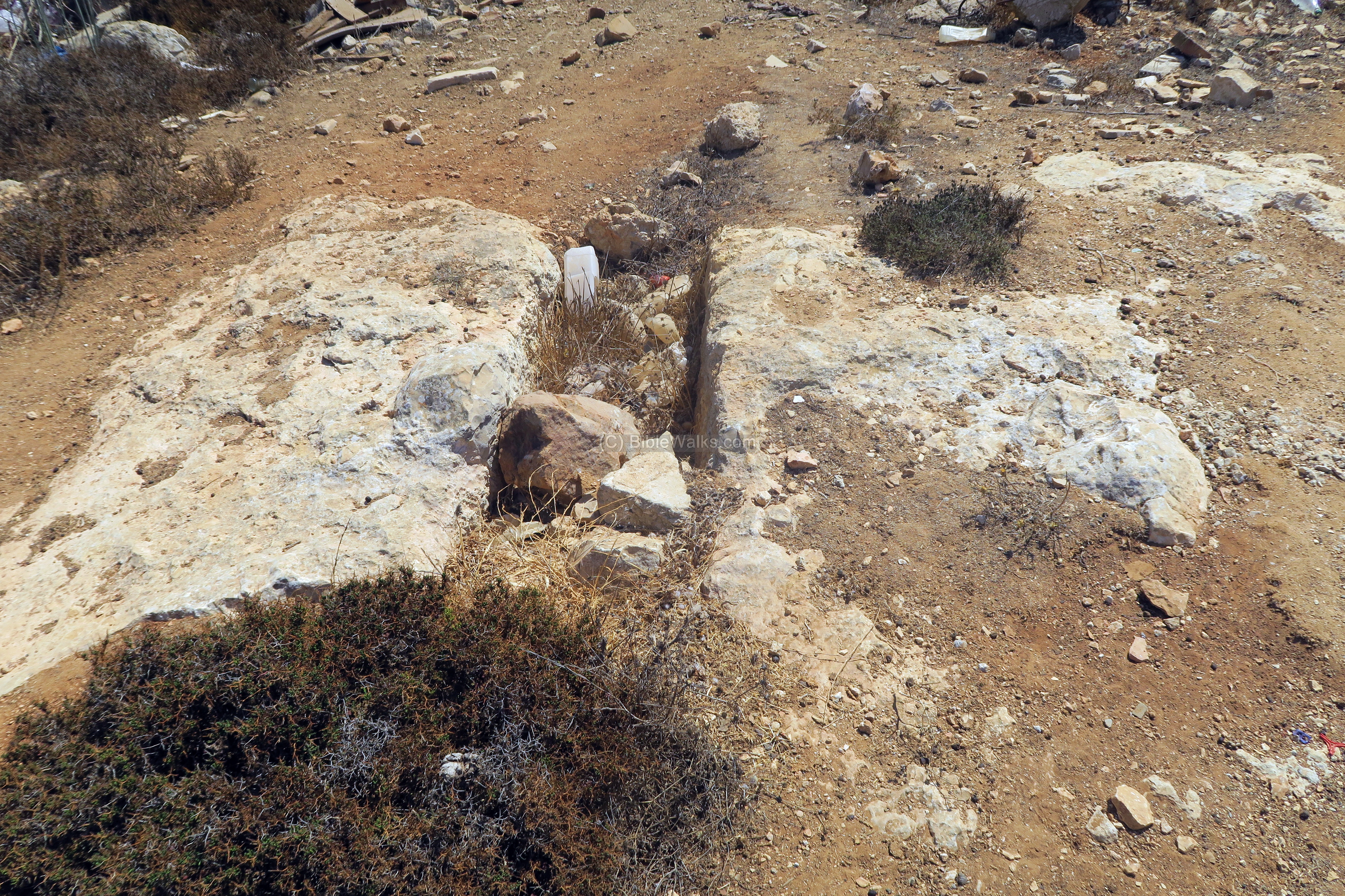
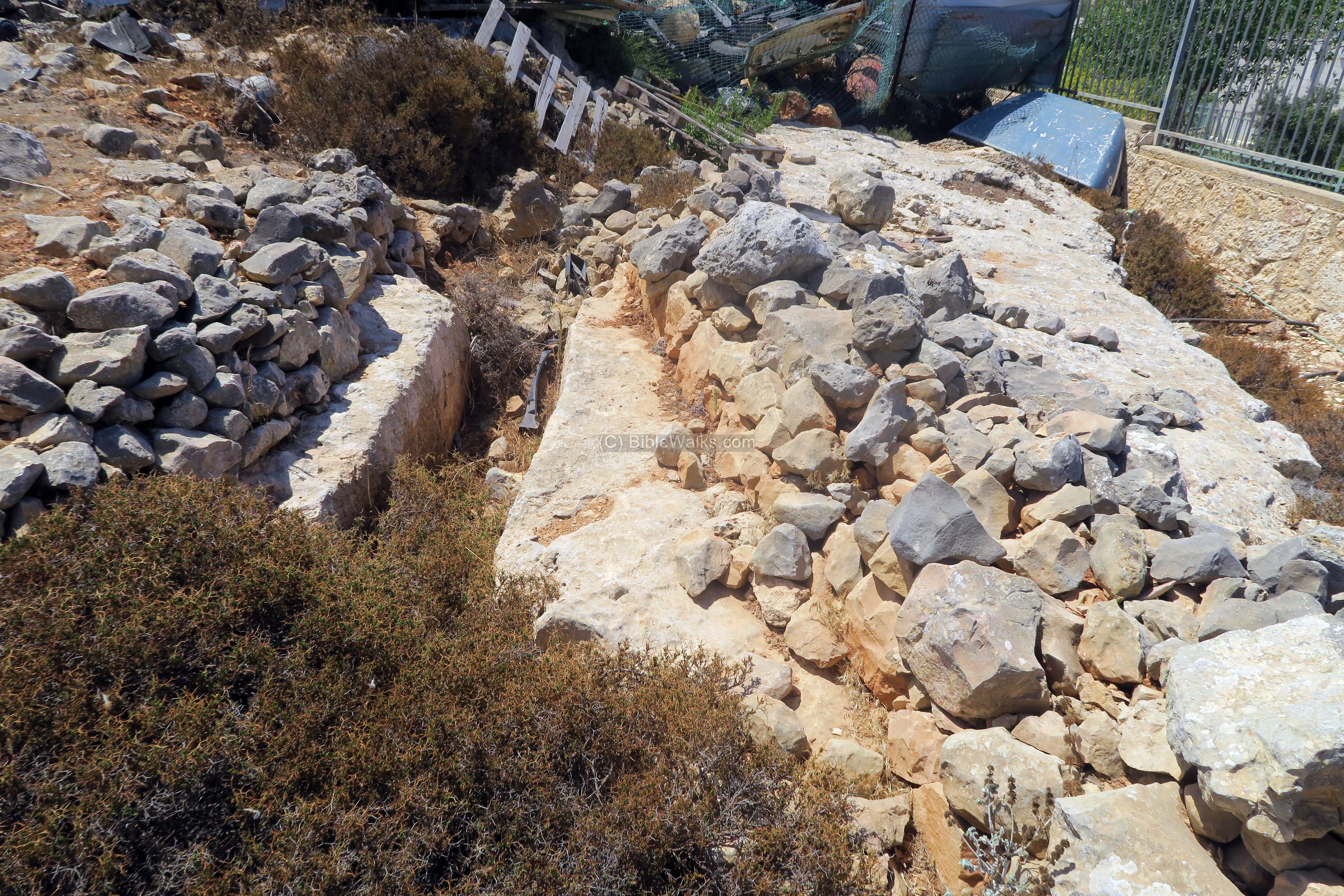
(e) Wine Press:
On the hill are rock hewn agriculture installations. An ancient winepress, seen in the following photos, is located near the lime kiln.
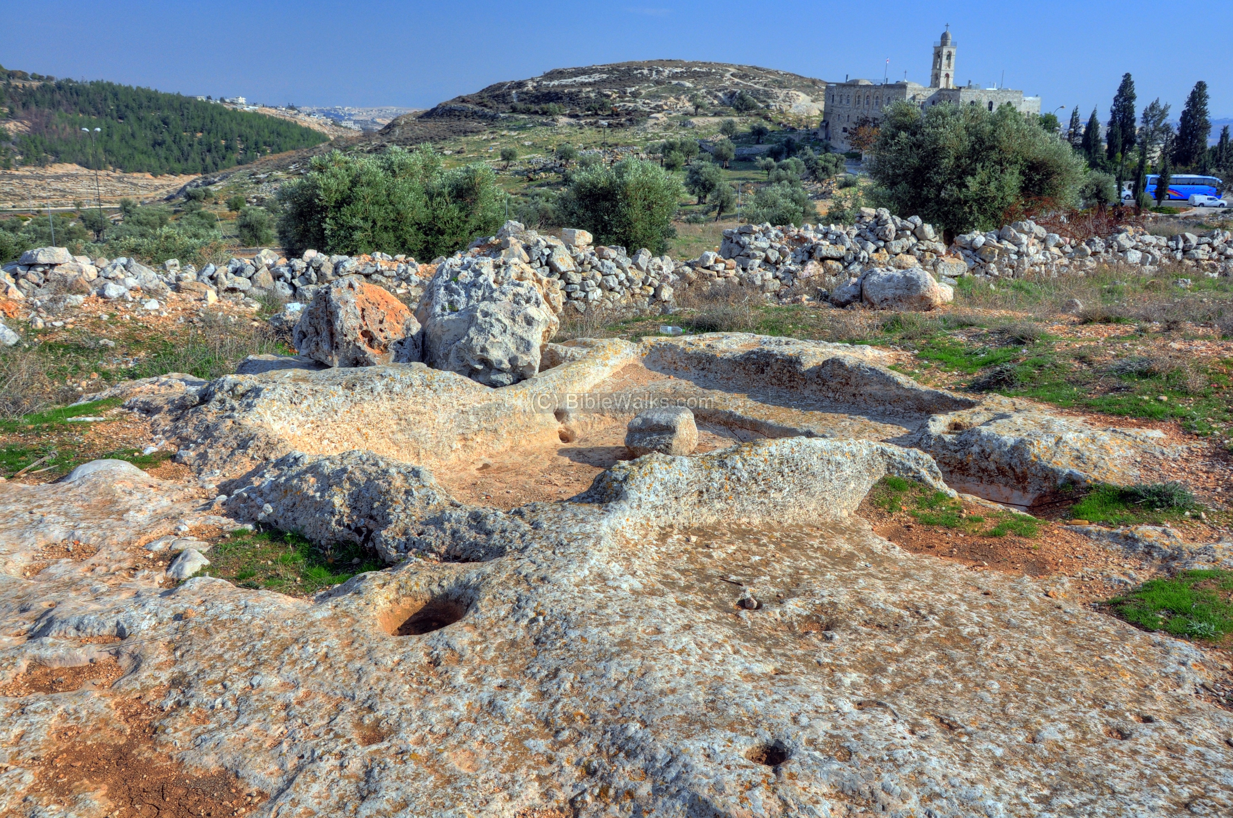
Other views of the winepress are shown here from different angles.
(f) Other scenes:
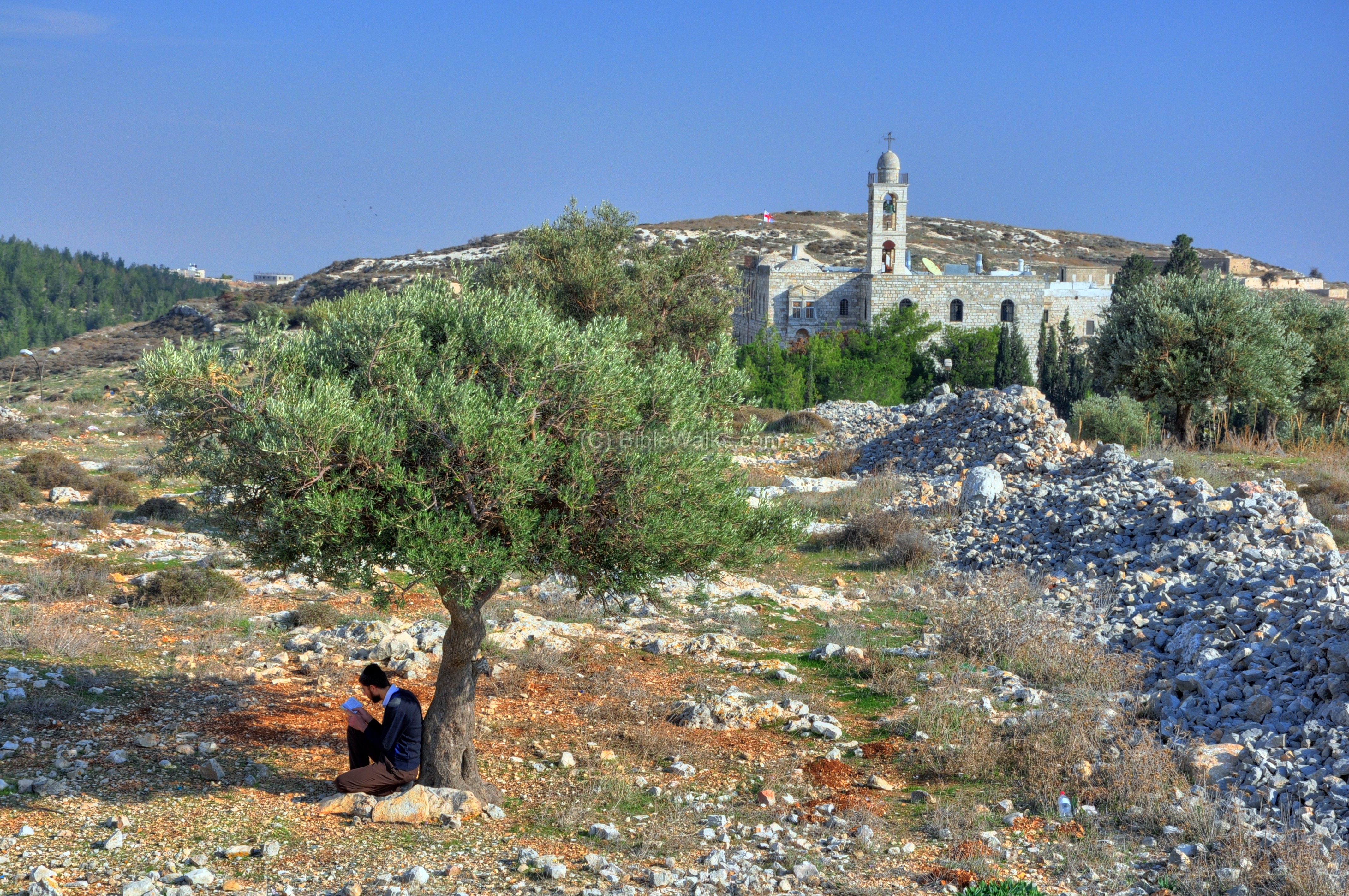
While exploring this interesting hill, we saw a person sitting under an olive tree. Behind the olive tree are the ruins of the lime kiln.
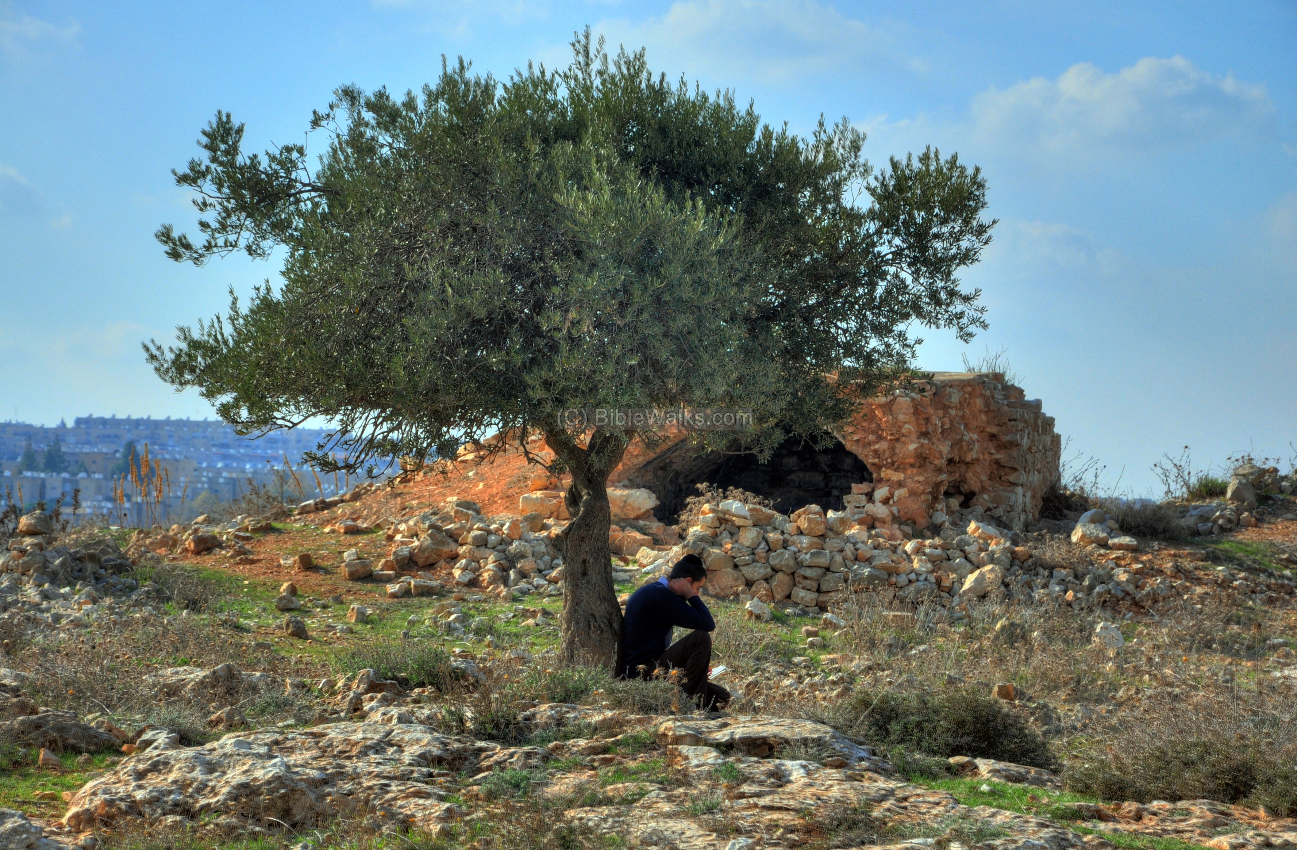
Getting closer, we find that this religious person was reading the psalms.
Behind, in the background, is the monastery of Mar Elias.
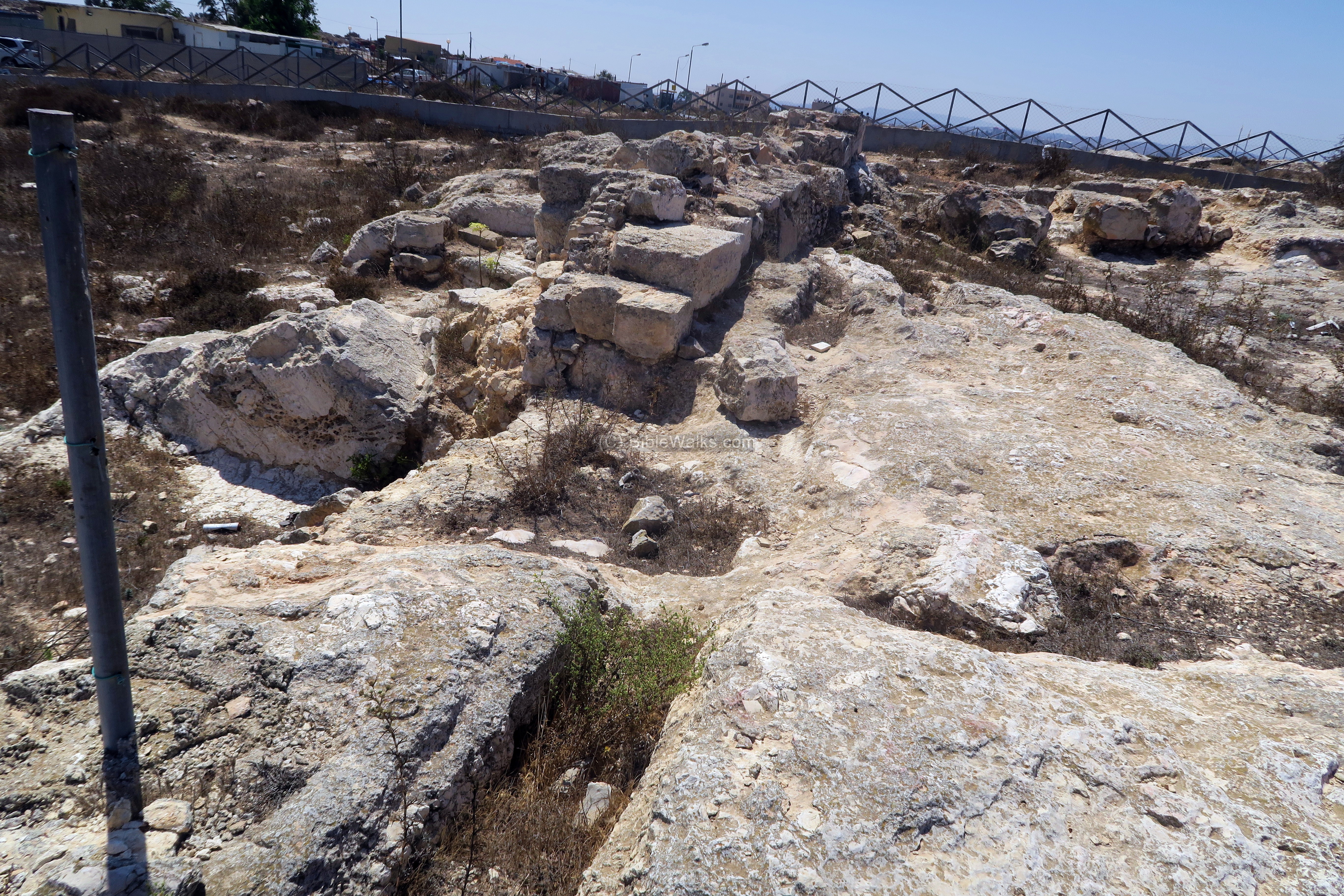
(g) Hill top:
On the hill top, on its north west side, are remains of a large Byzantine structure which was later reused during the Mameluke period. This was probably part of a Byzantine period monastery dedicated to Habakkuk.
The excavations were centered around wall ‘W4’ (numbered by the archaeologists), seen here from the western side. Around it are remains of an old quarry, and a number of cisterns and water channels. Around this place are several caravans, left over from the larger temporary housing project on top of the airplane hill. In the background is Kibbutz Ramat Rachel (right) and the modern high rise towers of Arnona in southern Jerusalem.
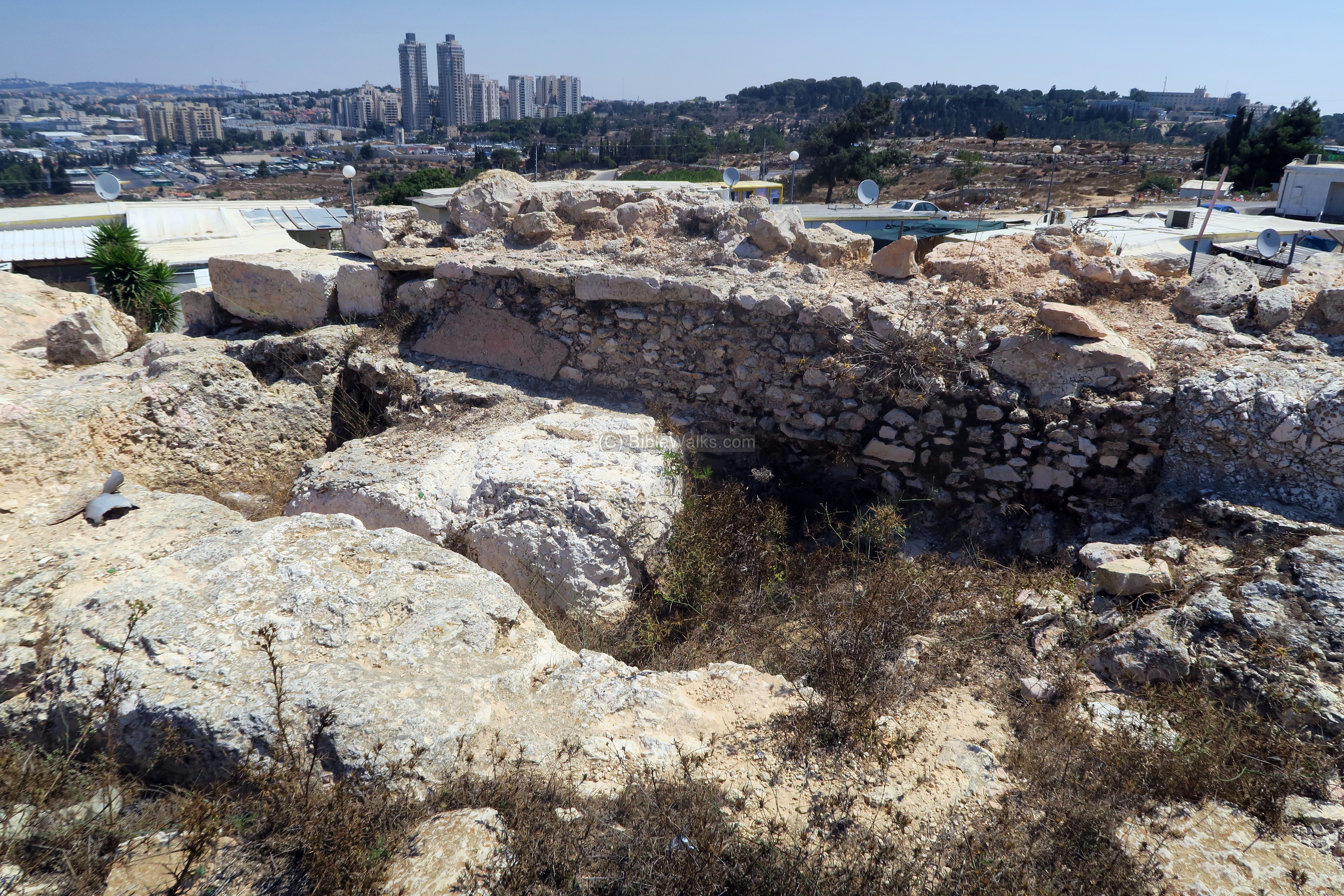
This view is on the eastern side of a large wall (‘W4’), 0.9m wide, which was the western wall of the structure. Only 9m survived from the original 25m length as reported by the PEF survey.
In the front is a surface ‘L333’ with a round cavity on its south side, probably served as some kind of installation. Under it is a cistern L334 (2.0m x 1.6m, 0.95m deep), which feeds thru a narrow channel ‘L348’ to the round mouth of cistern ‘L338’ in the back (0.82m deep, 0.9 in diameter). The water channels and cisterns used to collect the runoff rain water from the roofs, and store them for future use during the dry season. A coin dated to Leo I the Thracian, emperor of the Eastern Roman empire (457-474 AD), was found inside the cistern ‘L334’, among Byzantine and Mamluke ceramics .
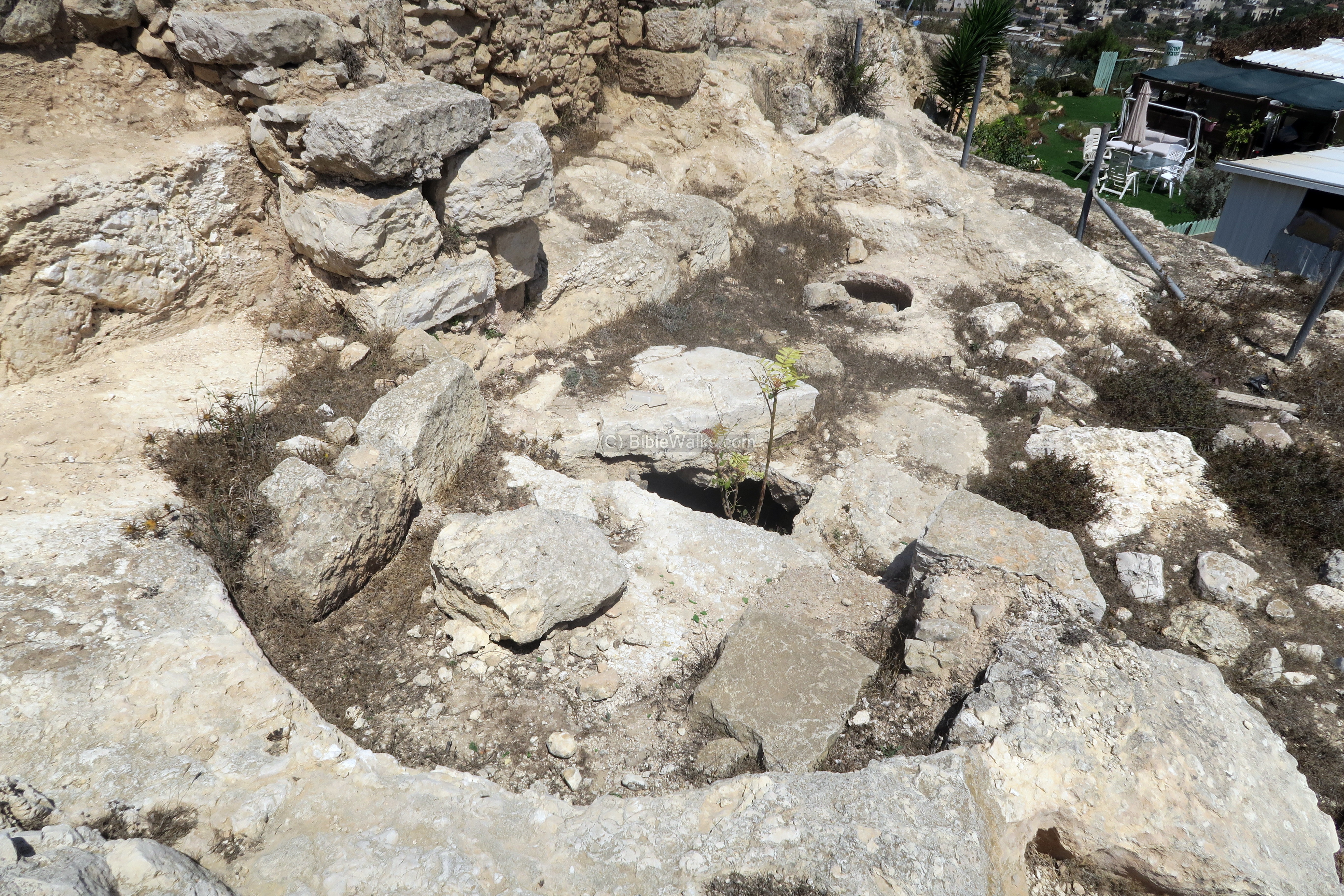
A section of two walls were revealed (‘W8’ on the south side above the edge of the round mouth, ‘W9’ on the north side above the residential yard). They were part of a 5.5m room (‘L346’).
A round installation ‘L347’ (2m diameter, 0.65m deep) was also unearthed on the east side, which may have been a stove. Ceramics fragments were dated to the Byzantine and Mameluke periods.
The next photo shows the other side of the wall. On this western side is another rock hewn water channel (‘L332a’). It is 7.5m long, width 0.3m and depth 0.5m.
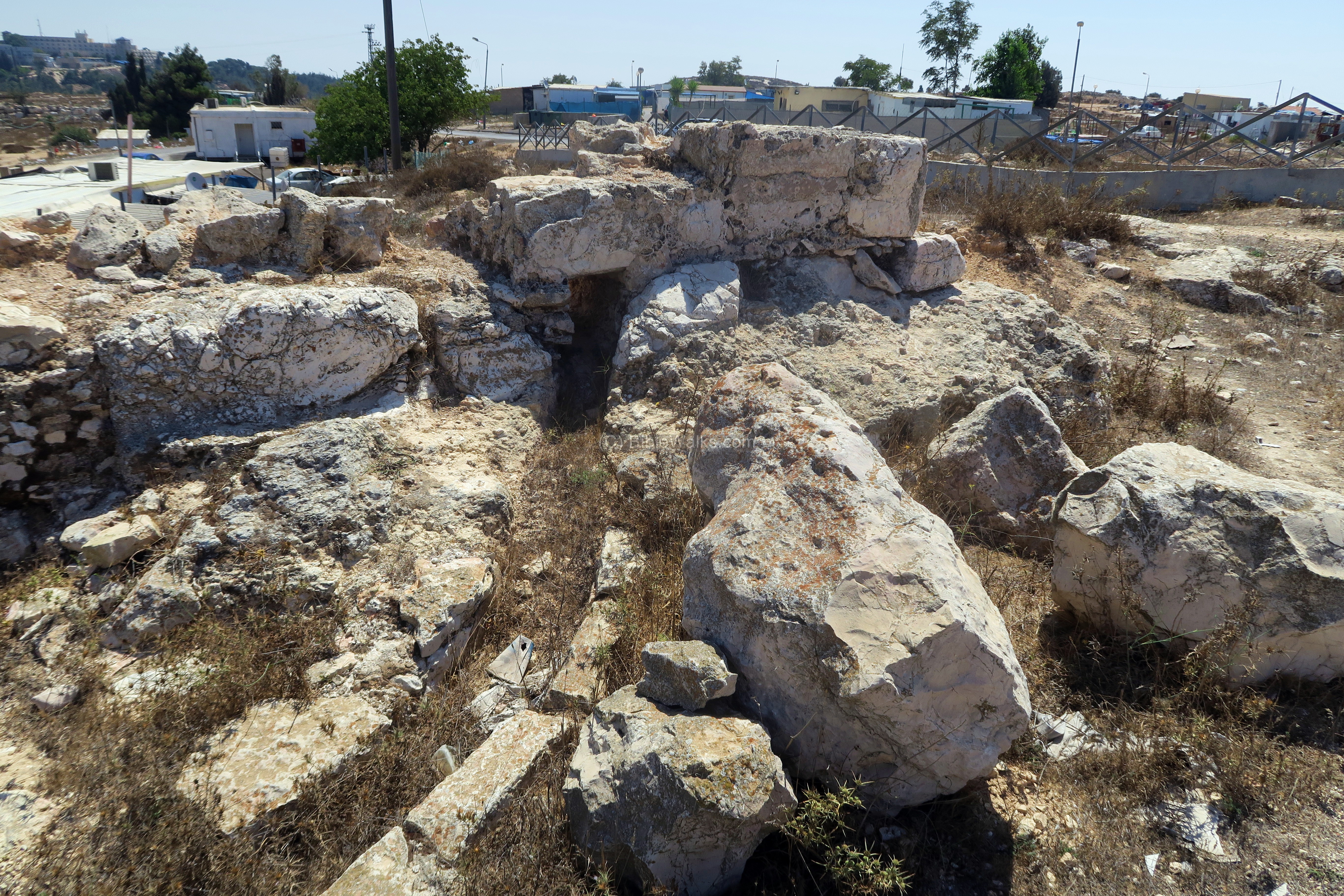
The water channel L332a feeds to the reservoir L329, dated to the Byzantine period. It is 5m x 4m and 2m deep, also cut into the rock. Inside the archaeologists discovered roof tiles, some with crosses, glassware and ceramics. The cistern was decommissioned during the Mameluke period.
The next photo shows another view from the north west. South of the wall are remains of a mosaic floor, composed of 1×1 cm white stones.
Facing west are remains of a Jordanian bunker. It overlooks the south west neighborhoods of Jerusalem.
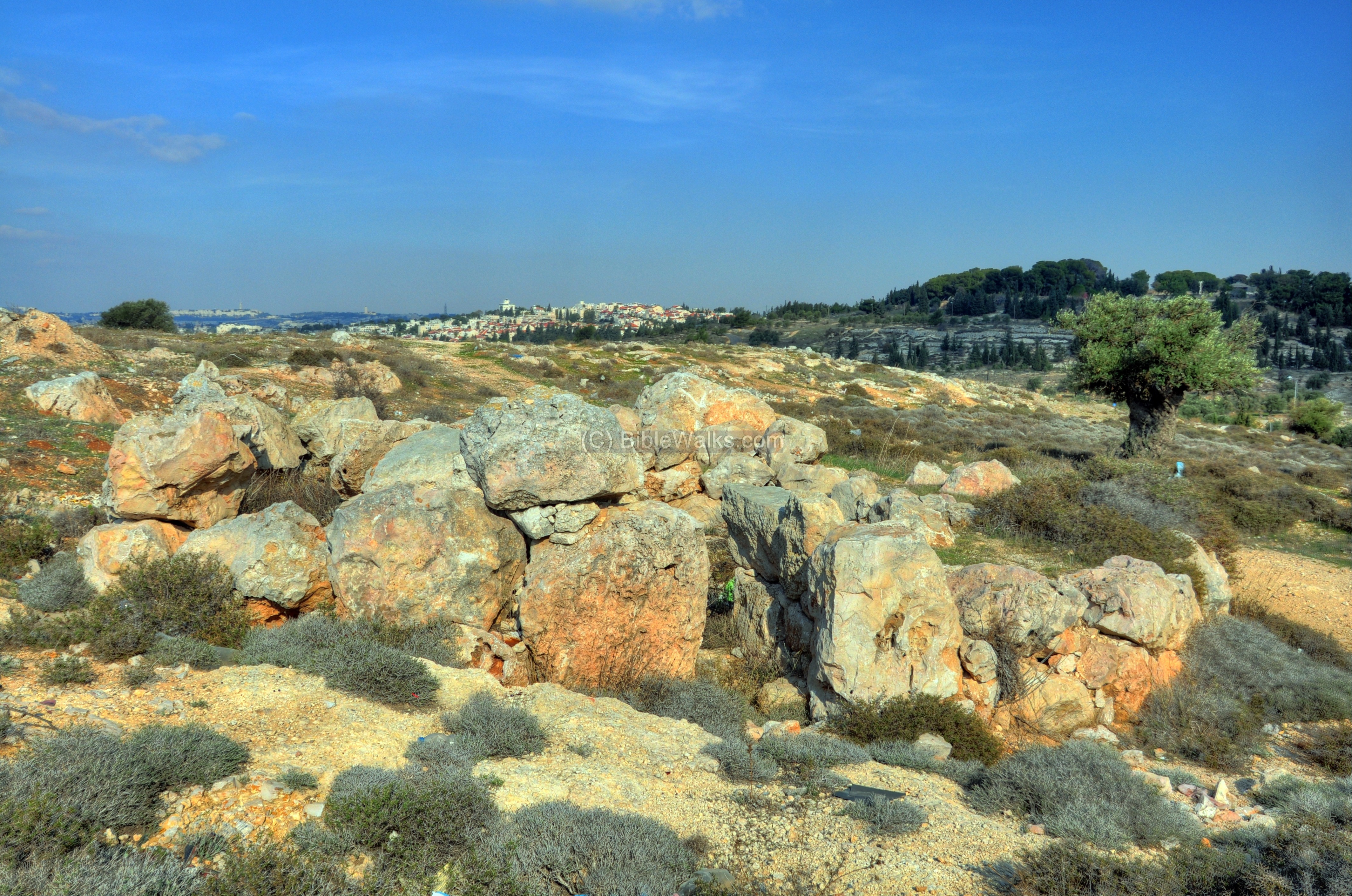
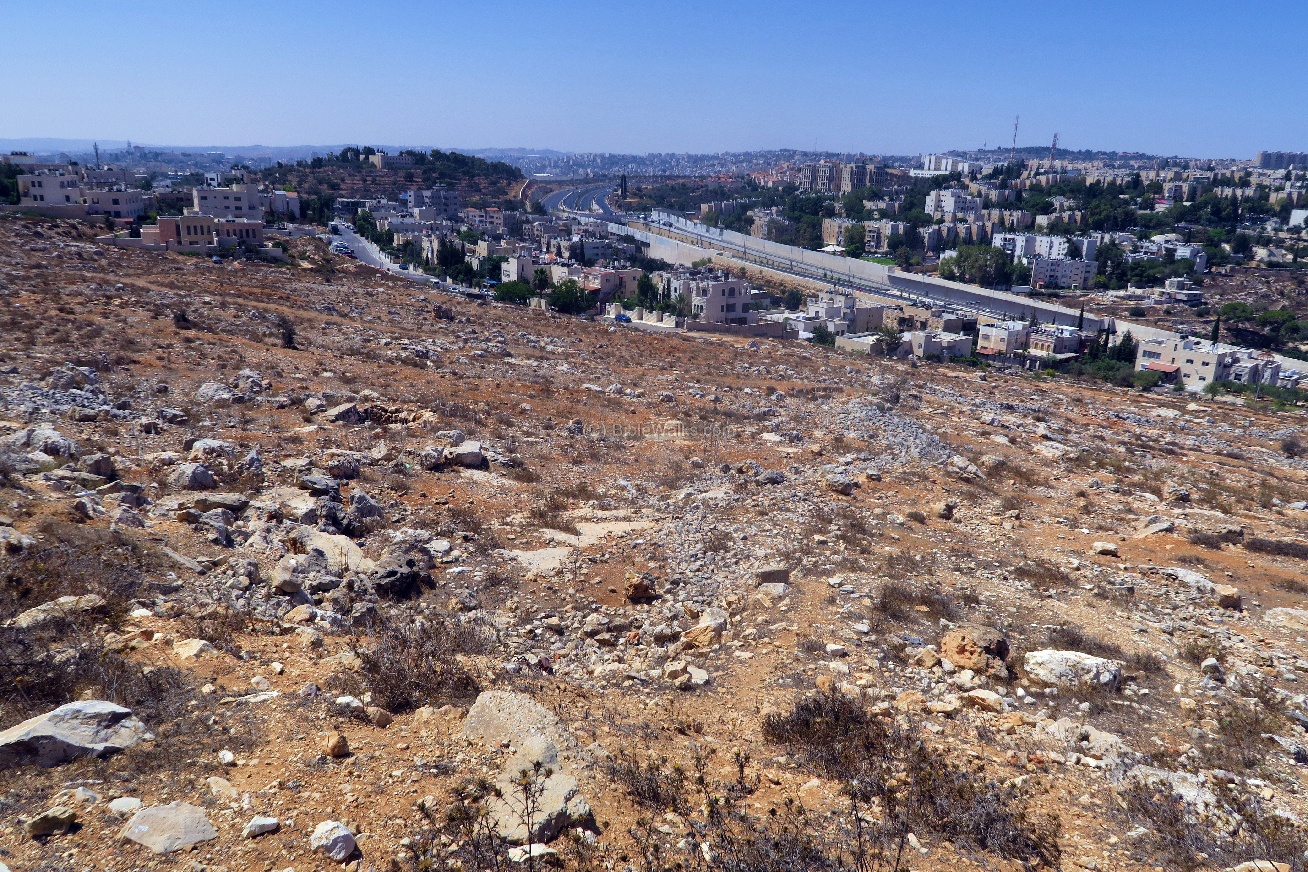
The foothills on the south western side of Airplane hill are seen in the following photo, with the Giloh neighborhood in the background, and highway 60 that crosses Samaria and Judea from North to South.
(g) Upper Aqueduct:
During the end of the 1st century, Herod the Great planned to increase the water supply to Jerusalem which was growing in size. Pontius Pilatus, Judea’s prefect (26/27 thru 36/37 AD), increased the water supply to the reservoirs (“Solomon’s’ Pools”) by diverting the Arroub spring waters. As Josephus wrote (Antiquities 18 3:2) “But Pilate undertook to bring a current of water to Jerusalem, and did it with the sacred money, and derived the origin of the stream from the distance of two hundred furlongs”.
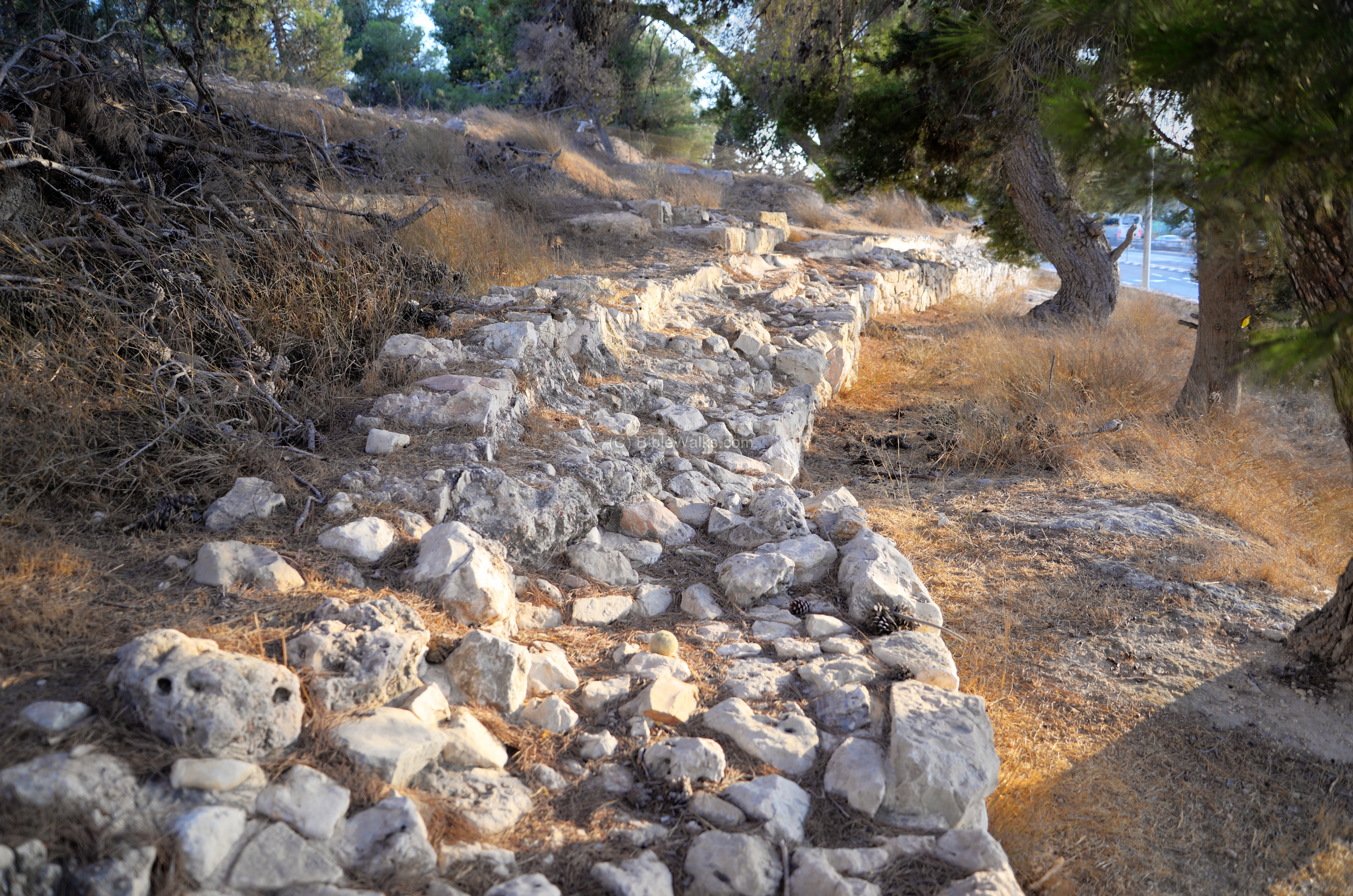
Later, the 10th Legion constructed a second aqueduct – named the “Upper Aqueduct” – in addition to the Hasmonean period “Lower aqueduct” that crosses the hill east of Mar Elias. The Biar spring, another source of the pools near Efrat, was collected into a higher pool. This enabled to increase the height of the aqueduct, make the plan straighter, and cut the total length by half.
The 13 km long aqueduct started from the ‘Solomon’s pools’, where it received waters from the Arroub and Biar springs. It conveyed the water to the old city near Herod’s palace. Its engineering was more sophisticated, using a different shorter and straighter route.
A section of the Roman period Upper Aqueduct curves around the airplane hill on its western side, at the height of 775.59m. At this point is flowed in a narrow cut into the rock.
The U shaped channel is narrow (0.3m) and shallow (0.2-0.6m deep). It was plastered with 2 layers.
Unfortunately, only a small section (68m) remained here at the north west side of the hill. Since its discovery most of that section was covered, as seen in this photo.
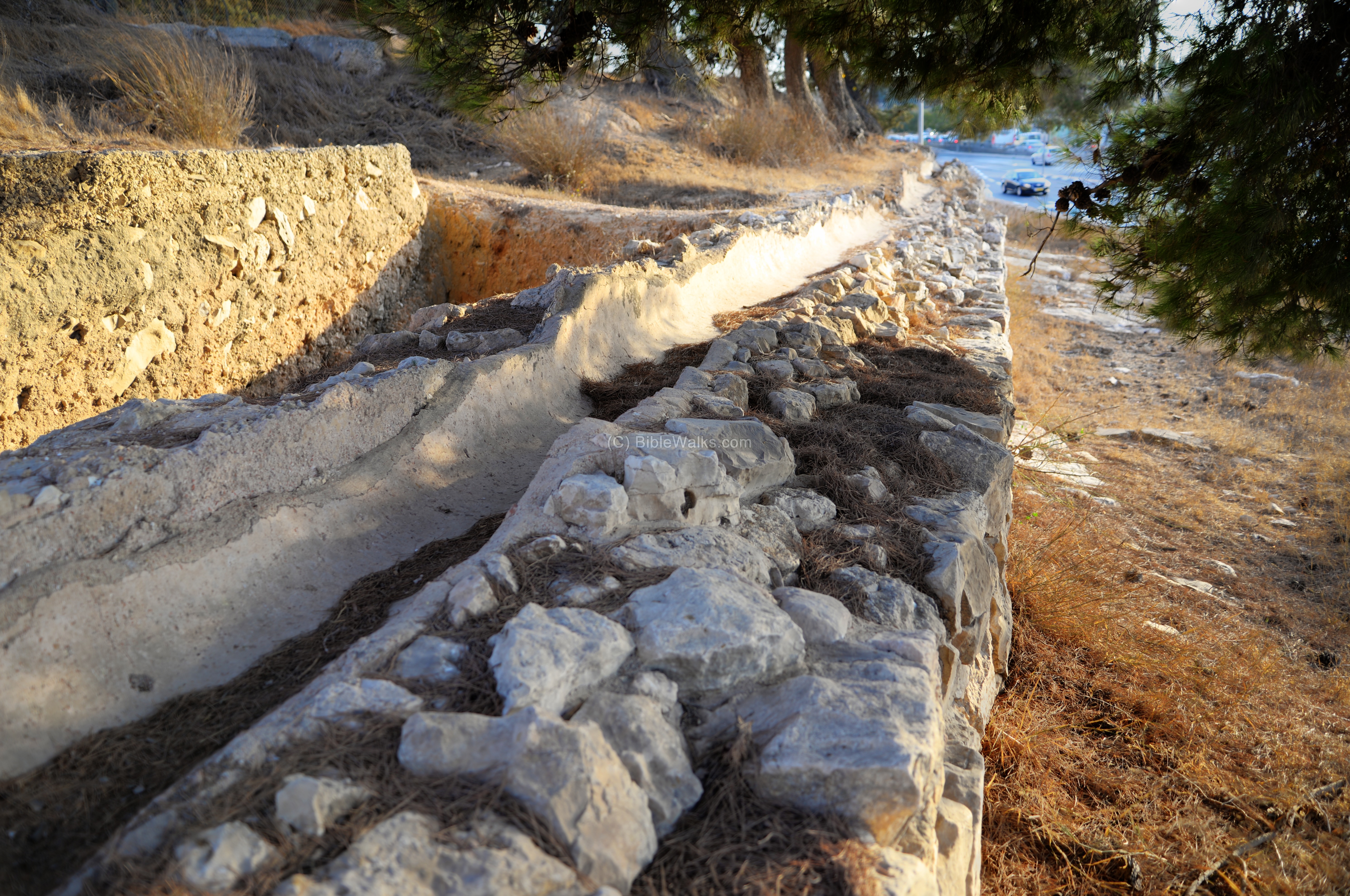
A longer and more complete section of the aqueduct is located on the eastern side of Hebron way, just past the gas station. The aqueduct raises 2m above the ground, and its foundation is 2m wide. This section, 120m long, underwent excavations and restorations in 1992-1993 (Area ‘A1’).
The channel at this section is ‘U’ shaped and is 1.7m wide, as seen below with another view of this section towards the south.
Ceramics and coins collected at this section were dated to the Roman and Byzantine periods.
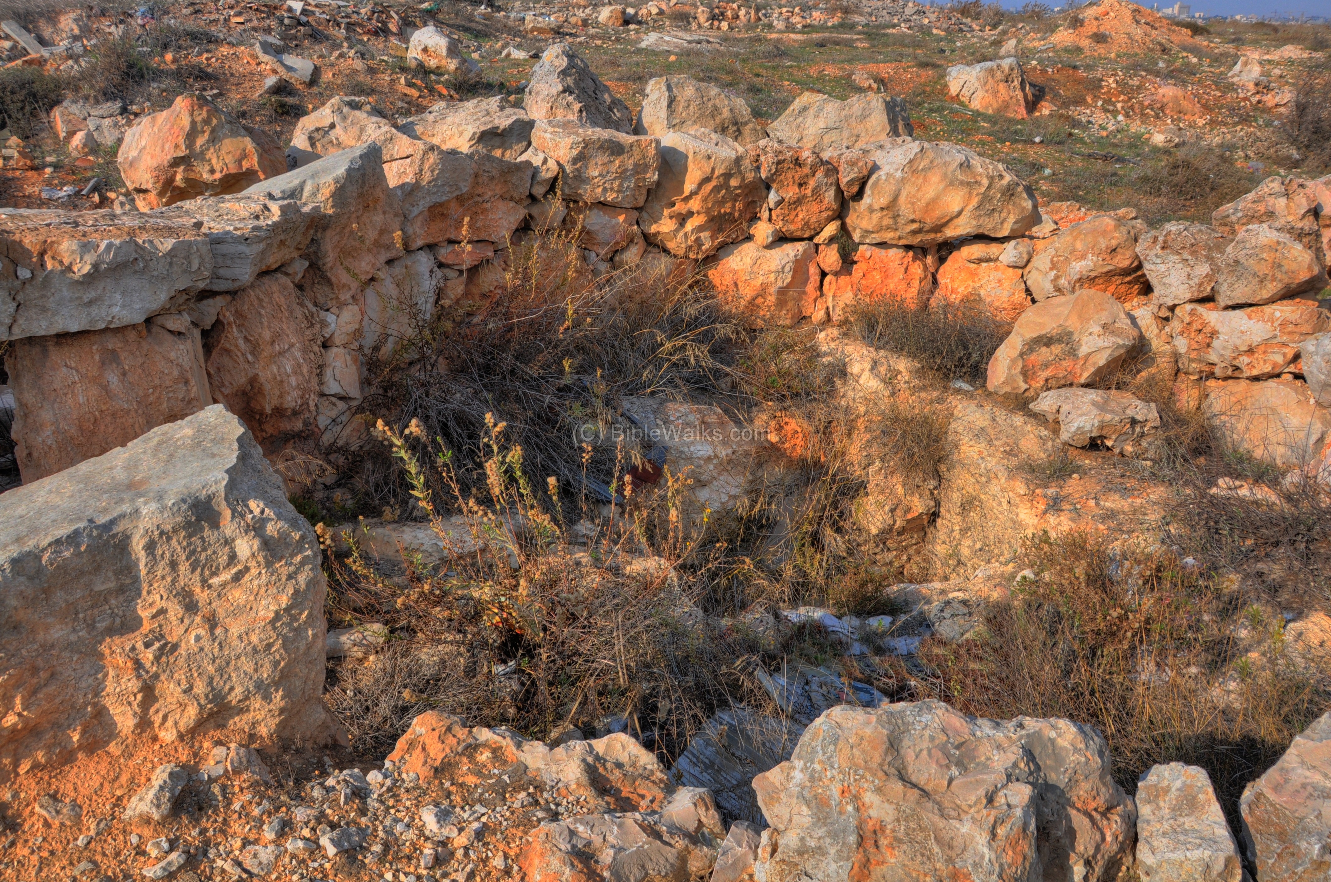
(i) Northern ruins:
Remains of beautiful ancient structures are located on the northern foothills.
The ruins are visible from the road from Hebron way to Givat Hamatos and Beit Safafa.
This was a small fortified monastery, although if someone has more information on this please let us know.
(j) Nature:
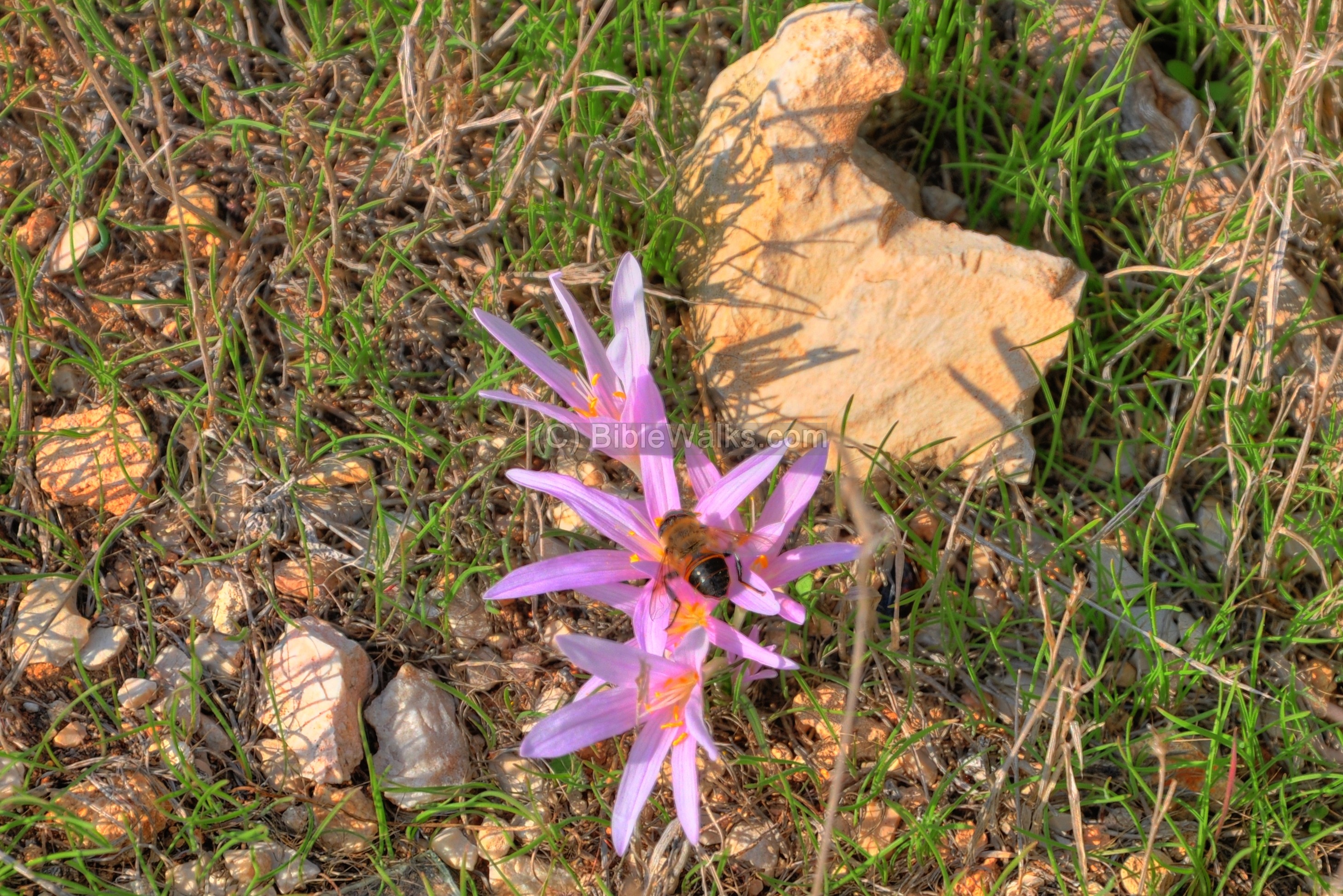
Finally, a photo of the wild flower Sitvanit (Jerusalem Autumn-crocus, Latin: Colchicum hierosolymitanum) with a bee sucking the nectar. It flowers from October thru January. The Sitvanit is referred in the Mishna, the 2nd century AD books of Jewish practices, where it is said to be used to produce vinegar.
Biblical References:
Apocryphal book – Bel and The Dragon (33-42):
Prophet Habakkuk brought food to the farmers working in the field on this hillside. An angel came down, picked up the prophet by his hair to Daniel who was in the lion-pit. After feeding Daniel the angel brought him back. This saved Daniel, and the King pulled him out of the pit.
“Now the prophet Habakkuk was in Judea; he had made a stew and crumbled bread into the bowl, and he was on the way to his field, carrying it to the reapers, when an angel of the Lord said, ‘Habakkuk, carry the meal you have with you to Babylon, for Daniel, who is in the lion-pit.’ Habakkuk said, ‘My Lord, I have never been to Babylon. I do not know where the lion-pit is.’ Then the angel took the prophet by the crown of his head, and carrying him by his hair, he swept him to Babylon with the blast of his breath and put him down above the pit. Habakkuk called out, ‘Daniel, Daniel, take the meal that God has sent you!’ Daniel said, ‘O God, thou dost indeed remember me; thou dost never forsake those who love thee.’ Then he got up and ate; and God’s angel returned Habakkuk at once to his home. On the seventh day the king went to mourn for Daniel, but when he arrived at the pit and looked in, there sat Daniel! Then the king cried aloud, ‘Great art thou, O Lord, the God of Daniel, and there is no God but thou alone.’ So the king drew Daniel up; and the men who had planned to destroy him he flung into the pit, and then and there they were eaten up before his eyes”.
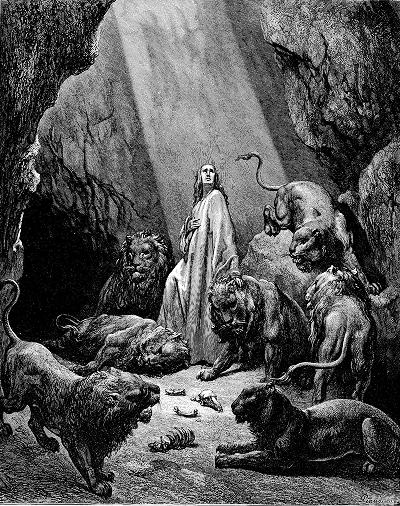
Daniel in the Lions Den – – by Gustav Dore (French artist, 1832-1883)
Etymology:
- Tabalieh, Tabaliya – according to the PEF dictionary, it means in Arabic: “The place where sweet herbs for seasoning grow”.
However, there are other suggestions for this name.
Links:
* External:
- Upper Aqueduct – Atiqot 69-90 (Hebrew)
- From the Jerusalem archaeological appendix: Giv’at Hamatos (Kh. Tabaliya) – west hill
- Excavations of the Upper aqueduct in airplane hill (2023)
- The forgotten poor of Givat Hamatos (Deb Herman, 2011)
- Dan Givon memorial page – The pilot (Hebrew)
- Biblical pictures by Gustave Doré (1832-1883) – public domain
- The Tomb and Memorial of a Chain-Wearing Anchorite at Kh. Tabaliya, near Jerusalem. Kogan-Zehavi, E., Gorin-Rosen, Y
- Remains of a settlement in Kh. Tabaliya. Kogan-Zehavi, E. ‘Atiqot 40
* Internal:
- Mar Elias – monastery on the east side
- Giva’at Ha’Arba’a – the Hill of Four on the east side of Mar Elias
- Kathisma ruins of a Byzantine church north of Mar Elias
- Wildflowers of the Holy Land
BibleWalks.com – walk with us through the sites of the Holy Land
Mar Elias<<<—previous Judea site–<<< All Sites >>>—next Judea site—>>> Hill of the four
This page was last updated on Sep 3, 2023 (new link)
Sponsored links: